Totale Sonnenfinsternis vom 03.05.-1355
| Wochentag: | Donnerstag |
| Maximale Dauer der Verfinsterung: | 06m53s |
| Maximale Breite des Finsternispfades: | 254 km |
| Saroszyklus: | 26 |
| Bedeckungsgrad: | 100% |
| Magnitude: | 1.0785 |
| Gamma: | 0.0743 |
Wo kann man die Sonnenfinsternis vom 03.05.-1355 sehen?
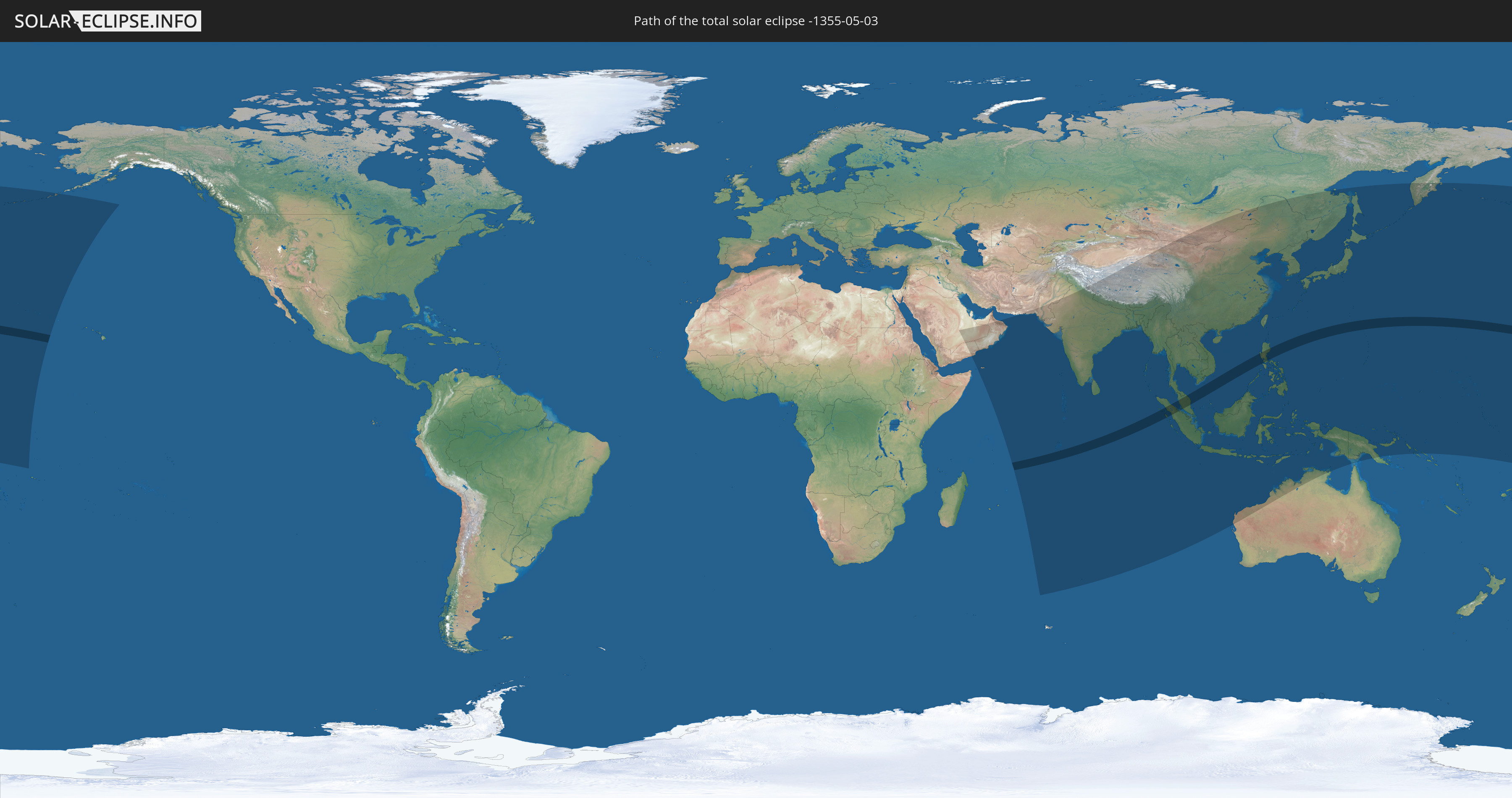
Die Sonnenfinsternis am 03.05.-1355 kann man in 49 Ländern als partielle Sonnenfinsternis beobachten.
Der Finsternispfad verläuft durch 5 Länder. Nur in diesen Ländern ist sie als totale Sonnenfinsternis zu sehen.
In den folgenden Ländern ist die Sonnenfinsternis total zu sehen
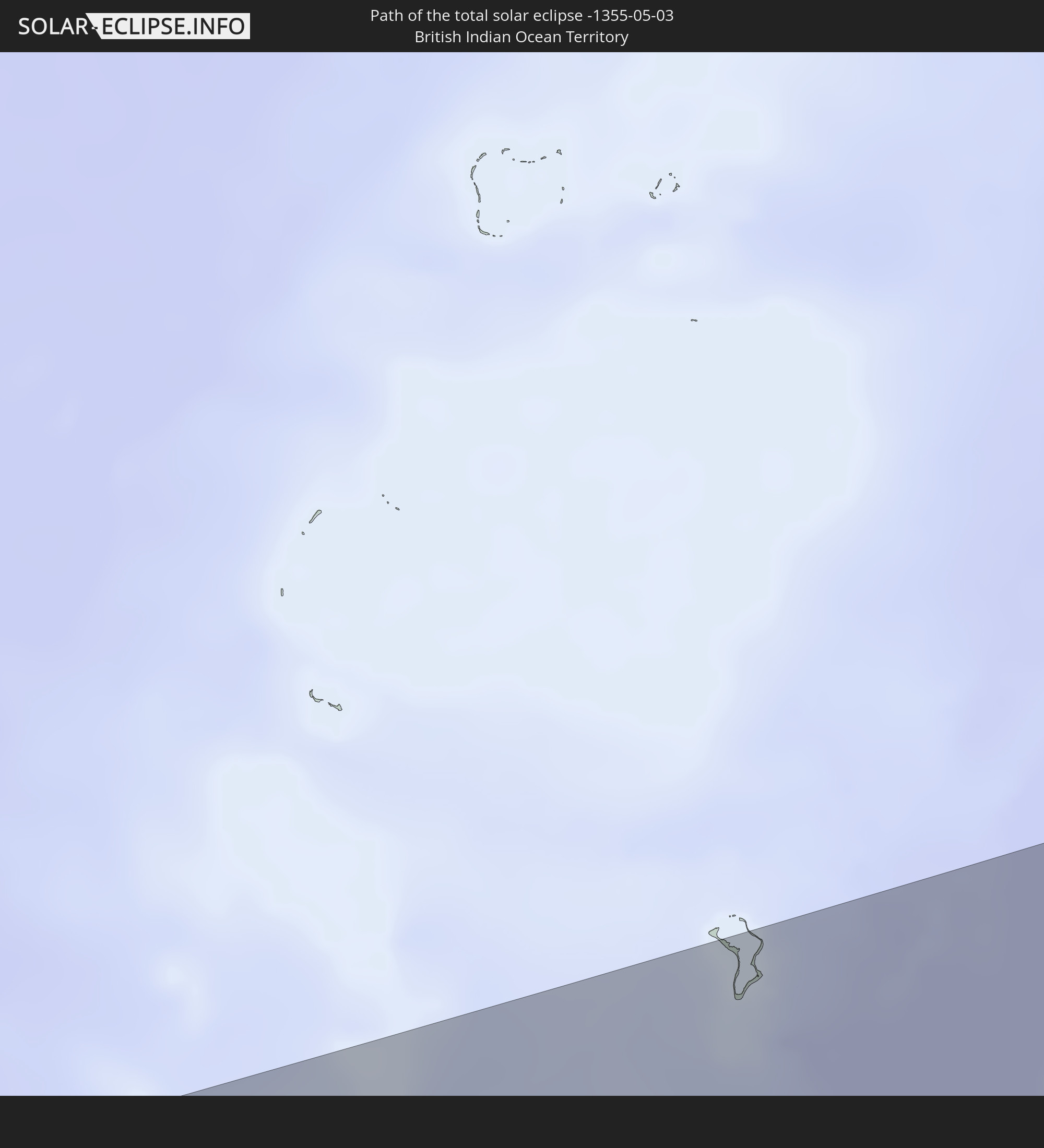 Britisches Territorium im Indischen Ozean
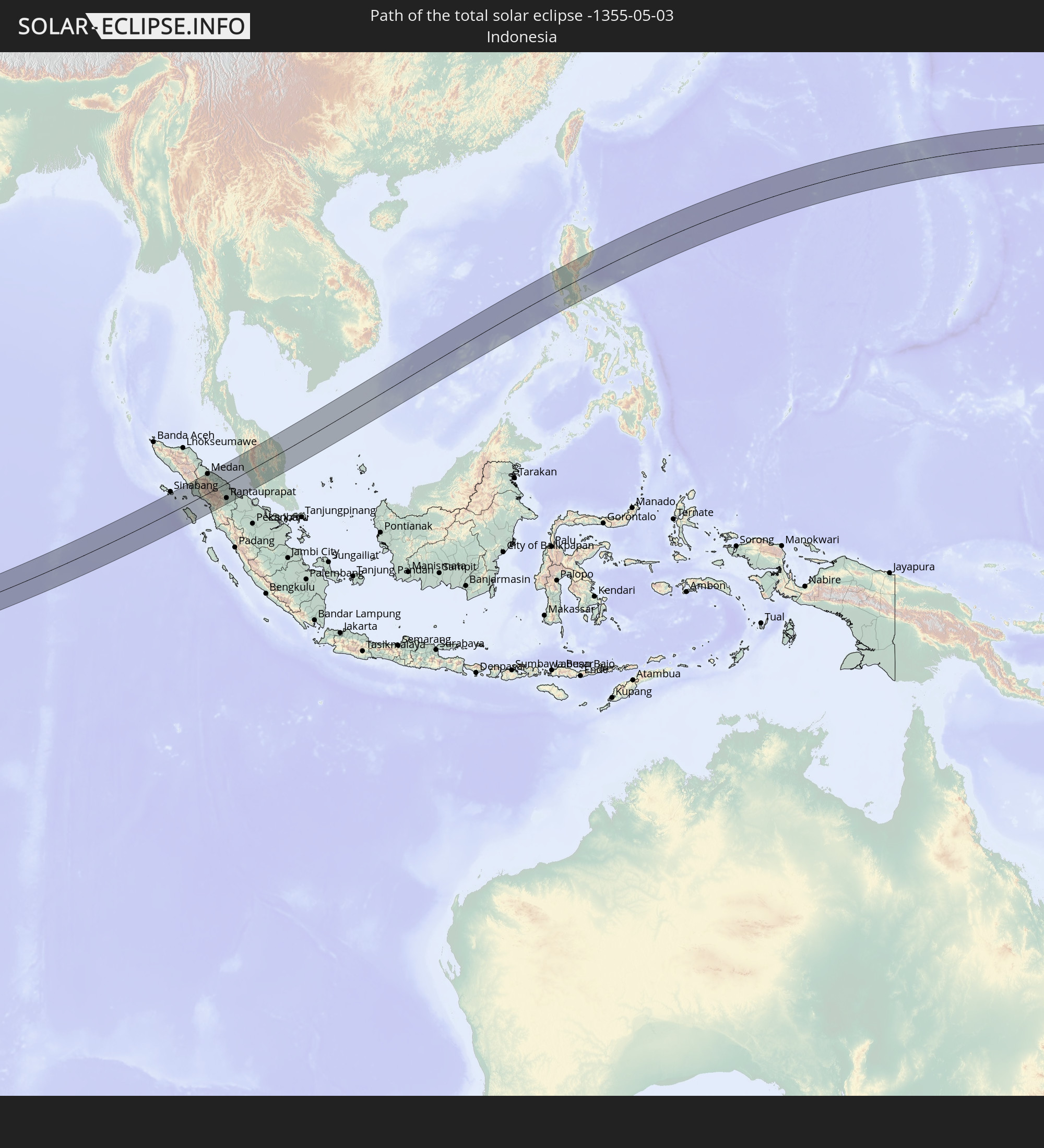 Indonesien
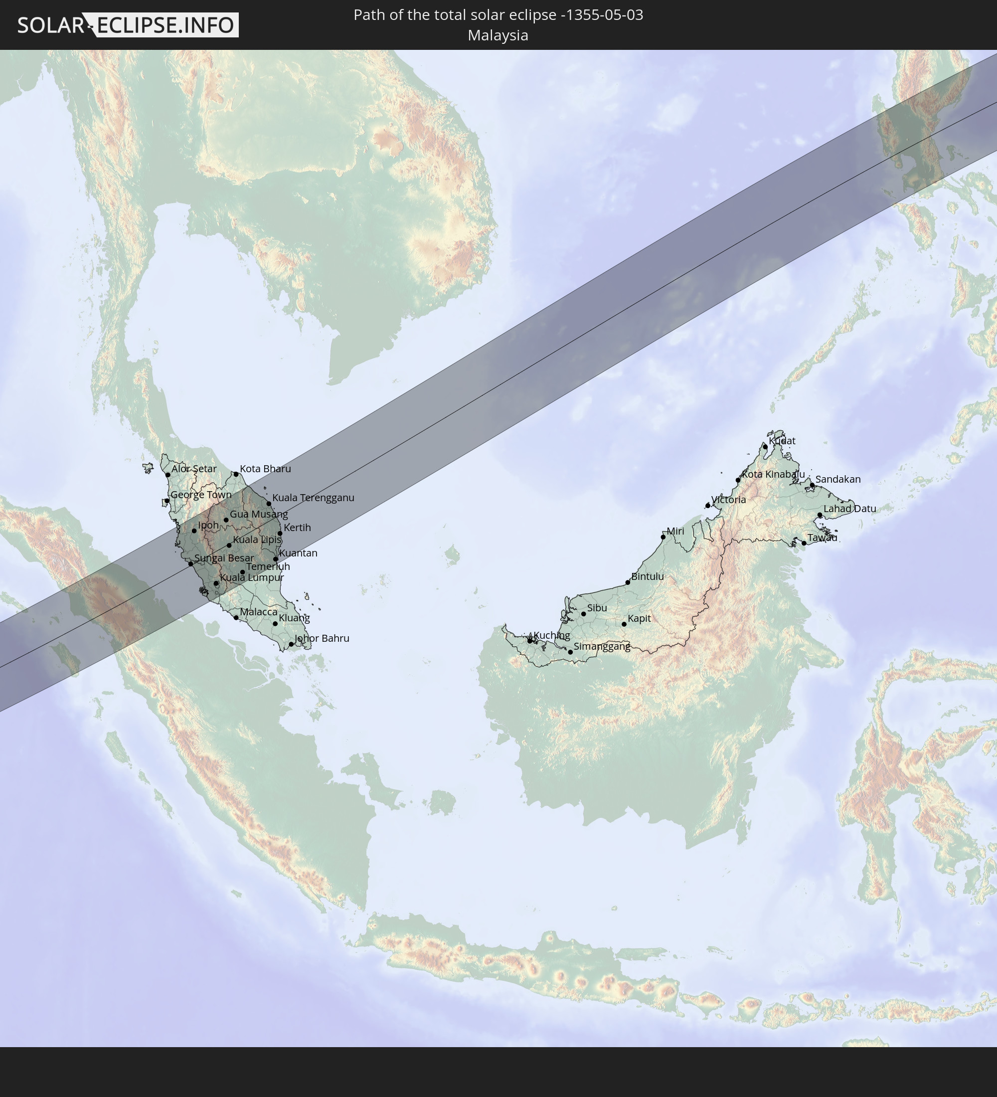 Malaysia
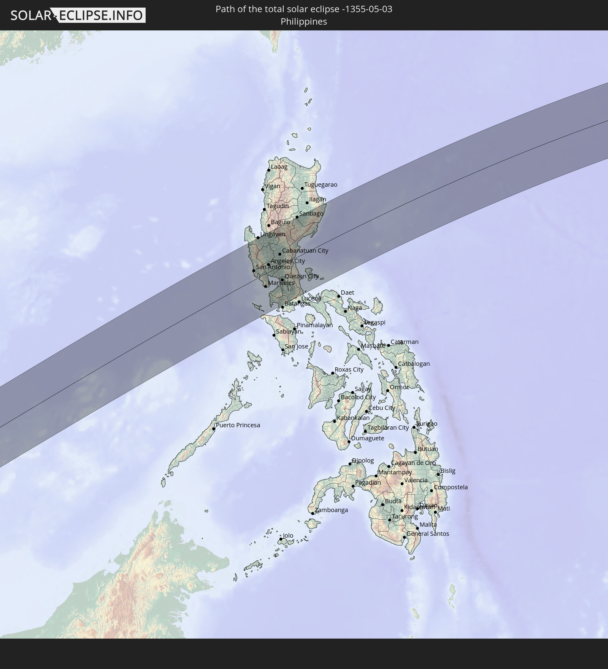 Philippinen
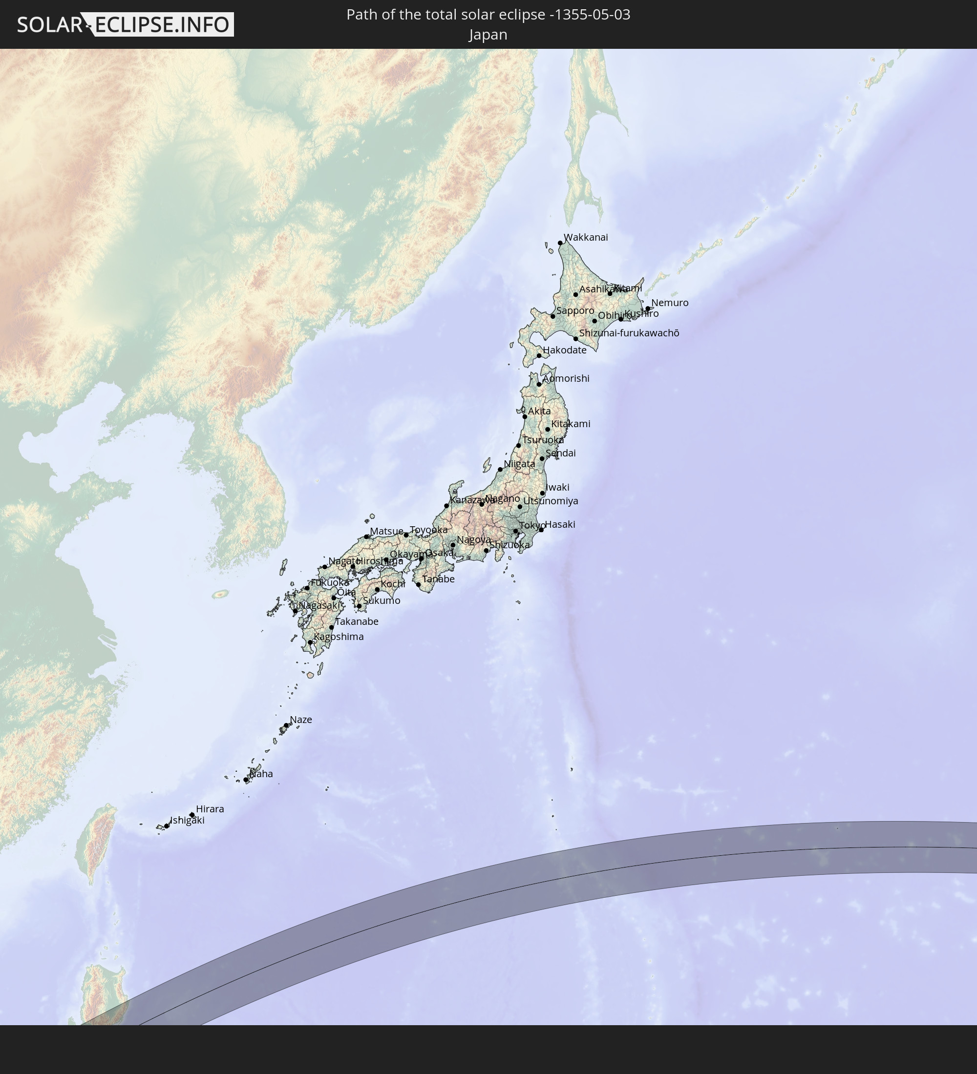 Japan
Japan
In den folgenden Ländern ist die Sonnenfinsternis partiell zu sehen
 Russland
 Vereinigte Staaten
 United States Minor Outlying Islands
 Kiribati
 Saudi-Arabien
 Französische Süd- und Antarktisgebiete
 Jemen
Jemen
 Vereinigte Arabische Emirate
 Oman
Oman
 Mauritius
 Pakistan
 Indien
 Britisches Territorium im Indischen Ozean
 Malediven
 Volksrepublik China
 Sri Lanka
 Nepal
Nepal
 Mongolei
 Bangladesch
 Bhutan
 Myanmar
 Indonesien
 Kokosinseln
 Thailand
 Malaysia
 Laos
Laos
 Vietnam
 Kambodscha
 Singapur
 Weihnachtsinsel
 Australien
 Macau
Macau
 Hongkong
 Brunei
 Taiwan
 Philippinen
 Japan
Japan
 Osttimor
 Nordkorea
 Südkorea
 Palau
Palau
 Föderierte Staaten von Mikronesien
 Papua-Neuguinea
 Guam
Guam
 Nördliche Marianen
 Salomonen
 Marshallinseln
 Nauru
Nauru
 Tuvalu
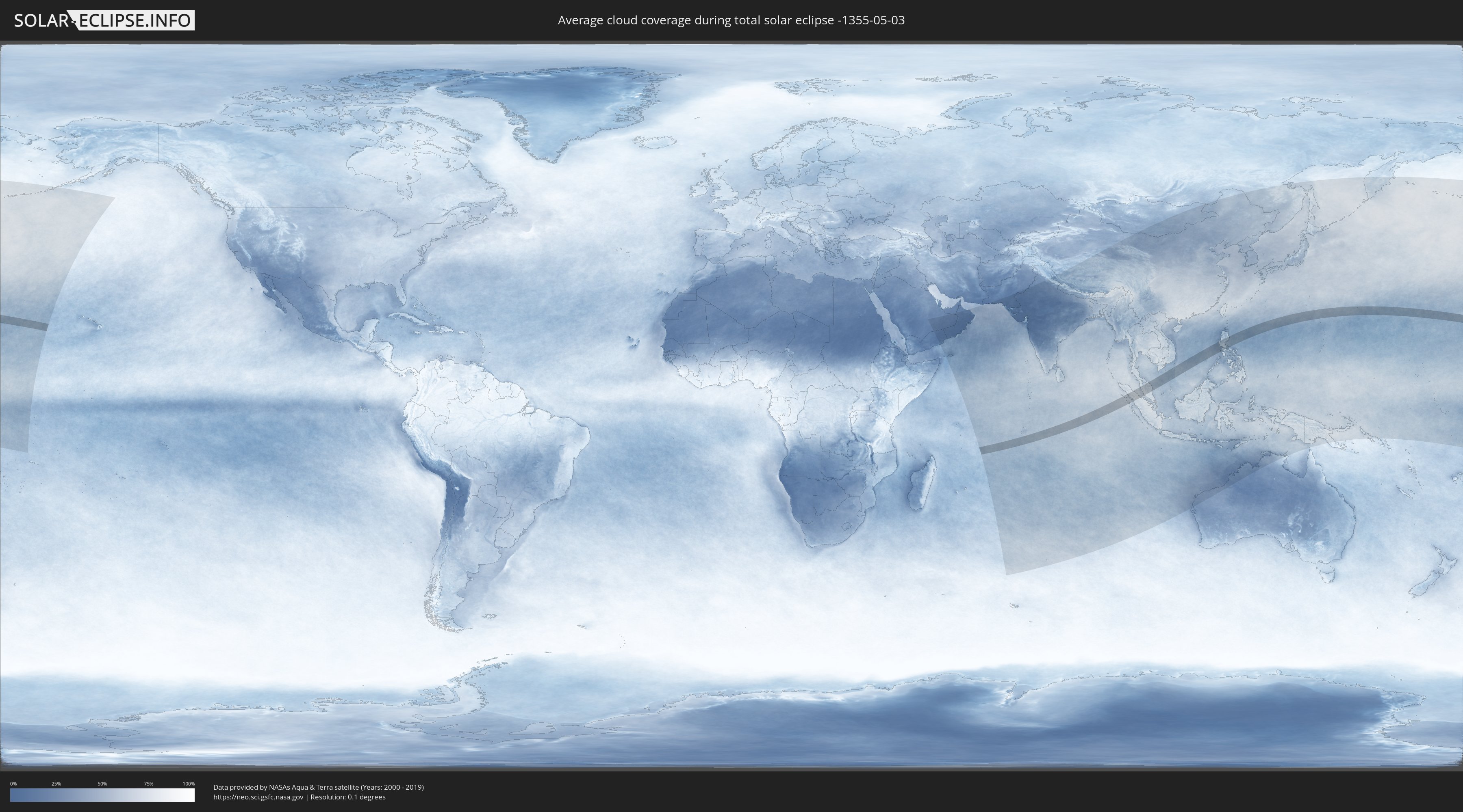
Wie wird das Wetter während der totalen Sonnenfinsternis am 03.05.-1355?
Wo ist der beste Ort, um die totale Sonnenfinsternis vom 03.05.-1355 zu beobachten?
Die folgenden Karten zeigen die durchschnittliche Bewölkung für den Tag, an dem die totale Sonnenfinsternis
stattfindet. Mit Hilfe der Karten lässt sich der Ort entlang des Finsternispfades eingrenzen,
der die besten Aussichen auf einen klaren wolkenfreien Himmel bietet.
Trotzdem muss man immer lokale Gegenenheiten beachten und sollte sich genau über das Wetter an seinem
gewählten Beobachtungsort informieren.
Die Daten stammen von den beiden NASA-Satelliten
AQUA und TERRA
und wurden über einen Zeitraum von 19 Jahren (2000 - 2019) gemittelt.
Detaillierte Länderkarten
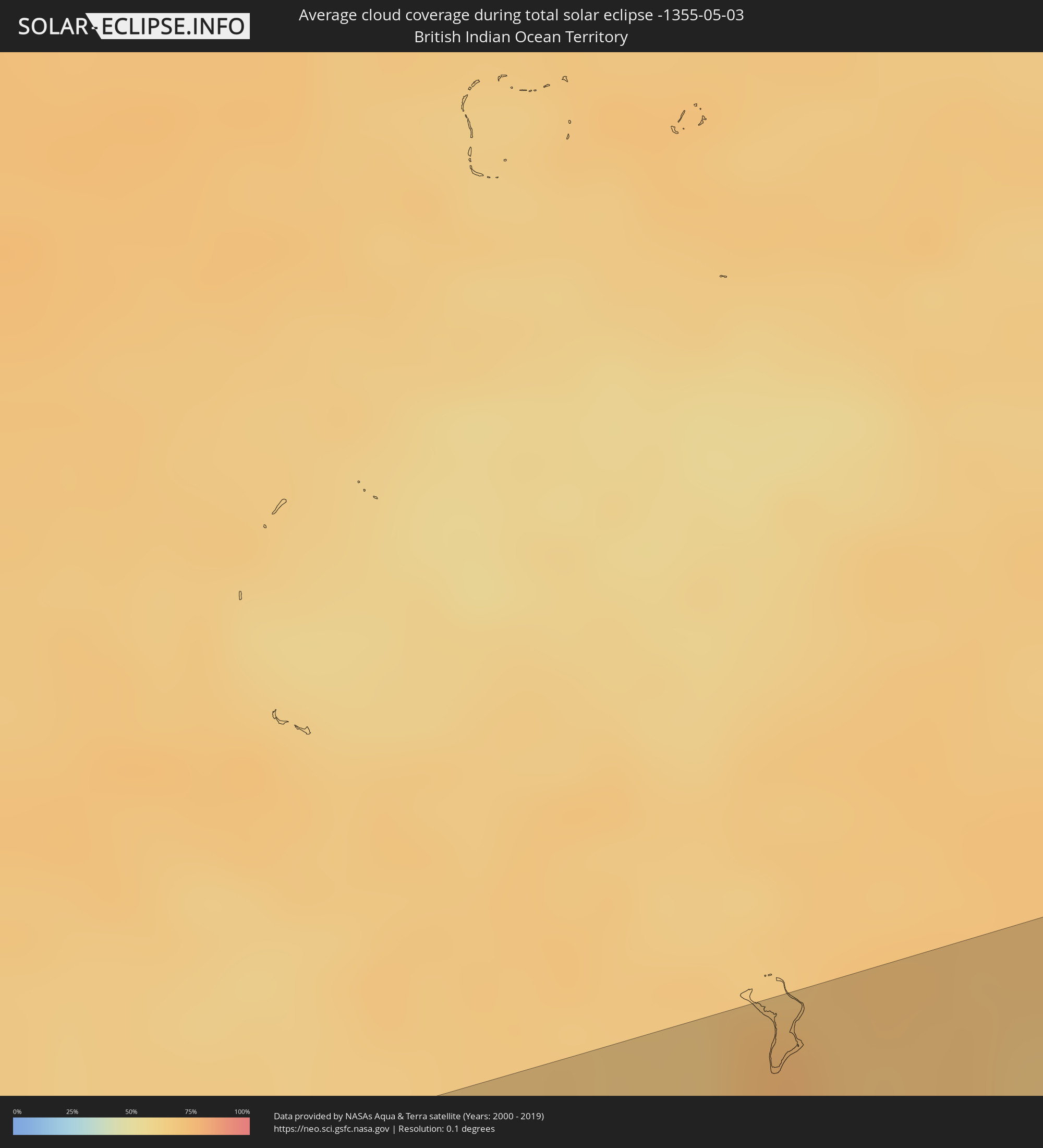 Britisches Territorium im Indischen Ozean
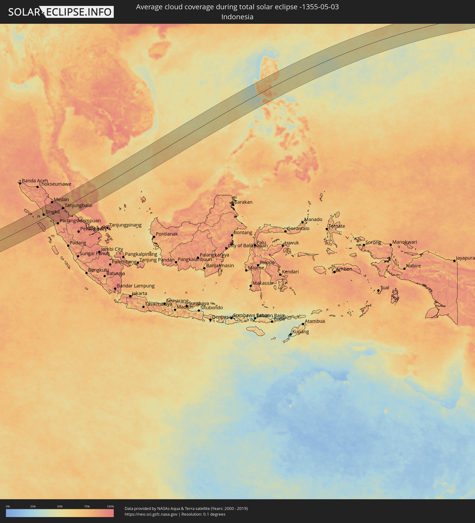 Indonesien
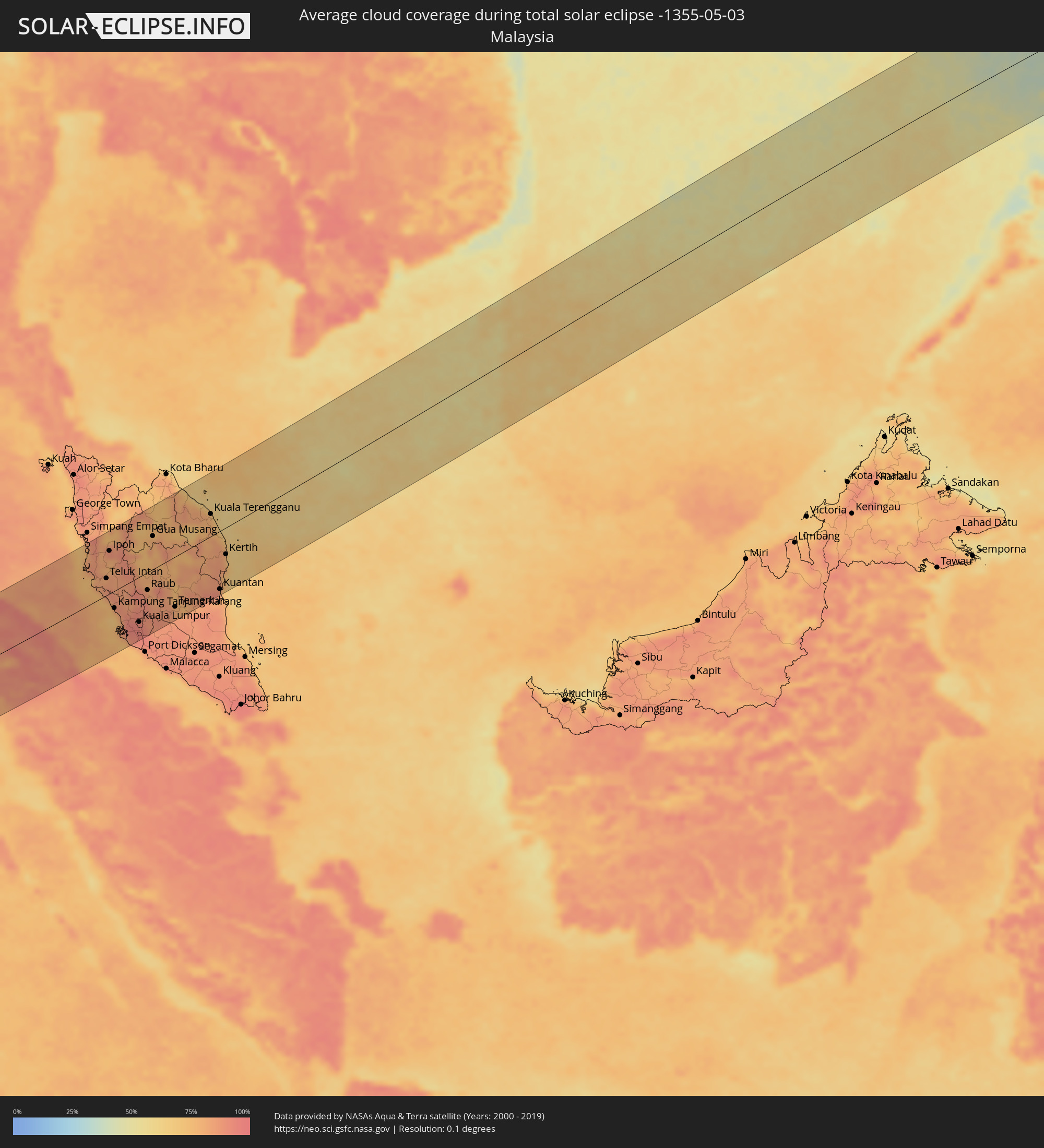 Malaysia
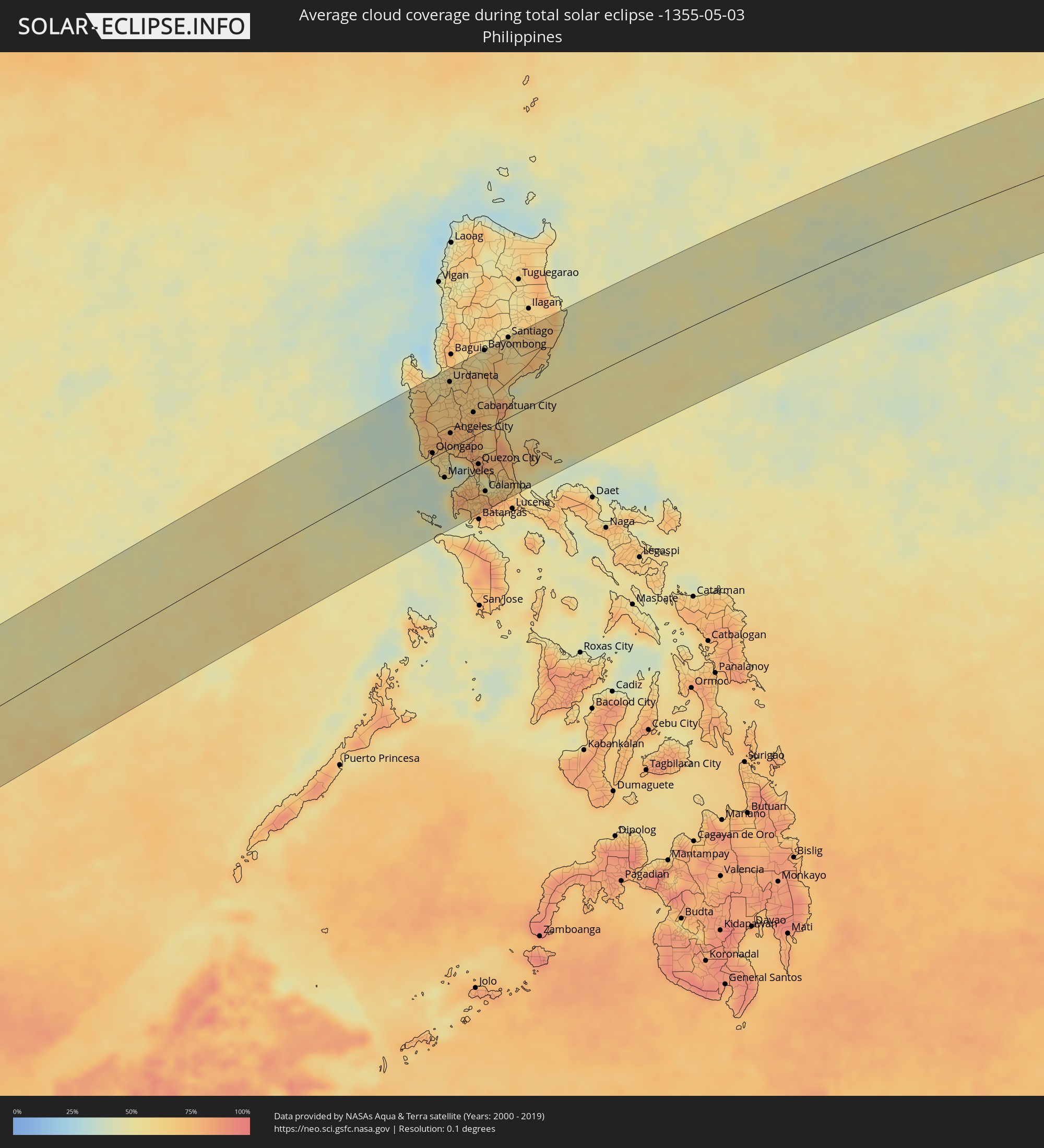 Philippinen
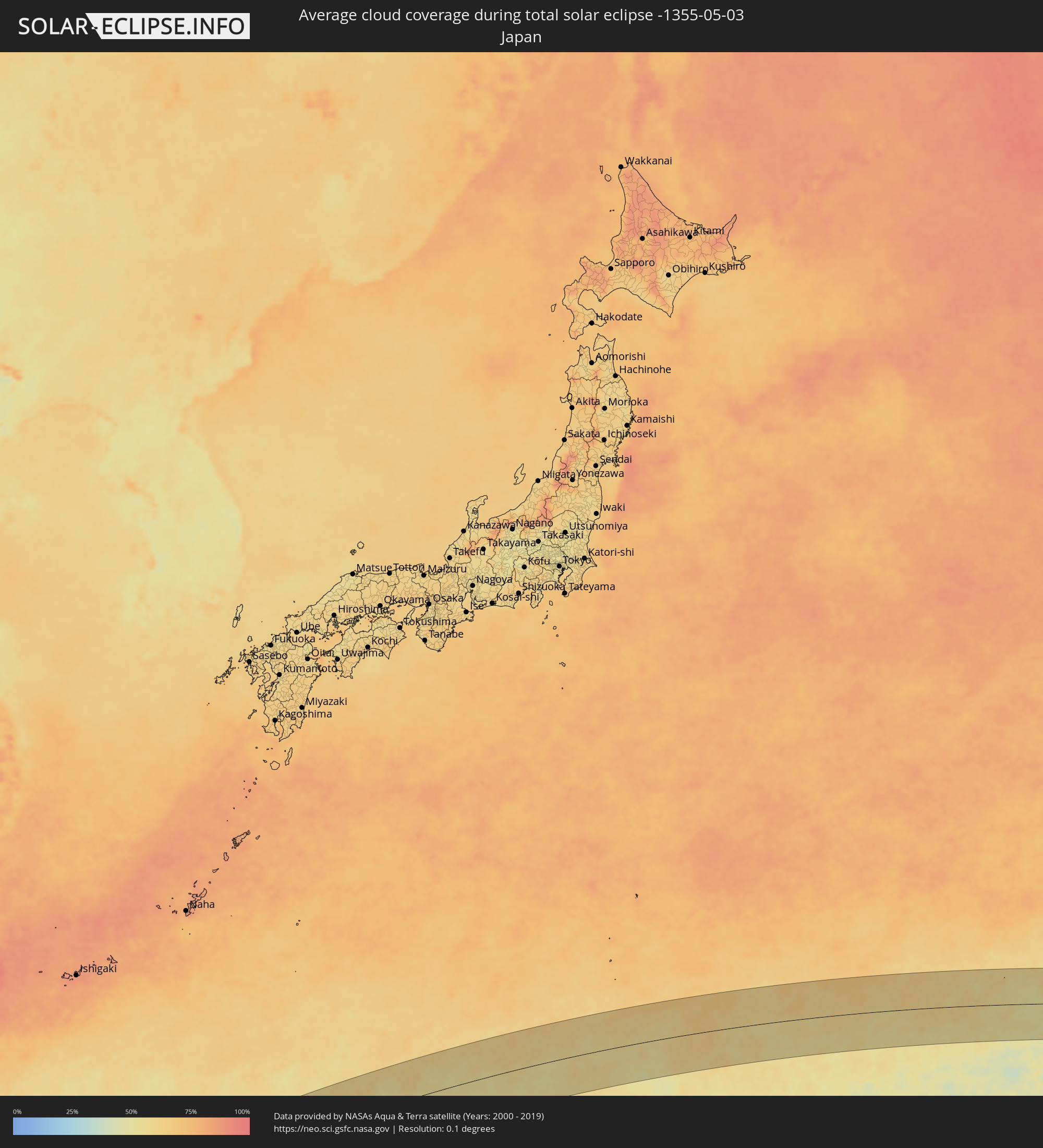 Japan
Japan
Orte im Finsternispfad
Die nachfolgene Tabelle zeigt Städte und Orte mit mehr als 5.000 Einwohnern, die sich im Finsternispfad befinden. Städte mit mehr als 100.000 Einwohnern sind dick gekennzeichnet. Mit einem Klick auf den Ort öffnet sich eine Detailkarte die die Lage des jeweiligen Ortes zusammen mit dem Verlauf der zentralen Finsternis präsentiert.
| Ort | Typ | Dauer der Verfinsterung | Ortszeit bei maximaler Verfinsterung | Entfernung zur Zentrallinie | Ø Bewölkung |
|
Singkil, Aceh
|
total | - | 09:38:38 UTC+07:07 | 36 km | 74% |
|
Kabanjahe, North Sumatra
|
total | - | 09:40:40 UTC+07:07 | 79 km | 89% |
|
Berastagi, North Sumatra
|
total | - | 09:40:49 UTC+07:07 | 87 km | 88% |
|
Tongging, North Sumatra
|
total | - | 09:40:28 UTC+07:07 | 57 km | 87% |
|
Sunggal, North Sumatra
|
total | - | 09:41:27 UTC+07:07 | 119 km | 96% |
|
Medan, North Sumatra
|
total | - | 09:41:32 UTC+07:07 | 117 km | 96% |
|
Deli Tua, North Sumatra
|
total | - | 09:41:28 UTC+07:07 | 108 km | 93% |
|
Sibolga, North Sumatra
|
total | - | 09:39:28 UTC+07:07 | 70 km | 77% |
|
Percut, North Sumatra
|
total | - | 09:41:53 UTC+07:07 | 110 km | 95% |
|
Perbaungan, North Sumatra
|
total | - | 09:41:58 UTC+07:07 | 100 km | 95% |
|
Pematangsiantar, North Sumatra
|
total | - | 09:41:23 UTC+07:07 | 34 km | 93% |
|
Tebingtinggi, North Sumatra
|
total | - | 09:41:59 UTC+07:07 | 65 km | 93% |
|
Pekan Bahapal, North Sumatra
|
total | - | 09:41:44 UTC+07:07 | 44 km | 92% |
|
Kisaran, North Sumatra
|
total | - | 09:42:16 UTC+07:07 | 8 km | 94% |
|
Bandar, North Sumatra
|
total | - | 09:41:20 UTC+07:07 | 91 km | 92% |
|
Tanjungbalai, North Sumatra
|
total | - | 09:42:32 UTC+07:07 | 4 km | 92% |
|
Teluk Nibung, North Sumatra
|
total | - | 09:42:37 UTC+07:07 | 2 km | 92% |
|
Rantauprapat, North Sumatra
|
total | - | 09:41:32 UTC+07:07 | 90 km | 92% |
|
Pantai Remis, Perak
|
total | - | 09:33:59 UTC+06:55 | 97 km | 80% |
|
Lumut, Perak
|
total | - | 09:33:42 UTC+06:55 | 75 km | 78% |
|
Kuala Kangsar, Perak
|
total | - | 09:34:54 UTC+06:55 | 110 km | 82% |
|
Sungai Besar, Selangor
|
total | - | 09:33:35 UTC+06:55 | 1 km | 80% |
|
Sabak Bernam, Selangor
|
total | - | 09:33:42 UTC+06:55 | 10 km | 86% |
|
Teluk Intan, Perak
|
total | - | 09:34:05 UTC+06:55 | 34 km | 84% |
|
Batu Gajah, Perak
|
total | - | 09:34:42 UTC+06:55 | 75 km | 82% |
|
Ipoh, Perak
|
total | - | 09:34:55 UTC+06:55 | 84 km | 89% |
|
Kampar, Perak
|
total | - | 09:34:39 UTC+06:55 | 53 km | 81% |
|
Kampung Tanjung Karang, Selangor
|
total | - | 09:33:35 UTC+06:55 | 34 km | 77% |
|
Tapah Road, Perak
|
total | - | 09:34:34 UTC+06:55 | 37 km | 83% |
|
Kuala Selangor, Selangor
|
total | - | 09:33:36 UTC+06:55 | 45 km | 86% |
|
Bidur, Perak
|
total | - | 09:34:38 UTC+06:55 | 28 km | 85% |
|
Kampong Dungun, Perak
|
total | - | 09:33:32 UTC+06:55 | 61 km | 78% |
|
Tanah Rata, Pahang
|
total | - | 09:35:15 UTC+06:55 | 57 km | 89% |
|
Batang Berjuntai, Selangor
|
total | - | 09:33:55 UTC+06:55 | 50 km | 89% |
|
Klang, Selangor
|
total | - | 09:33:32 UTC+06:55 | 86 km | 92% |
|
Batu Arang, Selangor
|
total | - | 09:33:55 UTC+06:55 | 60 km | 92% |
|
Jenjarum, Selangor
|
total | - | 09:33:24 UTC+06:55 | 104 km | 90% |
|
Banting, Selangor
|
total | - | 09:33:20 UTC+06:55 | 110 km | 85% |
|
Ladang Seri Kundang, Selangor
|
total | - | 09:33:58 UTC+06:55 | 65 km | 92% |
|
Shah Alam, Selangor
|
total | - | 09:33:44 UTC+06:55 | 86 km | 95% |
|
Kampung Baru Subang, Selangor
|
total | - | 09:33:49 UTC+06:55 | 79 km | 94% |
|
Kuang, Selangor
|
total | - | 09:34:00 UTC+06:55 | 70 km | 92% |
|
Putra Heights, Selangor
|
total | - | 09:33:41 UTC+06:55 | 97 km | 93% |
|
Rawang, Selangor
|
total | - | 09:34:07 UTC+06:55 | 65 km | 92% |
|
Subang Jaya, Selangor
|
total | - | 09:33:46 UTC+06:55 | 92 km | 93% |
|
Serendah, Selangor
|
total | - | 09:34:13 UTC+06:55 | 62 km | 92% |
|
Petaling Jaya, Selangor
|
total | - | 09:33:53 UTC+06:55 | 88 km | 95% |
|
Kuala Lumpur, Kuala Lumpur
|
total | - | 09:34:04 UTC+06:55 | 89 km | 94% |
|
Putrajaya, Putrajaya
|
total | - | 09:33:49 UTC+06:55 | 109 km | 94% |
|
Kampong Baharu Balakong, Selangor
|
total | - | 09:34:02 UTC+06:55 | 102 km | 93% |
|
Kampung Bukit Tinggi, Bentong, Pahang
|
total | - | 09:34:34 UTC+06:55 | 76 km | 88% |
|
Semenyih, Selangor
|
total | - | 09:34:05 UTC+06:55 | 115 km | 93% |
|
Raub, Pahang
|
total | - | 09:35:11 UTC+06:55 | 35 km | 82% |
|
Bentong Town, Pahang
|
total | - | 09:34:56 UTC+06:55 | 64 km | 88% |
|
Gua Musang, Kelantan
|
total | - | 09:36:48 UTC+06:55 | 65 km | 81% |
|
Kuala Lipis, Pahang
|
total | - | 09:36:02 UTC+06:55 | 7 km | 83% |
|
Mentekab, Pahang
|
total | - | 09:35:38 UTC+06:55 | 91 km | 86% |
|
Jerantut, Pahang
|
total | - | 09:36:15 UTC+06:55 | 48 km | 73% |
|
Temerluh, Pahang
|
total | - | 09:35:43 UTC+06:55 | 98 km | 81% |
|
Jertih, Terengganu
|
total | - | 09:38:52 UTC+06:55 | 119 km | 77% |
|
Kuala Terengganu, Terengganu
|
total | - | 09:39:29 UTC+06:55 | 44 km | 79% |
|
Marang, Terengganu
|
total | - | 09:39:25 UTC+06:55 | 28 km | 74% |
|
Kuantan, Pahang
|
total | - | 09:37:46 UTC+06:55 | 114 km | 88% |
|
Cukai, Terengganu
|
total | - | 09:38:31 UTC+06:55 | 76 km | 83% |
|
Paka, Terengganu
|
total | - | 09:39:04 UTC+06:55 | 40 km | 81% |
|
Kertih, Terengganu
|
total | - | 09:38:56 UTC+06:55 | 52 km | 80% |
|
Santa Cruz, Central Luzon
|
total | - | 11:36:38 UTC+08:00 | 118 km | 51% |
|
Masinloc, Central Luzon
|
total | - | 11:36:25 UTC+08:00 | 94 km | 69% |
|
Iba, Central Luzon
|
total | - | 11:36:12 UTC+08:00 | 72 km | 52% |
|
San Antonio, Central Luzon
|
total | - | 11:35:56 UTC+08:00 | 29 km | 62% |
|
Lingayen, Ilocos
|
total | - | 11:37:49 UTC+08:00 | 127 km | 56% |
|
Morong, Central Luzon
|
total | - | 11:36:01 UTC+08:00 | 6 km | 51% |
|
Olongapo, Central Luzon
|
total | - | 11:36:16 UTC+08:00 | 7 km | 57% |
|
Urbiztondo, Ilocos
|
total | - | 11:37:47 UTC+08:00 | 103 km | 57% |
|
Mayantoc, Central Luzon
|
total | - | 11:37:37 UTC+08:00 | 80 km | 69% |
|
Mangaldan, Ilocos
|
total | - | 11:38:19 UTC+08:00 | 123 km | 53% |
|
Camiling, Central Luzon
|
total | - | 11:37:49 UTC+08:00 | 85 km | 67% |
|
Dinalupihan, Central Luzon
|
total | - | 11:36:46 UTC+08:00 | 4 km | 59% |
|
Mariveles, Central Luzon
|
total | - | 11:36:14 UTC+08:00 | 42 km | 39% |
|
Sison, Ilocos
|
total | - | 11:38:45 UTC+08:00 | 128 km | 56% |
|
Alcala, Ilocos
|
total | - | 11:38:19 UTC+08:00 | 95 km | 61% |
|
Balanga, Central Luzon
|
total | - | 11:36:42 UTC+08:00 | 21 km | 54% |
|
Urdaneta, Ilocos
|
total | - | 11:38:37 UTC+08:00 | 105 km | 58% |
|
Paniqui, Central Luzon
|
total | - | 11:38:13 UTC+08:00 | 75 km | 67% |
|
Angeles City, Central Luzon
|
total | - | 11:37:30 UTC+08:00 | 24 km | 76% |
|
Capas, Central Luzon
|
total | - | 11:37:46 UTC+08:00 | 41 km | 74% |
|
Tarlac City, Central Luzon
|
total | - | 11:38:00 UTC+08:00 | 55 km | 68% |
|
Nasugbu, Calabarzon
|
total | - | 11:36:05 UTC+08:00 | 85 km | 70% |
|
Calatagan, Calabarzon
|
total | - | 11:35:45 UTC+08:00 | 108 km | 43% |
|
Cuyapo, Central Luzon
|
total | - | 11:38:35 UTC+08:00 | 82 km | 68% |
|
Guiset East, Ilocos
|
total | - | 11:39:02 UTC+08:00 | 109 km | 59% |
|
San Fernando, Central Luzon
|
total | - | 11:37:36 UTC+08:00 | 6 km | 72% |
|
Balayan, Calabarzon
|
total | - | 11:36:10 UTC+08:00 | 103 km | 54% |
|
Naic, Calabarzon
|
total | - | 11:36:47 UTC+08:00 | 67 km | 79% |
|
Guimba, Central Luzon
|
total | - | 11:38:41 UTC+08:00 | 64 km | 66% |
|
Arayat, Central Luzon
|
total | - | 11:37:58 UTC+08:00 | 14 km | 71% |
|
General Emilio Aguinaldo, Calabarzon
|
total | - | 11:36:40 UTC+08:00 | 82 km | 80% |
|
Santa Barbara, Central Luzon
|
total | - | 11:38:22 UTC+08:00 | 36 km | 73% |
|
Malolos, Central Luzon
|
total | - | 11:37:39 UTC+08:00 | 18 km | 62% |
|
Baliuag, Central Luzon
|
total | - | 11:38:01 UTC+08:00 | 11 km | 82% |
|
Lupao, Central Luzon
|
total | - | 11:39:19 UTC+08:00 | 80 km | 68% |
|
Cavite City, Calabarzon
|
total | - | 11:37:22 UTC+08:00 | 58 km | 62% |
|
Muñoz, Central Luzon
|
total | - | 11:39:06 UTC+08:00 | 63 km | 67% |
|
Taal, Calabarzon
|
total | - | 11:36:34 UTC+08:00 | 118 km | 70% |
|
Dasmariñas, Calabarzon
|
total | - | 11:37:15 UTC+08:00 | 75 km | 78% |
|
Gapan, Central Luzon
|
total | - | 11:38:39 UTC+08:00 | 21 km | 79% |
|
Cabanatuan City, Central Luzon
|
total | - | 11:38:57 UTC+08:00 | 37 km | 77% |
|
Patuto, Calabarzon
|
total | - | 11:37:01 UTC+08:00 | 97 km | 71% |
|
San Miguel, Central Luzon
|
total | - | 11:38:29 UTC+08:00 | 3 km | 78% |
|
Aritao, Cagayan Valley
|
total | - | 11:40:15 UTC+08:00 | 114 km | 57% |
|
San Jose del Monte, Central Luzon
|
total | - | 11:38:13 UTC+08:00 | 33 km | 80% |
|
Quezon City, Metro Manila
|
total | - | 11:37:59 UTC+08:00 | 49 km | 67% |
|
Carranglan, Central Luzon
|
total | - | 11:39:51 UTC+08:00 | 79 km | 59% |
|
Bongabon, Central Luzon
|
total | - | 11:39:36 UTC+08:00 | 43 km | 73% |
|
Bayombong, Cagayan Valley
|
total | - | 11:40:47 UTC+08:00 | 126 km | 51% |
|
Lipa City, Calabarzon
|
total | - | 11:37:17 UTC+08:00 | 125 km | 77% |
|
Calamba, Calabarzon
|
total | - | 11:37:40 UTC+08:00 | 98 km | 74% |
|
Binangonan, Calabarzon
|
total | - | 11:38:06 UTC+08:00 | 75 km | 49% |
|
Rodriguez, Calabarzon
|
total | - | 11:38:32 UTC+08:00 | 46 km | 80% |
|
San Pablo, Calabarzon
|
total | - | 11:37:53 UTC+08:00 | 120 km | 81% |
|
Malaya, Calabarzon
|
total | - | 11:38:23 UTC+08:00 | 89 km | 51% |
|
Sampaloc, Calabarzon
|
total | - | 11:38:38 UTC+08:00 | 76 km | 63% |
|
Dingalan, Central Luzon
|
total | - | 11:39:55 UTC+08:00 | 7 km | 59% |
|
Santa Cruz, Calabarzon
|
total | - | 11:38:25 UTC+08:00 | 104 km | 63% |
|
Maria Aurora, Central Luzon
|
total | - | 11:40:41 UTC+08:00 | 43 km | 57% |
|
Santiago, Cagayan Valley
|
total | - | 11:42:05 UTC+08:00 | 127 km | 56% |
|
Lucban, Calabarzon
|
total | - | 11:38:33 UTC+08:00 | 127 km | 74% |
|
Saguday, Cagayan Valley
|
total | - | 11:41:56 UTC+08:00 | 112 km | 57% |
|
Kalayaan, Calabarzon
|
total | - | 11:38:55 UTC+08:00 | 105 km | 64% |
|
Real, Calabarzon
|
total | - | 11:39:27 UTC+08:00 | 75 km | 70% |
|
Maddela, Cagayan Valley
|
total | - | 11:41:58 UTC+08:00 | 86 km | 61% |
|
Cagsiay, Calabarzon
|
total | - | 11:39:12 UTC+08:00 | 127 km | 54% |
|
Patnanungan, Calabarzon
|
total | - | 11:41:08 UTC+08:00 | 92 km | 59% |