Totale Sonnenfinsternis vom 10.05.-1551
| Wochentag: | Samstag |
| Maximale Dauer der Verfinsterung: | 02m12s |
| Maximale Breite des Finsternispfades: | 103 km |
| Saroszyklus: | 13 |
| Bedeckungsgrad: | 100% |
| Magnitude: | 1.024 |
| Gamma: | -0.6318 |
Wo kann man die Sonnenfinsternis vom 10.05.-1551 sehen?
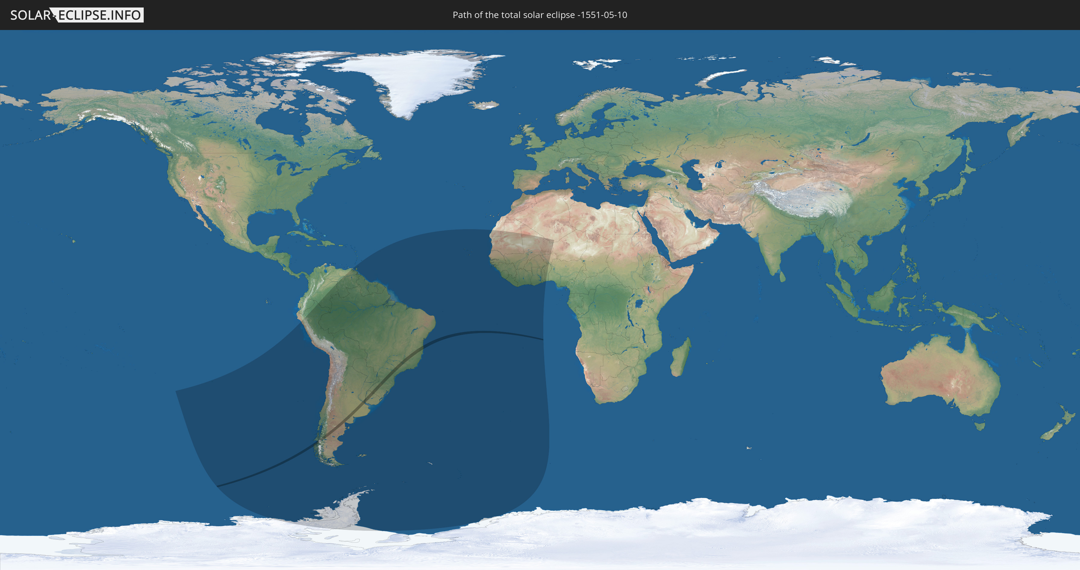
Die Sonnenfinsternis am 10.05.-1551 kann man in 33 Ländern als partielle Sonnenfinsternis beobachten.
Der Finsternispfad verläuft durch 4 Länder. Nur in diesen Ländern ist sie als totale Sonnenfinsternis zu sehen.
In den folgenden Ländern ist die Sonnenfinsternis total zu sehen
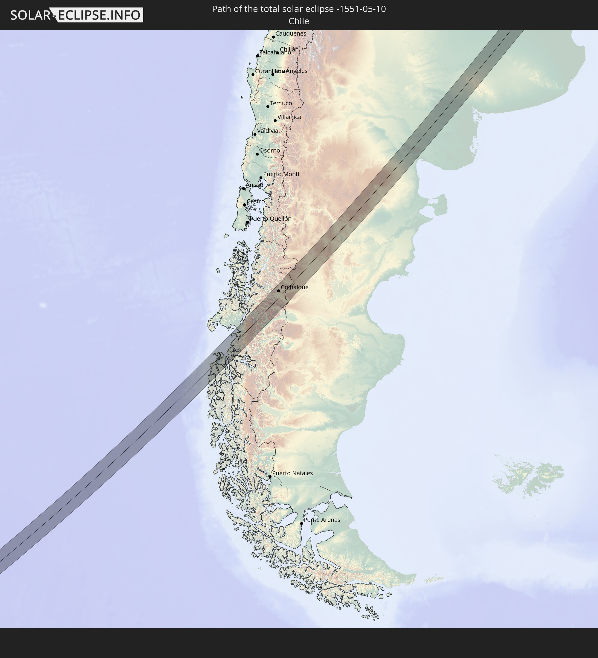 Chile
Chile
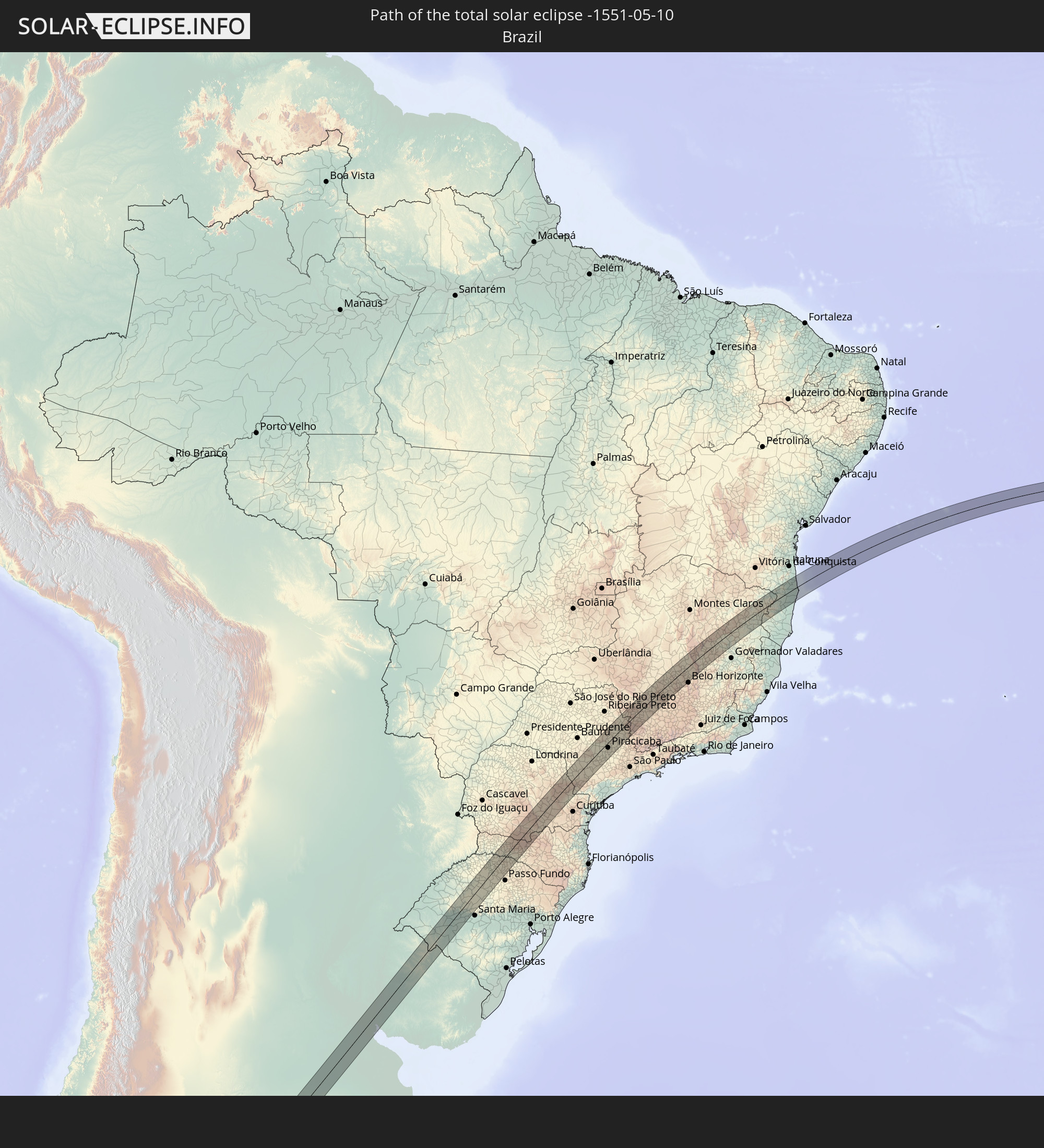 Brasilien
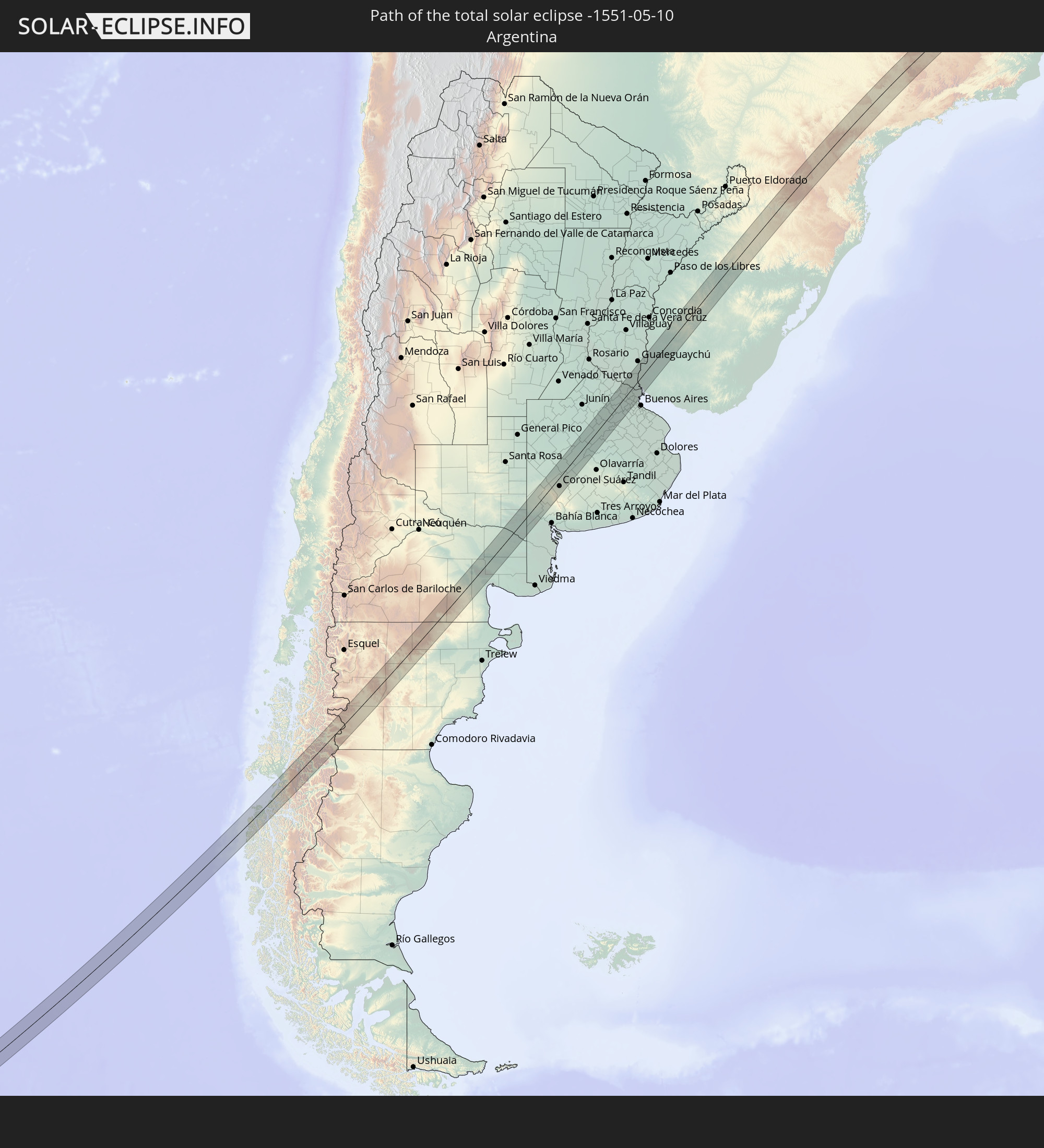 Argentinien
 Uruguay
In den folgenden Ländern ist die Sonnenfinsternis partiell zu sehen
 Antarktika
 Chile
Chile
 Kolumbien
 Peru
Peru
 Brasilien
 Argentinien
 Venezuela
 Bolivien
 Paraguay
 Trinidad und Tobago
 Falklandinseln
 Guyana
 Uruguay
 Suriname
 Französisch-Guayana
 Südgeorgien und die Südlichen Sandwichinseln
 Kap Verde
 Senegal
 Mauretanien
 Gambia
 Guinea-Bissau
 Guinea
 St. Helena
 Sierra Leone
 Mali
Mali
 Liberia
 Algerien
 Elfenbeinküste
 Burkina Faso
 Ghana
Ghana
 Togo
Togo
 Niger
Niger
 Benin
Benin
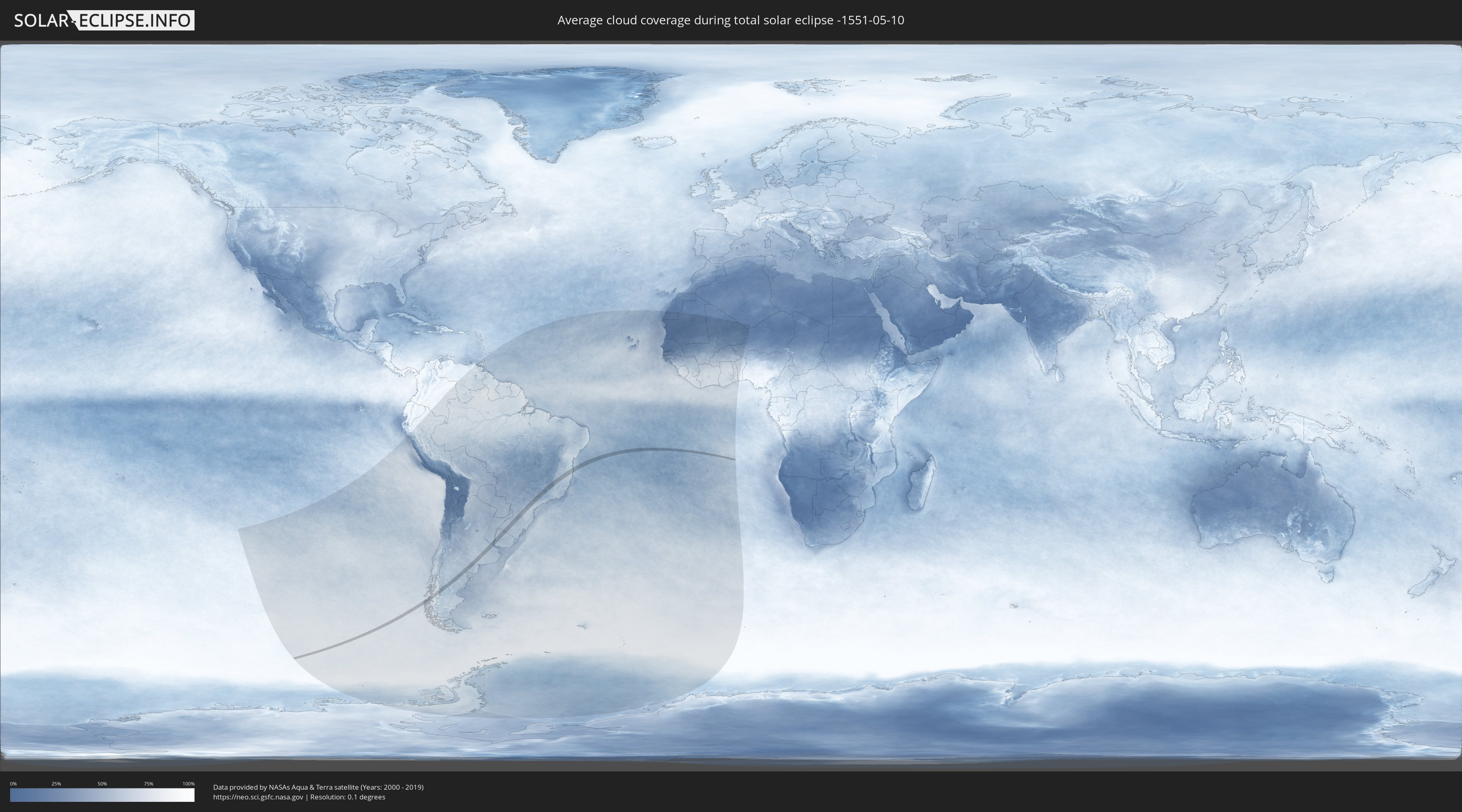
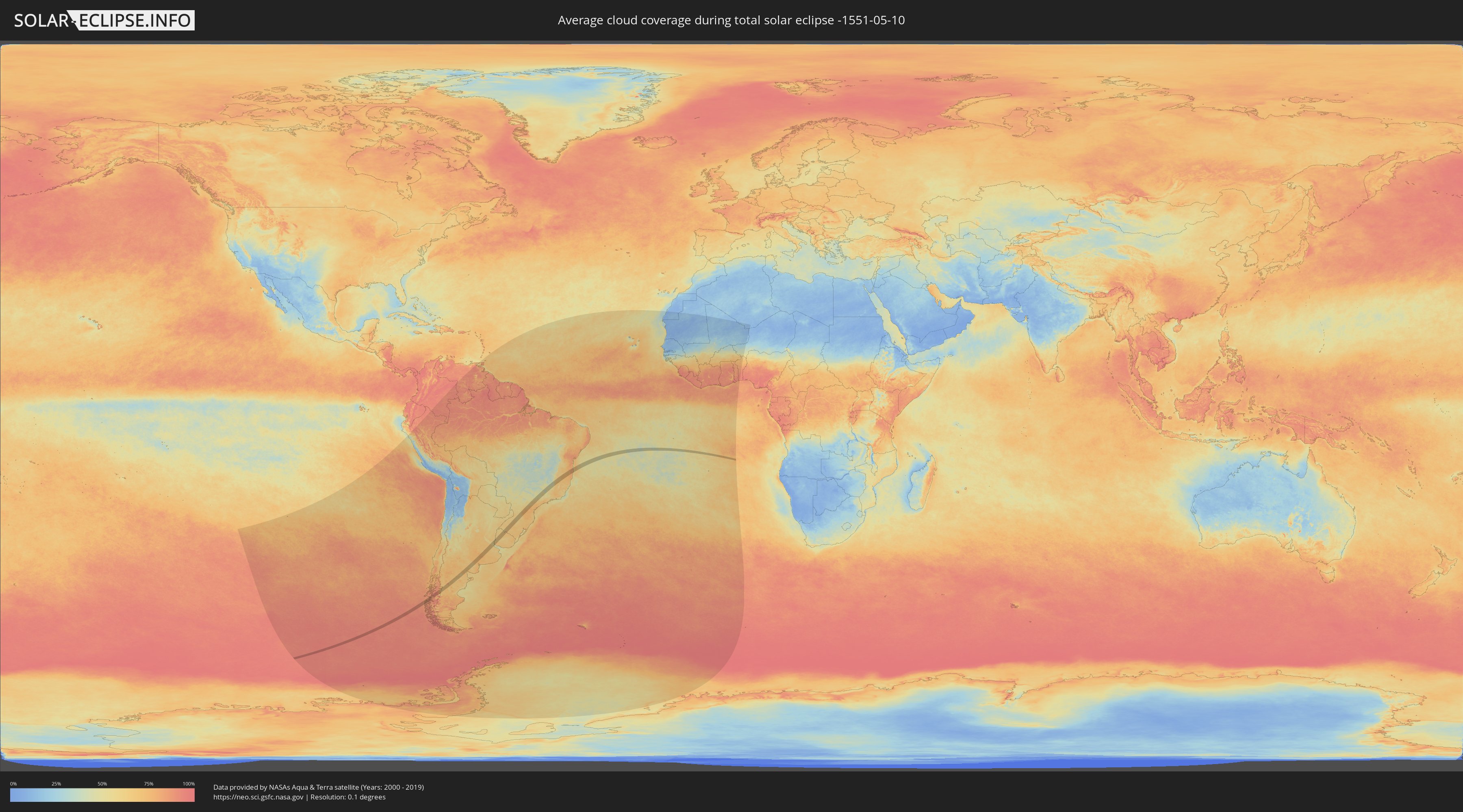
Wie wird das Wetter während der totalen Sonnenfinsternis am 10.05.-1551?
Wo ist der beste Ort, um die totale Sonnenfinsternis vom 10.05.-1551 zu beobachten?
Die folgenden Karten zeigen die durchschnittliche Bewölkung für den Tag, an dem die totale Sonnenfinsternis
stattfindet. Mit Hilfe der Karten lässt sich der Ort entlang des Finsternispfades eingrenzen,
der die besten Aussichen auf einen klaren wolkenfreien Himmel bietet.
Trotzdem muss man immer lokale Gegenenheiten beachten und sollte sich genau über das Wetter an seinem
gewählten Beobachtungsort informieren.
Die Daten stammen von den beiden NASA-Satelliten
AQUA und TERRA
und wurden über einen Zeitraum von 19 Jahren (2000 - 2019) gemittelt.
Detaillierte Länderkarten
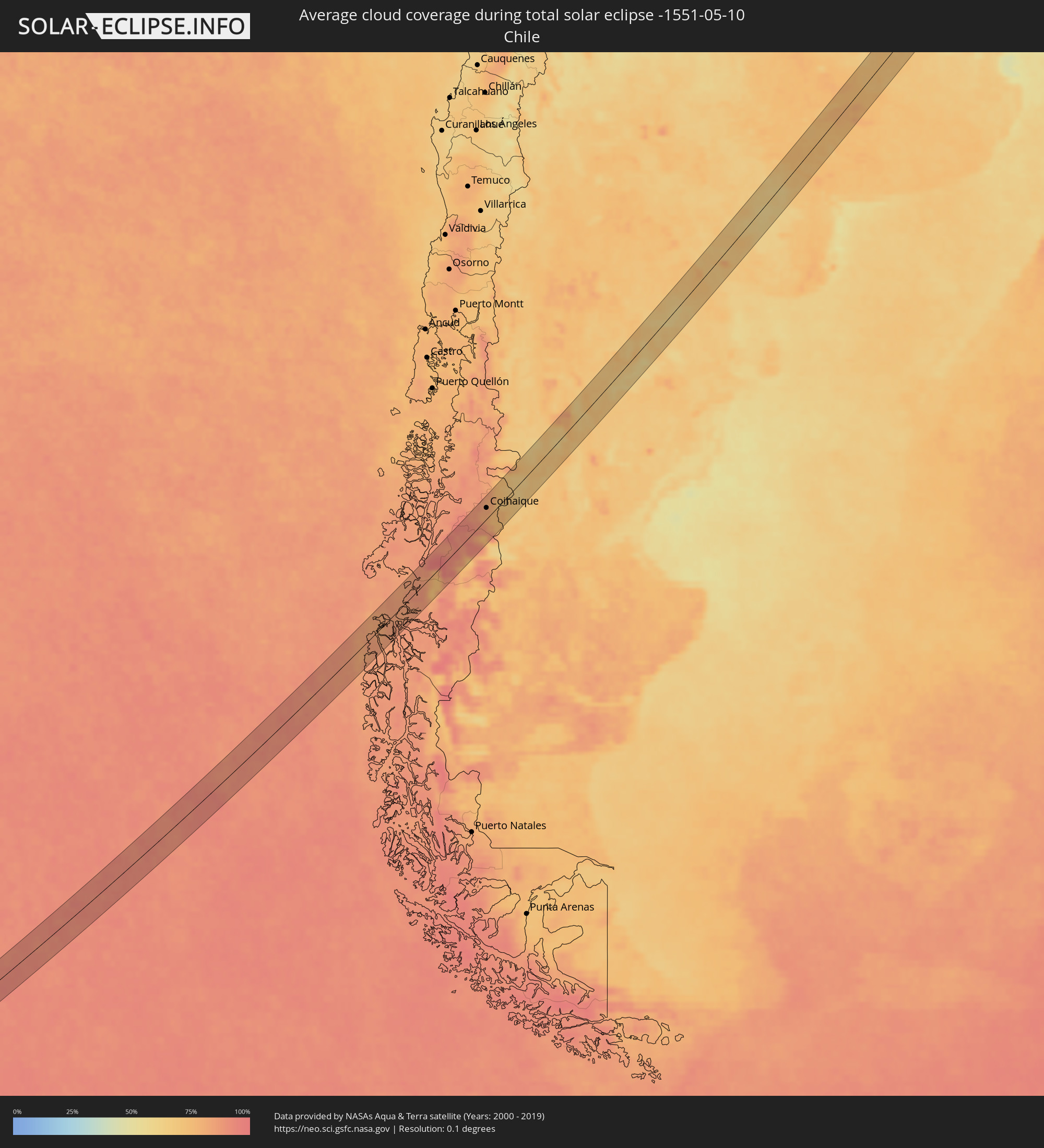 Chile
Chile
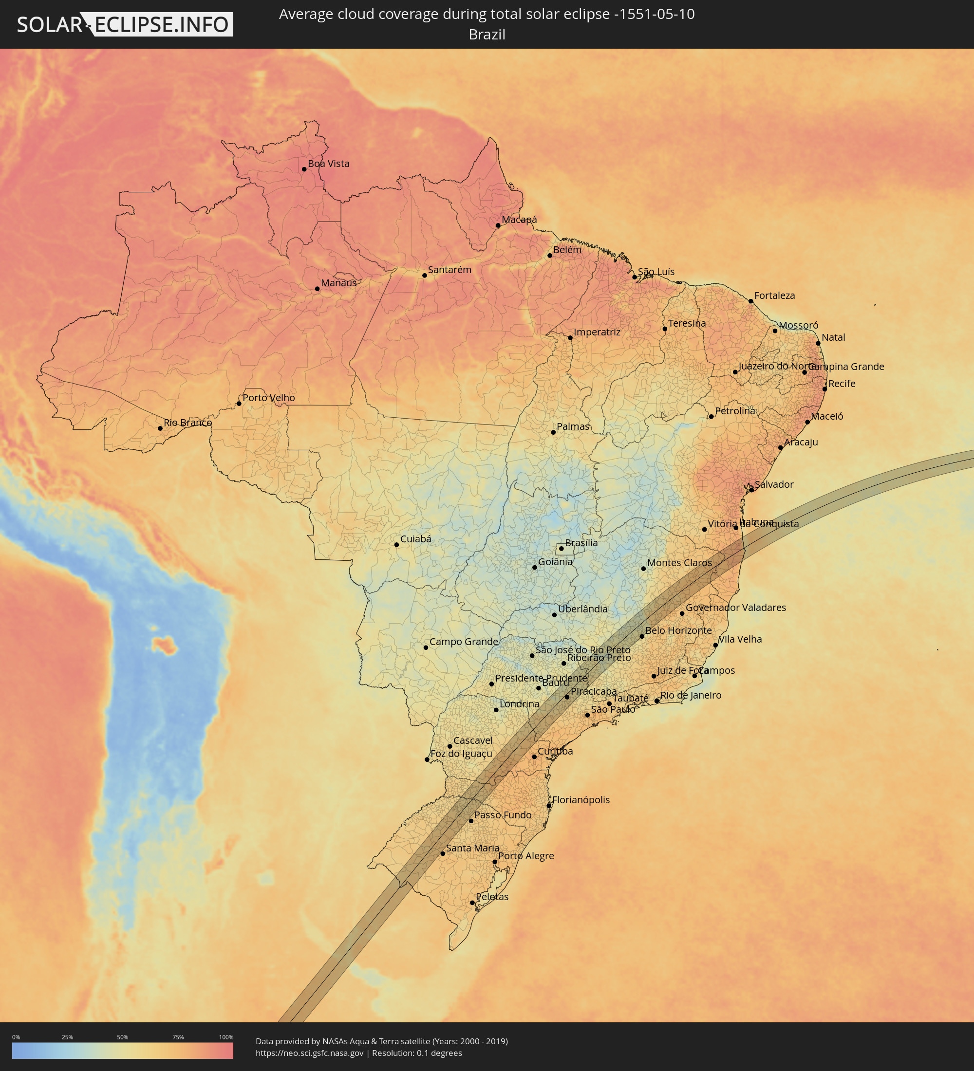 Brasilien
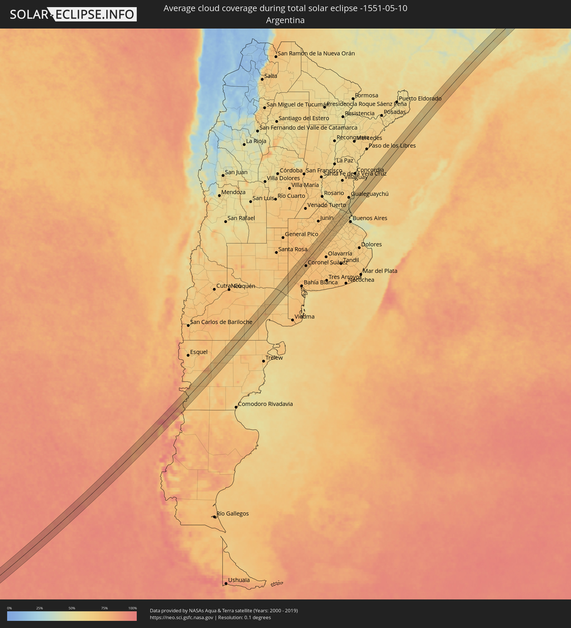 Argentinien
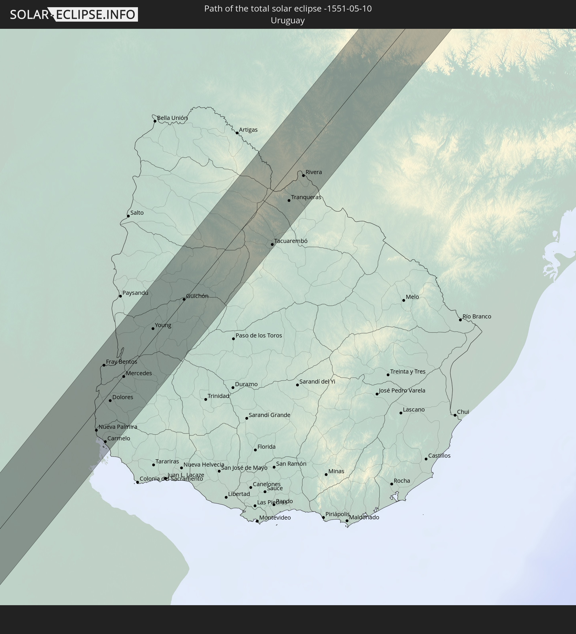
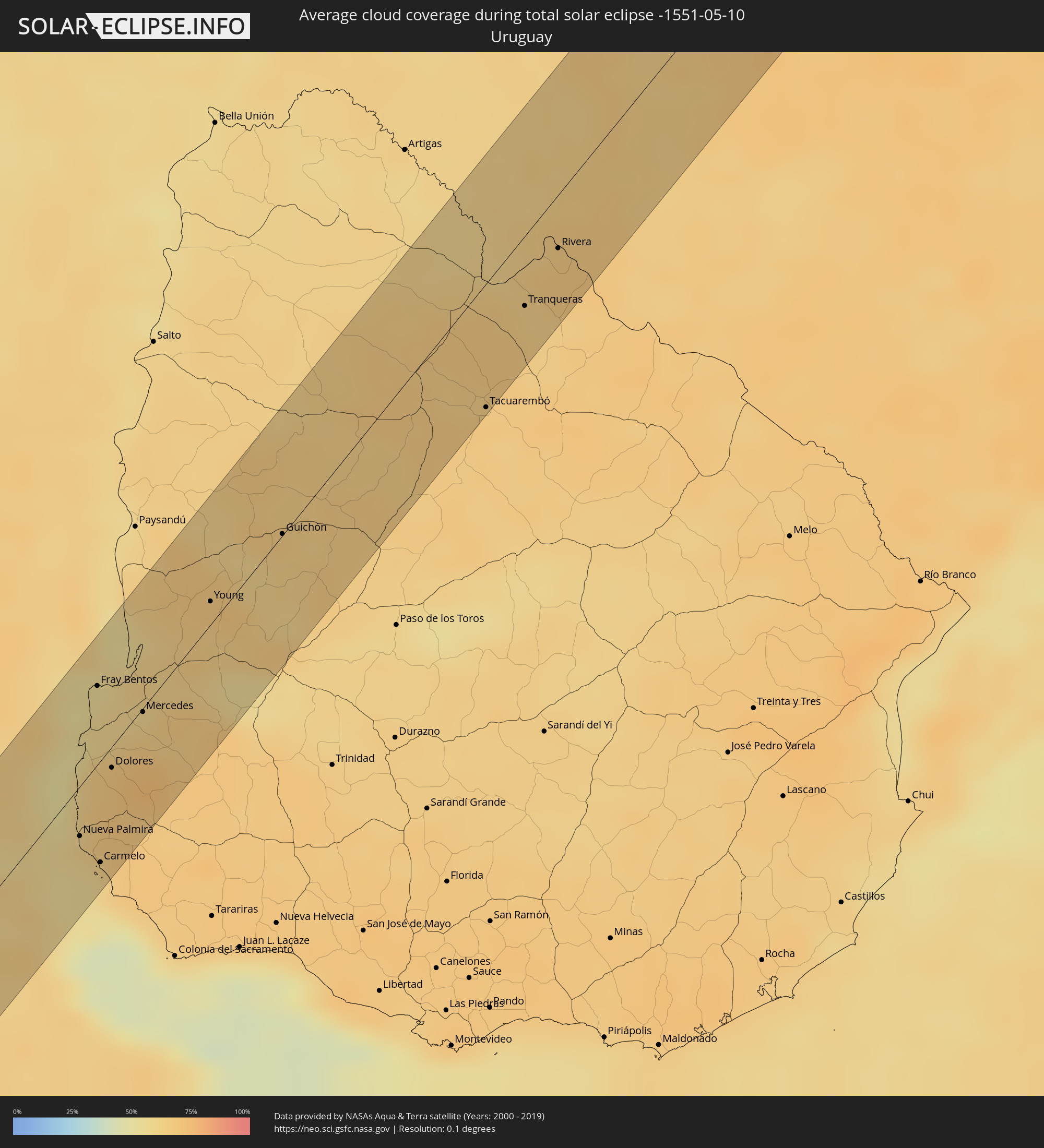 Uruguay
Orte im Finsternispfad
Die nachfolgene Tabelle zeigt Städte und Orte mit mehr als 5.000 Einwohnern, die sich im Finsternispfad befinden. Städte mit mehr als 100.000 Einwohnern sind dick gekennzeichnet. Mit einem Klick auf den Ort öffnet sich eine Detailkarte die die Lage des jeweiligen Ortes zusammen mit dem Verlauf der zentralen Finsternis präsentiert.
| Ort | Typ | Dauer der Verfinsterung | Ortszeit bei maximaler Verfinsterung | Entfernung zur Zentrallinie | Ø Bewölkung |
|
Coihaique, Aisén
|
total | - | 10:21:57 UTC-04:42 | 17 km | 82% |
|
Coronel Suárez, Buenos Aires
|
total | - | 11:06:29 UTC-04:16 | 21 km | 73% |
|
Veinticinco de Mayo, Buenos Aires
|
total | - | 11:11:21 UTC-04:16 | 1 km | 68% |
|
Chivilcoy, Buenos Aires
|
total | - | 11:12:11 UTC-04:16 | 26 km | 69% |
|
Mercedes, Buenos Aires
|
total | - | 11:13:27 UTC-04:16 | 1 km | 67% |
|
Luján, Buenos Aires
|
total | - | 11:14:06 UTC-04:16 | 16 km | 67% |
|
Zárate, Buenos Aires
|
total | - | 11:14:47 UTC-04:16 | 11 km | 65% |
|
Campana, Buenos Aires
|
total | - | 11:14:49 UTC-04:16 | 1 km | 67% |
|
Tigre, Buenos Aires
|
total | - | 11:15:10 UTC-04:16 | 44 km | 62% |
|
Nueva Palmira, Colonia
|
total | - | 11:48:04 UTC-03:44 | 17 km | 58% |
|
Fray Bentos, Río Negro
|
total | - | 11:49:09 UTC-03:44 | 28 km | 56% |
|
Carmelo, Colonia
|
total | - | 11:48:08 UTC-03:44 | 35 km | 57% |
|
Dolores, Soriano
|
total | - | 11:48:49 UTC-03:44 | 7 km | 67% |
|
Mercedes, Soriano
|
total | - | 11:49:29 UTC-03:44 | 1 km | 66% |
|
Young, Río Negro
|
total | - | 11:50:53 UTC-03:44 | 8 km | 65% |
|
Guichón, Paysandú
|
total | - | 11:52:05 UTC-03:44 | 1 km | 63% |
|
Tacuarembó, Tacuarembó
|
total | - | 11:55:10 UTC-03:44 | 44 km | 67% |
|
Tranqueras, Rivera
|
total | - | 11:56:18 UTC-03:44 | 25 km | 65% |
|
Rivera, Rivera
|
total | - | 11:57:04 UTC-03:44 | 19 km | 67% |
|
Santana do Livramento, Rio Grande do Sul
|
total | - | 12:35:31 UTC-03:06 | 20 km | 67% |
|
Rosário do Sul, Rio Grande do Sul
|
total | - | 12:37:35 UTC-03:06 | 21 km | 63% |
|
Ijuí, Rio Grande do Sul
|
total | - | 12:42:17 UTC-03:06 | 36 km | 63% |
|
Cruz Alta, Rio Grande do Sul
|
total | - | 12:42:31 UTC-03:06 | 5 km | 67% |
|
Carazinho, Rio Grande do Sul
|
total | - | 12:44:41 UTC-03:06 | 42 km | 65% |
|
Chapecó, Santa Catarina
|
total | - | 12:46:54 UTC-03:06 | 31 km | 62% |
|
Erechim, Rio Grande do Sul
|
total | - | 12:46:44 UTC-03:06 | 34 km | 63% |
|
Concórdia, Santa Catarina
|
total | - | 12:47:52 UTC-03:06 | 24 km | 61% |
|
Palmas, Paraná
|
total | - | 12:49:10 UTC-03:06 | 27 km | 63% |
|
União da Vitória, Paraná
|
total | - | 12:51:27 UTC-03:06 | 22 km | 76% |
|
Irati, Paraná
|
total | - | 12:53:38 UTC-03:06 | 1 km | 75% |
|
Ponta Grossa, Paraná
|
total | - | 12:55:17 UTC-03:06 | 9 km | 68% |
|
Castro, Paraná
|
total | - | 12:56:08 UTC-03:06 | 3 km | 68% |
|
Itararé, São Paulo
|
total | - | 12:58:45 UTC-03:06 | 2 km | 60% |
|
Avaré, São Paulo
|
total | - | 13:01:25 UTC-03:06 | 49 km | 56% |
|
Itapeva, São Paulo
|
total | - | 12:59:57 UTC-03:06 | 22 km | 62% |
|
Botucatu, São Paulo
|
total | - | 13:02:50 UTC-03:06 | 29 km | 56% |
|
Tatuí, São Paulo
|
total | - | 13:03:15 UTC-03:06 | 51 km | 64% |
|
Piracicaba, São Paulo
|
total | - | 13:04:50 UTC-03:06 | 17 km | 58% |
|
Rio Claro, São Paulo
|
total | - | 13:05:36 UTC-03:06 | 1 km | 55% |
|
Porto Ferreira, São Paulo
|
total | - | 13:06:48 UTC-03:06 | 38 km | 50% |
|
Pirassununga, São Paulo
|
total | - | 13:06:39 UTC-03:06 | 23 km | 50% |
|
Limeira, São Paulo
|
total | - | 13:05:40 UTC-03:06 | 23 km | 55% |
|
Leme, São Paulo
|
total | - | 13:06:23 UTC-03:06 | 6 km | 51% |
|
Araras, São Paulo
|
total | - | 13:06:05 UTC-03:06 | 8 km | 53% |
|
Americana, São Paulo
|
total | - | 13:05:30 UTC-03:06 | 42 km | 56% |
|
Cosmópolis, São Paulo
|
total | - | 13:05:57 UTC-03:06 | 45 km | 54% |
|
Mococa, São Paulo
|
total | - | 13:08:33 UTC-03:06 | 34 km | 49% |
|
Mogi-Gaucu, São Paulo
|
total | - | 13:07:00 UTC-03:06 | 41 km | 53% |
|
São José do Rio Pardo, São Paulo
|
total | - | 13:08:33 UTC-03:06 | 15 km | 53% |
|
São João da Boa Vista, São Paulo
|
total | - | 13:08:04 UTC-03:06 | 21 km | 53% |
|
Guaxupé, Minas Gerais
|
total | - | 13:09:29 UTC-03:06 | 26 km | 51% |
|
Espírito Santo do Pinhal, São Paulo
|
total | - | 13:08:02 UTC-03:06 | 41 km | 53% |
|
Poços de Caldas, Minas Gerais
|
total | - | 13:08:55 UTC-03:06 | 24 km | 55% |
|
Alfenas, Minas Gerais
|
total | - | 13:10:55 UTC-03:06 | 40 km | 46% |
|
Lagoa da Prata, Minas Gerais
|
total | - | 13:14:26 UTC-03:06 | 46 km | 50% |
|
Formiga, Minas Gerais
|
total | - | 13:13:51 UTC-03:06 | 1 km | 49% |
|
Campo Belo, Minas Gerais
|
total | - | 13:13:22 UTC-03:06 | 45 km | 52% |
|
Bom Despacho, Minas Gerais
|
total | - | 13:15:37 UTC-03:06 | 49 km | 48% |
|
Divinópolis, Minas Gerais
|
total | - | 13:15:38 UTC-03:06 | 10 km | 50% |
|
Pará de Minas, Minas Gerais
|
total | - | 13:16:47 UTC-03:06 | 7 km | 49% |
|
Itaúna, Minas Gerais
|
total | - | 13:16:27 UTC-03:06 | 27 km | 52% |
|
Esmeraldas, Minas Gerais
|
total | - | 13:17:37 UTC-03:06 | 19 km | 51% |
|
Sete Lagoas, Minas Gerais
|
total | - | 13:18:20 UTC-03:06 | 1 km | 47% |
|
Betim, Minas Gerais
|
total | - | 13:17:29 UTC-03:06 | 44 km | 52% |
|
Ribeirão das Neves, Minas Gerais
|
total | - | 13:18:06 UTC-03:06 | 35 km | 54% |
|
Contagem, Minas Gerais
|
total | - | 13:17:52 UTC-03:06 | 51 km | 54% |
|
Pedro Leopoldo, Minas Gerais
|
total | - | 13:18:29 UTC-03:06 | 25 km | 49% |
|
Santa Luzia, Minas Gerais
|
total | - | 13:18:37 UTC-03:06 | 51 km | 53% |
|
Teófilo Otoni, Minas Gerais
|
total | - | 13:27:23 UTC-03:06 | 42 km | 71% |