Totale Sonnenfinsternis vom 31.08.-1678
| Wochentag: | Mittwoch |
| Maximale Dauer der Verfinsterung: | 01m13s |
| Maximale Breite des Finsternispfades: | 132 km |
| Saroszyklus: | 8 |
| Bedeckungsgrad: | 100% |
| Magnitude: | 1.0192 |
| Gamma: | 0.869 |
Wo kann man die Sonnenfinsternis vom 31.08.-1678 sehen?
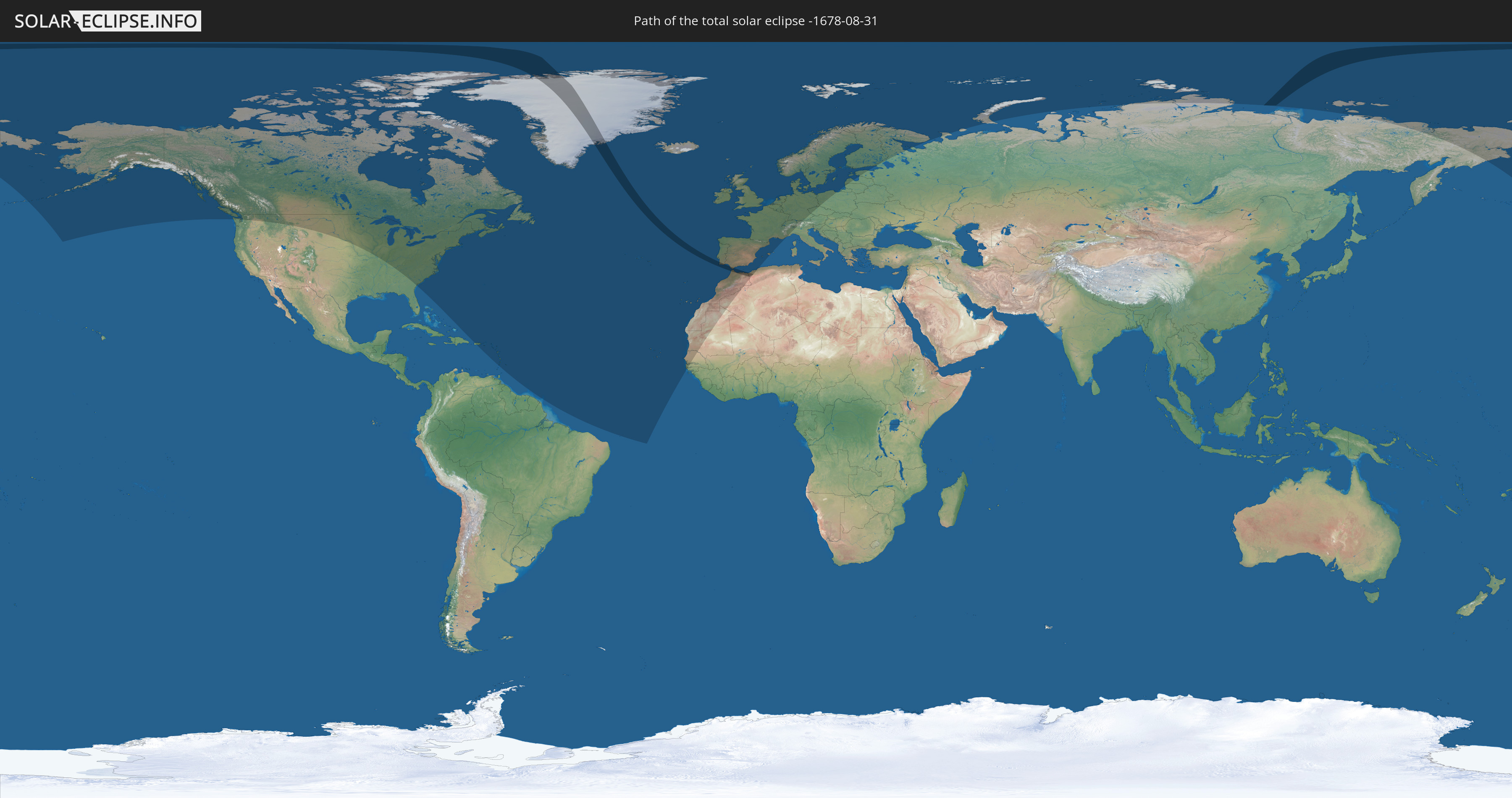
Die Sonnenfinsternis am 31.08.-1678 kann man in 59 Ländern als partielle Sonnenfinsternis beobachten.
Der Finsternispfad verläuft durch 6 Länder. Nur in diesen Ländern ist sie als totale Sonnenfinsternis zu sehen.
In den folgenden Ländern ist die Sonnenfinsternis total zu sehen
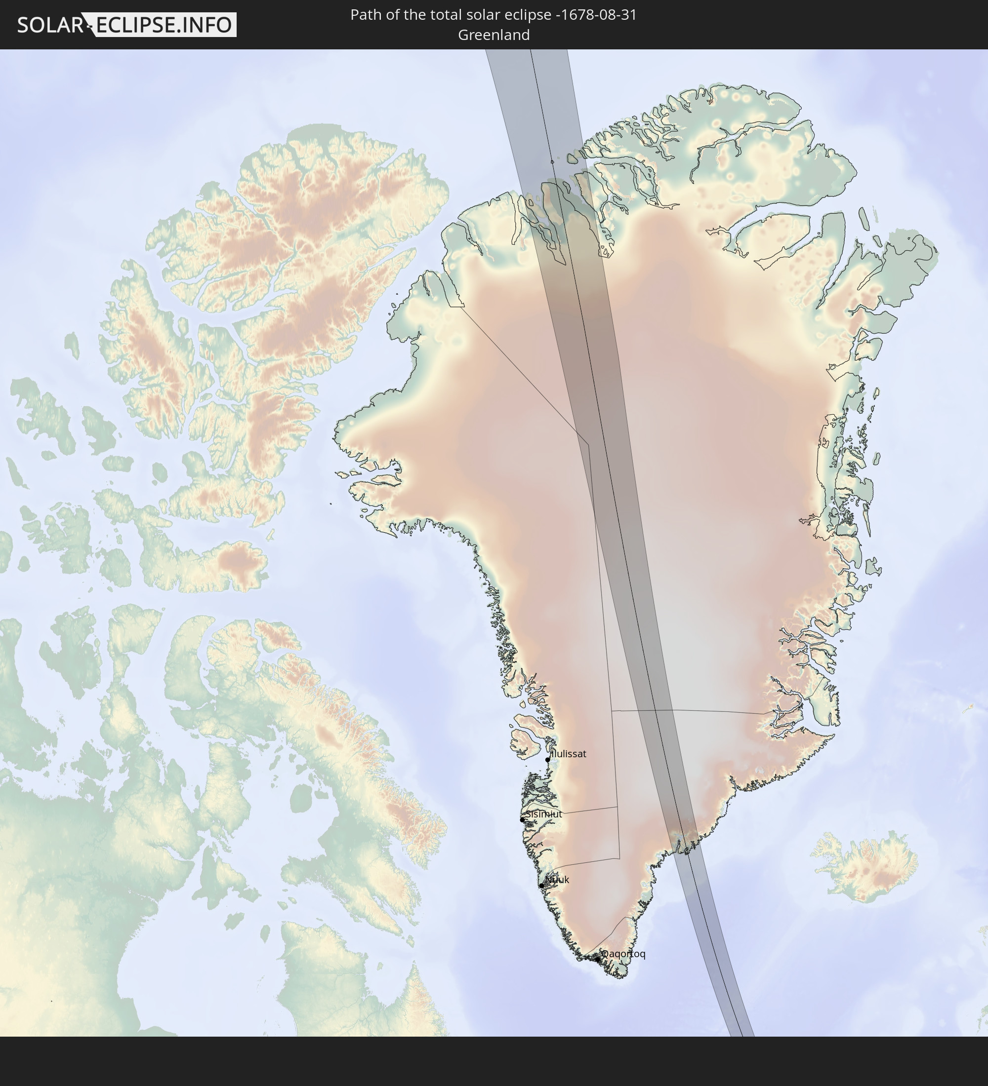 Grönland
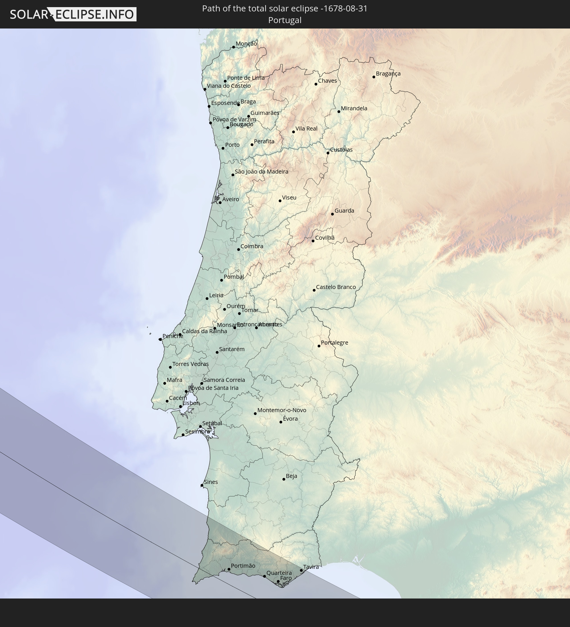 Portugal
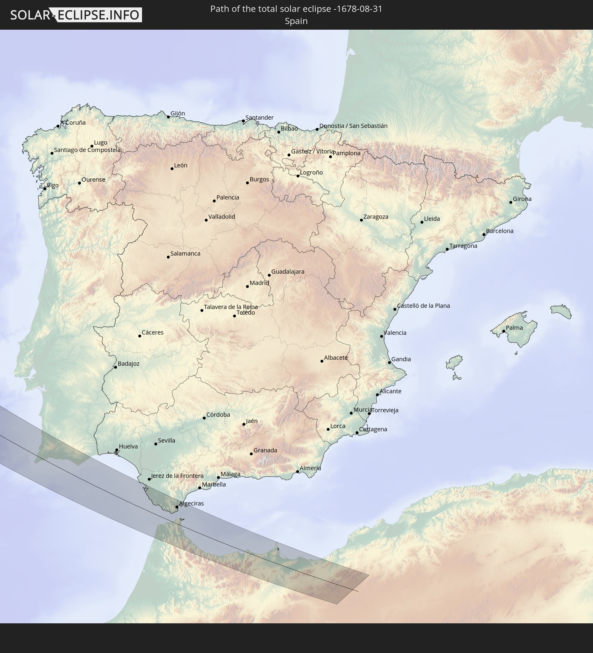 Spanien
 Marokko
 Algerien
 Gibraltar
In den folgenden Ländern ist die Sonnenfinsternis partiell zu sehen
 Russland
 Vereinigte Staaten
 Kanada
 Grönland
 Puerto Rico
 Amerikanische Jungferninseln
 Bermuda
 Britische Jungferninseln
 Anguilla
 Saint-Martin
 Saint-Barthélemy
 St. Kitts und Nevis
 Antigua und Barbuda
 Montserrat
 Guadeloupe
 Dominica
 St. Vincent und die Grenadinen
 Martinique
 St. Lucia
 Barbados
 Saint-Pierre und Miquelon
 Portugal
 Kap Verde
 Island
 Spanien
 Senegal
 Mauretanien
 Gambia
 Guinea-Bissau
 Marokko
 Irland
 Spitzbergen
 Algerien
 Vereinigtes Königreich
 Färöer
 Gibraltar
 Frankreich
 Isle of Man
 Guernsey
 Jersey
 Andorra
 Belgien
 Niederlande
 Norwegen
 Luxemburg
 Deutschland
 Schweiz
 Italien
 Dänemark
 Liechtenstein
 Österreich
 Schweden
 Tschechien
 Polen
Polen
 Åland Islands
 Finnland
 Litauen
 Lettland
 Estland
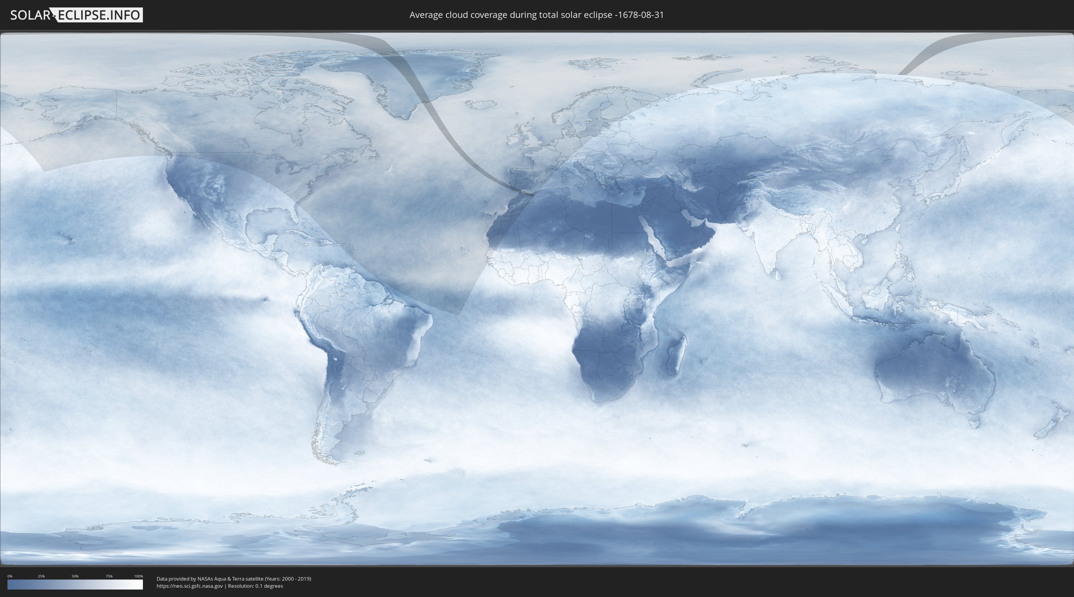
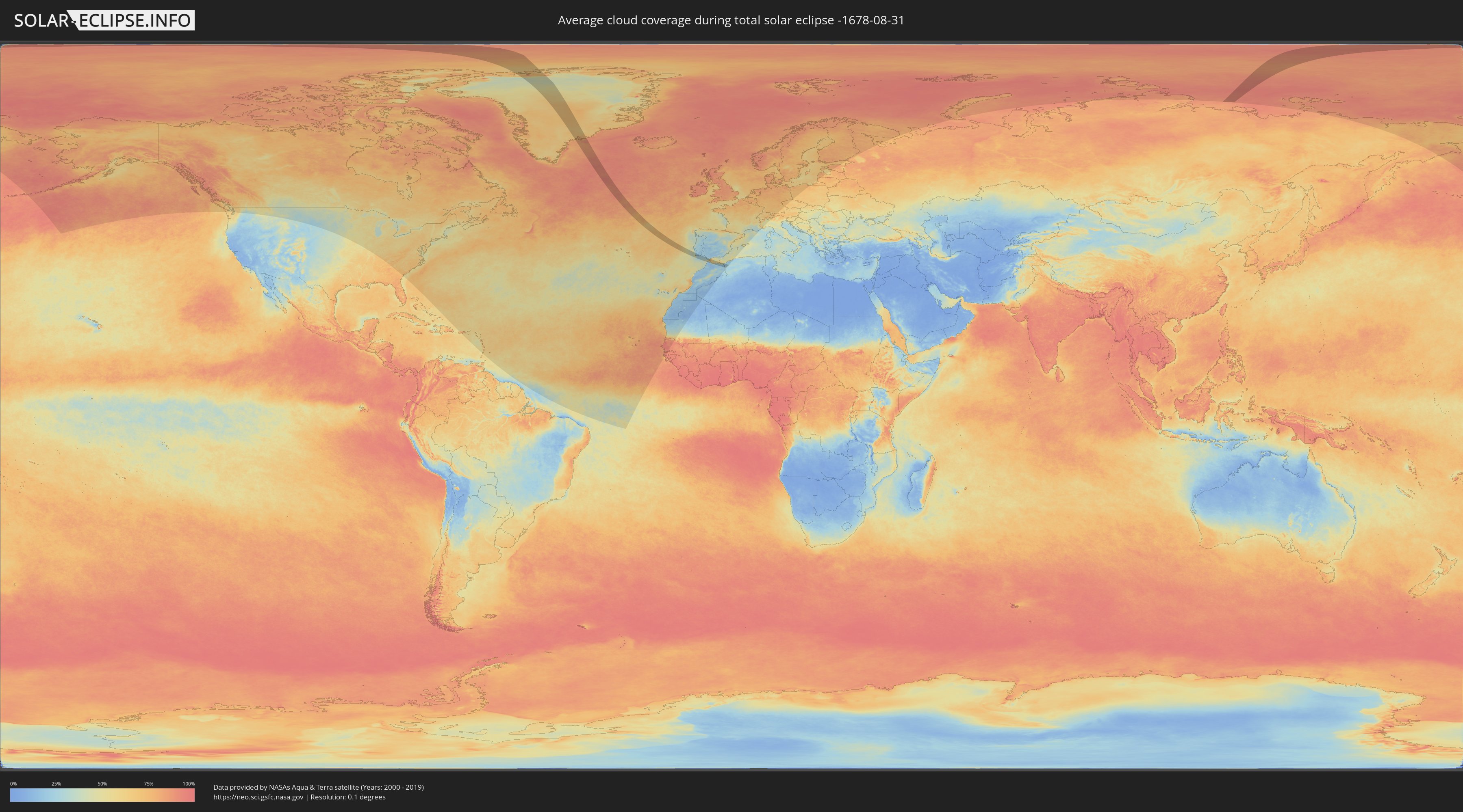
Wie wird das Wetter während der totalen Sonnenfinsternis am 31.08.-1678?
Wo ist der beste Ort, um die totale Sonnenfinsternis vom 31.08.-1678 zu beobachten?
Die folgenden Karten zeigen die durchschnittliche Bewölkung für den Tag, an dem die totale Sonnenfinsternis
stattfindet. Mit Hilfe der Karten lässt sich der Ort entlang des Finsternispfades eingrenzen,
der die besten Aussichen auf einen klaren wolkenfreien Himmel bietet.
Trotzdem muss man immer lokale Gegenenheiten beachten und sollte sich genau über das Wetter an seinem
gewählten Beobachtungsort informieren.
Die Daten stammen von den beiden NASA-Satelliten
AQUA und TERRA
und wurden über einen Zeitraum von 19 Jahren (2000 - 2019) gemittelt.
Detaillierte Länderkarten
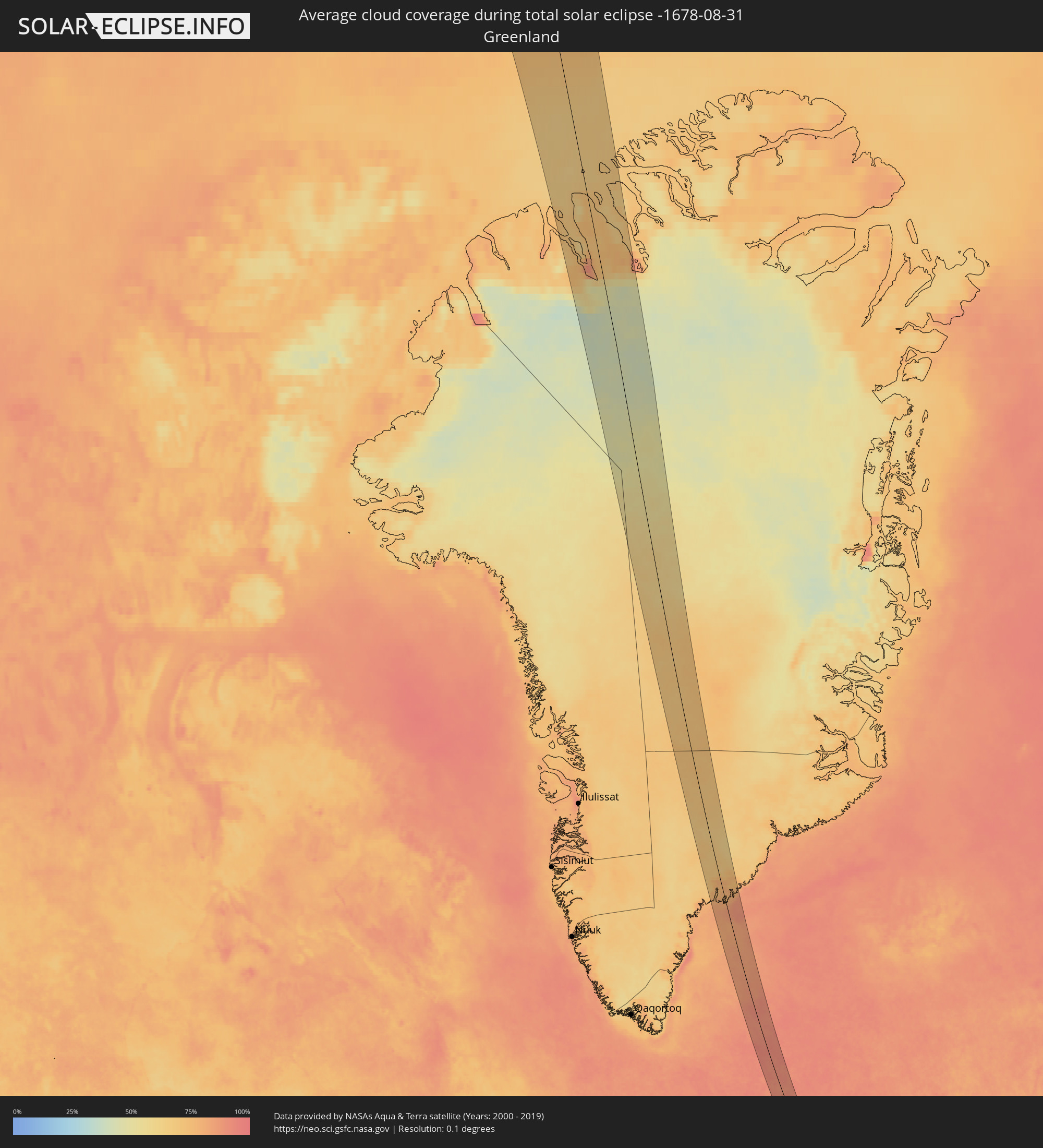 Grönland
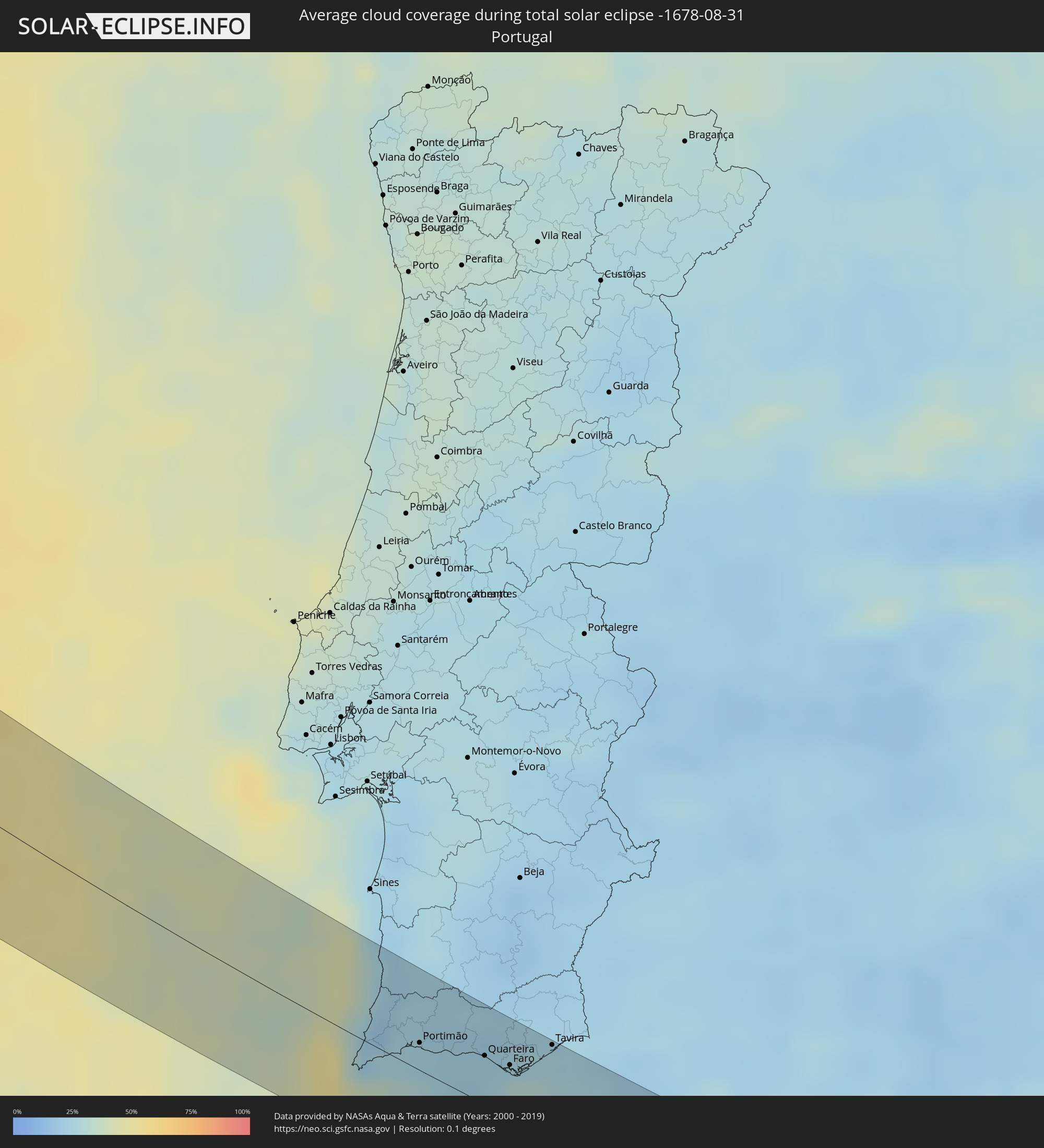 Portugal
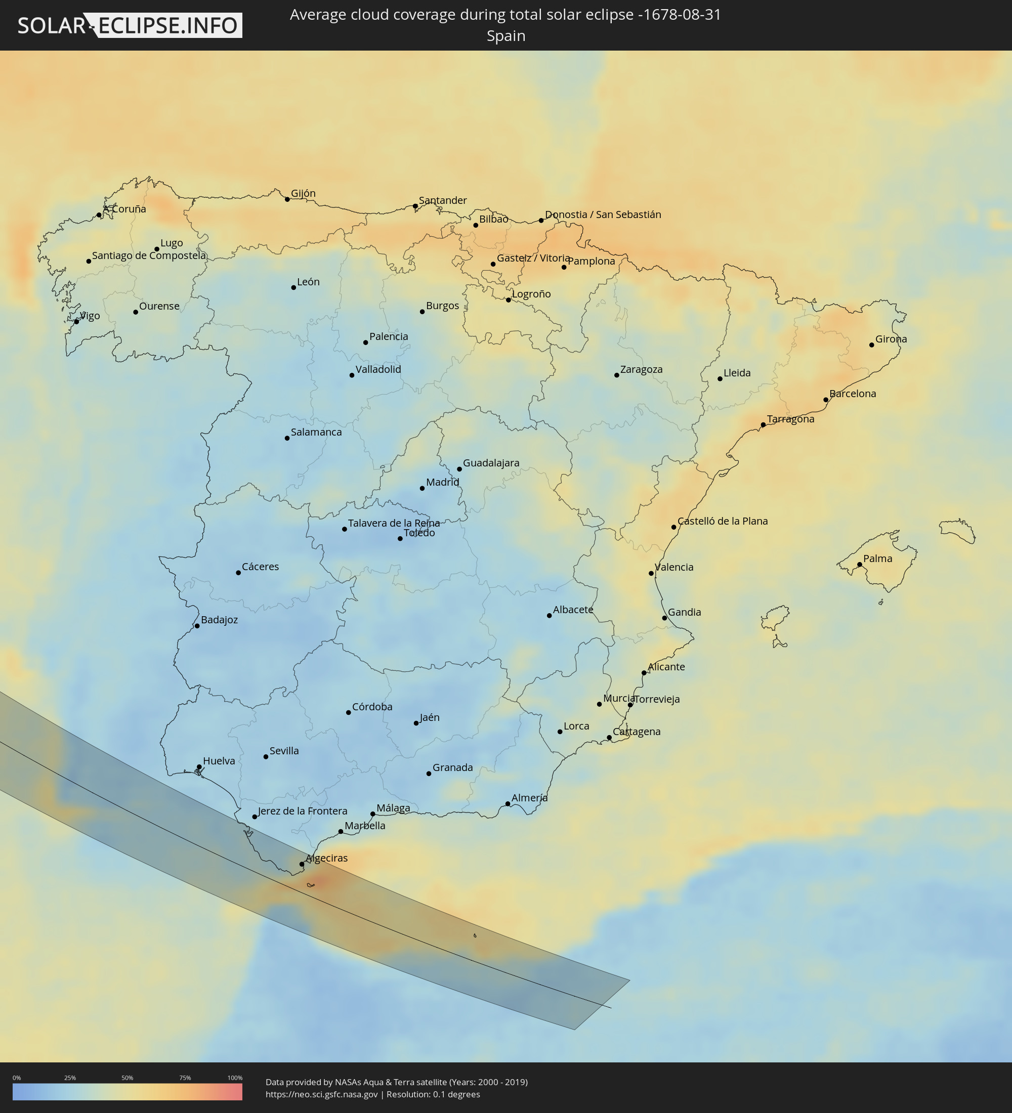 Spanien
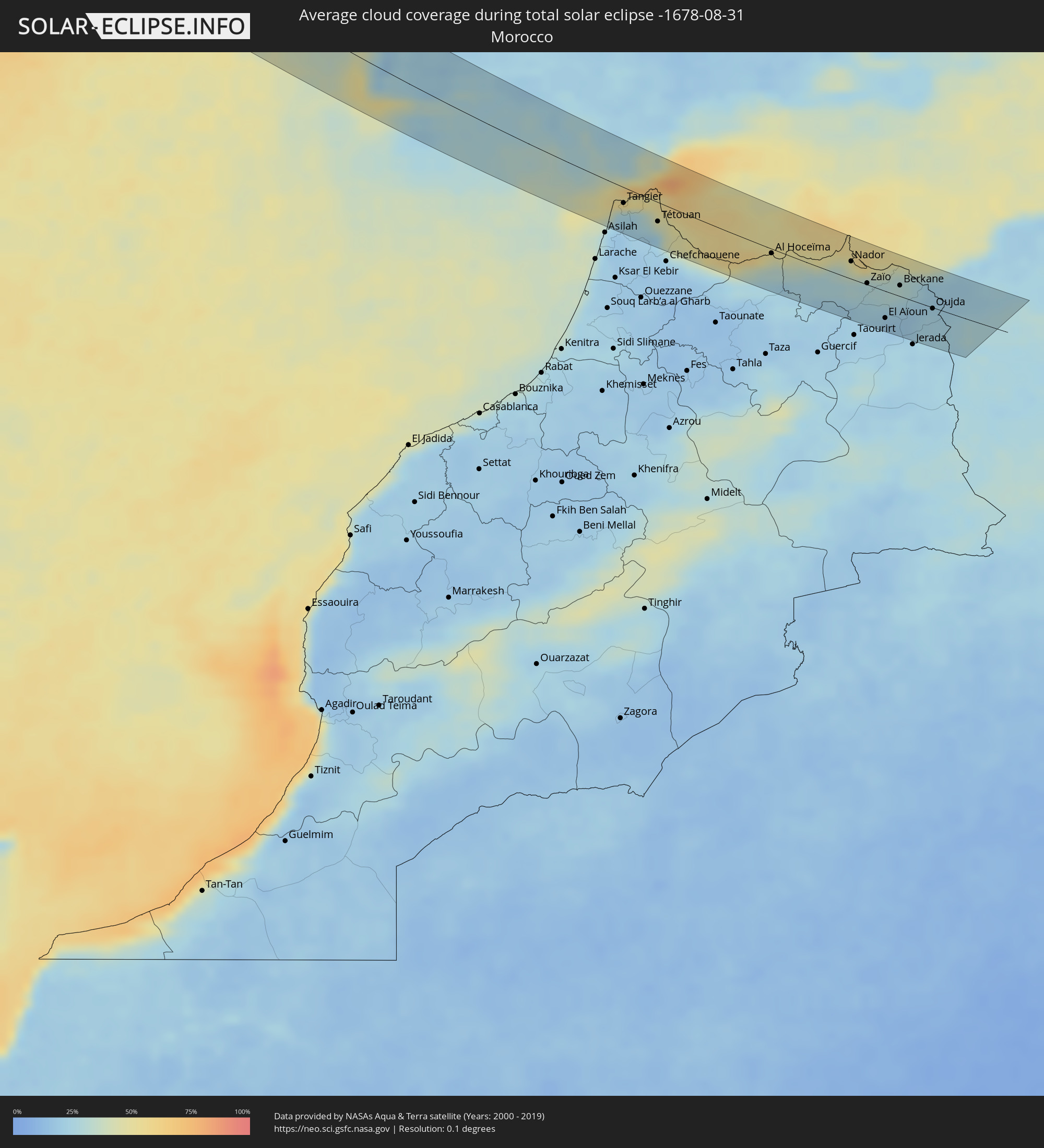 Marokko
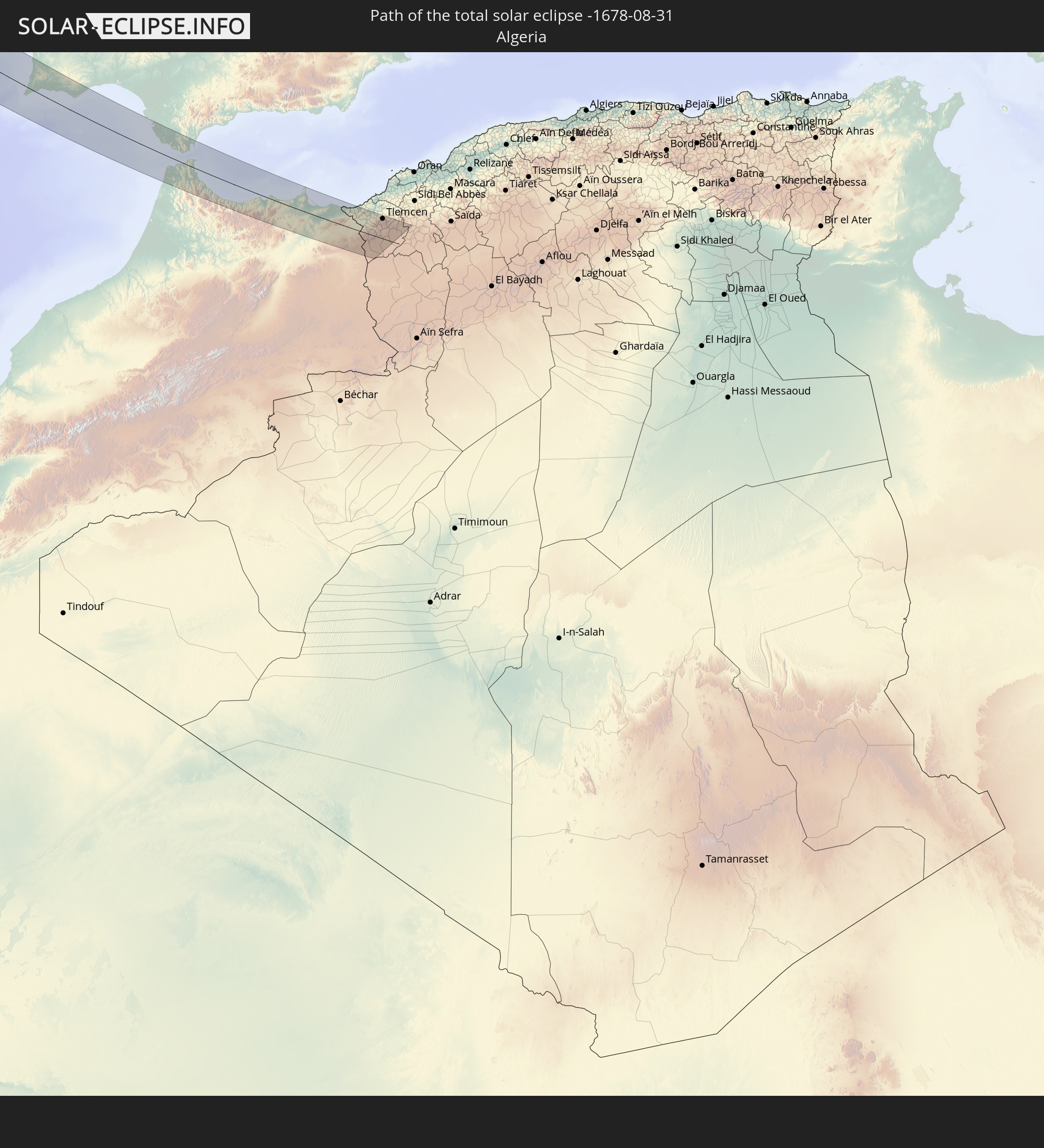
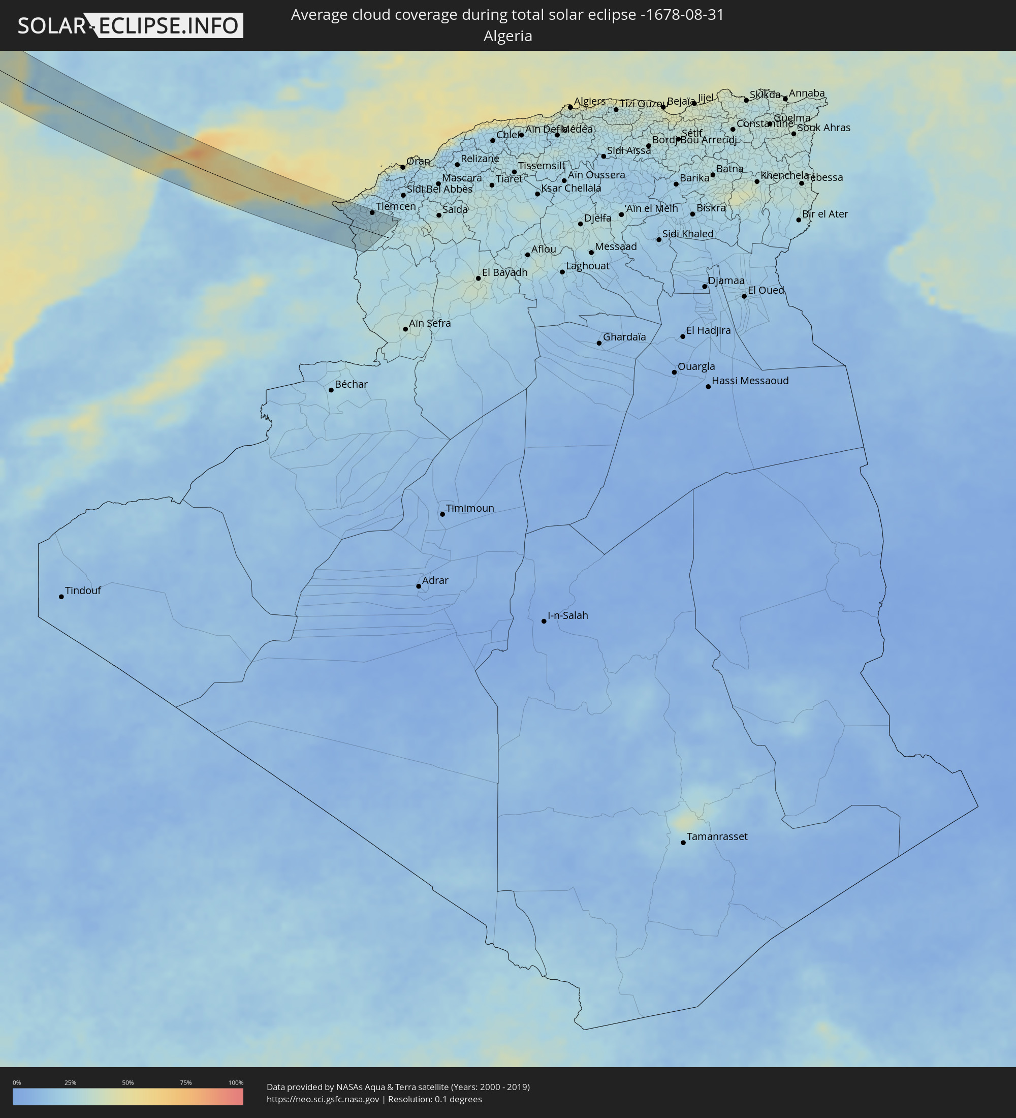 Algerien
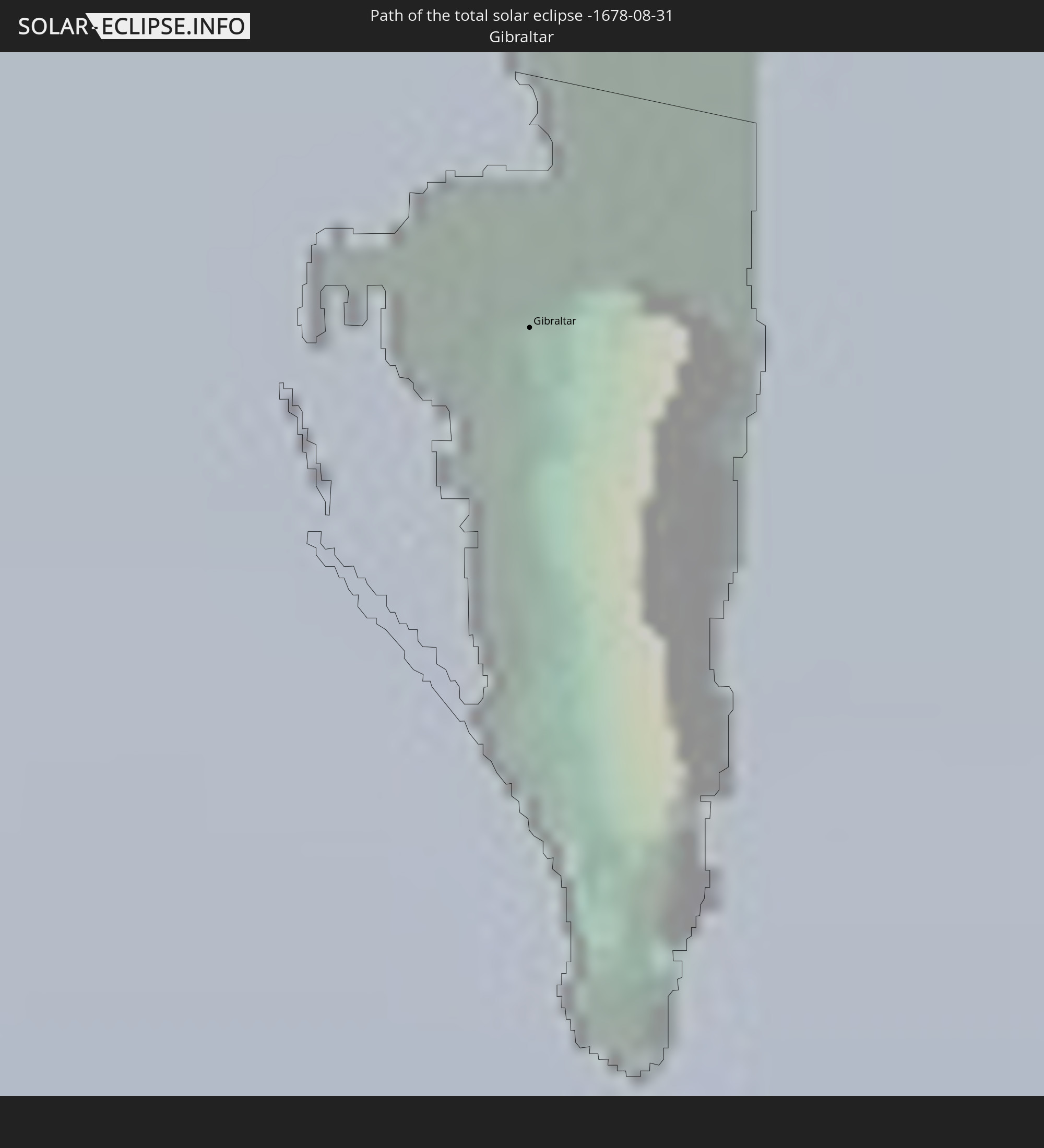
 Gibraltar
Orte im Finsternispfad
Die nachfolgene Tabelle zeigt Städte und Orte mit mehr als 5.000 Einwohnern, die sich im Finsternispfad befinden. Städte mit mehr als 100.000 Einwohnern sind dick gekennzeichnet. Mit einem Klick auf den Ort öffnet sich eine Detailkarte die die Lage des jeweiligen Ortes zusammen mit dem Verlauf der zentralen Finsternis präsentiert.
| Ort | Typ | Dauer der Verfinsterung | Ortszeit bei maximaler Verfinsterung | Entfernung zur Zentrallinie | Ø Bewölkung |
|
Lagos, Faro
|
total | - | 18:09:00 UTC-00:36 | 21 km | 26% |
|
Alvor, Faro
|
total | - | 18:08:56 UTC-00:36 | 19 km | 25% |
|
Monchique, Faro
|
total | - | 18:08:38 UTC-00:36 | 38 km | 24% |
|
Portimão, Faro
|
total | - | 18:08:54 UTC-00:36 | 18 km | 24% |
|
Estômbar, Faro
|
total | - | 18:08:53 UTC-00:36 | 19 km | 24% |
|
Lagoa, Faro
|
total | - | 18:08:54 UTC-00:36 | 18 km | 24% |
|
Silves, Faro
|
total | - | 18:08:48 UTC-00:36 | 24 km | 22% |
|
São Bartolomeu de Messines, Faro
|
total | - | 18:08:40 UTC-00:36 | 37 km | 22% |
|
Albufeira, Faro
|
total | - | 18:08:55 UTC-00:36 | 25 km | 22% |
|
Ferreiras, Faro
|
total | - | 18:08:51 UTC-00:36 | 29 km | 23% |
|
Quarteira, Faro
|
total | - | 18:08:55 UTC-00:36 | 35 km | 22% |
|
Almancil, Faro
|
total | - | 18:08:53 UTC-00:36 | 36 km | 23% |
|
Loulé, Faro
|
total | - | 18:08:48 UTC-00:36 | 41 km | 23% |
|
Faro, Faro
|
total | - | 18:08:58 UTC-00:36 | 29 km | 30% |
|
São Brás de Alportel, Faro
|
total | - | 18:08:45 UTC-00:36 | 44 km | 22% |
|
Olhão, Faro
|
total | - | 18:08:56 UTC-00:36 | 32 km | 30% |
|
Laranjeiro, Faro
|
total | - | 18:08:51 UTC-00:36 | 38 km | 26% |
|
Moncarapacho, Faro
|
total | - | 18:08:49 UTC-00:36 | 40 km | 26% |
|
Tavira, Faro
|
total | - | 18:08:44 UTC-00:36 | 51 km | 25% |
|
Rota, Andalusia
|
total | - | 18:45:57 UTC+00:00 | 51 km | 28% |
|
Cadiz, Andalusia
|
total | - | 18:46:04 UTC+00:00 | 43 km | 31% |
|
San Fernando, Andalusia
|
total | - | 18:46:08 UTC+00:00 | 42 km | 28% |
|
Puerto Real, Andalusia
|
total | - | 18:46:03 UTC+00:00 | 47 km | 28% |
|
Chiclana de la Frontera, Andalusia
|
total | - | 18:46:12 UTC+00:00 | 41 km | 27% |
|
Conil de la Frontera, Andalusia
|
total | - | 18:46:24 UTC+00:00 | 32 km | 31% |
|
Vejer de la Frontera, Andalusia
|
total | - | 18:46:25 UTC+00:00 | 28 km | 34% |
|
Medina Sidonia, Andalusia
|
total | - | 18:46:05 UTC+00:00 | 51 km | 24% |
|
Barbate de Franco, Andalusia
|
total | - | 18:46:29 UTC+00:00 | 23 km | 33% |
|
Tangier, Tanger-Tétouan
|
total | - | 18:16:46 UTC-00:30 | 28 km | 28% |
|
Tarifa, Andalusia
|
total | - | 18:46:41 UTC+00:00 | 24 km | 67% |
|
Los Barrios, Andalusia
|
total | - | 18:46:23 UTC+00:00 | 41 km | 45% |
|
Algeciras, Andalusia
|
total | - | 18:46:27 UTC+00:00 | 35 km | 58% |
|
San Roque, Andalusia
|
total | - | 18:46:19 UTC+00:00 | 45 km | 52% |
|
Tétouan, Tanger-Tétouan
|
total | - | 18:16:56 UTC-00:30 | 29 km | 35% |
|
Gibraltar
|
total | - | 18:46:24 UTC+00:00 | 38 km | 70% |
|
La Línea de la Concepción, Andalusia
|
total | - | 18:46:22 UTC+00:00 | 41 km | 62% |
|
Ceuta, Ceuta
|
total | - | 18:46:47 UTC+00:00 | 18 km | 57% |
|
Martil, Tanger-Tétouan
|
total | - | 18:16:51 UTC-00:30 | 25 km | 42% |
|
Tirhanimîne, Taza-Al Hoceima-Taounate
|
total | - | 18:17:01 UTC-00:30 | 10 km | 34% |
|
Al Hoceïma, Taza-Al Hoceima-Taounate
|
total | - | 18:16:59 UTC-00:30 | 9 km | 42% |
|
Imzoûrene, Taza-Al Hoceima-Taounate
|
total | - | 18:17:07 UTC-00:30 | 23 km | 32% |
|
Melilla, Melilla
|
total | - | 18:46:56 UTC+00:00 | 32 km | 57% |
|
Nador, Oriental
|
total | - | 18:16:47 UTC-00:30 | 19 km | 48% |
|
Zaïo, Oriental
|
total | - | 18:17:03 UTC-00:30 | 23 km | 26% |
|
El Aïoun, Oriental
|
total | - | 18:17:30 UTC-00:30 | 31 km | 18% |
|
Berkane, Oriental
|
total | - | 18:16:56 UTC-00:30 | 18 km | 26% |
|
Ahfir, Oriental
|
total | - | 18:16:49 UTC-00:30 | 28 km | 25% |
|
Oujda, Oriental
|
total | - | 18:17:09 UTC-00:30 | 9 km | 23% |
|
Nedroma, Tlemcen
|
total | - | 18:56:17 UTC+00:09 | 40 km | 21% |
|
Beni Mester, Tlemcen
|
total | - | 18:56:23 UTC+00:09 | 33 km | 23% |
|
Hennaya, Tlemcen
|
total | - | 18:56:14 UTC+00:09 | 43 km | 23% |
|
Mansoûra, Tlemcen
|
total | - | 18:56:22 UTC+00:09 | 35 km | 22% |
|
Sebdou, Tlemcen
|
total | - | 18:56:41 UTC+00:09 | 17 km | 28% |
|
Tlemcen, Tlemcen
|
total | - | 18:56:20 UTC+00:09 | 37 km | 22% |
|
Chetouane, Tlemcen
|
total | - | 18:56:15 UTC+00:09 | 42 km | 22% |