Totale Sonnenfinsternis vom 18.08.-1742
| Wochentag: | Montag |
| Maximale Dauer der Verfinsterung: | 05m43s |
| Maximale Breite des Finsternispfades: | 203 km |
| Saroszyklus: | 17 |
| Bedeckungsgrad: | 100% |
| Magnitude: | 1.0614 |
| Gamma: | -0.1242 |
Wo kann man die Sonnenfinsternis vom 18.08.-1742 sehen?
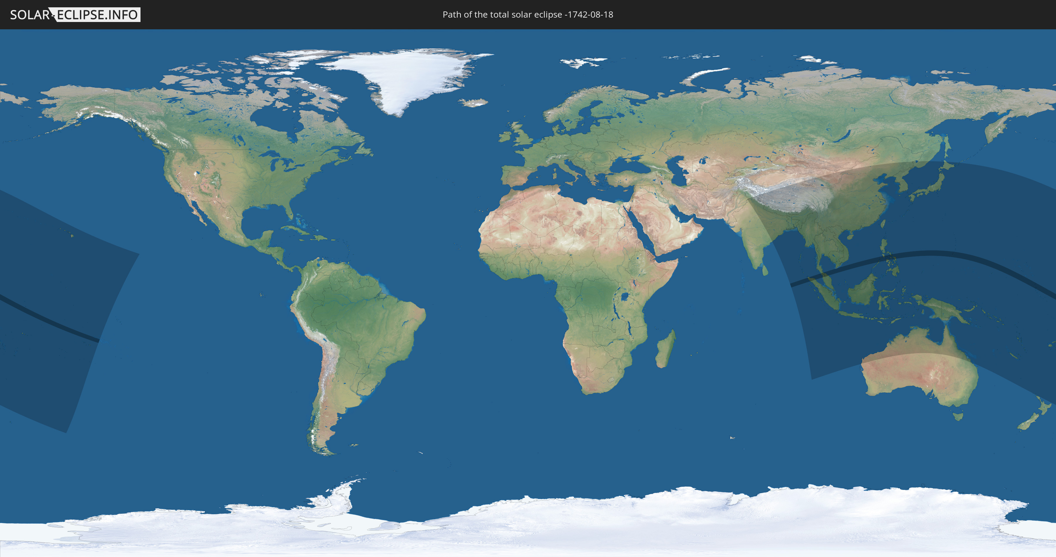
Die Sonnenfinsternis am 18.08.-1742 kann man in 52 Ländern als partielle Sonnenfinsternis beobachten.
Der Finsternispfad verläuft durch 11 Länder. Nur in diesen Ländern ist sie als totale Sonnenfinsternis zu sehen.
In den folgenden Ländern ist die Sonnenfinsternis total zu sehen
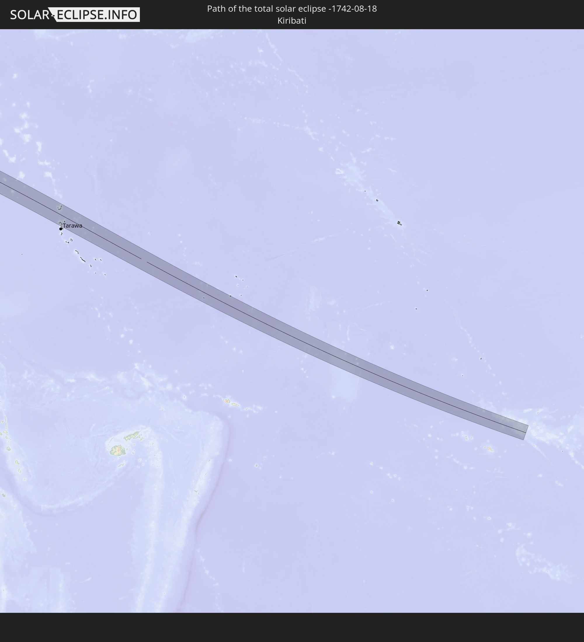 Kiribati
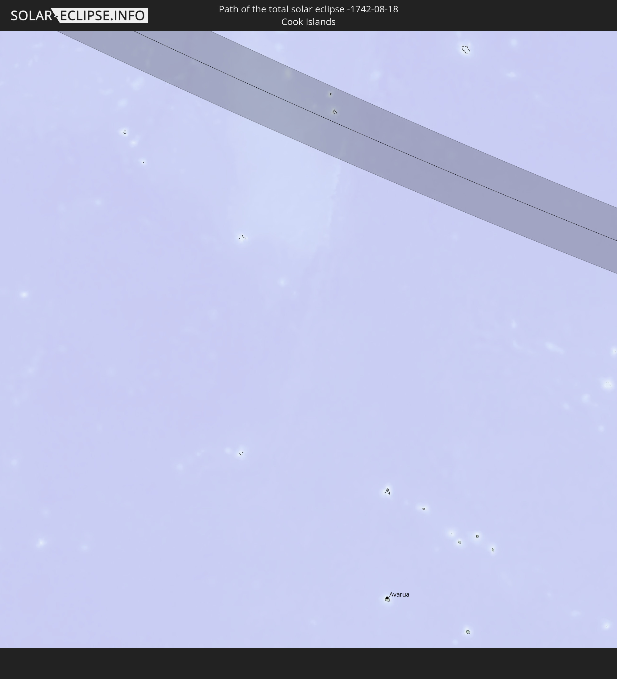 Cookinseln
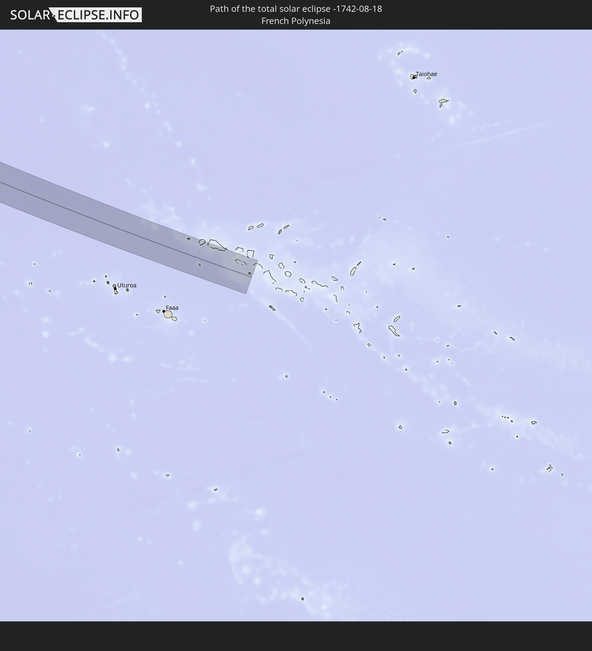 Französisch-Polynesien
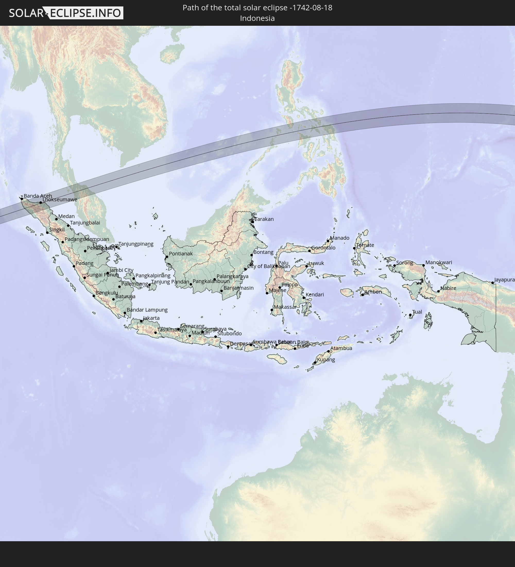 Indonesien
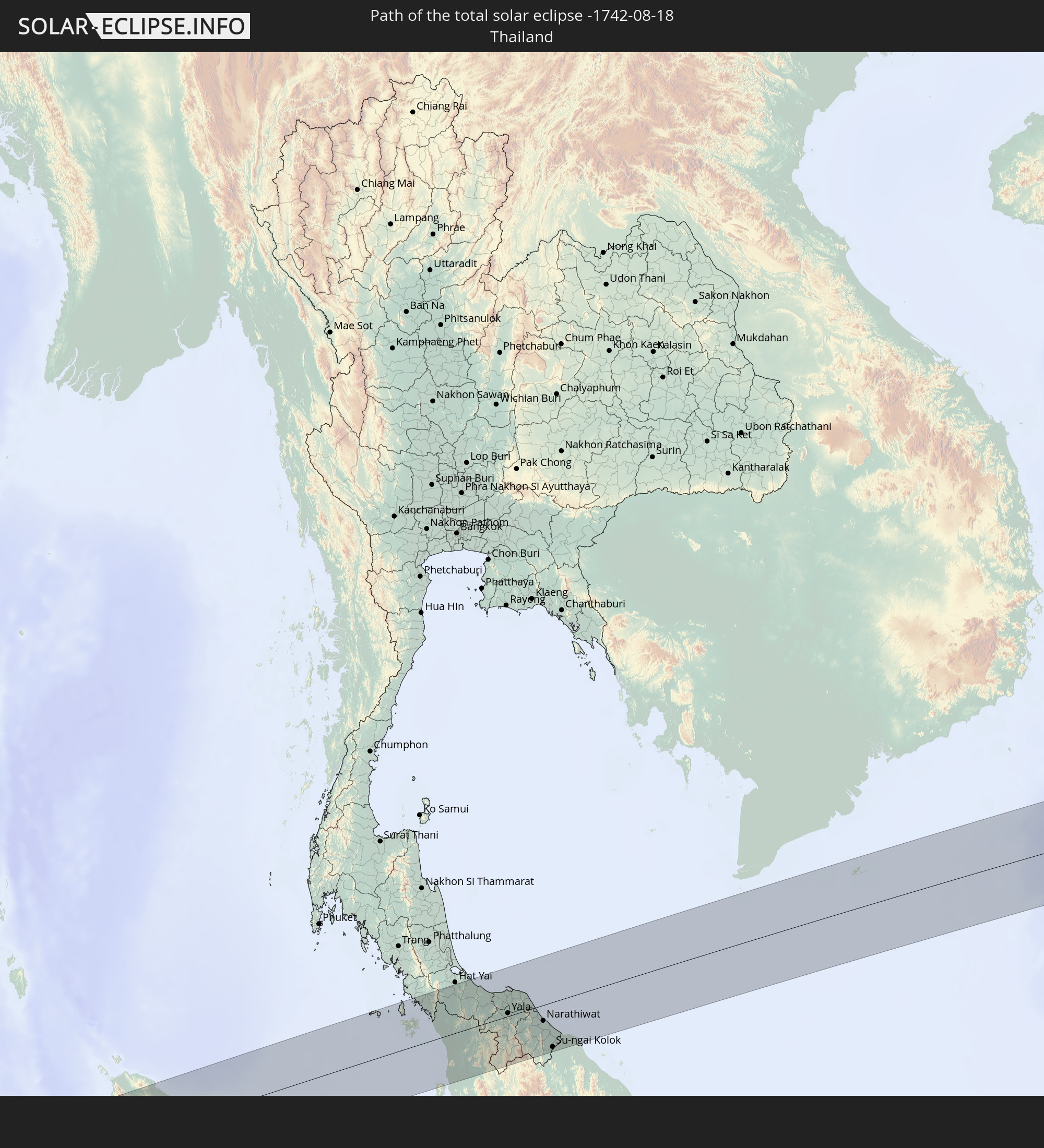 Thailand
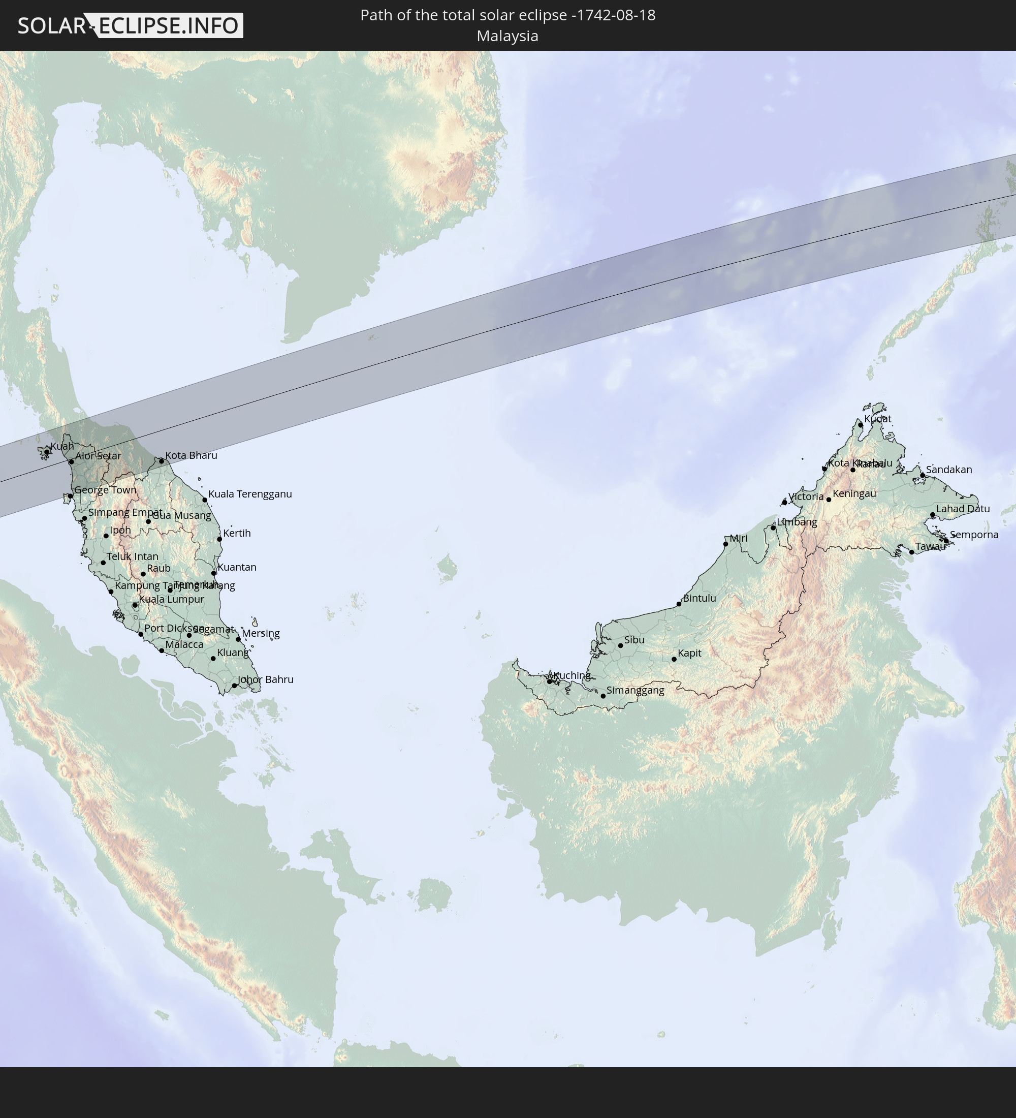 Malaysia
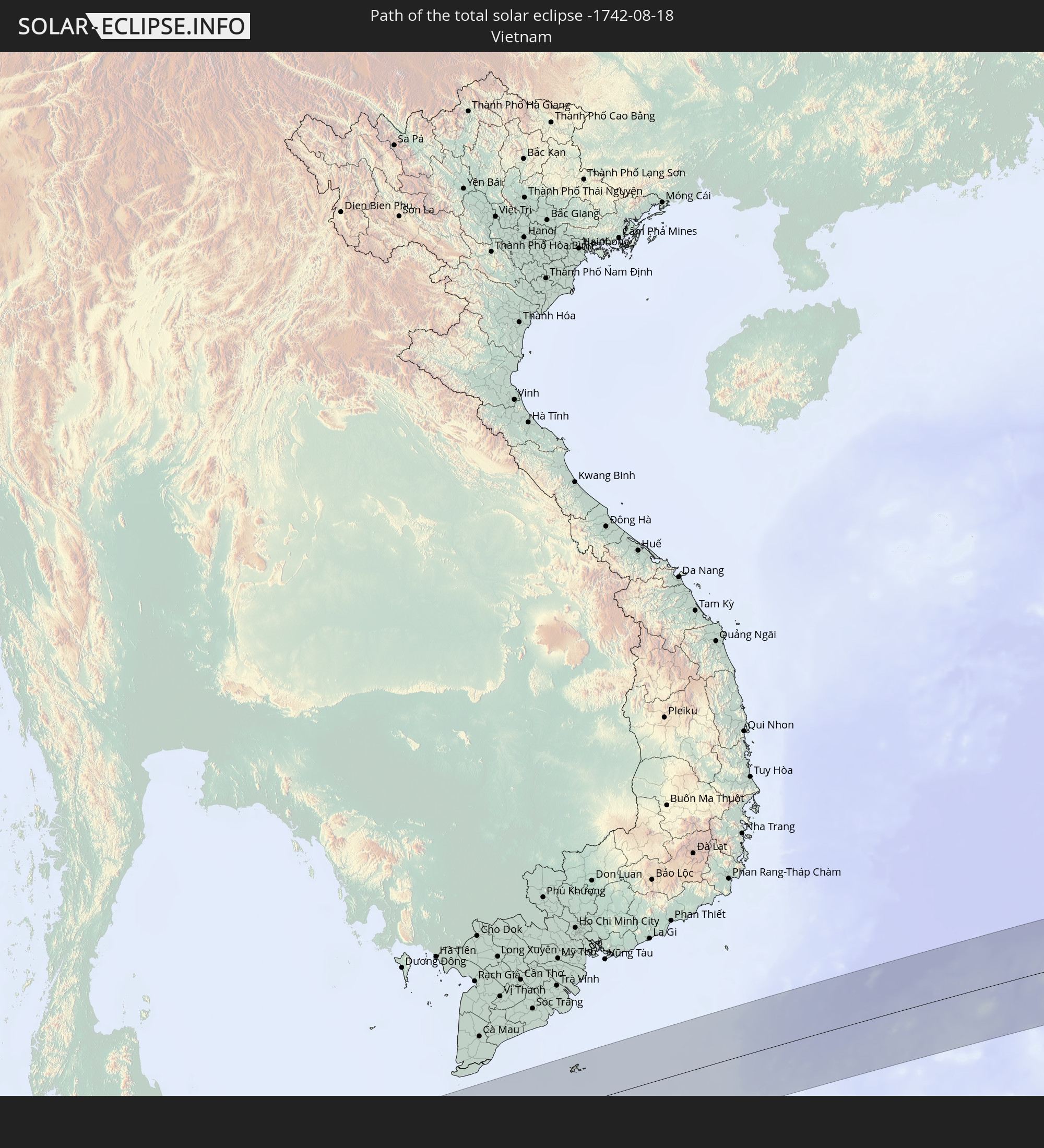 Vietnam
 Philippinen
 Guam
Guam
 Nördliche Marianen
 Marshallinseln
In den folgenden Ländern ist die Sonnenfinsternis partiell zu sehen
 Fidschi
 Russland
 Vereinigte Staaten
 Neuseeland
 United States Minor Outlying Islands
 Wallis und Futuna
 Tonga
Tonga
 Kiribati
 Samoa
Samoa
 Tokelau
 Amerikanisch-Samoa
 Niue
Niue
 Cookinseln
 Französisch-Polynesien
 Pakistan
 Indien
 Volksrepublik China
 Nepal
Nepal
 Bangladesch
 Bhutan
 Myanmar
 Indonesien
 Kokosinseln
 Thailand
 Malaysia
 Laos
Laos
 Vietnam
 Kambodscha
 Singapur
 Weihnachtsinsel
 Australien
 Macau
Macau
 Hongkong
 Brunei
 Taiwan
 Philippinen
 Japan
Japan
 Osttimor
 Nordkorea
 Südkorea
 Palau
Palau
 Föderierte Staaten von Mikronesien
 Papua-Neuguinea
 Guam
Guam
 Nördliche Marianen
 Salomonen
 Neukaledonien
 Marshallinseln
 Vanuatu
 Nauru
Nauru
 Norfolkinsel
 Tuvalu
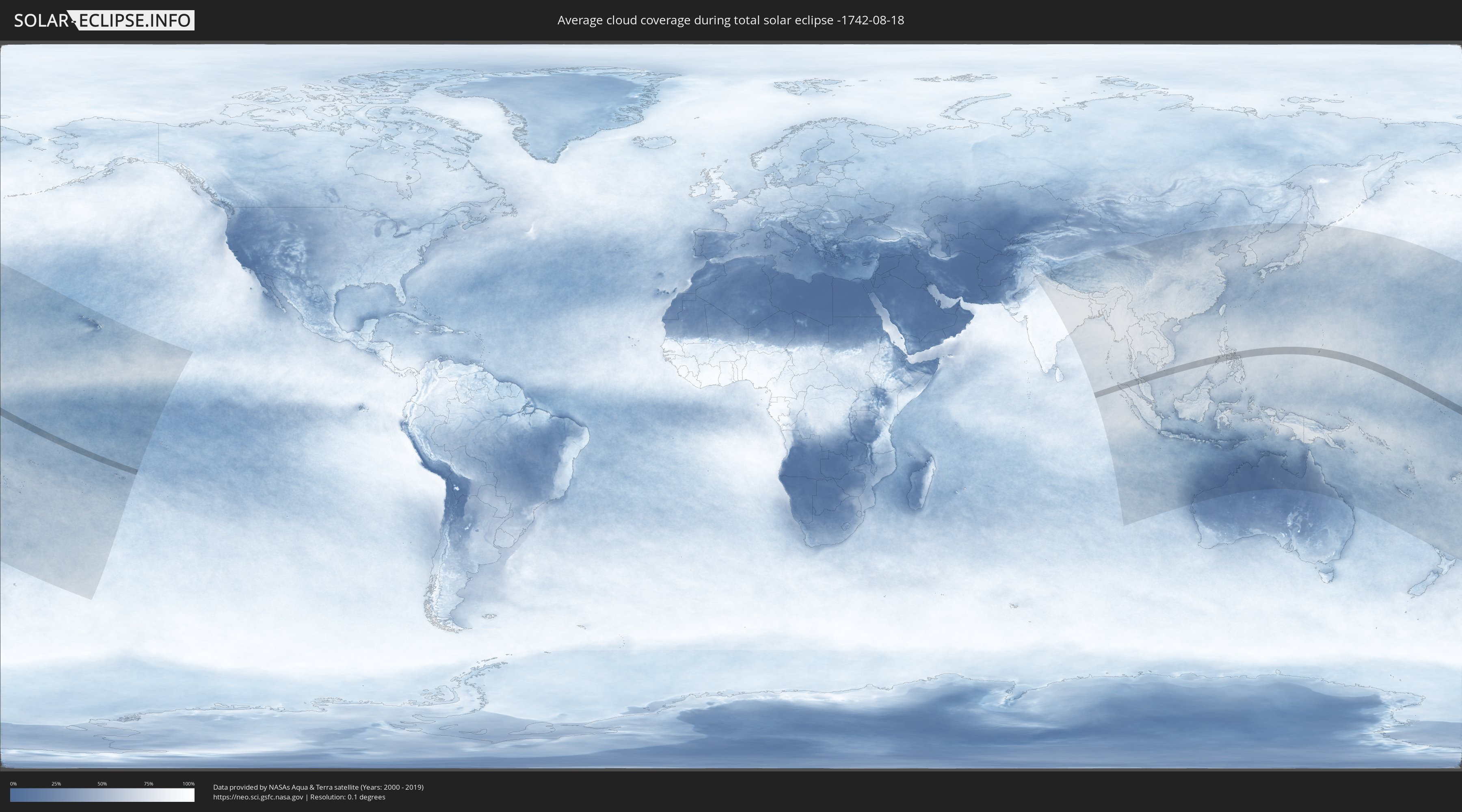
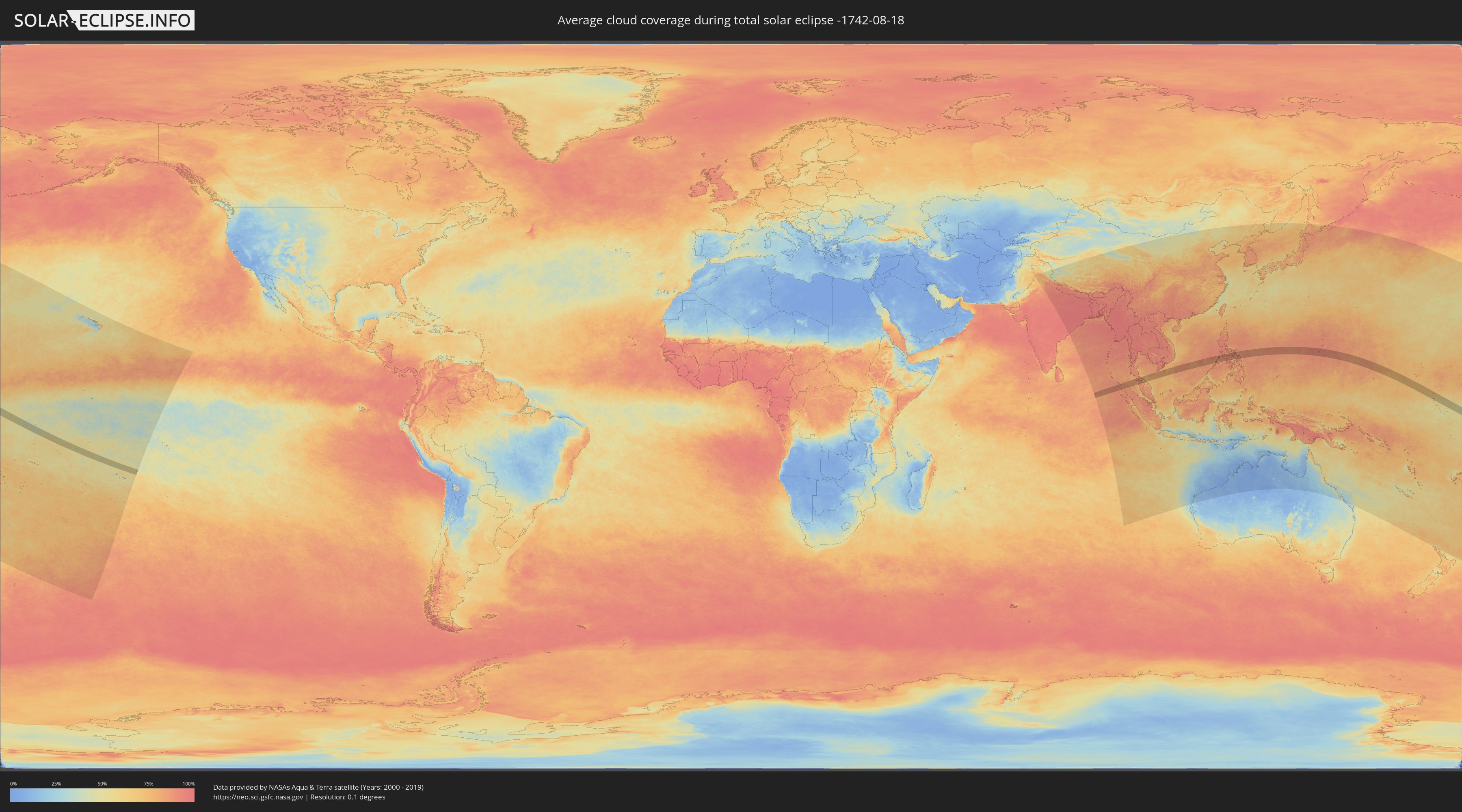
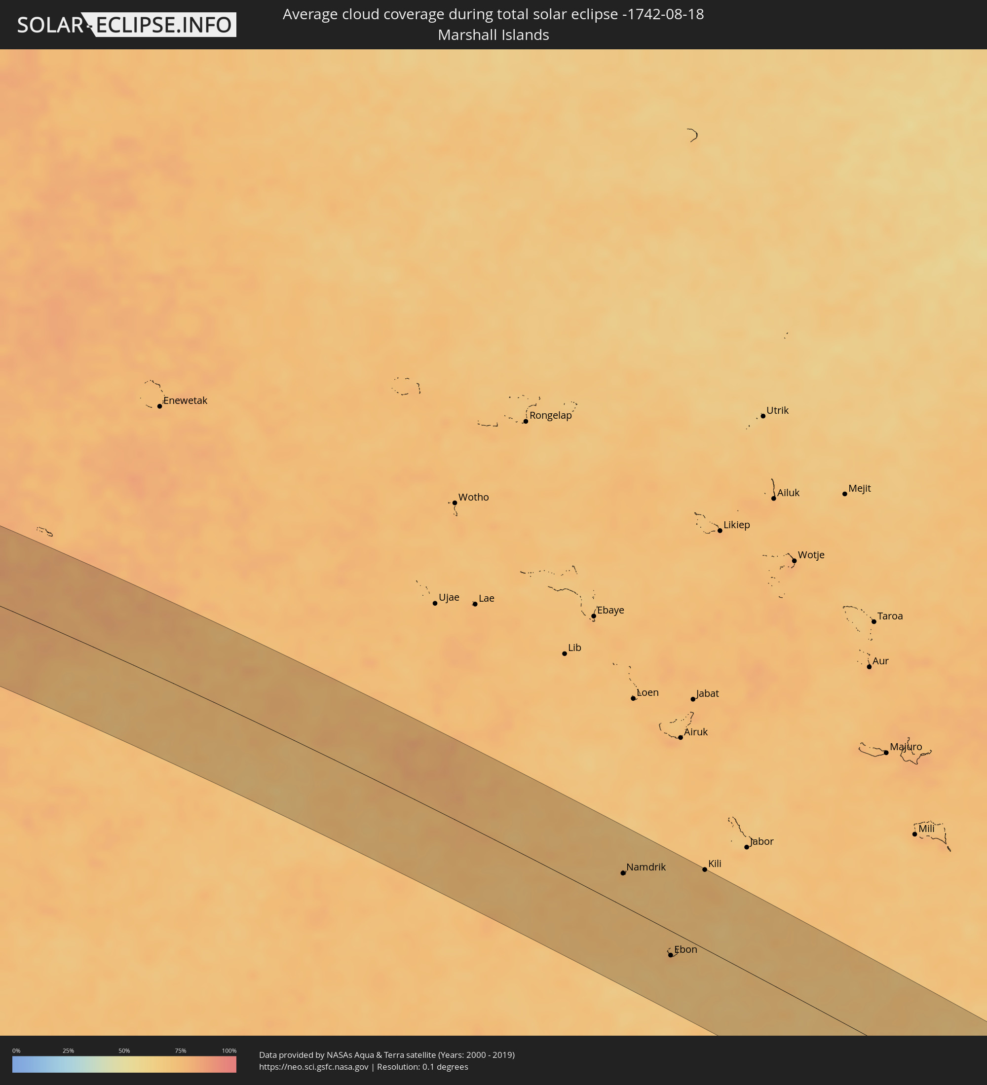
Wie wird das Wetter während der totalen Sonnenfinsternis am 18.08.-1742?
Wo ist der beste Ort, um die totale Sonnenfinsternis vom 18.08.-1742 zu beobachten?
Die folgenden Karten zeigen die durchschnittliche Bewölkung für den Tag, an dem die totale Sonnenfinsternis
stattfindet. Mit Hilfe der Karten lässt sich der Ort entlang des Finsternispfades eingrenzen,
der die besten Aussichen auf einen klaren wolkenfreien Himmel bietet.
Trotzdem muss man immer lokale Gegenenheiten beachten und sollte sich genau über das Wetter an seinem
gewählten Beobachtungsort informieren.
Die Daten stammen von den beiden NASA-Satelliten
AQUA und TERRA
und wurden über einen Zeitraum von 19 Jahren (2000 - 2019) gemittelt.
Detaillierte Länderkarten
 Kiribati
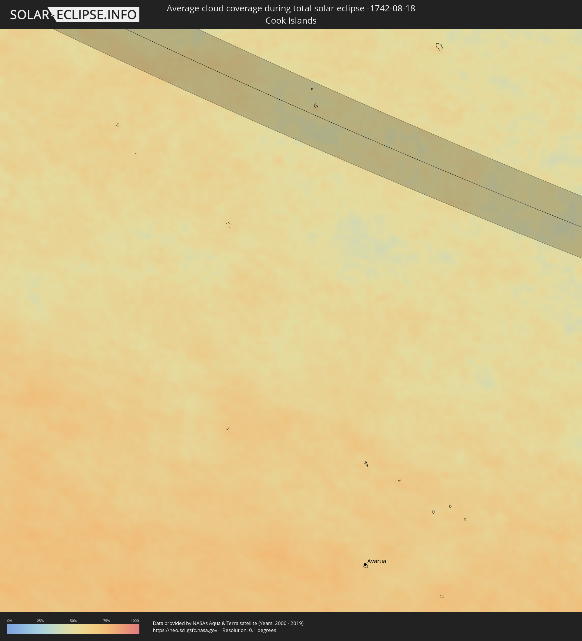 Cookinseln
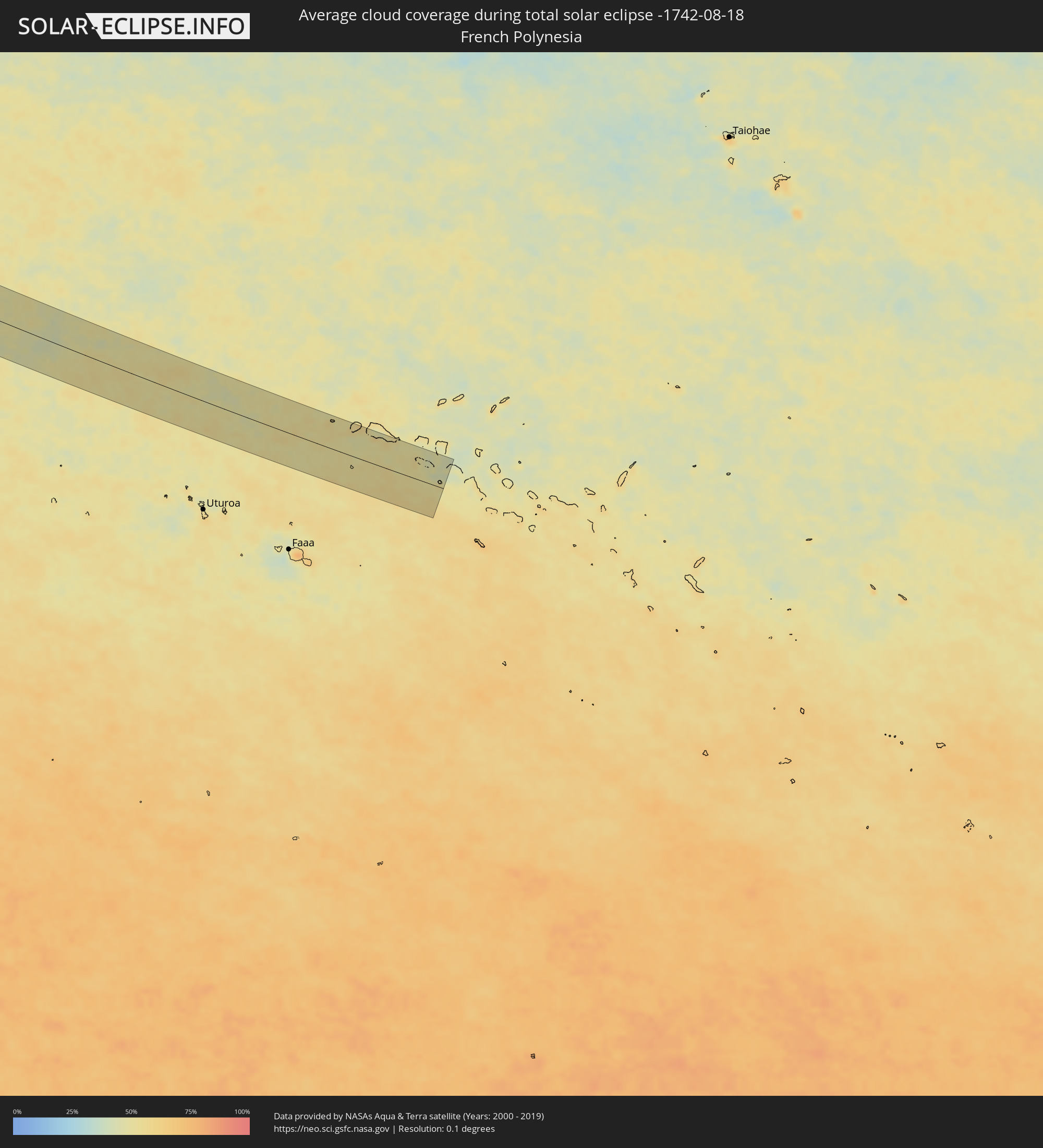 Französisch-Polynesien
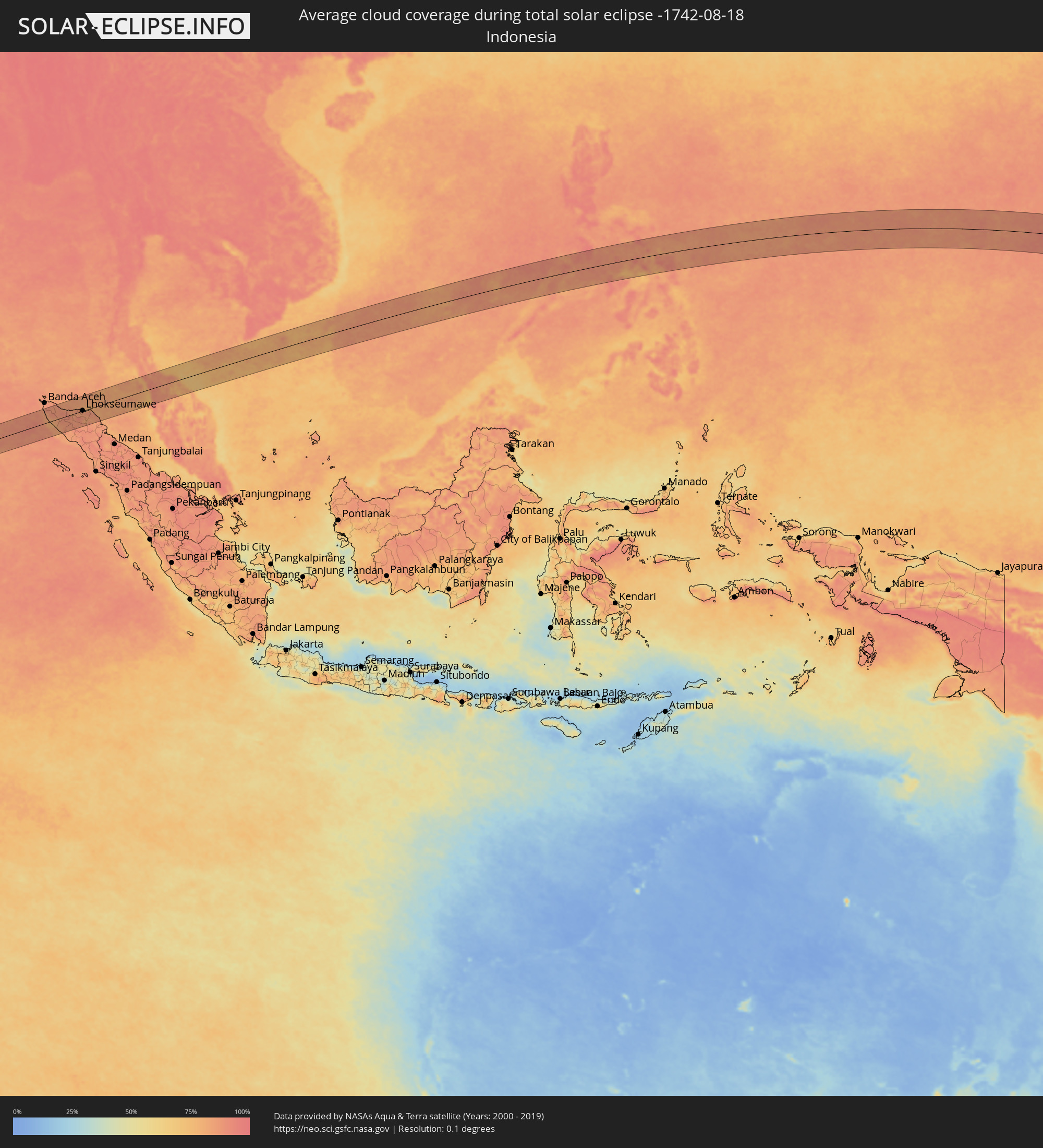 Indonesien
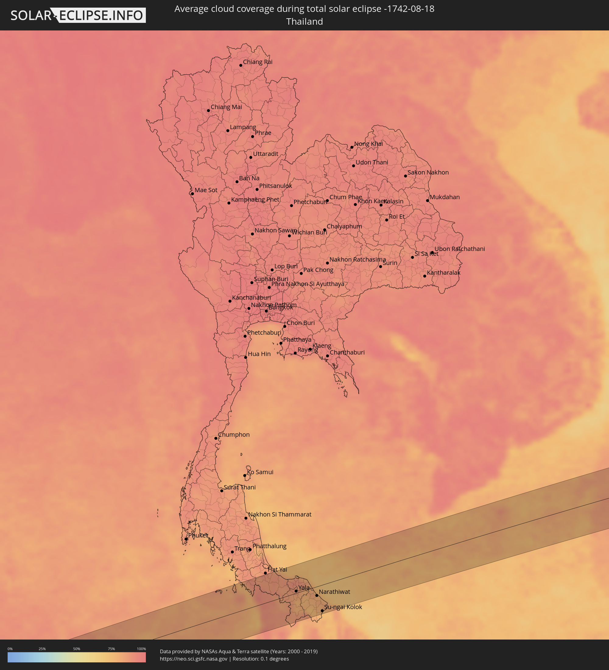 Thailand
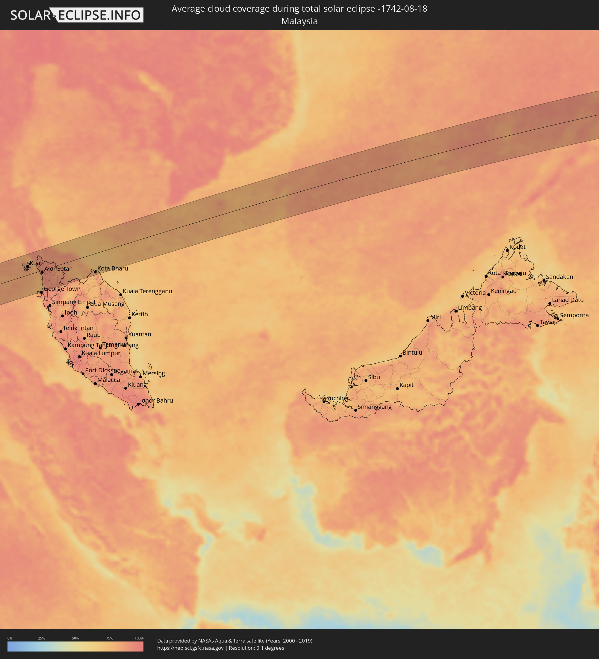 Malaysia
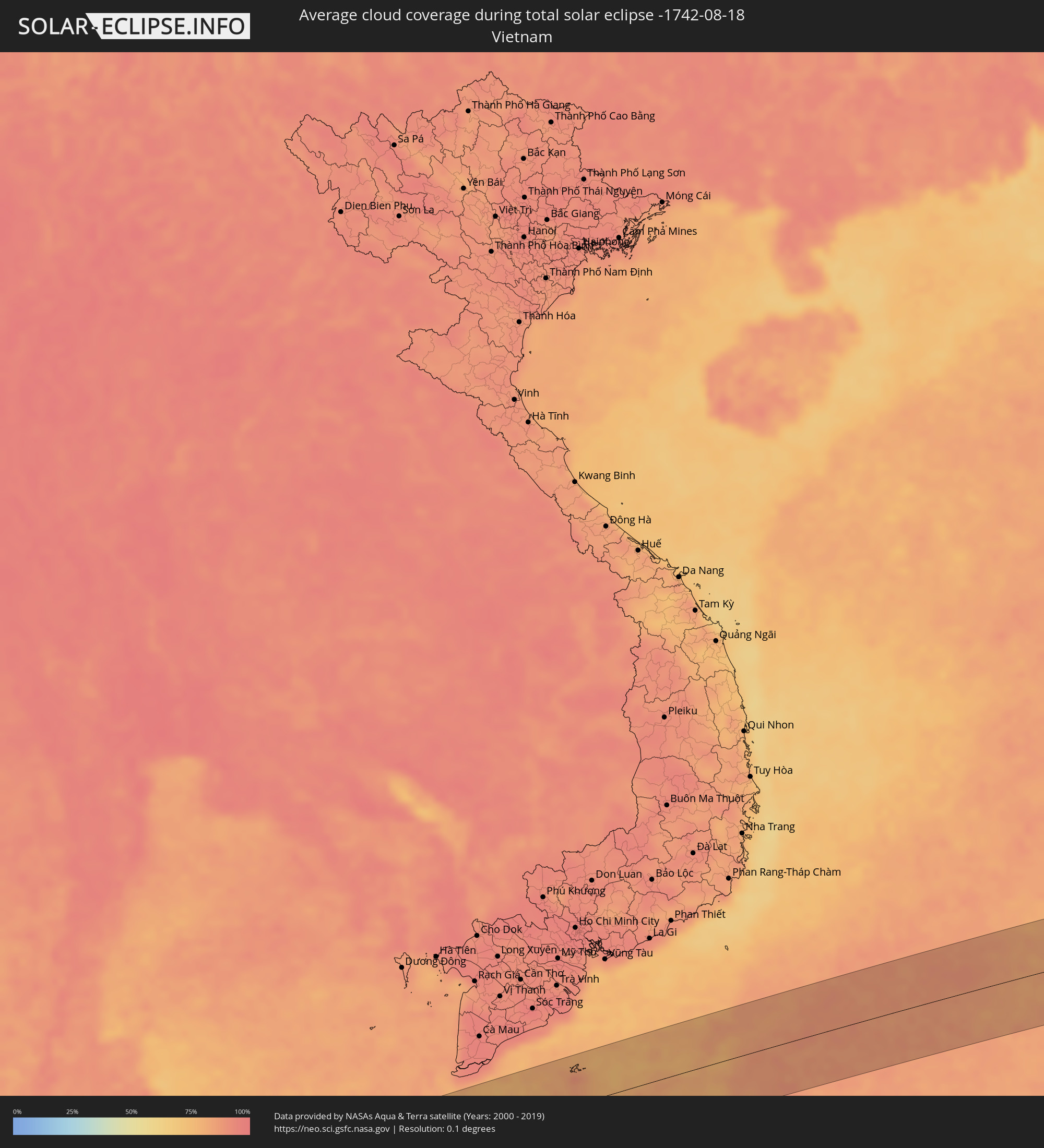 Vietnam
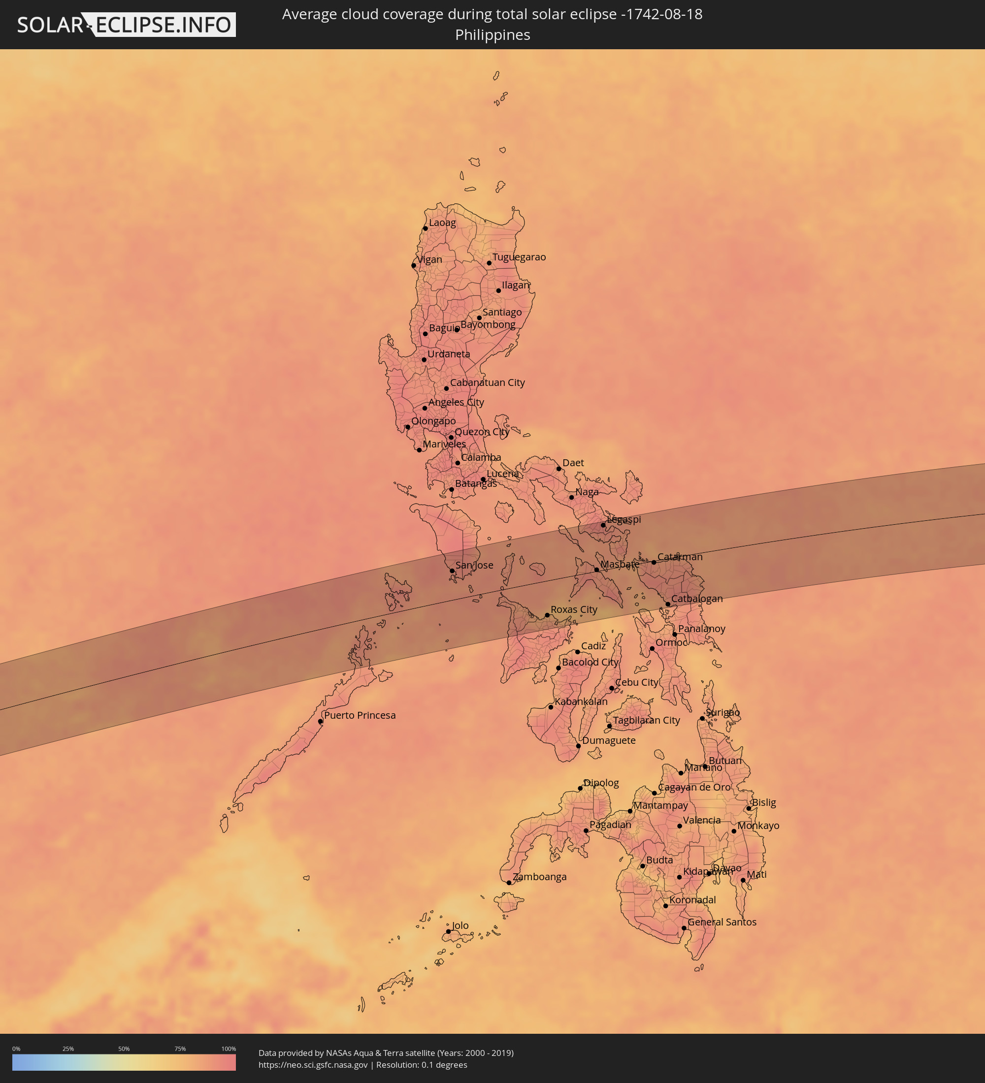 Philippinen
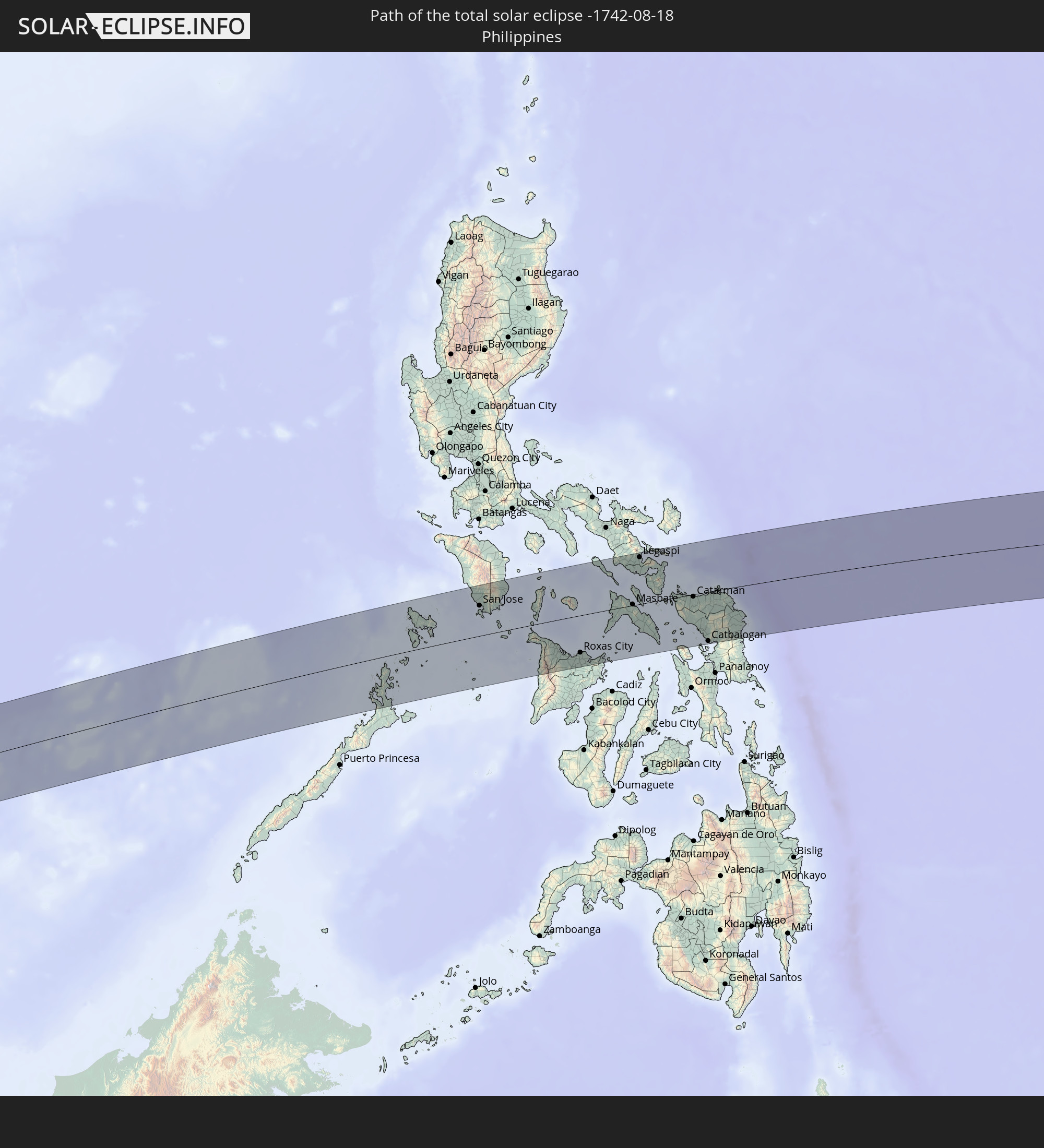
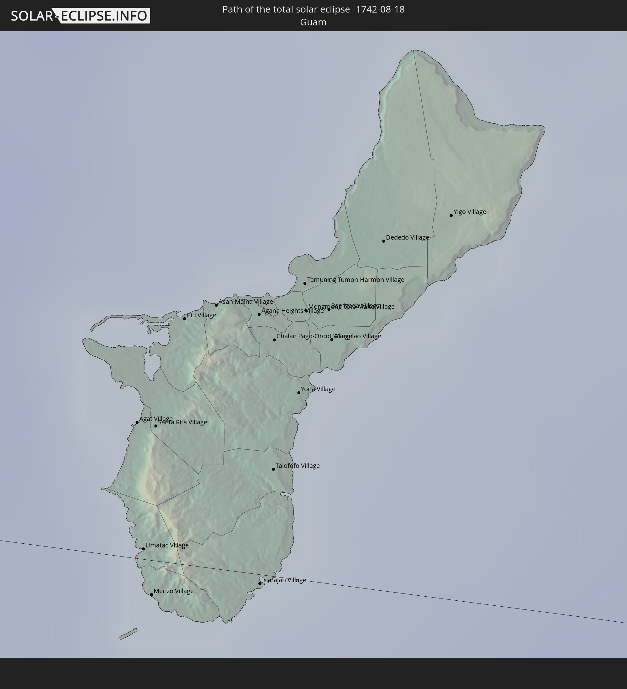
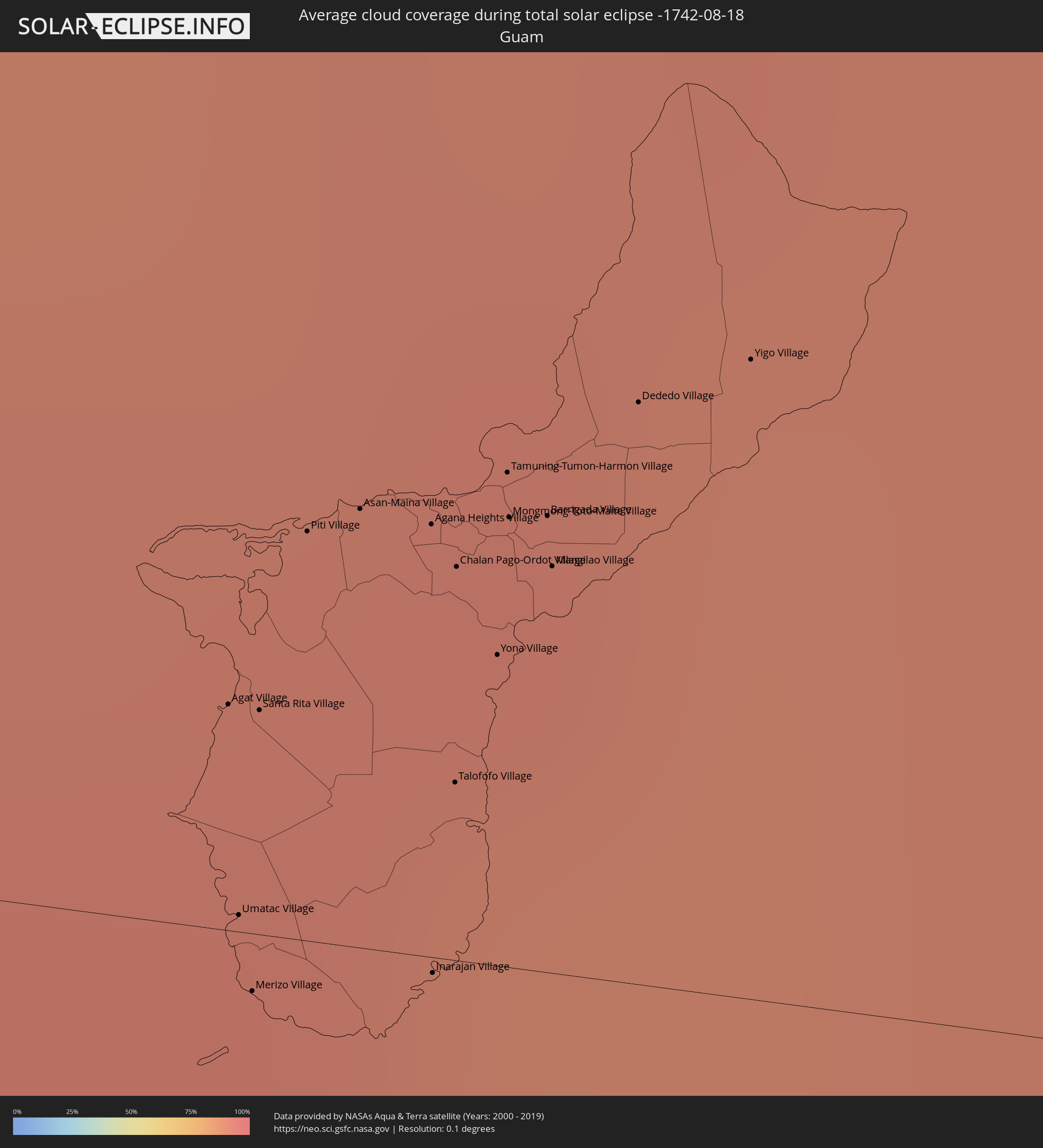 Guam
Guam
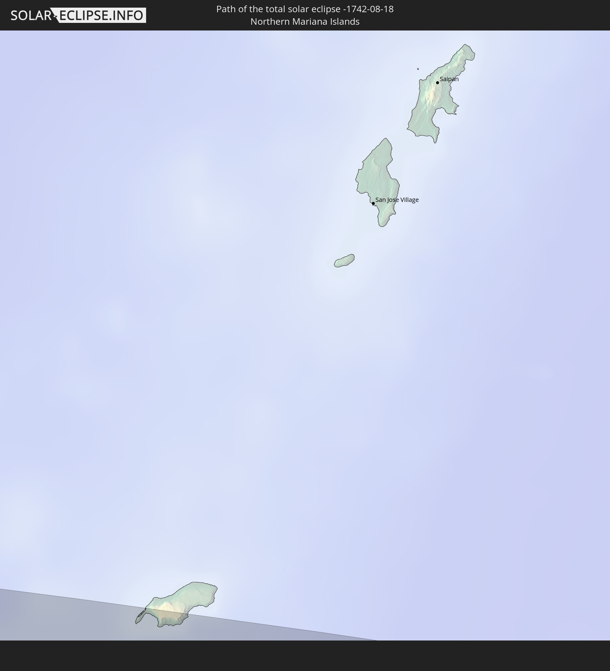
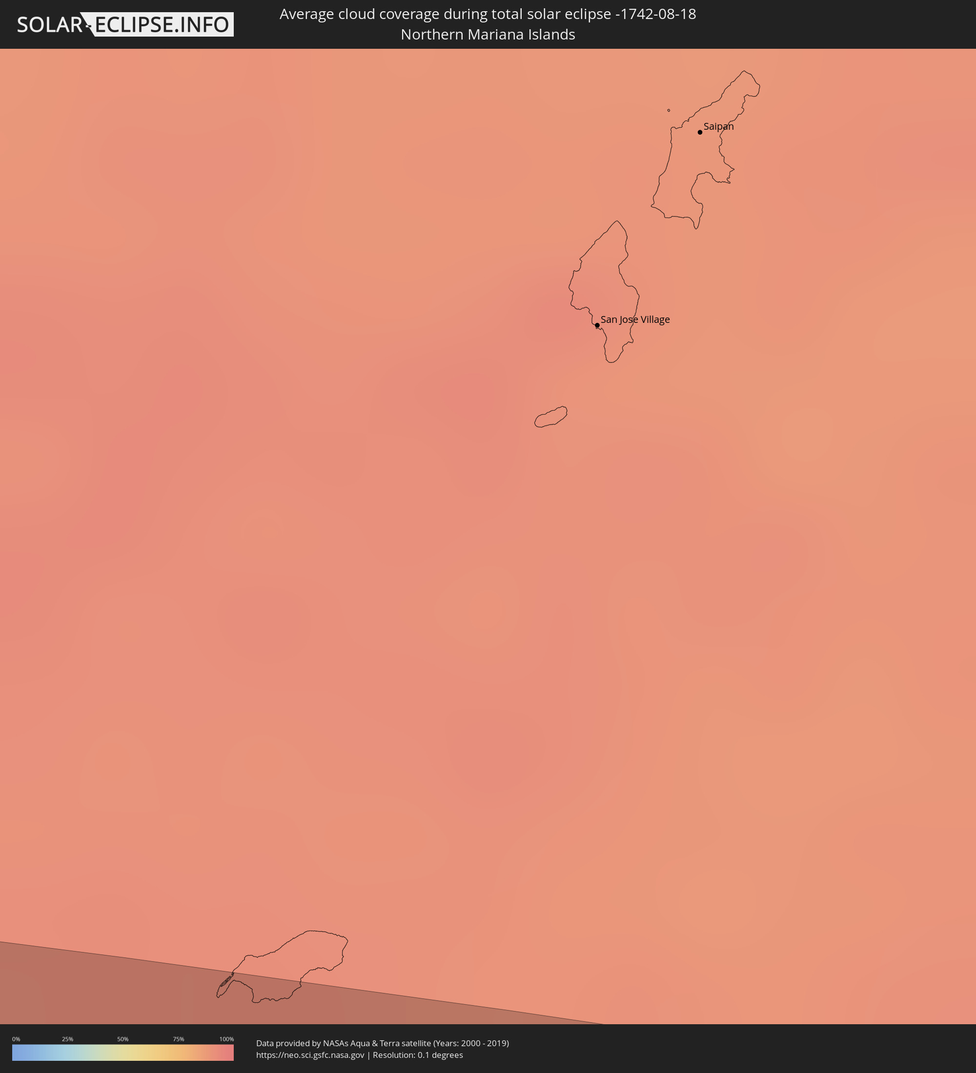 Nördliche Marianen
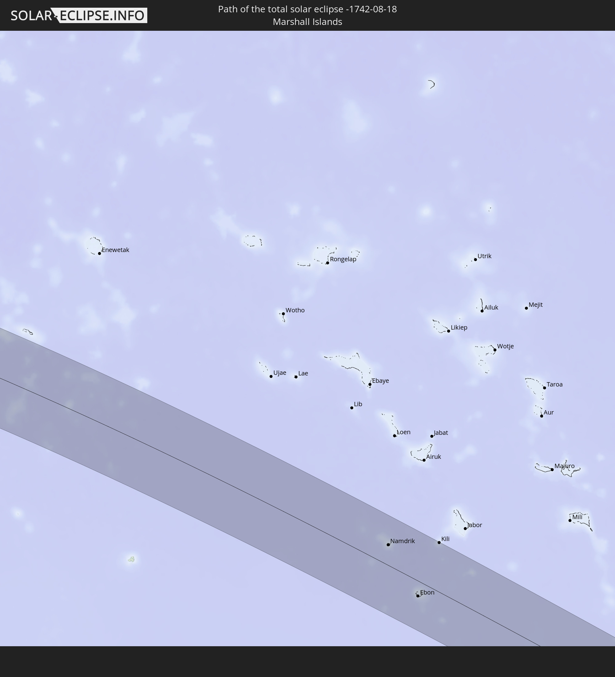
 Marshallinseln
Orte im Finsternispfad
Die nachfolgene Tabelle zeigt Städte und Orte mit mehr als 5.000 Einwohnern, die sich im Finsternispfad befinden. Städte mit mehr als 100.000 Einwohnern sind dick gekennzeichnet. Mit einem Klick auf den Ort öffnet sich eine Detailkarte die die Lage des jeweiligen Ortes zusammen mit dem Verlauf der zentralen Finsternis präsentiert.
| Ort | Typ | Dauer der Verfinsterung | Ortszeit bei maximaler Verfinsterung | Entfernung zur Zentrallinie | Ø Bewölkung |
|
Sigli, Aceh
|
total | - | 07:09:35 UTC+07:07 | 64 km | 88% |
|
Meulaboh, Aceh
|
total | - | 07:09:30 UTC+07:07 | 73 km | 83% |
|
Reuleuet, Aceh
|
total | - | 07:09:38 UTC+07:07 | 35 km | 88% |
|
Bireun, Aceh
|
total | - | 07:09:43 UTC+07:07 | 19 km | 87% |
|
Lhokseumawe, Aceh
|
total | - | 07:09:50 UTC+07:07 | 1 km | 84% |
|
Pantai Cenang, Perlis
|
total | - | 06:58:59 UTC+06:55 | 31 km | 84% |
|
Padang Mat Sirat, Kedah
|
total | - | 06:58:59 UTC+06:55 | 37 km | 86% |
|
Ayer Hangat, Kedah
|
total | - | 06:59:02 UTC+06:55 | 41 km | 89% |
|
Kuah, Kedah
|
total | - | 06:59:01 UTC+06:55 | 31 km | 85% |
|
Satun, Satun
|
total | - | 06:45:48 UTC+06:42 | 54 km | 81% |
|
Kuala Perlis, Perlis
|
total | - | 06:59:08 UTC+06:55 | 29 km | 77% |
|
Kangar, Perlis
|
total | - | 06:59:10 UTC+06:55 | 31 km | 87% |
|
Telaga Batu, Penang
|
total | - | 06:59:03 UTC+06:55 | 74 km | 80% |
|
Kuala Kedah, Kedah
|
total | - | 06:59:10 UTC+06:55 | 9 km | 80% |
|
Tanjung Tokong, Penang
|
total | - | 06:59:05 UTC+06:55 | 77 km | 85% |
|
Alor Setar, Kedah
|
total | - | 06:59:11 UTC+06:55 | 9 km | 89% |
|
Jitra, Kedah
|
total | - | 06:59:14 UTC+06:55 | 5 km | 91% |
|
Sadao, Songkhla
|
total | - | 06:45:56 UTC+06:42 | 44 km | 92% |
|
Kepala Batas, Penang
|
total | - | 06:59:08 UTC+06:55 | 75 km | 91% |
|
Gurun, Kedah
|
total | - | 06:59:11 UTC+06:55 | 45 km | 89% |
|
Sungai Petani, Kedah
|
total | - | 06:59:10 UTC+06:55 | 63 km | 93% |
|
Bedong, Kedah
|
total | - | 06:59:12 UTC+06:55 | 55 km | 90% |
|
Na Mom, Songkhla
|
total | - | 06:46:02 UTC+06:42 | 74 km | 86% |
|
Betong, Yala
|
total | - | 06:46:04 UTC+06:42 | 69 km | 83% |
|
Nong Chik, Pattani
|
total | - | 06:46:16 UTC+06:42 | 41 km | 90% |
|
Pattani, Pattani
|
total | - | 06:46:18 UTC+06:42 | 41 km | 88% |
|
Yala, Yala
|
total | - | 06:46:16 UTC+06:42 | 5 km | 84% |
|
Yaring, Pattani
|
total | - | 06:46:21 UTC+06:42 | 37 km | 85% |
|
Sai Buri, Pattani
|
total | - | 06:46:26 UTC+06:42 | 11 km | 80% |
|
Ra-ngae, Narathiwat
|
total | - | 06:46:25 UTC+06:42 | 36 km | 78% |
|
Narathiwat, Narathiwat
|
total | - | 06:46:29 UTC+06:42 | 25 km | 79% |
|
Ban Su-ngai Pa Di, Narathiwat
|
total | - | 06:46:27 UTC+06:42 | 65 km | 80% |
|
Su-ngai Kolok, Narathiwat
|
total | - | 06:46:30 UTC+06:42 | 72 km | 74% |
|
Tak Bai, Narathiwat
|
total | - | 06:46:34 UTC+06:42 | 51 km | 78% |
|
Pasir Mas, Kelantan
|
total | - | 06:59:56 UTC+06:55 | 76 km | 74% |
|
Tumpat, Kelantan
|
total | - | 06:59:58 UTC+06:55 | 61 km | 81% |
|
Kota Bharu, Kelantan
|
total | - | 06:59:59 UTC+06:55 | 70 km | 79% |
|
El Nido, Mimaropa
|
total | - | 08:20:48 UTC+08:00 | 34 km | 90% |
|
Taytay, Mimaropa
|
total | - | 08:20:52 UTC+08:00 | 77 km | 87% |
|
Coron, Mimaropa
|
total | - | 08:22:06 UTC+08:00 | 35 km | 89% |
|
Calintaan, Mimaropa
|
total | - | 08:23:16 UTC+08:00 | 80 km | 90% |
|
San Jose, Mimaropa
|
total | - | 08:23:25 UTC+08:00 | 54 km | 89% |
|
Bulalacao, Mimaropa
|
total | - | 08:23:49 UTC+08:00 | 45 km | 87% |
|
Mansalay, Mimaropa
|
total | - | 08:24:00 UTC+08:00 | 64 km | 90% |
|
Pandan, Western Visayas
|
total | - | 08:24:51 UTC+08:00 | 35 km | 88% |
|
Romblon, Mimaropa
|
total | - | 08:25:17 UTC+08:00 | 52 km | 86% |
|
Kalibo (poblacion), Western Visayas
|
total | - | 08:25:15 UTC+08:00 | 45 km | 84% |
|
Dao, Western Visayas
|
total | - | 08:25:42 UTC+08:00 | 86 km | 92% |
|
Roxas City, Western Visayas
|
total | - | 08:25:50 UTC+08:00 | 66 km | 86% |
|
President Roxas, Western Visayas
|
total | - | 08:26:05 UTC+08:00 | 87 km | 92% |
|
Pilar, Western Visayas
|
total | - | 08:26:13 UTC+08:00 | 82 km | 89% |
|
Guinticgan, Western Visayas
|
total | - | 08:26:26 UTC+08:00 | 77 km | 82% |
|
Estancia, Western Visayas
|
total | - | 08:26:27 UTC+08:00 | 89 km | 84% |
|
Pio Duran, Bicol
|
total | - | 08:27:13 UTC+08:00 | 77 km | 88% |
|
Masbate, Bicol
|
total | - | 08:27:23 UTC+08:00 | 2 km | 88% |
|
Pilar, Bicol
|
total | - | 08:27:34 UTC+08:00 | 61 km | 87% |
|
San Jacinto, Bicol
|
total | - | 08:27:36 UTC+08:00 | 21 km | 86% |
|
Legaspi, Bicol
|
total | - | 08:27:44 UTC+08:00 | 84 km | 92% |
|
Bulan, Bicol
|
total | - | 08:27:51 UTC+08:00 | 30 km | 87% |
|
Cataingan, Bicol
|
total | - | 08:27:56 UTC+08:00 | 46 km | 89% |
|
Sorsogon, Bicol
|
total | - | 08:28:06 UTC+08:00 | 60 km | 86% |
|
Irosin, Bicol
|
total | - | 08:28:07 UTC+08:00 | 30 km | 88% |
|
Gubat, Bicol
|
total | - | 08:28:19 UTC+08:00 | 52 km | 87% |
|
Allen, Eastern Visayas
|
total | - | 08:28:30 UTC+08:00 | 3 km | 81% |
|
Calbayog City, Eastern Visayas
|
total | - | 08:28:57 UTC+08:00 | 51 km | 84% |
|
Catarman, Eastern Visayas
|
total | - | 08:29:06 UTC+08:00 | 4 km | 89% |
|
Pagsanghan, Eastern Visayas
|
total | - | 08:29:09 UTC+08:00 | 64 km | 83% |
|
Catbalogan, Eastern Visayas
|
total | - | 08:29:25 UTC+08:00 | 88 km | 84% |
|
Laoang, Eastern Visayas
|
total | - | 08:29:45 UTC+08:00 | 3 km | 86% |
|
Gamay, Eastern Visayas
|
total | - | 08:30:13 UTC+08:00 | 29 km | 87% |
|
Dolores, Eastern Visayas
|
total | - | 08:30:29 UTC+08:00 | 70 km | 86% |
|
Agat Village, Agat
|
total | - | 11:16:03 UTC+10:00 | 11 km | 92% |
|
Umatac Village, Umatac
|
total | - | 11:16:06 UTC+10:00 | 1 km | 93% |
|
Merizo Village, Merizo
|
total | - | 11:16:08 UTC+10:00 | 3 km | 93% |
|
Santa Rita Village, Santa Rita
|
total | - | 11:16:05 UTC+10:00 | 11 km | 92% |
|
Piti Village, Piti
|
total | - | 11:16:07 UTC+10:00 | 19 km | 91% |
|
Asan-Maina Village, Asan
|
total | - | 11:16:10 UTC+10:00 | 21 km | 91% |
|
Agana Heights Village, Agana Heights
|
total | - | 11:16:16 UTC+10:00 | 20 km | 91% |
|
Inarajan Village, Inarajan
|
total | - | 11:16:22 UTC+10:00 | 1 km | 93% |
|
Hagåtña, Hagatna
|
total | - | 11:16:16 UTC+10:00 | 22 km | 91% |
|
Guam Government House, Hagatna
|
total | - | 11:16:16 UTC+10:00 | 21 km | 91% |
|
Sinajana Village, Sinajana
|
total | - | 11:16:17 UTC+10:00 | 20 km | 92% |
|
Talofofo Village, Talofofo
|
total | - | 11:16:21 UTC+10:00 | 8 km | 89% |
|
Chalan Pago-Ordot Village, Chalan Pago-Ordot
|
total | - | 11:16:18 UTC+10:00 | 19 km | 89% |
|
Yona Village, Yona
|
total | - | 11:16:22 UTC+10:00 | 15 km | 89% |
|
Tamuning-Tumon-Harmon Village, Tamuning
|
total | - | 11:16:21 UTC+10:00 | 23 km | 92% |
|
Mongmong-Toto-Maite Village, Mongmong-Toto-Maite
|
total | - | 11:16:22 UTC+10:00 | 21 km | 92% |
|
Barrigada Village, Barrigada
|
total | - | 11:16:24 UTC+10:00 | 22 km | 92% |
|
Mangilao Village, Mangilao
|
total | - | 11:16:25 UTC+10:00 | 19 km | 89% |
|
Dededo Village, Dededo
|
total | - | 11:16:30 UTC+10:00 | 27 km | 92% |
|
Yigo Village, Yigo
|
total | - | 11:16:38 UTC+10:00 | 30 km | 89% |
|
Namdrik, Namdrik Atoll
|
total | - | 13:29:11 UTC+11:00 | 40 km | 73% |
|
Ebon, Ebon Atoll
|
total | - | 13:31:41 UTC+11:00 | 30 km | 76% |
|
Kili, Kili Island
|
total | - | 13:31:25 UTC+11:00 | 96 km | 72% |