Totale Sonnenfinsternis vom 03.12.0438
| Wochentag: | Freitag |
| Maximale Dauer der Verfinsterung: | 03m27s |
| Maximale Breite des Finsternispfades: | 138 km |
| Saroszyklus: | 78 |
| Bedeckungsgrad: | 100% |
| Magnitude: | 1.0357 |
| Gamma: | 0.4982 |
Wo kann man die Sonnenfinsternis vom 03.12.0438 sehen?
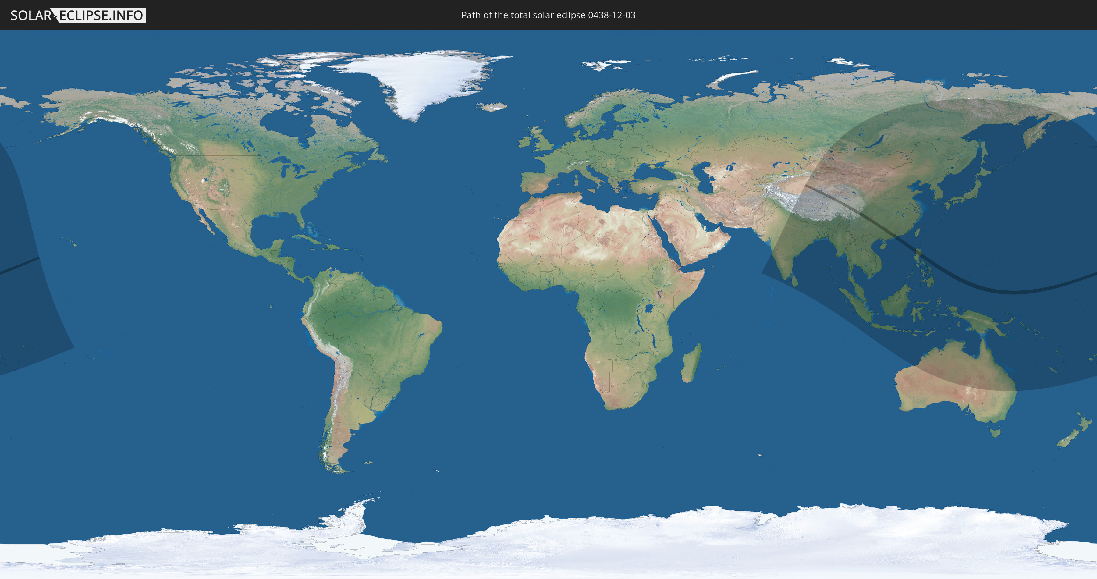
Die Sonnenfinsternis am 03.12.0438 kann man in 49 Ländern als partielle Sonnenfinsternis beobachten.
Der Finsternispfad verläuft durch 8 Länder. Nur in diesen Ländern ist sie als totale Sonnenfinsternis zu sehen.
In den folgenden Ländern ist die Sonnenfinsternis total zu sehen
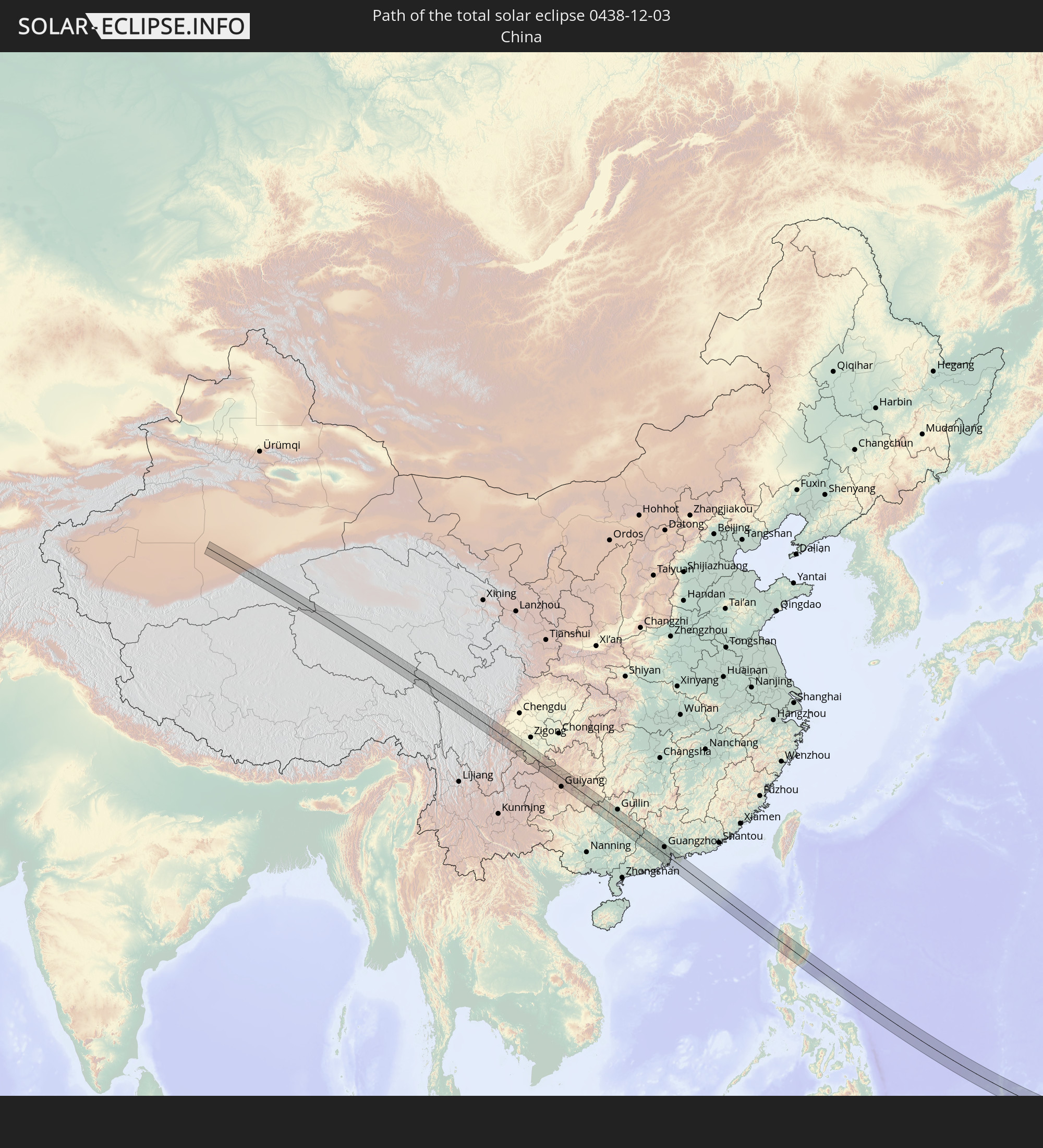 Volksrepublik China
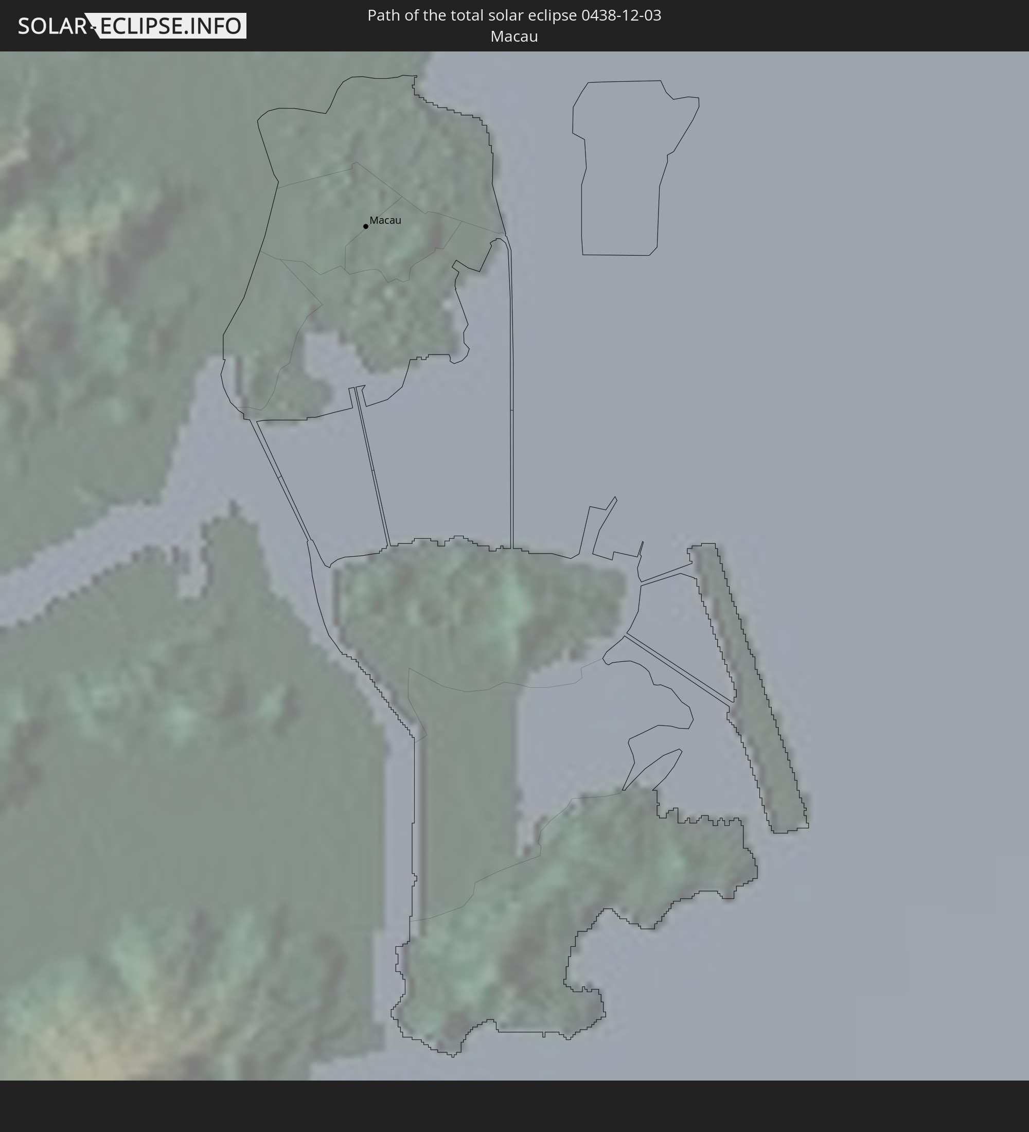 Macau
Macau
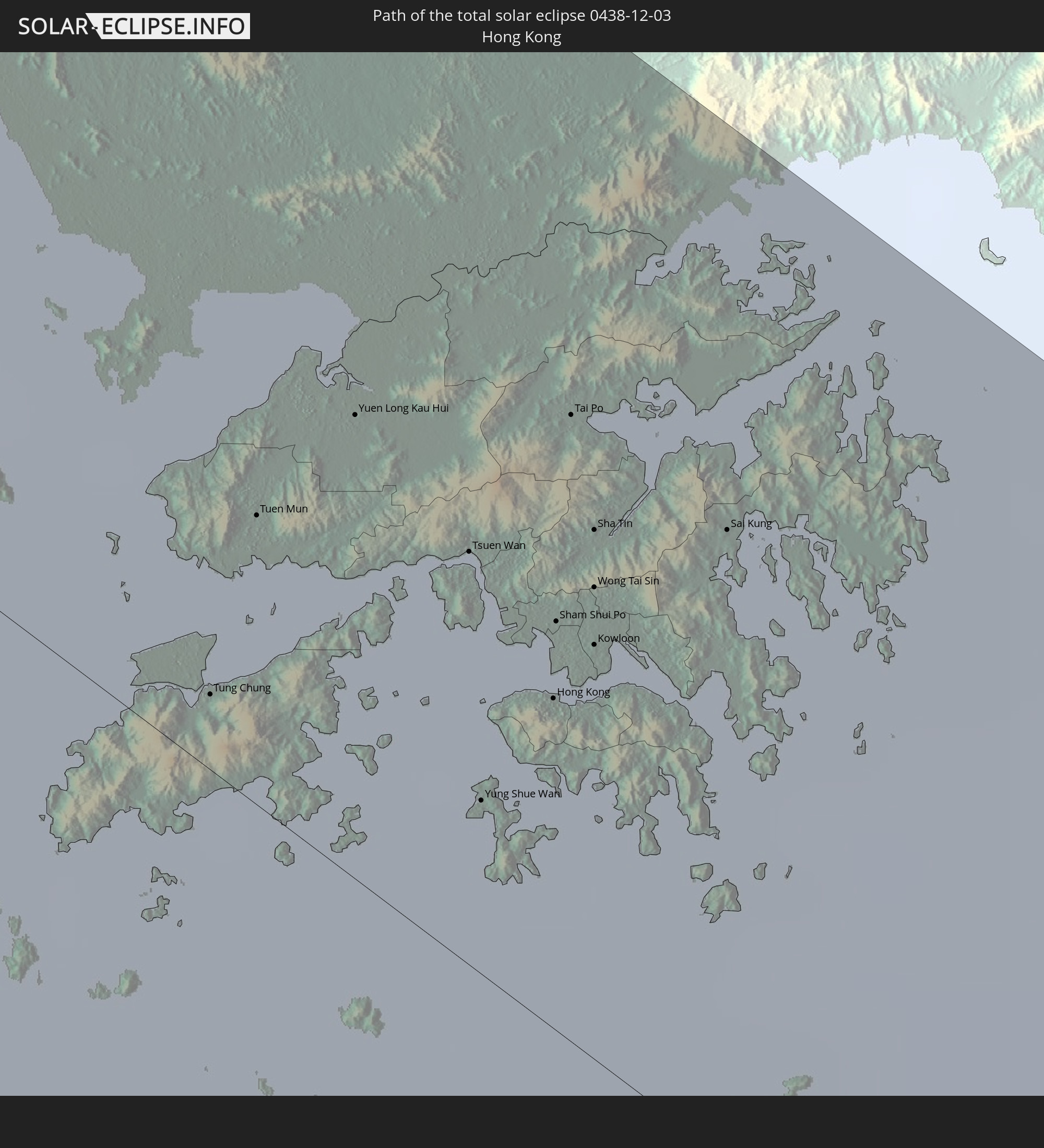 Hongkong
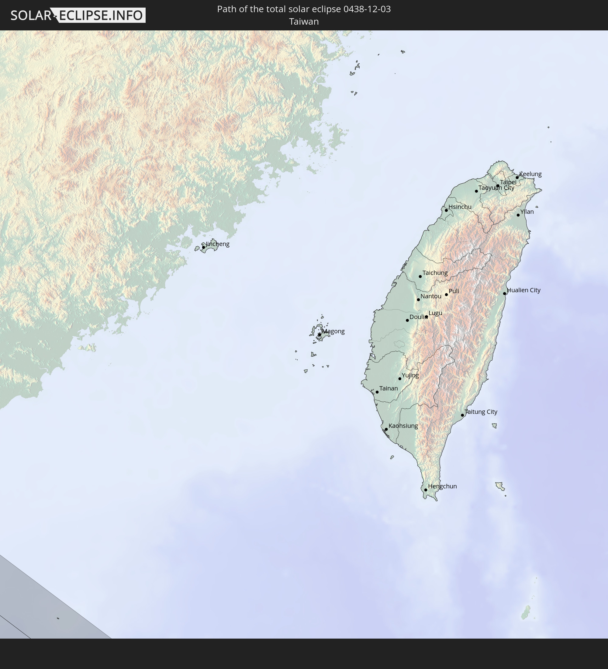 Taiwan
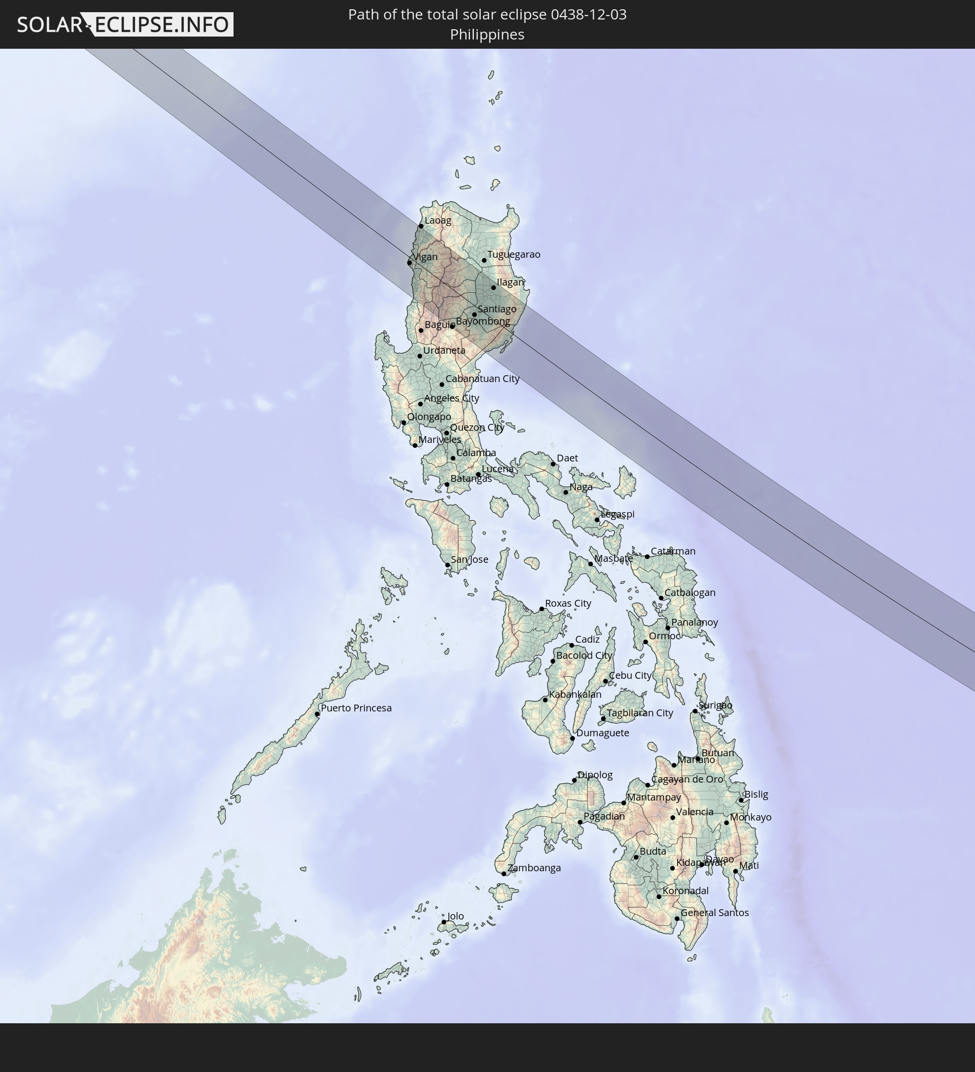 Philippinen
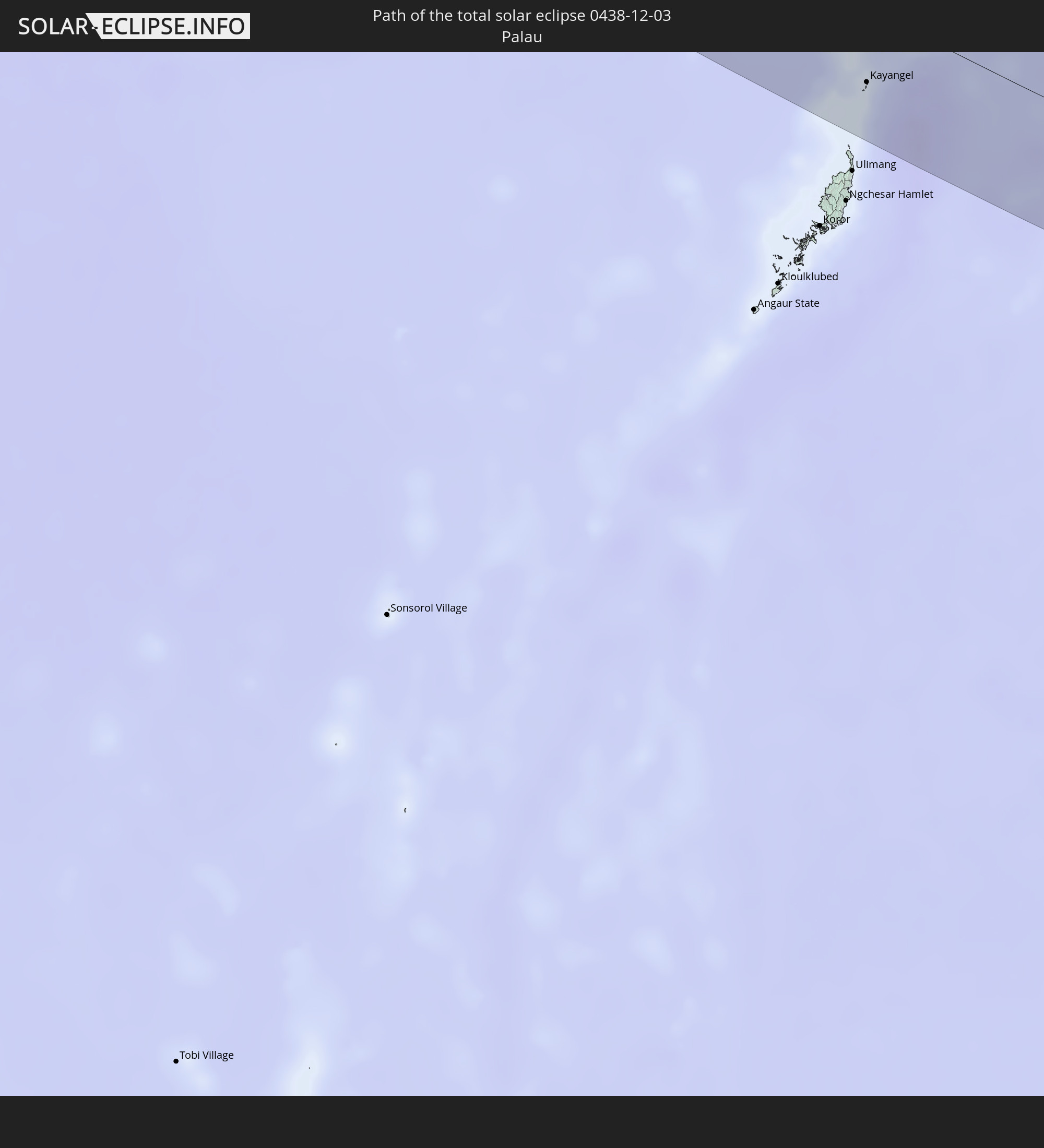 Palau
Palau
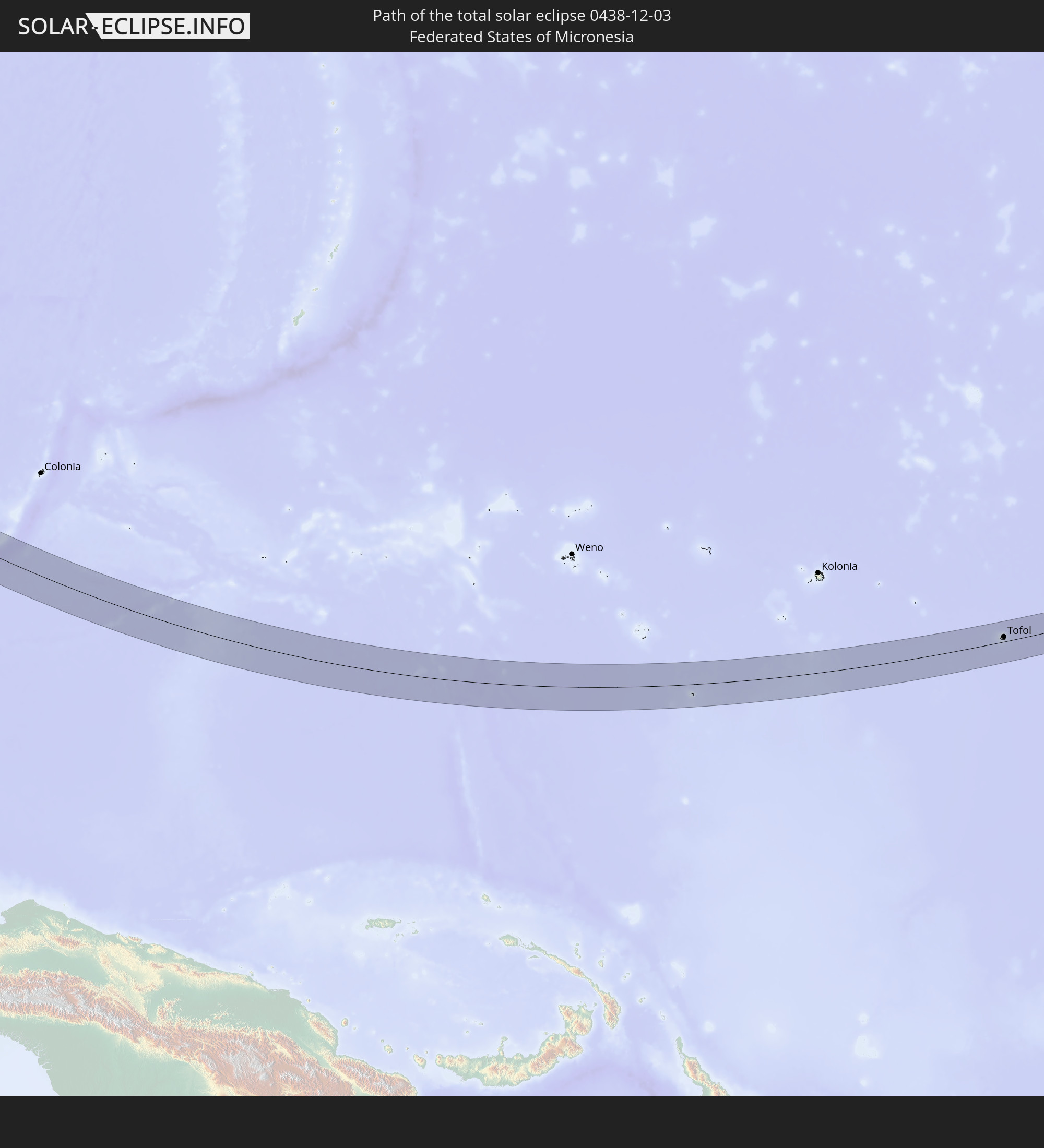 Föderierte Staaten von Mikronesien
 Marshallinseln
In den folgenden Ländern ist die Sonnenfinsternis partiell zu sehen
 Russland
 Fidschi
 Vereinigte Staaten
 United States Minor Outlying Islands
 Wallis und Futuna
 Tonga
Tonga
 Kiribati
 Samoa
Samoa
 Tokelau
 Amerikanisch-Samoa
 Niue
Niue
 Cookinseln
 Indien
 Volksrepublik China
 Sri Lanka
 Nepal
Nepal
 Mongolei
 Bangladesch
 Bhutan
 Myanmar
 Indonesien
 Thailand
 Malaysia
 Laos
Laos
 Vietnam
 Kambodscha
 Singapur
 Weihnachtsinsel
 Australien
 Macau
Macau
 Hongkong
 Brunei
 Taiwan
 Philippinen
 Japan
Japan
 Osttimor
 Nordkorea
 Südkorea
 Palau
Palau
 Föderierte Staaten von Mikronesien
 Papua-Neuguinea
 Guam
Guam
 Nördliche Marianen
 Salomonen
 Neukaledonien
 Marshallinseln
 Vanuatu
 Nauru
Nauru
 Tuvalu
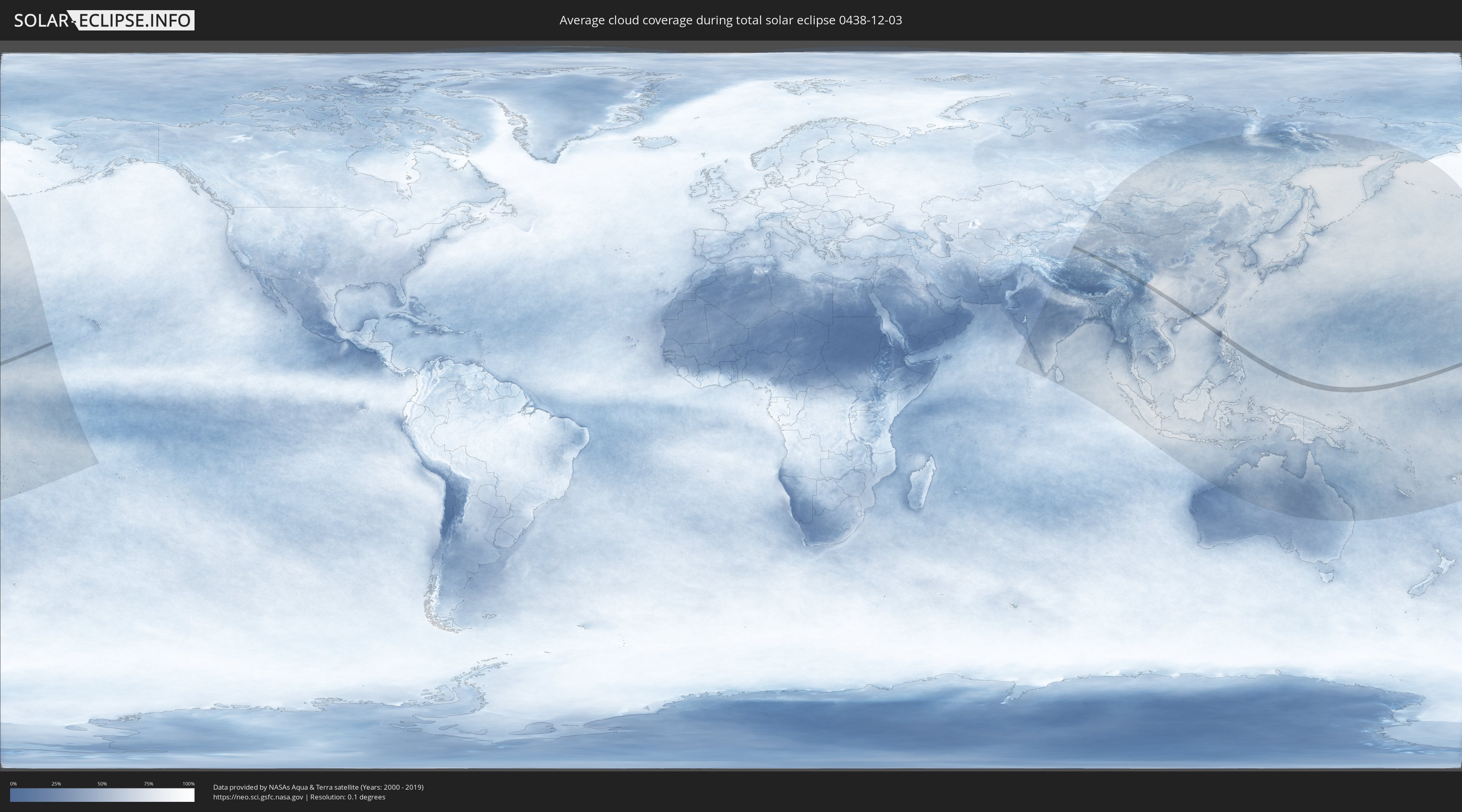
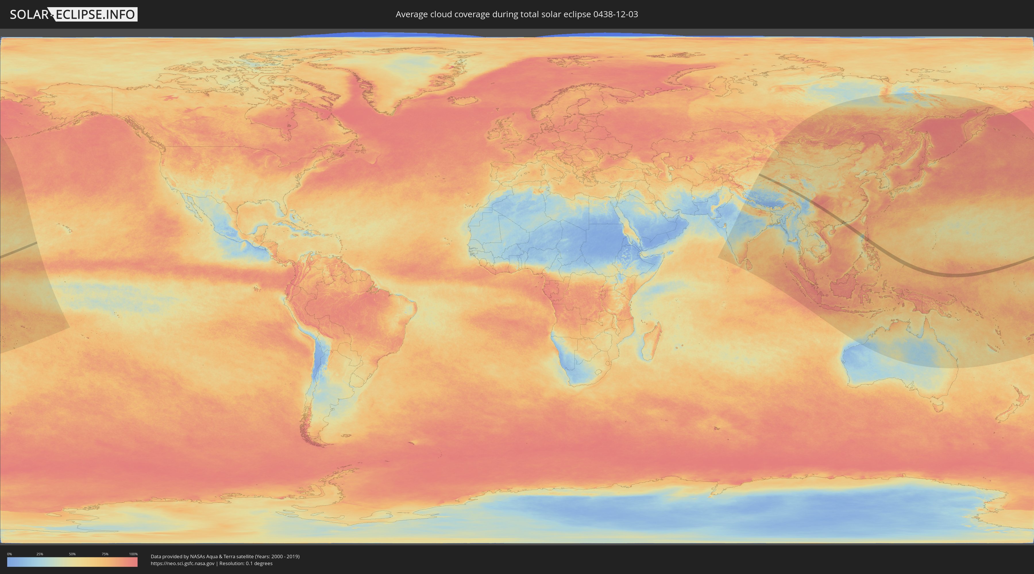
Wie wird das Wetter während der totalen Sonnenfinsternis am 03.12.0438?
Wo ist der beste Ort, um die totale Sonnenfinsternis vom 03.12.0438 zu beobachten?
Die folgenden Karten zeigen die durchschnittliche Bewölkung für den Tag, an dem die totale Sonnenfinsternis
stattfindet. Mit Hilfe der Karten lässt sich der Ort entlang des Finsternispfades eingrenzen,
der die besten Aussichen auf einen klaren wolkenfreien Himmel bietet.
Trotzdem muss man immer lokale Gegenenheiten beachten und sollte sich genau über das Wetter an seinem
gewählten Beobachtungsort informieren.
Die Daten stammen von den beiden NASA-Satelliten
AQUA und TERRA
und wurden über einen Zeitraum von 19 Jahren (2000 - 2019) gemittelt.
Detaillierte Länderkarten
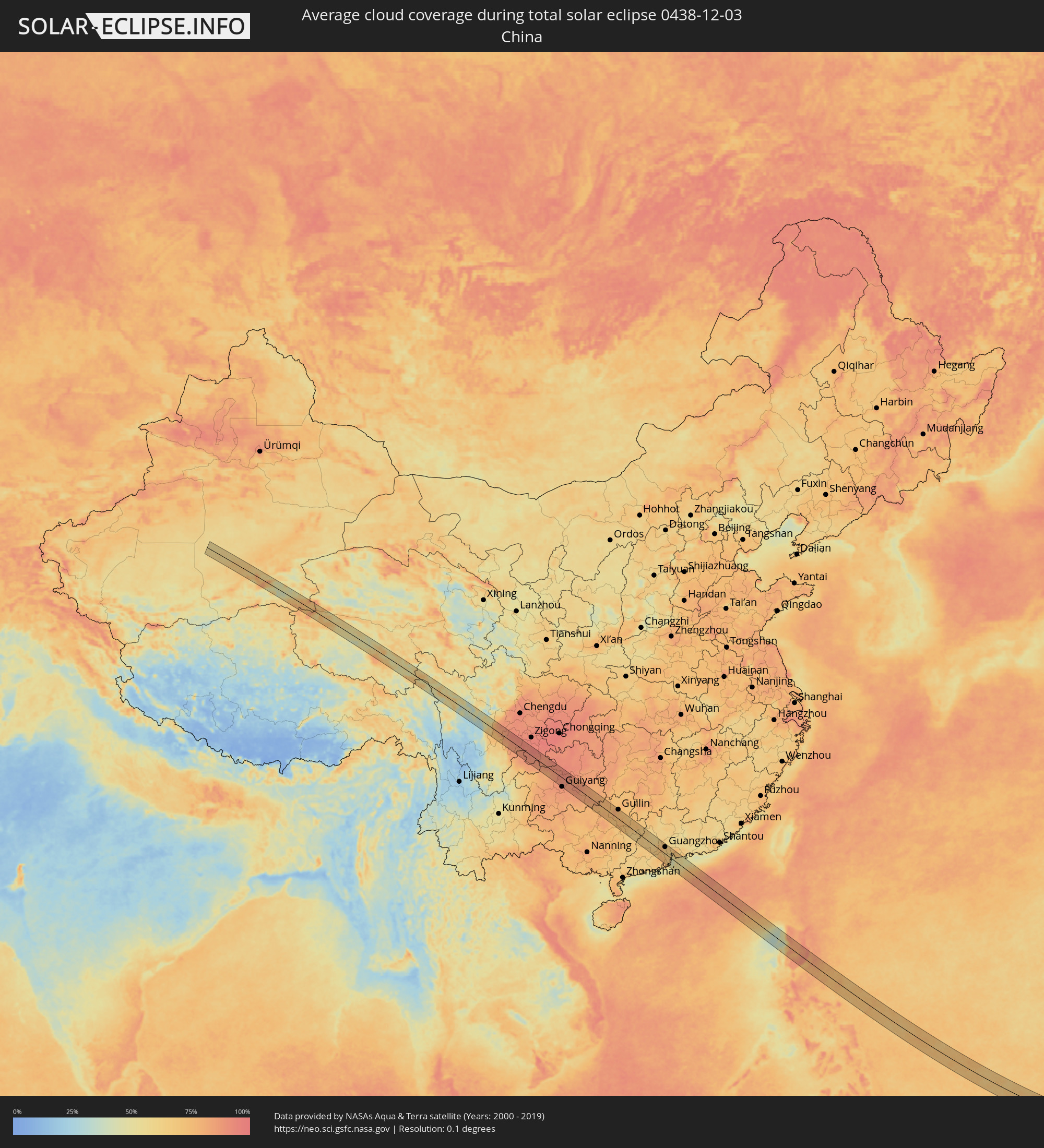 Volksrepublik China
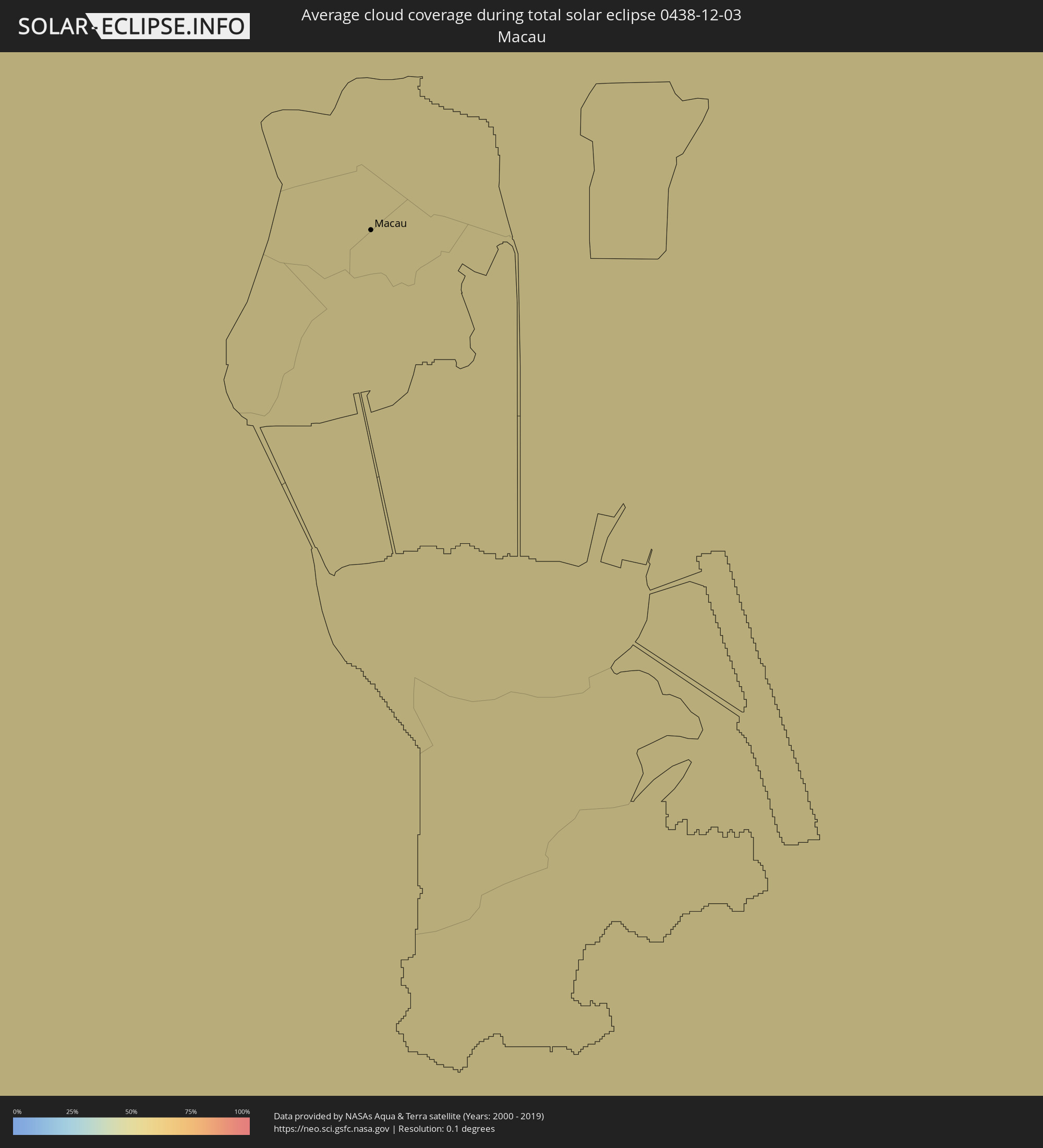 Macau
Macau
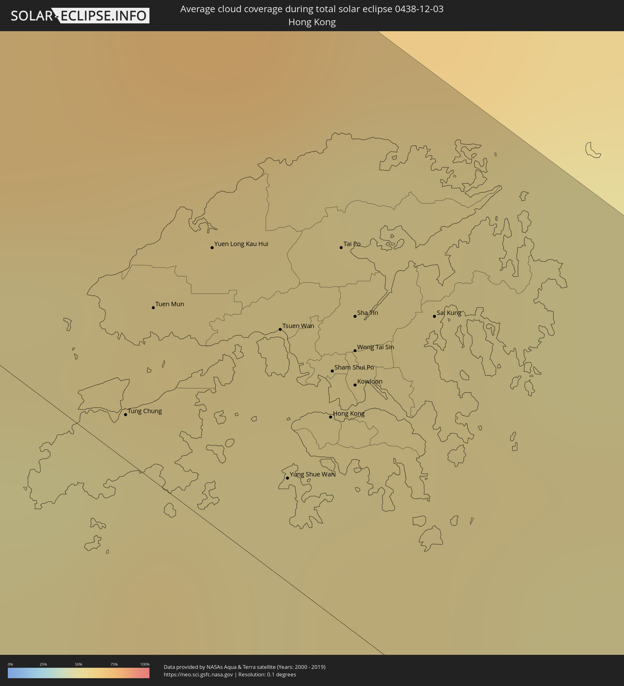 Hongkong
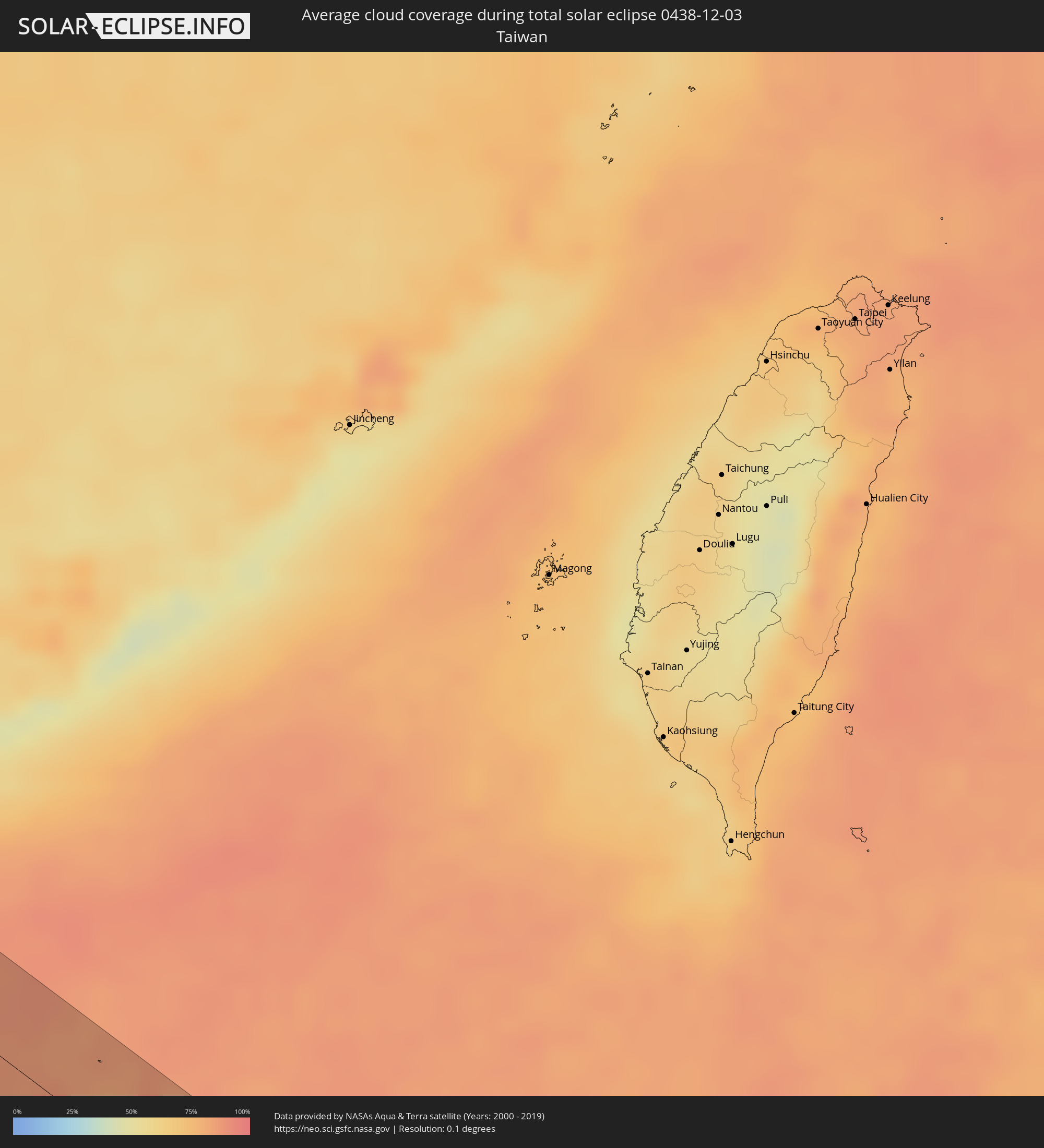 Taiwan
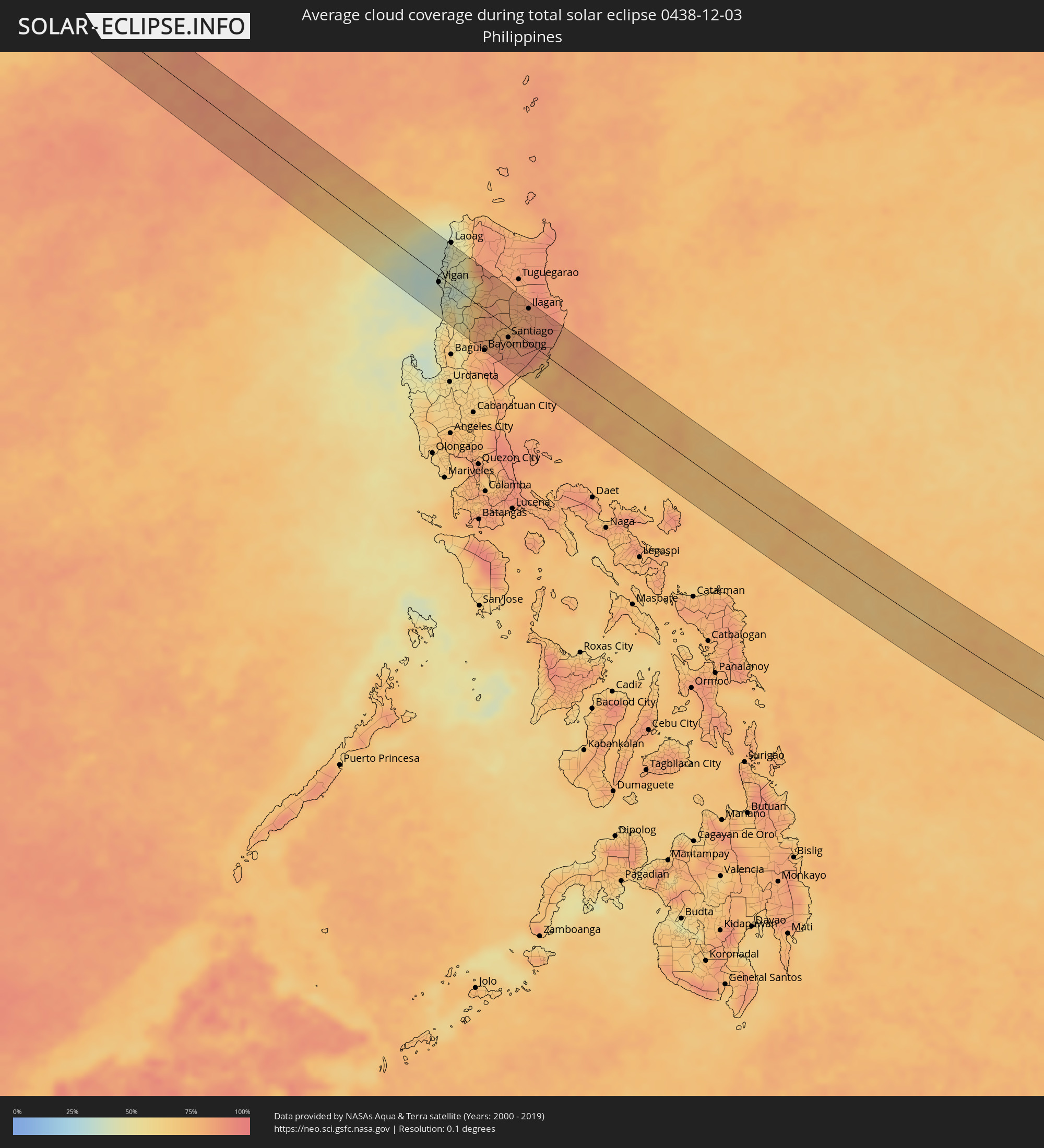 Philippinen
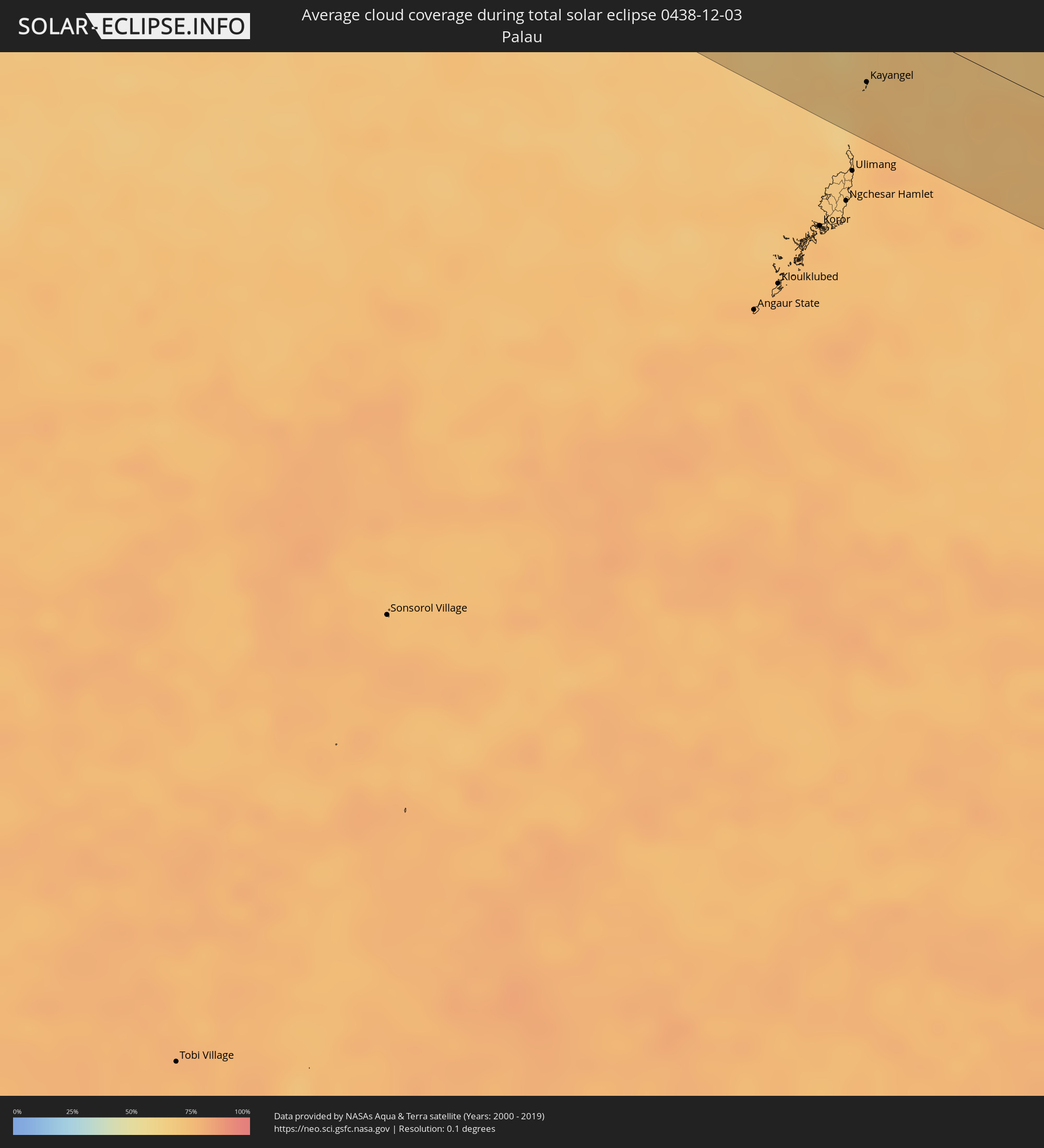 Palau
Palau
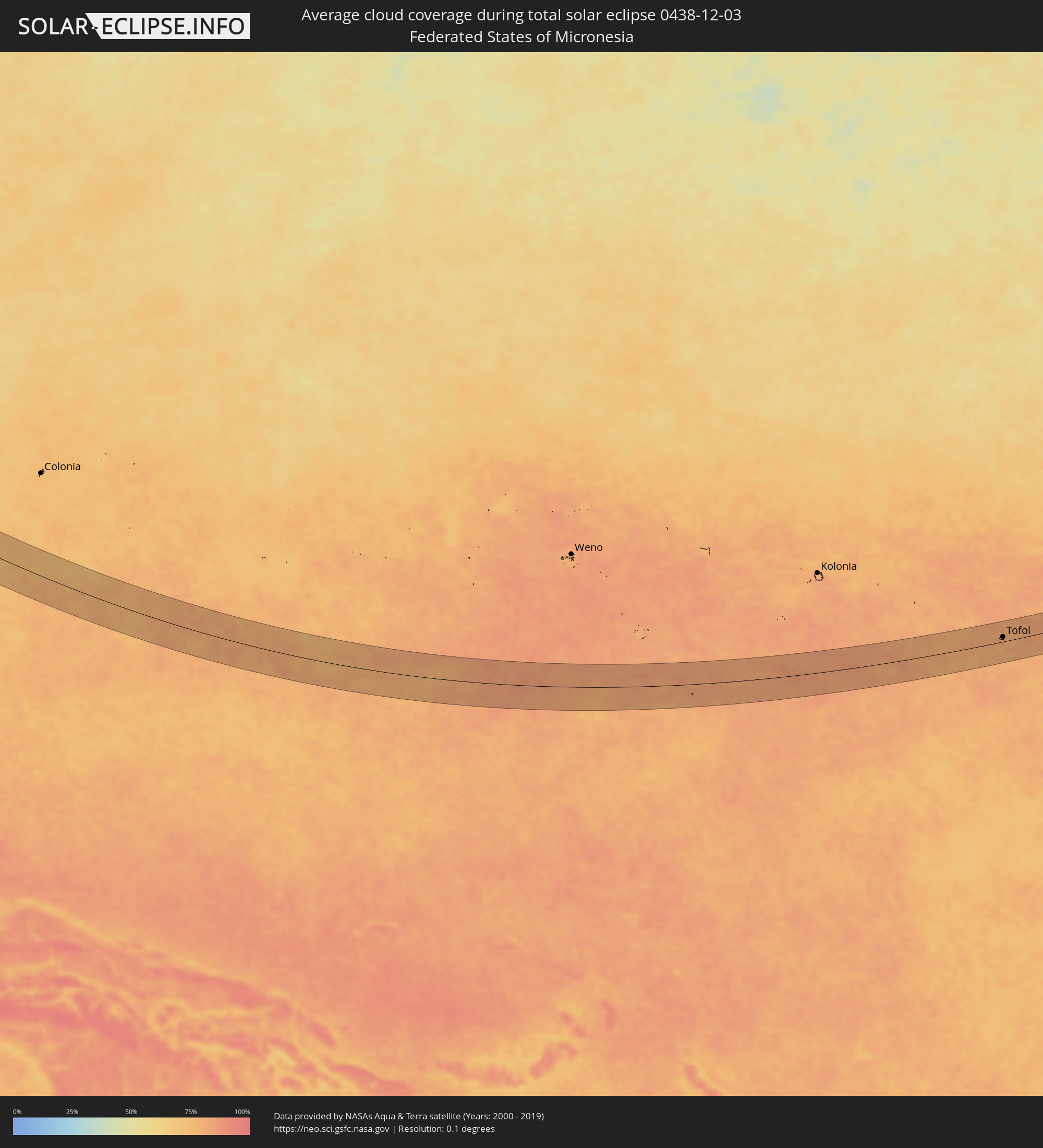 Föderierte Staaten von Mikronesien
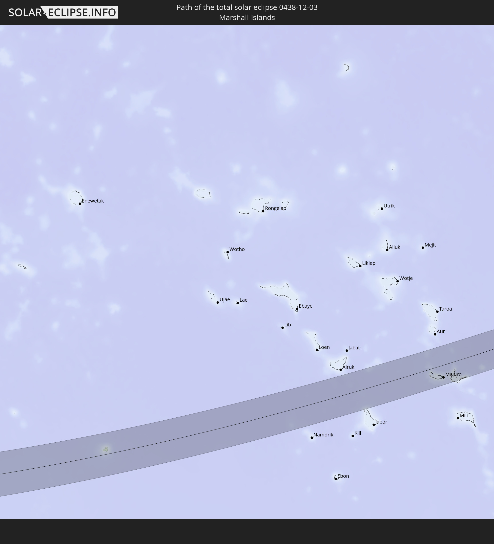
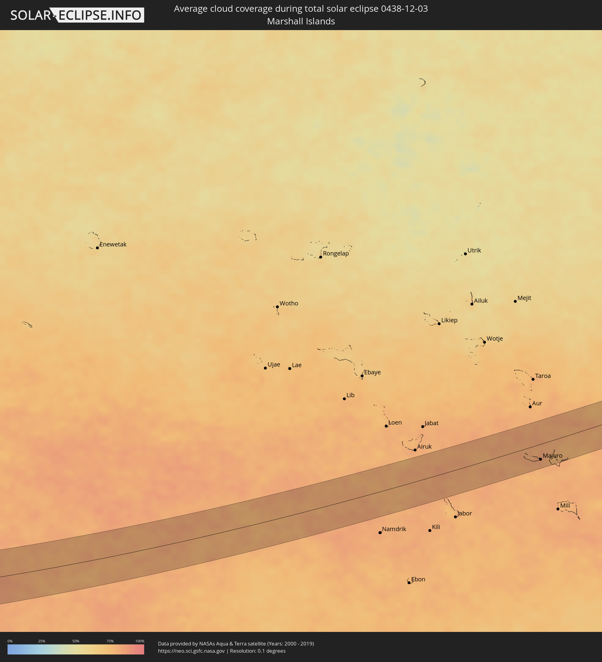 Marshallinseln
Orte im Finsternispfad
Die nachfolgene Tabelle zeigt Städte und Orte mit mehr als 5.000 Einwohnern, die sich im Finsternispfad befinden. Städte mit mehr als 100.000 Einwohnern sind dick gekennzeichnet. Mit einem Klick auf den Ort öffnet sich eine Detailkarte die die Lage des jeweiligen Ortes zusammen mit dem Verlauf der zentralen Finsternis präsentiert.
| Ort | Typ | Dauer der Verfinsterung | Ortszeit bei maximaler Verfinsterung | Entfernung zur Zentrallinie | Ø Bewölkung |
|
Kangding, Sichuan
|
total | - | 09:42:03 UTC+08:00 | 1 km | 54% |
|
Yibin, Sichuan
|
total | - | 09:44:23 UTC+08:00 | 30 km | 92% |
|
Xunchang, Sichuan
|
total | - | 09:44:27 UTC+08:00 | 7 km | 91% |
|
Guiyang, Guizhou
|
total | - | 09:46:33 UTC+08:00 | 47 km | 88% |
|
Xiaoweizhai, Guizhou
|
total | - | 09:47:28 UTC+08:00 | 36 km | 85% |
|
Duyun, Guizhou
|
total | - | 09:47:28 UTC+08:00 | 29 km | 86% |
|
Guilin, Guangxi Zhuang Autonomous Region
|
total | - | 09:50:55 UTC+08:00 | 47 km | 77% |
|
Yangshuo, Guangxi Zhuang Autonomous Region
|
total | - | 09:51:16 UTC+08:00 | 15 km | 75% |
|
Wuzhou, Guangxi Zhuang Autonomous Region
|
total | - | 09:52:38 UTC+08:00 | 51 km | 68% |
|
Babu, Guangxi Zhuang Autonomous Region
|
total | - | 09:52:41 UTC+08:00 | 44 km | 73% |
|
Nanfeng, Guangdong
|
total | - | 09:53:13 UTC+08:00 | 0 km | 66% |
|
Huaicheng, Guangdong
|
total | - | 09:53:42 UTC+08:00 | 40 km | 64% |
|
Lubu, Guangdong
|
total | - | 09:54:03 UTC+08:00 | 20 km | 65% |
|
Zhaoqing, Guangdong
|
total | - | 09:54:19 UTC+08:00 | 20 km | 67% |
|
Sanshui, Guangdong
|
total | - | 09:54:54 UTC+08:00 | 16 km | 70% |
|
Shaping, Guangdong
|
total | - | 09:55:07 UTC+08:00 | 14 km | 73% |
|
Xinhui, Guangdong
|
total | - | 09:55:21 UTC+08:00 | 36 km | 76% |
|
Shiwan, Guangdong
|
total | - | 09:55:13 UTC+08:00 | 14 km | 72% |
|
Jiangmen, Guangdong
|
total | - | 09:55:21 UTC+08:00 | 23 km | 75% |
|
Foshan, Guangdong
|
total | - | 09:55:17 UTC+08:00 | 19 km | 72% |
|
Guangzhou, Guangdong
|
total | - | 09:55:26 UTC+08:00 | 35 km | 66% |
|
Daliang, Guangdong
|
total | - | 09:55:31 UTC+08:00 | 10 km | 66% |
|
Shiqiao, Guangdong
|
total | - | 09:55:38 UTC+08:00 | 26 km | 65% |
|
Shiqi, Guangdong
|
total | - | 09:55:49 UTC+08:00 | 10 km | 66% |
|
Dasha, Guangdong
|
total | - | 09:55:42 UTC+08:00 | 46 km | 67% |
|
Macau, Macau
|
total | - | 09:30:19 UTC+07:34 | 28 km | 63% |
|
Zhuhai, Guangdong
|
total | - | 09:56:10 UTC+08:00 | 20 km | 53% |
|
Humen, Guangdong
|
total | - | 09:56:08 UTC+08:00 | 34 km | 63% |
|
Tung Chung, Islands
|
total | - | 09:33:25 UTC+07:36 | 4 km | 53% |
|
Tuen Mun, Tuen Mun
|
total | - | 09:33:25 UTC+07:36 | 15 km | 54% |
|
Yuen Long Kau Hui, Yuen Long
|
total | - | 09:33:29 UTC+07:36 | 24 km | 57% |
|
Shenzhen, Guangdong
|
total | - | 09:56:49 UTC+08:00 | 35 km | 56% |
|
Tsuen Wan, Tsuen Wan
|
total | - | 09:33:38 UTC+07:36 | 21 km | 53% |
|
Yung Shue Wan
|
total | - | 09:33:41 UTC+07:36 | 9 km | 51% |
|
Hong Kong, Central and Western
|
total | - | 09:33:44 UTC+07:36 | 17 km | 55% |
|
Central, Central and Western
|
total | - | 09:33:44 UTC+07:36 | 17 km | 55% |
|
Sham Shui Po, Sham Shui Po
|
total | - | 09:33:43 UTC+07:36 | 21 km | 55% |
|
Tai Po, Tai Po
|
total | - | 09:33:42 UTC+07:36 | 32 km | 55% |
|
Wan Chai, Wanchai
|
total | - | 09:33:46 UTC+07:36 | 18 km | 55% |
|
Kowloon, Kowloon City
|
total | - | 09:33:46 UTC+07:36 | 21 km | 55% |
|
Wong Tai Sin, Wong Tai Sin
|
total | - | 09:33:45 UTC+07:36 | 24 km | 54% |
|
Sha Tin, Sha Tin
|
total | - | 09:33:44 UTC+07:36 | 27 km | 54% |
|
Sai Kung, Sai Kung
|
total | - | 09:33:52 UTC+07:36 | 32 km | 55% |
|
Vigan, Ilocos
|
total | - | 10:10:02 UTC+08:00 | 9 km | 40% |
|
Candon, Ilocos
|
total | - | 10:10:24 UTC+08:00 | 39 km | 53% |
|
Cabugao, Ilocos
|
total | - | 10:10:01 UTC+08:00 | 15 km | 47% |
|
Suyo, Ilocos
|
total | - | 10:10:42 UTC+08:00 | 53 km | 55% |
|
Batac City, Ilocos
|
total | - | 10:10:04 UTC+08:00 | 45 km | 45% |
|
Dingras, Ilocos
|
total | - | 10:10:17 UTC+08:00 | 58 km | 47% |
|
Mankayan, Cordillera
|
total | - | 10:11:16 UTC+08:00 | 47 km | 58% |
|
Bontoc, Cordillera
|
total | - | 10:11:30 UTC+08:00 | 15 km | 74% |
|
Lagawe, Cordillera
|
total | - | 10:11:59 UTC+08:00 | 31 km | 80% |
|
Pasil, Cordillera
|
total | - | 10:11:36 UTC+08:00 | 22 km | 79% |
|
Bayombong, Cagayan Valley
|
total | - | 10:12:16 UTC+08:00 | 58 km | 79% |
|
Diadi, Cagayan Valley
|
total | - | 10:12:30 UTC+08:00 | 23 km | 81% |
|
Tabuk, Cordillera
|
total | - | 10:12:12 UTC+08:00 | 51 km | 82% |
|
Cabarroguis, Cagayan Valley
|
total | - | 10:12:59 UTC+08:00 | 32 km | 86% |
|
Santiago, Cagayan Valley
|
total | - | 10:12:55 UTC+08:00 | 14 km | 80% |
|
Saguday, Cagayan Valley
|
total | - | 10:13:03 UTC+08:00 | 26 km | 86% |
|
San Mateo, Cagayan Valley
|
total | - | 10:12:51 UTC+08:00 | 6 km | 77% |
|
Batal, Cagayan Valley
|
total | - | 10:13:01 UTC+08:00 | 11 km | 81% |
|
Quezon, Cagayan Valley
|
total | - | 10:12:36 UTC+08:00 | 45 km | 82% |
|
Salinungan Proper, Cagayan Valley
|
total | - | 10:12:55 UTC+08:00 | 6 km | 77% |
|
Roxas, Cagayan Valley
|
total | - | 10:12:45 UTC+08:00 | 29 km | 78% |
|
San Manuel, Cagayan Valley
|
total | - | 10:12:51 UTC+08:00 | 21 km | 80% |
|
Echague, Cagayan Valley
|
total | - | 10:13:09 UTC+08:00 | 5 km | 83% |
|
Maddela, Cagayan Valley
|
total | - | 10:13:26 UTC+08:00 | 36 km | 88% |
|
Alicia, Cagayan Valley
|
total | - | 10:13:09 UTC+08:00 | 3 km | 82% |
|
Minante Segundo, Cagayan Valley
|
total | - | 10:13:11 UTC+08:00 | 19 km | 84% |
|
Naguilian, Cagayan Valley
|
total | - | 10:13:15 UTC+08:00 | 34 km | 83% |
|
Ilagan, Cagayan Valley
|
total | - | 10:13:16 UTC+08:00 | 49 km | 84% |
|
San Mariano, Cagayan Valley
|
total | - | 10:13:38 UTC+08:00 | 42 km | 85% |
|
Kayangel, Kayangel
|
total | - | 11:53:21 UTC+09:00 | 38 km | 72% |
|
Tofol, Kosrae
|
total | - | 15:12:17 UTC+11:00 | 13 km | 80% |
|
Majuro, Majuro Atoll
|
total | - | 15:24:44 UTC+11:00 | 33 km | 82% |
|
RMI Capitol, Majuro Atoll
|
total | - | 15:24:44 UTC+11:00 | 33 km | 82% |
|
Arno, Arno Atoll
|
total | - | 15:24:59 UTC+11:00 | 41 km | 79% |