Totale Sonnenfinsternis vom 17.05.0440
| Wochentag: | Donnerstag |
| Maximale Dauer der Verfinsterung: | 01m54s |
| Maximale Breite des Finsternispfades: | 107 km |
| Saroszyklus: | 93 |
| Bedeckungsgrad: | 100% |
| Magnitude: | 1.0253 |
| Gamma: | 0.603 |
Wo kann man die Sonnenfinsternis vom 17.05.0440 sehen?
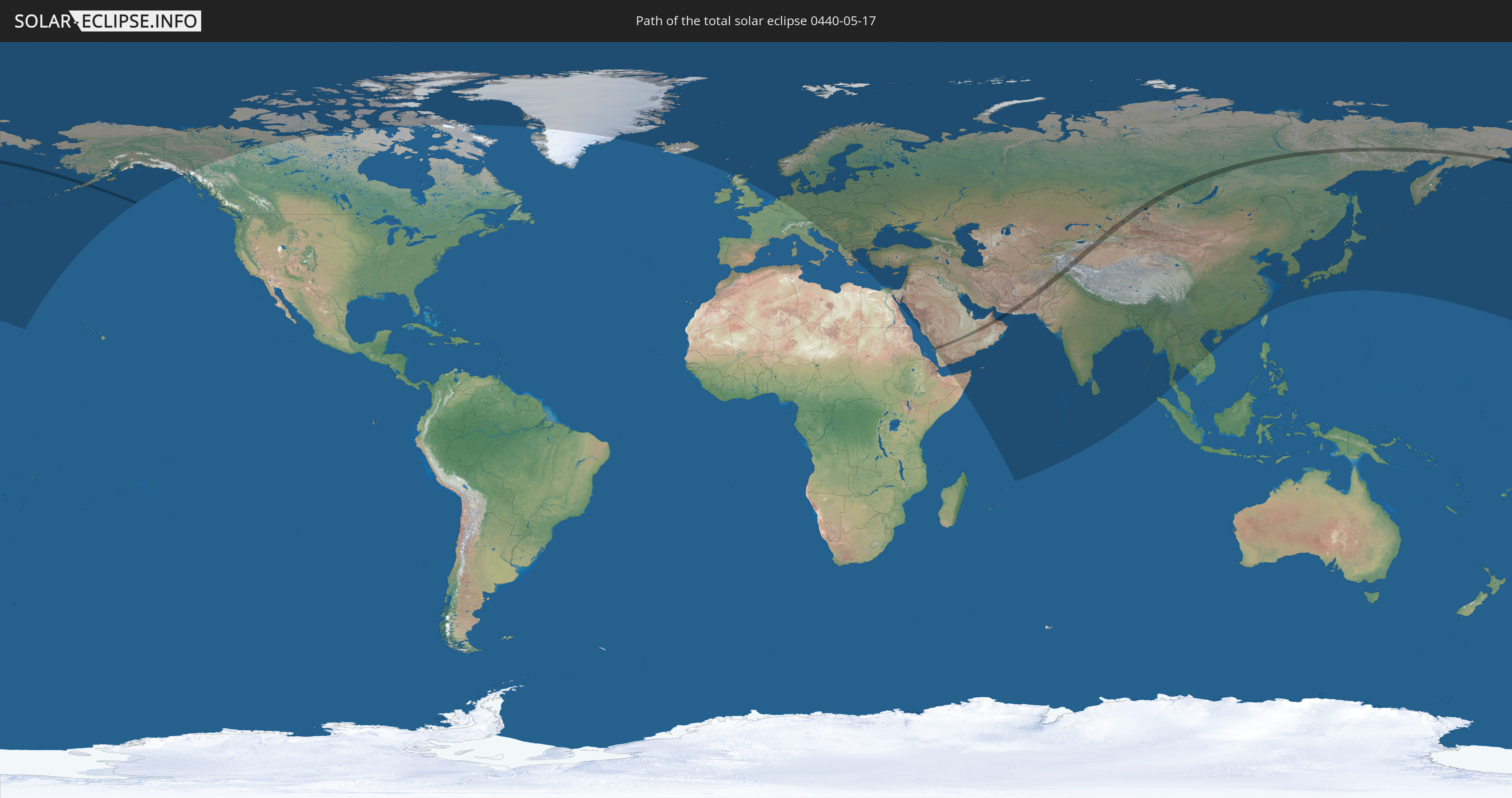
Die Sonnenfinsternis am 17.05.0440 kann man in 86 Ländern als partielle Sonnenfinsternis beobachten.
Der Finsternispfad verläuft durch 13 Länder. Nur in diesen Ländern ist sie als totale Sonnenfinsternis zu sehen.
In den folgenden Ländern ist die Sonnenfinsternis total zu sehen
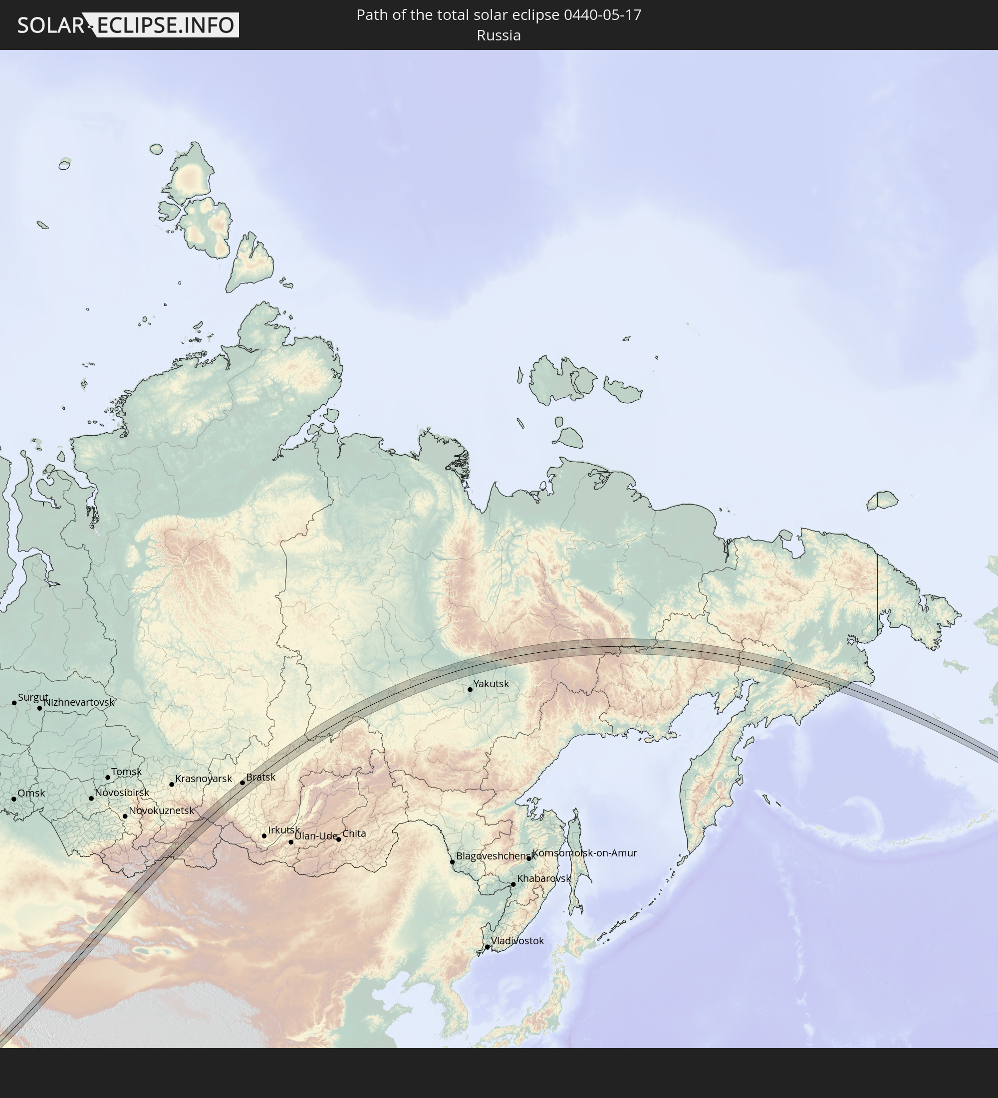 Russland
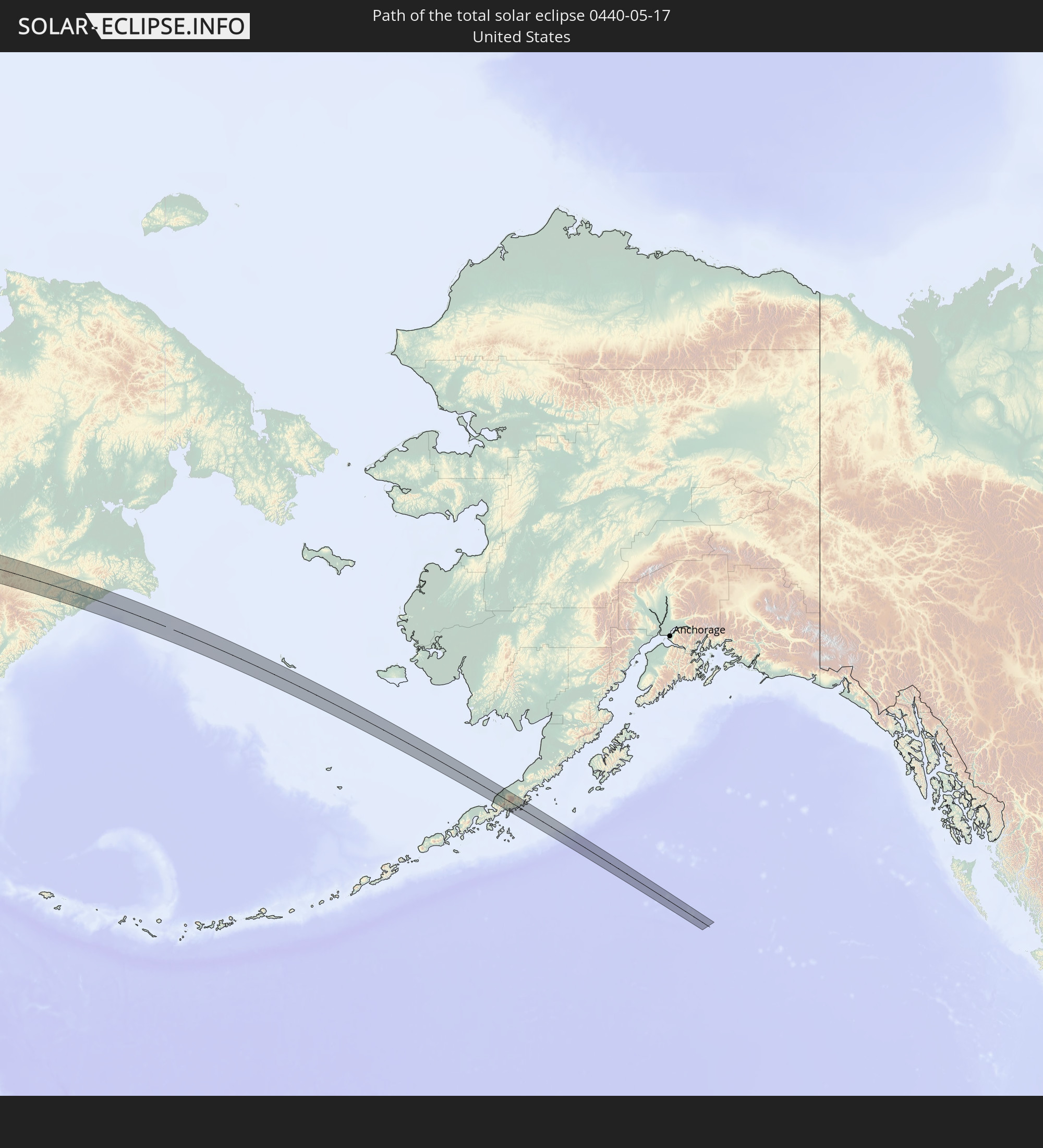 Vereinigte Staaten
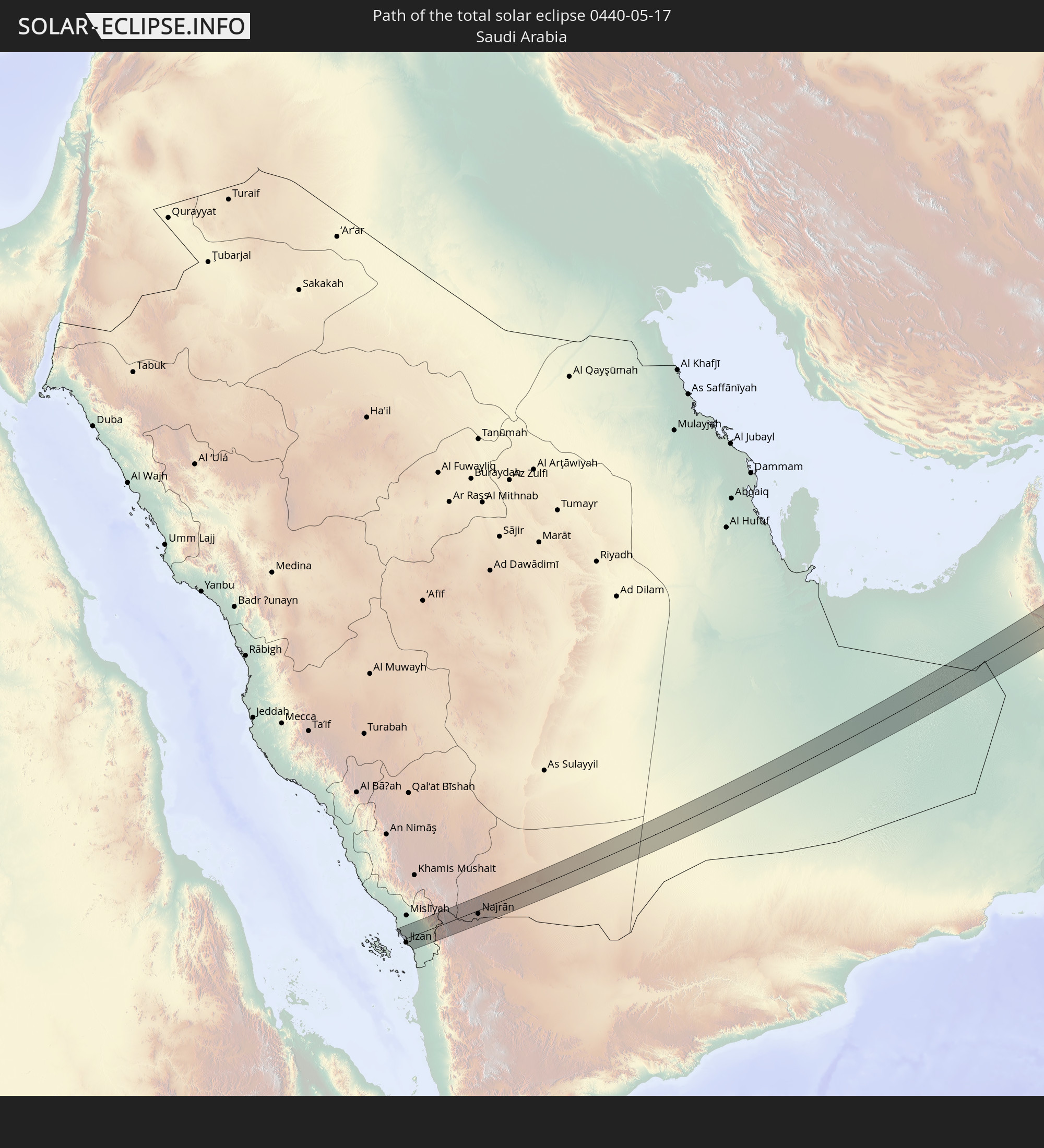 Saudi-Arabien
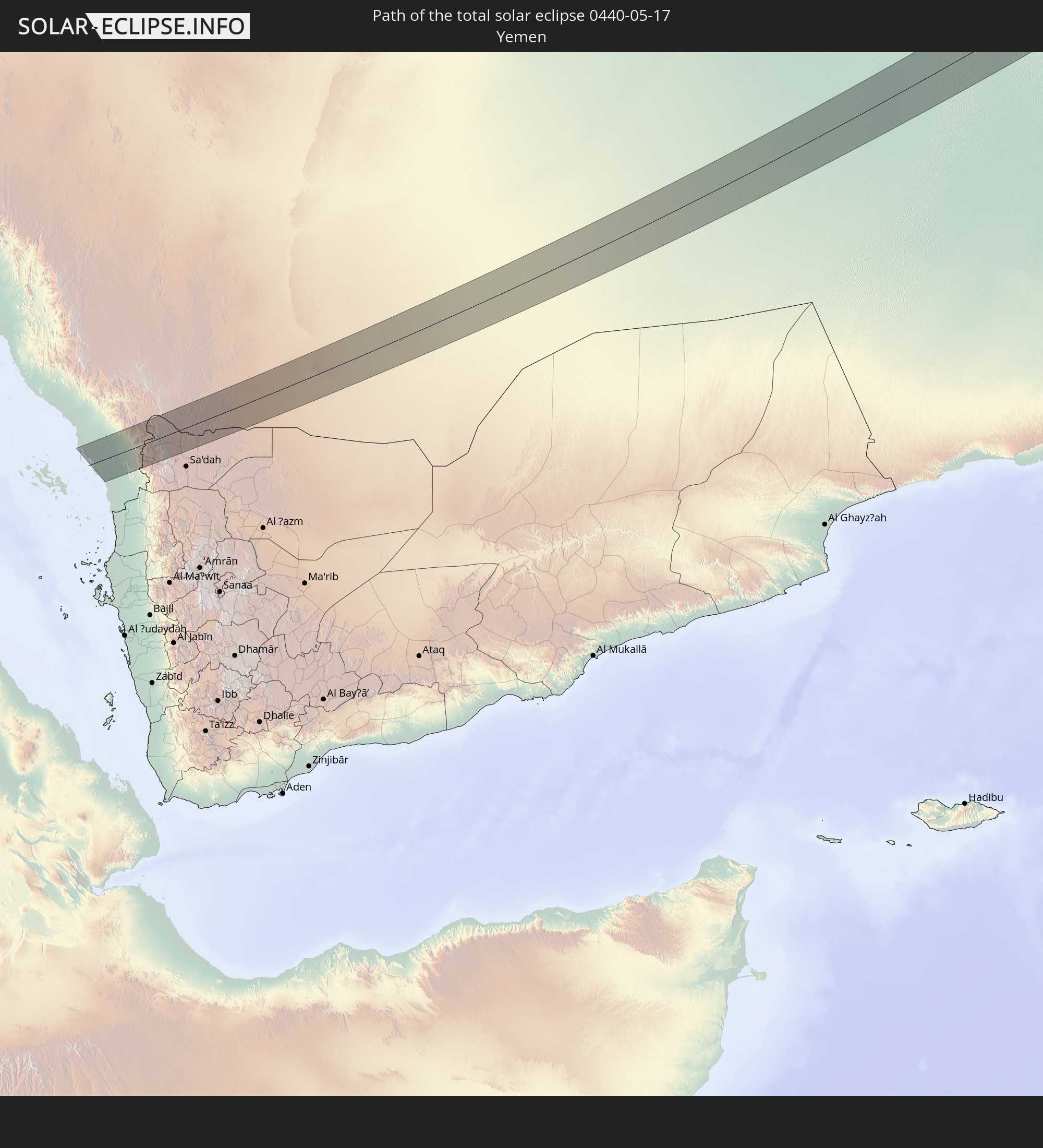 Jemen
Jemen
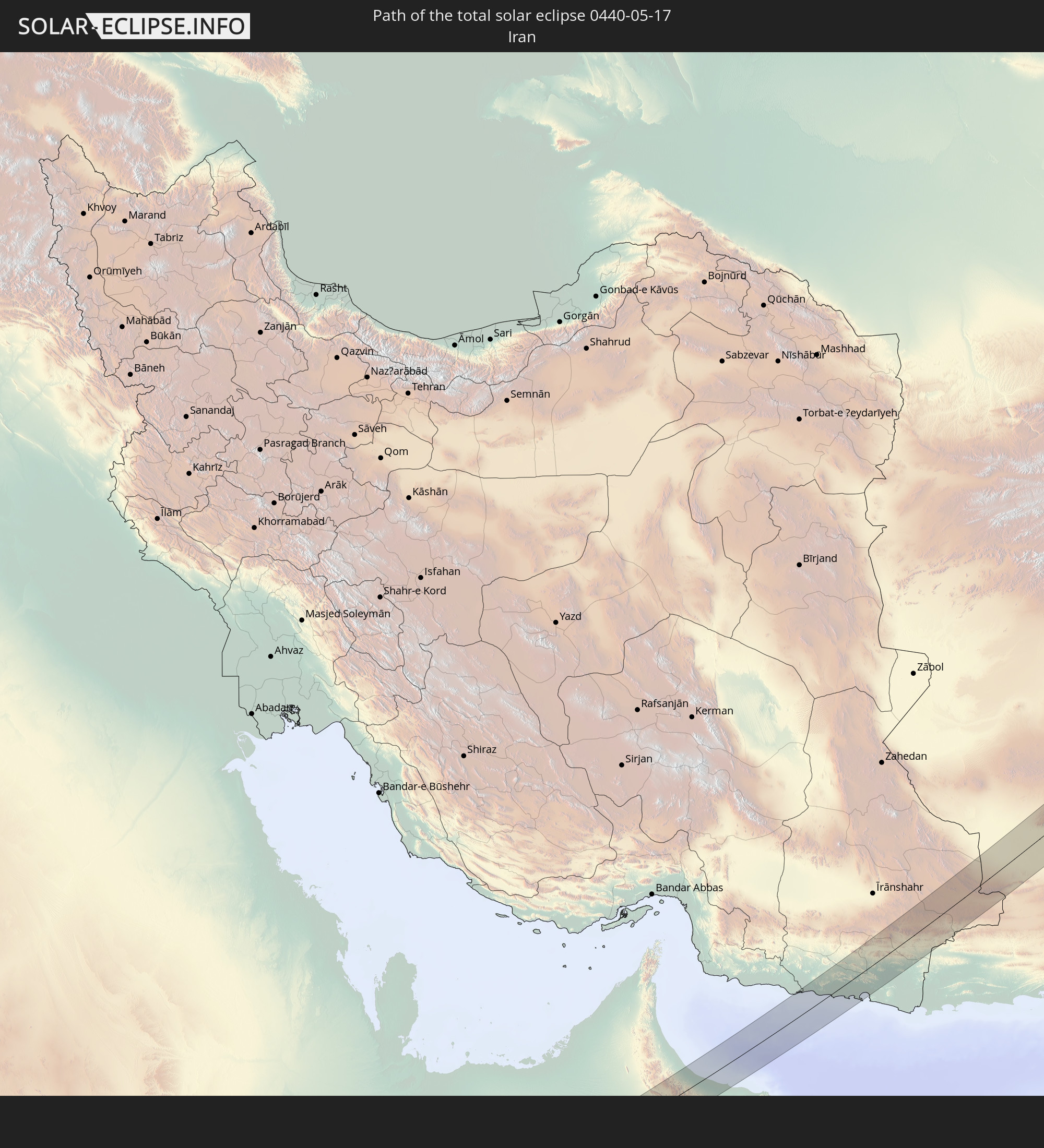 Iran
Iran
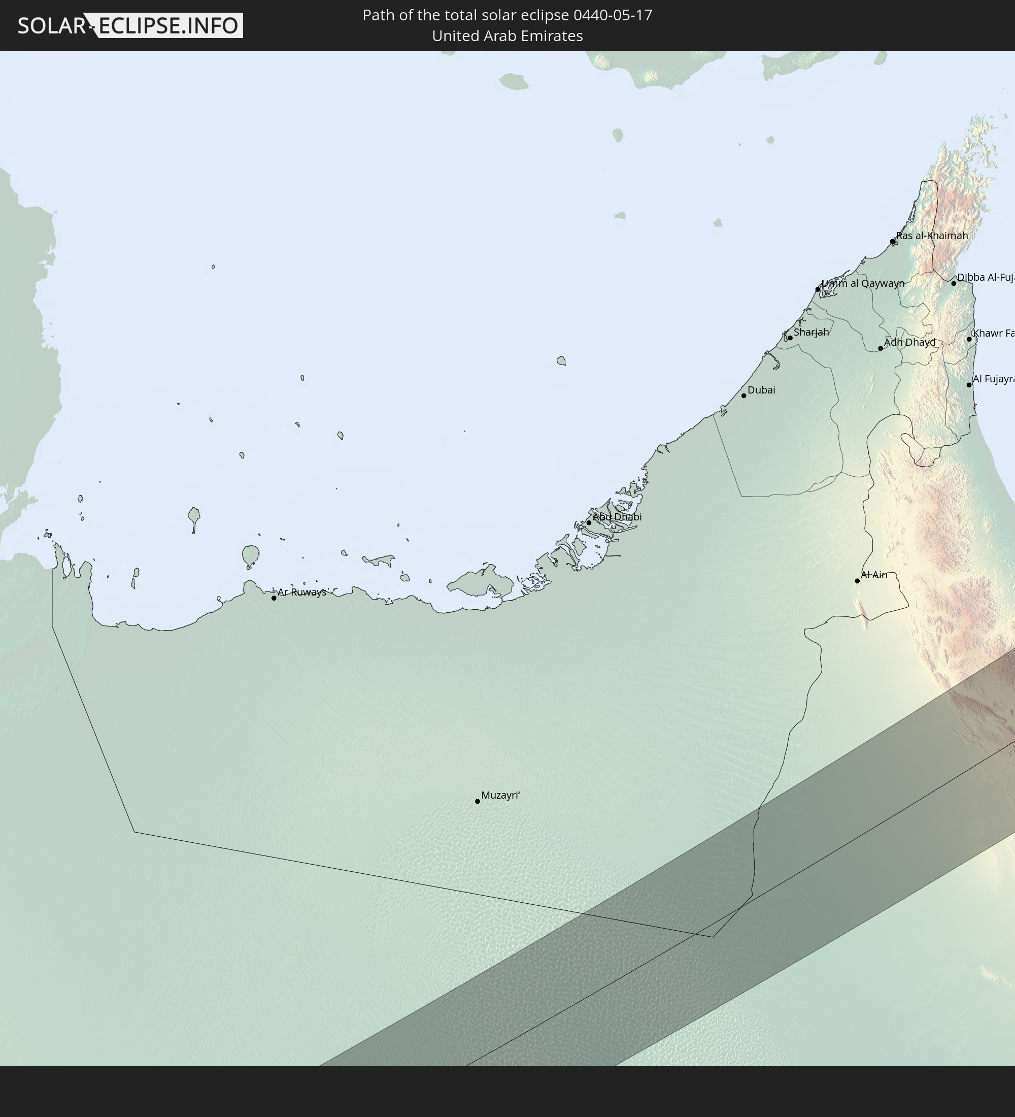 Vereinigte Arabische Emirate
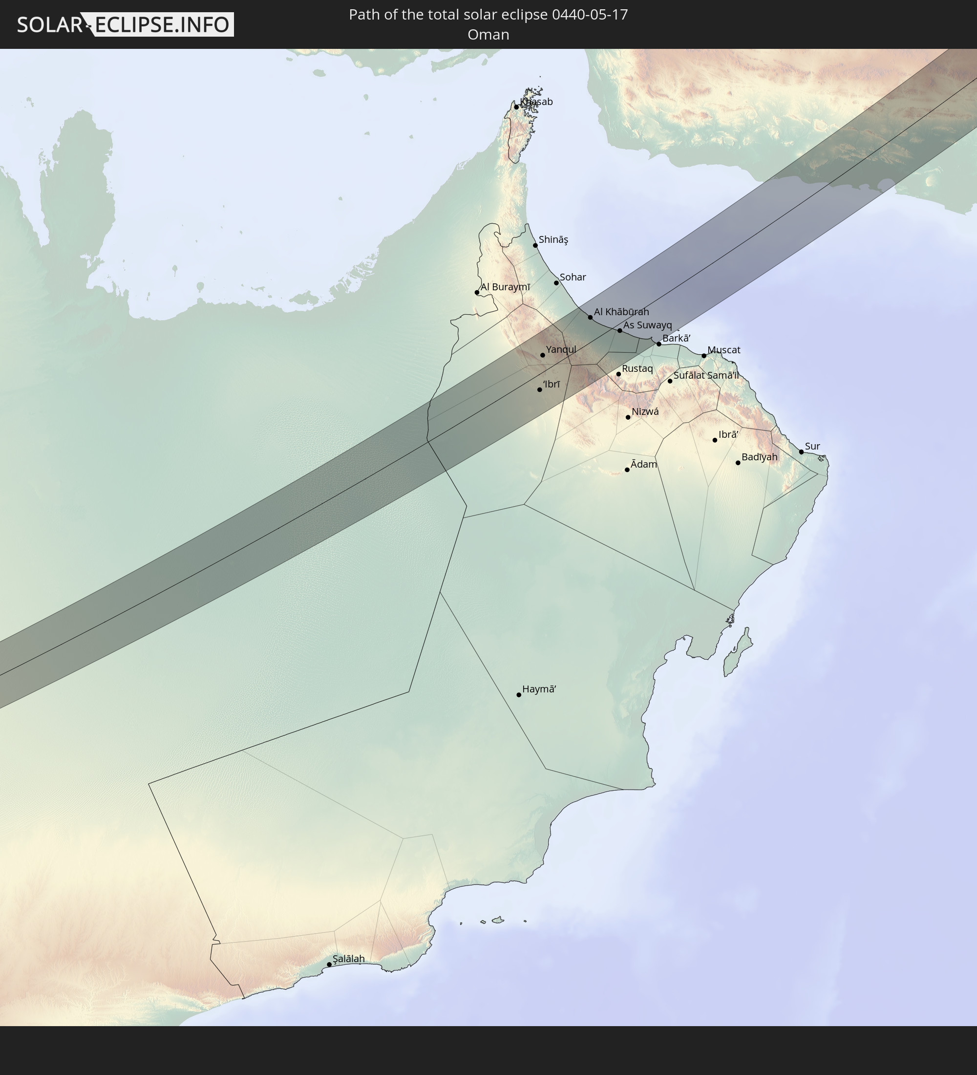 Oman
Oman
 Afghanistan
 Pakistan
 Tadschikistan
 Kirgisistan
 Volksrepublik China
 Mongolei
In den folgenden Ländern ist die Sonnenfinsternis partiell zu sehen
 Russland
 Vereinigte Staaten
 United States Minor Outlying Islands
 Kanada
 Grönland
 Island
 Spitzbergen
 Vereinigtes Königreich
 Färöer
 Niederlande
 Norwegen
 Deutschland
 Dänemark
 Österreich
 Schweden
 Tschechien
 Slowenien
 Kroatien
 Polen
Polen
 Bosnien und Herzegowina
 Ungarn
 Slowakei
 Montenegro
 Serbien
 Albanien
 Åland Islands
 Griechenland
 Rumänien
 Mazedonien
 Finnland
 Litauen
 Lettland
 Estland
 Ukraine
 Bulgarien
 Weißrussland
 Ägypten
 Türkei
 Moldawien
 Republik Zypern
 Staat Palästina
 Israel
 Saudi-Arabien
 Jordanien
 Libanon
 Syrien
 Irak
Irak
 Georgien
 Somalia
 Jemen
Jemen
 Armenien
 Iran
Iran
 Aserbaidschan
 Kasachstan
 Kuwait
 Bahrain
 Katar
Katar
 Vereinigte Arabische Emirate
 Oman
Oman
 Turkmenistan
 Usbekistan
 Afghanistan
 Pakistan
 Tadschikistan
 Indien
 Kirgisistan
 Britisches Territorium im Indischen Ozean
 Malediven
 Volksrepublik China
 Sri Lanka
 Nepal
Nepal
 Mongolei
 Bangladesch
 Bhutan
 Myanmar
 Indonesien
 Thailand
 Laos
Laos
 Vietnam
 Kambodscha
 Macau
Macau
 Hongkong
 Taiwan
 Japan
Japan
 Nordkorea
 Südkorea
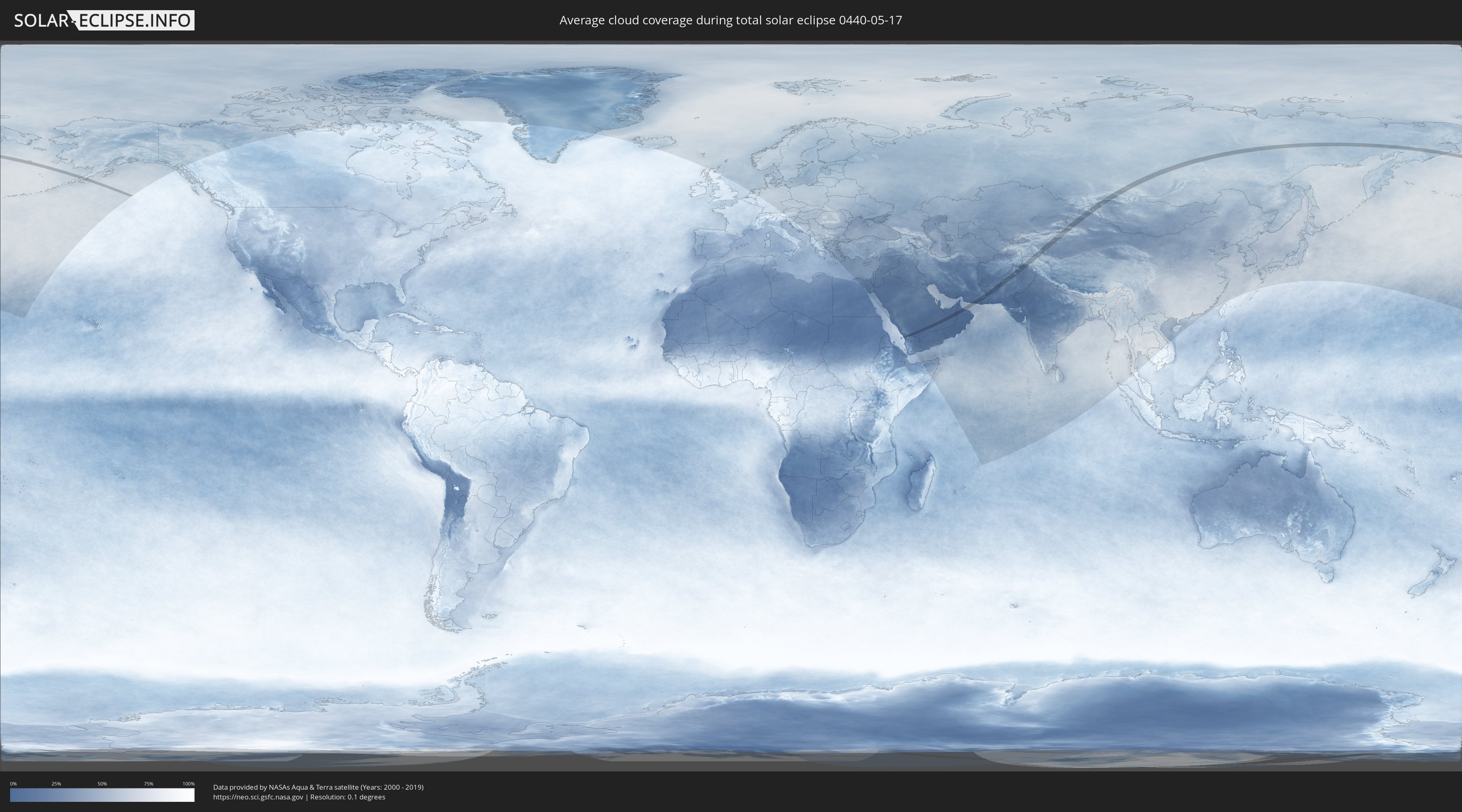
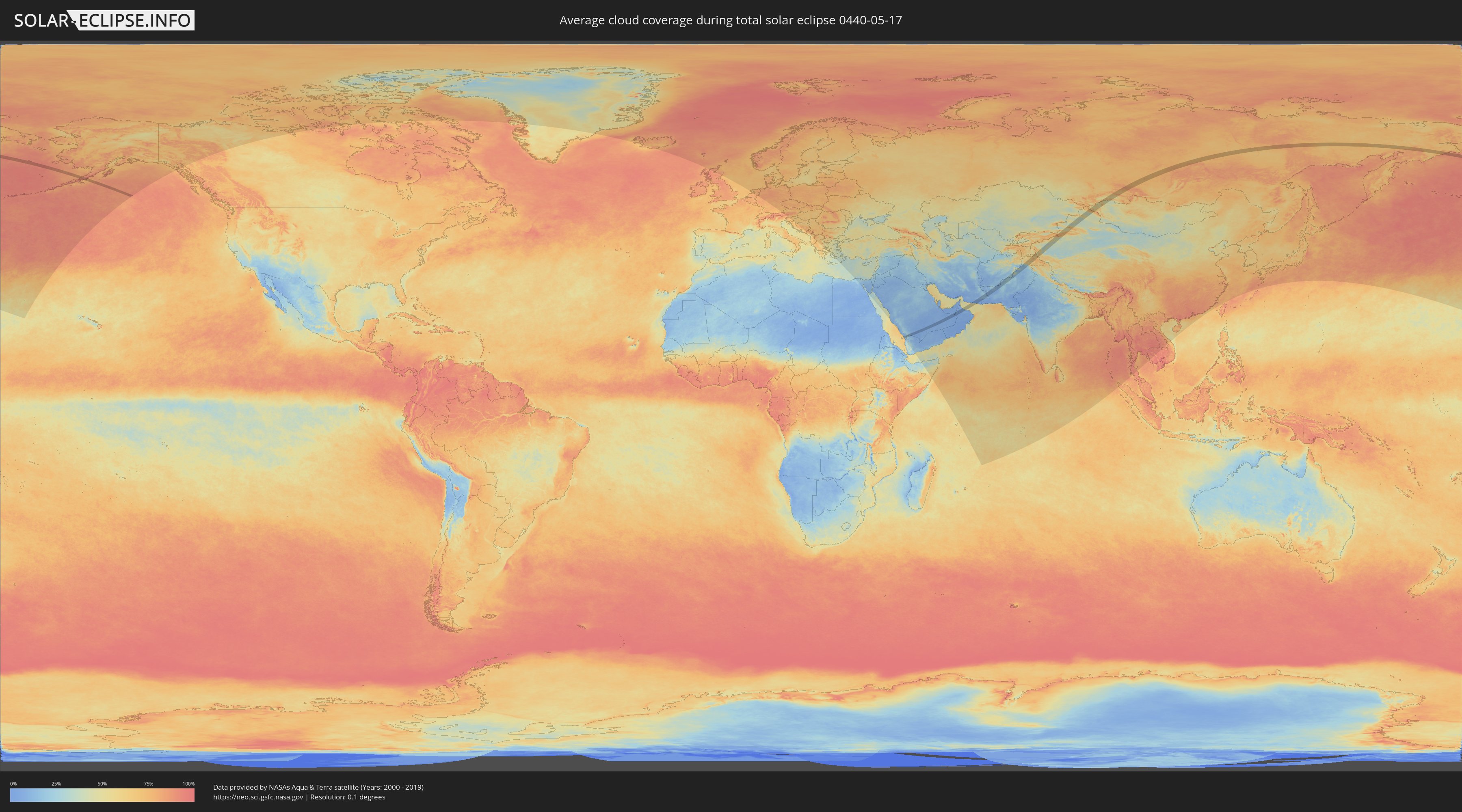
Wie wird das Wetter während der totalen Sonnenfinsternis am 17.05.0440?
Wo ist der beste Ort, um die totale Sonnenfinsternis vom 17.05.0440 zu beobachten?
Die folgenden Karten zeigen die durchschnittliche Bewölkung für den Tag, an dem die totale Sonnenfinsternis
stattfindet. Mit Hilfe der Karten lässt sich der Ort entlang des Finsternispfades eingrenzen,
der die besten Aussichen auf einen klaren wolkenfreien Himmel bietet.
Trotzdem muss man immer lokale Gegenenheiten beachten und sollte sich genau über das Wetter an seinem
gewählten Beobachtungsort informieren.
Die Daten stammen von den beiden NASA-Satelliten
AQUA und TERRA
und wurden über einen Zeitraum von 19 Jahren (2000 - 2019) gemittelt.
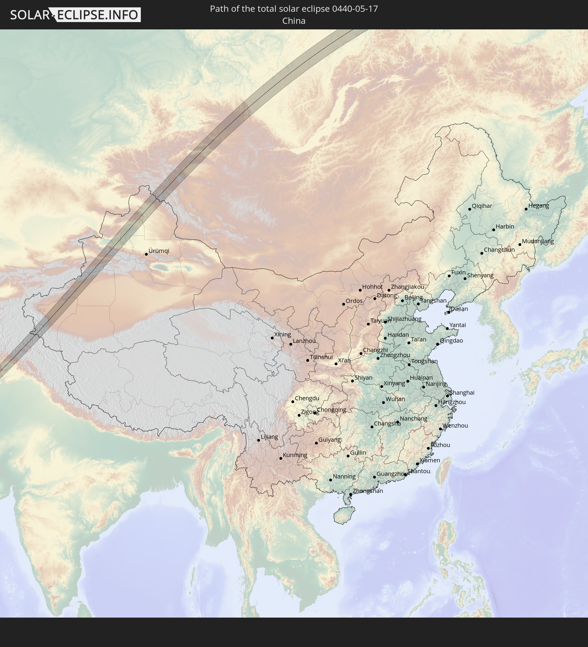
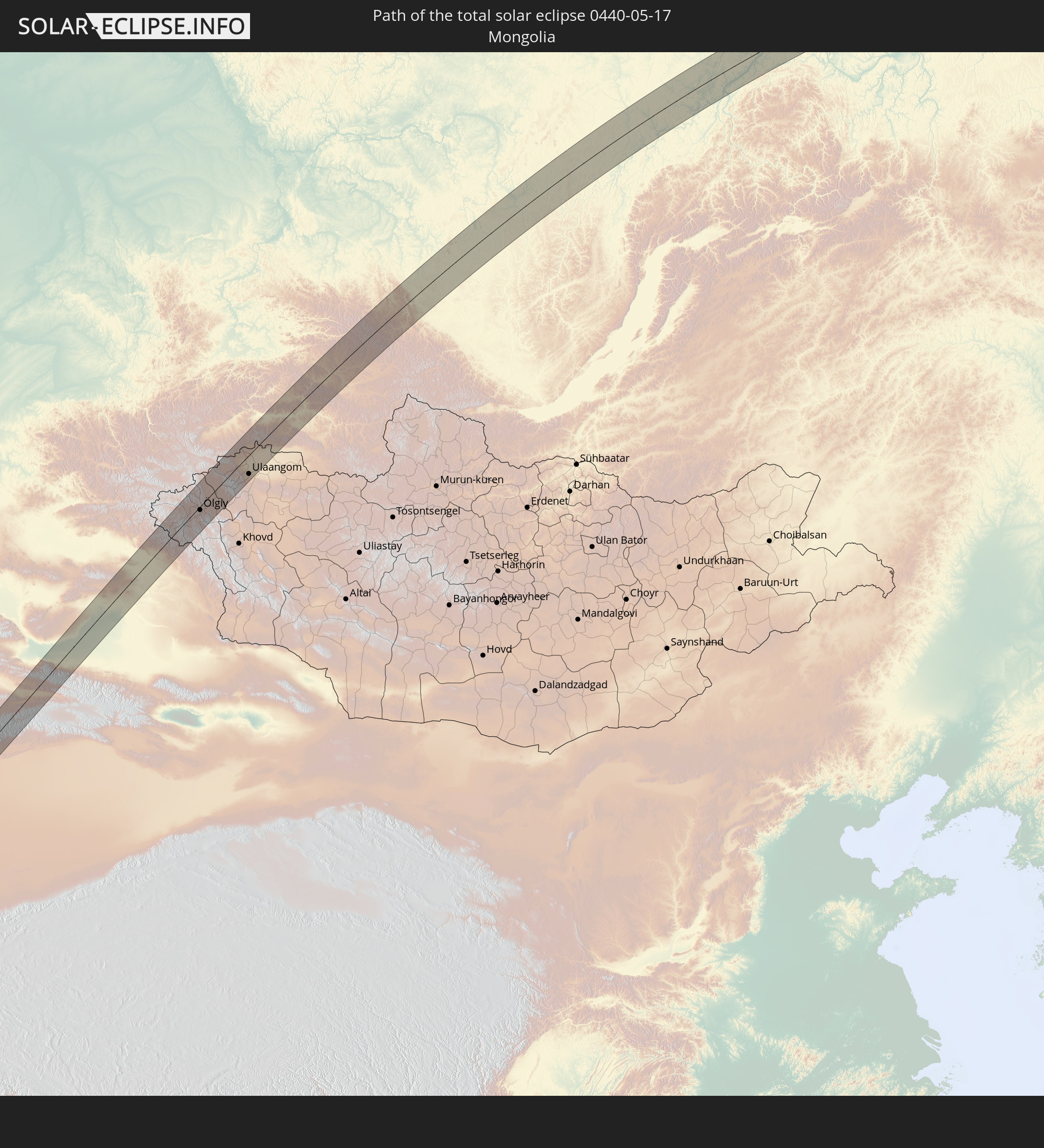
Detaillierte Länderkarten
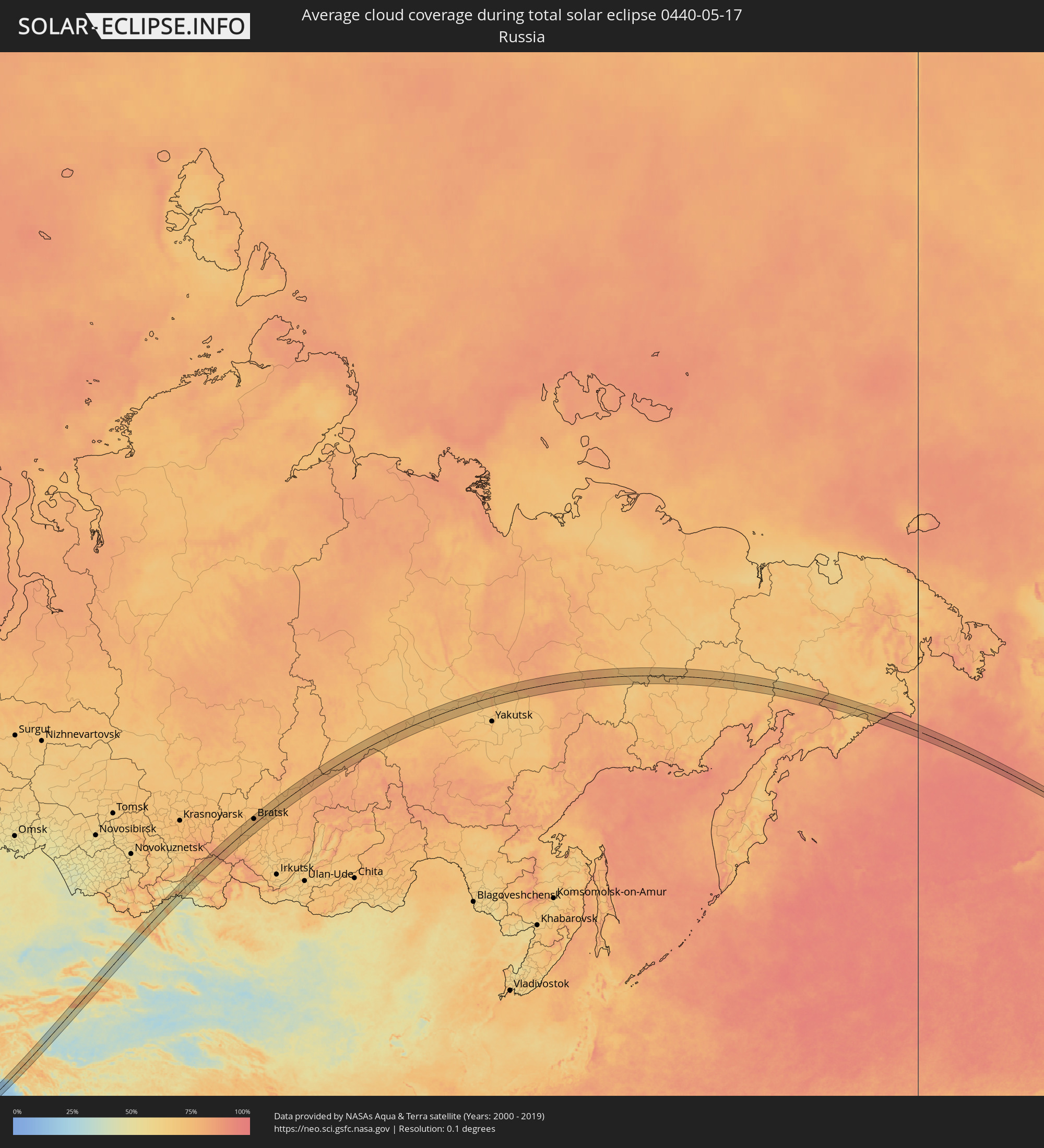 Russland
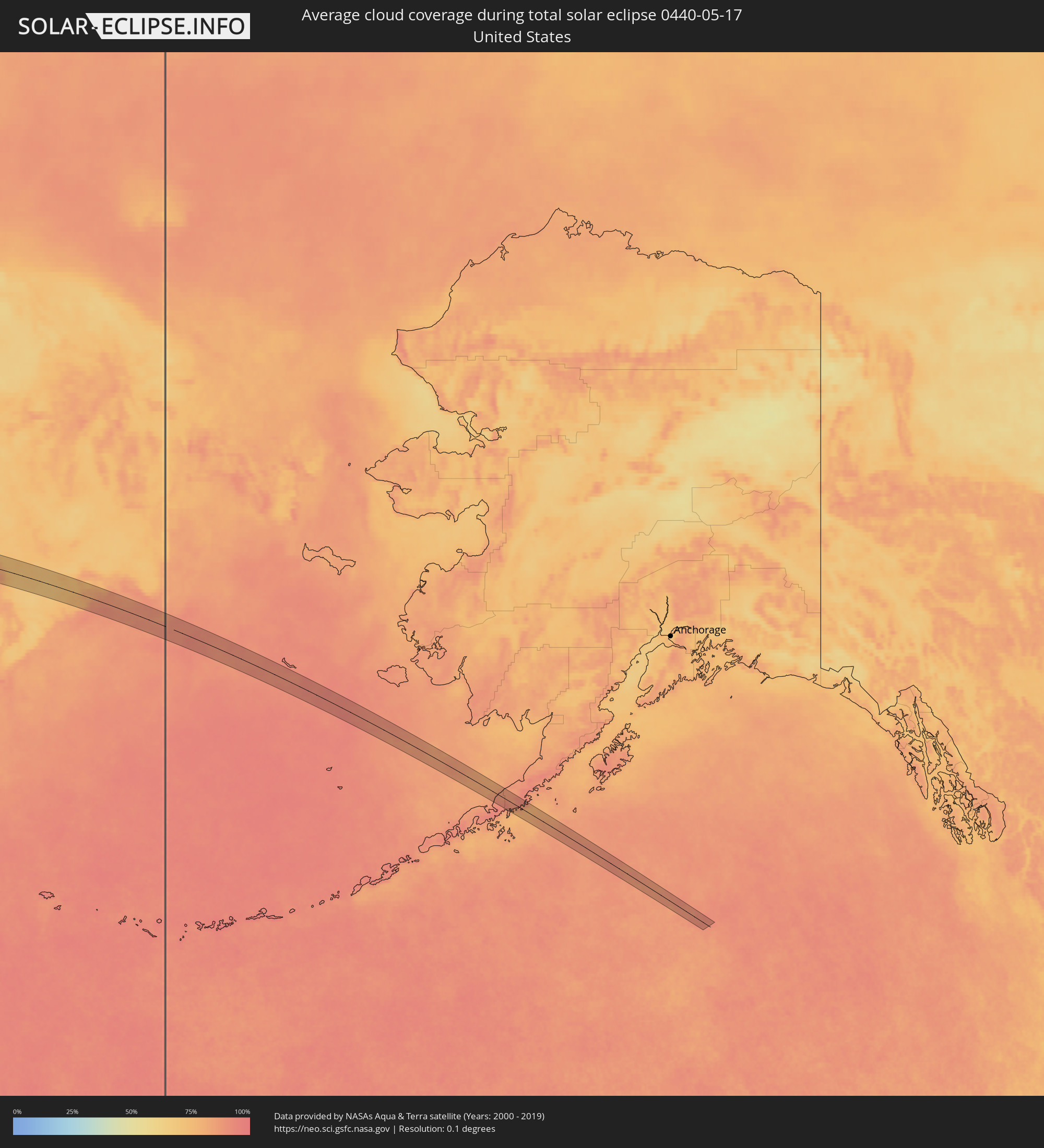 Vereinigte Staaten
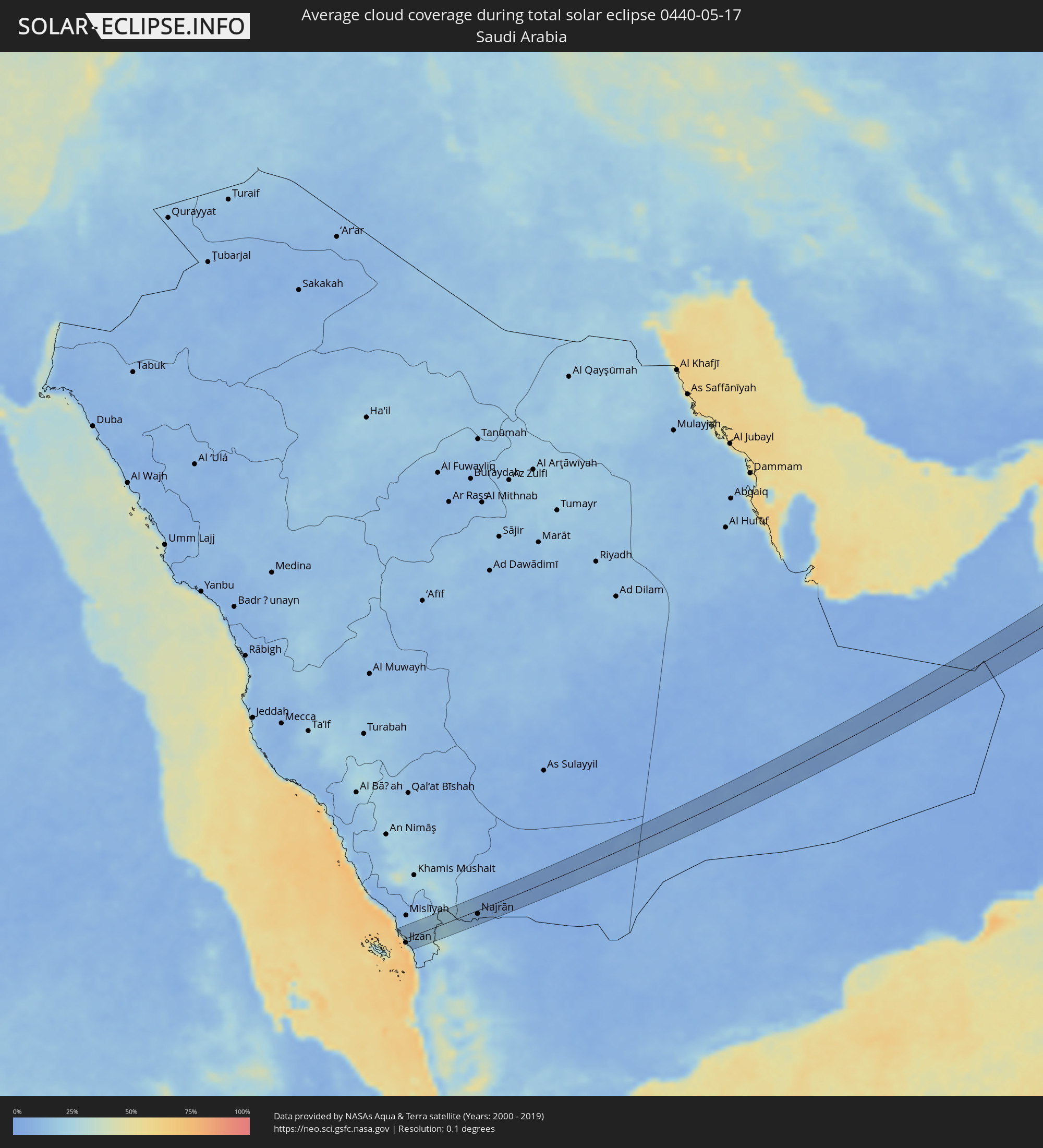 Saudi-Arabien
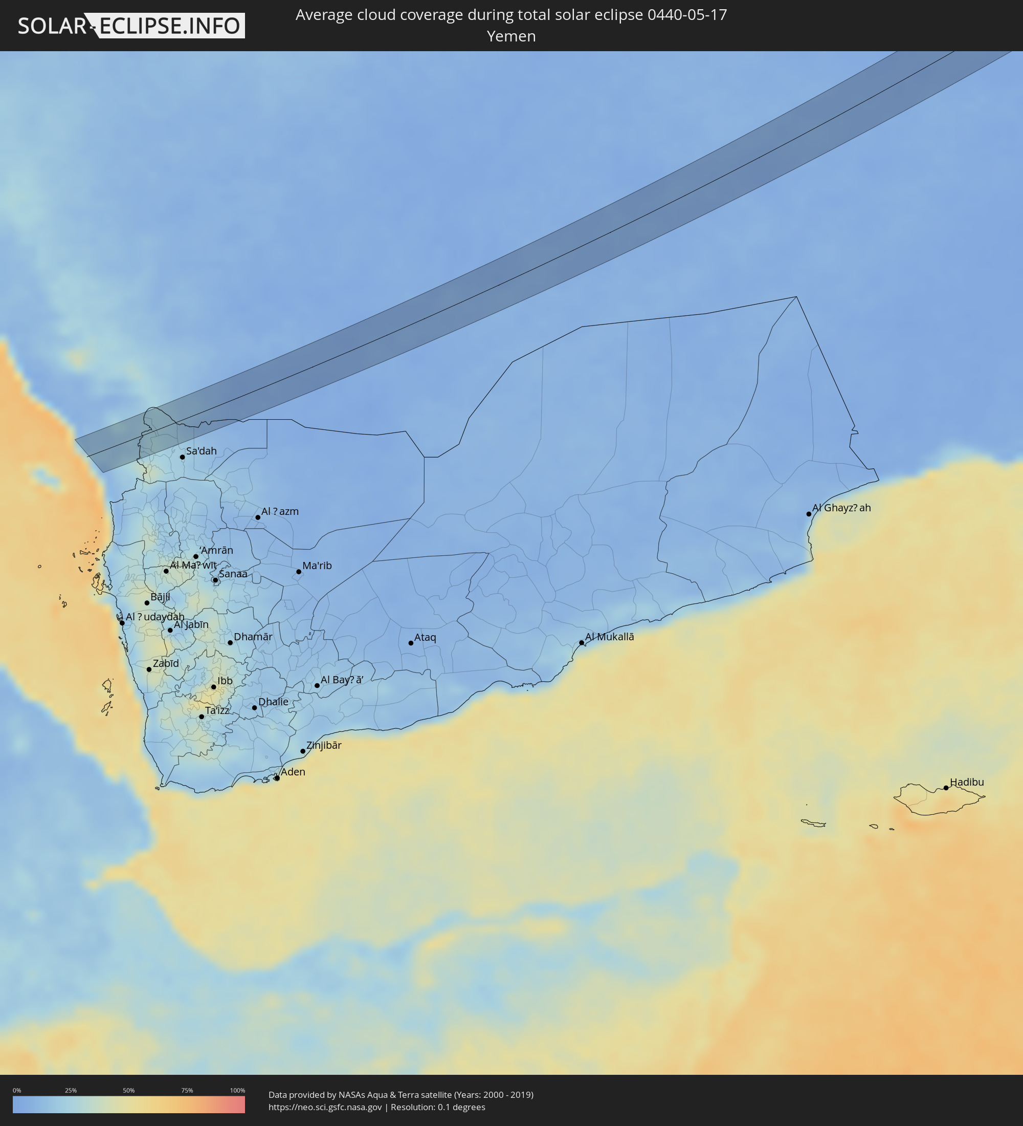 Jemen
Jemen
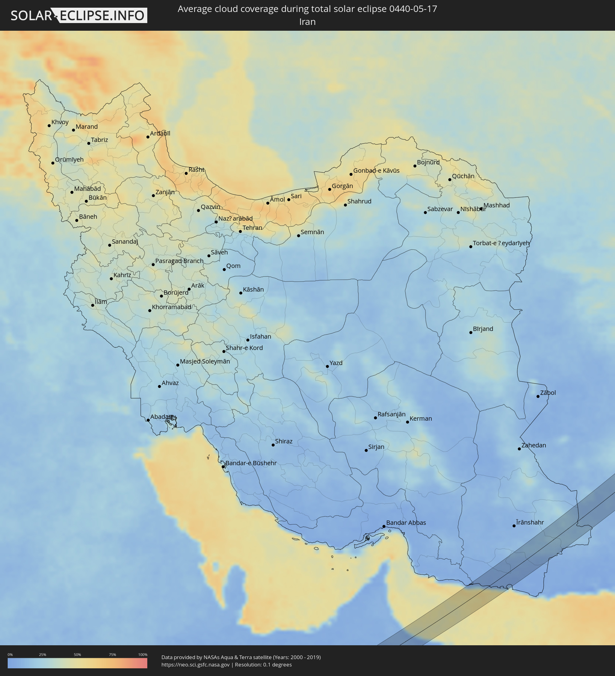 Iran
Iran
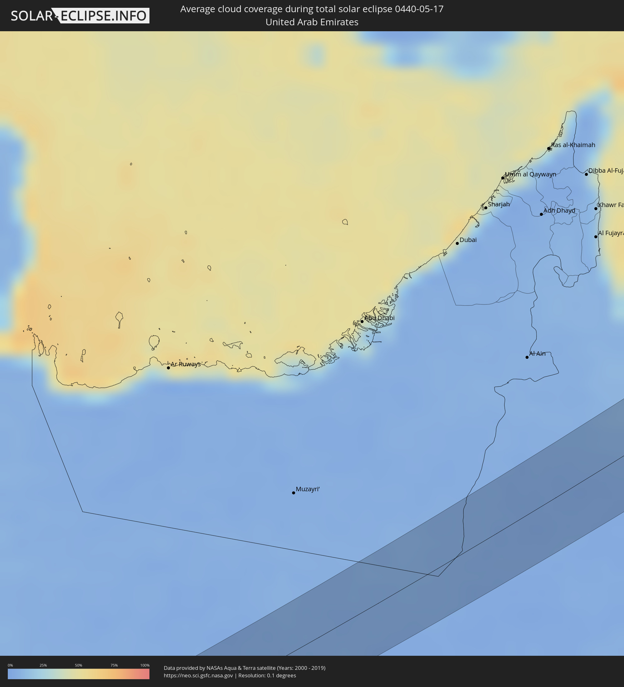 Vereinigte Arabische Emirate
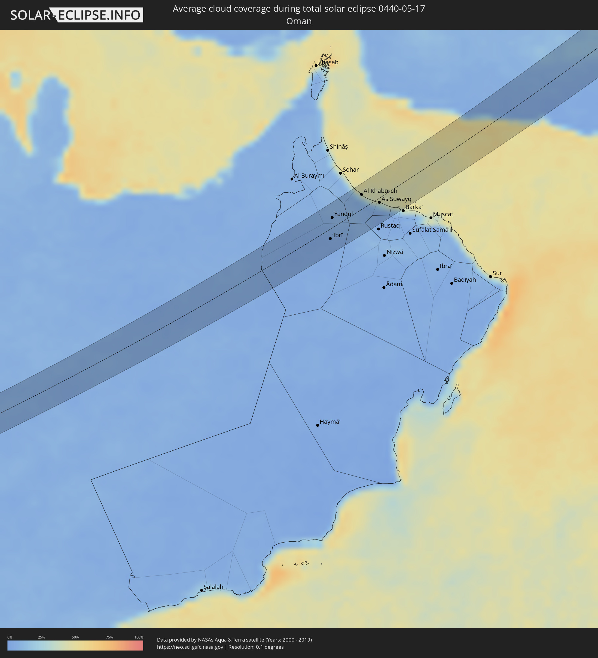 Oman
Oman
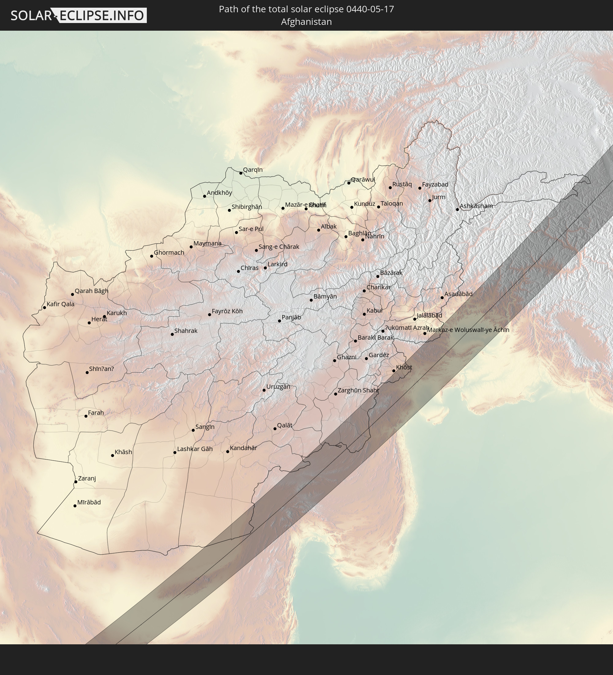
 Afghanistan
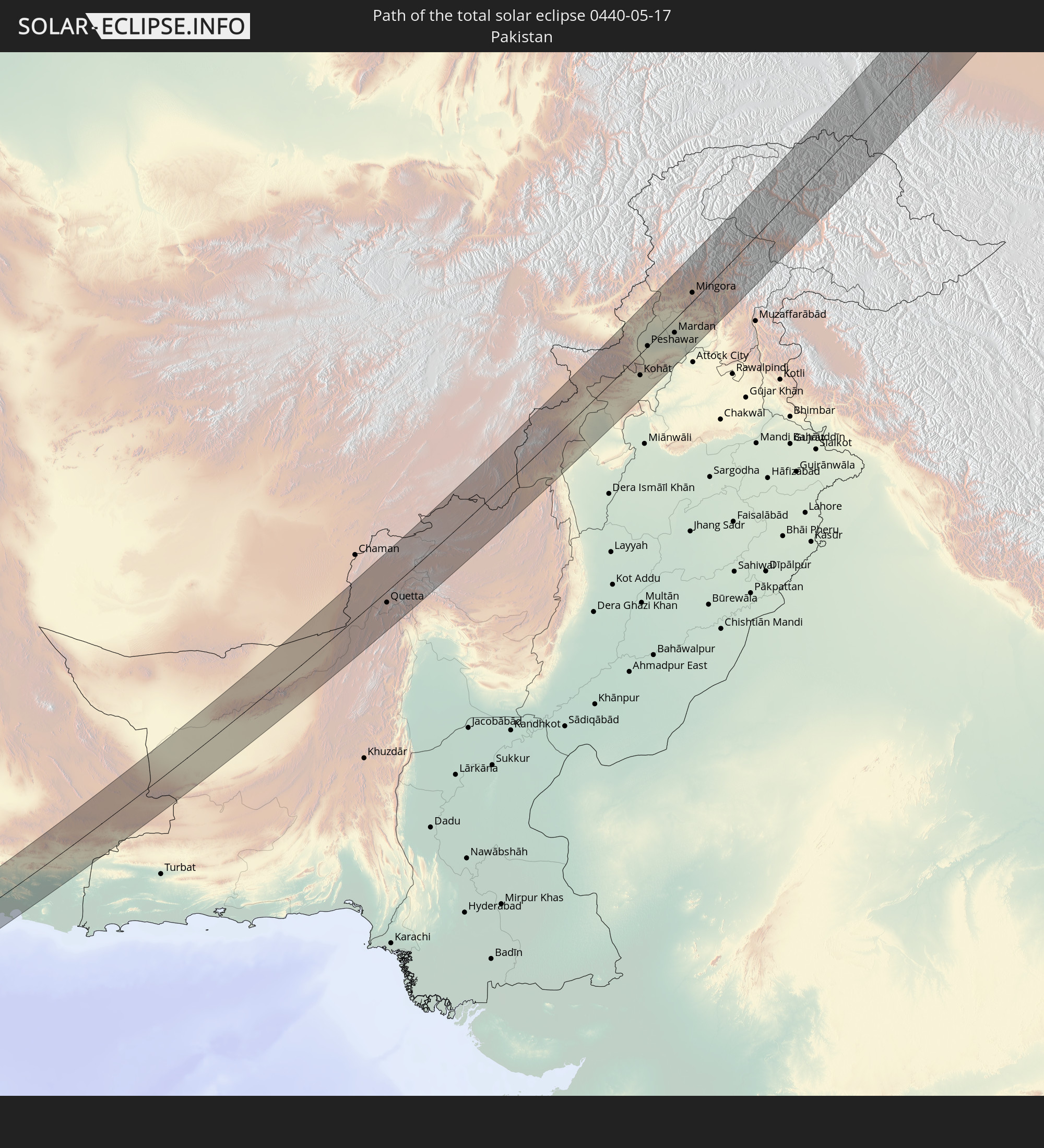
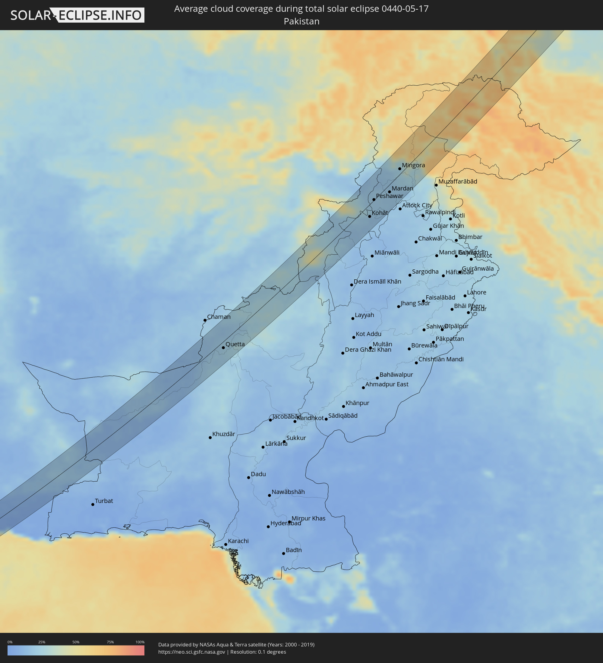 Pakistan
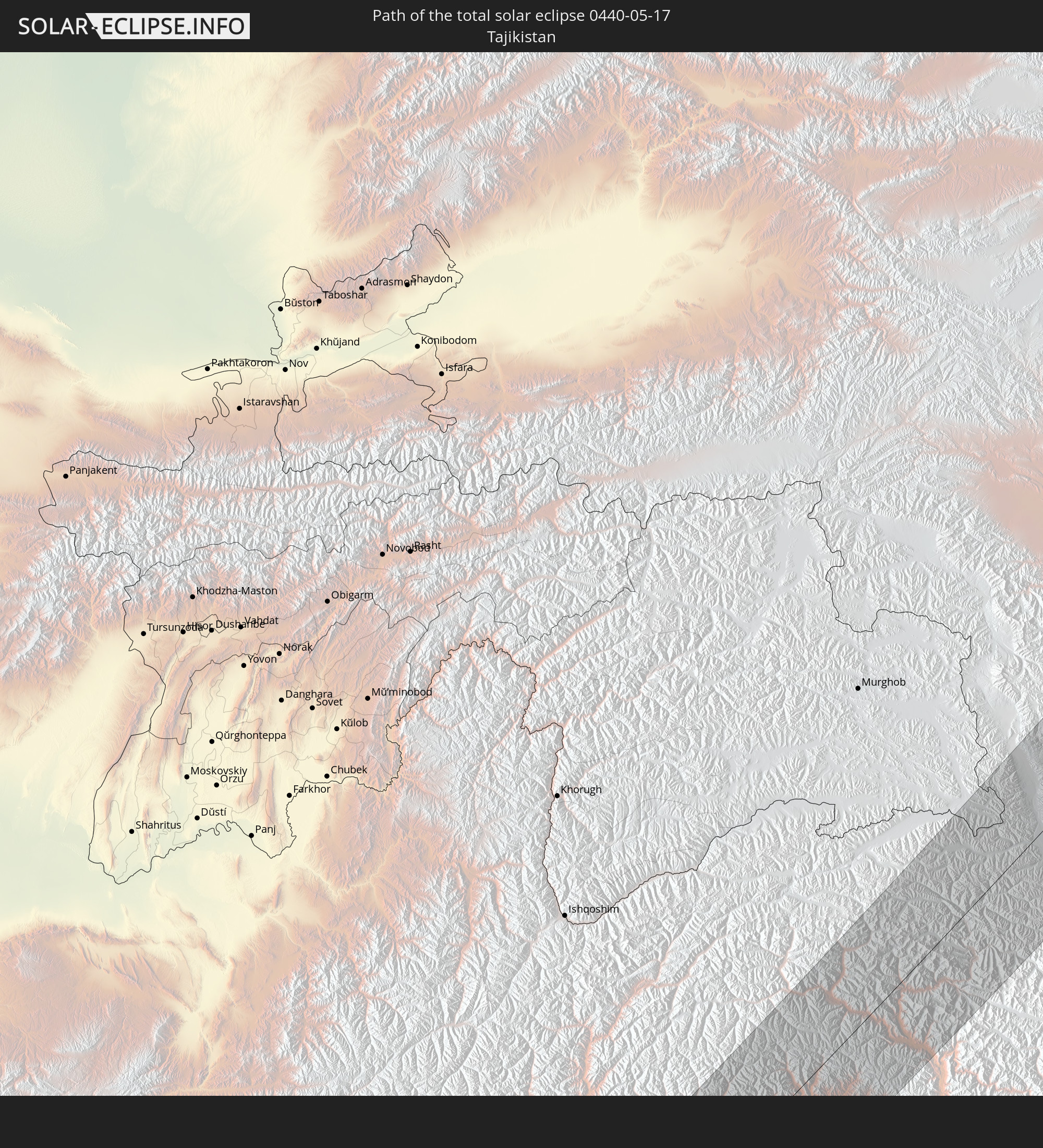
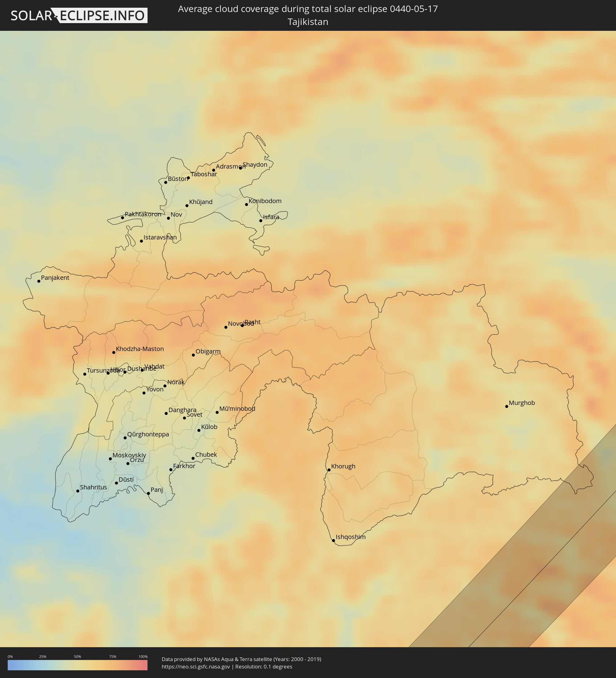 Tadschikistan
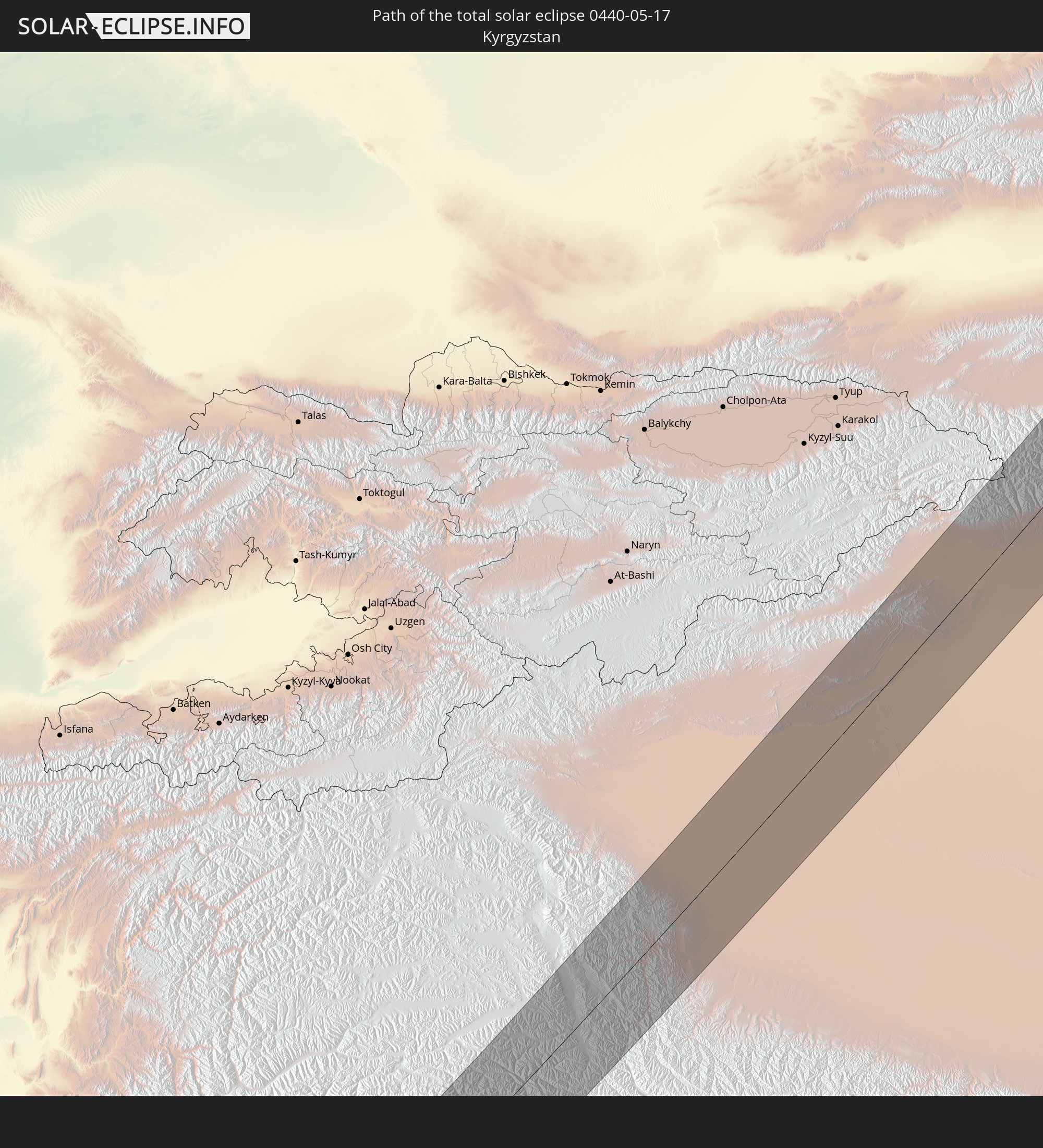
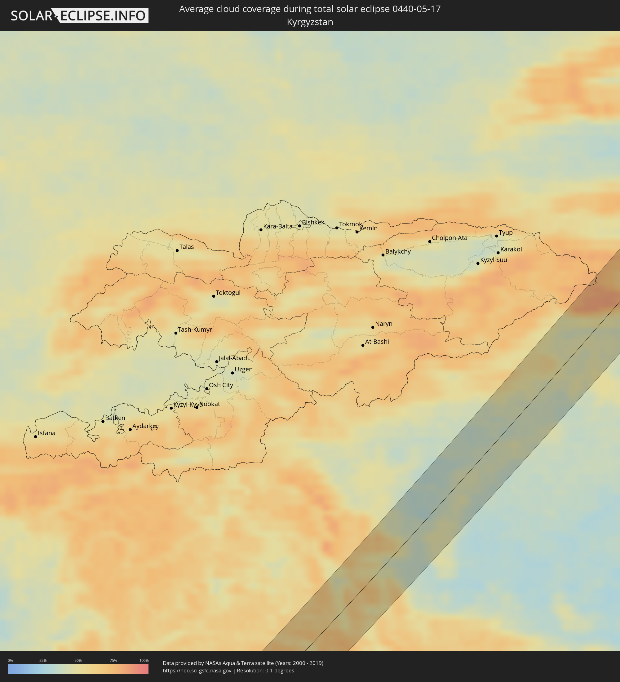 Kirgisistan
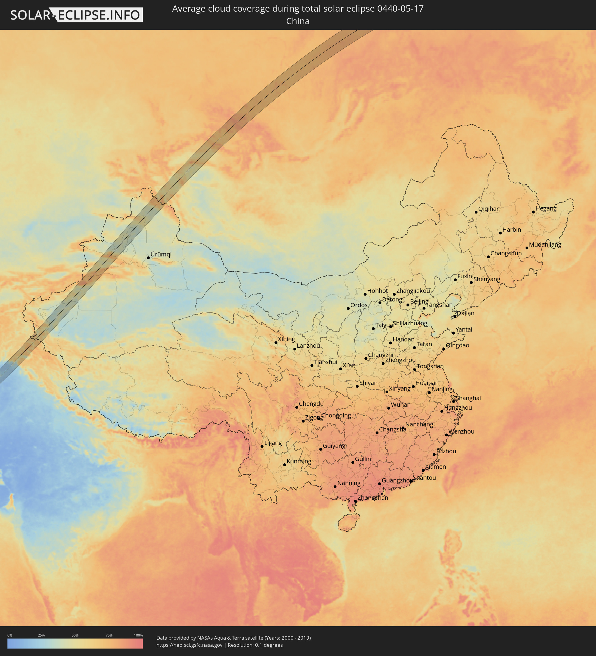 Volksrepublik China
 Mongolei
Orte im Finsternispfad
Die nachfolgene Tabelle zeigt Städte und Orte mit mehr als 5.000 Einwohnern, die sich im Finsternispfad befinden. Städte mit mehr als 100.000 Einwohnern sind dick gekennzeichnet. Mit einem Klick auf den Ort öffnet sich eine Detailkarte die die Lage des jeweiligen Ortes zusammen mit dem Verlauf der zentralen Finsternis präsentiert.
| Ort | Typ | Dauer der Verfinsterung | Ortszeit bei maximaler Verfinsterung | Entfernung zur Zentrallinie | Ø Bewölkung |
|
Şabyā, Jizan
|
total | - | 05:45:45 UTC+03:06 | 25 km | 18% |
|
Mizhirah, Jizan
|
total | - | 05:45:20 UTC+03:06 | 29 km | 33% |
|
Abū ‘Arīsh, Jizan
|
total | - | 05:45:28 UTC+03:06 | 12 km | 13% |
|
Najrān, Najran
|
total | - | 05:45:34 UTC+03:06 | 14 km | 9% |
|
‘Ibrī, Az̧ Z̧āhirah
|
total | - | 06:24:46 UTC+03:41 | 19 km | 3% |
|
Yanqul, Az̧ Z̧āhirah
|
total | - | 06:25:17 UTC+03:41 | 23 km | 6% |
|
Al Khābūrah, Al Batinah North Governorate
|
total | - | 06:25:52 UTC+03:41 | 36 km | 14% |
|
As Suwayq, Al Batinah North Governorate
|
total | - | 06:25:39 UTC+03:41 | 15 km | 4% |
|
Qaşr-e Qand, Sistan and Baluchestan
|
total | - | 06:14:00 UTC+03:25 | 28 km | 8% |
|
Dālbandīn, Balochistān
|
total | - | 07:21:24 UTC+04:28 | 42 km | 16% |
|
Nushki, Balochistān
|
total | - | 07:22:56 UTC+04:28 | 7 km | 10% |
|
Mastung, Balochistān
|
total | - | 07:23:37 UTC+04:28 | 39 km | 22% |
|
Kot Malik Barkhurdār, Balochistān
|
total | - | 07:24:22 UTC+04:28 | 18 km | 21% |
|
Pishin, Balochistān
|
total | - | 07:25:01 UTC+04:28 | 24 km | 17% |
|
Quetta, Balochistān
|
total | - | 07:24:22 UTC+04:28 | 19 km | 21% |
|
Alik Ghund, Balochistān
|
total | - | 07:25:02 UTC+04:28 | 29 km | 22% |
|
Bannu, Khyber Pakhtunkhwa
|
total | - | 07:30:44 UTC+04:28 | 18 km | 23% |
|
Doāba, Khyber Pakhtunkhwa
|
total | - | 07:31:37 UTC+04:28 | 27 km | 18% |
|
Sarāi Naurang, Khyber Pakhtunkhwa
|
total | - | 07:30:32 UTC+04:28 | 42 km | 16% |
|
Hangu, Khyber Pakhtunkhwa
|
total | - | 07:31:57 UTC+04:28 | 6 km | 17% |
|
Karak, Khyber Pakhtunkhwa
|
total | - | 07:31:12 UTC+04:28 | 46 km | 15% |
|
Lāchi, Khyber Pakhtunkhwa
|
total | - | 07:31:49 UTC+04:28 | 35 km | 14% |
|
Kohāt, Khyber Pakhtunkhwa
|
total | - | 07:32:14 UTC+04:28 | 40 km | 17% |
|
Shabqadar, Khyber Pakhtunkhwa
|
total | - | 07:33:28 UTC+04:28 | 31 km | 18% |
|
Peshawar, Khyber Pakhtunkhwa
|
total | - | 07:33:06 UTC+04:28 | 11 km | 19% |
|
Tangi, Khyber Pakhtunkhwa
|
total | - | 07:33:40 UTC+04:28 | 32 km | 19% |
|
Chārsadda, Khyber Pakhtunkhwa
|
total | - | 07:33:26 UTC+04:28 | 32 km | 18% |
|
Utmānzai, Khyber Pakhtunkhwa
|
total | - | 07:33:31 UTC+04:28 | 28 km | 20% |
|
Pabbi, Khyber Pakhtunkhwa
|
total | - | 07:33:12 UTC+04:28 | 28 km | 18% |
|
Amān Garh, Khyber Pakhtunkhwa
|
total | - | 07:33:16 UTC+04:28 | 39 km | 18% |
|
Bat Khela, Khyber Pakhtunkhwa
|
total | - | 07:34:26 UTC+04:28 | 30 km | 16% |
|
Risalpur Cantonment, Khyber Pakhtunkhwa
|
total | - | 07:33:24 UTC+04:28 | 32 km | 17% |
|
Nowshera Cantonment, Khyber Pakhtunkhwa
|
total | - | 07:33:17 UTC+04:28 | 39 km | 18% |
|
Mardan, Khyber Pakhtunkhwa
|
total | - | 07:33:41 UTC+04:28 | 17 km | 19% |
|
Akora, Khyber Pakhtunkhwa
|
total | - | 07:33:22 UTC+04:28 | 40 km | 17% |
|
Mingora, Khyber Pakhtunkhwa
|
total | - | 07:34:56 UTC+04:28 | 13 km | 24% |
|
Swābi, Khyber Pakhtunkhwa
|
total | - | 07:33:45 UTC+04:28 | 50 km | 19% |
|
Gilgit, Gilgit-Baltistan
|
total | - | 07:38:11 UTC+04:28 | 31 km | 61% |
|
Shache, Xinjiang Uyghur Autonomous Region
|
total | - | 11:16:43 UTC+08:00 | 30 km | 47% |
|
Aykol, Xinjiang Uyghur Autonomous Region
|
total | - | 11:23:52 UTC+08:00 | 29 km | 45% |
|
Aksu, Xinjiang Uyghur Autonomous Region
|
total | - | 11:24:26 UTC+08:00 | 23 km | 46% |
|
Baijiantan, Xinjiang Uyghur Autonomous Region
|
total | - | 11:37:31 UTC+08:00 | 30 km | 44% |
|
Hoxtolgay, Xinjiang Uyghur Autonomous Region
|
total | - | 11:39:56 UTC+08:00 | 38 km | 43% |
|
Altay, Xinjiang Uyghur Autonomous Region
|
total | - | 11:44:34 UTC+08:00 | 24 km | 45% |
|
Ölgiy, Bayan-Ölgiy
|
total | - | 09:55:07 UTC+06:06 | 14 km | 56% |
|
Ulaangom, Uvs
|
total | - | 09:59:11 UTC+06:06 | 43 km | 47% |
|
Shagonar, Tyva
|
total | - | 10:07:30 UTC+06:11 | 50 km | 51% |
|
Turan, Tyva
|
total | - | 10:09:45 UTC+06:11 | 42 km | 61% |
|
Kyzyl, Tyva
|
total | - | 10:09:37 UTC+06:11 | 31 km | 53% |
|
Kaa-Khem, Tyva
|
total | - | 10:09:53 UTC+06:11 | 42 km | 53% |
|
Nizhneudinsk, Irkutsk
|
total | - | 11:05:23 UTC+06:57 | 33 km | 72% |
|
Vikhorevka, Irkutsk
|
total | - | 11:09:29 UTC+06:57 | 46 km | 73% |
|
Bratsk, Irkutsk
|
total | - | 11:09:59 UTC+06:57 | 29 km | 75% |
|
Novaya Igirma, Irkutsk
|
total | - | 11:13:51 UTC+06:57 | 31 km | 73% |
|
Zheleznogorsk-Ilimskiy, Irkutsk
|
total | - | 11:13:26 UTC+06:57 | 32 km | 73% |
|
Lensk, Sakha
|
total | - | 13:11:19 UTC+08:38 | 18 km | 73% |
|
Ust-Nera, Sakha
|
total | - | 13:46:49 UTC+08:47 | 20 km | 75% |