Totale Sonnenfinsternis vom 12.05.1203
| Wochentag: | Montag |
| Maximale Dauer der Verfinsterung: | 05m26s |
| Maximale Breite des Finsternispfades: | 275 km |
| Saroszyklus: | 115 |
| Bedeckungsgrad: | 100% |
| Magnitude: | 1.0755 |
| Gamma: | 0.4596 |
Wo kann man die Sonnenfinsternis vom 12.05.1203 sehen?
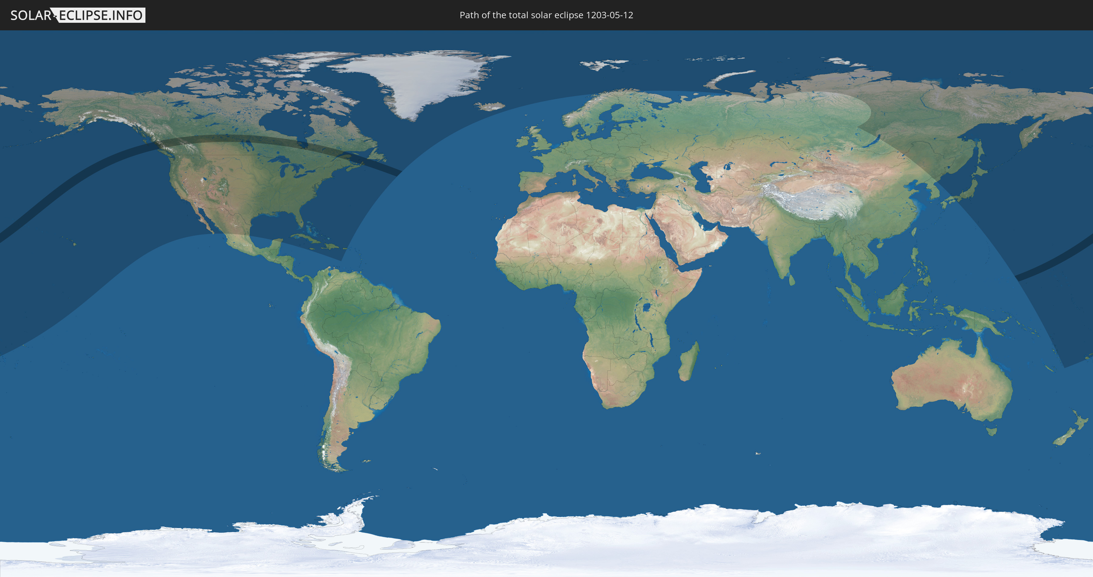
Die Sonnenfinsternis am 12.05.1203 kann man in 36 Ländern als partielle Sonnenfinsternis beobachten.
Der Finsternispfad verläuft durch 5 Länder. Nur in diesen Ländern ist sie als totale Sonnenfinsternis zu sehen.
In den folgenden Ländern ist die Sonnenfinsternis total zu sehen
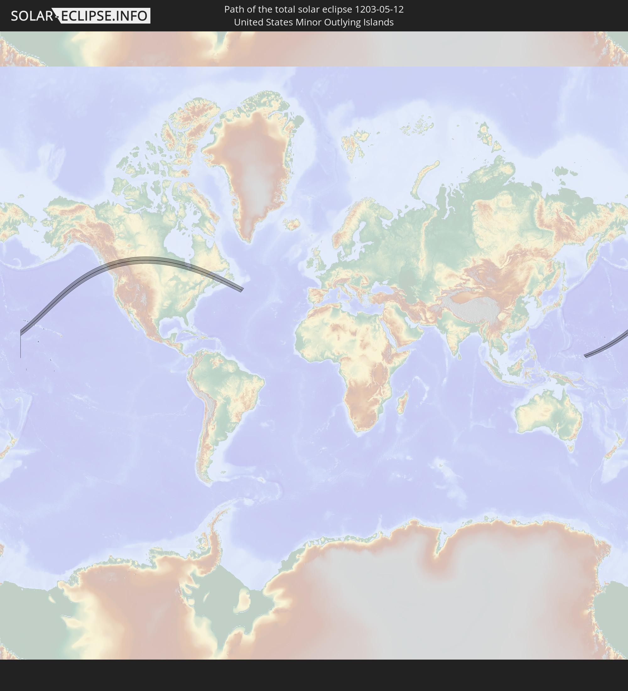 United States Minor Outlying Islands
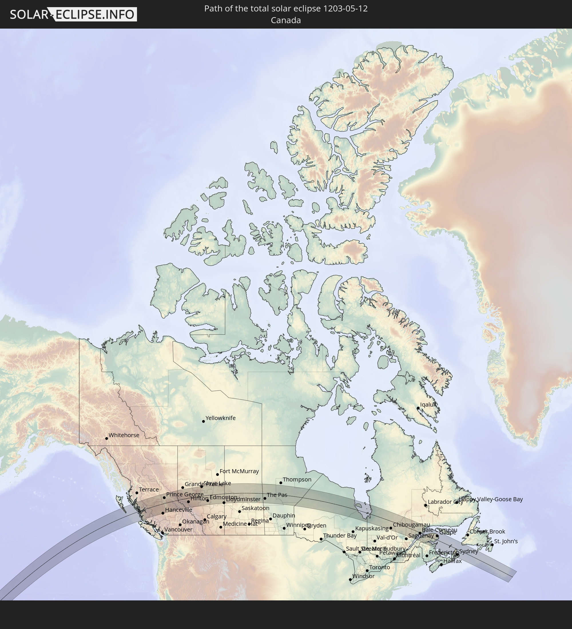 Kanada
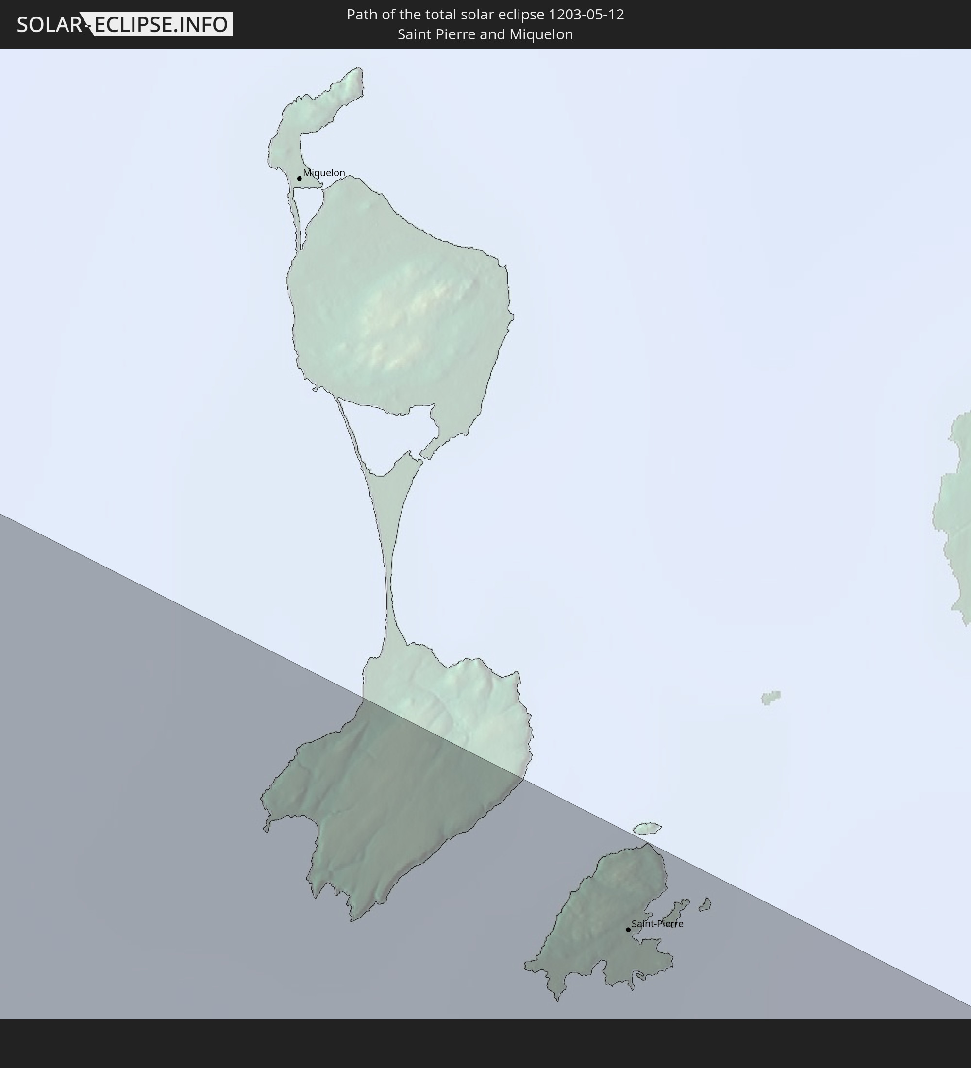 Saint-Pierre und Miquelon
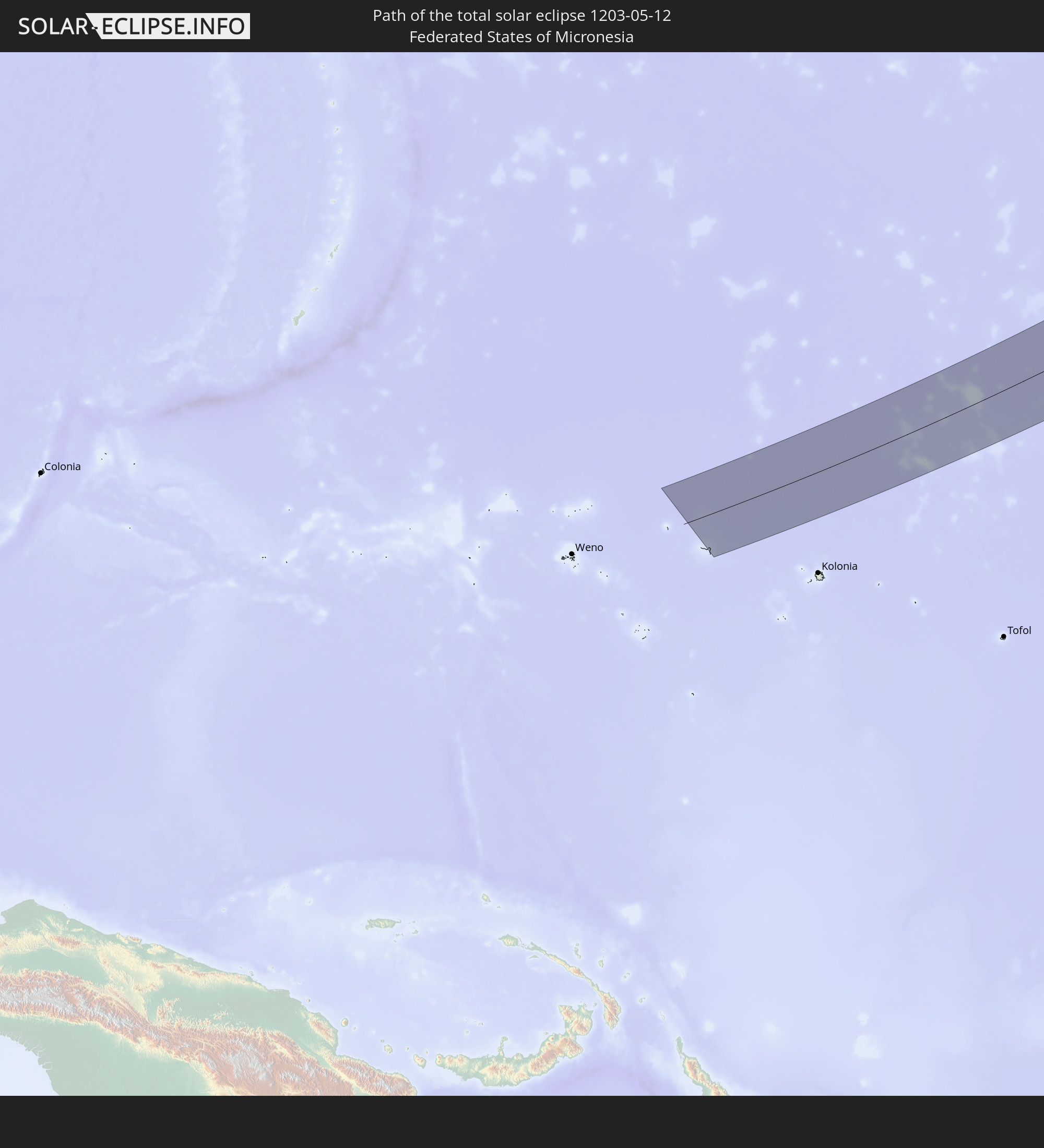 Föderierte Staaten von Mikronesien
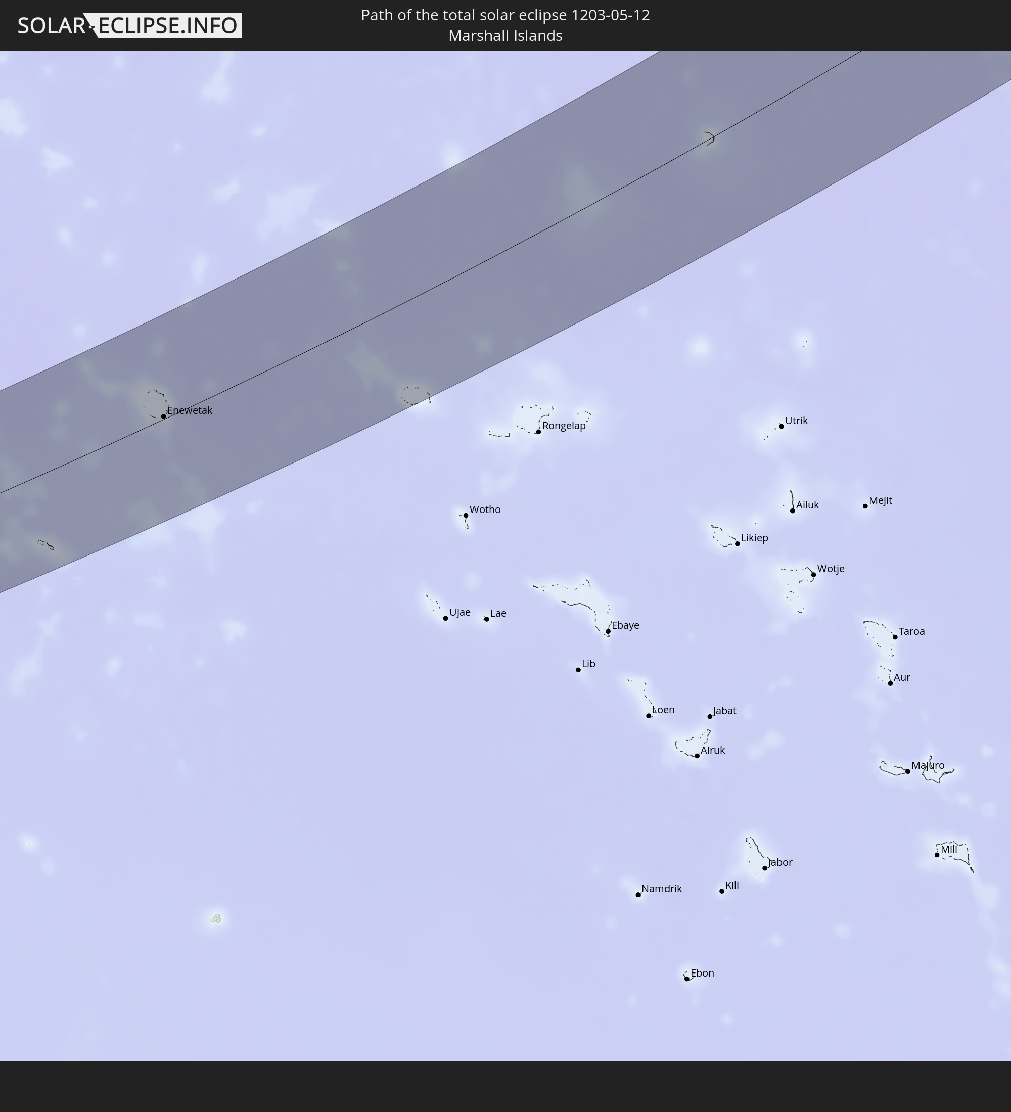 Marshallinseln
In den folgenden Ländern ist die Sonnenfinsternis partiell zu sehen
 Fidschi
 Russland
 Vereinigte Staaten
 United States Minor Outlying Islands
 Wallis und Futuna
 Kiribati
 Samoa
Samoa
 Tokelau
 Amerikanisch-Samoa
 Kanada
 Mexiko
 Grönland
 Kuba
Kuba
 Kaimaninseln
 Bahamas
 Jamaika
 Haiti
Haiti
 Turks- und Caicosinseln
 Dominikanische Republik
 Puerto Rico
 Bermuda
 Saint-Pierre und Miquelon
 Island
 Spitzbergen
 Norwegen
 Finnland
 Volksrepublik China
 Mongolei
 Japan
Japan
 Nordkorea
 Föderierte Staaten von Mikronesien
 Salomonen
 Marshallinseln
 Vanuatu
 Nauru
Nauru
 Tuvalu
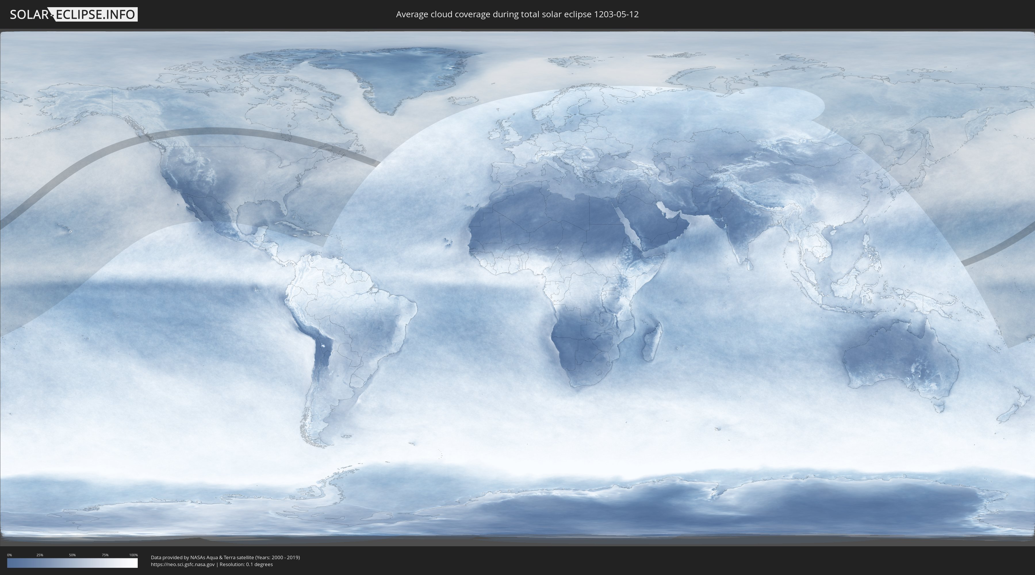
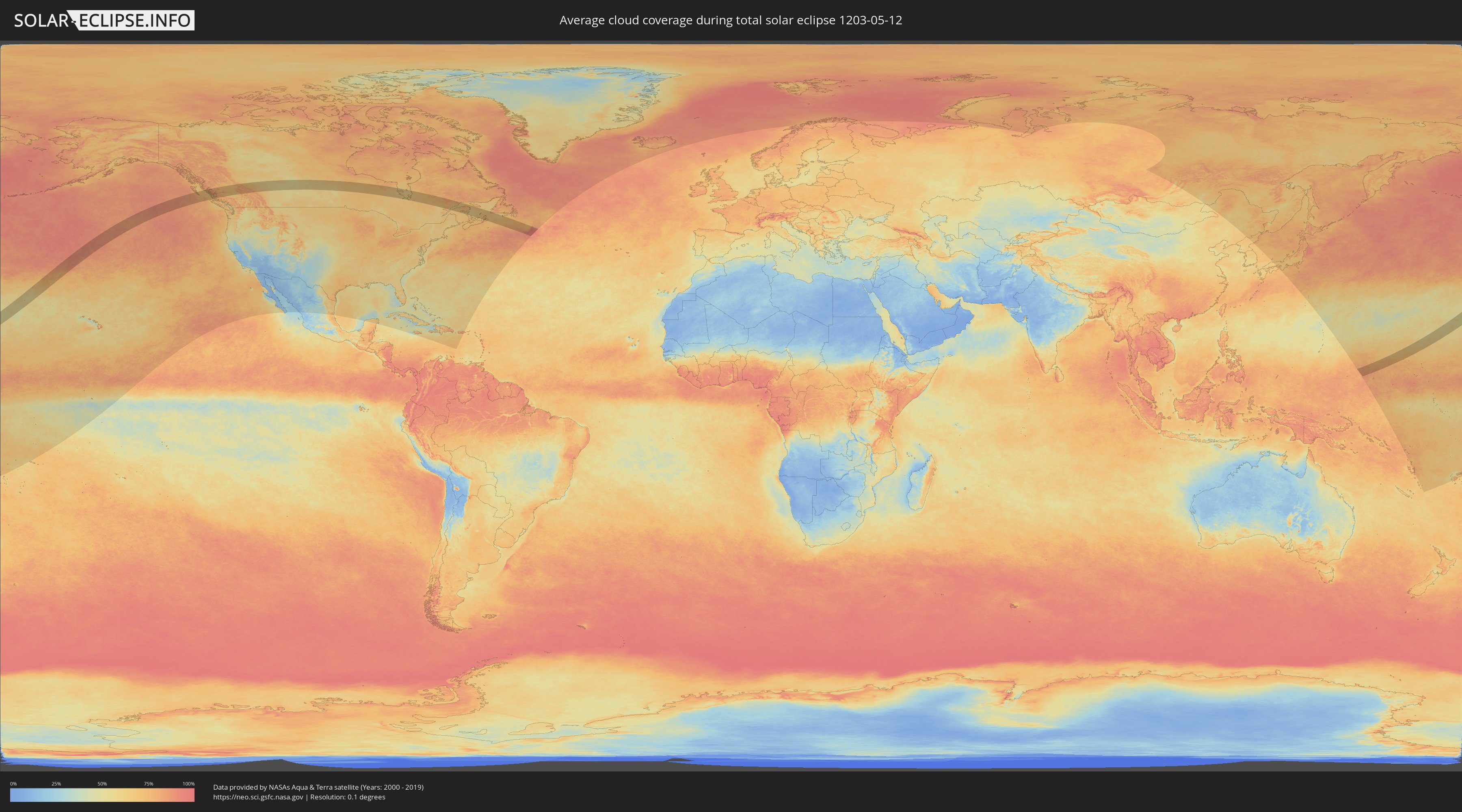
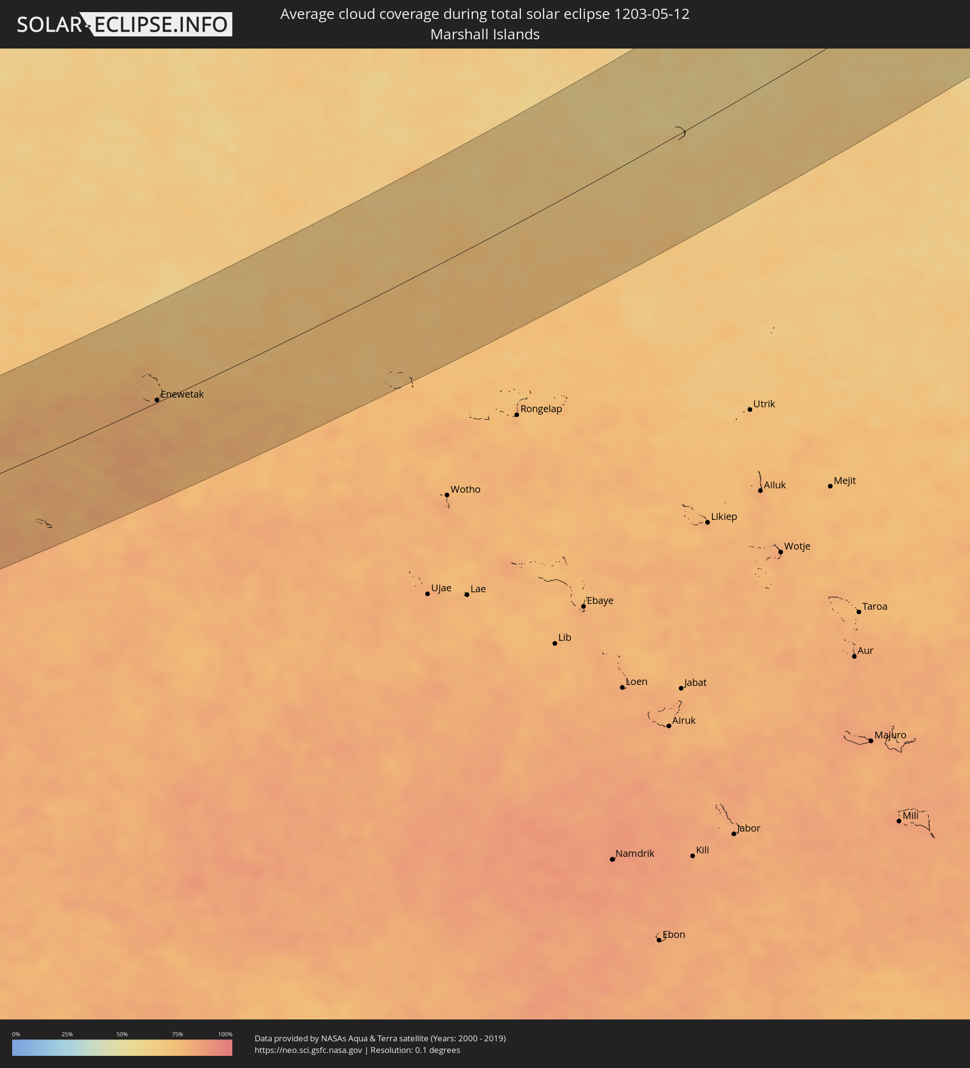
Wie wird das Wetter während der totalen Sonnenfinsternis am 12.05.1203?
Wo ist der beste Ort, um die totale Sonnenfinsternis vom 12.05.1203 zu beobachten?
Die folgenden Karten zeigen die durchschnittliche Bewölkung für den Tag, an dem die totale Sonnenfinsternis
stattfindet. Mit Hilfe der Karten lässt sich der Ort entlang des Finsternispfades eingrenzen,
der die besten Aussichen auf einen klaren wolkenfreien Himmel bietet.
Trotzdem muss man immer lokale Gegenenheiten beachten und sollte sich genau über das Wetter an seinem
gewählten Beobachtungsort informieren.
Die Daten stammen von den beiden NASA-Satelliten
AQUA und TERRA
und wurden über einen Zeitraum von 19 Jahren (2000 - 2019) gemittelt.
Detaillierte Länderkarten
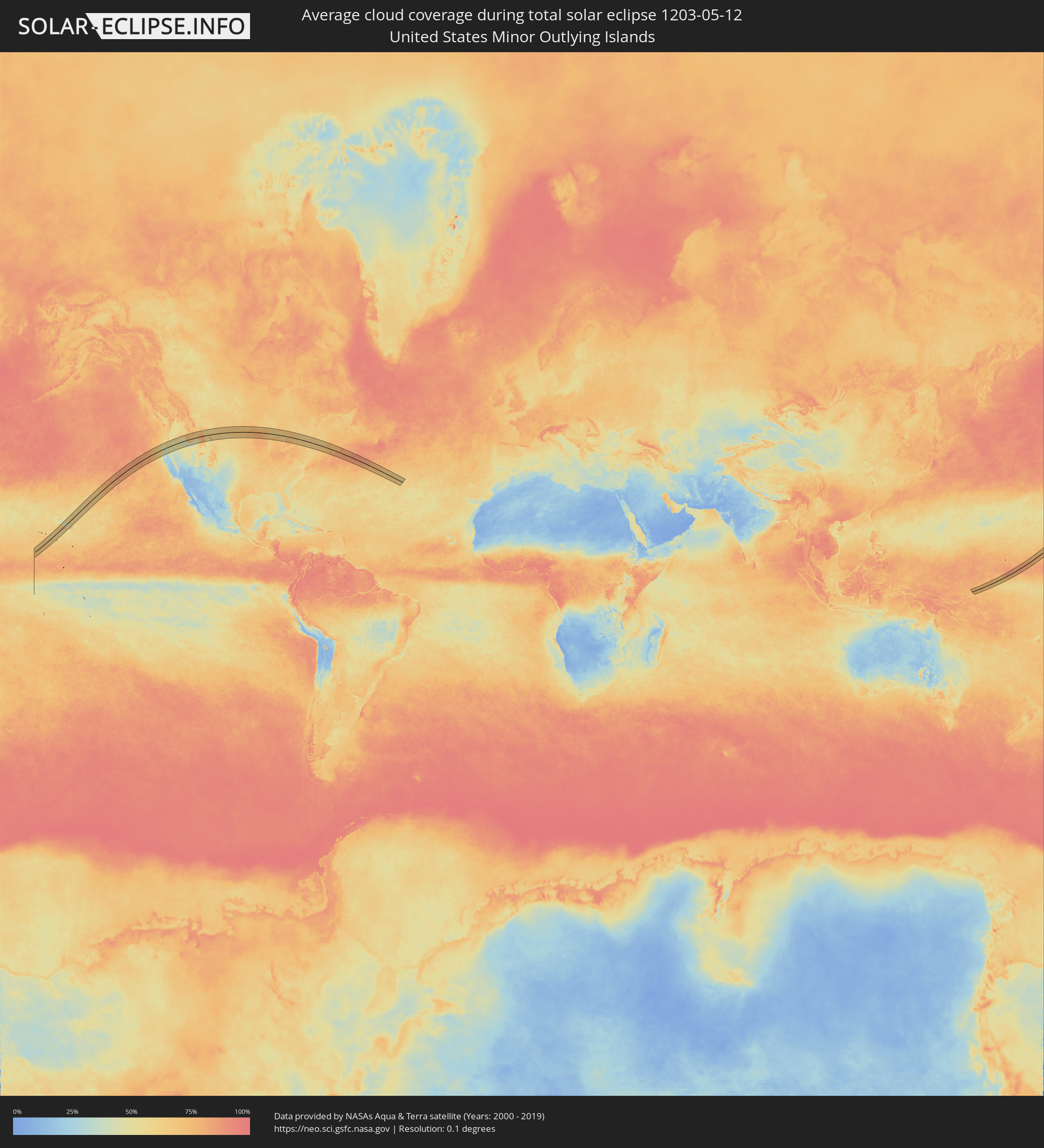 United States Minor Outlying Islands
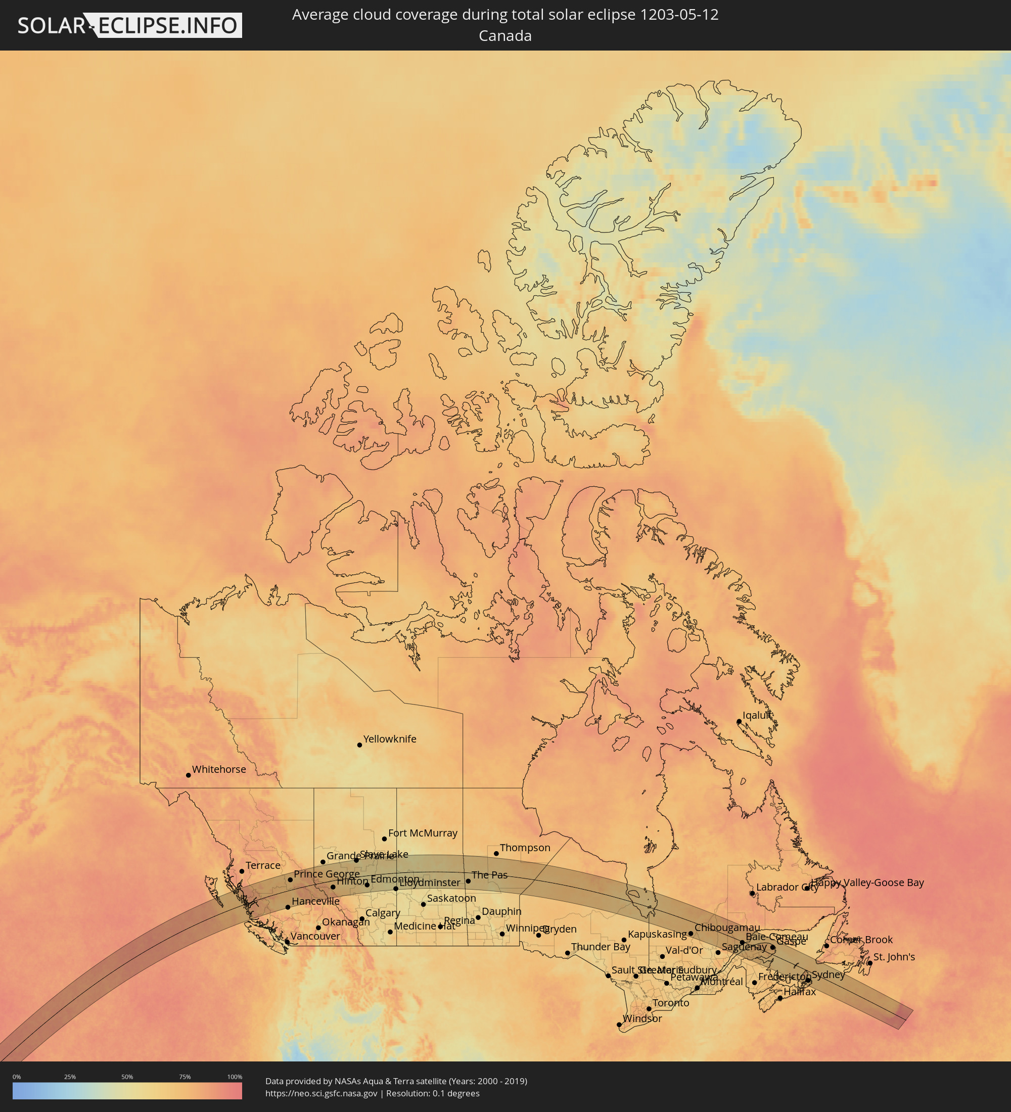 Kanada
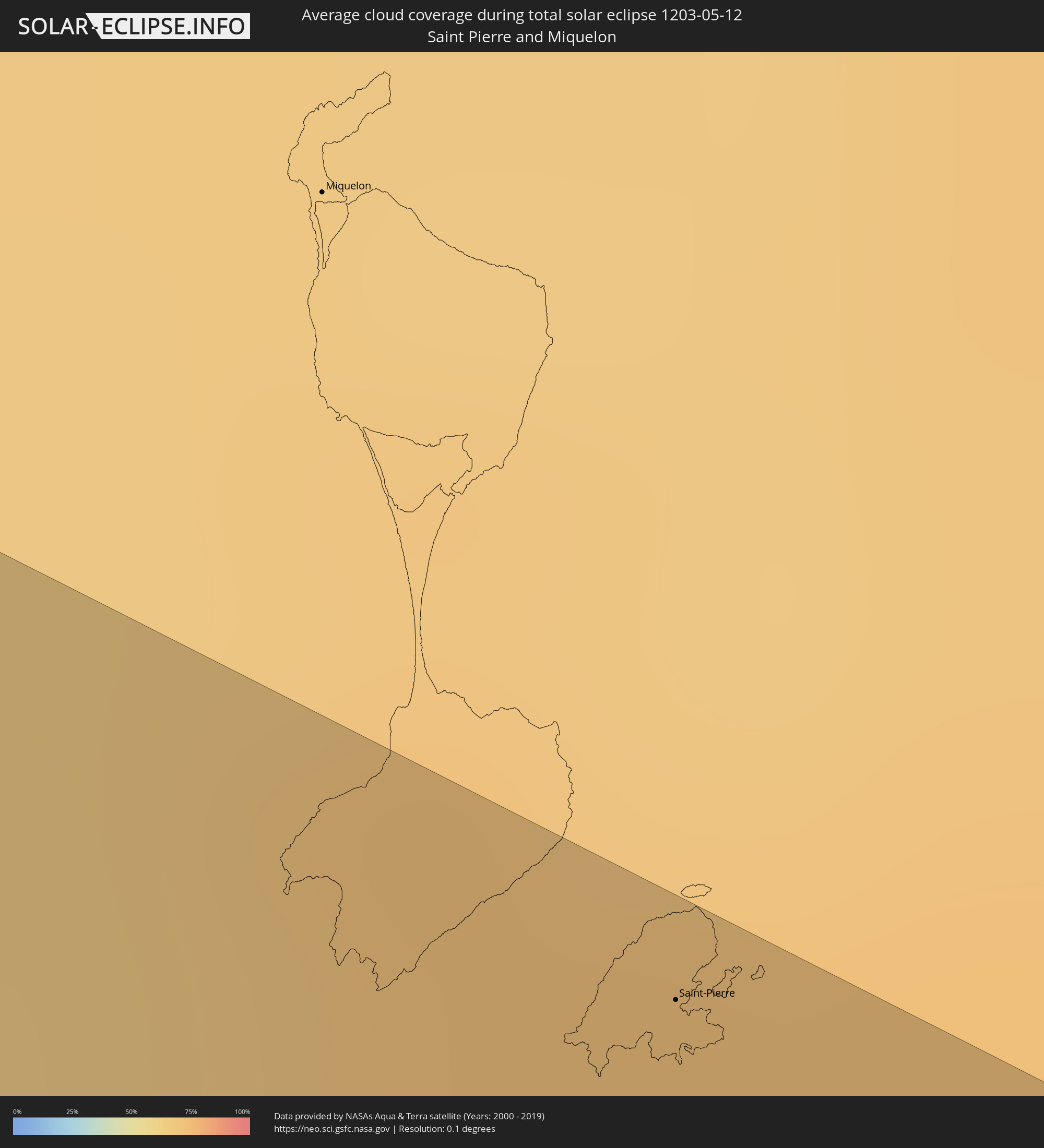 Saint-Pierre und Miquelon
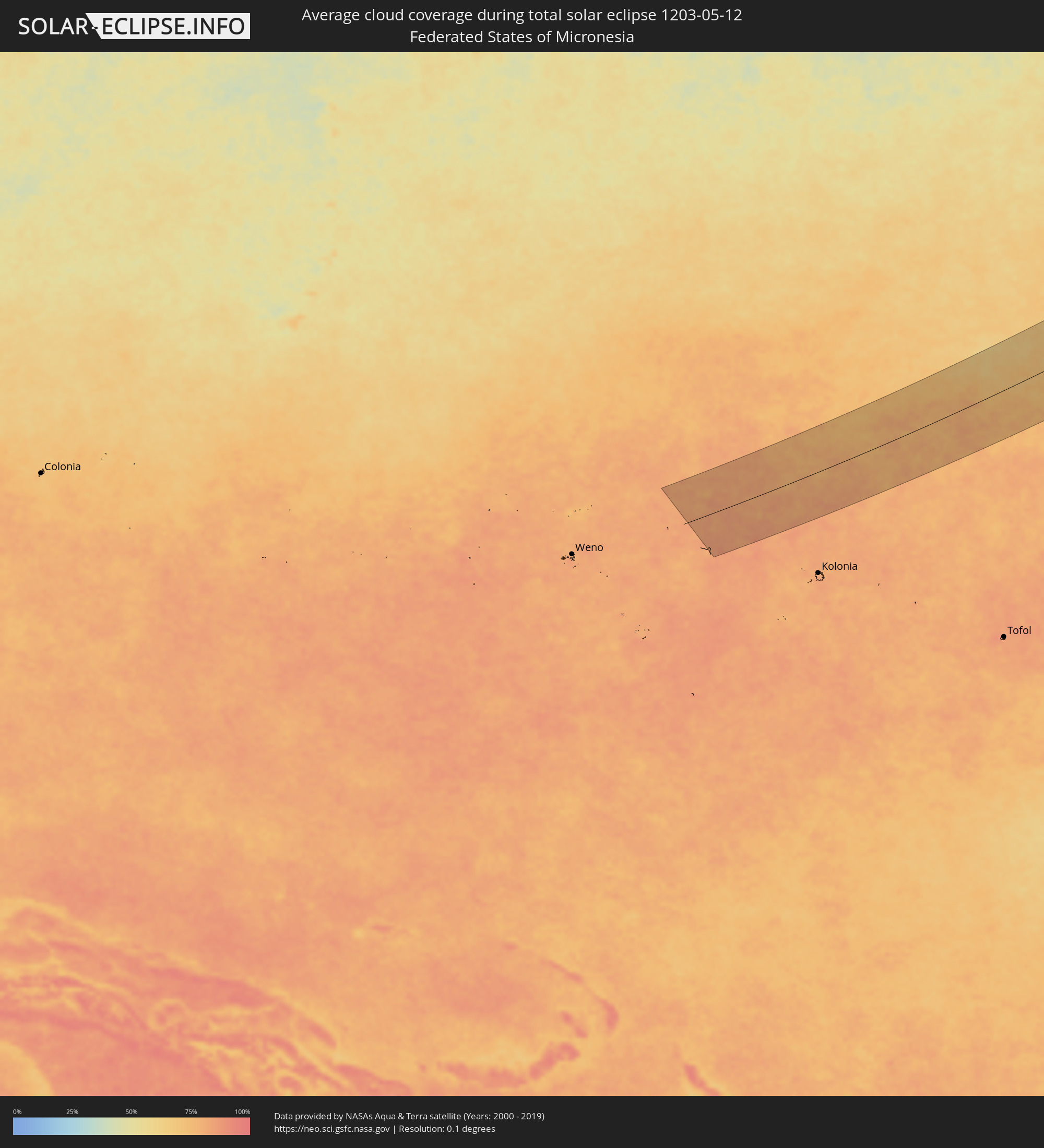 Föderierte Staaten von Mikronesien
 Marshallinseln
Orte im Finsternispfad
Die nachfolgene Tabelle zeigt Städte und Orte mit mehr als 5.000 Einwohnern, die sich im Finsternispfad befinden. Städte mit mehr als 100.000 Einwohnern sind dick gekennzeichnet. Mit einem Klick auf den Ort öffnet sich eine Detailkarte die die Lage des jeweiligen Ortes zusammen mit dem Verlauf der zentralen Finsternis präsentiert.
| Ort | Typ | Dauer der Verfinsterung | Ortszeit bei maximaler Verfinsterung | Entfernung zur Zentrallinie | Ø Bewölkung |
|
Prince George, British Columbia
|
total | - | 13:36:30 UTC-08:00 | 74 km | 70% |
|
Quesnel, British Columbia
|
total | - | 13:36:48 UTC-08:00 | 32 km | 67% |
|
Williams Lake, British Columbia
|
total | - | 13:37:13 UTC-08:00 | 128 km | 68% |
|
Hinton, Alberta
|
total | - | 14:09:07 UTC-07:33 | 56 km | 67% |
|
Edson, Alberta
|
total | - | 14:10:28 UTC-07:33 | 48 km | 62% |
|
Whitecourt, Alberta
|
total | - | 14:11:12 UTC-07:33 | 7 km | 62% |
|
Drayton Valley, Alberta
|
total | - | 14:12:18 UTC-07:33 | 103 km | 64% |
|
Slave Lake, Alberta
|
total | - | 14:11:53 UTC-07:33 | 123 km | 54% |
|
Stony Plain, Alberta
|
total | - | 14:13:22 UTC-07:33 | 76 km | 57% |
|
Spruce Grove, Alberta
|
total | - | 14:13:28 UTC-07:33 | 77 km | 57% |
|
Westlock, Alberta
|
total | - | 14:13:18 UTC-07:33 | 9 km | 54% |
|
Devon, Alberta
|
total | - | 14:13:44 UTC-07:33 | 97 km | 57% |
|
Morinville, Alberta
|
total | - | 14:13:41 UTC-07:33 | 50 km | 55% |
|
St. Albert, Alberta
|
total | - | 14:13:46 UTC-07:33 | 68 km | 60% |
|
Leduc, Alberta
|
total | - | 14:13:59 UTC-07:33 | 109 km | 55% |
|
Edmonton, Alberta
|
total | - | 14:13:59 UTC-07:33 | 79 km | 59% |
|
Beaumont, Alberta
|
total | - | 14:14:07 UTC-07:33 | 101 km | 57% |
|
Silver Berry, Alberta
|
total | - | 14:14:07 UTC-07:33 | 90 km | 58% |
|
Wild Rose, Alberta
|
total | - | 14:14:07 UTC-07:33 | 88 km | 58% |
|
Sherwood Park, Alberta
|
total | - | 14:14:10 UTC-07:33 | 84 km | 58% |
|
Fort Saskatchewan, Alberta
|
total | - | 14:14:12 UTC-07:33 | 62 km | 54% |
|
Vegreville, Alberta
|
total | - | 14:15:38 UTC-07:33 | 94 km | 55% |
|
Bonnyville, Alberta
|
total | - | 14:16:44 UTC-07:33 | 17 km | 53% |
|
Cold Lake, Alberta
|
total | - | 14:17:14 UTC-07:33 | 3 km | 52% |
|
Lloydminster, Saskatchewan
|
total | - | 14:18:02 UTC-07:33 | 129 km | 51% |
|
Flin Flon, Manitoba
|
total | - | 15:59:02 UTC-06:00 | 31 km | 60% |
|
The Pas, Manitoba
|
total | - | 16:00:21 UTC-06:00 | 71 km | 59% |
|
Chibougamau, Quebec
|
total | - | 17:20:25 UTC-05:00 | 102 km | 72% |
|
Rimouski, Quebec
|
total | - | 17:23:12 UTC-05:00 | 100 km | 66% |
|
Mont-Joli, Quebec
|
total | - | 17:23:05 UTC-05:00 | 77 km | 63% |
|
Baie-Comeau, Quebec
|
total | - | 17:22:24 UTC-05:00 | 11 km | 65% |
|
Matane, Quebec
|
total | - | 17:22:54 UTC-05:00 | 33 km | 67% |
|
Amqui, Quebec
|
total | - | 17:23:18 UTC-05:00 | 68 km | 71% |
|
Port-Cartier, Quebec
|
total | - | 17:21:38 UTC-05:00 | 109 km | 69% |
|
Campbellton, New Brunswick
|
total | - | 18:09:28 UTC-04:14 | 93 km | 71% |
|
Sainte-Anne-des-Monts, Quebec
|
total | - | 17:22:40 UTC-05:00 | 27 km | 66% |
|
Bathurst, New Brunswick
|
total | - | 18:09:58 UTC-04:14 | 102 km | 67% |
|
Chandler, Quebec
|
total | - | 17:23:37 UTC-05:00 | 2 km | 69% |
|
Gaspé, Quebec
|
total | - | 17:23:06 UTC-05:00 | 57 km | 70% |
|
Sydney Mines, Nova Scotia
|
total | - | 18:11:22 UTC-04:14 | 72 km | 67% |
|
Sydney, Nova Scotia
|
total | - | 18:11:28 UTC-04:14 | 81 km | 71% |
|
Glace Bay, Nova Scotia
|
total | - | 18:11:23 UTC-04:14 | 67 km | 66% |
|
Saint-Pierre, Saint-Pierre
|
total | - | 18:40:07 UTC-03:44 | 118 km | 71% |
|
Enewetak, Enewetak Atoll
|
total | - | 06:25:27 UTC+11:00 | 2 km | 75% |