Totale Sonnenfinsternis vom 04.03.1821
| Wochentag: | Sonntag |
| Maximale Dauer der Verfinsterung: | 04m14s |
| Maximale Breite des Finsternispfades: | 168 km |
| Saroszyklus: | 127 |
| Bedeckungsgrad: | 100% |
| Magnitude: | 1.0506 |
| Gamma: | -0.0284 |
Wo kann man die Sonnenfinsternis vom 04.03.1821 sehen?
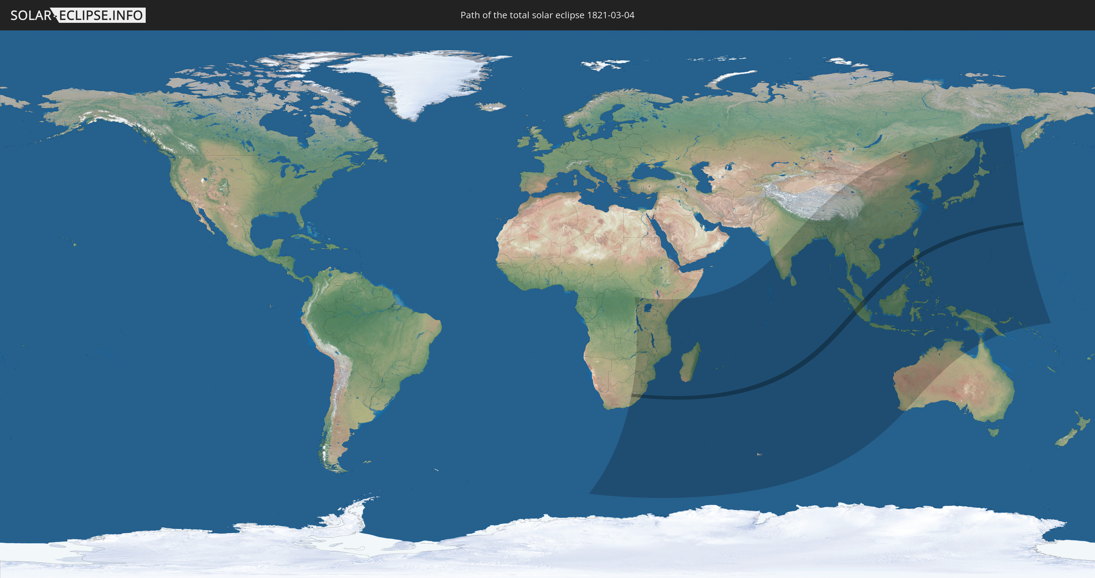
Die Sonnenfinsternis am 04.03.1821 kann man in 59 Ländern als partielle Sonnenfinsternis beobachten.
Der Finsternispfad verläuft durch 7 Länder. Nur in diesen Ländern ist sie als totale Sonnenfinsternis zu sehen.
In den folgenden Ländern ist die Sonnenfinsternis total zu sehen
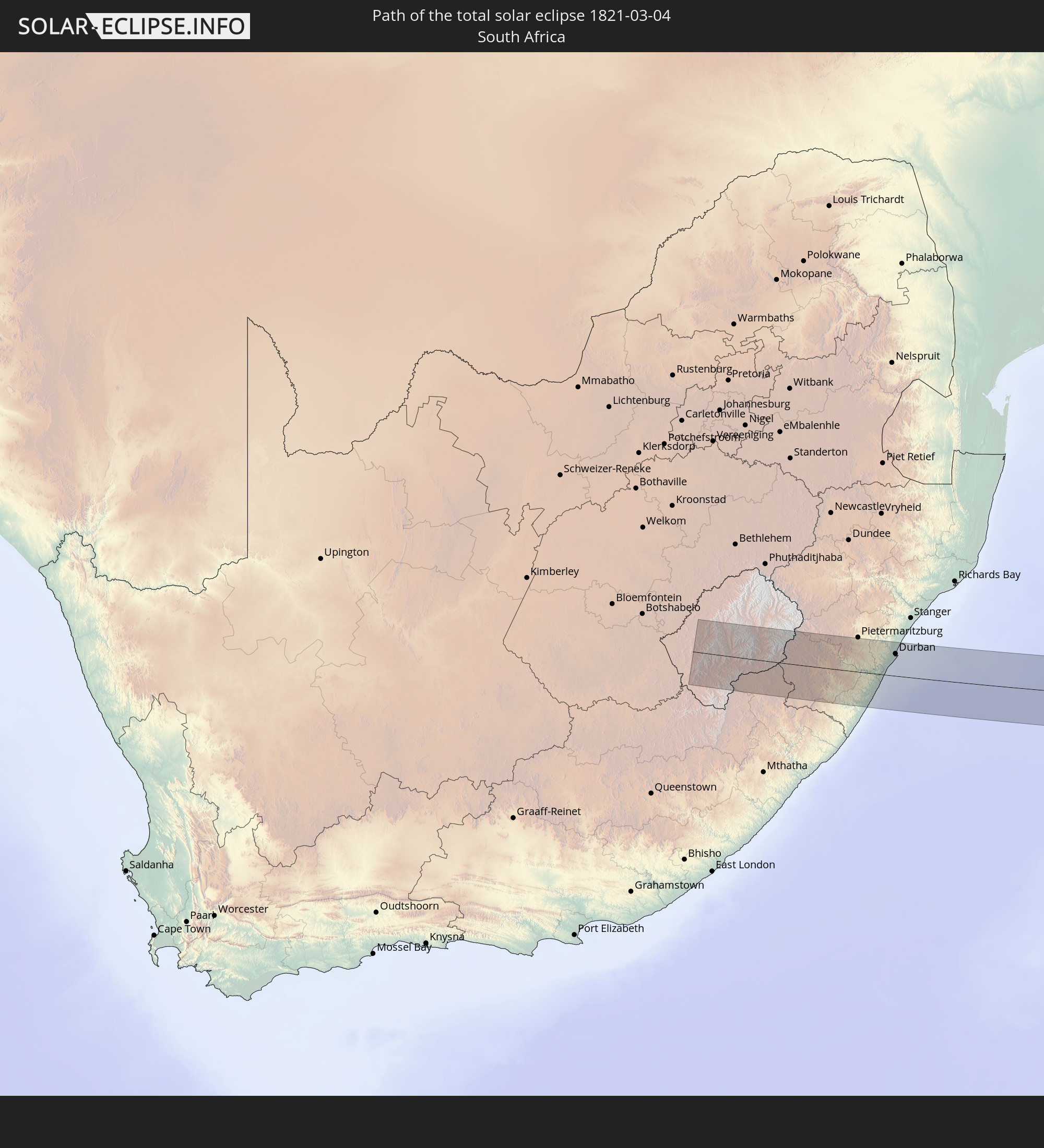 Südafrika
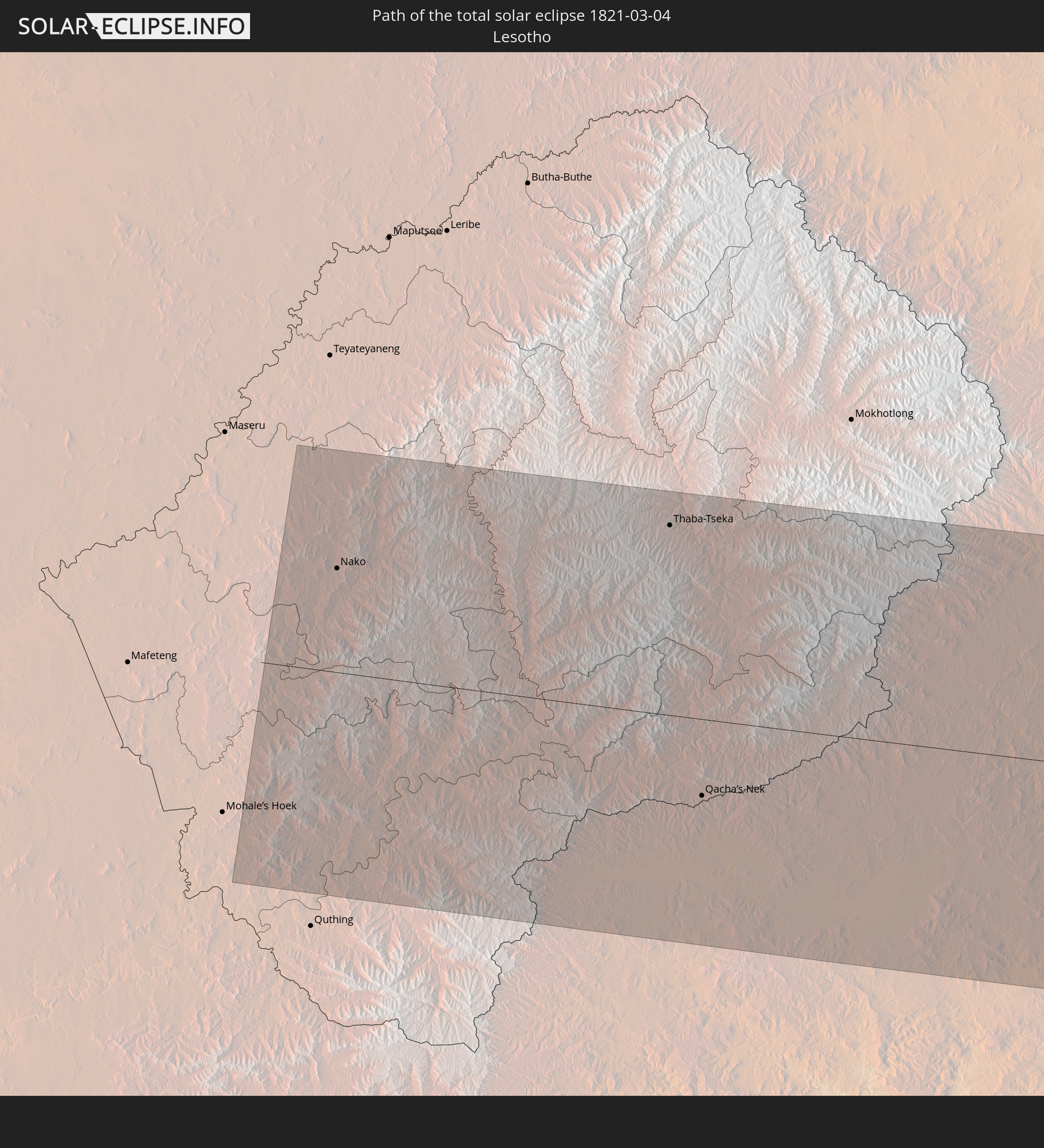 Lesotho
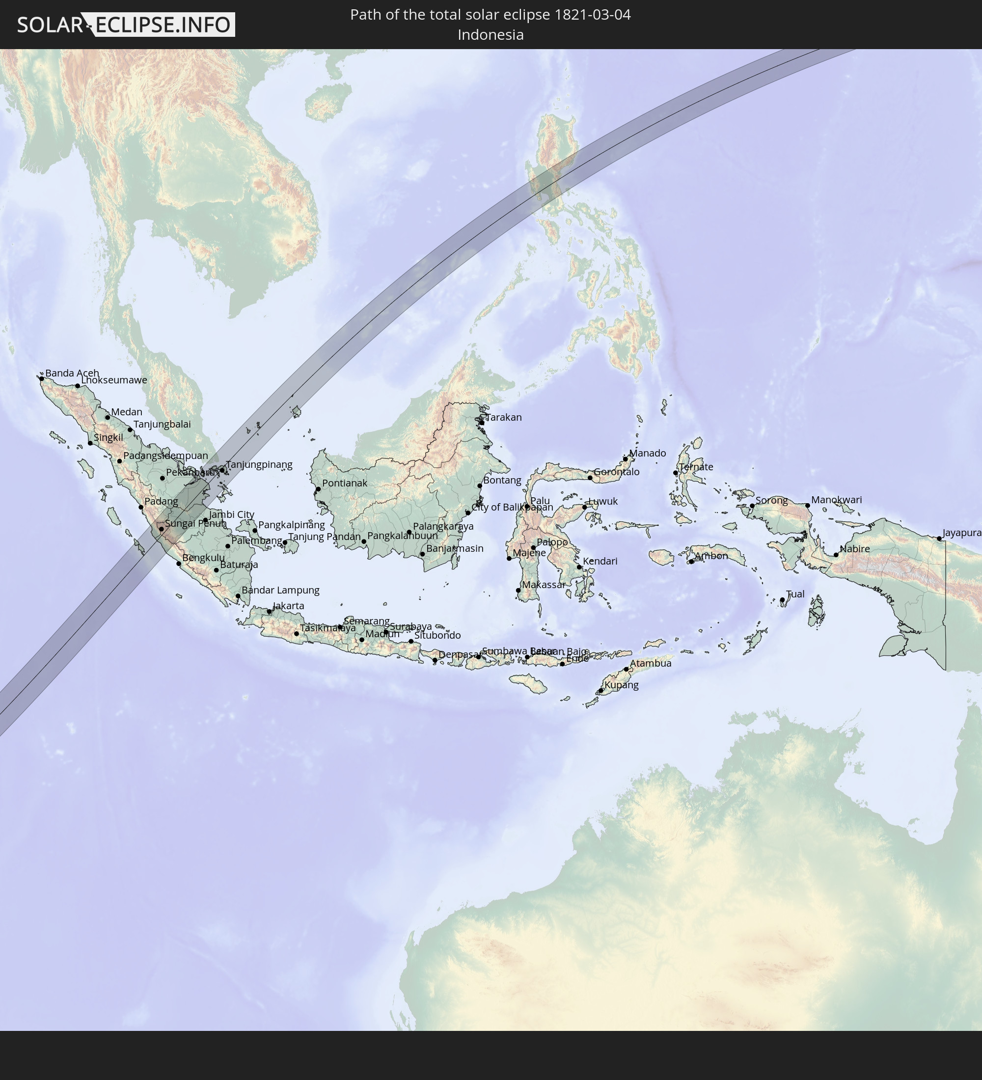 Indonesien
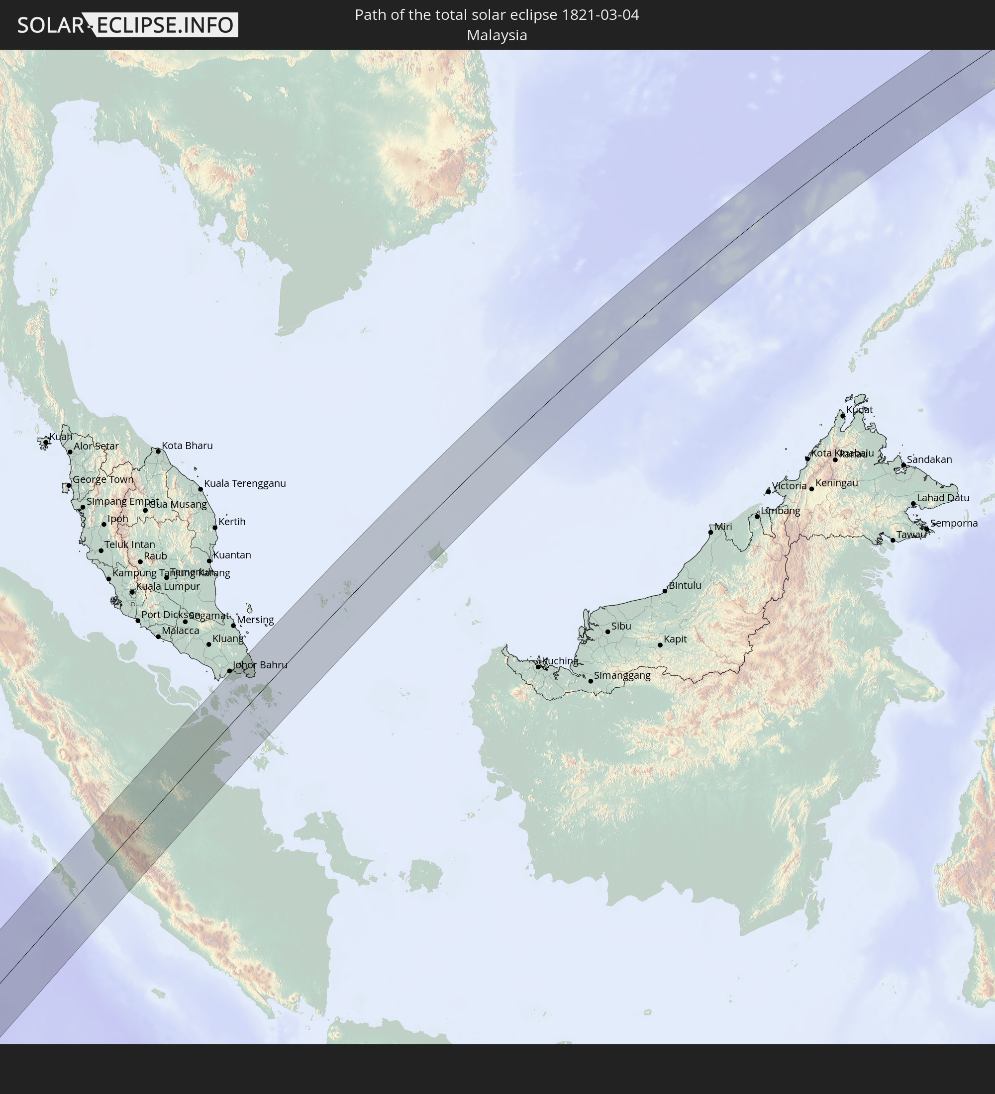 Malaysia
 Singapur
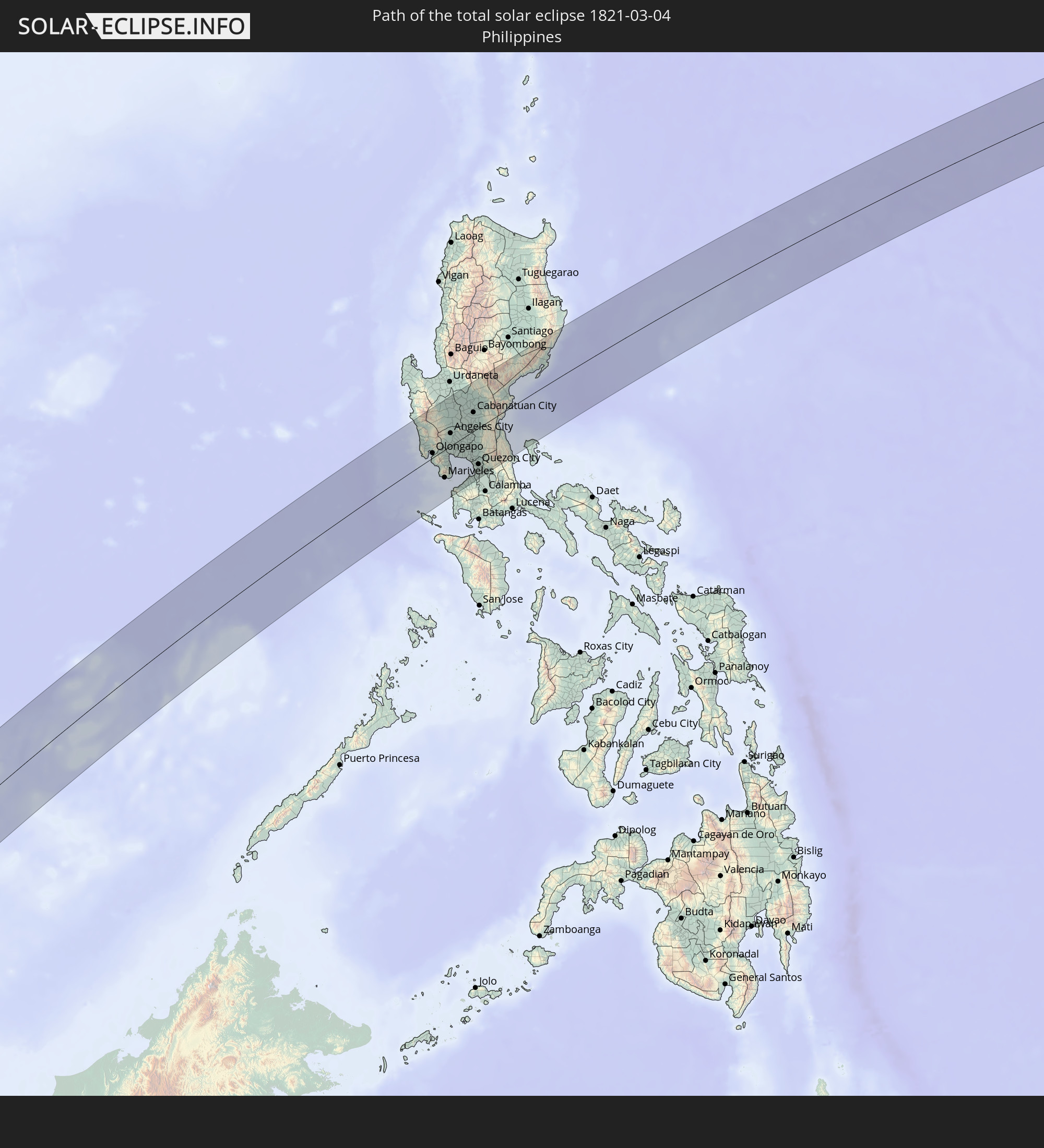 Philippinen
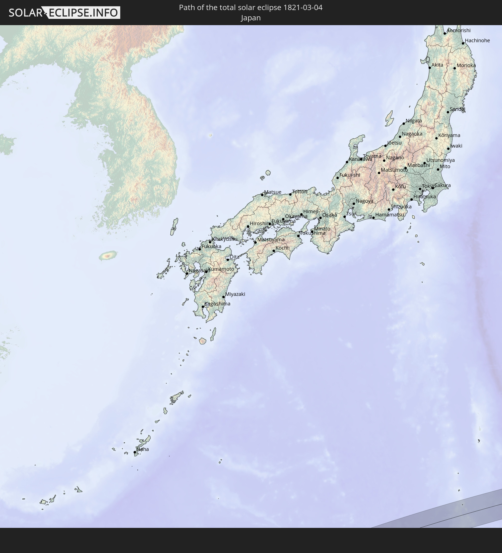 Japan
Japan
In den folgenden Ländern ist die Sonnenfinsternis partiell zu sehen
 Russland
 Demokratische Republik Kongo
 Südafrika
 Botswana
 Sambia
 Simbabwe
 Lesotho
 Ruanda
 Burundi
 Tansania
 Uganda
 Mosambik
 Swasiland
 Malawi
 Kenia
Kenia
 Französische Süd- und Antarktisgebiete
 Somalia
 Madagaskar
 Komoren
 Mayotte
 Seychellen
 Réunion
 Mauritius
 Indien
 Britisches Territorium im Indischen Ozean
 Heard und McDonaldinseln
 Malediven
 Volksrepublik China
 Sri Lanka
 Nepal
Nepal
 Mongolei
 Bangladesch
 Bhutan
 Myanmar
 Indonesien
 Kokosinseln
 Thailand
 Malaysia
 Laos
Laos
 Vietnam
 Kambodscha
 Singapur
 Weihnachtsinsel
 Australien
 Macau
Macau
 Hongkong
 Brunei
 Taiwan
 Philippinen
 Japan
Japan
 Osttimor
 Nordkorea
 Südkorea
 Palau
Palau
 Föderierte Staaten von Mikronesien
 Papua-Neuguinea
 Guam
Guam
 Nördliche Marianen
 Salomonen
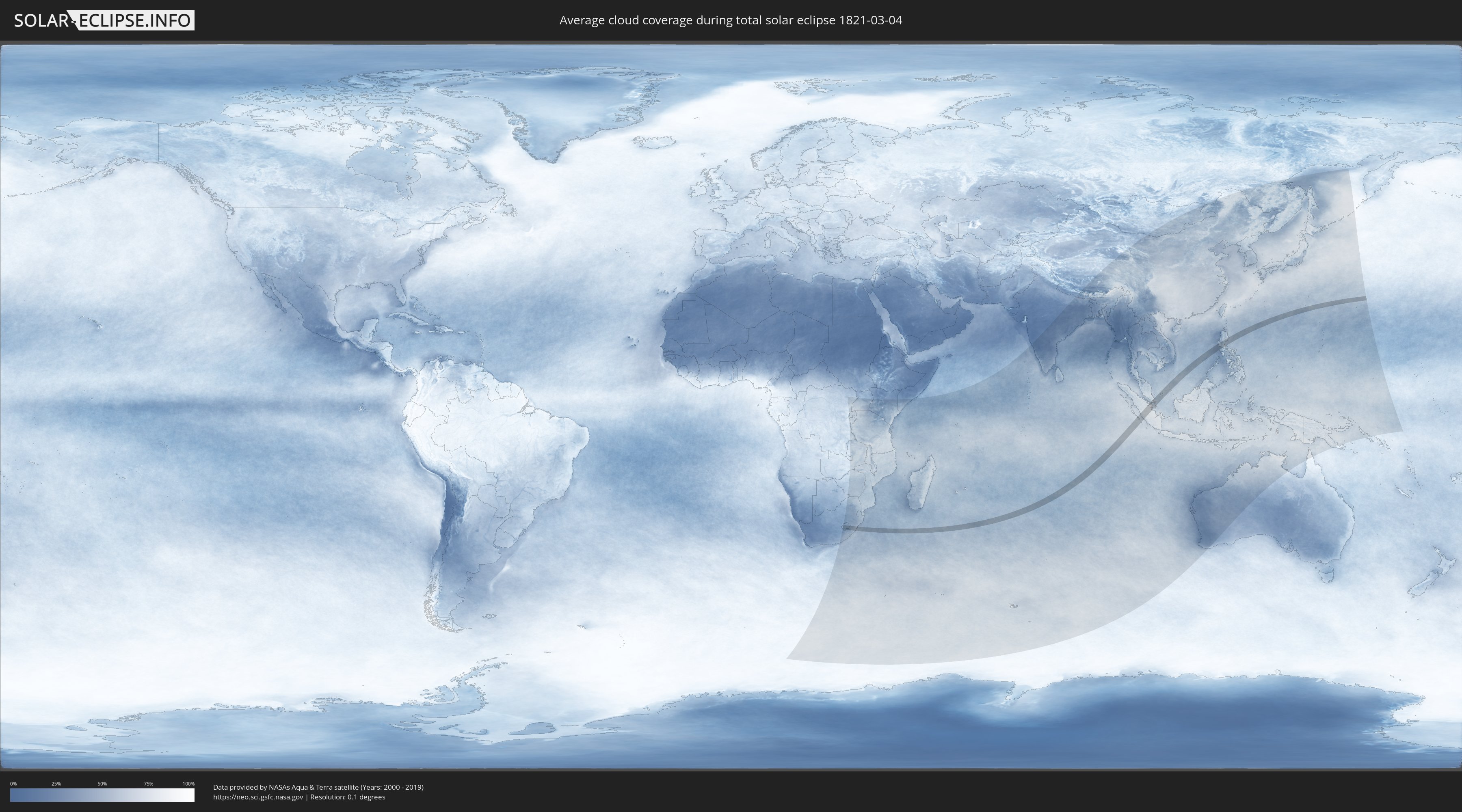
Wie wird das Wetter während der totalen Sonnenfinsternis am 04.03.1821?
Wo ist der beste Ort, um die totale Sonnenfinsternis vom 04.03.1821 zu beobachten?
Die folgenden Karten zeigen die durchschnittliche Bewölkung für den Tag, an dem die totale Sonnenfinsternis
stattfindet. Mit Hilfe der Karten lässt sich der Ort entlang des Finsternispfades eingrenzen,
der die besten Aussichen auf einen klaren wolkenfreien Himmel bietet.
Trotzdem muss man immer lokale Gegenenheiten beachten und sollte sich genau über das Wetter an seinem
gewählten Beobachtungsort informieren.
Die Daten stammen von den beiden NASA-Satelliten
AQUA und TERRA
und wurden über einen Zeitraum von 19 Jahren (2000 - 2019) gemittelt.

Detaillierte Länderkarten
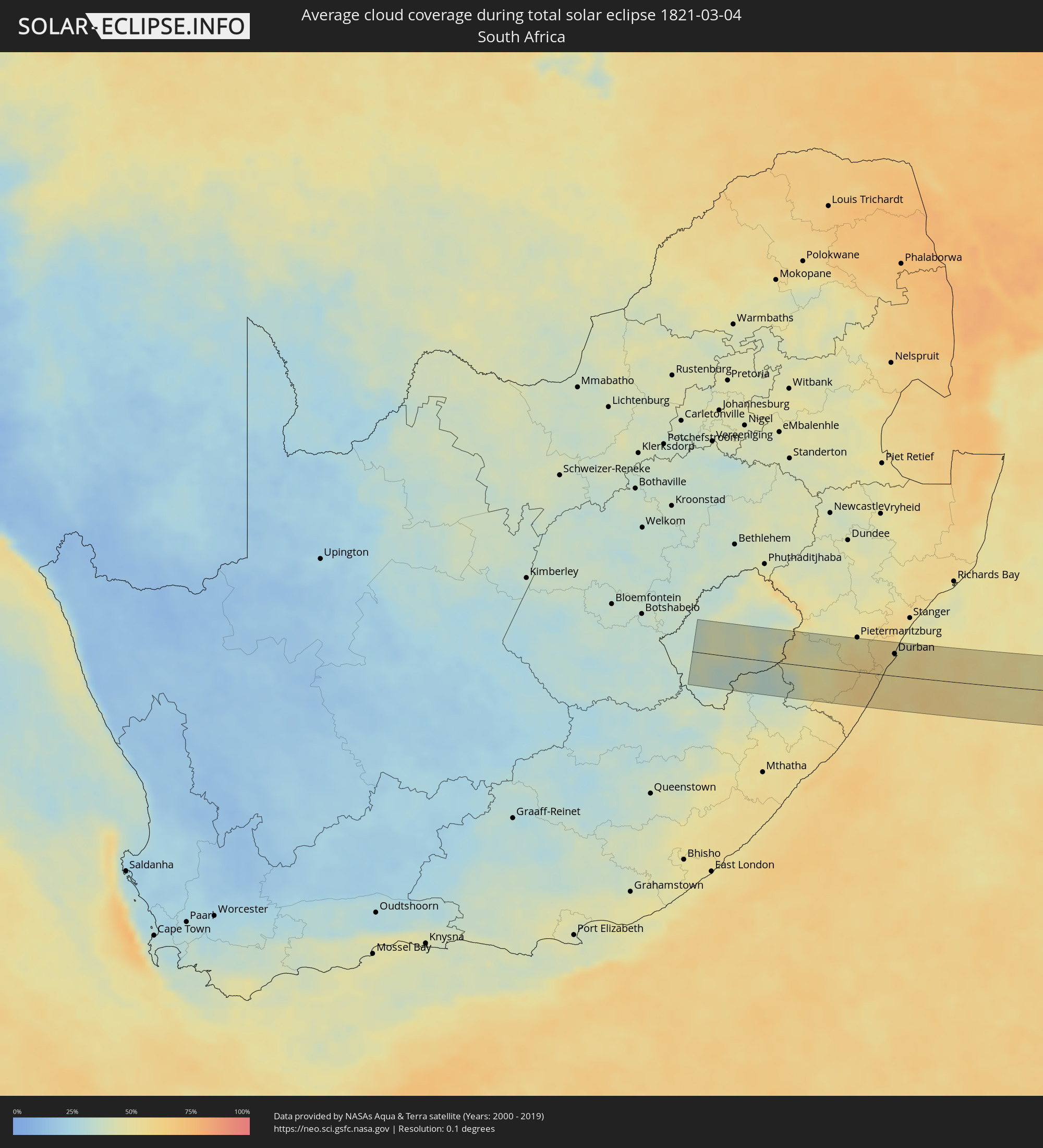 Südafrika
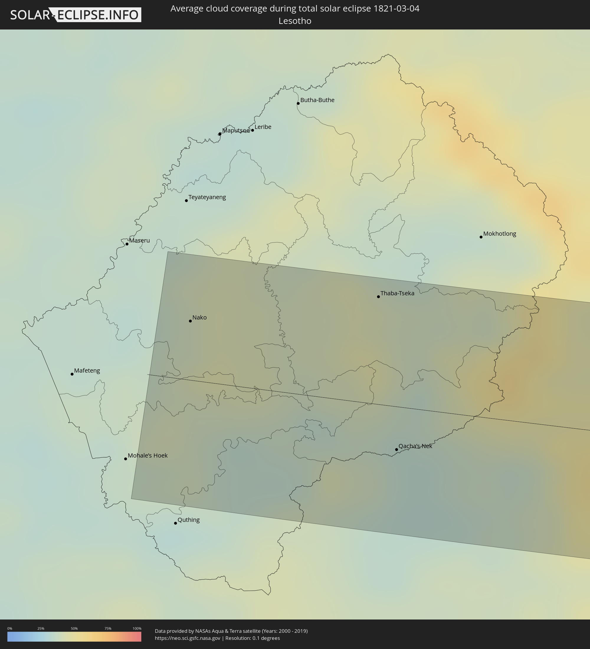 Lesotho
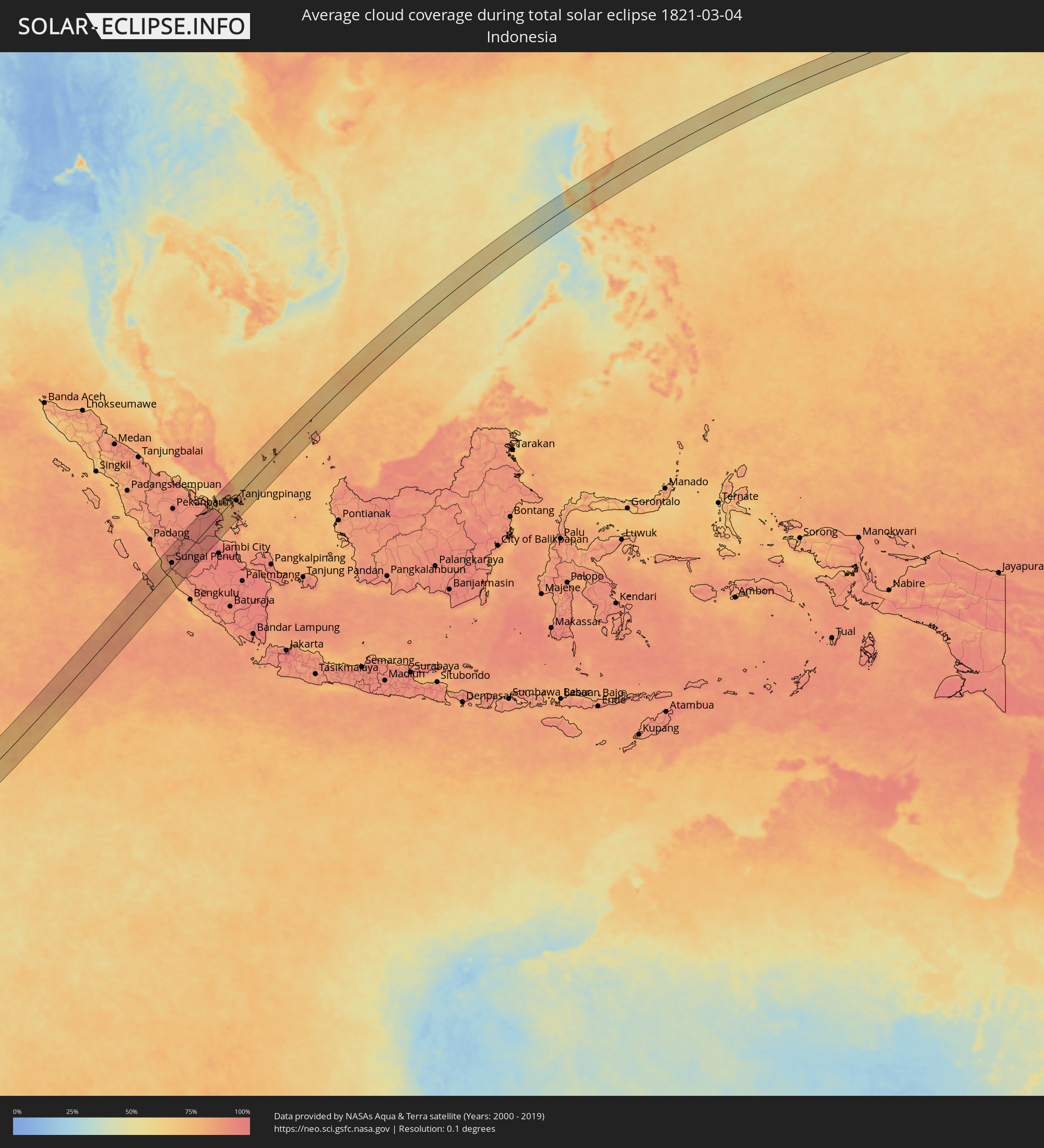 Indonesien
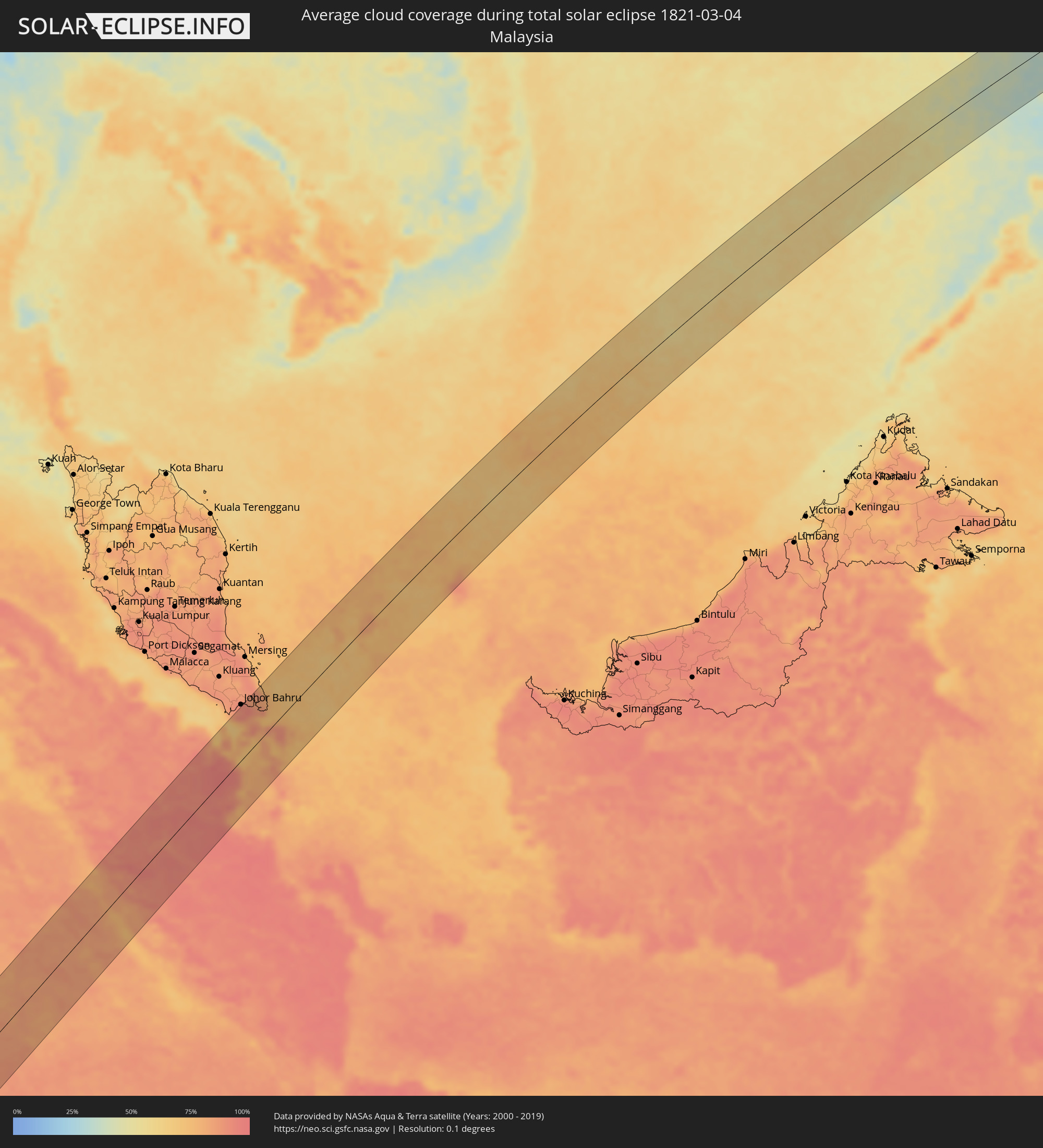 Malaysia
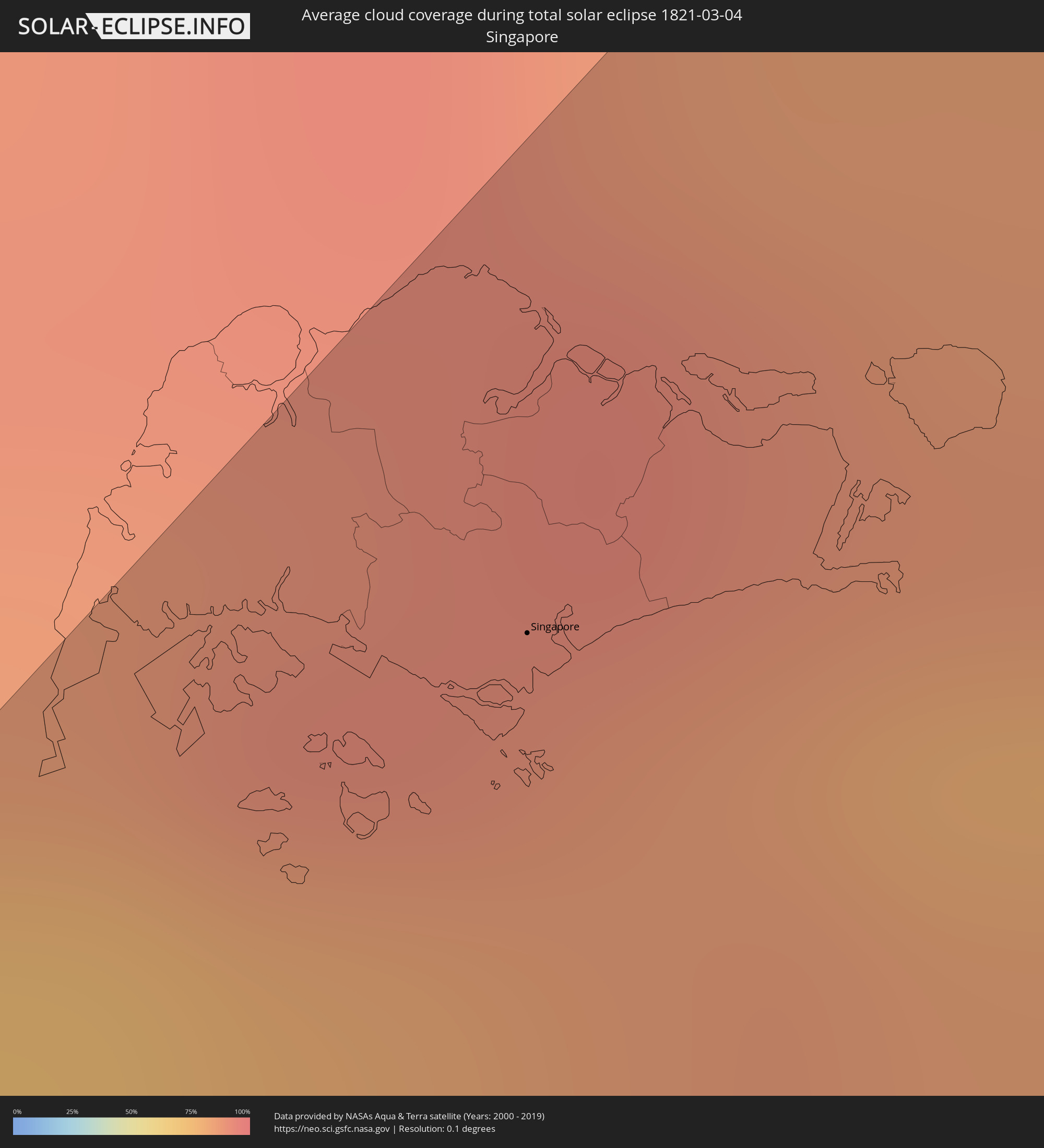 Singapur
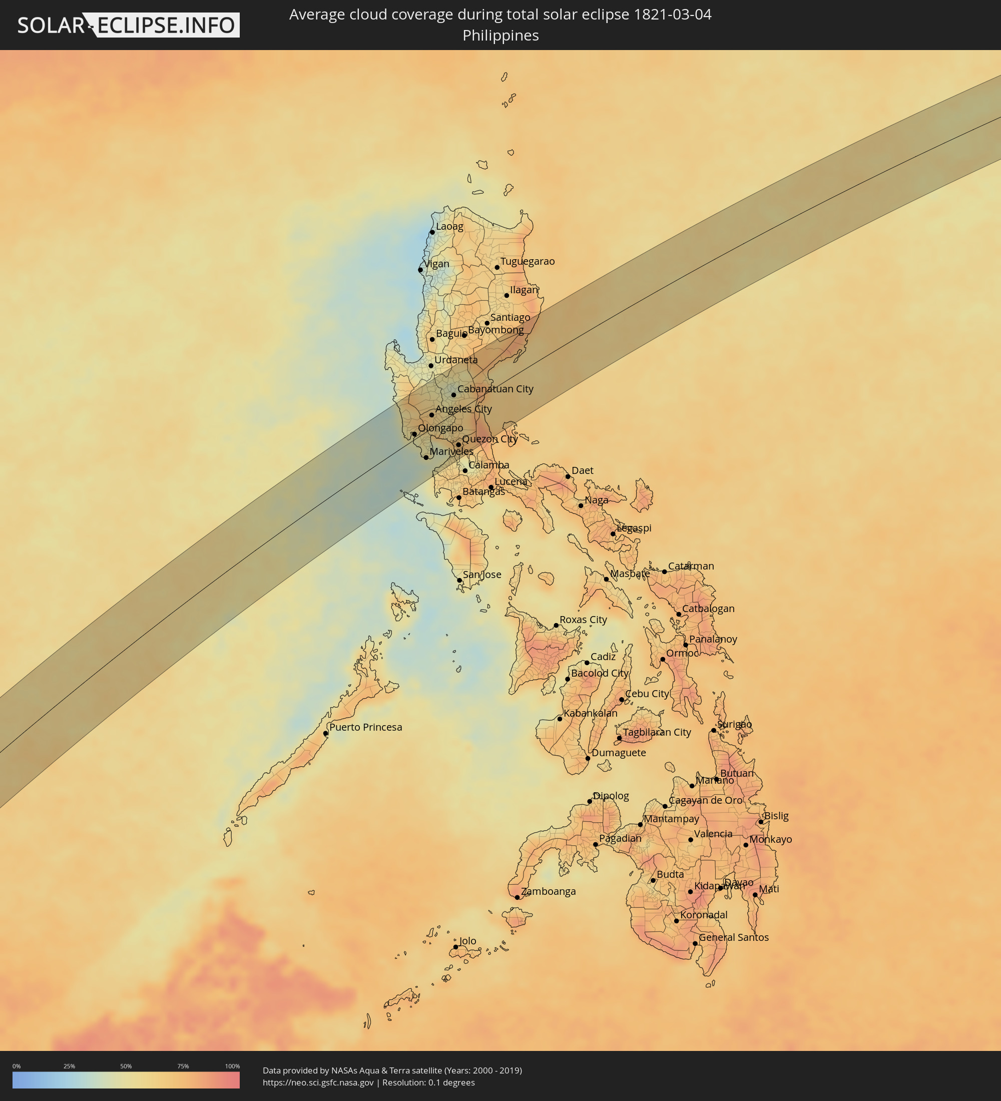 Philippinen
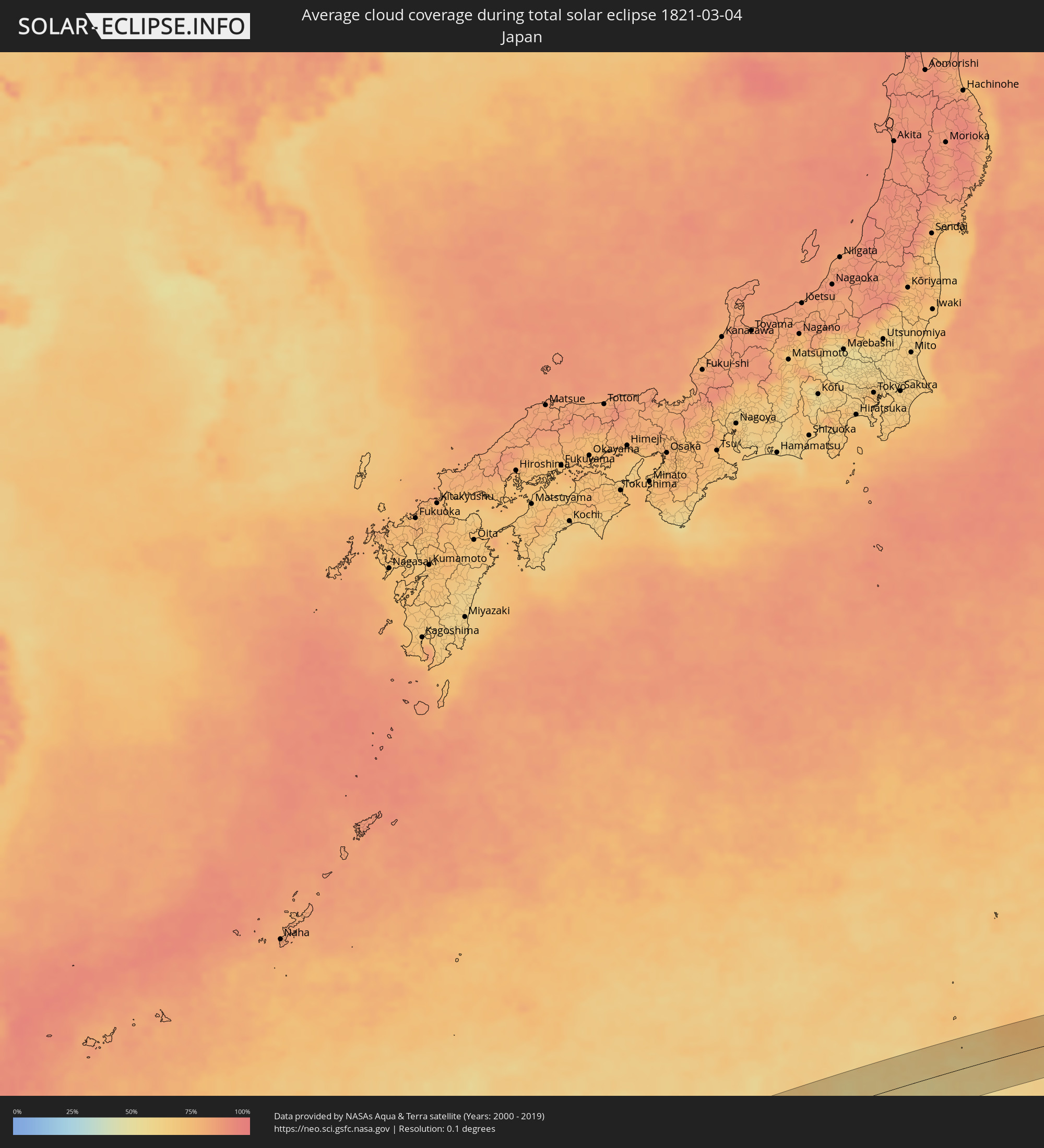 Japan
Japan
Orte im Finsternispfad
Die nachfolgene Tabelle zeigt Städte und Orte mit mehr als 5.000 Einwohnern, die sich im Finsternispfad befinden. Städte mit mehr als 100.000 Einwohnern sind dick gekennzeichnet. Mit einem Klick auf den Ort öffnet sich eine Detailkarte die die Lage des jeweiligen Ortes zusammen mit dem Verlauf der zentralen Finsternis präsentiert.
| Ort | Typ | Dauer der Verfinsterung | Ortszeit bei maximaler Verfinsterung | Entfernung zur Zentrallinie | Ø Bewölkung |
|
Nako, Maseru
|
total | - | 05:36:38 UTC+01:30 | 25 km | 40% |
|
Thaba-Tseka, Thaba-Tseka
|
total | - | 05:36:37 UTC+01:30 | 46 km | 42% |
|
Qacha’s Nek, Qachaʼs Nek
|
total | - | 05:36:42 UTC+01:30 | 19 km | 34% |
|
Richmond, KwaZulu-Natal
|
total | - | 05:36:43 UTC+01:30 | 26 km | 57% |
|
Mpumalanga, KwaZulu-Natal
|
total | - | 05:36:44 UTC+01:30 | 37 km | 58% |
|
Scottburgh, KwaZulu-Natal
|
total | - | 05:36:48 UTC+01:30 | 14 km | 55% |
|
Umkomaas, KwaZulu-Natal
|
total | - | 05:36:48 UTC+01:30 | 5 km | 55% |
|
Berea, KwaZulu-Natal
|
total | - | 05:36:45 UTC+01:30 | 36 km | 53% |
|
Durban, KwaZulu-Natal
|
total | - | 05:36:46 UTC+01:30 | 36 km | 53% |
|
Sungai Penuh, Jambi
|
total | - | 13:18:54 UTC+07:07 | 19 km | 89% |
|
Kuala Tungkal, Jambi
|
total | - | 13:25:02 UTC+07:07 | 61 km | 90% |
|
Singapore, Central Singapore
|
total | - | 13:18:06 UTC+06:55 | 65 km | 87% |
|
Kampung Pasir Gudang Baru, Johor
|
total | - | 13:18:30 UTC+06:55 | 76 km | 93% |
|
Tanjungpinang, Riau Islands
|
total | - | 13:30:11 UTC+07:07 | 13 km | 89% |
|
Kijang, Riau Islands
|
total | - | 13:30:27 UTC+07:07 | 29 km | 89% |
|
Iba, Central Luzon
|
total | - | 15:07:58 UTC+08:00 | 71 km | 47% |
|
San Antonio, Central Luzon
|
total | - | 15:07:39 UTC+08:00 | 30 km | 51% |
|
Morong, Central Luzon
|
total | - | 15:07:32 UTC+08:00 | 6 km | 45% |
|
Olongapo, Central Luzon
|
total | - | 15:07:43 UTC+08:00 | 7 km | 46% |
|
Santa Ignacia, Central Luzon
|
total | - | 15:08:48 UTC+08:00 | 71 km | 59% |
|
Dinalupihan, Central Luzon
|
total | - | 15:07:58 UTC+08:00 | 2 km | 53% |
|
Mariveles, Central Luzon
|
total | - | 15:07:29 UTC+08:00 | 42 km | 40% |
|
Balanga, Central Luzon
|
total | - | 15:07:50 UTC+08:00 | 22 km | 48% |
|
Paniqui, Central Luzon
|
total | - | 15:09:00 UTC+08:00 | 68 km | 50% |
|
Angeles City, Central Luzon
|
total | - | 15:08:25 UTC+08:00 | 19 km | 63% |
|
Capas, Central Luzon
|
total | - | 15:08:38 UTC+08:00 | 36 km | 62% |
|
Tarlac City, Central Luzon
|
total | - | 15:08:49 UTC+08:00 | 49 km | 57% |
|
Cuyapo, Central Luzon
|
total | - | 15:09:13 UTC+08:00 | 73 km | 51% |
|
San Fernando, Central Luzon
|
total | - | 15:08:24 UTC+08:00 | 2 km | 57% |
|
Naic, Calabarzon
|
total | - | 15:07:40 UTC+08:00 | 69 km | 62% |
|
Guimba, Central Luzon
|
total | - | 15:09:12 UTC+08:00 | 56 km | 44% |
|
Arayat, Central Luzon
|
total | - | 15:08:38 UTC+08:00 | 8 km | 53% |
|
Malolos, Central Luzon
|
total | - | 15:08:19 UTC+08:00 | 23 km | 65% |
|
Baliuag, Central Luzon
|
total | - | 15:08:32 UTC+08:00 | 17 km | 60% |
|
Lupao, Central Luzon
|
total | - | 15:09:35 UTC+08:00 | 69 km | 55% |
|
Muñoz, Central Luzon
|
total | - | 15:09:24 UTC+08:00 | 54 km | 41% |
|
Bacoor, Calabarzon
|
total | - | 15:08:00 UTC+08:00 | 66 km | 57% |
|
Gapan, Central Luzon
|
total | - | 15:09:00 UTC+08:00 | 13 km | 58% |
|
Cabanatuan City, Central Luzon
|
total | - | 15:09:13 UTC+08:00 | 28 km | 61% |
|
San Miguel, Central Luzon
|
total | - | 15:08:50 UTC+08:00 | 4 km | 65% |
|
San Jose del Monte, Central Luzon
|
total | - | 15:08:32 UTC+08:00 | 39 km | 69% |
|
Quezon City, Metro Manila
|
total | - | 15:08:21 UTC+08:00 | 55 km | 62% |
|
Carranglan, Central Luzon
|
total | - | 15:09:51 UTC+08:00 | 67 km | 58% |
|
Bongabon, Central Luzon
|
total | - | 15:09:34 UTC+08:00 | 32 km | 60% |
|
Angono, Calabarzon
|
total | - | 15:08:20 UTC+08:00 | 72 km | 50% |
|
Rodriguez, Calabarzon
|
total | - | 15:08:39 UTC+08:00 | 53 km | 72% |
|
Dingalan, Central Luzon
|
total | - | 15:09:34 UTC+08:00 | 5 km | 64% |
|
Maria Aurora, Central Luzon
|
total | - | 15:10:06 UTC+08:00 | 28 km | 61% |
|
Maddela, Cagayan Valley
|
total | - | 15:10:54 UTC+08:00 | 68 km | 71% |