Totale Sonnenfinsternis vom 18.03.2732
| Wochentag: | Freitag |
| Maximale Dauer der Verfinsterung: | 04m15s |
| Maximale Breite des Finsternispfades: | 200 km |
| Saroszyklus: | 151 |
| Bedeckungsgrad: | 100% |
| Magnitude: | 1.0544 |
| Gamma: | -0.4552 |
Wo kann man die Sonnenfinsternis vom 18.03.2732 sehen?
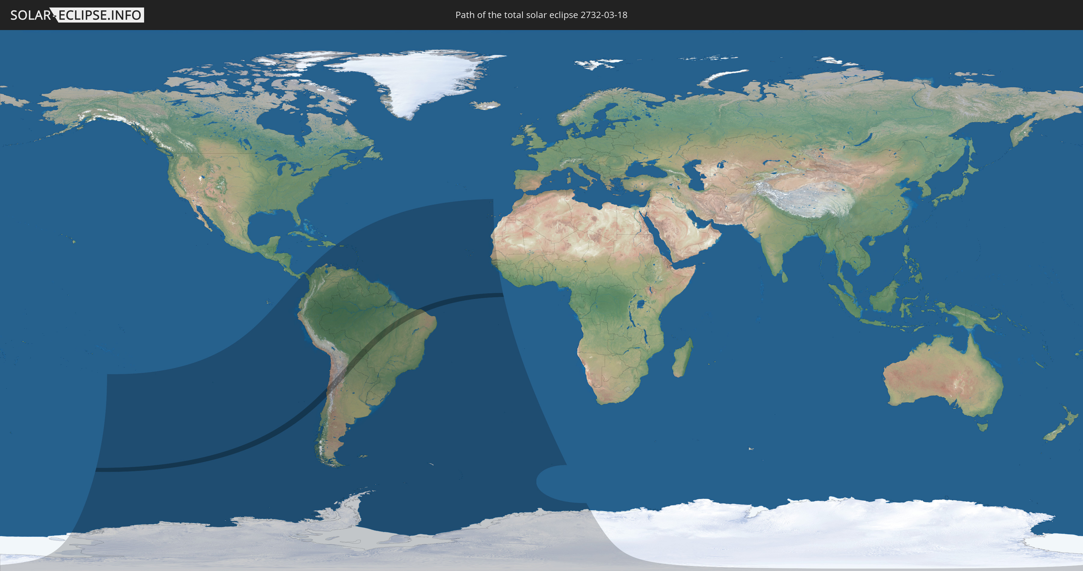
Die Sonnenfinsternis am 18.03.2732 kann man in 48 Ländern als partielle Sonnenfinsternis beobachten.
Der Finsternispfad verläuft durch 5 Länder. Nur in diesen Ländern ist sie als totale Sonnenfinsternis zu sehen.
In den folgenden Ländern ist die Sonnenfinsternis total zu sehen
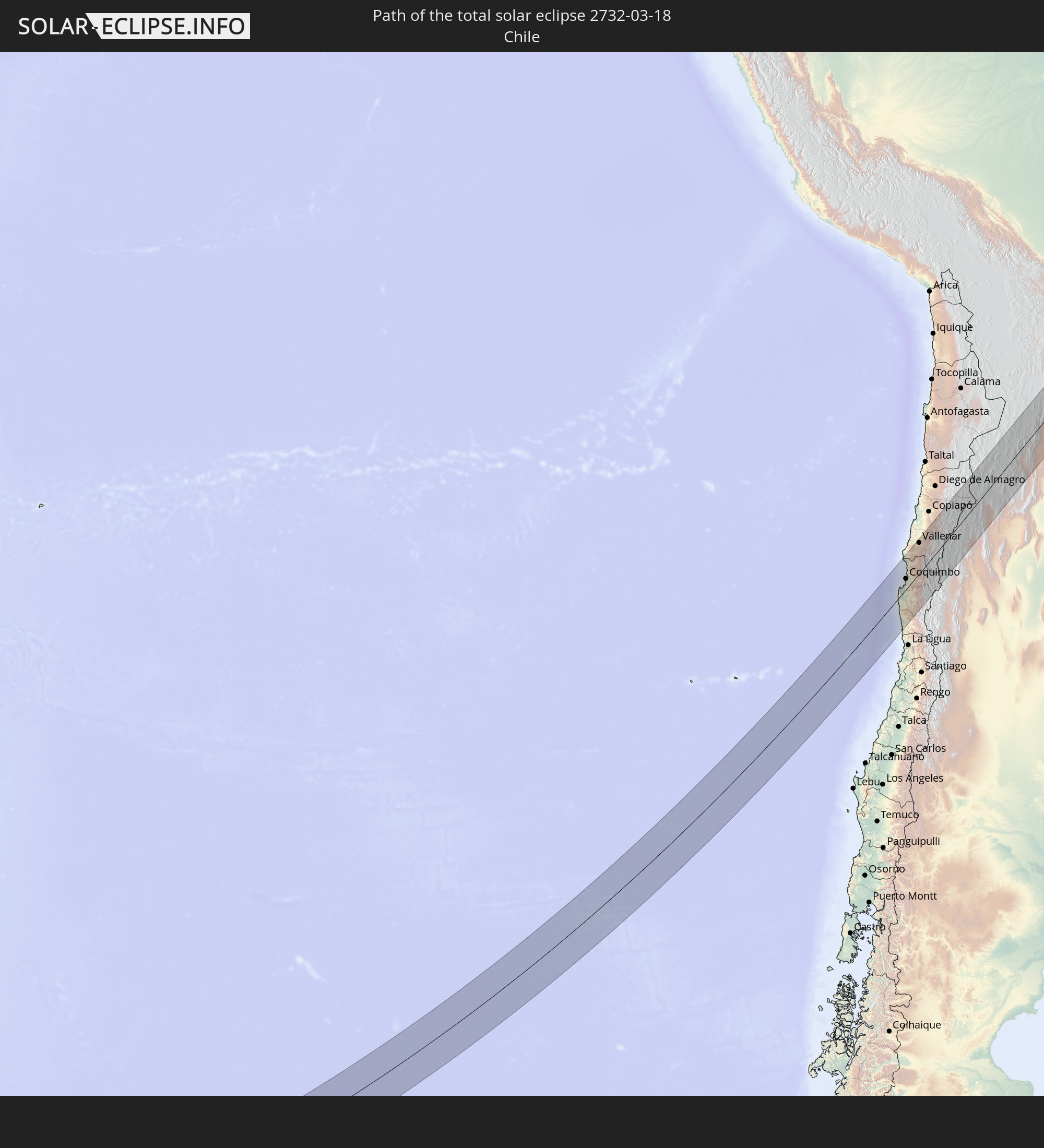 Chile
Chile
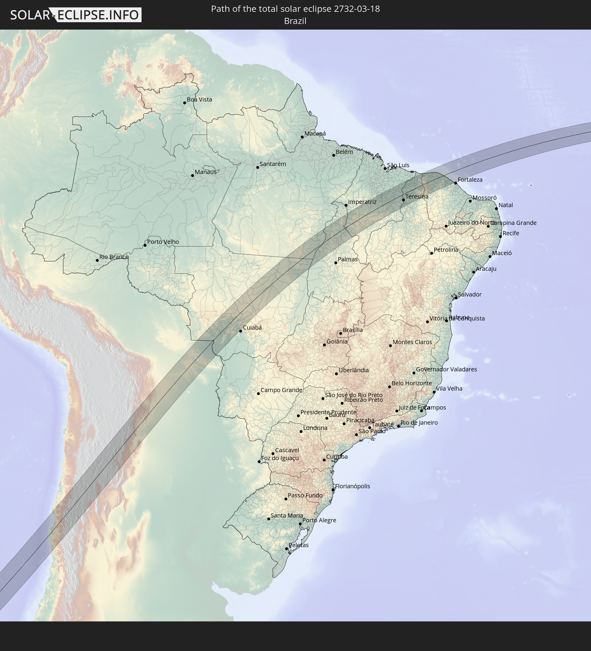 Brasilien
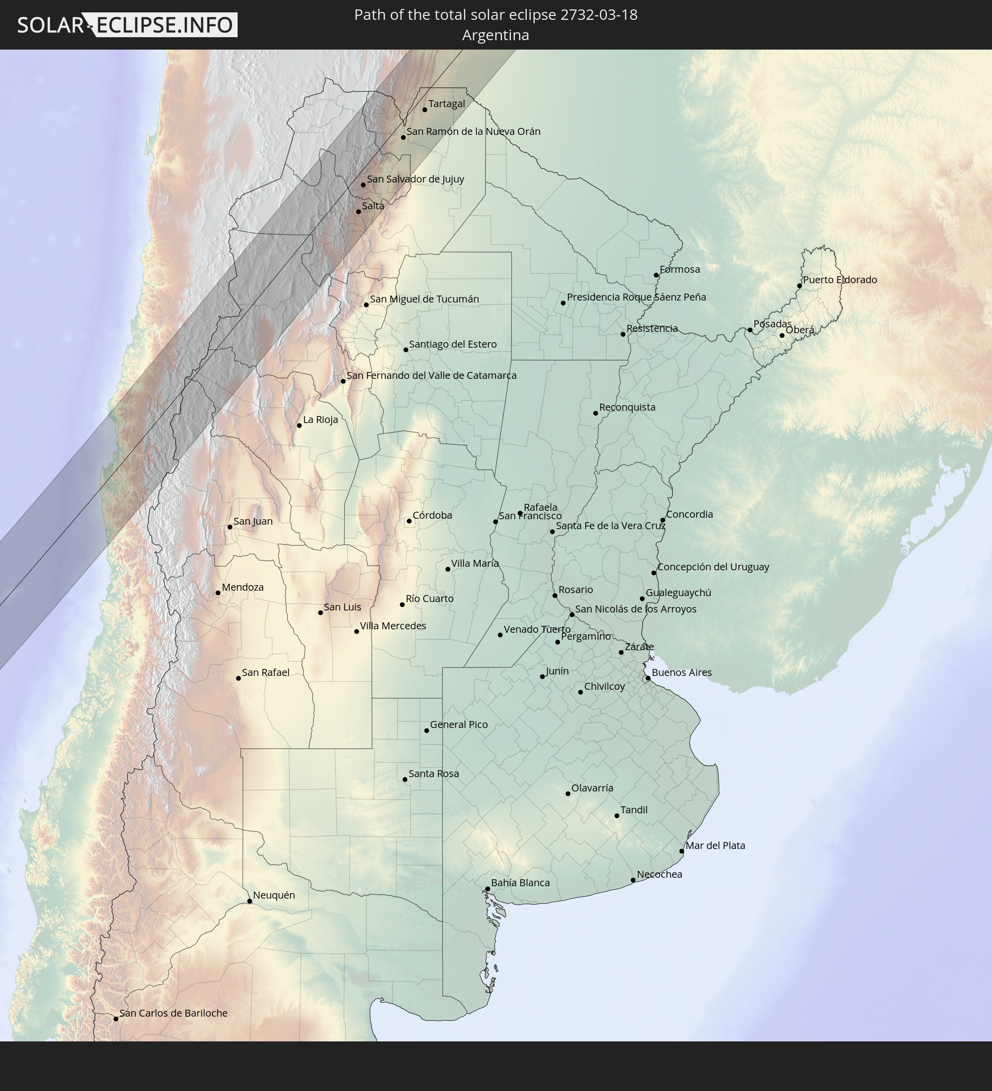 Argentinien
 Bolivien
 Paraguay
In den folgenden Ländern ist die Sonnenfinsternis partiell zu sehen
 Antarktika
 Französisch-Polynesien
 Pitcairninseln
 Chile
Chile
 Ecuador
 Panama
 Kolumbien
 Peru
Peru
 Brasilien
 Argentinien
 Venezuela
 Dominikanische Republik
 Aruba
Aruba
 Bolivien
 Puerto Rico
 Amerikanische Jungferninseln
 Britische Jungferninseln
 Anguilla
 Saint-Martin
 Saint-Barthélemy
 St. Kitts und Nevis
 Paraguay
 Antigua und Barbuda
 Montserrat
 Trinidad und Tobago
 Guadeloupe
 Grenada
 Dominica
 St. Vincent und die Grenadinen
 Falklandinseln
 Guyana
 Martinique
 St. Lucia
 Barbados
 Uruguay
 Suriname
 Französisch-Guayana
 Südgeorgien und die Südlichen Sandwichinseln
 Portugal
 Kap Verde
 Spanien
 Senegal
 Mauretanien
 Gambia
 Guinea-Bissau
 Guinea
 St. Helena
 Bouvetinsel
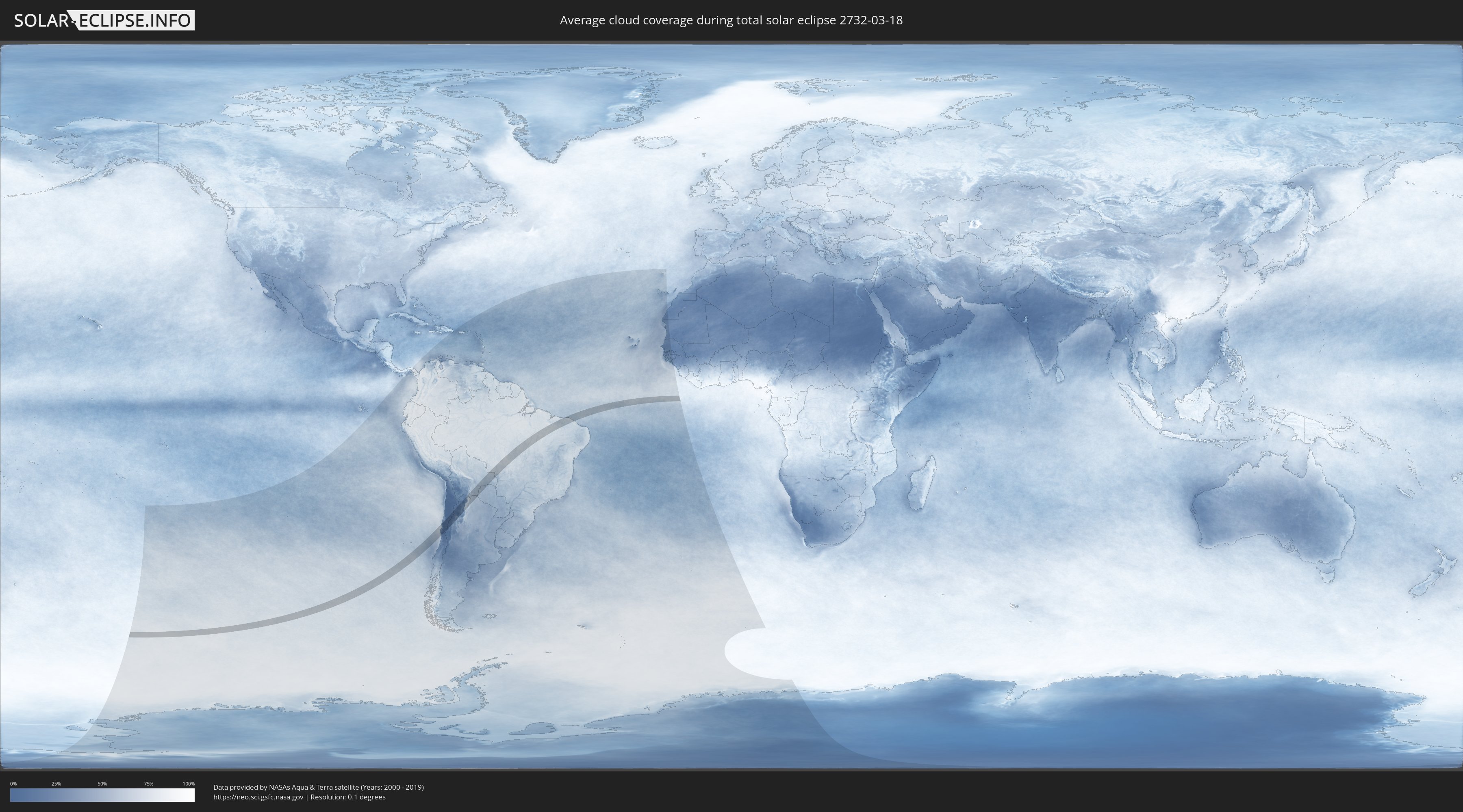
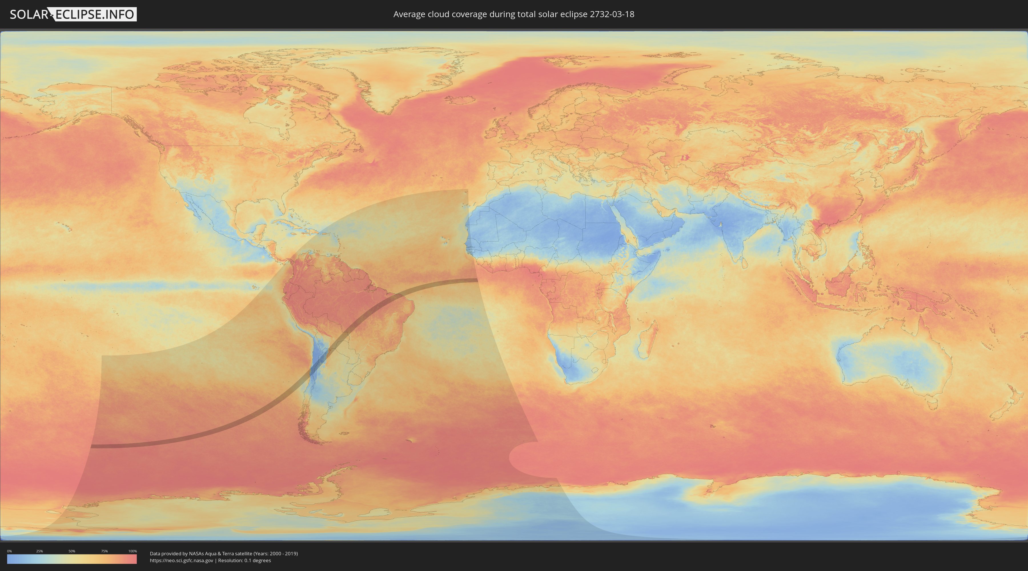
Wie wird das Wetter während der totalen Sonnenfinsternis am 18.03.2732?
Wo ist der beste Ort, um die totale Sonnenfinsternis vom 18.03.2732 zu beobachten?
Die folgenden Karten zeigen die durchschnittliche Bewölkung für den Tag, an dem die totale Sonnenfinsternis
stattfindet. Mit Hilfe der Karten lässt sich der Ort entlang des Finsternispfades eingrenzen,
der die besten Aussichen auf einen klaren wolkenfreien Himmel bietet.
Trotzdem muss man immer lokale Gegenenheiten beachten und sollte sich genau über das Wetter an seinem
gewählten Beobachtungsort informieren.
Die Daten stammen von den beiden NASA-Satelliten
AQUA und TERRA
und wurden über einen Zeitraum von 19 Jahren (2000 - 2019) gemittelt.
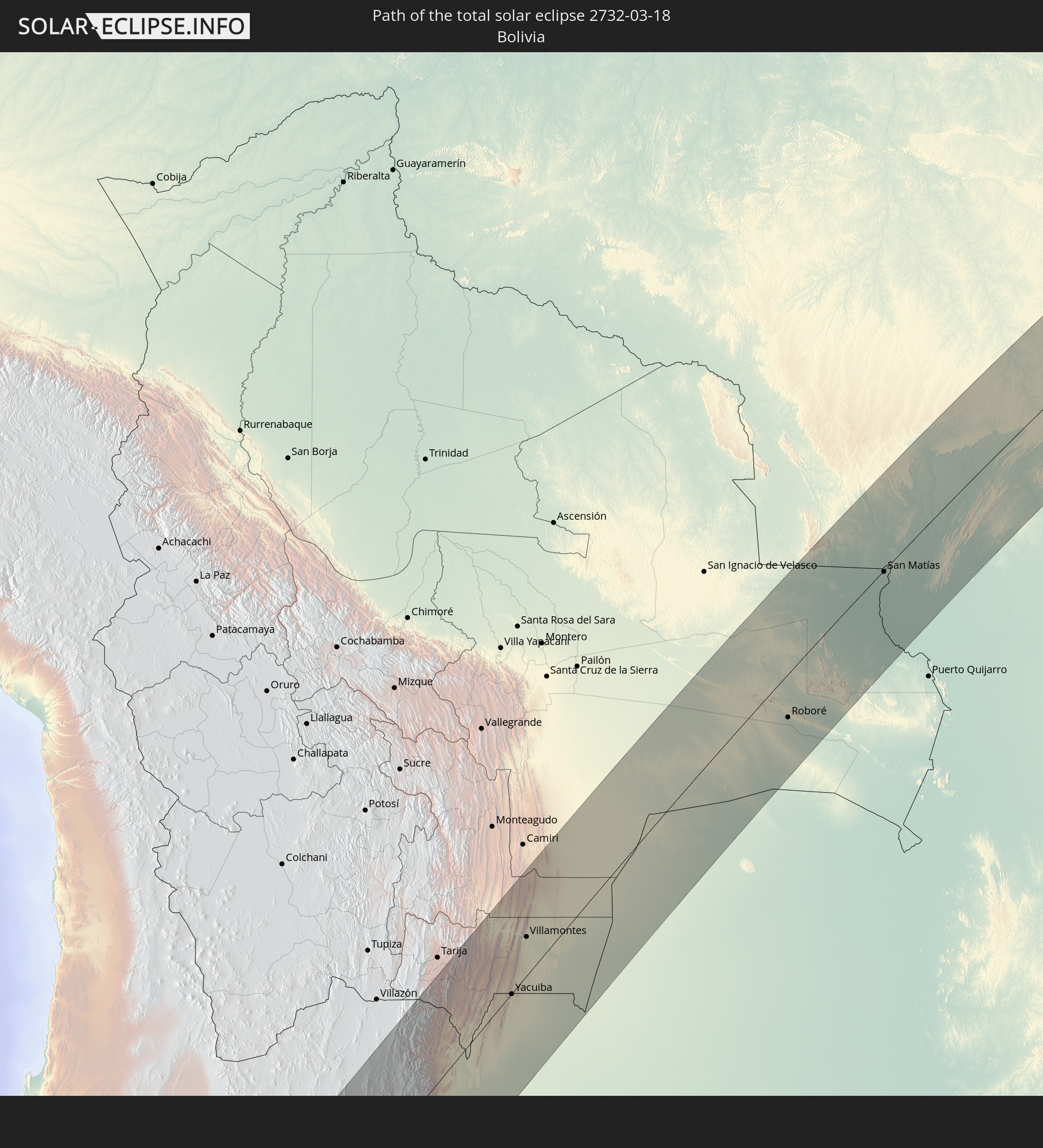
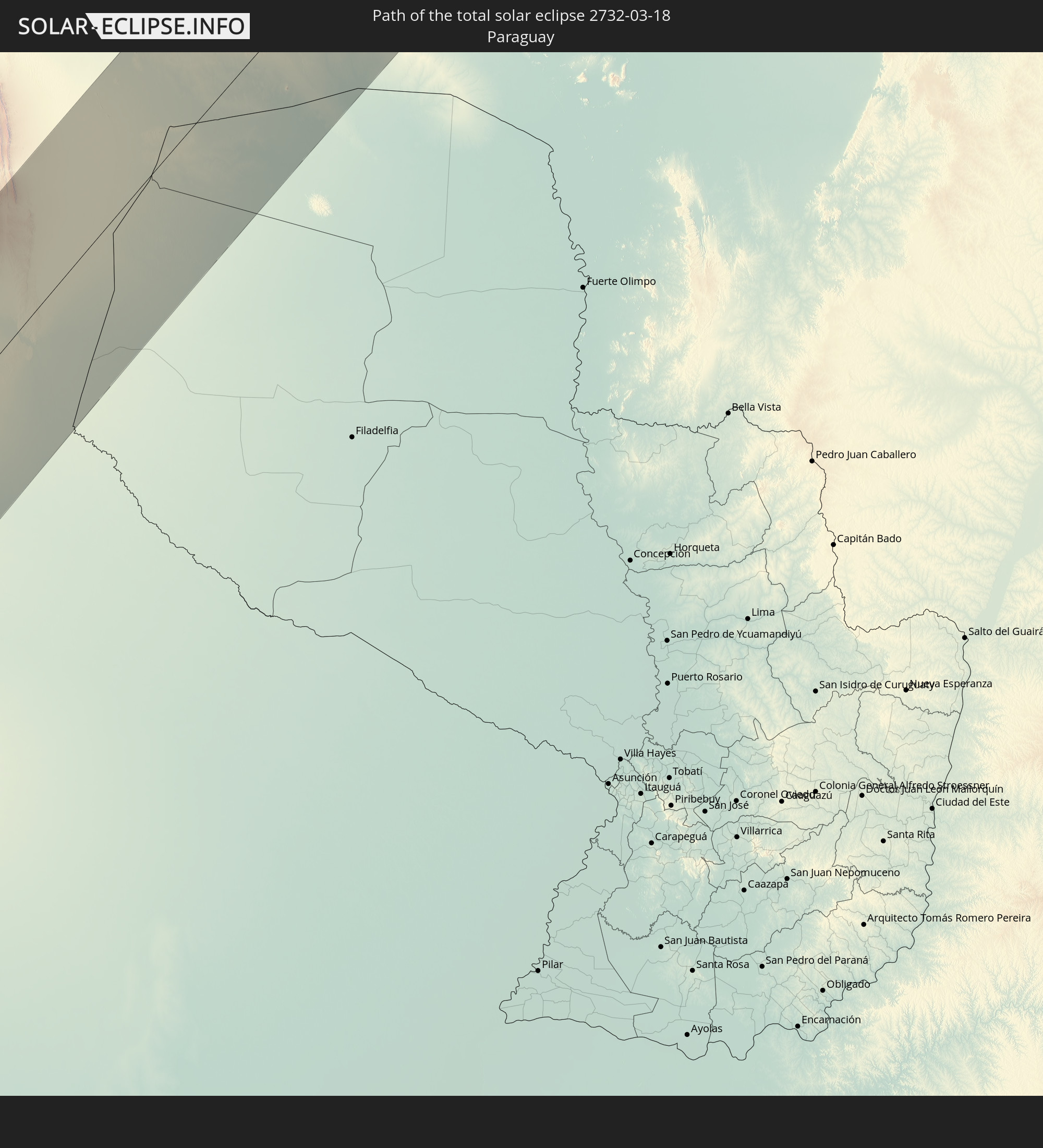
Detaillierte Länderkarten
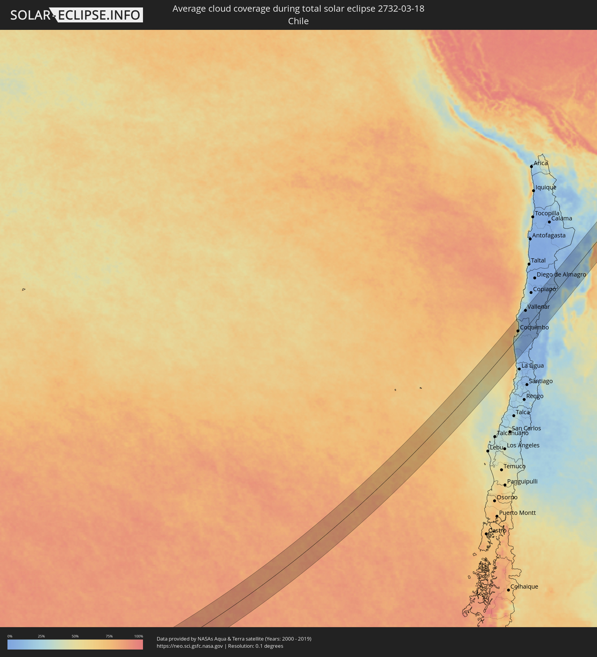 Chile
Chile
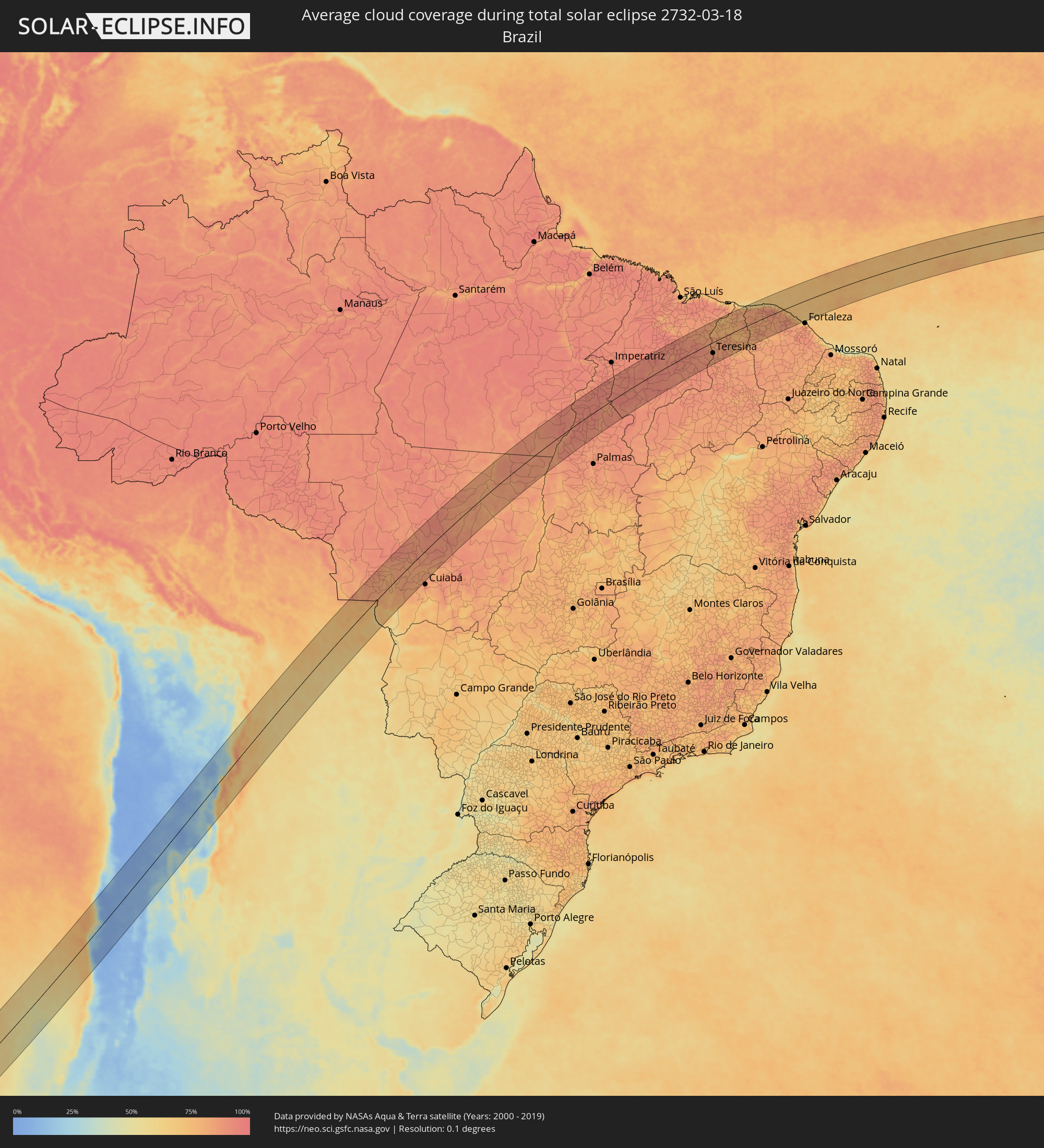 Brasilien
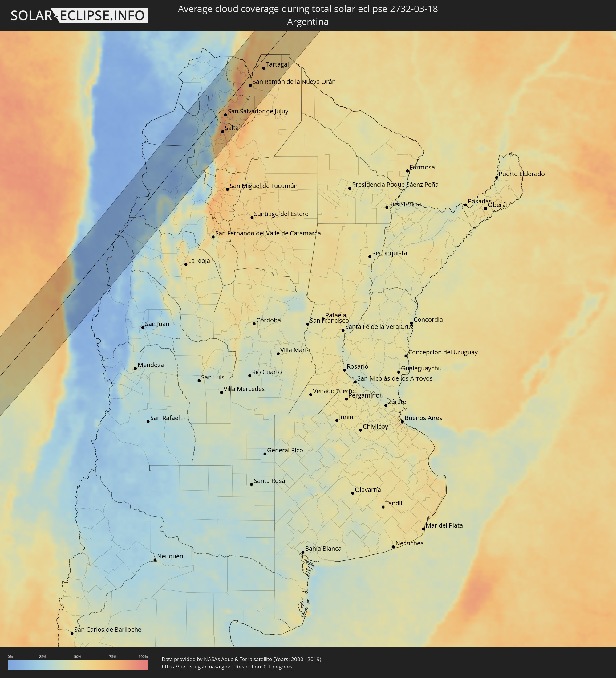 Argentinien
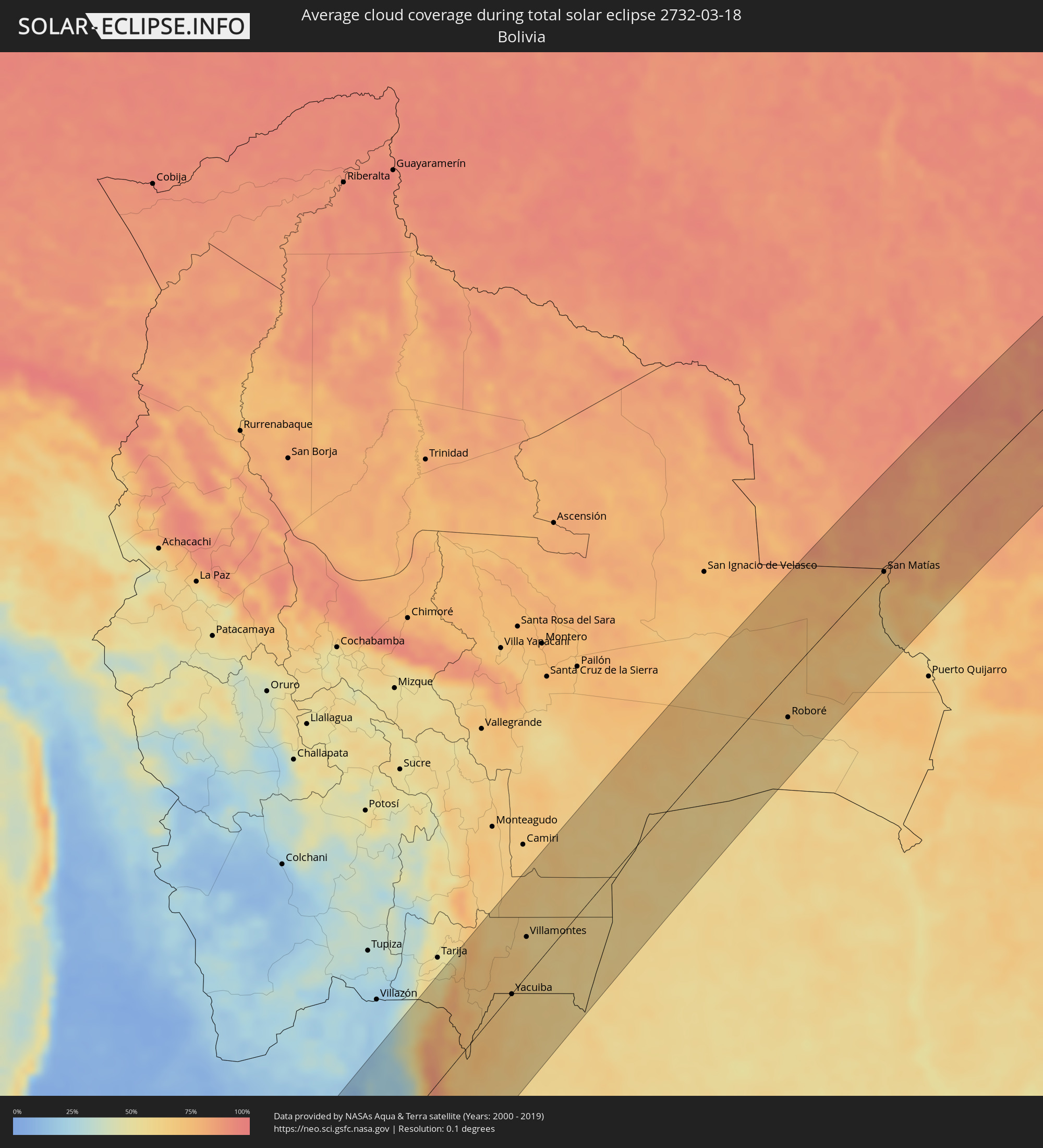 Bolivien
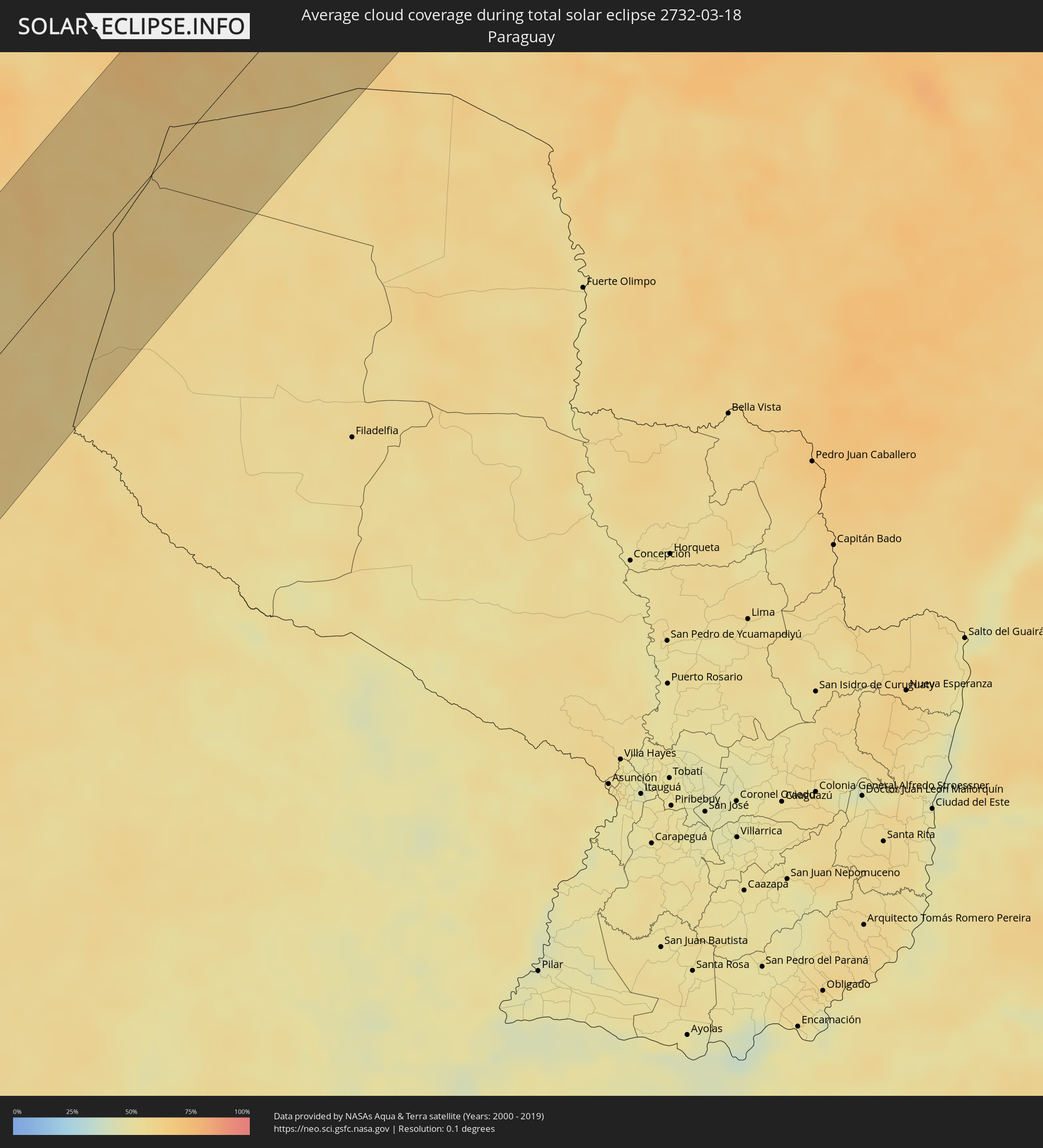 Paraguay
Orte im Finsternispfad
Die nachfolgene Tabelle zeigt Städte und Orte mit mehr als 5.000 Einwohnern, die sich im Finsternispfad befinden. Städte mit mehr als 100.000 Einwohnern sind dick gekennzeichnet. Mit einem Klick auf den Ort öffnet sich eine Detailkarte die die Lage des jeweiligen Ortes zusammen mit dem Verlauf der zentralen Finsternis präsentiert.
| Ort | Typ | Dauer der Verfinsterung | Ortszeit bei maximaler Verfinsterung | Entfernung zur Zentrallinie | Ø Bewölkung |
|
Coquimbo, Coquimbo
|
total | - | 14:07:45 UTC-03:00 | 29 km | 39% |
|
La Serena, Coquimbo
|
total | - | 14:07:58 UTC-03:00 | 25 km | 39% |
|
Ovalle, Coquimbo
|
total | - | 14:06:54 UTC-03:00 | 28 km | 15% |
|
Monte Patria, Coquimbo
|
total | - | 14:07:08 UTC-03:00 | 53 km | 7% |
|
Vallenar, Atacama
|
total | - | 14:11:01 UTC-03:00 | 84 km | 10% |
|
Vicuña, Coquimbo
|
total | - | 14:08:37 UTC-03:00 | 24 km | 6% |
|
Fiambalá, Catamarca Province
|
total | - | 14:17:39 UTC-03:00 | 92 km | 26% |
|
Chicoana, Salta Province
|
total | - | 14:25:46 UTC-03:00 | 72 km | 69% |
|
El Carril, Salta Province
|
total | - | 14:25:54 UTC-03:00 | 74 km | 69% |
|
Salta, Salta Province
|
total | - | 14:26:34 UTC-03:00 | 60 km | 74% |
|
Tilcara, Jujuy Province
|
total | - | 14:28:58 UTC-03:00 | 21 km | 27% |
|
Humahuaca, Jujuy Province
|
total | - | 14:29:41 UTC-03:00 | 47 km | 24% |
|
San Salvador de Jujuy, Jujuy Province
|
total | - | 14:27:52 UTC-03:00 | 27 km | 76% |
|
Palpalá, Jujuy Province
|
total | - | 14:27:54 UTC-03:00 | 38 km | 71% |
|
San Pedro, Jujuy Province
|
total | - | 14:28:30 UTC-03:00 | 64 km | 65% |
|
Ingenio La Esperanza, Jujuy Province
|
total | - | 14:28:33 UTC-03:00 | 65 km | 63% |
|
Fraile Pintado, Jujuy Province
|
total | - | 14:29:10 UTC-03:00 | 49 km | 66% |
|
Libertador General San Martín, Jujuy Province
|
total | - | 14:29:26 UTC-03:00 | 40 km | 70% |
|
Calilegua, Jujuy Province
|
total | - | 14:29:32 UTC-03:00 | 39 km | 70% |
|
Caimancito, Jujuy Province
|
total | - | 14:29:53 UTC-03:00 | 51 km | 66% |
|
Yuto, Jujuy Province
|
total | - | 14:30:16 UTC-03:00 | 53 km | 64% |
|
San Ramón de la Nueva Orán, Salta Province
|
total | - | 14:31:29 UTC-03:00 | 29 km | 67% |
|
Palma Sola, Jujuy Province
|
total | - | 14:29:56 UTC-03:00 | 90 km | 73% |
|
Embarcación, Salta Province
|
total | - | 14:31:42 UTC-03:00 | 52 km | 64% |
|
General Enrique Mosconi, Salta Province
|
total | - | 14:33:21 UTC-03:00 | 31 km | 64% |
|
Tartagal, Salta Province
|
total | - | 14:33:31 UTC-03:00 | 27 km | 65% |
|
Yacuiba, Tarija
|
total | - | 13:34:42 UTC-04:00 | 1 km | 65% |
|
Villamontes, Tarija
|
total | - | 13:36:31 UTC-04:00 | 36 km | 64% |
|
Roboré, Santa Cruz
|
total | - | 13:48:13 UTC-04:00 | 44 km | 61% |
|
San Matías, Santa Cruz
|
total | - | 13:54:14 UTC-04:00 | 2 km | 72% |
|
Nova Olímpia, Mato Grosso
|
total | - | 13:59:02 UTC-04:00 | 34 km | 85% |
|
Barra do Bugres, Mato Grosso
|
total | - | 13:58:39 UTC-04:00 | 5 km | 85% |
|
Diamantino, Mato Grosso
|
total | - | 14:01:04 UTC-04:00 | 1 km | 85% |
|
Conceição do Araguaia, Pará
|
total | - | 15:22:30 UTC-03:00 | 19 km | 85% |
|
Araguaína, Tocantins
|
total | - | 15:25:41 UTC-03:00 | 51 km | 93% |
|
Carolina, Maranhão
|
total | - | 15:26:21 UTC-03:00 | 7 km | 86% |
|
Porto Franco, Maranhão
|
total | - | 15:28:06 UTC-03:00 | 82 km | 89% |
|
Santa Luzia, Maranhão
|
total | - | 15:26:07 UTC-03:00 | 51 km | 90% |
|
Grajaú, Maranhão
|
total | - | 15:30:25 UTC-03:00 | 59 km | 92% |
|
Barra do Corda, Maranhão
|
total | - | 15:31:57 UTC-03:00 | 39 km | 90% |
|
Tuntum, Maranhão
|
total | - | 15:32:59 UTC-03:00 | 30 km | 92% |
|
Presidente Dutra, Maranhão
|
total | - | 15:33:06 UTC-03:00 | 19 km | 93% |
|
Dom Pedro, Maranhão
|
total | - | 15:33:34 UTC-03:00 | 41 km | 93% |
|
São Domingos do Maranhão, Maranhão
|
total | - | 15:32:46 UTC-03:00 | 15 km | 91% |
|
Colinas, Maranhão
|
total | - | 15:32:12 UTC-03:00 | 66 km | 90% |
|
Timbiras, Maranhão
|
total | - | 15:35:18 UTC-03:00 | 91 km | 88% |
|
Codó, Maranhão
|
total | - | 15:35:03 UTC-03:00 | 69 km | 88% |
|
Buriti Bravo, Maranhão
|
total | - | 15:32:57 UTC-03:00 | 70 km | 90% |
|
Caxias, Maranhão
|
total | - | 15:34:59 UTC-03:00 | 1 km | 90% |
|
Estreito, Maranhão
|
total | - | 15:33:39 UTC-03:00 | 95 km | 92% |
|
Coelho Neto, Maranhão
|
total | - | 15:36:16 UTC-03:00 | 44 km | 84% |
|
União, Piauí
|
total | - | 15:35:55 UTC-03:00 | 3 km | 83% |
|
Teresina, Piauí
|
total | - | 15:35:12 UTC-03:00 | 50 km | 90% |
|
Demerval Lobão, Piauí
|
total | - | 15:34:55 UTC-03:00 | 83 km | 87% |
|
José de Freitas, Piauí
|
total | - | 15:35:57 UTC-03:00 | 28 km | 83% |
|
Santa Quitéria do Maranhão, Maranhão
|
total | - | 15:37:51 UTC-03:00 | 94 km | 75% |
|
Altos, Piauí
|
total | - | 15:35:38 UTC-03:00 | 62 km | 84% |
|
Barras, Piauí
|
total | - | 15:37:01 UTC-03:00 | 9 km | 82% |
|
Esperantina, Piauí
|
total | - | 15:37:35 UTC-03:00 | 40 km | 75% |
|
Campo Maior, Piauí
|
total | - | 15:36:15 UTC-03:00 | 55 km | 85% |
|
Piripiri, Piauí
|
total | - | 15:37:29 UTC-03:00 | 19 km | 76% |
|
Piracuruca, Piauí
|
total | - | 15:38:04 UTC-03:00 | 13 km | 79% |
|
Pedro II, Piauí
|
total | - | 15:37:34 UTC-03:00 | 49 km | 82% |
|
Viçosa do Ceará, Ceará
|
total | - | 15:39:12 UTC-03:00 | 20 km | 81% |
|
Tianguá, Ceará
|
total | - | 15:39:03 UTC-03:00 | 1 km | 82% |
|
Camocim, Ceará
|
total | - | 15:40:23 UTC-03:00 | 76 km | 85% |
|
Granja, Ceará
|
total | - | 15:40:05 UTC-03:00 | 53 km | 85% |
|
Guaraciaba do Norte, Ceará
|
total | - | 15:38:38 UTC-03:00 | 57 km | 86% |
|
Ipu, Ceará
|
total | - | 15:38:27 UTC-03:00 | 74 km | 83% |
|
Varjota, Ceará
|
total | - | 15:38:51 UTC-03:00 | 72 km | 73% |
|
Sobral, Ceará
|
total | - | 15:39:43 UTC-03:00 | 26 km | 82% |
|
Santana do Acaraú, Ceará
|
total | - | 15:40:10 UTC-03:00 | 9 km | 84% |
|
Marco, Ceará
|
total | - | 15:40:43 UTC-03:00 | 22 km | 88% |
|
Acaraú, Ceará
|
total | - | 15:41:05 UTC-03:00 | 45 km | 88% |
|
Itapagé, Ceará
|
total | - | 15:40:25 UTC-03:00 | 60 km | 86% |
|
Itapipoca, Ceará
|
total | - | 15:40:42 UTC-03:00 | 41 km | 89% |
|
Pentecoste, Ceará
|
total | - | 15:40:33 UTC-03:00 | 85 km | 84% |
|
Trairi, Ceará
|
total | - | 15:41:17 UTC-03:00 | 32 km | 81% |
|
Paracuru, Ceará
|
total | - | 15:41:19 UTC-03:00 | 56 km | 78% |
|
São Gonçalo do Amarante, Ceará
|
total | - | 15:41:05 UTC-03:00 | 79 km | 81% |