Hybrid solar eclipse of 07/02/-0400
| Day of week: | Sunday |
| Maximum duration of eclipse: | 01m01s |
| Maximum width of eclipse path: | 32 km |
| Saros cycle: | 59 |
| Coverage: | 100% |
| Magnitude: | 1.0092 |
| Gamma: | -0.1015 |
Wo kann man die Sonnenfinsternis vom 07/02/-0400 sehen?
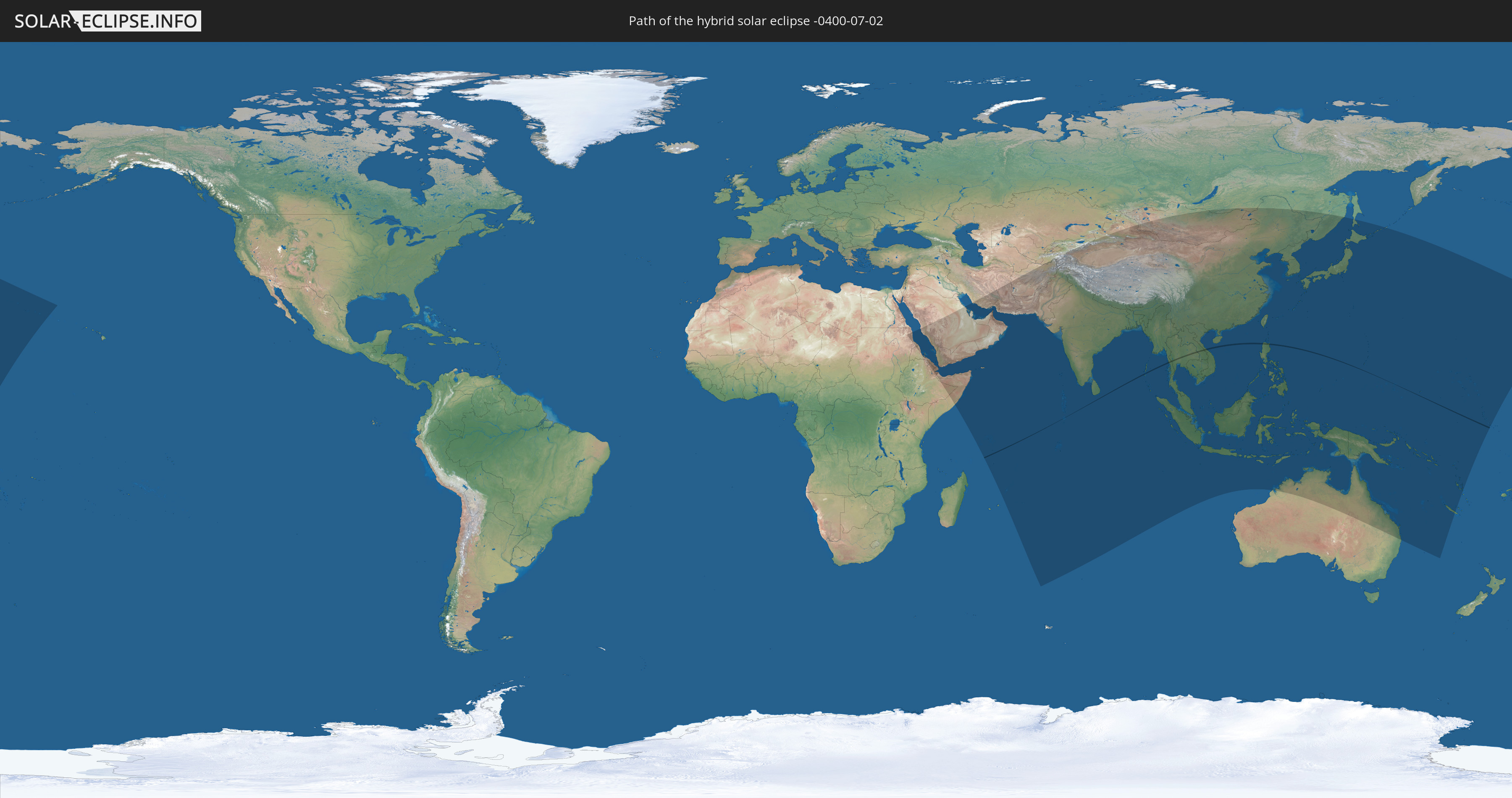
Die Sonnenfinsternis am 07/02/-0400 kann man in 61 Ländern als partielle Sonnenfinsternis beobachten.
Der Finsternispfad verläuft durch 6 Länder. Nur in diesen Ländern ist sie als hybrid Sonnenfinsternis zu sehen.
In den folgenden Ländern ist die Sonnenfinsternis hybrid zu sehen
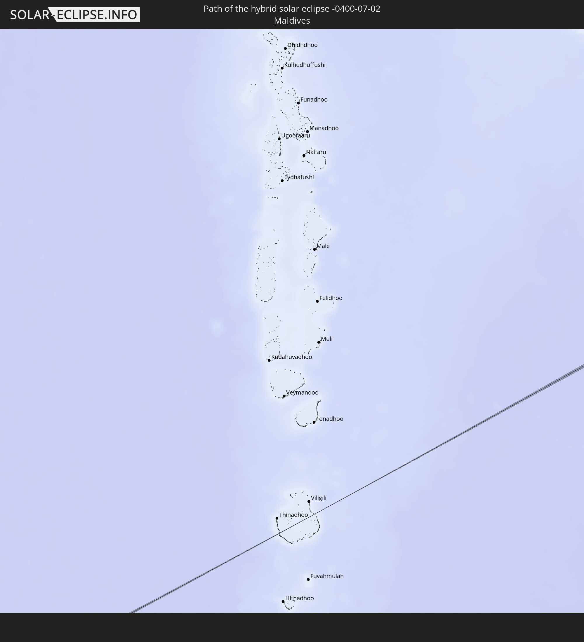 Maldives
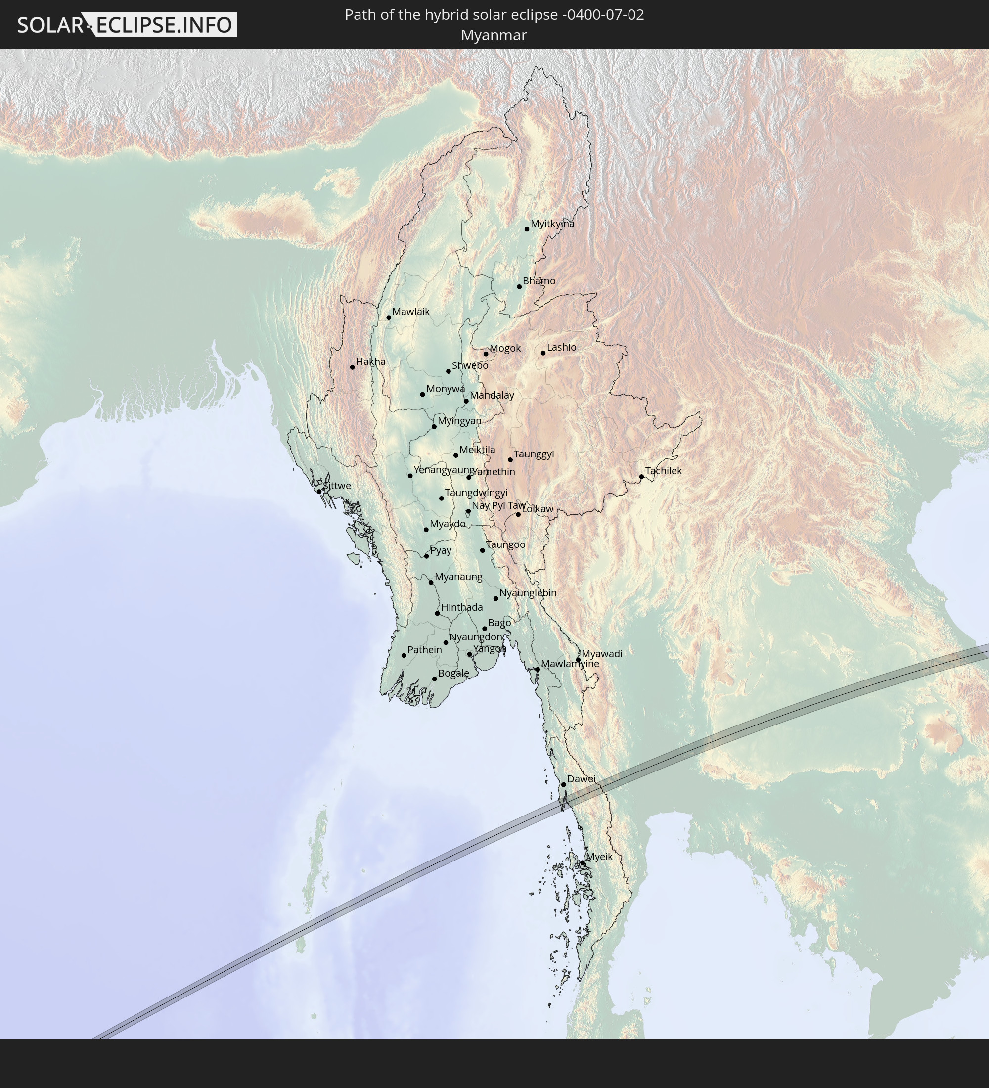 Myanmar
 Thailand
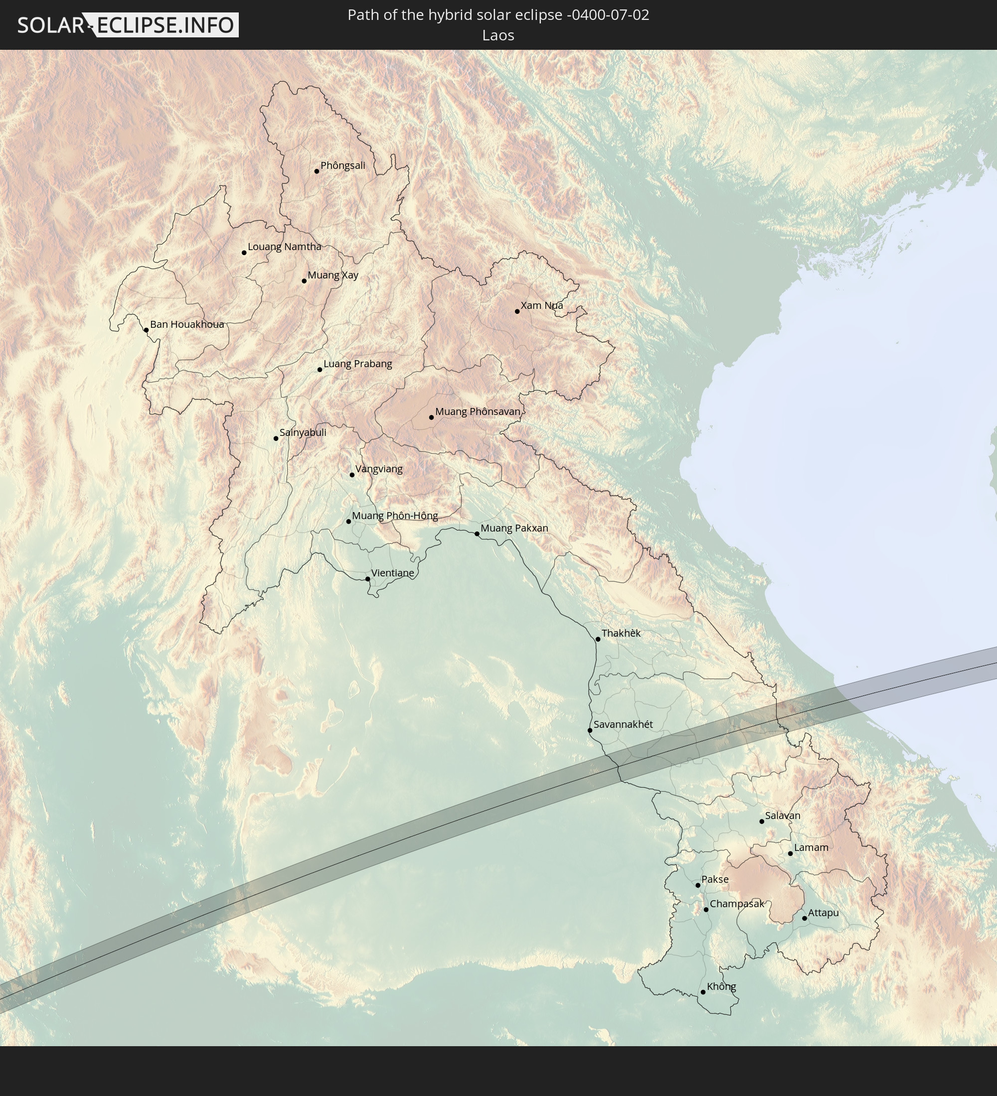 Laos
Laos
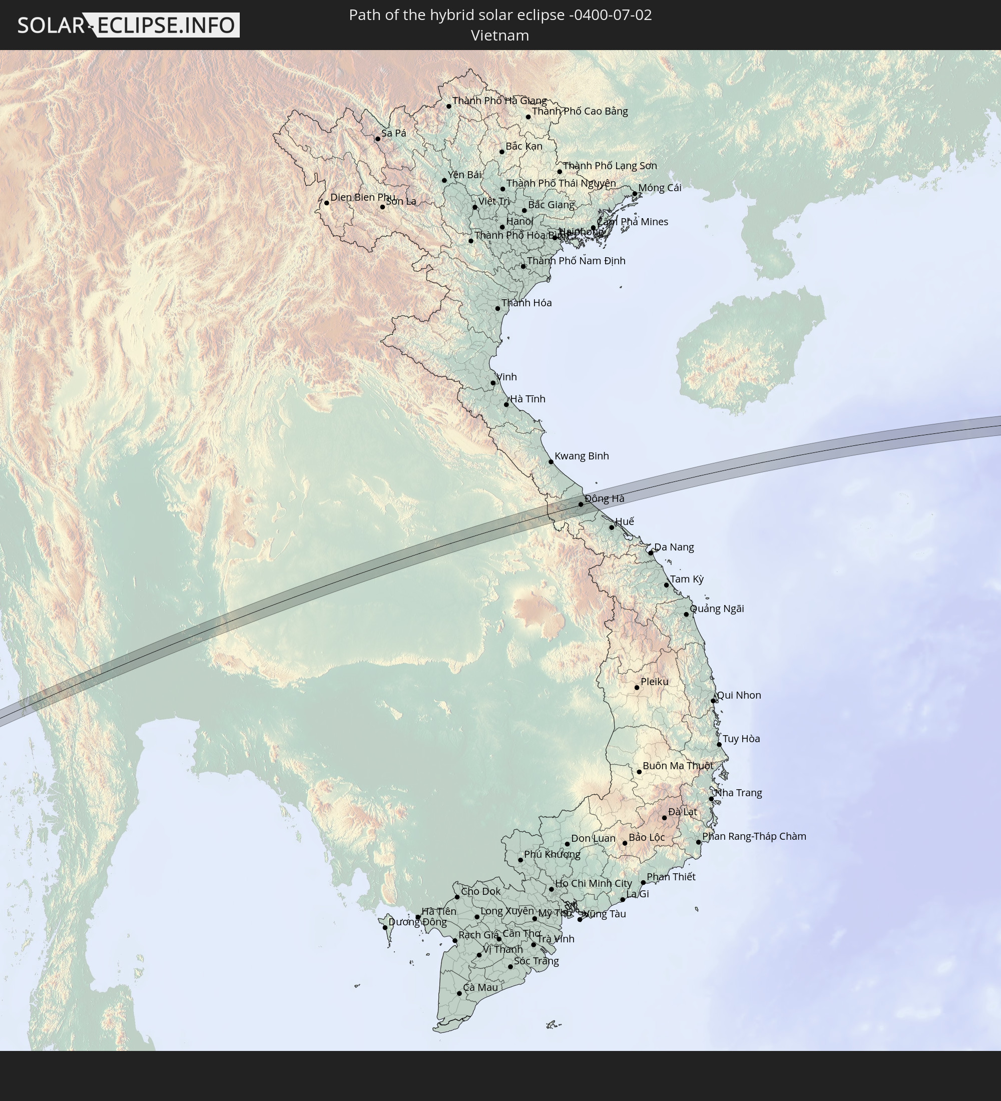 Vietnam
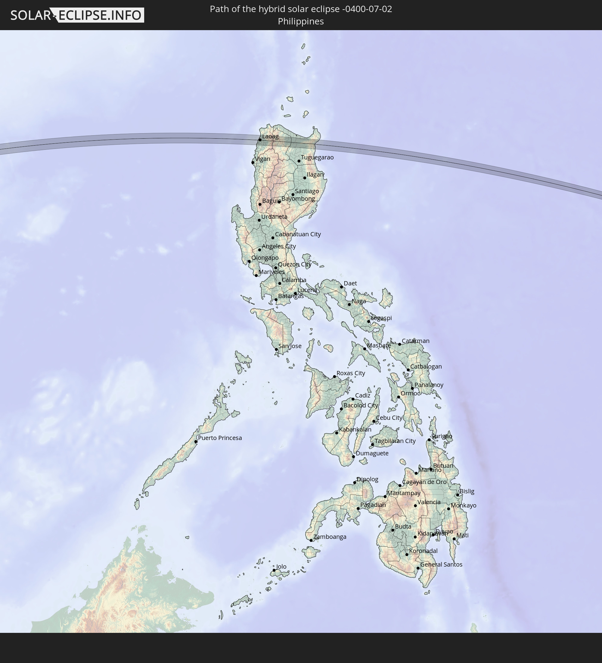 Philippines
In den folgenden Ländern ist die Sonnenfinsternis partiell zu sehen
 Russia
 United States Minor Outlying Islands
 Kiribati
 Sudan
Sudan
 Ethiopia
 Saudi Arabia
 Eritrea
 Somalia
 Djibouti
 Yemen
Yemen
 Iran
Iran
 Seychelles
 Kazakhstan
 Bahrain
 Qatar
Qatar
 United Arab Emirates
 Oman
Oman
 Mauritius
 Afghanistan
 Pakistan
 Tajikistan
 India
India
 Kyrgyzstan
 British Indian Ocean Territory
 Maldives
 China
China
 Sri Lanka
 Nepal
Nepal
 Mongolia
 Bangladesh
 Bhutan
 Myanmar
 Indonesia
 Cocos Islands
 Thailand
 Malaysia
 Laos
Laos
 Vietnam
 Cambodia
 Singapore
 Christmas Island
 Australia
 Macau
Macau
 Hong Kong
 Brunei
 Taiwan
 Philippines
 Japan
Japan
 East Timor
 North Korea
 South Korea
 Palau
Palau
 Federated States of Micronesia
 Papua New Guinea
 Guam
Guam
 Northern Mariana Islands
 Solomon Islands
 New Caledonia
 Marshall Islands
 Vanuatu
 Nauru
Nauru
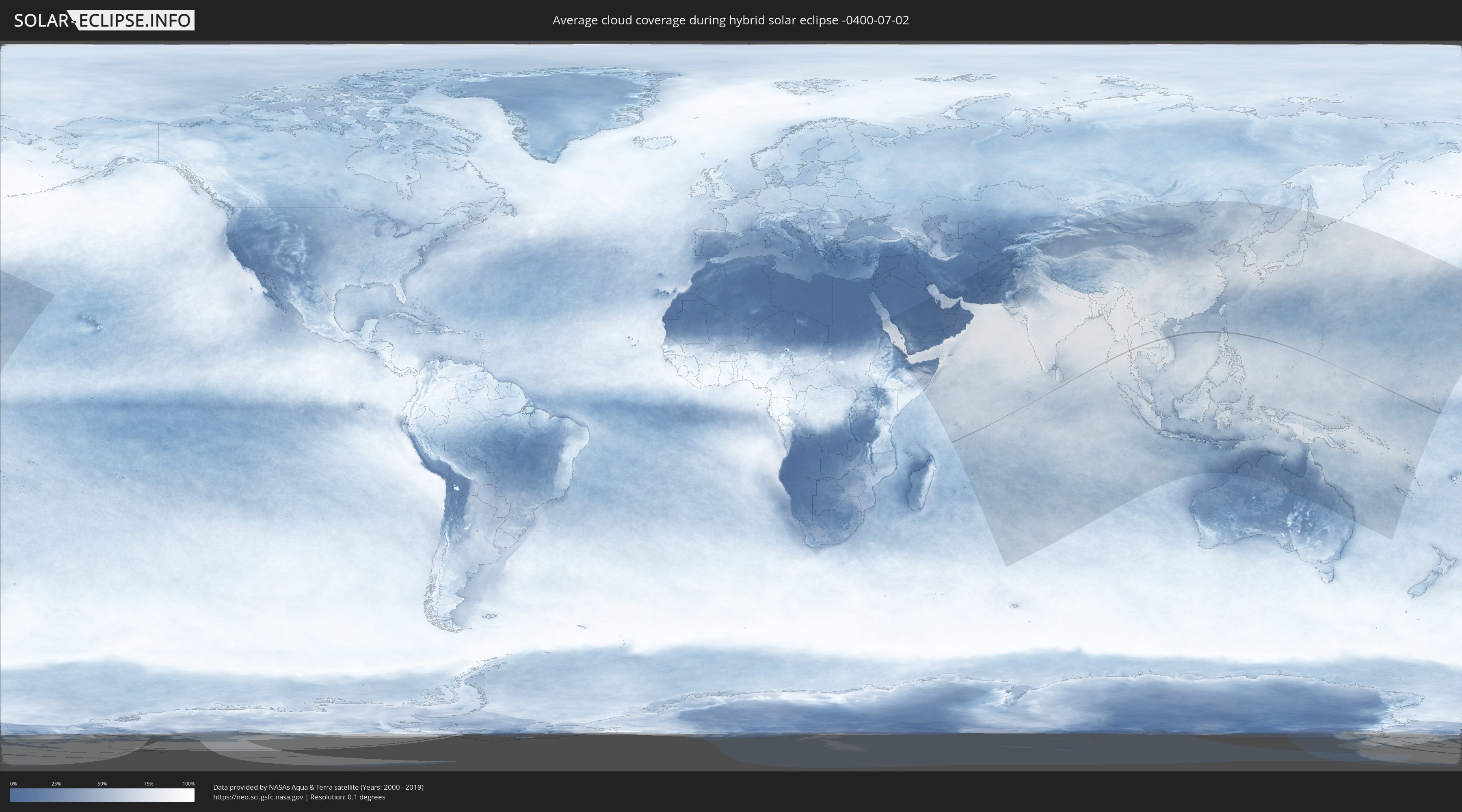
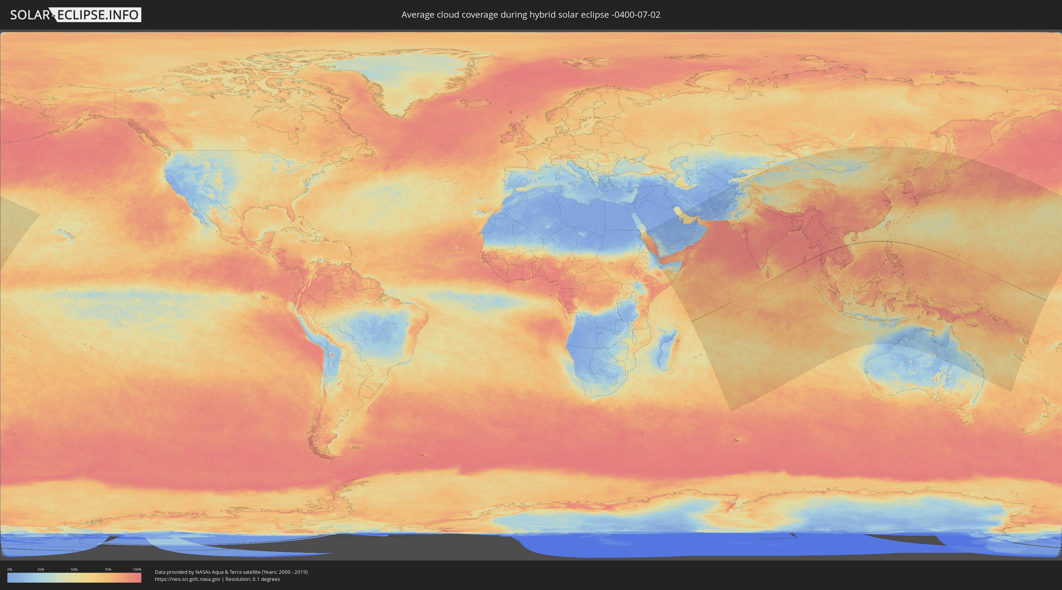
How will be the weather during the hybrid solar eclipse on 07/02/-0400?
Where is the best place to see the hybrid solar eclipse of 07/02/-0400?
The following maps show the average cloud coverage for the day of the hybrid solar eclipse.
With the help of these maps, it is possible to find the place along the eclipse path, which has the best
chance of a cloudless sky.
Nevertheless, you should consider local circumstances and inform about the weather of your chosen
observation site.
The data is provided by NASAs satellites
AQUA and TERRA.
The cloud maps are averaged over a period of 19 years (2000 - 2019).
Detailed country maps
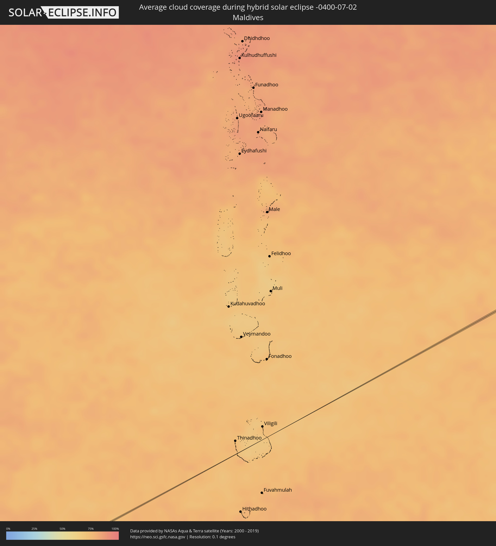 Maldives
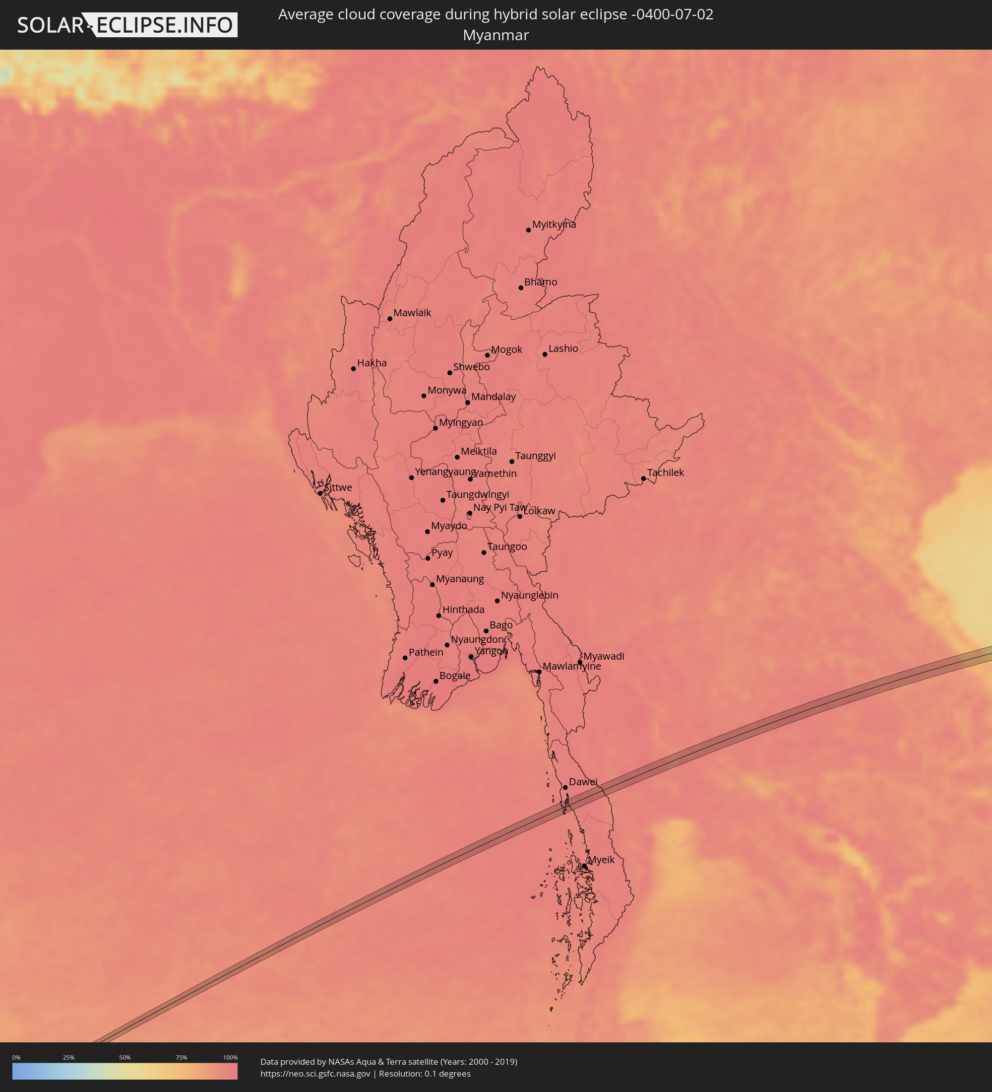 Myanmar
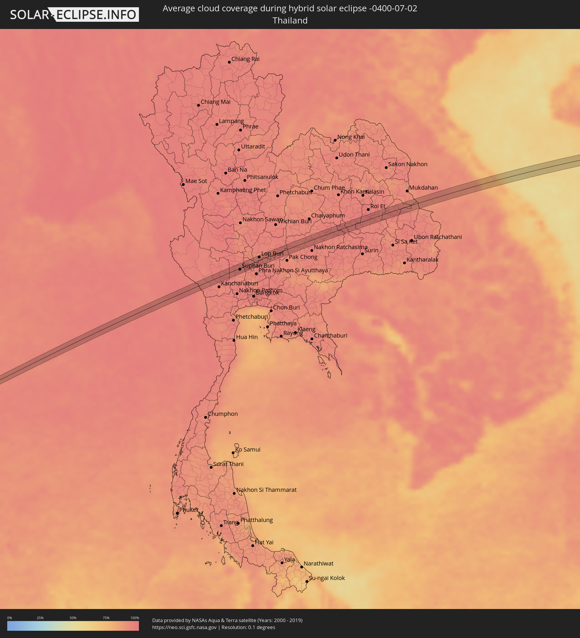 Thailand
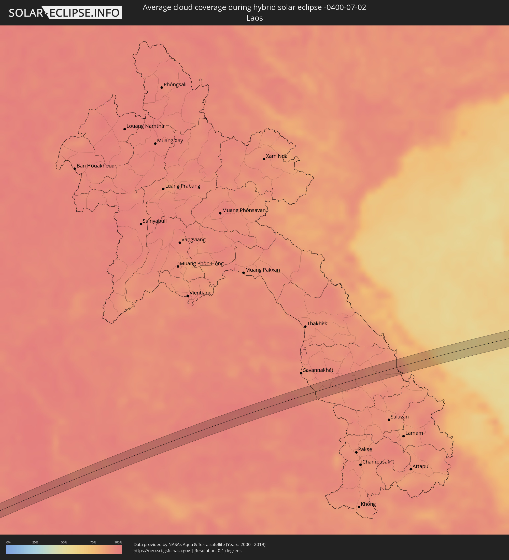 Laos
Laos
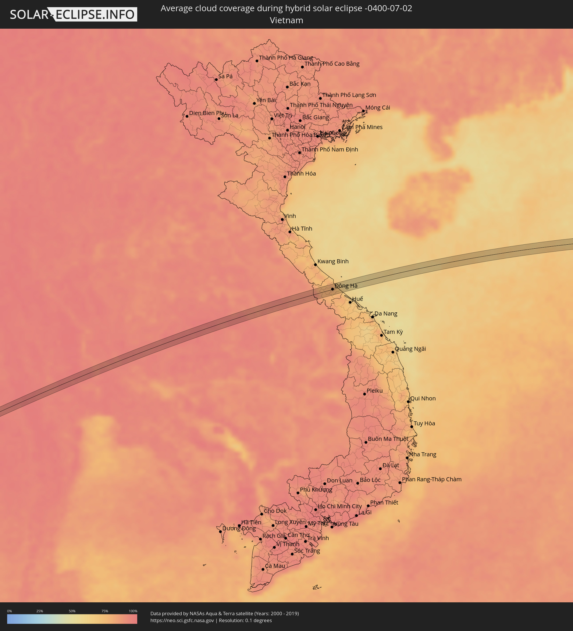 Vietnam
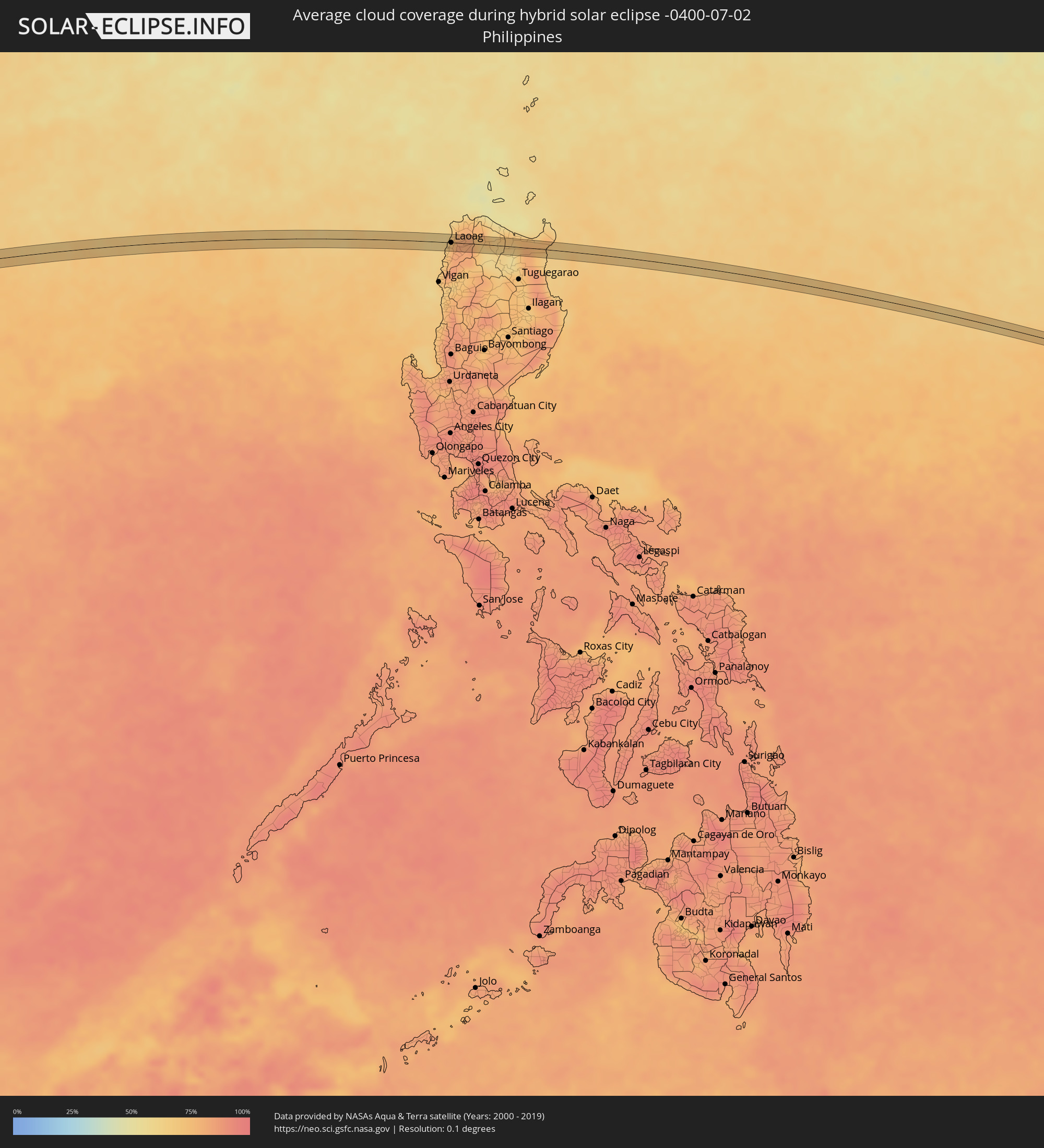 Philippines
Cities inside the path of the eclipse
The following table shows all locations with a population of more than 5,000 inside the eclipse path. Cities which have more than 100,000 inhabitants are marked bold. A click at the locations opens a detailed map.
| City | Type | Eclipse duration | Local time of max. eclipse | Distance to central line | Ø Cloud coverage |
|
Bo Phloi, Kanchanaburi
|
total | - | 10:22:31 UTC+06:42 | 7 km | 97% |
|
Suphan Buri, Suphan Buri
|
total | - | 10:24:18 UTC+06:42 | 3 km | 96% |
|
Wiset Chaichan, Ang Thong
|
total | - | 10:25:01 UTC+06:42 | 0 km | 96% |
|
Pho Thong, Ang Thong
|
total | - | 10:25:17 UTC+06:42 | 5 km | 94% |
|
Ang Thong, Ang Thong
|
total | - | 10:25:19 UTC+06:42 | 5 km | 93% |
|
Chaiyo, Ang Thong
|
total | - | 10:25:27 UTC+06:42 | 4 km | 93% |
|
Ban Thai Tan, Ang Thong
|
total | - | 10:25:27 UTC+06:42 | 3 km | 93% |
|
Lop Buri, Lop Buri
|
total | - | 10:26:05 UTC+06:42 | 9 km | 96% |
|
Ban Mo, Sara Buri
|
total | - | 10:26:06 UTC+06:42 | 13 km | 96% |
|
Phra Phutthabat, Sara Buri
|
total | - | 10:26:24 UTC+06:42 | 5 km | 95% |
|
Dan Khun Thot, Nakhon Ratchasima
|
total | - | 10:29:38 UTC+06:42 | 7 km | 94% |
|
Non Thai, Nakhon Ratchasima
|
total | - | 10:30:28 UTC+06:42 | 6 km | 96% |
|
Kham Sakae Saeng, Nakhon Ratchasima
|
total | - | 10:30:54 UTC+06:42 | 5 km | 95% |
|
Non Sung, Nakhon Ratchasima
|
total | - | 10:30:59 UTC+06:42 | 14 km | 94% |
|
Phayakkhaphum Phisai, Maha Sarakham
|
total | - | 10:34:02 UTC+06:42 | 14 km | 94% |
|
Wapi Pathum, Maha Sarakham
|
total | - | 10:34:54 UTC+06:42 | 14 km | 97% |
|
Kaset Wisai, Roi Et
|
total | - | 10:35:19 UTC+06:42 | 13 km | 95% |
|
Ban Selaphum, Roi Et
|
total | - | 10:36:45 UTC+06:42 | 13 km | 94% |
|
Ðông Hà, Quảng Trị
|
total | - | 11:11:45 UTC+07:06 | 0 km | 76% |
|
San Nicolas, Ilocos
|
total | - | 12:50:28 UTC+08:00 | 3 km | 76% |
|
Laoag, Ilocos
|
total | - | 12:50:28 UTC+08:00 | 1 km | 76% |
|
Bacarra, Ilocos
|
total | - | 12:50:31 UTC+08:00 | 6 km | 73% |
|
Pasuquin, Ilocos
|
total | - | 12:50:31 UTC+08:00 | 15 km | 73% |
|
Sarrat, Ilocos
|
total | - | 12:50:38 UTC+08:00 | 4 km | 76% |
|
Vintar, Ilocos
|
total | - | 12:50:38 UTC+08:00 | 3 km | 76% |
|
Dingras, Ilocos
|
total | - | 12:50:48 UTC+08:00 | 10 km | 82% |
|
Lasam, Cagayan Valley
|
total | - | 12:53:42 UTC+08:00 | 8 km | 63% |
|
Magapit, Cagayan Valley
|
total | - | 12:53:54 UTC+08:00 | 1 km | 69% |
|
Magapit, Aguiguican, Cagayan Valley
|
total | - | 12:53:56 UTC+08:00 | 3 km | 69% |