Total solar eclipse of 11/14/-0491
| Day of week: | Saturday |
| Maximum duration of eclipse: | 02m15s |
| Maximum width of eclipse path: | 83 km |
| Saros cycle: | 54 |
| Coverage: | 100% |
| Magnitude: | 1.0241 |
| Gamma: | 0.1254 |
Wo kann man die Sonnenfinsternis vom 11/14/-0491 sehen?
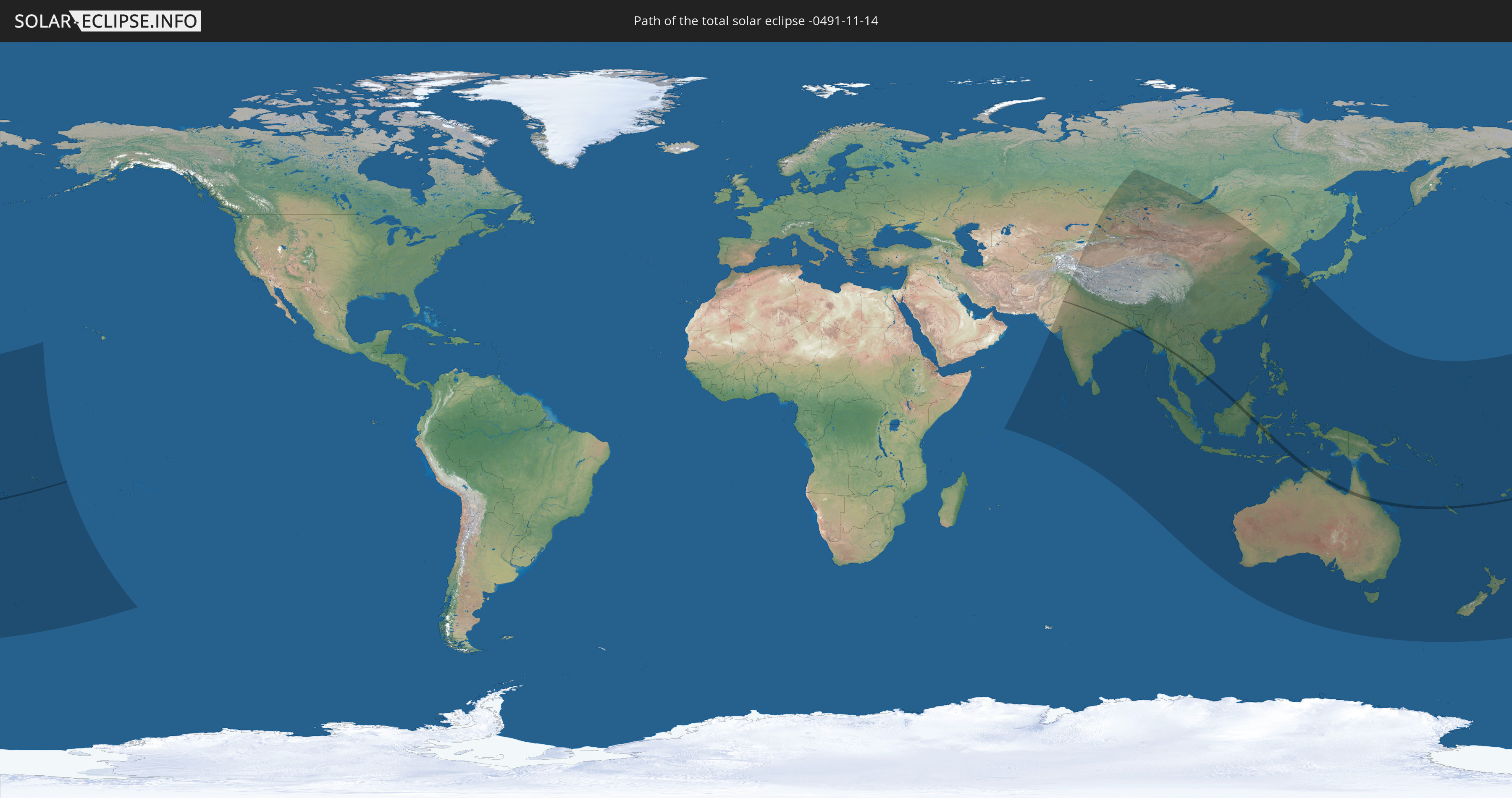
Die Sonnenfinsternis am 11/14/-0491 kann man in 56 Ländern als partielle Sonnenfinsternis beobachten.
Der Finsternispfad verläuft durch 14 Länder. Nur in diesen Ländern ist sie als total Sonnenfinsternis zu sehen.
In den folgenden Ländern ist die Sonnenfinsternis total zu sehen
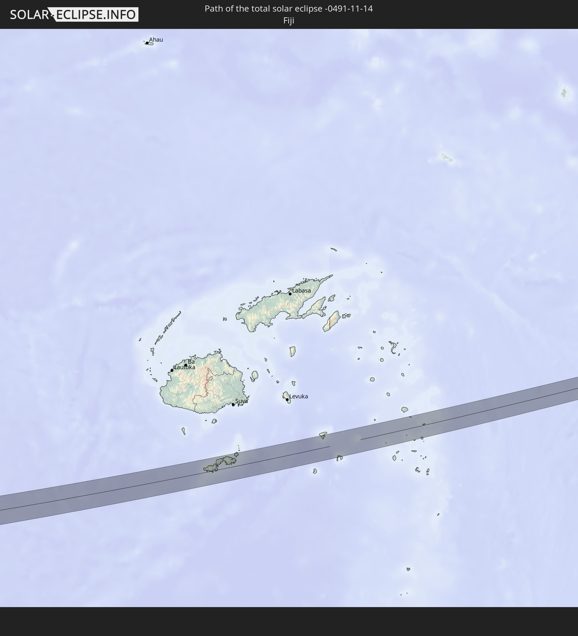 Fiji
Fiji
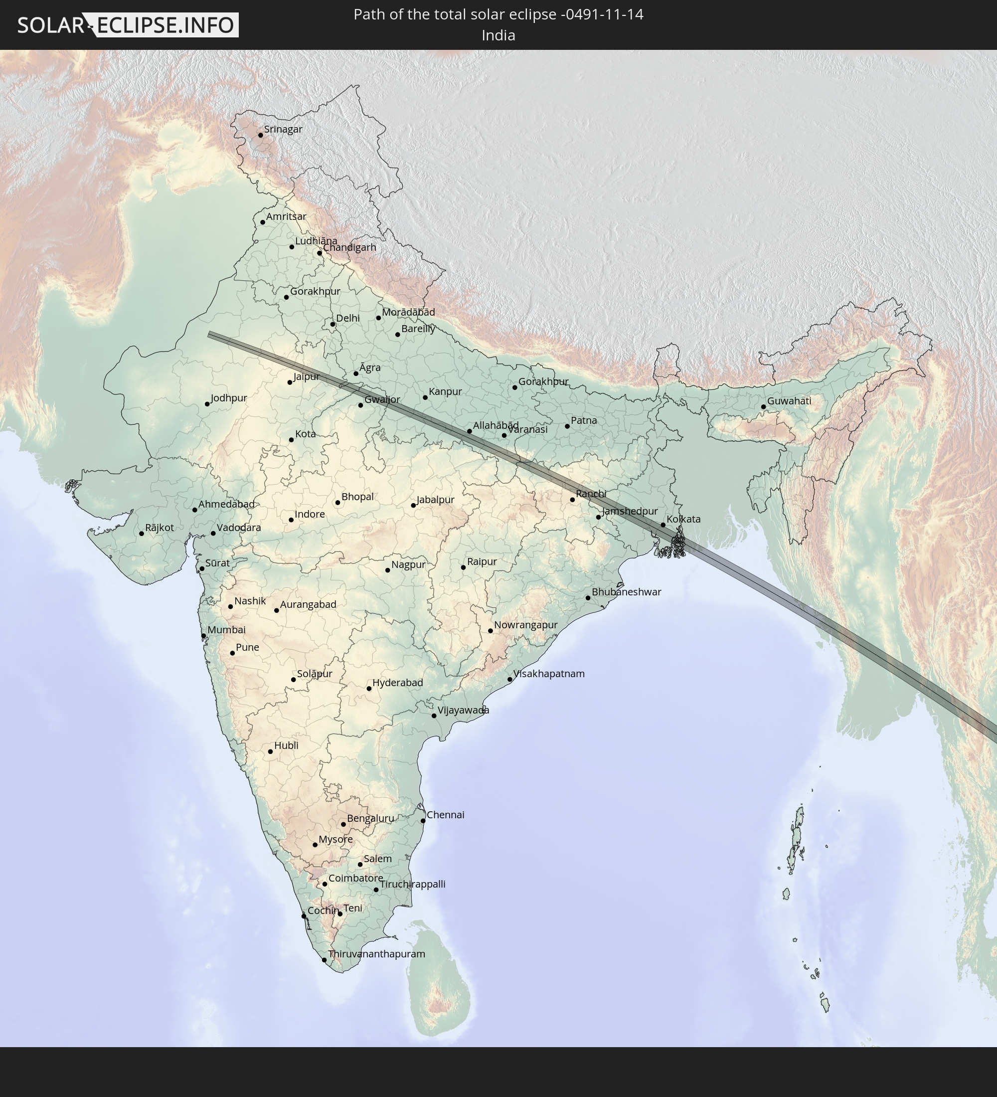 India
India
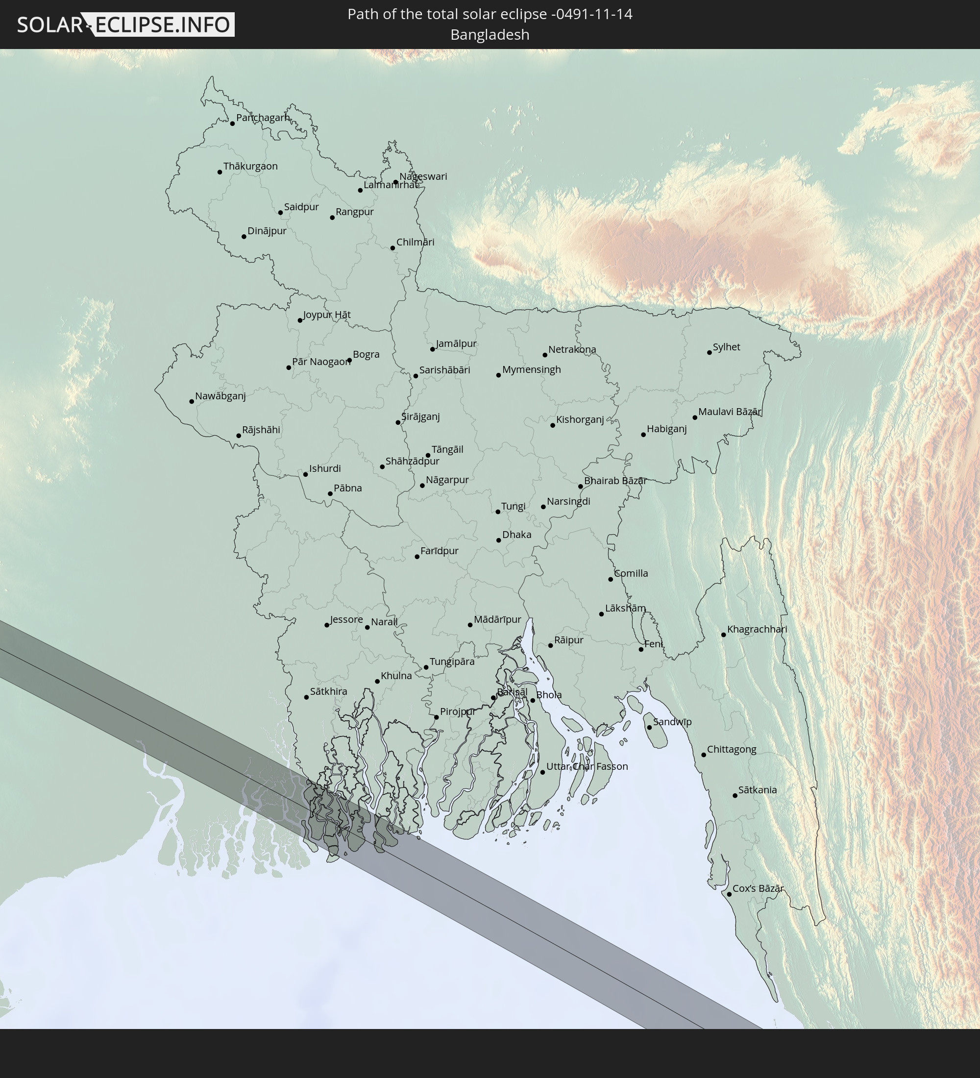 Bangladesh
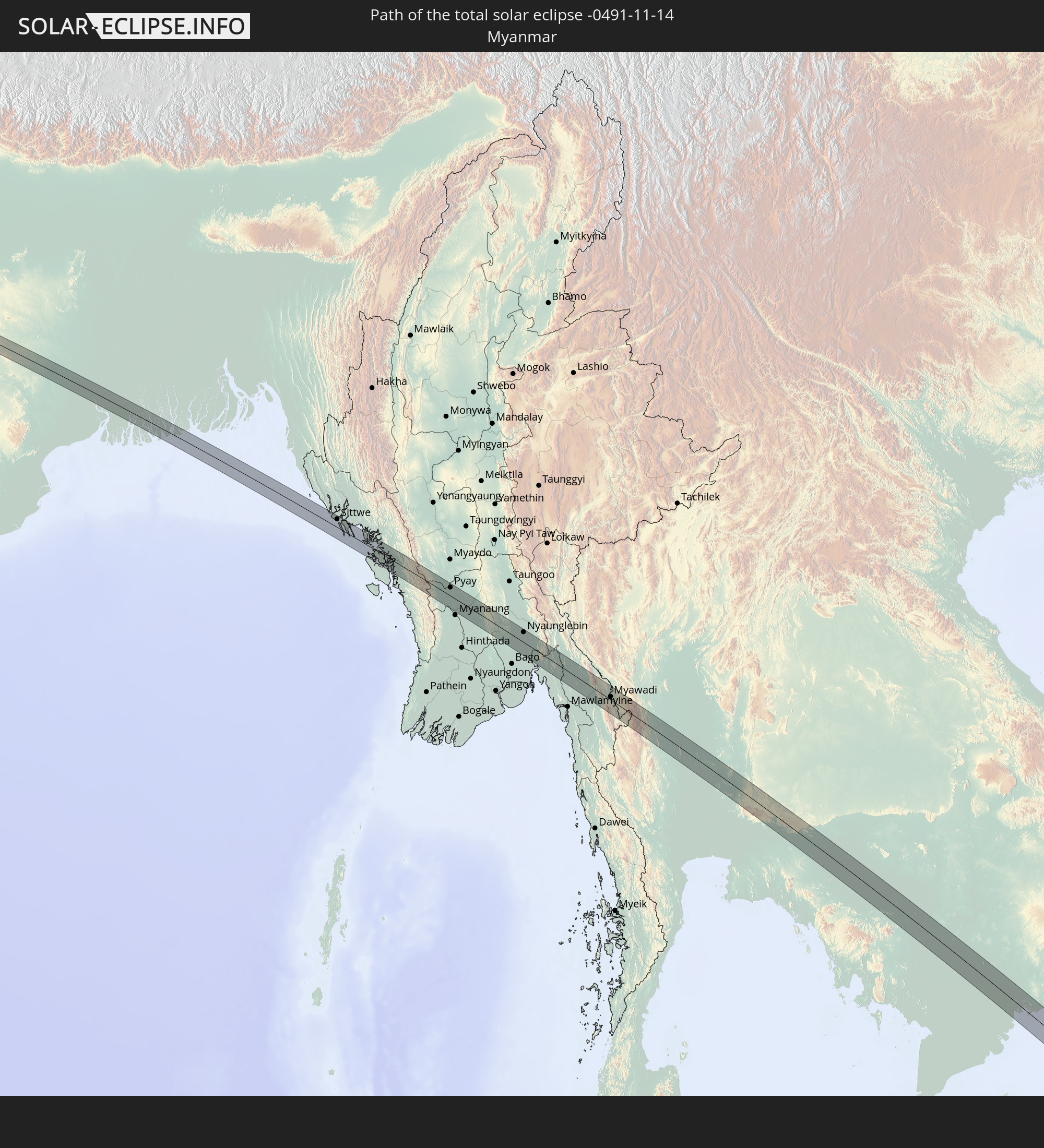 Myanmar
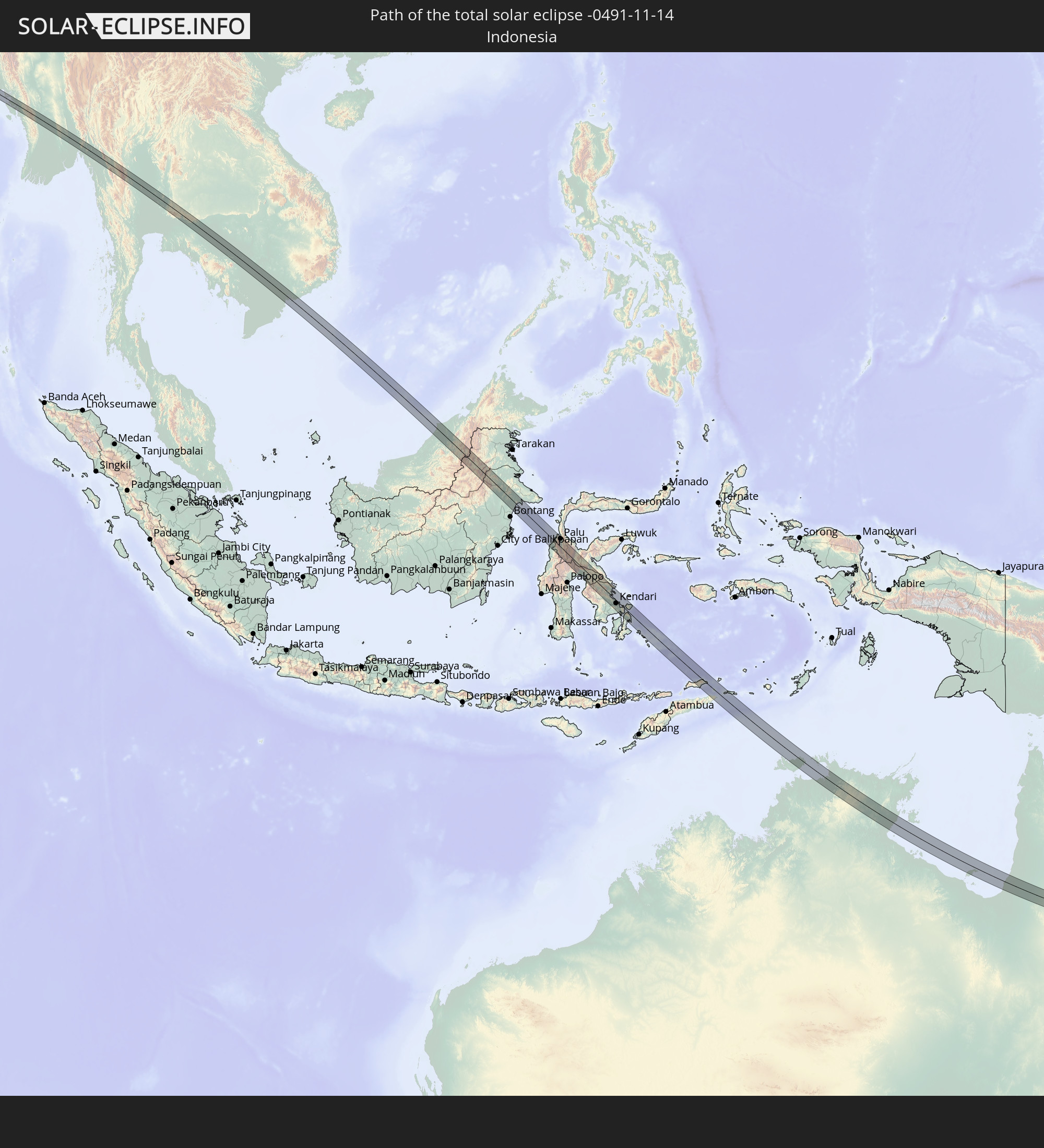 Indonesia
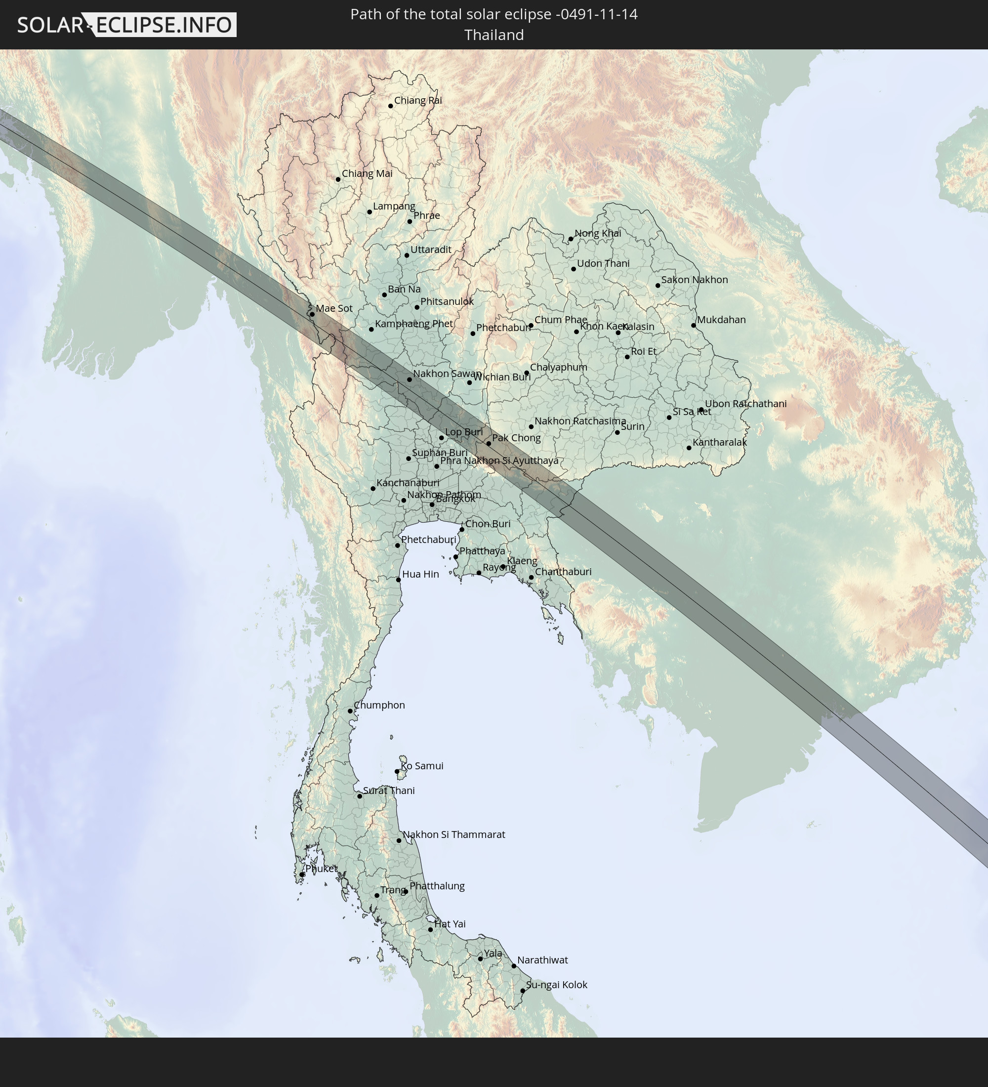 Thailand
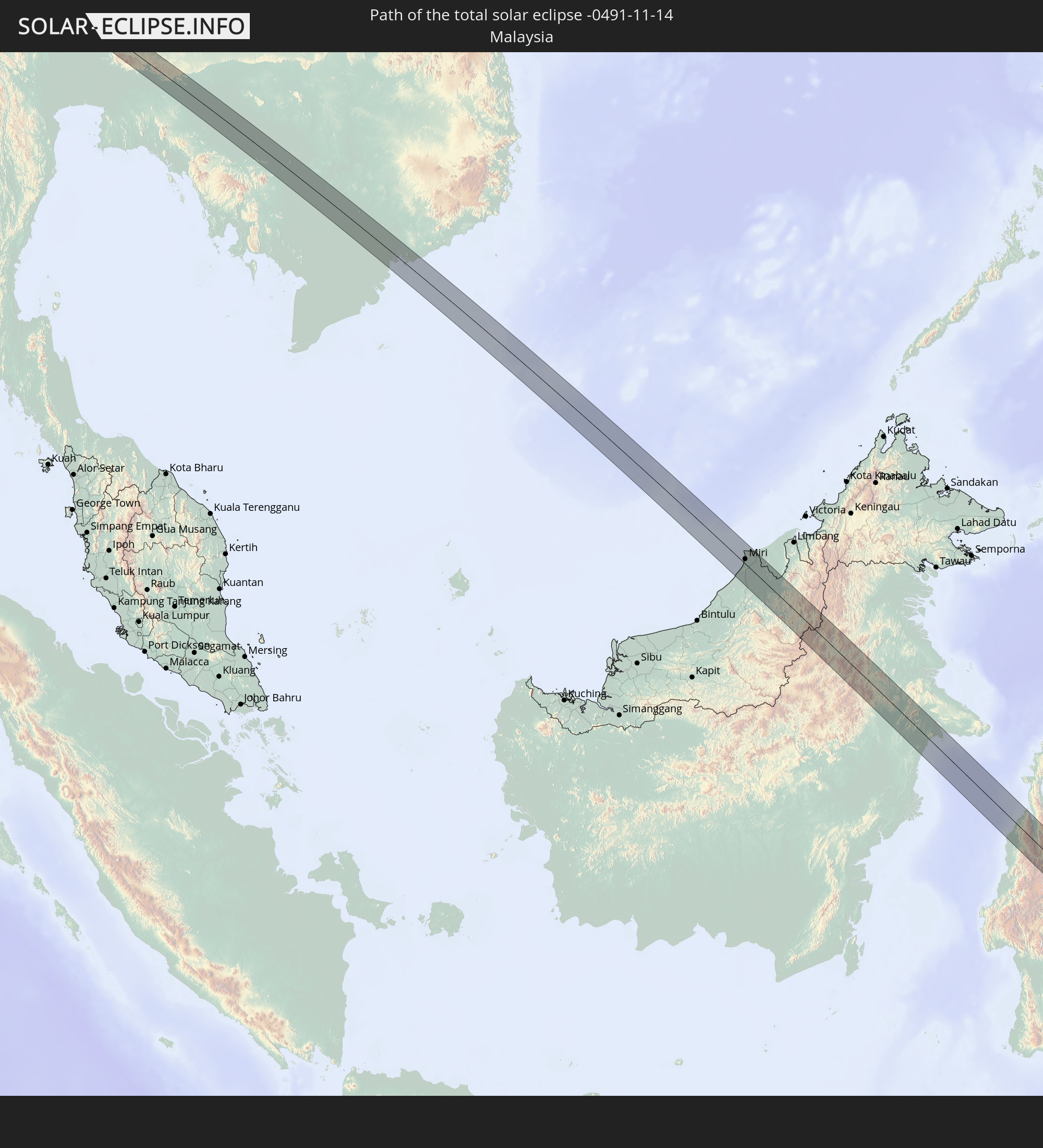 Malaysia
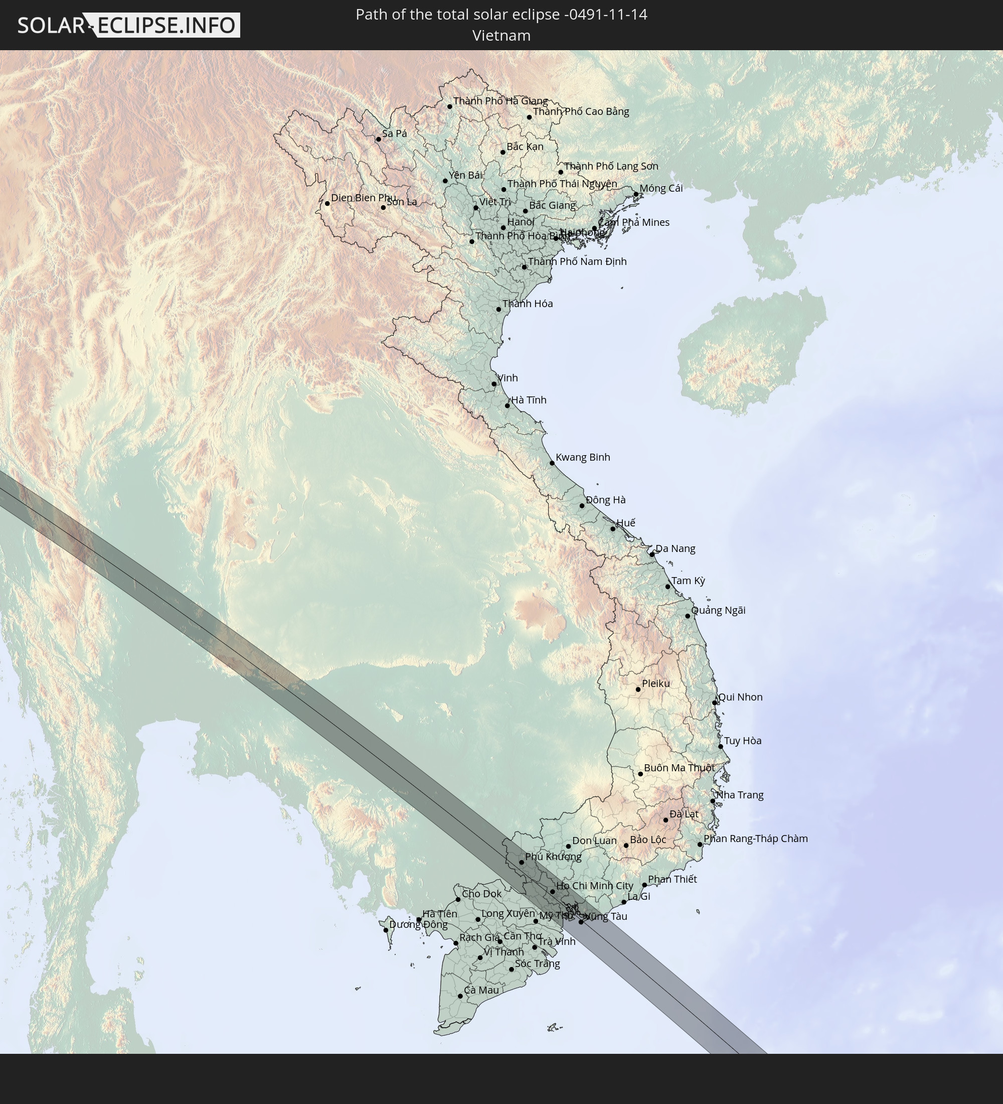 Vietnam
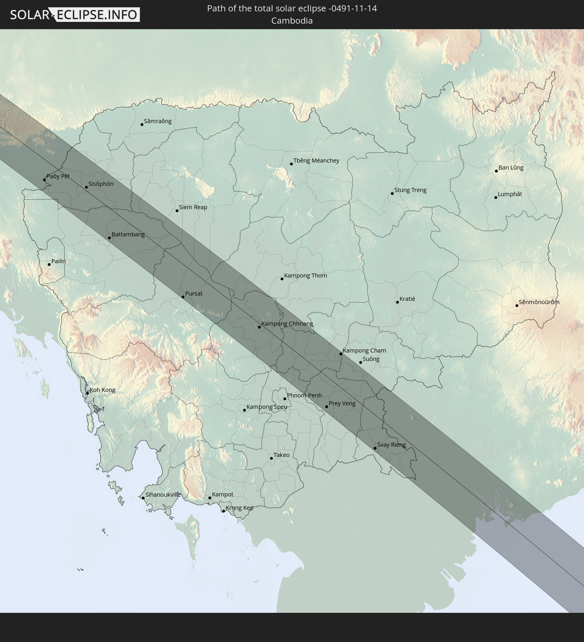 Cambodia
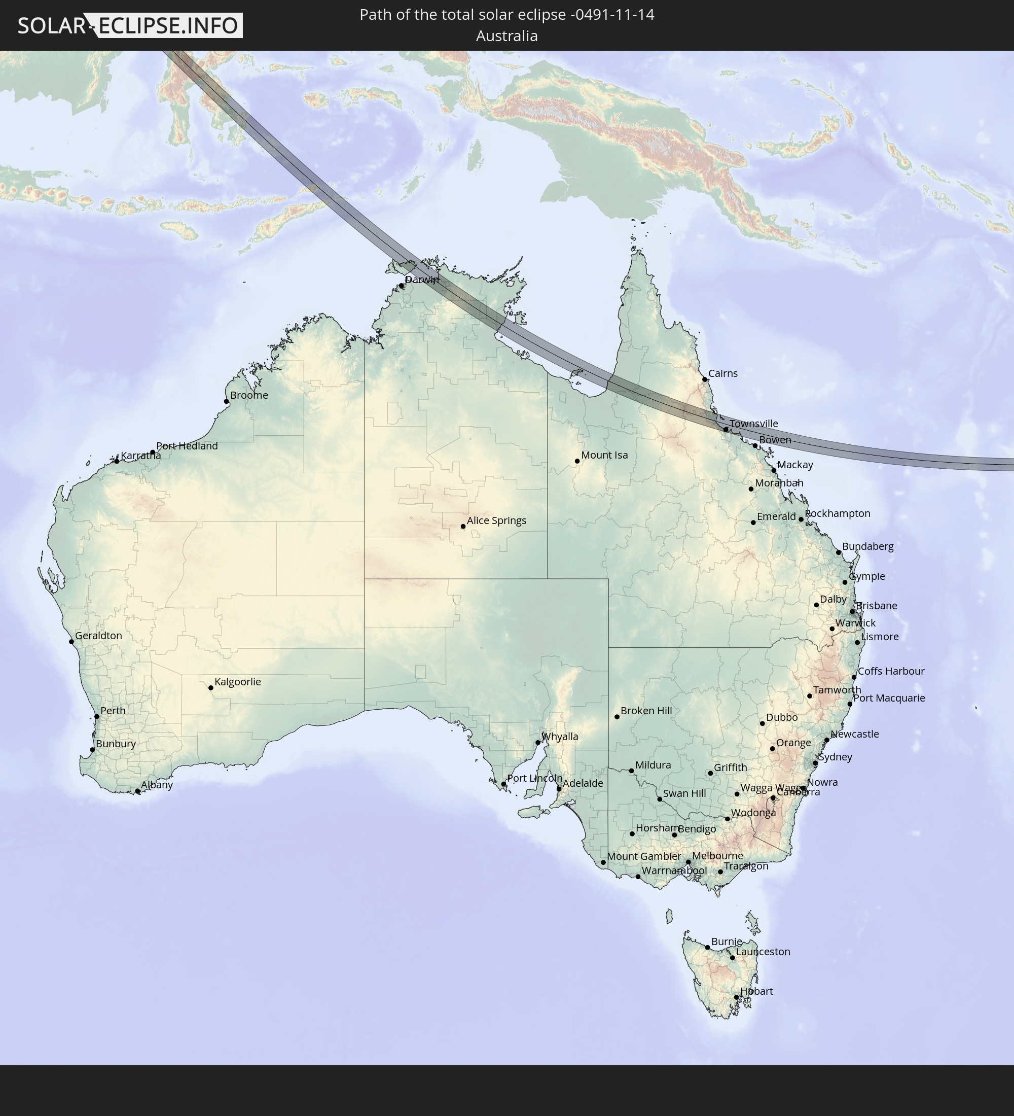 Australia
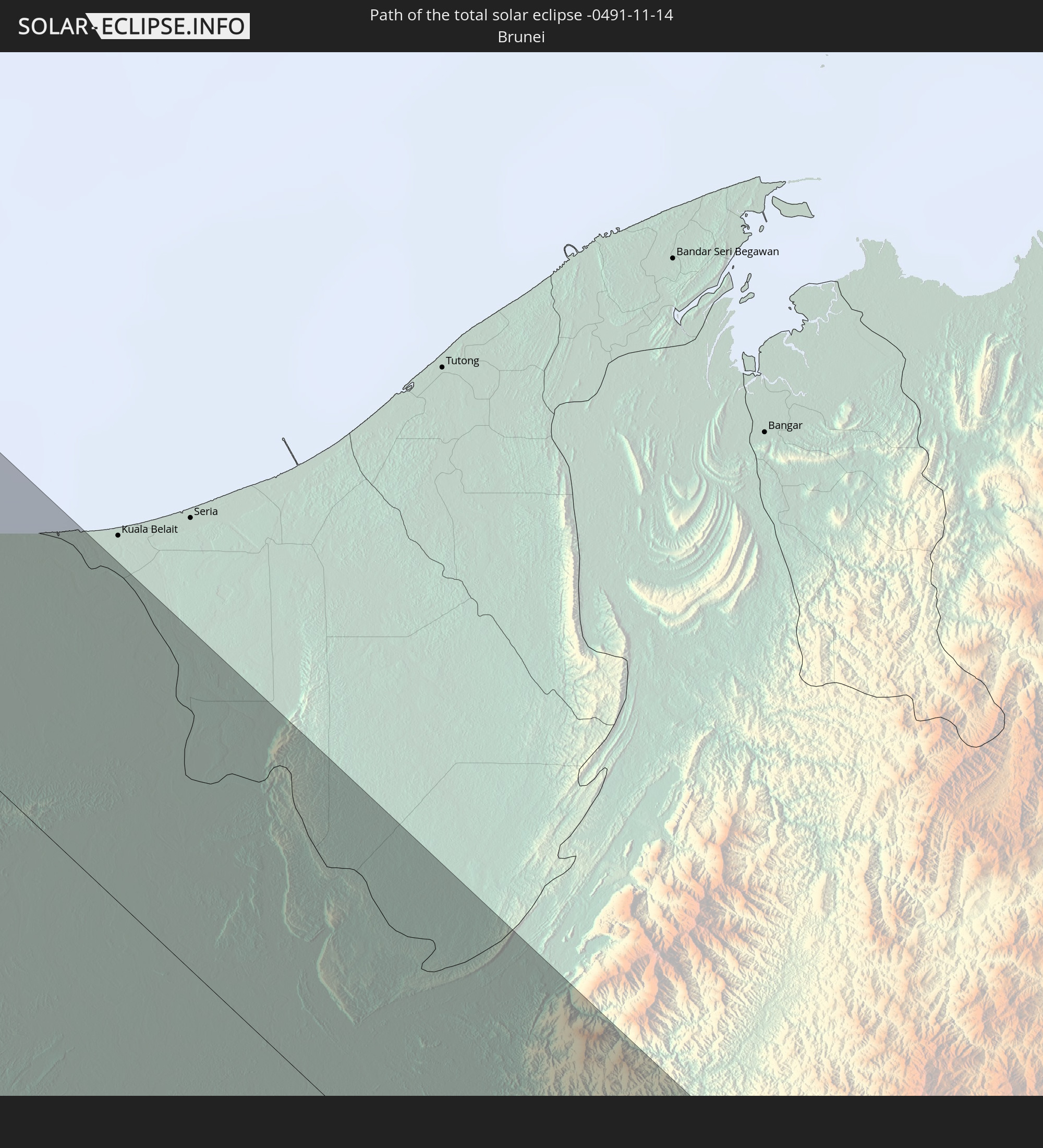 Brunei
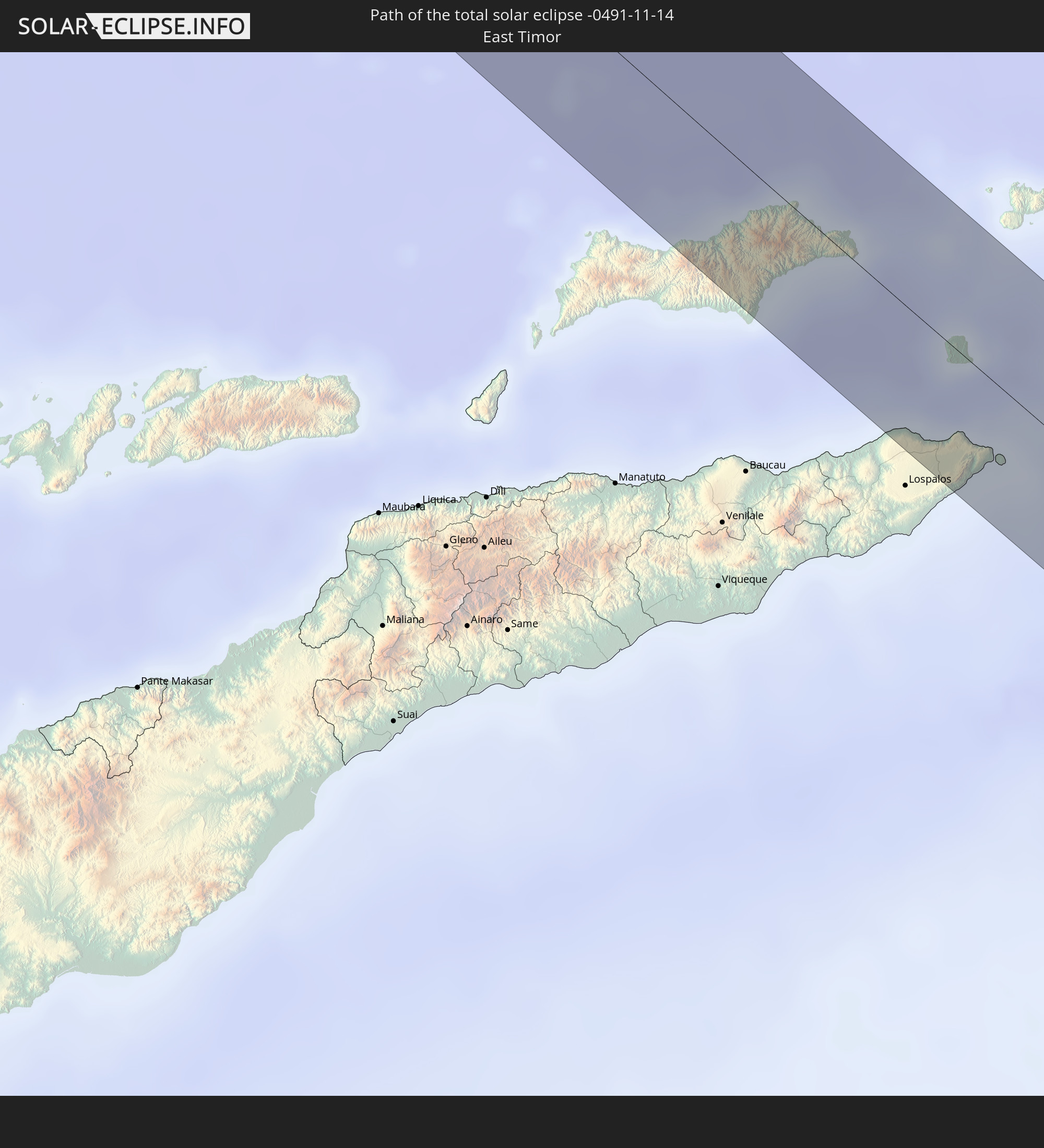 East Timor
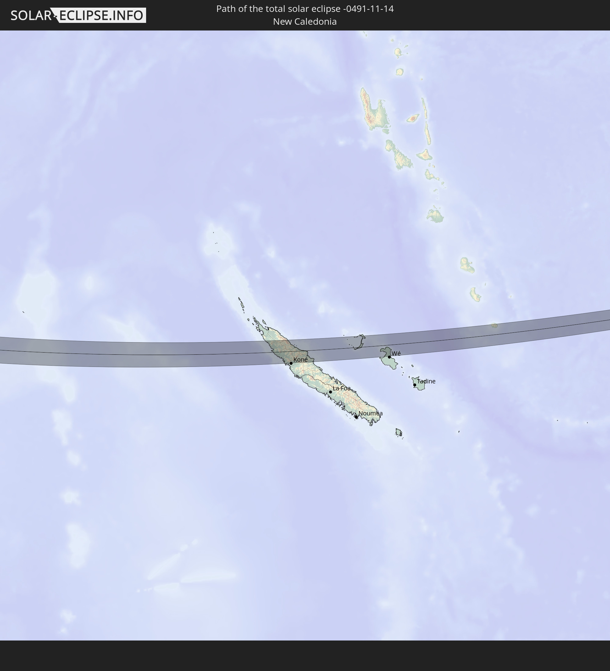 New Caledonia
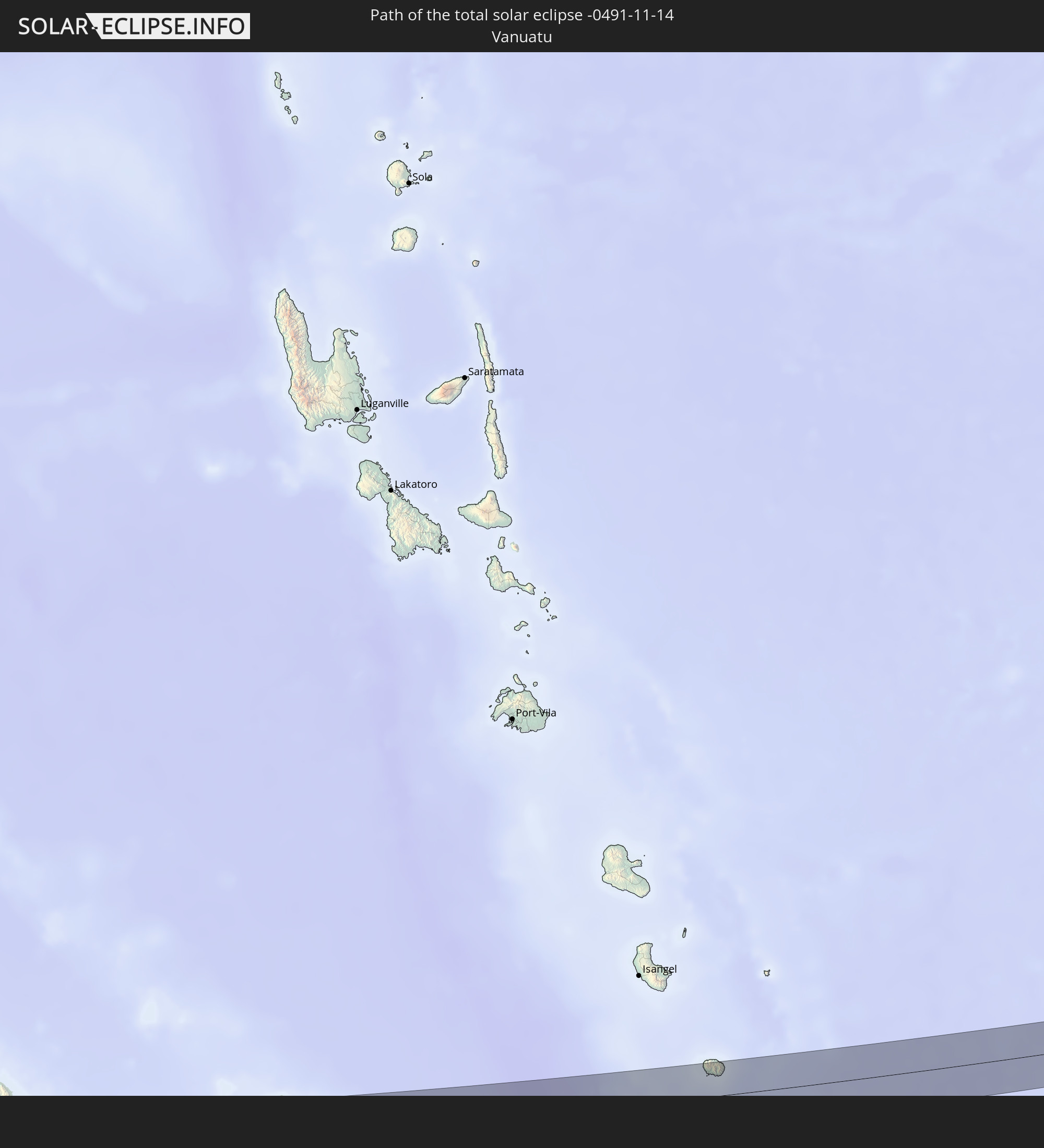 Vanuatu
In den folgenden Ländern ist die Sonnenfinsternis partiell zu sehen
 Fiji
Fiji
 Russia
 New Zealand
 United States Minor Outlying Islands
 Wallis and Futuna
 Tonga
Tonga
 Kiribati
 Samoa
Samoa
 Tokelau
 American Samoa
 Niue
Niue
 Cook Islands
 Kazakhstan
 Pakistan
 India
India
 Kyrgyzstan
 British Indian Ocean Territory
 Maldives
 China
China
 Sri Lanka
 Nepal
Nepal
 Mongolia
 Bangladesh
 Bhutan
 Myanmar
 Indonesia
 Cocos Islands
 Thailand
 Malaysia
 Laos
Laos
 Vietnam
 Cambodia
 Singapore
 Christmas Island
 Australia
 Macau
Macau
 Hong Kong
 Brunei
 Taiwan
 Philippines
 Japan
Japan
 East Timor
 North Korea
 South Korea
 Palau
Palau
 Federated States of Micronesia
 Papua New Guinea
 Guam
Guam
 Northern Mariana Islands
 Solomon Islands
 New Caledonia
 Marshall Islands
 Vanuatu
 Nauru
Nauru
 Norfolk Island
 Tuvalu
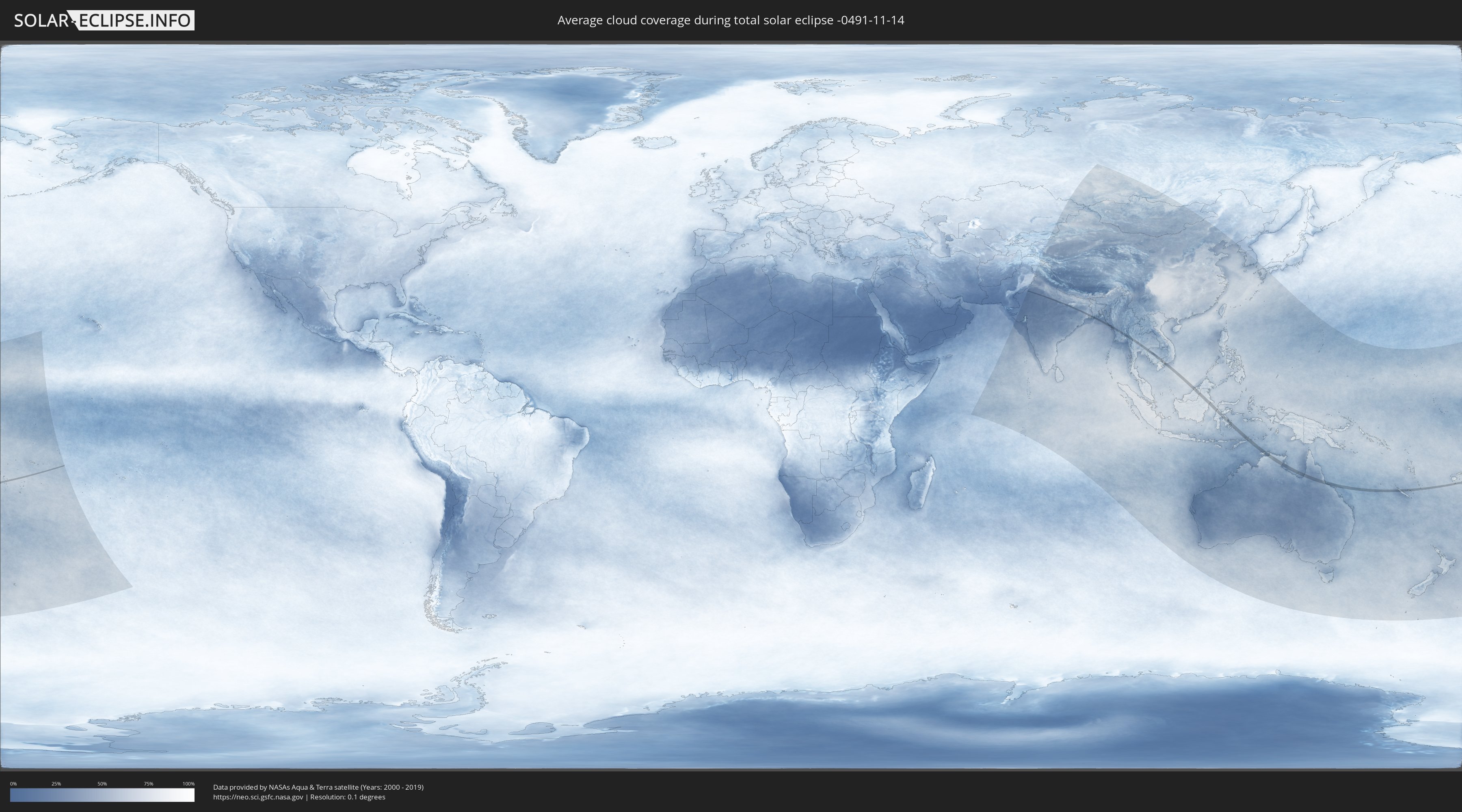
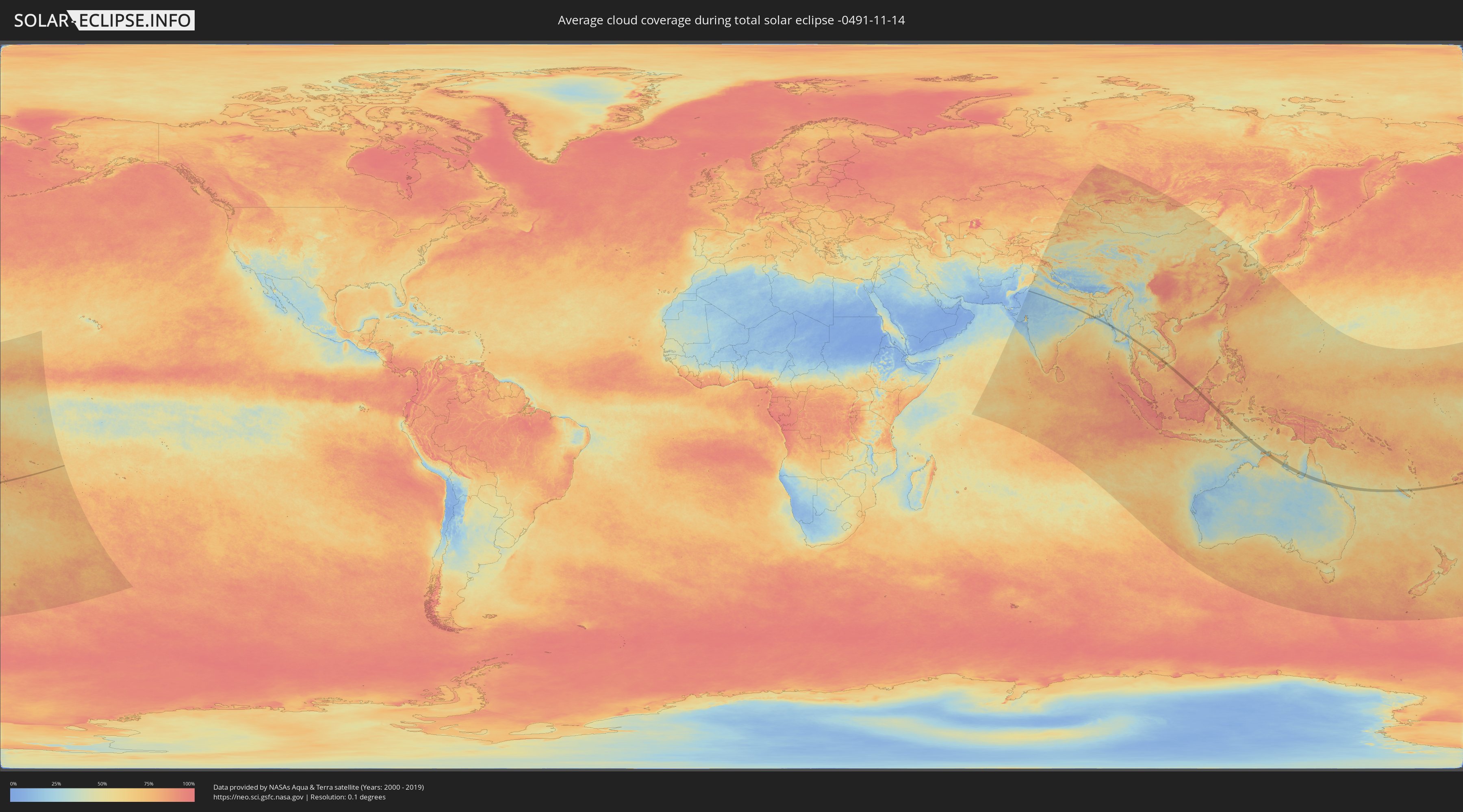
How will be the weather during the total solar eclipse on 11/14/-0491?
Where is the best place to see the total solar eclipse of 11/14/-0491?
The following maps show the average cloud coverage for the day of the total solar eclipse.
With the help of these maps, it is possible to find the place along the eclipse path, which has the best
chance of a cloudless sky.
Nevertheless, you should consider local circumstances and inform about the weather of your chosen
observation site.
The data is provided by NASAs satellites
AQUA and TERRA.
The cloud maps are averaged over a period of 19 years (2000 - 2019).
Detailed country maps
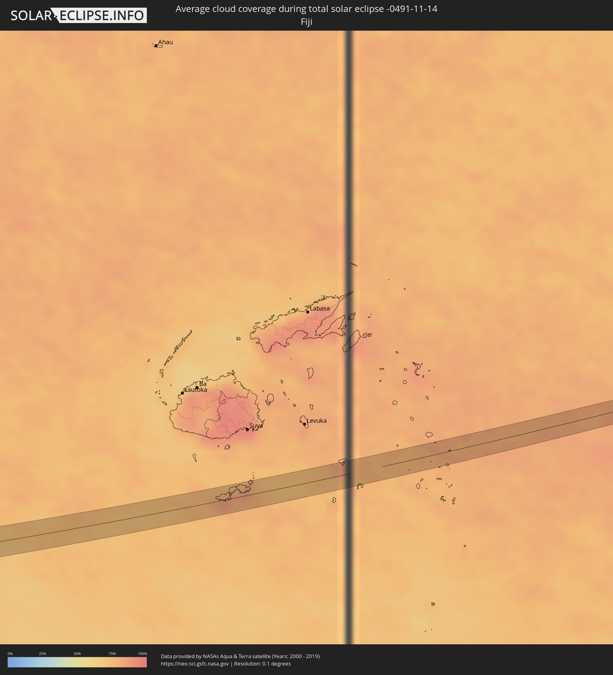 Fiji
Fiji
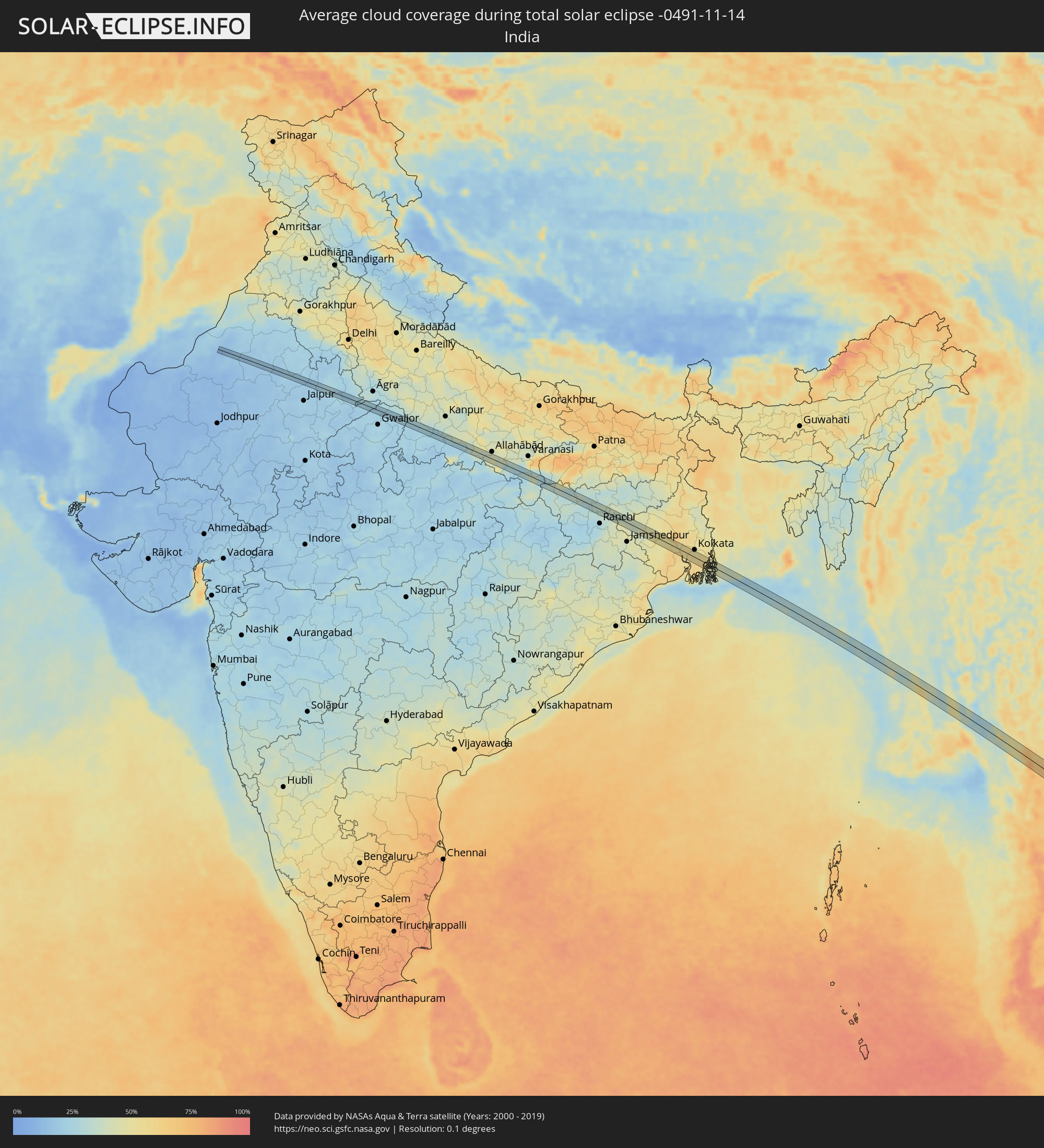 India
India
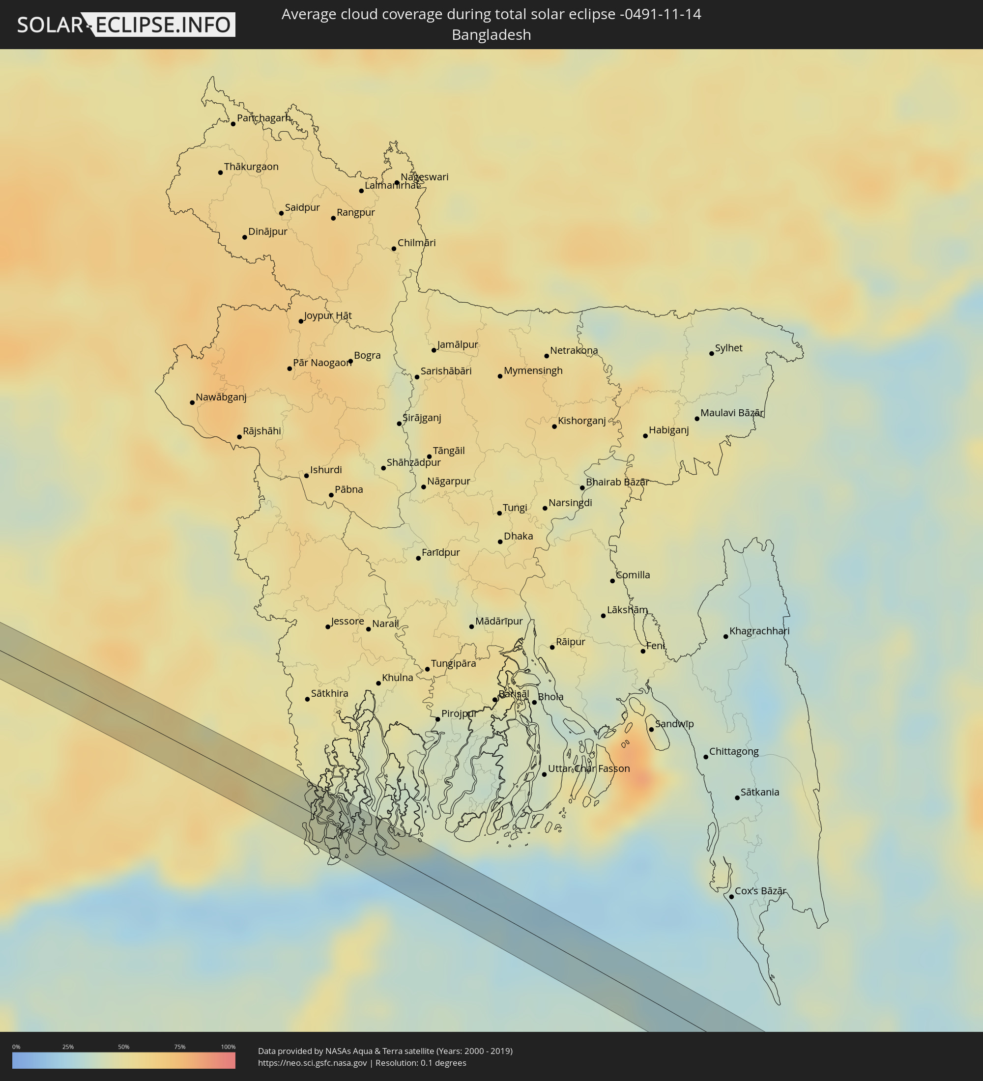 Bangladesh
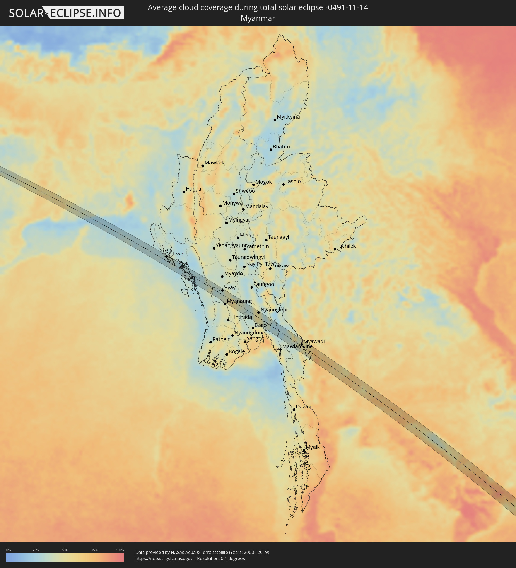 Myanmar
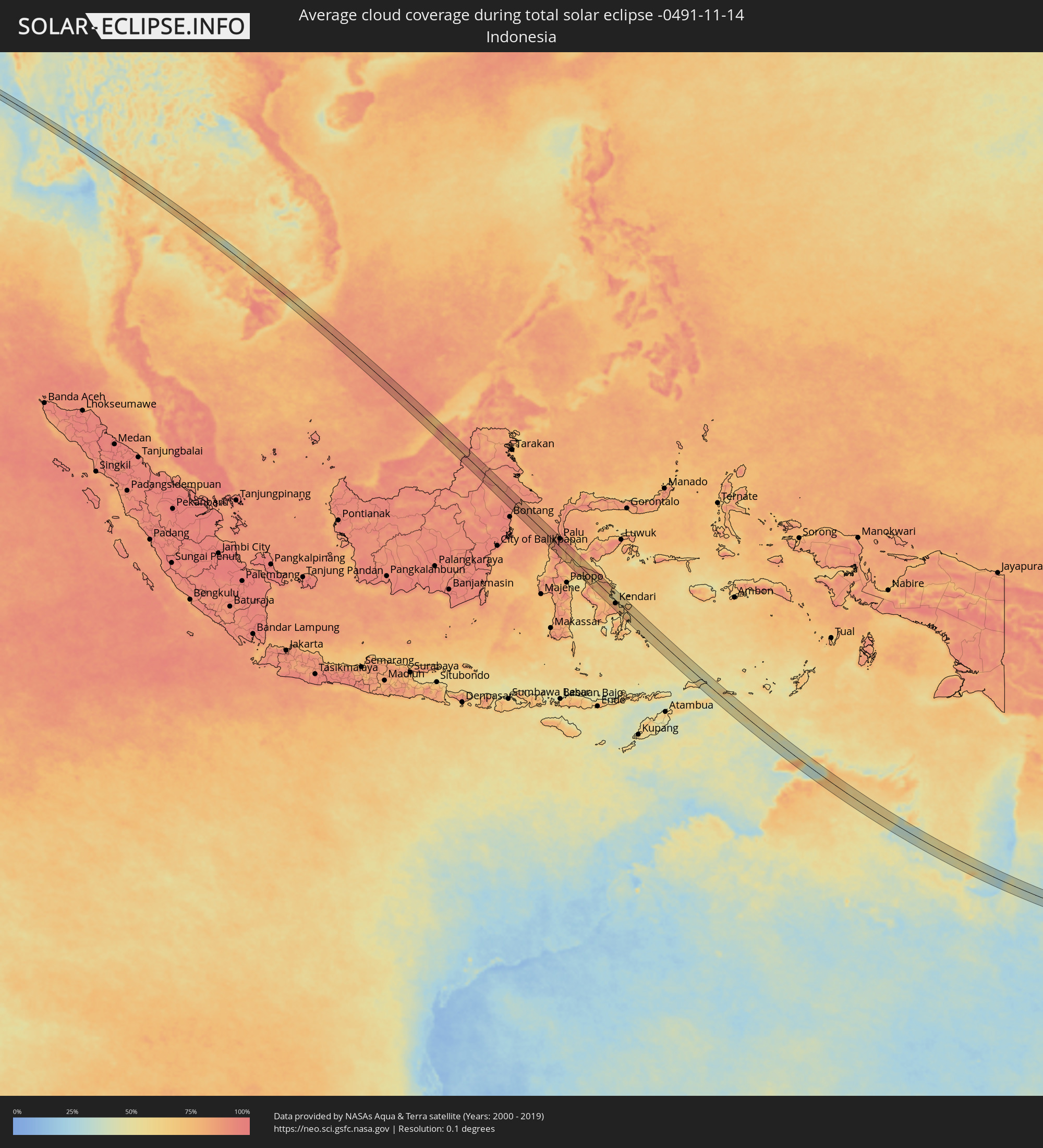 Indonesia
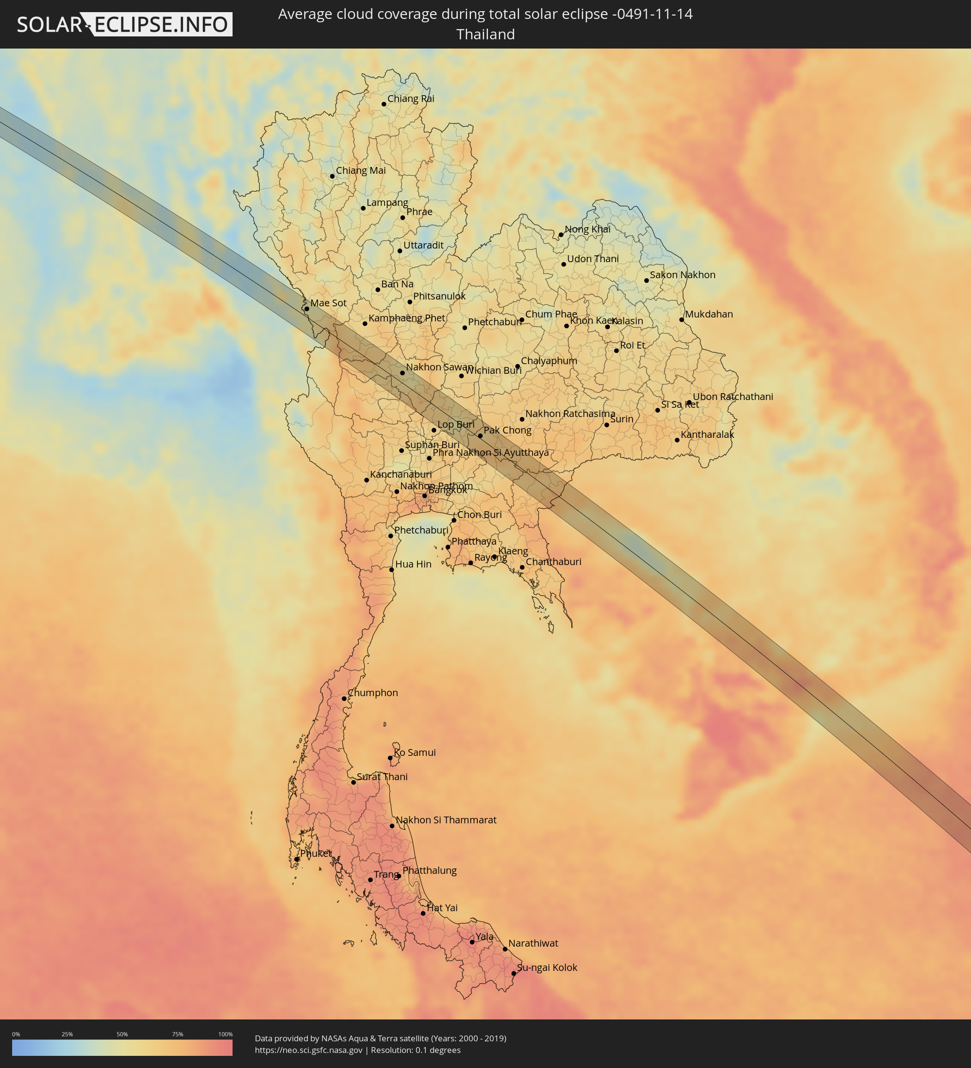 Thailand
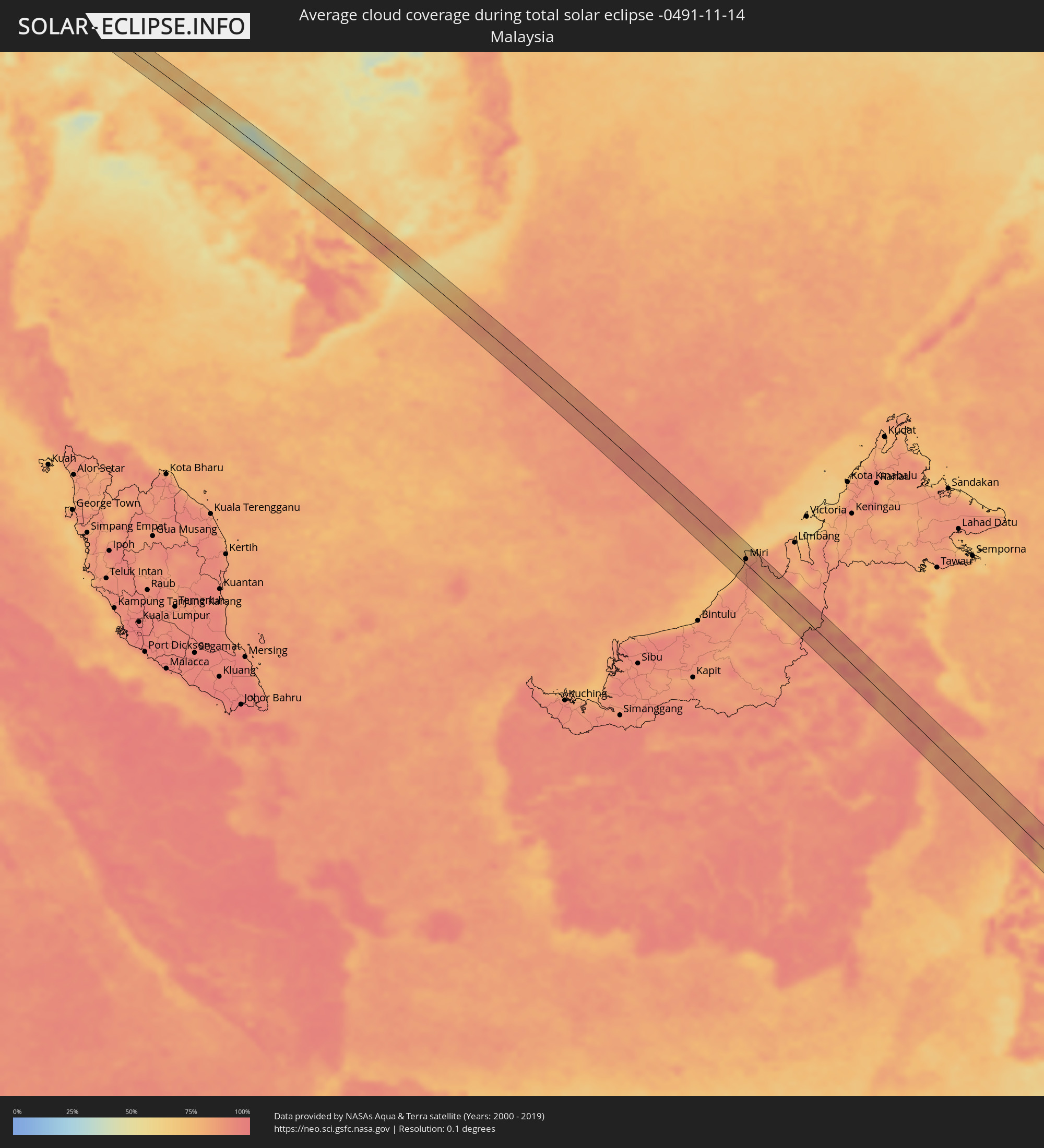 Malaysia
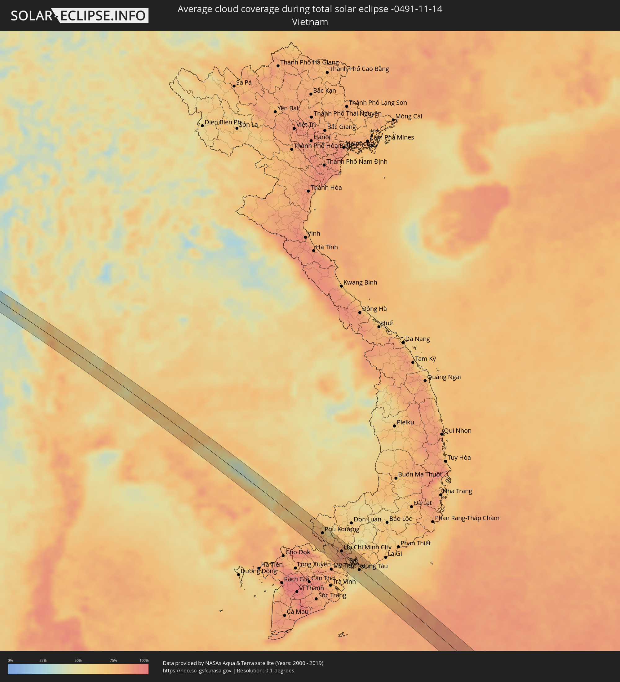 Vietnam
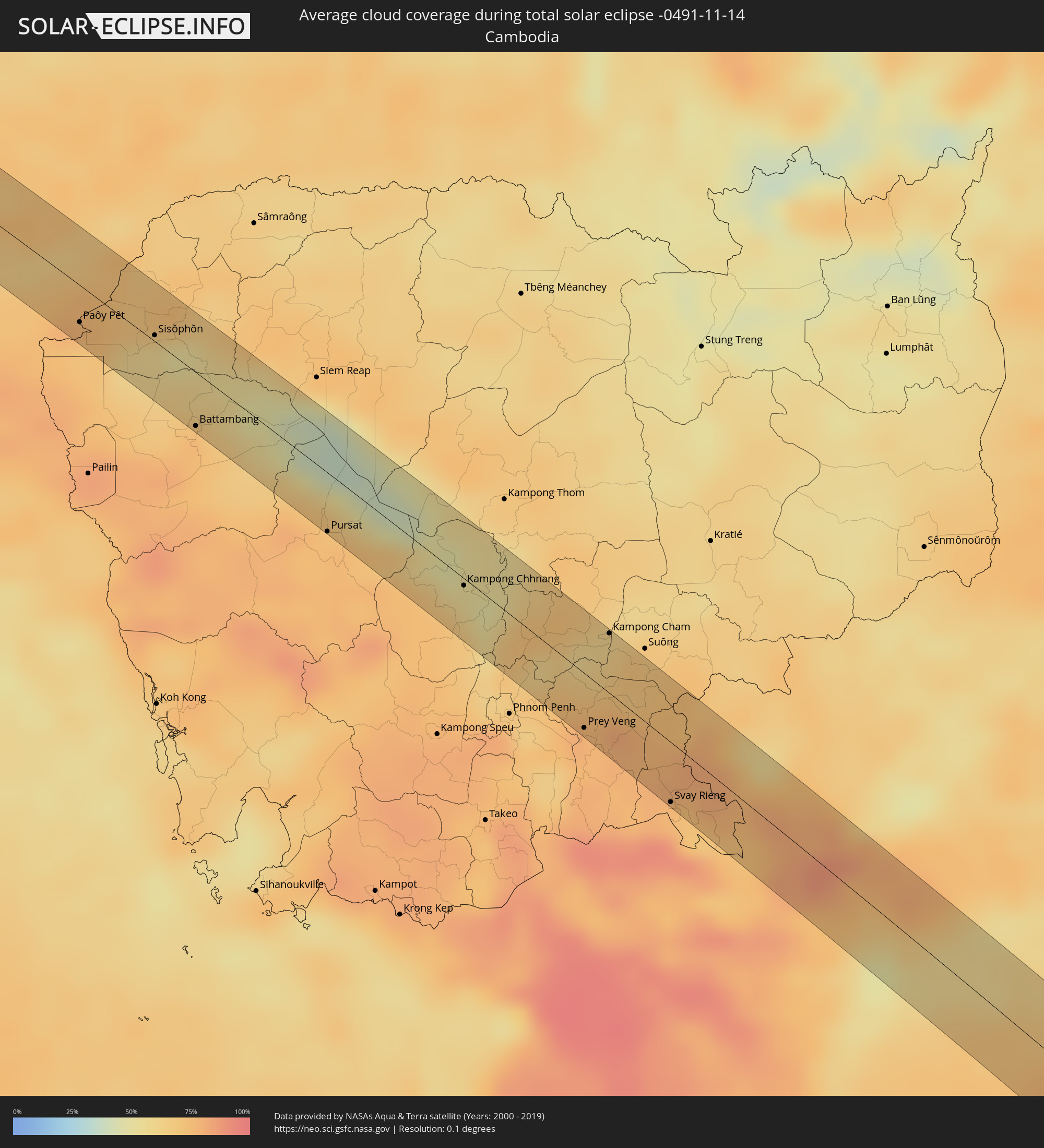 Cambodia
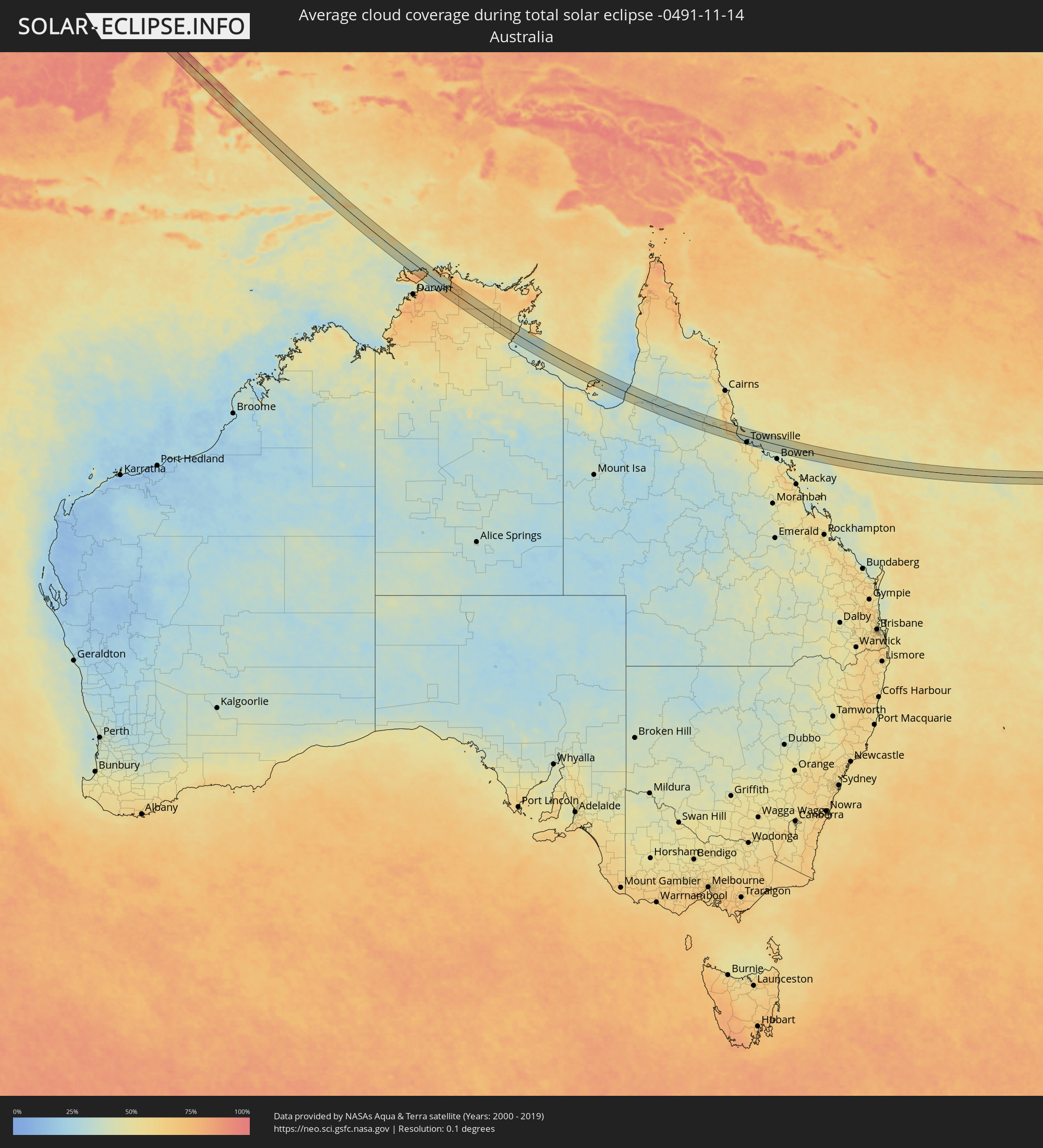 Australia
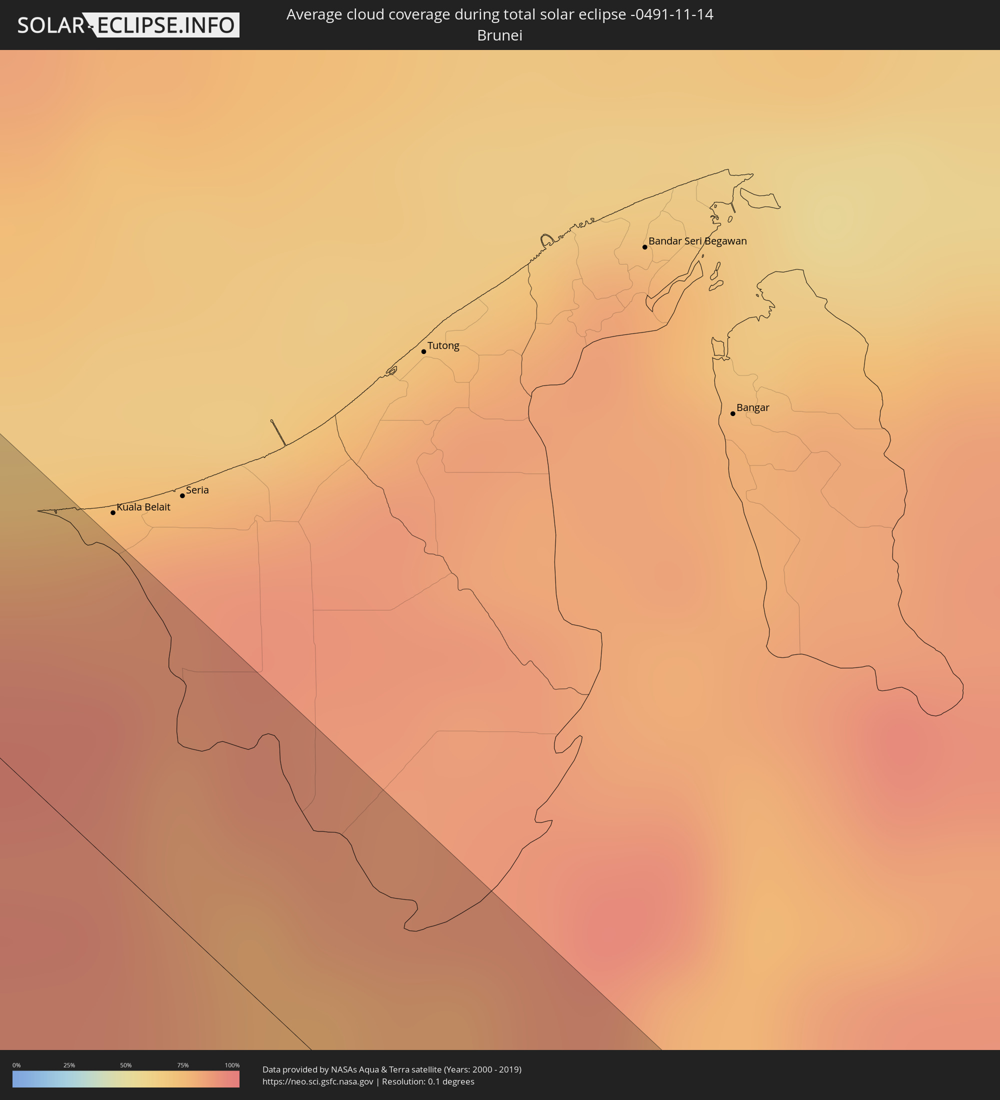 Brunei
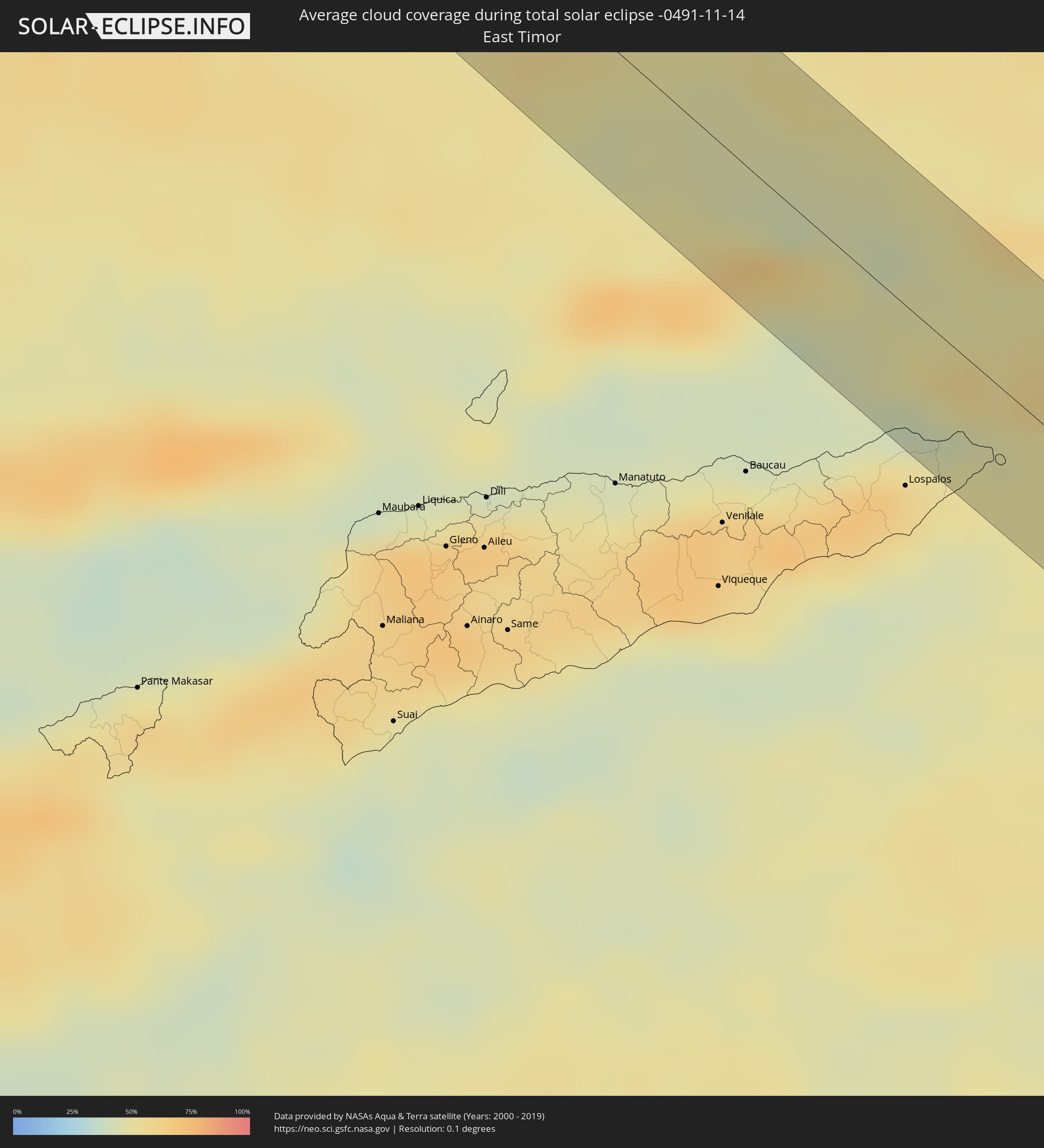 East Timor
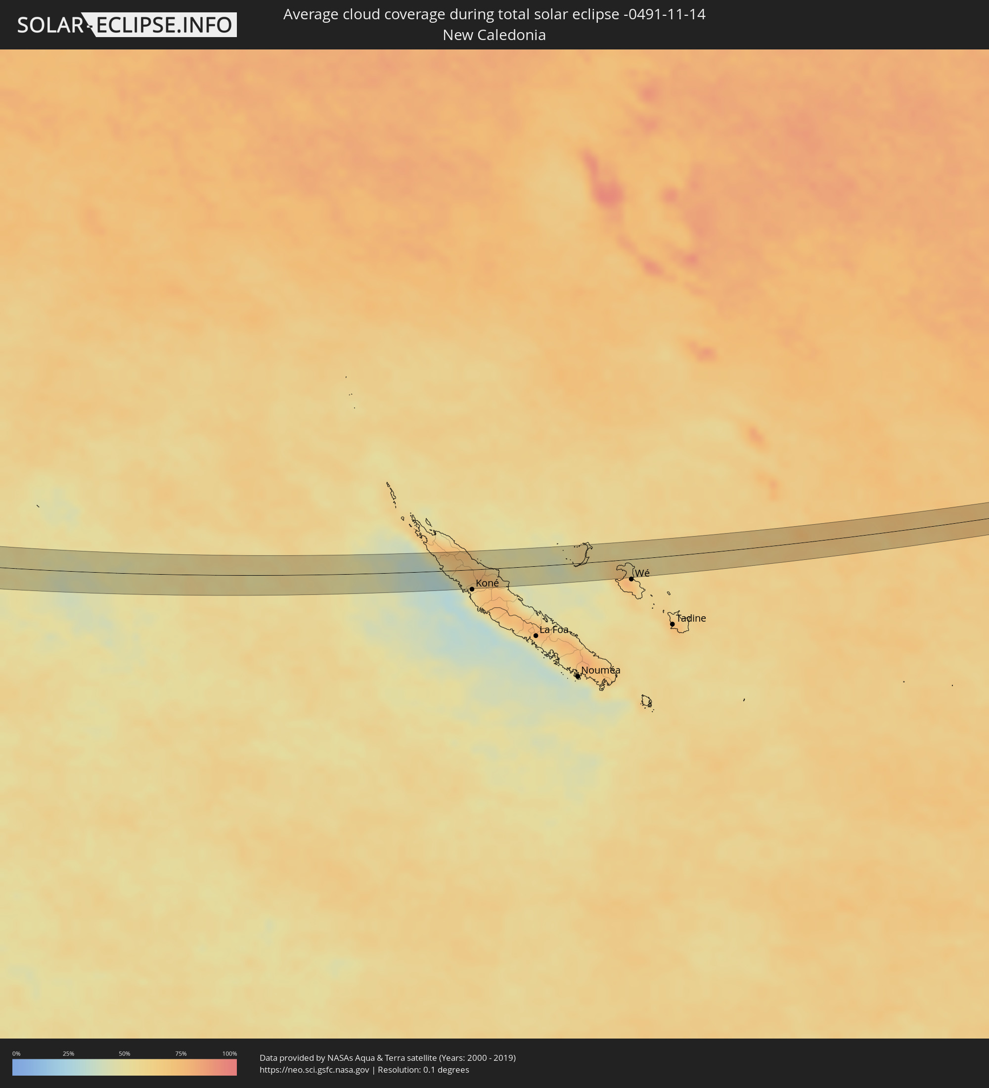 New Caledonia
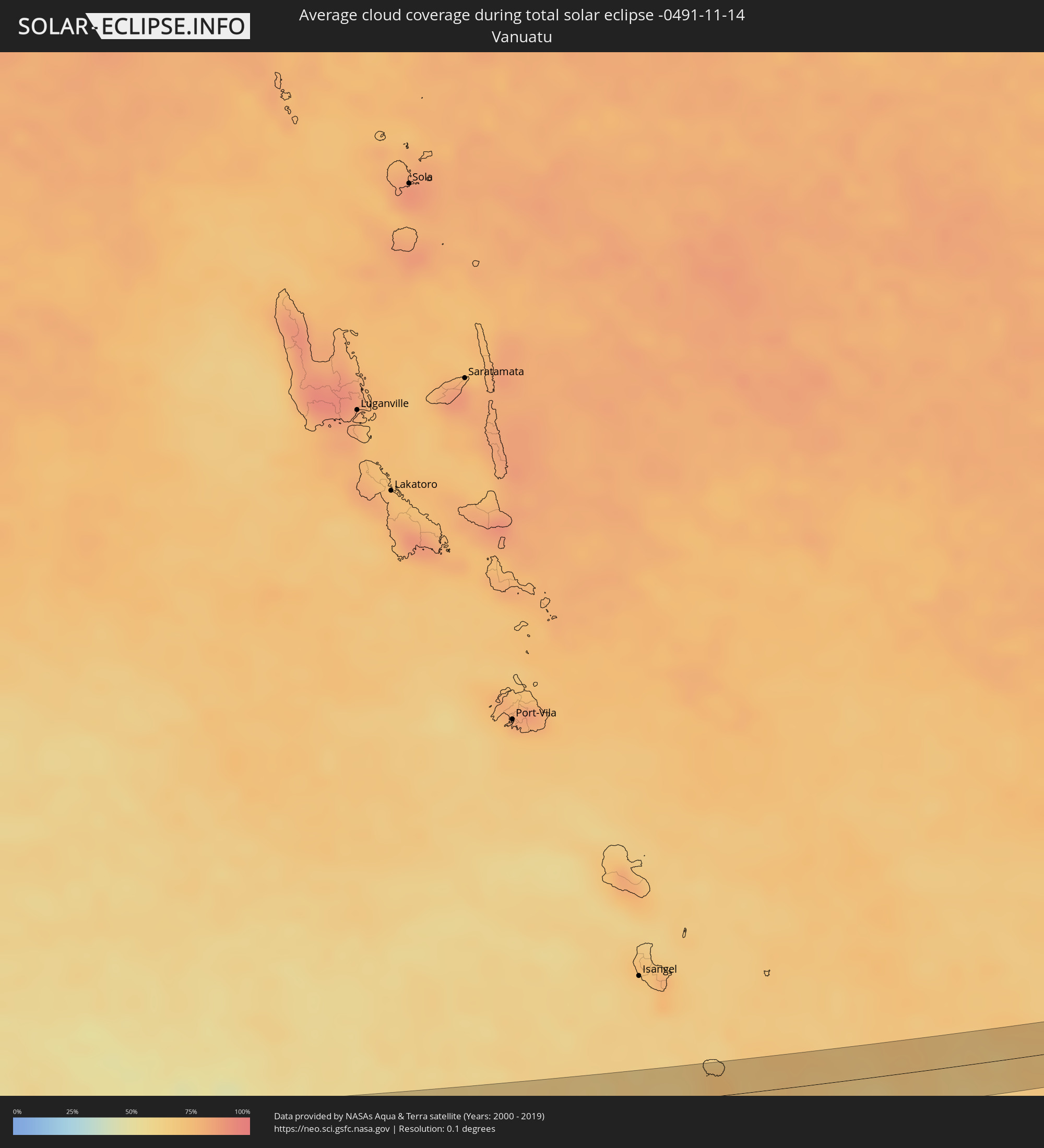 Vanuatu
Cities inside the path of the eclipse
The following table shows all locations with a population of more than 5,000 inside the eclipse path. Cities which have more than 100,000 inhabitants are marked bold. A click at the locations opens a detailed map.
| City | Type | Eclipse duration | Local time of max. eclipse | Distance to central line | Ø Cloud coverage |
|
Sri Dūngargarh, Rajasthan
|
total | - | 06:55:51 UTC+05:21 | 2 km | 18% |
|
Rājaldesar, Rajasthan
|
total | - | 06:55:52 UTC+05:21 | 11 km | 16% |
|
Lachhmangarh Sīkar, Rajasthan
|
total | - | 06:55:53 UTC+05:21 | 8 km | 17% |
|
Sīkar, Rajasthan
|
total | - | 06:55:54 UTC+05:21 | 10 km | 20% |
|
Khandela, Rajasthan
|
total | - | 06:55:55 UTC+05:21 | 2 km | 20% |
|
Sri Mādhopur, Rajasthan
|
total | - | 06:55:56 UTC+05:21 | 9 km | 19% |
|
Shāhpura, Rajasthan
|
total | - | 06:55:58 UTC+05:21 | 4 km | 19% |
|
Rājgarh, Rajasthan
|
total | - | 06:56:01 UTC+05:21 | 4 km | 23% |
|
Mahwah, Rajasthan
|
total | - | 06:56:04 UTC+05:21 | 5 km | 25% |
|
Bayāna, Rajasthan
|
total | - | 06:56:07 UTC+05:21 | 6 km | 22% |
|
Dhaulpur, Rajasthan
|
total | - | 06:56:12 UTC+05:21 | 7 km | 21% |
|
Ambāh, Madhya Pradesh
|
total | - | 06:56:14 UTC+05:21 | 8 km | 22% |
|
Gohadi, Madhya Pradesh
|
total | - | 06:56:17 UTC+05:21 | 12 km | 23% |
|
Jālaun, Uttar Pradesh
|
total | - | 06:56:27 UTC+05:21 | 8 km | 22% |
|
Kālpi, Uttar Pradesh
|
total | - | 06:56:31 UTC+05:21 | 5 km | 24% |
|
Hamīrpur, Uttar Pradesh
|
total | - | 06:56:37 UTC+05:21 | 5 km | 25% |
|
Robertsganj, Uttar Pradesh
|
total | - | 06:57:28 UTC+05:21 | 5 km | 37% |
|
Rāmgarh, Jharkhand
|
total | - | 06:58:27 UTC+05:21 | 4 km | 35% |
|
Puruliya, West Bengal
|
total | - | 06:58:49 UTC+05:21 | 4 km | 39% |
|
Chandrakona, West Bengal
|
total | - | 06:59:27 UTC+05:21 | 2 km | 55% |
|
Ghātāl, West Bengal
|
total | - | 06:59:33 UTC+05:21 | 2 km | 51% |
|
Nangi, West Bengal
|
total | - | 06:59:48 UTC+05:21 | 9 km | 54% |
|
Bārāsat, West Bengal
|
total | - | 07:00:00 UTC+05:21 | 8 km | 58% |
|
Canning, West Bengal
|
total | - | 07:00:04 UTC+05:21 | 11 km | 51% |
|
Gosāba, West Bengal
|
total | - | 07:00:11 UTC+05:21 | 4 km | 48% |
|
Sittwe, Rakhine
|
total | - | 08:06:44 UTC+06:24 | 15 km | 29% |
|
Pyay, Bago
|
total | - | 08:08:54 UTC+06:24 | 16 km | 33% |
|
Paungde, Bago
|
total | - | 08:09:18 UTC+06:24 | 0 km | 53% |
|
Nyaunglebin, Bago
|
total | - | 08:10:29 UTC+06:24 | 19 km | 48% |
|
Myawadi, Kayin
|
total | - | 08:12:43 UTC+06:24 | 6 km | 47% |
|
Mae Sot, Tak
|
total | - | 08:30:01 UTC+06:42 | 12 km | 51% |
|
Lat Yao, Nakhon Sawan
|
total | - | 08:31:46 UTC+06:42 | 3 km | 58% |
|
Thap Than, Uthai Thani
|
total | - | 08:32:06 UTC+06:42 | 23 km | 58% |
|
Uthai Thani, Uthai Thani
|
total | - | 08:32:17 UTC+06:42 | 22 km | 61% |
|
Phayuha Khiri, Nakhon Sawan
|
total | - | 08:32:19 UTC+06:42 | 9 km | 63% |
|
Nakhon Sawan, Nakhon Sawan
|
total | - | 08:32:06 UTC+06:42 | 14 km | 56% |
|
Pak Chong, Nakhon Ratchasima
|
total | - | 08:34:05 UTC+06:42 | 4 km | 70% |
|
Aranyaprathet, Sa Kaeo
|
total | - | 08:36:02 UTC+06:42 | 18 km | 78% |
|
Paôy Pêt, Banteay Meanchey
|
total | - | 08:36:08 UTC+06:42 | 17 km | 76% |
|
Sisŏphŏn, Banteay Meanchey
|
total | - | 08:36:36 UTC+06:42 | 3 km | 57% |
|
Battambang, Battambang
|
total | - | 08:37:17 UTC+06:42 | 25 km | 75% |
|
Pursat, Pursat
|
total | - | 08:38:35 UTC+06:42 | 28 km | 74% |
|
Kampong Chhnang, Kampong Chhnang
|
total | - | 08:39:40 UTC+06:42 | 3 km | 54% |
|
Prey Veng, Prey Veng
|
total | - | 08:41:12 UTC+06:42 | 26 km | 78% |
|
Kampong Cham, Kampong Cham
|
total | - | 08:40:48 UTC+06:42 | 28 km | 64% |
|
Svay Rieng, Svay Rieng
|
total | - | 08:42:10 UTC+06:42 | 28 km | 77% |
|
Tây Ninh, Tây Ninh
|
total | - | 09:06:51 UTC+07:06 | 12 km | 80% |
|
Phú Khương, Tây Ninh
|
total | - | 09:06:55 UTC+07:06 | 12 km | 80% |
|
Củ Chi, Ho Chi Minh City
|
total | - | 09:07:41 UTC+07:06 | 10 km | 81% |
|
Ho Chi Minh City, Ho Chi Minh City
|
total | - | 09:08:01 UTC+07:06 | 6 km | 88% |
|
Thủ Dầu Một, Bình Dương
|
total | - | 09:07:51 UTC+07:06 | 21 km | 82% |
|
Cần Giuộc, Long An
|
total | - | 09:08:19 UTC+07:06 | 9 km | 75% |
|
Biên Hòa, Đồng Nai
|
total | - | 09:08:06 UTC+07:06 | 30 km | 85% |
|
Cần Giờ, Ho Chi Minh City
|
total | - | 09:08:52 UTC+07:06 | 7 km | 55% |
|
Vũng Tàu, Bà Rịa-Vũng Tàu
|
total | - | 09:09:06 UTC+07:06 | 3 km | 55% |
|
Thành Phố Bà Rịa, Bà Rịa-Vũng Tàu
|
total | - | 09:09:01 UTC+07:06 | 16 km | 66% |
|
Miri, Sarawak
|
total | - | 09:41:19 UTC+07:21 | 8 km | 87% |
|
Palu, Central Sulawesi
|
total | - | 10:36:36 UTC+07:57 | 31 km | 91% |
|
Kendari, Southeast Sulawesi
|
total | - | 10:47:28 UTC+07:57 | 12 km | 83% |
|
Ingham, Queensland
|
total | - | 14:10:02 UTC+10:00 | 17 km | 57% |
|
Townsville, Queensland
|
total | - | 14:12:04 UTC+10:00 | 29 km | 48% |