Total solar eclipse of 06/09/-0566
| Day of week: | Saturday |
| Maximum duration of eclipse: | 06m15s |
| Maximum width of eclipse path: | 263 km |
| Saros cycle: | 57 |
| Coverage: | 100% |
| Magnitude: | 1.079 |
| Gamma: | 0.2456 |
Wo kann man die Sonnenfinsternis vom 06/09/-0566 sehen?
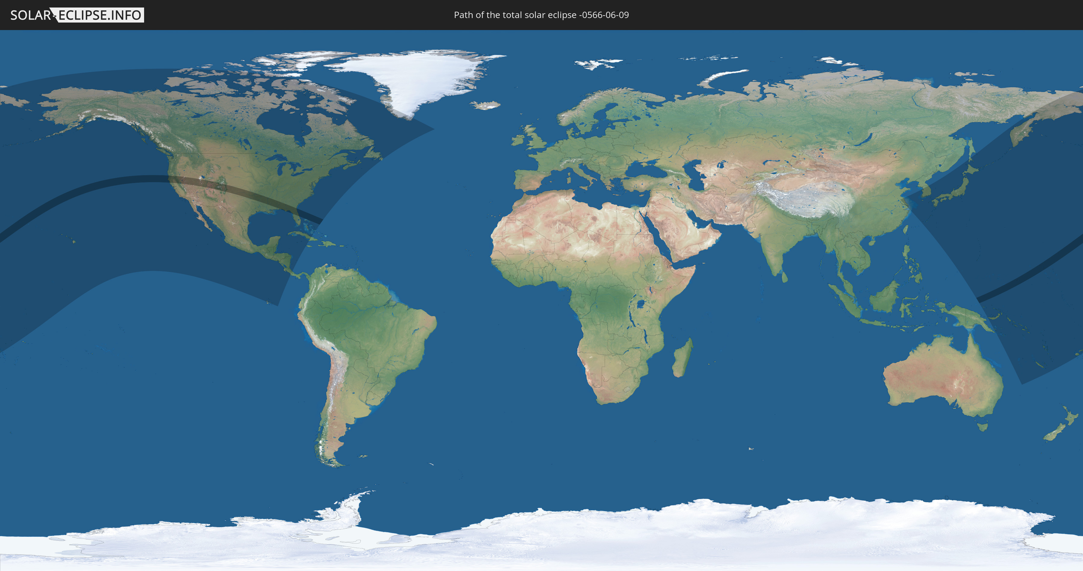
Die Sonnenfinsternis am 06/09/-0566 kann man in 37 Ländern als partielle Sonnenfinsternis beobachten.
Der Finsternispfad verläuft durch 5 Länder. Nur in diesen Ländern ist sie als total Sonnenfinsternis zu sehen.
In den folgenden Ländern ist die Sonnenfinsternis total zu sehen
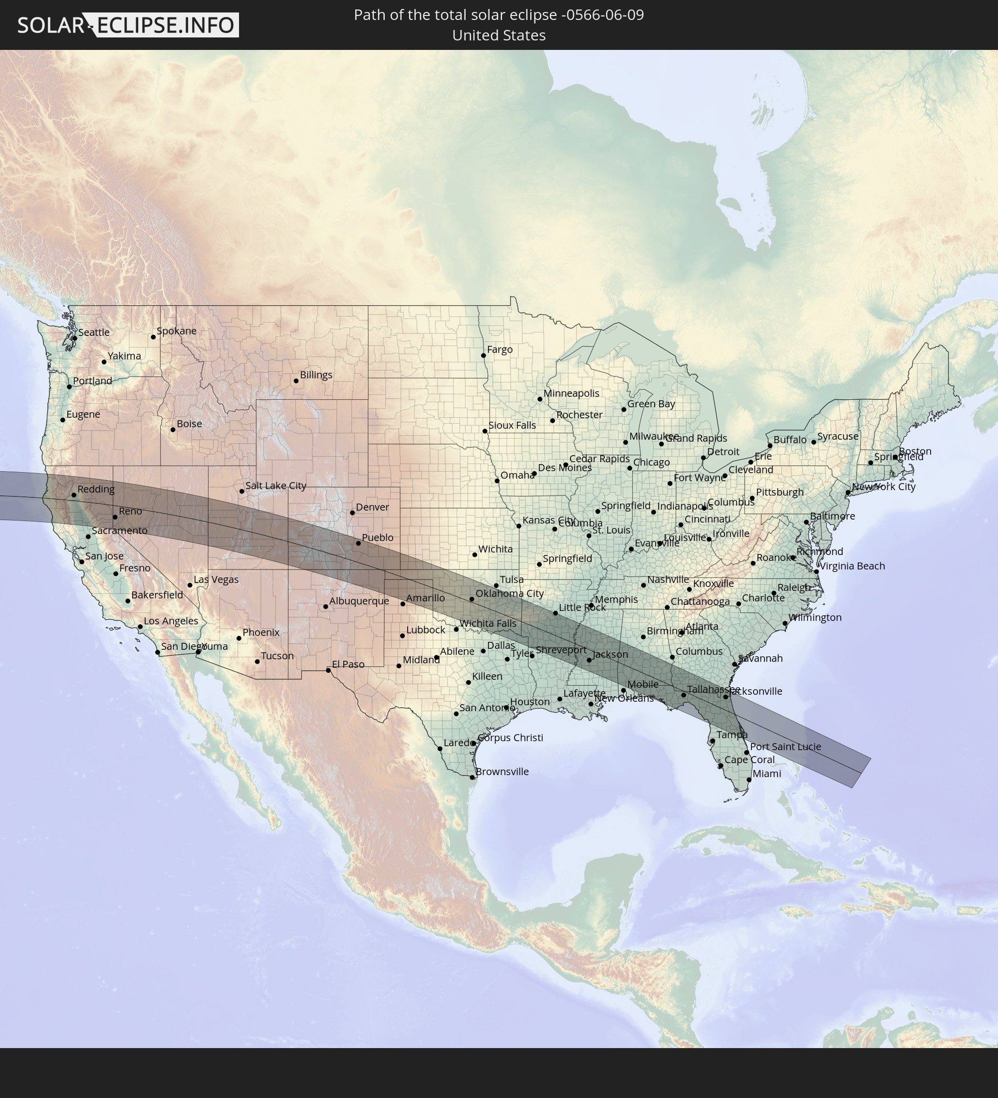 United States
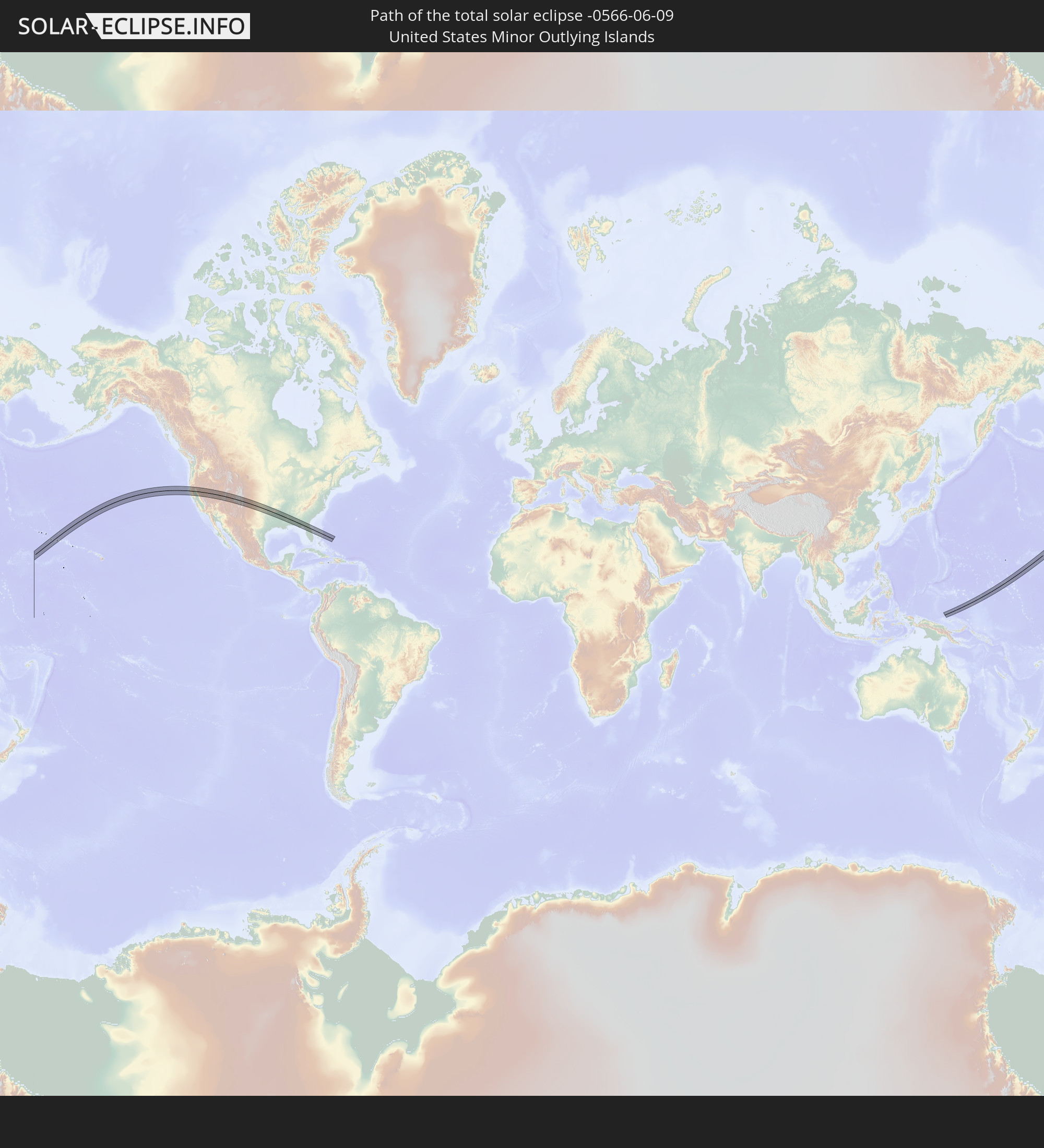 United States Minor Outlying Islands
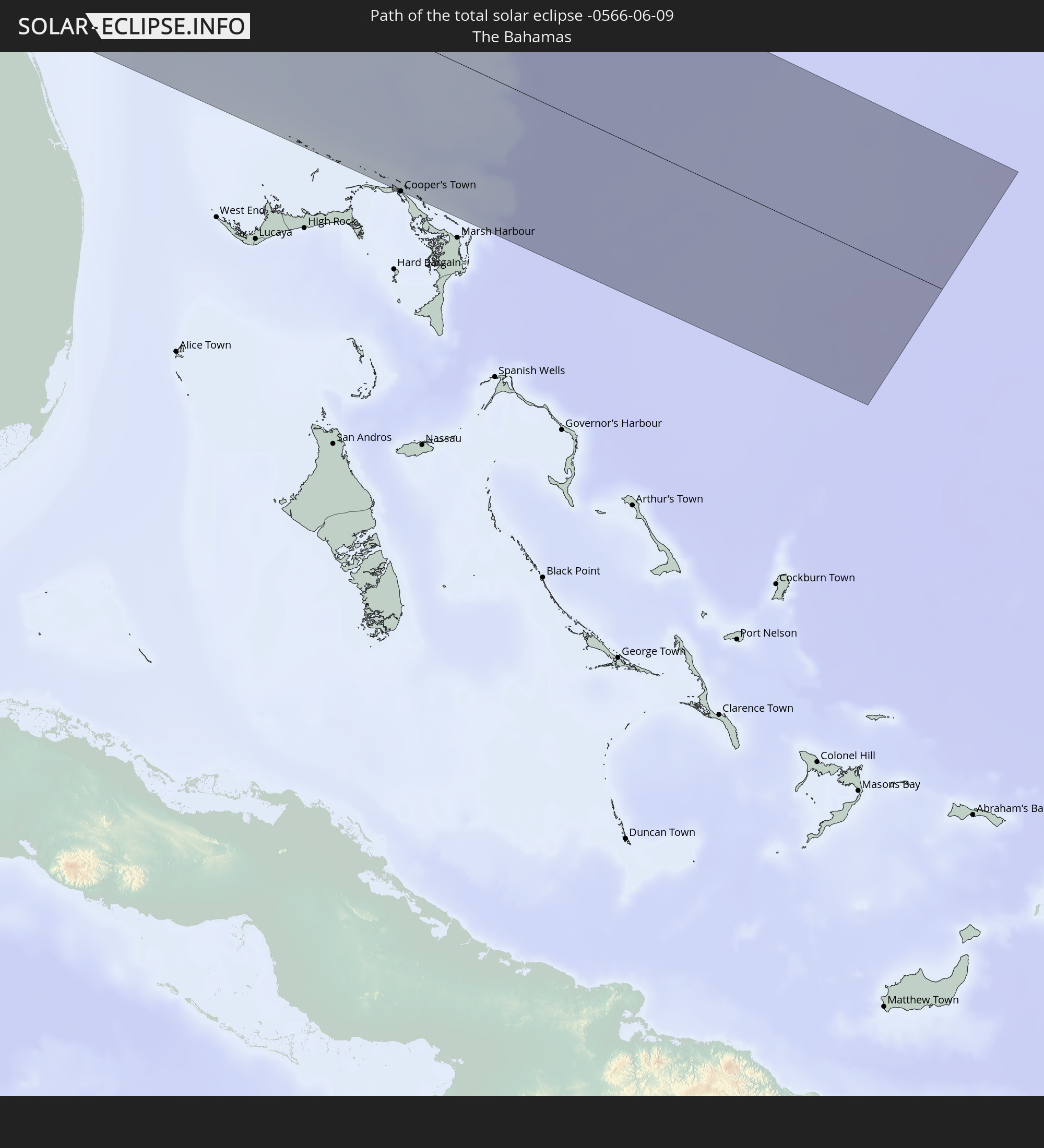 The Bahamas
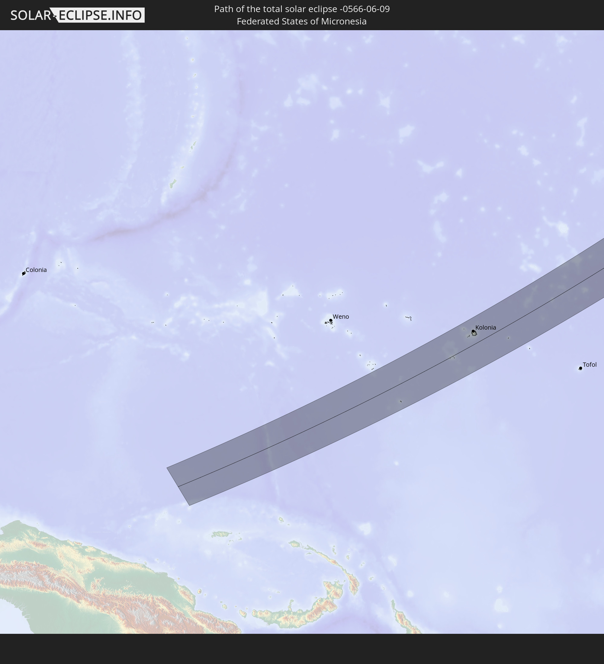 Federated States of Micronesia
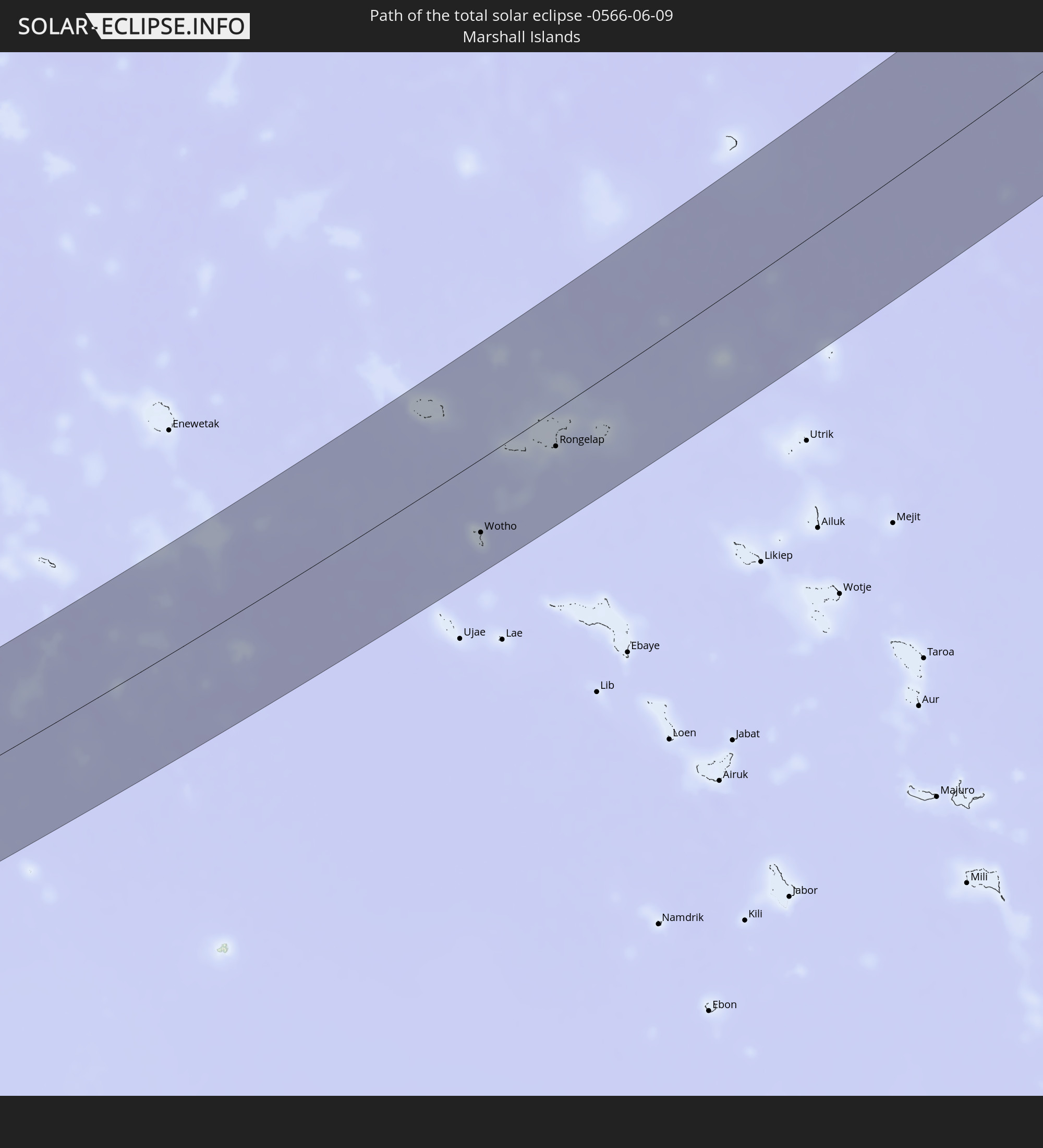 Marshall Islands
In den folgenden Ländern ist die Sonnenfinsternis partiell zu sehen
 Fiji
Fiji
 Russia
 United States
 United States Minor Outlying Islands
 Wallis and Futuna
 Kiribati
 Tokelau
 American Samoa
 Canada
 Mexico
 Greenland
 Guatemala
 Ecuador
 El Salvador
 Honduras
 Belize
 Nicaragua
 Costa Rica
 Cuba
Cuba
 Colombia
 Cayman Islands
 The Bahamas
 Jamaica
 Saint Pierre and Miquelon
 China
China
 Japan
Japan
 South Korea
 Federated States of Micronesia
 Papua New Guinea
 Guam
Guam
 Northern Mariana Islands
 Solomon Islands
 New Caledonia
 Marshall Islands
 Vanuatu
 Nauru
Nauru
 Tuvalu
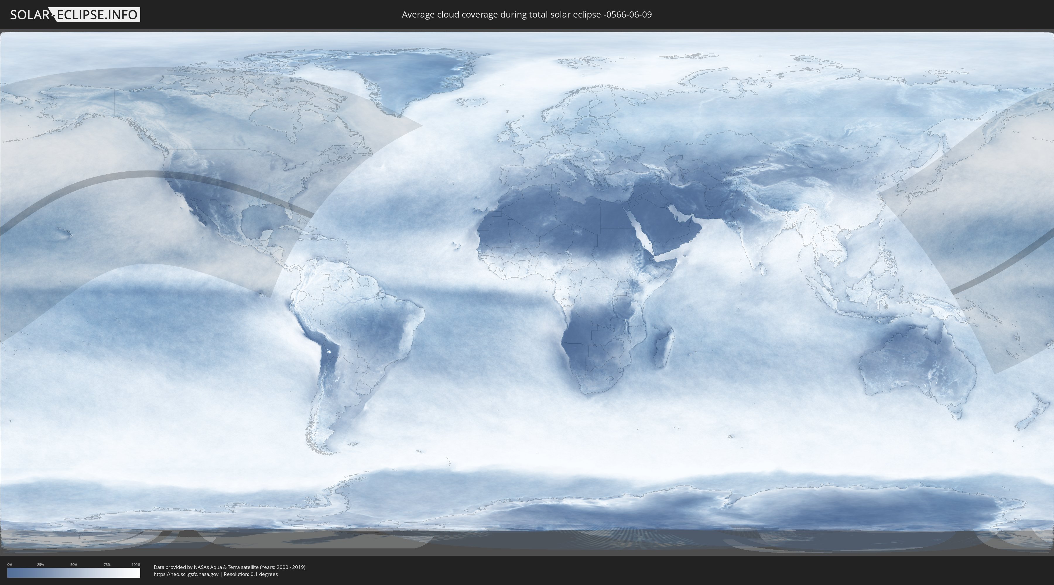
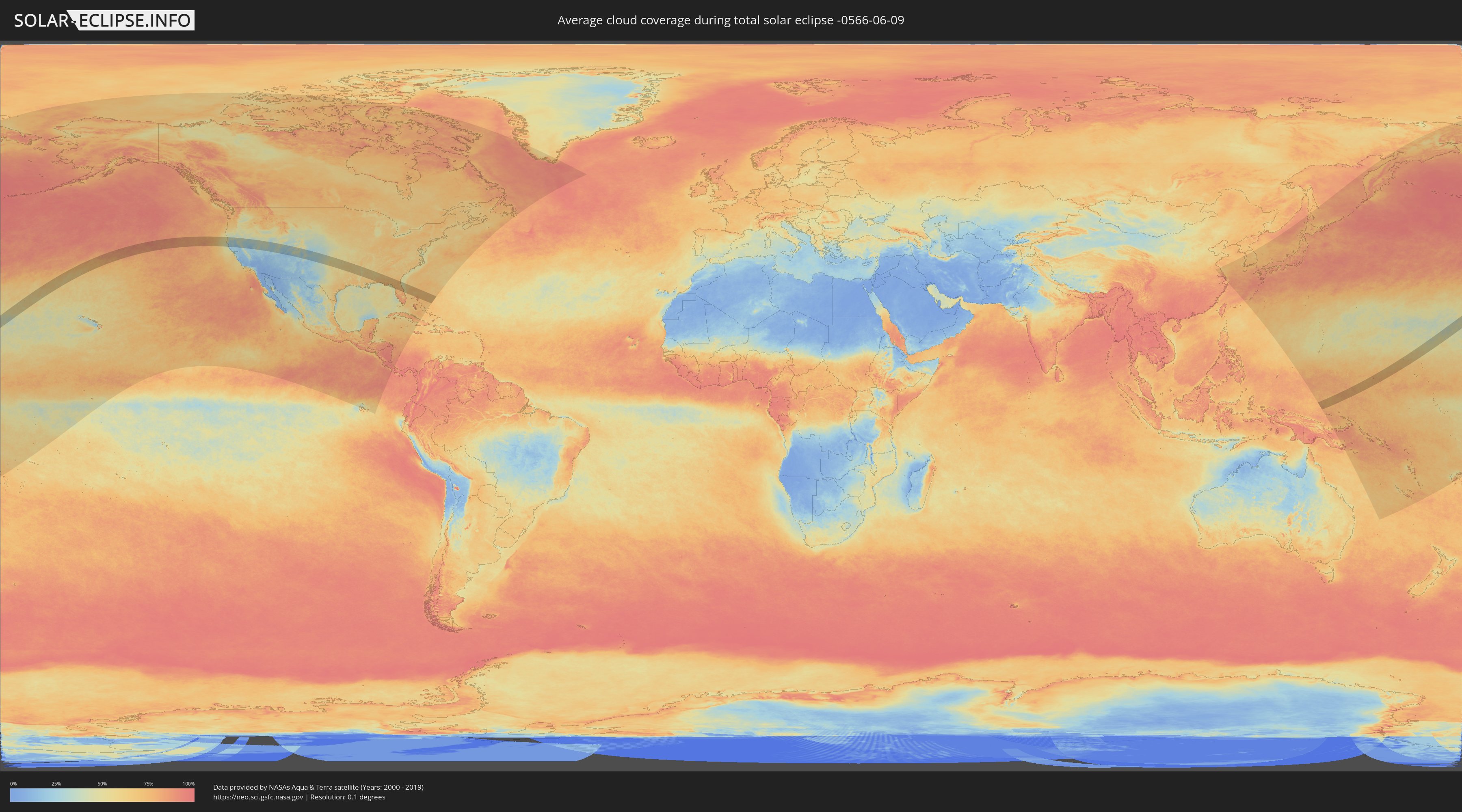
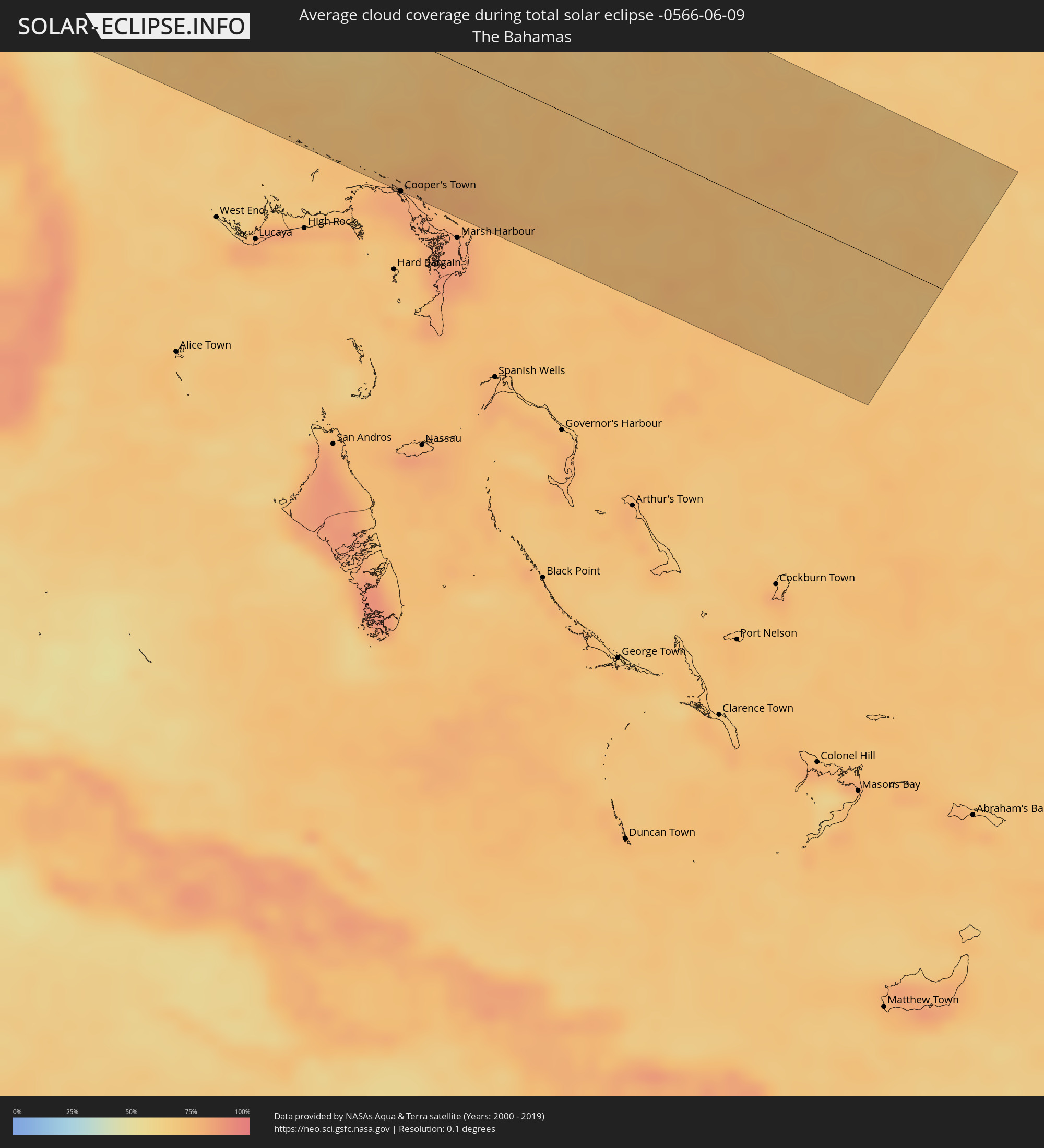
How will be the weather during the total solar eclipse on 06/09/-0566?
Where is the best place to see the total solar eclipse of 06/09/-0566?
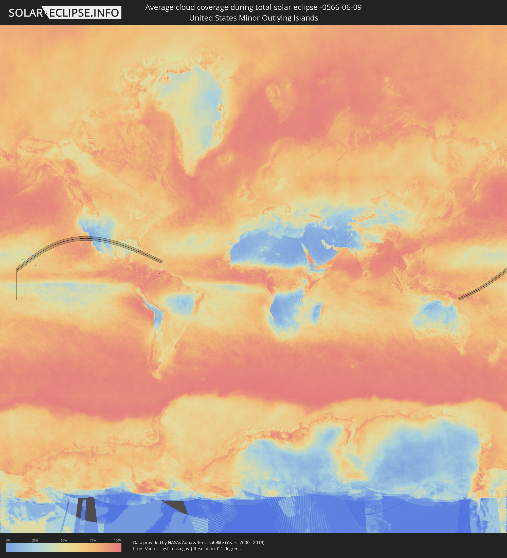
The following maps show the average cloud coverage for the day of the total solar eclipse.
With the help of these maps, it is possible to find the place along the eclipse path, which has the best
chance of a cloudless sky.
Nevertheless, you should consider local circumstances and inform about the weather of your chosen
observation site.
The data is provided by NASAs satellites
AQUA and TERRA.
The cloud maps are averaged over a period of 19 years (2000 - 2019).
Detailed country maps
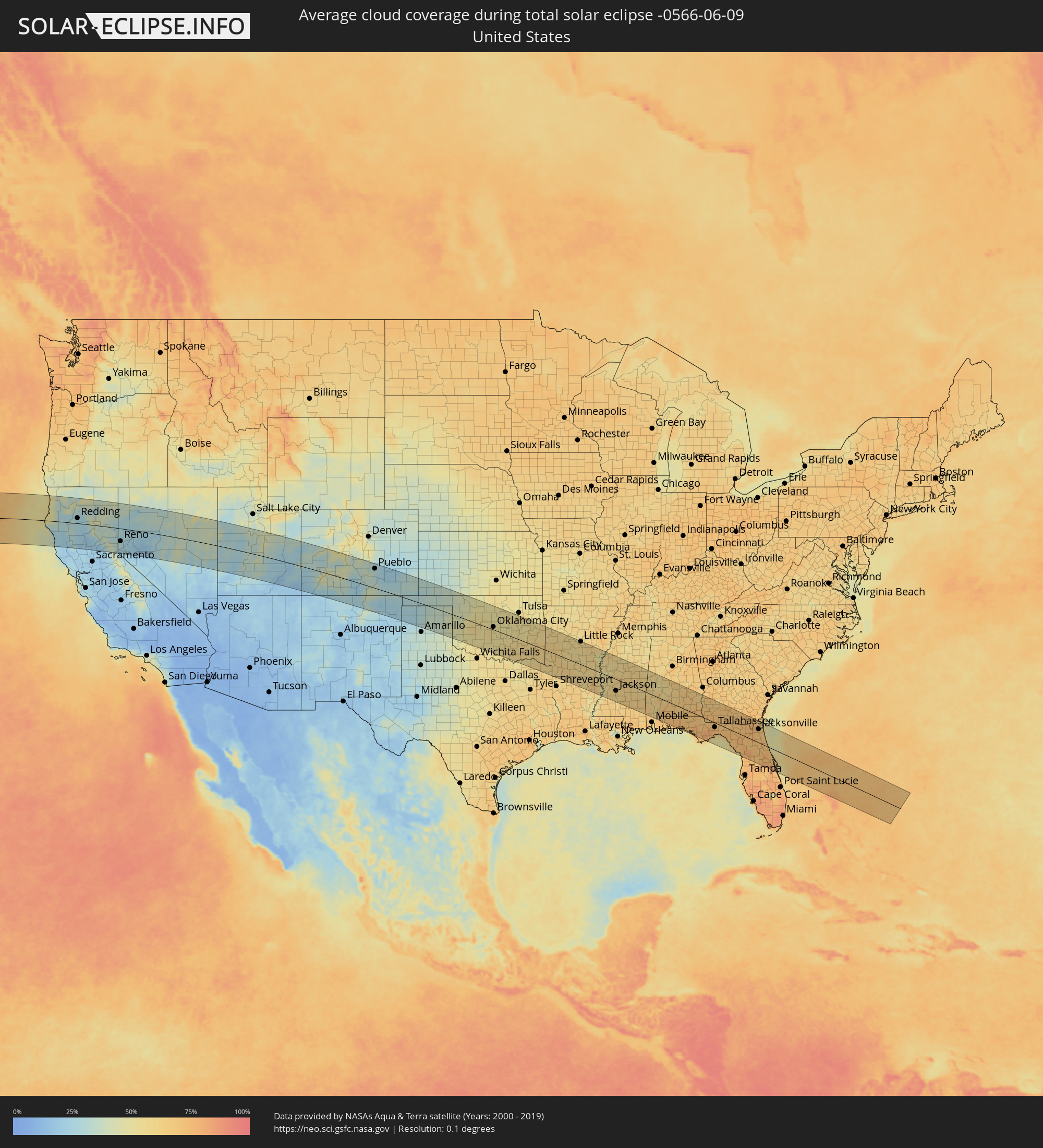 United States
 United States Minor Outlying Islands
 The Bahamas
 Federated States of Micronesia
 Marshall Islands
Cities inside the path of the eclipse
The following table shows all locations with a population of more than 5,000 inside the eclipse path. Cities which have more than 100,000 inhabitants are marked bold. A click at the locations opens a detailed map.
| City | Type | Eclipse duration | Local time of max. eclipse | Distance to central line | Ø Cloud coverage |
|
Eureka, California
|
total | - | 14:50:38 UTC-08:00 | 37 km | 54% |
|
Redding, California
|
total | - | 14:53:20 UTC-08:00 | 26 km | 26% |
|
Chico, California
|
total | - | 14:54:39 UTC-08:00 | 64 km | 20% |
|
Paradise, California
|
total | - | 14:54:56 UTC-08:00 | 58 km | 24% |
|
Reno, Nevada
|
total | - | 14:57:36 UTC-08:00 | 64 km | 27% |
|
Carson City, Nevada
|
total | - | 14:57:55 UTC-08:00 | 104 km | 23% |
|
Grand Junction, Colorado
|
total | - | 16:10:46 UTC-07:00 | 85 km | 33% |
|
Pueblo, Colorado
|
total | - | 16:14:48 UTC-07:00 | 97 km | 30% |
|
Lawton, Oklahoma
|
total | - | 17:22:14 UTC-06:00 | 103 km | 56% |
|
Enid, Oklahoma
|
total | - | 17:20:51 UTC-06:00 | 99 km | 51% |
|
Oklahoma City, Oklahoma
|
total | - | 17:21:54 UTC-06:00 | 14 km | 53% |
|
Edmond, Oklahoma
|
total | - | 17:21:45 UTC-06:00 | 35 km | 53% |
|
Norman, Oklahoma
|
total | - | 17:22:10 UTC-06:00 | 9 km | 51% |
|
Stillwater, Oklahoma
|
total | - | 17:21:32 UTC-06:00 | 96 km | 52% |
|
Shawnee, Oklahoma
|
total | - | 17:22:19 UTC-06:00 | 19 km | 54% |
|
Paris, Texas
|
total | - | 17:24:28 UTC-06:00 | 109 km | 58% |
|
Muskogee, Oklahoma
|
total | - | 17:22:39 UTC-06:00 | 114 km | 57% |
|
Fort Smith, Arkansas
|
total | - | 17:23:23 UTC-06:00 | 109 km | 61% |
|
Texarkana, Texas
|
total | - | 17:25:17 UTC-06:00 | 82 km | 62% |
|
Hot Springs National Park, Arkansas
|
total | - | 17:24:39 UTC-06:00 | 67 km | 57% |
|
Benton, Arkansas
|
total | - | 17:24:47 UTC-06:00 | 87 km | 57% |
|
Little Rock, Arkansas
|
total | - | 17:24:43 UTC-06:00 | 116 km | 59% |
|
Monroe, Louisiana
|
total | - | 17:26:45 UTC-06:00 | 108 km | 60% |
|
Pine Bluff, Arkansas
|
total | - | 17:25:17 UTC-06:00 | 73 km | 60% |
|
Greenville, Mississippi
|
total | - | 17:26:17 UTC-06:00 | 23 km | 48% |
|
Jackson, Mississippi
|
total | - | 17:27:28 UTC-06:00 | 59 km | 65% |
|
Meridian, Mississippi
|
total | - | 17:27:45 UTC-06:00 | 2 km | 61% |
|
Prattville, Alabama
|
total | - | 17:28:02 UTC-06:00 | 97 km | 61% |
|
Montgomery, Alabama
|
total | - | 17:28:08 UTC-06:00 | 94 km | 69% |
|
Enterprise, Alabama
|
total | - | 17:29:03 UTC-06:00 | 4 km | 69% |
|
Panama City, Florida
|
total | - | 17:30:00 UTC-06:00 | 106 km | 63% |
|
Dothan, Alabama
|
total | - | 17:29:10 UTC-06:00 | 12 km | 71% |
|
Tallahassee, Florida
|
total | - | 18:29:53 UTC-05:00 | 24 km | 78% |
|
Albany, Georgia
|
total | - | 18:28:59 UTC-05:00 | 97 km | 66% |
|
Valdosta, Georgia
|
total | - | 18:29:37 UTC-05:00 | 56 km | 70% |
|
Gainesville, Florida
|
total | - | 18:30:32 UTC-05:00 | 26 km | 73% |
|
Ocala, Florida
|
total | - | 18:30:53 UTC-05:00 | 66 km | 78% |
|
The Villages, Florida
|
total | - | 18:31:04 UTC-05:00 | 84 km | 72% |
|
Lakeside, Florida
|
total | - | 18:30:10 UTC-05:00 | 45 km | 72% |
|
Jacksonville, Florida
|
total | - | 18:30:01 UTC-05:00 | 70 km | 73% |
|
Apopka, Florida
|
total | - | 18:31:14 UTC-05:00 | 92 km | 77% |
|
Ponte Vedra Beach, Florida
|
total | - | 18:30:05 UTC-05:00 | 71 km | 64% |
|
Orlando, Florida
|
total | - | 18:31:20 UTC-05:00 | 101 km | 79% |
|
Winter Springs, Florida
|
total | - | 18:31:13 UTC-05:00 | 82 km | 78% |
|
Deltona, Florida
|
total | - | 18:31:04 UTC-05:00 | 59 km | 74% |
|
Alafaya, Florida
|
total | - | 18:31:19 UTC-05:00 | 91 km | 82% |
|
Palm Coast, Florida
|
total | - | 18:30:34 UTC-05:00 | 12 km | 65% |
|
Daytona Beach, Florida
|
total | - | 18:30:50 UTC-05:00 | 18 km | 71% |
|
Titusville, Florida
|
total | - | 18:31:15 UTC-05:00 | 70 km | 75% |
|
Merritt Island, Florida
|
total | - | 18:31:18 UTC-05:00 | 72 km | 70% |
|
Cooper’s Town, North Abaco
|
total | - | 18:22:37 UTC-05:09 | 111 km | 83% |
|
Palikir - National Government Center, Pohnpei
|
total | - | 07:16:36 UTC+11:00 | 56 km | 80% |
|
Kolonia Town, Pohnpei
|
total | - | 07:16:38 UTC+11:00 | 57 km | 82% |
|
Kolonia, Pohnpei
|
total | - | 07:16:38 UTC+11:00 | 57 km | 82% |
|
Wotho, Wotho Atoll
|
total | - | 07:21:58 UTC+11:00 | 80 km | 70% |
|
Rongelap, Rongelap Atoll
|
total | - | 07:23:29 UTC+11:00 | 39 km | 73% |