Annular solar eclipse of 11/30/-0734
| Day of week: | Sunday |
| Maximum duration of eclipse: | 08m30s |
| Maximum width of eclipse path: | 312 km |
| Saros cycle: | 40 |
| Coverage: | 93.2% |
| Magnitude: | 0.9324 |
| Gamma: | 0.6024 |
Wo kann man die Sonnenfinsternis vom 11/30/-0734 sehen?
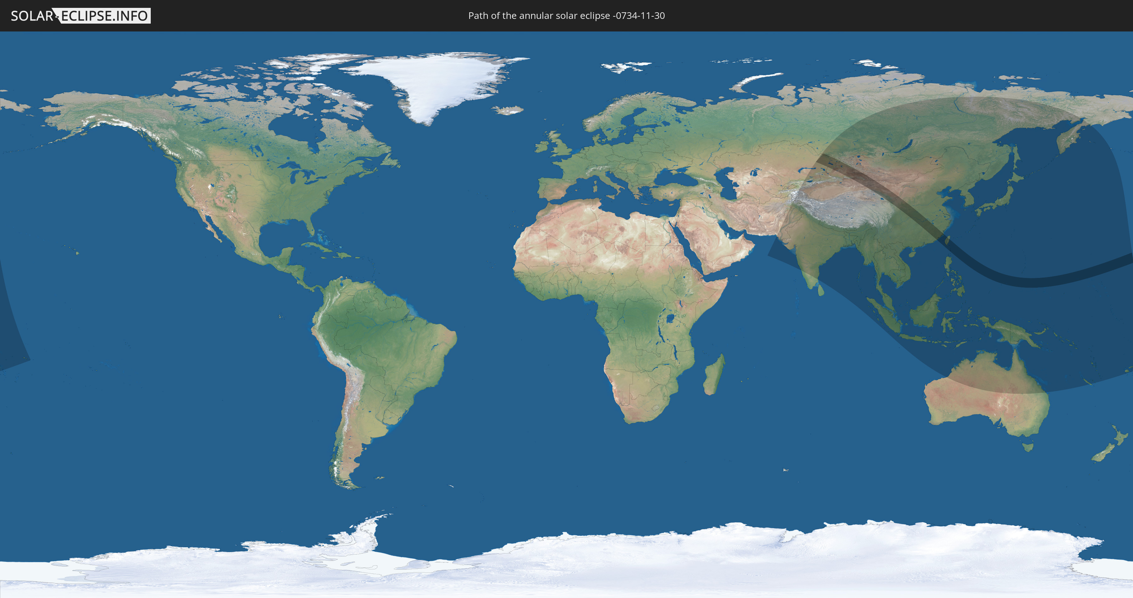
Die Sonnenfinsternis am 11/30/-0734 kann man in 49 Ländern als partielle Sonnenfinsternis beobachten.
Der Finsternispfad verläuft durch 8 Länder. Nur in diesen Ländern ist sie als annular Sonnenfinsternis zu sehen.
In den folgenden Ländern ist die Sonnenfinsternis annular zu sehen
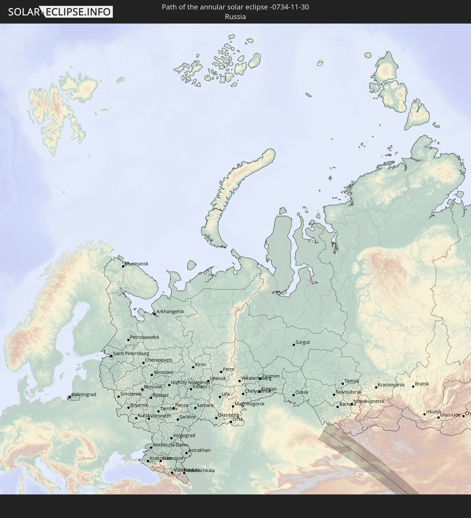 Russia
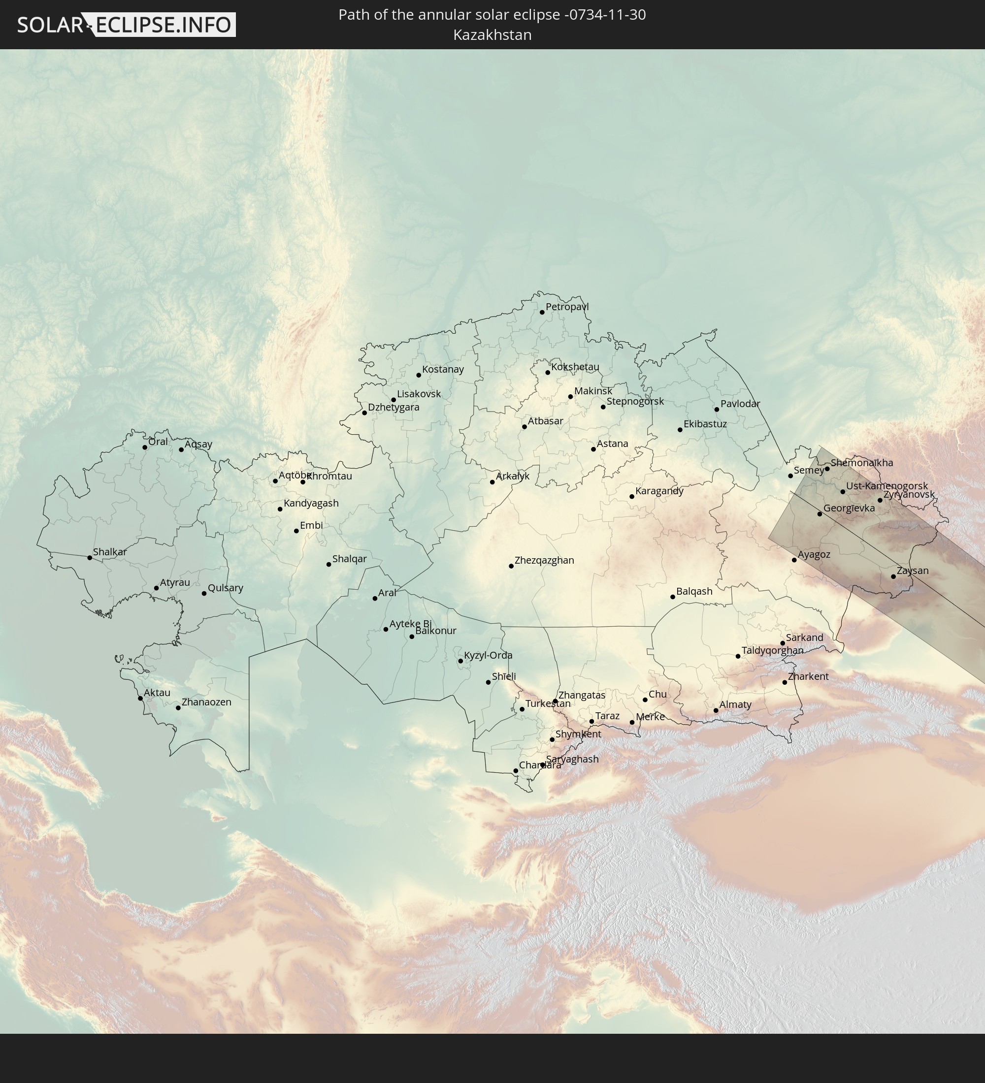 Kazakhstan
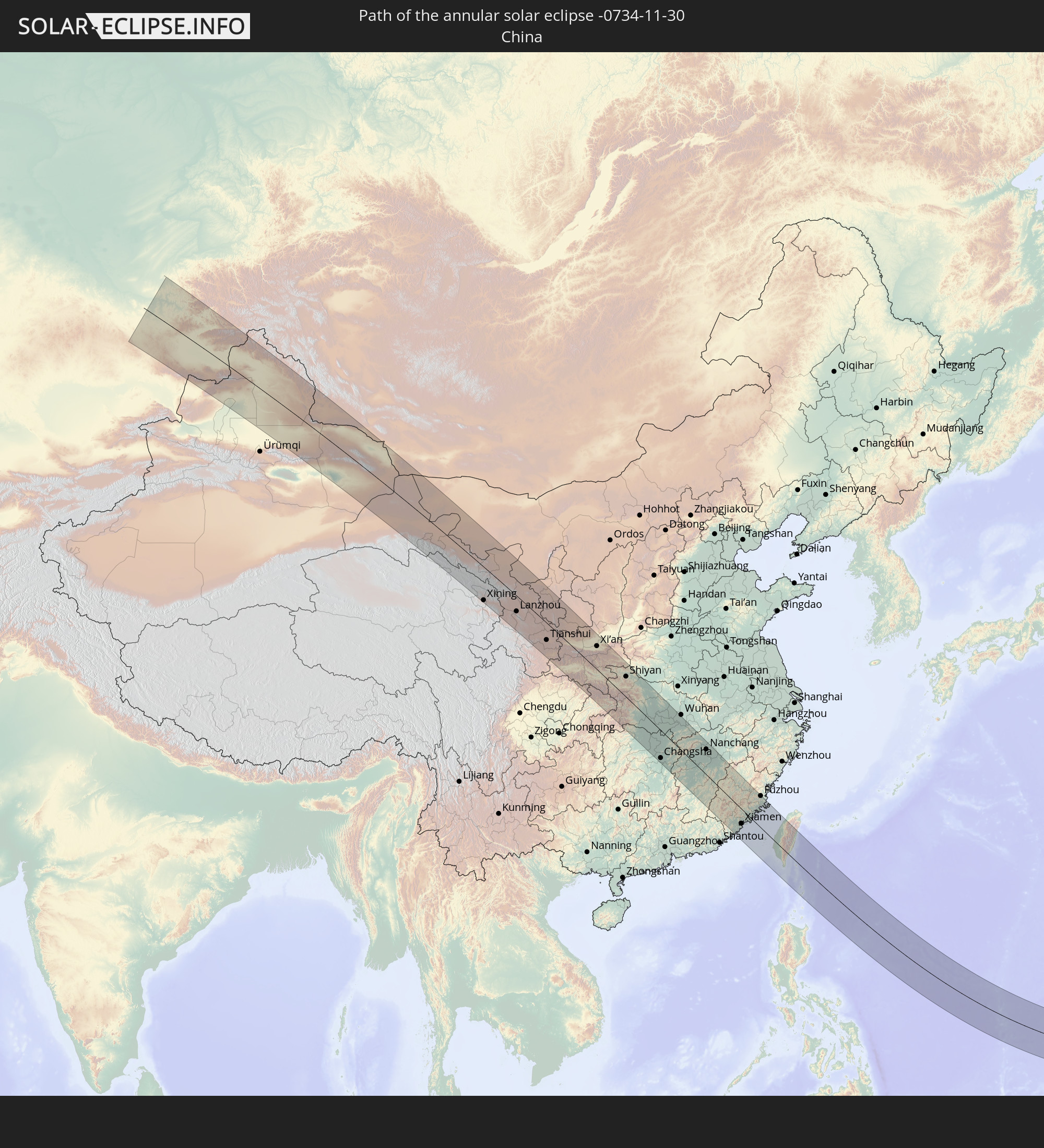 China
China
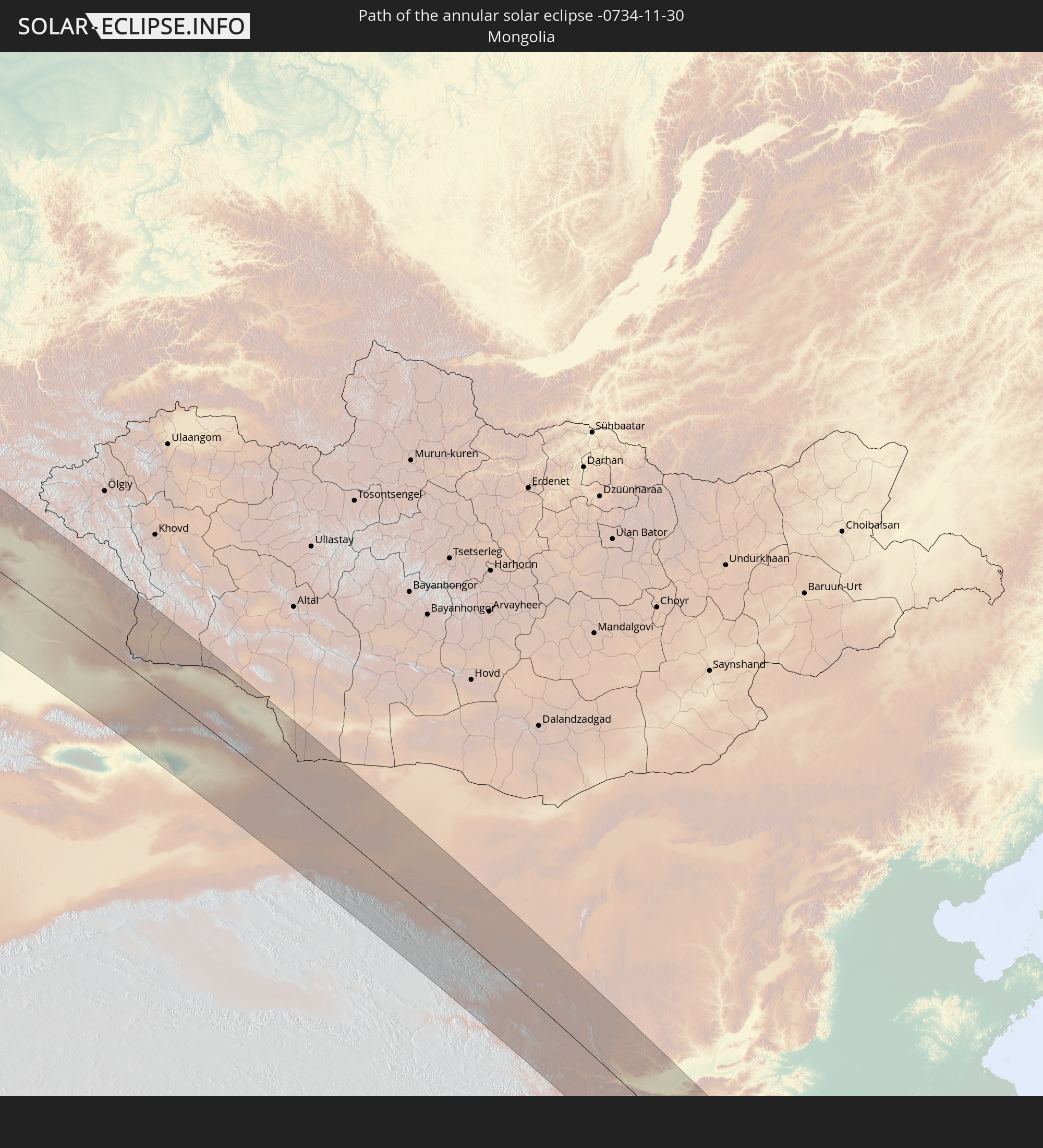 Mongolia
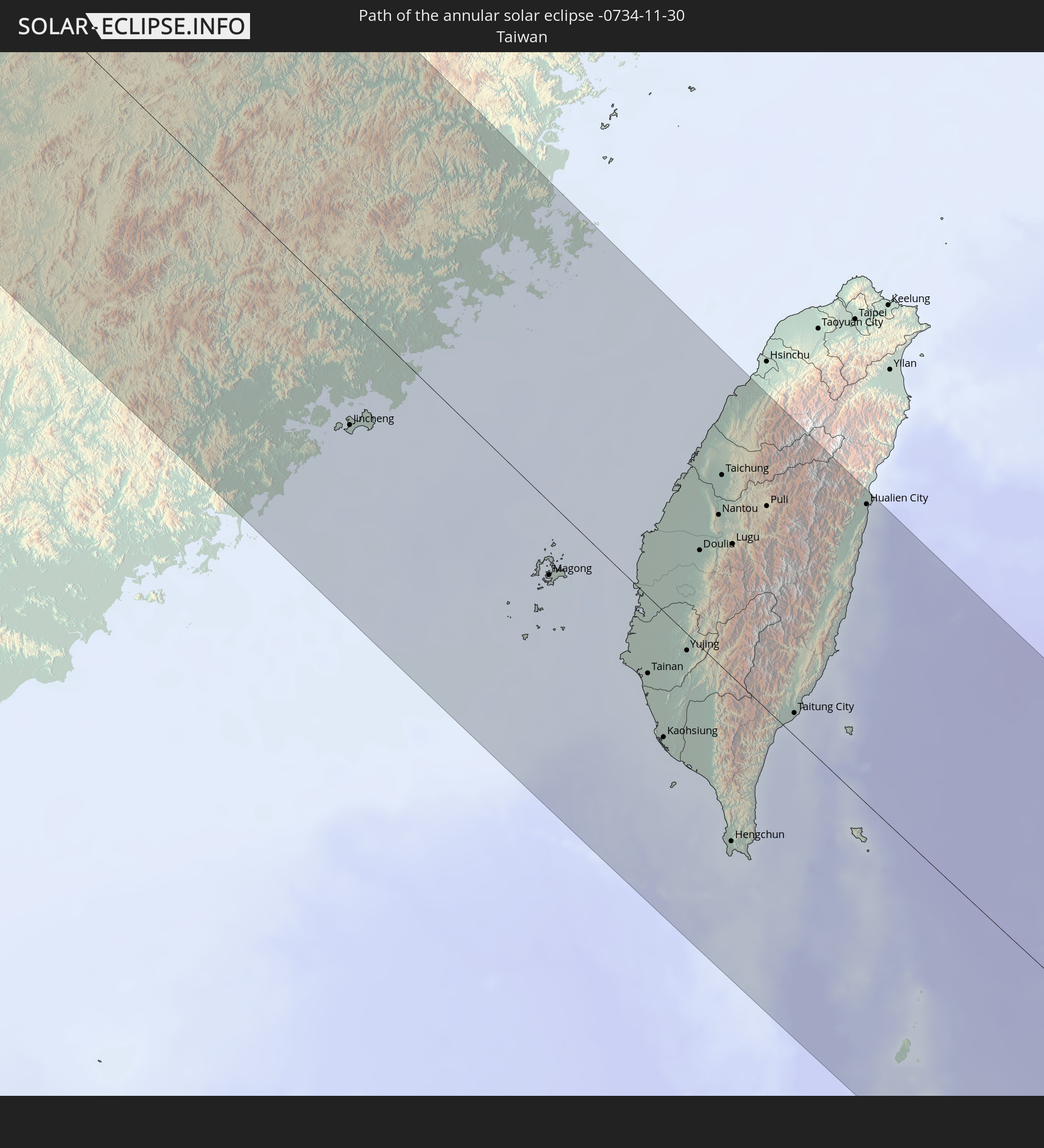 Taiwan
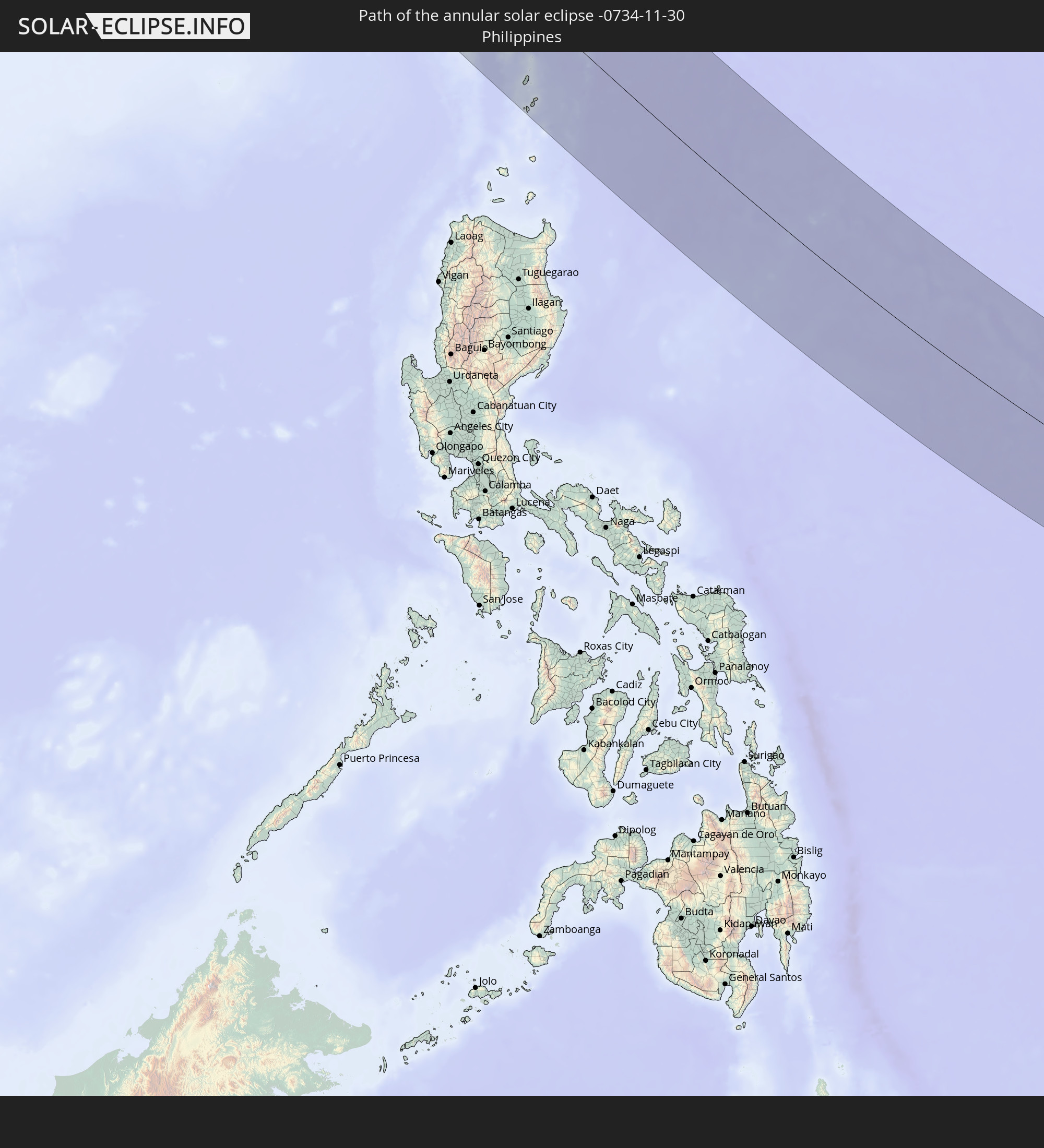 Philippines
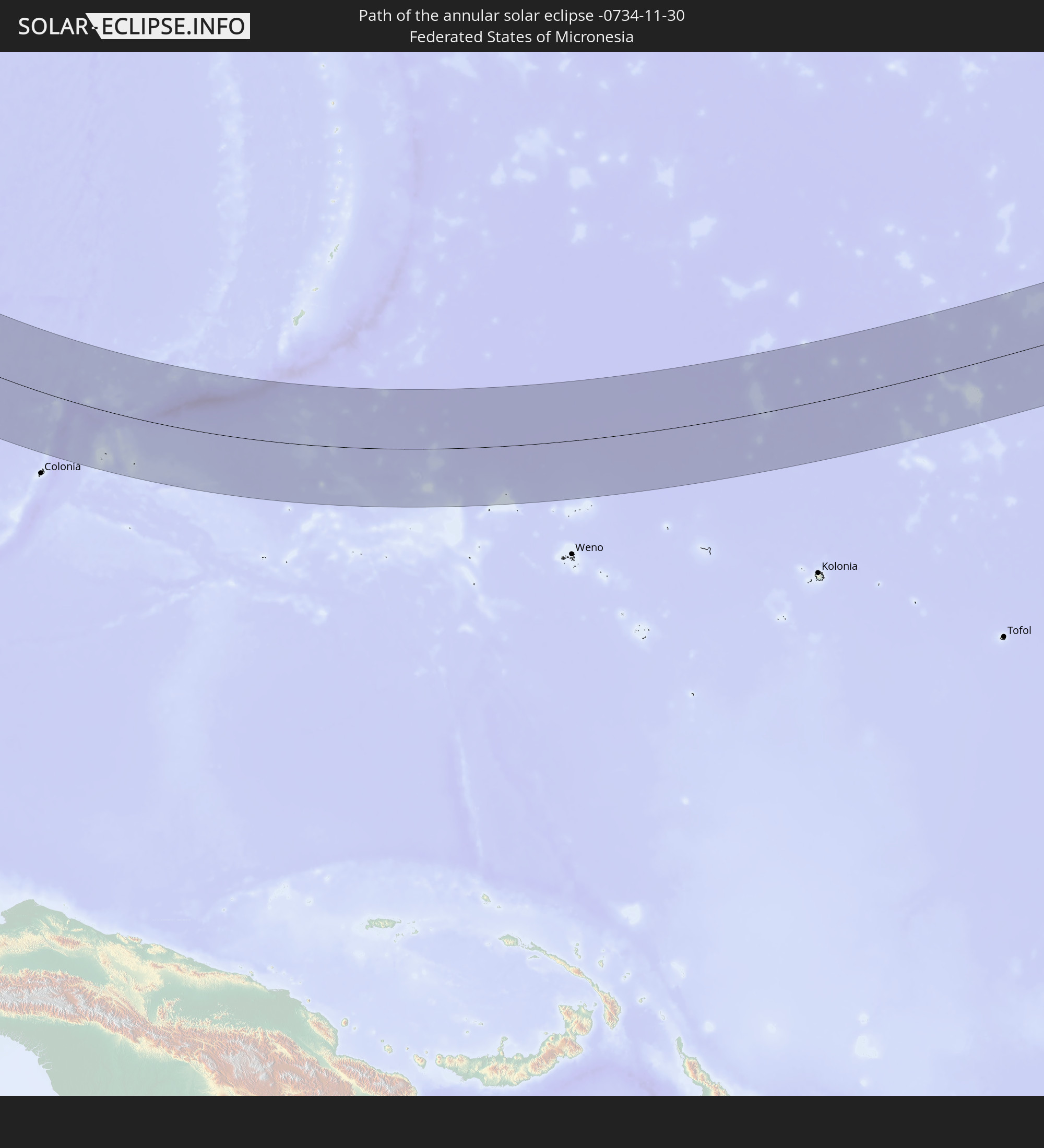 Federated States of Micronesia
 Marshall Islands
In den folgenden Ländern ist die Sonnenfinsternis partiell zu sehen
 Fiji
Fiji
 Russia
 United States
 United States Minor Outlying Islands
 Wallis and Futuna
 Tonga
Tonga
 Kiribati
 Samoa
Samoa
 American Samoa
 Kazakhstan
 Afghanistan
 Pakistan
 Tajikistan
 India
India
 Kyrgyzstan
 China
China
 Nepal
Nepal
 Mongolia
 Bangladesh
 Bhutan
 Myanmar
 Indonesia
 Thailand
 Malaysia
 Laos
Laos
 Vietnam
 Cambodia
 Singapore
 Australia
 Macau
Macau
 Hong Kong
 Brunei
 Taiwan
 Philippines
 Japan
Japan
 East Timor
 North Korea
 South Korea
 Palau
Palau
 Federated States of Micronesia
 Papua New Guinea
 Guam
Guam
 Northern Mariana Islands
 Solomon Islands
 New Caledonia
 Marshall Islands
 Vanuatu
 Nauru
Nauru
 Tuvalu
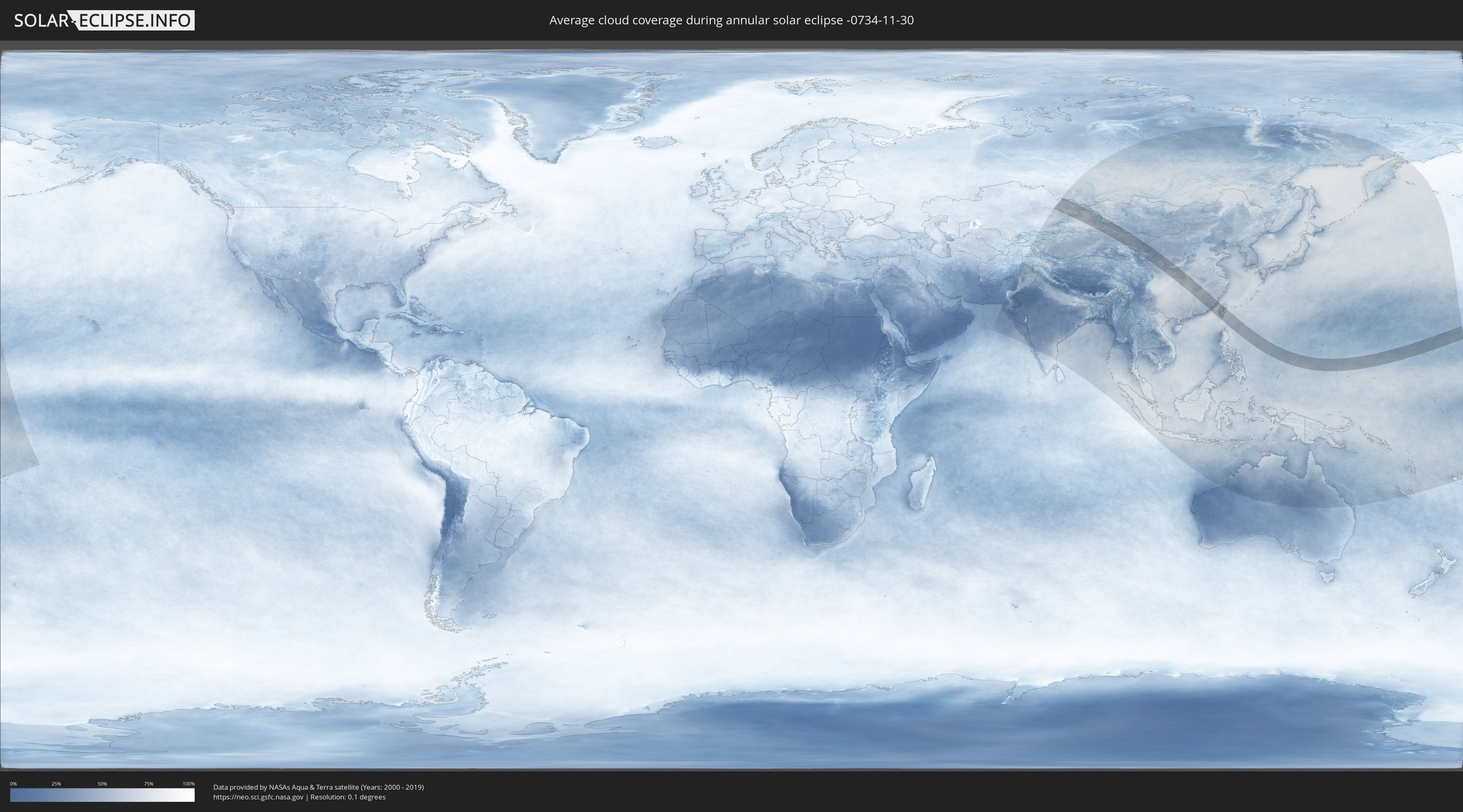
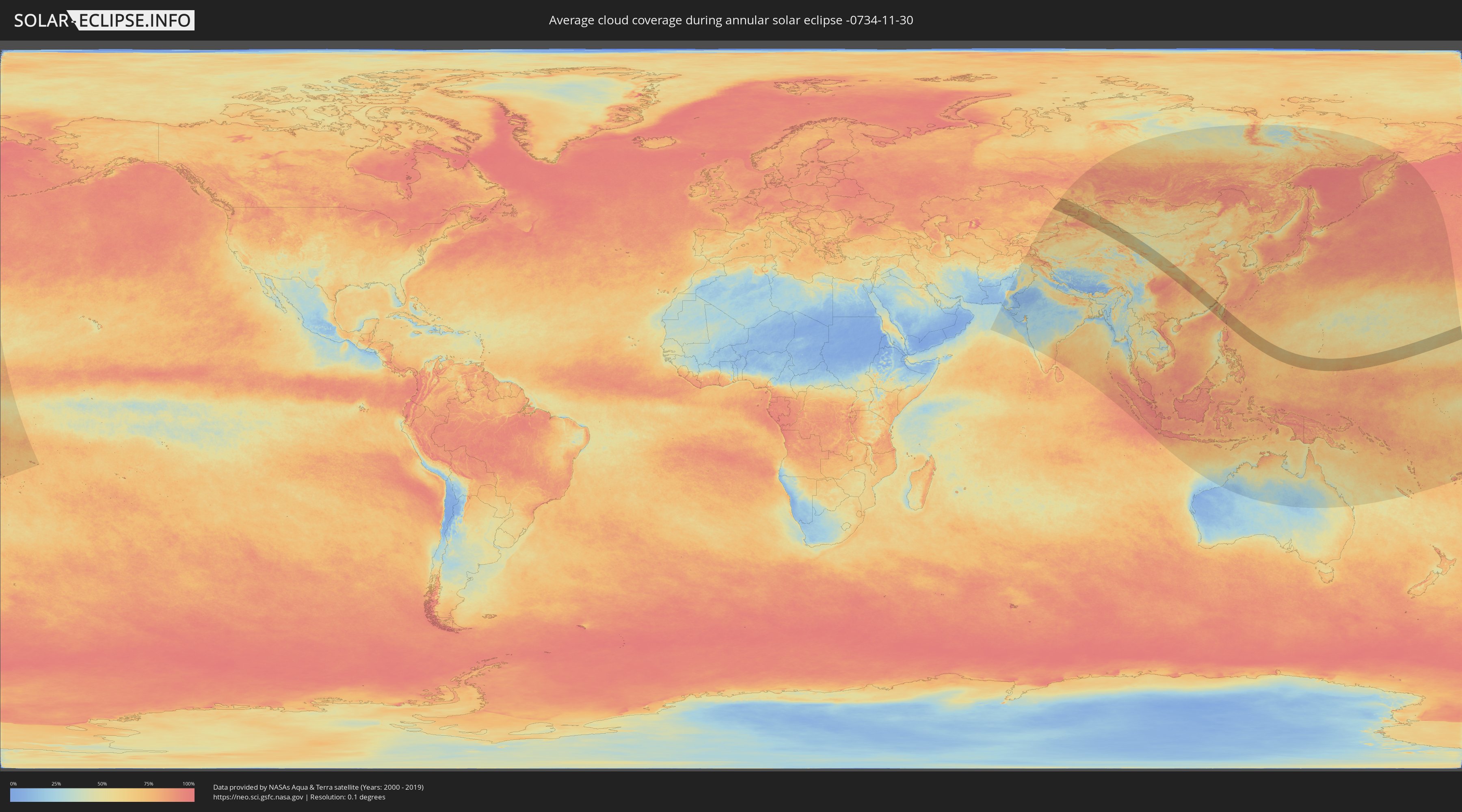
How will be the weather during the annular solar eclipse on 11/30/-0734?
Where is the best place to see the annular solar eclipse of 11/30/-0734?
The following maps show the average cloud coverage for the day of the annular solar eclipse.
With the help of these maps, it is possible to find the place along the eclipse path, which has the best
chance of a cloudless sky.
Nevertheless, you should consider local circumstances and inform about the weather of your chosen
observation site.
The data is provided by NASAs satellites
AQUA and TERRA.
The cloud maps are averaged over a period of 19 years (2000 - 2019).
Detailed country maps
 Russia
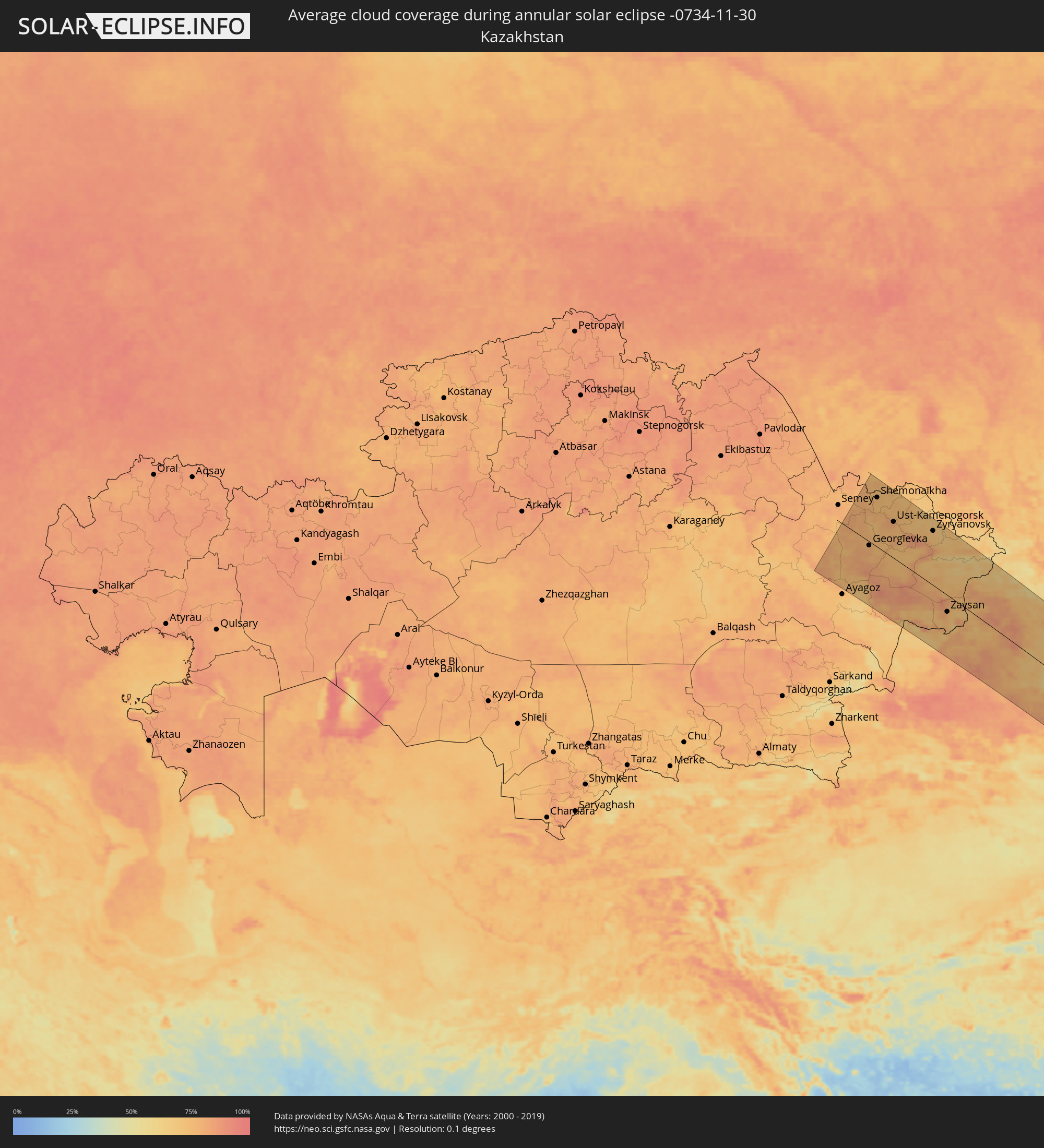 Kazakhstan
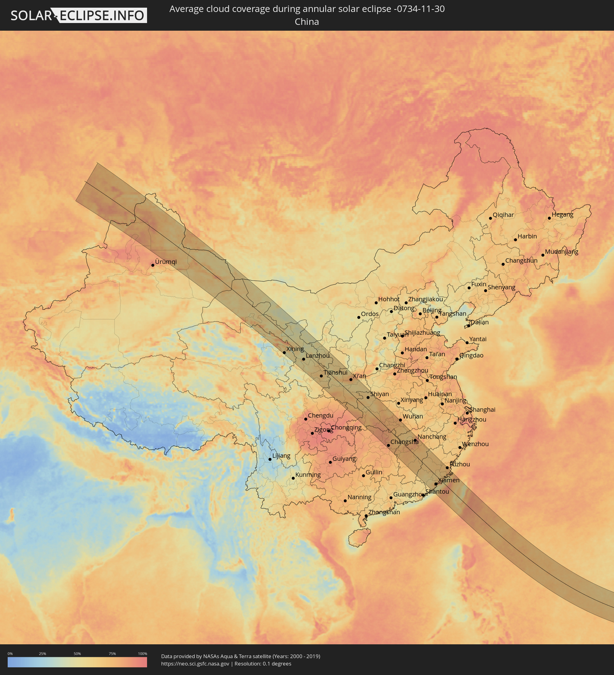 China
China
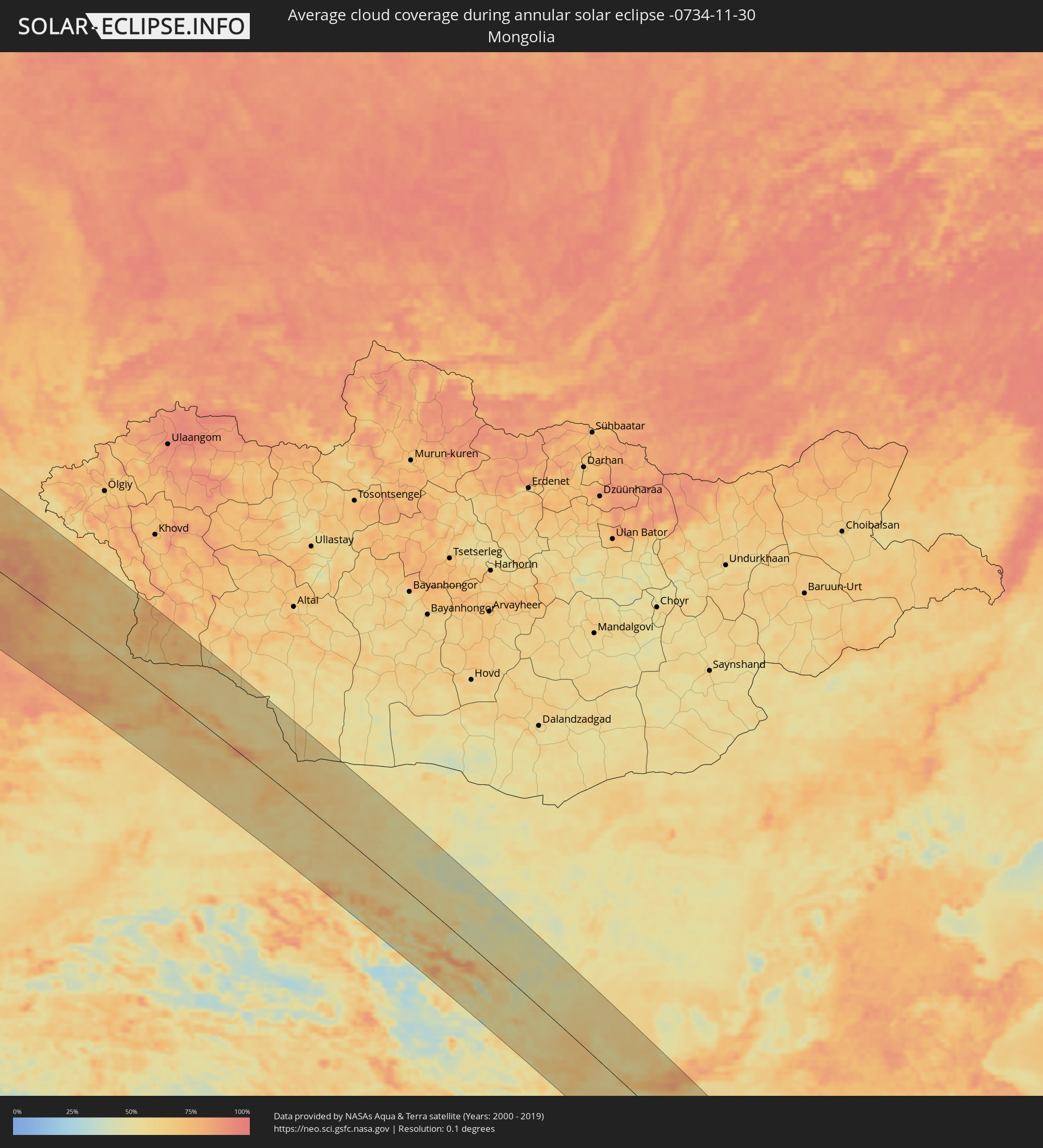 Mongolia
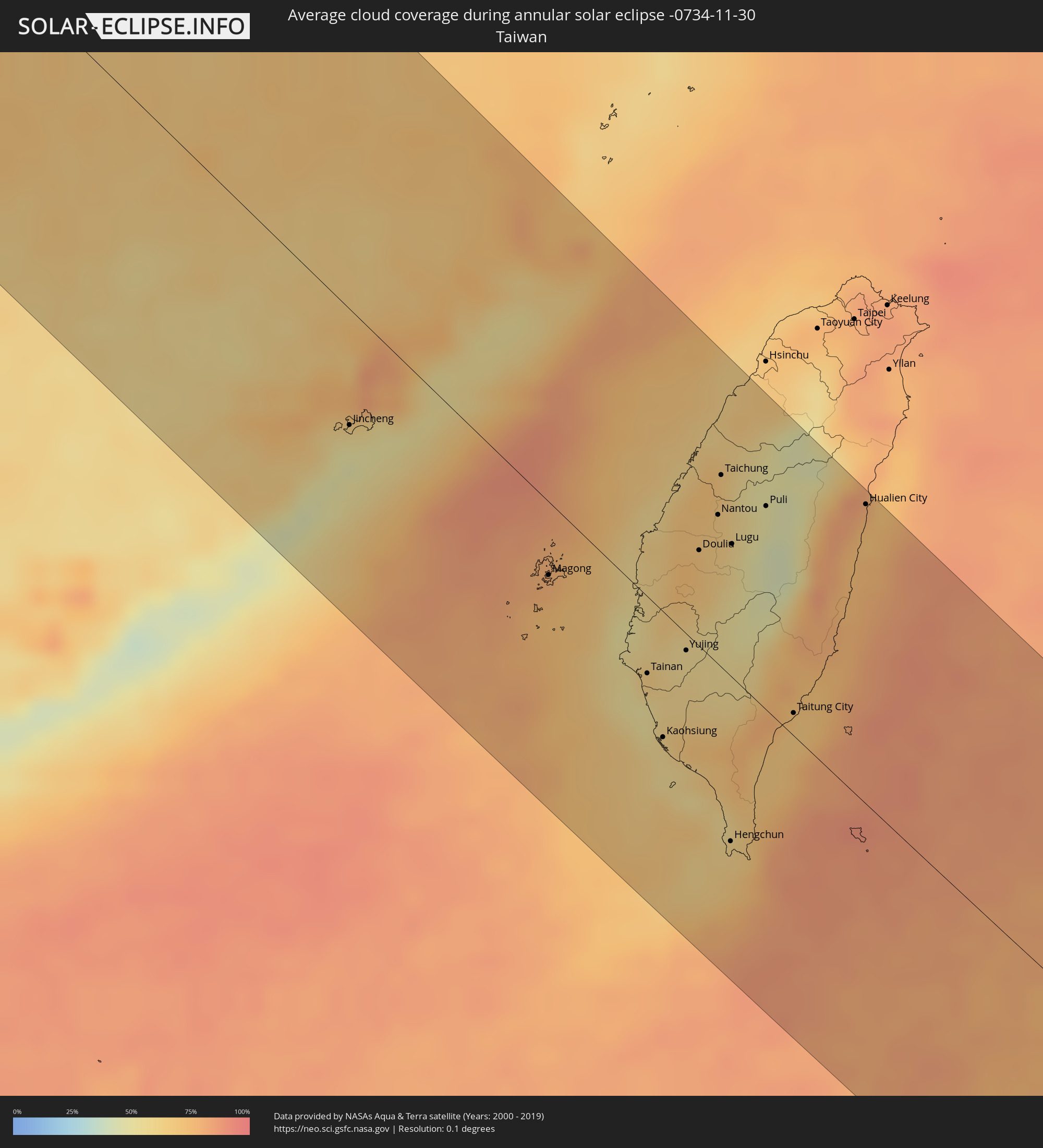 Taiwan
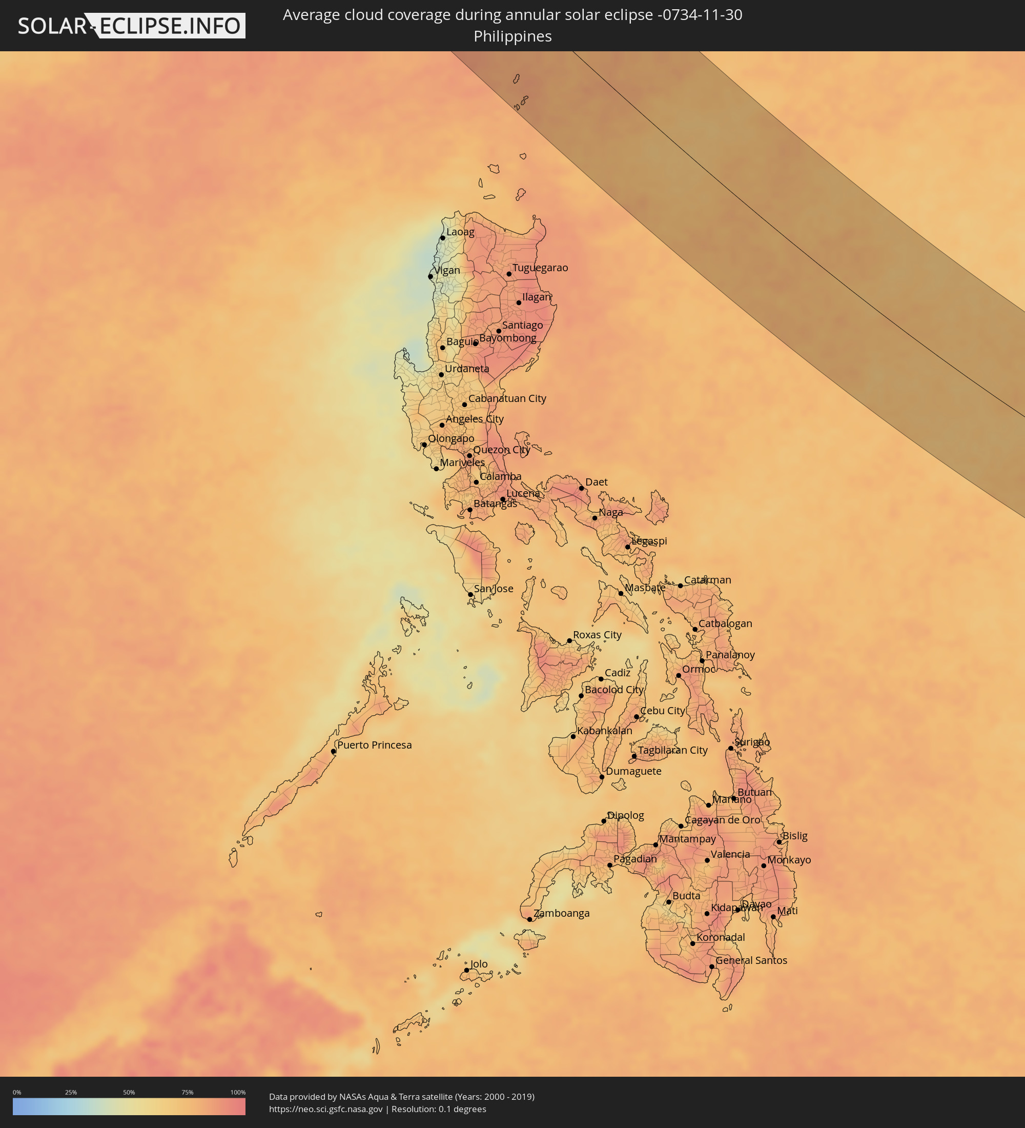 Philippines
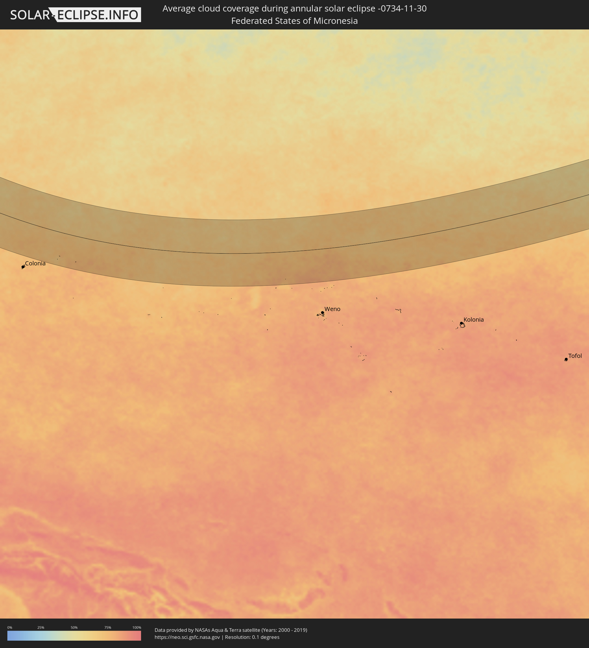 Federated States of Micronesia
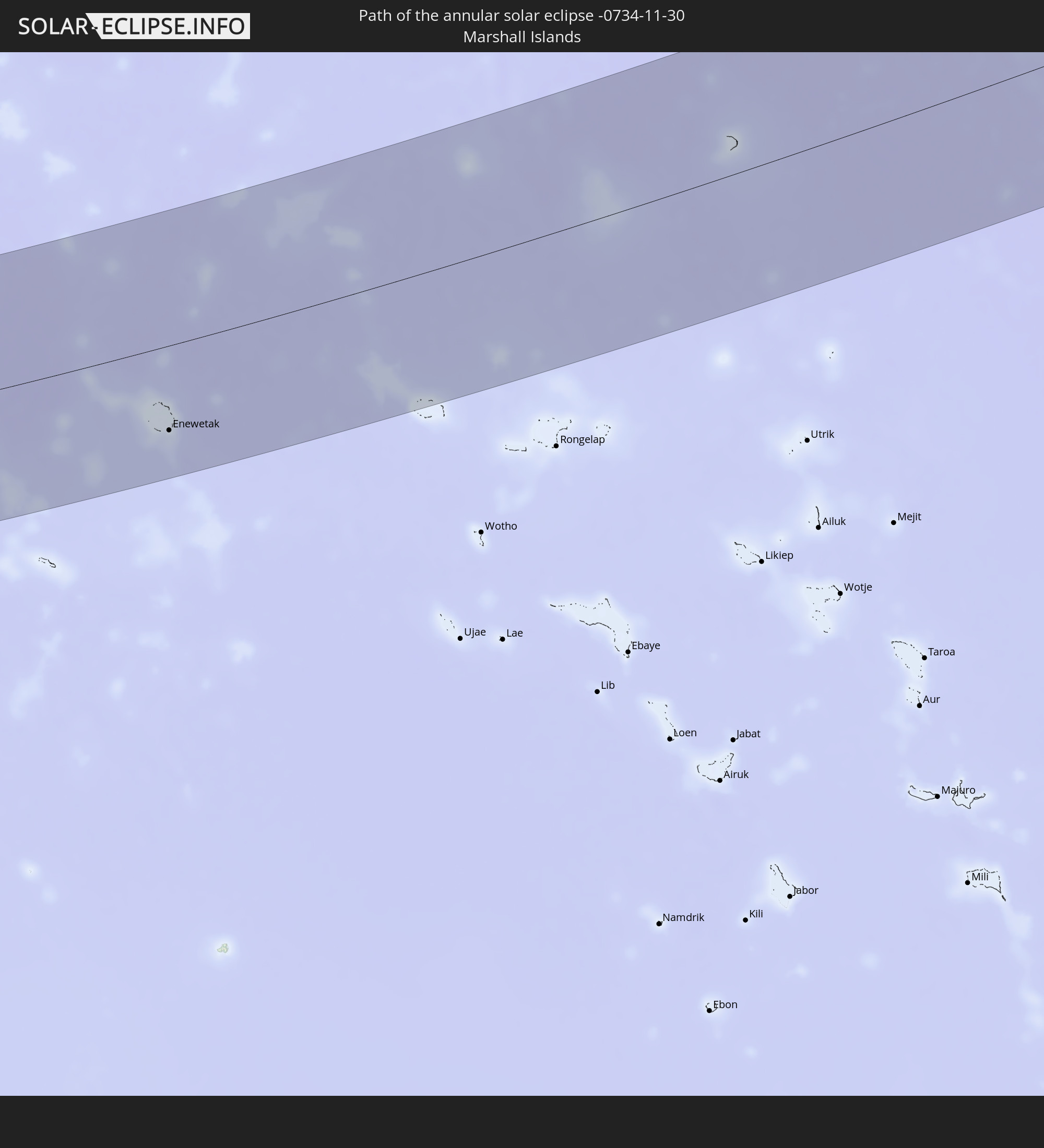
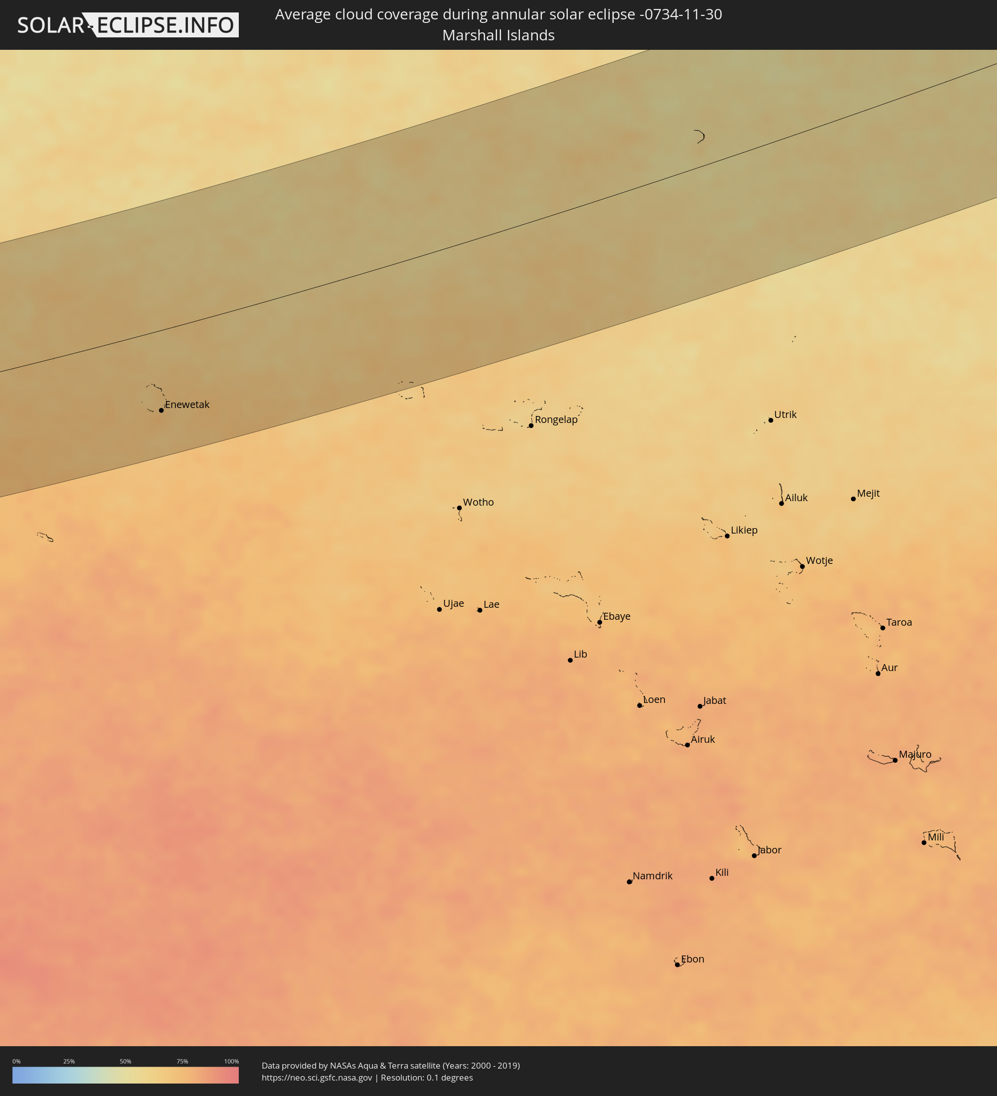 Marshall Islands
Cities inside the path of the eclipse
The following table shows all locations with a population of more than 5,000 inside the eclipse path. Cities which have more than 100,000 inhabitants are marked bold. A click at the locations opens a detailed map.
| City | Type | Eclipse duration | Local time of max. eclipse | Distance to central line | Ø Cloud coverage |
|
Shar, East Kazakhstan
|
annular | - | 06:40:39 UTC+04:21 | 7 km | 79% |
|
Zhezkent, East Kazakhstan
|
annular | - | 06:41:58 UTC+04:21 | 130 km | 77% |
|
Gornyak, Altai Krai
|
annular | - | 08:31:38 UTC+06:11 | 140 km | 76% |
|
Georgīevka, East Kazakhstan
|
annular | - | 06:40:38 UTC+04:21 | 10 km | 78% |
|
Ūst’-Talovka, East Kazakhstan
|
annular | - | 06:41:49 UTC+04:21 | 114 km | 74% |
|
Shemonaīkha, East Kazakhstan
|
annular | - | 06:41:55 UTC+04:21 | 124 km | 75% |
|
Staroaleyskoye, Altai Krai
|
annular | - | 08:31:52 UTC+06:11 | 162 km | 76% |
|
Glubokoye, East Kazakhstan
|
annular | - | 06:41:39 UTC+04:21 | 95 km | 81% |
|
Kokpekty
|
annular | - | 06:40:30 UTC+04:21 | 29 km | 74% |
|
Belūsovka, East Kazakhstan
|
annular | - | 06:41:44 UTC+04:21 | 103 km | 80% |
|
Ust-Kamenogorsk, East Kazakhstan
|
annular | - | 06:41:38 UTC+04:21 | 91 km | 81% |
|
Asūbulaq, East Kazakhstan
|
annular | - | 06:41:28 UTC+04:21 | 72 km | 76% |
|
Ridder, East Kazakhstan
|
annular | - | 06:42:22 UTC+04:21 | 162 km | 71% |
|
Zhanga Buqtyrma, East Kazakhstan
|
annular | - | 06:41:45 UTC+04:21 | 98 km | 89% |
|
Kurchum, East Kazakhstan
|
annular | - | 06:40:55 UTC+04:21 | 6 km | 77% |
|
Aksuat
|
annular | - | 06:41:04 UTC+04:21 | 22 km | 74% |
|
Tūghyl, East Kazakhstan
|
annular | - | 06:40:31 UTC+04:21 | 48 km | 80% |
|
Zyryanovsk, East Kazakhstan
|
annular | - | 06:42:11 UTC+04:21 | 138 km | 71% |
|
Zaysan, East Kazakhstan
|
annular | - | 06:40:39 UTC+04:21 | 43 km | 76% |
|
Xining, Qinghai
|
annular | - | 10:28:07 UTC+08:00 | 141 km | 49% |
|
Wuwei, Gansu
|
annular | - | 10:29:12 UTC+08:00 | 19 km | 49% |
|
Linxia Chengguanzhen, Gansu
|
annular | - | 10:29:54 UTC+08:00 | 142 km | 62% |
|
Lanzhou, Gansu
|
annular | - | 10:30:40 UTC+08:00 | 66 km | 61% |
|
Baiyin, Gansu
|
annular | - | 10:31:04 UTC+08:00 | 5 km | 56% |
|
Tianshui, Gansu
|
annular | - | 10:33:21 UTC+08:00 | 73 km | 68% |
|
Xianyang, Shaanxi
|
annular | - | 10:37:41 UTC+08:00 | 92 km | 79% |
|
Xi’an, Shaanxi
|
annular | - | 10:38:03 UTC+08:00 | 100 km | 83% |
|
Shiyan, Hubei
|
annular | - | 10:41:31 UTC+08:00 | 89 km | 64% |
|
Yichang, Hubei
|
annular | - | 10:43:14 UTC+08:00 | 33 km | 80% |
|
Laohekou, Hubei
|
annular | - | 10:43:07 UTC+08:00 | 126 km | 73% |
|
Changde, Hunan
|
annular | - | 10:44:52 UTC+08:00 | 142 km | 85% |
|
Xiangyang, Hubei
|
annular | - | 10:44:05 UTC+08:00 | 130 km | 75% |
|
Shashi, Hubei
|
annular | - | 10:45:08 UTC+08:00 | 2 km | 82% |
|
Yiyang, Hunan
|
annular | - | 10:46:20 UTC+08:00 | 135 km | 85% |
|
Qianjiang, Hubei
|
annular | - | 10:46:14 UTC+08:00 | 50 km | 78% |
|
Changsha, Hunan
|
annular | - | 10:47:48 UTC+08:00 | 123 km | 82% |
|
Yueyang, Hunan
|
annular | - | 10:47:14 UTC+08:00 | 20 km | 82% |
|
Jingling, Hubei
|
annular | - | 10:46:29 UTC+08:00 | 82 km | 77% |
|
Zhuzhou, Hunan
|
annular | - | 10:48:23 UTC+08:00 | 140 km | 80% |
|
Xiantao, Hubei
|
annular | - | 10:47:16 UTC+08:00 | 83 km | 76% |
|
Xindi, Hubei
|
annular | - | 10:47:39 UTC+08:00 | 40 km | 76% |
|
Chengzhong, Hubei
|
annular | - | 10:47:09 UTC+08:00 | 136 km | 76% |
|
Guankou, Hunan
|
annular | - | 10:49:04 UTC+08:00 | 81 km | 76% |
|
Pingxiang, Jiangxi
|
annular | - | 10:49:54 UTC+08:00 | 109 km | 74% |
|
Xianning, Hubei
|
annular | - | 10:49:15 UTC+08:00 | 100 km | 70% |
|
Ji’an, Jiangxi
|
annular | - | 10:52:30 UTC+08:00 | 72 km | 77% |
|
Nanchang, Jiangxi
|
annular | - | 10:53:03 UTC+08:00 | 113 km | 81% |
|
Sanming, Fujian
|
annular | - | 10:58:48 UTC+08:00 | 42 km | 69% |
|
Zhangzhou, Fujian
|
annular | - | 11:00:35 UTC+08:00 | 94 km | 69% |
|
Xiamen, Fujian
|
annular | - | 11:01:34 UTC+08:00 | 67 km | 62% |
|
Jincheng, Fukien
|
annular | - | 11:02:09 UTC+08:00 | 54 km | 50% |
|
Quanzhou, Fujian
|
annular | - | 11:02:16 UTC+08:00 | 3 km | 79% |
|
Putian, Fujian
|
annular | - | 11:02:42 UTC+08:00 | 75 km | 74% |
|
Fuzhou, Fujian
|
annular | - | 11:02:45 UTC+08:00 | 145 km | 76% |
|
Magong, Taiwan
|
annular | - | 11:06:03 UTC+08:00 | 34 km | 77% |
|
Tainan, Taiwan
|
annular | - | 11:08:14 UTC+08:00 | 36 km | 62% |
|
Kaohsiung, Takao
|
annular | - | 11:08:55 UTC+08:00 | 59 km | 58% |
|
Yujing, Taiwan
|
annular | - | 11:08:40 UTC+08:00 | 8 km | 58% |
|
Douliu, Taiwan
|
annular | - | 11:08:11 UTC+08:00 | 45 km | 72% |
|
Nantou, Taiwan
|
annular | - | 11:08:15 UTC+08:00 | 70 km | 64% |
|
Taichung, Taiwan
|
annular | - | 11:08:02 UTC+08:00 | 90 km | 66% |
|
Zhongxing New Village, Taiwan
|
annular | - | 11:08:15 UTC+08:00 | 75 km | 64% |
|
Hengchun, Taiwan
|
annular | - | 11:10:44 UTC+08:00 | 79 km | 62% |
|
Lugu, Taiwan
|
annular | - | 11:08:39 UTC+08:00 | 63 km | 54% |
|
Puli, Taiwan
|
annular | - | 11:08:56 UTC+08:00 | 96 km | 48% |
|
Taitung City, Taiwan
|
annular | - | 11:10:48 UTC+08:00 | 11 km | 74% |
|
Hualien City, Taiwan
|
annular | - | 11:10:30 UTC+08:00 | 141 km | 78% |
|
Basco, Cagayan Valley
|
annular | - | 11:15:53 UTC+08:00 | 119 km | 82% |
|
Enewetak, Enewetak Atoll
|
annular | - | 16:16:42 UTC+11:00 | 105 km | 70% |