Total solar eclipse of 05/22/-0928
| Day of week: | Monday |
| Maximum duration of eclipse: | 04m39s |
| Maximum width of eclipse path: | 157 km |
| Saros cycle: | 42 |
| Coverage: | 100% |
| Magnitude: | 1.047 |
| Gamma: | -0.0771 |
Wo kann man die Sonnenfinsternis vom 05/22/-0928 sehen?
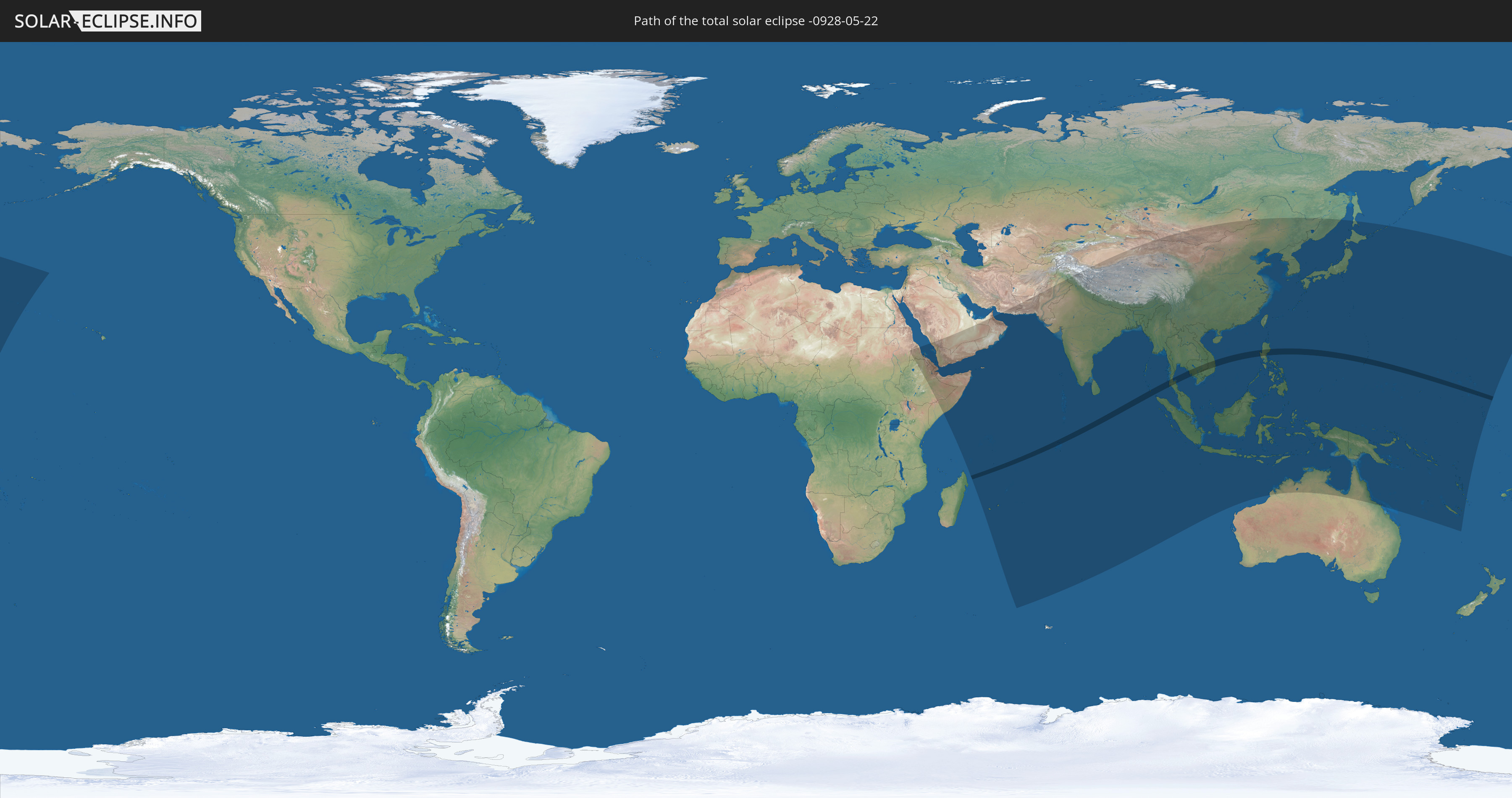
Die Sonnenfinsternis am 05/22/-0928 kann man in 57 Ländern als partielle Sonnenfinsternis beobachten.
Der Finsternispfad verläuft durch 10 Länder. Nur in diesen Ländern ist sie als total Sonnenfinsternis zu sehen.
In den folgenden Ländern ist die Sonnenfinsternis total zu sehen
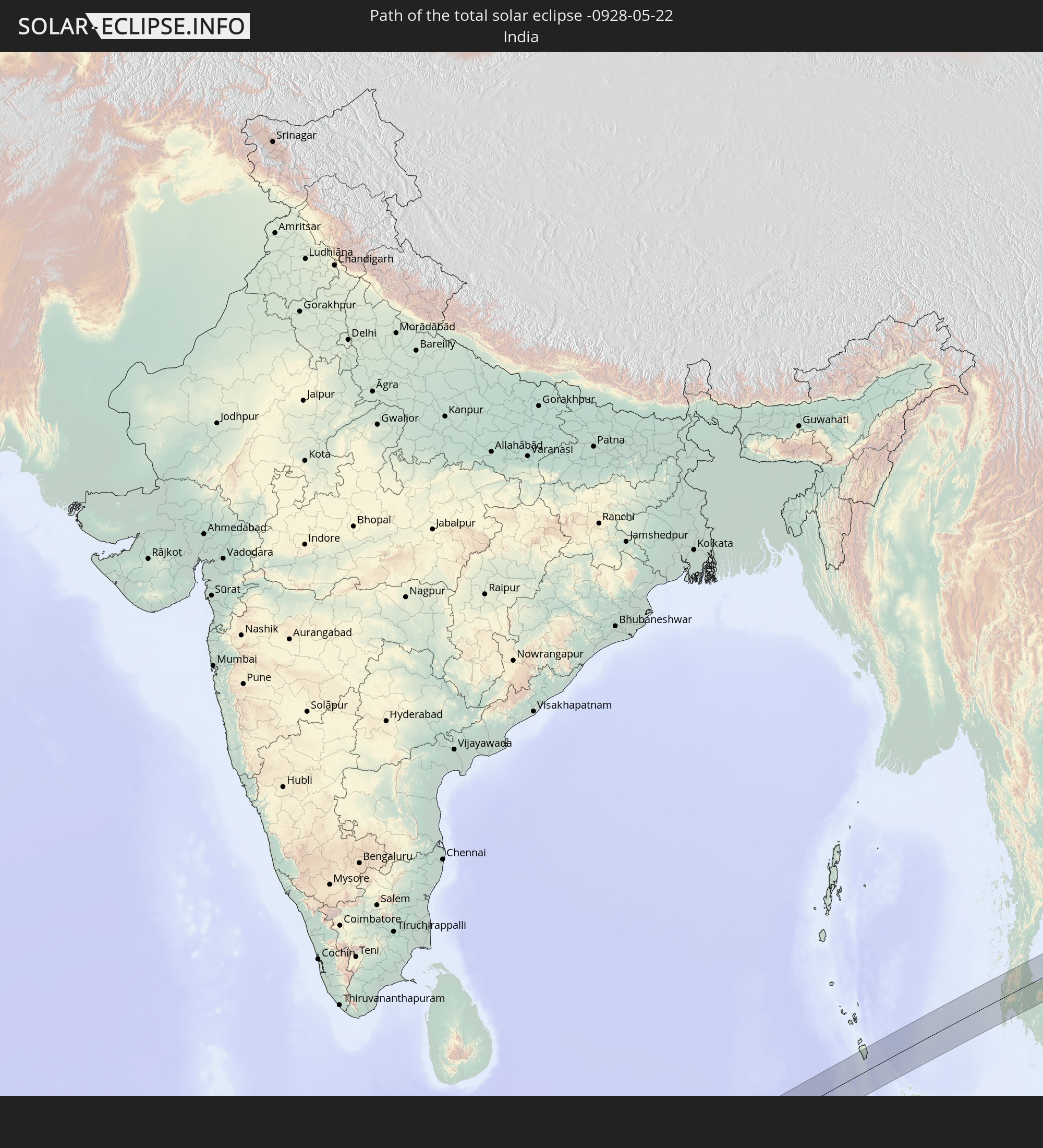 India
India
 British Indian Ocean Territory
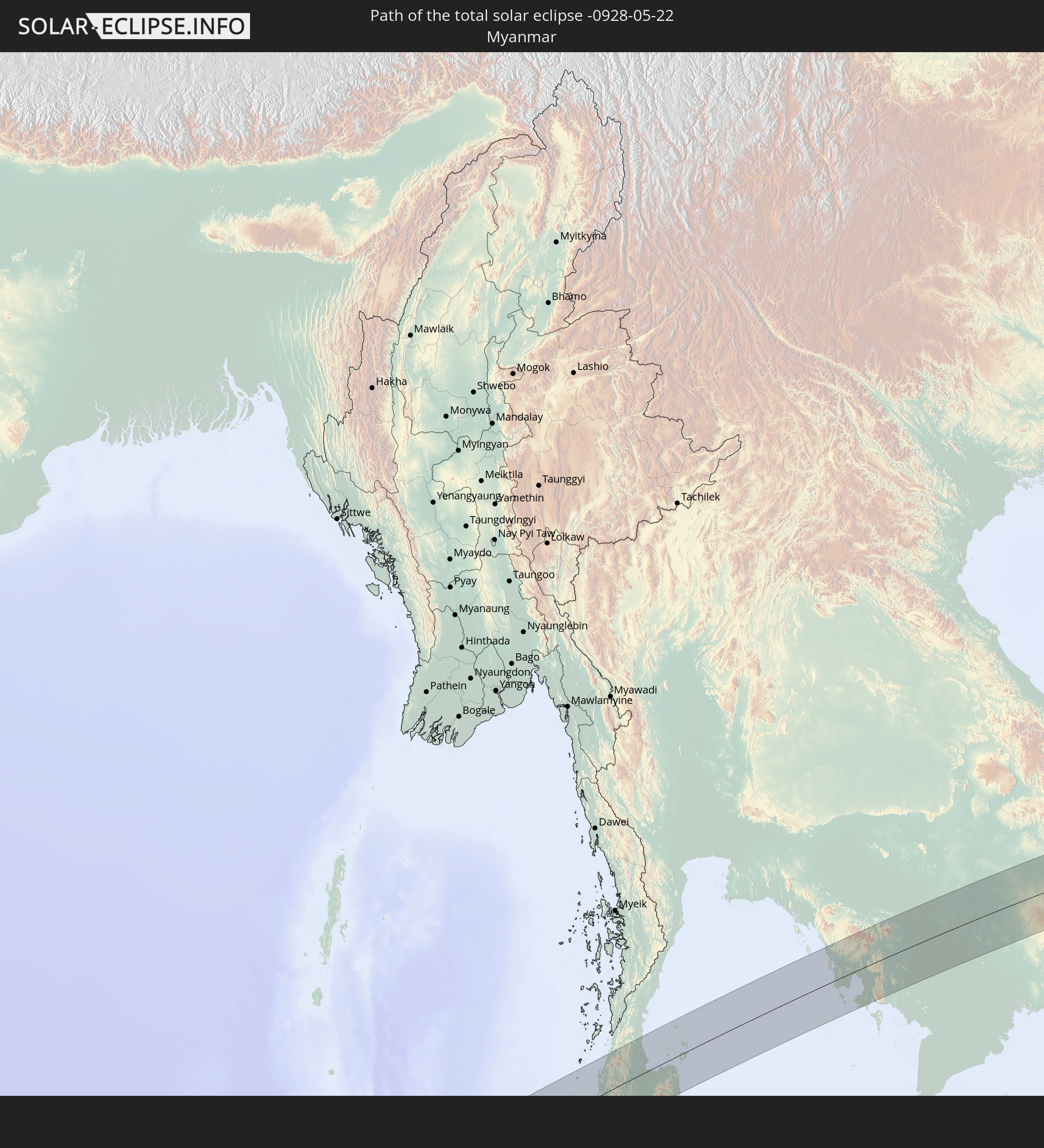 Myanmar
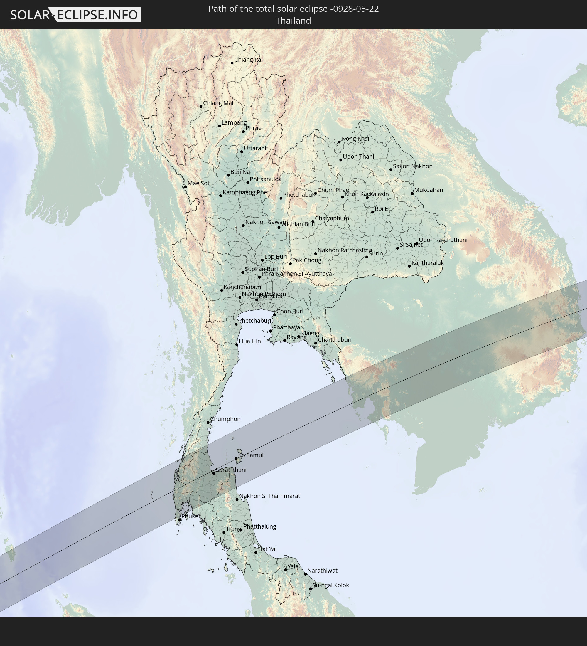 Thailand
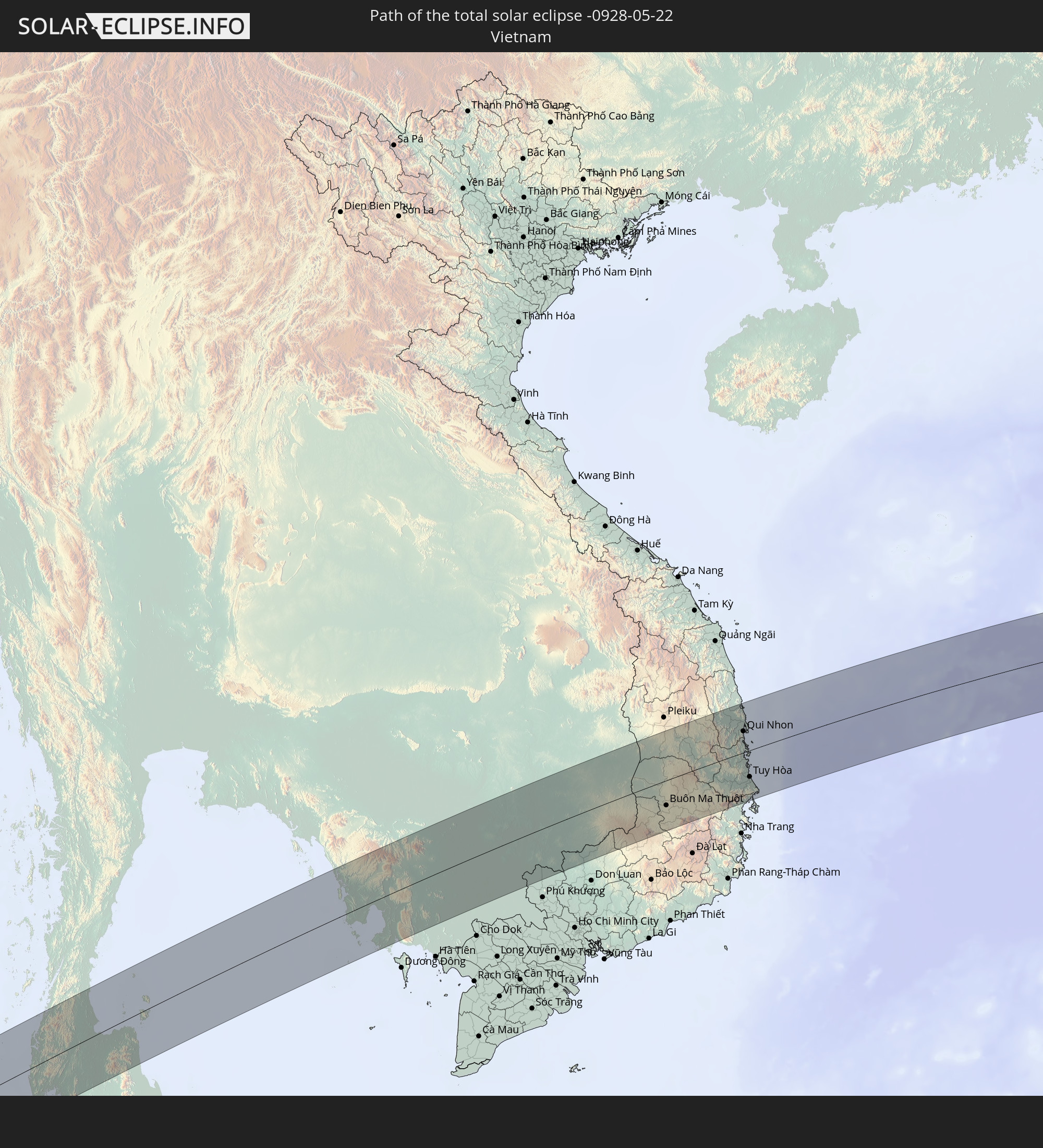 Vietnam
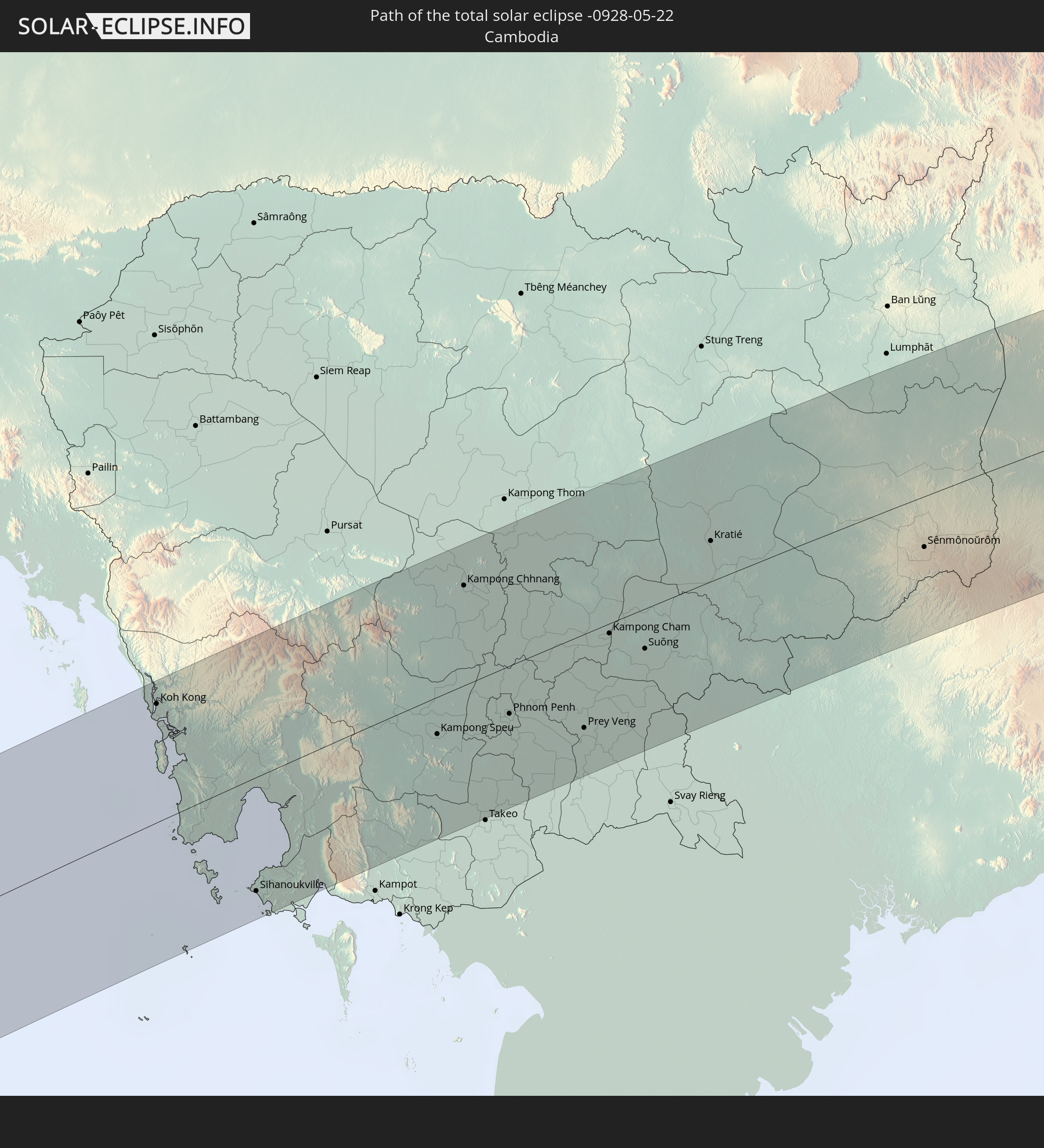 Cambodia
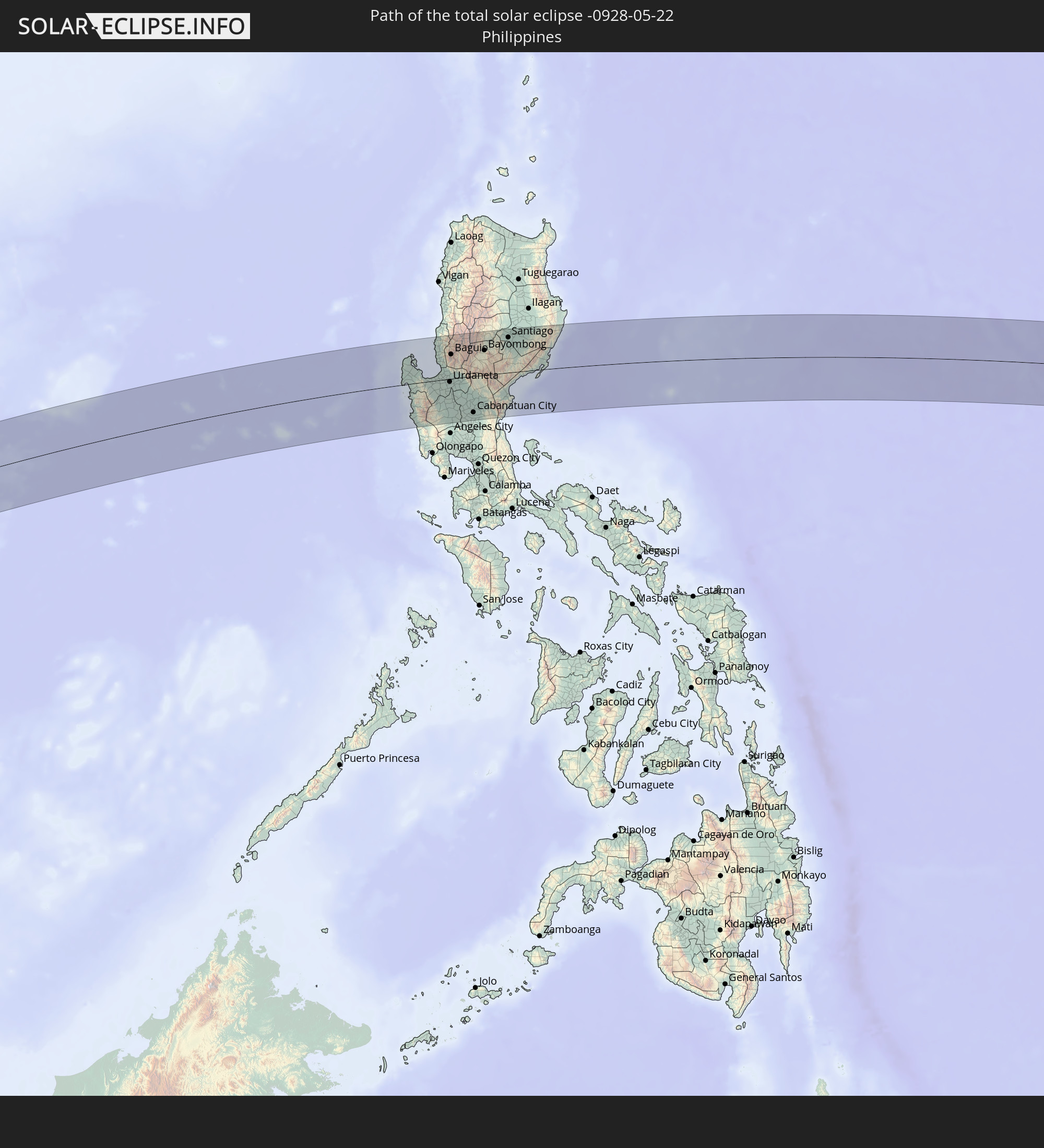 Philippines
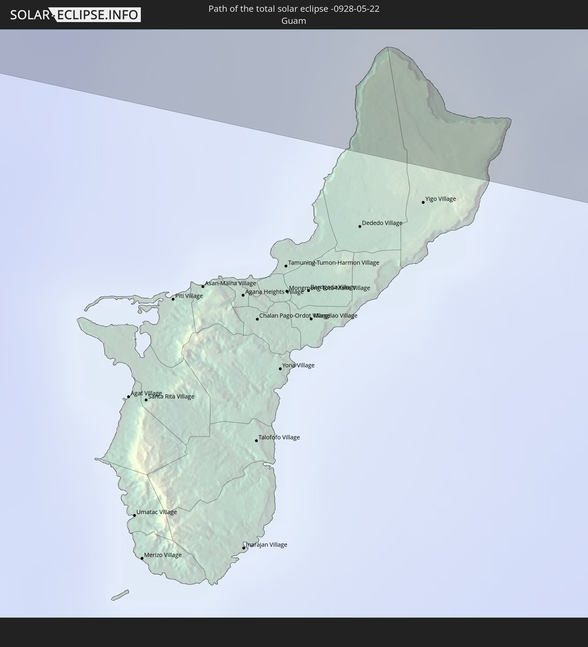 Guam
Guam
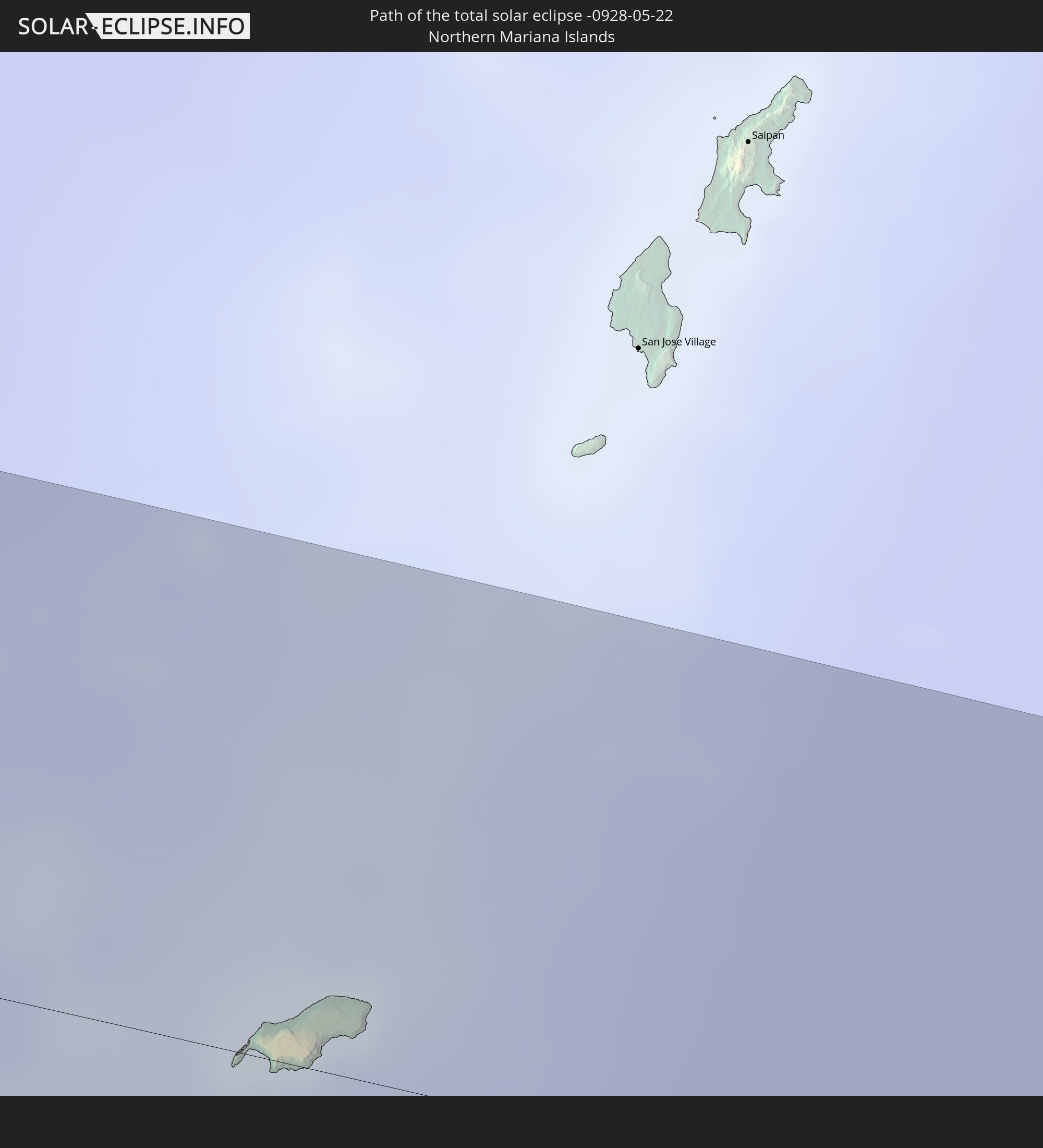 Northern Mariana Islands
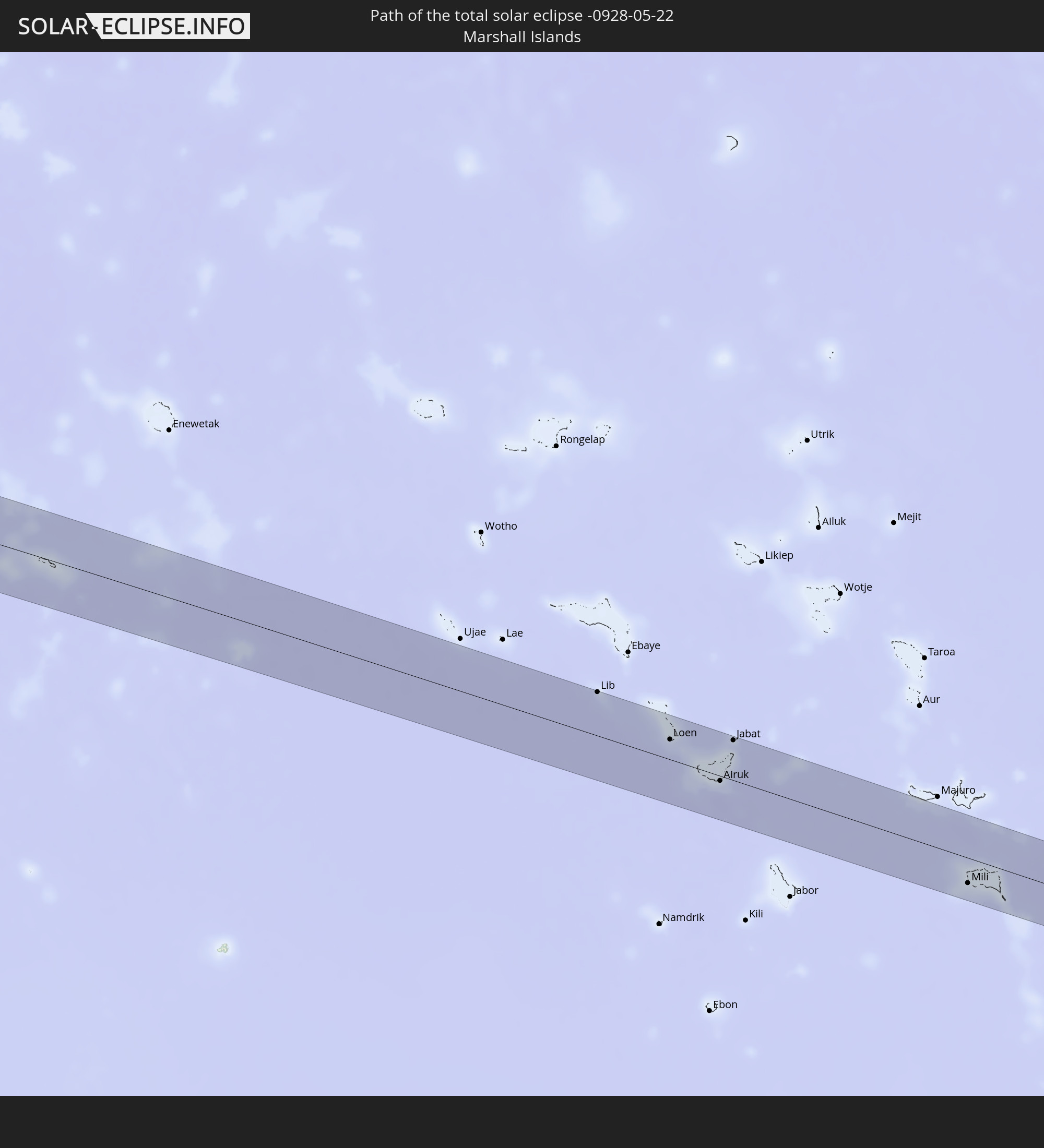 Marshall Islands
In den folgenden Ländern ist die Sonnenfinsternis partiell zu sehen
 Russia
 United States Minor Outlying Islands
 Kiribati
 Sudan
Sudan
 Ethiopia
 Saudi Arabia
 Eritrea
 French Southern and Antarctic Lands
 Somalia
 Djibouti
 Yemen
Yemen
 Iran
Iran
 Seychelles
 United Arab Emirates
 Oman
Oman
 Réunion
 Mauritius
 Pakistan
 India
India
 British Indian Ocean Territory
 Maldives
 China
China
 Sri Lanka
 Nepal
Nepal
 Mongolia
 Bangladesh
 Bhutan
 Myanmar
 Indonesia
 Cocos Islands
 Thailand
 Malaysia
 Laos
Laos
 Vietnam
 Cambodia
 Singapore
 Christmas Island
 Australia
 Macau
Macau
 Hong Kong
 Brunei
 Taiwan
 Philippines
 Japan
Japan
 East Timor
 North Korea
 South Korea
 Palau
Palau
 Federated States of Micronesia
 Papua New Guinea
 Guam
Guam
 Northern Mariana Islands
 Solomon Islands
 New Caledonia
 Marshall Islands
 Vanuatu
 Nauru
Nauru
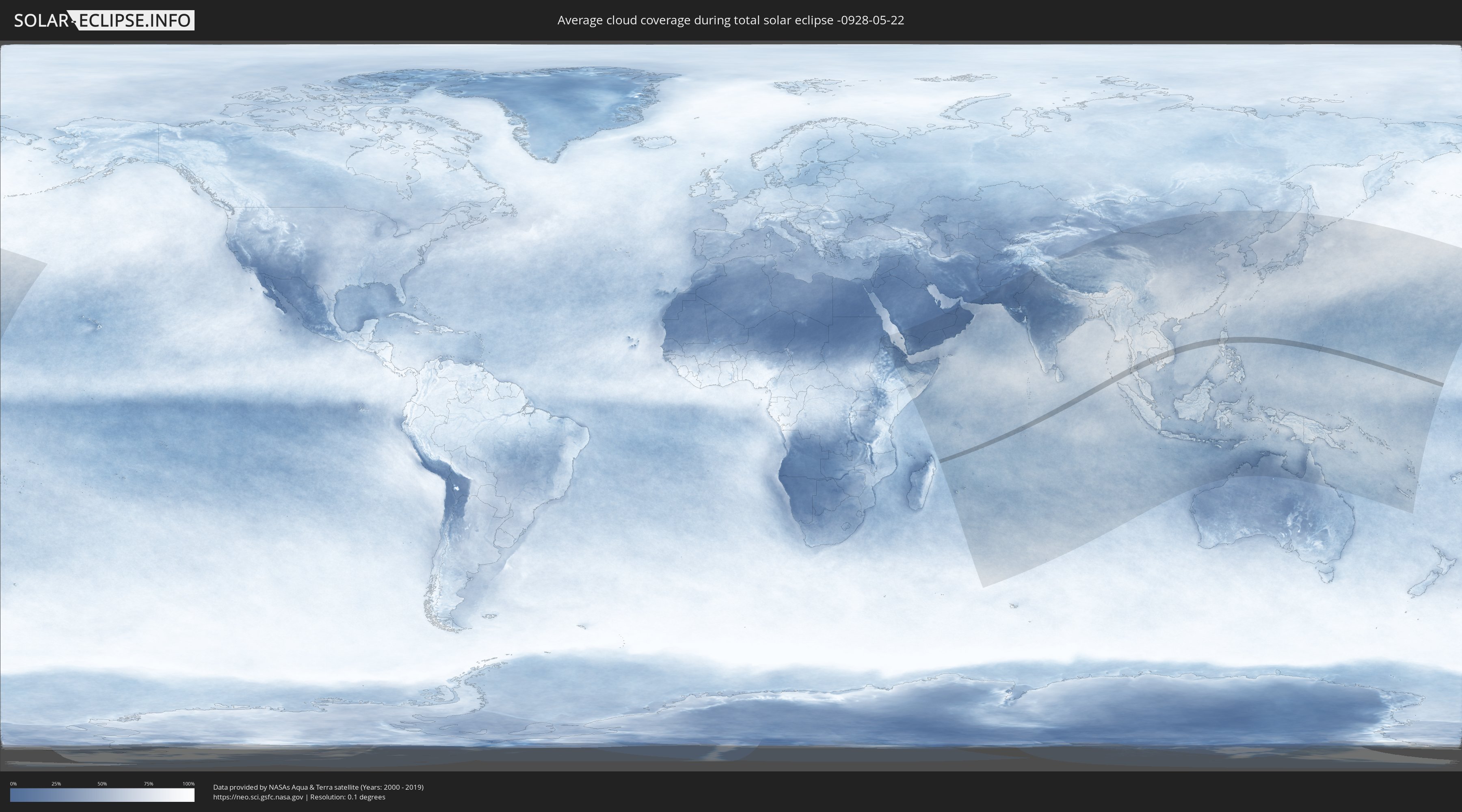
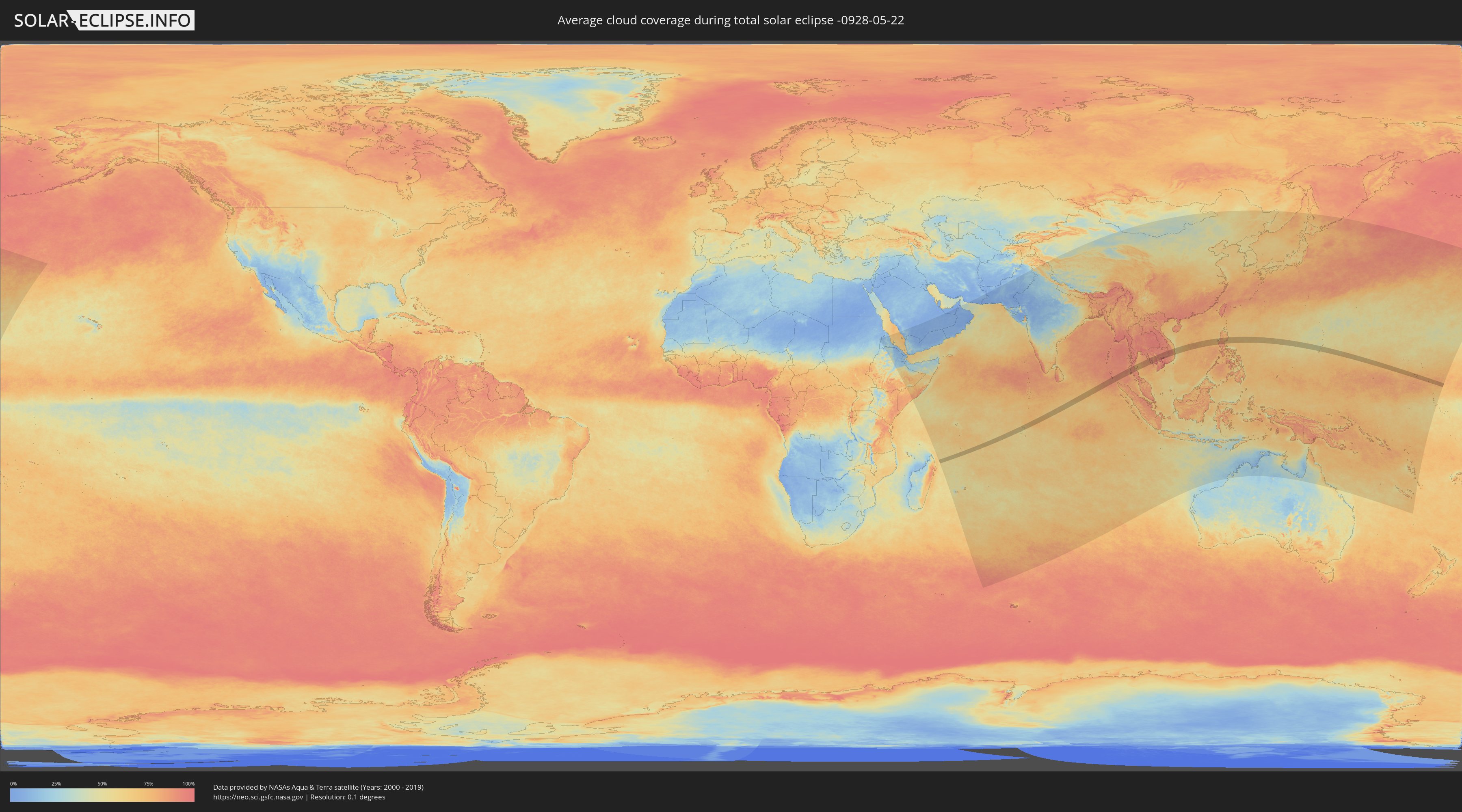
How will be the weather during the total solar eclipse on 05/22/-0928?
Where is the best place to see the total solar eclipse of 05/22/-0928?
The following maps show the average cloud coverage for the day of the total solar eclipse.
With the help of these maps, it is possible to find the place along the eclipse path, which has the best
chance of a cloudless sky.
Nevertheless, you should consider local circumstances and inform about the weather of your chosen
observation site.
The data is provided by NASAs satellites
AQUA and TERRA.
The cloud maps are averaged over a period of 19 years (2000 - 2019).
Detailed country maps
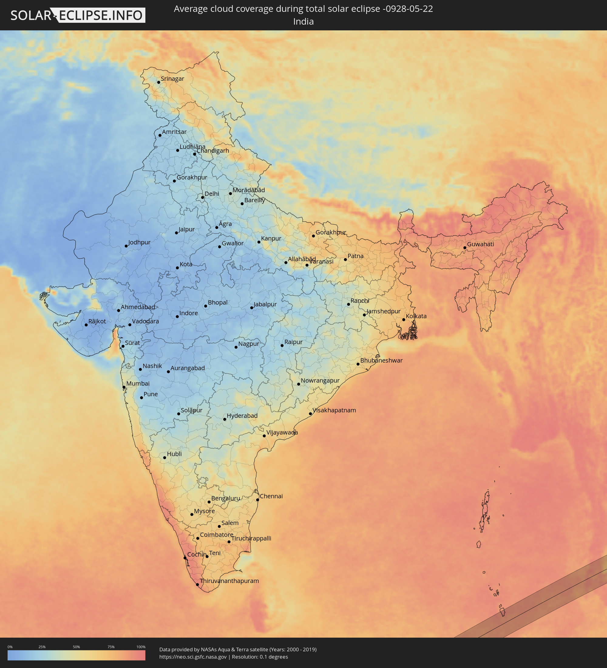 India
India
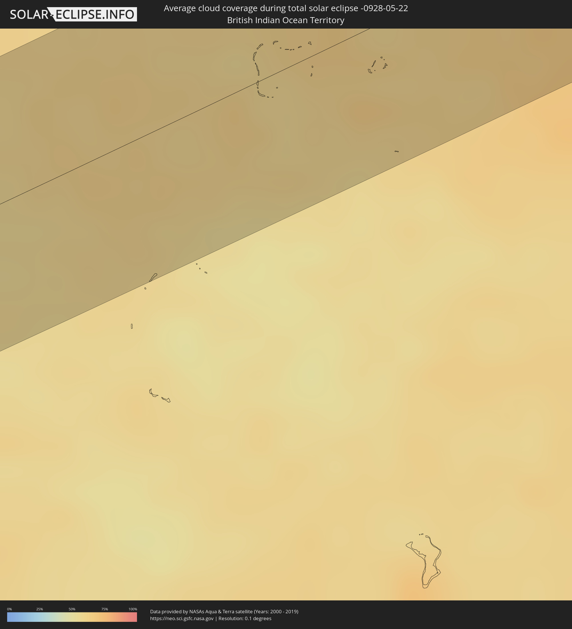 British Indian Ocean Territory
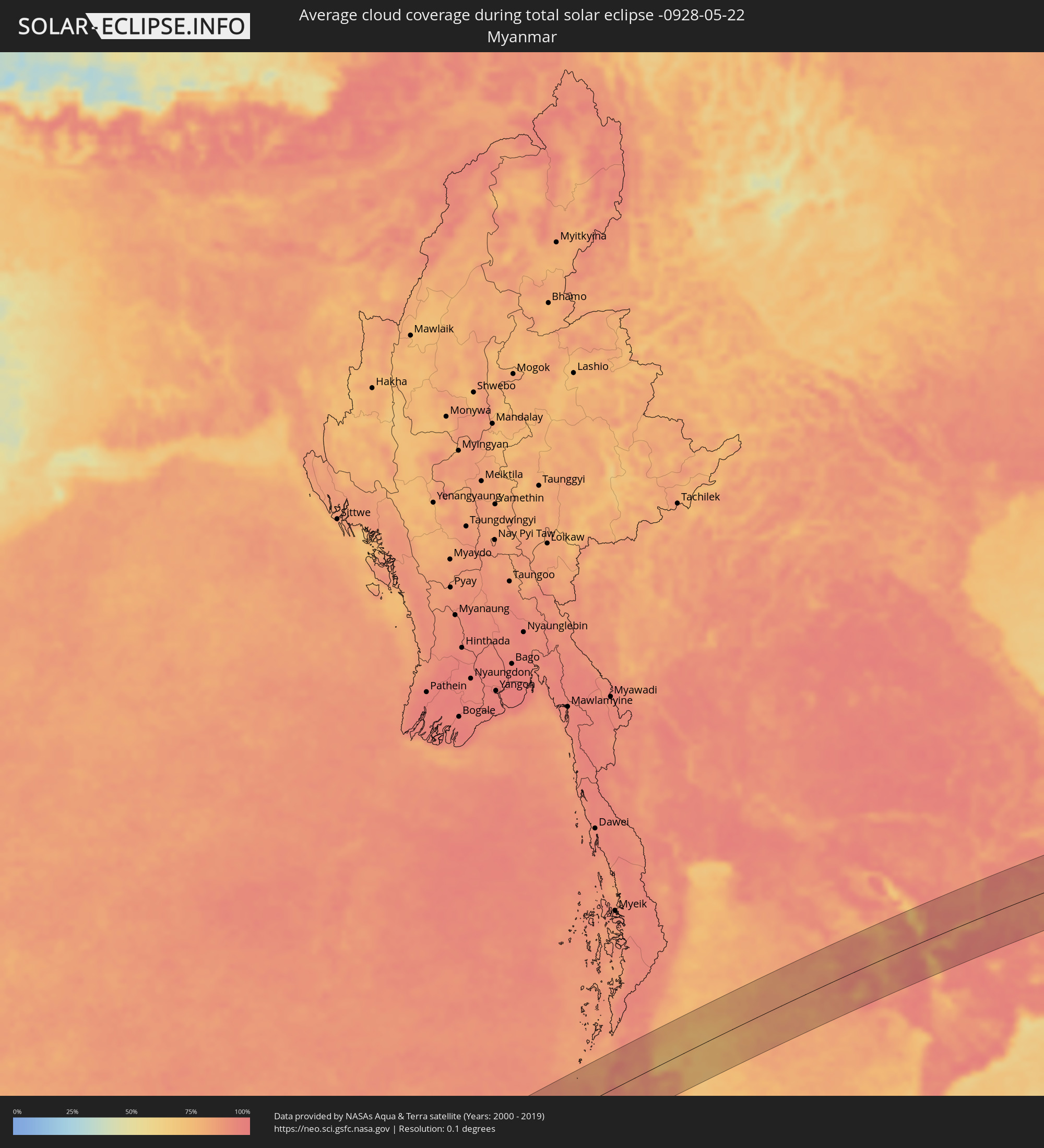 Myanmar
 Thailand
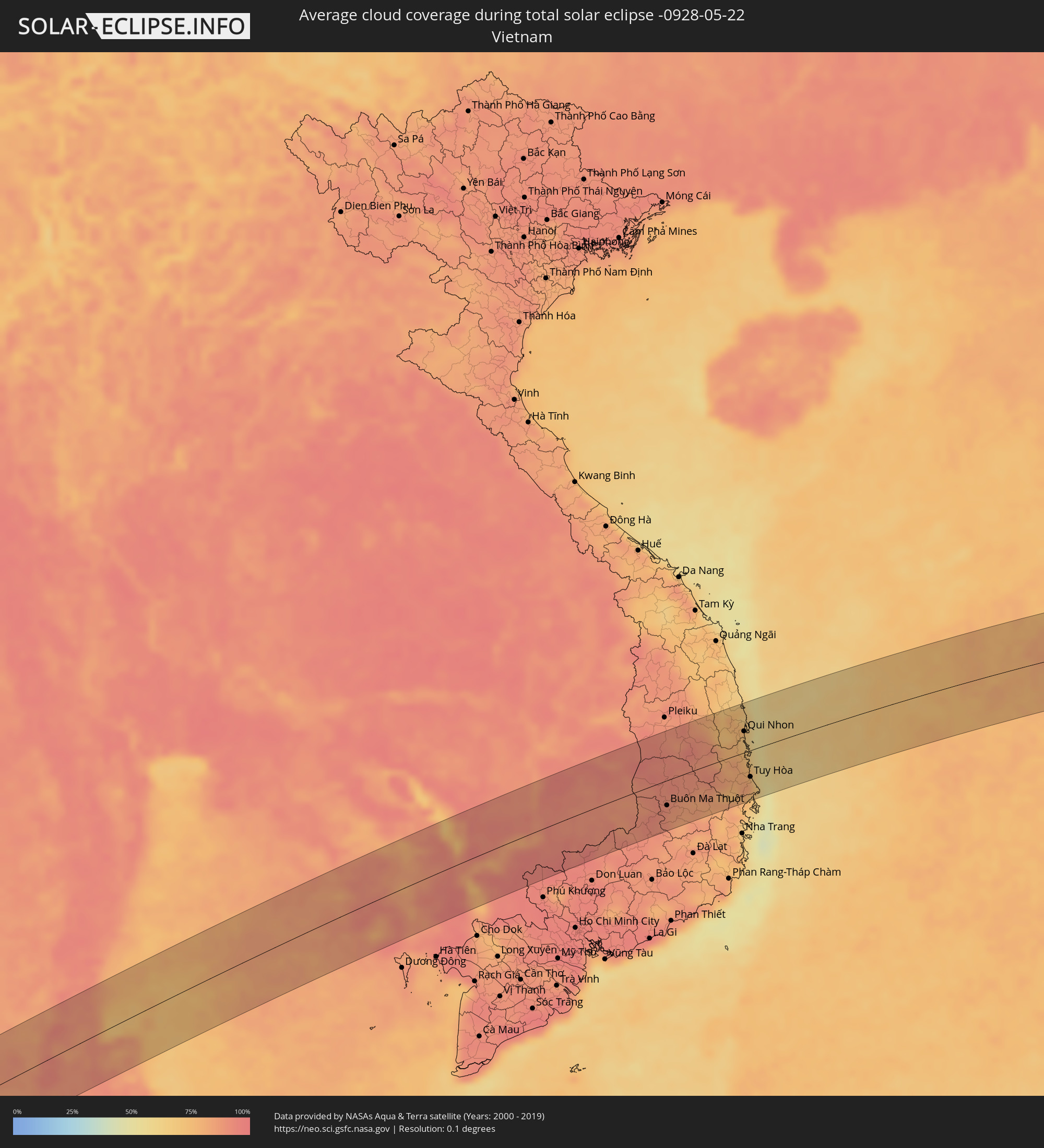 Vietnam
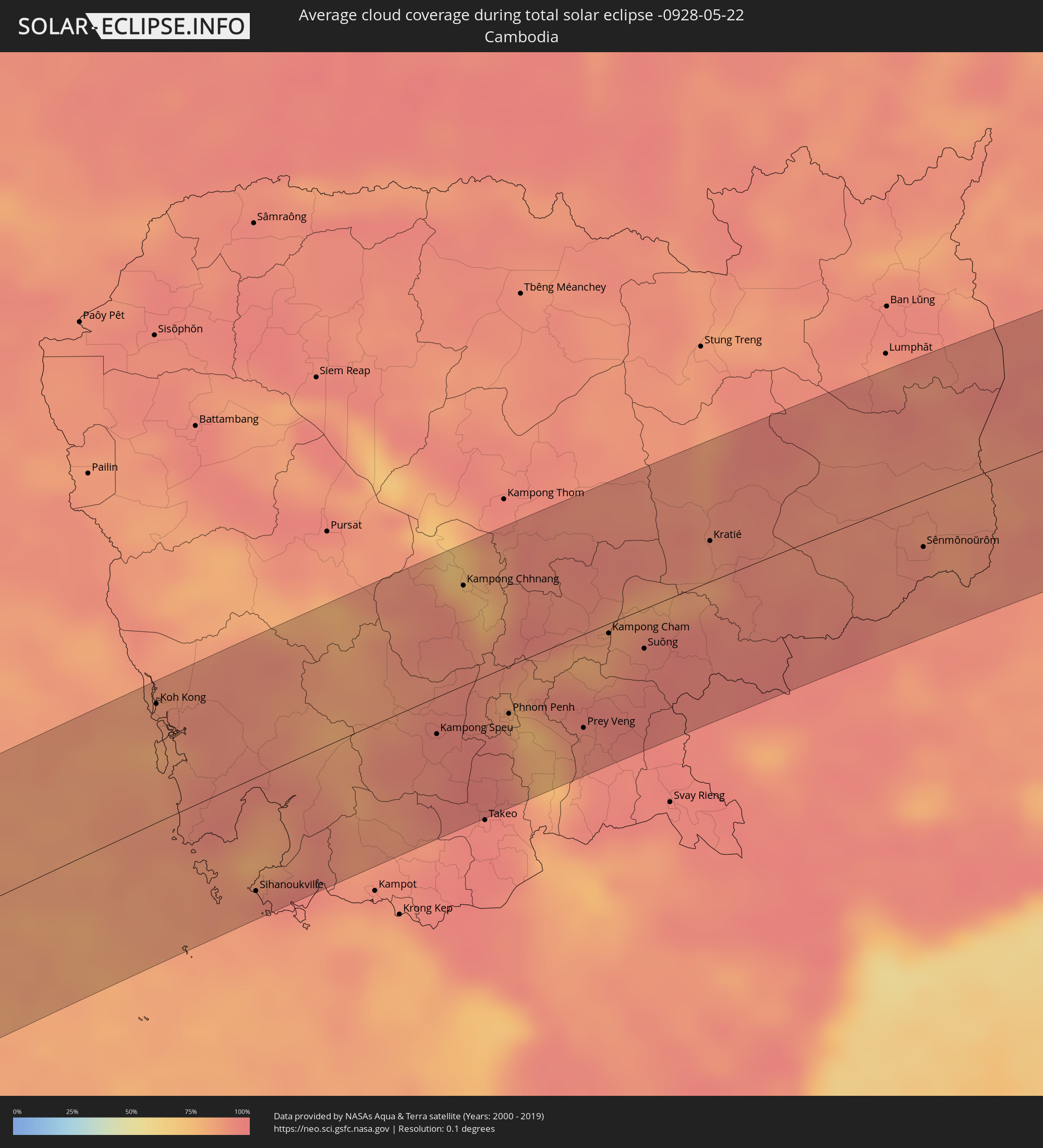 Cambodia
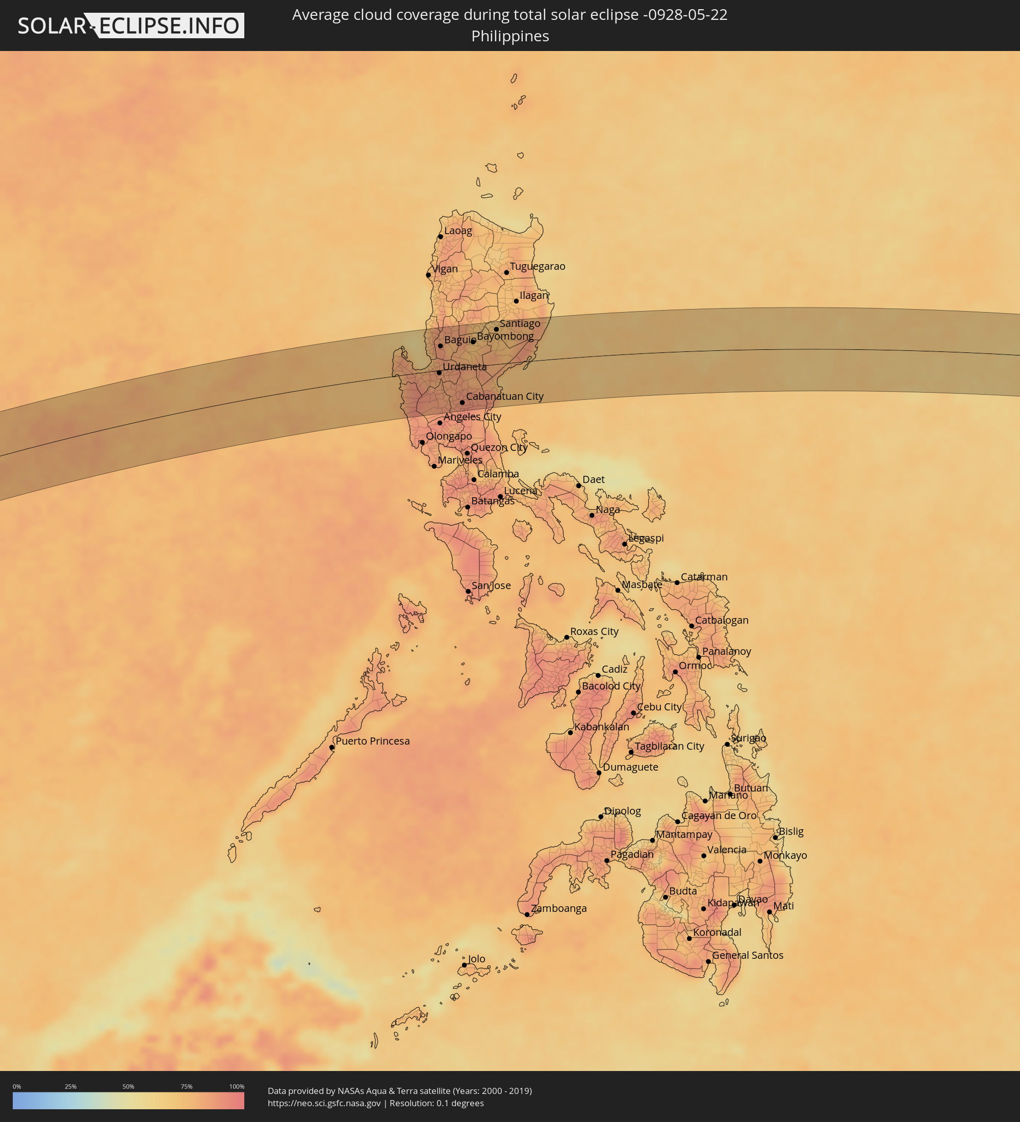 Philippines
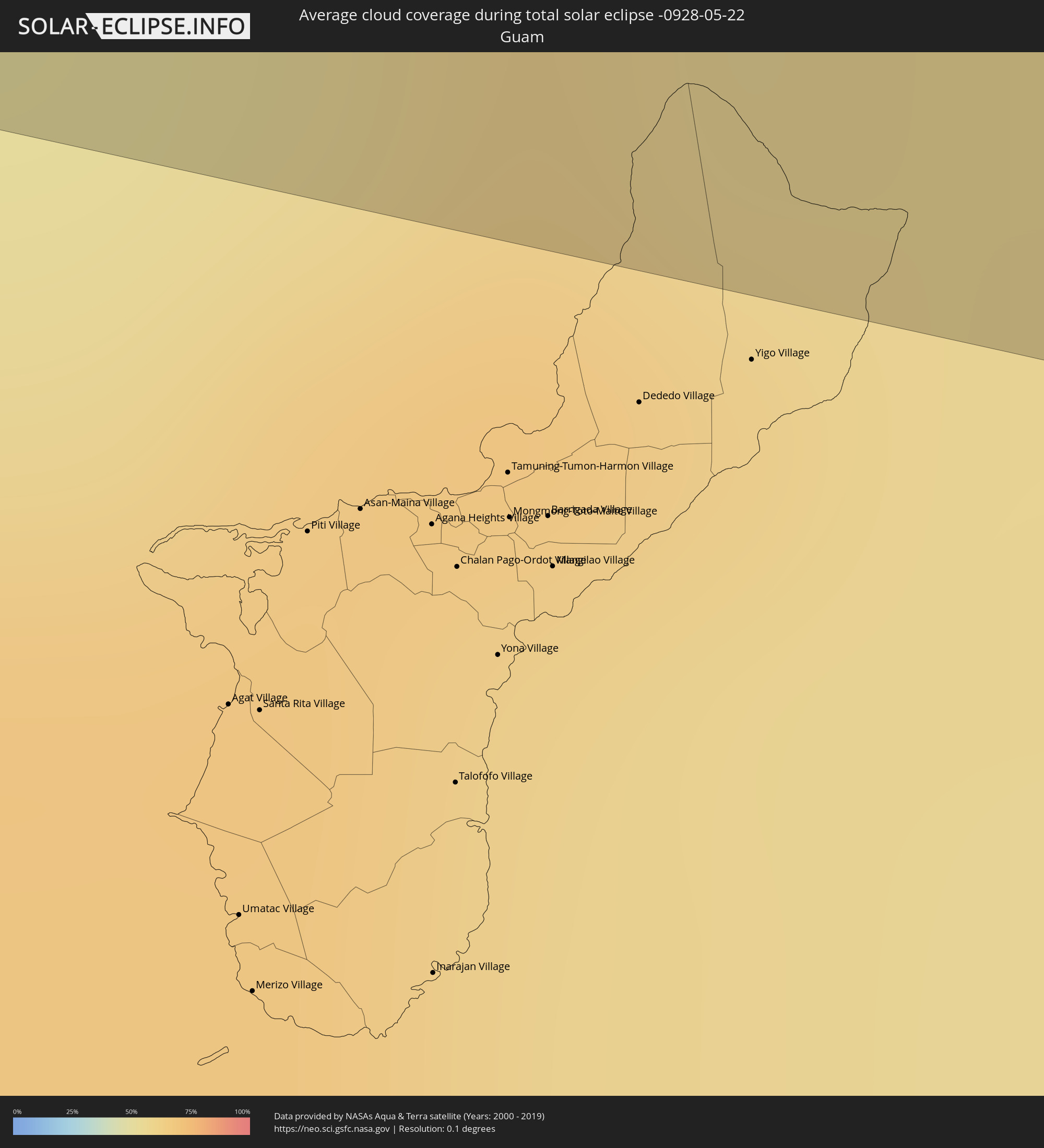 Guam
Guam
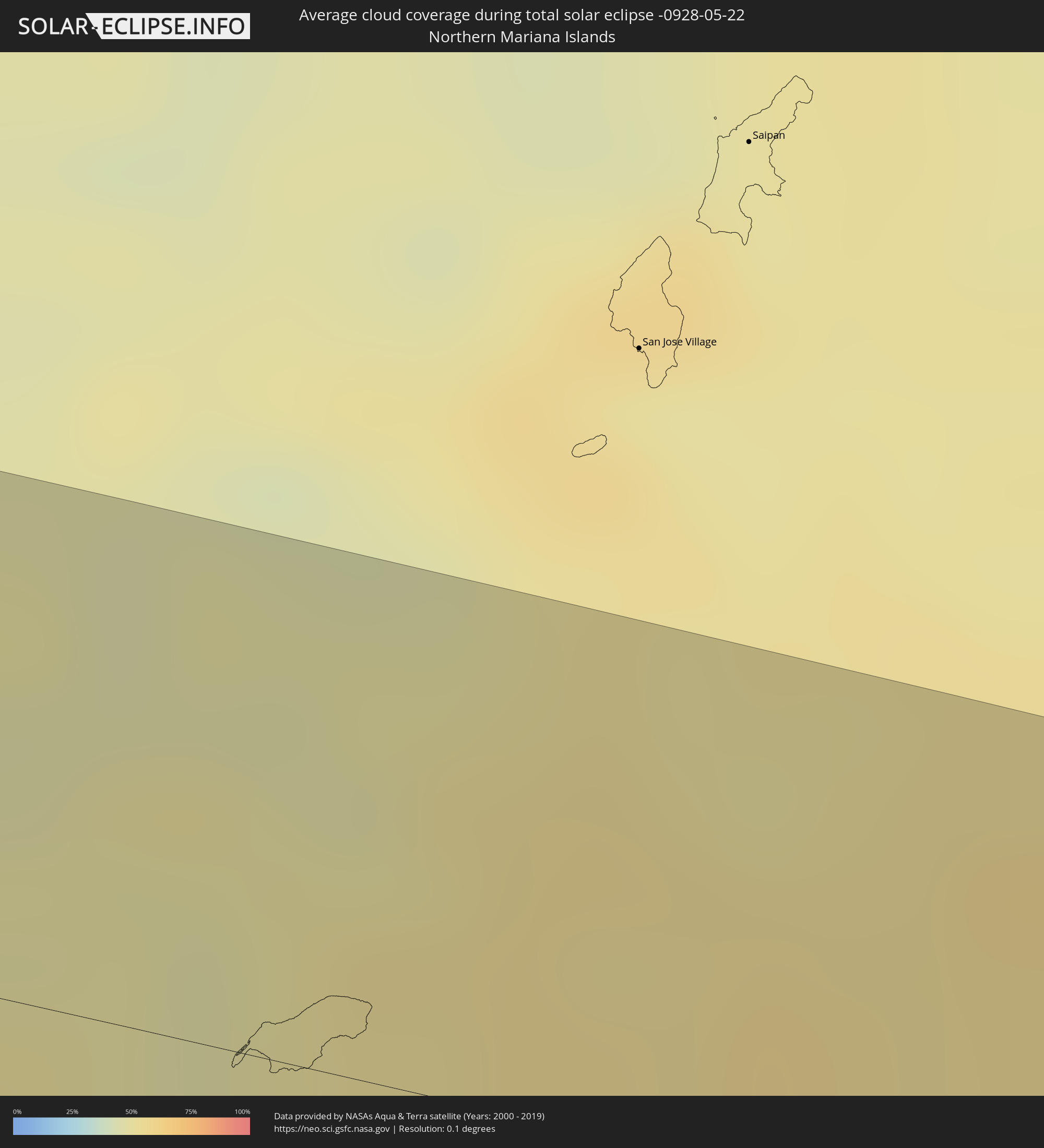 Northern Mariana Islands
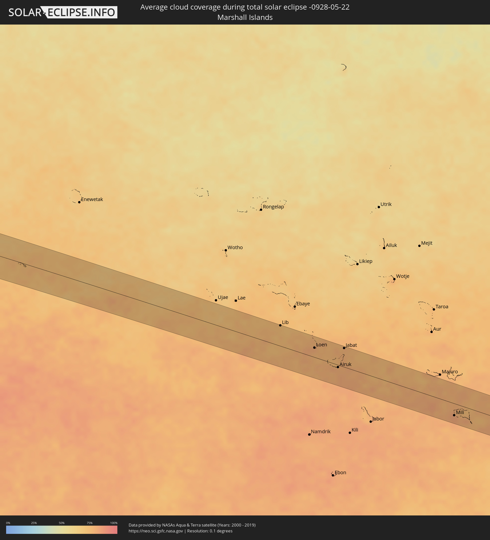 Marshall Islands
Cities inside the path of the eclipse
The following table shows all locations with a population of more than 5,000 inside the eclipse path. Cities which have more than 100,000 inhabitants are marked bold. A click at the locations opens a detailed map.
| City | Type | Eclipse duration | Local time of max. eclipse | Distance to central line | Ø Cloud coverage |
|
Phang Nga, Phangnga
|
total | - | 10:30:42 UTC+06:42 | 38 km | 89% |
|
Ao Luek, Krabi
|
total | - | 10:31:05 UTC+06:42 | 55 km | 83% |
|
Chai Buri, Surat Thani
|
total | - | 10:32:05 UTC+06:42 | 64 km | 89% |
|
Chaiya, Surat Thani
|
total | - | 10:33:34 UTC+06:42 | 21 km | 87% |
|
Phunphin, Surat Thani
|
total | - | 10:33:18 UTC+06:42 | 8 km | 90% |
|
Surat Thani, Surat Thani
|
total | - | 10:33:36 UTC+06:42 | 10 km | 88% |
|
Ban Na San, Surat Thani
|
total | - | 10:33:14 UTC+06:42 | 45 km | 88% |
|
Wiang Sa, Surat Thani
|
total | - | 10:33:02 UTC+06:42 | 61 km | 90% |
|
Don Sak, Surat Thani
|
total | - | 10:34:44 UTC+06:42 | 10 km | 85% |
|
Ko Samui, Surat Thani
|
total | - | 10:35:39 UTC+06:42 | 1 km | 73% |
|
Ko Pha Ngan, Nakhon Si Thammarat
|
total | - | 10:36:10 UTC+06:42 | 17 km | 75% |
|
Koh Kong, Koh Kong
|
total | - | 10:46:26 UTC+06:42 | 65 km | 84% |
|
Smach Mean Chey, Koh Kong
|
total | - | 10:46:29 UTC+06:42 | 55 km | 80% |
|
Sihanoukville, Preah Sihanouk
|
total | - | 10:46:42 UTC+06:42 | 62 km | 88% |
|
Kampong Speu, Kampong Speu
|
total | - | 10:50:32 UTC+06:42 | 20 km | 93% |
|
Kampong Chhnang, Kampong Chhnang
|
total | - | 10:51:56 UTC+06:42 | 55 km | 80% |
|
Phnom Penh, Phnom Penh
|
total | - | 10:51:48 UTC+06:42 | 26 km | 91% |
|
Ta Khmau, Kandal
|
total | - | 10:51:48 UTC+06:42 | 36 km | 82% |
|
Prey Veng, Prey Veng
|
total | - | 10:52:54 UTC+06:42 | 52 km | 90% |
|
Kampong Cham, Kampong Cham
|
total | - | 10:53:54 UTC+06:42 | 5 km | 86% |
|
Suŏng, Tboung Khmum
|
total | - | 10:54:22 UTC+06:42 | 22 km | 94% |
|
Kratié, Kratie
|
total | - | 10:56:06 UTC+06:42 | 22 km | 88% |
|
Sênmônoŭrôm, Mondolkiri
|
total | - | 10:59:30 UTC+06:42 | 28 km | 91% |
|
Buôn Ma Thuột, Ðắc Lắk
|
total | - | 11:26:53 UTC+07:06 | 39 km | 91% |
|
Sông Cầu, Phú Yên
|
total | - | 11:31:19 UTC+07:06 | 0 km | 76% |
|
Qui Nhon, Bình Định
|
total | - | 11:31:40 UTC+07:06 | 33 km | 70% |
|
Tuy Hòa, Phú Yên
|
total | - | 11:31:14 UTC+07:06 | 42 km | 82% |
|
Santa Cruz, Central Luzon
|
total | - | 12:59:15 UTC+08:00 | 20 km | 75% |
|
Zaragoza, Ilocos
|
total | - | 12:59:39 UTC+08:00 | 48 km | 74% |
|
Masinloc, Central Luzon
|
total | - | 12:59:16 UTC+08:00 | 46 km | 85% |
|
Iba, Central Luzon
|
total | - | 12:59:15 UTC+08:00 | 69 km | 79% |
|
Alaminos, Ilocos
|
total | - | 12:59:39 UTC+08:00 | 22 km | 83% |
|
Agoo, Ilocos
|
total | - | 12:59:58 UTC+08:00 | 13 km | 80% |
|
Lingayen, Ilocos
|
total | - | 13:00:20 UTC+08:00 | 4 km | 82% |
|
San Fernando, Ilocos
|
total | - | 13:00:51 UTC+08:00 | 69 km | 65% |
|
Urbiztondo, Ilocos
|
total | - | 13:00:32 UTC+08:00 | 19 km | 85% |
|
Aringay, Ilocos
|
total | - | 13:00:52 UTC+08:00 | 44 km | 77% |
|
Mayantoc, Central Luzon
|
total | - | 13:00:35 UTC+08:00 | 42 km | 86% |
|
Mangaldan, Ilocos
|
total | - | 13:00:51 UTC+08:00 | 7 km | 80% |
|
Camiling, Central Luzon
|
total | - | 13:00:43 UTC+08:00 | 35 km | 87% |
|
Sison, Ilocos
|
total | - | 13:01:14 UTC+08:00 | 17 km | 80% |
|
Alcala, Ilocos
|
total | - | 13:01:07 UTC+08:00 | 19 km | 80% |
|
Urdaneta, Ilocos
|
total | - | 13:01:19 UTC+08:00 | 5 km | 83% |
|
Paniqui, Central Luzon
|
total | - | 13:01:12 UTC+08:00 | 39 km | 82% |
|
Capas, Central Luzon
|
total | - | 13:01:05 UTC+08:00 | 77 km | 91% |
|
Baguio, Cordillera
|
total | - | 13:01:34 UTC+08:00 | 43 km | 86% |
|
Tarlac City, Central Luzon
|
total | - | 13:01:10 UTC+08:00 | 60 km | 86% |
|
Kibungan, Cordillera
|
total | - | 13:01:52 UTC+08:00 | 73 km | 84% |
|
Cuyapo, Central Luzon
|
total | - | 13:01:30 UTC+08:00 | 28 km | 84% |
|
Loacan, Cordillera
|
total | - | 13:01:50 UTC+08:00 | 57 km | 82% |
|
Guiset East, Ilocos
|
total | - | 13:01:41 UTC+08:00 | 3 km | 84% |
|
Guimba, Central Luzon
|
total | - | 13:01:45 UTC+08:00 | 43 km | 85% |
|
San Francisco, Central Luzon
|
total | - | 13:01:50 UTC+08:00 | 77 km | 88% |
|
Lupao, Central Luzon
|
total | - | 13:02:14 UTC+08:00 | 20 km | 86% |
|
Muñoz, Central Luzon
|
total | - | 13:02:11 UTC+08:00 | 38 km | 88% |
|
Cabanatuan City, Central Luzon
|
total | - | 13:02:16 UTC+08:00 | 64 km | 91% |
|
Aritao, Cagayan Valley
|
total | - | 13:02:48 UTC+08:00 | 25 km | 76% |
|
Carranglan, Central Luzon
|
total | - | 13:02:45 UTC+08:00 | 13 km | 80% |
|
Bongabon, Central Luzon
|
total | - | 13:02:51 UTC+08:00 | 50 km | 90% |
|
Bayombong, Cagayan Valley
|
total | - | 13:03:13 UTC+08:00 | 44 km | 73% |
|
Gabaldon, Central Luzon
|
total | - | 13:03:21 UTC+08:00 | 72 km | 83% |
|
Diadi, Cagayan Valley
|
total | - | 13:03:55 UTC+08:00 | 69 km | 74% |
|
Maria Aurora, Central Luzon
|
total | - | 13:03:53 UTC+08:00 | 36 km | 75% |
|
Santiago, Cagayan Valley
|
total | - | 13:04:27 UTC+08:00 | 62 km | 73% |
|
Saguday, Cagayan Valley
|
total | - | 13:04:26 UTC+08:00 | 46 km | 75% |
|
Maddela, Cagayan Valley
|
total | - | 13:04:42 UTC+08:00 | 23 km | 74% |
|
Alicia, Cagayan Valley
|
total | - | 13:04:54 UTC+08:00 | 71 km | 73% |
|
Lib, Lib Island
|
total | - | 17:15:10 UTC+11:00 | 54 km | 74% |
|
Loen, Namu Atoll
|
total | - | 17:15:29 UTC+11:00 | 25 km | 80% |
|
Airuk, Ailinglaplap Atoll
|
total | - | 17:15:42 UTC+11:00 | 6 km | 79% |
|
Jabat, Jabat Island
|
total | - | 17:15:38 UTC+11:00 | 49 km | 78% |
|
Mili, Mili Atoll
|
total | - | 17:16:18 UTC+11:00 | 31 km | 83% |