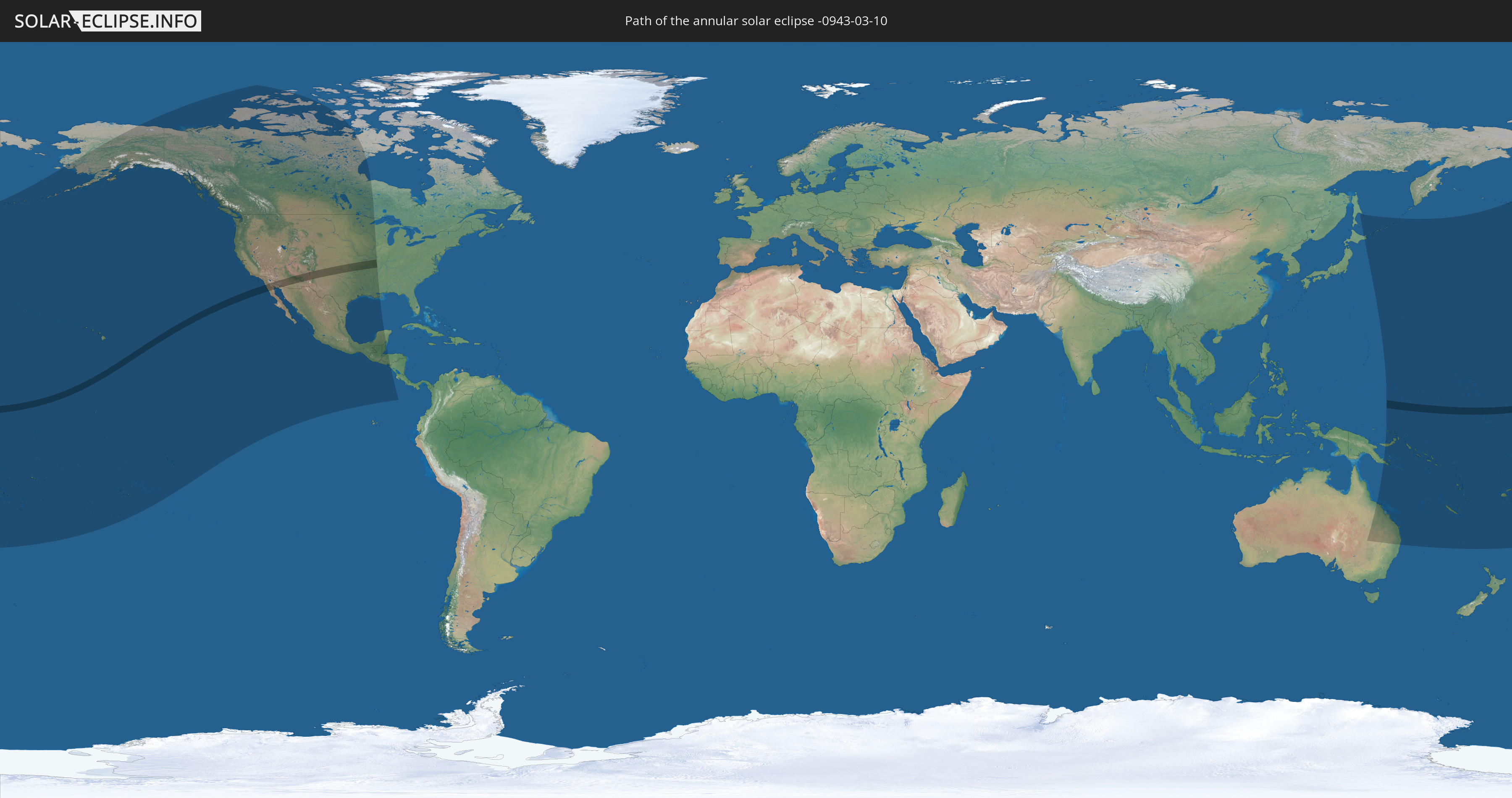
Annular solar eclipse of 03/10/-0943
| Day of week: | Sunday |
| Maximum duration of eclipse: | 04m37s |
| Maximum width of eclipse path: | 148 km |
| Saros cycle: | 34 |
| Coverage: | 96.2% |
| Magnitude: | 0.9616 |
| Gamma: | 0.3529 |
Wo kann man die Sonnenfinsternis vom 03/10/-0943 sehen?
Die Sonnenfinsternis am 03/10/-0943 kann man in 34 Ländern als partielle Sonnenfinsternis beobachten.
Der Finsternispfad verläuft durch 5 Länder. Nur in diesen Ländern ist sie als annular Sonnenfinsternis zu sehen.
In den folgenden Ländern ist die Sonnenfinsternis annular zu sehen
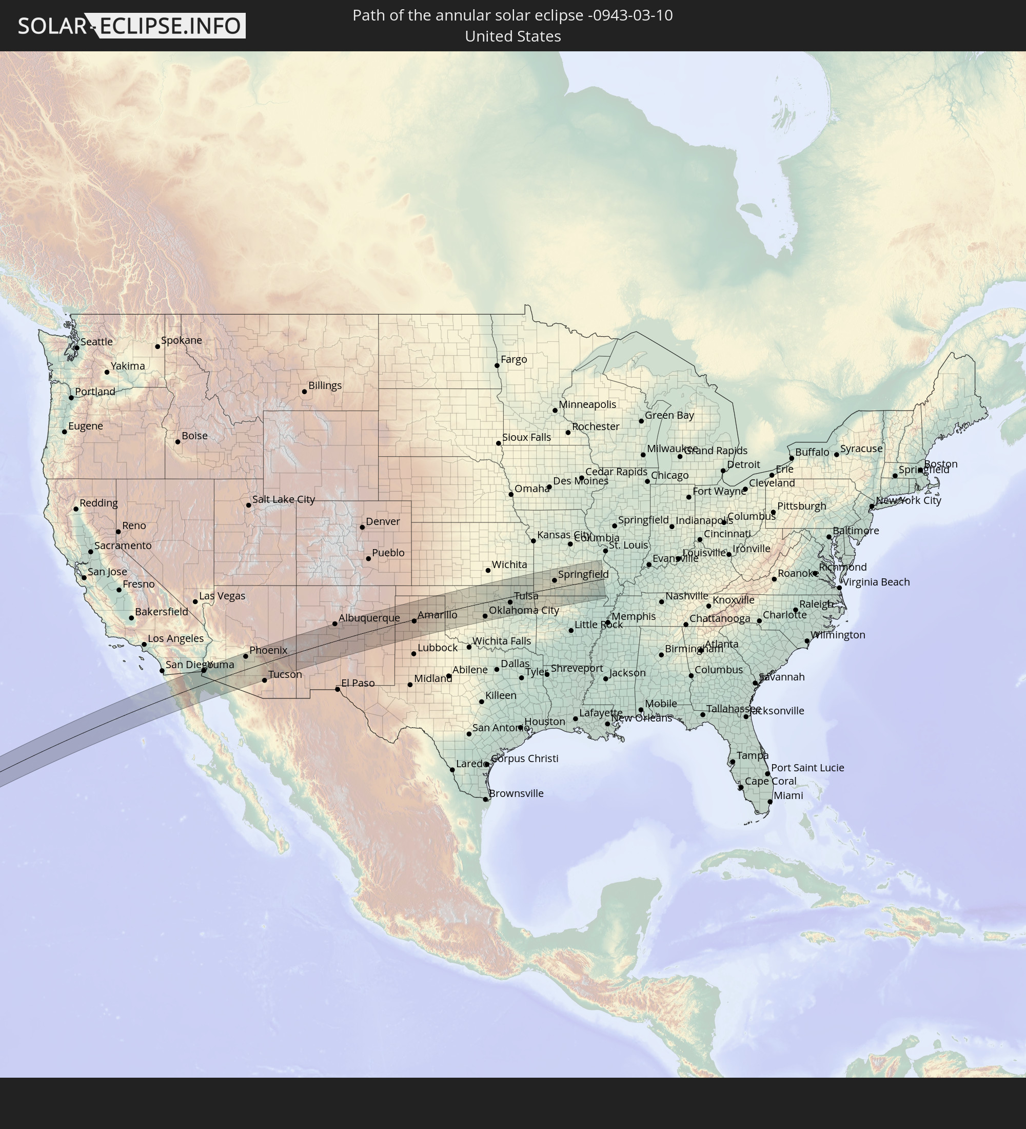 United States
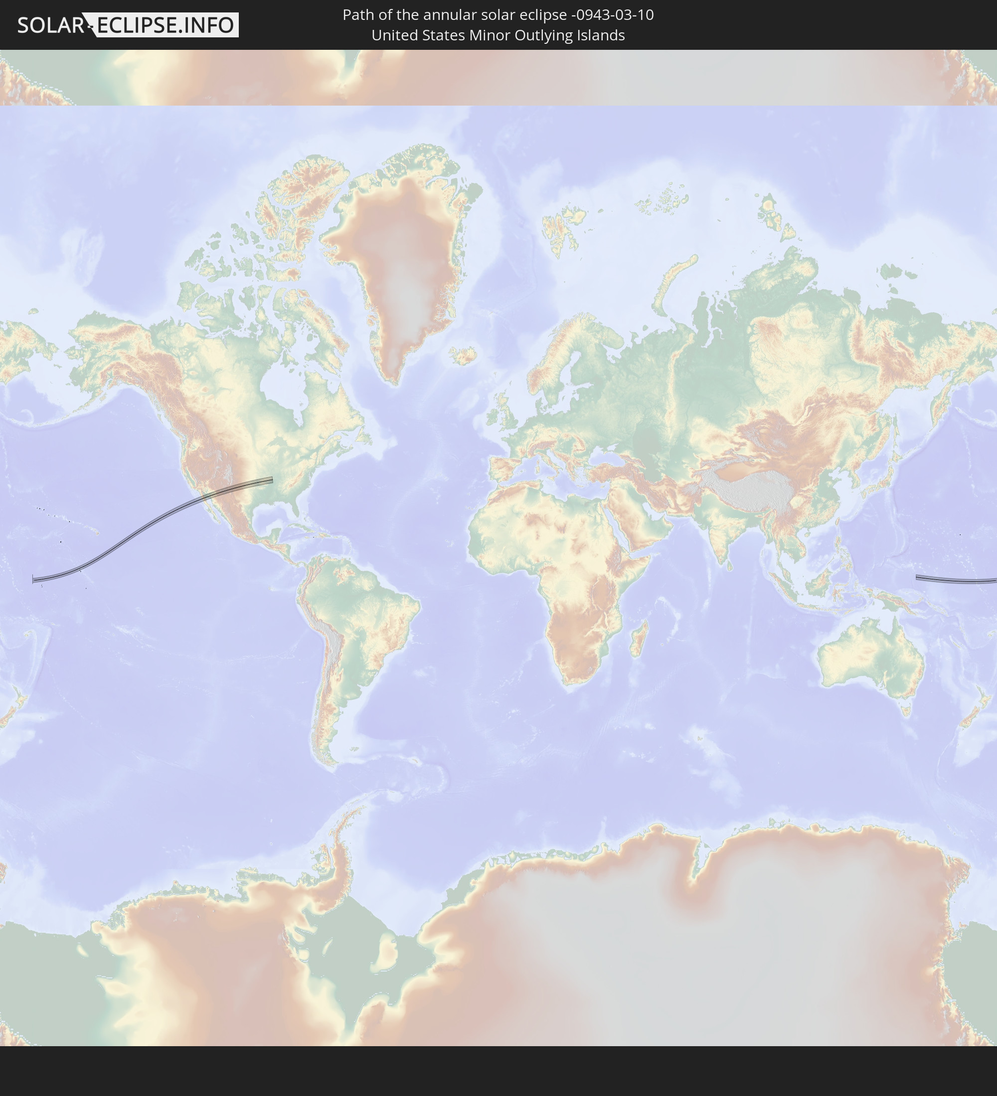 United States Minor Outlying Islands
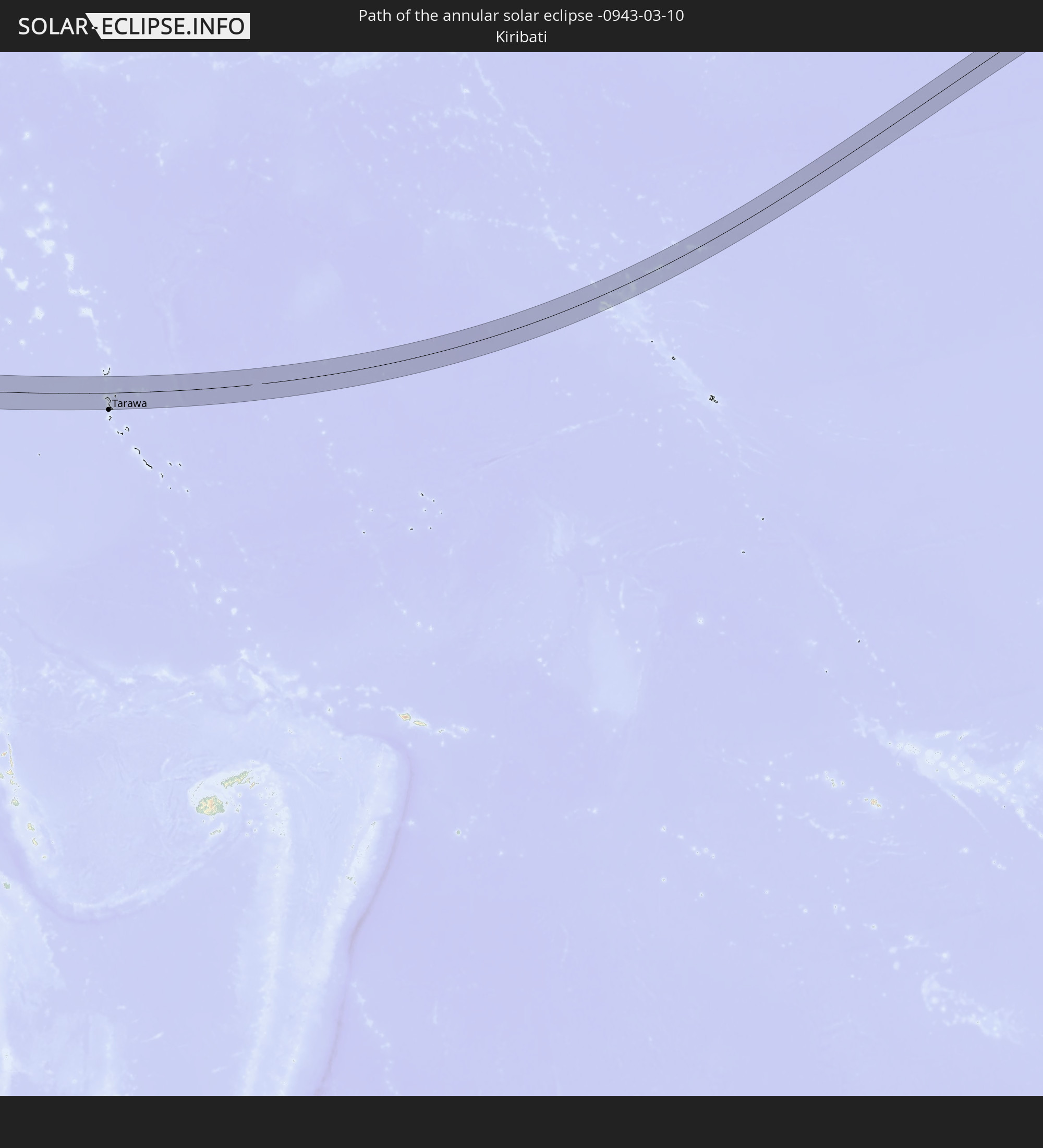 Kiribati
 Mexico
 Federated States of Micronesia
In den folgenden Ländern ist die Sonnenfinsternis partiell zu sehen
 Fiji
Fiji
 Russia
 United States
 New Zealand
 United States Minor Outlying Islands
 Wallis and Futuna
 Tonga
Tonga
 Kiribati
 Samoa
Samoa
 Tokelau
 American Samoa
 Niue
Niue
 Cook Islands
 French Polynesia
 Canada
 Mexico
 Greenland
 Guatemala
 El Salvador
 Honduras
 Belize
 Nicaragua
 Costa Rica
 Australia
 Japan
Japan
 Federated States of Micronesia
 Papua New Guinea
 Solomon Islands
 New Caledonia
 Marshall Islands
 Vanuatu
 Nauru
Nauru
 Norfolk Island
 Tuvalu
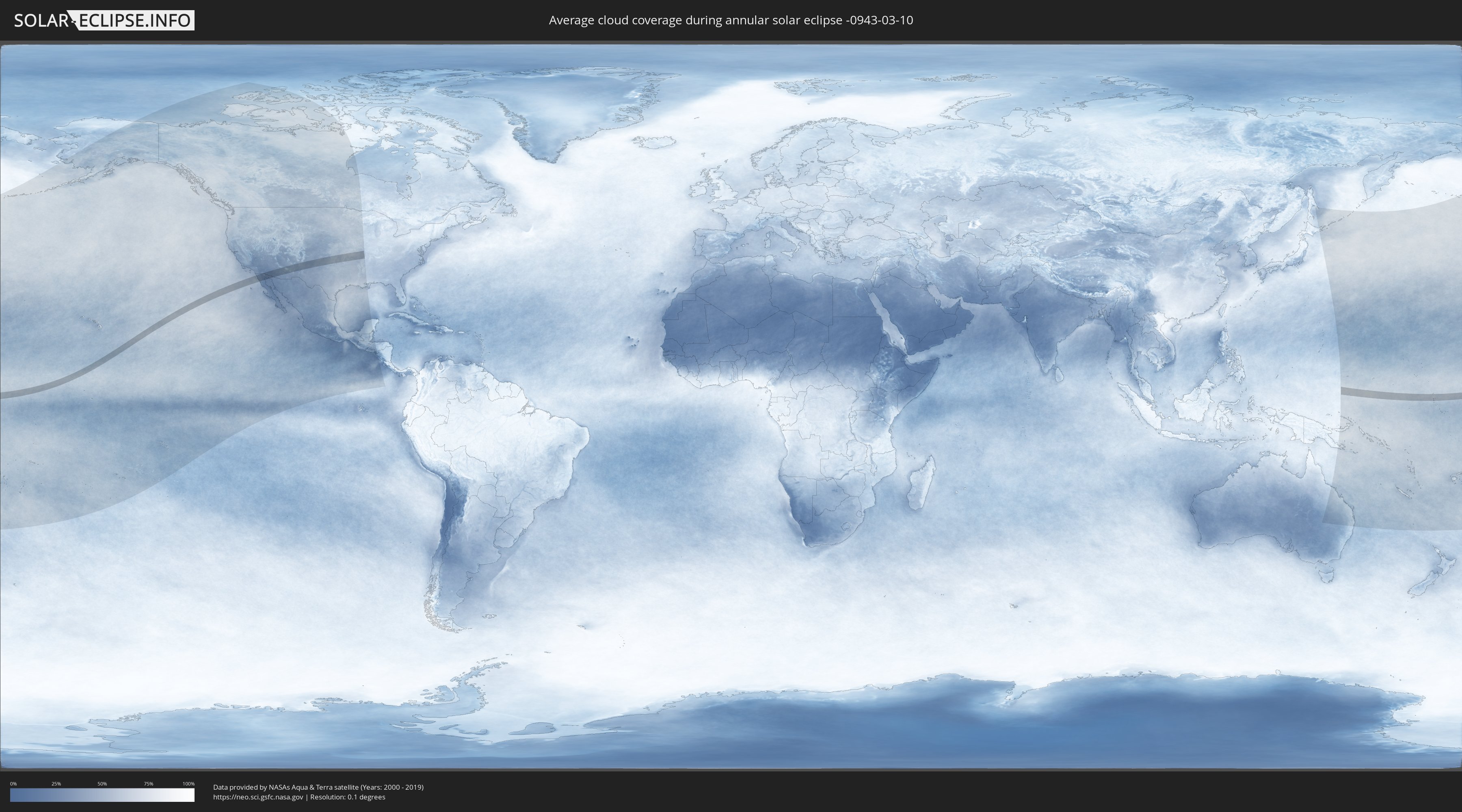
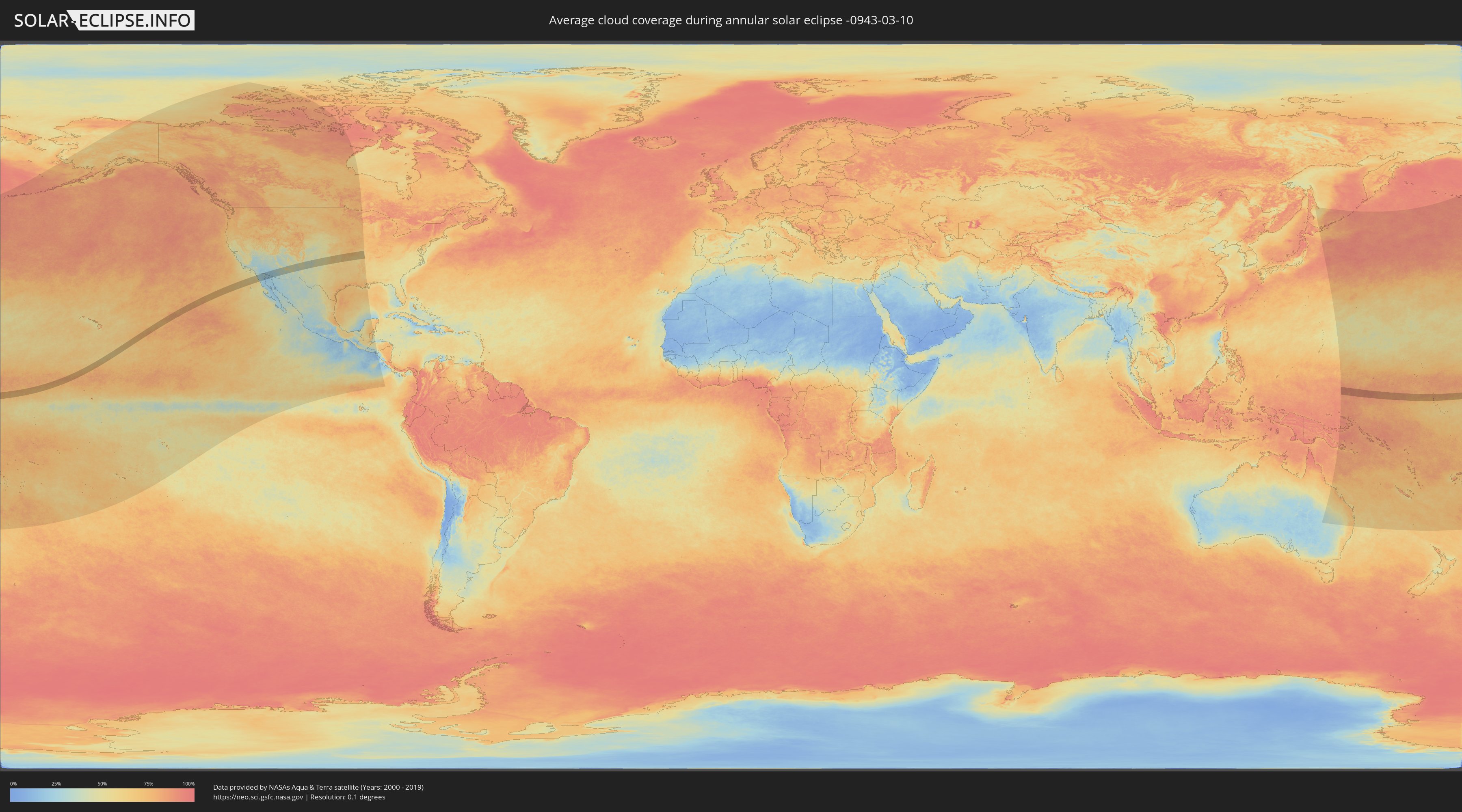
How will be the weather during the annular solar eclipse on 03/10/-0943?
Where is the best place to see the annular solar eclipse of 03/10/-0943?
The following maps show the average cloud coverage for the day of the annular solar eclipse.
With the help of these maps, it is possible to find the place along the eclipse path, which has the best
chance of a cloudless sky.
Nevertheless, you should consider local circumstances and inform about the weather of your chosen
observation site.
The data is provided by NASAs satellites
AQUA and TERRA.
The cloud maps are averaged over a period of 19 years (2000 - 2019).
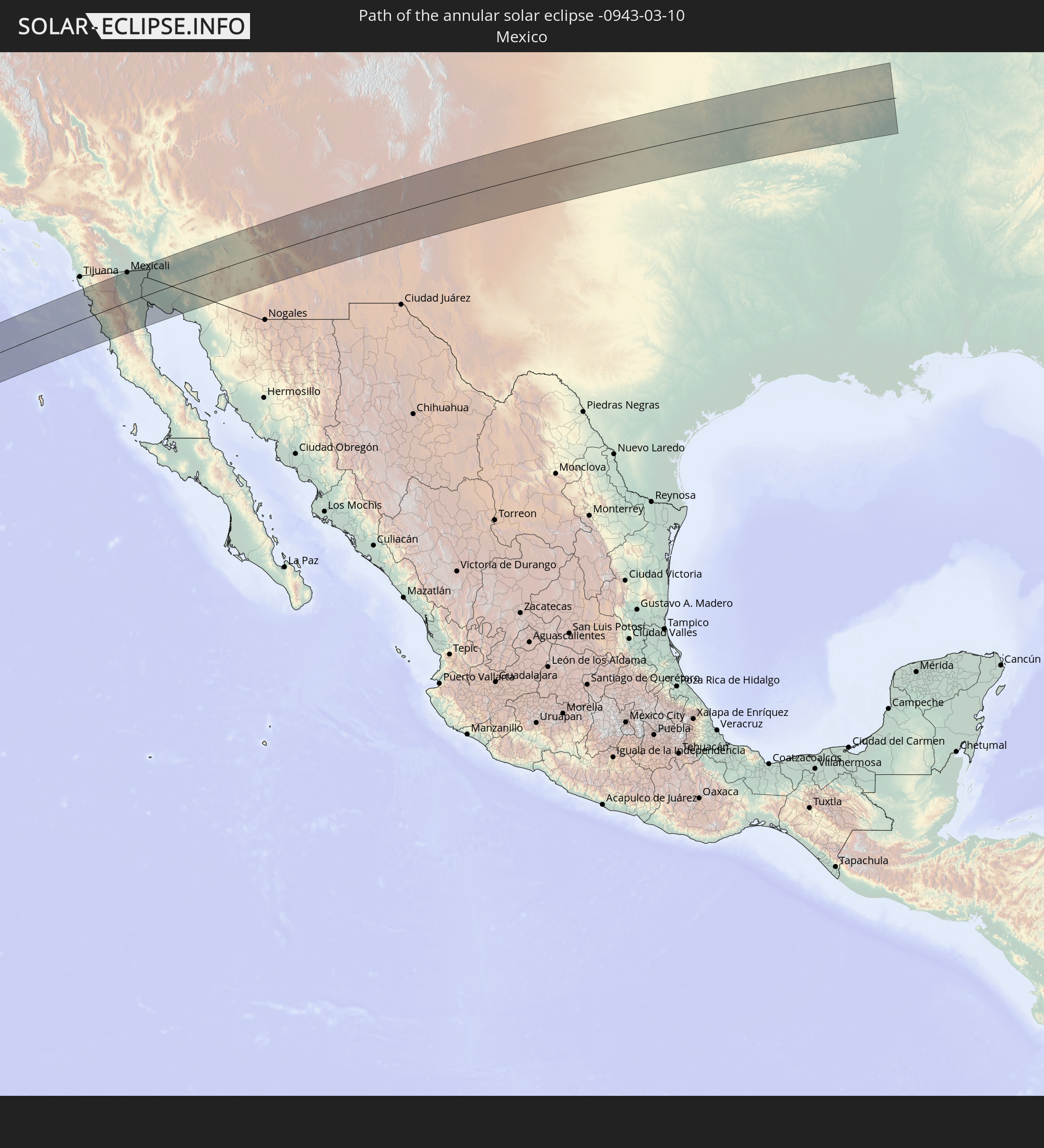
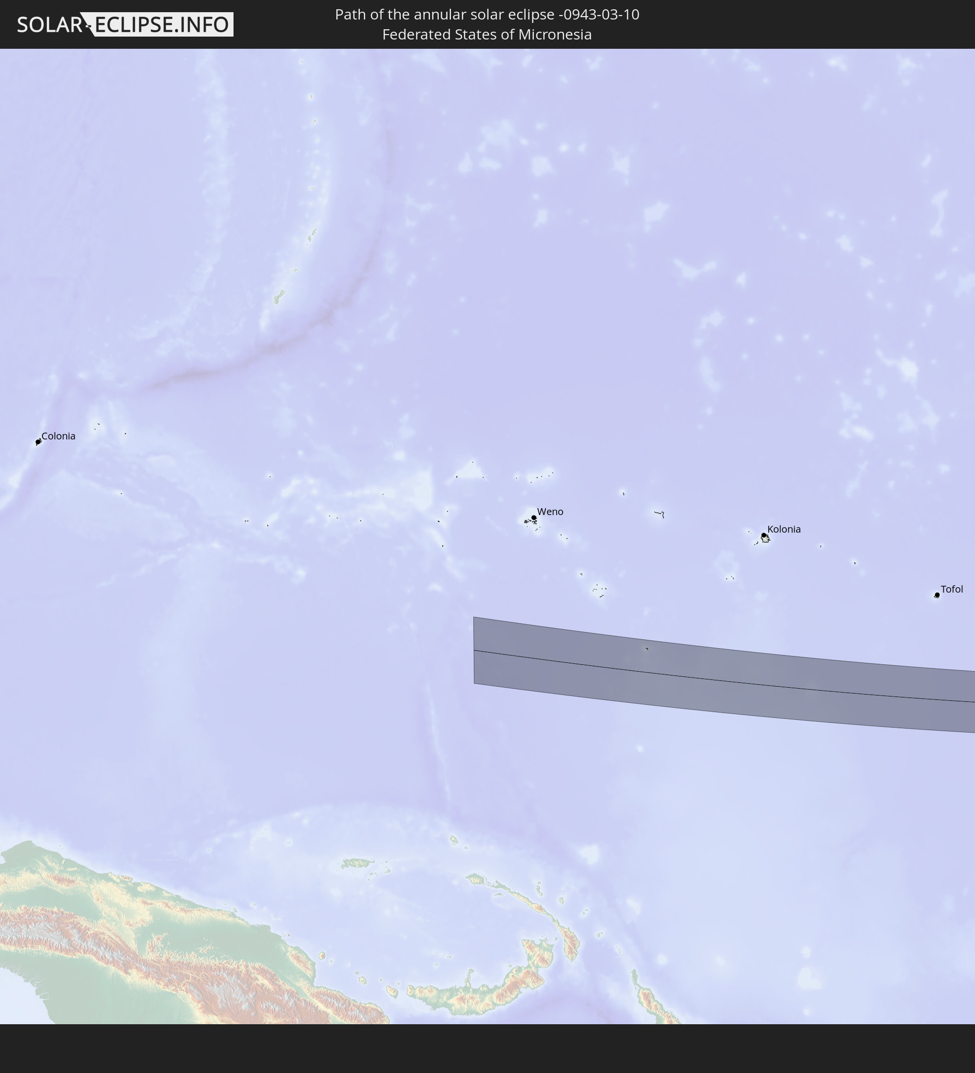
Detailed country maps
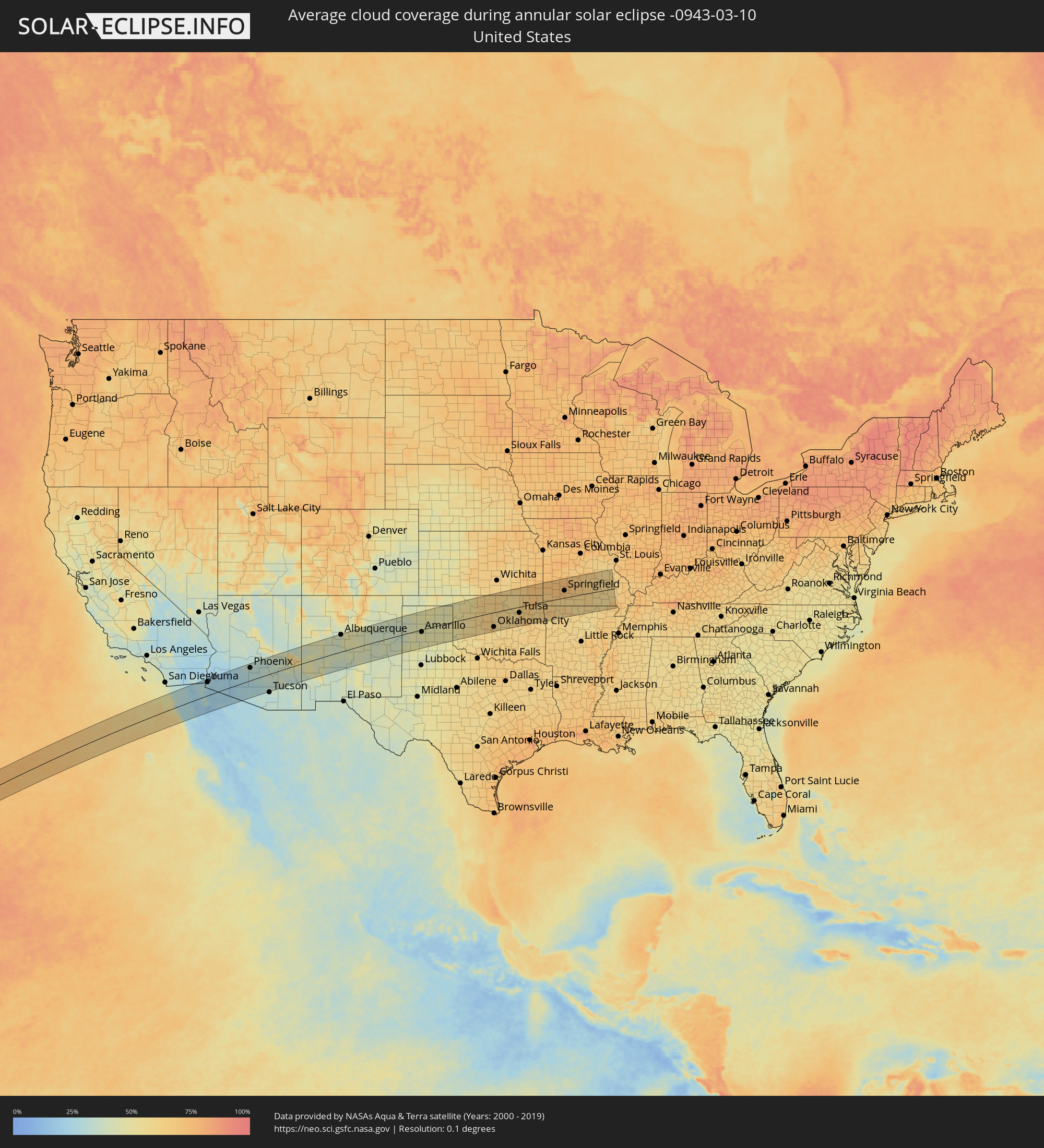 United States
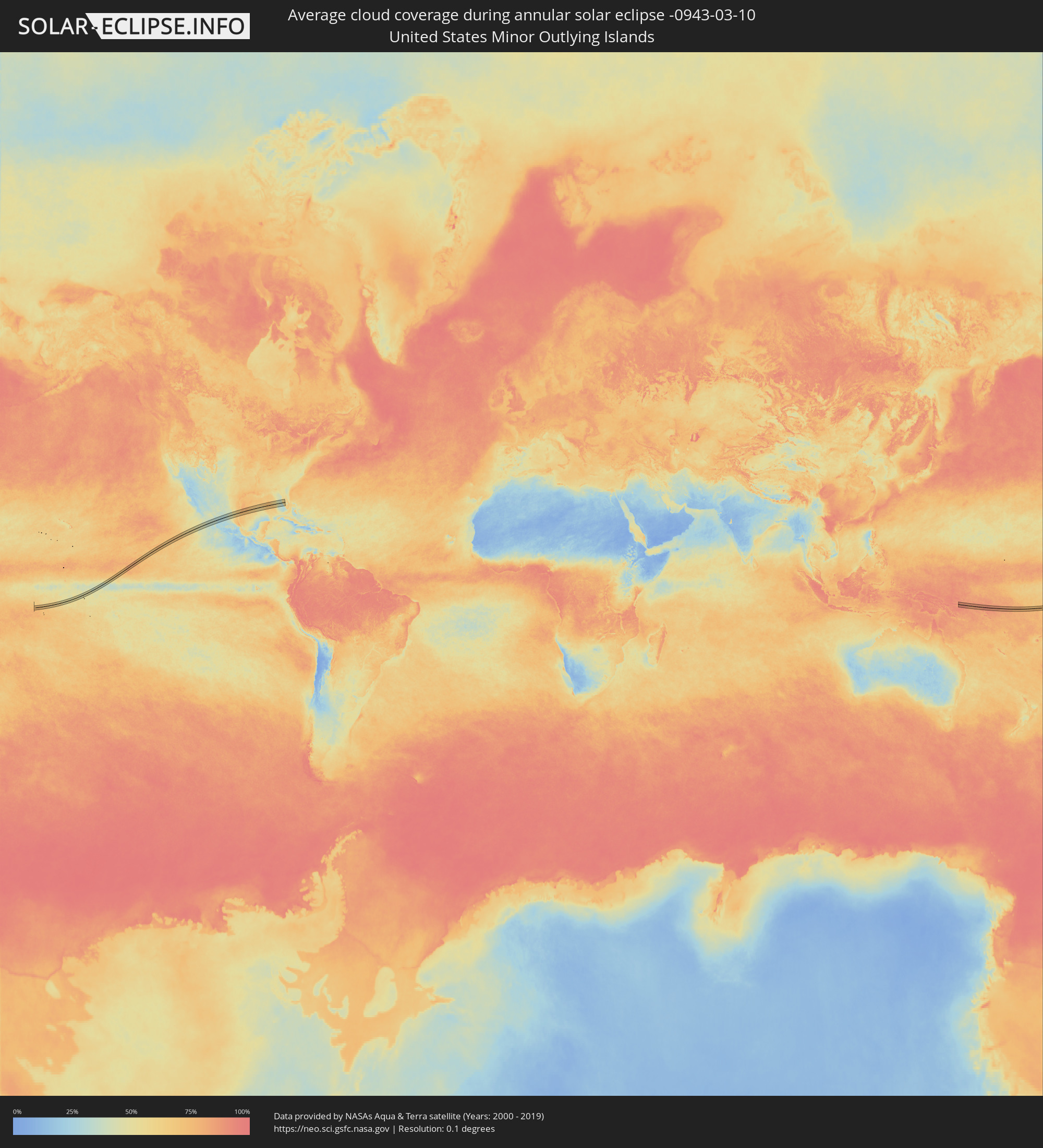 United States Minor Outlying Islands
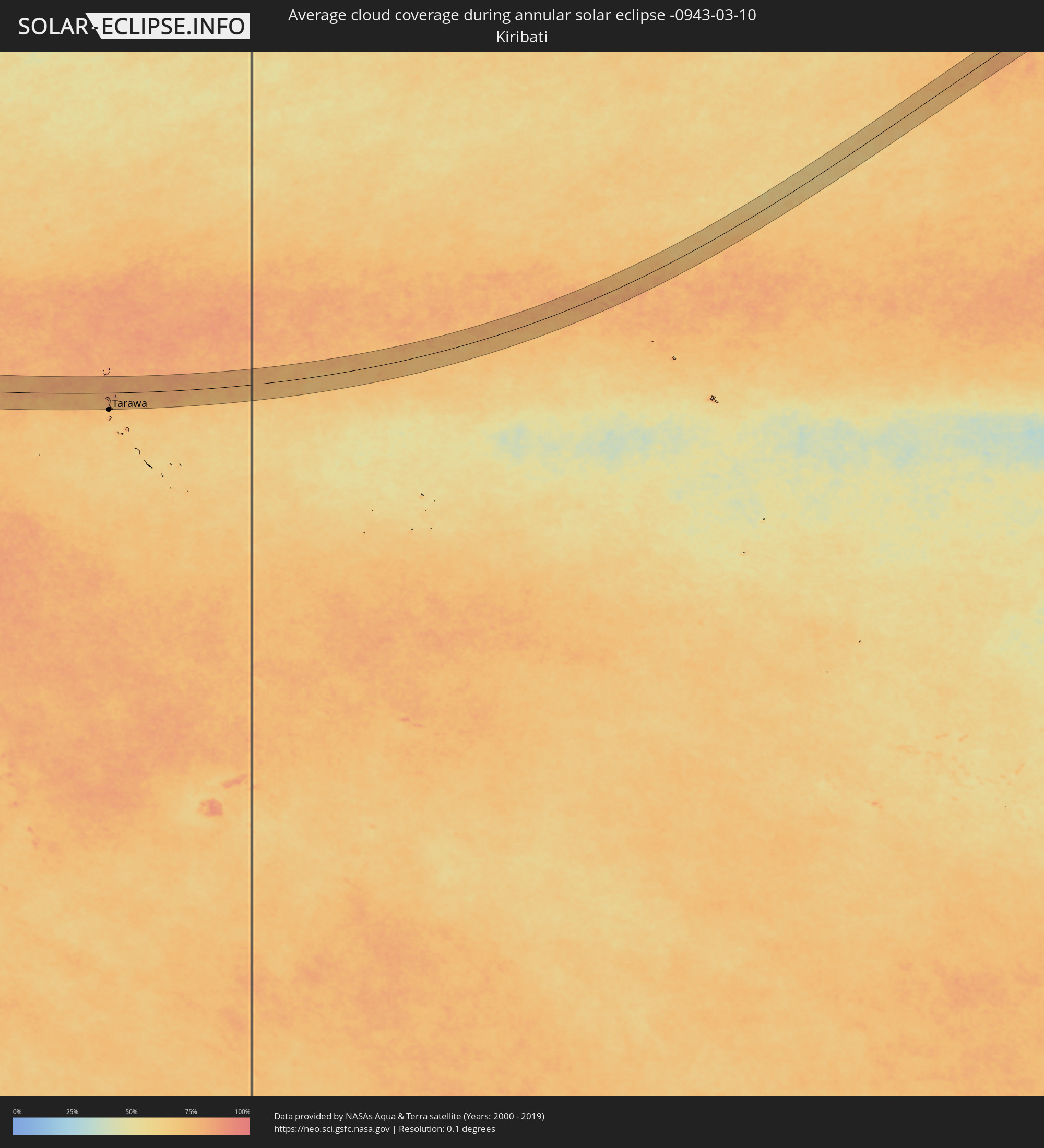 Kiribati
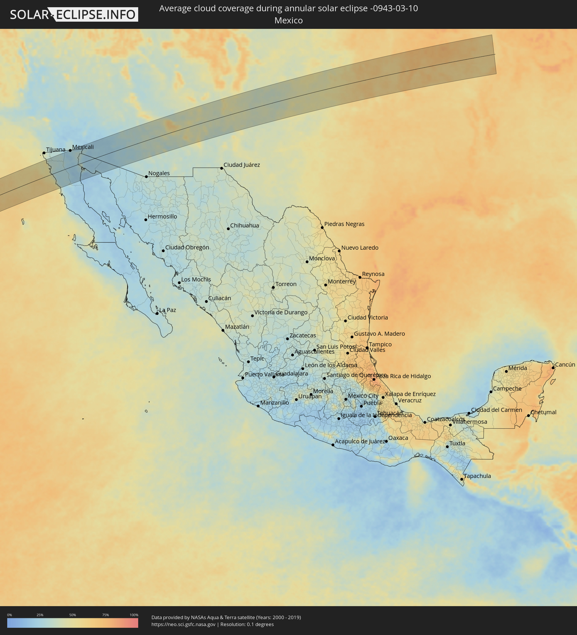 Mexico
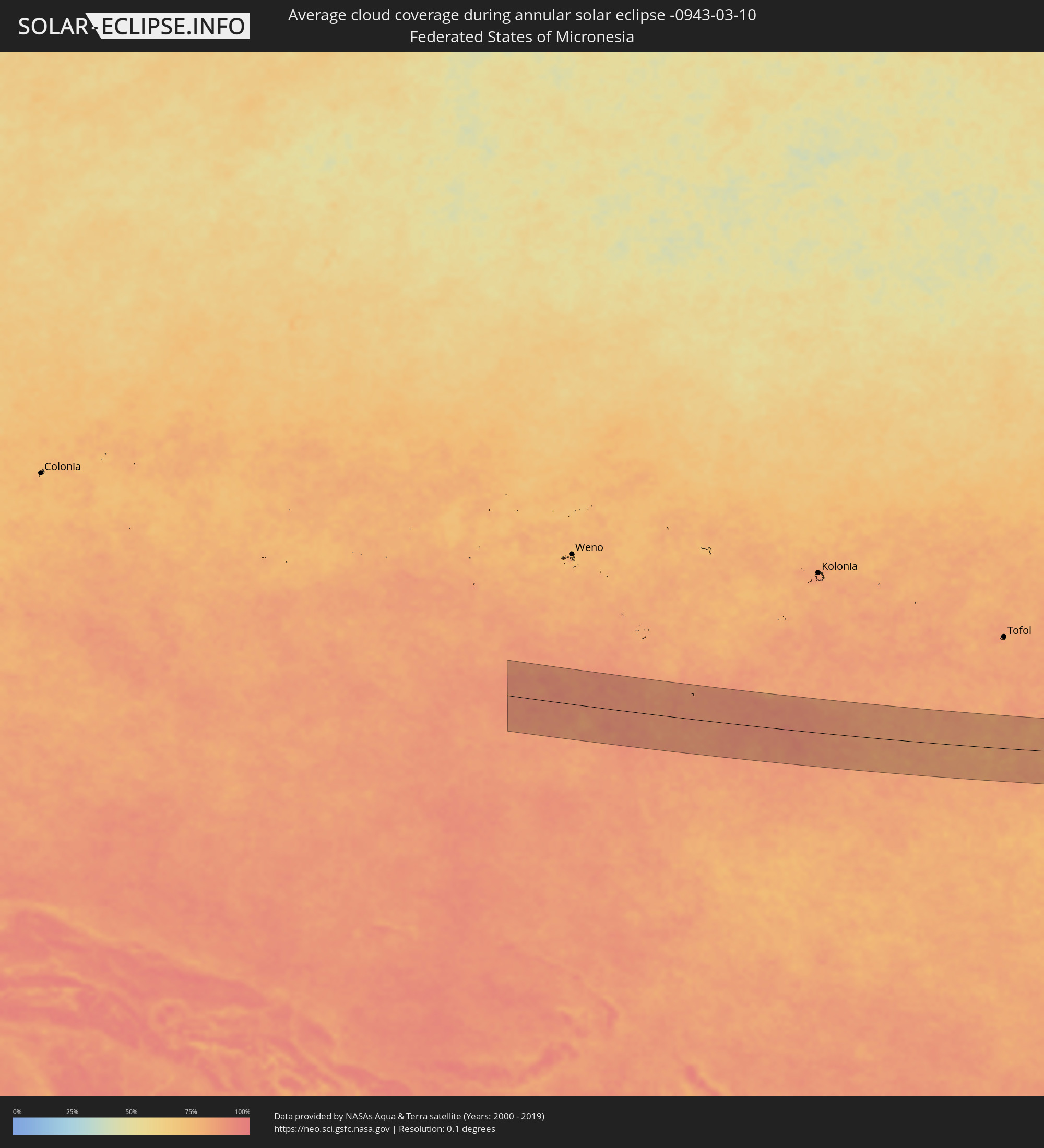 Federated States of Micronesia
Cities inside the path of the eclipse
The following table shows all locations with a population of more than 5,000 inside the eclipse path. Cities which have more than 100,000 inhabitants are marked bold. A click at the locations opens a detailed map.
| City | Type | Eclipse duration | Local time of max. eclipse | Distance to central line | Ø Cloud coverage |
|
El Sauzal, Baja California
|
annular | - | 15:52:38 UTC-07:48 | 51 km | 43% |
|
Ensenada, Baja California
|
annular | - | 15:52:43 UTC-07:48 | 45 km | 38% |
|
Rodolfo Sánchez Taboada, Baja California
|
annular | - | 15:52:46 UTC-07:48 | 29 km | 36% |
|
Benito García (El Zorrillo), Baja California
|
annular | - | 15:52:50 UTC-07:48 | 22 km | 32% |
|
Camalú, Baja California
|
annular | - | 15:53:23 UTC-07:48 | 80 km | 43% |
|
Progreso, Baja California
|
annular | - | 15:53:38 UTC-07:48 | 86 km | 23% |
|
Mexicali, Baja California
|
annular | - | 15:53:45 UTC-07:48 | 86 km | 25% |
|
Puebla, Baja California
|
annular | - | 15:53:51 UTC-07:48 | 76 km | 26% |
|
Delta, Baja California
|
annular | - | 15:54:03 UTC-07:48 | 49 km | 28% |
|
Doctor Alberto Oviedo Mota, Baja California
|
annular | - | 15:54:05 UTC-07:48 | 35 km | 25% |
|
Guadalupe Victoria, Baja California
|
annular | - | 15:54:08 UTC-07:48 | 39 km | 29% |
|
Ciudad Coahuila (Kilómetro Cincuenta y Siete), Baja California
|
annular | - | 15:54:15 UTC-07:48 | 26 km | 29% |
|
Estación Coahuila, Baja California
|
annular | - | 15:54:15 UTC-07:48 | 26 km | 29% |
|
Tecolots, Baja California
|
annular | - | 15:54:12 UTC-07:48 | 64 km | 31% |
|
Hermosillo, Baja California
|
annular | - | 15:54:16 UTC-07:48 | 57 km | 32% |
|
San Luis, Arizona
|
annular | - | 16:18:37 UTC-07:23 | 50 km | 29% |
|
San Luis Río Colorado, Sonora
|
annular | - | 16:18:38 UTC-07:23 | 46 km | 29% |
|
Yuma, Arizona
|
annular | - | 15:42:35 UTC-08:00 | 69 km | 29% |
|
Fortuna Foothills, Arizona
|
annular | - | 16:42:47 UTC-07:00 | 56 km | 22% |
|
Sonoyta, Sonora
|
annular | - | 16:20:28 UTC-07:23 | 77 km | 27% |
|
Buckeye, Arizona
|
annular | - | 16:44:14 UTC-07:00 | 73 km | 31% |
|
Avondale, Arizona
|
annular | - | 16:44:25 UTC-07:00 | 73 km | 31% |
|
Peoria, Arizona
|
annular | - | 16:44:28 UTC-07:00 | 85 km | 31% |
|
Phoenix, Arizona
|
annular | - | 16:44:38 UTC-07:00 | 66 km | 32% |
|
Maricopa, Arizona
|
annular | - | 16:44:45 UTC-07:00 | 24 km | 31% |
|
Paradise Valley, Arizona
|
annular | - | 16:44:43 UTC-07:00 | 71 km | 33% |
|
Sun Lakes, Arizona
|
annular | - | 16:44:52 UTC-07:00 | 35 km | 29% |
|
Mesa, Arizona
|
annular | - | 16:44:50 UTC-07:00 | 55 km | 32% |
|
Casa Grande, Arizona
|
annular | - | 16:45:02 UTC-07:00 | 3 km | 30% |
|
Fountain Hills, Arizona
|
annular | - | 16:44:53 UTC-07:00 | 73 km | 30% |
|
Eloy, Arizona
|
annular | - | 16:45:14 UTC-07:00 | 22 km | 30% |
|
Apache Junction, Arizona
|
annular | - | 16:45:04 UTC-07:00 | 47 km | 32% |
|
San Tan Valley, Arizona
|
annular | - | 16:45:09 UTC-07:00 | 23 km | 31% |
|
Coolidge, Arizona
|
annular | - | 16:45:13 UTC-07:00 | 0 km | 33% |
|
Florence, Arizona
|
annular | - | 16:45:18 UTC-07:00 | 2 km | 32% |
|
Marana, Arizona
|
annular | - | 16:45:35 UTC-07:00 | 66 km | 32% |
|
Casas Adobes, Arizona
|
annular | - | 16:45:47 UTC-07:00 | 85 km | 34% |
|
Los Lunas, New Mexico
|
annular | - | 16:47:57 UTC-07:00 | 61 km | 42% |
|
Albuquerque, New Mexico
|
annular | - | 16:47:54 UTC-07:00 | 89 km | 40% |
|
Portales, New Mexico
|
annular | - | 16:50:04 UTC-07:00 | 89 km | 42% |
|
Clovis, New Mexico
|
annular | - | 16:50:02 UTC-07:00 | 69 km | 45% |
|
Hereford, Texas
|
annular | - | 17:50:15 UTC-06:00 | 43 km | 45% |
|
Dumas, Texas
|
annular | - | 17:49:57 UTC-06:00 | 61 km | 46% |
|
Canyon, Texas
|
annular | - | 17:50:23 UTC-06:00 | 36 km | 45% |
|
Amarillo, Texas
|
annular | - | 17:50:19 UTC-06:00 | 12 km | 48% |
|
Borger, Texas
|
annular | - | 17:50:17 UTC-06:00 | 26 km | 45% |
|
Pampa, Texas
|
annular | - | 17:50:32 UTC-06:00 | 3 km | 47% |
|
Woodward, Oklahoma
|
annular | - | 17:50:40 UTC-06:00 | 66 km | 56% |
|
El Reno, Oklahoma
|
annular | - | 17:51:36 UTC-06:00 | 61 km | 64% |
|
Enid, Oklahoma
|
annular | - | 17:51:10 UTC-06:00 | 32 km | 62% |
|
Yukon, Oklahoma
|
annular | - | 17:51:40 UTC-06:00 | 67 km | 65% |
|
Oklahoma City, Oklahoma
|
annular | - | 17:51:46 UTC-06:00 | 76 km | 63% |
|
Edmond, Oklahoma
|
annular | - | 17:51:41 UTC-06:00 | 57 km | 60% |
|
Ponca City, Oklahoma
|
annular | - | 17:51:14 UTC-06:00 | 50 km | 63% |
|
Stillwater, Oklahoma
|
annular | - | 17:51:33 UTC-06:00 | 15 km | 61% |
|
Arkansas City, Kansas
|
annular | - | 17:51:03 UTC-06:00 | 88 km | 62% |
|
Sapulpa, Oklahoma
|
annular | - | 17:51:52 UTC-06:00 | 45 km | 61% |
|
Tulsa, Oklahoma
|
annular | - | 17:51:49 UTC-06:00 | 31 km | 63% |
|
Bartlesville, Oklahoma
|
annular | - | 17:51:30 UTC-06:00 | 34 km | 60% |
|
Okmulgee, Oklahoma
|
annular | - | 17:52:06 UTC-06:00 | 89 km | 59% |
|
Owasso, Oklahoma
|
annular | - | 17:51:47 UTC-06:00 | 21 km | 66% |
|
Broken Arrow, Oklahoma
|
annular | - | 17:51:55 UTC-06:00 | 46 km | 67% |
|
Claremore, Oklahoma
|
annular | - | 17:51:49 UTC-06:00 | 20 km | 66% |
|
Muskogee, Oklahoma
|
annular | - | 17:52:11 UTC-06:00 | 87 km | 67% |
|
Tahlequah, Oklahoma
|
annular | - | 17:52:11 UTC-06:00 | 76 km | 64% |
|
Miami, Oklahoma
|
annular | - | 17:51:40 UTC-06:00 | 27 km | 71% |
|
Pittsburg, Kansas
|
annular | - | 17:51:24 UTC-06:00 | 83 km | 69% |
|
Siloam Springs, Arkansas
|
annular | - | 17:52:07 UTC-06:00 | 53 km | 66% |
|
Joplin, Missouri
|
annular | - | 17:51:38 UTC-06:00 | 44 km | 63% |
|
Neosho, Missouri
|
annular | - | 17:51:47 UTC-06:00 | 18 km | 66% |
|
Carthage, Missouri
|
annular | - | 17:51:37 UTC-06:00 | 50 km | 68% |
|
Bella Vista, Arkansas
|
annular | - | 17:52:01 UTC-06:00 | 26 km | 63% |
|
Fayetteville, Arkansas
|
annular | - | 17:52:16 UTC-06:00 | 74 km | 65% |
|
Rogers, Arkansas
|
annular | - | 17:52:08 UTC-06:00 | 45 km | 68% |
|
Republic, Missouri
|
annular | - | 17:51:48 UTC-06:00 | 30 km | 71% |
|
Springfield, Missouri
|
annular | - | 17:51:46 UTC-06:00 | 37 km | 70% |
|
Nixa, Missouri
|
annular | - | 17:51:52 UTC-06:00 | 18 km | 66% |
|
Harrison, Arkansas
|
annular | - | 17:52:22 UTC-06:00 | 74 km | 67% |
|
Lebanon, Missouri
|
annular | - | 17:51:36 UTC-06:00 | 77 km | 71% |
|
Mountain Home, Arkansas
|
annular | - | 17:52:25 UTC-06:00 | 74 km | 59% |
|
Fort Leonard Wood, Missouri
|
annular | - | 17:51:39 UTC-06:00 | 72 km | 64% |
|
West Plains, Missouri
|
annular | - | 17:52:16 UTC-06:00 | 40 km | 63% |
|
Rolla, Missouri
|
annular | - | 17:51:33 UTC-06:00 | 93 km | 65% |
|
Poplar Bluff, Missouri
|
annular | - | 17:52:24 UTC-06:00 | 60 km | 64% |
|
Bikenibeu Village, Gilbert Islands
|
annular | - | 08:28:18 UTC+12:00 | 89 km | 78% |