Total solar eclipse of 05/31/-1496
| Day of week: | Thursday |
| Maximum duration of eclipse: | 06m44s |
| Maximum width of eclipse path: | 254 km |
| Saros cycle: | 23 |
| Coverage: | 100% |
| Magnitude: | 1.0785 |
| Gamma: | -0.0807 |
Wo kann man die Sonnenfinsternis vom 05/31/-1496 sehen?
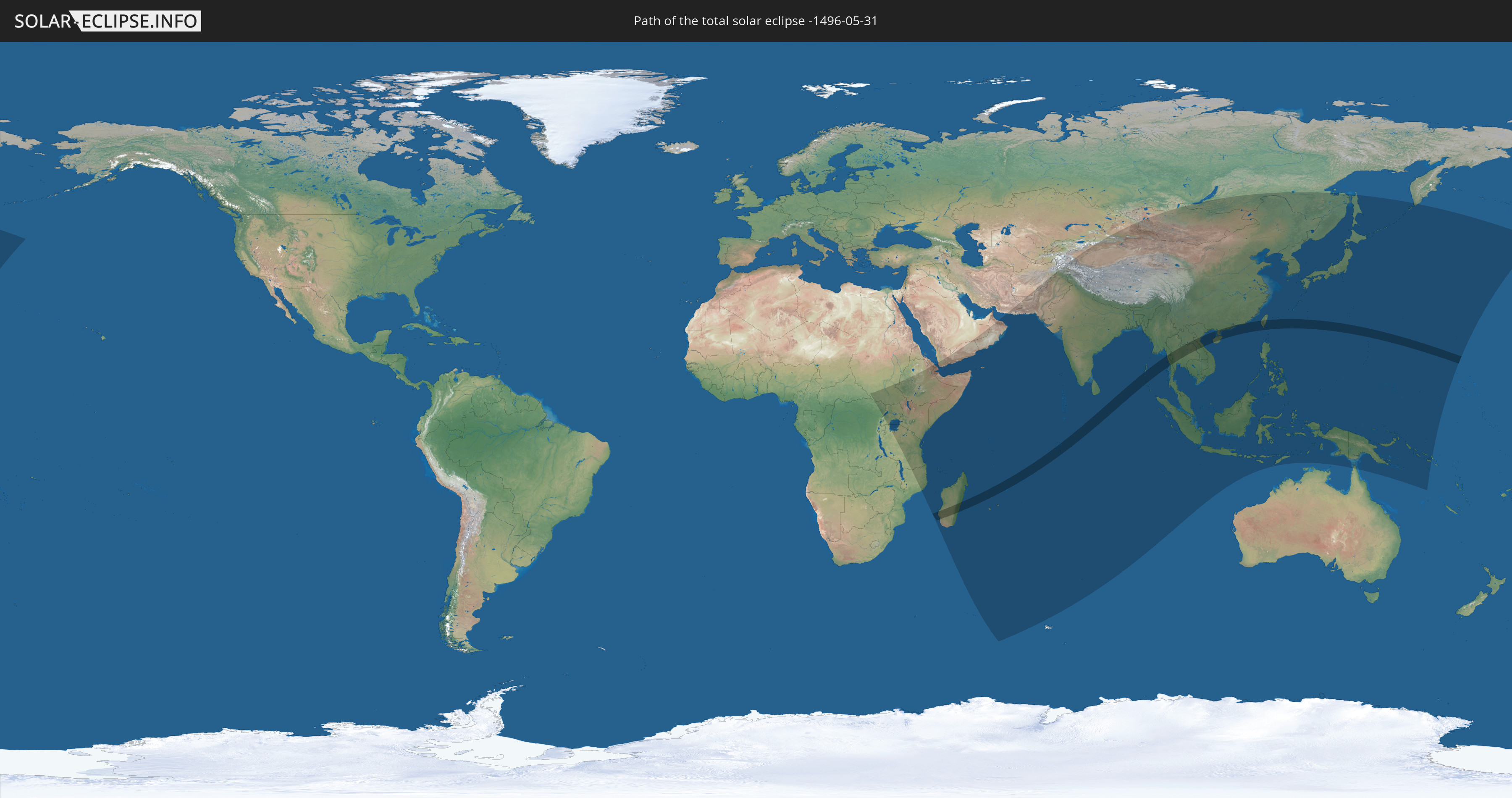
Die Sonnenfinsternis am 05/31/-1496 kann man in 61 Ländern als partielle Sonnenfinsternis beobachten.
Der Finsternispfad verläuft durch 13 Länder. Nur in diesen Ländern ist sie als total Sonnenfinsternis zu sehen.
In den folgenden Ländern ist die Sonnenfinsternis total zu sehen
 Madagascar
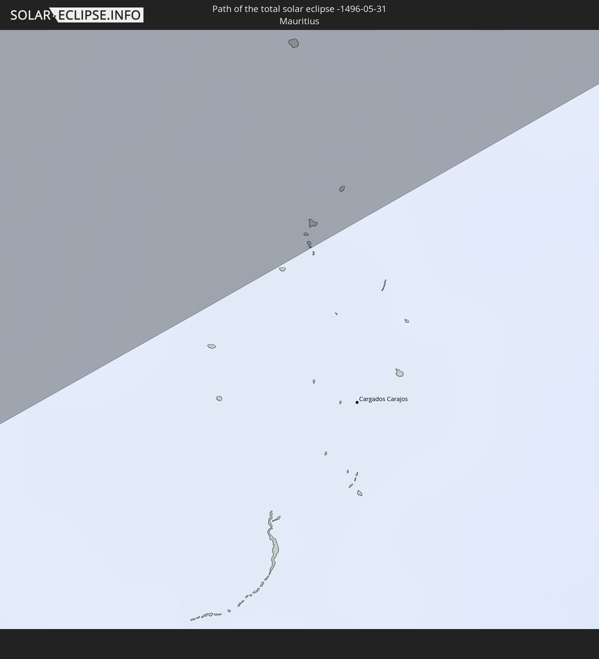 Mauritius
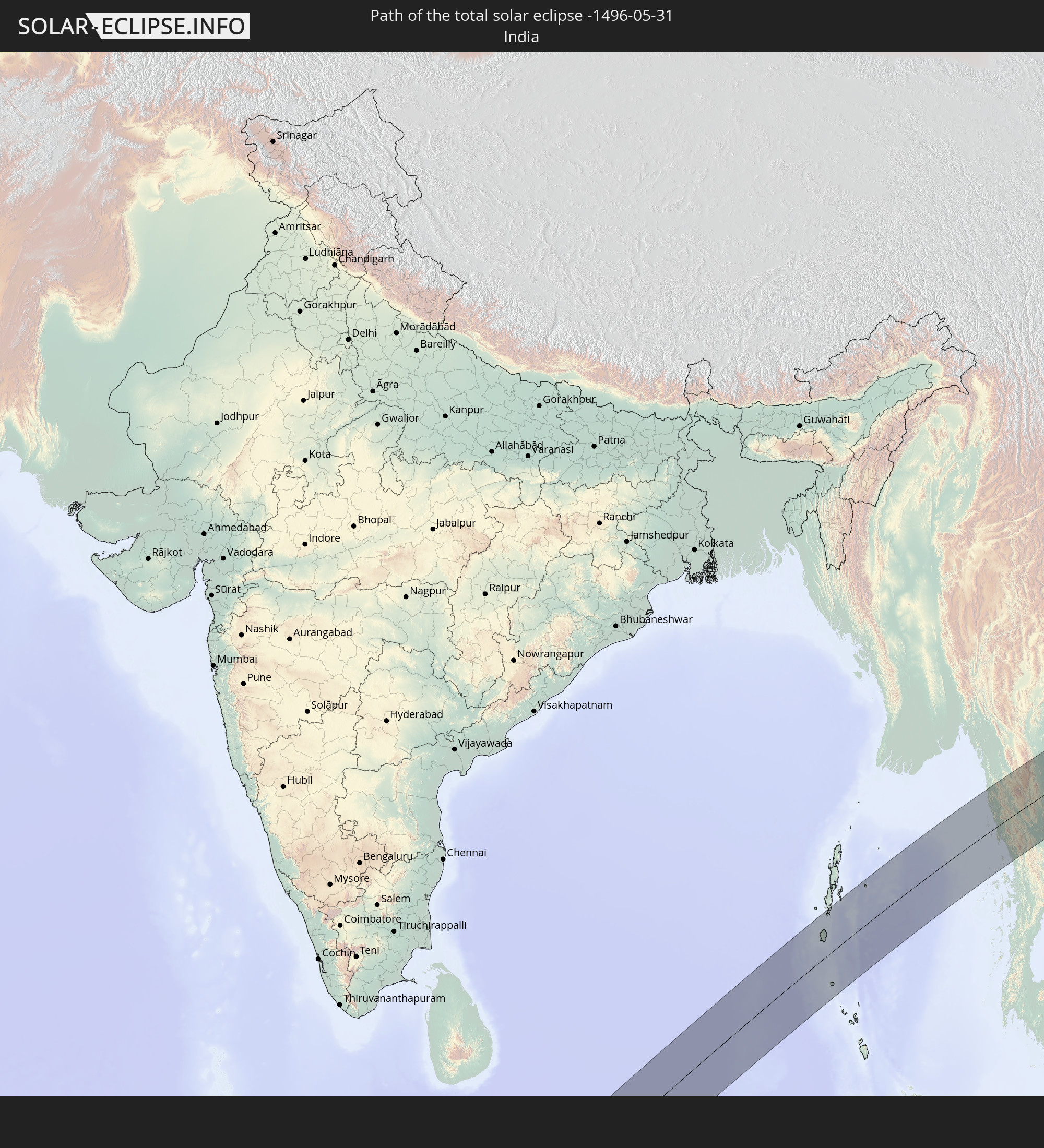 India
India
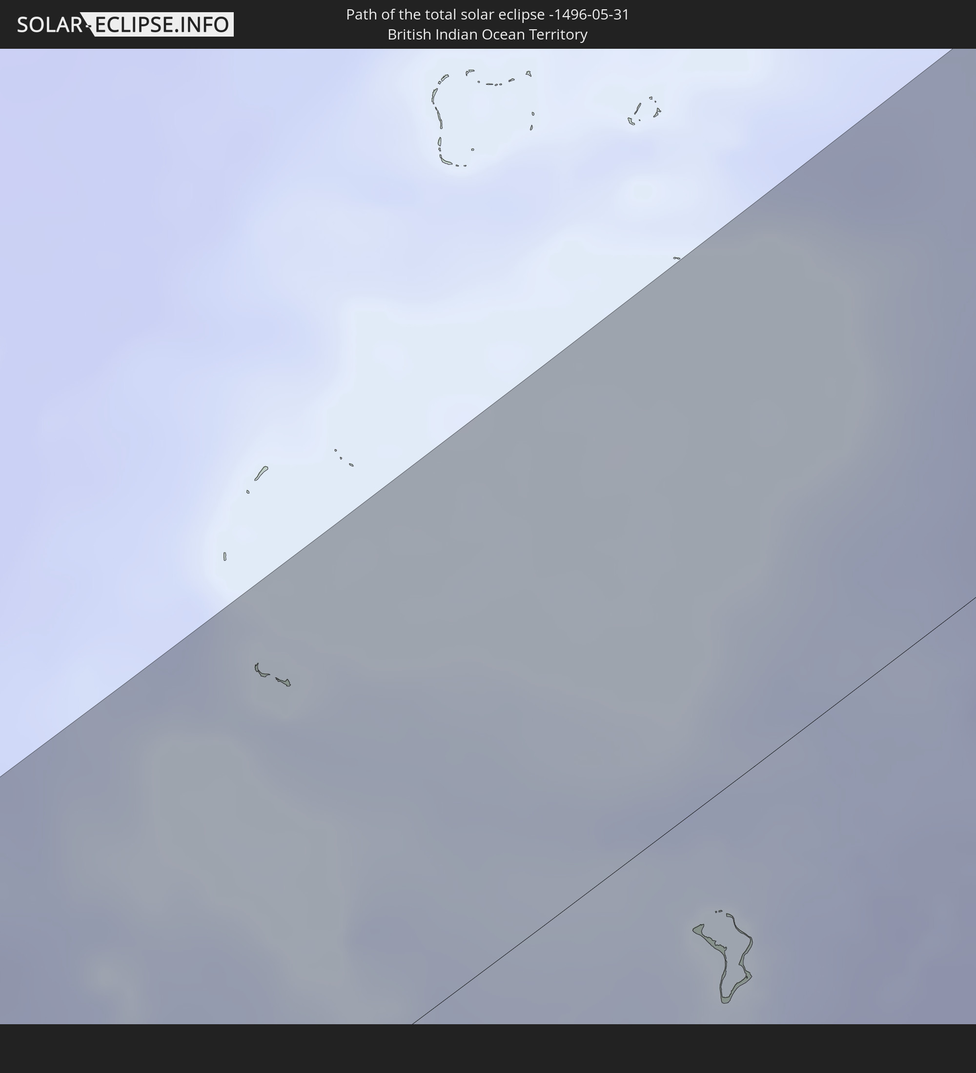 British Indian Ocean Territory
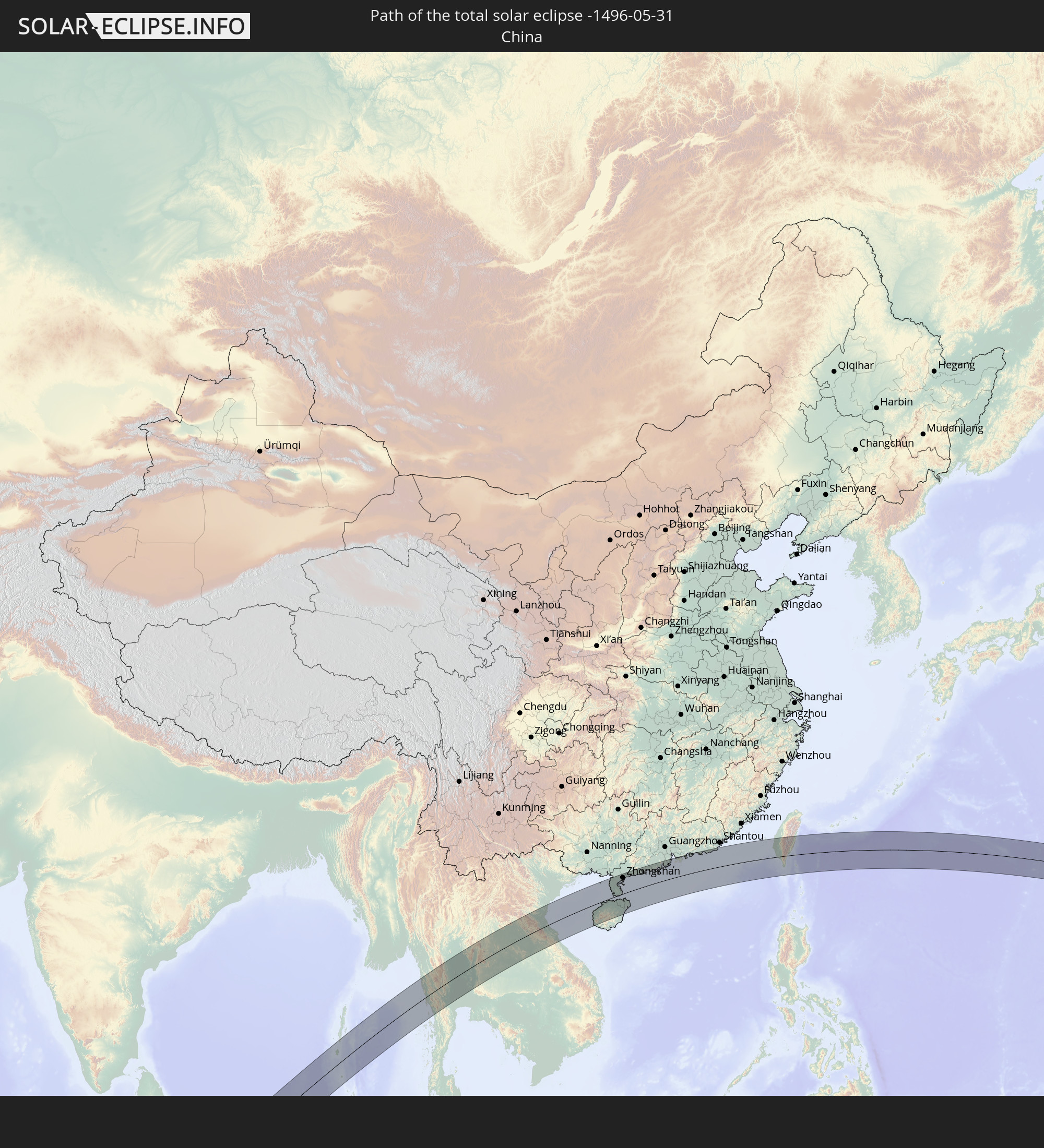 China
China
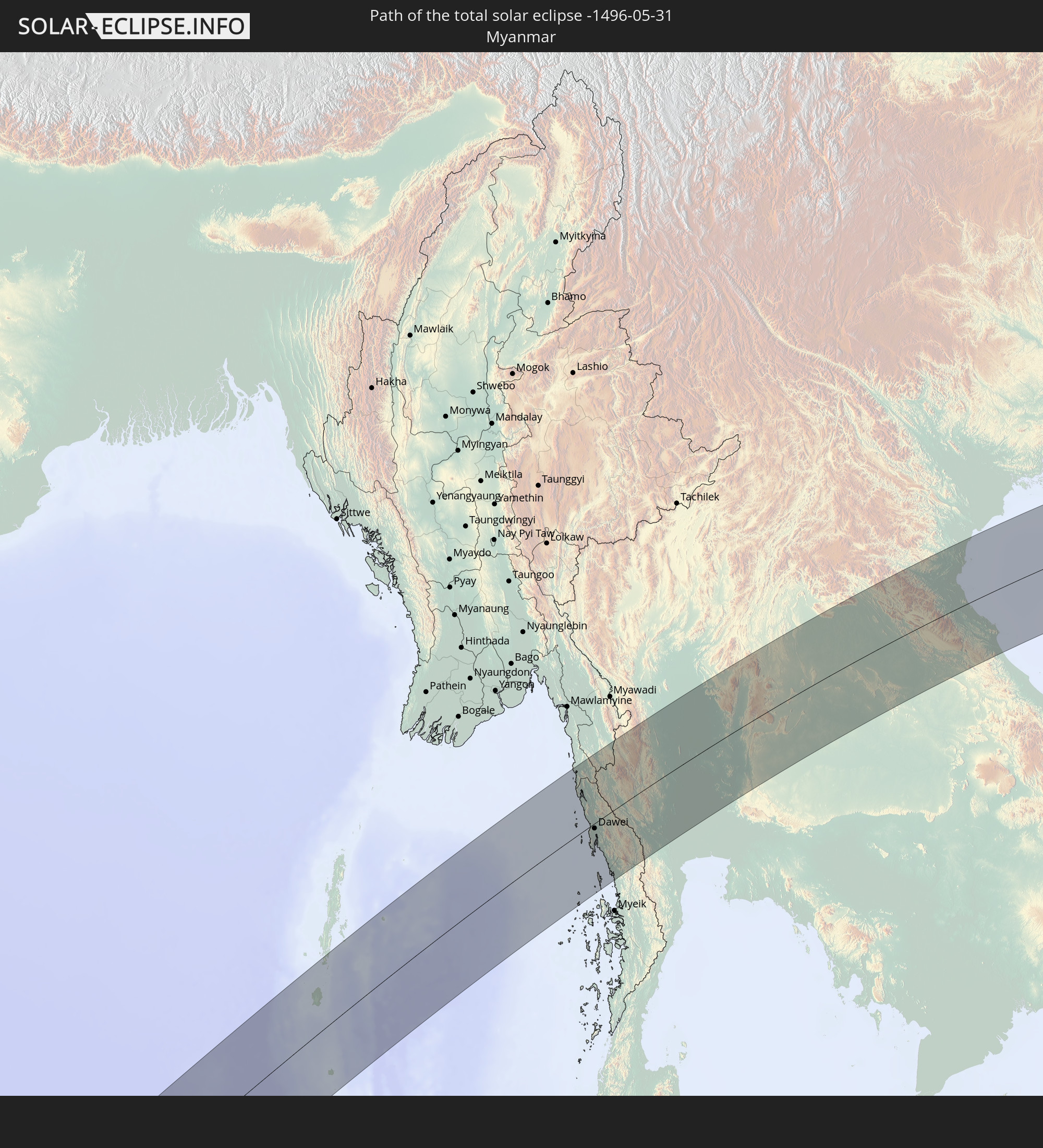 Myanmar
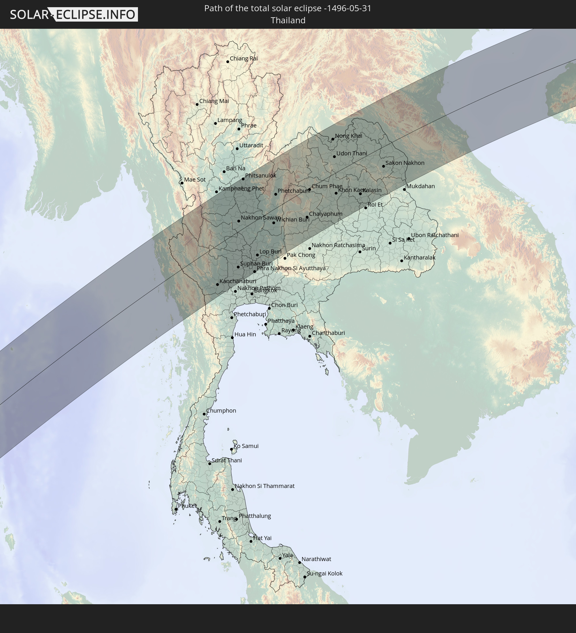 Thailand
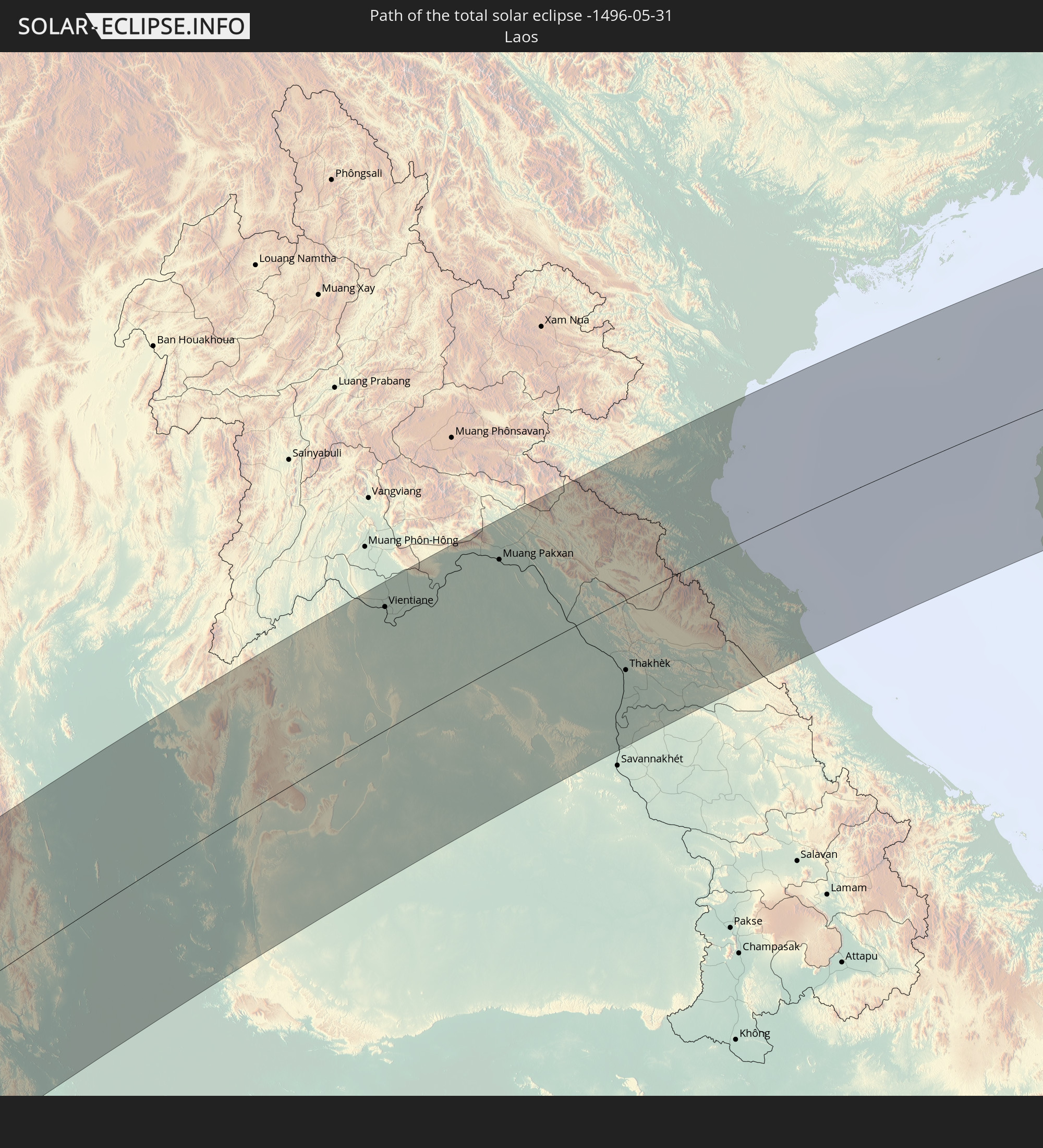 Laos
Laos
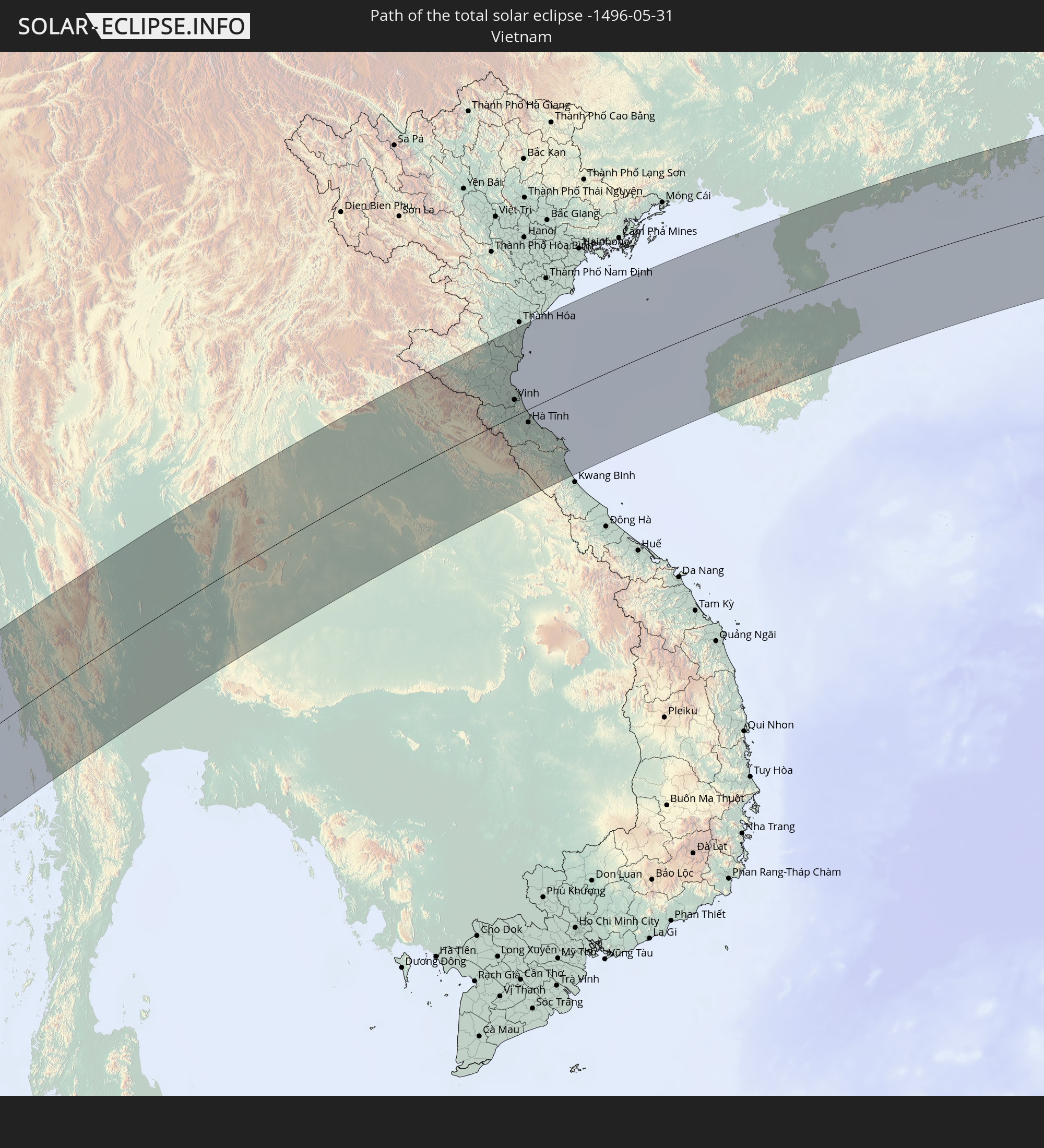 Vietnam
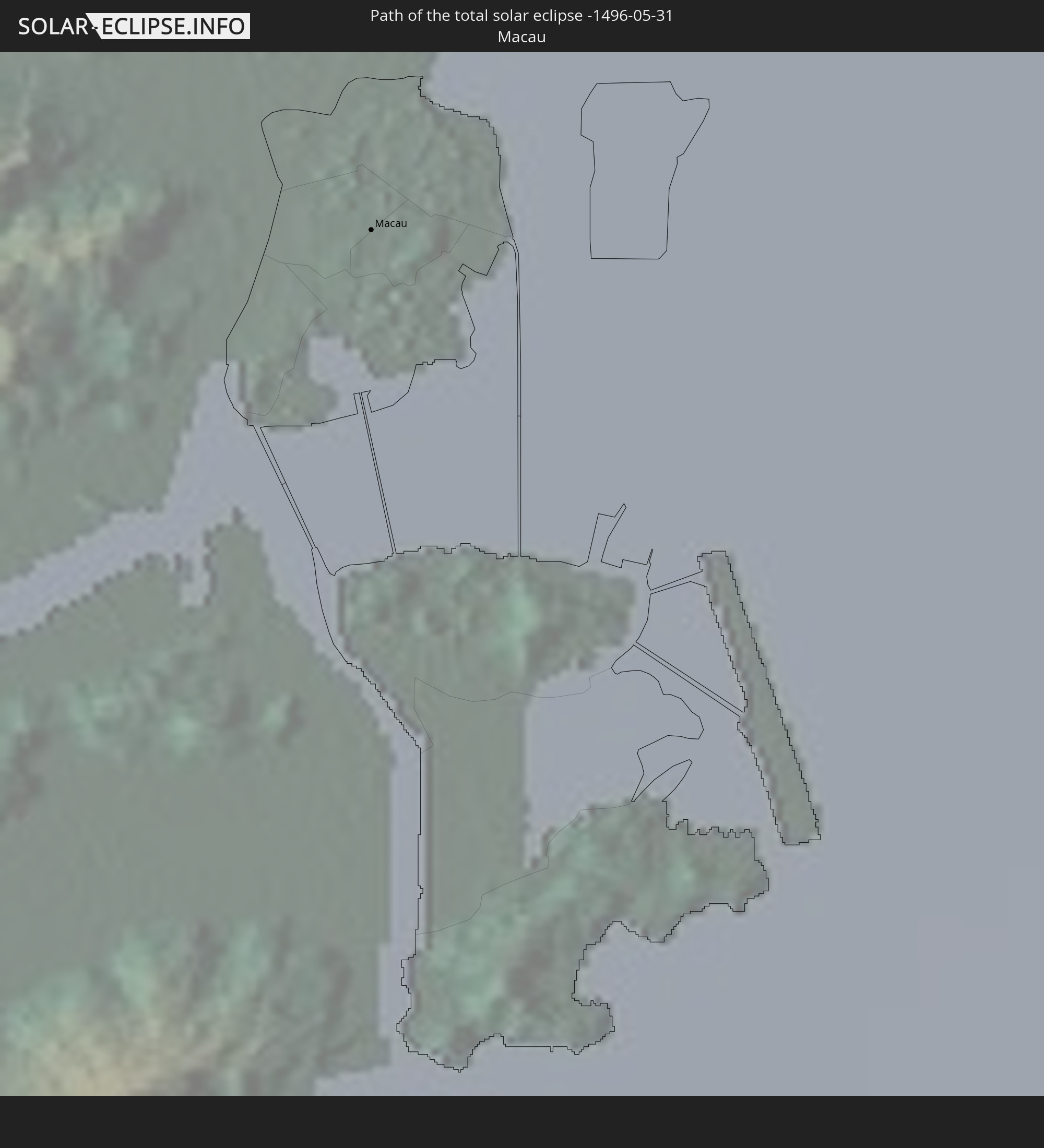 Macau
Macau
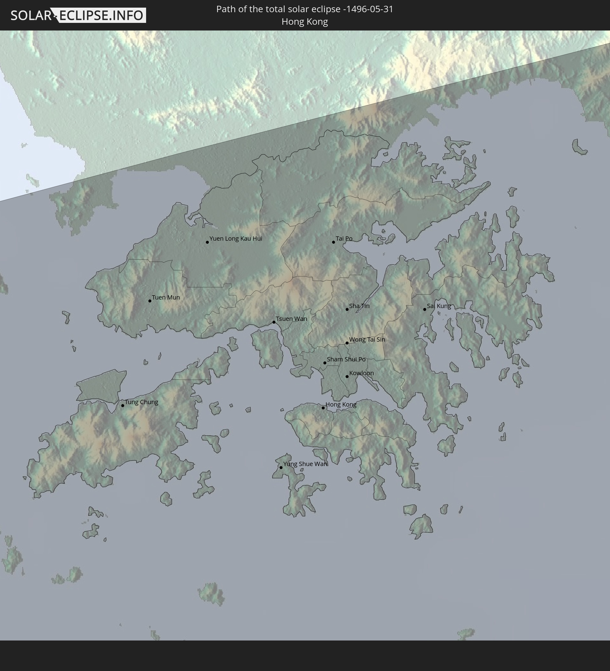 Hong Kong
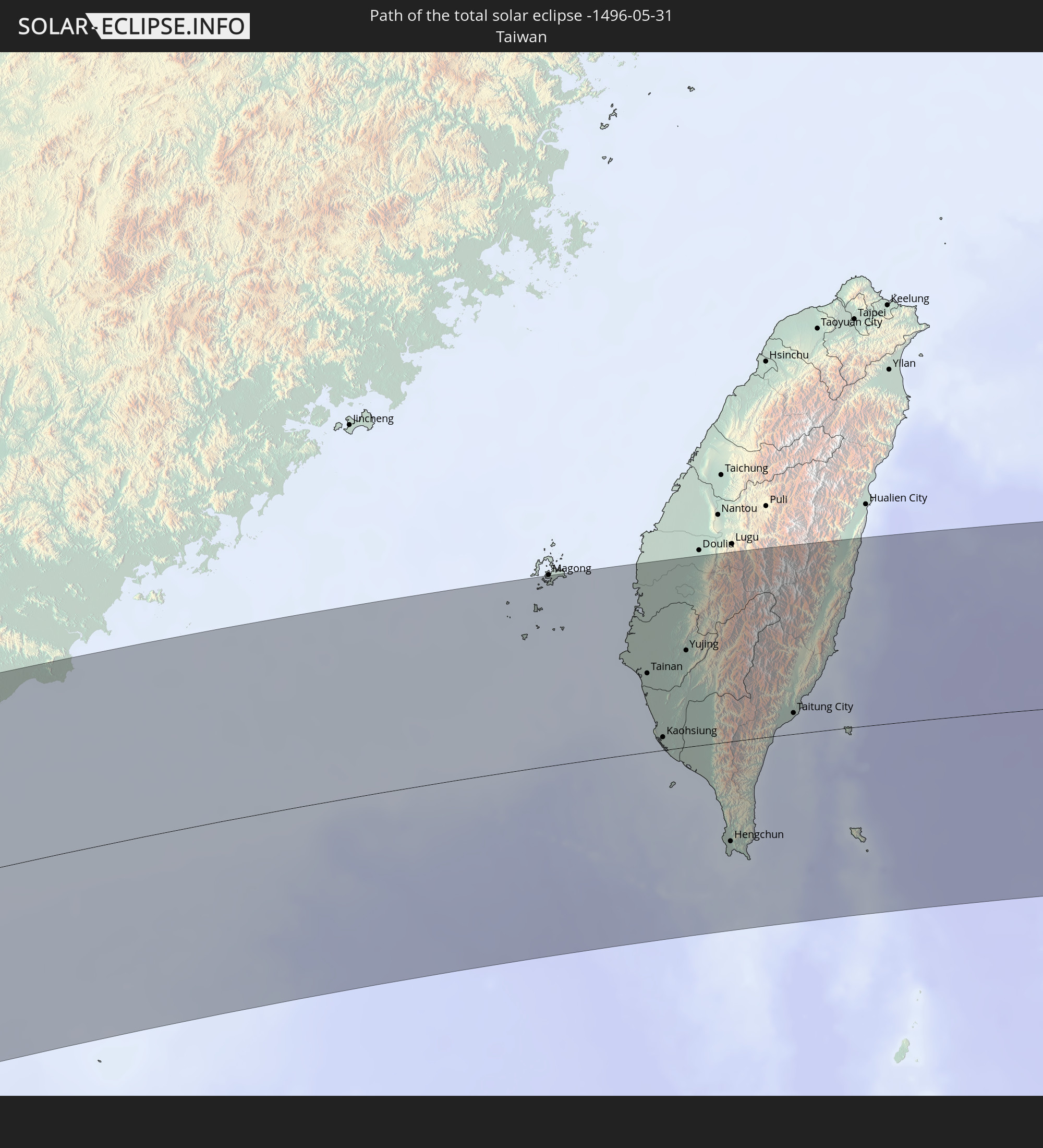 Taiwan
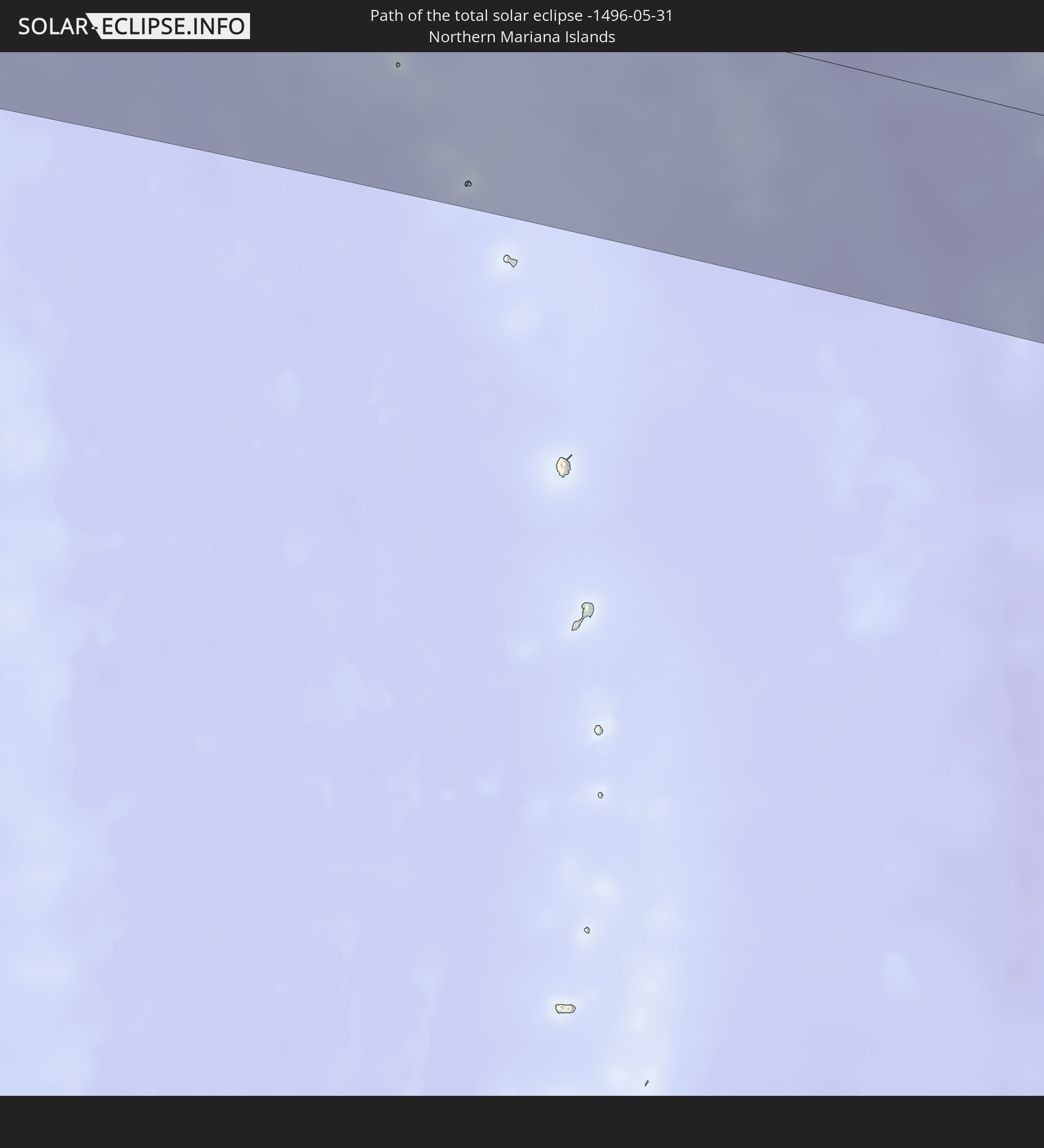 Northern Mariana Islands
In den folgenden Ländern ist die Sonnenfinsternis partiell zu sehen
 Russia
 United States Minor Outlying Islands
 Democratic Republic of the Congo
 Tanzania
 Uganda
 Mozambique
 Ethiopia
 Kenya
Kenya
 Saudi Arabia
 Eritrea
 French Southern and Antarctic Lands
 Somalia
 Djibouti
 Yemen
Yemen
 Madagascar
 Comoros
 Iran
Iran
 Mayotte
 Seychelles
 Oman
Oman
 Réunion
 Mauritius
 Afghanistan
 Pakistan
 Tajikistan
 India
India
 British Indian Ocean Territory
 Maldives
 China
China
 Sri Lanka
 Nepal
Nepal
 Mongolia
 Bangladesh
 Bhutan
 Myanmar
 Indonesia
 Cocos Islands
 Thailand
 Malaysia
 Laos
Laos
 Vietnam
 Cambodia
 Singapore
 Christmas Island
 Australia
 Macau
Macau
 Hong Kong
 Brunei
 Taiwan
 Philippines
 Japan
Japan
 East Timor
 North Korea
 South Korea
 Palau
Palau
 Federated States of Micronesia
 Papua New Guinea
 Guam
Guam
 Northern Mariana Islands
 Solomon Islands
 Marshall Islands
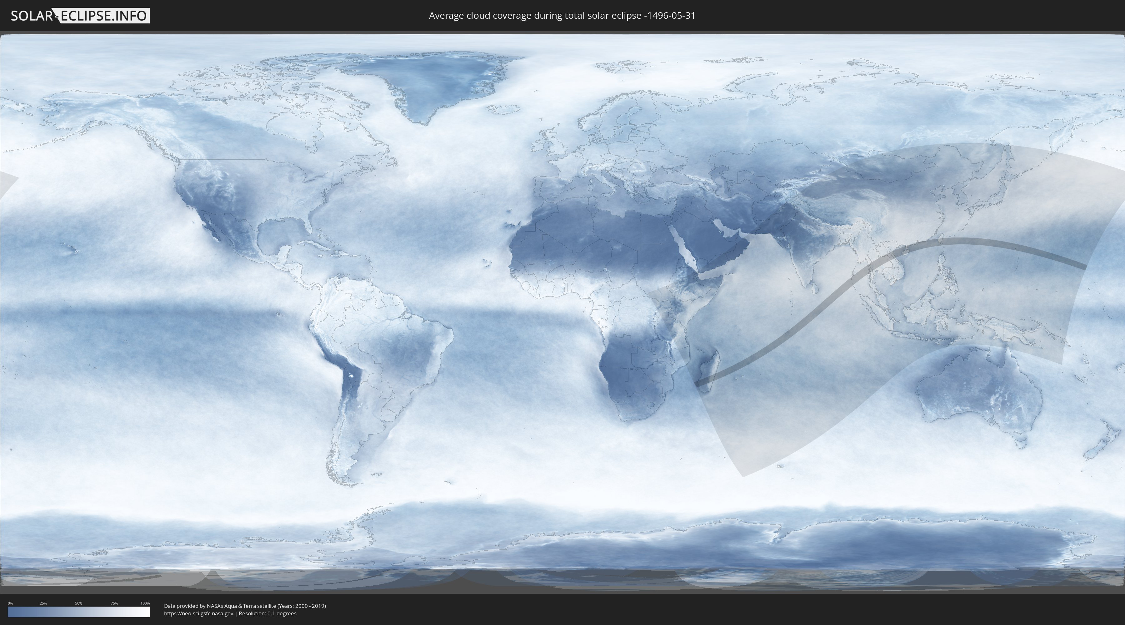
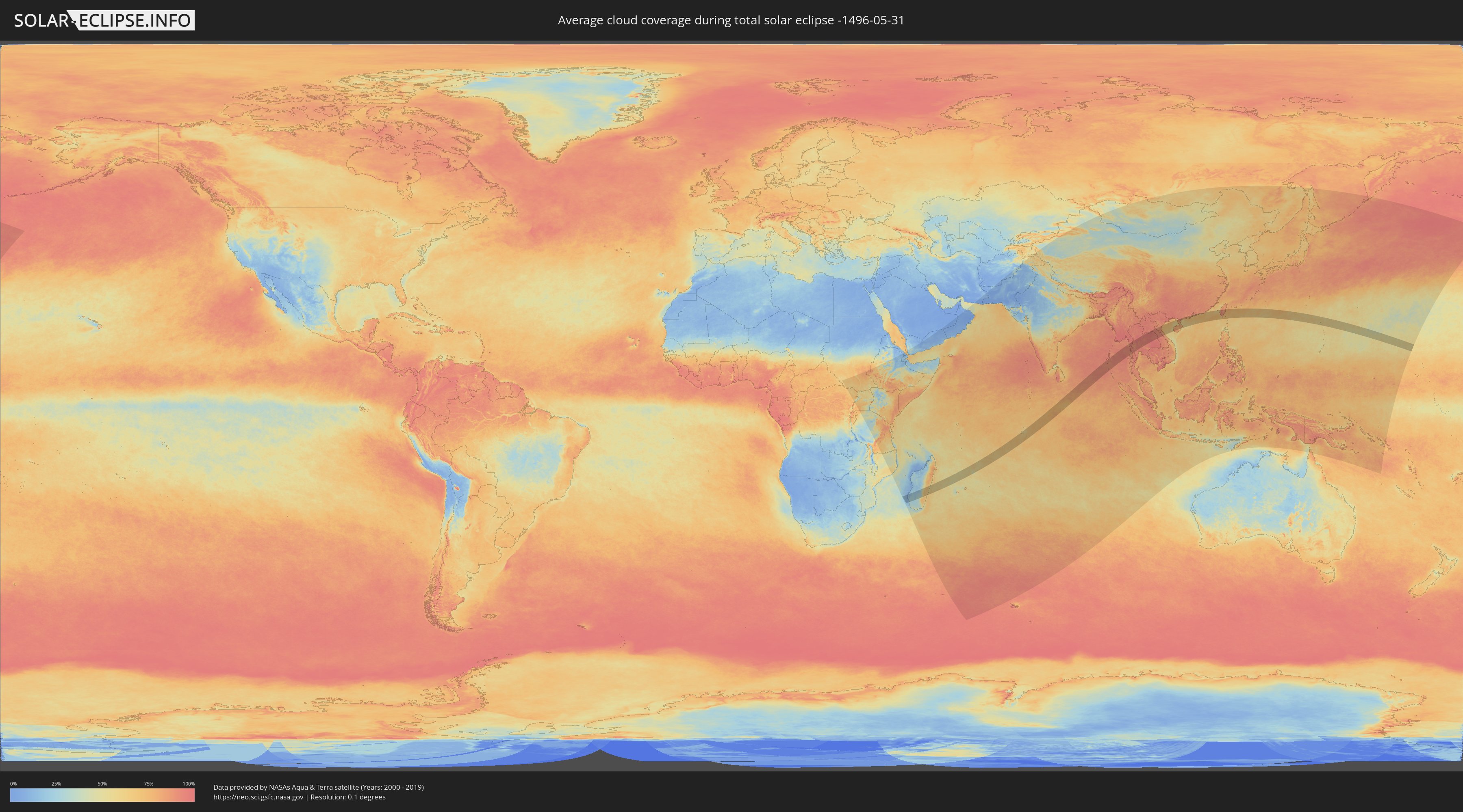
How will be the weather during the total solar eclipse on 05/31/-1496?
Where is the best place to see the total solar eclipse of 05/31/-1496?
The following maps show the average cloud coverage for the day of the total solar eclipse.
With the help of these maps, it is possible to find the place along the eclipse path, which has the best
chance of a cloudless sky.
Nevertheless, you should consider local circumstances and inform about the weather of your chosen
observation site.
The data is provided by NASAs satellites
AQUA and TERRA.
The cloud maps are averaged over a period of 19 years (2000 - 2019).
Detailed country maps
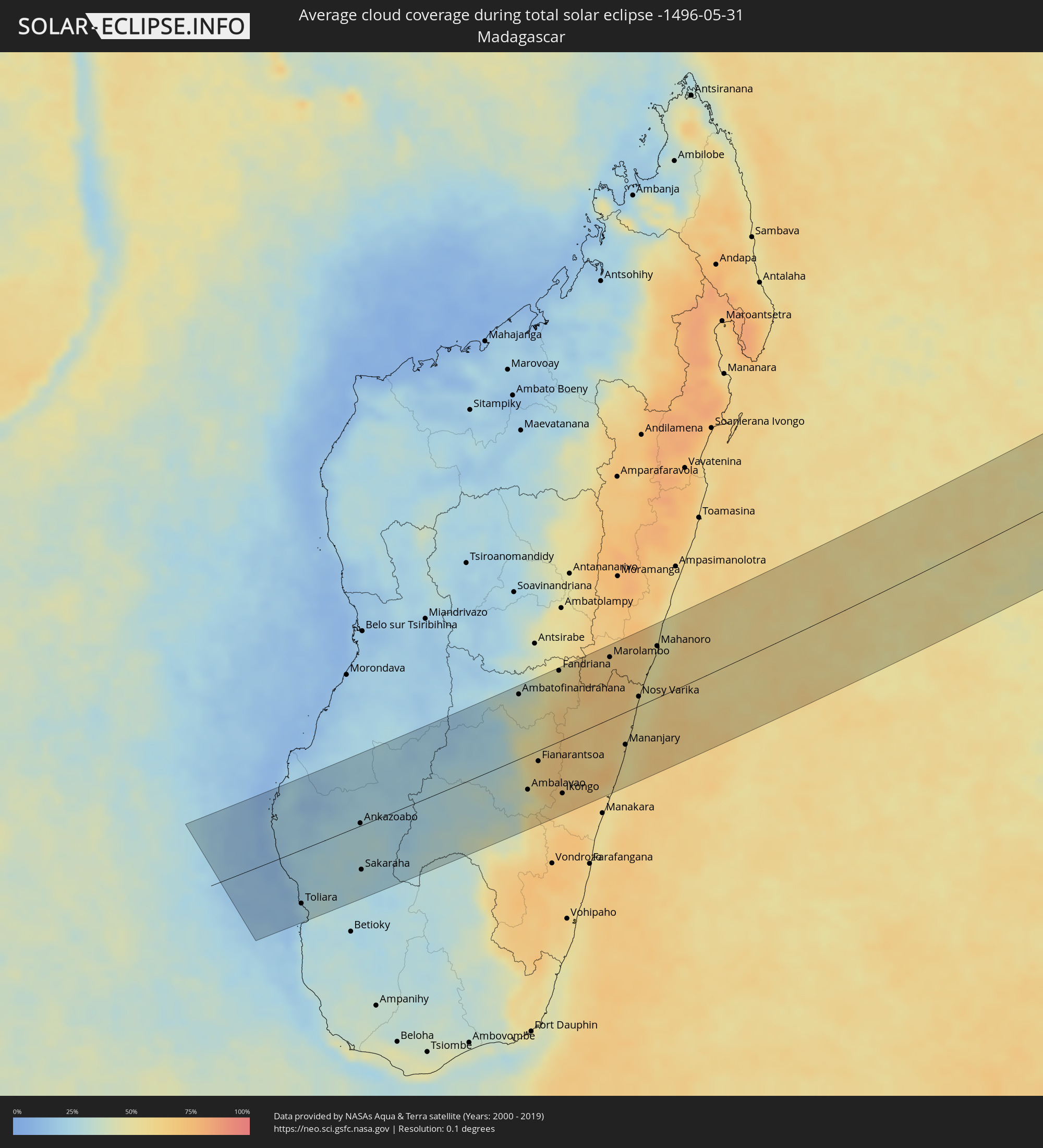 Madagascar
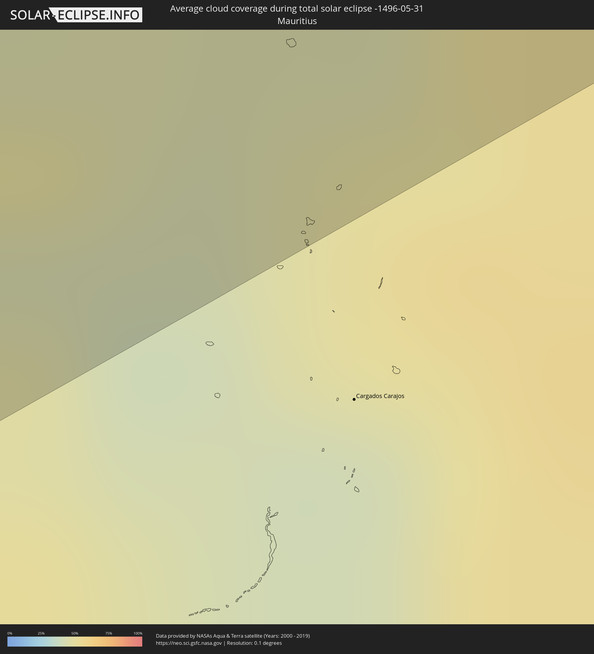 Mauritius
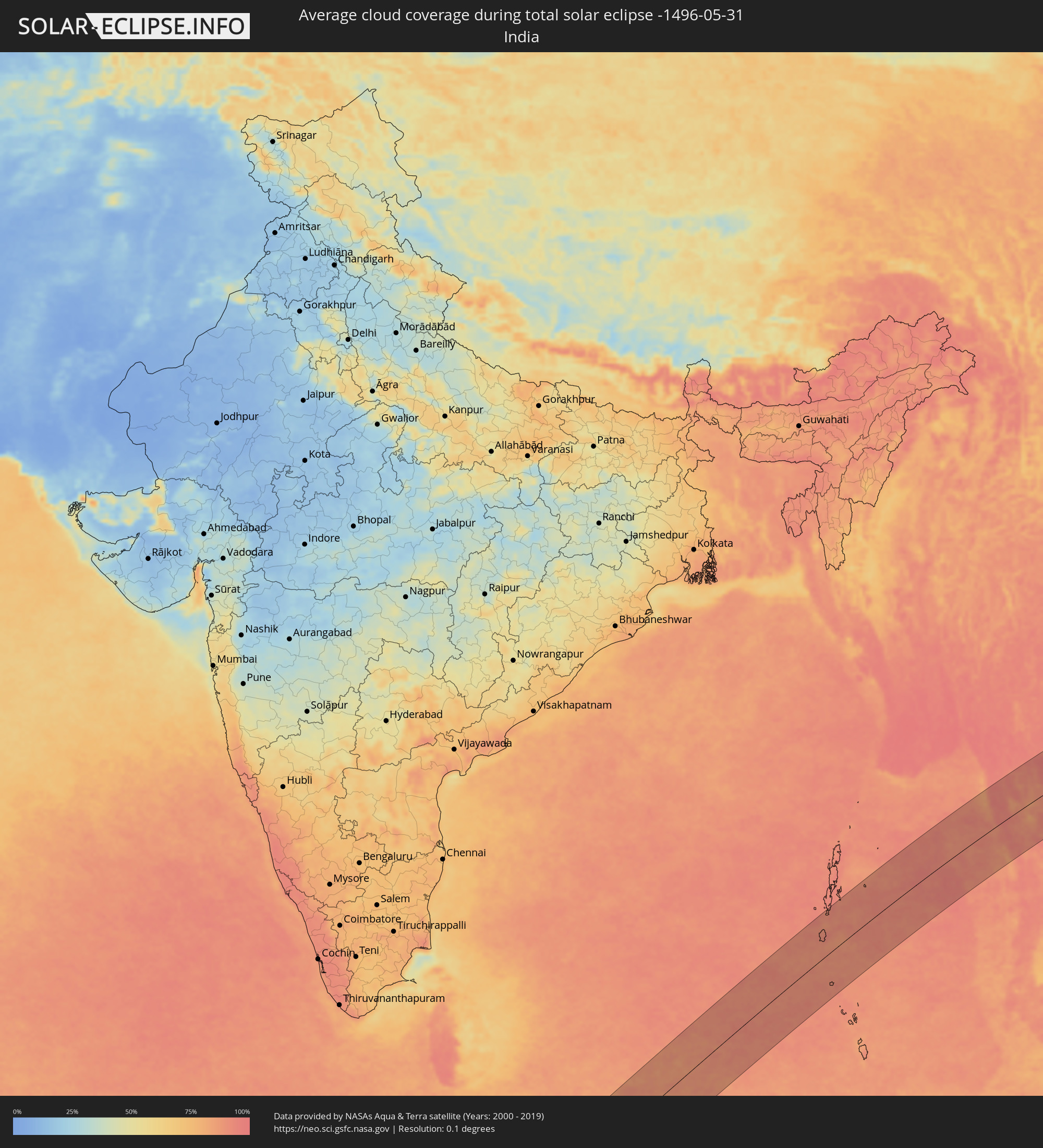 India
India
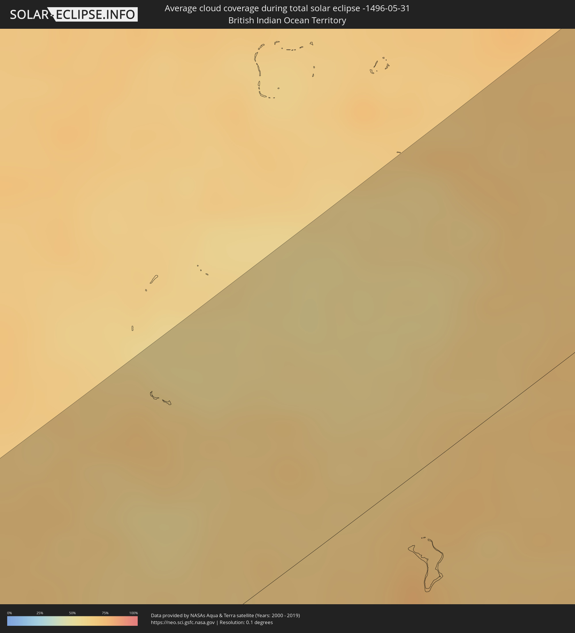 British Indian Ocean Territory
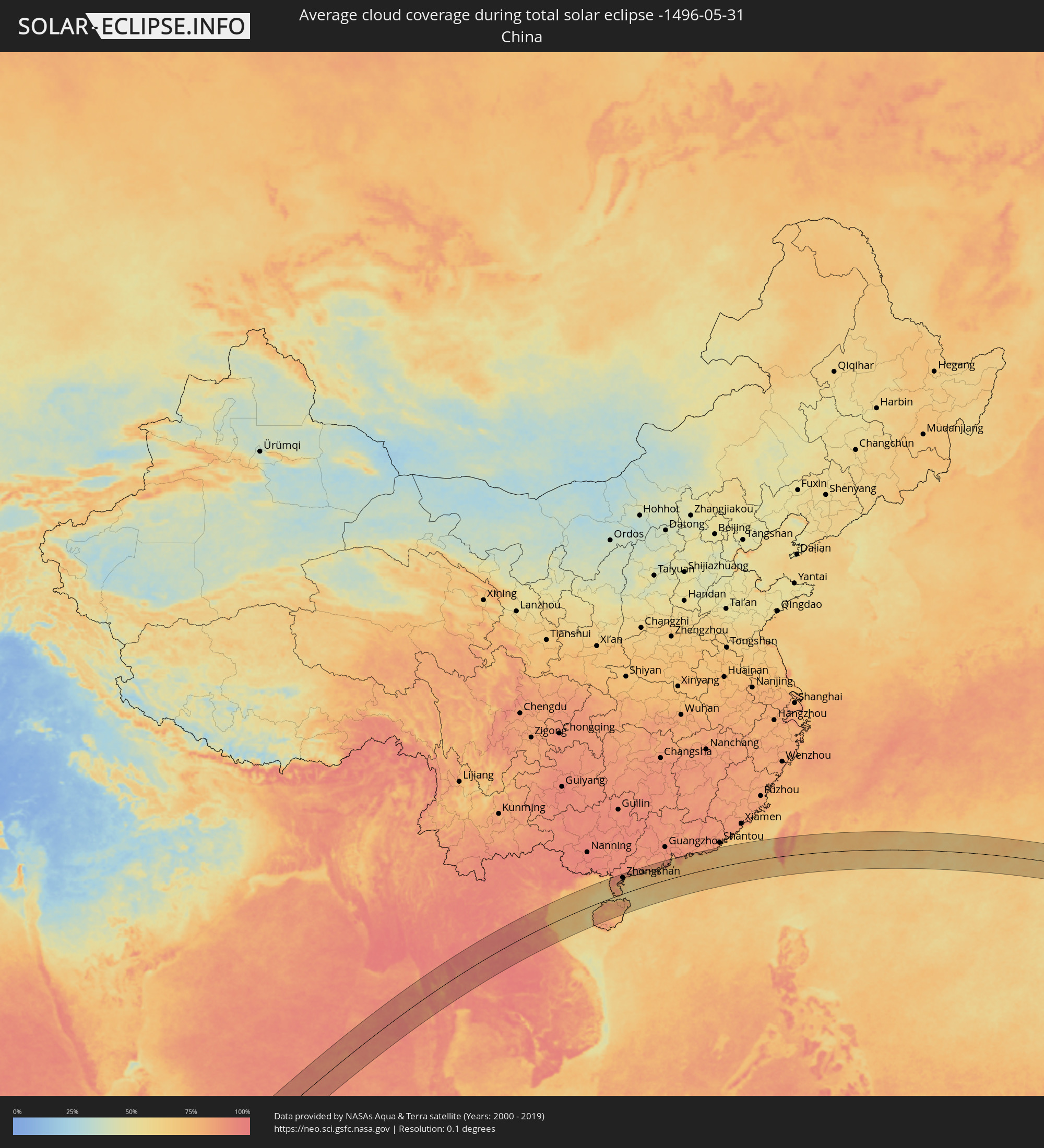 China
China
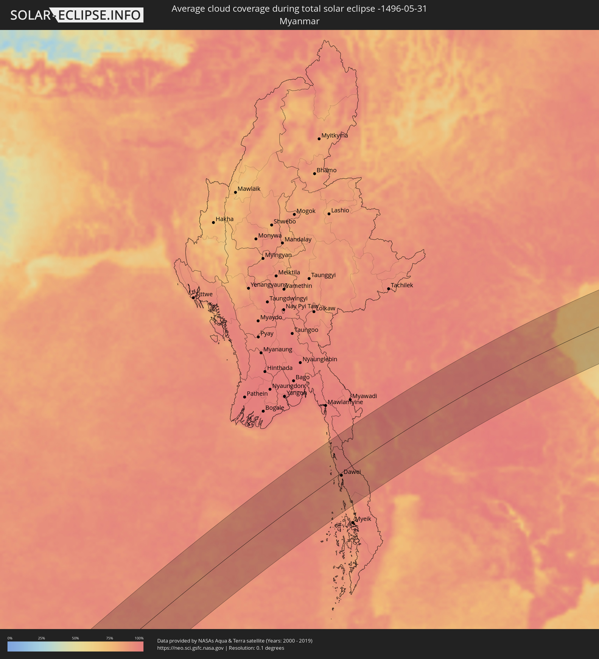 Myanmar
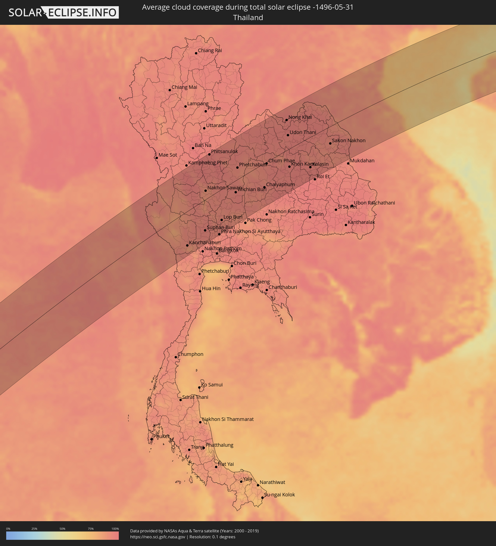 Thailand
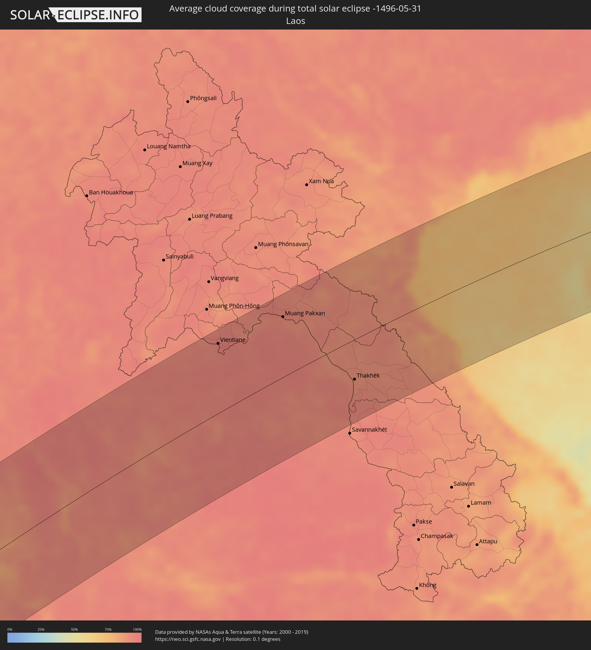 Laos
Laos
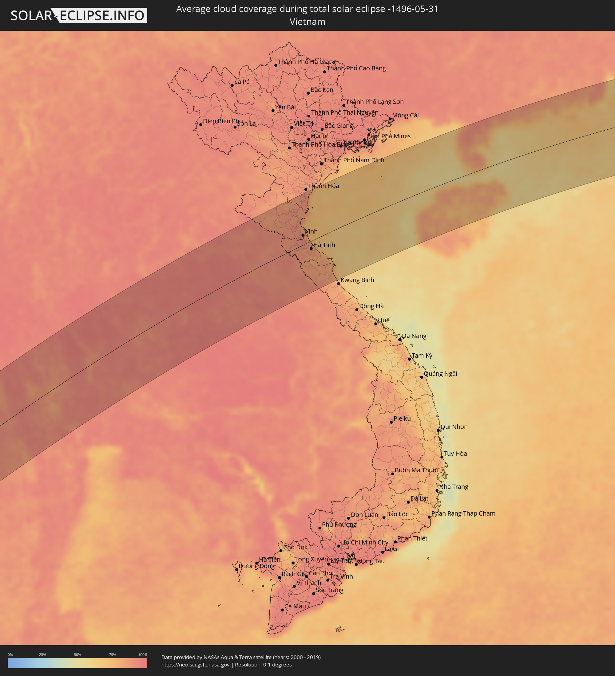 Vietnam
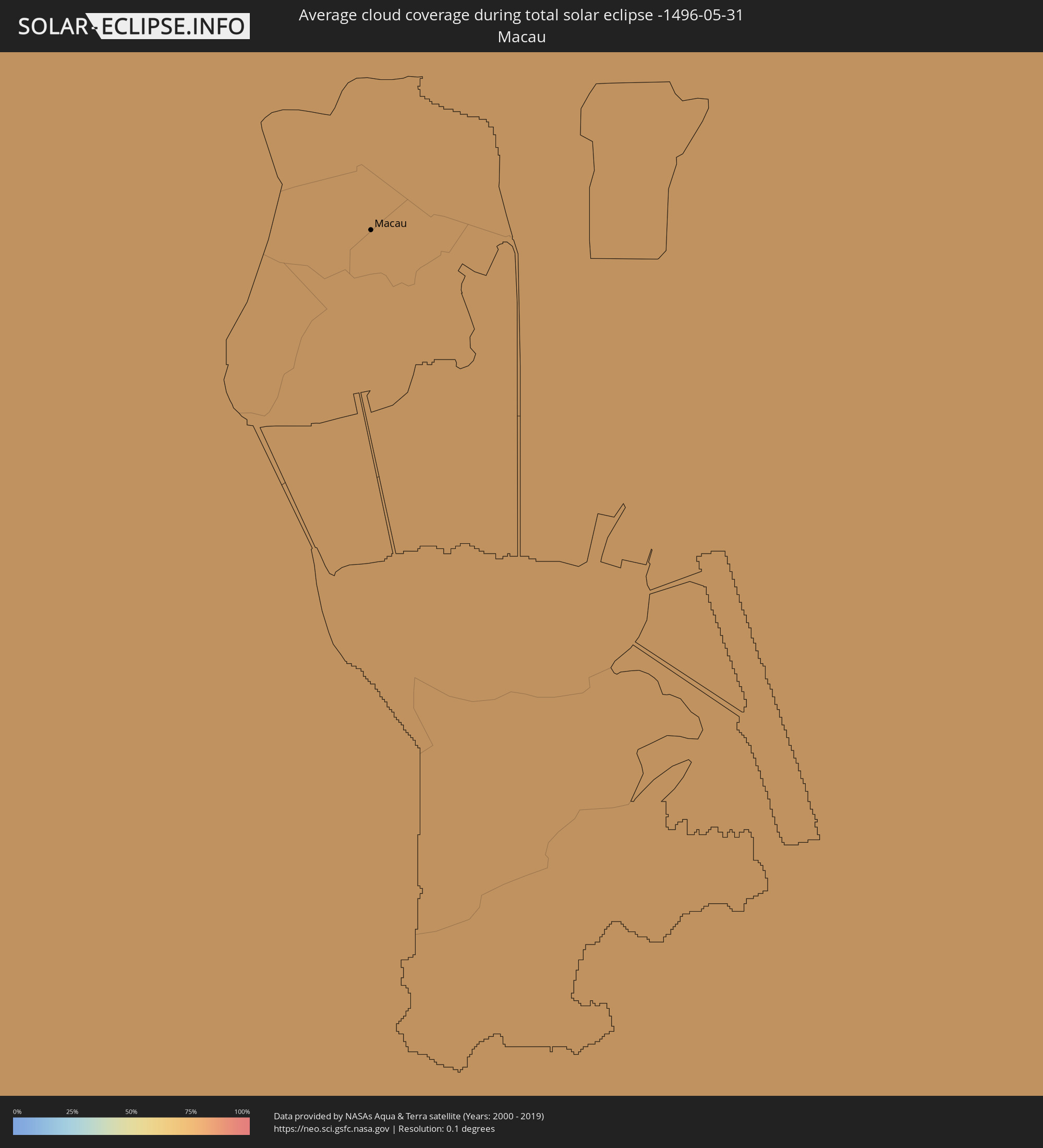 Macau
Macau
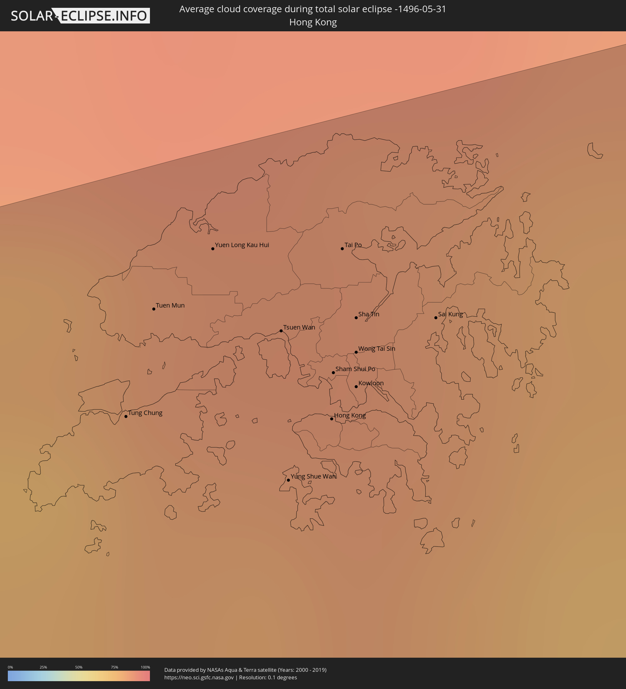 Hong Kong
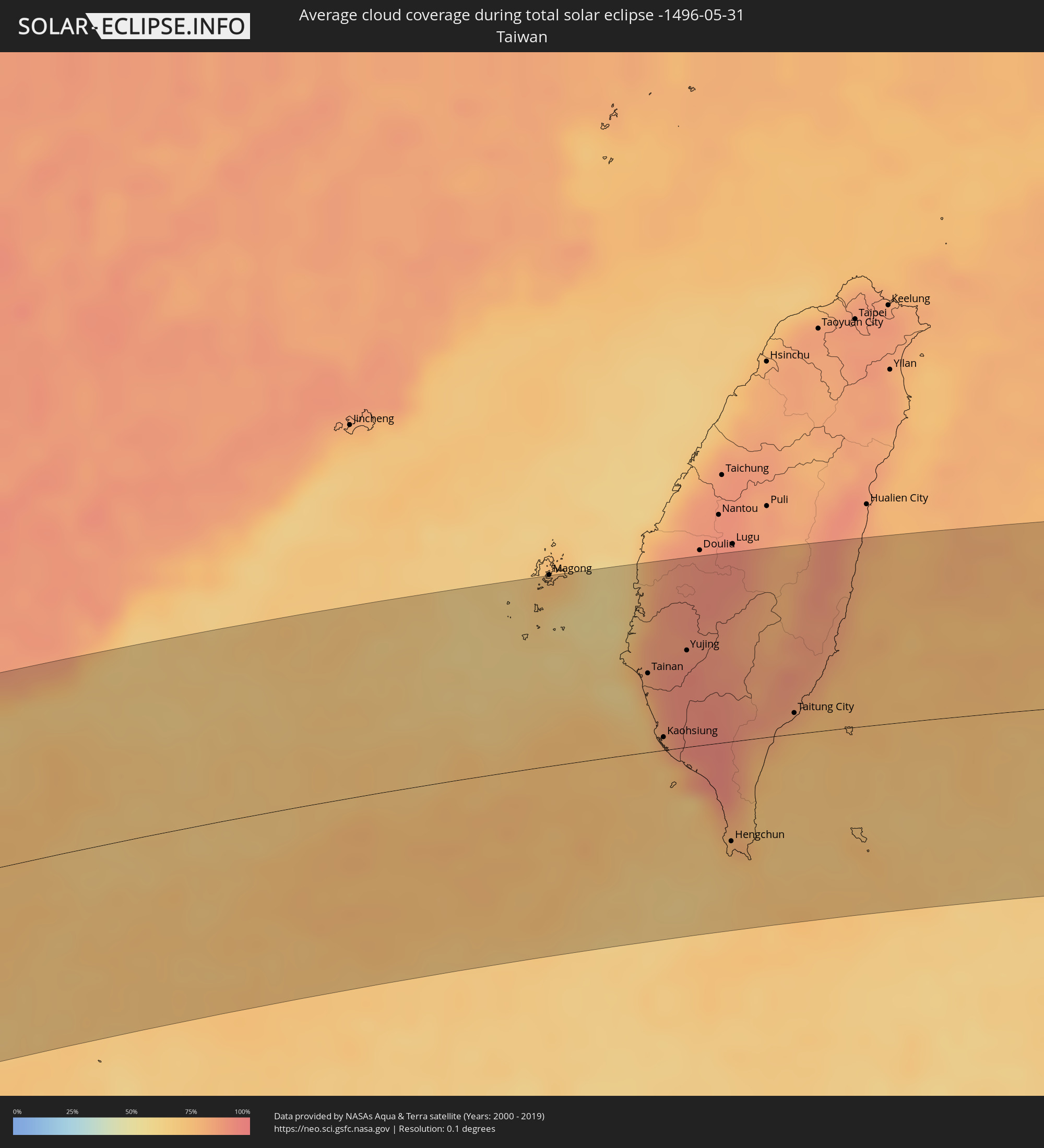 Taiwan
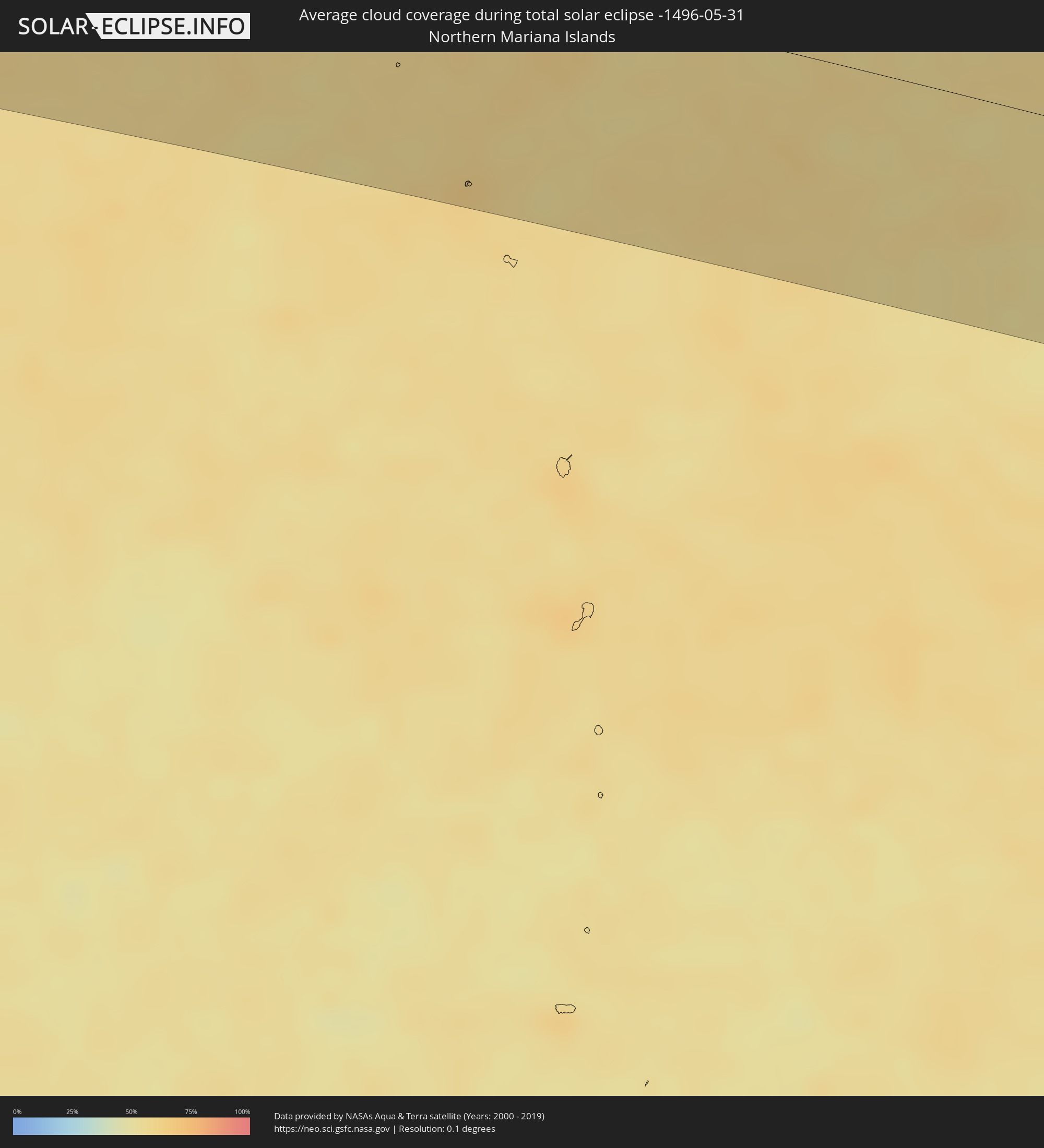 Northern Mariana Islands
Cities inside the path of the eclipse
The following table shows all locations with a population of more than 5,000 inside the eclipse path. Cities which have more than 100,000 inhabitants are marked bold. A click at the locations opens a detailed map.
| City | Type | Eclipse duration | Local time of max. eclipse | Distance to central line | Ø Cloud coverage |
|
Toliara, Atsimo-Andrefana
|
total | - | 06:02:02 UTC+02:27 | 74 km | 20% |
|
Behompy, Atsimo-Andrefana
|
total | - | 06:02:03 UTC+02:27 | 71 km | 28% |
|
Ankazoabo, Atsimo-Andrefana
|
total | - | 06:02:10 UTC+02:27 | 3 km | 27% |
|
Sakaraha, Atsimo-Andrefana
|
total | - | 06:02:05 UTC+02:27 | 61 km | 28% |
|
Beroroha, Atsimo-Andrefana
|
total | - | 06:02:17 UTC+02:27 | 41 km | 23% |
|
Ranohira, Ihorombe
|
total | - | 06:02:10 UTC+02:27 | 52 km | 29% |
|
Ihosy, Ihorombe
|
total | - | 06:02:12 UTC+02:27 | 73 km | 37% |
|
Ikalamavony, Upper Matsiatra
|
total | - | 06:02:27 UTC+02:27 | 37 km | 29% |
|
Ambatofinandrahana, Amoron'i Mania
|
total | - | 06:02:36 UTC+02:27 | 89 km | 40% |
|
Ambalavao, Upper Matsiatra
|
total | - | 06:02:21 UTC+02:27 | 47 km | 41% |
|
Fianarantsoa, Upper Matsiatra
|
total | - | 06:02:26 UTC+02:27 | 15 km | 59% |
|
Ambositra, Amoron'i Mania
|
total | - | 06:02:39 UTC+02:27 | 73 km | 50% |
|
Fandrandava, Upper Matsiatra
|
total | - | 06:02:26 UTC+02:27 | 28 km | 65% |
|
Fandriana, Amoron'i Mania
|
total | - | 06:02:44 UTC+02:27 | 97 km | 52% |
|
Ikongo, Vatovavy Fitovinany
|
total | - | 06:02:23 UTC+02:27 | 73 km | 65% |
|
Ifanadiana, Vatovavy Fitovinany
|
total | - | 06:02:30 UTC+02:27 | 22 km | 64% |
|
Vohimanitra, Vatovavy Fitovinany
|
total | - | 06:02:26 UTC+02:27 | 65 km | 64% |
|
Marolambo, Atsinanana
|
total | - | 06:02:51 UTC+02:27 | 85 km | 67% |
|
Sahavato, Vatovavy Fitovinany
|
total | - | 06:02:44 UTC+02:27 | 20 km | 67% |
|
Mananjary, Vatovavy Fitovinany
|
total | - | 06:02:36 UTC+02:27 | 45 km | 55% |
|
Nosy Varika, Vatovavy Fitovinany
|
total | - | 06:02:46 UTC+02:27 | 13 km | 55% |
|
Mahanoro, Atsinanana
|
total | - | 06:02:58 UTC+02:27 | 71 km | 49% |
|
Dawei, Tanintharyi
|
total | - | 11:37:00 UTC+06:24 | 9 km | 92% |
|
Kanchanaburi, Kanchanaburi
|
total | - | 11:57:24 UTC+06:42 | 99 km | 89% |
|
Tha Maka, Kanchanaburi
|
total | - | 11:57:45 UTC+06:42 | 122 km | 89% |
|
Suphan Buri, Suphan Buri
|
total | - | 11:59:33 UTC+06:42 | 90 km | 94% |
|
Nakhon Sawan, Nakhon Sawan
|
total | - | 12:01:32 UTC+06:42 | 25 km | 88% |
|
Phitsanulok, Phitsanulok
|
total | - | 12:03:35 UTC+06:42 | 123 km | 95% |
|
Phichit, Phichit
|
total | - | 12:03:12 UTC+06:42 | 82 km | 95% |
|
Phra Nakhon Si Ayutthaya, Phra Nakhon Si Ayutthaya
|
partial | - | 12:00:28 UTC+06:42 | 128 km | 93% |
|
Lop Buri, Lop Buri
|
total | - | 12:01:22 UTC+06:42 | 90 km | 92% |
|
Phra Phutthabat, Sara Buri
|
total | - | 12:01:35 UTC+06:42 | 105 km | 94% |
|
Wichian Buri, Phetchabun
|
total | - | 12:03:49 UTC+06:42 | 35 km | 94% |
|
Phetchabun, Phetchabun
|
total | - | 12:05:07 UTC+06:42 | 34 km | 93% |
|
Loei, Loei
|
total | - | 12:08:06 UTC+06:42 | 106 km | 95% |
|
Chaiyaphum, Chaiyaphum
|
total | - | 12:06:18 UTC+06:42 | 72 km | 94% |
|
Chum Phae, Khon Kaen
|
total | - | 12:07:35 UTC+06:42 | 5 km | 93% |
|
Tha Bo, Nong Khai
|
total | - | 12:10:41 UTC+06:42 | 95 km | 93% |
|
Vientiane, Vientiane
|
total | - | 12:10:54 UTC+06:42 | 105 km | 94% |
|
Ban Phai, Khon Kaen
|
total | - | 12:08:25 UTC+06:42 | 86 km | 95% |
|
Nong Khai, Nong Khai
|
total | - | 12:11:07 UTC+06:42 | 89 km | 94% |
|
Udon Thani, Changwat Udon Thani
|
total | - | 12:10:33 UTC+06:42 | 42 km | 95% |
|
Khon Kaen, Khon Kaen
|
total | - | 12:09:15 UTC+06:42 | 54 km | 94% |
|
Maha Sarakham, Maha Sarakham
|
total | - | 12:10:01 UTC+06:42 | 104 km | 94% |
|
Kalasin, Kalasin
|
total | - | 12:10:54 UTC+06:42 | 91 km | 96% |
|
Muang Pakxan, Bolikhamsai Province
|
total | - | 12:14:03 UTC+06:42 | 92 km | 91% |
|
Sakon Nakhon, Sakon Nakhon
|
total | - | 12:13:32 UTC+06:42 | 52 km | 93% |
|
Nakhon Phanom, Nakhon Phanom
|
total | - | 12:15:27 UTC+06:42 | 59 km | 91% |
|
Thakhèk, Khammouan
|
total | - | 12:15:35 UTC+06:42 | 61 km | 91% |
|
Yên Vinh, Nghệ An
|
total | - | 12:43:56 UTC+07:06 | 24 km | 88% |
|
Vinh, Nghệ An
|
total | - | 12:44:01 UTC+07:06 | 24 km | 88% |
|
Hà Tĩnh, Hà Tĩnh
|
total | - | 12:44:06 UTC+07:06 | 19 km | 86% |
|
Lincheng, Hainan
|
total | - | 13:48:36 UTC+08:00 | 16 km | 83% |
|
Jinjiang, Hainan
|
total | - | 13:49:11 UTC+08:00 | 47 km | 79% |
|
Xucheng, Guangdong
|
total | - | 13:50:12 UTC+08:00 | 10 km | 63% |
|
Xiuying, Hainan
|
total | - | 13:50:10 UTC+08:00 | 29 km | 83% |
|
Haikou, Hainan
|
total | - | 13:50:20 UTC+08:00 | 26 km | 83% |
|
Zhanjiang, Guangdong
|
total | - | 13:51:36 UTC+08:00 | 103 km | 90% |
|
Qiongshan, Hainan
|
total | - | 13:50:19 UTC+08:00 | 31 km | 81% |
|
Zhongshan, Guangdong
|
total | - | 13:52:10 UTC+08:00 | 100 km | 78% |
|
Wuchuan, Guangdong
|
total | - | 13:52:46 UTC+08:00 | 107 km | 82% |
|
Yangjiang, Guangdong
|
total | - | 13:55:56 UTC+08:00 | 111 km | 82% |
|
Macau, Macau
|
total | - | 13:34:01 UTC+07:34 | 101 km | 83% |
|
Zhuhai, Guangdong
|
total | - | 13:59:58 UTC+08:00 | 109 km | 76% |
|
Tung Chung, Islands
|
total | - | 13:37:32 UTC+07:36 | 100 km | 75% |
|
Tuen Mun, Tuen Mun
|
total | - | 13:37:40 UTC+07:36 | 110 km | 81% |
|
Yuen Long Kau Hui, Yuen Long
|
total | - | 13:37:51 UTC+07:36 | 115 km | 84% |
|
Shenzhen, Guangdong
|
total | - | 14:01:19 UTC+08:00 | 124 km | 86% |
|
Tsuen Wan, Tsuen Wan
|
total | - | 13:37:57 UTC+07:36 | 105 km | 82% |
|
Yung Shue Wan
|
total | - | 13:37:52 UTC+07:36 | 89 km | 73% |
|
Hong Kong, Central and Western
|
total | - | 13:38:01 UTC+07:36 | 94 km | 82% |
|
Central, Central and Western
|
total | - | 13:38:01 UTC+07:36 | 94 km | 82% |
|
Sham Shui Po, Sham Shui Po
|
total | - | 13:38:03 UTC+07:36 | 99 km | 82% |
|
Tai Po, Tai Po
|
total | - | 13:38:10 UTC+07:36 | 111 km | 86% |
|
Wan Chai, Wanchai
|
total | - | 13:38:03 UTC+07:36 | 93 km | 82% |
|
Kowloon, Kowloon City
|
total | - | 13:38:06 UTC+07:36 | 97 km | 82% |
|
Wong Tai Sin, Wong Tai Sin
|
total | - | 13:38:07 UTC+07:36 | 100 km | 84% |
|
Sha Tin, Sha Tin
|
total | - | 13:38:09 UTC+07:36 | 104 km | 84% |
|
Sai Kung, Sai Kung
|
total | - | 13:38:20 UTC+07:36 | 102 km | 81% |
|
Shanwei, Guangdong
|
total | - | 14:04:20 UTC+08:00 | 118 km | 73% |
|
Jieshi, Guangdong
|
total | - | 14:05:25 UTC+08:00 | 110 km | 72% |
|
Jiazi, Guangdong
|
total | - | 14:05:59 UTC+08:00 | 112 km | 74% |
|
Tainan, Taiwan
|
total | - | 14:14:49 UTC+08:00 | 51 km | 80% |
|
Kaohsiung, Takao
|
total | - | 14:14:51 UTC+08:00 | 8 km | 77% |
|
Yujing, Taiwan
|
total | - | 14:15:23 UTC+08:00 | 63 km | 93% |
|
Hengchun, Taiwan
|
total | - | 14:15:28 UTC+08:00 | 65 km | 70% |
|
Taitung City, Taiwan
|
total | - | 14:16:37 UTC+08:00 | 14 km | 82% |