Total solar eclipse of 04/01/-1930
| Day of week: | Sunday |
| Maximum duration of eclipse: | 06m43s |
| Maximum width of eclipse path: | 246 km |
| Saros cycle: | 8 |
| Coverage: | 100% |
| Magnitude: | 1.076 |
| Gamma: | -0.0247 |
Wo kann man die Sonnenfinsternis vom 04/01/-1930 sehen?
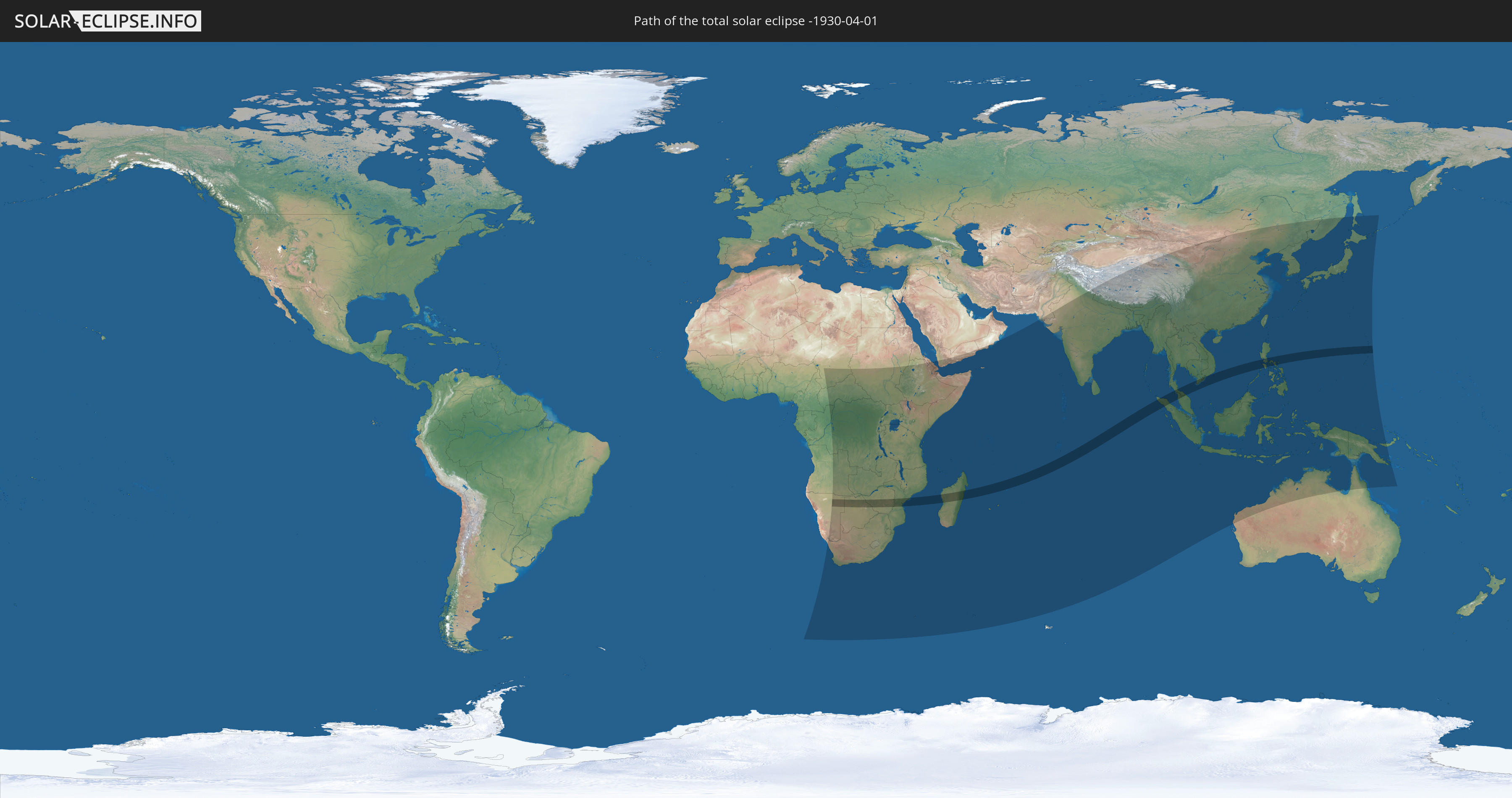
Die Sonnenfinsternis am 04/01/-1930 kann man in 69 Ländern als partielle Sonnenfinsternis beobachten.
Der Finsternispfad verläuft durch 13 Länder. Nur in diesen Ländern ist sie als total Sonnenfinsternis zu sehen.
In den folgenden Ländern ist die Sonnenfinsternis total zu sehen
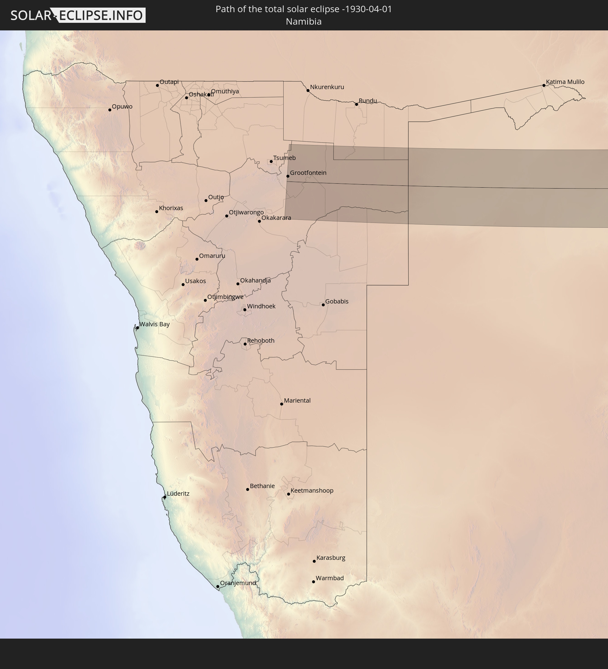 Namibia
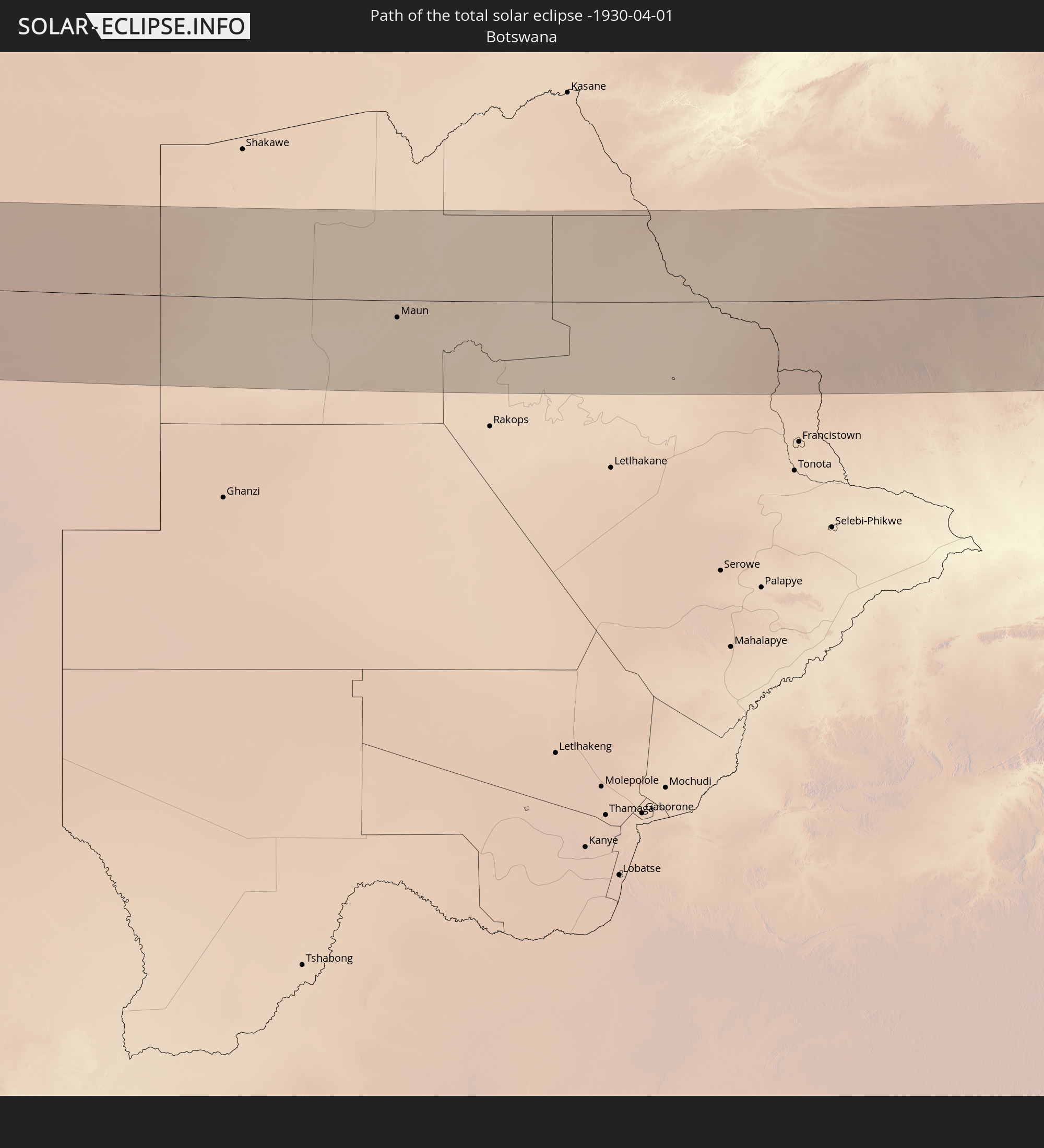 Botswana
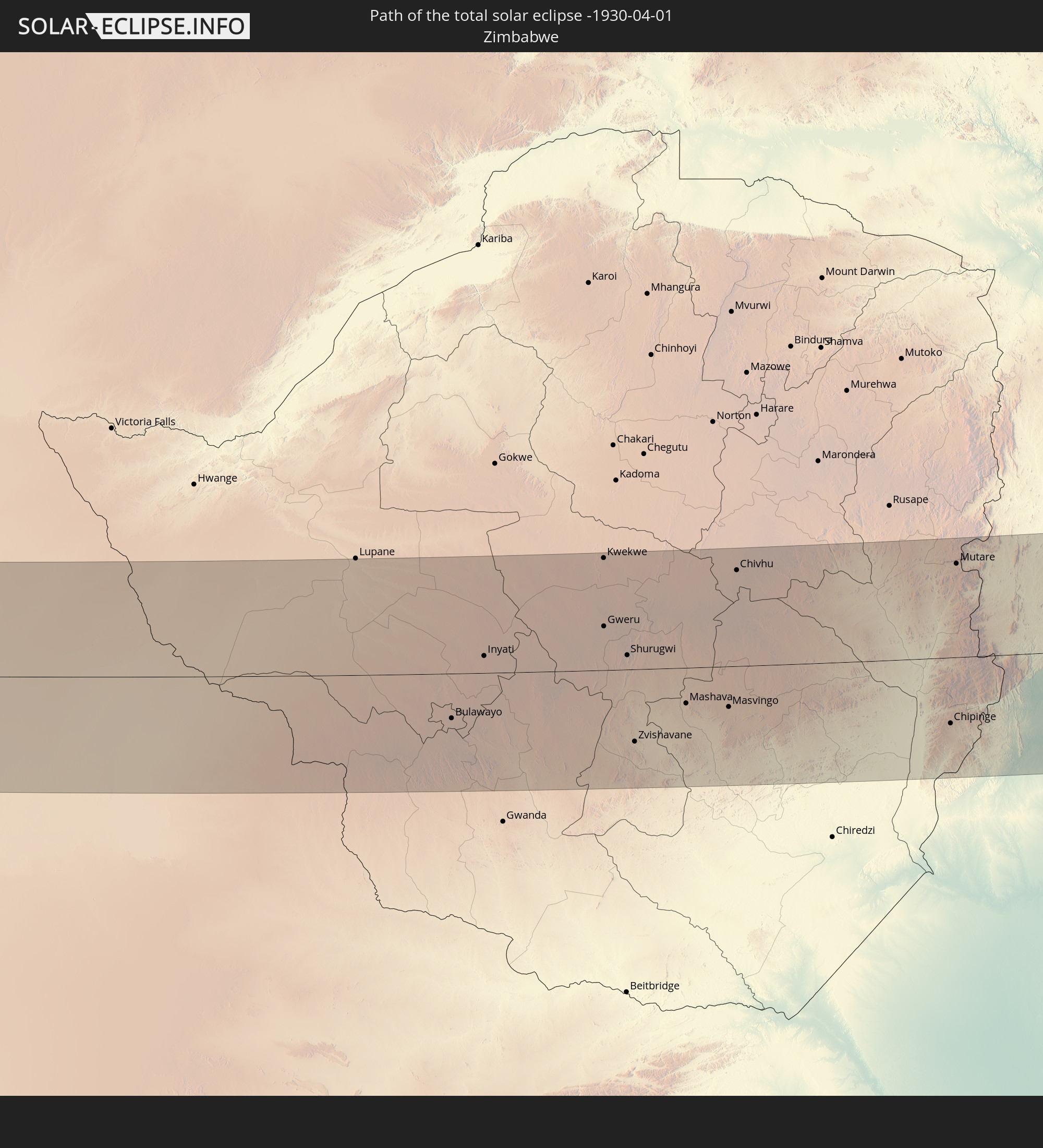 Zimbabwe
 Mozambique
 French Southern and Antarctic Lands
 Madagascar
 Mauritius
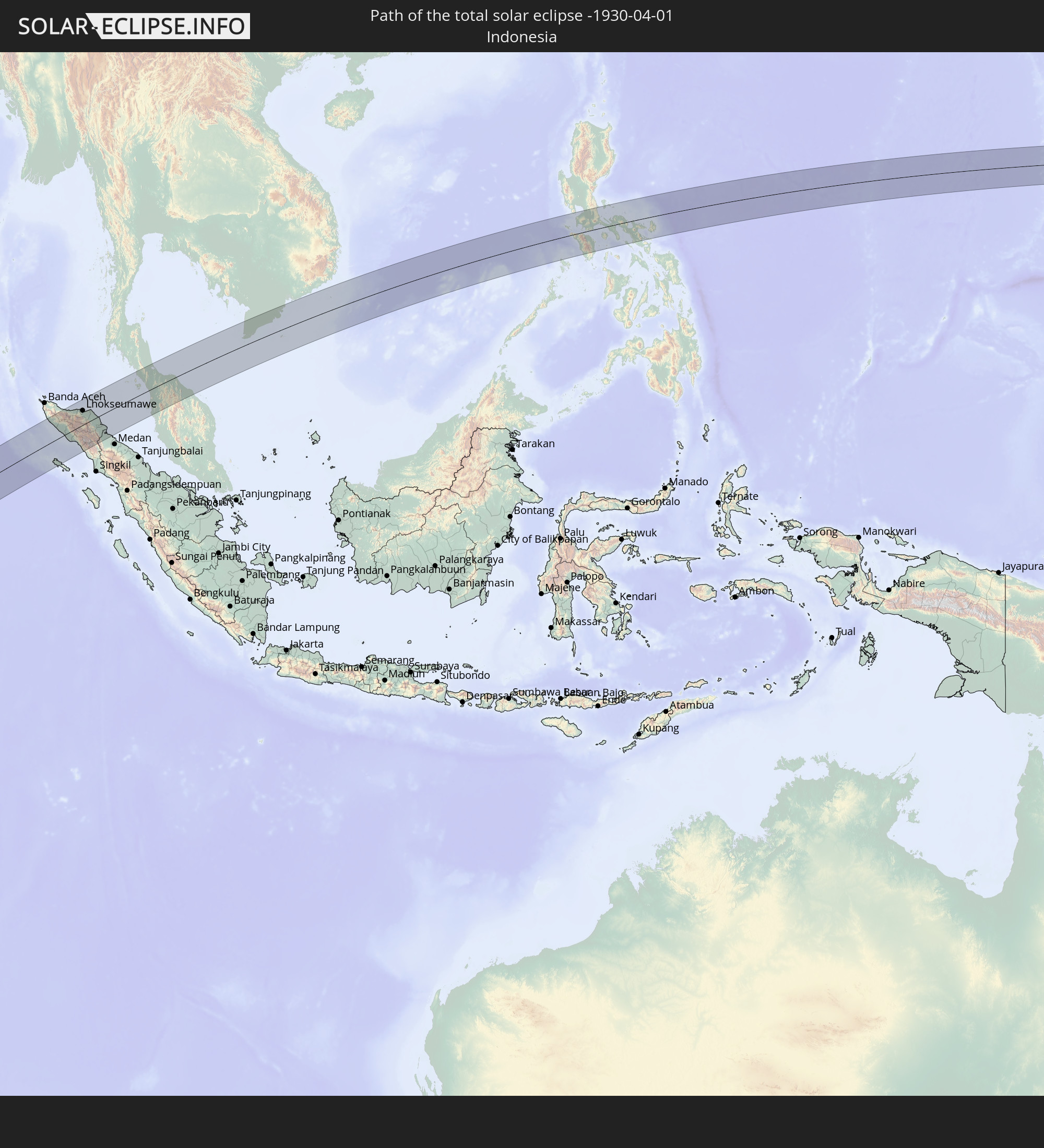 Indonesia
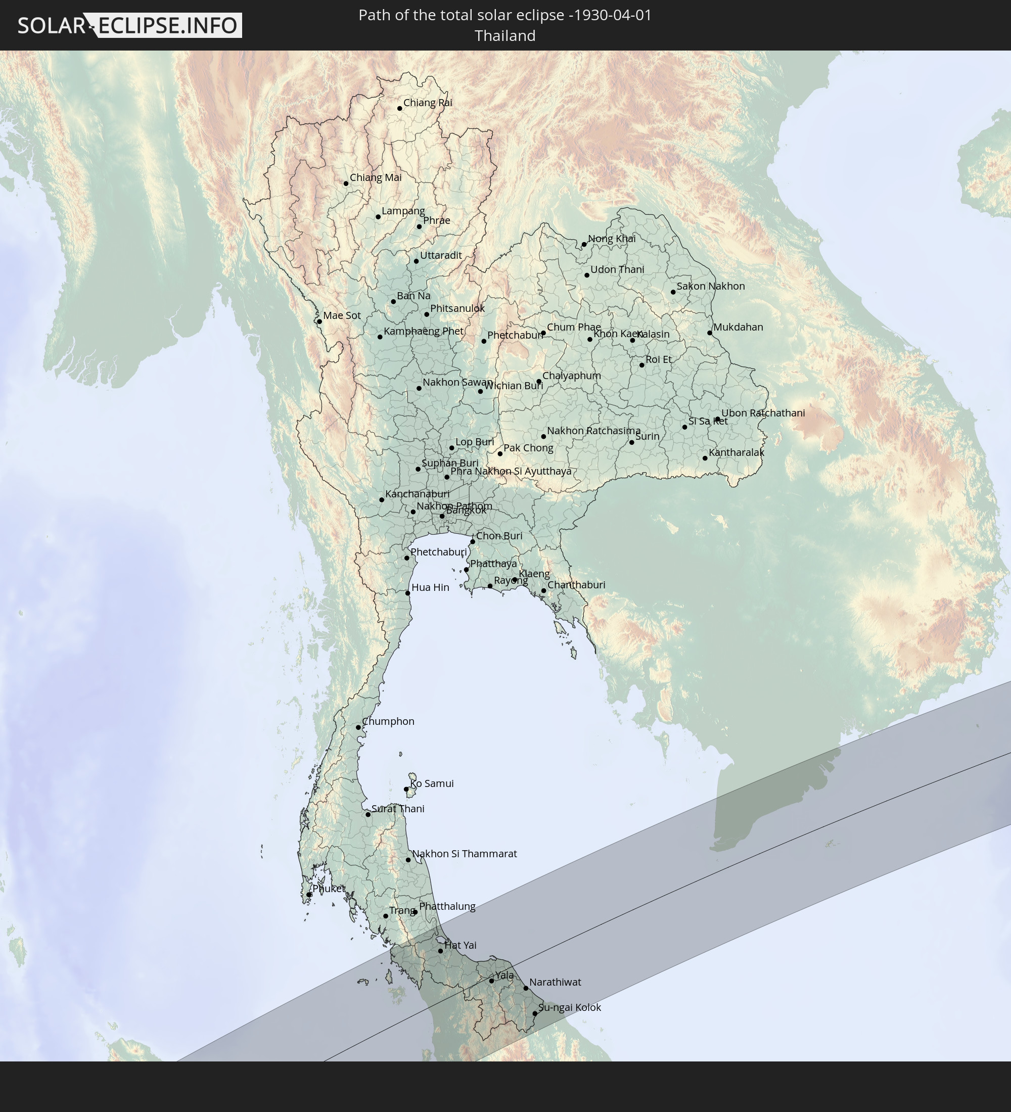 Thailand
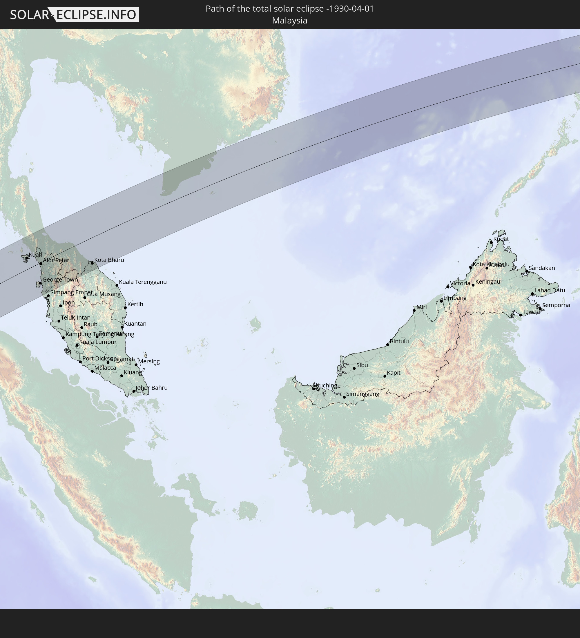 Malaysia
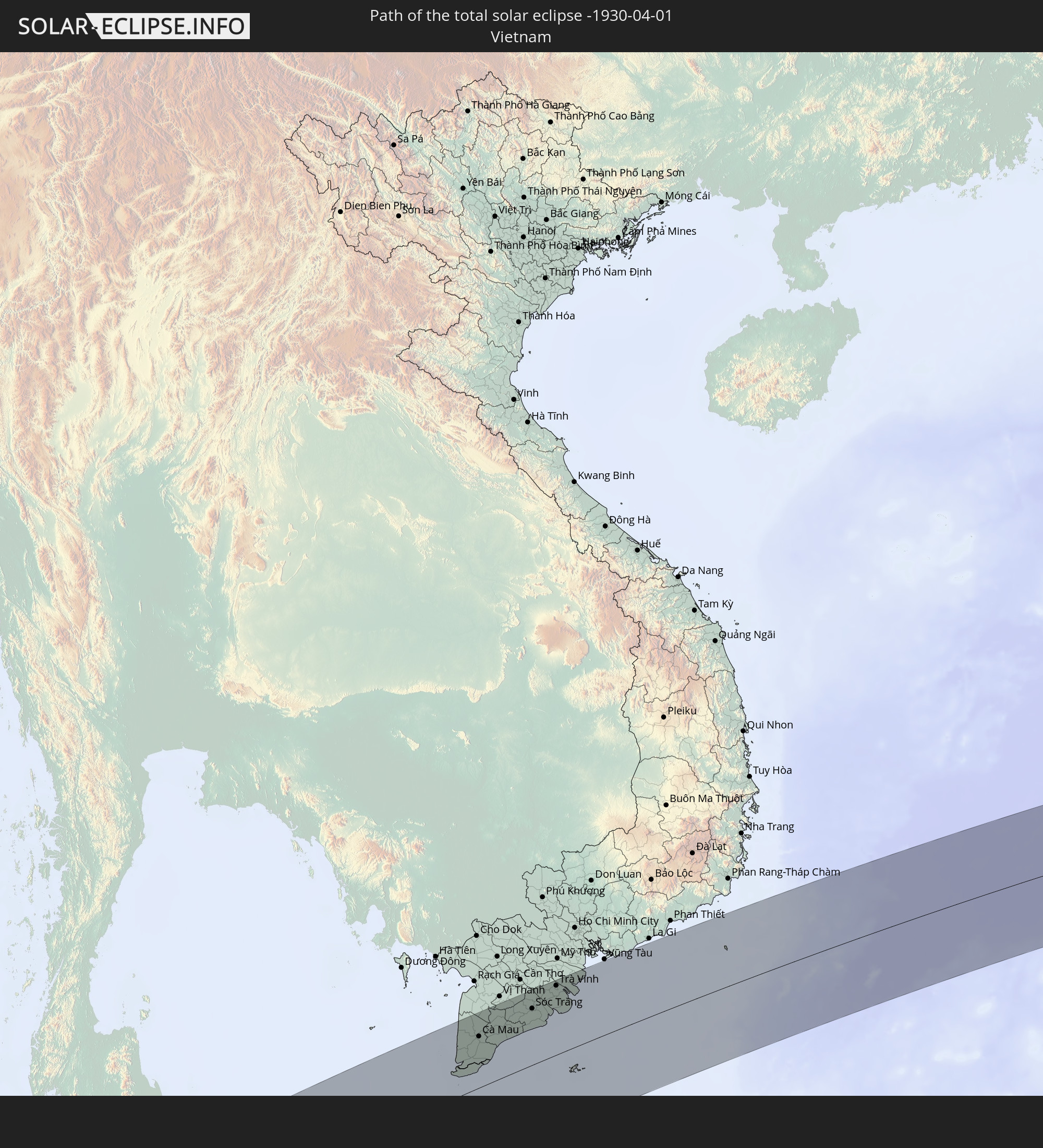 Vietnam
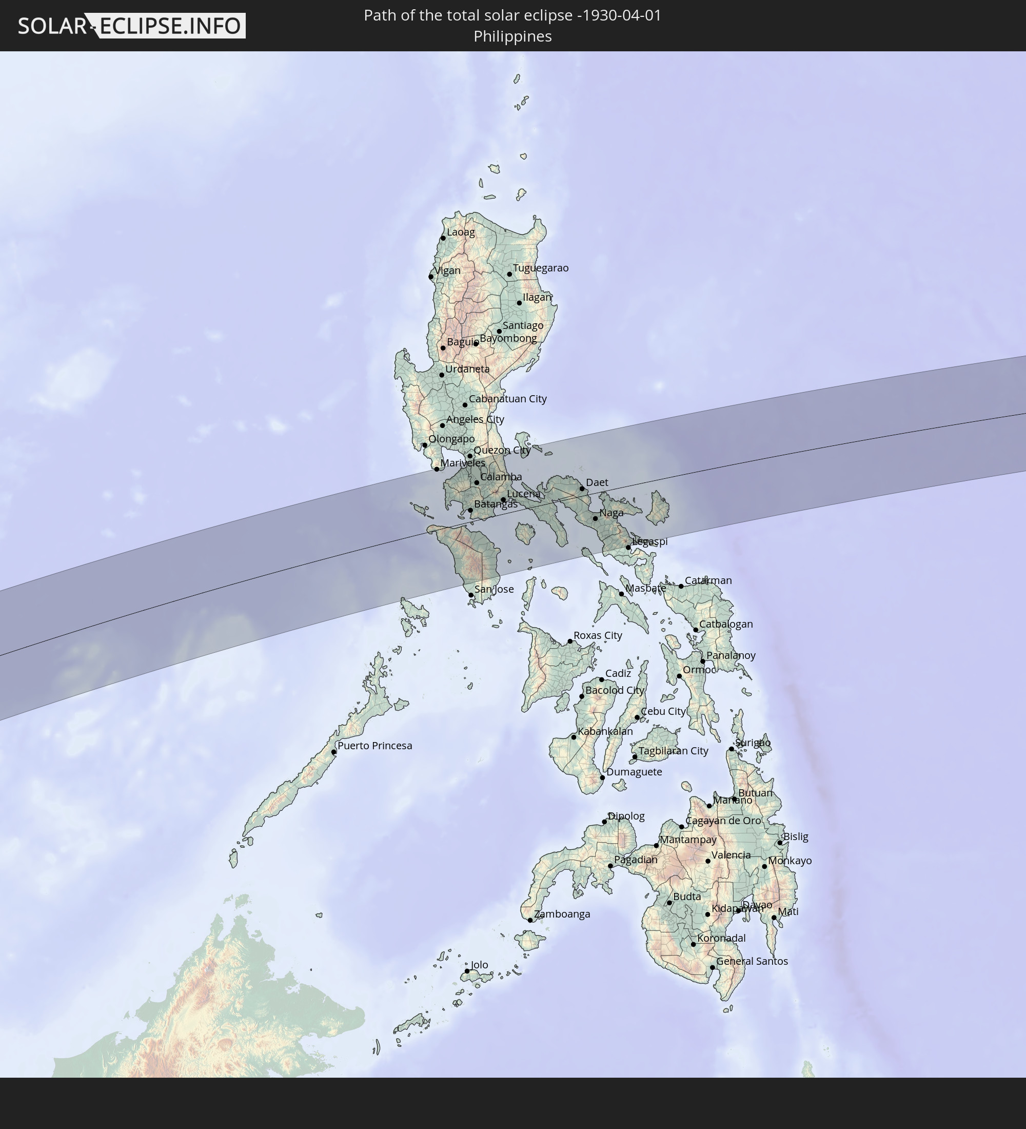 Philippines
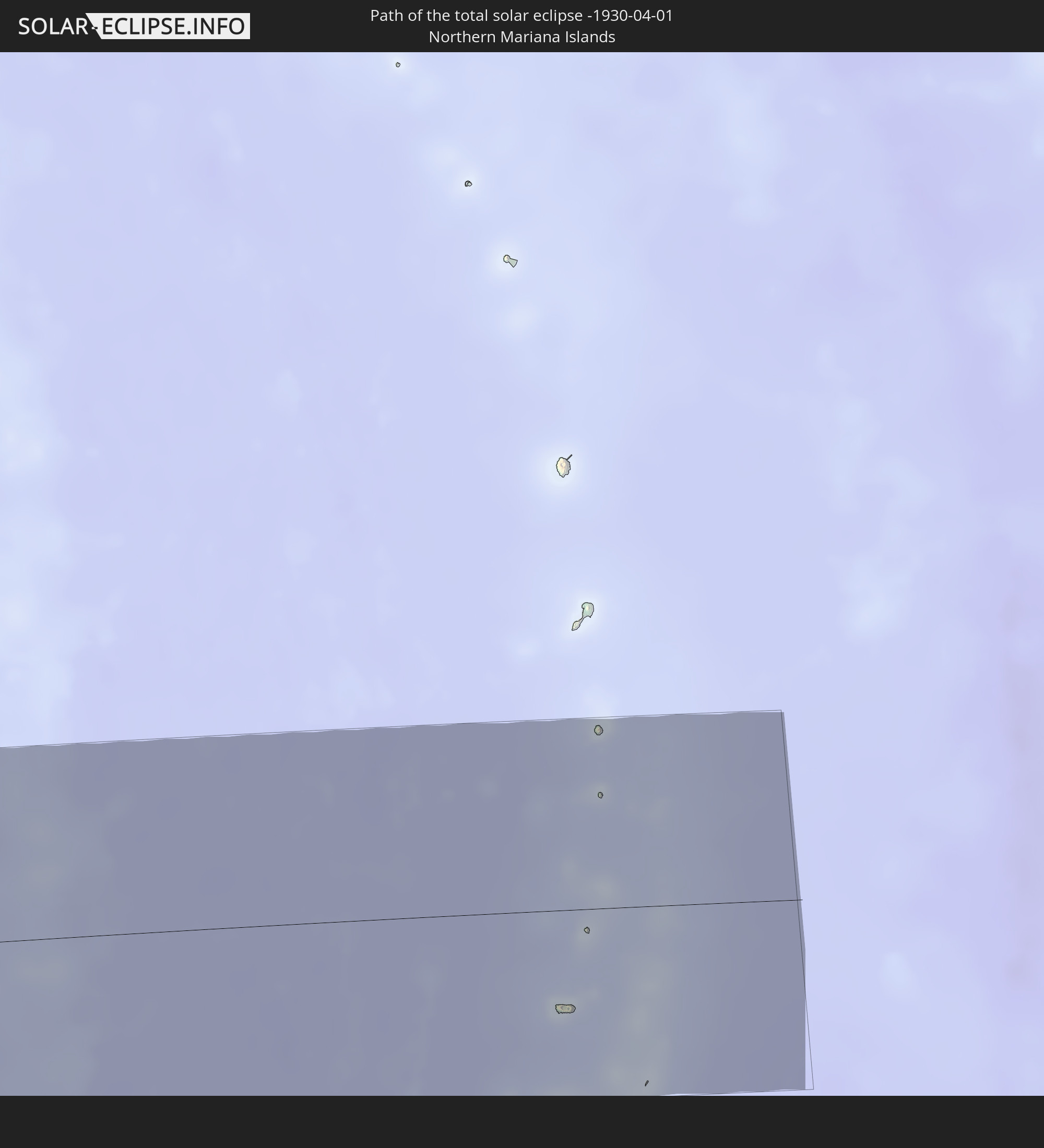 Northern Mariana Islands
In den folgenden Ländern ist die Sonnenfinsternis partiell zu sehen
 Russia
 Republic of the Congo
 Angola
 Namibia
 Democratic Republic of the Congo
 Chad
Chad
 Central African Republic
 South Africa
 Botswana
 Sudan
Sudan
 Zambia
 Zimbabwe
 Lesotho
 Rwanda
 Burundi
 Tanzania
 Uganda
 Mozambique
 Swaziland
 Malawi
 Ethiopia
 Kenya
Kenya
 Eritrea
 French Southern and Antarctic Lands
 Somalia
 Djibouti
 Yemen
Yemen
 Madagascar
 Comoros
 Mayotte
 Seychelles
 Oman
Oman
 Réunion
 Mauritius
 Pakistan
 India
India
 British Indian Ocean Territory
 Maldives
 China
China
 Sri Lanka
 Nepal
Nepal
 Mongolia
 Bangladesh
 Bhutan
 Myanmar
 Indonesia
 Cocos Islands
 Thailand
 Malaysia
 Laos
Laos
 Vietnam
 Cambodia
 Singapore
 Christmas Island
 Australia
 Macau
Macau
 Hong Kong
 Brunei
 Taiwan
 Philippines
 Japan
Japan
 East Timor
 North Korea
 South Korea
 Palau
Palau
 Federated States of Micronesia
 Papua New Guinea
 Guam
Guam
 Northern Mariana Islands
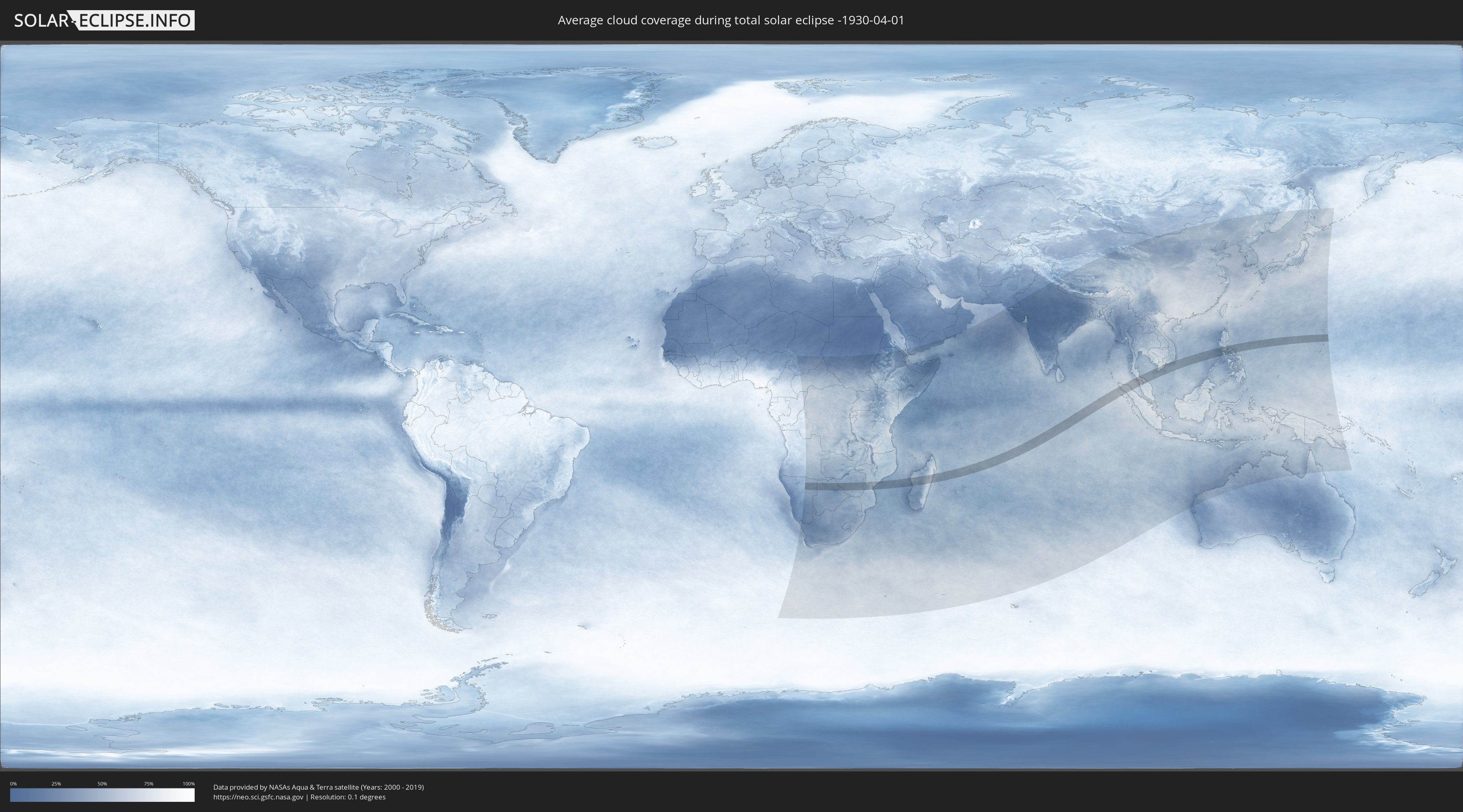
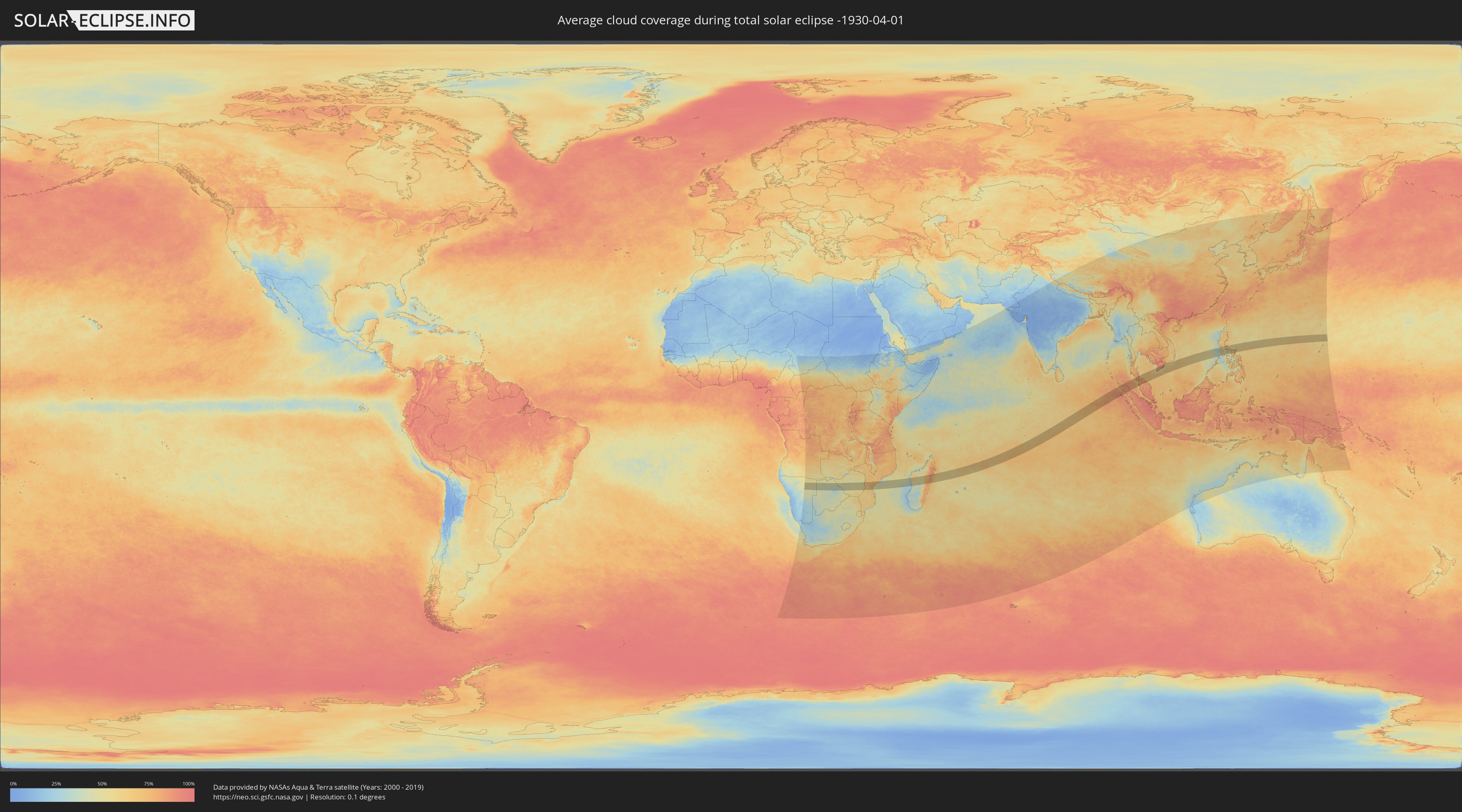
How will be the weather during the total solar eclipse on 04/01/-1930?
Where is the best place to see the total solar eclipse of 04/01/-1930?
The following maps show the average cloud coverage for the day of the total solar eclipse.
With the help of these maps, it is possible to find the place along the eclipse path, which has the best
chance of a cloudless sky.
Nevertheless, you should consider local circumstances and inform about the weather of your chosen
observation site.
The data is provided by NASAs satellites
AQUA and TERRA.
The cloud maps are averaged over a period of 19 years (2000 - 2019).
Detailed country maps
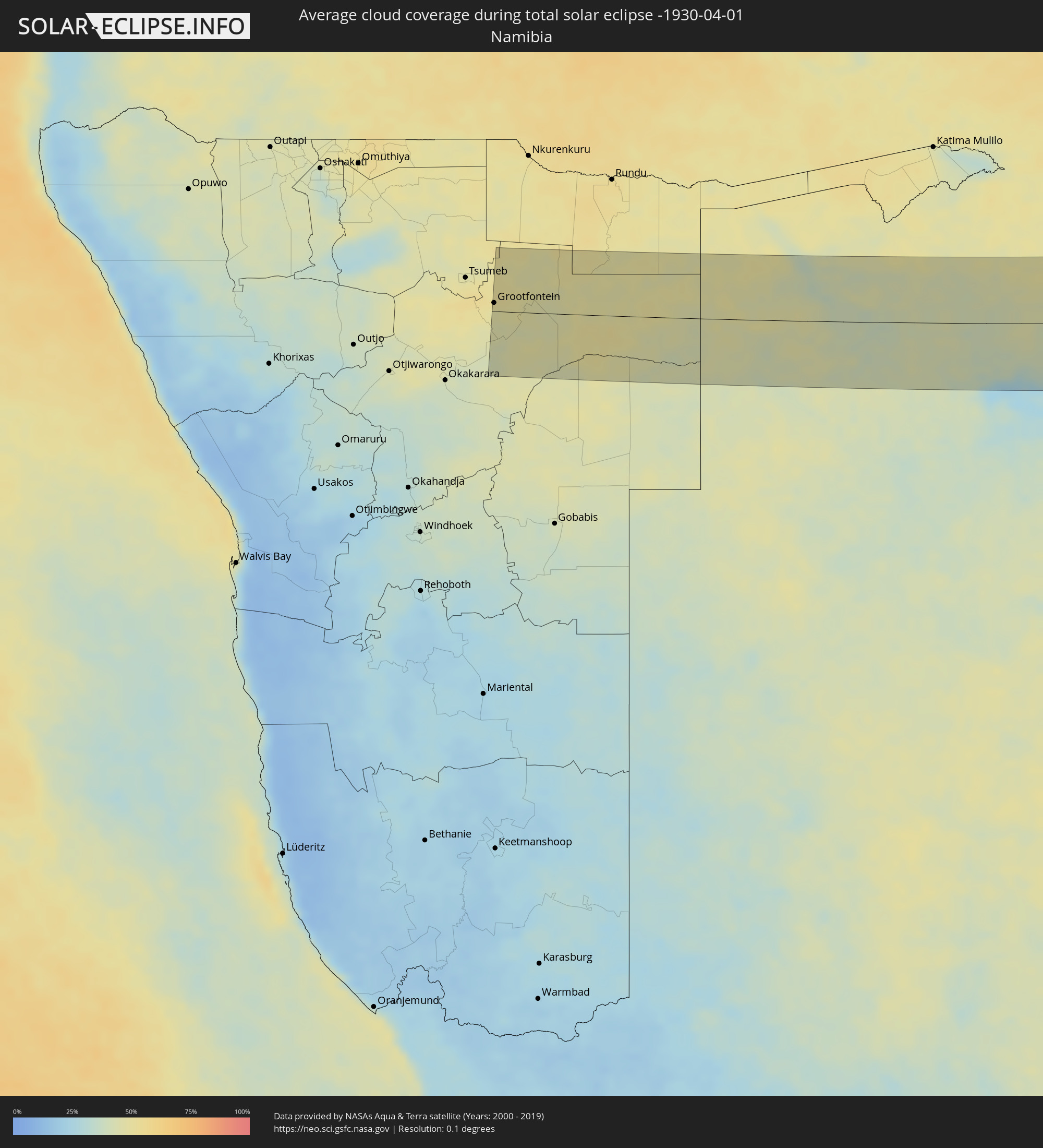 Namibia
 Botswana
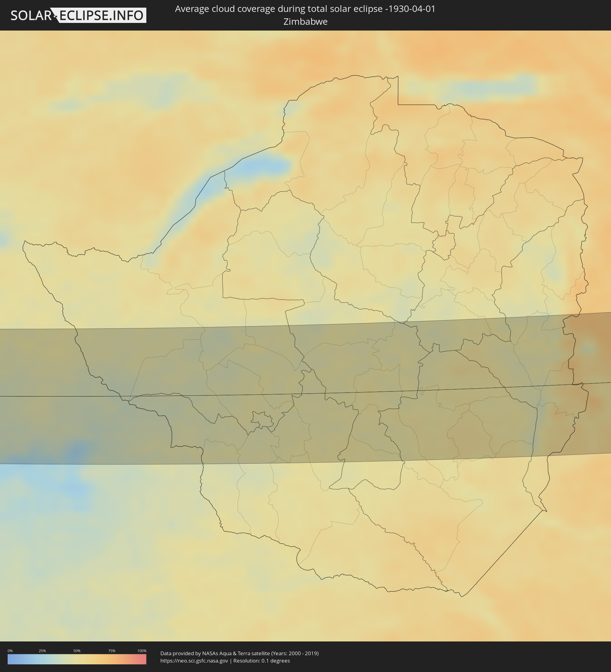 Zimbabwe
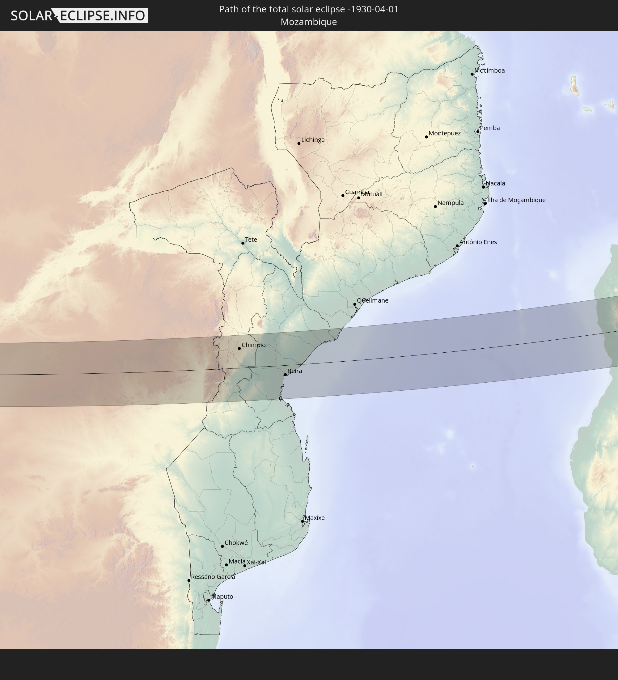
 Mozambique
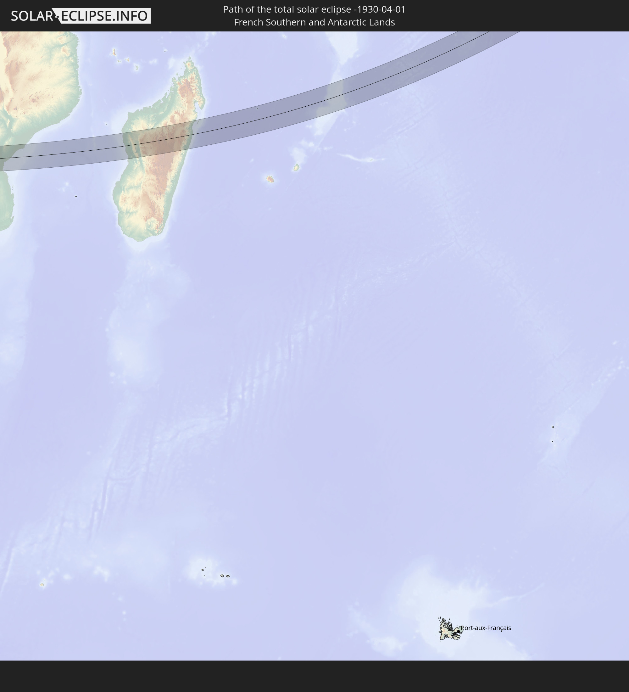
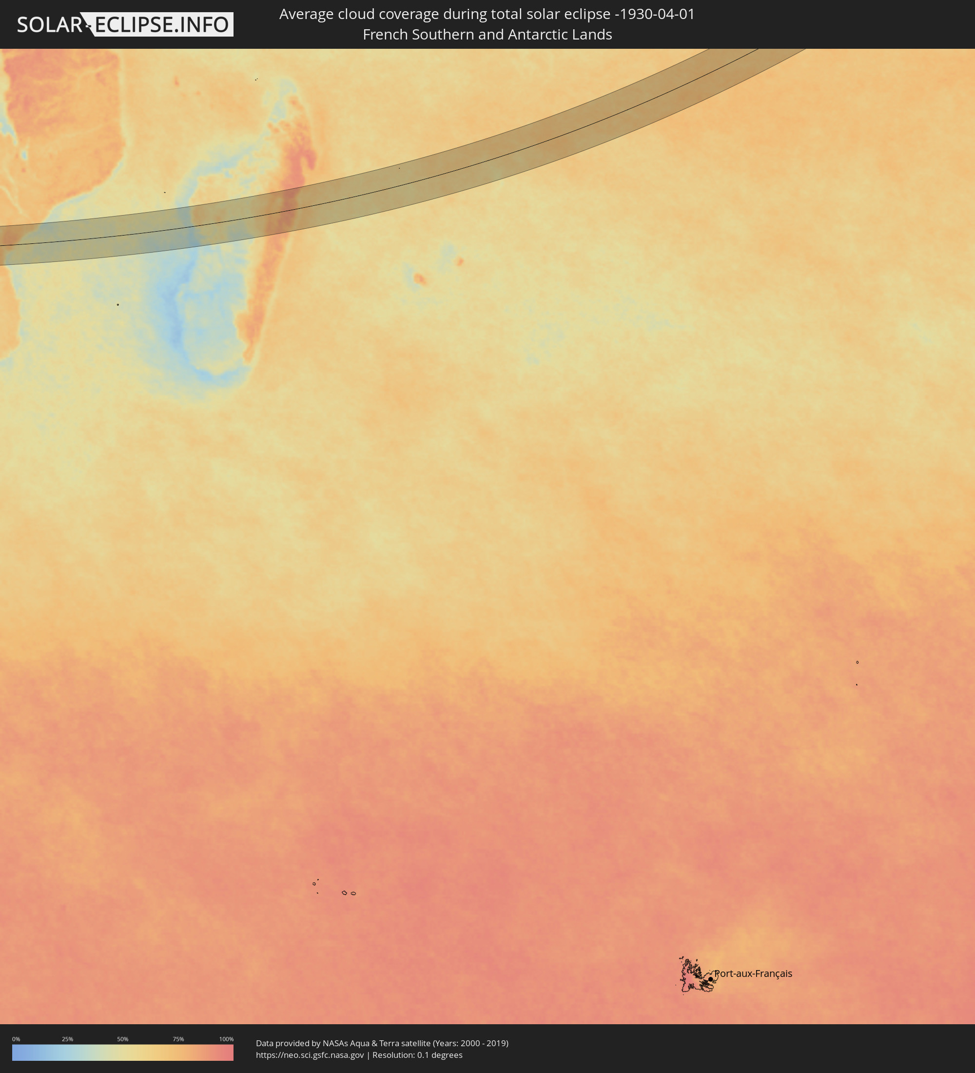 French Southern and Antarctic Lands
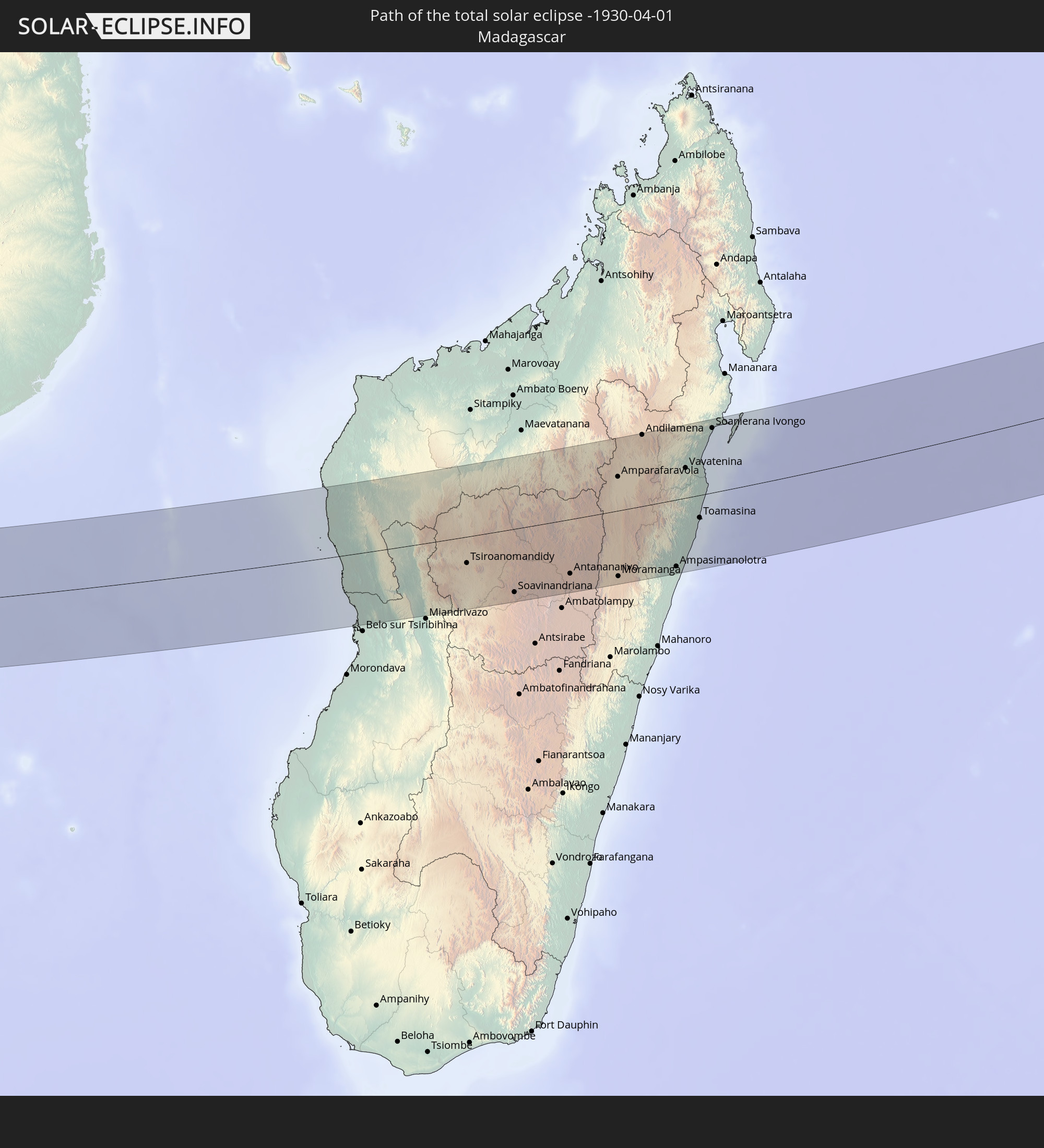
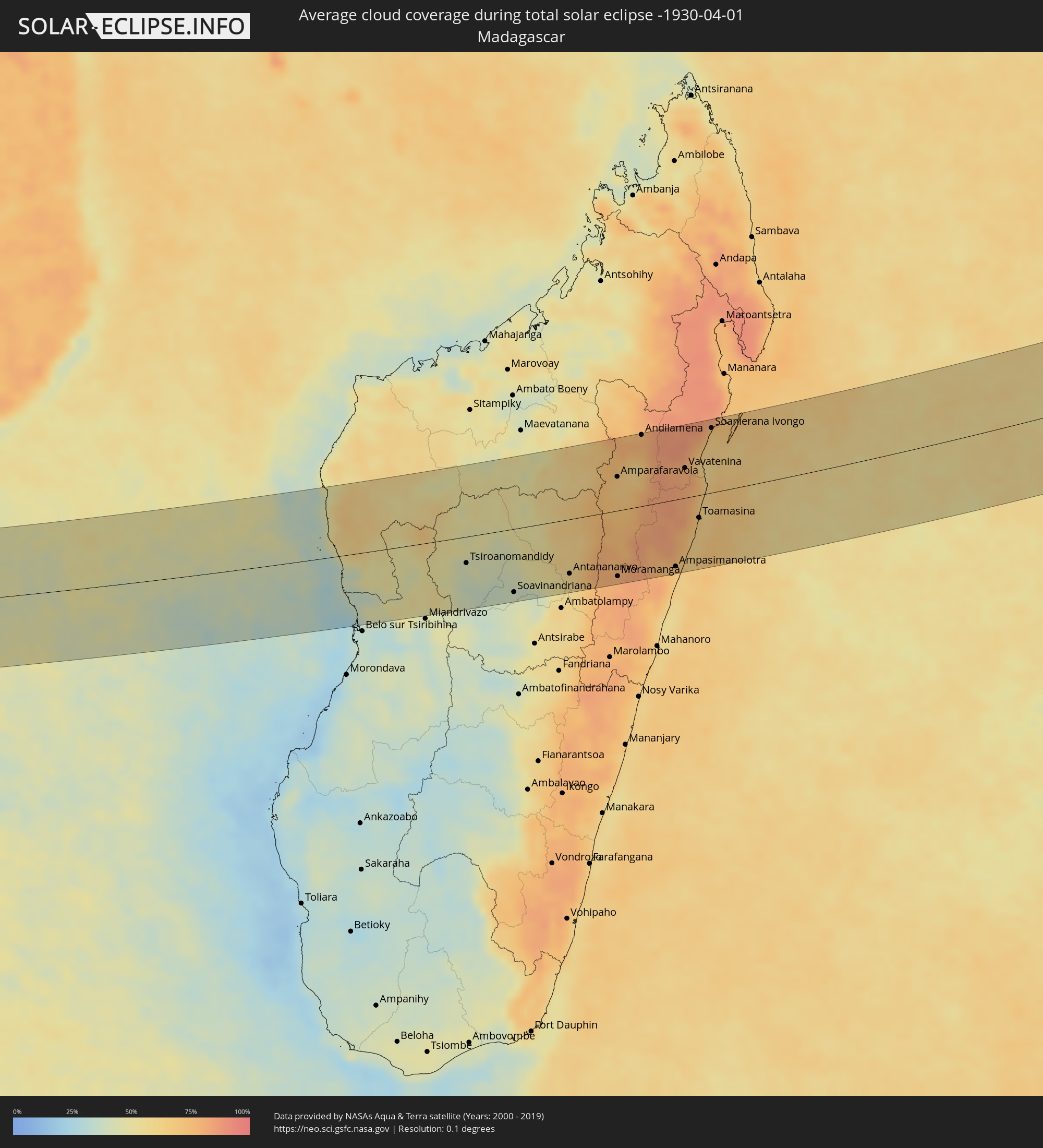 Madagascar
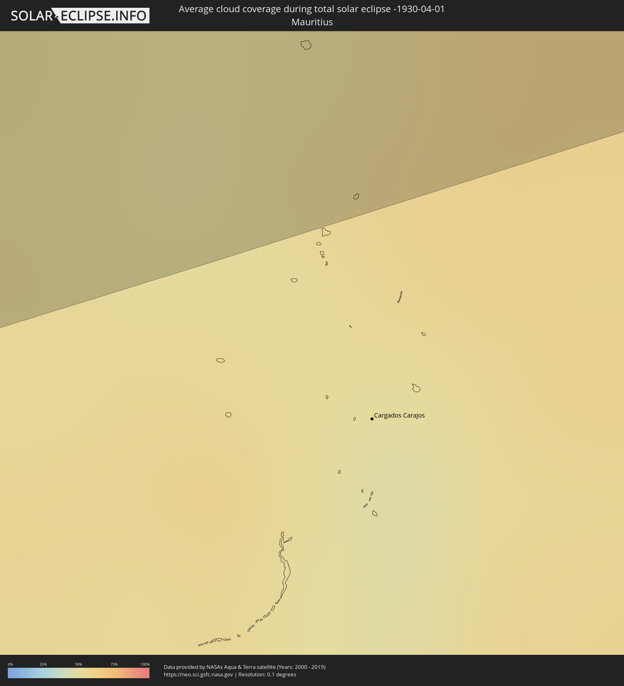 Mauritius
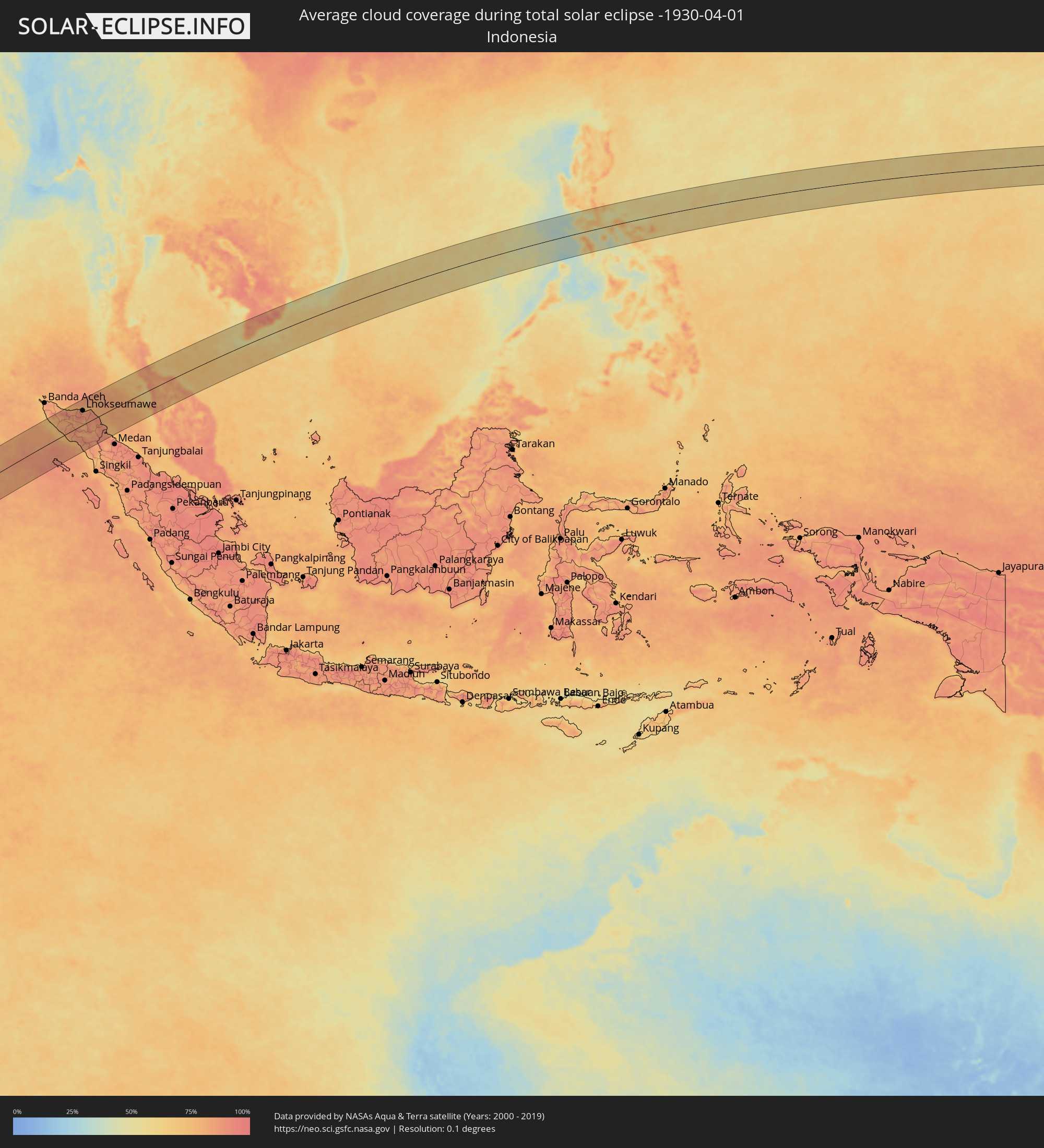 Indonesia
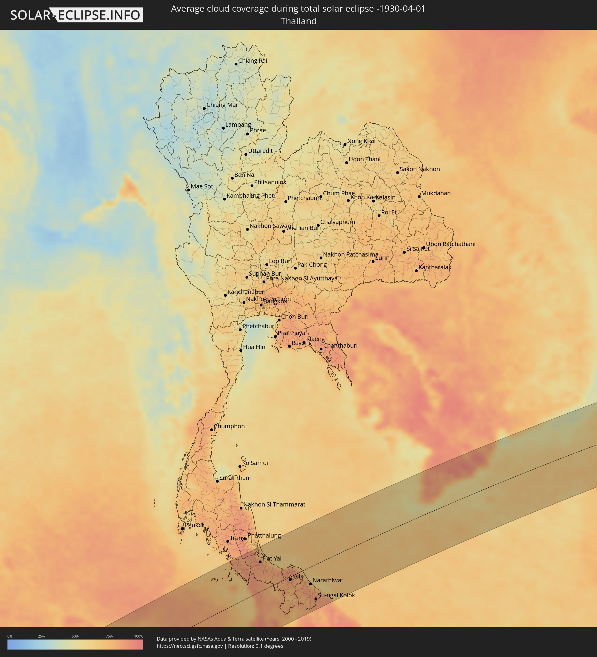 Thailand
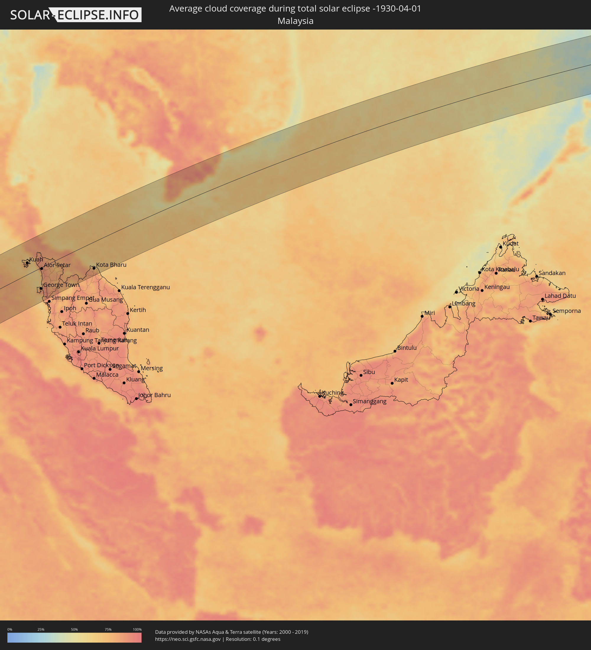 Malaysia
 Vietnam
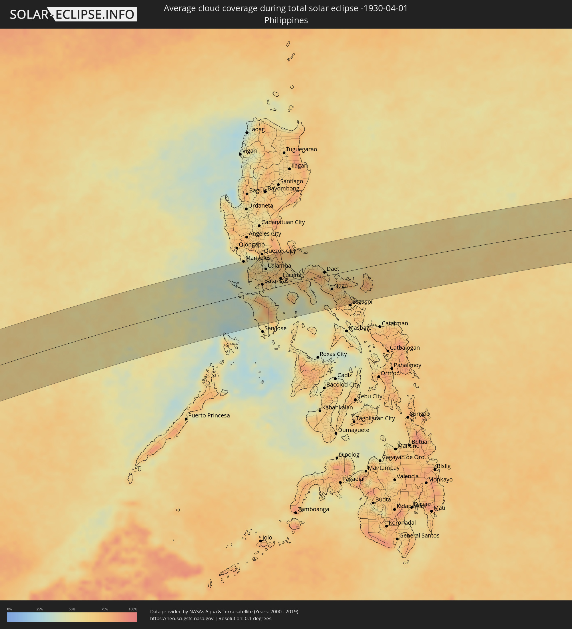 Philippines
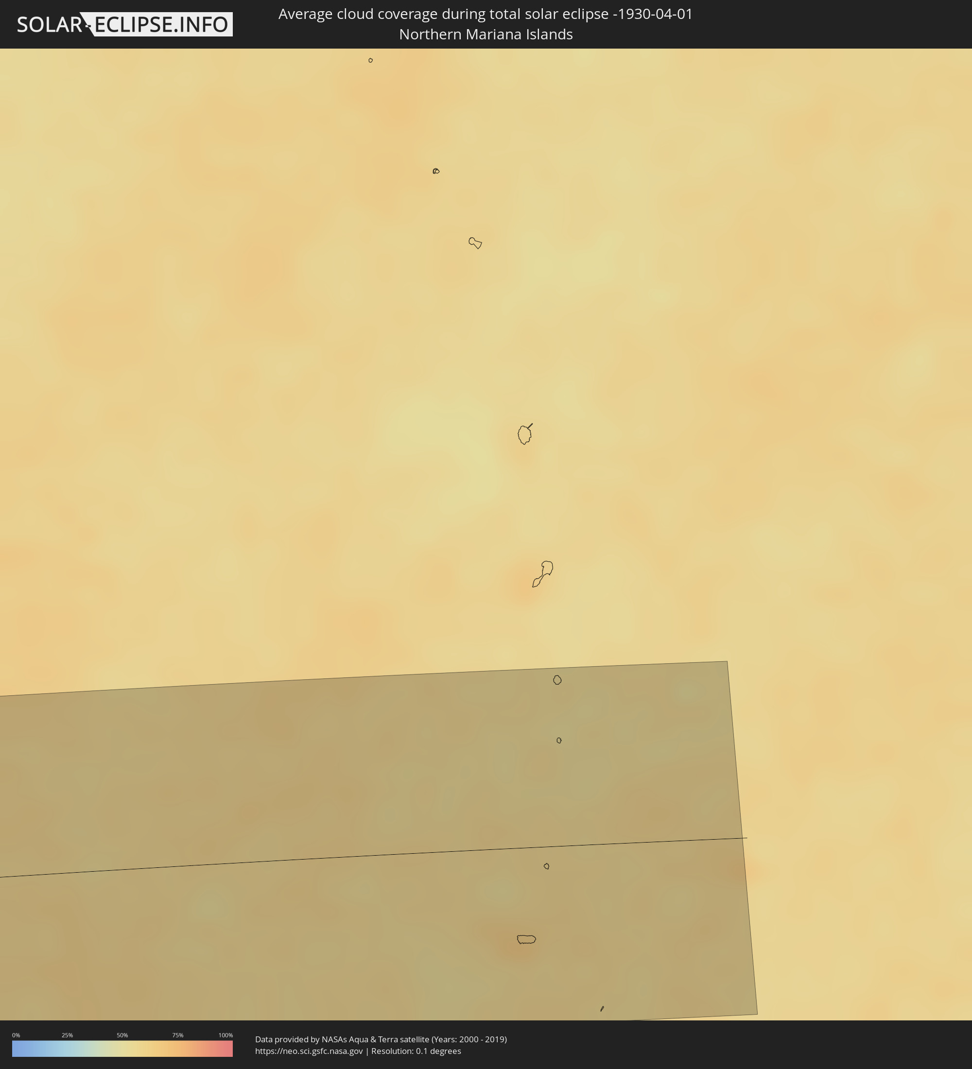 Northern Mariana Islands
Cities inside the path of the eclipse
The following table shows all locations with a population of more than 5,000 inside the eclipse path. Cities which have more than 100,000 inhabitants are marked bold. A click at the locations opens a detailed map.
| City | Type | Eclipse duration | Local time of max. eclipse | Distance to central line | Ø Cloud coverage |
|
Grootfontein, Otjozondjupa
|
total | - | 06:23:23 UTC+01:30 | 12 km | 46% |
|
Maun, North-West
|
total | - | 07:04:09 UTC+02:10 | 18 km | 41% |
|
Chimoio, Manica
|
total | - | 07:07:25 UTC+02:10 | 59 km | 66% |
|
Dondo, Sofala
|
total | - | 07:08:05 UTC+02:10 | 3 km | 66% |
|
Beira, Sofala
|
total | - | 07:08:07 UTC+02:10 | 30 km | 55% |
|
Maintirano, Melaky
|
total | - | 07:32:10 UTC+02:27 | 70 km | 38% |
|
Tsiroanomandidy, Bongolava
|
total | - | 07:34:01 UTC+02:27 | 39 km | 42% |
|
Fenoarivo Be, Bongolava
|
total | - | 07:34:38 UTC+02:27 | 11 km | 44% |
|
Soavinandriana, Itasy
|
total | - | 07:34:39 UTC+02:27 | 95 km | 41% |
|
Ankazobe, Analamanga
|
total | - | 07:35:16 UTC+02:27 | 8 km | 50% |
|
Arivonimamo, Itasy
|
total | - | 07:35:09 UTC+02:27 | 86 km | 47% |
|
Antananarivo, Analamanga
|
total | - | 07:35:34 UTC+02:27 | 81 km | 55% |
|
Ambohitrolomahitsy, Analamanga
|
total | - | 07:35:47 UTC+02:27 | 61 km | 66% |
|
Sadabe, Analamanga
|
total | - | 07:35:49 UTC+02:27 | 54 km | 64% |
|
Alarobia, Analamanga
|
total | - | 07:35:46 UTC+02:27 | 91 km | 64% |
|
Ankazondandy, Analamanga
|
total | - | 07:35:54 UTC+02:27 | 63 km | 72% |
|
Manjakandriana, Analamanga
|
total | - | 07:35:51 UTC+02:27 | 87 km | 72% |
|
Anjozorobe, Analamanga
|
total | - | 07:36:04 UTC+02:27 | 31 km | 75% |
|
Amparafaravola, Alaotra Mangoro
|
total | - | 07:36:43 UTC+02:27 | 51 km | 68% |
|
Moramanga, Alaotra Mangoro
|
total | - | 07:36:20 UTC+02:27 | 98 km | 78% |
|
Ambatondrazaka, Alaotra Mangoro
|
total | - | 07:36:52 UTC+02:27 | 20 km | 69% |
|
Andilamena, Alaotra Mangoro
|
total | - | 07:37:19 UTC+02:27 | 107 km | 78% |
|
Vohibinany, Atsinanana
|
total | - | 07:37:45 UTC+02:27 | 61 km | 80% |
|
Ampasimanolotra, Atsinanana
|
total | - | 07:37:20 UTC+02:27 | 100 km | 66% |
|
Vavatenina, Analanjirofo
|
total | - | 07:37:54 UTC+02:27 | 45 km | 80% |
|
Toamasina, Atsinanana
|
total | - | 07:37:55 UTC+02:27 | 34 km | 67% |
|
Fenoarivo Atsinanana, Analanjirofo
|
total | - | 07:38:11 UTC+02:27 | 50 km | 68% |
|
Soanierana Ivongo, Analanjirofo
|
total | - | 07:38:34 UTC+02:27 | 97 km | 66% |
|
Meulaboh, Aceh
|
total | - | 14:25:58 UTC+07:07 | 20 km | 71% |
|
Reuleuet, Aceh
|
total | - | 14:27:45 UTC+07:07 | 116 km | 87% |
|
Bireun, Aceh
|
total | - | 14:28:39 UTC+07:07 | 92 km | 86% |
|
Lhokseumawe, Aceh
|
total | - | 14:29:36 UTC+07:07 | 66 km | 82% |
|
Langsa, Aceh
|
total | - | 14:30:26 UTC+07:07 | 47 km | 88% |
|
Pangkalan Brandan, North Sumatra
|
total | - | 14:30:31 UTC+07:07 | 107 km | 88% |
|
Tanjungtiram, North Sumatra
|
total | - | 14:30:46 UTC+07:07 | 108 km | 79% |
|
Pantai Cenang, Perlis
|
total | - | 14:24:40 UTC+06:55 | 43 km | 74% |
|
Kuah, Kedah
|
total | - | 14:24:56 UTC+06:55 | 41 km | 74% |
|
Satun, Satun
|
total | - | 14:12:24 UTC+06:42 | 59 km | 76% |
|
Kuala Perlis, Perlis
|
total | - | 14:25:37 UTC+06:55 | 34 km | 68% |
|
Kangar, Perlis
|
total | - | 14:25:48 UTC+06:55 | 35 km | 85% |
|
Kuala Kedah, Kedah
|
total | - | 14:25:36 UTC+06:55 | 4 km | 73% |
|
Tanjung Tokong, Penang
|
total | - | 14:24:50 UTC+06:55 | 68 km | 79% |
|
George Town, Penang
|
total | - | 14:24:50 UTC+06:55 | 75 km | 86% |
|
Alor Setar, Kedah
|
total | - | 14:25:45 UTC+06:55 | 5 km | 87% |
|
Permatang Kuching, Penang
|
total | - | 14:24:59 UTC+06:55 | 72 km | 86% |
|
Jitra, Kedah
|
total | - | 14:26:03 UTC+06:55 | 6 km | 87% |
|
Sadao, Songkhla
|
total | - | 14:13:09 UTC+06:42 | 43 km | 84% |
|
Kepala Batas, Penang
|
total | - | 14:25:09 UTC+06:55 | 69 km | 86% |
|
Bukit Mertajam, Penang
|
total | - | 14:25:02 UTC+06:55 | 86 km | 91% |
|
Gurun, Kedah
|
total | - | 14:25:36 UTC+06:55 | 41 km | 84% |
|
Hat Yai, Songkhla
|
total | - | 14:13:41 UTC+06:42 | 77 km | 85% |
|
Nibong Tebal, Penang
|
total | - | 14:24:49 UTC+06:55 | 106 km | 88% |
|
Sungai Petani, Kedah
|
total | - | 14:25:26 UTC+06:55 | 59 km | 89% |
|
Parit Buntar, Perak
|
total | - | 14:24:48 UTC+06:55 | 111 km | 87% |
|
Bedong, Kedah
|
total | - | 14:25:34 UTC+06:55 | 52 km | 85% |
|
Ban Mai, Songkhla
|
total | - | 14:14:03 UTC+06:42 | 94 km | 70% |
|
Na Mom, Songkhla
|
total | - | 14:13:47 UTC+06:42 | 68 km | 81% |
|
Songkhla, Songkhla
|
total | - | 14:14:09 UTC+06:42 | 91 km | 71% |
|
Betong, Yala
|
total | - | 14:13:25 UTC+06:42 | 75 km | 77% |
|
Nong Chik, Pattani
|
total | - | 14:14:53 UTC+06:42 | 27 km | 87% |
|
Pattani, Pattani
|
total | - | 14:15:03 UTC+06:42 | 26 km | 82% |
|
Yala, Yala
|
total | - | 14:14:44 UTC+06:42 | 9 km | 83% |
|
Yaring, Pattani
|
total | - | 14:15:17 UTC+06:42 | 20 km | 77% |
|
Sai Buri, Pattani
|
total | - | 14:15:35 UTC+06:42 | 9 km | 72% |
|
Ra-ngae, Narathiwat
|
total | - | 14:15:20 UTC+06:42 | 55 km | 85% |
|
Narathiwat, Narathiwat
|
total | - | 14:15:40 UTC+06:42 | 46 km | 78% |
|
Ban Su-ngai Pa Di, Narathiwat
|
total | - | 14:15:21 UTC+06:42 | 84 km | 86% |
|
Su-ngai Kolok, Narathiwat
|
total | - | 14:15:29 UTC+06:42 | 93 km | 84% |
|
Tak Bai, Narathiwat
|
total | - | 14:15:56 UTC+06:42 | 74 km | 69% |
|
Pasir Mas, Kelantan
|
total | - | 14:29:12 UTC+06:55 | 99 km | 84% |
|
Tumpat, Kelantan
|
total | - | 14:29:26 UTC+06:55 | 86 km | 80% |
|
Kampong Pangkal Kalong, Kelantan
|
total | - | 14:29:12 UTC+06:55 | 116 km | 83% |
|
Kota Bharu, Kelantan
|
total | - | 14:29:29 UTC+06:55 | 96 km | 83% |
|
Kampong Kadok, Kelantan
|
total | - | 14:29:21 UTC+06:55 | 110 km | 85% |
|
Peringat, Kelantan
|
total | - | 14:29:28 UTC+06:55 | 108 km | 85% |
|
Cà Mau, Cà Mau
|
total | - | 14:49:23 UTC+07:06 | 80 km | 85% |
|
Thành phố Bạc Liêu, Bạc Liêu
|
total | - | 14:50:30 UTC+07:06 | 67 km | 79% |
|
Sóc Trăng, Sóc Trăng
|
total | - | 14:51:12 UTC+07:06 | 88 km | 93% |
|
Trà Vinh, Trà Vinh
|
total | - | 14:52:09 UTC+07:06 | 108 km | 92% |
|
Mariveles, Central Luzon
|
total | - | 16:06:58 UTC+08:00 | 107 km | 42% |
|
Nasugbu, Calabarzon
|
total | - | 16:06:57 UTC+08:00 | 64 km | 62% |
|
Balayan, Calabarzon
|
total | - | 16:06:59 UTC+08:00 | 47 km | 47% |
|
Naic, Calabarzon
|
total | - | 16:07:11 UTC+08:00 | 87 km | 63% |
|
Cavite City, Calabarzon
|
total | - | 16:07:23 UTC+08:00 | 102 km | 56% |
|
Dasmariñas, Calabarzon
|
total | - | 16:07:21 UTC+08:00 | 84 km | 61% |
|
Patuto, Calabarzon
|
total | - | 16:07:17 UTC+08:00 | 61 km | 58% |
|
Batangas, Calabarzon
|
total | - | 16:07:12 UTC+08:00 | 19 km | 65% |
|
Taguig, Calabarzon
|
total | - | 16:07:34 UTC+08:00 | 102 km | 47% |
|
Lipa City, Calabarzon
|
total | - | 16:07:23 UTC+08:00 | 37 km | 62% |
|
Calamba, Calabarzon
|
total | - | 16:07:30 UTC+08:00 | 66 km | 65% |
|
Calapan, Mimaropa
|
total | - | 16:07:10 UTC+08:00 | 21 km | 52% |
|
Tanay, Calabarzon
|
total | - | 16:07:44 UTC+08:00 | 94 km | 52% |
|
San Pablo, Calabarzon
|
total | - | 16:07:36 UTC+08:00 | 46 km | 71% |
|
Santa Cruz, Calabarzon
|
total | - | 16:07:46 UTC+08:00 | 67 km | 59% |
|
Candelaria, Calabarzon
|
total | - | 16:07:37 UTC+08:00 | 29 km | 53% |
|
Pinamalayan, Mimaropa
|
total | - | 16:07:16 UTC+08:00 | 68 km | 52% |
|
Lucena, Calabarzon
|
total | - | 16:07:48 UTC+08:00 | 24 km | 54% |
|
Daet, Bicol
|
total | - | 16:09:04 UTC+08:00 | 12 km | 60% |
|
Naga, Bicol
|
total | - | 16:09:03 UTC+08:00 | 47 km | 72% |
|
Iriga City, Bicol
|
total | - | 16:09:10 UTC+08:00 | 73 km | 69% |
|
Polangui, Bicol
|
total | - | 16:09:10 UTC+08:00 | 90 km | 70% |
|
Tabaco, Bicol
|
total | - | 16:09:24 UTC+08:00 | 88 km | 68% |