Total solar eclipse of 07/12/-1991
| Day of week: | Friday |
| Maximum duration of eclipse: | 05m50s |
| Maximum width of eclipse path: | 205 km |
| Saros cycle: | 14 |
| Coverage: | 100% |
| Magnitude: | 1.0606 |
| Gamma: | -0.2421 |
Wo kann man die Sonnenfinsternis vom 07/12/-1991 sehen?
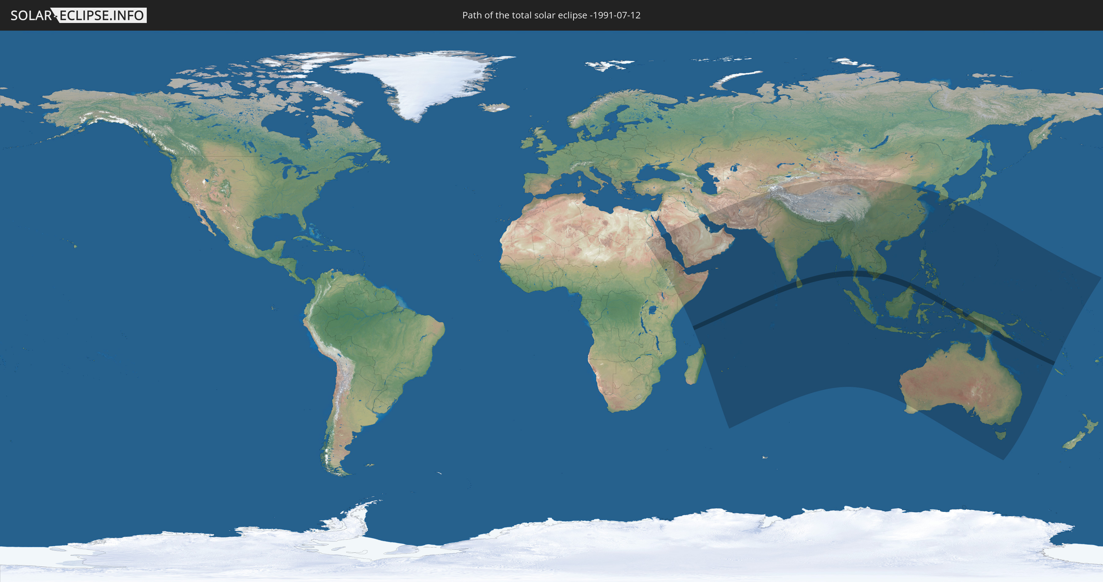
Die Sonnenfinsternis am 07/12/-1991 kann man in 61 Ländern als partielle Sonnenfinsternis beobachten.
Der Finsternispfad verläuft durch 13 Länder. Nur in diesen Ländern ist sie als total Sonnenfinsternis zu sehen.
In den folgenden Ländern ist die Sonnenfinsternis total zu sehen
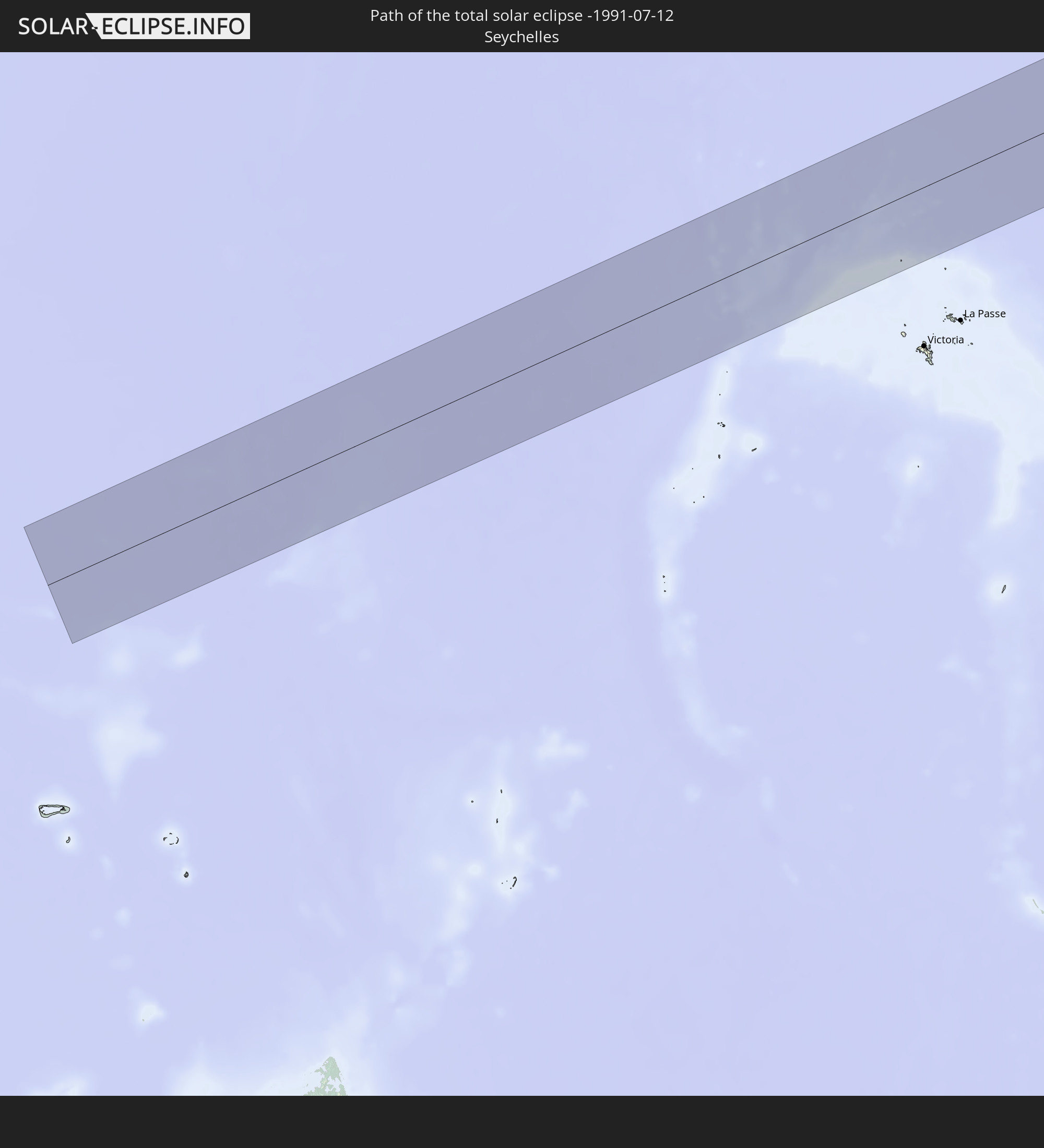 Seychelles
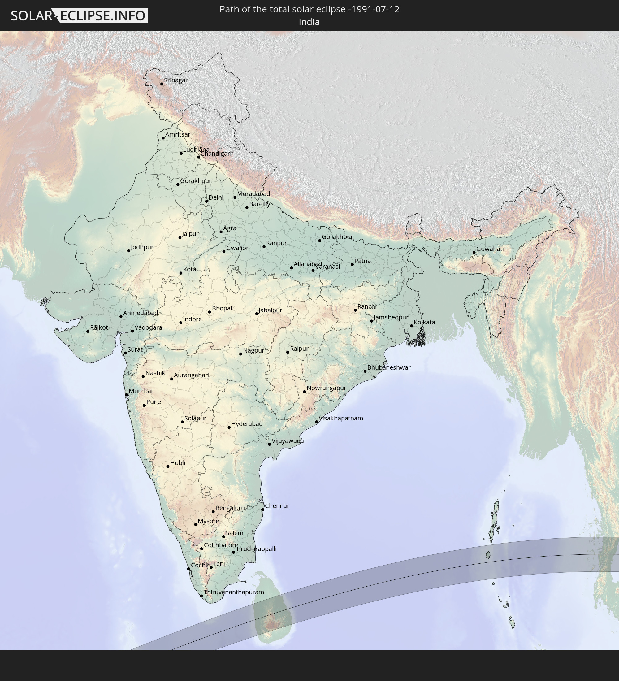 India
India
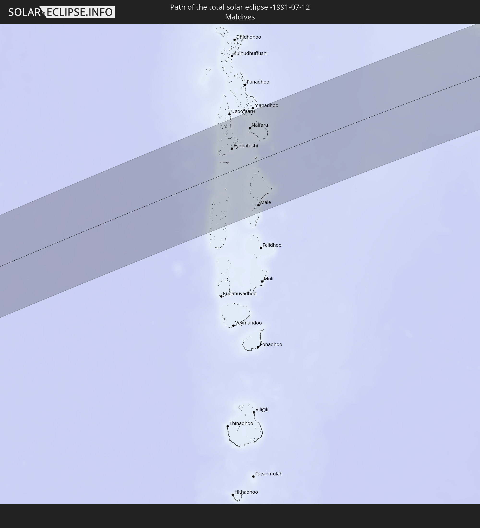 Maldives
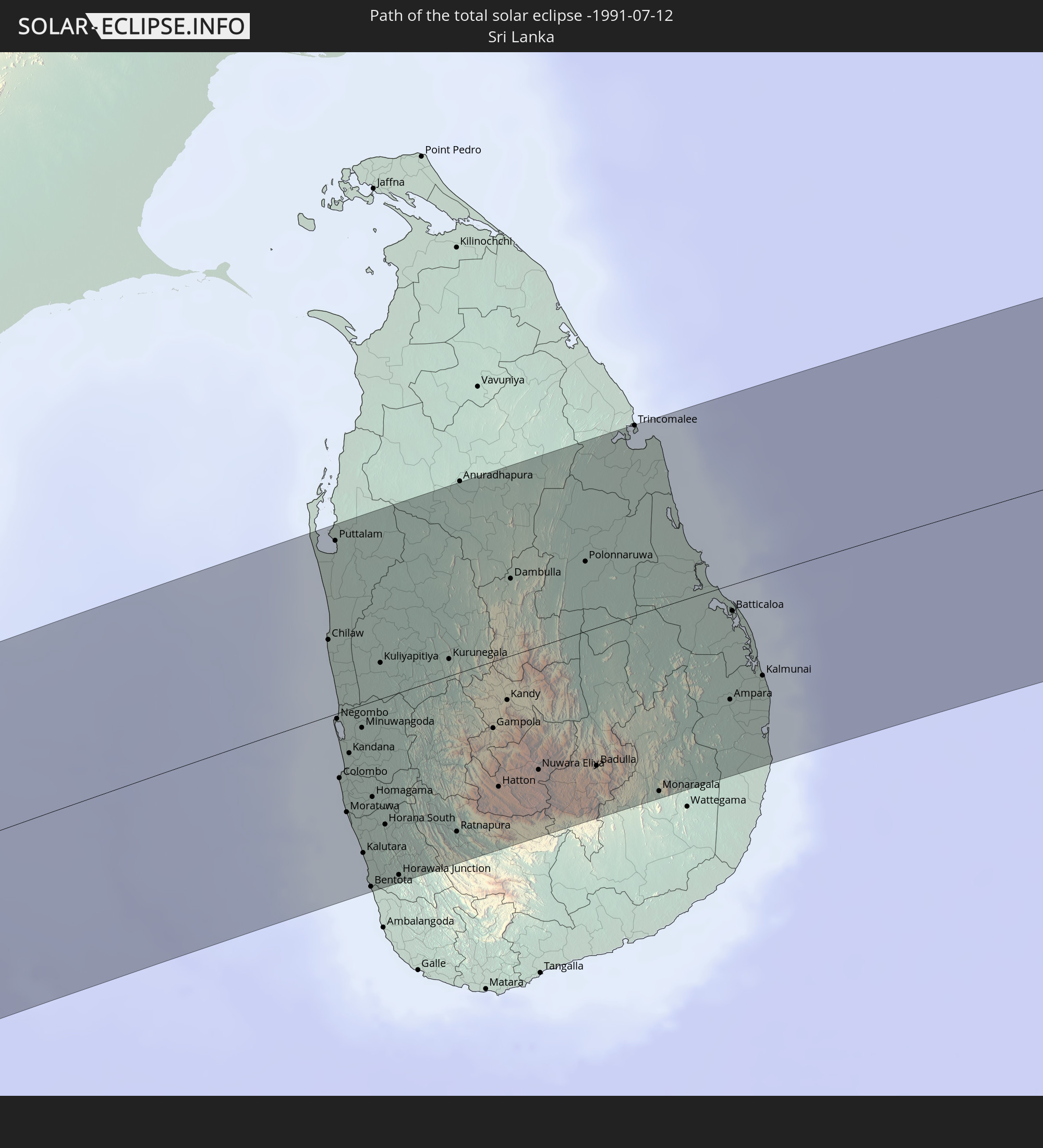 Sri Lanka
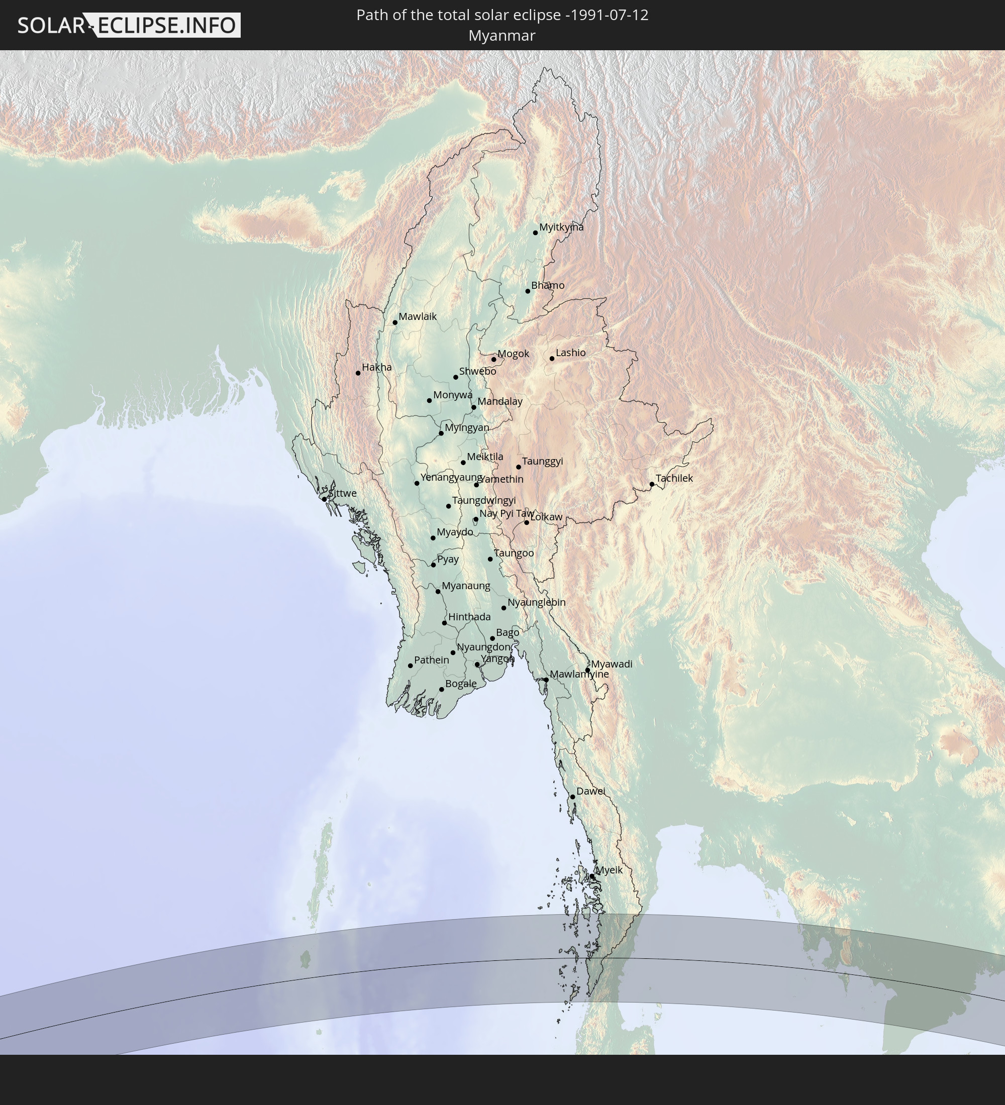 Myanmar
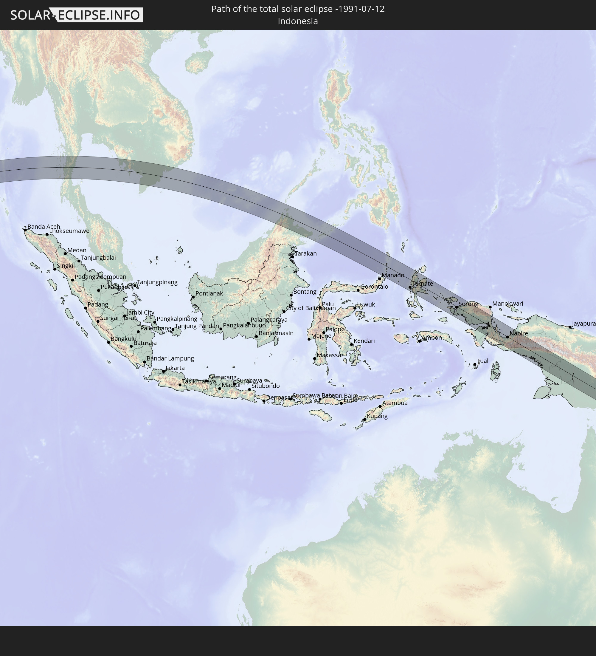 Indonesia
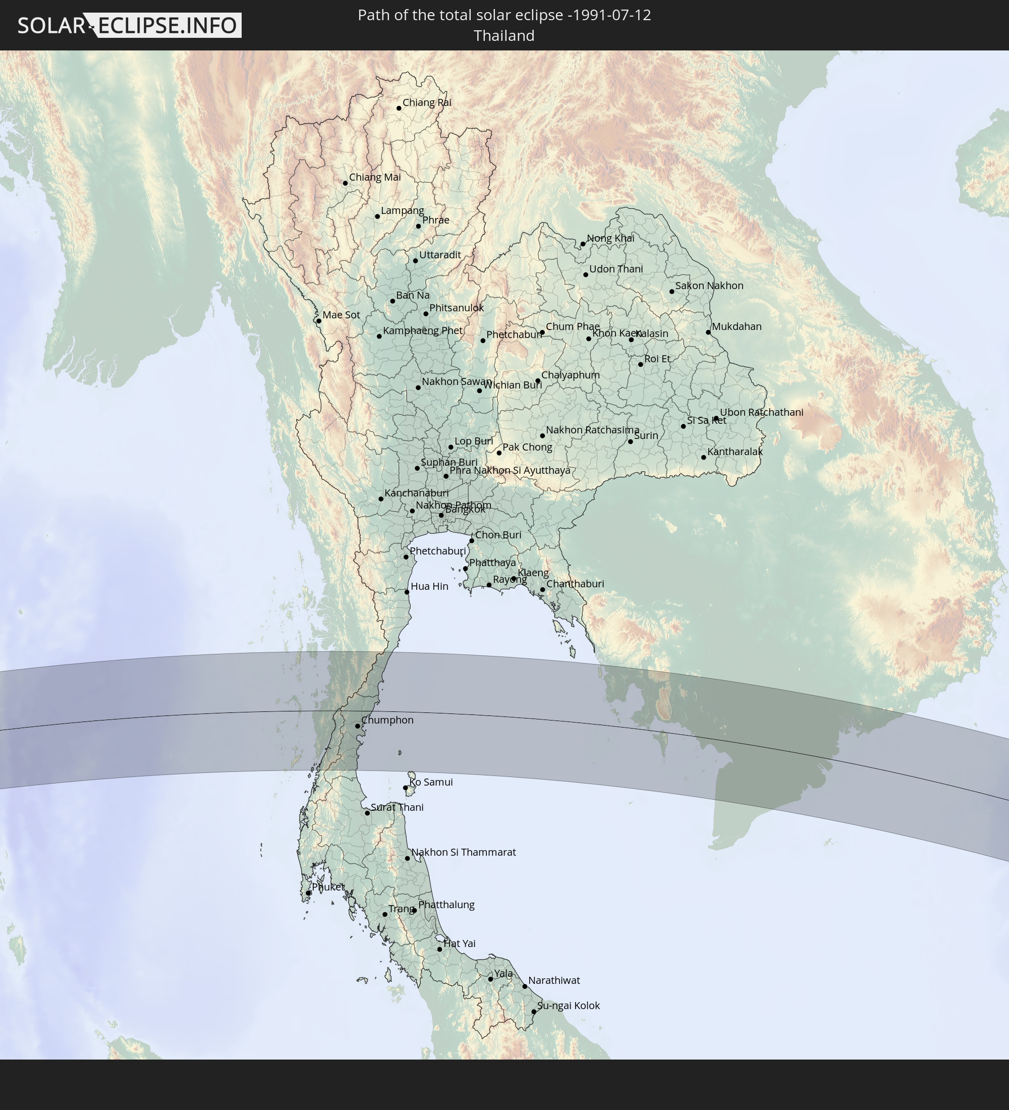 Thailand
 Malaysia
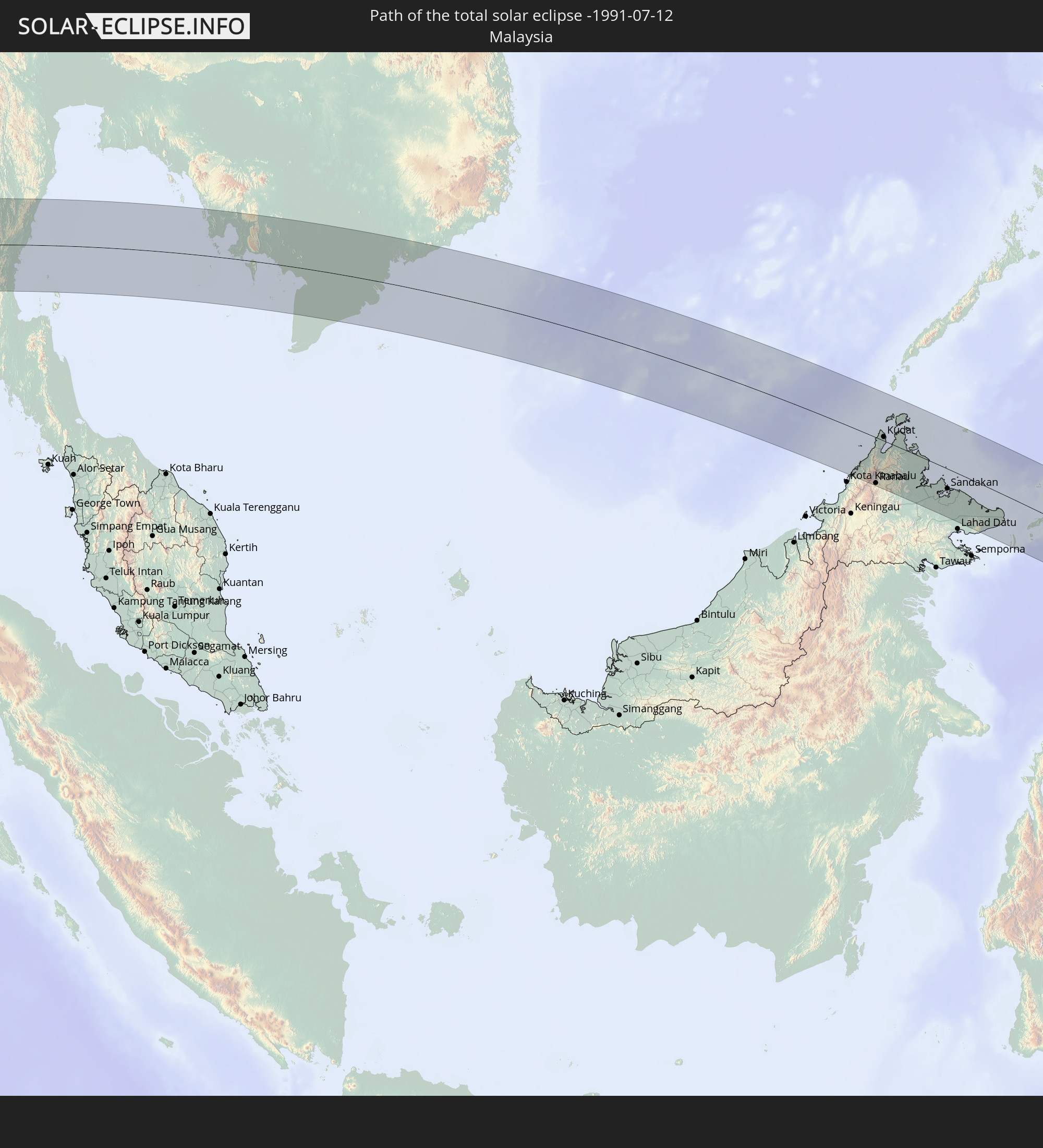
 Vietnam
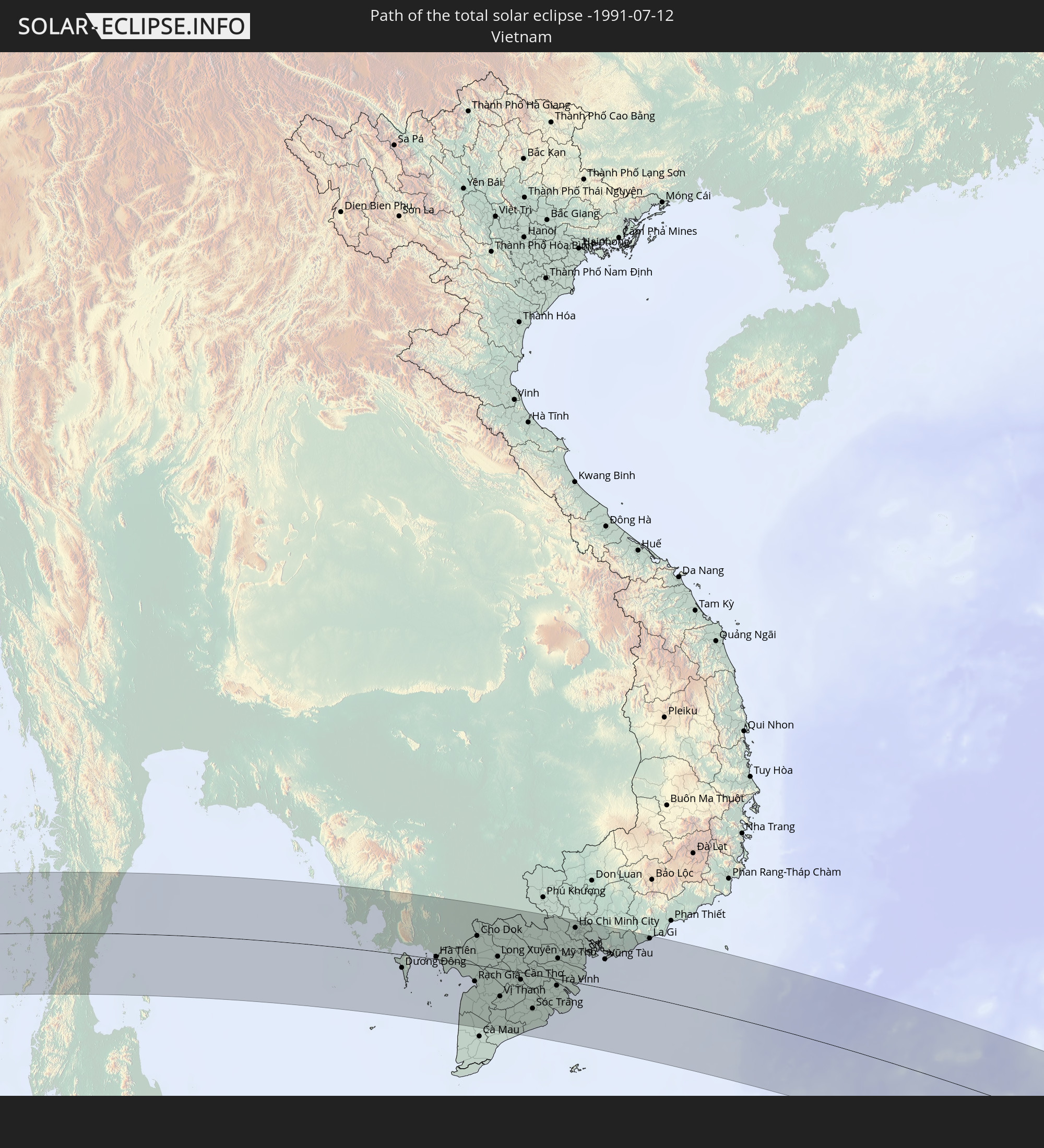
 Cambodia
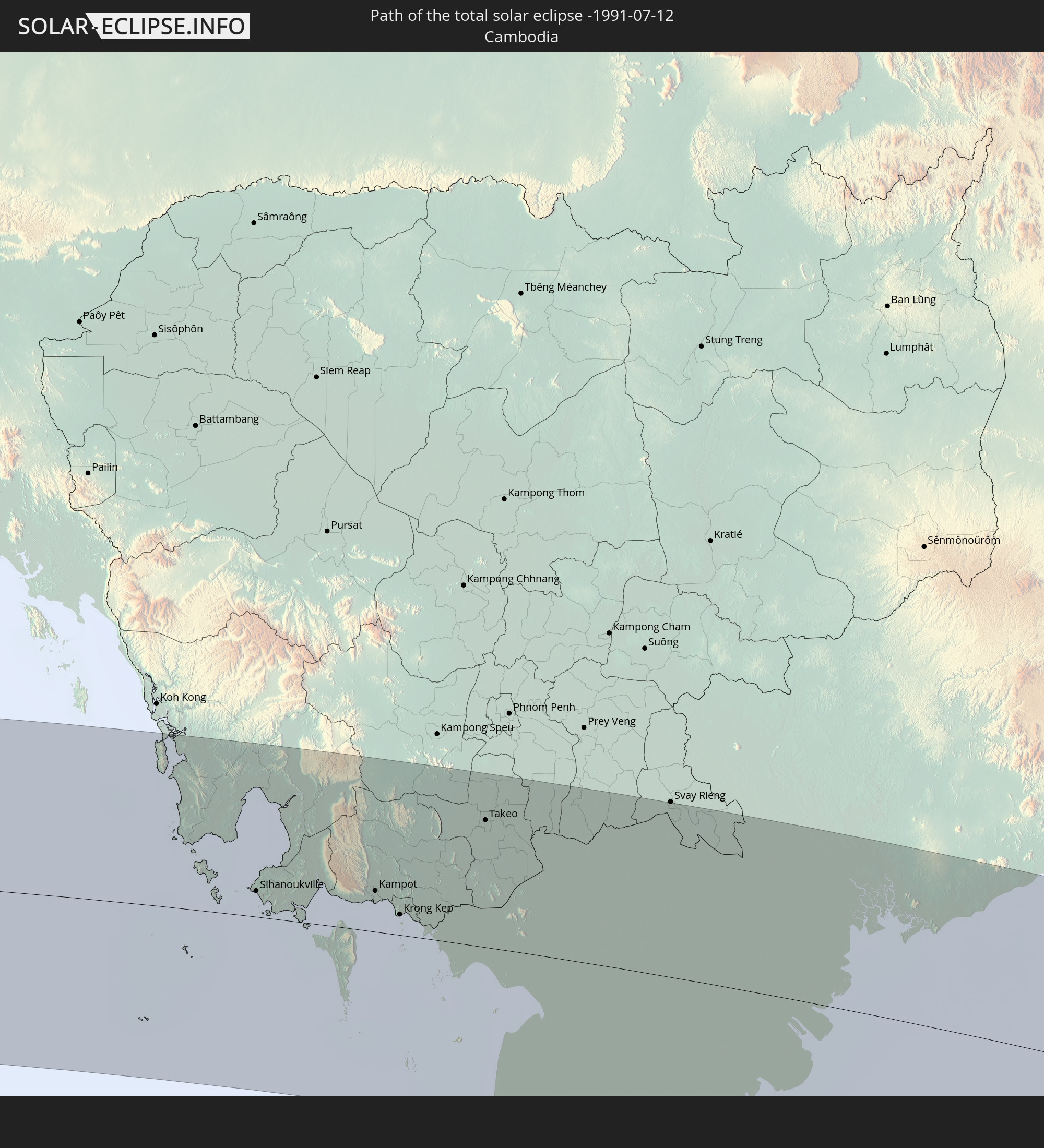
 Philippines
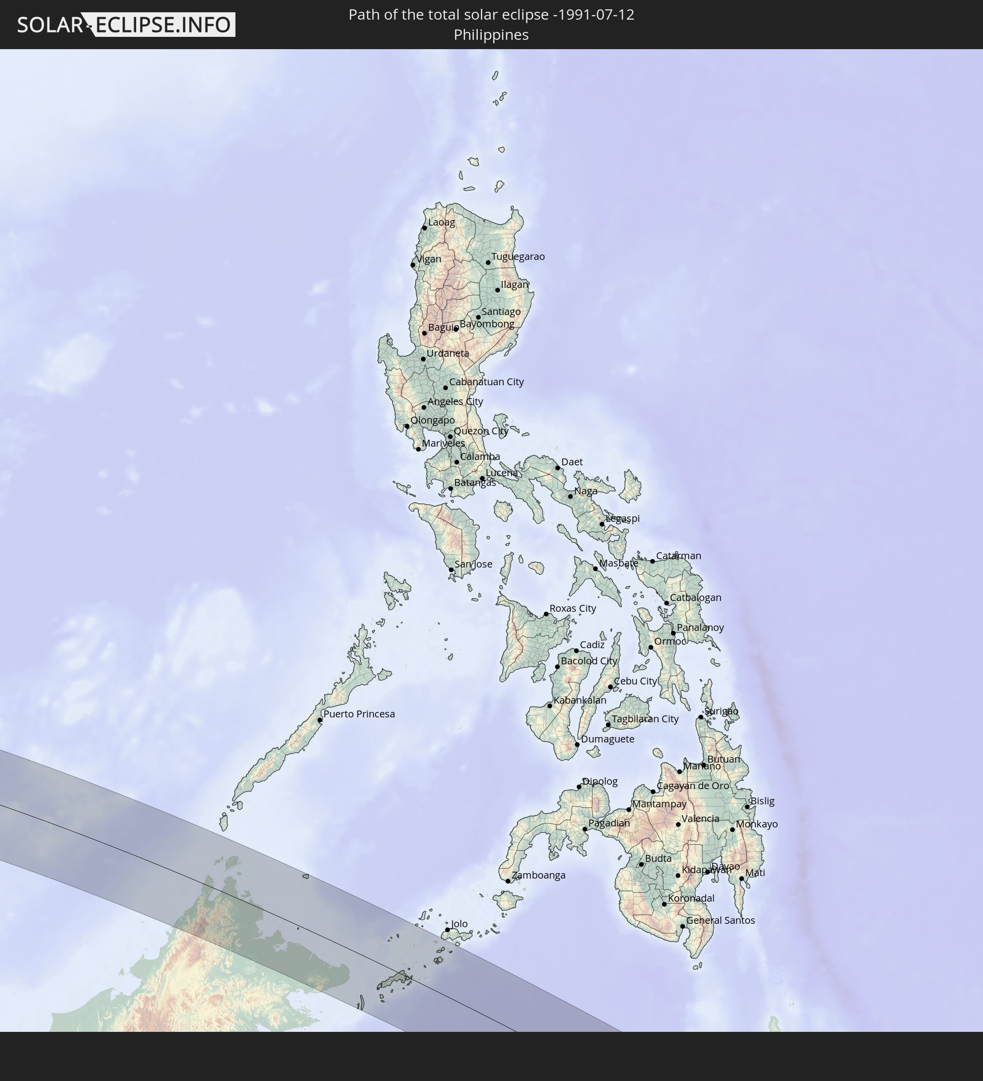
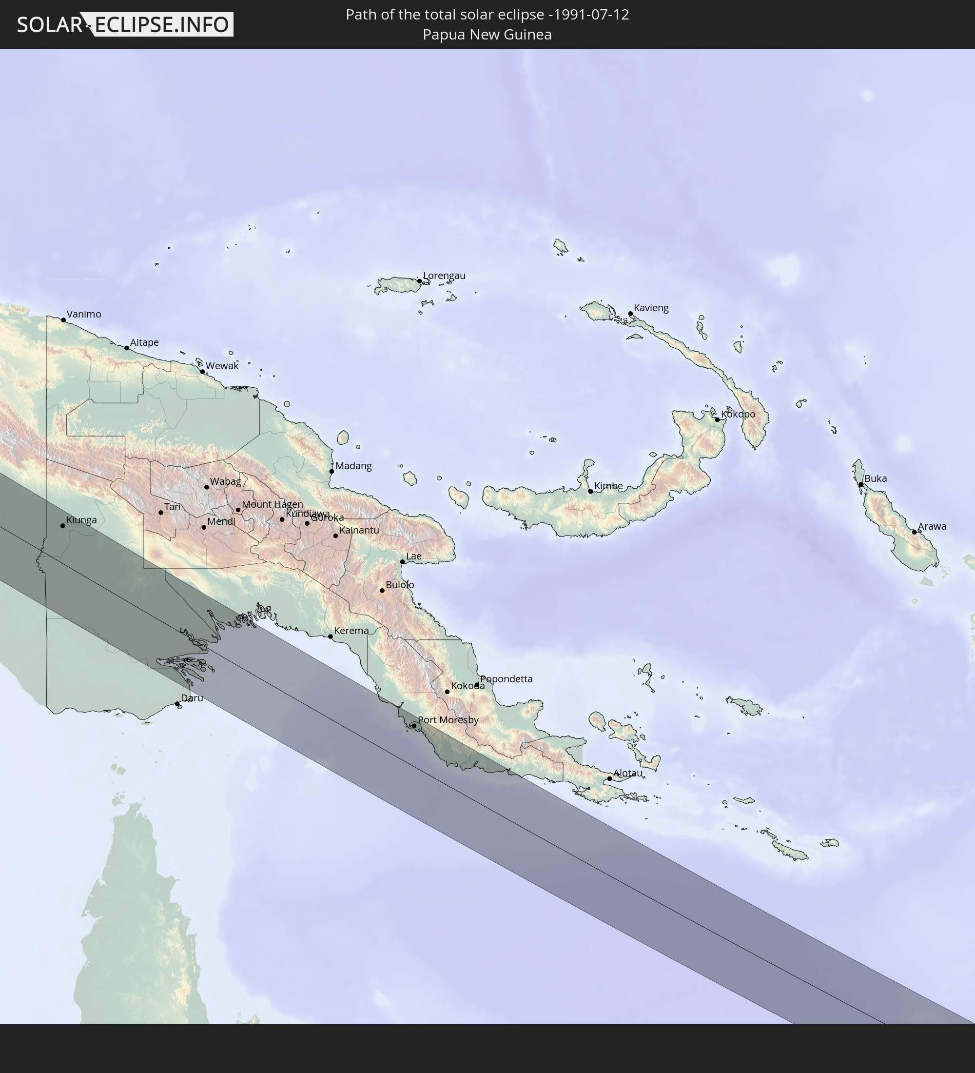 Papua New Guinea
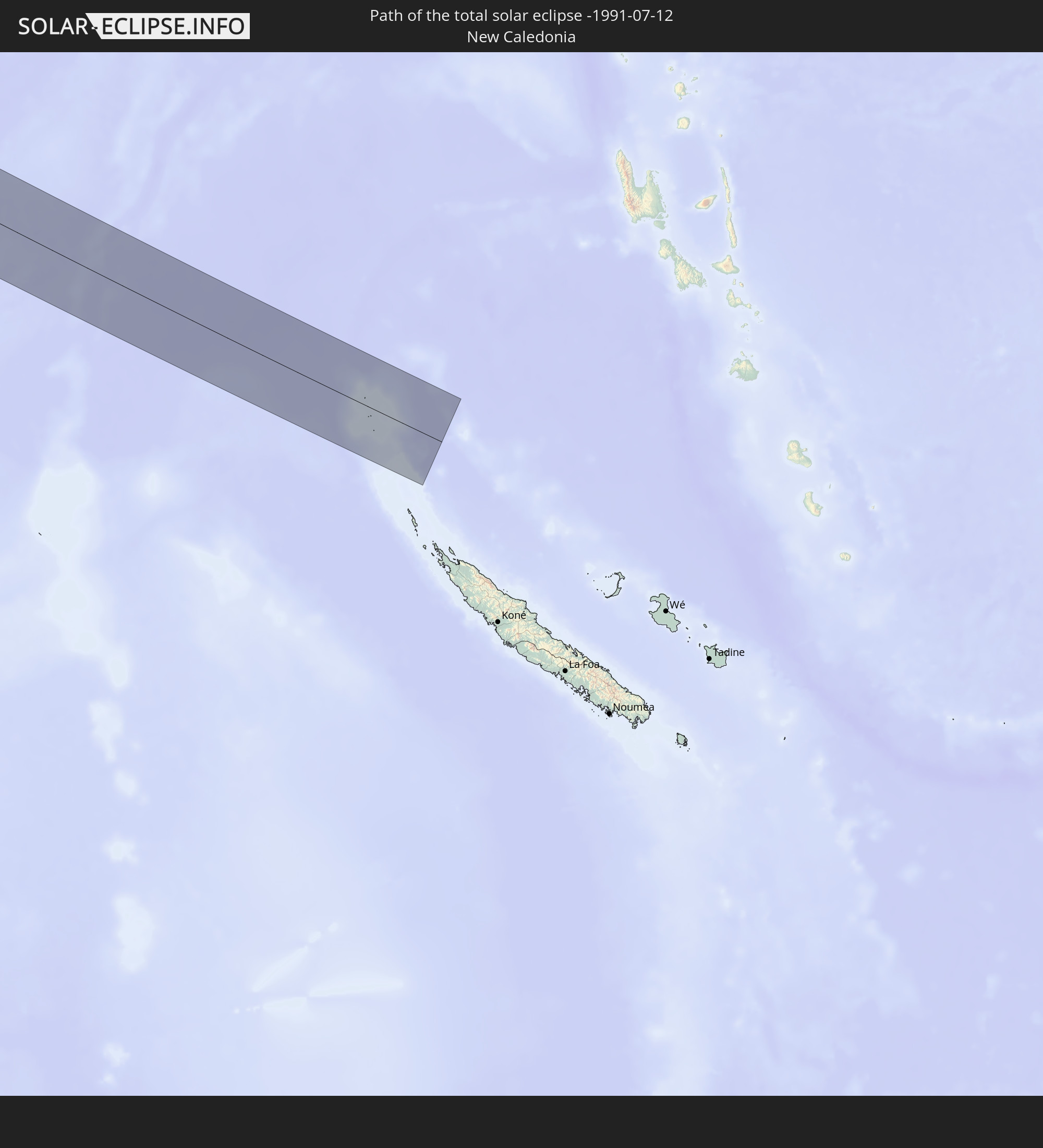 New Caledonia
In den folgenden Ländern ist die Sonnenfinsternis partiell zu sehen
 Kiribati
 Sudan
Sudan
 Egypt
Egypt
 Ethiopia
 Kenya
Kenya
 Saudi Arabia
 Eritrea
 French Southern and Antarctic Lands
 Somalia
 Djibouti
 Yemen
Yemen
 Madagascar
 Iran
Iran
 Seychelles
 Kuwait
 Bahrain
 Qatar
Qatar
 United Arab Emirates
 Oman
Oman
 Réunion
 Mauritius
 Afghanistan
 Pakistan
 Tajikistan
 India
India
 British Indian Ocean Territory
 Maldives
 China
China
 Sri Lanka
 Nepal
Nepal
 Bangladesh
 Bhutan
 Myanmar
 Indonesia
 Cocos Islands
 Thailand
 Malaysia
 Laos
Laos
 Vietnam
 Cambodia
 Singapore
 Christmas Island
 Australia
 Macau
Macau
 Hong Kong
 Brunei
 Taiwan
 Philippines
 Japan
Japan
 East Timor
 South Korea
 Palau
Palau
 Federated States of Micronesia
 Papua New Guinea
 Guam
Guam
 Northern Mariana Islands
 Solomon Islands
 New Caledonia
 Marshall Islands
 Vanuatu
 Nauru
Nauru
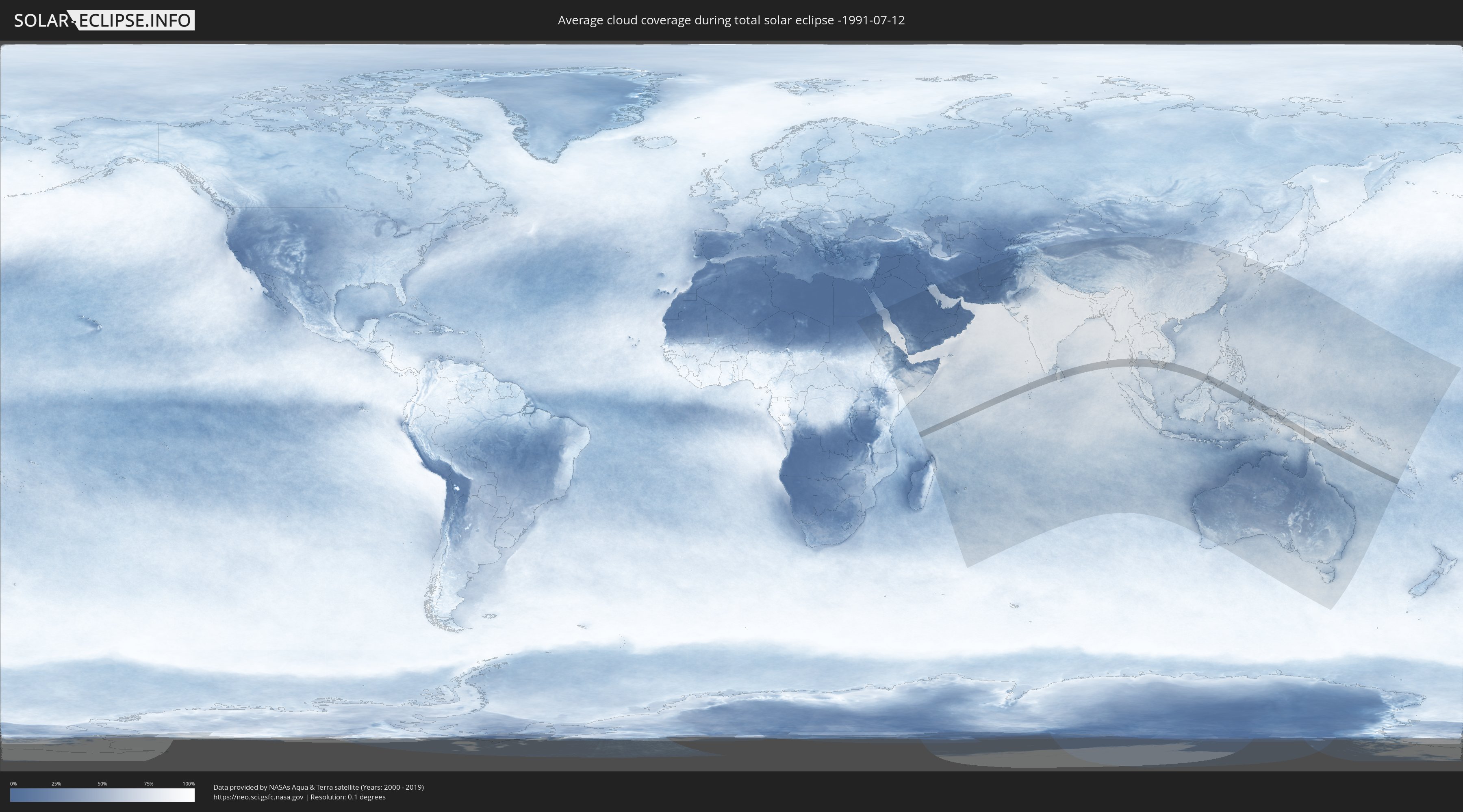
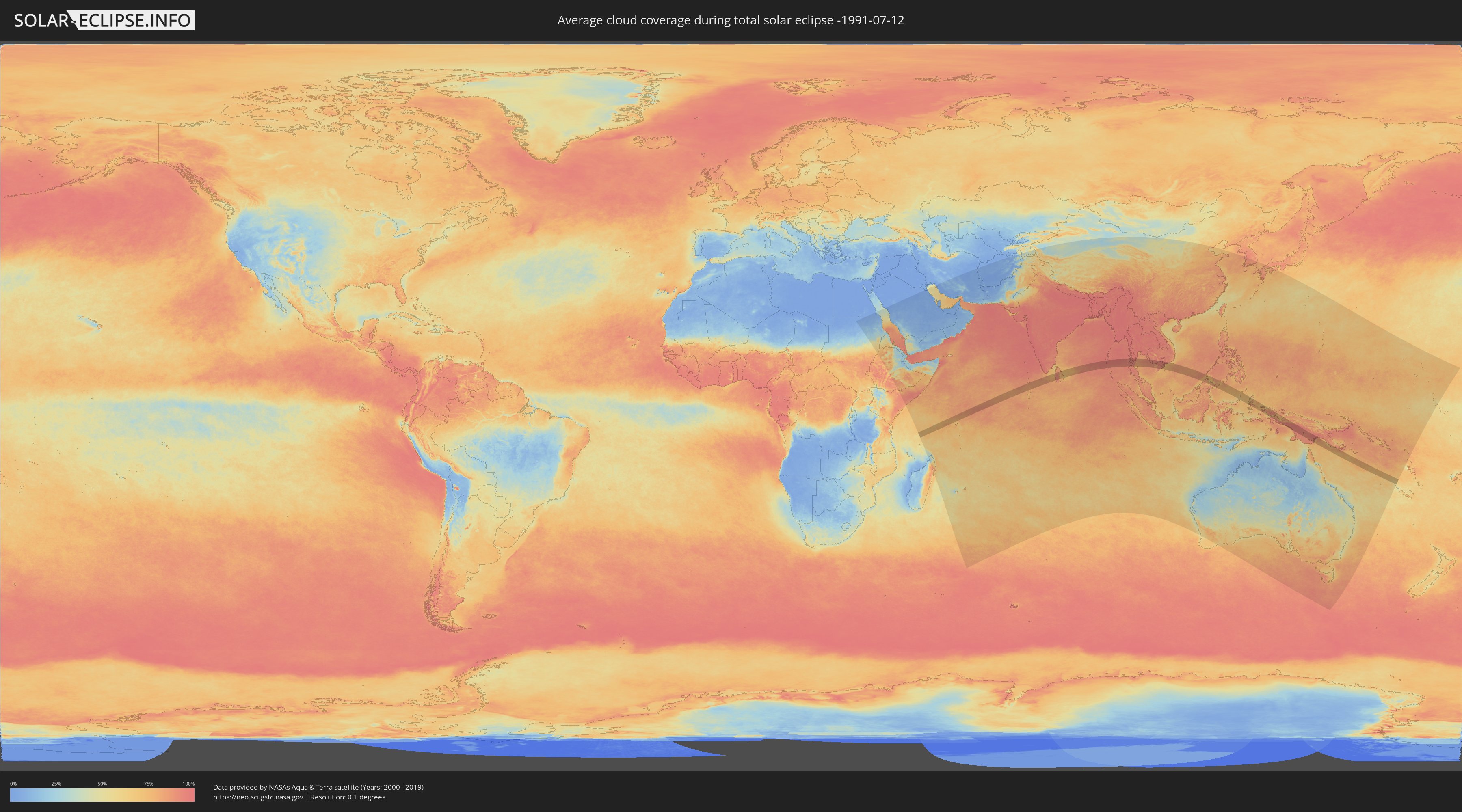
How will be the weather during the total solar eclipse on 07/12/-1991?
Where is the best place to see the total solar eclipse of 07/12/-1991?
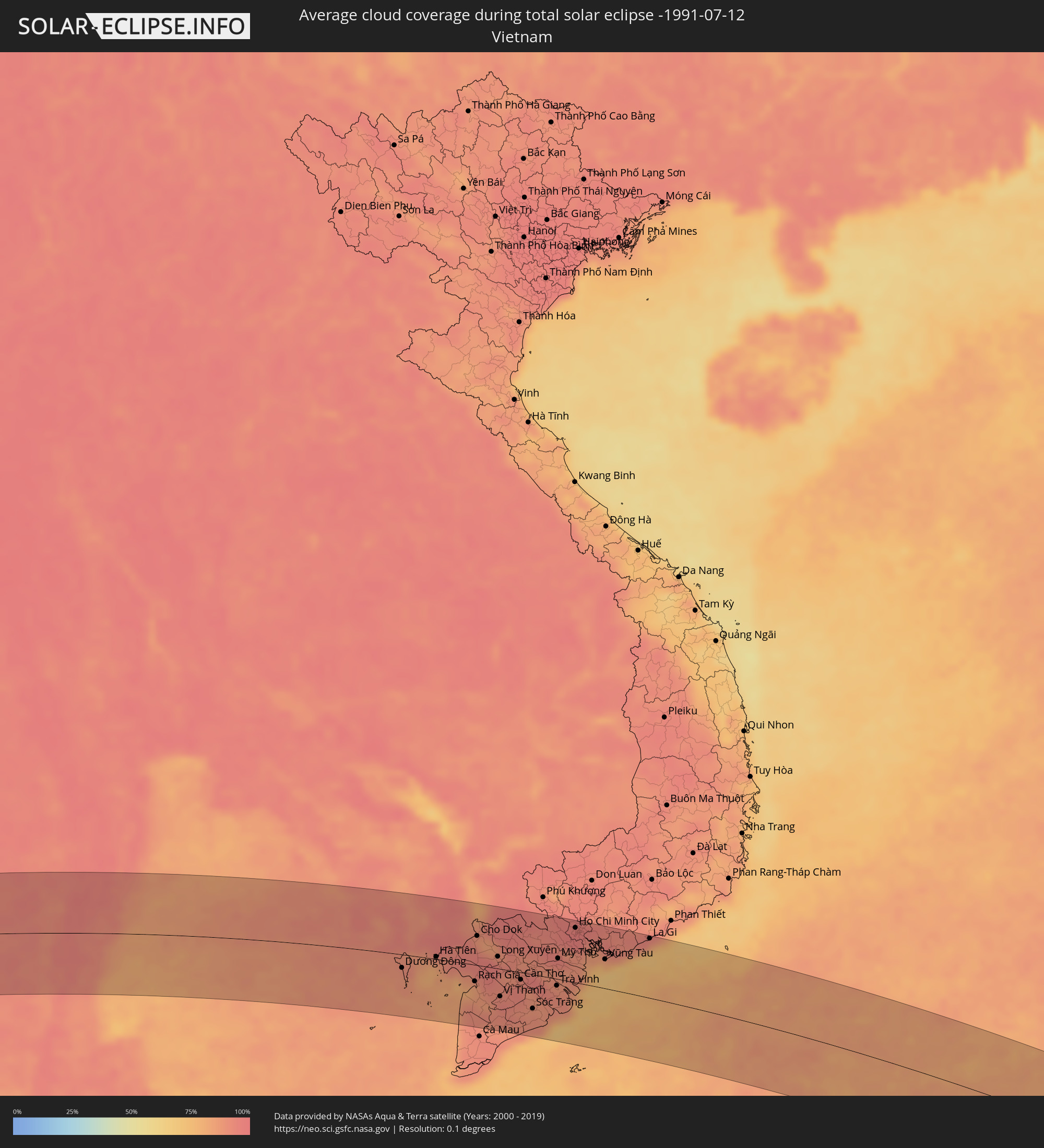
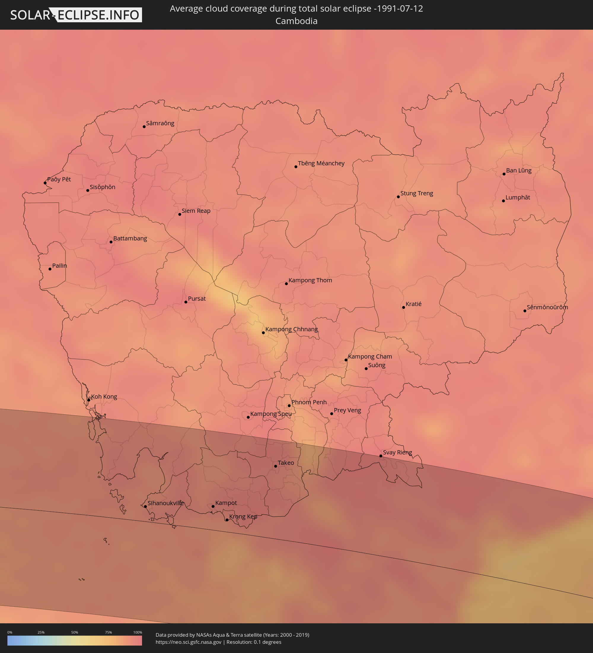
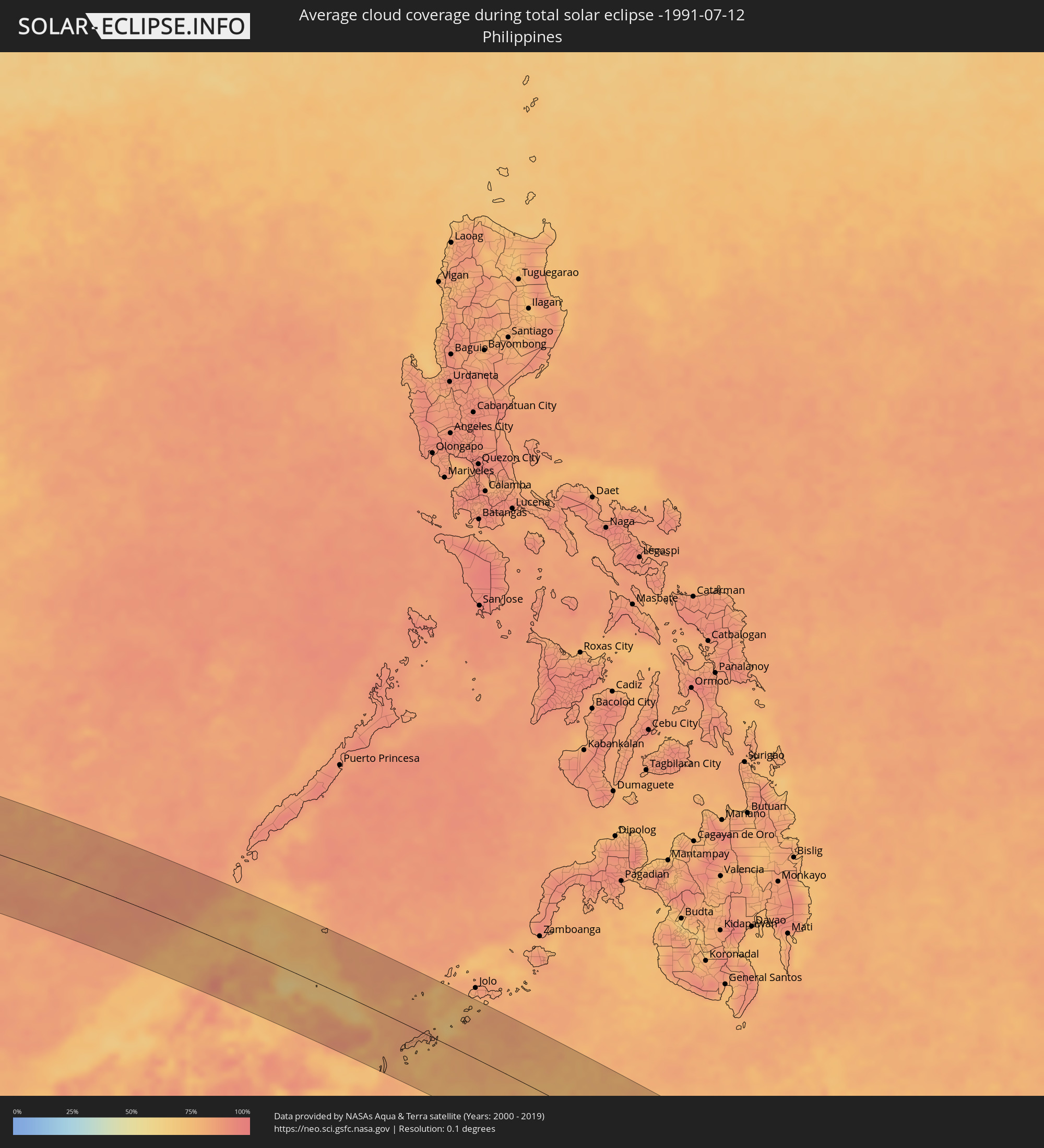
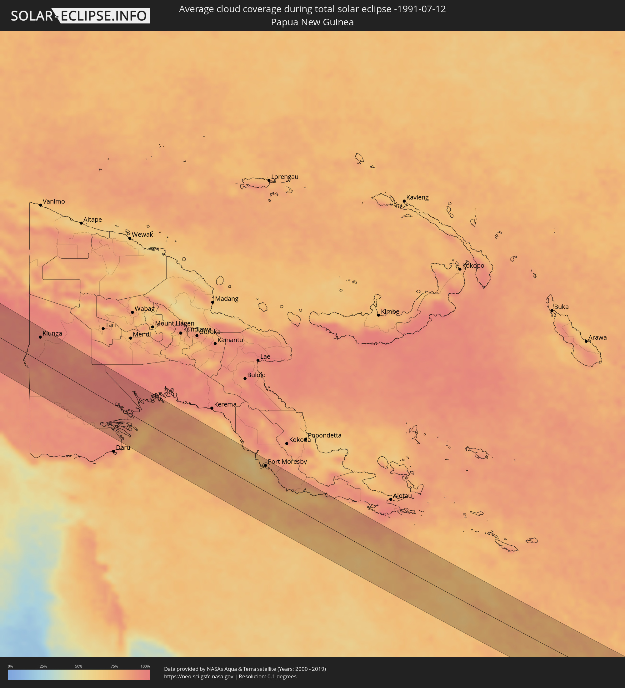
The following maps show the average cloud coverage for the day of the total solar eclipse.
With the help of these maps, it is possible to find the place along the eclipse path, which has the best
chance of a cloudless sky.
Nevertheless, you should consider local circumstances and inform about the weather of your chosen
observation site.
The data is provided by NASAs satellites
AQUA and TERRA.
The cloud maps are averaged over a period of 19 years (2000 - 2019).
Detailed country maps
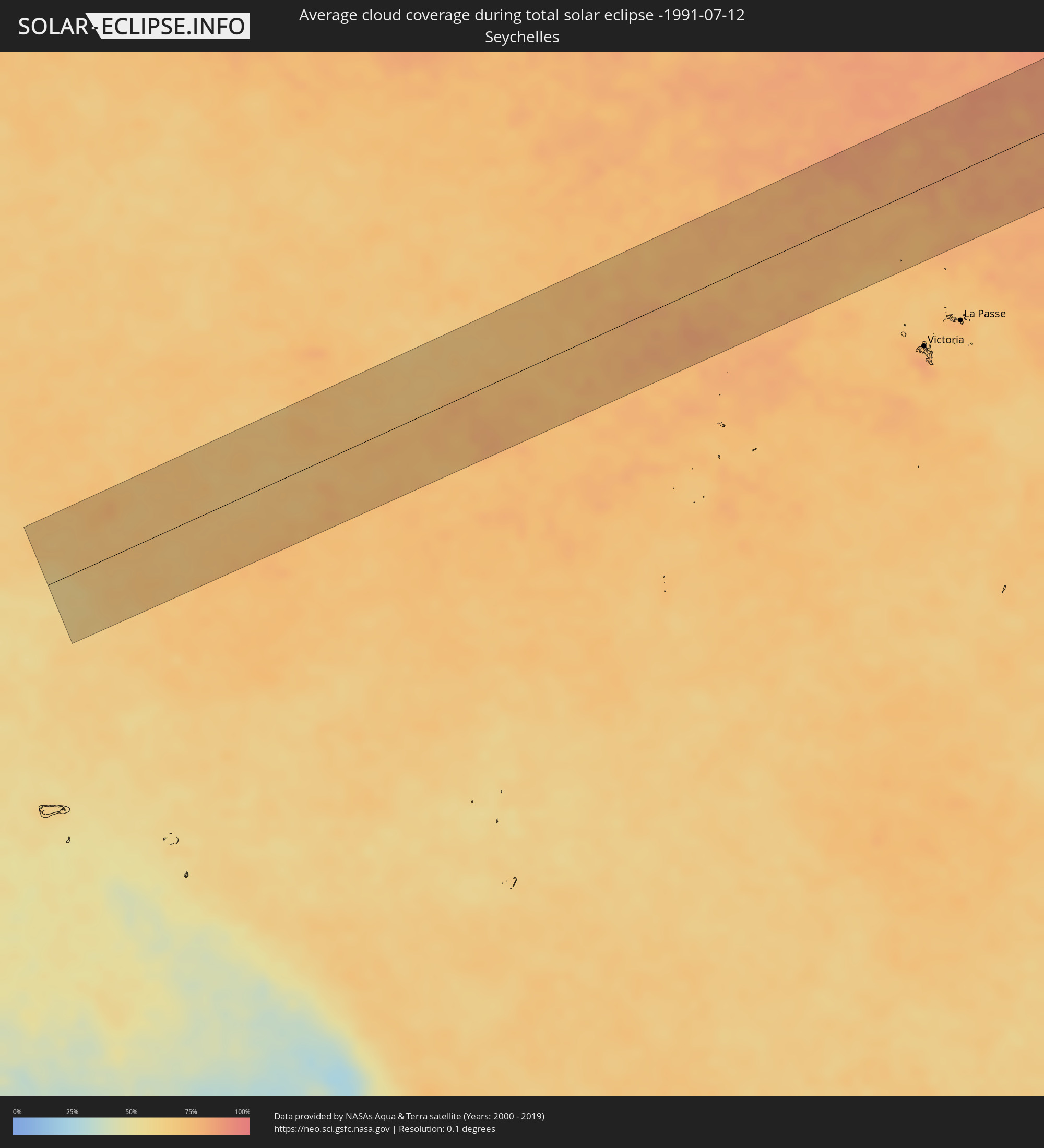 Seychelles
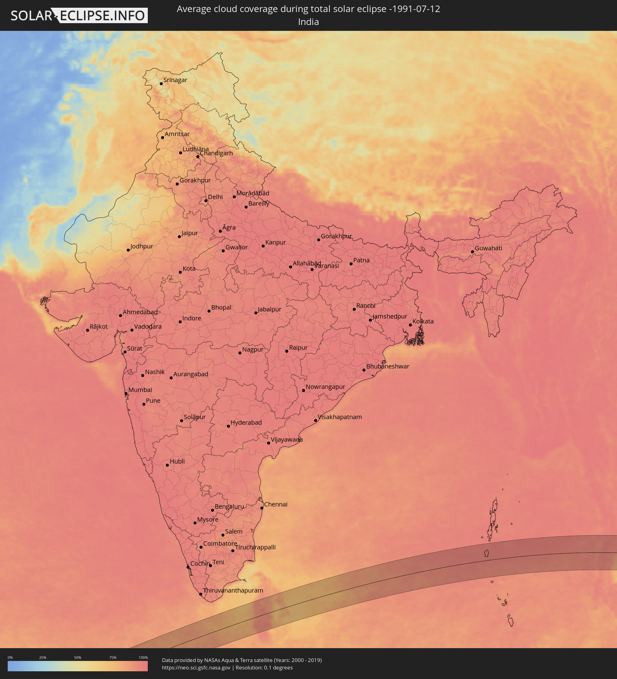 India
India
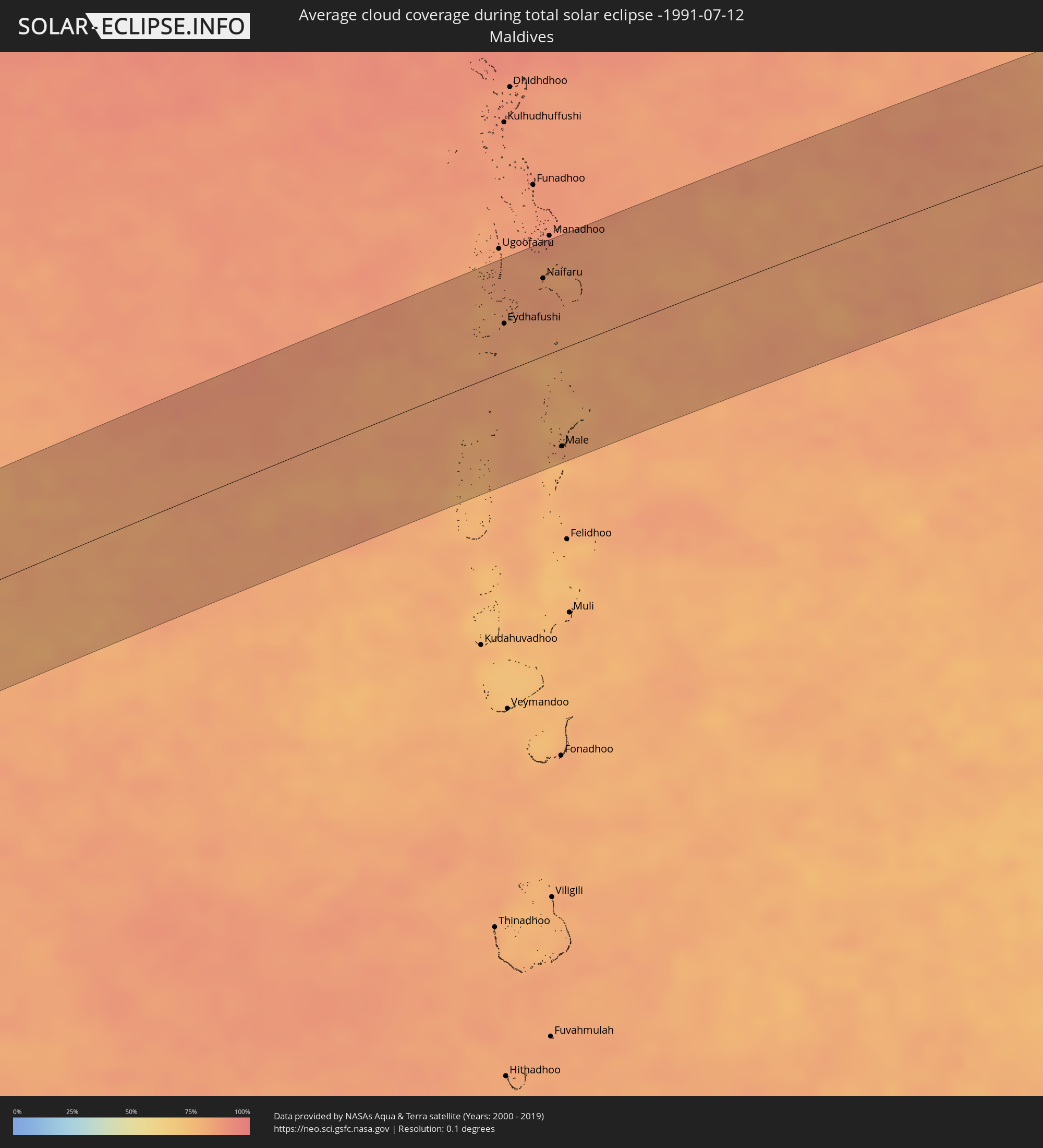 Maldives
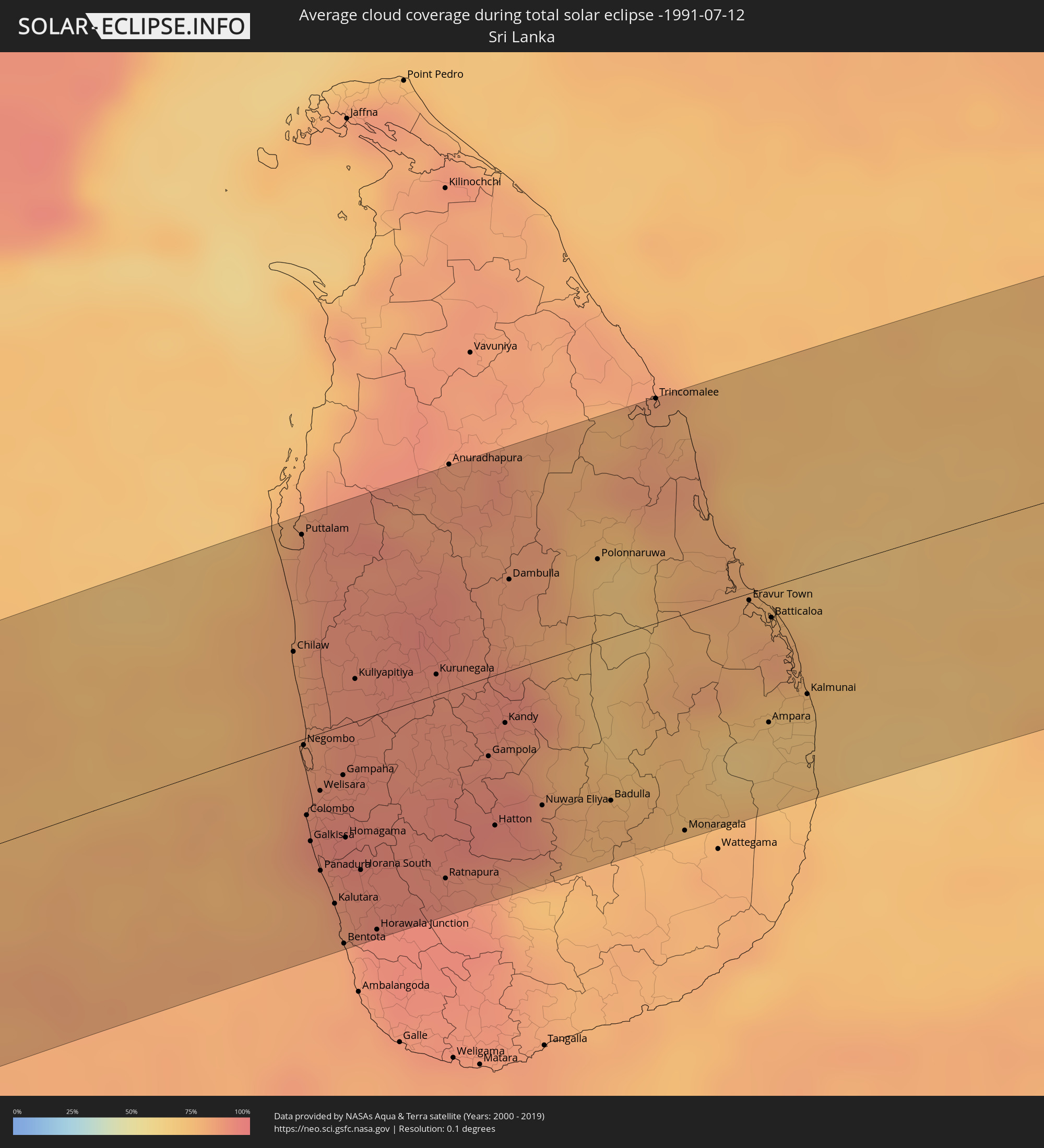 Sri Lanka
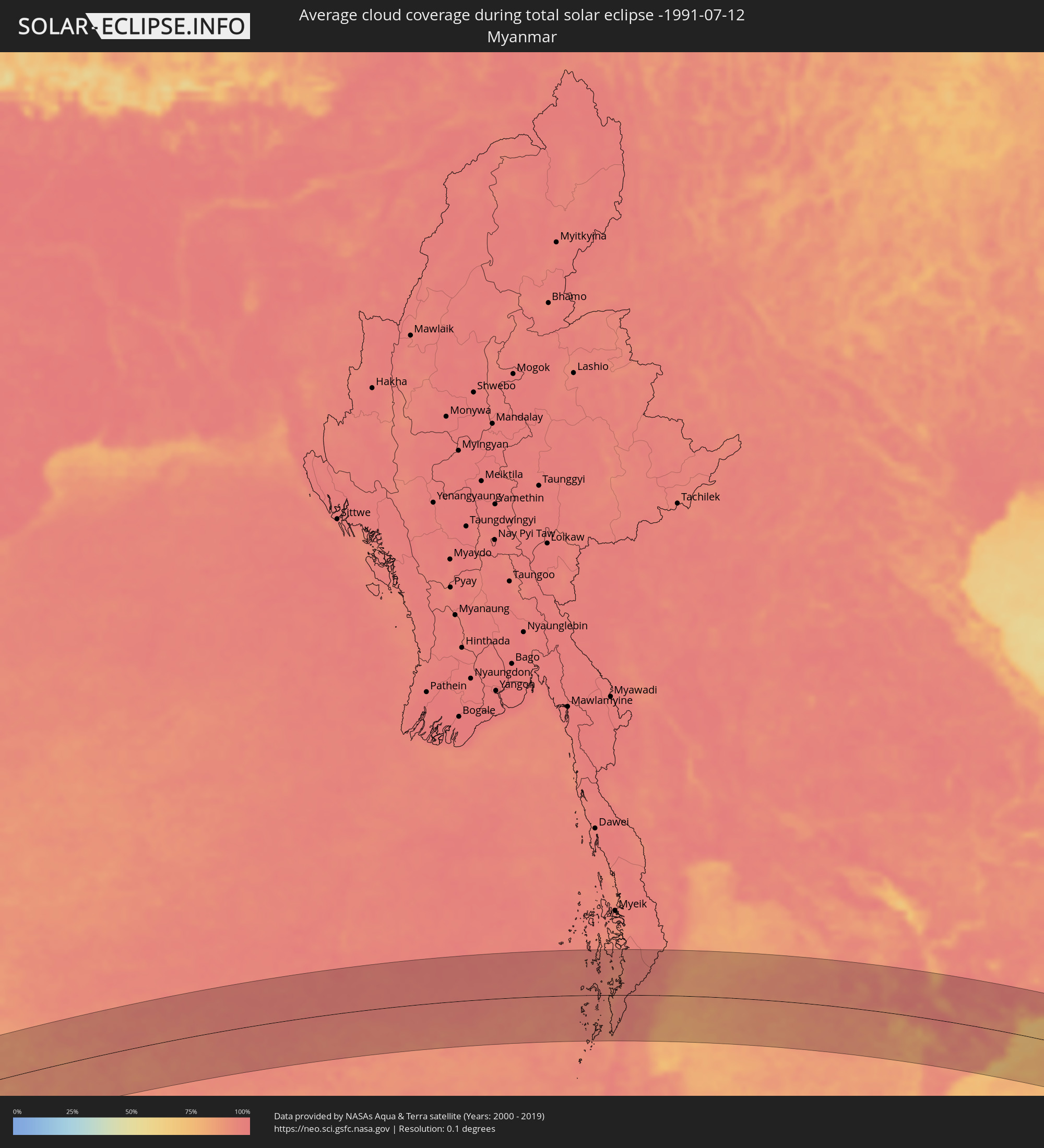 Myanmar
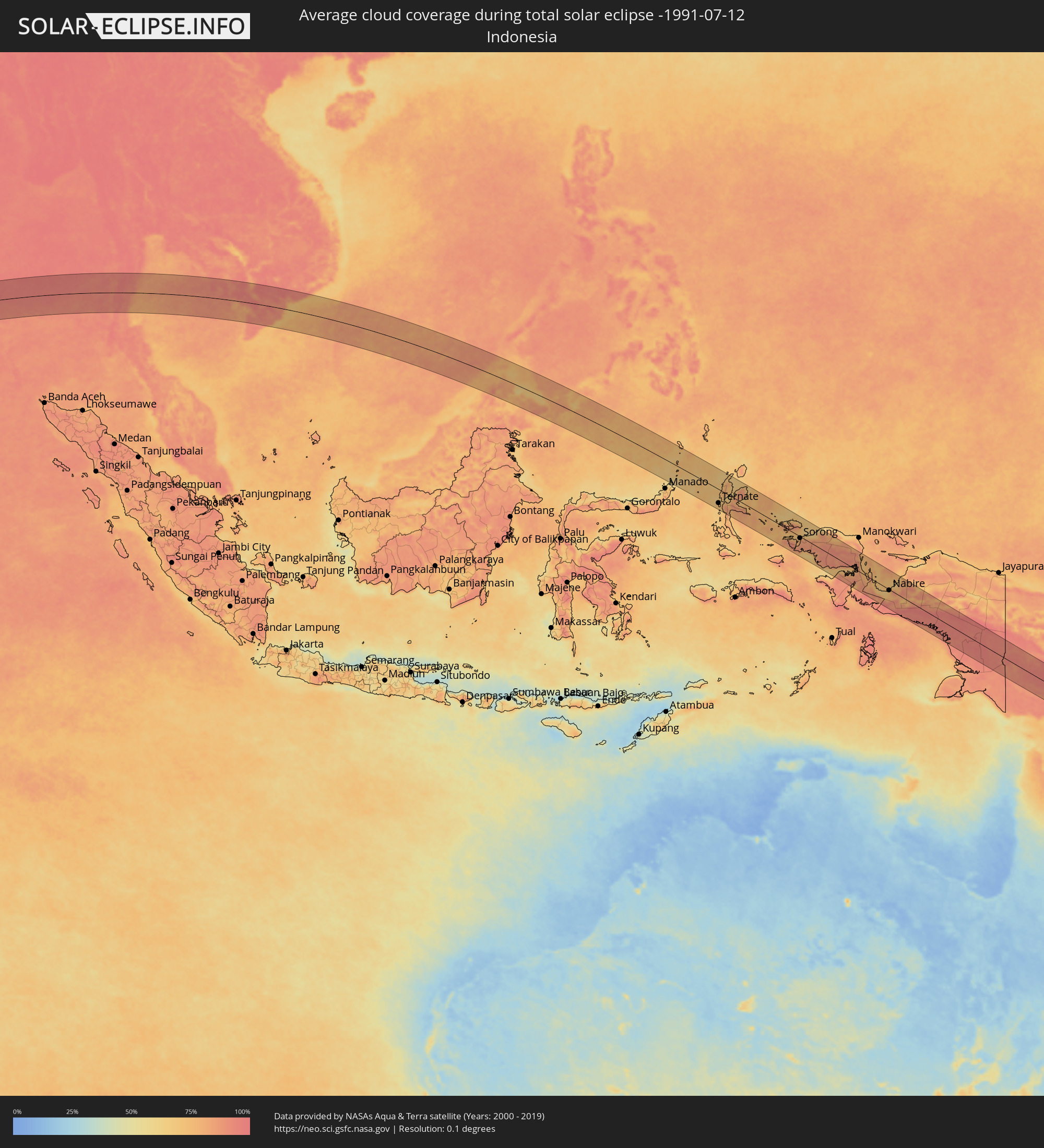 Indonesia
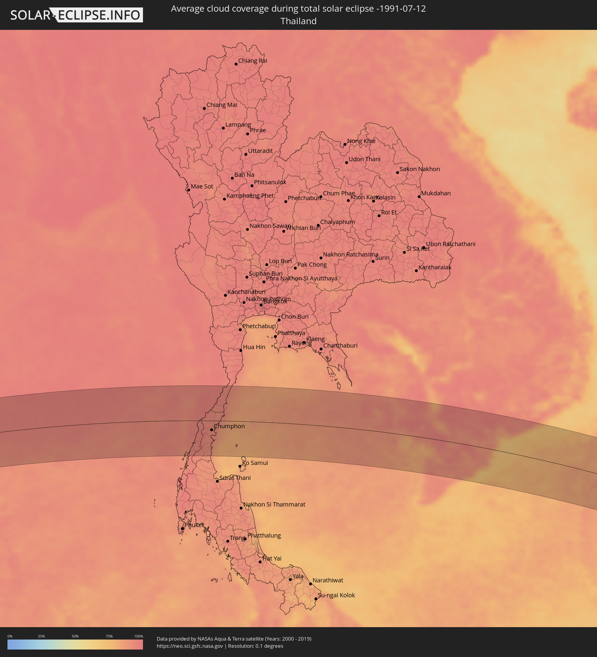 Thailand
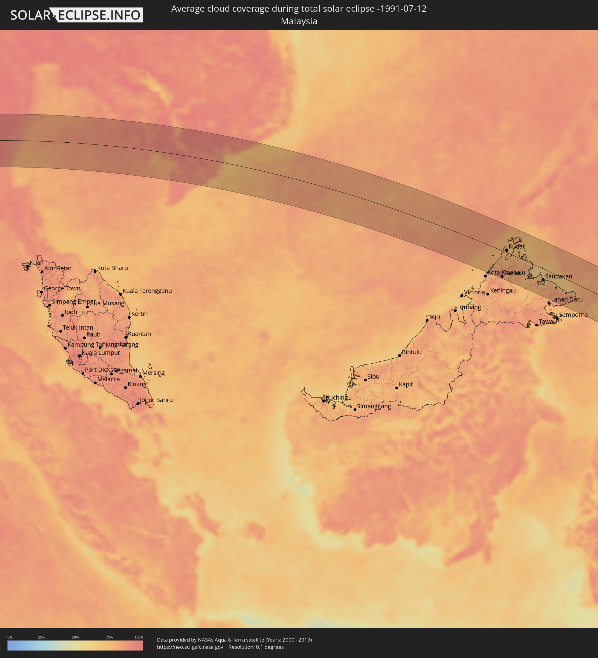 Malaysia
 Vietnam
 Cambodia
 Philippines
 Papua New Guinea
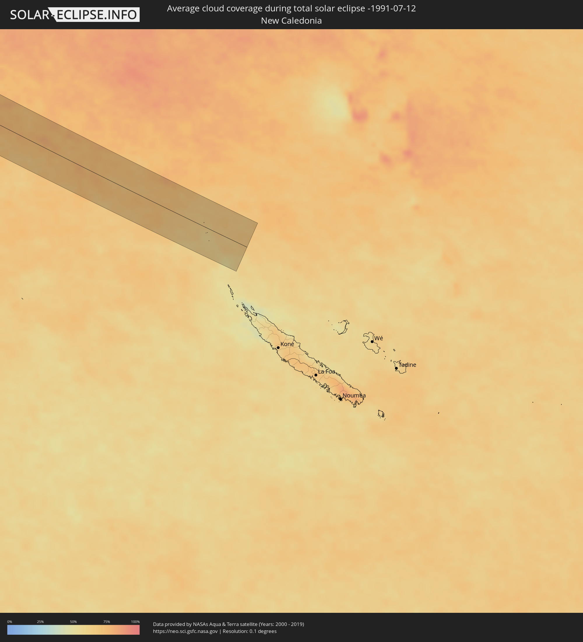 New Caledonia
Cities inside the path of the eclipse
The following table shows all locations with a population of more than 5,000 inside the eclipse path. Cities which have more than 100,000 inhabitants are marked bold. A click at the locations opens a detailed map.
| City | Type | Eclipse duration | Local time of max. eclipse | Distance to central line | Ø Cloud coverage |
|
Eydhafushi, Baa Atholhu
|
total | - | 08:14:13 UTC+04:54 | 37 km | 83% |
|
Naifaru, Lhaviyani Atholhu
|
total | - | 08:14:43 UTC+04:54 | 61 km | 85% |
|
Male, Kaafu Atoll
|
total | - | 08:14:32 UTC+04:54 | 77 km | 83% |
|
Puttalam, North Western
|
total | - | 08:51:16 UTC+05:19 | 85 km | 84% |
|
Negombo, Western
|
total | - | 08:51:00 UTC+05:19 | 3 km | 82% |
|
Colombo, Western
|
total | - | 08:50:56 UTC+05:19 | 32 km | 86% |
|
Moratuwa, Western
|
total | - | 08:50:57 UTC+05:19 | 50 km | 87% |
|
Peliyagoda, Western
|
total | - | 08:51:01 UTC+05:19 | 30 km | 91% |
|
Wattala, Western
|
total | - | 08:51:02 UTC+05:19 | 29 km | 91% |
|
Ja Ela, Western
|
total | - | 08:51:04 UTC+05:19 | 19 km | 89% |
|
Kandana, Western
|
total | - | 08:51:03 UTC+05:19 | 22 km | 91% |
|
Kelaniya, Western
|
total | - | 08:51:05 UTC+05:19 | 32 km | 91% |
|
Mulleriyawa, Western
|
total | - | 08:51:05 UTC+05:19 | 35 km | 92% |
|
Kalutara, Western
|
total | - | 08:51:02 UTC+05:19 | 73 km | 86% |
|
Bentota, Southern
|
total | - | 08:51:03 UTC+05:19 | 91 km | 82% |
|
Homagama, Western
|
total | - | 08:51:11 UTC+05:19 | 47 km | 92% |
|
Kurunegala, North Western
|
total | - | 08:52:03 UTC+05:19 | 8 km | 89% |
|
Ratnapura, Sabaragamuwa
|
total | - | 08:51:52 UTC+05:19 | 78 km | 91% |
|
Gampola, Central
|
total | - | 08:52:20 UTC+05:19 | 33 km | 91% |
|
Kandy, Central
|
total | - | 08:52:30 UTC+05:19 | 21 km | 89% |
|
Dambulla, Central
|
total | - | 08:52:43 UTC+05:19 | 38 km | 86% |
|
Nuwara Eliya, Central
|
total | - | 08:52:41 UTC+05:19 | 61 km | 85% |
|
Badulla, Uva
|
total | - | 08:53:12 UTC+05:19 | 68 km | 77% |
|
Trincomalee, Eastern Province
|
total | - | 08:54:03 UTC+05:19 | 94 km | 82% |
|
Batticaloa, Eastern Province
|
total | - | 08:54:39 UTC+05:19 | 13 km | 82% |
|
Kalmunai, Eastern Province
|
total | - | 08:54:50 UTC+05:19 | 50 km | 70% |
|
Ranong, Ranong
|
total | - | 11:01:12 UTC+06:42 | 87 km | 93% |
|
Ban Nam Yuen, Chumphon
|
total | - | 11:01:56 UTC+06:42 | 97 km | 90% |
|
Lang Suan, Chumphon
|
total | - | 11:02:34 UTC+06:42 | 89 km | 90% |
|
Chumphon, Chumphon
|
total | - | 11:02:46 UTC+06:42 | 27 km | 93% |
|
Bang Saphan, Prachuap Khiri Khan
|
total | - | 11:03:38 UTC+06:42 | 53 km | 92% |
|
Sihanoukville, Preah Sihanouk
|
total | - | 11:16:22 UTC+06:42 | 15 km | 89% |
|
Dương Đông, Kiến Giang
|
total | - | 11:42:30 UTC+07:06 | 22 km | 87% |
|
Kampot, Kampot
|
total | - | 11:18:26 UTC+06:42 | 24 km | 89% |
|
Krong Kep, Kep
|
total | - | 11:18:55 UTC+06:42 | 12 km | 85% |
|
Hà Tiên, Kiến Giang
|
total | - | 11:44:06 UTC+07:06 | 4 km | 84% |
|
Phumĭ Véal Srê, Takeo
|
total | - | 11:20:08 UTC+06:42 | 74 km | 93% |
|
Takeo, Takeo
|
total | - | 11:20:09 UTC+06:42 | 75 km | 93% |
|
Rạch Giá, Kiến Giang
|
total | - | 11:46:10 UTC+07:06 | 27 km | 85% |
|
Cho Dok, An Giang
|
total | - | 11:45:56 UTC+07:06 | 49 km | 91% |
|
Long Xuyên, An Giang
|
total | - | 11:47:06 UTC+07:06 | 20 km | 96% |
|
Vị Thanh, Hau Giang
|
total | - | 11:47:32 UTC+07:06 | 46 km | 95% |
|
Cao Lãnh, Đồng Tháp
|
total | - | 11:47:41 UTC+07:06 | 31 km | 92% |
|
Thành phố Bạc Liêu, Bạc Liêu
|
total | - | 11:48:38 UTC+07:06 | 95 km | 89% |
|
Sadek, Đồng Tháp
|
total | - | 11:48:10 UTC+07:06 | 15 km | 92% |
|
Cần Thơ, Cần Thơ
|
total | - | 11:48:24 UTC+07:06 | 12 km | 93% |
|
Sóc Trăng, Sóc Trăng
|
total | - | 11:49:14 UTC+07:06 | 57 km | 90% |
|
Vĩnh Long, Vĩnh Long
|
total | - | 11:48:52 UTC+07:06 | 15 km | 92% |
|
Ấp Tân Ngãi, Bến Tre
|
total | - | 11:49:52 UTC+07:06 | 19 km | 90% |
|
Trà Vinh, Trà Vinh
|
total | - | 11:50:13 UTC+07:06 | 11 km | 91% |
|
Mỹ Tho, Tiền Giang
|
total | - | 11:50:02 UTC+07:06 | 34 km | 92% |
|
Bến Tre, Bến Tre
|
total | - | 11:50:09 UTC+07:06 | 22 km | 88% |
|
Tân An, Long An
|
total | - | 11:50:06 UTC+07:06 | 55 km | 95% |
|
Ho Chi Minh City, Ho Chi Minh City
|
total | - | 11:50:36 UTC+07:06 | 90 km | 97% |
|
Cần Giuộc, Long An
|
total | - | 11:50:52 UTC+07:06 | 68 km | 91% |
|
Cần Giờ, Ho Chi Minh City
|
total | - | 11:51:52 UTC+07:06 | 52 km | 76% |
|
Vũng Tàu, Bà Rịa-Vũng Tàu
|
total | - | 11:52:19 UTC+07:06 | 48 km | 69% |
|
Thành Phố Bà Rịa, Bà Rịa-Vũng Tàu
|
total | - | 11:52:29 UTC+07:06 | 66 km | 87% |
|
La Gi, Bình Thuận
|
total | - | 11:54:15 UTC+07:06 | 98 km | 82% |
|
Kota Belud, Sabah
|
total | - | 12:38:04 UTC+07:21 | 64 km | 80% |
|
Ranau, Sabah
|
total | - | 12:39:04 UTC+07:21 | 94 km | 82% |
|
Kudat, Sabah
|
total | - | 12:38:38 UTC+07:21 | 8 km | 77% |
|
Taman Rajawali, Sabah
|
total | - | 12:42:50 UTC+07:21 | 39 km | 79% |
|
Sandakan, Sabah
|
total | - | 12:43:04 UTC+07:21 | 41 km | 74% |
|
Bongao, Autonomous Region in Muslim Mindanao
|
total | - | 13:26:45 UTC+08:00 | 45 km | 77% |
|
Sanga-Sanga, Autonomous Region in Muslim Mindanao
|
total | - | 13:26:44 UTC+08:00 | 40 km | 77% |
|
Tampakan, Autonomous Region in Muslim Mindanao
|
total | - | 13:26:54 UTC+08:00 | 54 km | 77% |
|
New Batu Batu, Autonomous Region in Muslim Mindanao
|
total | - | 13:26:59 UTC+08:00 | 36 km | 75% |
|
Balimbing, Autonomous Region in Muslim Mindanao
|
total | - | 13:27:10 UTC+08:00 | 30 km | 73% |
|
Languyan, Autonomous Region in Muslim Mindanao
|
total | - | 13:27:17 UTC+08:00 | 7 km | 83% |
|
Tongouson, Autonomous Region in Muslim Mindanao
|
total | - | 13:27:39 UTC+08:00 | 28 km | 75% |
|
Siasi, Autonomous Region in Muslim Mindanao
|
total | - | 13:28:49 UTC+08:00 | 58 km | 80% |
|
Lugus, Autonomous Region in Muslim Mindanao
|
total | - | 13:28:40 UTC+08:00 | 74 km | 77% |
|
Laminusa, Autonomous Region in Muslim Mindanao
|
total | - | 13:29:02 UTC+08:00 | 63 km | 81% |
|
Ternate, North Maluku
|
total | - | 15:10:10 UTC+09:22 | 64 km | 70% |
|
Sofifi, North Maluku
|
total | - | 15:10:33 UTC+09:22 | 59 km | 80% |
|
Tobelo, North Maluku
|
total | - | 15:10:33 UTC+09:22 | 61 km | 66% |
|
Sorong, West Papua
|
total | - | 15:18:21 UTC+09:22 | 8 km | 84% |
|
Nabire, Papua
|
total | - | 15:26:20 UTC+09:22 | 4 km | 74% |
|
Kiunga, Western Province
|
total | - | 16:11:44 UTC+10:00 | 60 km | 91% |
|
Port Moresby, National Capital
|
total | - | 16:17:54 UTC+10:00 | 65 km | 76% |