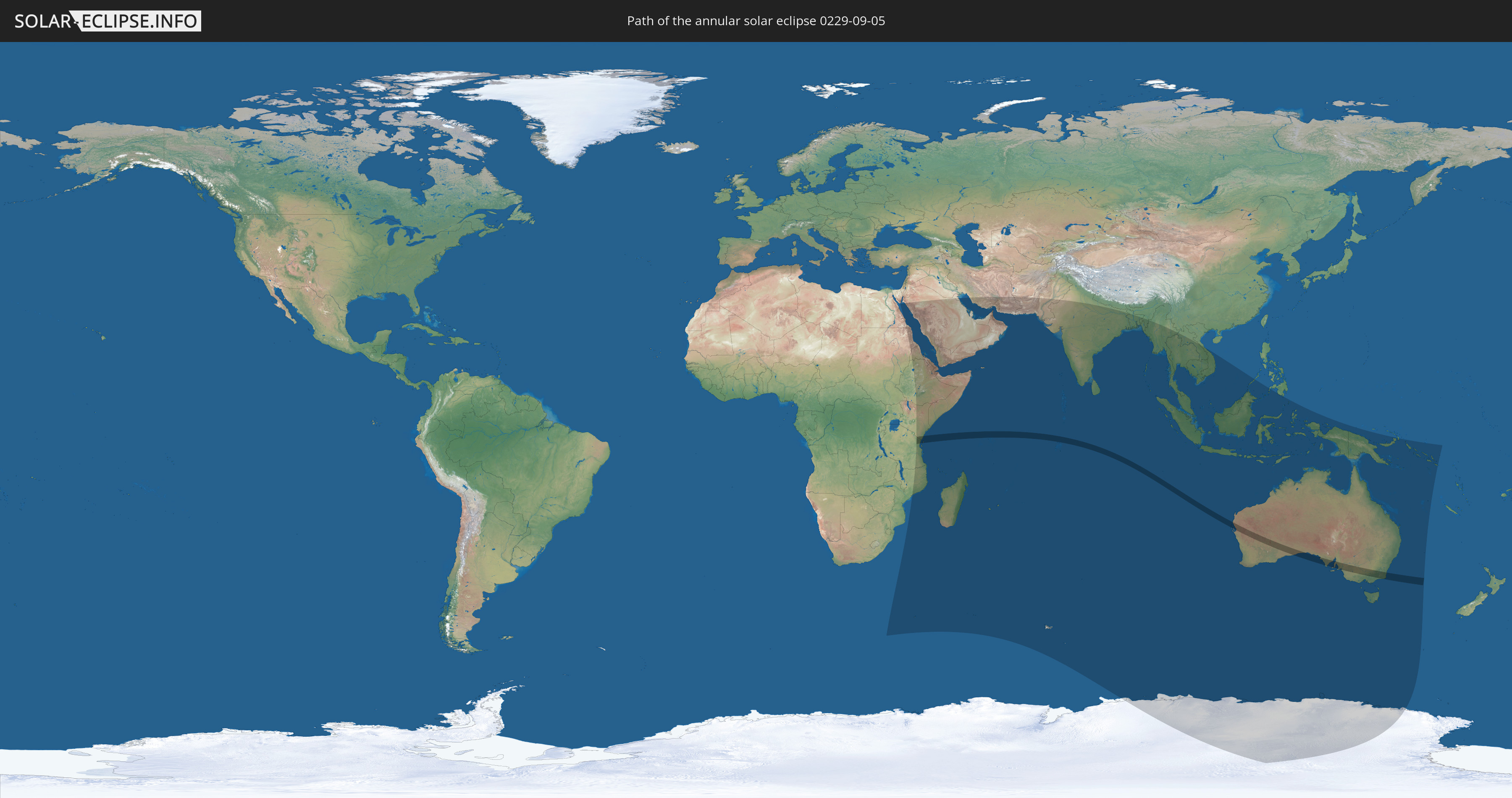
Annular solar eclipse of 09/05/0229
| Day of week: | Saturday |
| Maximum duration of eclipse: | 03m46s |
| Maximum width of eclipse path: | 125 km |
| Saros cycle: | 77 |
| Coverage: | 96.8% |
| Magnitude: | 0.9676 |
| Gamma: | -0.3696 |
Wo kann man die Sonnenfinsternis vom 09/05/0229 sehen?
Die Sonnenfinsternis am 09/05/0229 kann man in 49 Ländern als partielle Sonnenfinsternis beobachten.
Der Finsternispfad verläuft durch 4 Länder. Nur in diesen Ländern ist sie als annular Sonnenfinsternis zu sehen.
In den folgenden Ländern ist die Sonnenfinsternis annular zu sehen
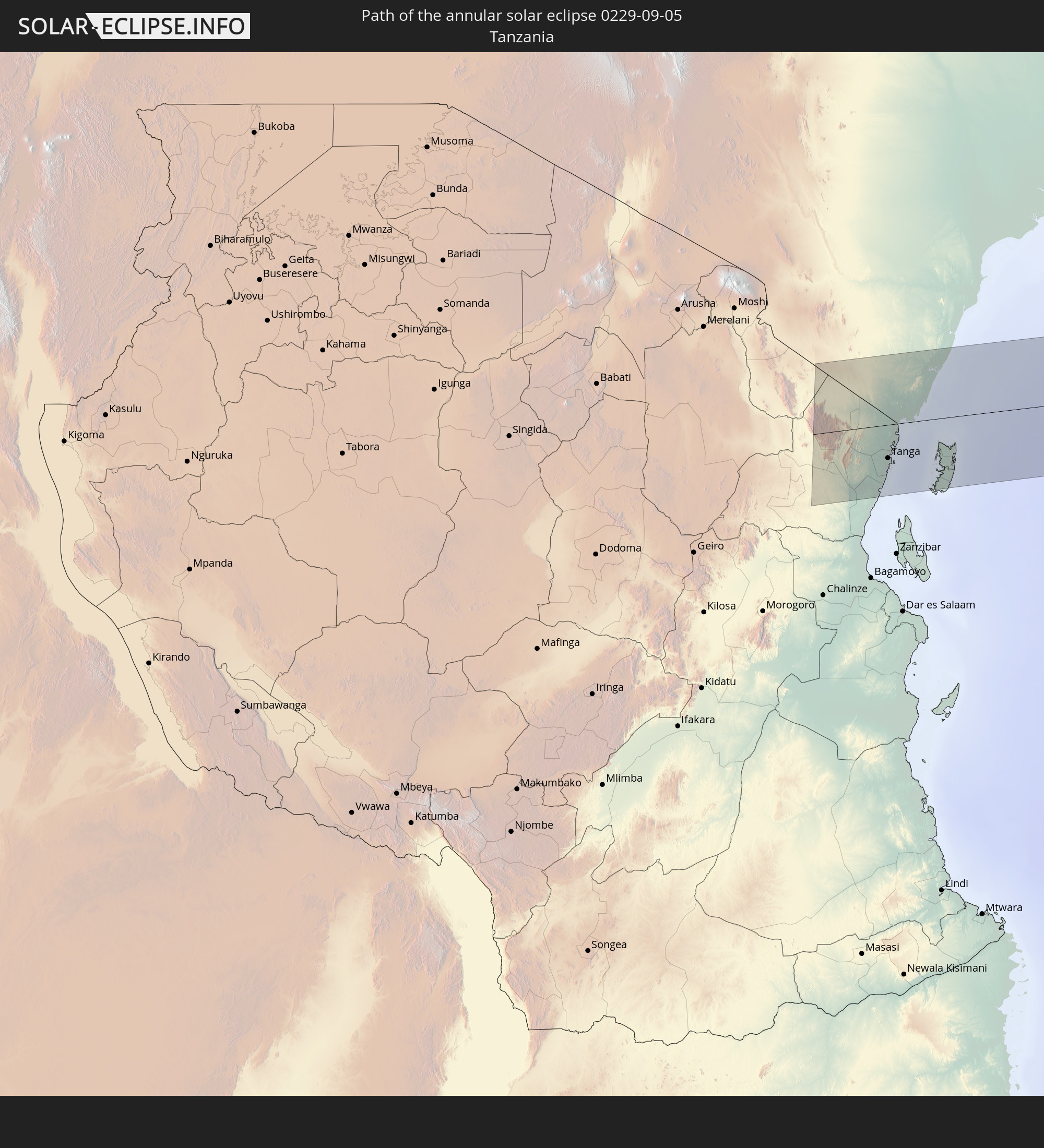 Tanzania
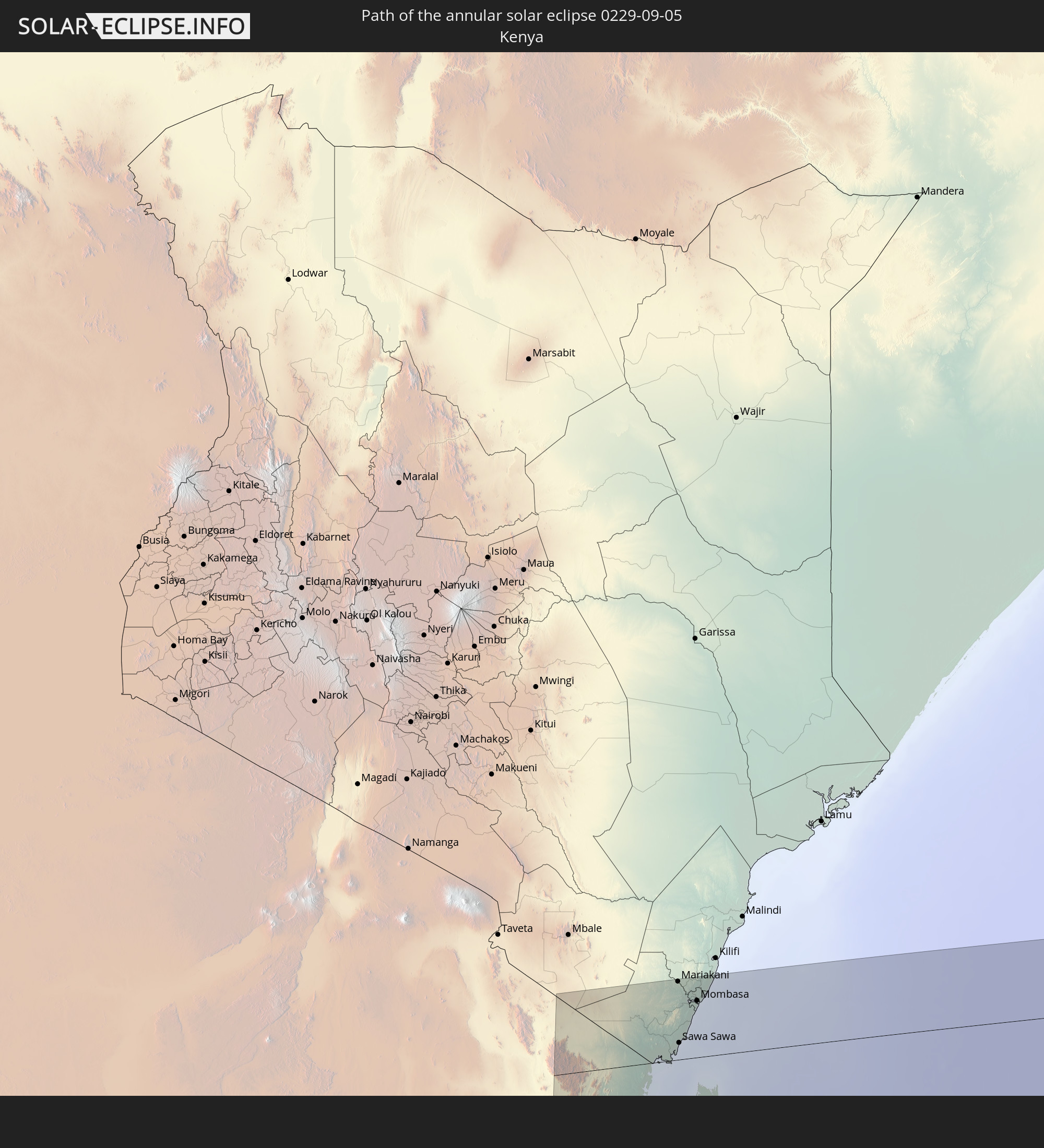 Kenya
Kenya
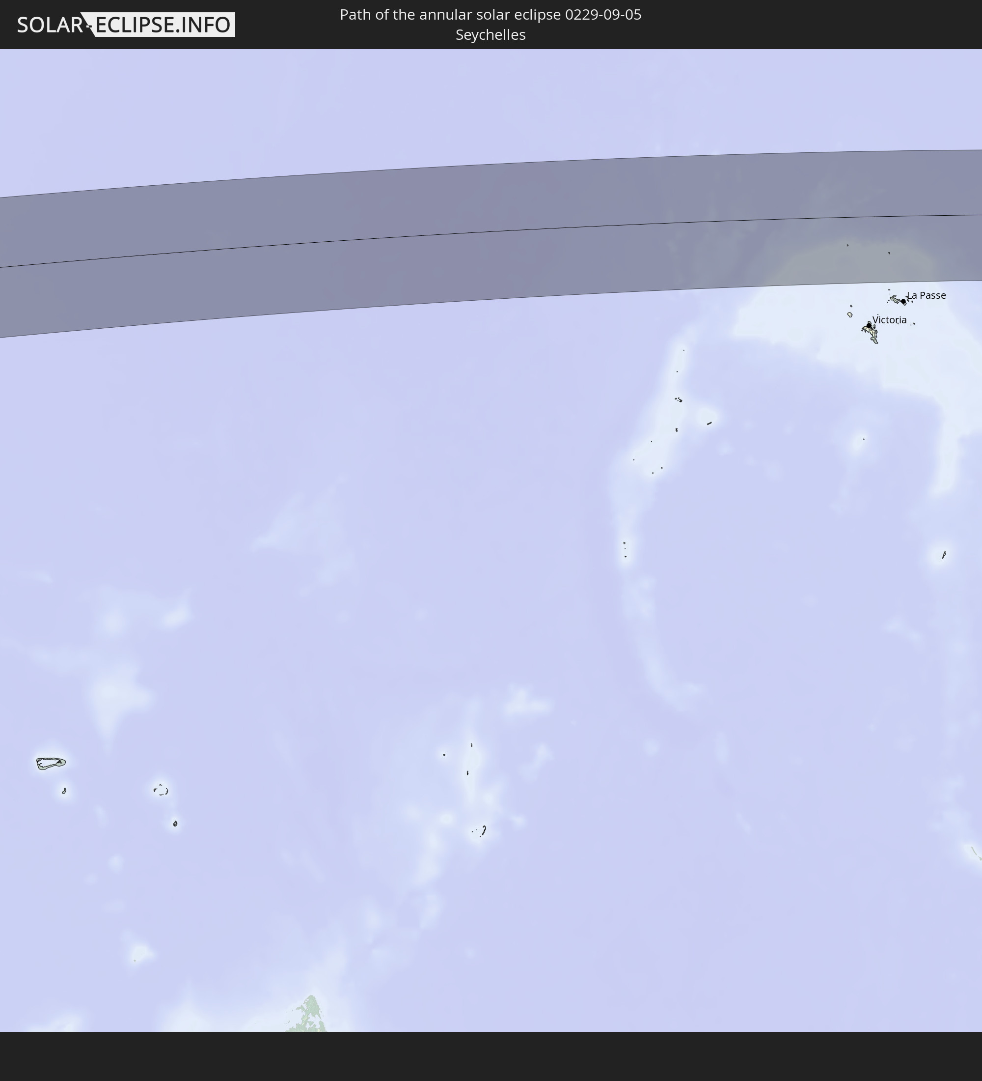 Seychelles
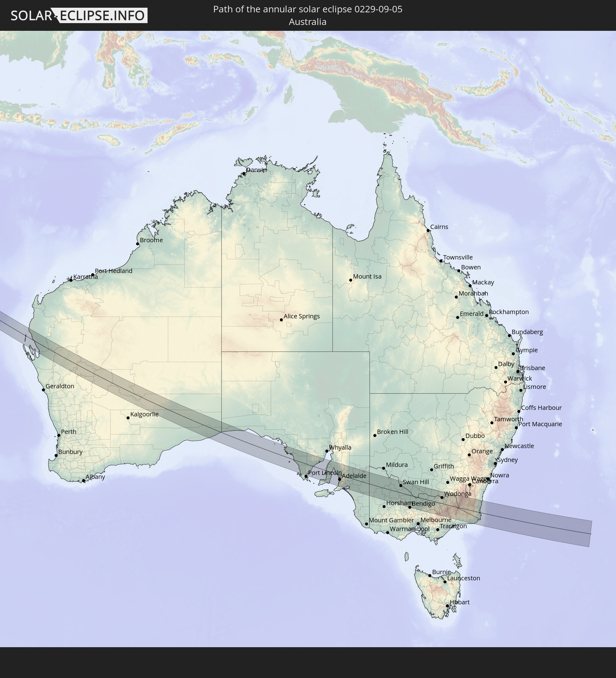 Australia
In den folgenden Ländern ist die Sonnenfinsternis partiell zu sehen
 Antarctica
 Sudan
Sudan
 Egypt
Egypt
 Tanzania
 Mozambique
 Ethiopia
 Kenya
Kenya
 Saudi Arabia
 Eritrea
 French Southern and Antarctic Lands
 Somalia
 Djibouti
 Yemen
Yemen
 Madagascar
 Comoros
 Iran
Iran
 Mayotte
 Seychelles
 Kuwait
 Bahrain
 Qatar
Qatar
 United Arab Emirates
 Oman
Oman
 Réunion
 Mauritius
 Pakistan
 India
India
 British Indian Ocean Territory
 Heard Island and McDonald Islands
 Maldives
 Sri Lanka
 Bangladesh
 Myanmar
 Indonesia
 Cocos Islands
 Thailand
 Malaysia
 Laos
Laos
 Vietnam
 Cambodia
 Singapore
 Christmas Island
 Australia
 Brunei
 Philippines
 East Timor
 Papua New Guinea
 Solomon Islands
 New Caledonia
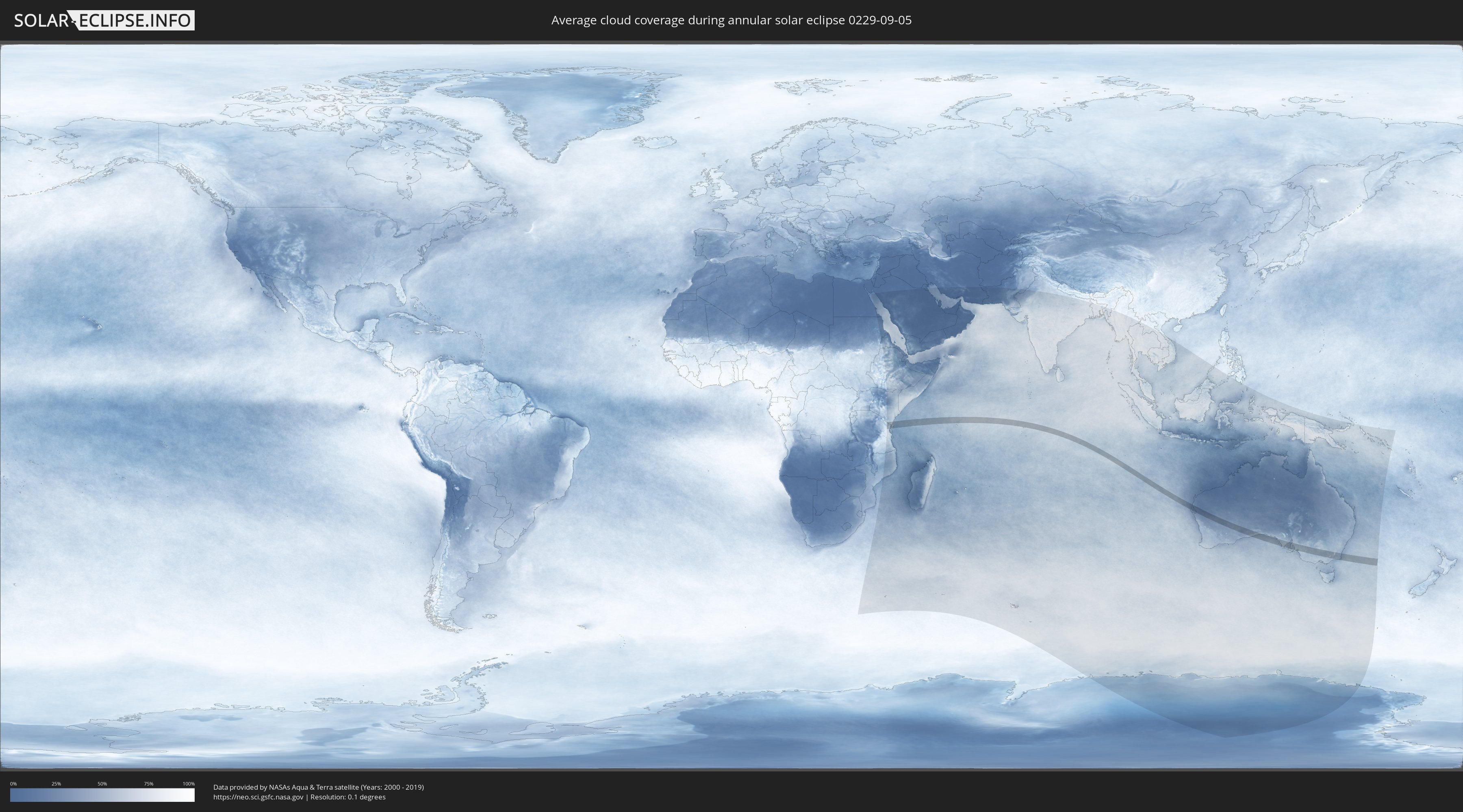
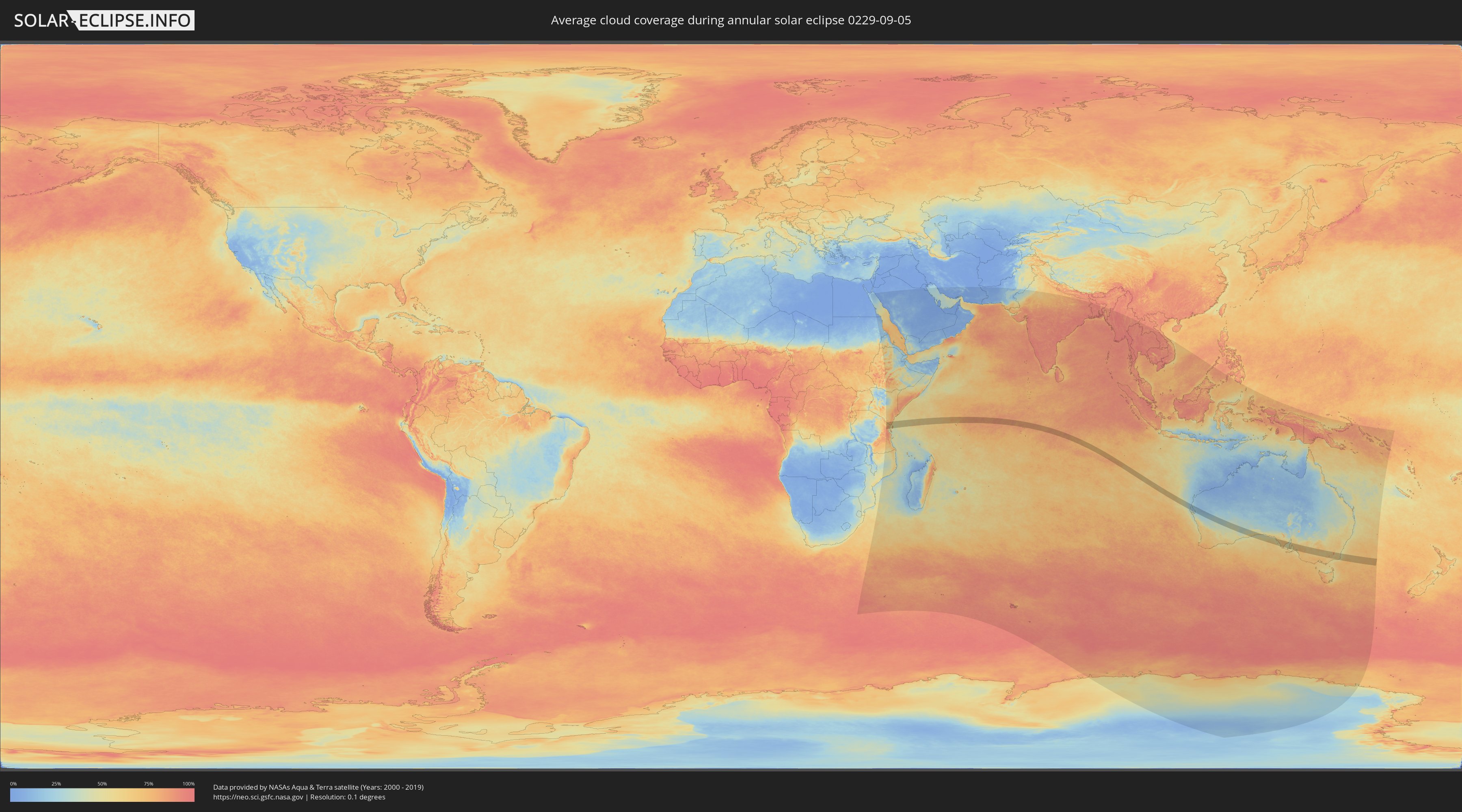
How will be the weather during the annular solar eclipse on 09/05/0229?
Where is the best place to see the annular solar eclipse of 09/05/0229?
The following maps show the average cloud coverage for the day of the annular solar eclipse.
With the help of these maps, it is possible to find the place along the eclipse path, which has the best
chance of a cloudless sky.
Nevertheless, you should consider local circumstances and inform about the weather of your chosen
observation site.
The data is provided by NASAs satellites
AQUA and TERRA.
The cloud maps are averaged over a period of 19 years (2000 - 2019).
Detailed country maps
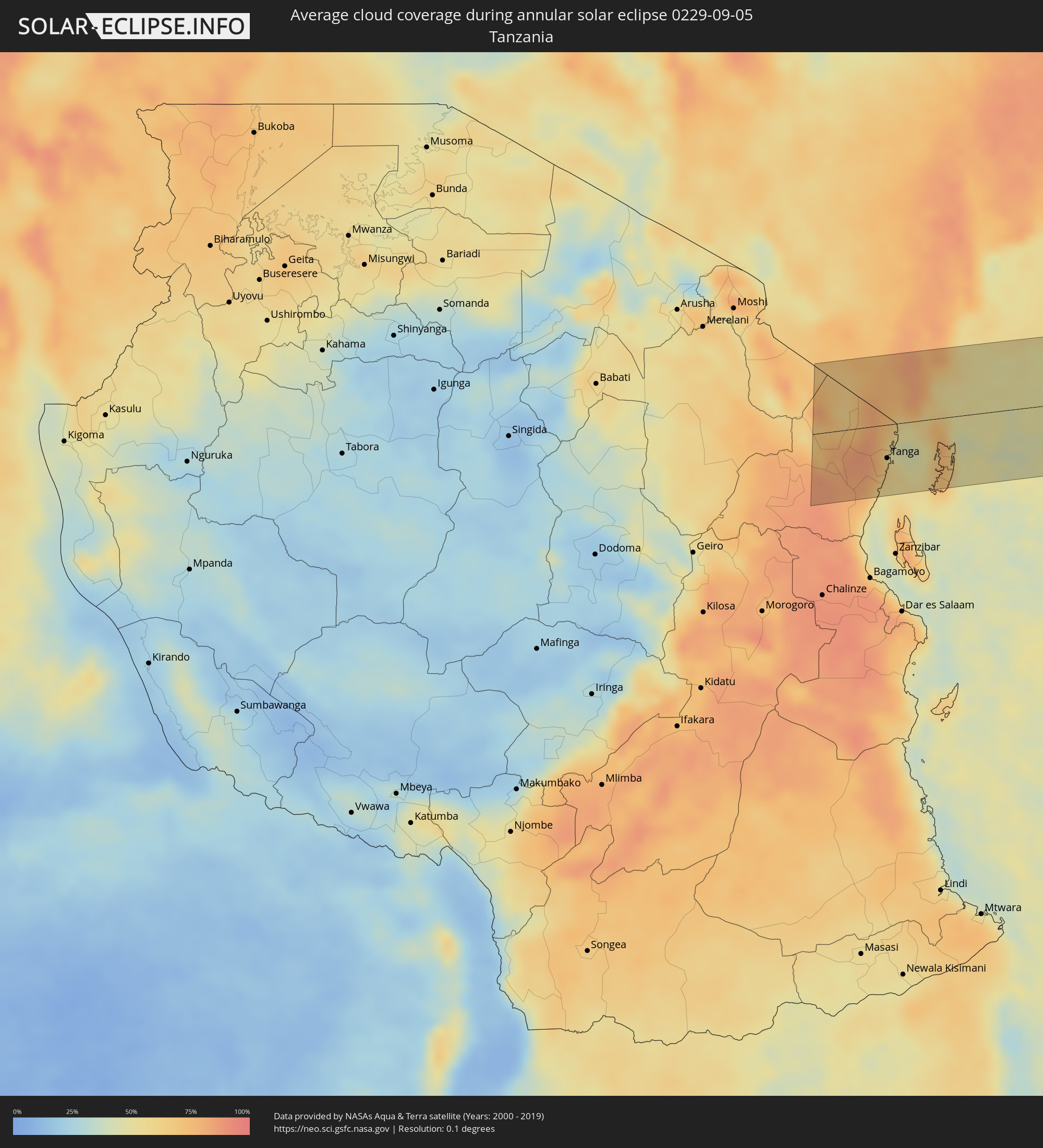 Tanzania
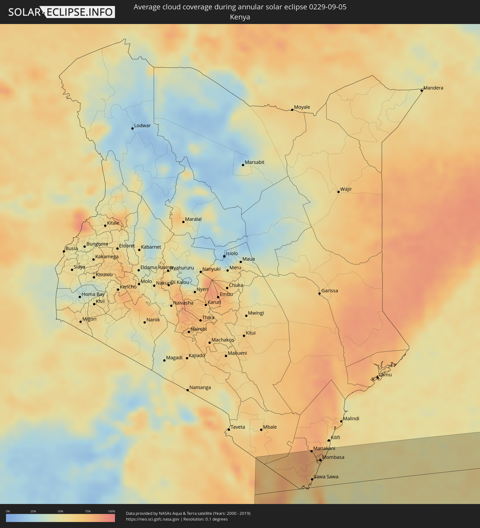 Kenya
Kenya
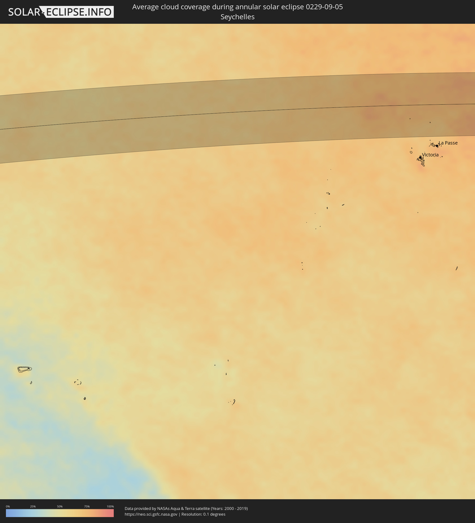 Seychelles
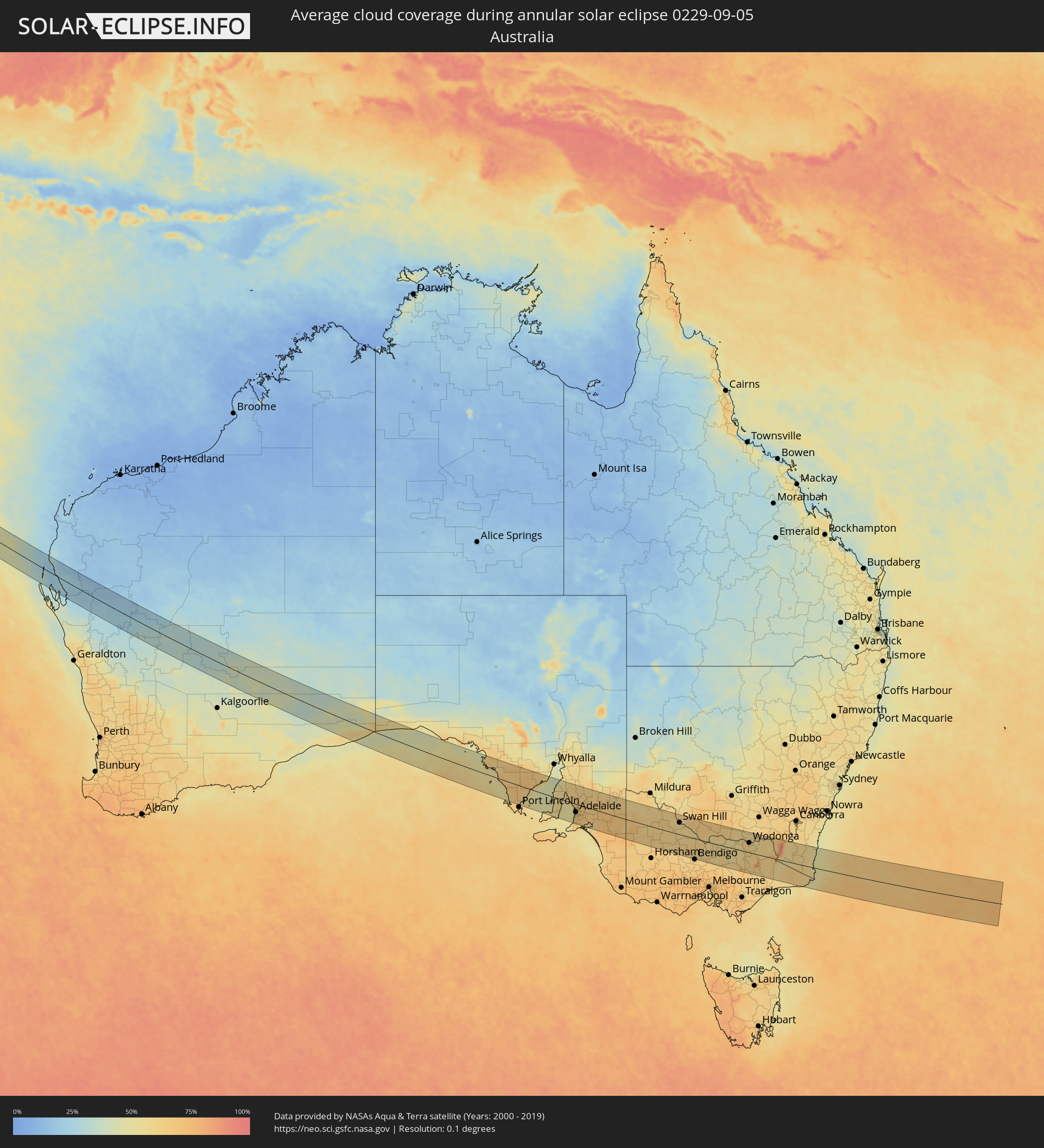 Australia
Cities inside the path of the eclipse
The following table shows all locations with a population of more than 5,000 inside the eclipse path. Cities which have more than 100,000 inhabitants are marked bold. A click at the locations opens a detailed map.
| City | Type | Eclipse duration | Local time of max. eclipse | Distance to central line | Ø Cloud coverage |
|
Matui, Tanga
|
annular | - | 05:54:52 UTC+02:27 | 1 km | 72% |
|
Lushoto, Tanga
|
annular | - | 05:54:52 UTC+02:27 | 1 km | 72% |
|
Soni, Tanga
|
annular | - | 05:54:54 UTC+02:27 | 8 km | 78% |
|
Maramba, Tanga
|
annular | - | 05:55:03 UTC+02:27 | 35 km | 84% |
|
Muheza, Tanga
|
annular | - | 05:55:09 UTC+02:27 | 49 km | 81% |
|
Mlalo, Tanga
|
annular | - | 05:55:01 UTC+02:27 | 25 km | 79% |
|
Pangani, Tanga
|
annular | - | 05:55:20 UTC+02:27 | 80 km | 50% |
|
Majengo, Tanga
|
annular | - | 05:55:10 UTC+02:27 | 50 km | 63% |
|
Tanga, Tanga
|
annular | - | 05:55:07 UTC+02:27 | 42 km | 60% |
|
Kinango, Kwale
|
annular | - | 05:54:33 UTC+02:27 | 58 km | 81% |
|
Kwale, Kwale
|
annular | - | 05:54:36 UTC+02:27 | 52 km | 76% |
|
Mariakani, Kwale
|
annular | - | 05:54:25 UTC+02:27 | 86 km | 77% |
|
Sawa Sawa, Kwale
|
annular | - | 05:54:47 UTC+02:27 | 18 km | 59% |
|
Gazi, Kwale
|
annular | - | 05:54:46 UTC+02:27 | 23 km | 63% |
|
Mombasa, Mombasa
|
annular | - | 05:54:33 UTC+02:27 | 62 km | 56% |
|
Mtambile, Pemba South
|
annular | - | 05:55:24 UTC+02:27 | 85 km | 62% |
|
Wete, Pemba North
|
annular | - | 05:55:12 UTC+02:27 | 49 km | 74% |
|
Konde, Pemba North
|
annular | - | 05:55:08 UTC+02:27 | 38 km | 65% |
|
Chake Chake, Pemba South
|
annular | - | 05:55:19 UTC+02:27 | 71 km | 60% |
|
Micheweni, Pemba North
|
annular | - | 05:55:09 UTC+02:27 | 41 km | 65% |
|
Carnarvon, Western Australia
|
annular | - | 14:17:50 UTC+08:00 | 22 km | 26% |
|
Aldinga, South Australia
|
annular | - | 16:22:55 UTC+09:30 | 75 km | 64% |
|
Grange, South Australia
|
annular | - | 16:23:04 UTC+09:30 | 34 km | 54% |
|
Henley Beach, South Australia
|
annular | - | 16:23:04 UTC+09:30 | 36 km | 54% |
|
Seaton, South Australia
|
annular | - | 16:23:05 UTC+09:30 | 33 km | 54% |
|
Morphett Vale, South Australia
|
annular | - | 16:23:00 UTC+09:30 | 58 km | 58% |
|
Findon, South Australia
|
annular | - | 16:23:06 UTC+09:30 | 33 km | 54% |
|
Happy Valley, South Australia
|
annular | - | 16:23:02 UTC+09:30 | 52 km | 58% |
|
North Adelaide, South Australia
|
annular | - | 16:23:08 UTC+09:30 | 32 km | 64% |
|
Prospect, South Australia
|
annular | - | 16:23:09 UTC+09:30 | 29 km | 64% |
|
Adelaide, South Australia
|
annular | - | 16:23:08 UTC+09:30 | 34 km | 64% |
|
Salisbury, South Australia
|
annular | - | 16:23:13 UTC+09:30 | 16 km | 66% |
|
Ingle Farm, South Australia
|
annular | - | 16:23:12 UTC+09:30 | 23 km | 66% |
|
Klemzig, South Australia
|
annular | - | 16:23:11 UTC+09:30 | 28 km | 64% |
|
Campbelltown, South Australia
|
annular | - | 16:23:12 UTC+09:30 | 28 km | 70% |
|
Paradise, South Australia
|
annular | - | 16:23:12 UTC+09:30 | 26 km | 70% |
|
Modbury, South Australia
|
annular | - | 16:23:14 UTC+09:30 | 22 km | 67% |
|
Athelstone, South Australia
|
annular | - | 16:23:14 UTC+09:30 | 25 km | 70% |
|
Hope Valley, South Australia
|
annular | - | 16:23:15 UTC+09:30 | 21 km | 67% |
|
Adelaide Hills, South Australia
|
annular | - | 16:23:13 UTC+09:30 | 29 km | 70% |
|
Golden Grove, South Australia
|
annular | - | 16:23:17 UTC+09:30 | 15 km | 67% |
|
Gawler, South Australia
|
annular | - | 16:23:22 UTC+09:30 | 5 km | 67% |
|
Mount Barker, South Australia
|
annular | - | 16:23:17 UTC+09:30 | 42 km | 68% |
|
Nuriootpa, South Australia
|
annular | - | 16:23:35 UTC+09:30 | 26 km | 68% |
|
Murray Bridge, South Australia
|
annular | - | 16:23:33 UTC+09:30 | 36 km | 65% |
|
Swan Hill, Victoria
|
annular | - | 16:56:11 UTC+10:00 | 49 km | 59% |
|
Echuca, Victoria
|
annular | - | 16:56:27 UTC+10:00 | 9 km | 60% |
|
Deniliquin, New South Wales
|
annular | - | 16:56:51 UTC+10:00 | 61 km | 65% |
|
Kyabram, Victoria
|
annular | - | 16:56:31 UTC+10:00 | 21 km | 59% |
|
Shepparton, Victoria
|
annular | - | 16:56:40 UTC+10:00 | 20 km | 61% |
|
Benalla, Victoria
|
annular | - | 16:56:51 UTC+10:00 | 26 km | 57% |
|
Yarrawonga, Victoria
|
annular | - | 16:57:08 UTC+10:00 | 32 km | 56% |
|
Wangaratta, Victoria
|
annular | - | 16:57:07 UTC+10:00 | 2 km | 55% |
|
Corowa, New South Wales
|
annular | - | 16:57:19 UTC+10:00 | 43 km | 57% |
|
Wodonga, Victoria
|
annular | - | 16:57:29 UTC+10:00 | 40 km | 61% |
|
Albury, New South Wales
|
annular | - | 16:57:31 UTC+10:00 | 46 km | 61% |
|
East Albury, New South Wales
|
annular | - | 16:57:31 UTC+10:00 | 45 km | 61% |
|
North Albury, New South Wales
|
annular | - | 16:57:32 UTC+10:00 | 48 km | 61% |
|
Lavington, New South Wales
|
annular | - | 16:57:33 UTC+10:00 | 50 km | 62% |
|
Cooma, New South Wales
|
annular | - | 16:58:20 UTC+10:00 | 74 km | 61% |
|
Merimbula, New South Wales
|
annular | - | 16:58:16 UTC+10:00 | 19 km | 52% |