Annular solar eclipse of 03/22/0703
| Day of week: | Sunday |
| Maximum duration of eclipse: | 04m08s |
| Maximum width of eclipse path: | 143 km |
| Saros cycle: | 89 |
| Coverage: | 96.1% |
| Magnitude: | 0.9612 |
| Gamma: | -0.1819 |
Wo kann man die Sonnenfinsternis vom 03/22/0703 sehen?
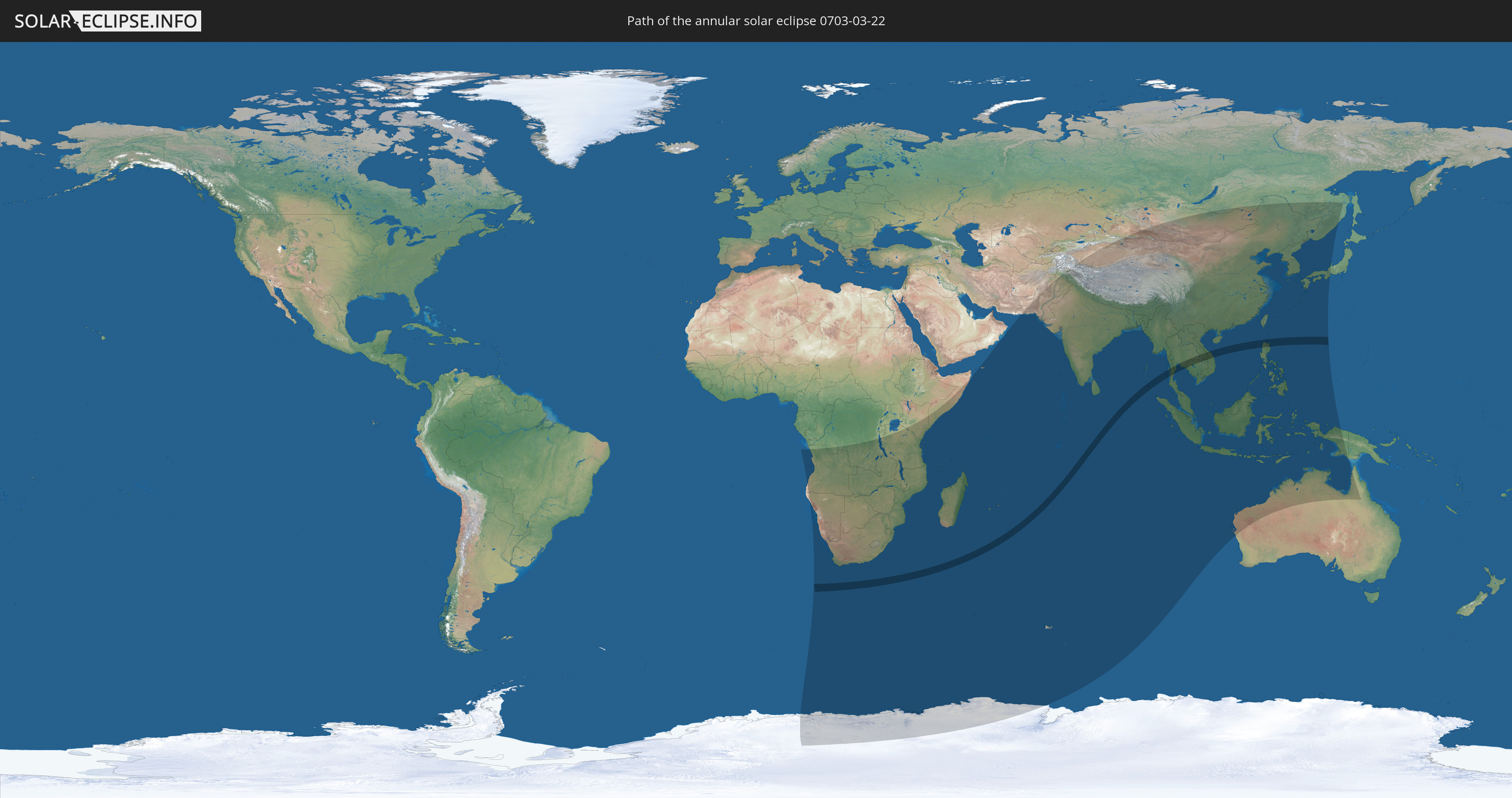
Die Sonnenfinsternis am 03/22/0703 kann man in 57 Ländern als partielle Sonnenfinsternis beobachten.
Der Finsternispfad verläuft durch 7 Länder. Nur in diesen Ländern ist sie als annular Sonnenfinsternis zu sehen.
In den folgenden Ländern ist die Sonnenfinsternis annular zu sehen
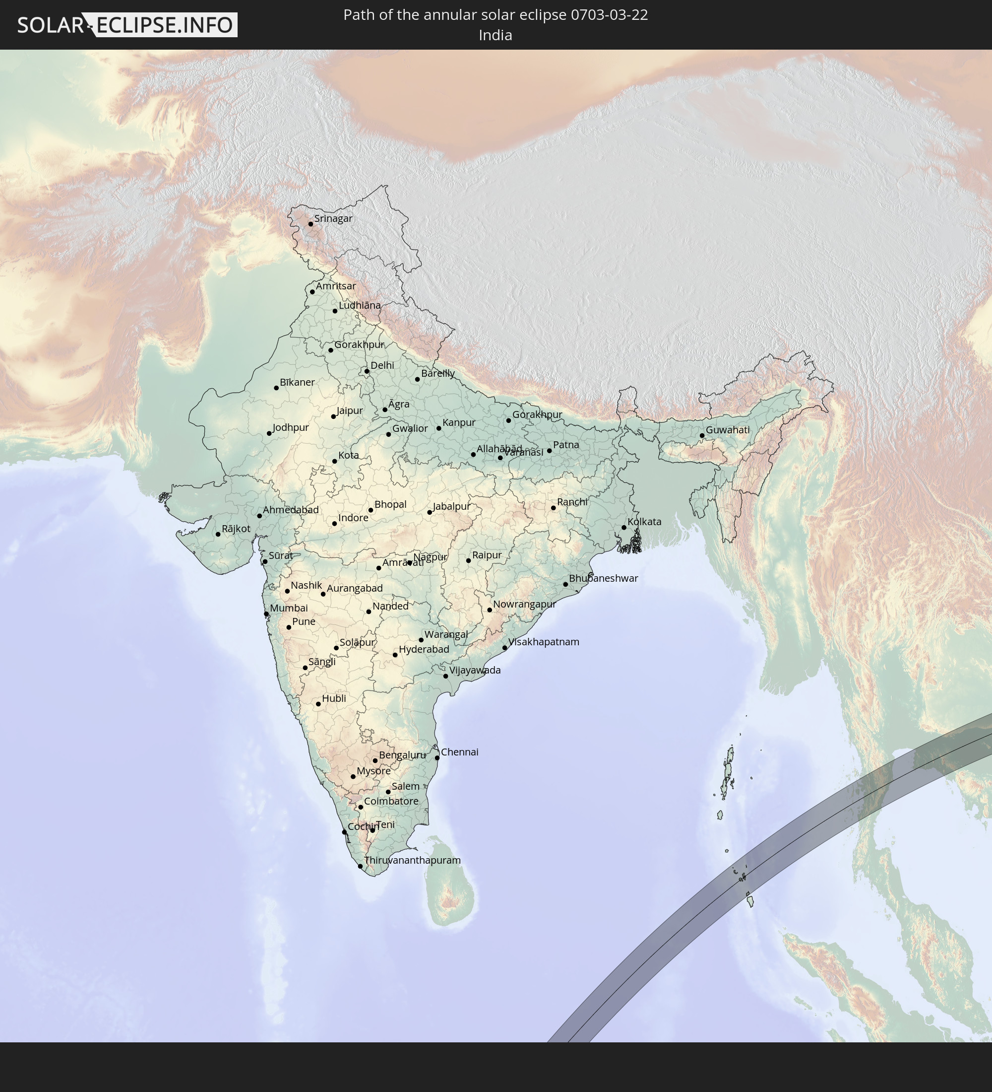 India
India
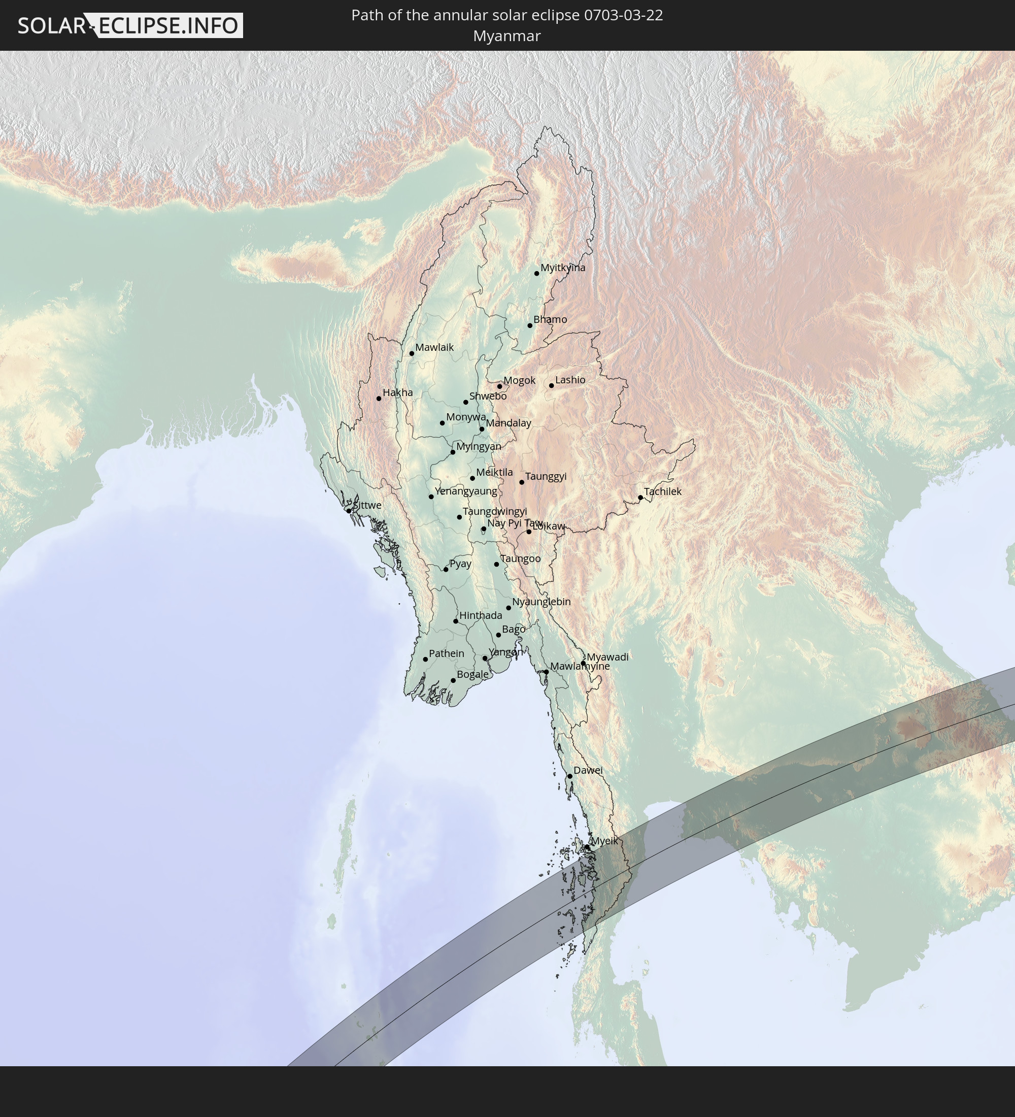 Myanmar
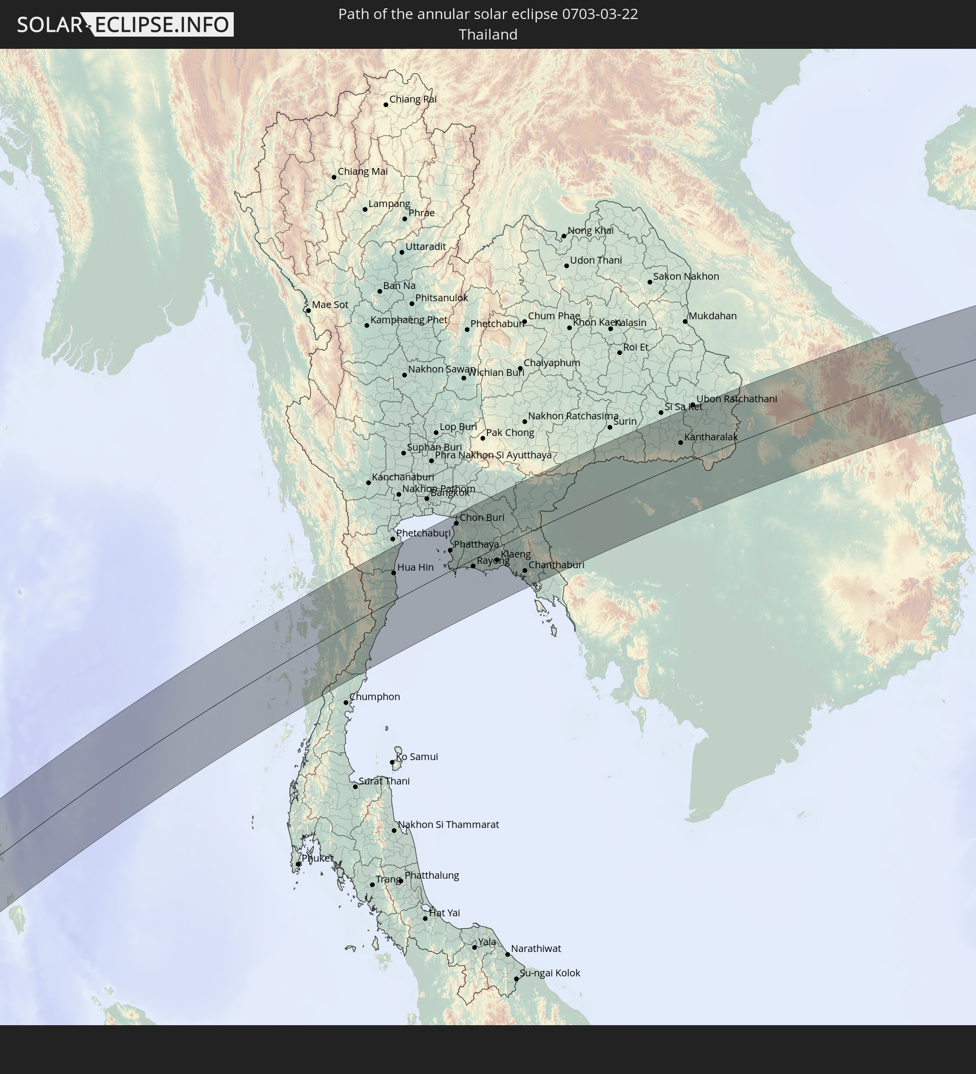 Thailand
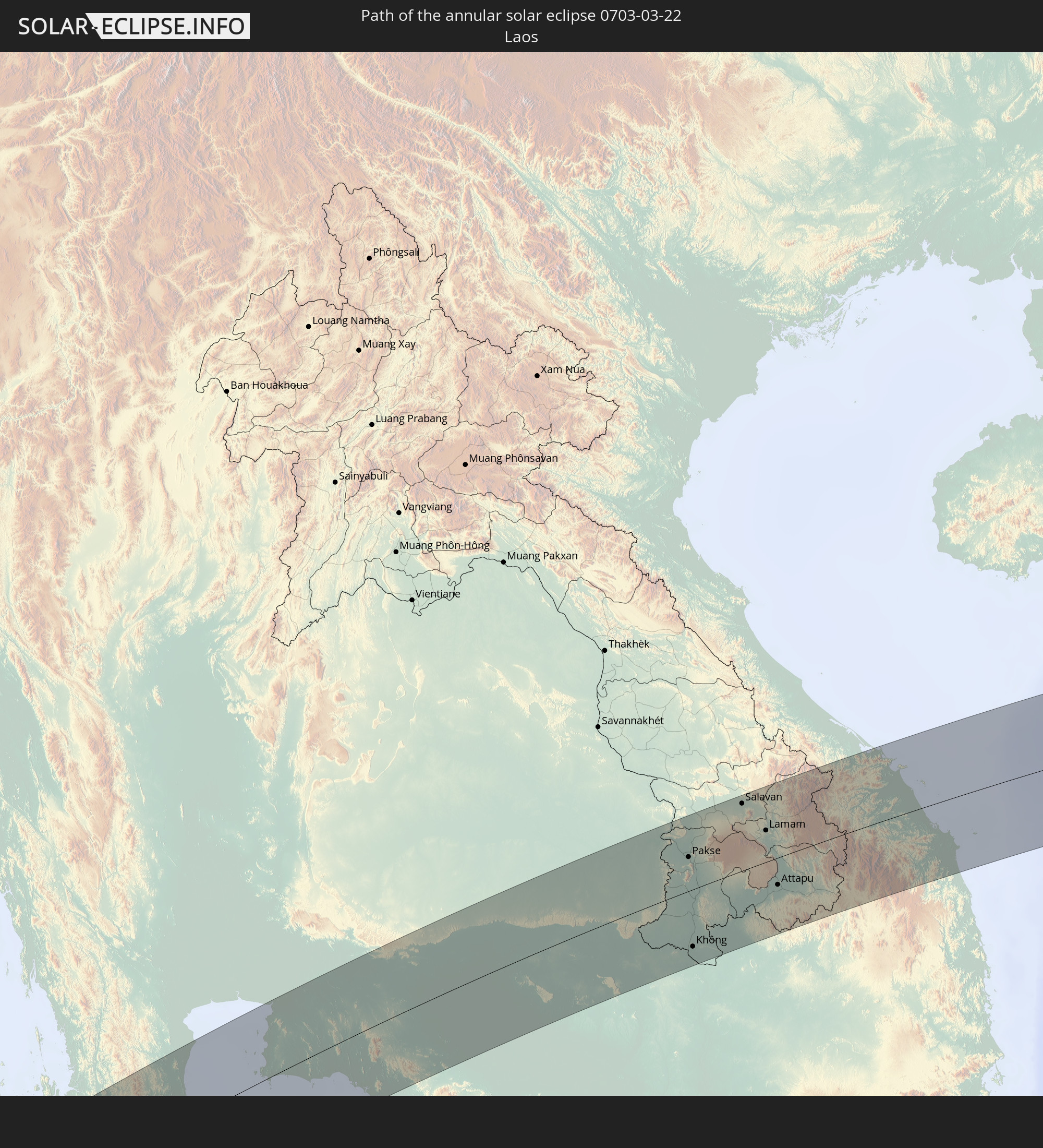 Laos
Laos
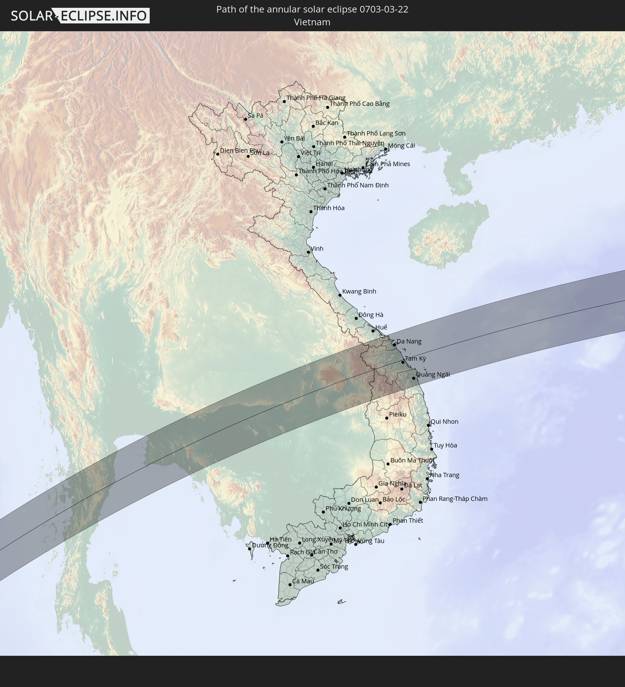 Vietnam
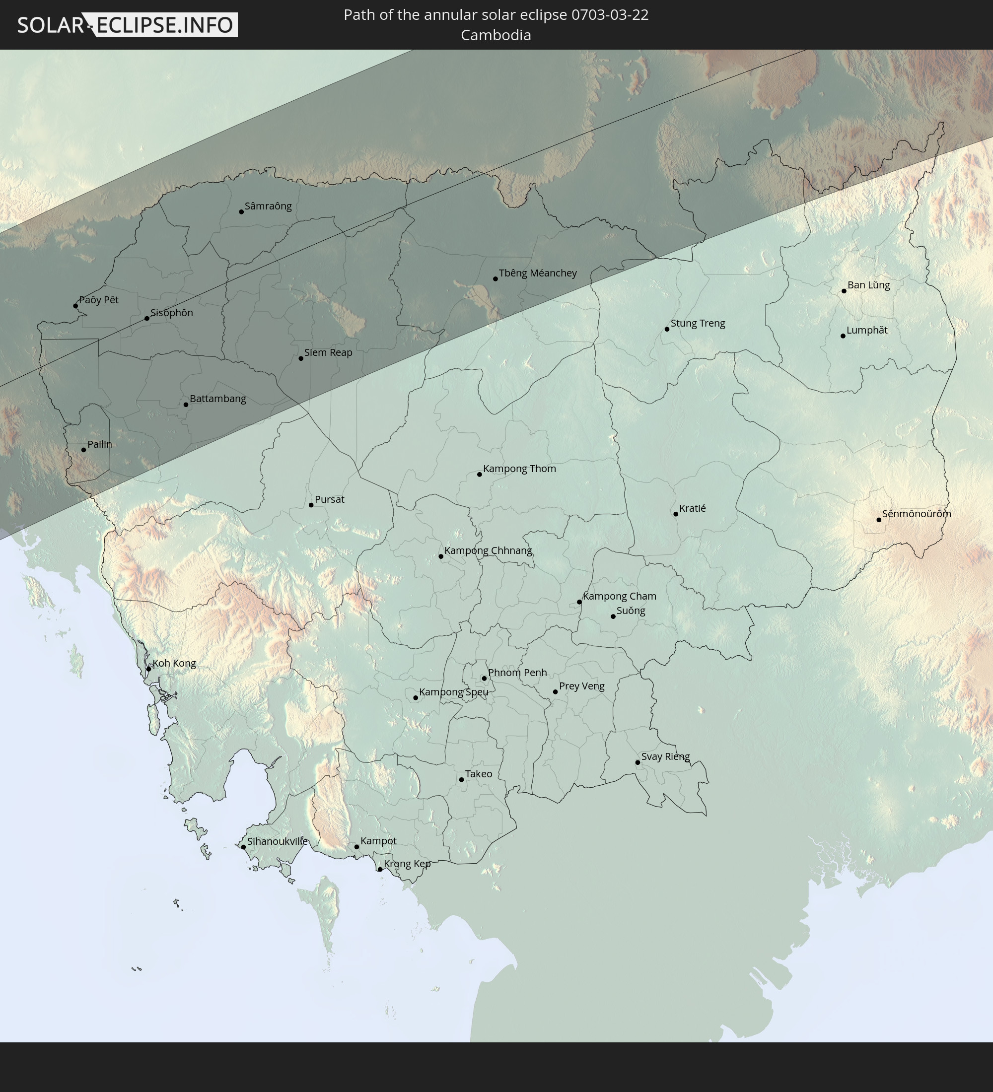 Cambodia
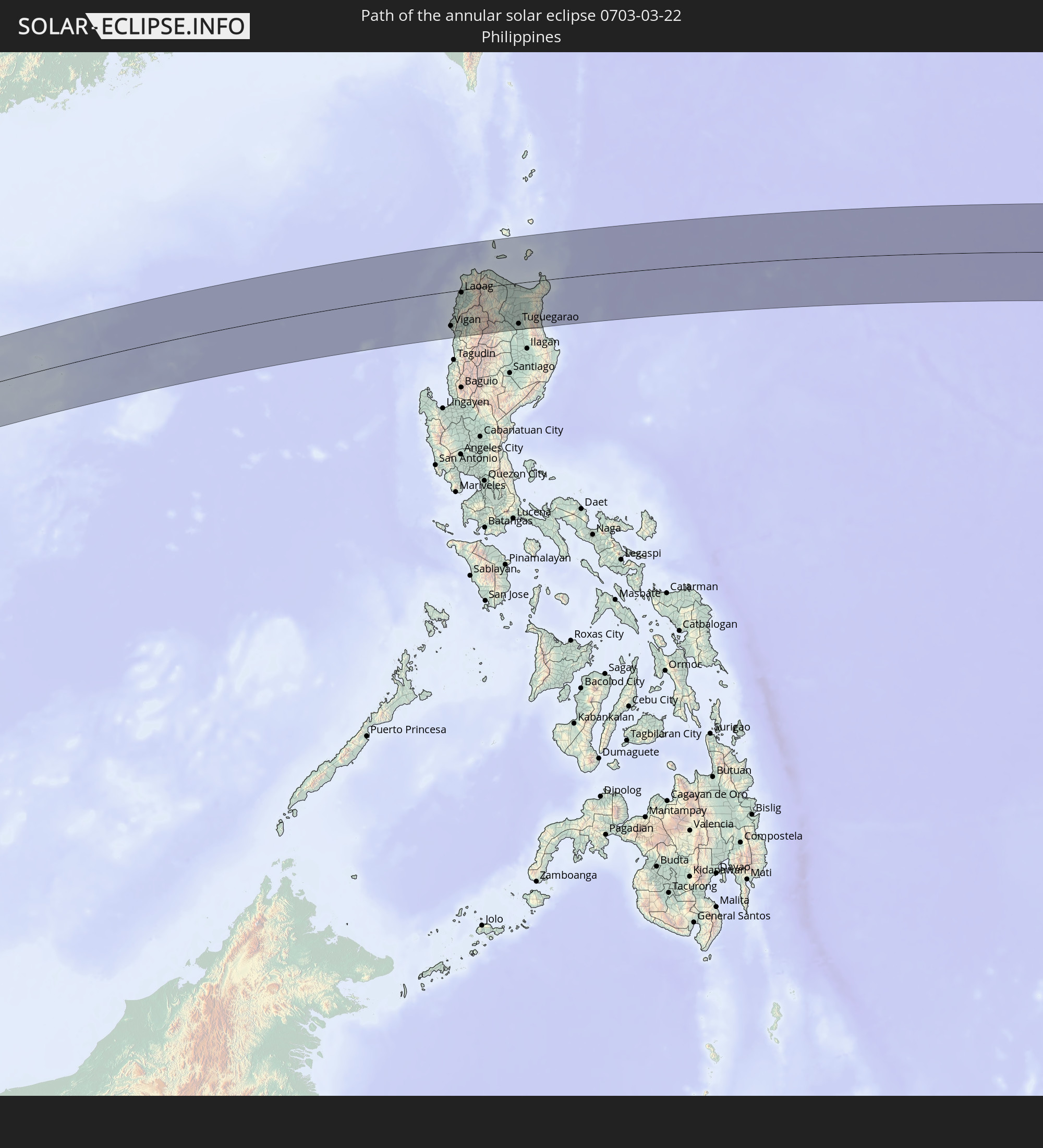 Philippines
In den folgenden Ländern ist die Sonnenfinsternis partiell zu sehen
 Russia
 Antarctica
 Angola
 Namibia
 Democratic Republic of the Congo
 South Africa
 Botswana
 Zambia
 Zimbabwe
 Lesotho
 Burundi
 Tanzania
 Mozambique
 Swaziland
 Malawi
 Kenya
Kenya
 French Southern and Antarctic Lands
 Somalia
 Yemen
Yemen
 Madagascar
 Comoros
 Mayotte
 Seychelles
 Réunion
 Mauritius
 Pakistan
 India
India
 British Indian Ocean Territory
 Heard Island and McDonald Islands
 Maldives
 China
China
 Sri Lanka
 Nepal
Nepal
 Mongolia
 Bangladesh
 Bhutan
 Myanmar
 Indonesia
 Cocos Islands
 Thailand
 Malaysia
 Laos
Laos
 Vietnam
 Cambodia
 Singapore
 Christmas Island
 Australia
 Macau
Macau
 Hong Kong
 Brunei
 Taiwan
 Philippines
 Japan
Japan
 East Timor
 North Korea
 South Korea
 Palau
Palau
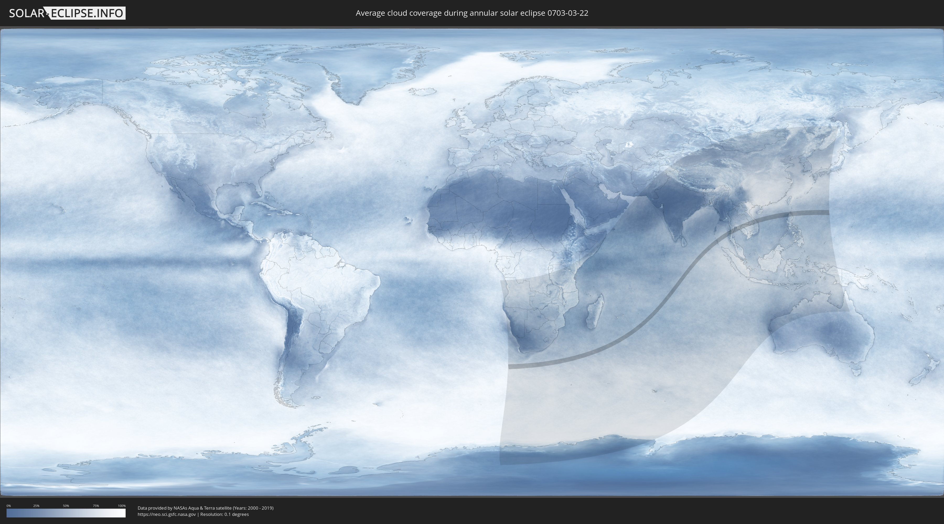
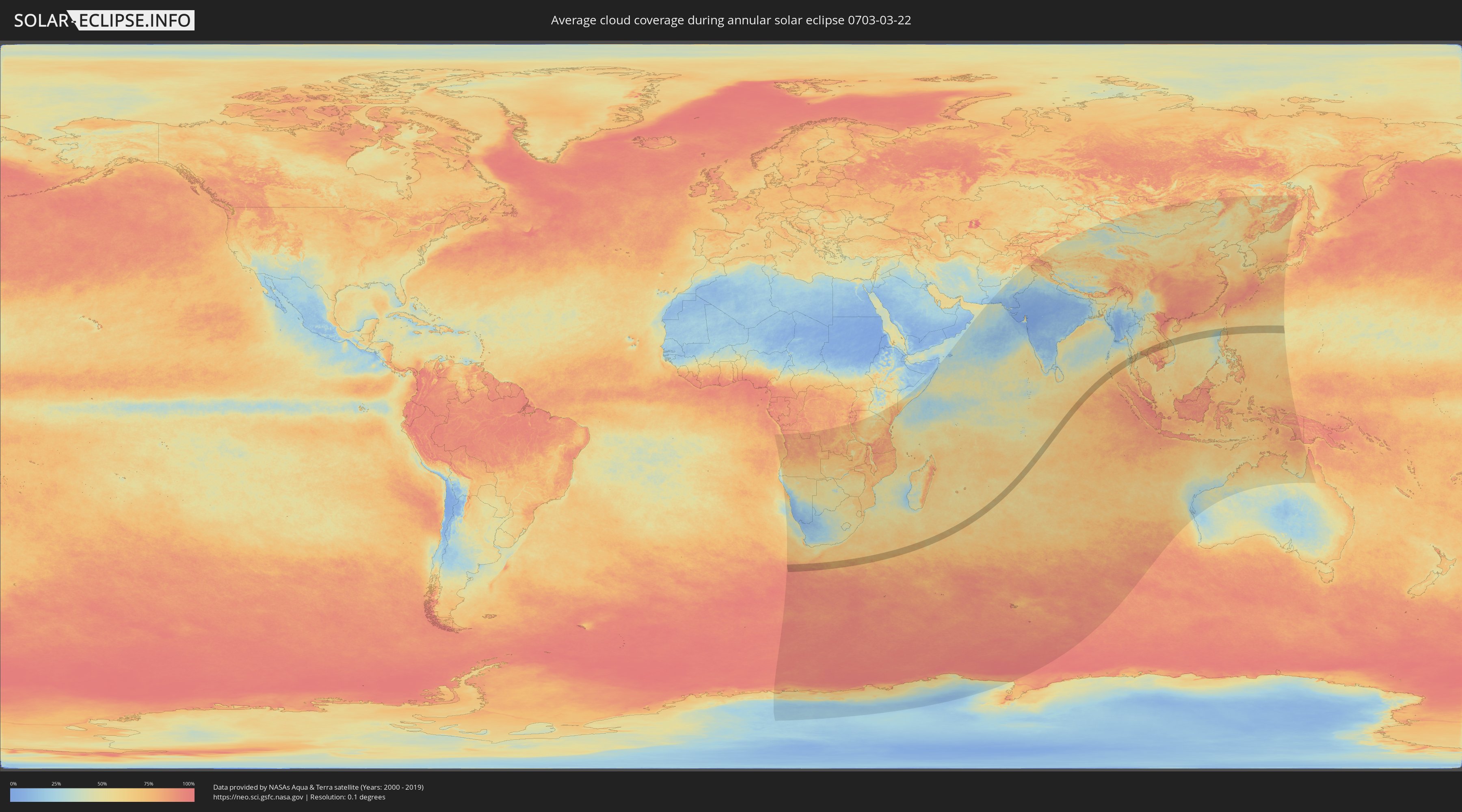
How will be the weather during the annular solar eclipse on 03/22/0703?
Where is the best place to see the annular solar eclipse of 03/22/0703?
The following maps show the average cloud coverage for the day of the annular solar eclipse.
With the help of these maps, it is possible to find the place along the eclipse path, which has the best
chance of a cloudless sky.
Nevertheless, you should consider local circumstances and inform about the weather of your chosen
observation site.
The data is provided by NASAs satellites
AQUA and TERRA.
The cloud maps are averaged over a period of 19 years (2000 - 2019).
Detailed country maps
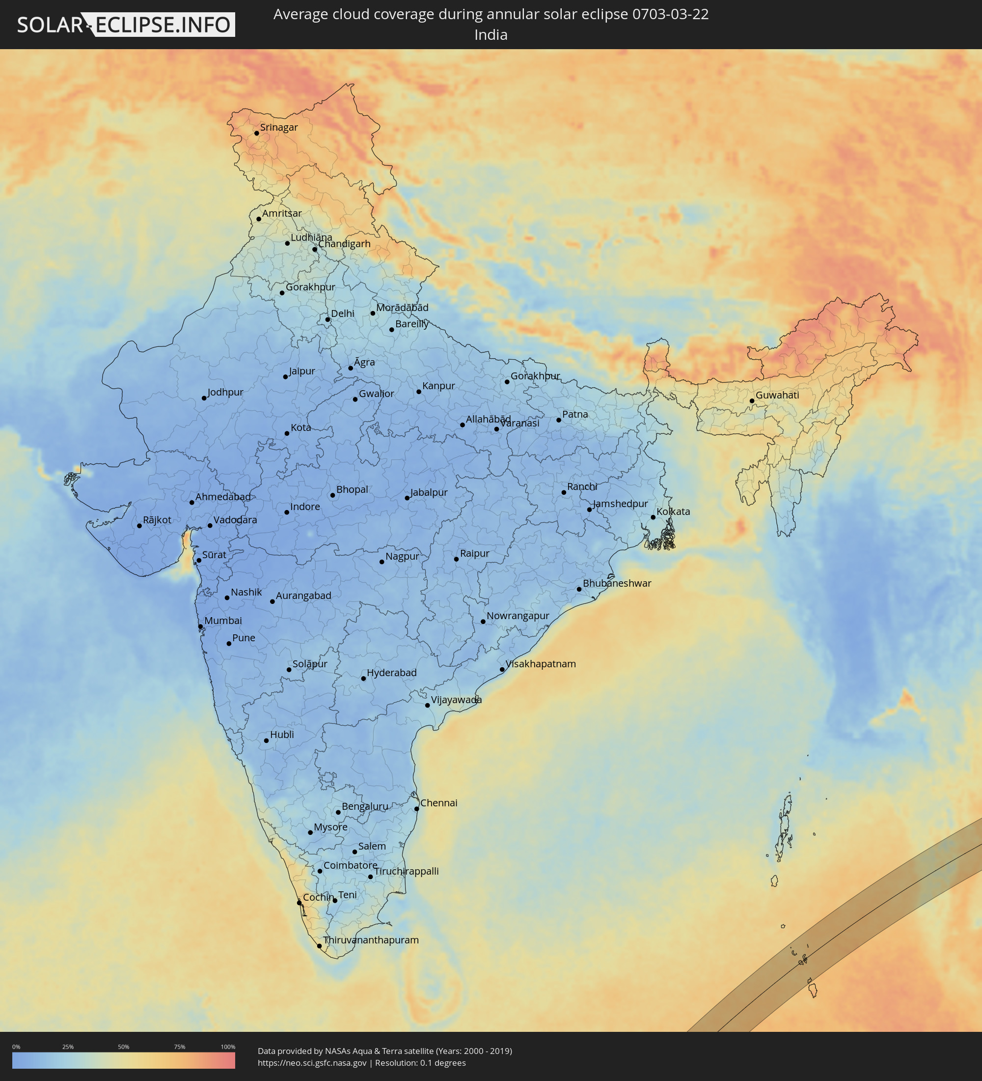 India
India
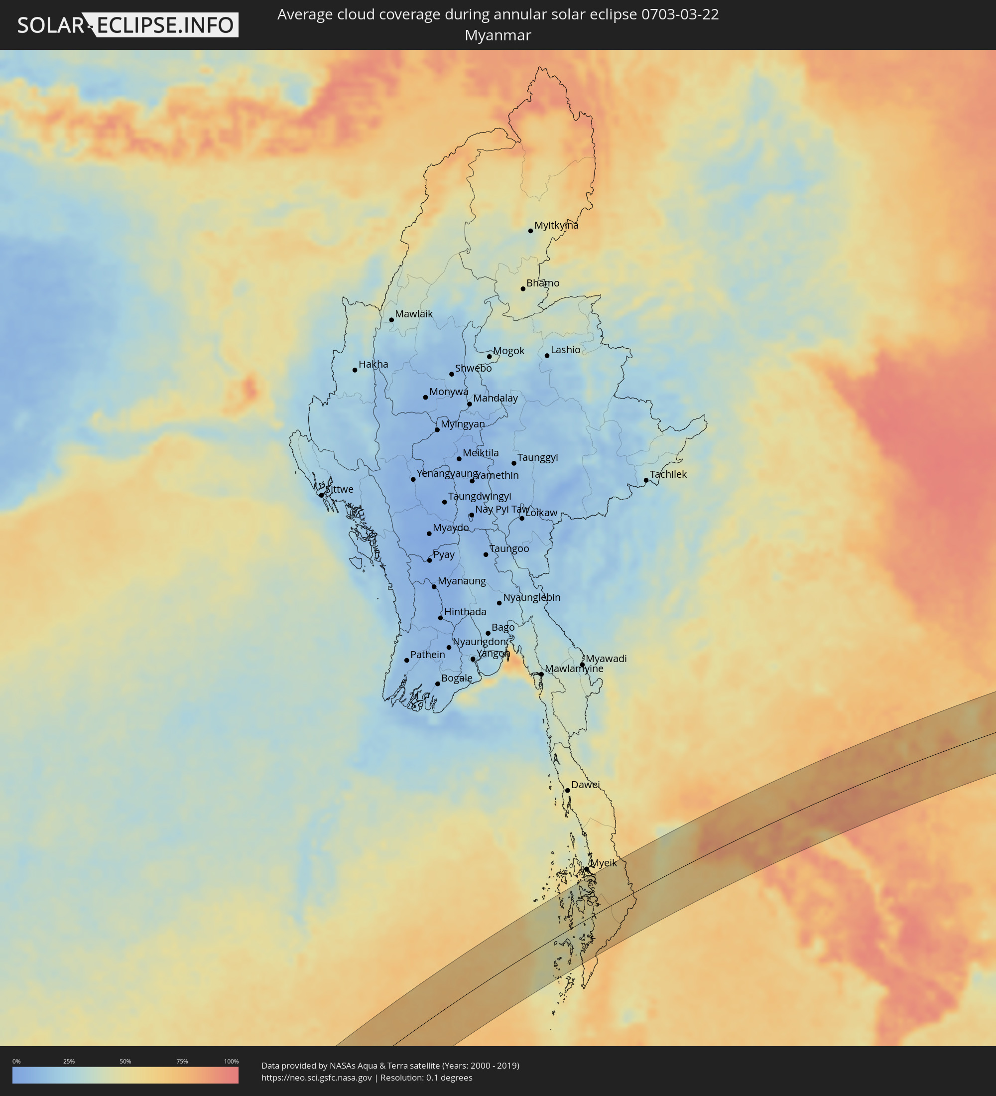 Myanmar
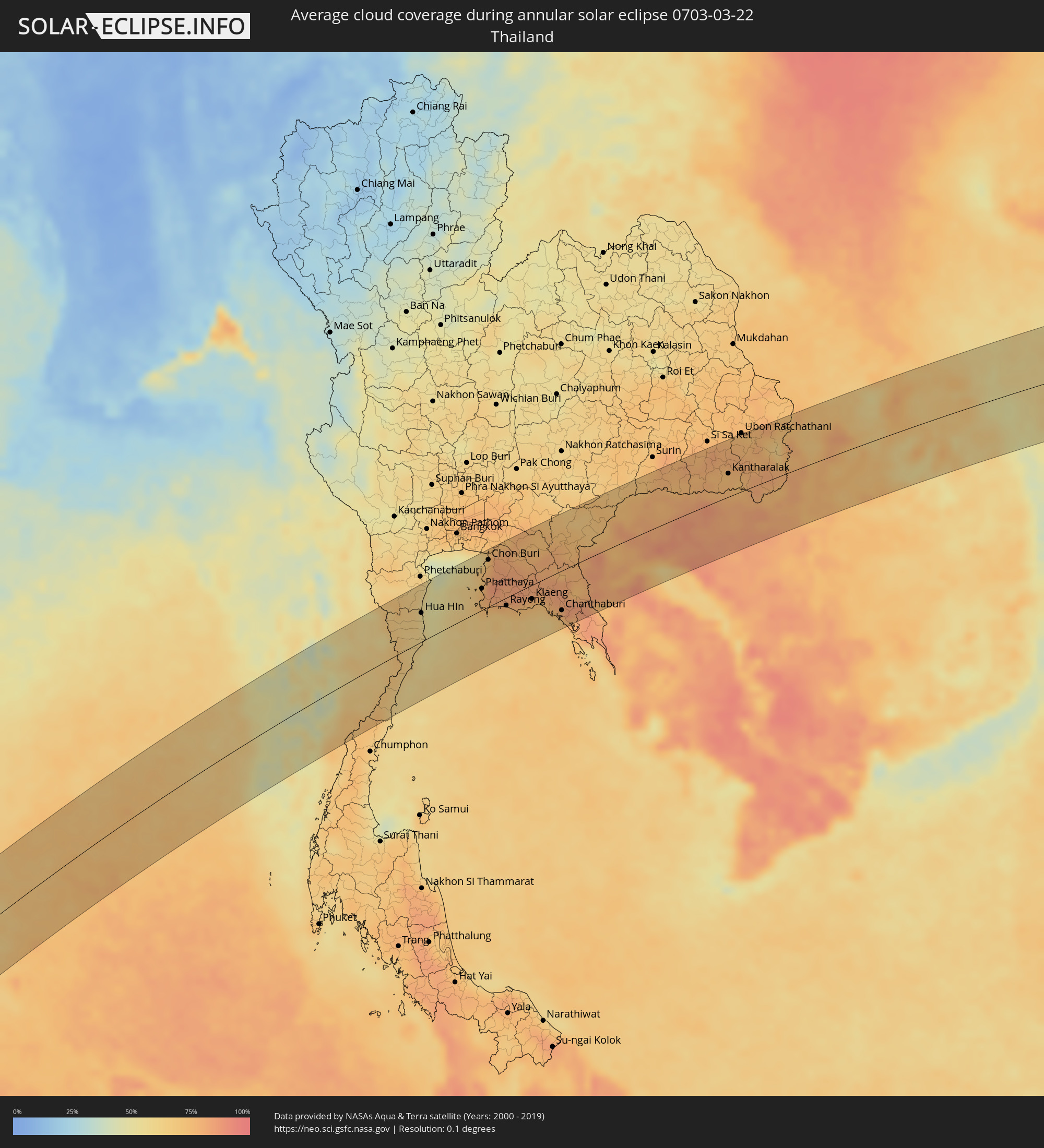 Thailand
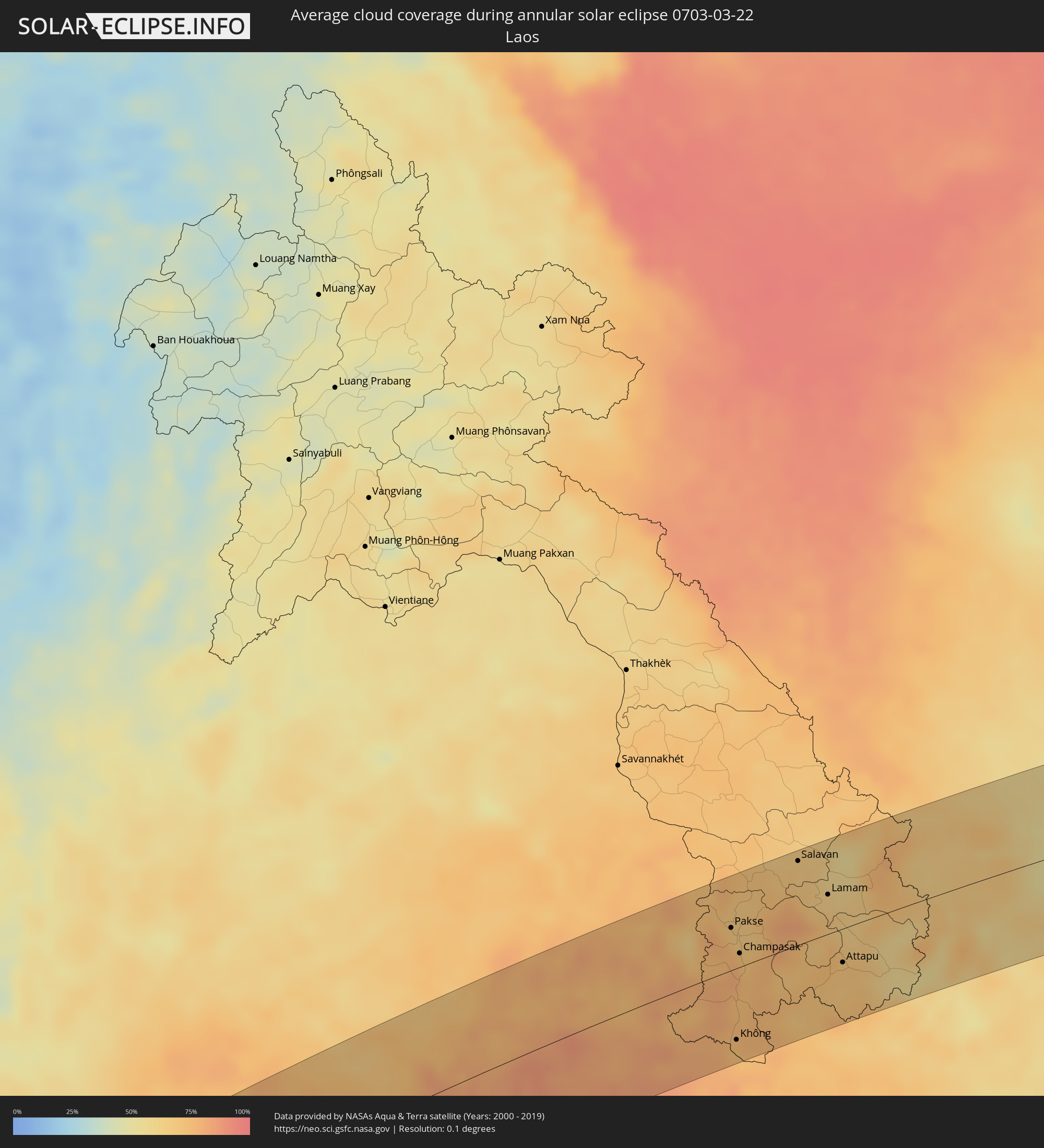 Laos
Laos
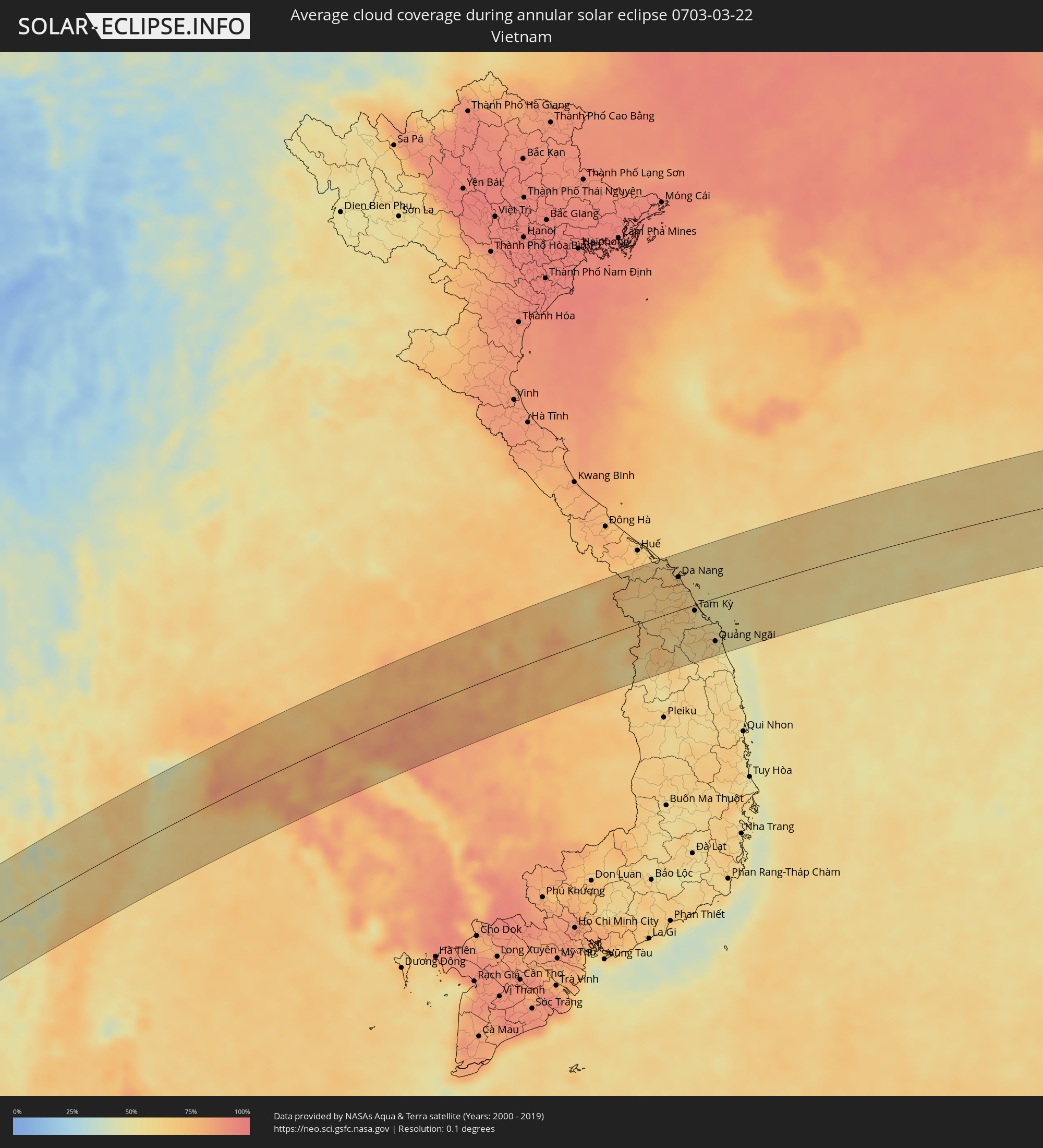 Vietnam
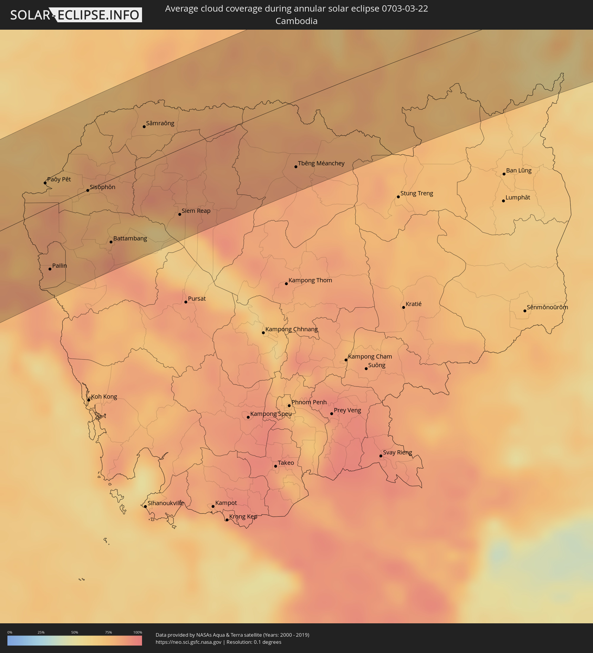 Cambodia
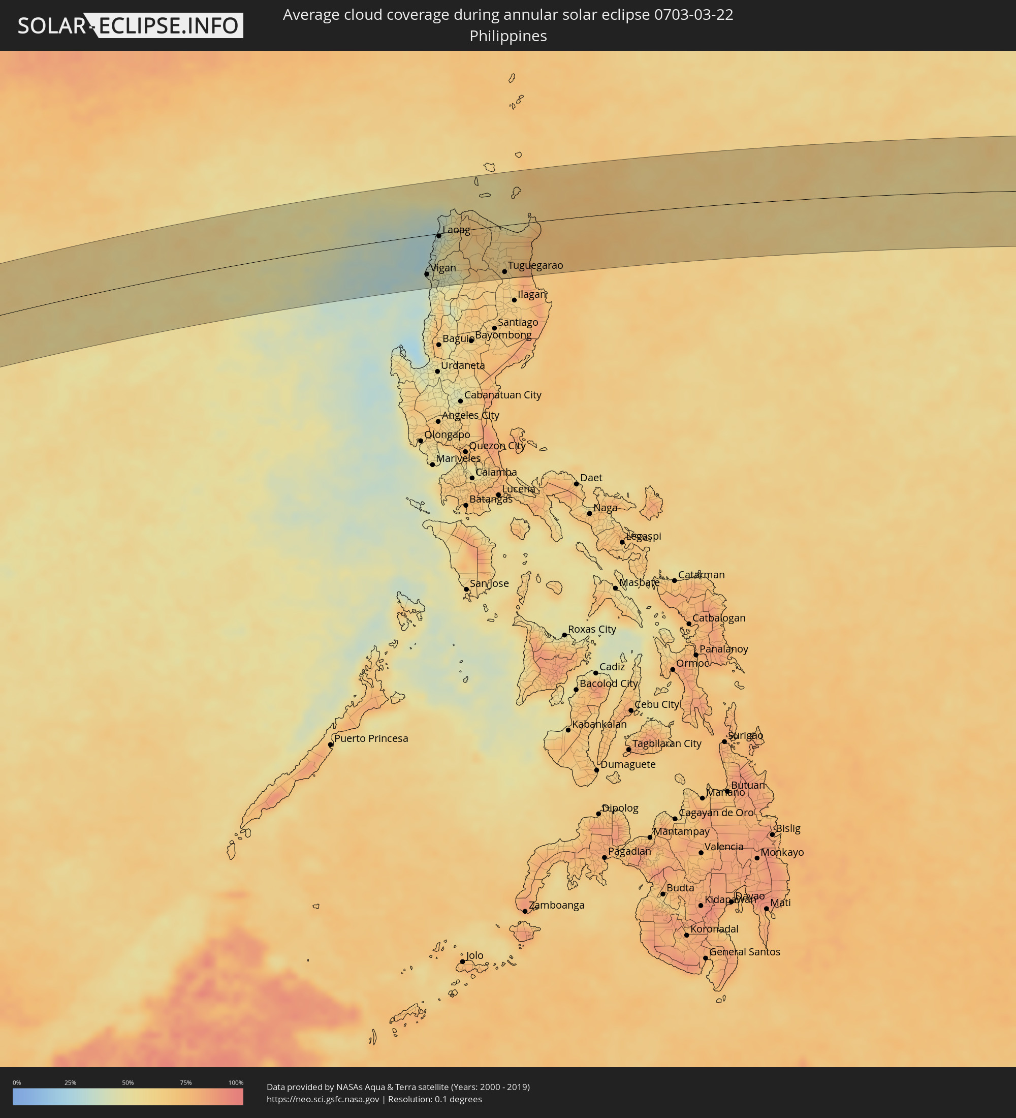 Philippines
Cities inside the path of the eclipse
The following table shows all locations with a population of more than 5,000 inside the eclipse path. Cities which have more than 100,000 inhabitants are marked bold. A click at the locations opens a detailed map.
| City | Type | Eclipse duration | Local time of max. eclipse | Distance to central line | Ø Cloud coverage |
|
Bang Saphan, Prachuap Khiri Khan
|
annular | - | 15:12:19 UTC+06:42 | 67 km | 61% |
|
Prachuap Khiri Khan, Prachuap Khiri Khan
|
annular | - | 15:13:40 UTC+06:42 | 22 km | 63% |
|
Kui Buri, Prachuap Khiri Khan
|
annular | - | 15:14:10 UTC+06:42 | 0 km | 59% |
|
Sam Roi Yot, Prachuap Khiri Khan
|
annular | - | 15:14:29 UTC+06:42 | 17 km | 60% |
|
Pran Buri, Prachuap Khiri Khan
|
annular | - | 15:14:42 UTC+06:42 | 27 km | 61% |
|
Tha Yang, Phetchaburi
|
annular | - | 15:15:33 UTC+06:42 | 83 km | 63% |
|
Hua Hin, Prachuap Khiri Khan
|
annular | - | 15:15:04 UTC+06:42 | 42 km | 55% |
|
Cha-am, Phetchaburi
|
annular | - | 15:15:25 UTC+06:42 | 64 km | 55% |
|
Phatthaya, Chon Buri
|
annular | - | 15:16:54 UTC+06:42 | 32 km | 75% |
|
Sattahip, Chon Buri
|
annular | - | 15:16:32 UTC+06:42 | 4 km | 74% |
|
Bang Lamung, Chon Buri
|
annular | - | 15:17:07 UTC+06:42 | 41 km | 73% |
|
Si Racha, Chon Buri
|
annular | - | 15:17:18 UTC+06:42 | 53 km | 71% |
|
Chon Buri, Chon Buri
|
annular | - | 15:17:39 UTC+06:42 | 70 km | 73% |
|
Ban Talat Bueng, Chon Buri
|
annular | - | 15:17:16 UTC+06:42 | 40 km | 81% |
|
Ban Chang, Rayong
|
annular | - | 15:16:50 UTC+06:42 | 3 km | 75% |
|
Phan Thong, Chon Buri
|
annular | - | 15:17:57 UTC+06:42 | 75 km | 79% |
|
Ban Bueng, Chon Buri
|
annular | - | 15:17:45 UTC+06:42 | 58 km | 82% |
|
Phanat Nikhom, Chon Buri
|
annular | - | 15:18:02 UTC+06:42 | 68 km | 80% |
|
Rayong, Rayong
|
annular | - | 15:17:03 UTC+06:42 | 12 km | 75% |
|
Klaeng, Rayong
|
annular | - | 15:17:44 UTC+06:42 | 21 km | 77% |
|
Tha Mai, Chanthaburi
|
annular | - | 15:18:00 UTC+06:42 | 53 km | 73% |
|
Sa Kaeo, Sa Kaeo
|
annular | - | 15:19:45 UTC+06:42 | 63 km | 73% |
|
Laem Sing, Chanthaburi
|
annular | - | 15:17:54 UTC+06:42 | 71 km | 70% |
|
Chanthaburi, Chanthaburi
|
annular | - | 15:18:08 UTC+06:42 | 59 km | 77% |
|
Wang Nam Yen, Sa Kaeo
|
annular | - | 15:19:28 UTC+06:42 | 27 km | 74% |
|
Khlung, Chanthaburi
|
annular | - | 15:18:04 UTC+06:42 | 80 km | 77% |
|
Pong Nam Ron, Chanthaburi
|
annular | - | 15:18:45 UTC+06:42 | 37 km | 73% |
|
Aranyaprathet, Sa Kaeo
|
annular | - | 15:20:09 UTC+06:42 | 31 km | 71% |
|
Bo Rai, Trat
|
annular | - | 15:18:40 UTC+06:42 | 83 km | 85% |
|
Paôy Pêt, Banteay Meanchey
|
annular | - | 15:20:11 UTC+06:42 | 25 km | 72% |
|
Pailin, Pailin
|
annular | - | 15:19:09 UTC+06:42 | 59 km | 79% |
|
Sisŏphŏn, Banteay Meanchey
|
annular | - | 15:20:38 UTC+06:42 | 1 km | 75% |
|
Battambang, Battambang
|
annular | - | 15:20:17 UTC+06:42 | 60 km | 83% |
|
Sâmraông, Ŏtâr Méanchey
|
annular | - | 15:22:07 UTC+06:42 | 36 km | 78% |
|
Siem Reap, Siem Reap
|
annular | - | 15:21:29 UTC+06:42 | 63 km | 82% |
|
Phrai Bueng, Sisaket
|
annular | - | 15:23:52 UTC+06:42 | 58 km | 74% |
|
Kantharalak, Sisaket
|
annular | - | 15:24:06 UTC+06:42 | 35 km | 75% |
|
Warin Chamrap, Changwat Ubon Ratchathani
|
annular | - | 15:25:01 UTC+06:42 | 84 km | 75% |
|
Tbêng Méanchey, Preah Vihear
|
annular | - | 15:23:28 UTC+06:42 | 64 km | 85% |
|
Det Udom, Changwat Ubon Ratchathani
|
annular | - | 15:24:56 UTC+06:42 | 46 km | 75% |
|
Sawang Wirawong, Changwat Ubon Ratchathani
|
annular | - | 15:25:21 UTC+06:42 | 80 km | 78% |
|
Phibun Mangsahan, Changwat Ubon Ratchathani
|
annular | - | 15:25:31 UTC+06:42 | 75 km | 72% |
|
Pakse, Champasak
|
annular | - | 15:26:02 UTC+06:42 | 39 km | 72% |
|
Không, Champasak
|
annular | - | 15:24:55 UTC+06:42 | 67 km | 73% |
|
Champasak, Champasak
|
annular | - | 15:25:52 UTC+06:42 | 13 km | 72% |
|
Salavan, Salavan
|
annular | - | 15:27:25 UTC+06:42 | 78 km | 67% |
|
Lamam, Xékong
|
annular | - | 15:27:24 UTC+06:42 | 37 km | 67% |
|
Attapu, Attapu
|
annular | - | 15:26:52 UTC+06:42 | 32 km | 70% |
|
Da Nang, Đà Nẵng
|
annular | - | 15:54:21 UTC+07:06 | 52 km | 69% |
|
Hội An, Quảng Nam
|
annular | - | 15:54:17 UTC+07:06 | 28 km | 62% |
|
Tam Kỳ, Quảng Nam
|
annular | - | 15:54:07 UTC+07:06 | 9 km | 59% |
|
Quảng Ngãi, Quảng Ngãi
|
annular | - | 15:53:58 UTC+07:06 | 68 km | 58% |
|
Vigan, Ilocos
|
annular | - | 16:58:46 UTC+08:00 | 71 km | 43% |
|
Bantay, Ilocos
|
annular | - | 16:58:47 UTC+08:00 | 70 km | 43% |
|
Cabugao, Ilocos
|
annular | - | 16:58:57 UTC+08:00 | 48 km | 48% |
|
Batac City, Ilocos
|
annular | - | 16:59:10 UTC+08:00 | 20 km | 43% |
|
San Nicolas, Ilocos
|
annular | - | 16:59:15 UTC+08:00 | 8 km | 38% |
|
Laoag, Ilocos
|
annular | - | 16:59:16 UTC+08:00 | 5 km | 38% |
|
Bacarra, Ilocos
|
annular | - | 16:59:19 UTC+08:00 | 1 km | 36% |
|
Pasuquin, Ilocos
|
annular | - | 16:59:22 UTC+08:00 | 9 km | 36% |
|
Sarrat, Ilocos
|
annular | - | 16:59:17 UTC+08:00 | 10 km | 38% |
|
Vintar, Ilocos
|
annular | - | 16:59:19 UTC+08:00 | 3 km | 38% |
|
Dingras, Ilocos
|
annular | - | 16:59:16 UTC+08:00 | 17 km | 50% |
|
Claveria, Cagayan Valley
|
annular | - | 16:59:46 UTC+08:00 | 33 km | 62% |
|
Piat, Cagayan Valley
|
annular | - | 16:59:30 UTC+08:00 | 62 km | 66% |
|
Cabaritan East, Cagayan Valley
|
annular | - | 16:59:52 UTC+08:00 | 7 km | 58% |
|
Ballesteros, Cagayan Valley
|
annular | - | 16:59:53 UTC+08:00 | 6 km | 58% |
|
Lasam, Cagayan Valley
|
annular | - | 16:59:43 UTC+08:00 | 33 km | 60% |
|
Liwan, Cordillera
|
annular | - | 16:59:25 UTC+08:00 | 94 km | 65% |
|
Aparri, Cagayan Valley
|
annular | - | 16:59:55 UTC+08:00 | 1 km | 54% |
|
Magapit, Cagayan Valley
|
annular | - | 16:59:48 UTC+08:00 | 26 km | 63% |
|
Magapit, Aguiguican, Cagayan Valley
|
annular | - | 16:59:47 UTC+08:00 | 29 km | 63% |
|
Bauan, Cagayan Valley
|
annular | - | 16:59:34 UTC+08:00 | 72 km | 61% |
|
Solana, Cagayan Valley
|
annular | - | 16:59:32 UTC+08:00 | 80 km | 61% |
|
Atulayan, Cagayan Valley
|
annular | - | 16:59:32 UTC+08:00 | 79 km | 61% |
|
Enrile, Cagayan Valley
|
annular | - | 16:59:28 UTC+08:00 | 90 km | 64% |
|
Nattapian, Cagayan Valley
|
annular | - | 16:59:33 UTC+08:00 | 77 km | 61% |
|
Dassun, Cagayan Valley
|
annular | - | 16:59:36 UTC+08:00 | 70 km | 61% |
|
Tuguegarao, Cagayan Valley
|
annular | - | 16:59:31 UTC+08:00 | 84 km | 64% |
|
Gonzaga, Cagayan Valley
|
annular | - | 17:00:02 UTC+08:00 | 16 km | 61% |
|
Santa Ana, Cagayan Valley
|
annular | - | 17:00:14 UTC+08:00 | 5 km | 59% |