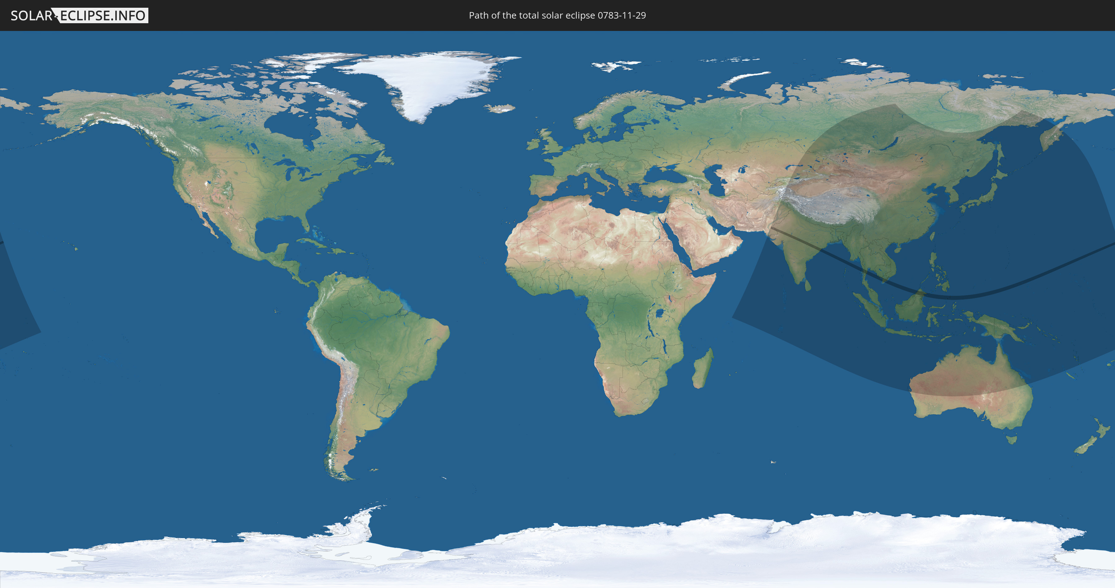
Total solar eclipse of 11/29/0783
| Day of week: | Tuesday |
| Maximum duration of eclipse: | 03m39s |
| Maximum width of eclipse path: | 137 km |
| Saros cycle: | 103 |
| Coverage: | 100% |
| Magnitude: | 1.0365 |
| Gamma: | 0.4403 |
Wo kann man die Sonnenfinsternis vom 11/29/0783 sehen?
Die Sonnenfinsternis am 11/29/0783 kann man in 50 Ländern als partielle Sonnenfinsternis beobachten.
Der Finsternispfad verläuft durch 11 Länder. Nur in diesen Ländern ist sie als total Sonnenfinsternis zu sehen.
In den folgenden Ländern ist die Sonnenfinsternis total zu sehen
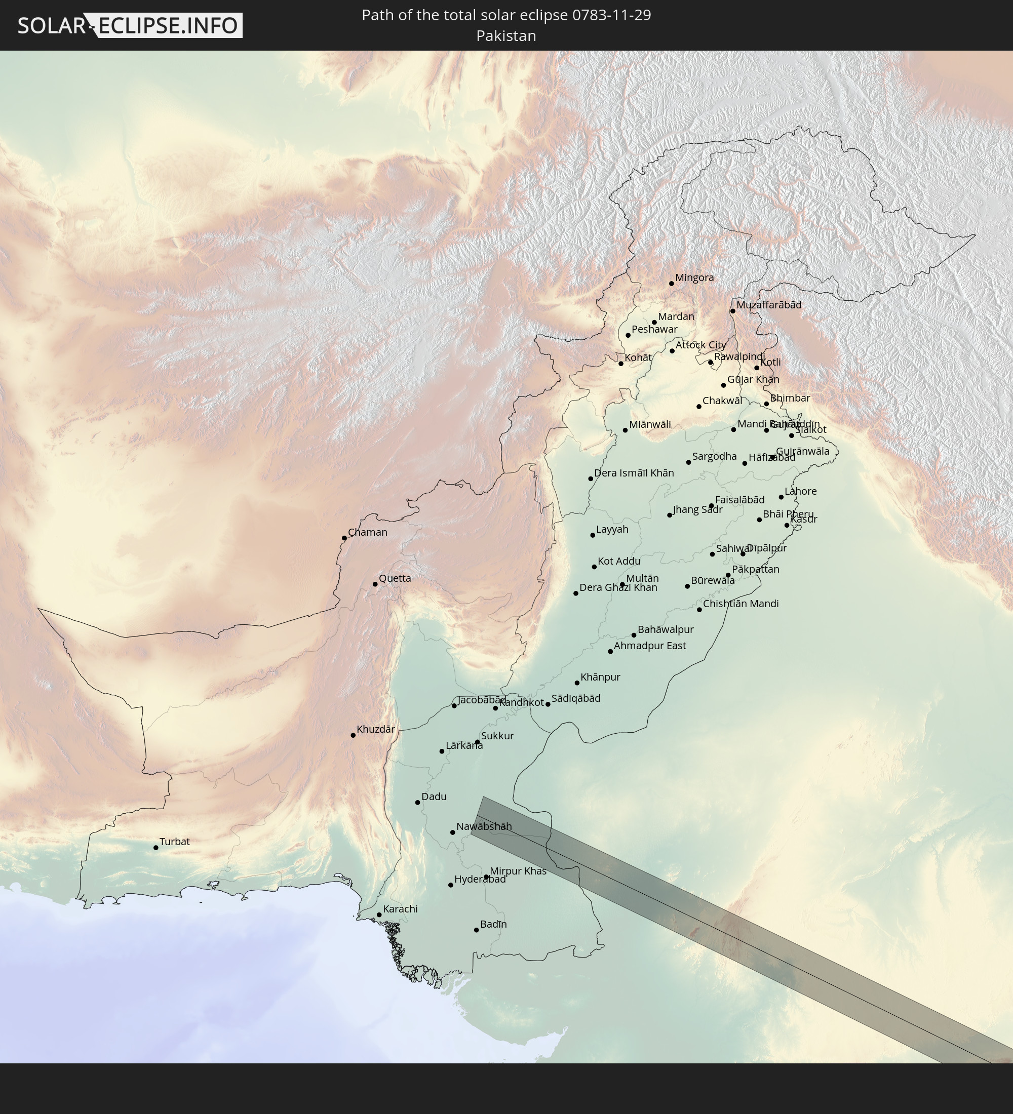 Pakistan
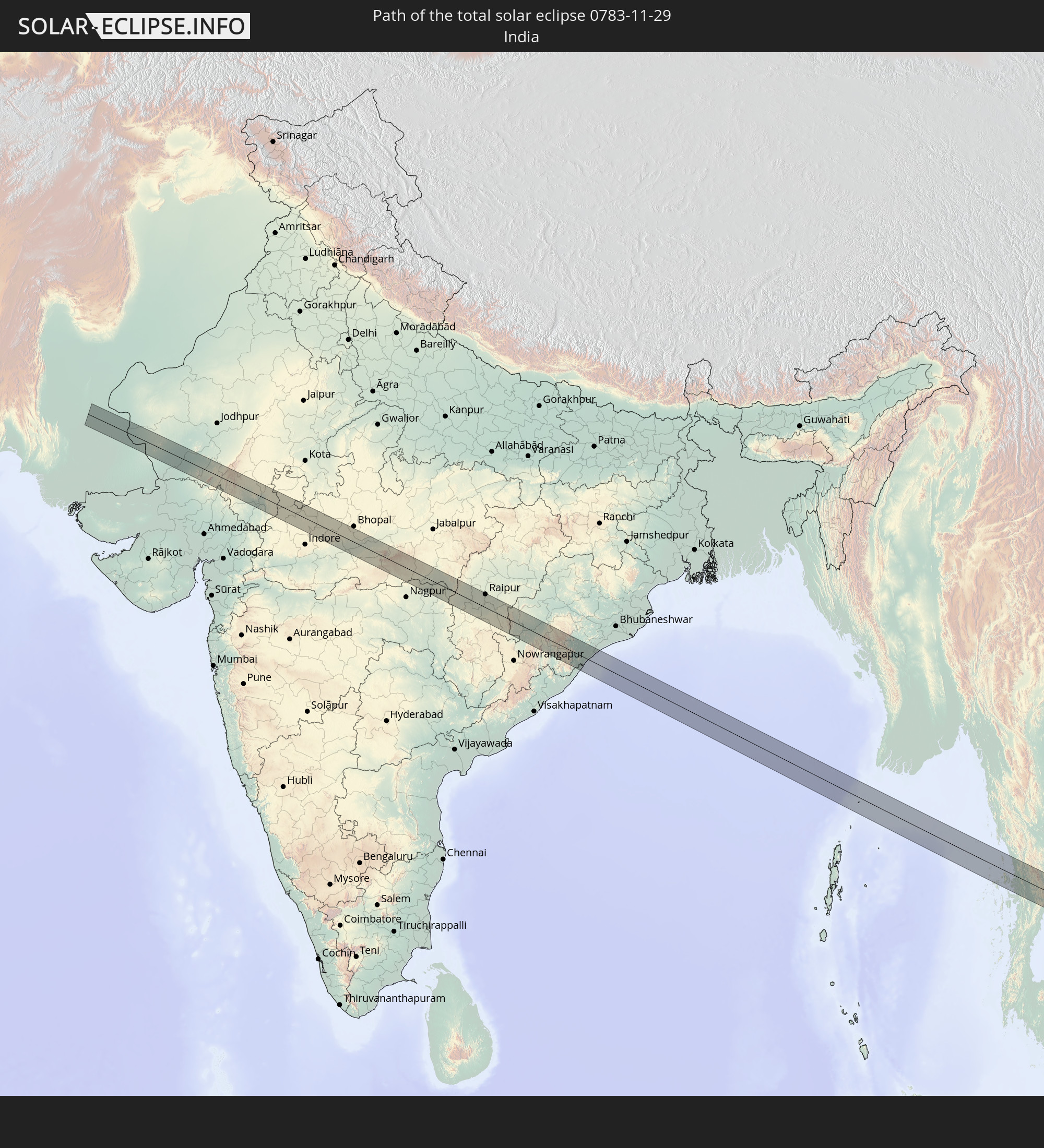 India
India
 Myanmar
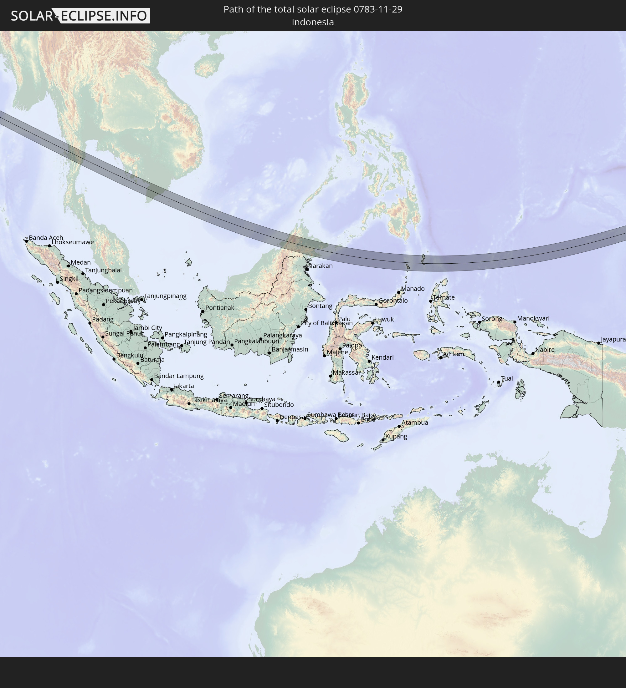 Indonesia
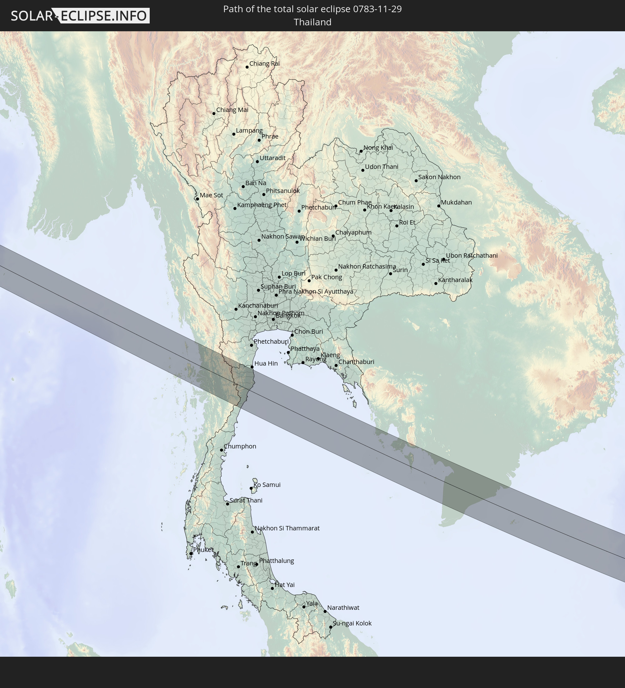 Thailand
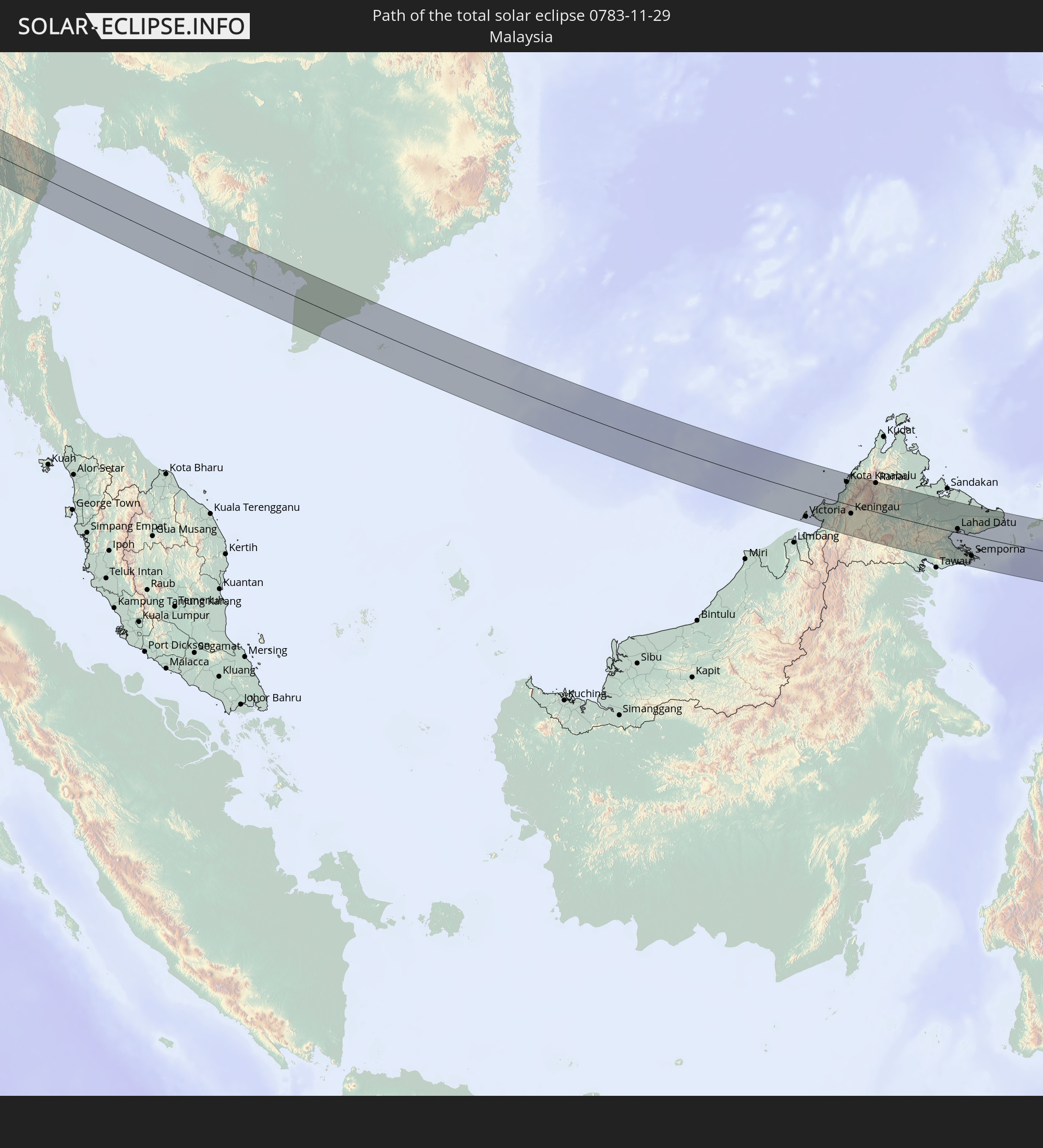 Malaysia
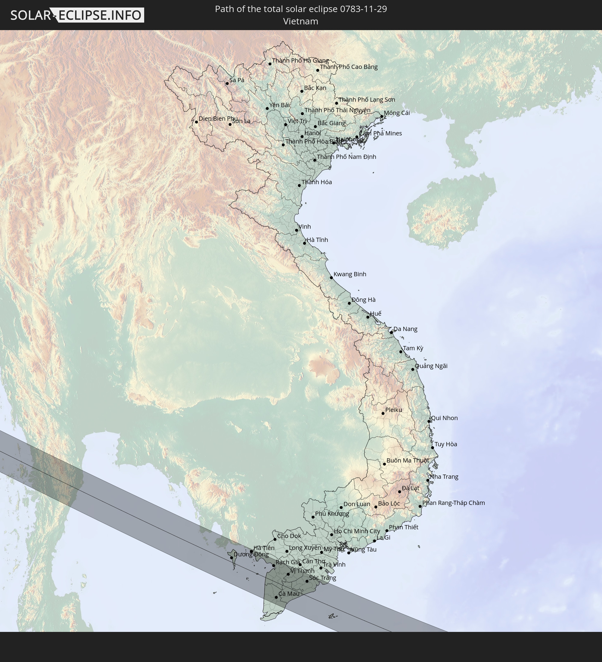 Vietnam
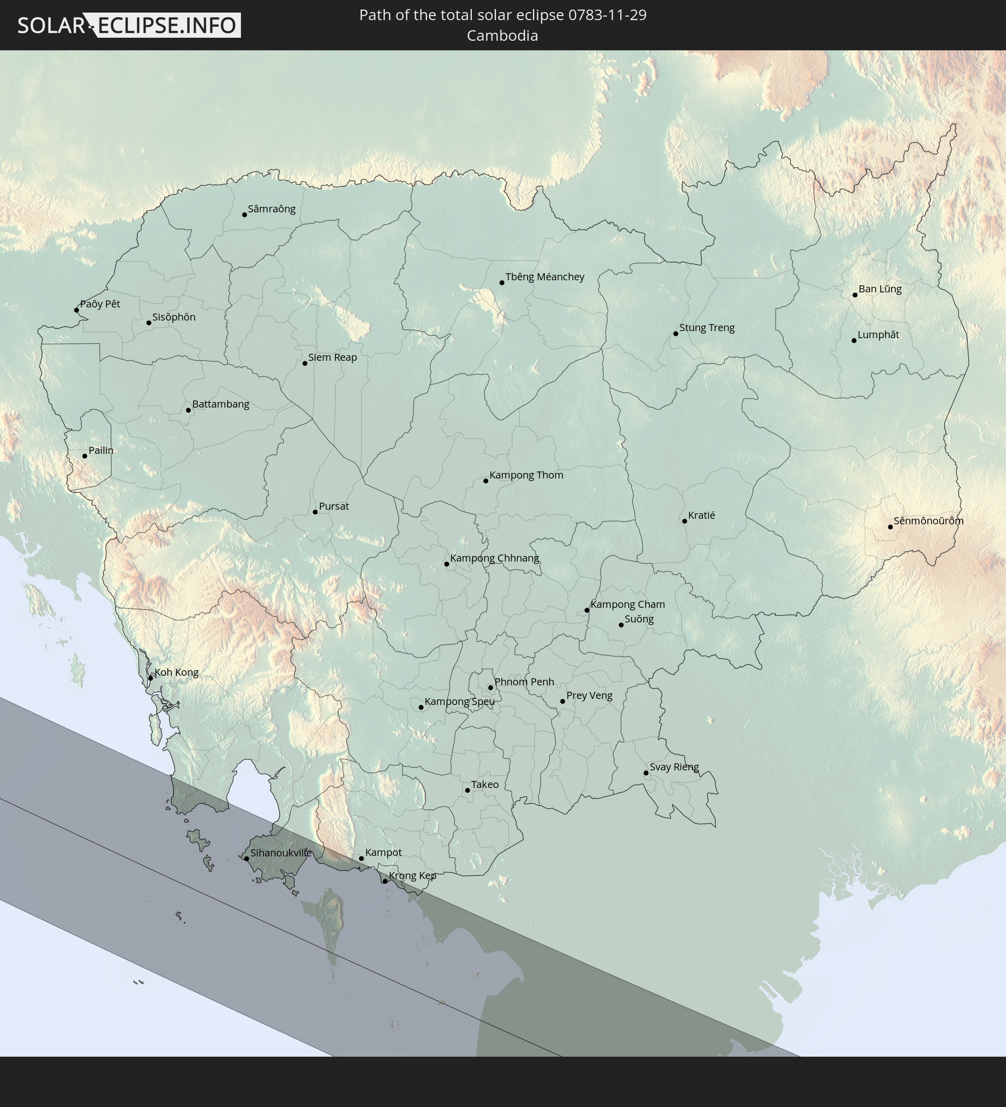 Cambodia
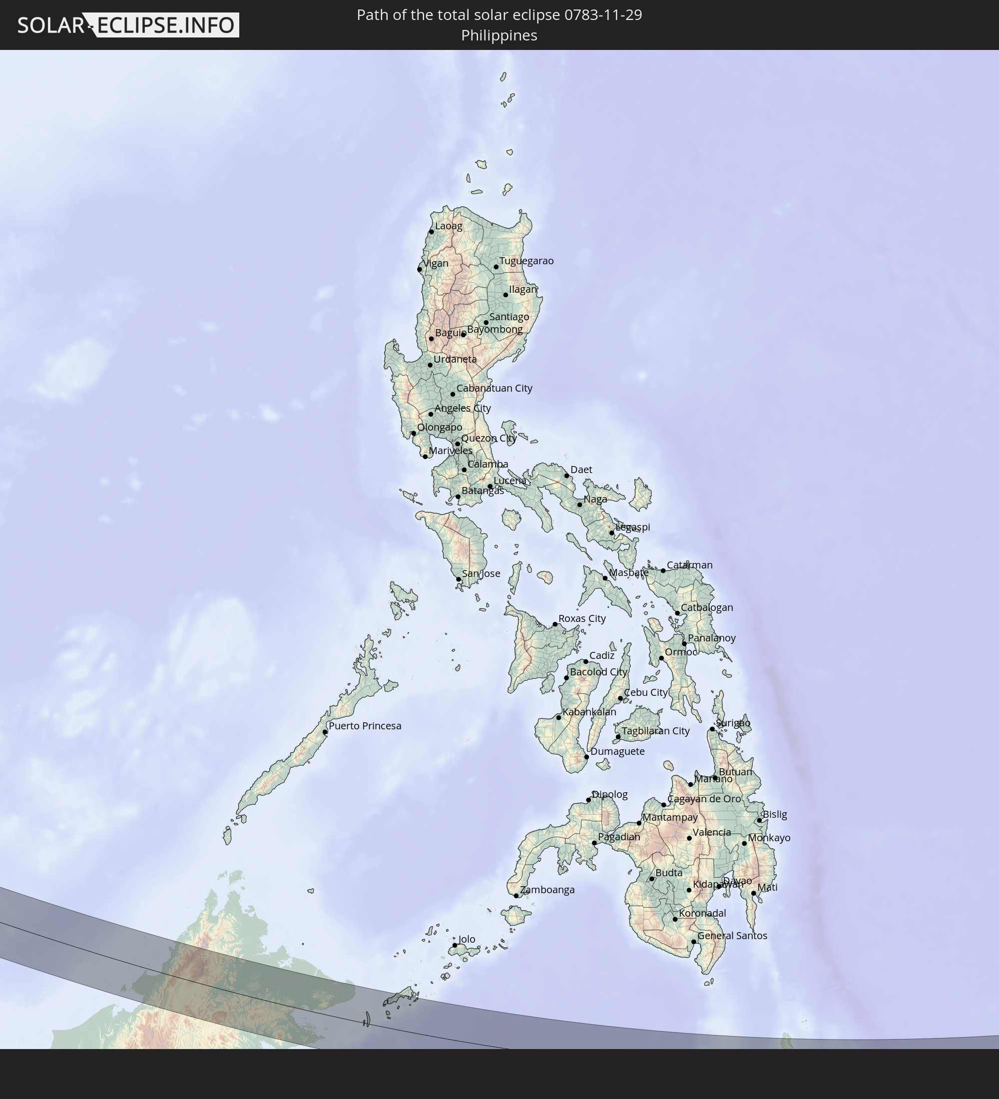 Philippines
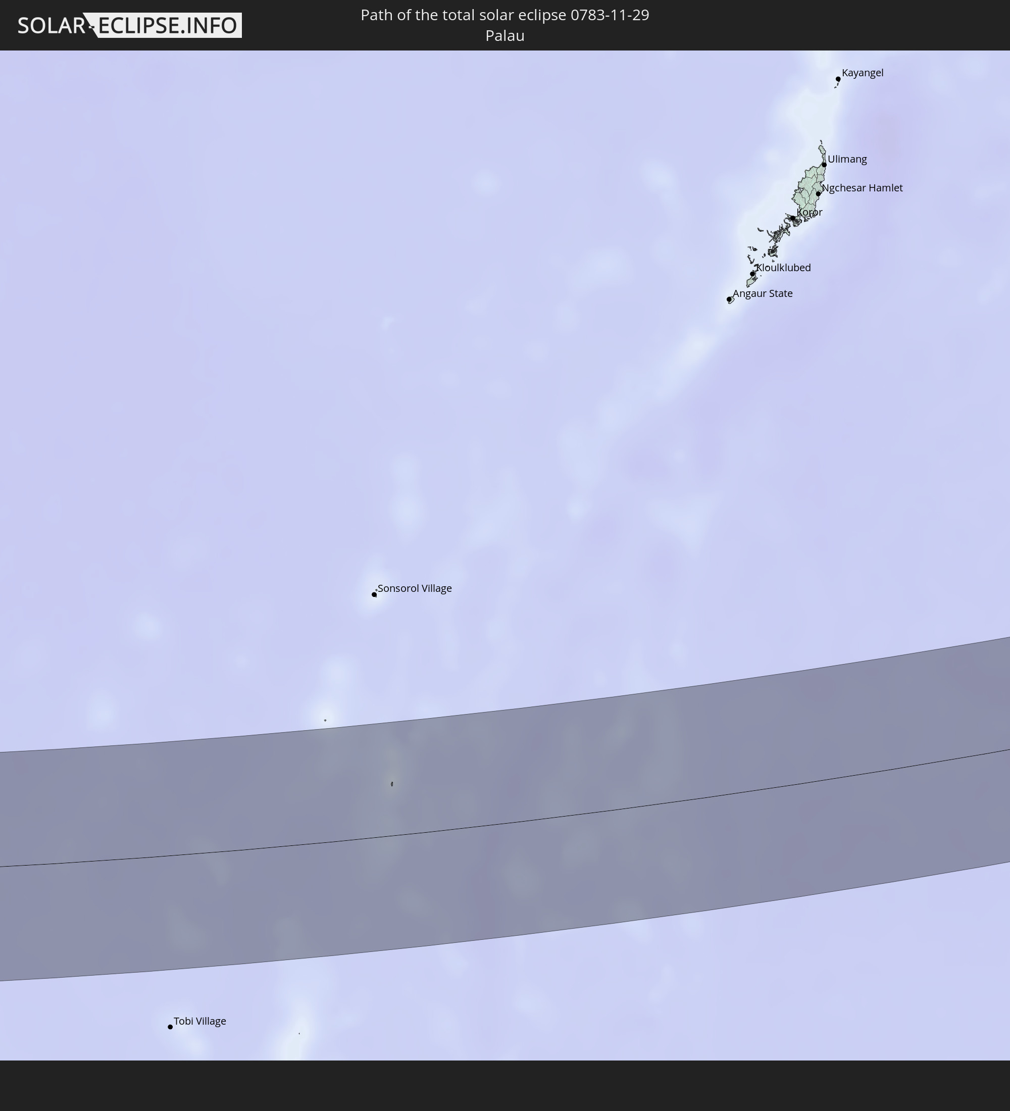 Palau
Palau
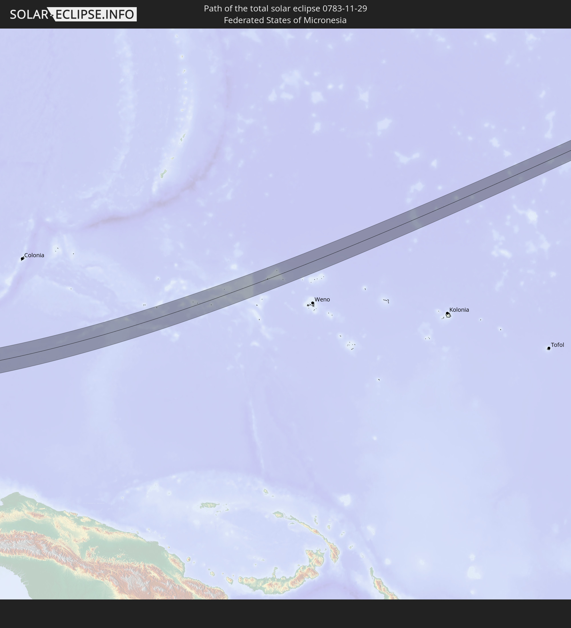 Federated States of Micronesia
In den folgenden Ländern ist die Sonnenfinsternis partiell zu sehen
 Russia
 Fiji
Fiji
 United States Minor Outlying Islands
 Kiribati
 Tokelau
 Kazakhstan
 Afghanistan
 Pakistan
 Tajikistan
 India
India
 Kyrgyzstan
 British Indian Ocean Territory
 Maldives
 China
China
 Sri Lanka
 Nepal
Nepal
 Mongolia
 Bangladesh
 Bhutan
 Myanmar
 Indonesia
 Cocos Islands
 Thailand
 Malaysia
 Laos
Laos
 Vietnam
 Cambodia
 Singapore
 Christmas Island
 Australia
 Macau
Macau
 Hong Kong
 Brunei
 Taiwan
 Philippines
 Japan
Japan
 East Timor
 North Korea
 South Korea
 Palau
Palau
 Federated States of Micronesia
 Papua New Guinea
 Guam
Guam
 Northern Mariana Islands
 Solomon Islands
 New Caledonia
 Marshall Islands
 Vanuatu
 Nauru
Nauru
 Tuvalu
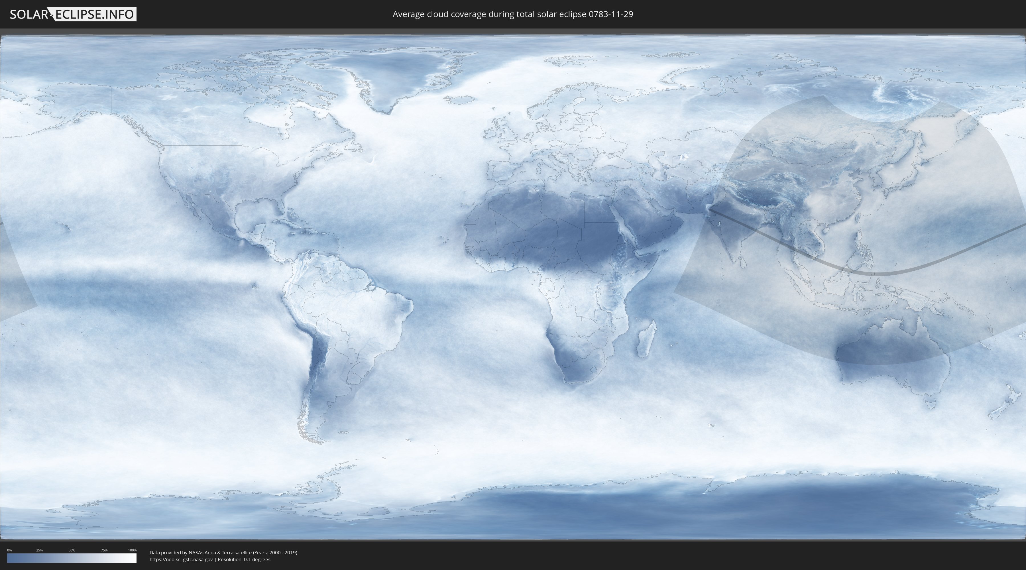
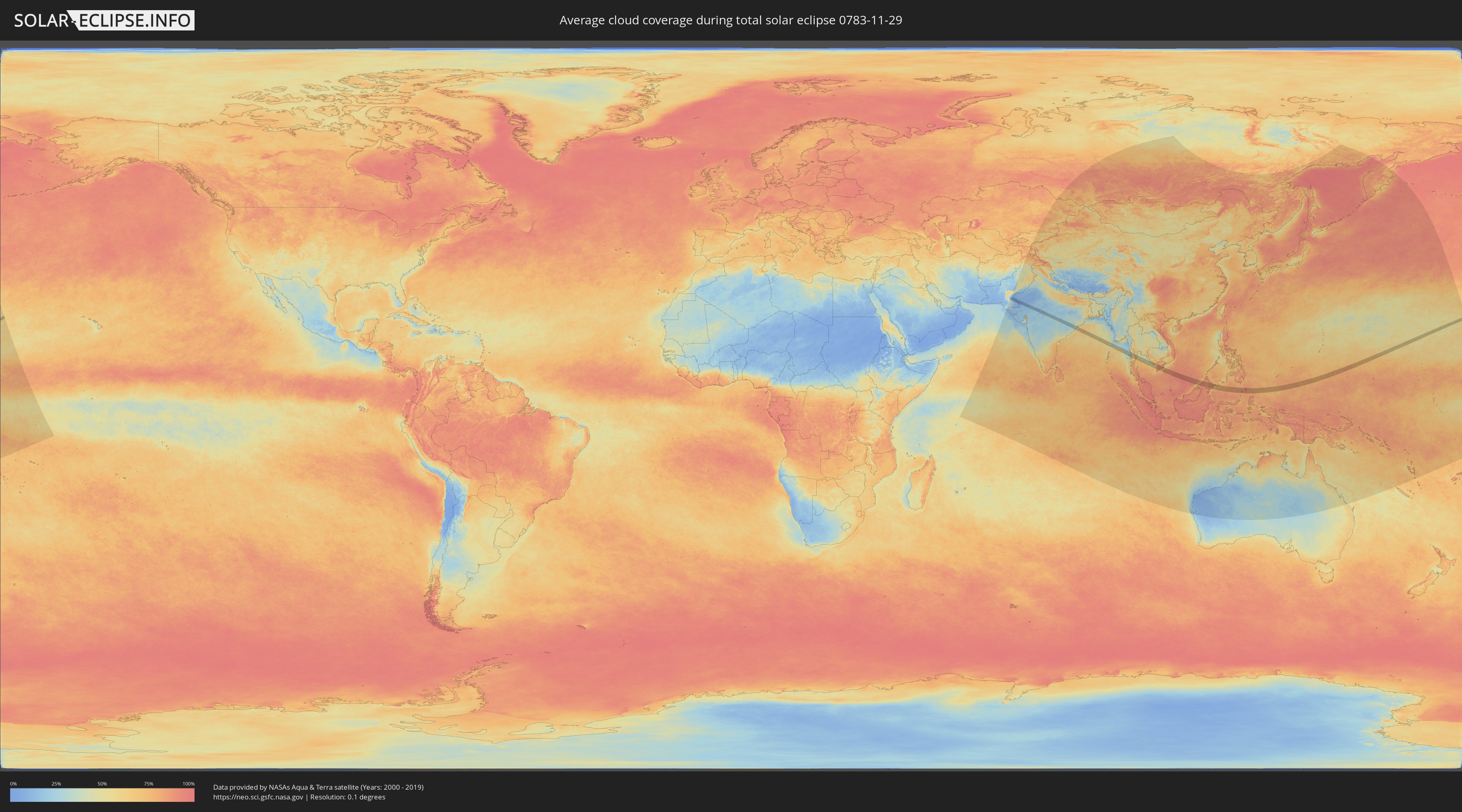
How will be the weather during the total solar eclipse on 11/29/0783?
Where is the best place to see the total solar eclipse of 11/29/0783?
The following maps show the average cloud coverage for the day of the total solar eclipse.
With the help of these maps, it is possible to find the place along the eclipse path, which has the best
chance of a cloudless sky.
Nevertheless, you should consider local circumstances and inform about the weather of your chosen
observation site.
The data is provided by NASAs satellites
AQUA and TERRA.
The cloud maps are averaged over a period of 19 years (2000 - 2019).
Detailed country maps
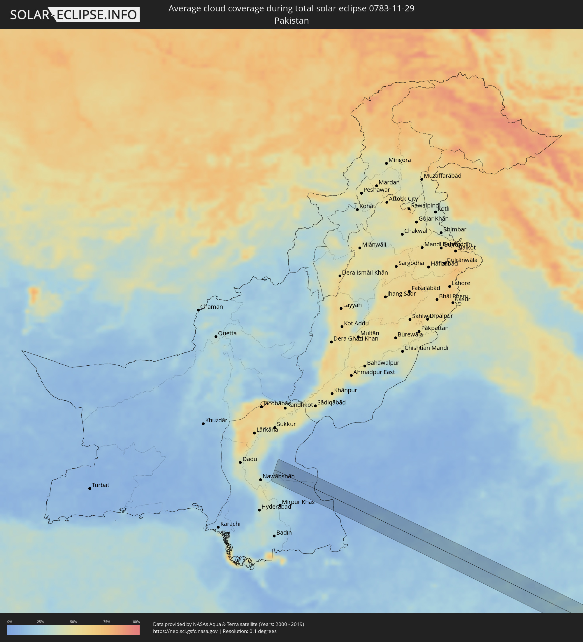 Pakistan
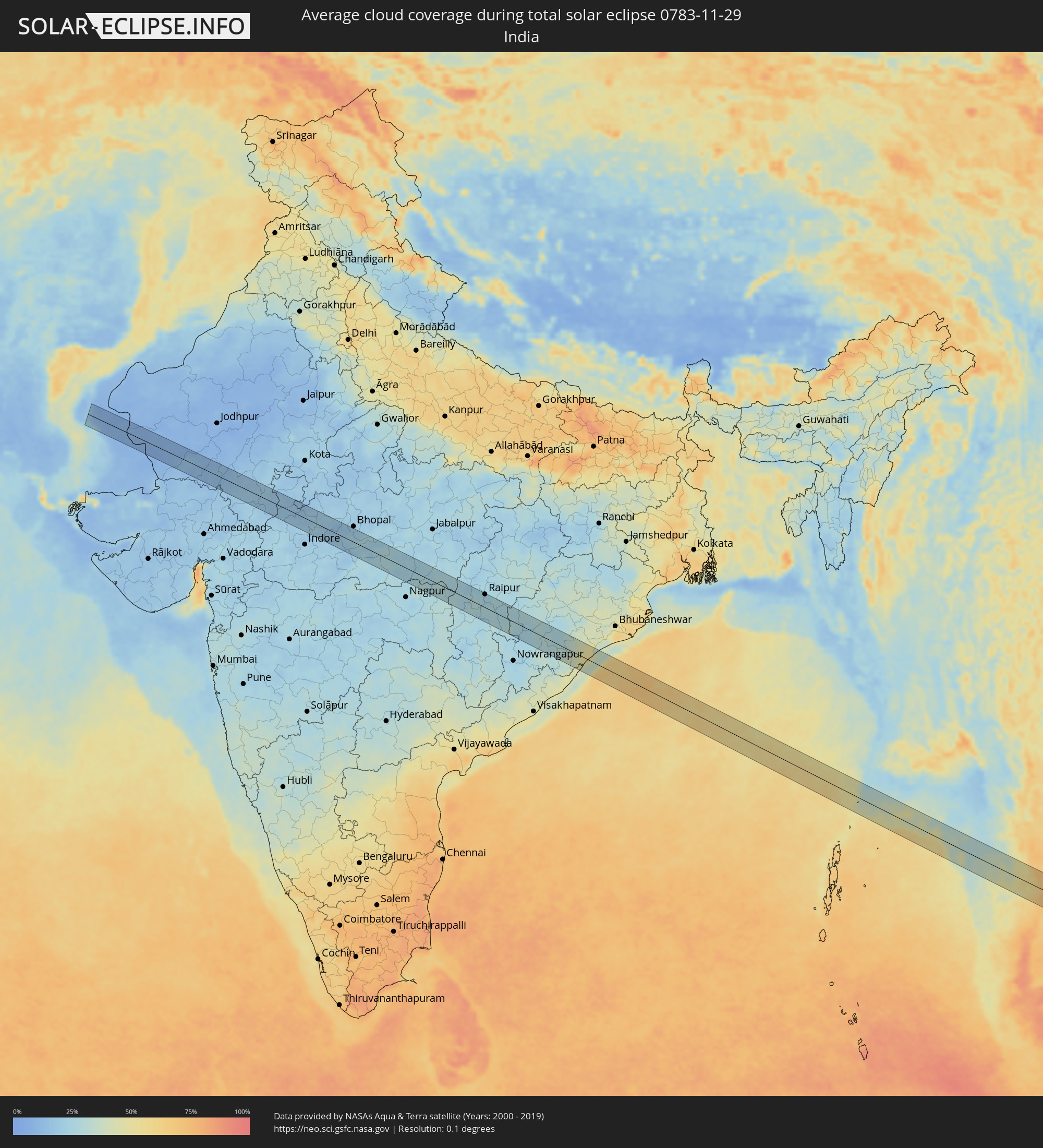 India
India
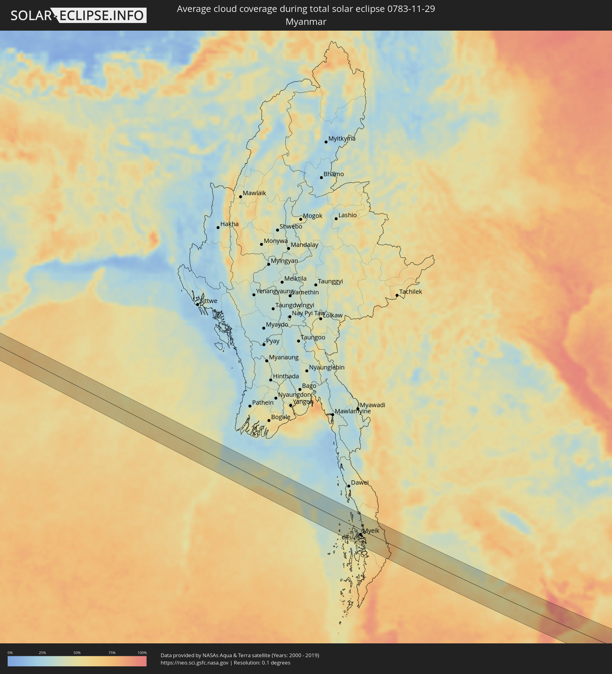 Myanmar
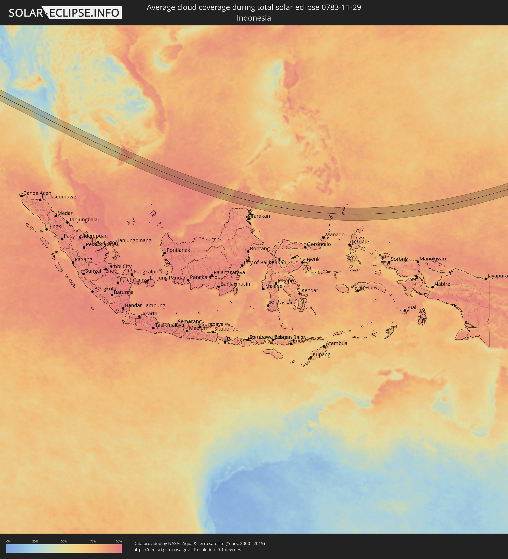 Indonesia
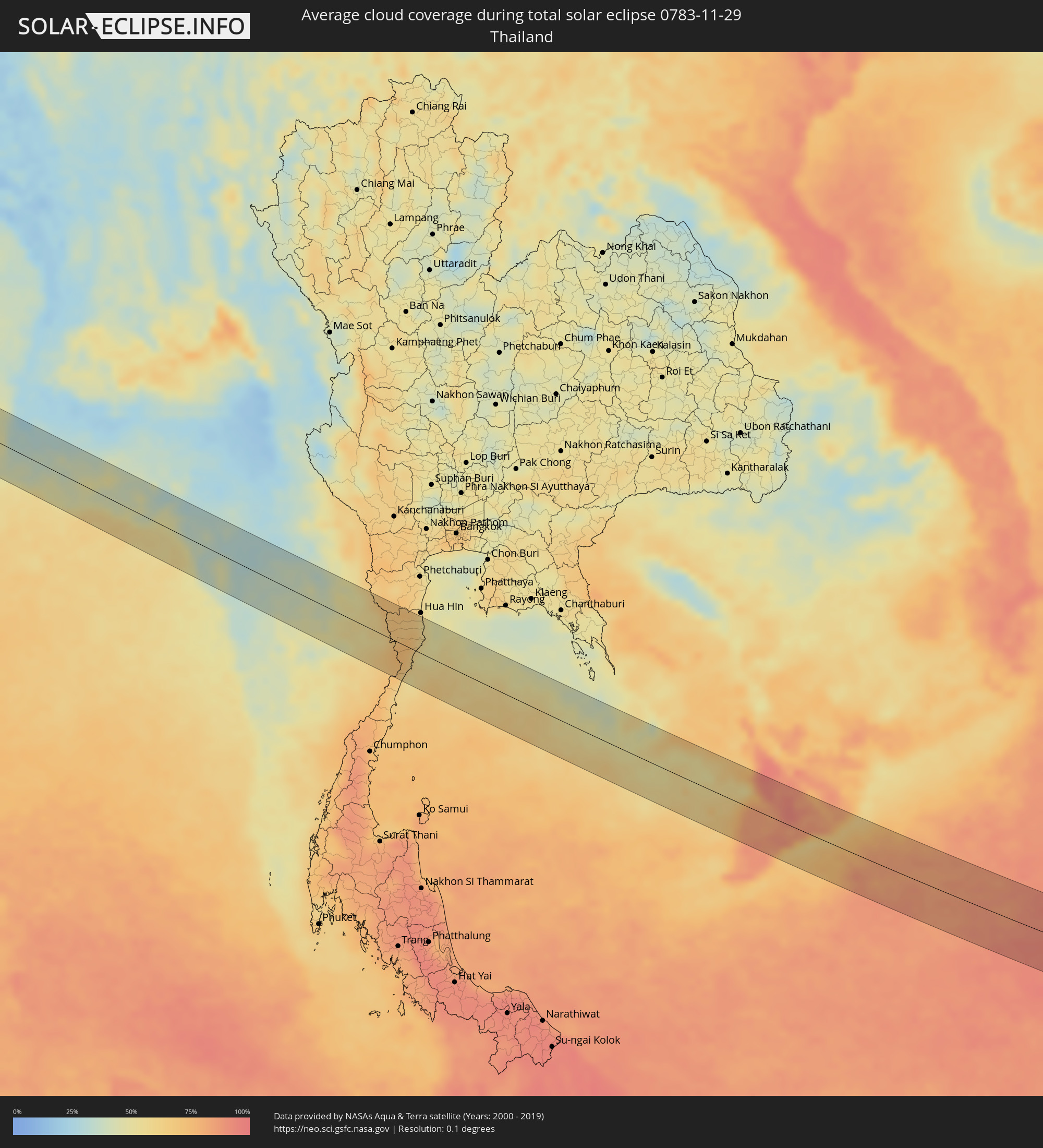 Thailand
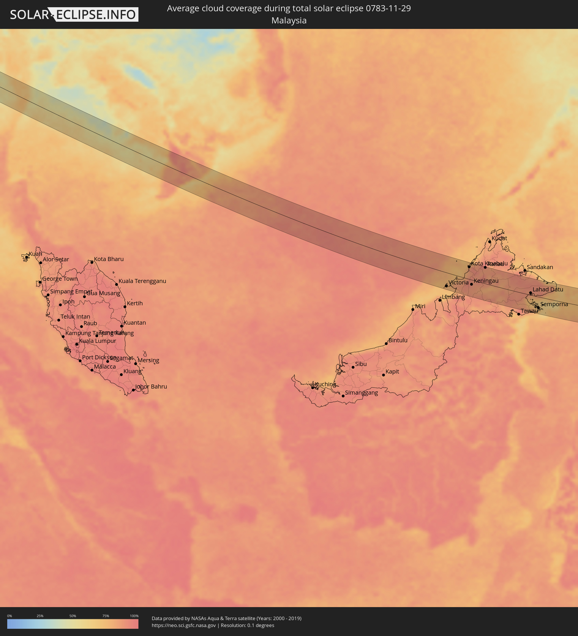 Malaysia
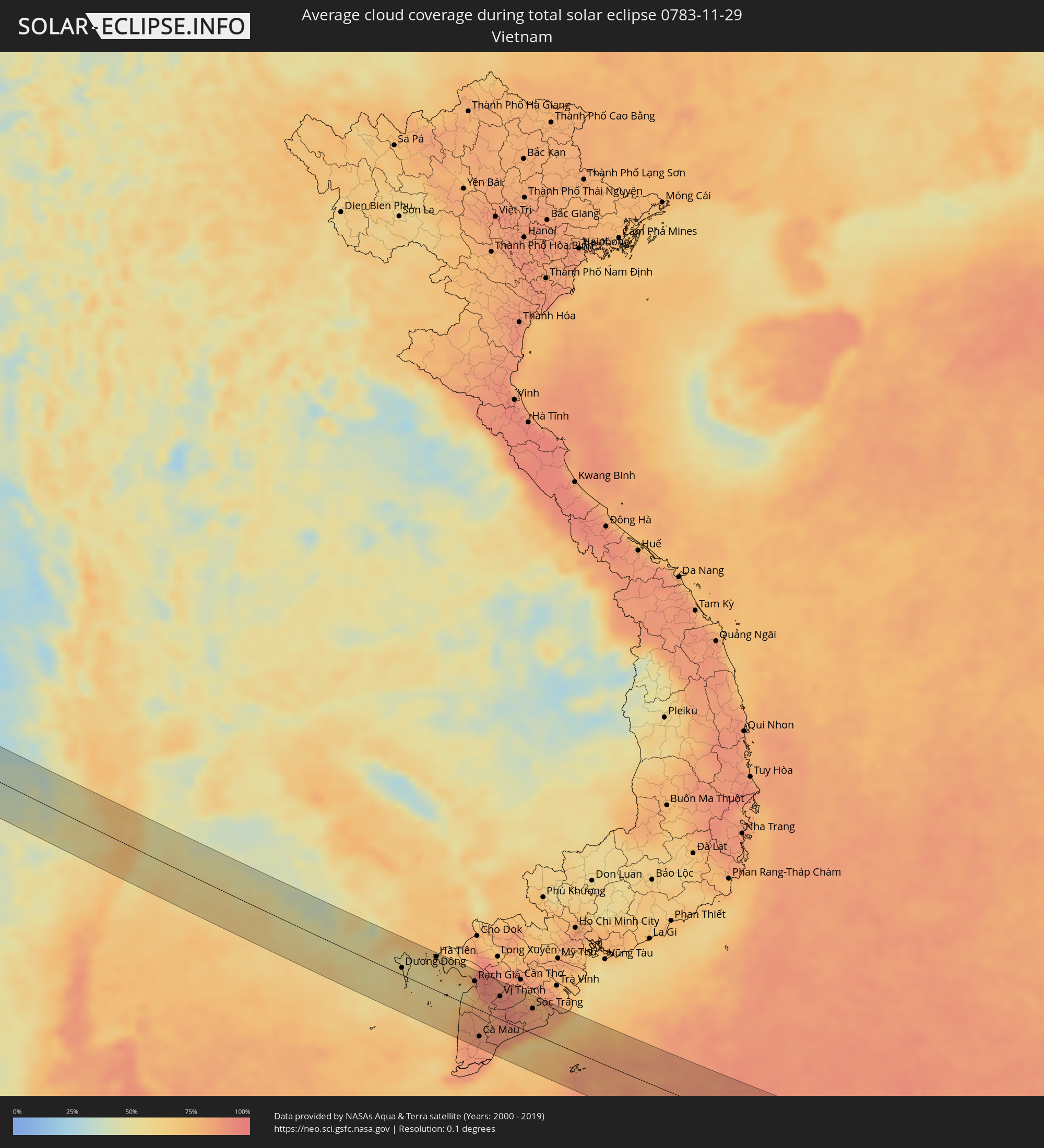 Vietnam
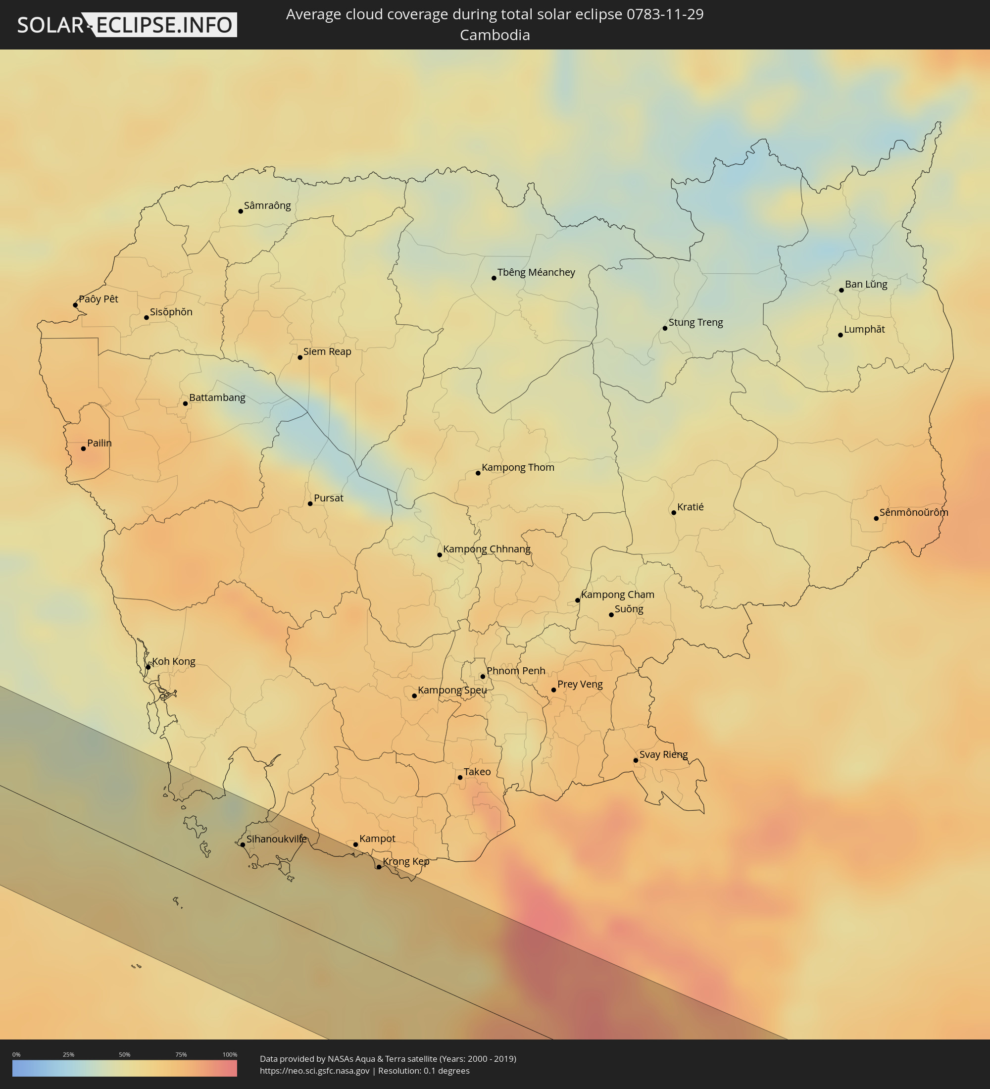 Cambodia
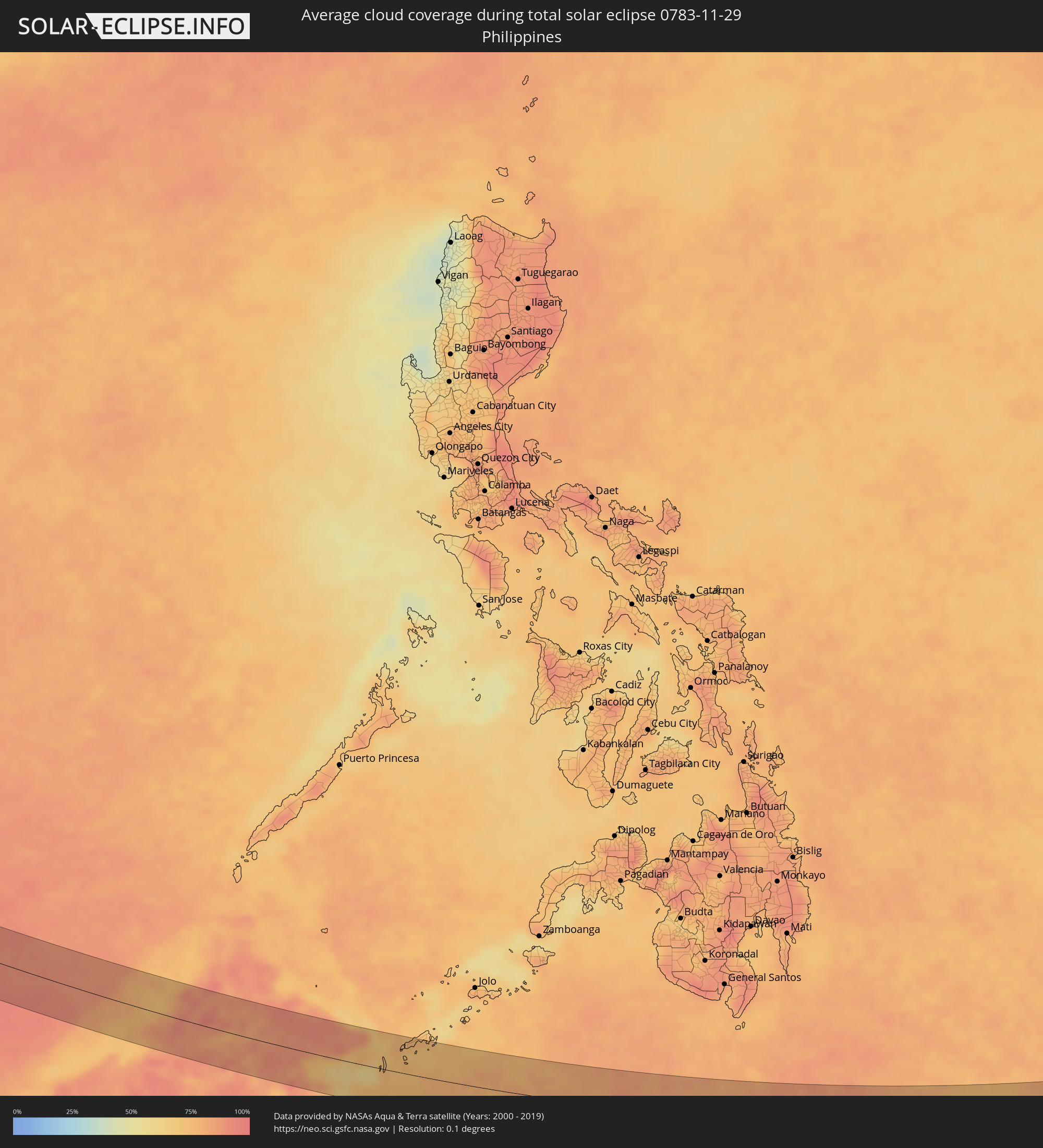 Philippines
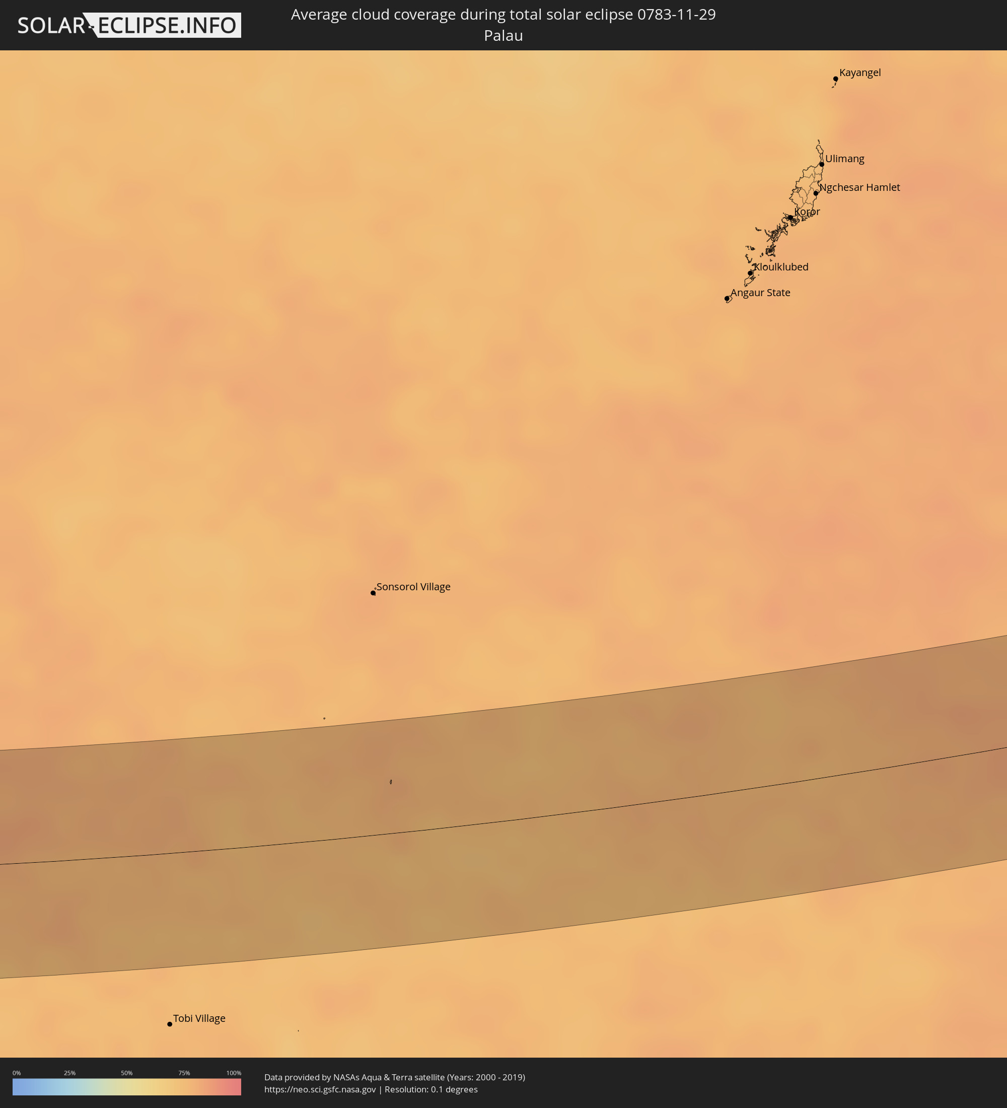 Palau
Palau
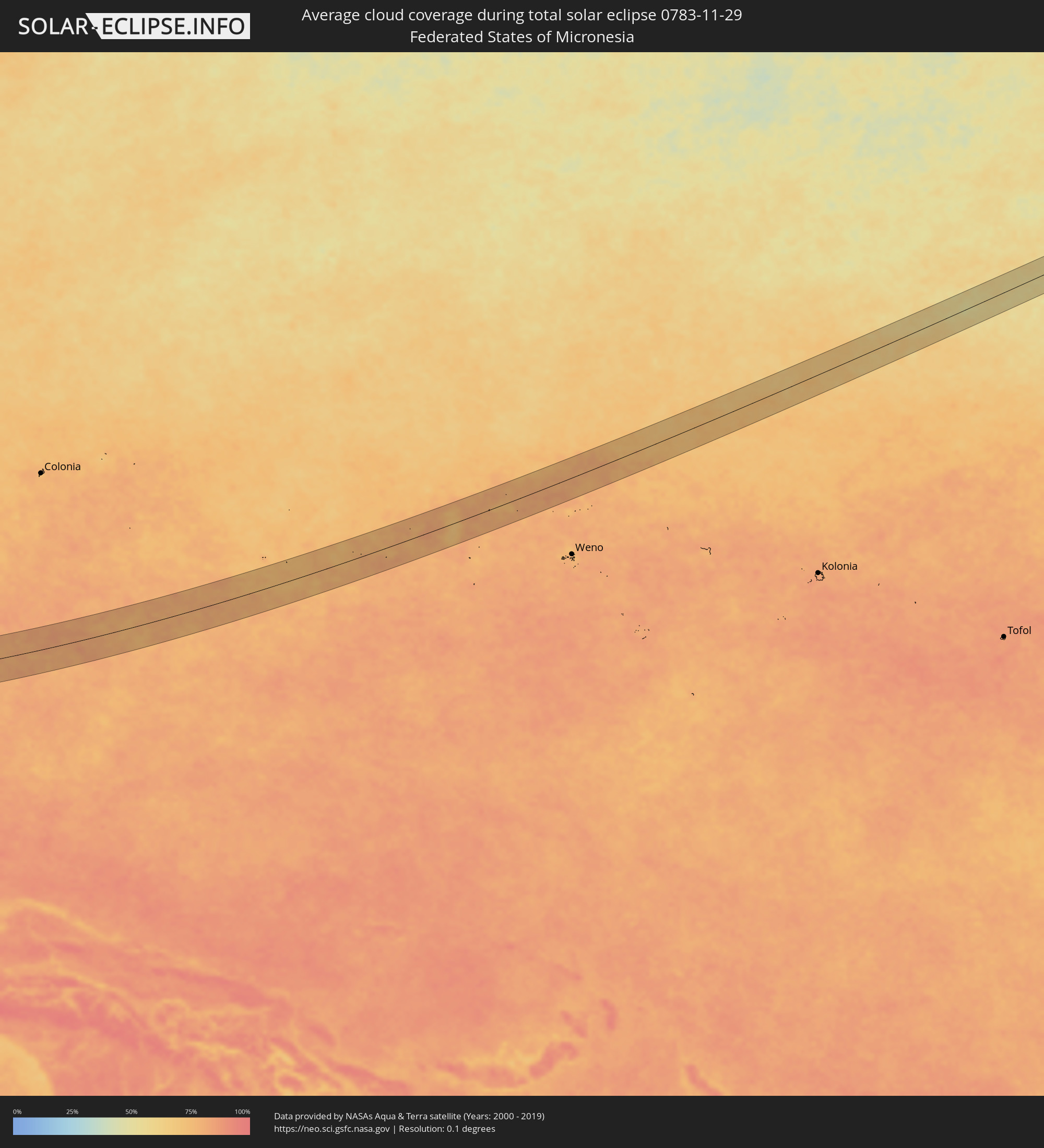 Federated States of Micronesia
Cities inside the path of the eclipse
The following table shows all locations with a population of more than 5,000 inside the eclipse path. Cities which have more than 100,000 inhabitants are marked bold. A click at the locations opens a detailed map.
| City | Type | Eclipse duration | Local time of max. eclipse | Distance to central line | Ø Cloud coverage |
|
Bārmer, Rajasthan
|
total | - | 07:25:12 UTC+05:21 | 29 km | 9% |
|
Bhīnmāl, Rajasthan
|
total | - | 07:25:08 UTC+05:21 | 8 km | 12% |
|
Ābu Road, Rajasthan
|
total | - | 07:25:04 UTC+05:21 | 37 km | 13% |
|
Sirohi, Rajasthan
|
total | - | 07:25:16 UTC+05:21 | 6 km | 13% |
|
Udaipur, Rajasthan
|
total | - | 07:25:26 UTC+05:21 | 12 km | 17% |
|
Mandsaur, Madhya Pradesh
|
total | - | 07:25:46 UTC+05:21 | 23 km | 18% |
|
Jaorā, Madhya Pradesh
|
total | - | 07:25:37 UTC+05:21 | 18 km | 18% |
|
Nagda, Madhya Pradesh
|
total | - | 07:25:40 UTC+05:21 | 23 km | 19% |
|
Ujjain, Madhya Pradesh
|
total | - | 07:25:43 UTC+05:21 | 35 km | 23% |
|
Shājāpur, Madhya Pradesh
|
total | - | 07:26:03 UTC+05:21 | 12 km | 21% |
|
Shujālpur, Madhya Pradesh
|
total | - | 07:26:14 UTC+05:21 | 30 km | 18% |
|
Ashta, Madhya Pradesh
|
total | - | 07:26:06 UTC+05:21 | 9 km | 18% |
|
Sehore, Madhya Pradesh
|
total | - | 07:26:21 UTC+05:21 | 26 km | 17% |
|
Mandideep, Madhya Pradesh
|
total | - | 07:26:32 UTC+05:21 | 35 km | 21% |
|
Hoshangābād, Madhya Pradesh
|
total | - | 07:26:30 UTC+05:21 | 10 km | 21% |
|
Itārsi, Madhya Pradesh
|
total | - | 07:26:28 UTC+05:21 | 2 km | 23% |
|
Parāsia, Madhya Pradesh
|
total | - | 07:26:52 UTC+05:21 | 2 km | 25% |
|
Chhindwāra, Madhya Pradesh
|
total | - | 07:26:56 UTC+05:21 | 3 km | 23% |
|
Seoni, Madhya Pradesh
|
total | - | 07:27:18 UTC+05:21 | 27 km | 24% |
|
Tumsar, Maharashtra
|
total | - | 07:27:11 UTC+05:21 | 34 km | 27% |
|
Bālāghāt, Madhya Pradesh
|
total | - | 07:27:36 UTC+05:21 | 30 km | 28% |
|
Gondiā, Maharashtra
|
total | - | 07:27:29 UTC+05:21 | 5 km | 28% |
|
Rāj-Nāndgaon, Chhattisgarh
|
total | - | 07:27:55 UTC+05:21 | 2 km | 25% |
|
Durg, Chhattisgarh
|
total | - | 07:28:06 UTC+05:21 | 18 km | 28% |
|
Bhilai, Chhattisgarh
|
total | - | 07:28:13 UTC+05:21 | 27 km | 28% |
|
Dhamtari, Chhattisgarh
|
total | - | 07:28:09 UTC+05:21 | 17 km | 24% |
|
Raipur, Chhattisgarh
|
total | - | 07:28:22 UTC+05:21 | 39 km | 24% |
|
Bhawānipatna, Odisha
|
total | - | 07:29:07 UTC+05:21 | 21 km | 27% |
|
Brahmapur, Odisha
|
total | - | 07:30:16 UTC+05:21 | 3 km | 50% |
|
Myeik, Tanintharyi
|
total | - | 08:50:31 UTC+06:24 | 18 km | 49% |
|
Prachuap Khiri Khan, Prachuap Khiri Khan
|
total | - | 09:09:55 UTC+06:42 | 23 km | 56% |
|
Kui Buri, Prachuap Khiri Khan
|
total | - | 09:10:00 UTC+06:42 | 7 km | 57% |
|
Sam Roi Yot, Prachuap Khiri Khan
|
total | - | 09:10:00 UTC+06:42 | 26 km | 63% |
|
Pran Buri, Prachuap Khiri Khan
|
total | - | 09:10:02 UTC+06:42 | 39 km | 67% |
|
Sihanoukville, Preah Sihanouk
|
total | - | 09:17:14 UTC+06:42 | 31 km | 58% |
|
Dương Đông, Kiến Giang
|
total | - | 09:42:49 UTC+07:06 | 11 km | 55% |
|
Krong Kep, Kep
|
total | - | 09:18:53 UTC+06:42 | 54 km | 61% |
|
Hà Tiên, Kiến Giang
|
total | - | 09:43:52 UTC+07:06 | 52 km | 60% |
|
Rạch Giá, Kiến Giang
|
total | - | 09:45:14 UTC+07:06 | 41 km | 82% |
|
Cà Mau, Cà Mau
|
total | - | 09:45:36 UTC+07:06 | 41 km | 87% |
|
Vị Thanh, Hau Giang
|
total | - | 09:46:08 UTC+07:06 | 35 km | 92% |
|
Thành phố Bạc Liêu, Bạc Liêu
|
total | - | 09:46:50 UTC+07:06 | 3 km | 85% |
|
Sóc Trăng, Sóc Trăng
|
total | - | 09:47:17 UTC+07:06 | 39 km | 84% |
|
Victoria, Labuan
|
total | - | 10:27:22 UTC+07:21 | 53 km | 77% |
|
Bandar Labuan, Sabah
|
total | - | 10:27:27 UTC+07:21 | 51 km | 77% |
|
Beaufort, Sabah
|
total | - | 10:28:50 UTC+07:21 | 30 km | 85% |
|
Papar, Sabah
|
total | - | 10:29:15 UTC+07:21 | 17 km | 81% |
|
Kinarut, Sabah
|
total | - | 10:29:33 UTC+07:21 | 31 km | 83% |
|
Putatan, Sabah
|
total | - | 10:29:33 UTC+07:21 | 42 km | 87% |
|
Kota Kinabalu, Sabah
|
total | - | 10:29:34 UTC+07:21 | 48 km | 89% |
|
Donggongon, Sabah
|
total | - | 10:29:41 UTC+07:21 | 41 km | 87% |
|
Keningau, Sabah
|
total | - | 10:30:04 UTC+07:21 | 18 km | 87% |
|
Ranau, Sabah
|
total | - | 10:31:21 UTC+07:21 | 63 km | 86% |
|
Lahad Datu, Sabah
|
total | - | 10:36:46 UTC+07:21 | 8 km | 81% |
|
Semporna, Sabah
|
total | - | 03:16:30 UTC+00:00 | 44 km | 71% |
|
Sitangkai, Autonomous Region in Muslim Mindanao
|
total | - | 11:18:54 UTC+08:00 | 6 km | 74% |
|
Bongao, Autonomous Region in Muslim Mindanao
|
total | - | 11:19:58 UTC+08:00 | 42 km | 71% |
|
Sanga-Sanga, Autonomous Region in Muslim Mindanao
|
total | - | 11:20:00 UTC+08:00 | 47 km | 74% |
|
Tampakan, Autonomous Region in Muslim Mindanao
|
total | - | 11:20:04 UTC+08:00 | 31 km | 75% |
|
New Batu Batu, Autonomous Region in Muslim Mindanao
|
total | - | 11:20:19 UTC+08:00 | 49 km | 76% |
|
Balimbing, Autonomous Region in Muslim Mindanao
|
total | - | 11:20:34 UTC+08:00 | 53 km | 72% |
|
Tongouson, Autonomous Region in Muslim Mindanao
|
total | - | 11:21:07 UTC+08:00 | 49 km | 72% |