Total solar eclipse of 12/05/1676
| Day of week: | Saturday |
| Maximum duration of eclipse: | 04m30s |
| Maximum width of eclipse path: | 162 km |
| Saros cycle: | 127 |
| Coverage: | 100% |
| Magnitude: | 1.0486 |
| Gamma: | 0.0435 |
Wo kann man die Sonnenfinsternis vom 12/05/1676 sehen?
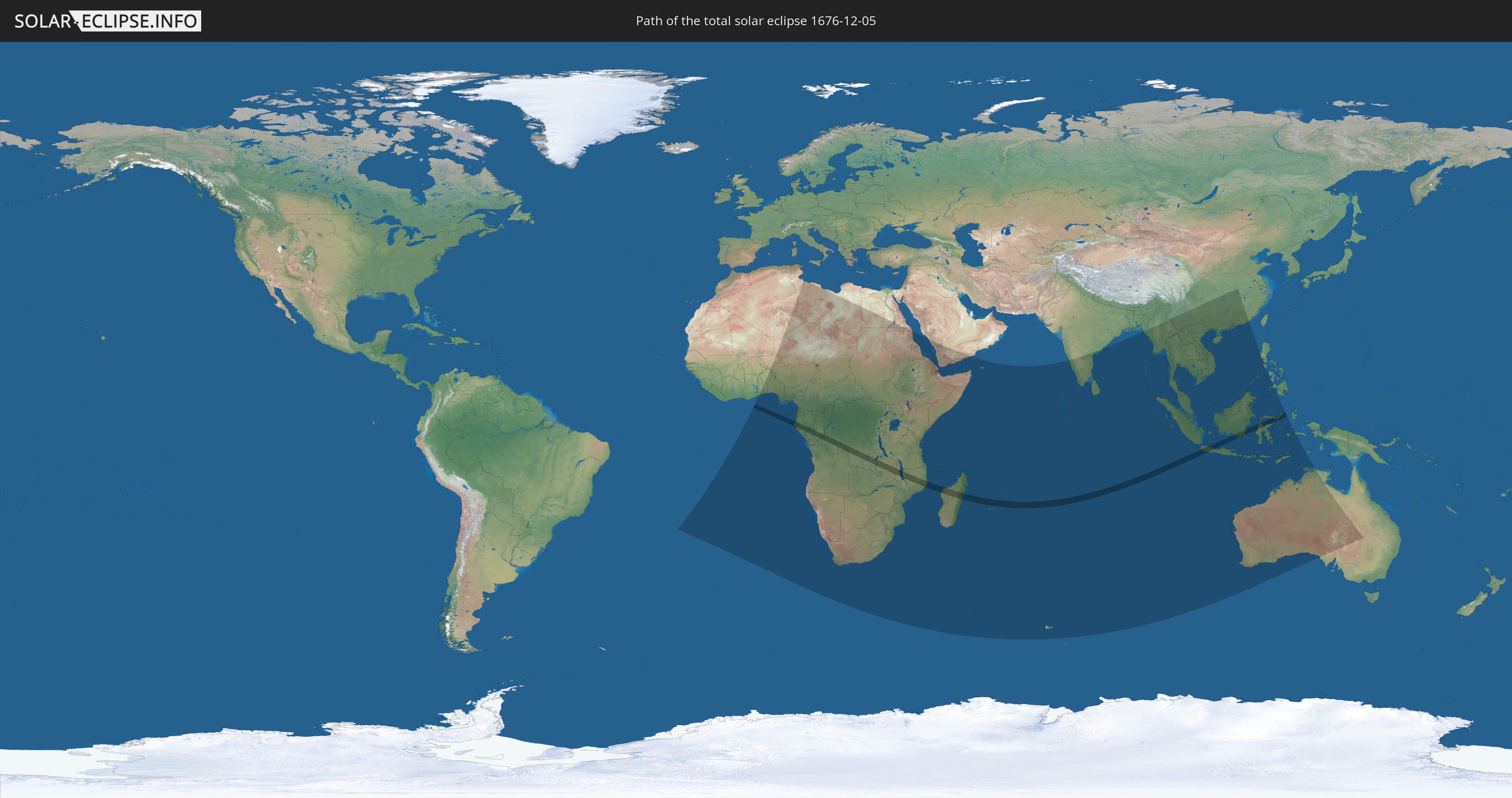
Die Sonnenfinsternis am 12/05/1676 kann man in 70 Ländern als partielle Sonnenfinsternis beobachten.
Der Finsternispfad verläuft durch 12 Länder. Nur in diesen Ländern ist sie als total Sonnenfinsternis zu sehen.
In den folgenden Ländern ist die Sonnenfinsternis total zu sehen
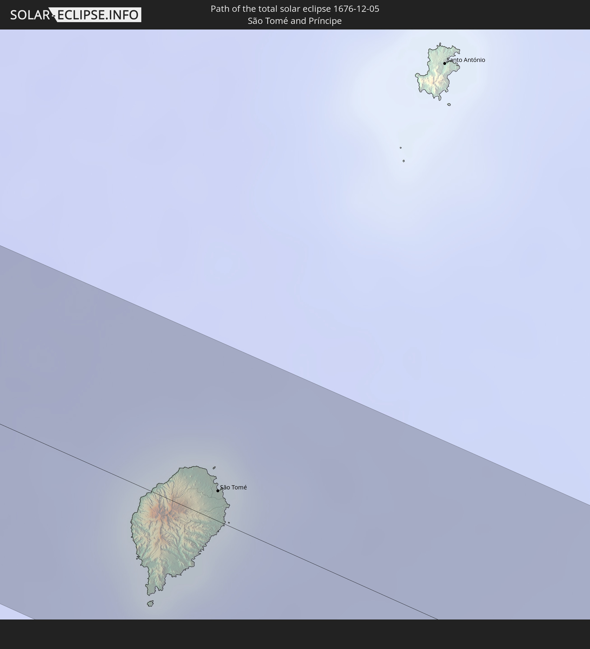 São Tomé and Príncipe
 Gabon
Gabon
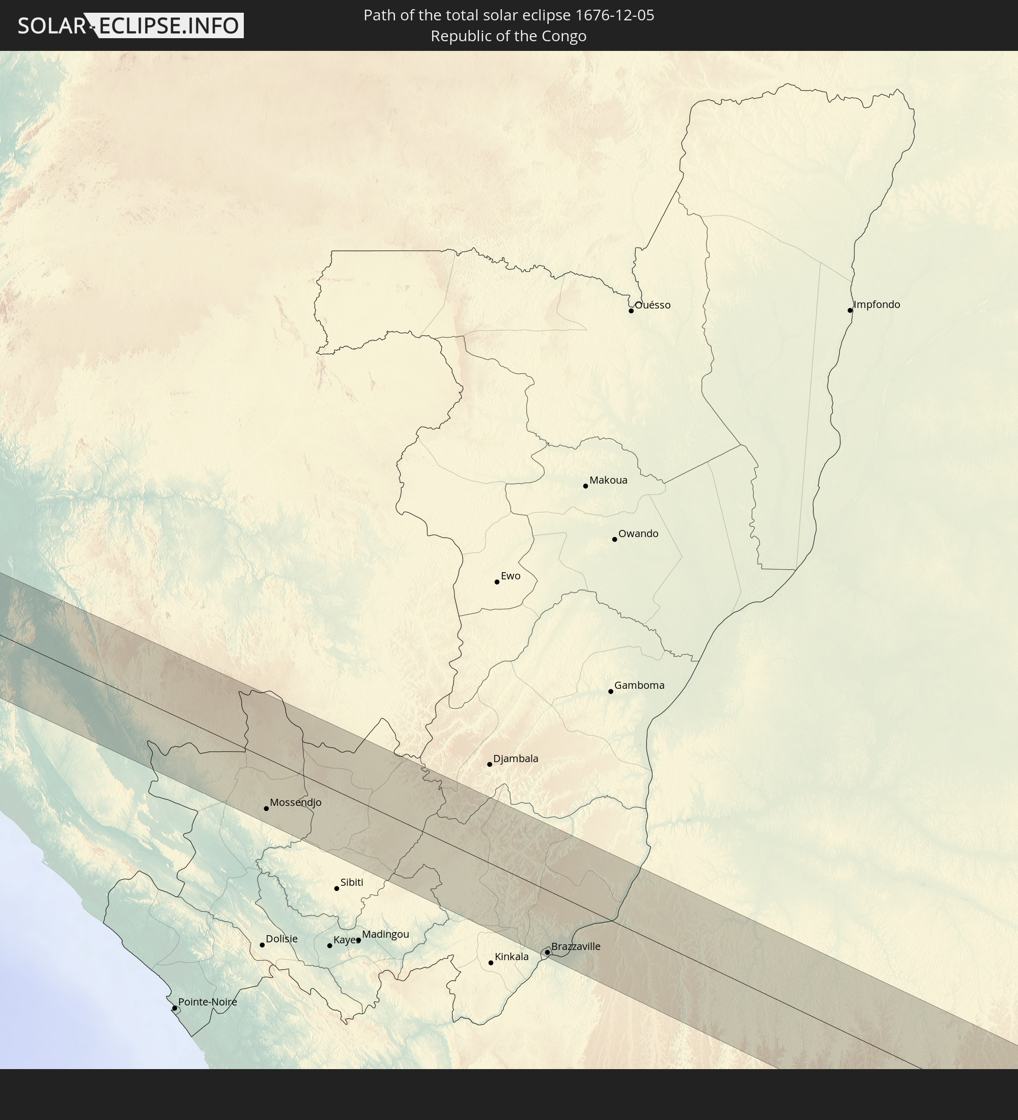 Republic of the Congo
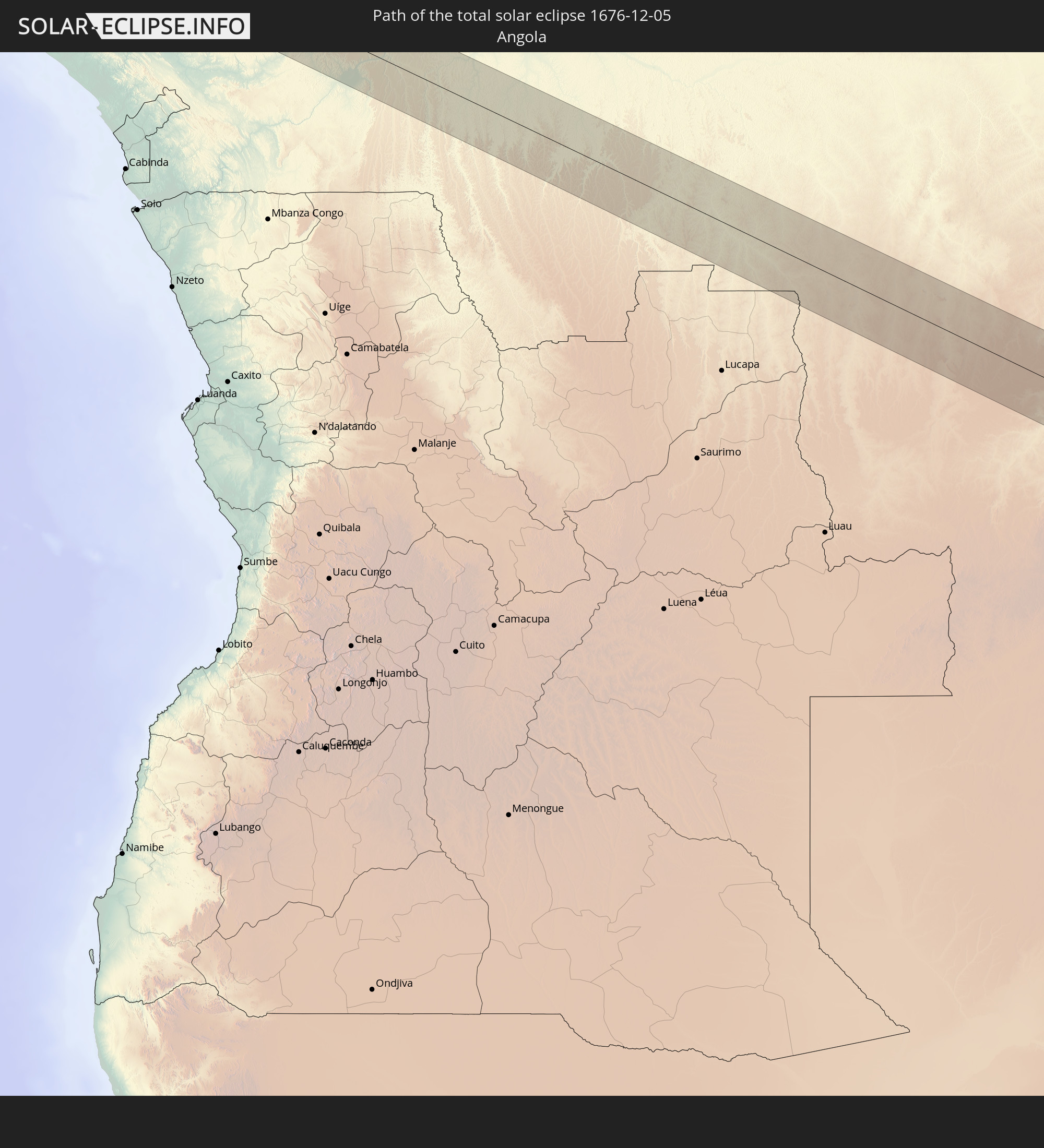 Angola
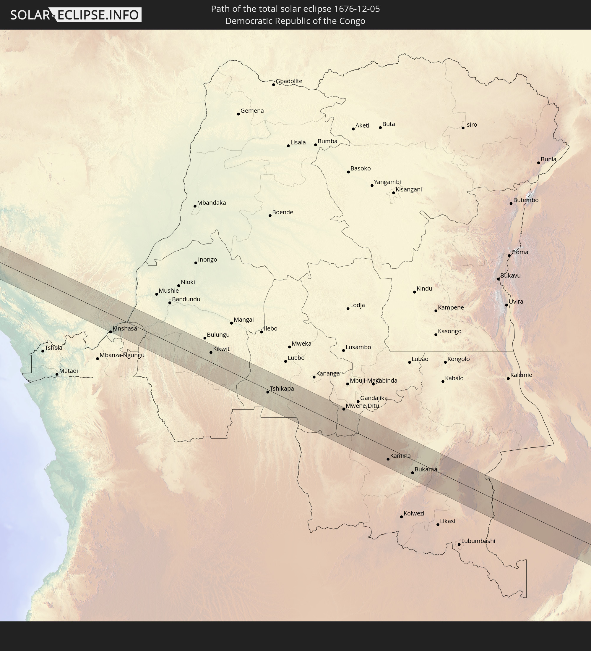 Democratic Republic of the Congo
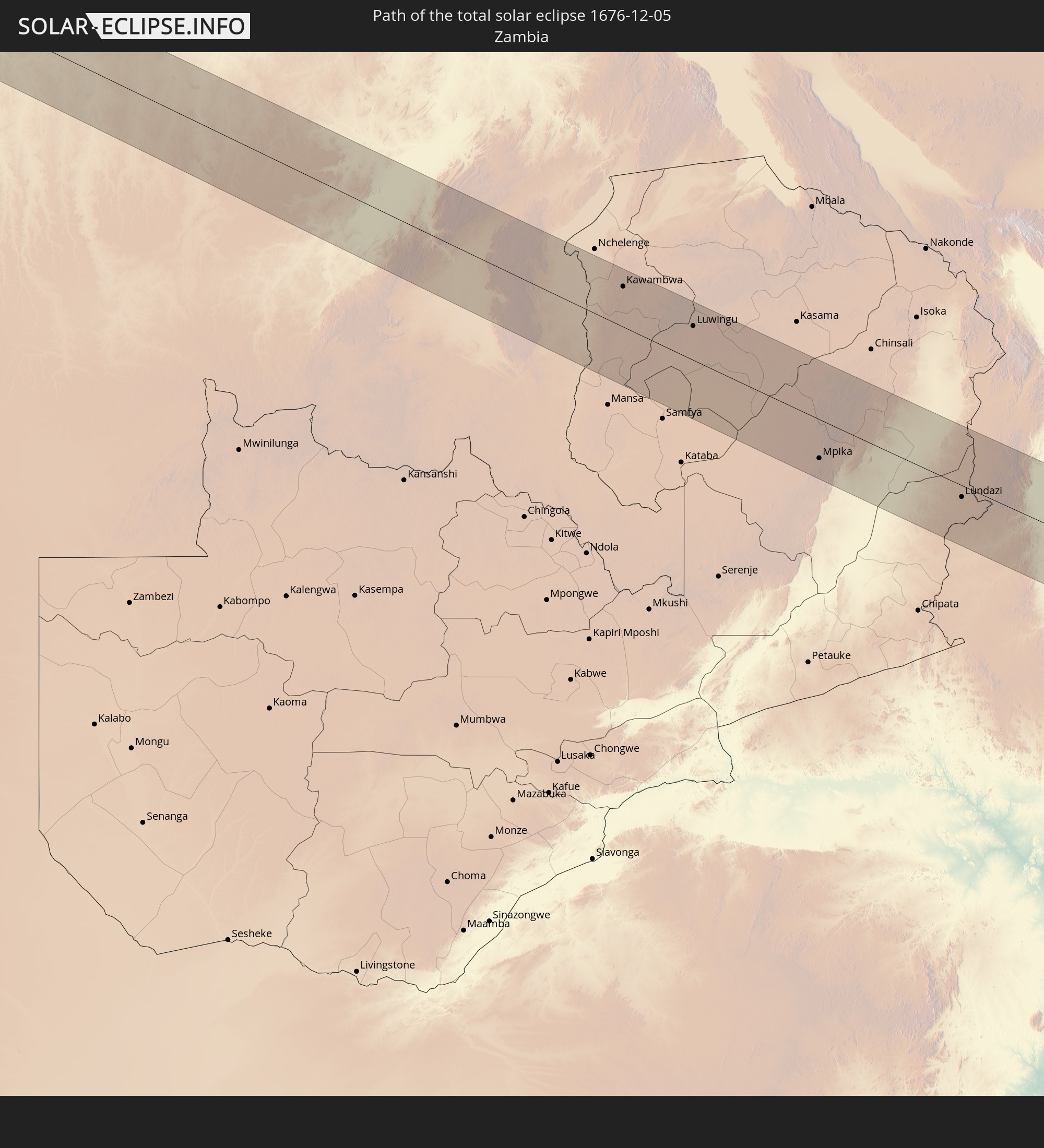 Zambia
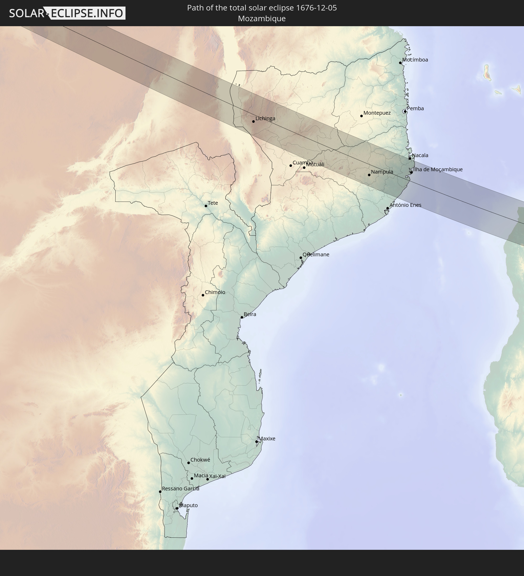 Mozambique
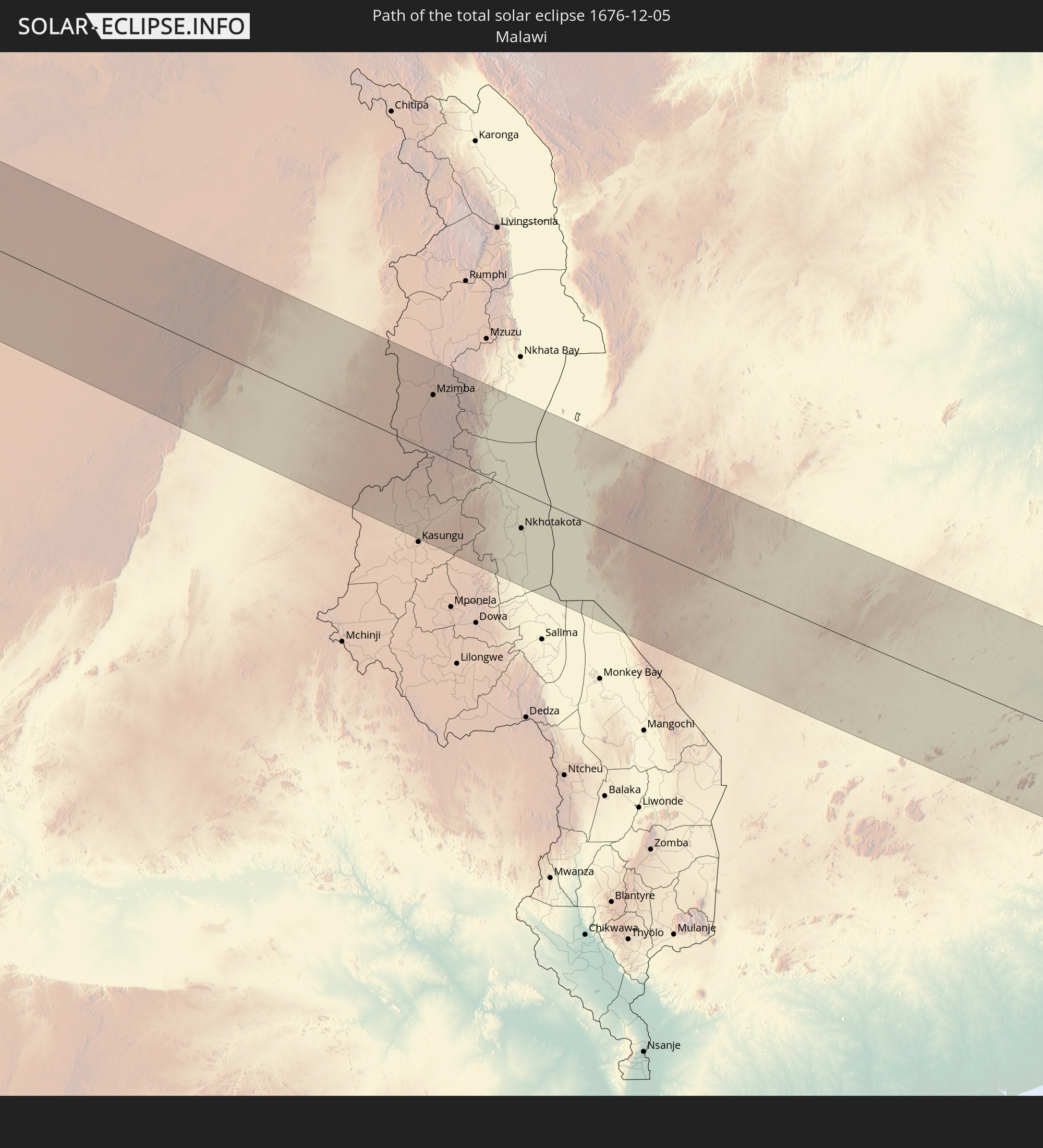 Malawi
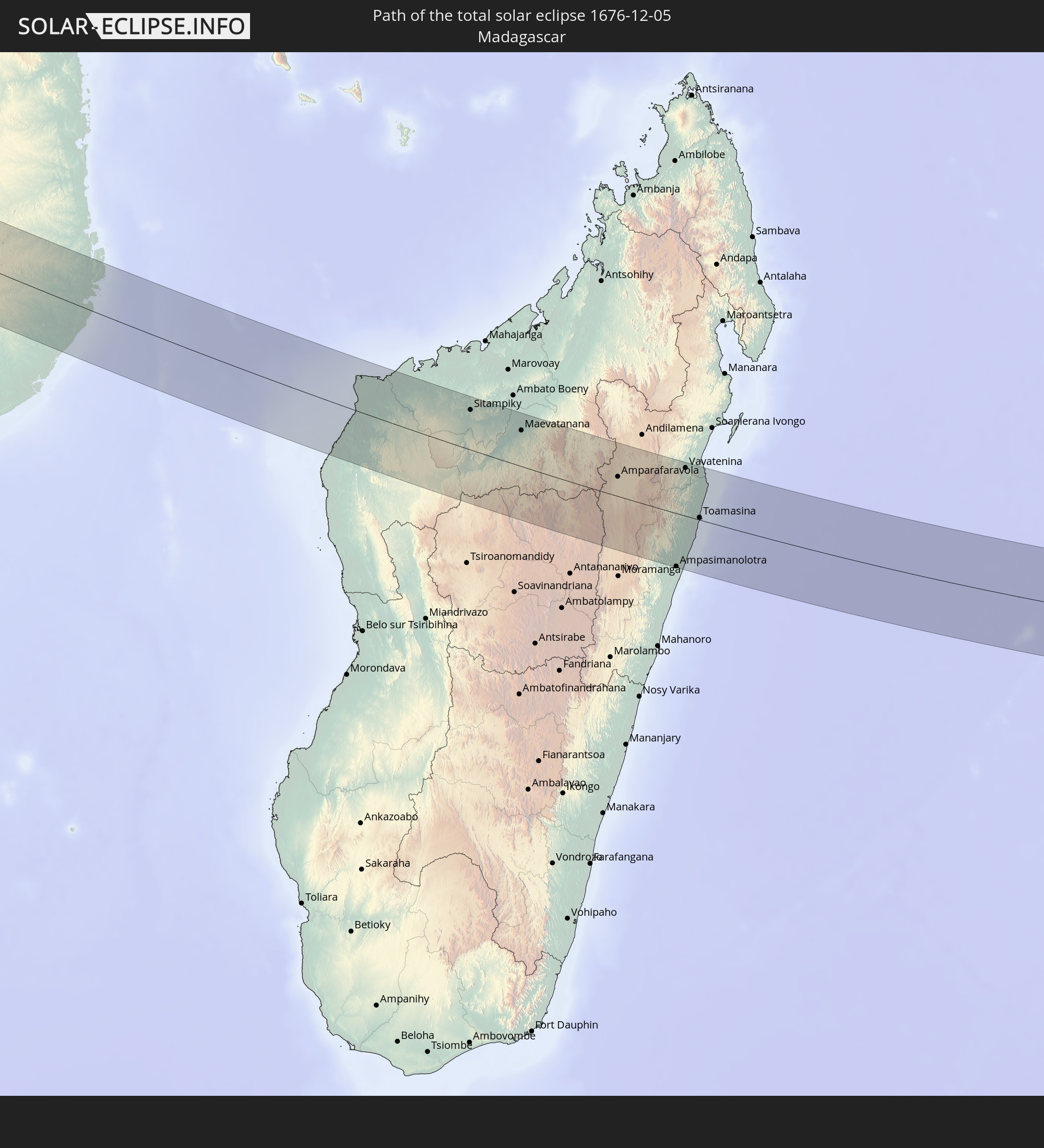 Madagascar
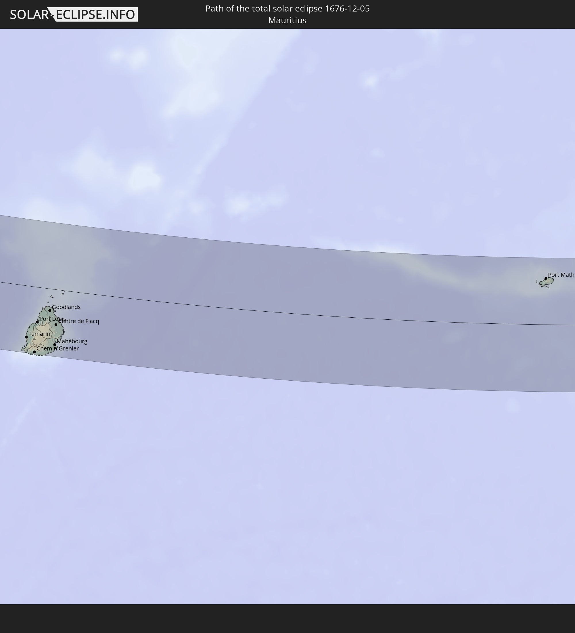 Mauritius
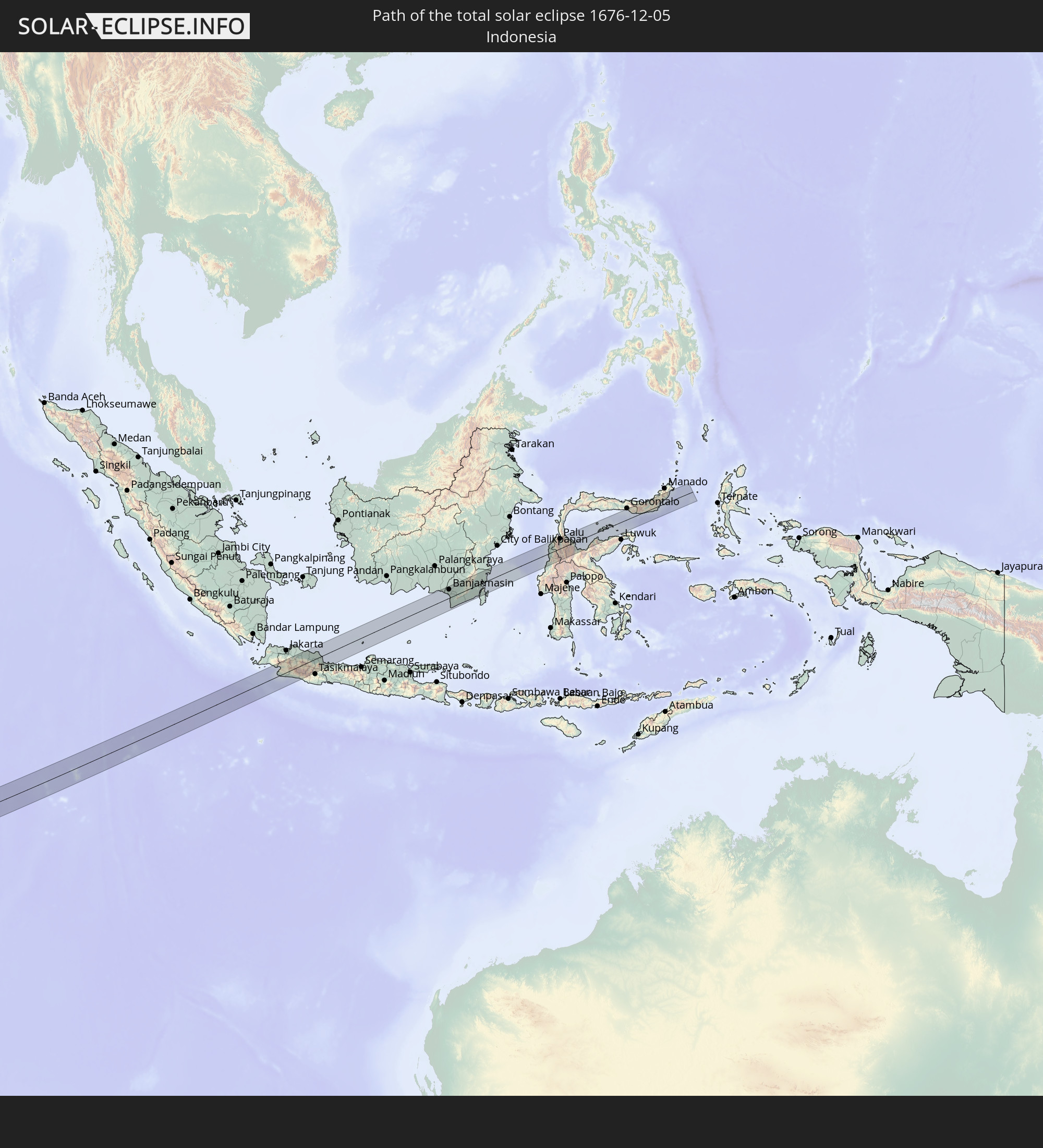 Indonesia
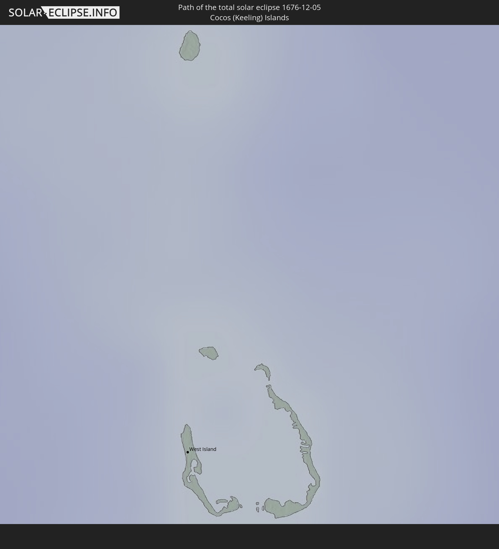 Cocos Islands
In den folgenden Ländern ist die Sonnenfinsternis partiell zu sehen
 Saint Helena, Ascension and Tristan da Cunha
 Algeria
 Ghana
Ghana
 Togo
Togo
 Niger
Niger
 Benin
Benin
 Nigeria
 Equatorial Guinea
 São Tomé and Príncipe
 Tunisia
 Cameroon
 Gabon
Gabon
 Libya
Libya
 Republic of the Congo
 Angola
 Namibia
 Democratic Republic of the Congo
 Chad
Chad
 Central African Republic
 South Africa
 Botswana
 Sudan
Sudan
 Zambia
 Egypt
Egypt
 Zimbabwe
 Lesotho
 Rwanda
 Burundi
 Tanzania
 Uganda
 Mozambique
 Swaziland
 Malawi
 Ethiopia
 Kenya
Kenya
 Saudi Arabia
 Eritrea
 French Southern and Antarctic Lands
 Somalia
 Djibouti
 Yemen
Yemen
 Madagascar
 Comoros
 Mayotte
 Seychelles
 Réunion
 Mauritius
 India
India
 British Indian Ocean Territory
 Maldives
 China
China
 Sri Lanka
 Bangladesh
 Myanmar
 Indonesia
 Cocos Islands
 Thailand
 Malaysia
 Laos
Laos
 Vietnam
 Cambodia
 Singapore
 Christmas Island
 Australia
 Macau
Macau
 Hong Kong
 Brunei
 Taiwan
 Philippines
 East Timor
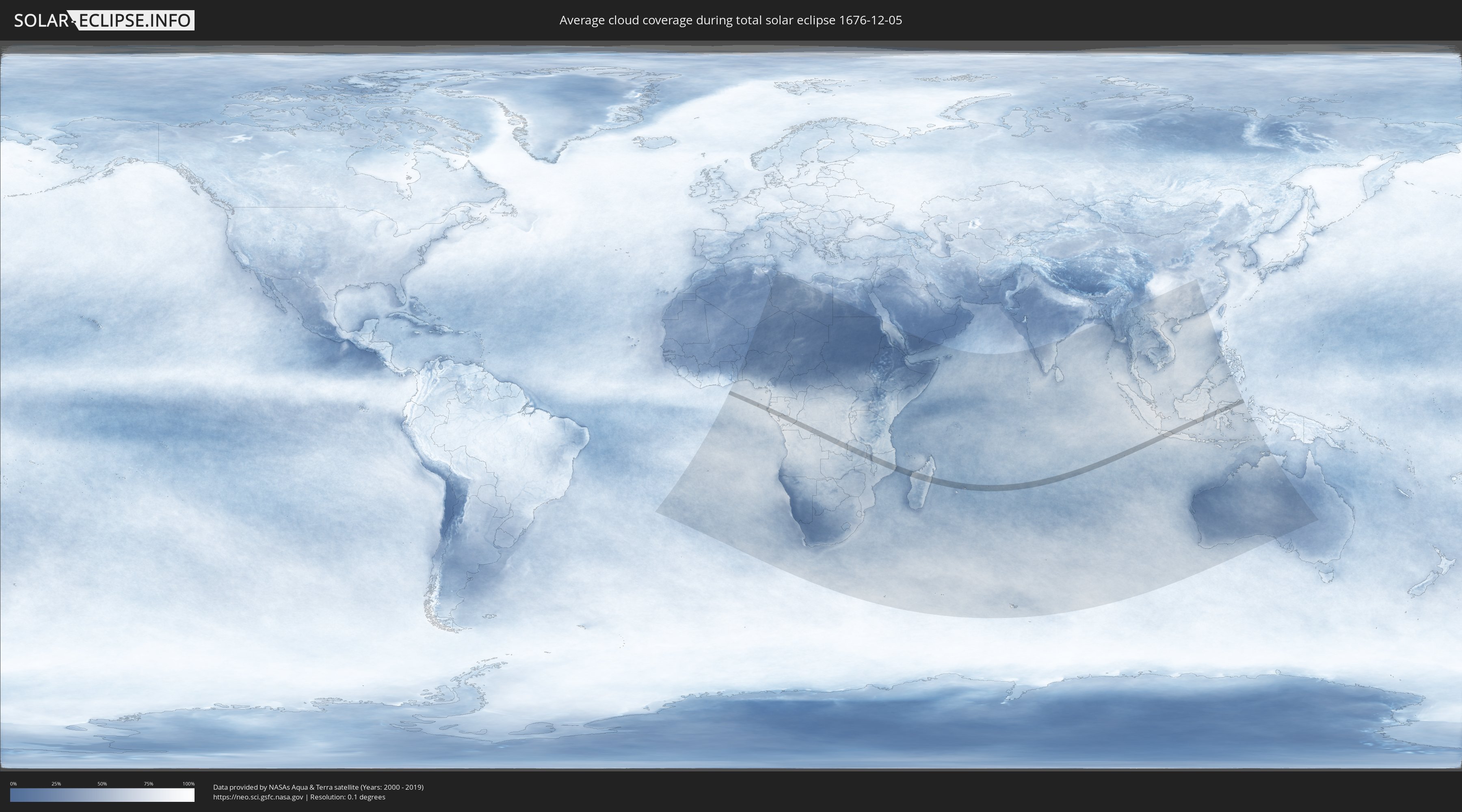
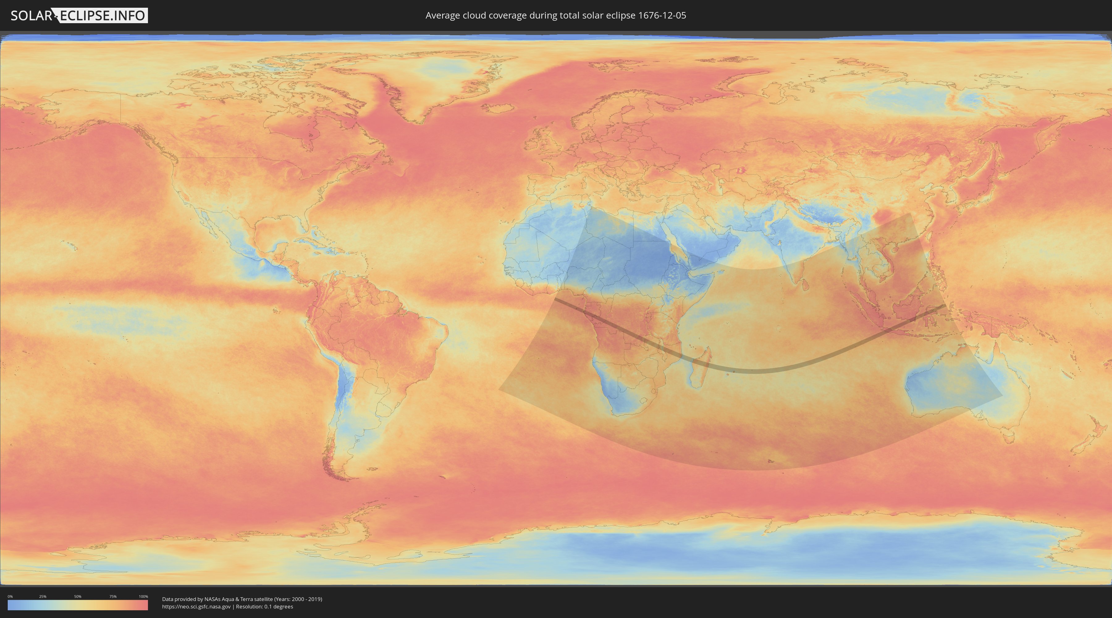
How will be the weather during the total solar eclipse on 12/05/1676?
Where is the best place to see the total solar eclipse of 12/05/1676?
The following maps show the average cloud coverage for the day of the total solar eclipse.
With the help of these maps, it is possible to find the place along the eclipse path, which has the best
chance of a cloudless sky.
Nevertheless, you should consider local circumstances and inform about the weather of your chosen
observation site.
The data is provided by NASAs satellites
AQUA and TERRA.
The cloud maps are averaged over a period of 19 years (2000 - 2019).
Detailed country maps
 São Tomé and Príncipe
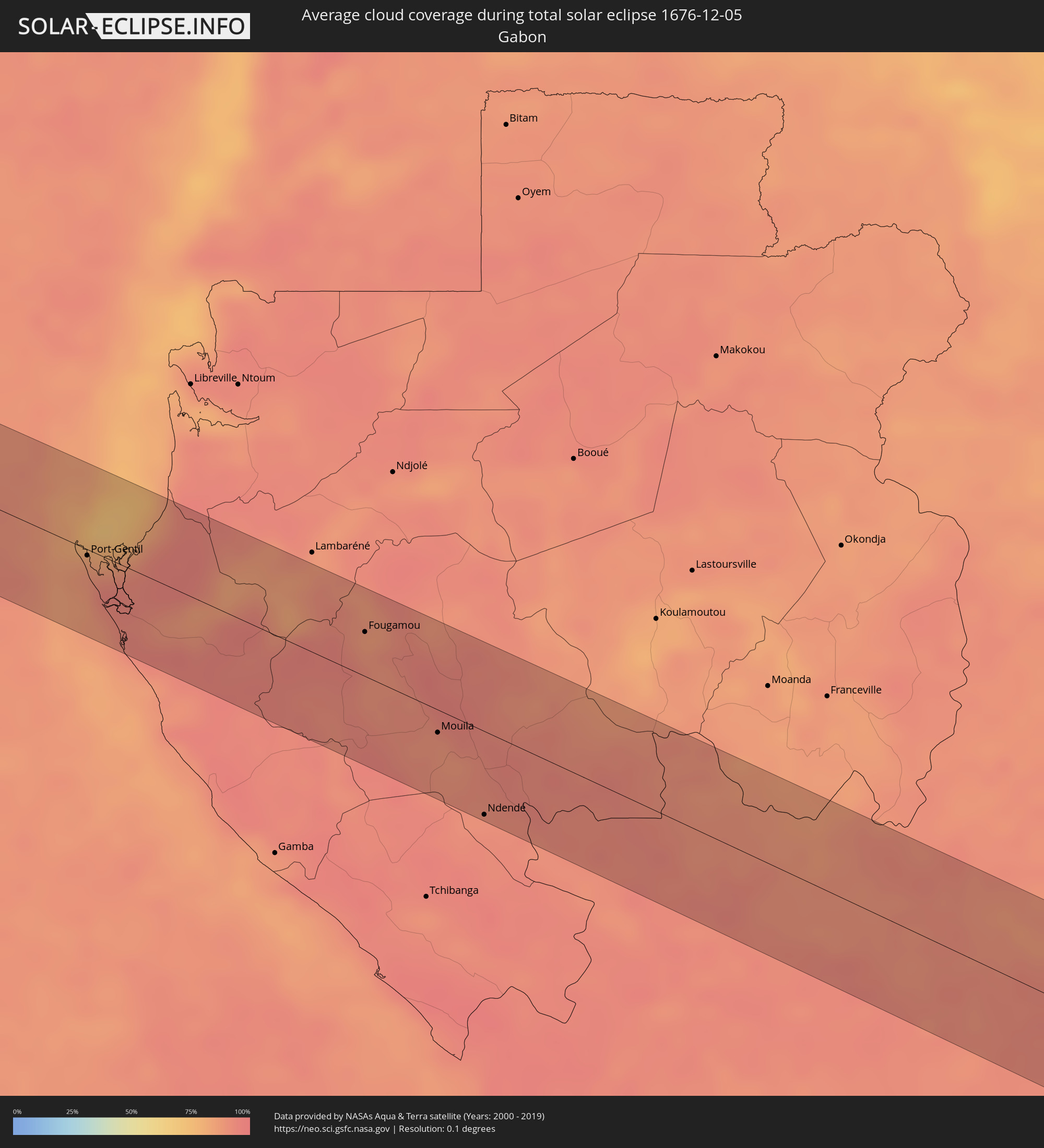 Gabon
Gabon
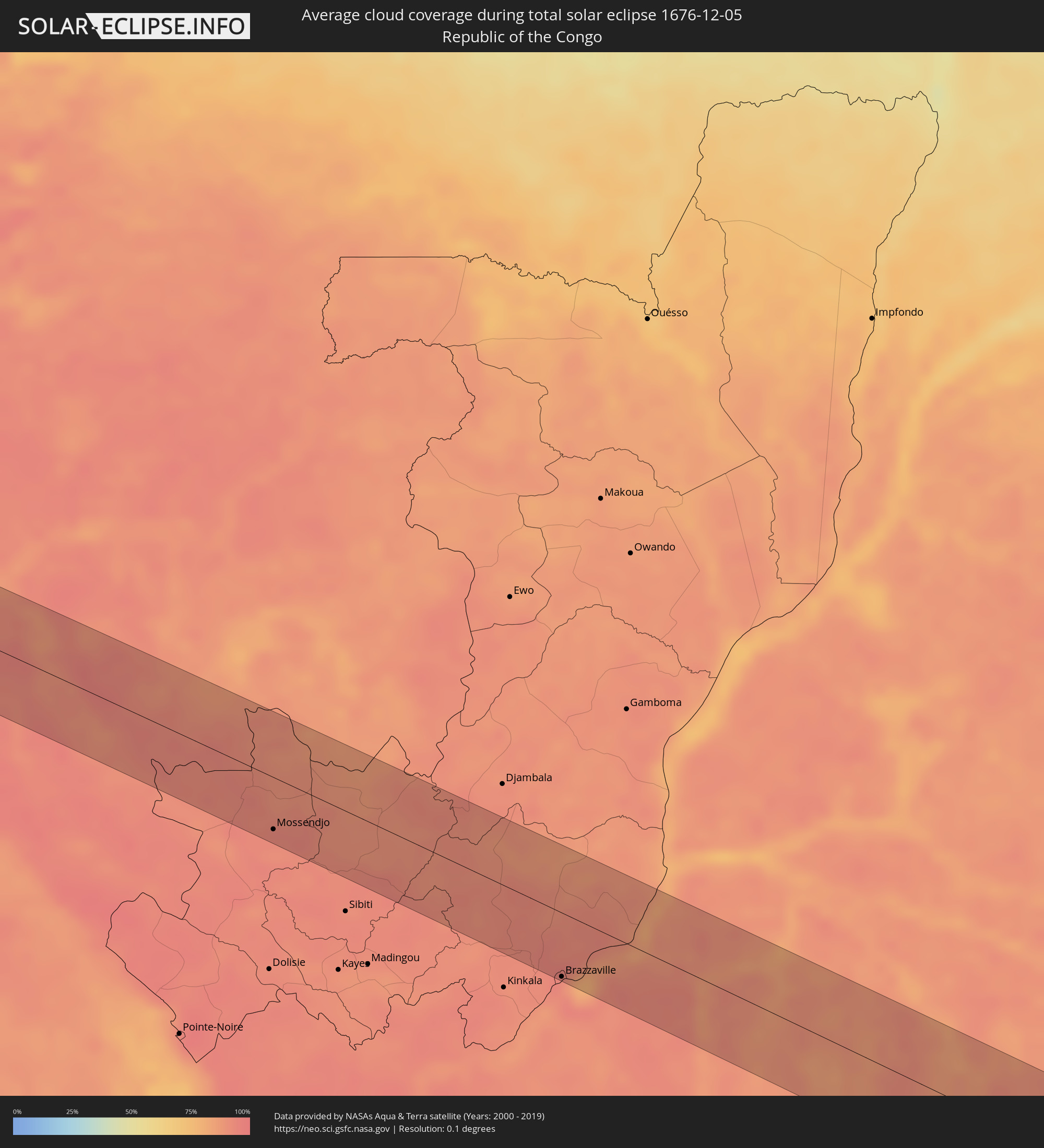 Republic of the Congo
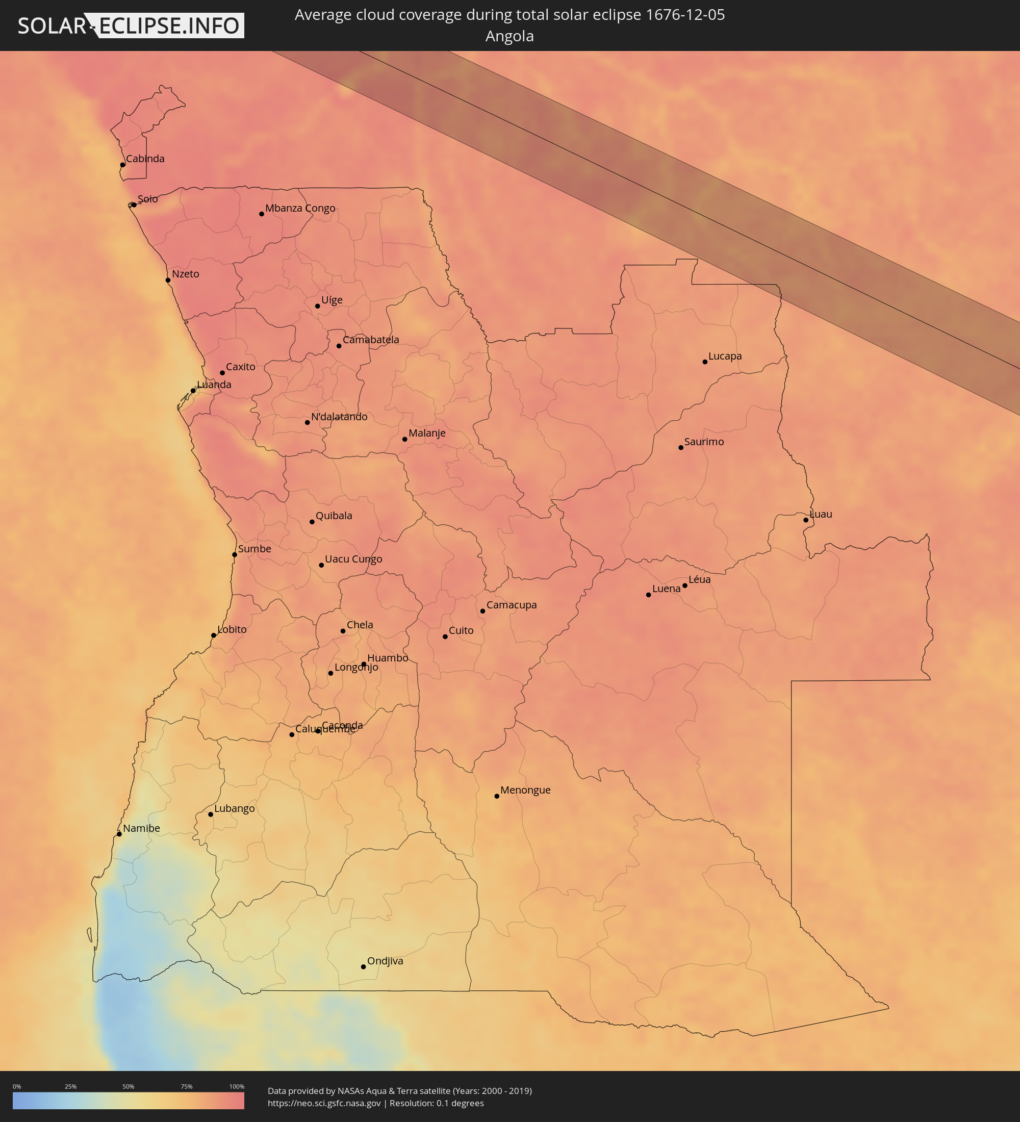 Angola
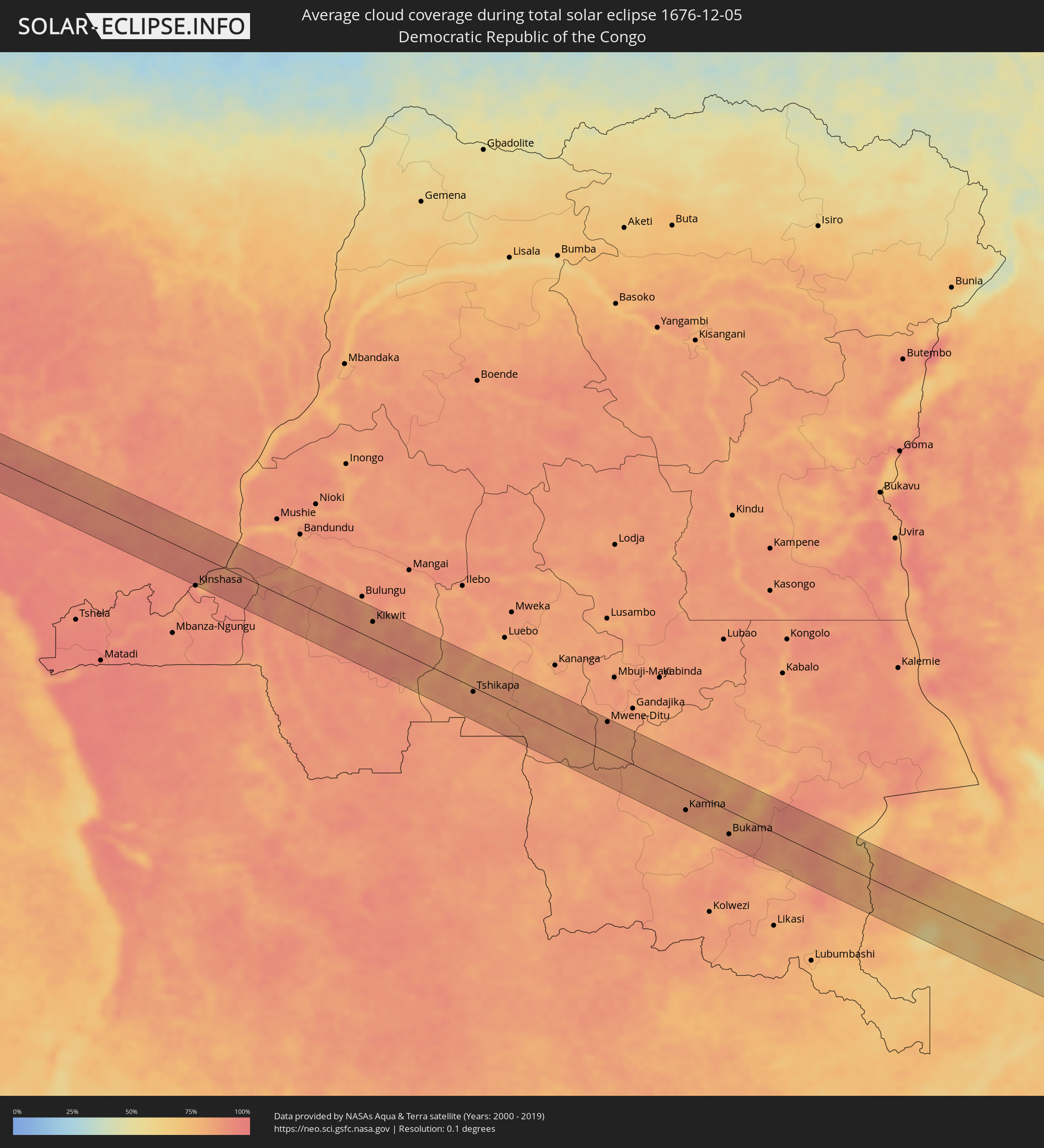 Democratic Republic of the Congo
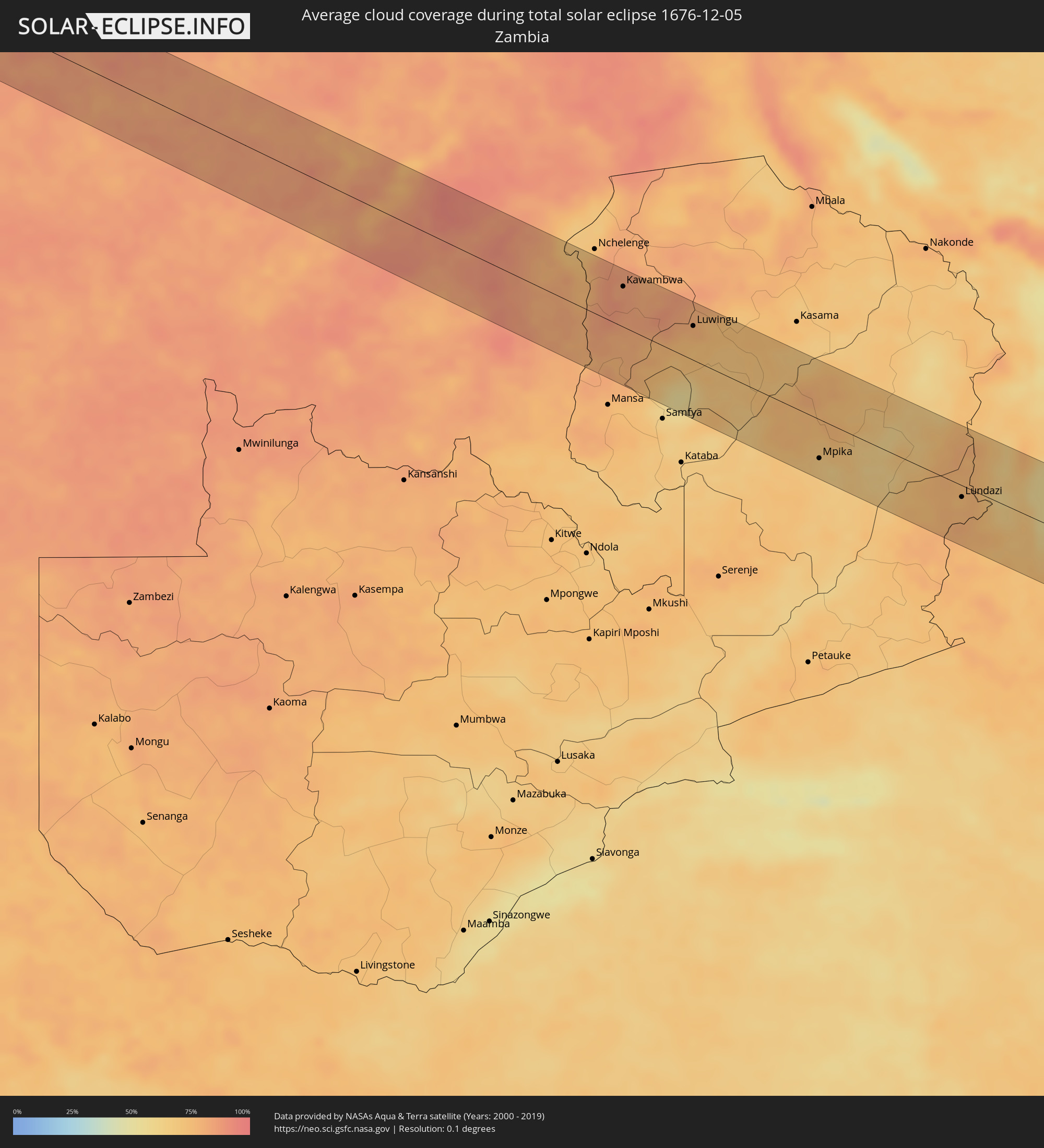 Zambia
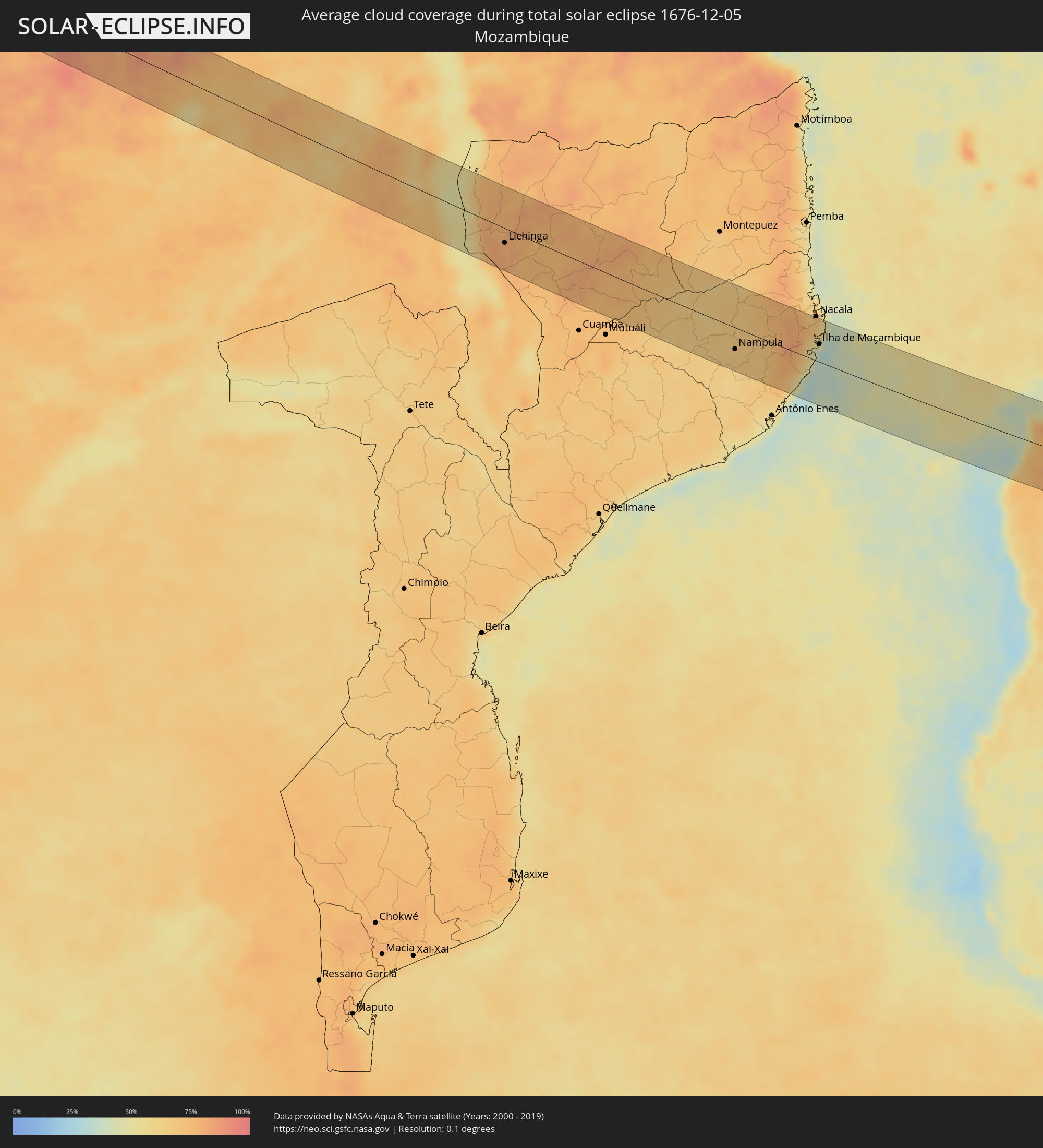 Mozambique
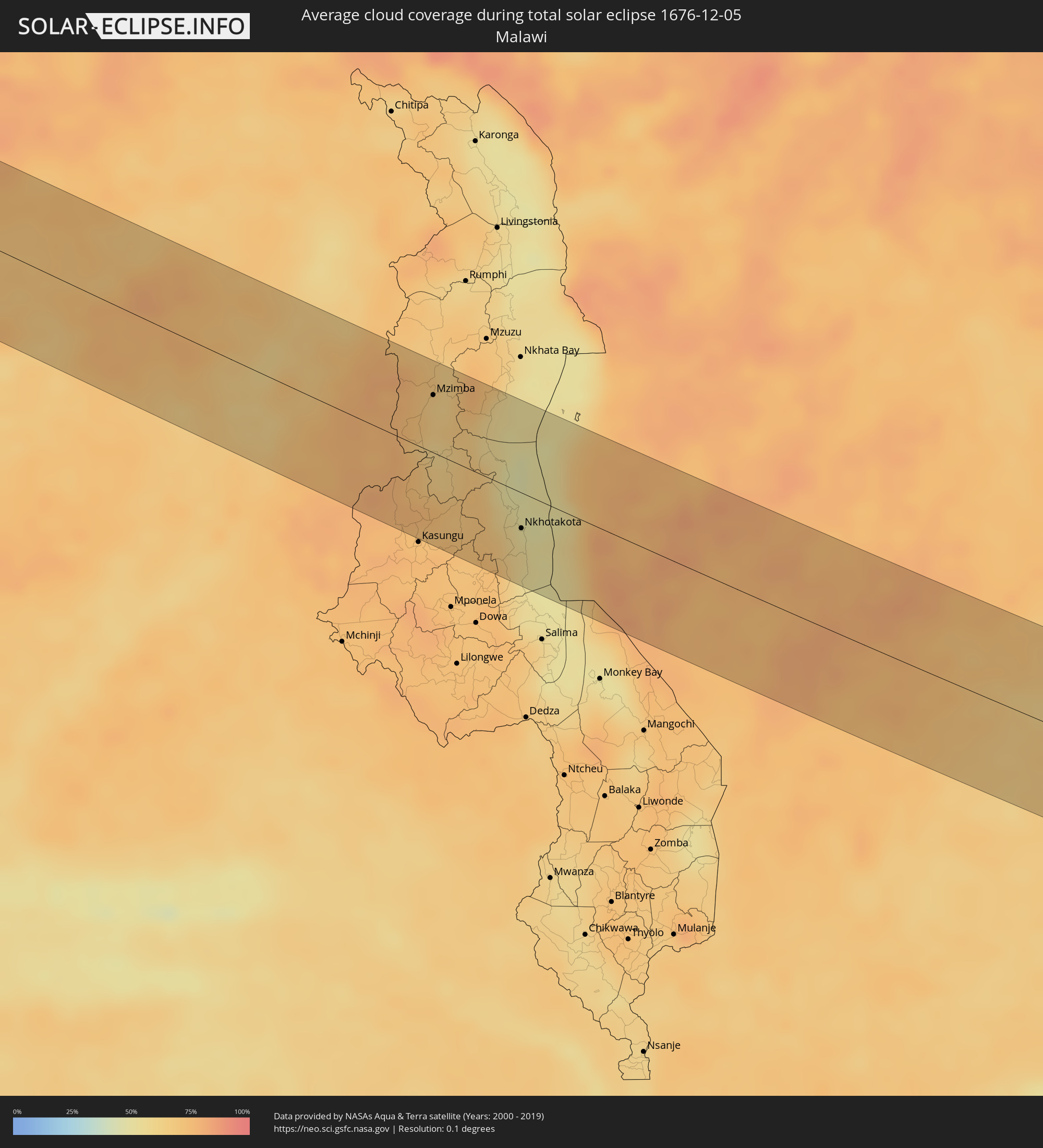 Malawi
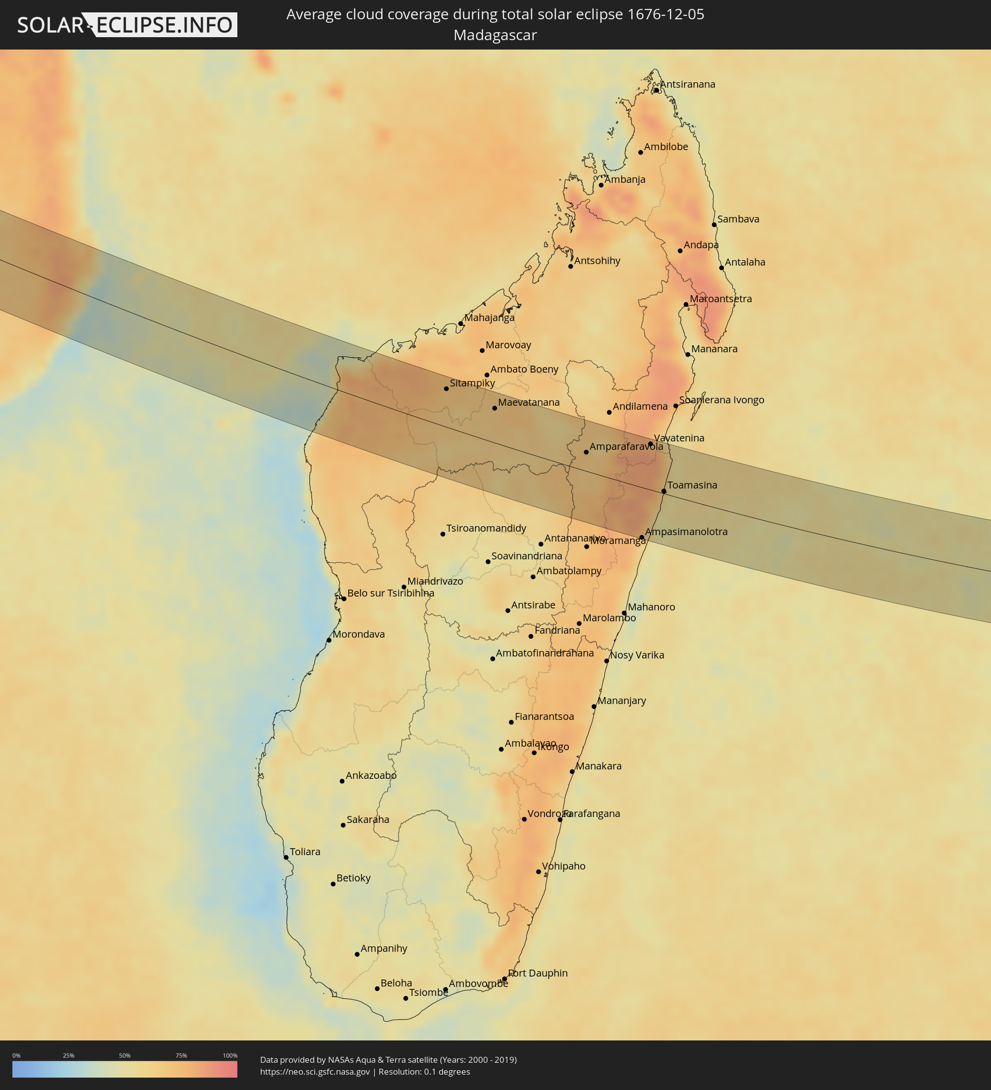 Madagascar
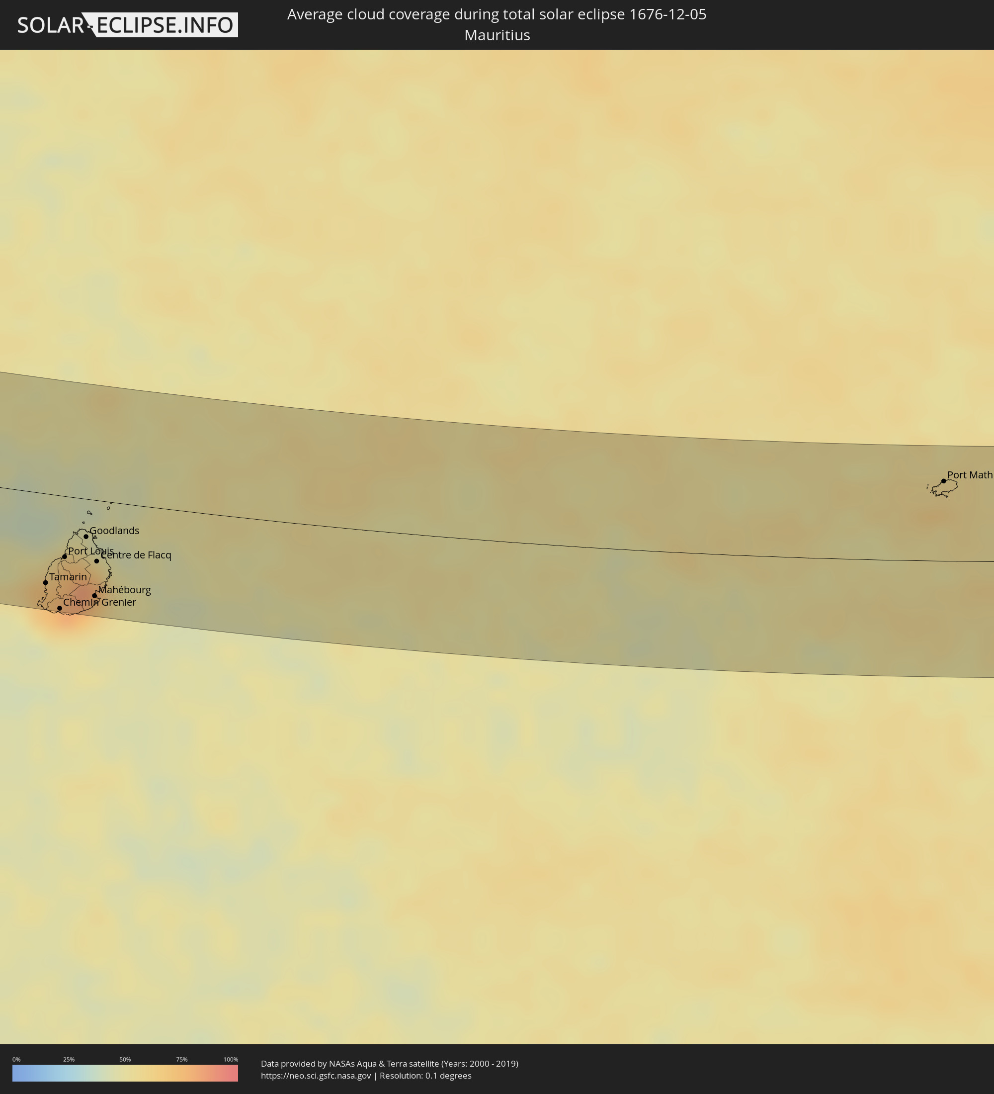 Mauritius
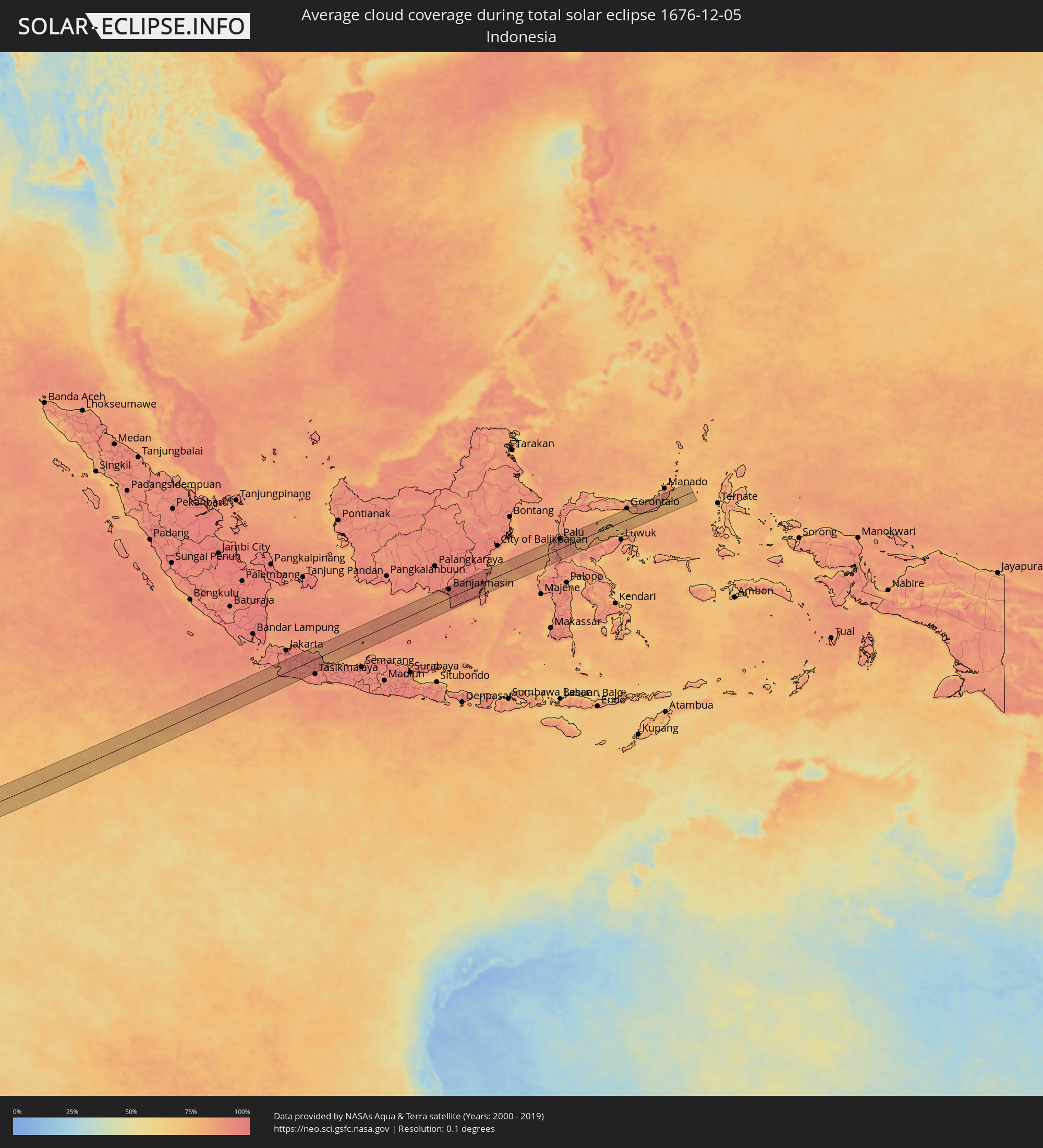 Indonesia
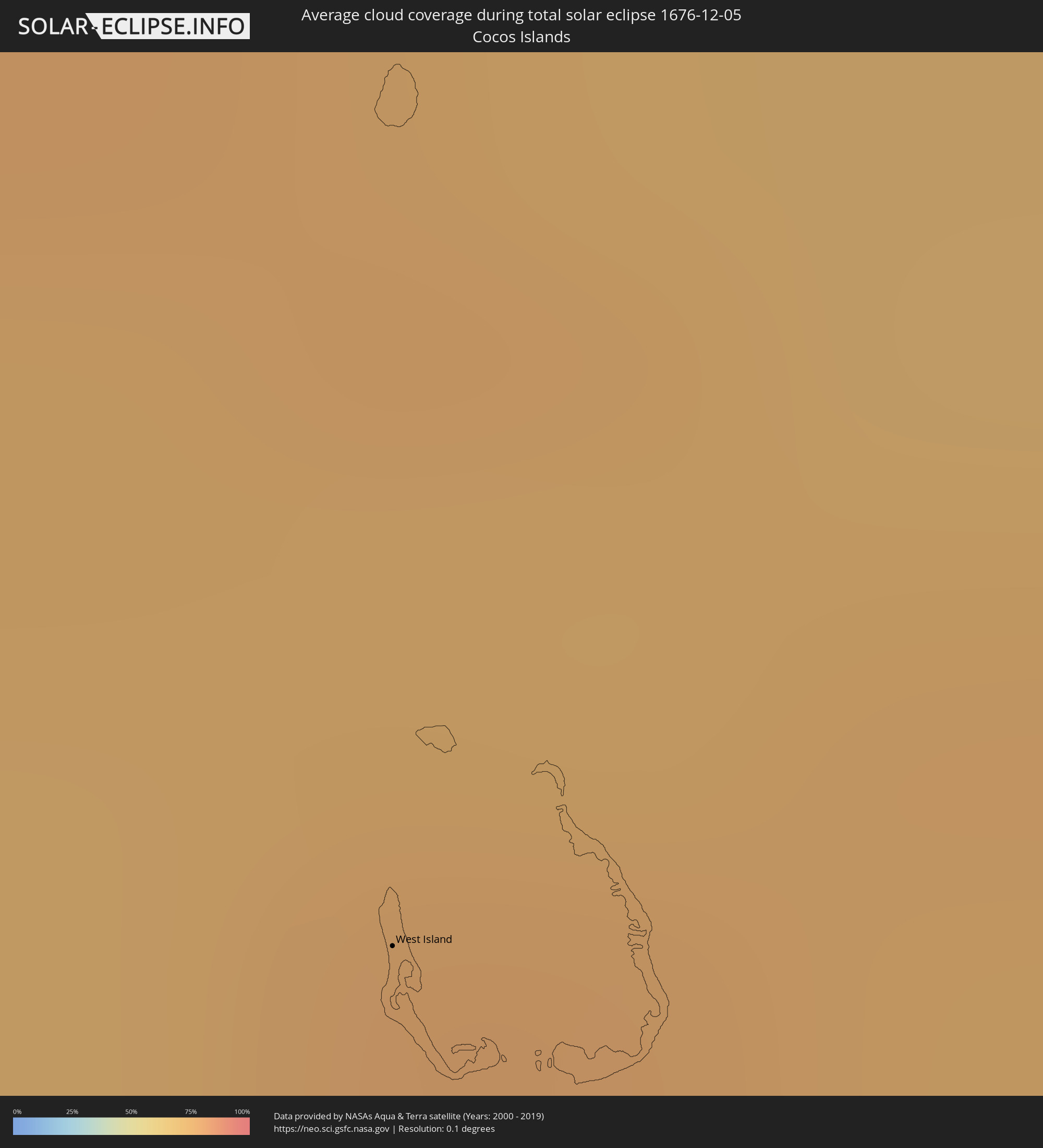 Cocos Islands
Cities inside the path of the eclipse
The following table shows all locations with a population of more than 5,000 inside the eclipse path. Cities which have more than 100,000 inhabitants are marked bold. A click at the locations opens a detailed map.
| City | Type | Eclipse duration | Local time of max. eclipse | Distance to central line | Ø Cloud coverage |
|
São Tomé, São Tomé Island
|
total | - | 05:23:16 UTC-00:36 | 9 km | 92% |
|
Port-Gentil, Ogooué-Maritime
|
total | - | 06:14:20 UTC+00:13 | 4 km | 89% |
|
Fougamou, Ngouni
|
total | - | 06:14:59 UTC+00:13 | 29 km | 89% |
|
Mouila, Ngouni
|
total | - | 06:15:24 UTC+00:13 | 15 km | 89% |
|
Ndendé, Ngouni
|
total | - | 06:15:43 UTC+00:13 | 55 km | 92% |
|
Mossendjo, Niari
|
total | - | 06:16:27 UTC+00:13 | 47 km | 93% |
|
Brazzaville, Brazzaville
|
total | - | 06:18:12 UTC+00:13 | 57 km | 93% |
|
Kikwit, Bandundu
|
total | - | 06:20:37 UTC+00:13 | 34 km | 87% |
|
Tshikapa, Kasaï-Occidental
|
total | - | 08:19:34 UTC+02:10 | 9 km | 84% |
|
Mwene-Ditu, Kasaï-Oriental
|
total | - | 08:22:06 UTC+02:10 | 59 km | 87% |
|
Kamina, Katanga
|
total | - | 08:24:44 UTC+02:10 | 40 km | 87% |
|
Bukama, Katanga
|
total | - | 08:25:56 UTC+02:10 | 46 km | 85% |
|
Kawambwa, Luapula
|
total | - | 08:29:57 UTC+02:10 | 48 km | 85% |
|
Luwingu, Northern
|
total | - | 08:31:22 UTC+02:10 | 41 km | 77% |
|
Mpika, Muchinga Province
|
total | - | 08:34:39 UTC+02:10 | 47 km | 66% |
|
Lundazi, Eastern
|
total | - | 08:37:28 UTC+02:10 | 14 km | 75% |
|
Mzimba, Northern Region
|
total | - | 08:37:45 UTC+02:10 | 45 km | 64% |
|
Nkhotakota, Central Region
|
total | - | 08:39:41 UTC+02:10 | 28 km | 54% |
|
Lichinga, Niassa
|
total | - | 08:41:30 UTC+02:10 | 25 km | 78% |
|
Nampula, Nampula
|
total | - | 08:50:04 UTC+02:10 | 37 km | 66% |
|
Ilha de Moçambique, Nampula
|
total | - | 08:52:48 UTC+02:10 | 30 km | 51% |
|
Mahabe, Melaky
|
total | - | 09:21:15 UTC+02:27 | 12 km | 72% |
|
Sitampiky, Boeny
|
total | - | 09:22:40 UTC+02:27 | 58 km | 70% |
|
Maevatanana, Betsiboka
|
total | - | 09:24:37 UTC+02:27 | 52 km | 66% |
|
Anjozorobe, Analamanga
|
total | - | 09:28:13 UTC+02:27 | 69 km | 68% |
|
Amparafaravola, Alaotra Mangoro
|
total | - | 09:28:28 UTC+02:27 | 29 km | 65% |
|
Ambatondrazaka, Alaotra Mangoro
|
total | - | 09:29:07 UTC+02:27 | 8 km | 68% |
|
Sahatavy, Analanjirofo
|
total | - | 09:30:17 UTC+02:27 | 66 km | 83% |
|
Vohibinany, Atsinanana
|
total | - | 09:30:18 UTC+02:27 | 78 km | 80% |
|
Ampasimanolotra, Atsinanana
|
total | - | 09:31:28 UTC+02:27 | 78 km | 55% |
|
Vavatenina, Analanjirofo
|
total | - | 09:30:48 UTC+02:27 | 71 km | 82% |
|
Toamasina, Atsinanana
|
total | - | 09:31:48 UTC+02:27 | 3 km | 58% |
|
Mahavelona, Atsinanana
|
total | - | 09:31:44 UTC+02:27 | 56 km | 56% |
|
Chemin Grenier, Savanne
|
total | - | 11:17:31 UTC+03:50 | 79 km | 59% |
|
Vacoas, Plaines Wilhems
|
total | - | 11:17:29 UTC+03:50 | 58 km | 79% |
|
Port Louis, Port Louis
|
total | - | 11:17:29 UTC+03:50 | 43 km | 76% |
|
Morcellemont Saint André, Pamplemousses
|
total | - | 11:17:37 UTC+03:50 | 32 km | 75% |
|
Dagotière, Moka
|
total | - | 11:17:42 UTC+03:50 | 51 km | 83% |
|
Fond du Sac, Pamplemousses
|
total | - | 11:17:40 UTC+03:50 | 28 km | 61% |
|
Quartier Militaire, Moka
|
total | - | 11:17:48 UTC+03:50 | 51 km | 83% |
|
Piton, Rivière du Rempart
|
total | - | 11:17:50 UTC+03:50 | 33 km | 75% |
|
Goodlands, Rivière du Rempart
|
total | - | 11:17:51 UTC+03:50 | 27 km | 61% |
|
Bon Accueil, Flacq
|
total | - | 11:17:56 UTC+03:50 | 41 km | 77% |
|
Grand Gaube, Rivière du Rempart
|
total | - | 11:17:53 UTC+03:50 | 23 km | 53% |
|
Laventure, Flacq
|
total | - | 11:17:59 UTC+03:50 | 38 km | 66% |
|
Sebastopol, Flacq
|
total | - | 11:18:04 UTC+03:50 | 54 km | 72% |
|
Beau Vallon, Grand Port
|
total | - | 11:18:08 UTC+03:50 | 68 km | 62% |
|
Mahébourg, Grand Port
|
total | - | 11:18:09 UTC+03:50 | 67 km | 62% |
|
Centre de Flacq, Flacq
|
total | - | 11:18:07 UTC+03:50 | 43 km | 77% |
|
Poste de Flacq, Flacq
|
total | - | 11:18:09 UTC+03:50 | 40 km | 77% |
|
Ecroignard, Flacq
|
total | - | 11:18:11 UTC+03:50 | 47 km | 77% |
|
Port Mathurin, Rodrigues
|
total | - | 11:34:33 UTC+03:50 | 56 km | 62% |
|
West Island
|
total | - | 15:34:02 UTC+06:30 | 42 km | 74% |
|
Cicurug, West Java
|
total | - | 16:23:56 UTC+07:07 | 49 km | 92% |
|
Caringin, West Java
|
total | - | 16:24:00 UTC+07:07 | 55 km | 92% |
|
Sukabumi, West Java
|
total | - | 16:23:57 UTC+07:07 | 29 km | 92% |
|
Purwakarta, West Java
|
total | - | 16:24:28 UTC+07:07 | 41 km | 90% |
|
Cikampek, West Java
|
total | - | 16:24:33 UTC+07:07 | 55 km | 96% |
|
Padalarang, West Java
|
total | - | 16:24:20 UTC+07:07 | 12 km | 91% |
|
Soreang, West Java
|
total | - | 16:24:15 UTC+07:07 | 10 km | 90% |
|
Bandung, West Java
|
total | - | 16:24:22 UTC+07:07 | 3 km | 88% |
|
Cileunyi, West Java
|
total | - | 16:24:27 UTC+07:07 | 11 km | 89% |
|
Paseh, West Java
|
total | - | 16:24:22 UTC+07:07 | 29 km | 93% |
|
Pamanukan, West Java
|
total | - | 16:24:51 UTC+07:07 | 52 km | 96% |
|
Sumedang Utara
|
total | - | 16:24:36 UTC+07:07 | 10 km | 93% |
|
Indramayu, West Java
|
total | - | 16:25:07 UTC+07:07 | 24 km | 95% |
|
Arjawinangun, West Java
|
total | - | 16:25:00 UTC+07:07 | 12 km | 95% |
|
Klangenan, West Java
|
total | - | 16:24:59 UTC+07:07 | 20 km | 95% |
|
Cirebon, West Java
|
total | - | 16:25:03 UTC+07:07 | 25 km | 89% |
|
Banjarmasin, South Kalimantan
|
total | - | 17:19:42 UTC+07:57 | 40 km | 95% |
|
Martapura, South Kalimantan
|
total | - | 17:19:45 UTC+07:57 | 19 km | 96% |
|
Palu, Central Sulawesi
|
total | - | 17:21:39 UTC+07:57 | 47 km | 94% |