Annular solar eclipse of 06/28/2215
| Day of week: | Wednesday |
| Maximum duration of eclipse: | 01m44s |
| Maximum width of eclipse path: | 58 km |
| Saros cycle: | 140 |
| Coverage: | 98.4% |
| Magnitude: | 0.9839 |
| Gamma: | 0.1388 |
Wo kann man die Sonnenfinsternis vom 06/28/2215 sehen?
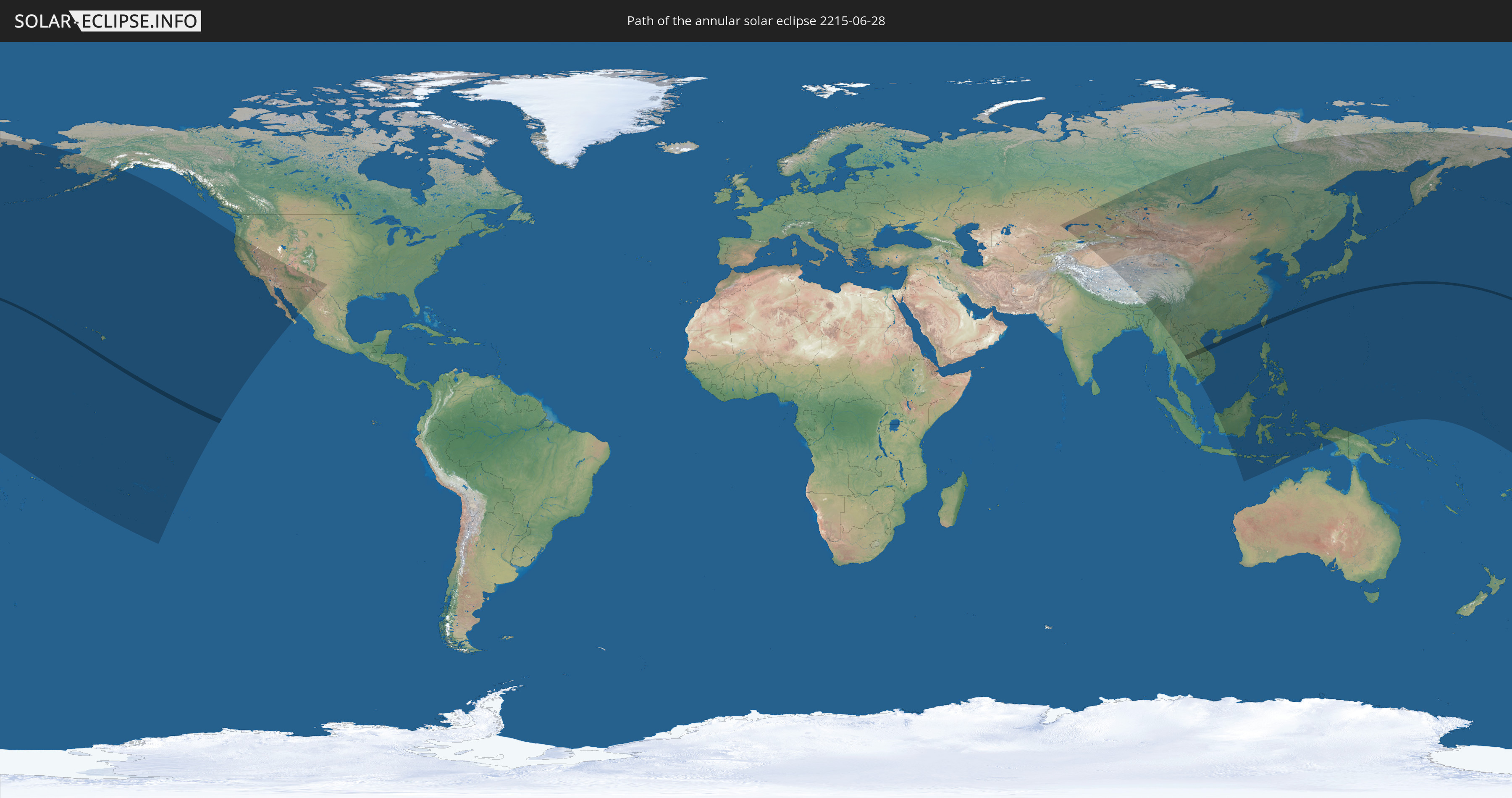
Die Sonnenfinsternis am 06/28/2215 kann man in 37 Ländern als partielle Sonnenfinsternis beobachten.
Der Finsternispfad verläuft durch 7 Länder. Nur in diesen Ländern ist sie als annular Sonnenfinsternis zu sehen.
In den folgenden Ländern ist die Sonnenfinsternis annular zu sehen
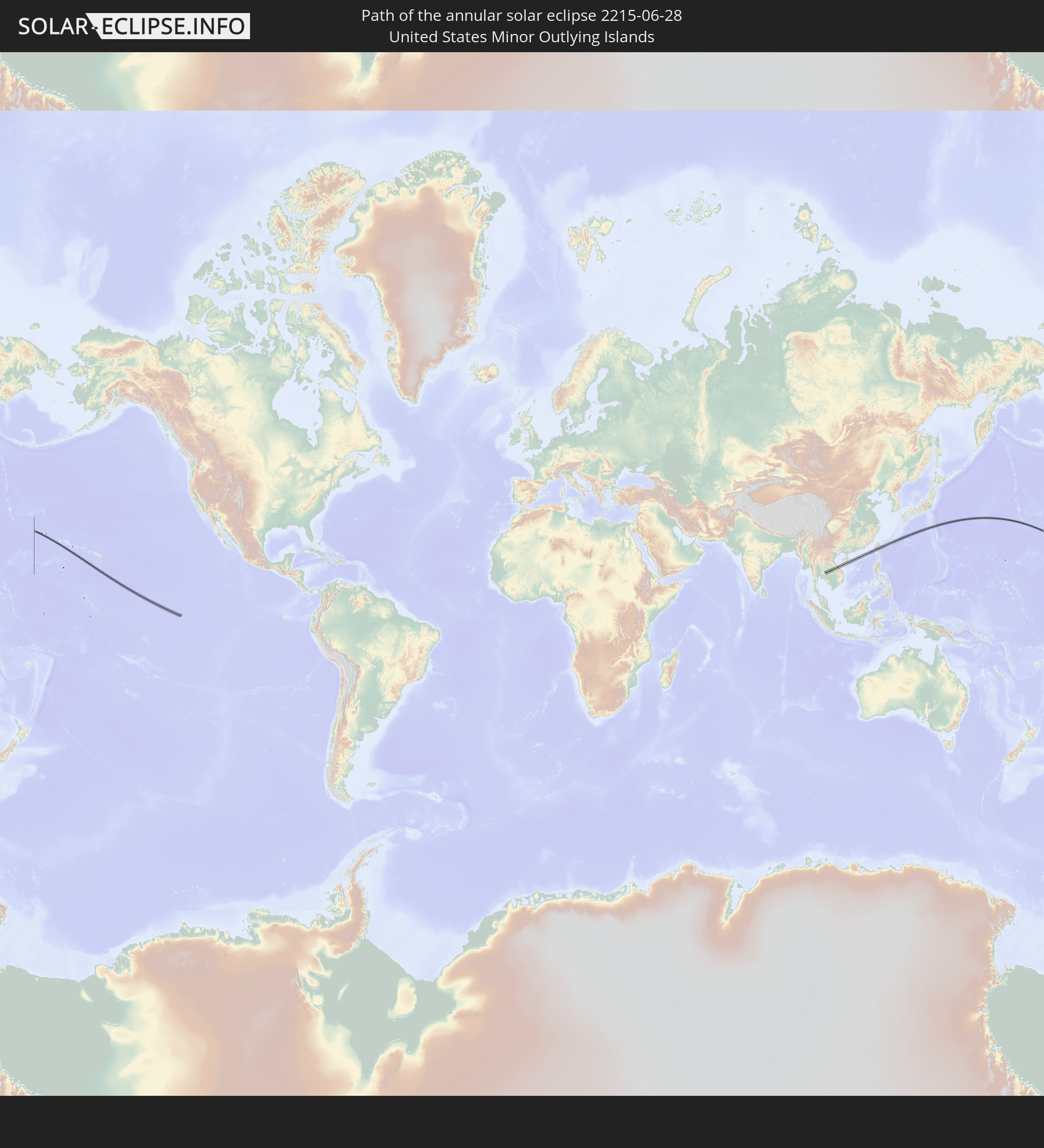 United States Minor Outlying Islands
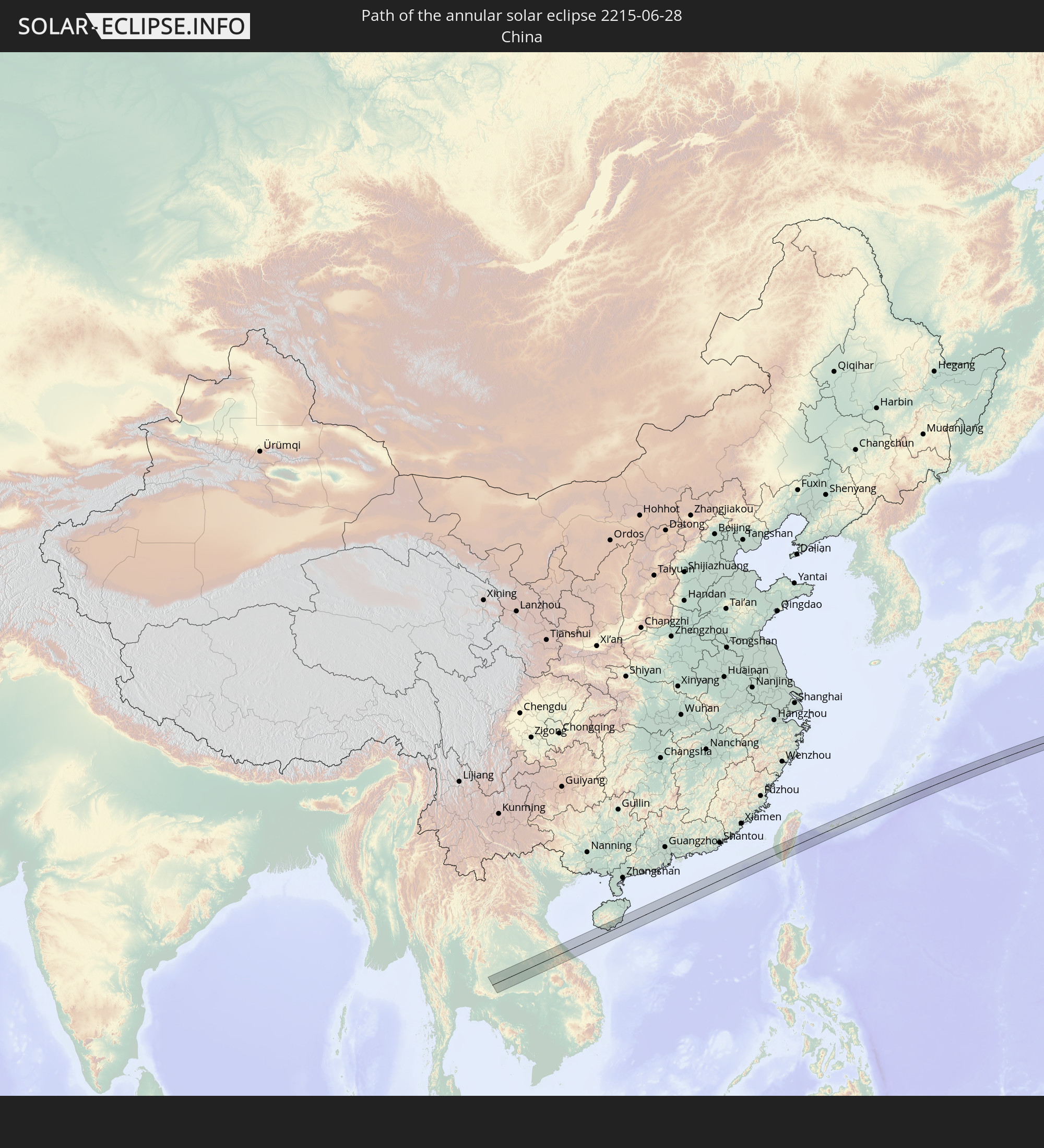 China
China
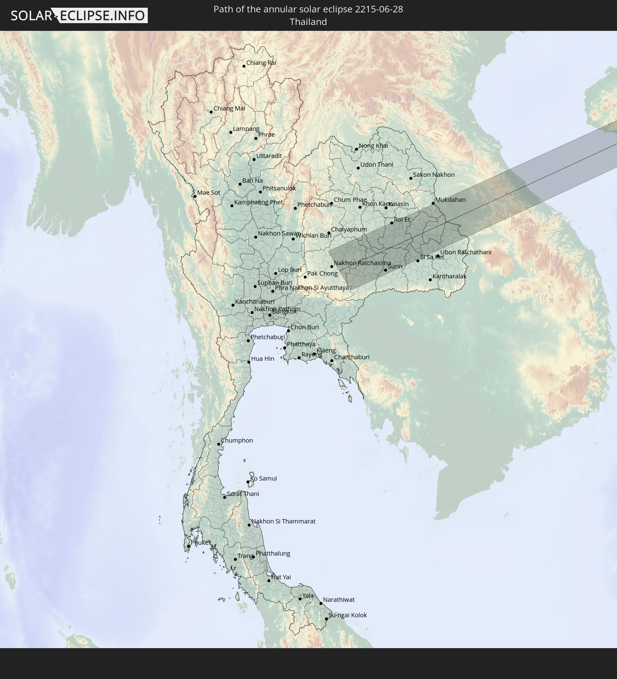 Thailand
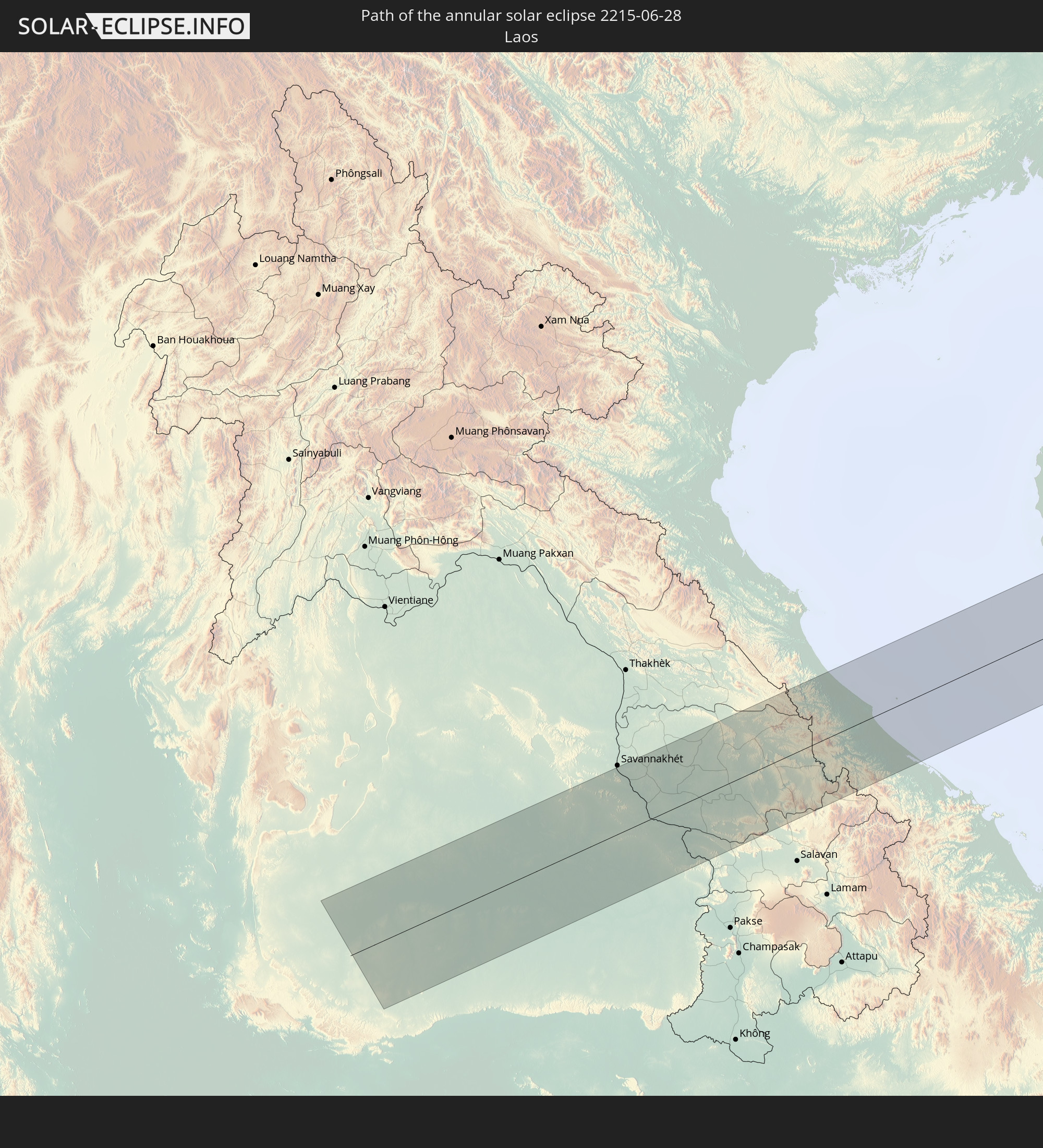 Laos
Laos
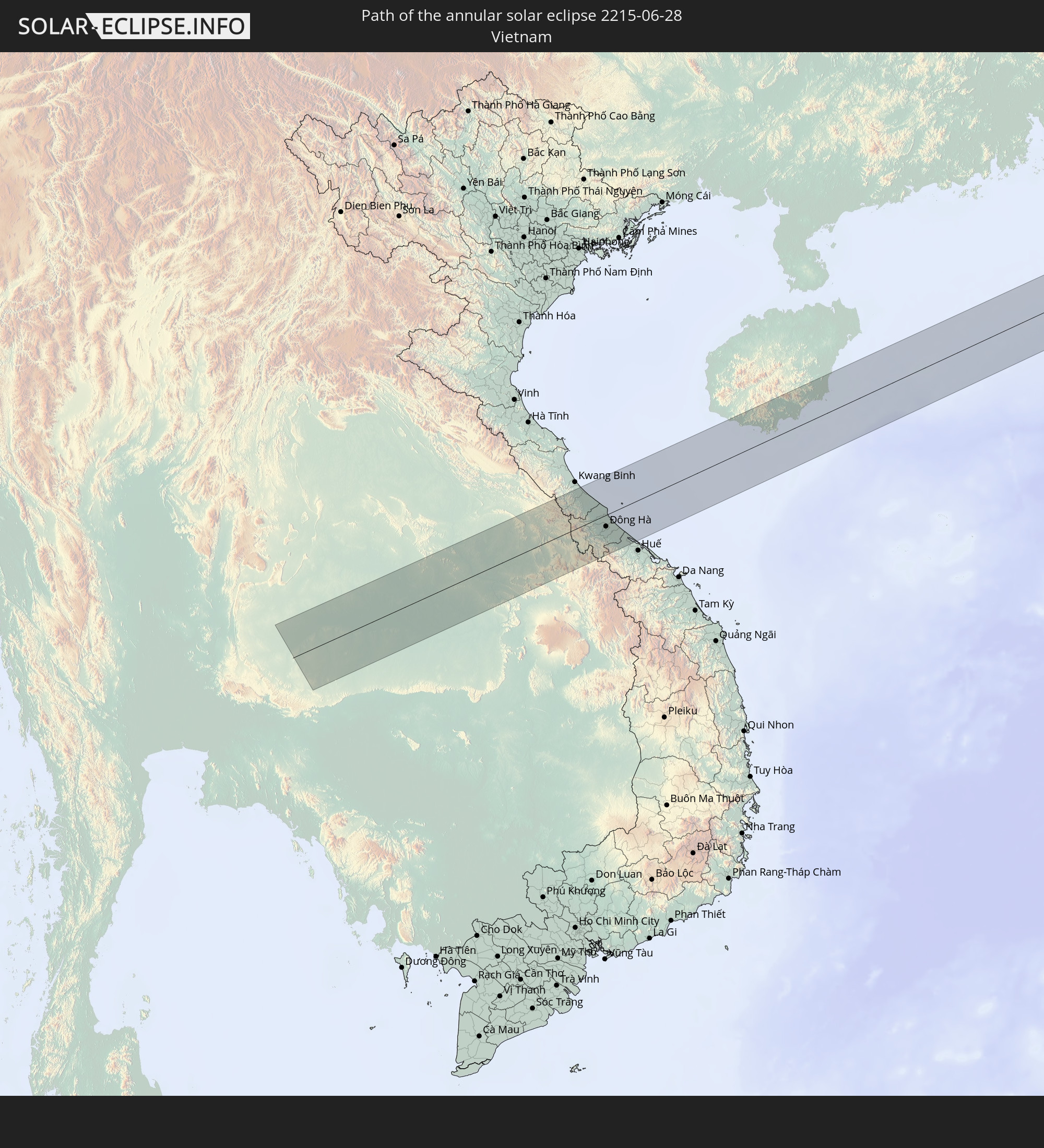 Vietnam
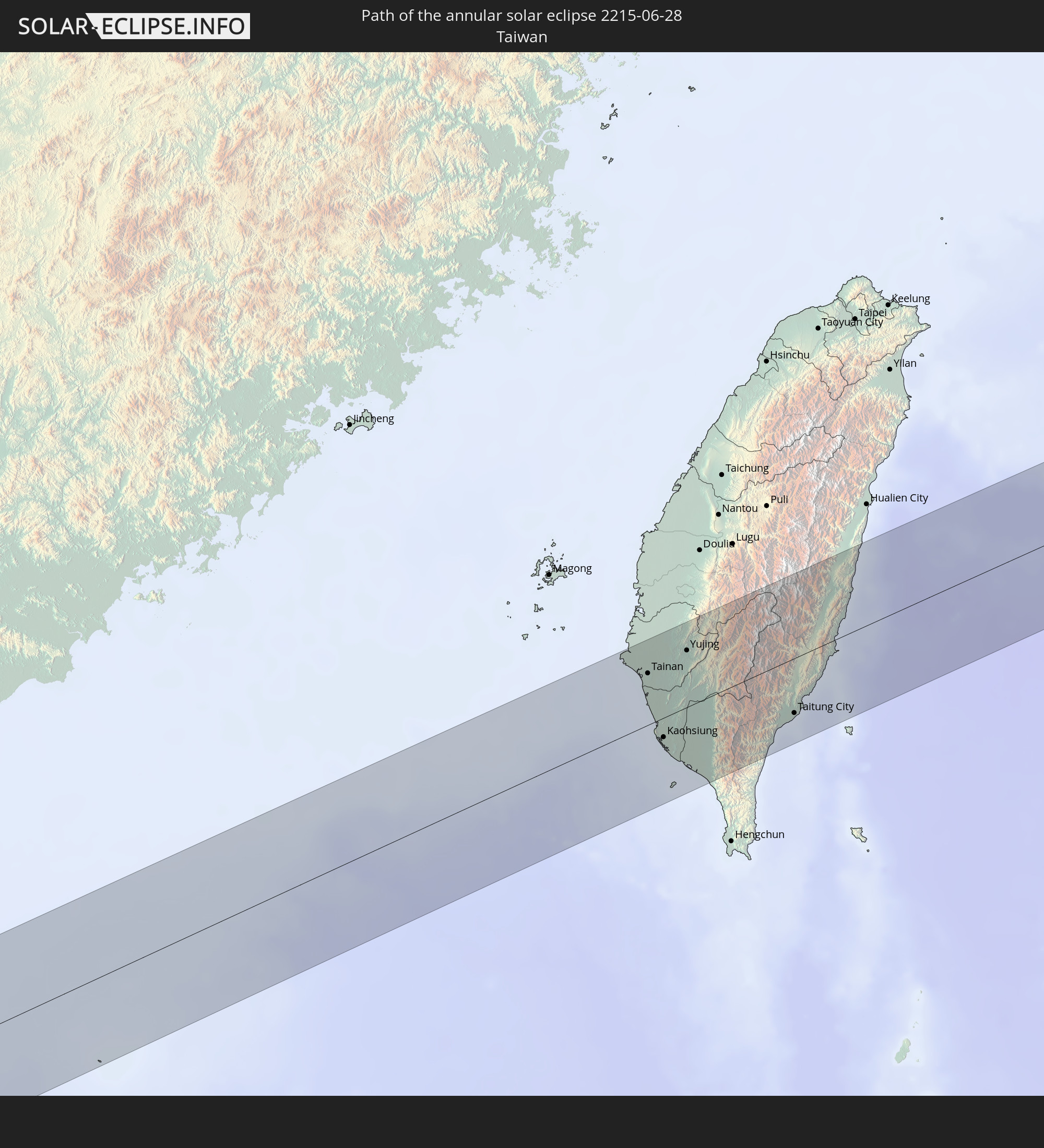 Taiwan
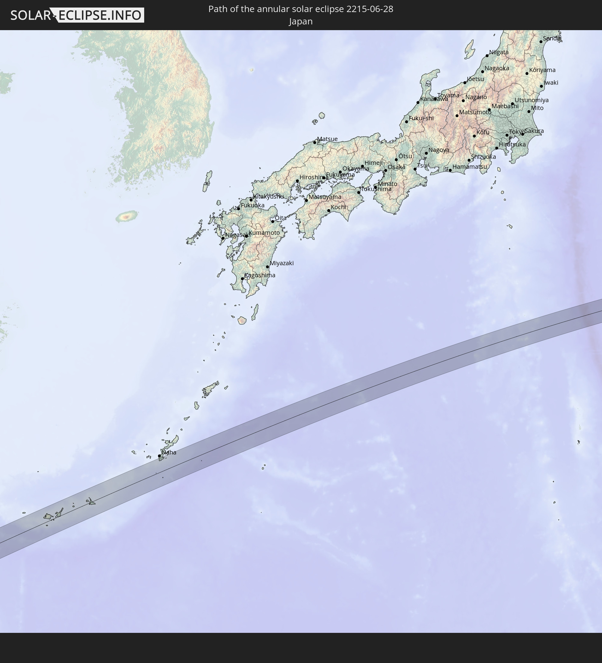 Japan
Japan
In den folgenden Ländern ist die Sonnenfinsternis partiell zu sehen
 Russia
 United States
 United States Minor Outlying Islands
 Kiribati
 Tokelau
 American Samoa
 Cook Islands
 French Polynesia
 Mexico
 Kazakhstan
 India
India
 Kyrgyzstan
 China
China
 Mongolia
 Myanmar
 Indonesia
 Thailand
 Malaysia
 Laos
Laos
 Vietnam
 Cambodia
 Macau
Macau
 Hong Kong
 Brunei
 Taiwan
 Philippines
 Japan
Japan
 East Timor
 North Korea
 South Korea
 Palau
Palau
 Federated States of Micronesia
 Papua New Guinea
 Guam
Guam
 Northern Mariana Islands
 Marshall Islands
 Nauru
Nauru
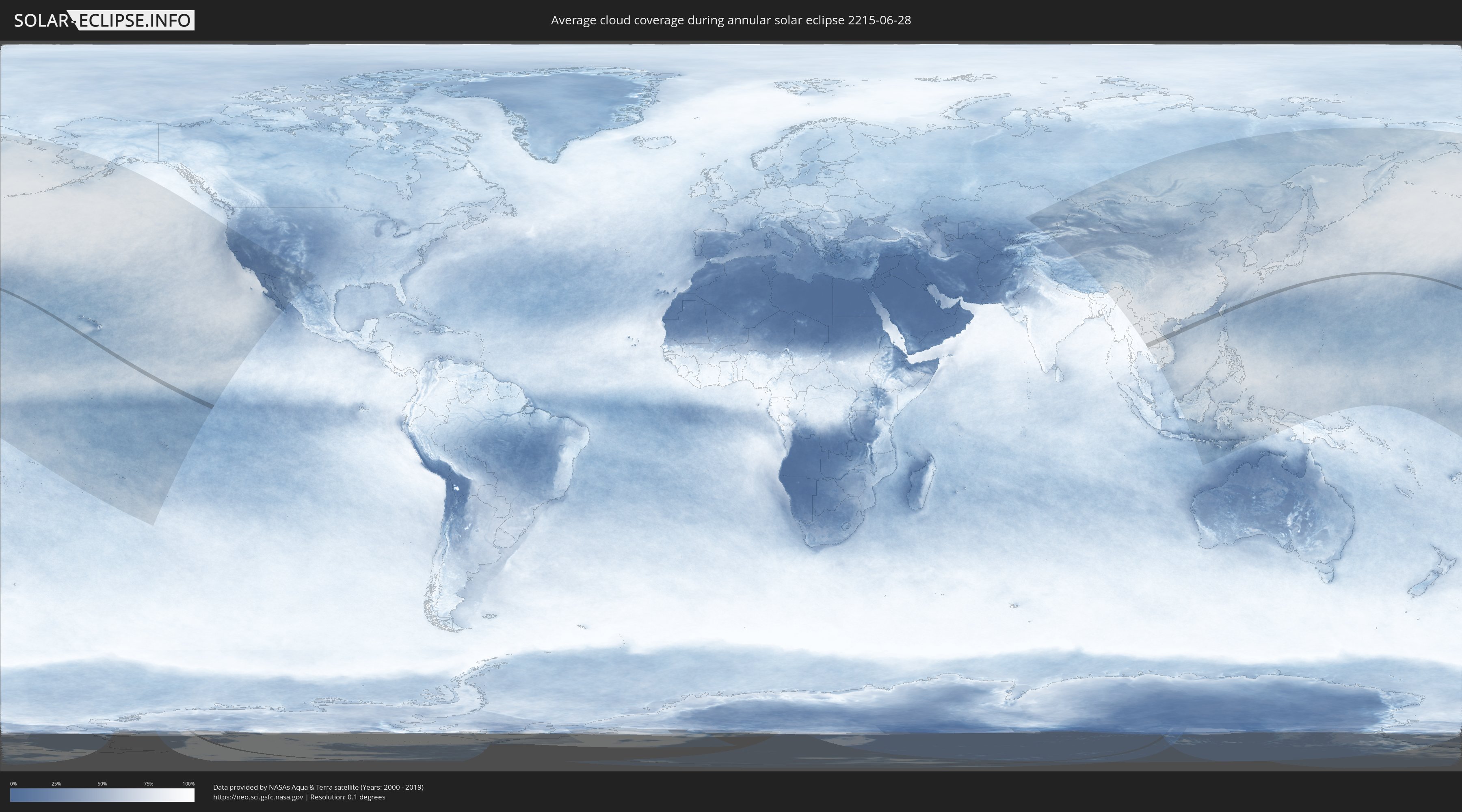
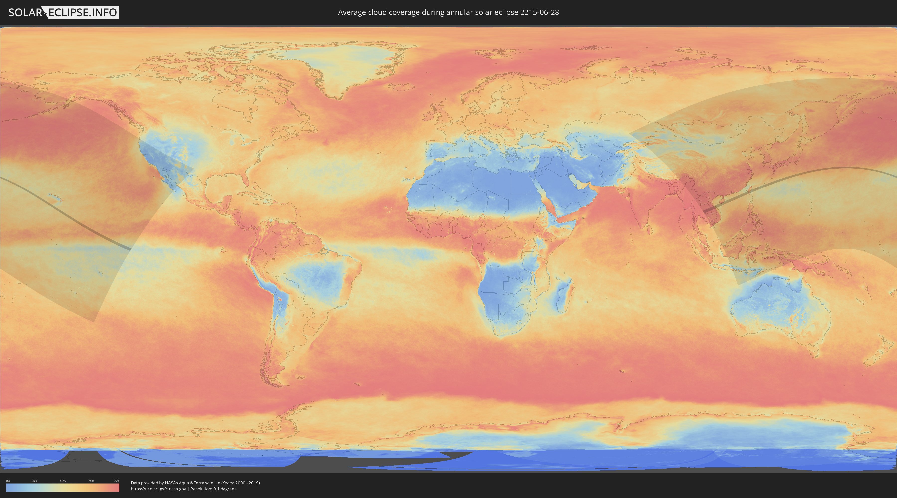
How will be the weather during the annular solar eclipse on 06/28/2215?
Where is the best place to see the annular solar eclipse of 06/28/2215?
The following maps show the average cloud coverage for the day of the annular solar eclipse.
With the help of these maps, it is possible to find the place along the eclipse path, which has the best
chance of a cloudless sky.
Nevertheless, you should consider local circumstances and inform about the weather of your chosen
observation site.
The data is provided by NASAs satellites
AQUA and TERRA.
The cloud maps are averaged over a period of 19 years (2000 - 2019).
Detailed country maps
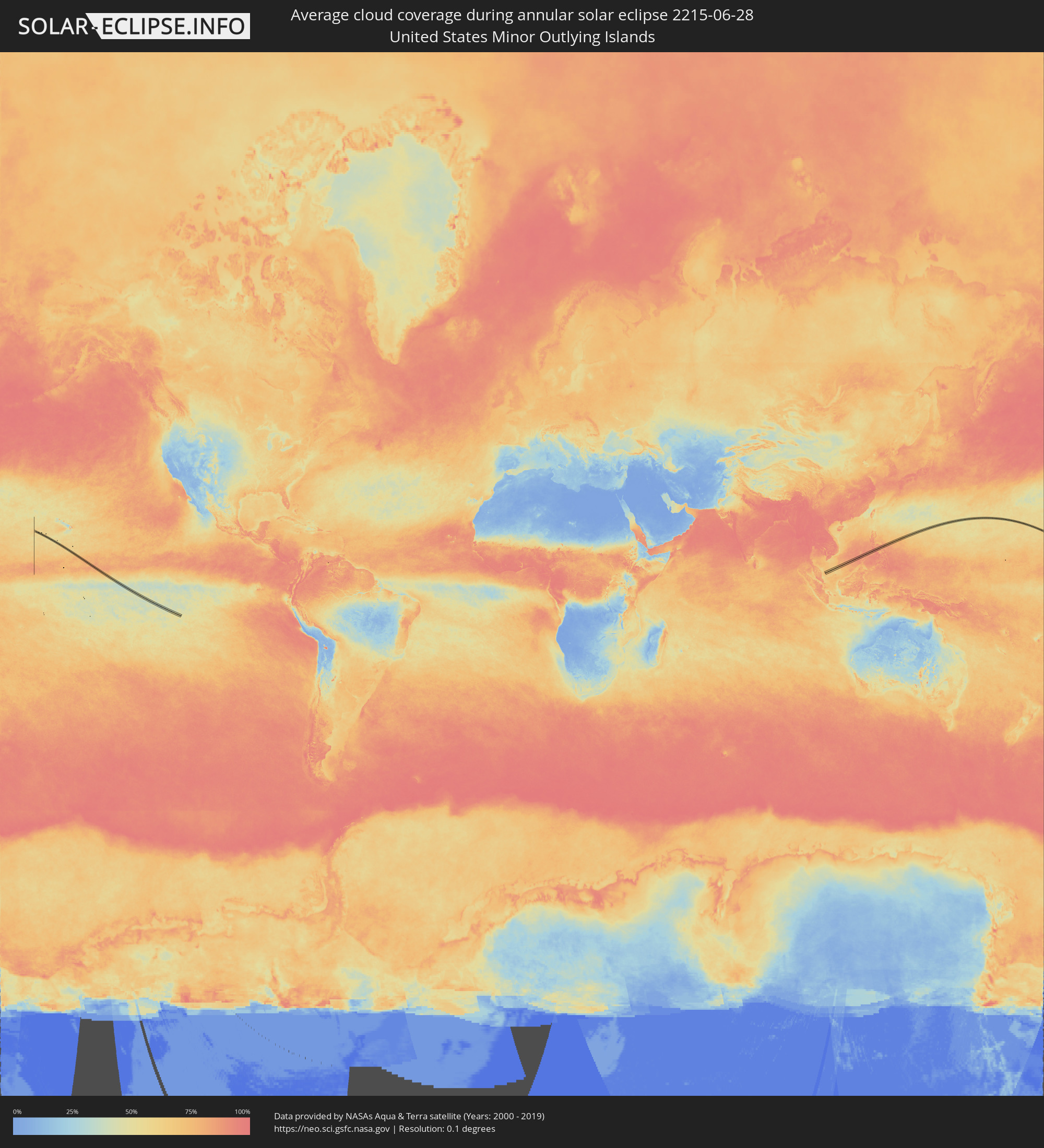 United States Minor Outlying Islands
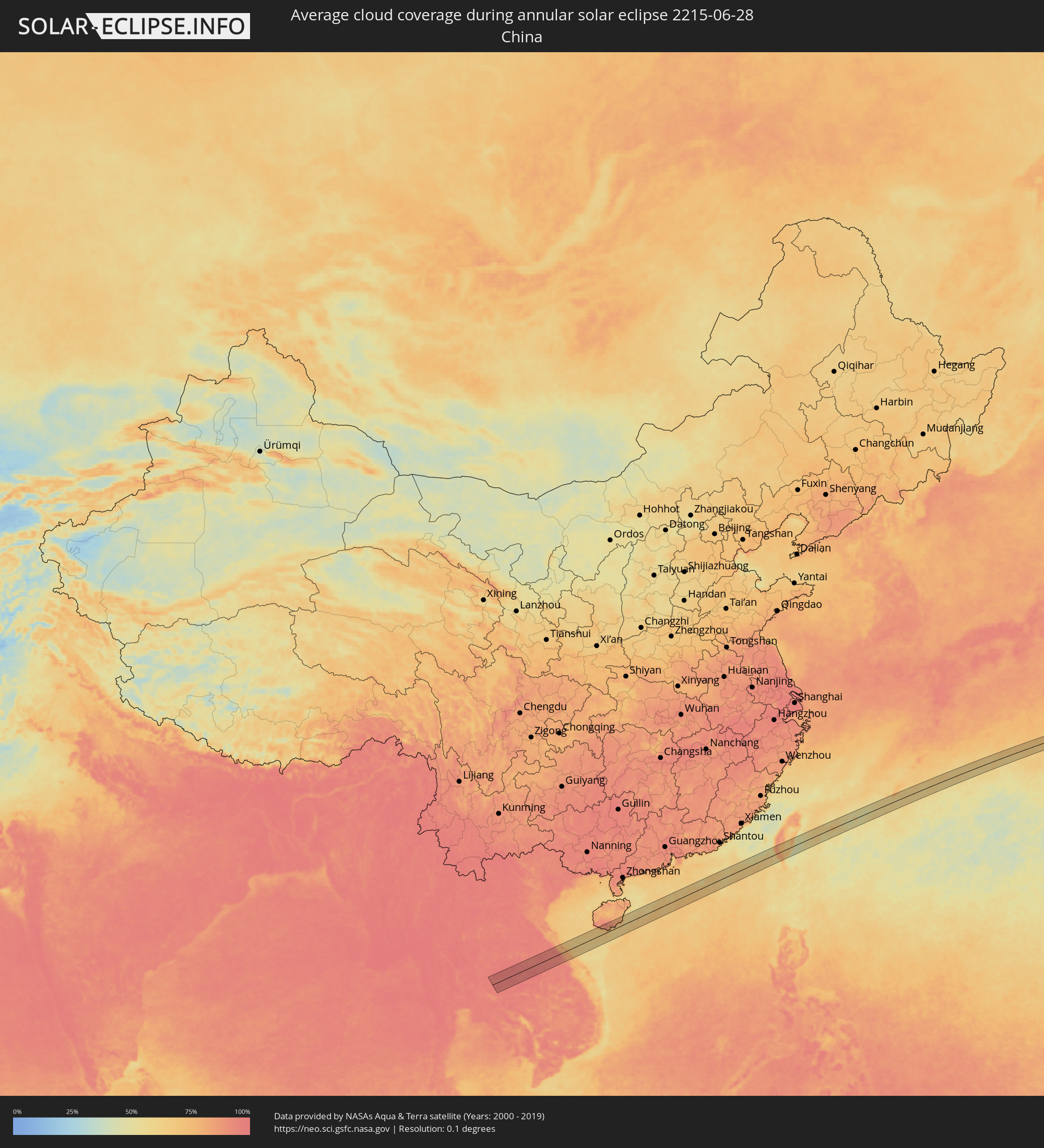 China
China
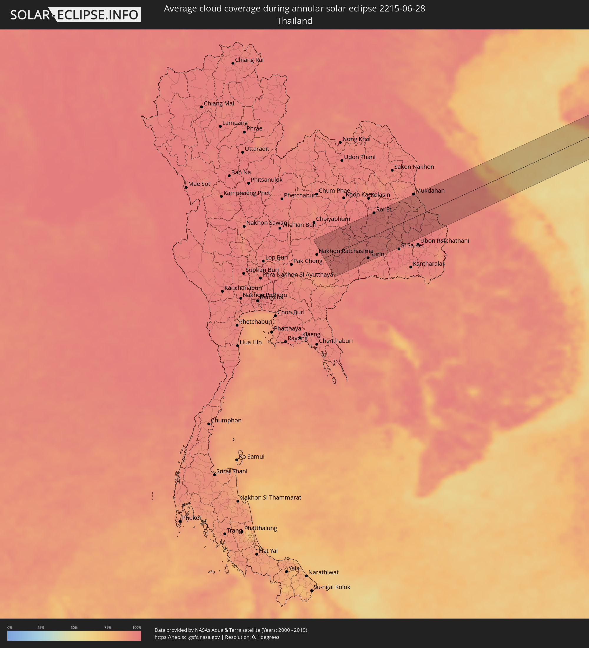 Thailand
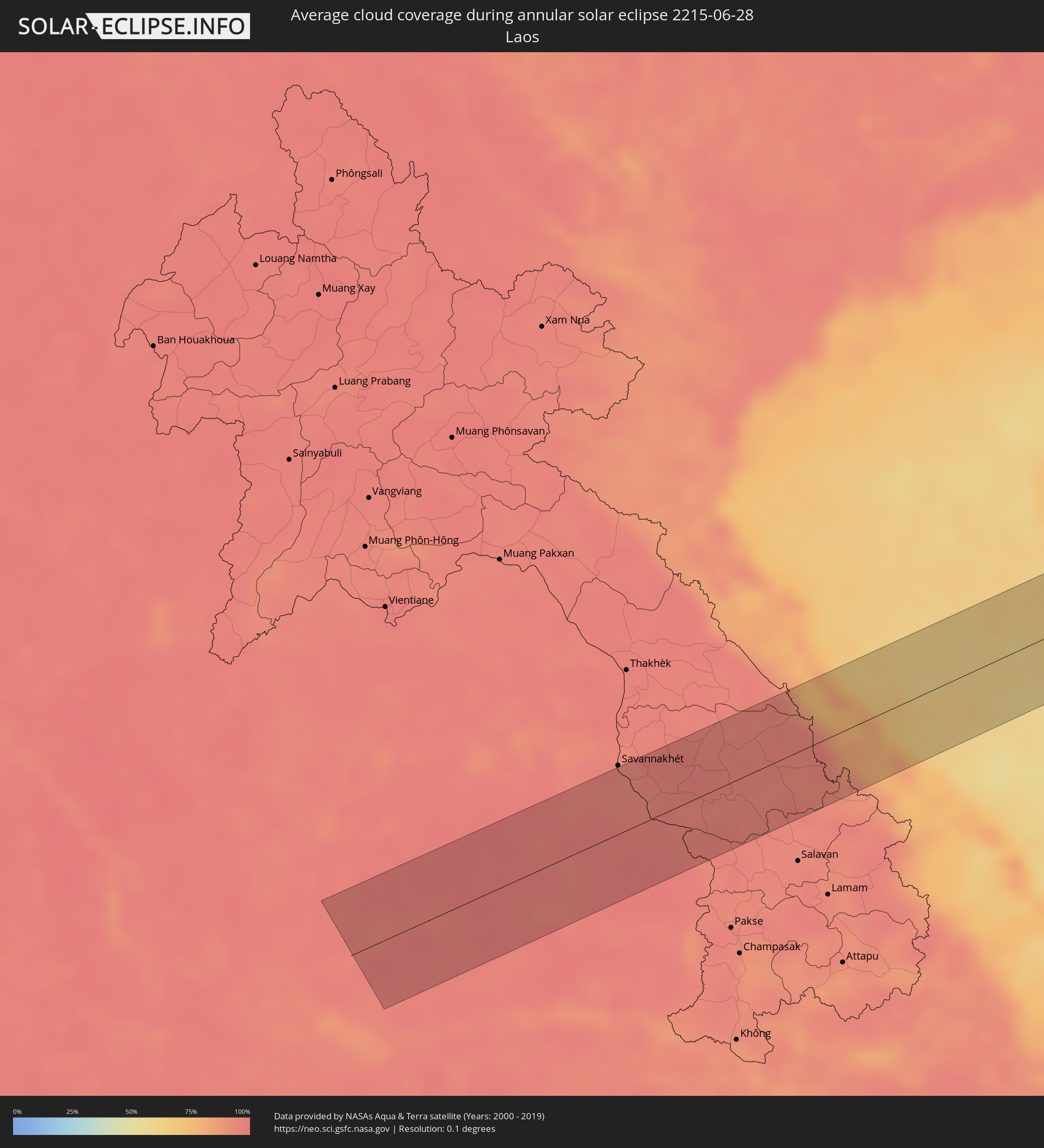 Laos
Laos
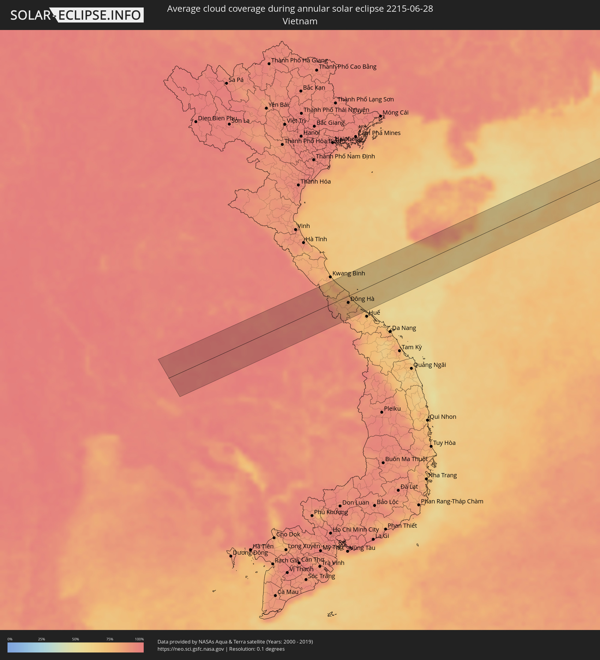 Vietnam
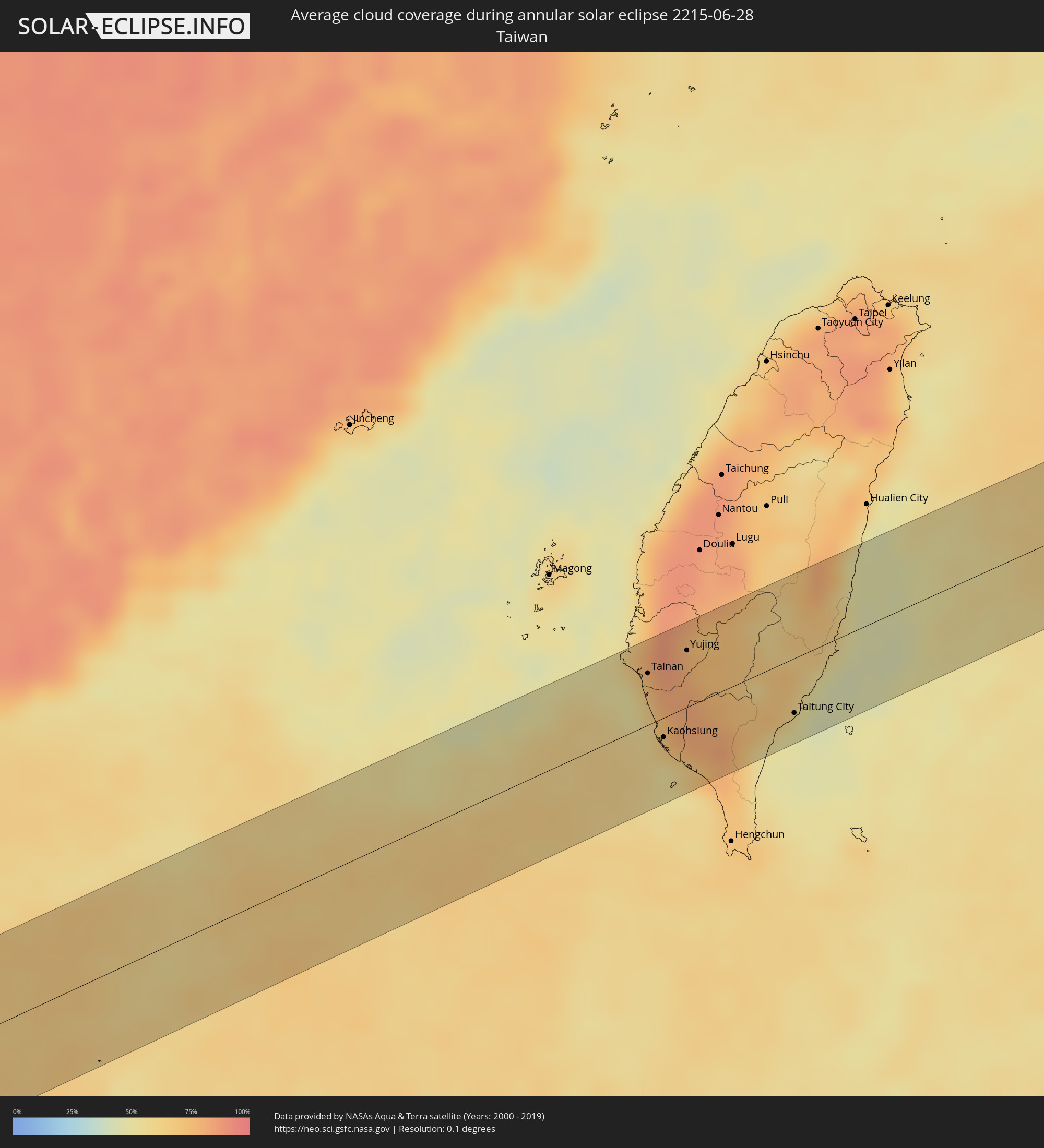 Taiwan
 Japan
Japan
Cities inside the path of the eclipse
The following table shows all locations with a population of more than 5,000 inside the eclipse path. Cities which have more than 100,000 inhabitants are marked bold. A click at the locations opens a detailed map.
| City | Type | Eclipse duration | Local time of max. eclipse | Distance to central line | Ø Cloud coverage |
|
Kham Sakae Saeng, Nakhon Ratchasima
|
annular | - | 05:48:24 UTC+07:00 | 51 km | 95% |
|
Non Sung, Nakhon Ratchasima
|
annular | - | 05:48:18 UTC+07:00 | 32 km | 96% |
|
Phimai, Nakhon Ratchasima
|
annular | - | 05:48:16 UTC+07:00 | 28 km | 94% |
|
Nong Ki, Buriram
|
annular | - | 05:47:57 UTC+07:00 | 30 km | 95% |
|
Ban Huai Thalaeng, Nakhon Ratchasima
|
annular | - | 05:48:06 UTC+07:00 | 16 km | 97% |
|
Nang Rong, Buriram
|
annular | - | 05:47:52 UTC+07:00 | 48 km | 96% |
|
Buriram, Buriram
|
annular | - | 05:48:00 UTC+07:00 | 24 km | 95% |
|
Phayakkhaphum Phisai, Maha Sarakham
|
annular | - | 05:48:17 UTC+07:00 | 25 km | 97% |
|
Satuek, Buriram
|
annular | - | 05:48:08 UTC+07:00 | 2 km | 96% |
|
Wapi Pathum, Maha Sarakham
|
annular | - | 05:48:26 UTC+07:00 | 50 km | 98% |
|
Surin, Surin
|
annular | - | 05:47:51 UTC+07:00 | 53 km | 95% |
|
Kaset Wisai, Roi Et
|
annular | - | 05:48:17 UTC+07:00 | 22 km | 97% |
|
Roi Et, Roi Et
|
annular | - | 05:48:30 UTC+07:00 | 59 km | 97% |
|
Suwannaphum, Roi Et
|
annular | - | 05:48:12 UTC+07:00 | 7 km | 96% |
|
Ban Selaphum, Roi Et
|
annular | - | 05:48:25 UTC+07:00 | 42 km | 95% |
|
Yasothon, Yasothon
|
annular | - | 05:48:15 UTC+07:00 | 11 km | 96% |
|
Amnat Charoen, Amnat Charoen
|
annular | - | 05:48:12 UTC+07:00 | 4 km | 96% |
|
Ðông Hà, Quảng Trị
|
annular | - | 05:48:29 UTC+07:00 | 17 km | 80% |
|
Sanya, Hainan
|
annular | - | 06:49:20 UTC+08:00 | 20 km | 69% |
|
Wanning, Hainan
|
annular | - | 06:49:45 UTC+08:00 | 37 km | 80% |
|
Tainan, Taiwan
|
annular | - | 06:55:28 UTC+08:00 | 31 km | 70% |
|
Kaohsiung, Takao
|
annular | - | 06:55:10 UTC+08:00 | 12 km | 64% |
|
Yujing, Taiwan
|
annular | - | 06:55:42 UTC+08:00 | 34 km | 76% |
|
Taitung City, Taiwan
|
annular | - | 06:55:41 UTC+08:00 | 33 km | 61% |
|
Ishigaki, Okinawa
|
annular | - | 07:58:51 UTC+09:00 | 3 km | 58% |
|
Hirara, Okinawa
|
annular | - | 08:00:04 UTC+09:00 | 2 km | 62% |
|
Itoman, Okinawa
|
annular | - | 08:03:11 UTC+09:00 | 43 km | 62% |