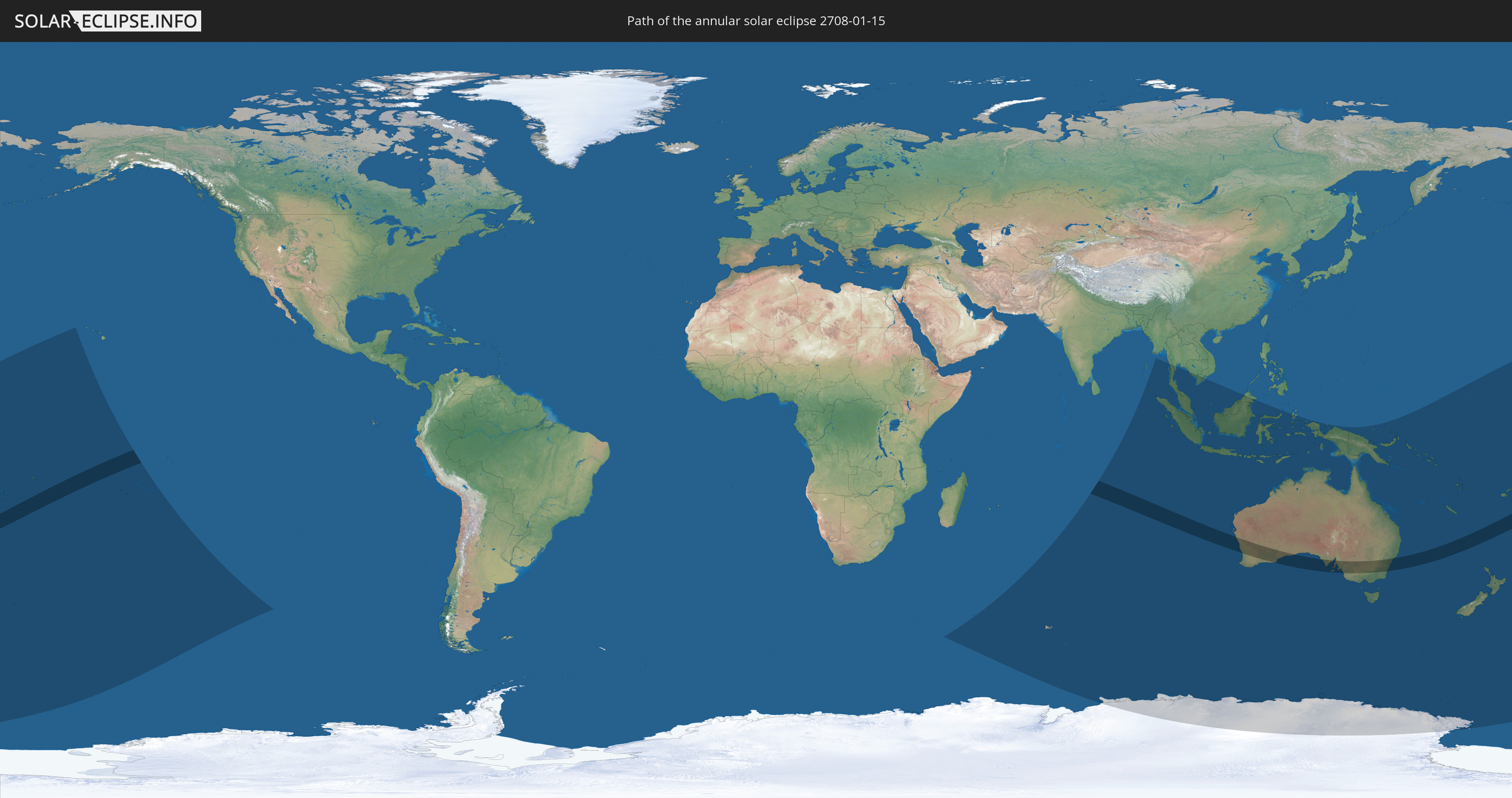
Annular solar eclipse of 01/15/2708
| Day of week: | Wednesday |
| Maximum duration of eclipse: | 09m38s |
| Maximum width of eclipse path: | 306 km |
| Saros cycle: | 162 |
| Coverage: | 92.1% |
| Magnitude: | 0.9212 |
| Gamma: | -0.2277 |
Wo kann man die Sonnenfinsternis vom 01/15/2708 sehen?
Die Sonnenfinsternis am 01/15/2708 kann man in 36 Ländern als partielle Sonnenfinsternis beobachten.
Der Finsternispfad verläuft durch 5 Länder. Nur in diesen Ländern ist sie als annular Sonnenfinsternis zu sehen.
In den folgenden Ländern ist die Sonnenfinsternis annular zu sehen
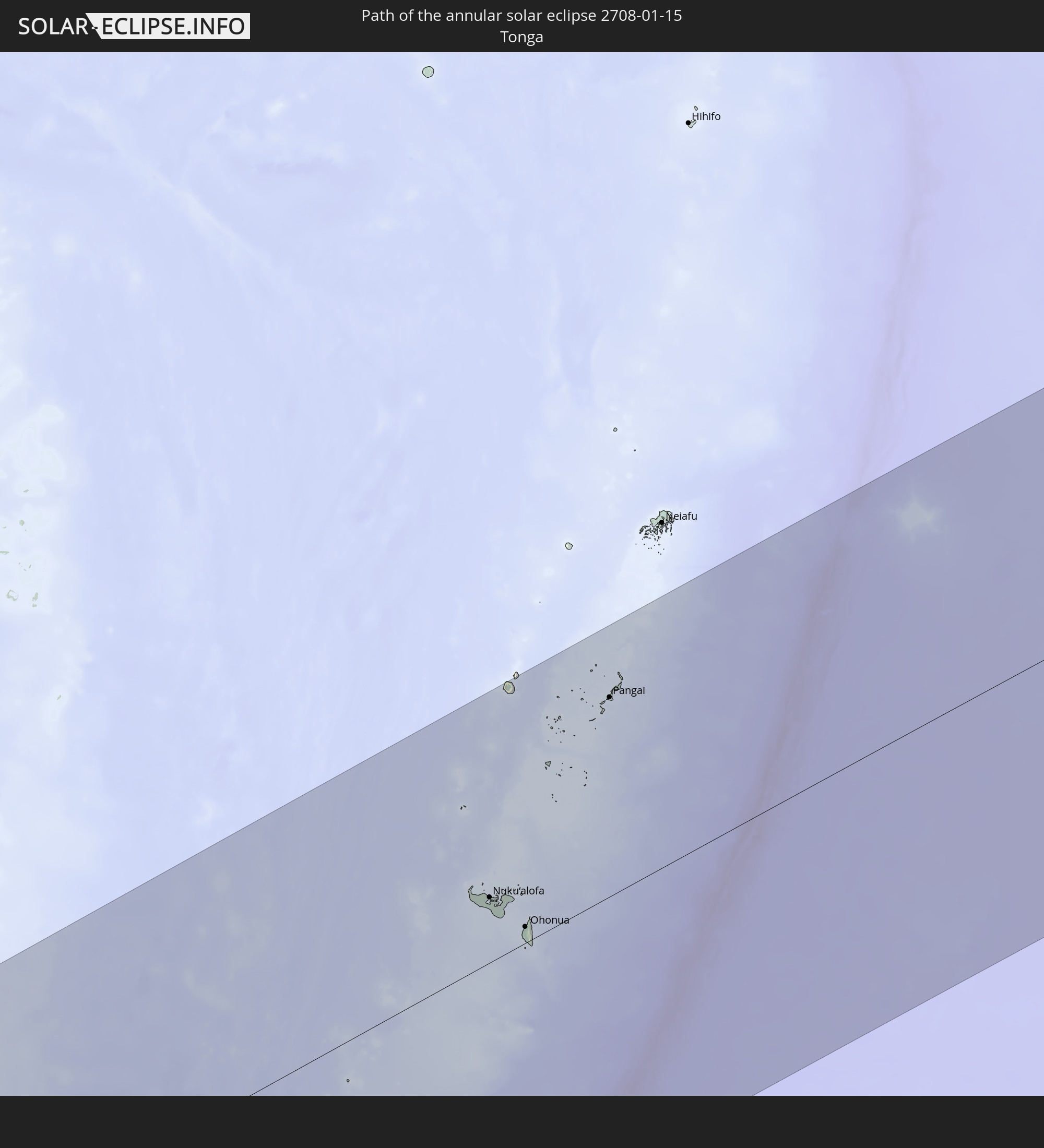 Tonga
Tonga
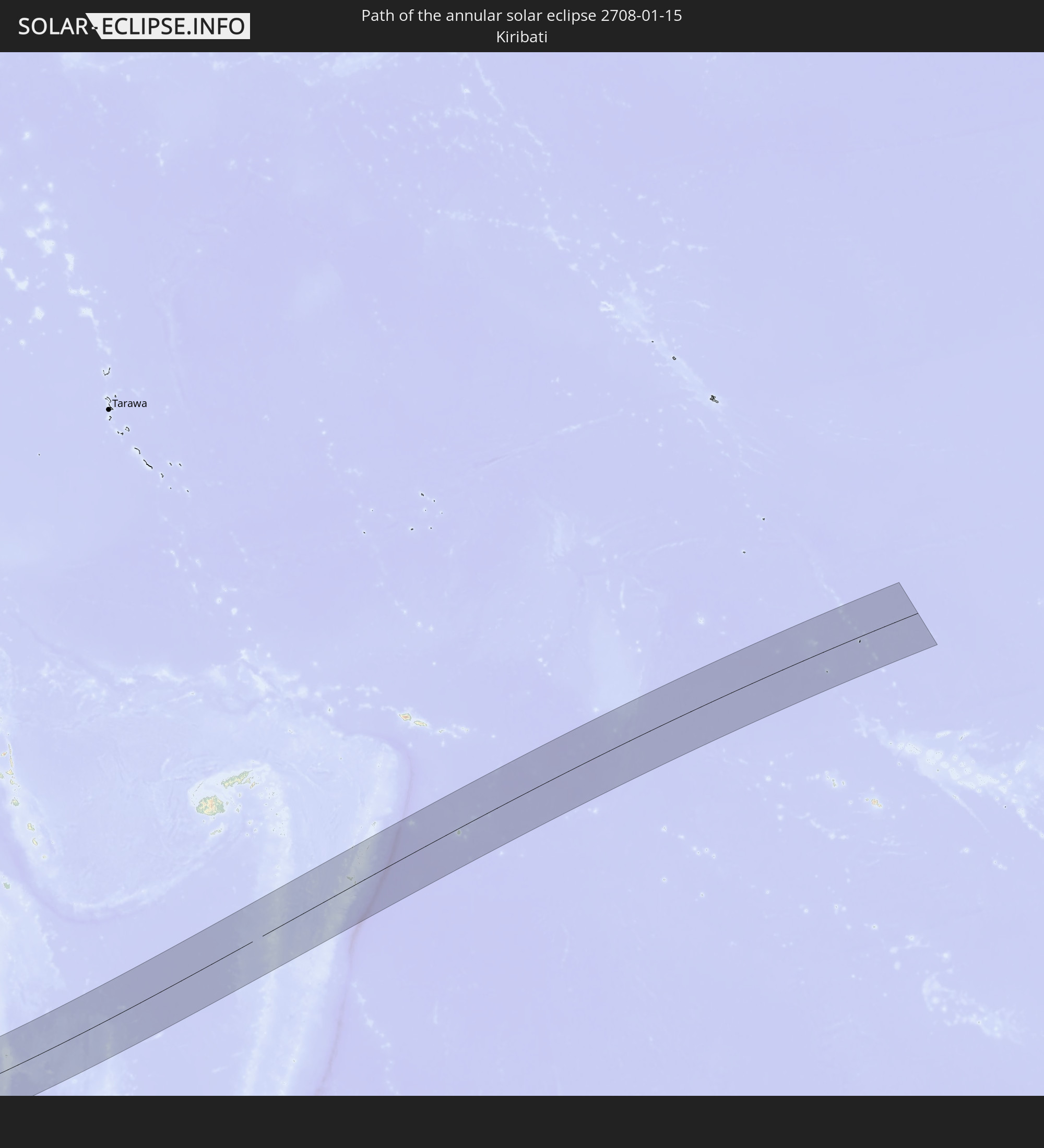 Kiribati
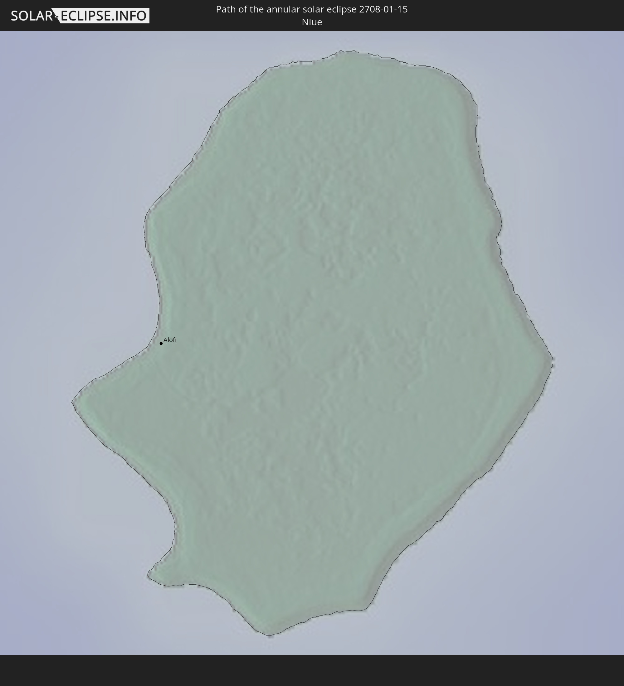 Niue
Niue
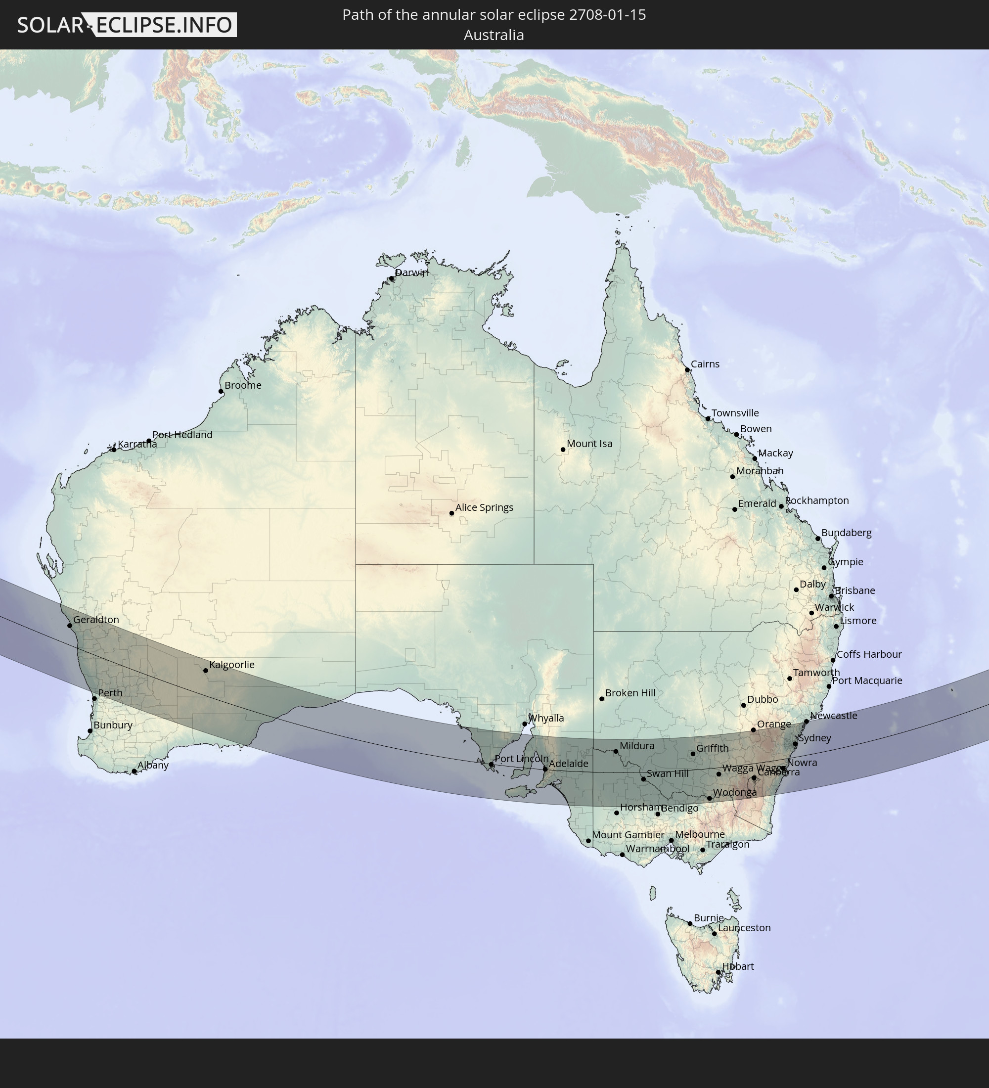 Australia
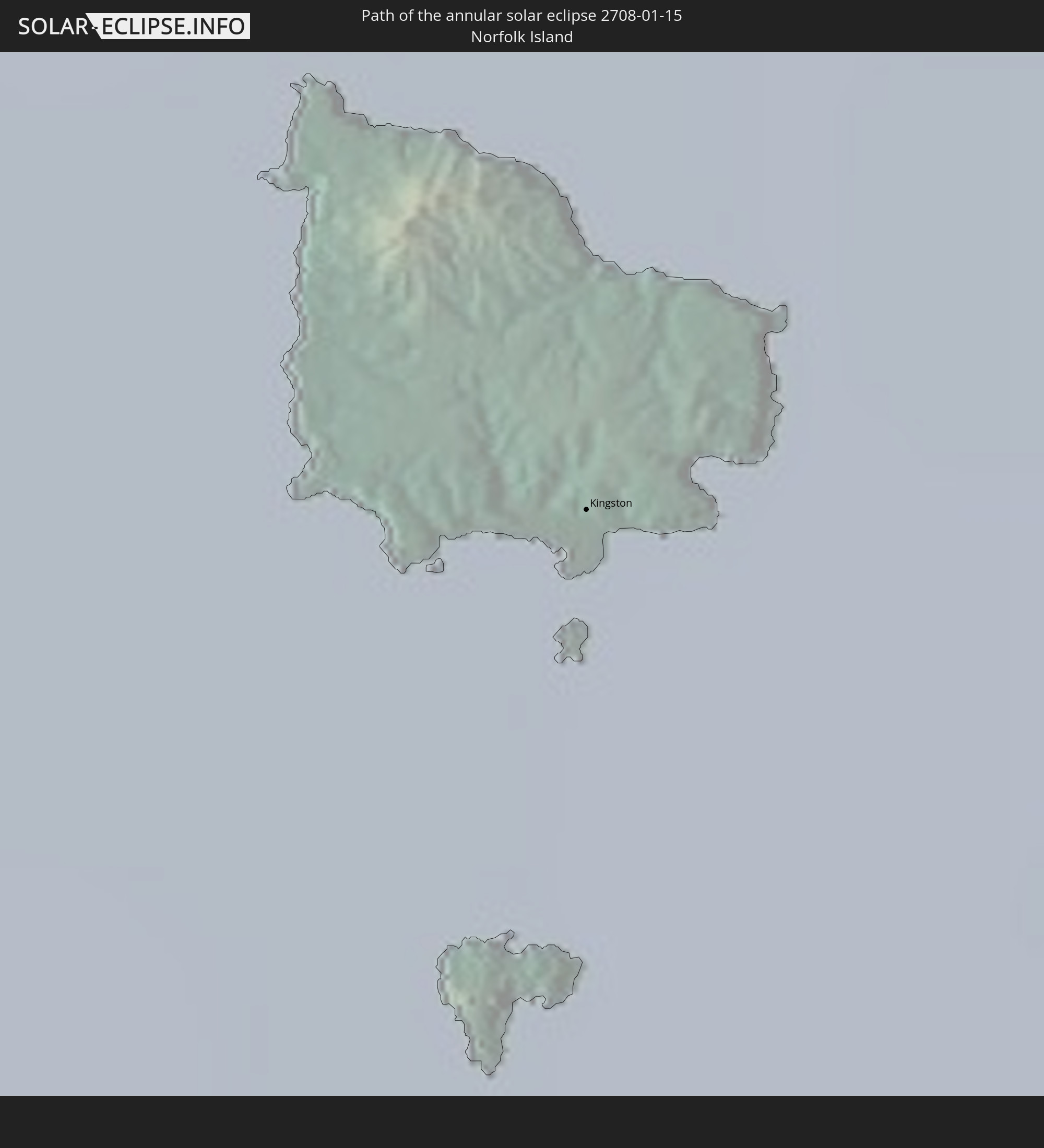 Norfolk Island
In den folgenden Ländern ist die Sonnenfinsternis partiell zu sehen
 Antarctica
 Fiji
Fiji
 New Zealand
 United States Minor Outlying Islands
 Wallis and Futuna
 Tonga
Tonga
 Kiribati
 Samoa
Samoa
 Tokelau
 American Samoa
 Niue
Niue
 Cook Islands
 French Polynesia
 French Southern and Antarctic Lands
 India
India
 Heard Island and McDonald Islands
 Myanmar
 Indonesia
 Cocos Islands
 Thailand
 Malaysia
 Vietnam
 Cambodia
 Singapore
 Christmas Island
 Australia
 Brunei
 East Timor
 Papua New Guinea
 Solomon Islands
 New Caledonia
 Marshall Islands
 Vanuatu
 Nauru
Nauru
 Norfolk Island
 Tuvalu
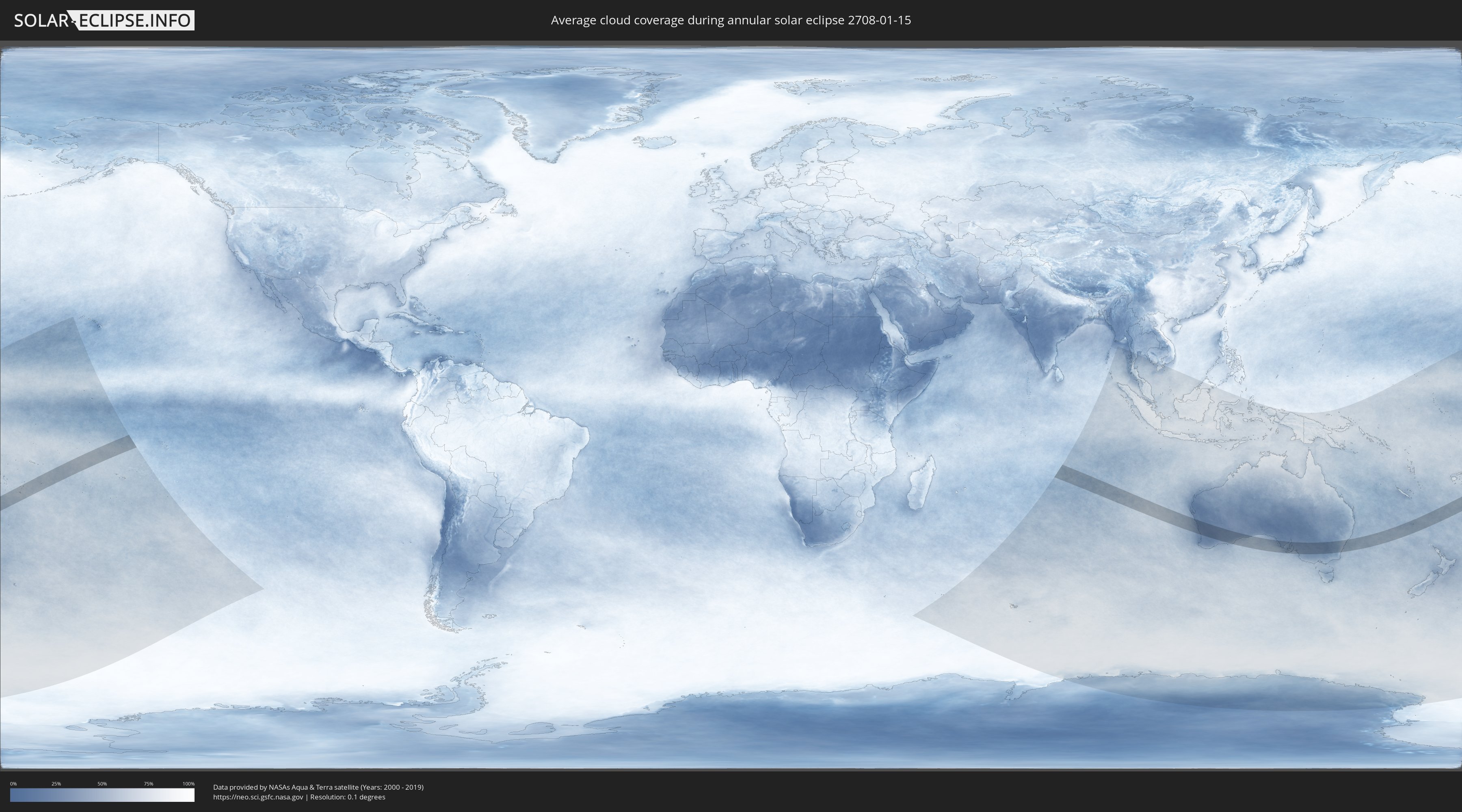
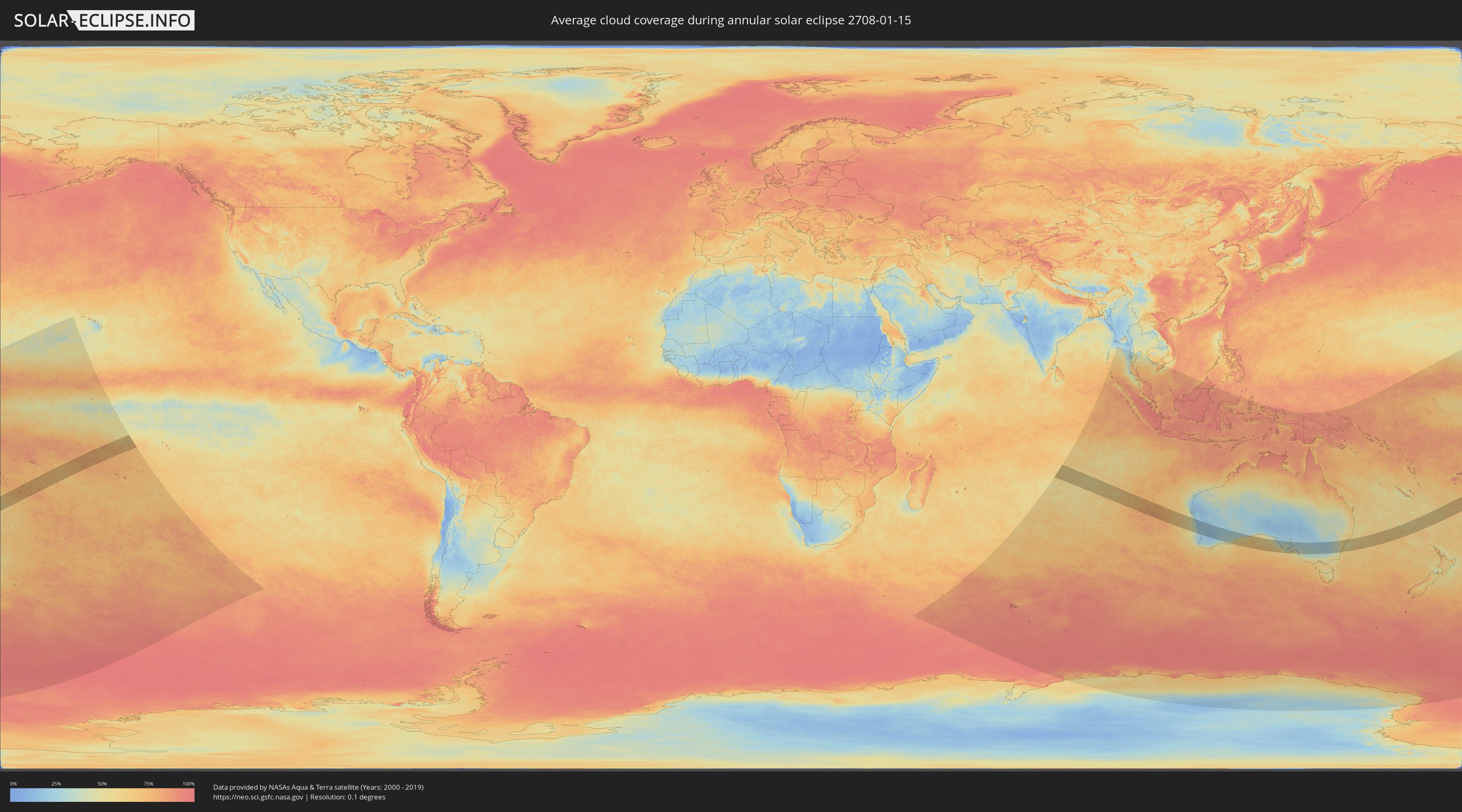
How will be the weather during the annular solar eclipse on 01/15/2708?
Where is the best place to see the annular solar eclipse of 01/15/2708?
The following maps show the average cloud coverage for the day of the annular solar eclipse.
With the help of these maps, it is possible to find the place along the eclipse path, which has the best
chance of a cloudless sky.
Nevertheless, you should consider local circumstances and inform about the weather of your chosen
observation site.
The data is provided by NASAs satellites
AQUA and TERRA.
The cloud maps are averaged over a period of 19 years (2000 - 2019).
Detailed country maps
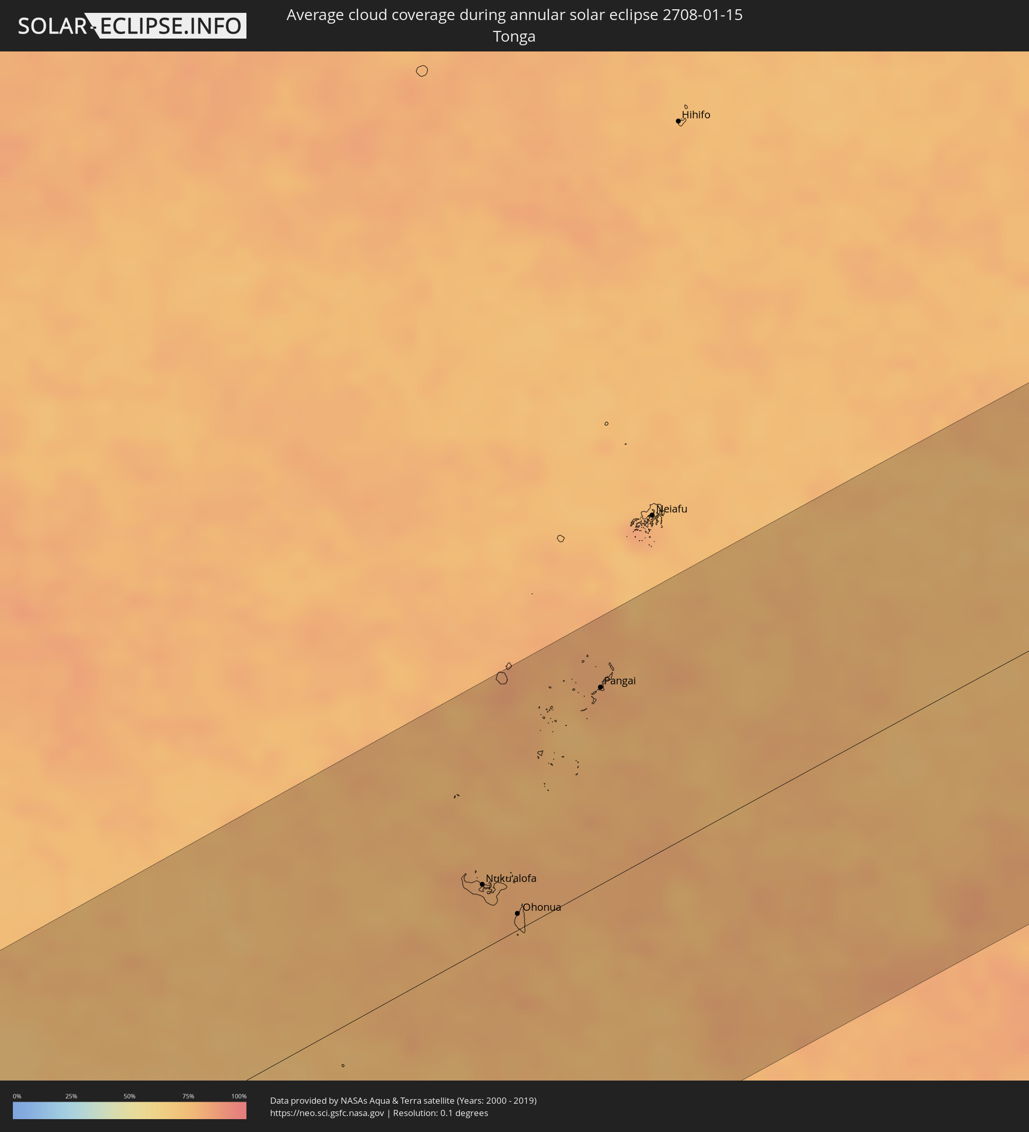 Tonga
Tonga
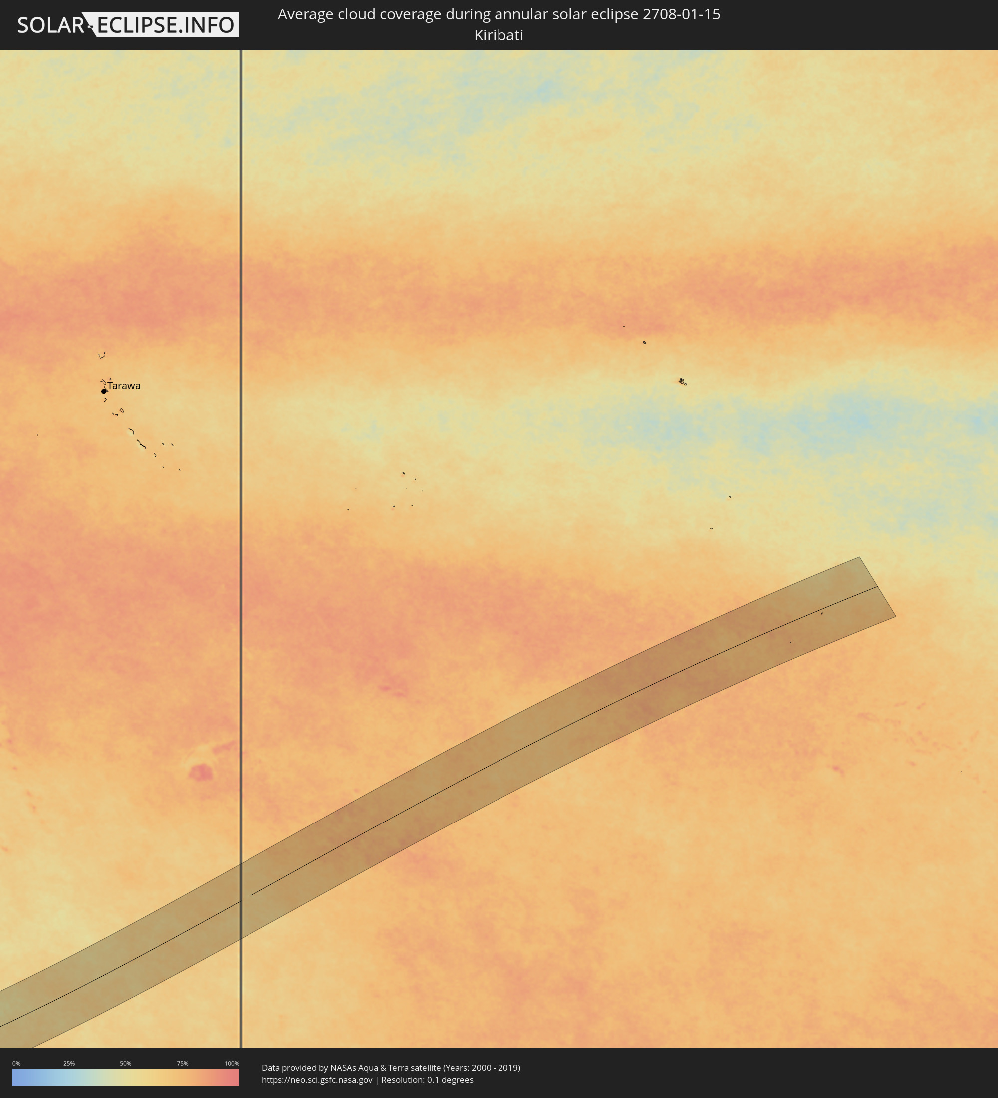 Kiribati
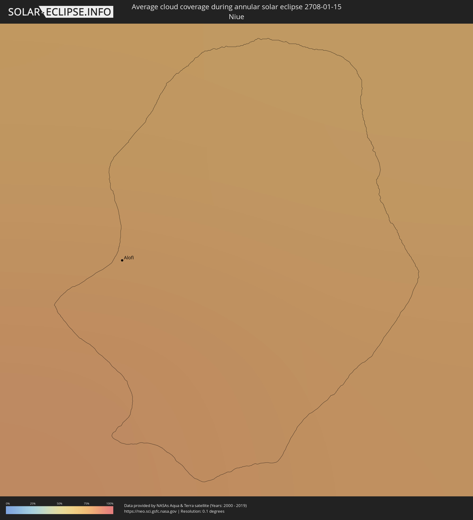 Niue
Niue
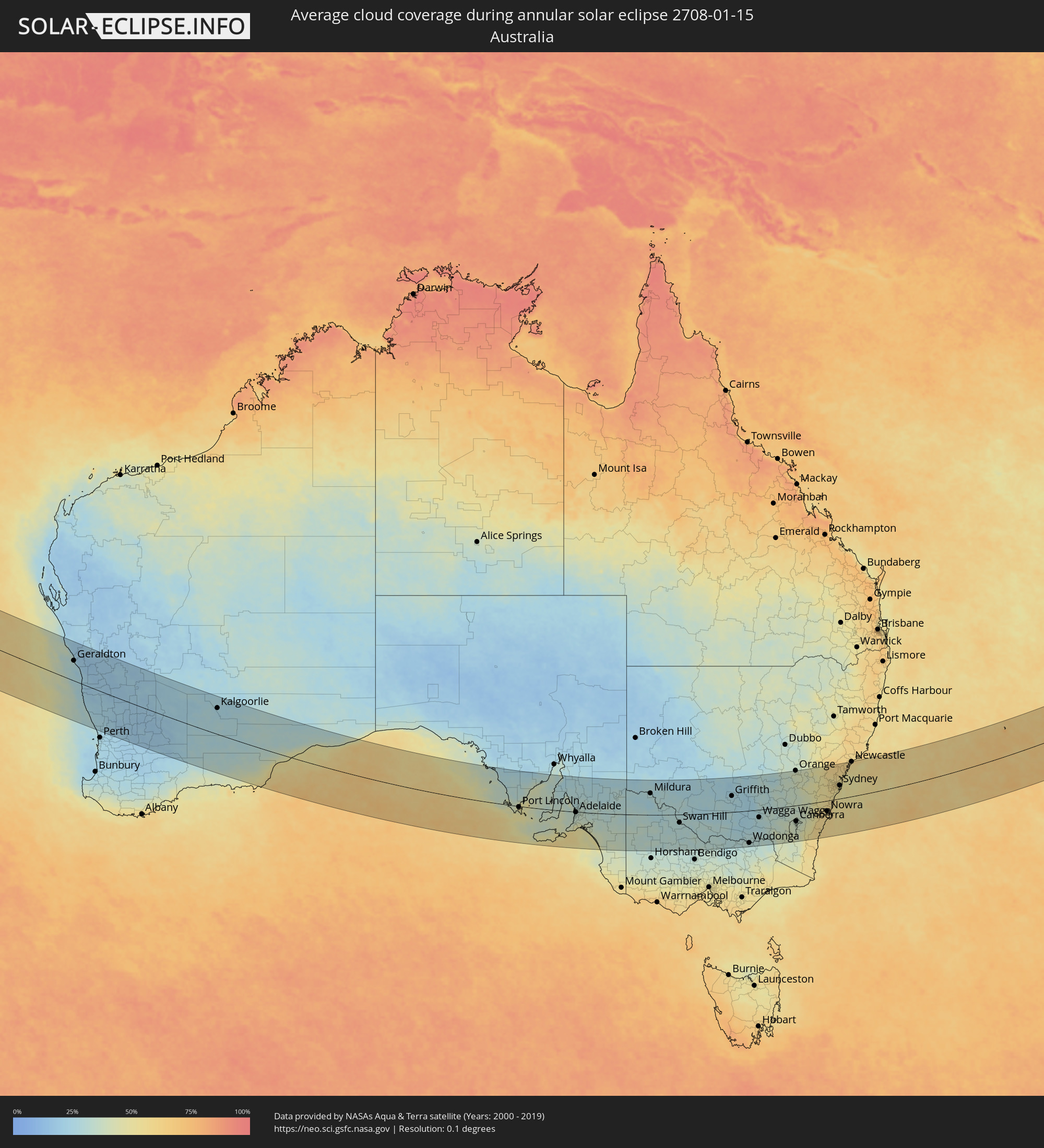 Australia
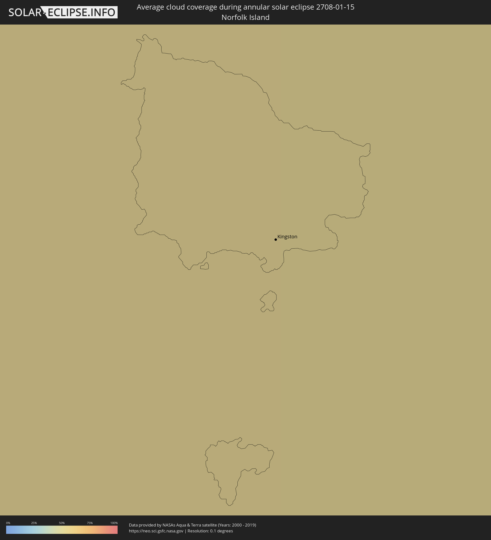 Norfolk Island
Cities inside the path of the eclipse
The following table shows all locations with a population of more than 5,000 inside the eclipse path. Cities which have more than 100,000 inhabitants are marked bold. A click at the locations opens a detailed map.
| City | Type | Eclipse duration | Local time of max. eclipse | Distance to central line | Ø Cloud coverage |
|
Nuku‘alofa, Tongatapu
|
annular | - | 16:49:30 UTC+13:00 | 42 km | 79% |
|
‘Ohonua, ʻEua
|
annular | - | 16:49:27 UTC+13:00 | 10 km | 79% |
|
Pangai, Ha‘apai
|
annular | - | 16:52:12 UTC+13:00 | 129 km | 79% |
|
Alofi
|
annular | - | 16:56:36 UTC-11:00 | 18 km | 76% |
|
Geraldton, Western Australia
|
annular | - | 08:46:40 UTC+08:00 | 87 km | 30% |
|
Kalgoorlie, Western Australia
|
annular | - | 08:59:53 UTC+08:00 | 113 km | 26% |
|
Port Lincoln, South Australia
|
annular | - | 12:06:27 UTC+10:30 | 4 km | 50% |
|
Morphett Vale, South Australia
|
annular | - | 12:13:46 UTC+10:30 | 25 km | 35% |
|
Adelaide, South Australia
|
annular | - | 12:13:54 UTC+10:30 | 2 km | 34% |
|
Victor Harbor, South Australia
|
annular | - | 12:14:15 UTC+10:30 | 70 km | 51% |
|
Golden Grove, South Australia
|
annular | - | 12:14:12 UTC+10:30 | 15 km | 33% |
|
Gawler, South Australia
|
annular | - | 12:14:10 UTC+10:30 | 36 km | 32% |
|
Mount Barker, South Australia
|
annular | - | 12:14:42 UTC+10:30 | 15 km | 36% |
|
Murray Bridge, South Australia
|
annular | - | 12:15:51 UTC+10:30 | 19 km | 36% |
|
Mildura, Victoria
|
annular | - | 12:53:50 UTC+11:00 | 94 km | 30% |
|
Swan Hill, Victoria
|
annular | - | 12:57:59 UTC+11:00 | 35 km | 32% |
|
Echuca, Victoria
|
annular | - | 13:01:23 UTC+11:00 | 128 km | 33% |
|
Deniliquin, New South Wales
|
annular | - | 13:02:00 UTC+11:00 | 62 km | 30% |
|
Kyabram, Victoria
|
annular | - | 13:02:13 UTC+11:00 | 149 km | 35% |
|
Griffith, New South Wales
|
annular | - | 13:05:23 UTC+11:00 | 70 km | 27% |
|
Leeton, New South Wales
|
annular | - | 13:06:23 UTC+11:00 | 39 km | 25% |
|
Albury, New South Wales
|
annular | - | 13:07:32 UTC+11:00 | 134 km | 30% |
|
North Albury, New South Wales
|
annular | - | 13:07:34 UTC+11:00 | 132 km | 30% |
|
Wagga Wagga, New South Wales
|
annular | - | 13:09:02 UTC+11:00 | 33 km | 31% |
|
Tumut, New South Wales
|
annular | - | 13:11:30 UTC+11:00 | 60 km | 35% |
|
Young, New South Wales
|
annular | - | 13:12:06 UTC+11:00 | 48 km | 34% |
|
Cowra, New South Wales
|
annular | - | 13:13:30 UTC+11:00 | 96 km | 37% |
|
Orange, New South Wales
|
annular | - | 13:14:59 UTC+11:00 | 152 km | 40% |
|
Canberra, Australian Capital Territory
|
annular | - | 13:14:07 UTC+11:00 | 69 km | 37% |
|
Bathurst, New South Wales
|
annular | - | 13:16:22 UTC+11:00 | 131 km | 41% |
|
Goulburn, New South Wales
|
annular | - | 13:16:06 UTC+11:00 | 18 km | 41% |
|
Lithgow, New South Wales
|
annular | - | 13:18:01 UTC+11:00 | 116 km | 46% |
|
Batemans Bay, New South Wales
|
annular | - | 13:16:54 UTC+11:00 | 129 km | 57% |
|
Katoomba, New South Wales
|
annular | - | 13:18:24 UTC+11:00 | 88 km | 51% |
|
Bowral, New South Wales
|
annular | - | 13:18:17 UTC+11:00 | 3 km | 54% |
|
Ulladulla, New South Wales
|
annular | - | 13:17:56 UTC+11:00 | 95 km | 57% |
|
Nowra, New South Wales
|
annular | - | 13:18:34 UTC+11:00 | 45 km | 57% |
|
Glenmore Park, New South Wales
|
annular | - | 13:19:26 UTC+11:00 | 74 km | 54% |
|
Kiama, New South Wales
|
annular | - | 13:19:26 UTC+11:00 | 25 km | 54% |
|
Riverstone, New South Wales
|
annular | - | 13:20:05 UTC+11:00 | 83 km | 58% |
|
Ingleburn, New South Wales
|
annular | - | 13:19:53 UTC+11:00 | 48 km | 55% |
|
Wollongong, New South Wales
|
annular | - | 13:19:42 UTC+11:00 | 1 km | 57% |
|
Blacktown, New South Wales
|
annular | - | 13:20:11 UTC+11:00 | 73 km | 58% |
|
Bankstown, New South Wales
|
annular | - | 13:20:26 UTC+11:00 | 55 km | 57% |
|
Hornsby, New South Wales
|
annular | - | 13:20:46 UTC+11:00 | 77 km | 56% |
|
Caringbah, New South Wales
|
annular | - | 13:20:37 UTC+11:00 | 39 km | 52% |
|
North Sydney, New South Wales
|
annular | - | 13:21:00 UTC+11:00 | 61 km | 54% |
|
Sydney, New South Wales
|
annular | - | 13:20:59 UTC+11:00 | 57 km | 53% |
|
Bronte, New South Wales
|
annular | - | 13:21:08 UTC+11:00 | 53 km | 51% |
|
Dee Why, New South Wales
|
annular | - | 13:21:20 UTC+11:00 | 69 km | 52% |
|
Umina, New South Wales
|
annular | - | 13:21:32 UTC+11:00 | 93 km | 55% |
|
Bateau Bay, New South Wales
|
annular | - | 13:22:05 UTC+11:00 | 106 km | 49% |
|
Rathmines, New South Wales
|
annular | - | 13:22:41 UTC+11:00 | 142 km | 59% |
|
Newcastle, New South Wales
|
annular | - | 13:23:20 UTC+11:00 | 151 km | 57% |
|
Kingston
|
annular | - | 15:11:14 UTC+12:00 | 58 km | 55% |