Annular solar eclipse of 11/25/2812
| Day of week: | Sunday |
| Maximum duration of eclipse: | 09m33s |
| Maximum width of eclipse path: | 266 km |
| Saros cycle: | 165 |
| Coverage: | 92.9% |
| Magnitude: | 0.9292 |
| Gamma: | 0.0341 |
Wo kann man die Sonnenfinsternis vom 11/25/2812 sehen?
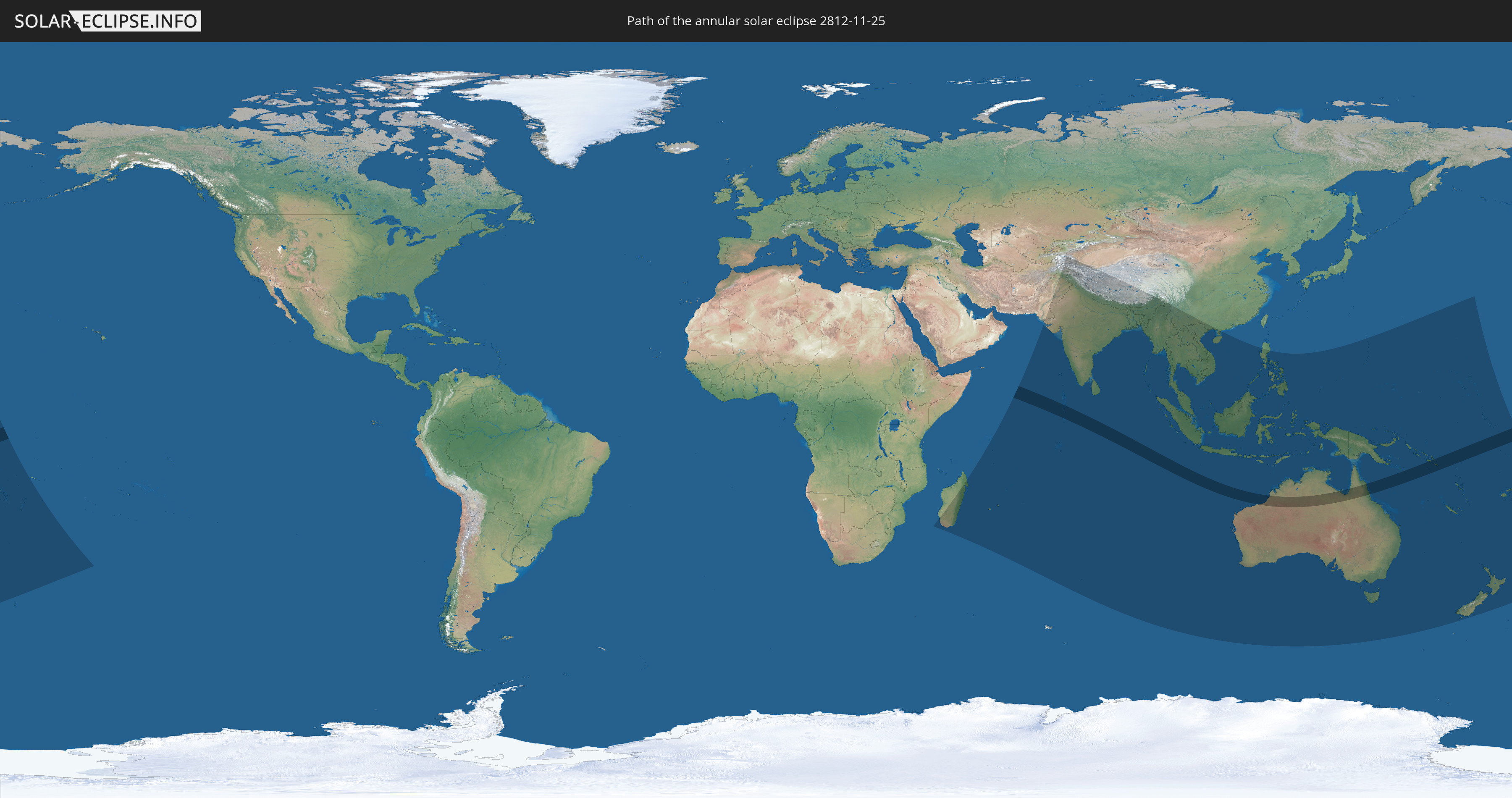
Die Sonnenfinsternis am 11/25/2812 kann man in 49 Ländern als partielle Sonnenfinsternis beobachten.
Der Finsternispfad verläuft durch 4 Länder. Nur in diesen Ländern ist sie als annular Sonnenfinsternis zu sehen.
In den folgenden Ländern ist die Sonnenfinsternis annular zu sehen
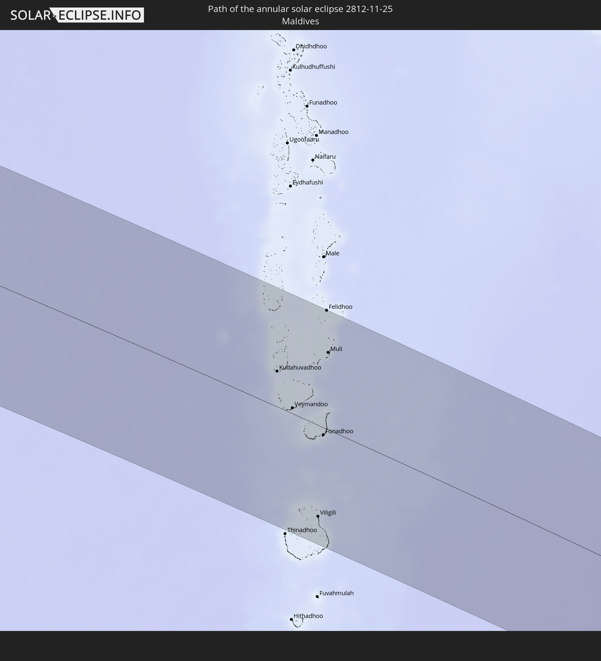 Maldives
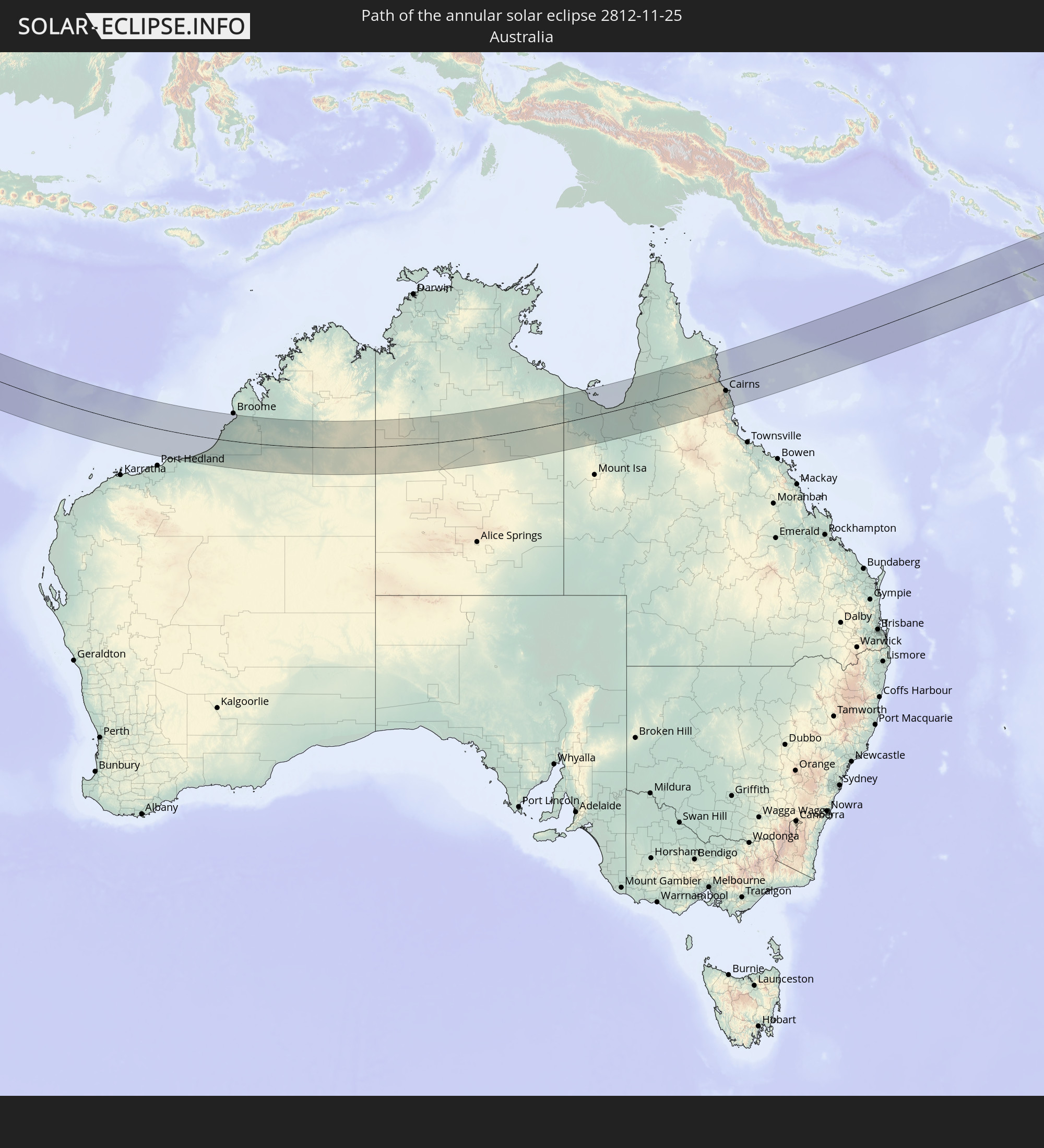 Australia
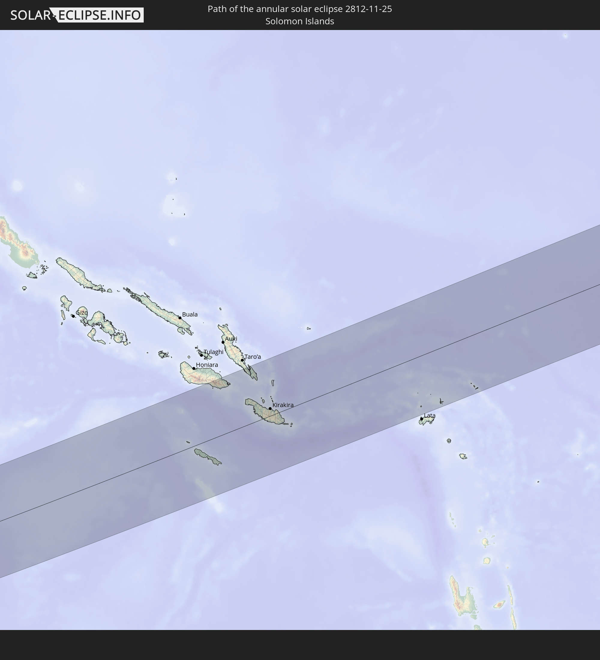 Solomon Islands
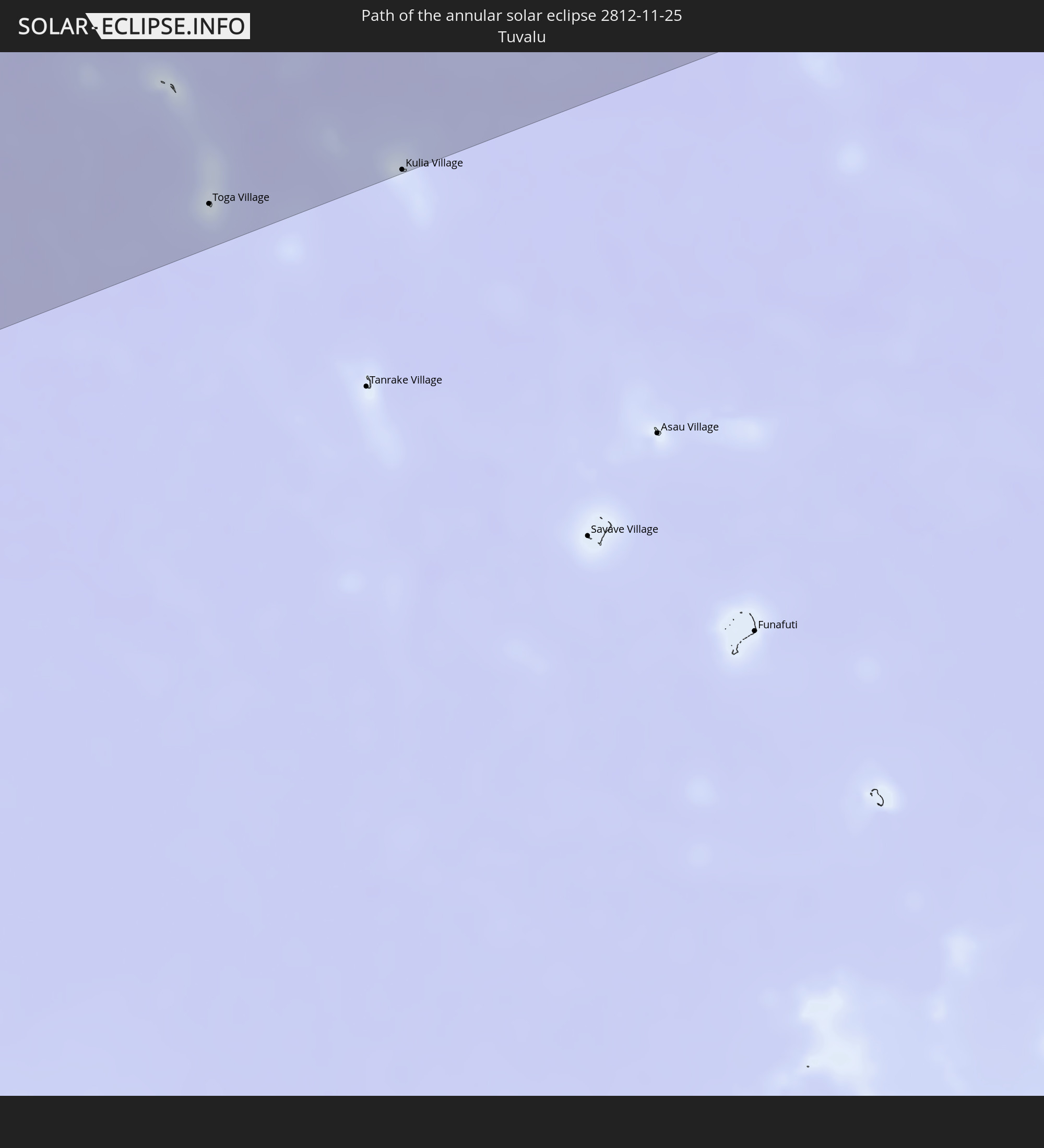 Tuvalu
In den folgenden Ländern ist die Sonnenfinsternis partiell zu sehen
 Fiji
Fiji
 New Zealand
 United States Minor Outlying Islands
 Wallis and Futuna
 Tonga
Tonga
 Kiribati
 Niue
Niue
 French Southern and Antarctic Lands
 Madagascar
 Seychelles
 Réunion
 Mauritius
 Afghanistan
 Pakistan
 Tajikistan
 India
India
 British Indian Ocean Territory
 Maldives
 China
China
 Sri Lanka
 Nepal
Nepal
 Bangladesh
 Bhutan
 Myanmar
 Indonesia
 Cocos Islands
 Thailand
 Malaysia
 Laos
Laos
 Vietnam
 Cambodia
 Singapore
 Christmas Island
 Australia
 Brunei
 Philippines
 East Timor
 Palau
Palau
 Federated States of Micronesia
 Papua New Guinea
 Guam
Guam
 Northern Mariana Islands
 Solomon Islands
 New Caledonia
 Marshall Islands
 Vanuatu
 Nauru
Nauru
 Norfolk Island
 Tuvalu
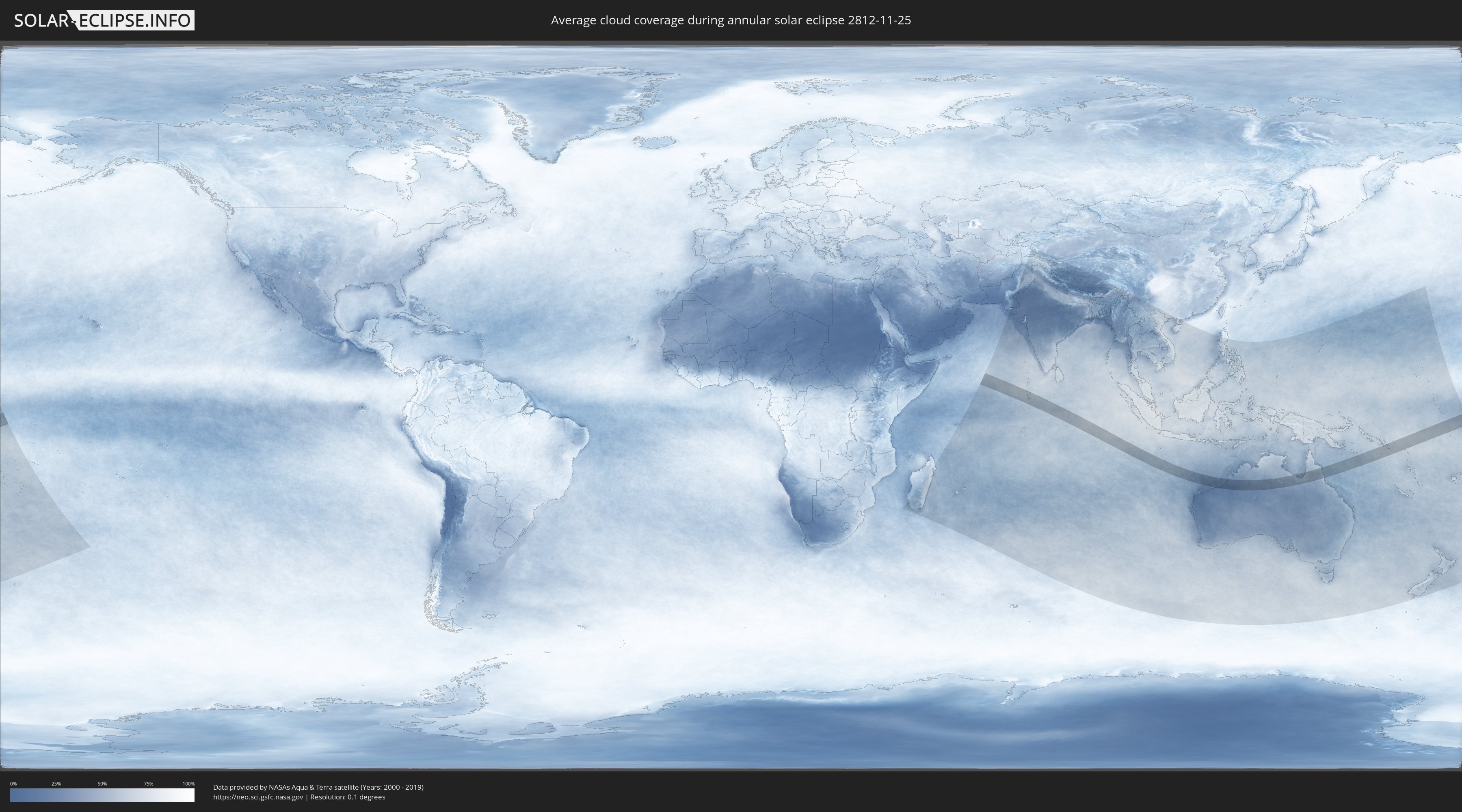
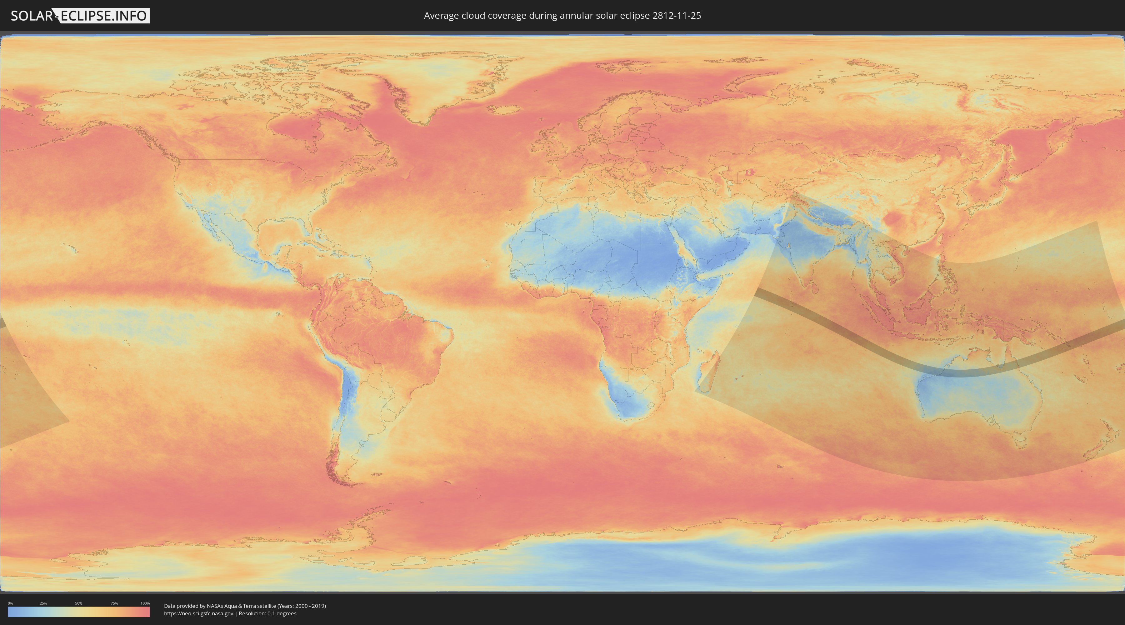
How will be the weather during the annular solar eclipse on 11/25/2812?
Where is the best place to see the annular solar eclipse of 11/25/2812?
The following maps show the average cloud coverage for the day of the annular solar eclipse.
With the help of these maps, it is possible to find the place along the eclipse path, which has the best
chance of a cloudless sky.
Nevertheless, you should consider local circumstances and inform about the weather of your chosen
observation site.
The data is provided by NASAs satellites
AQUA and TERRA.
The cloud maps are averaged over a period of 19 years (2000 - 2019).
Detailed country maps
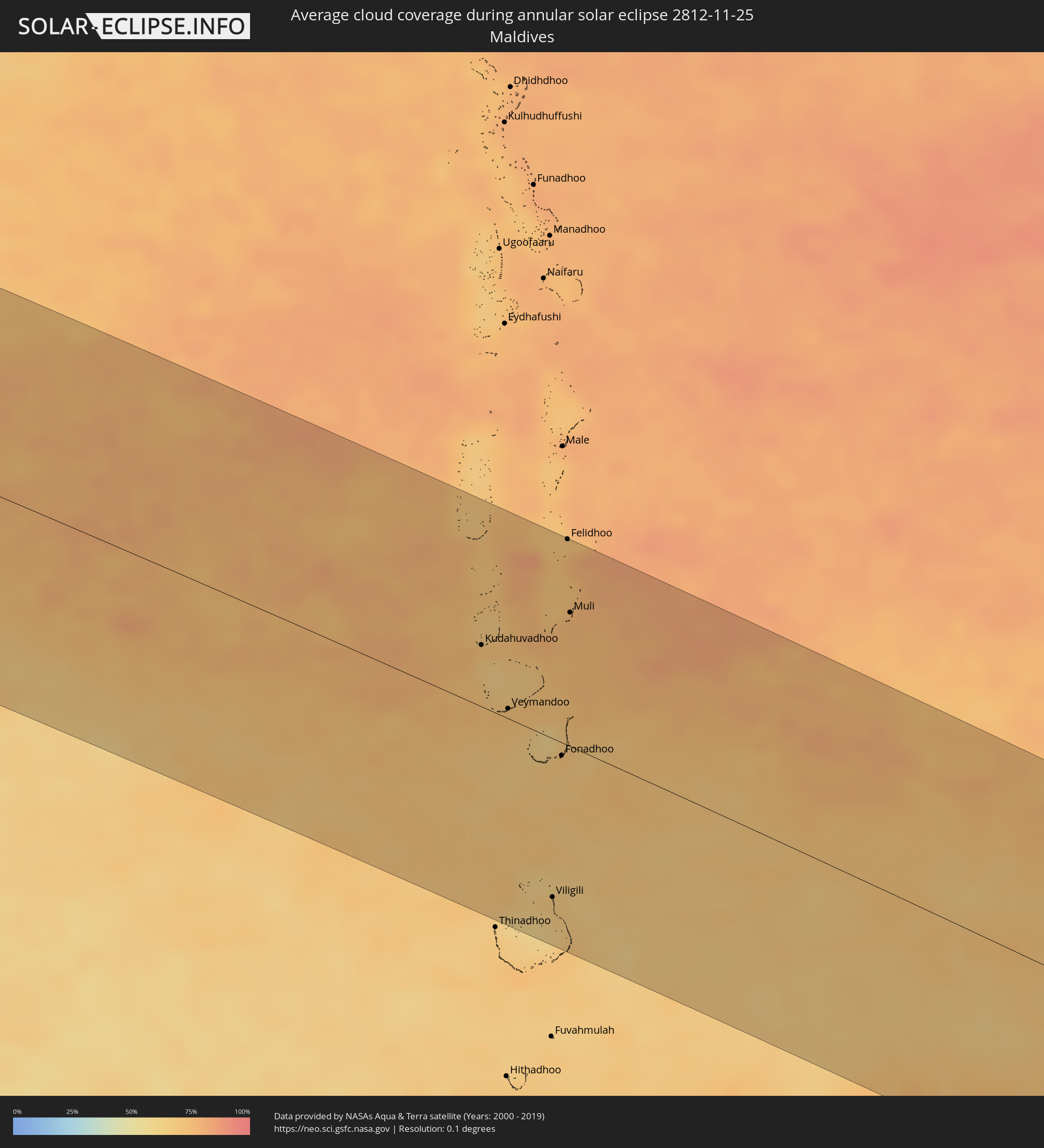 Maldives
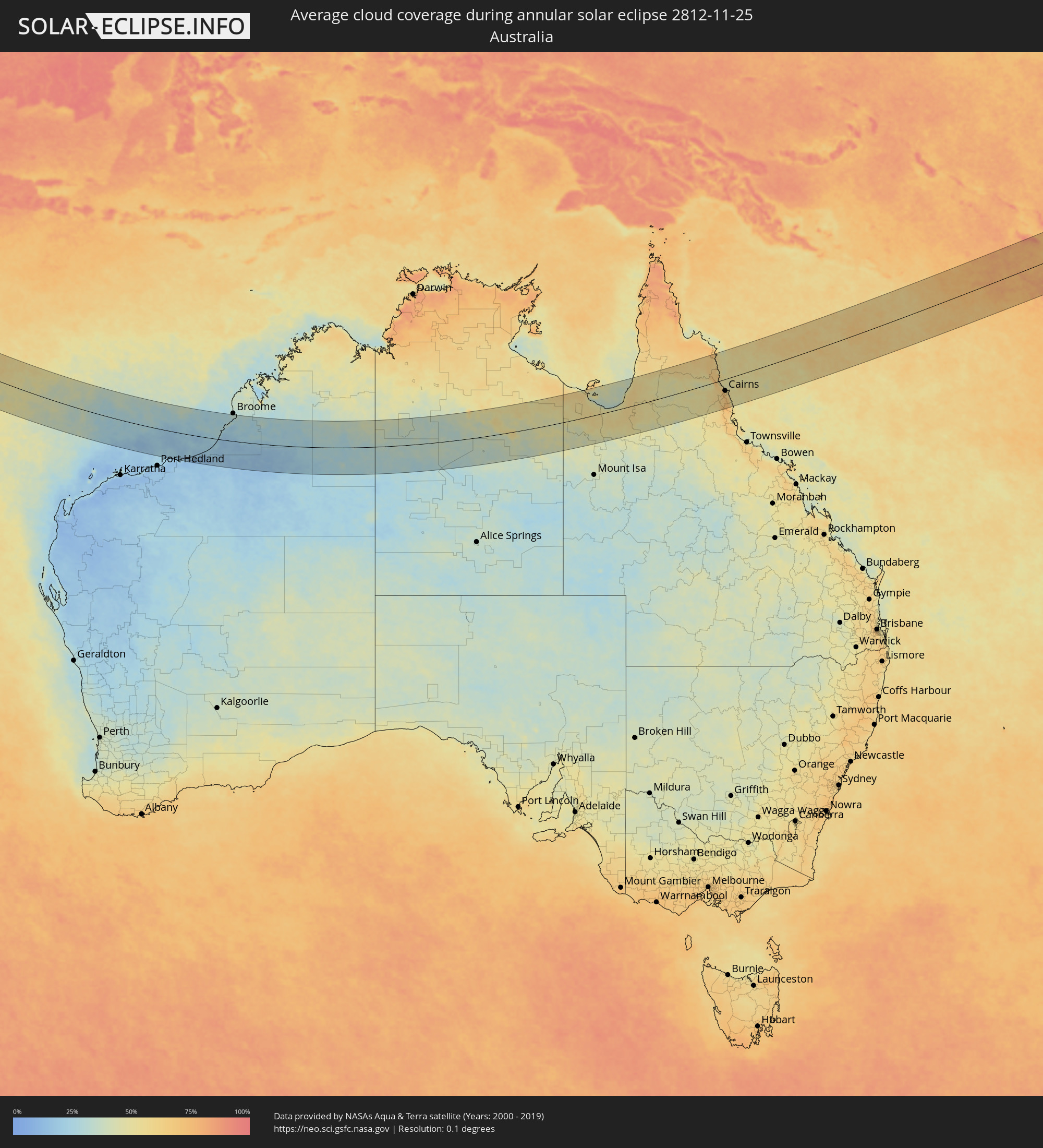 Australia
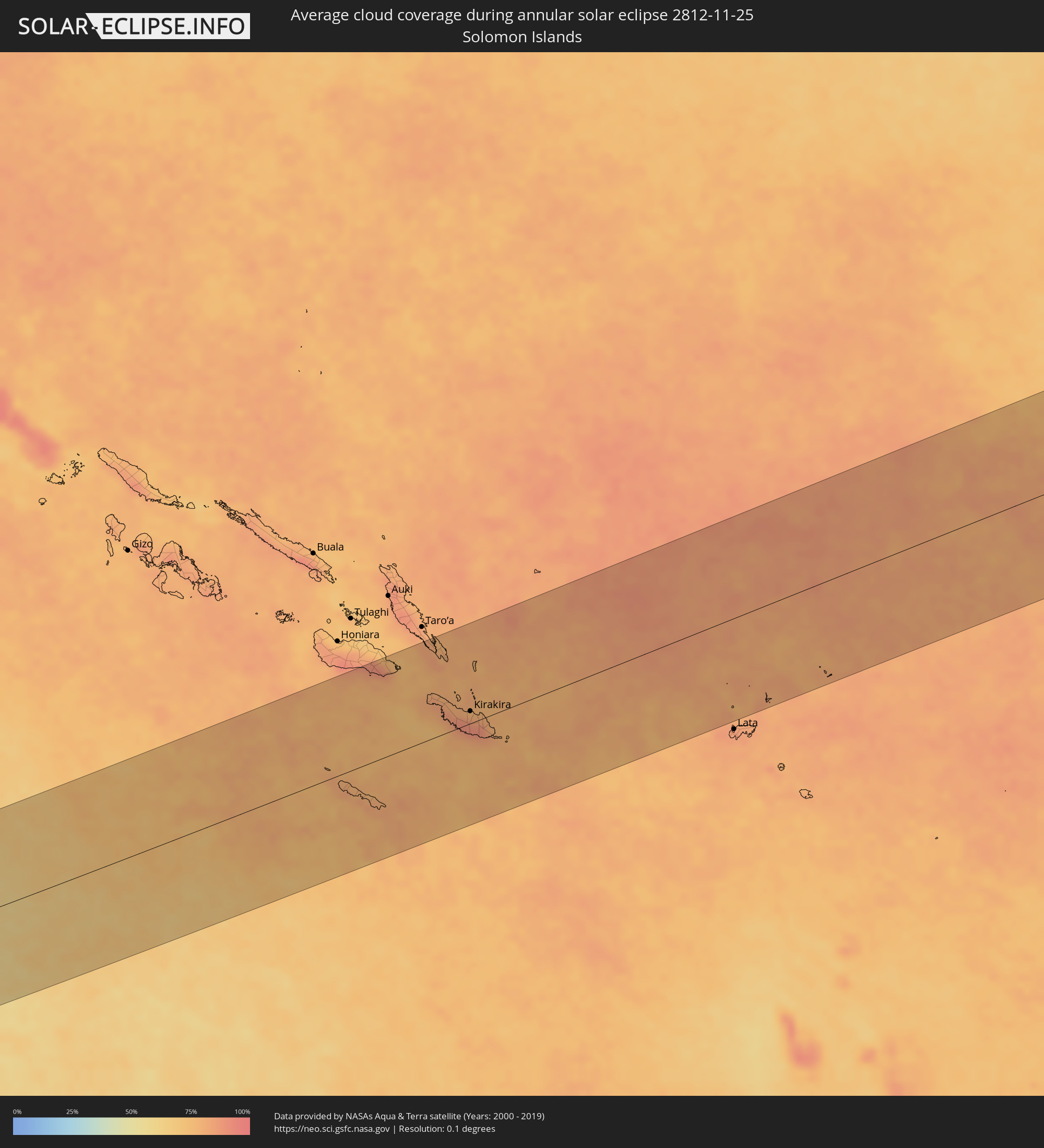 Solomon Islands
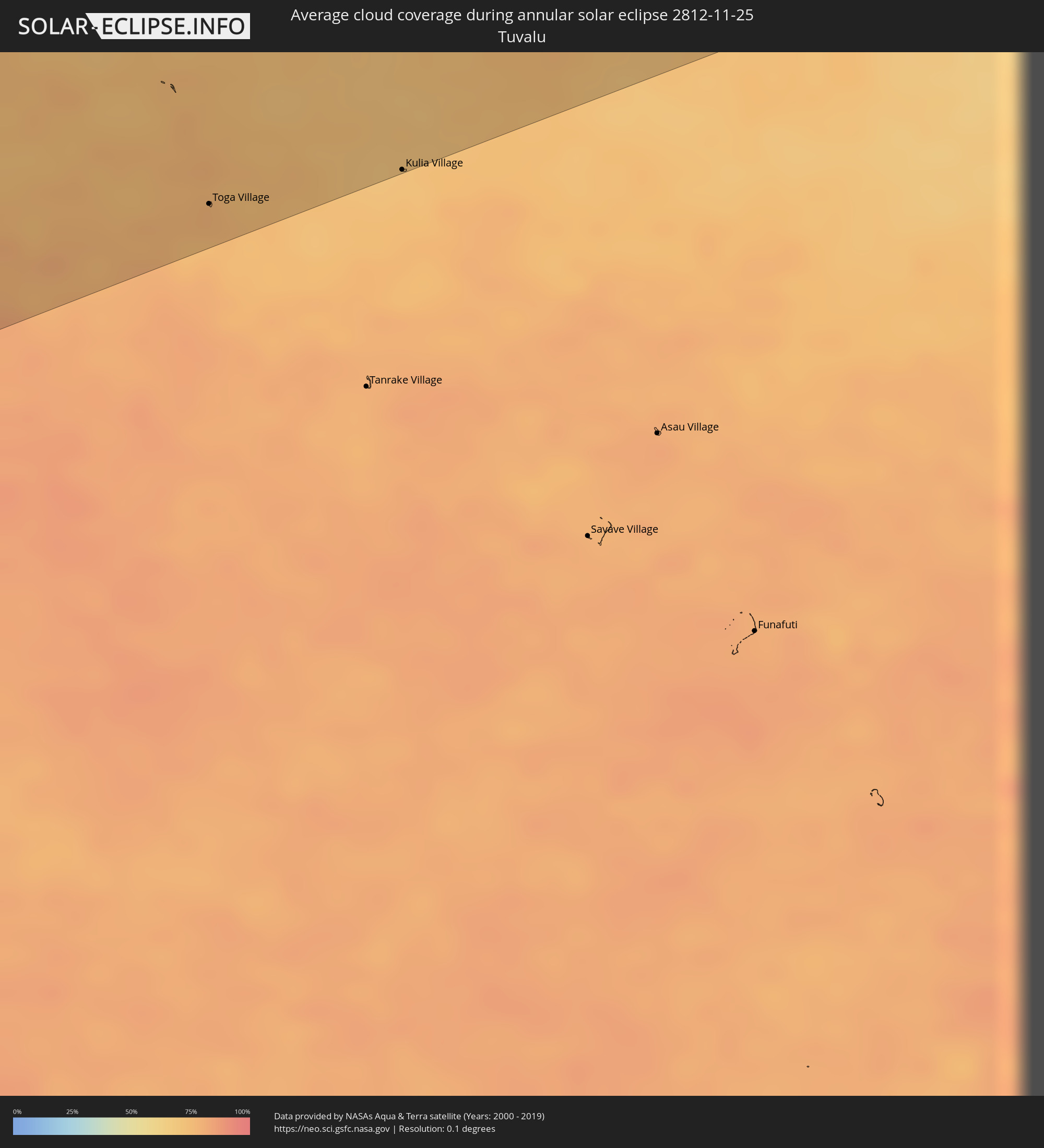 Tuvalu
Cities inside the path of the eclipse
The following table shows all locations with a population of more than 5,000 inside the eclipse path. Cities which have more than 100,000 inhabitants are marked bold. A click at the locations opens a detailed map.
| City | Type | Eclipse duration | Local time of max. eclipse | Distance to central line | Ø Cloud coverage |
|
Kudahuvadhoo, Dhaalu Atholhu
|
annular | - | 06:51:13 UTC+05:00 | 47 km | 73% |
|
Veymandoo, Thaa Atholhu
|
annular | - | 06:51:32 UTC+05:00 | 8 km | 73% |
|
Viligili, Gaafu Alifu Atholhu
|
annular | - | 06:52:28 UTC+05:00 | 122 km | 68% |
|
Fonadhoo, Laamu
|
annular | - | 06:51:52 UTC+05:00 | 10 km | 69% |
|
Felidhoo, Vaavu Atholhu
|
annular | - | 06:51:01 UTC+05:00 | 158 km | 70% |
|
Muli, Meemu Atholhu
|
annular | - | 06:51:18 UTC+05:00 | 103 km | 76% |
|
Mareeba, Queensland
|
annular | - | 15:08:14 UTC+10:00 | 53 km | 59% |
|
Atherton, Queensland
|
annular | - | 15:08:06 UTC+10:00 | 84 km | 63% |
|
Redlynch, Queensland
|
annular | - | 15:08:53 UTC+10:00 | 51 km | 71% |
|
Cairns, Queensland
|
annular | - | 15:08:59 UTC+10:00 | 57 km | 61% |
|
Innisfail, Queensland
|
annular | - | 15:09:01 UTC+10:00 | 129 km | 65% |
|
Kirakira, Makira
|
annular | - | 16:35:59 UTC+11:00 | 18 km | 85% |
|
Toga Village, Nanumanga
|
annular | - | 17:44:08 UTC+12:00 | 138 km | 75% |
|
Kulia Village, Niutao
|
annular | - | 17:44:16 UTC+12:00 | 160 km | 76% |