Totale Sonnenfinsternis vom 03.06.0699
| Wochentag: | Samstag |
| Maximale Dauer der Verfinsterung: | 07m17s |
| Maximale Breite des Finsternispfades: | 282 km |
| Saroszyklus: | 87 |
| Bedeckungsgrad: | 100% |
| Magnitude: | 1.0792 |
| Gamma: | -0.4291 |
Wo kann man die Sonnenfinsternis vom 03.06.0699 sehen?
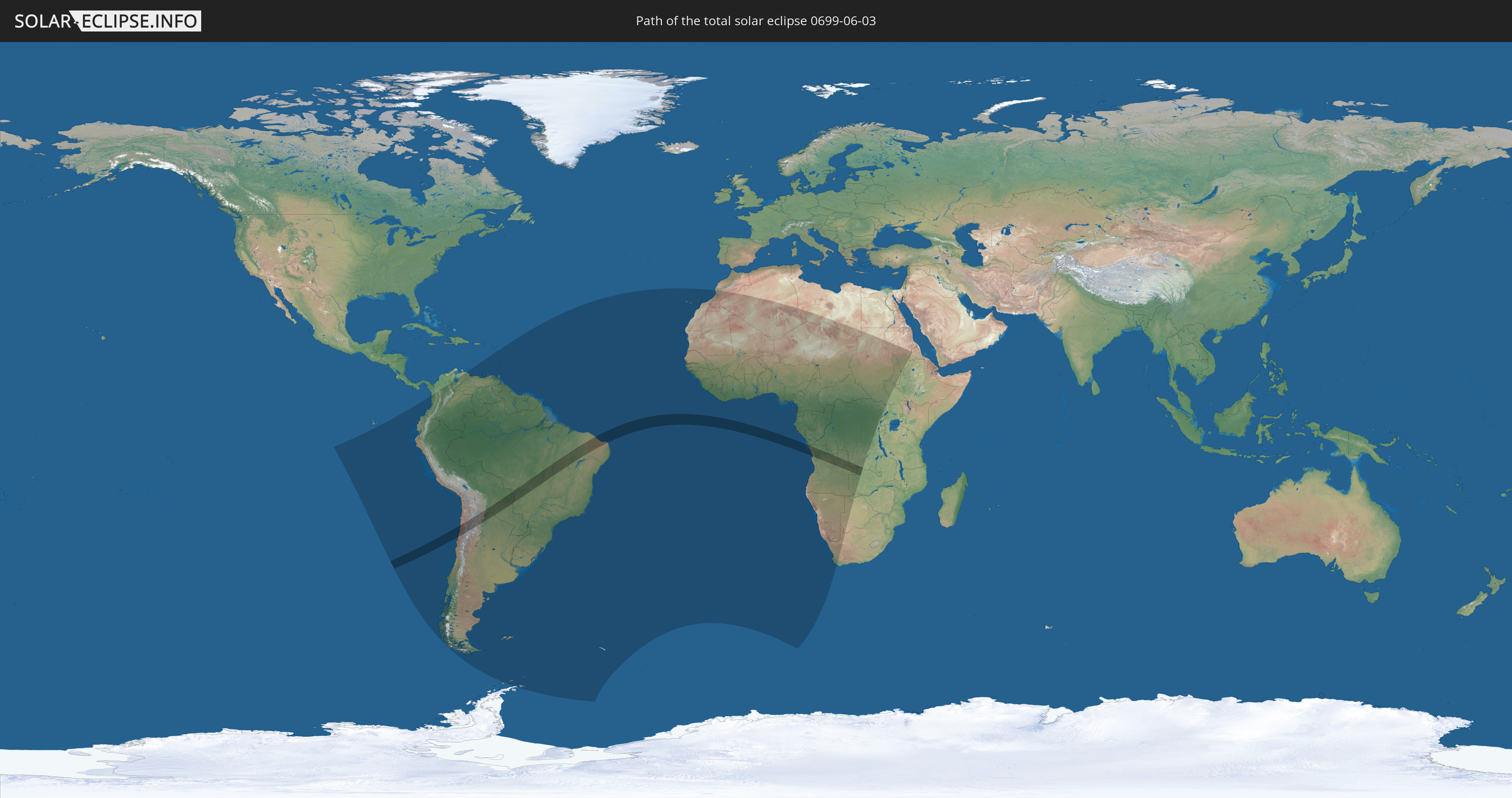
Die Sonnenfinsternis am 03.06.0699 kann man in 61 Ländern als partielle Sonnenfinsternis beobachten.
Der Finsternispfad verläuft durch 8 Länder. Nur in diesen Ländern ist sie als totale Sonnenfinsternis zu sehen.
In den folgenden Ländern ist die Sonnenfinsternis total zu sehen
 Chile
Chile
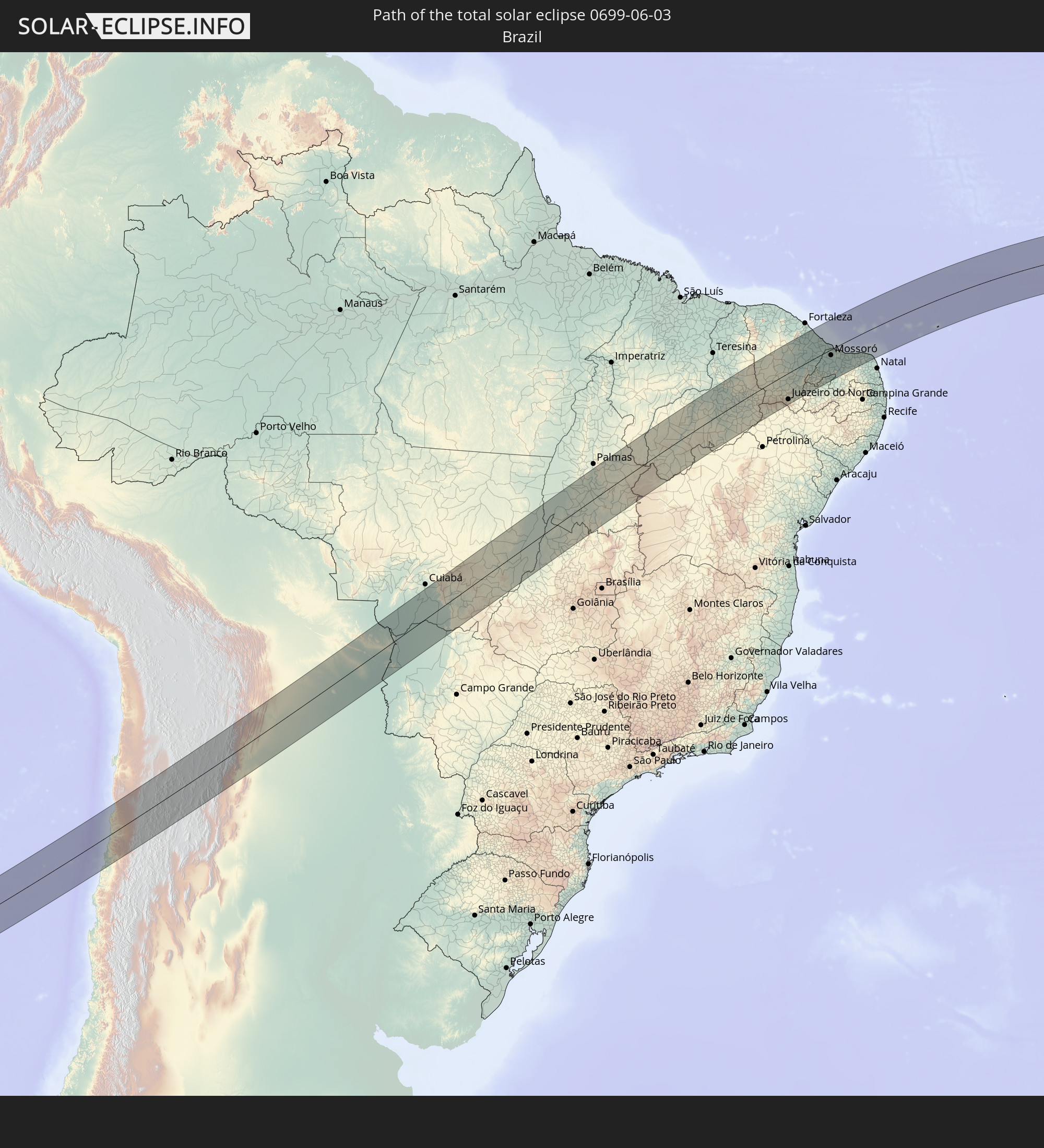 Brasilien
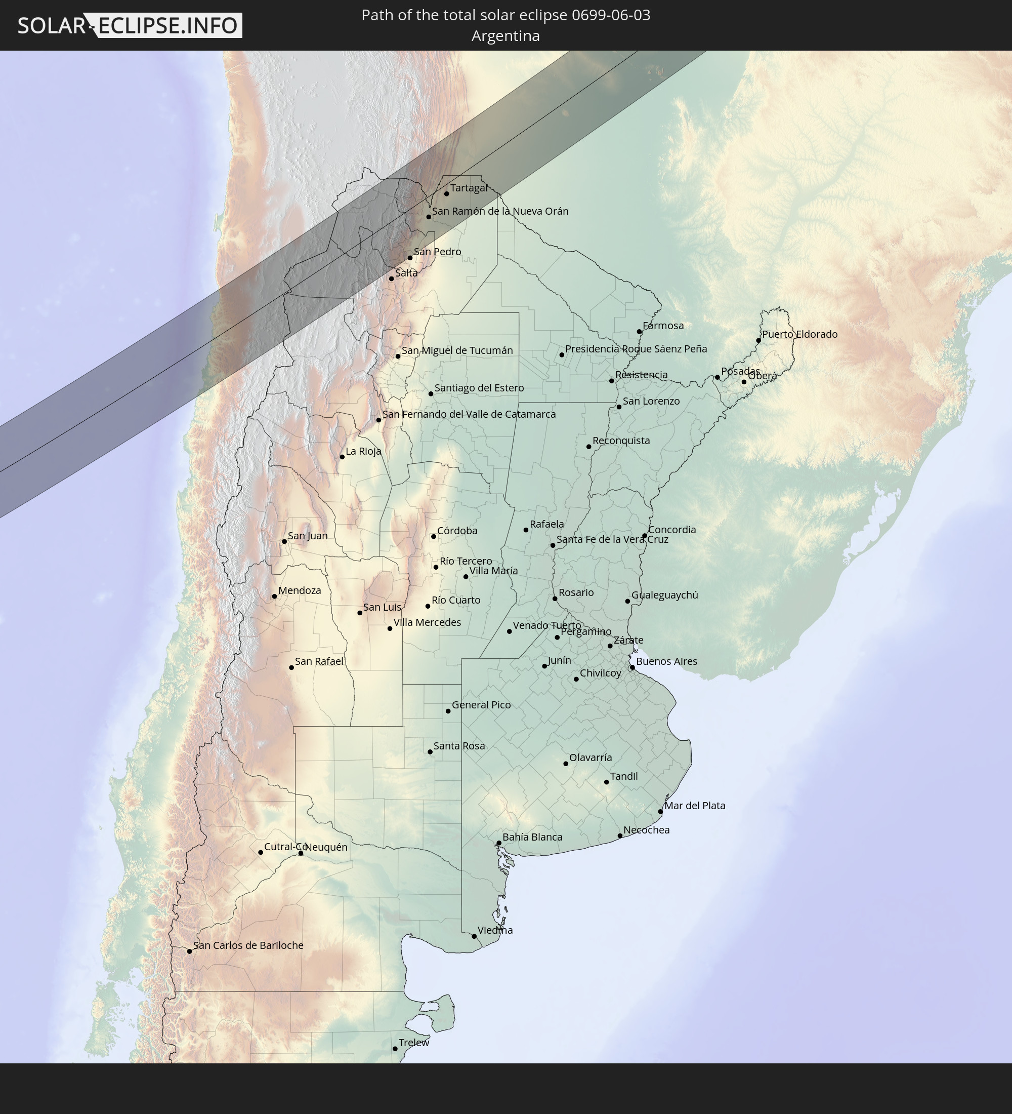 Argentinien
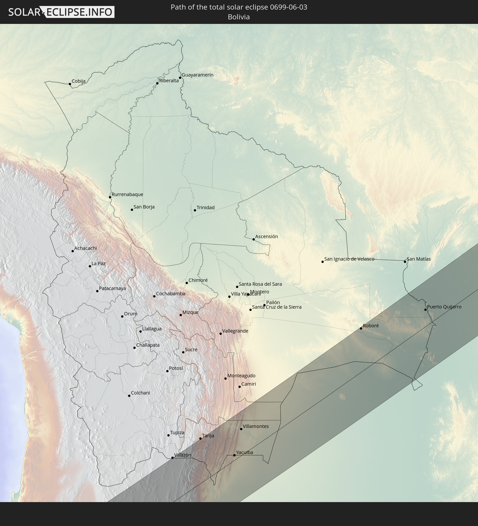 Bolivien
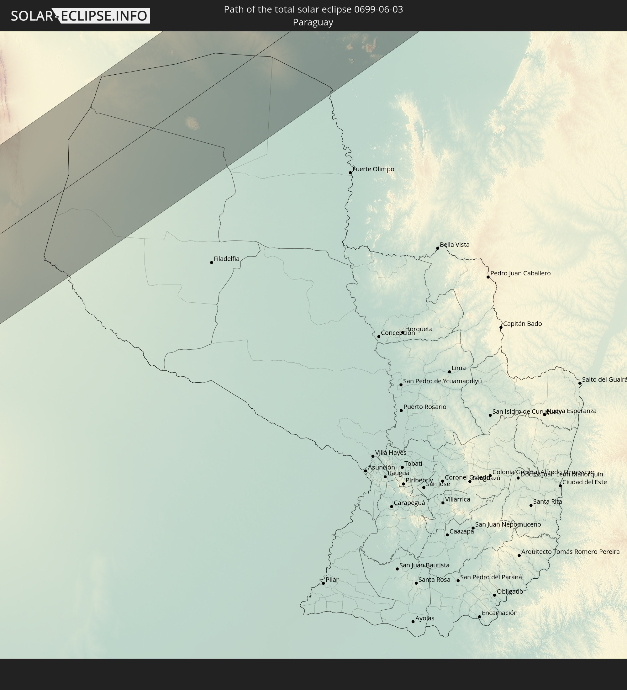 Paraguay
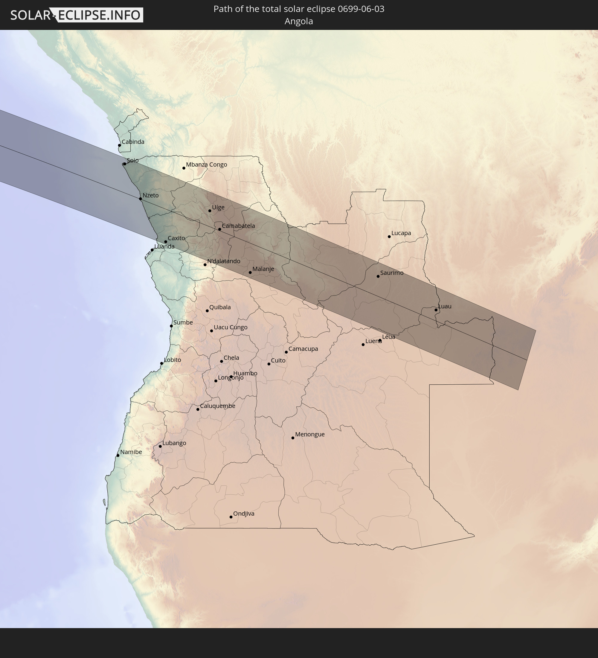 Angola
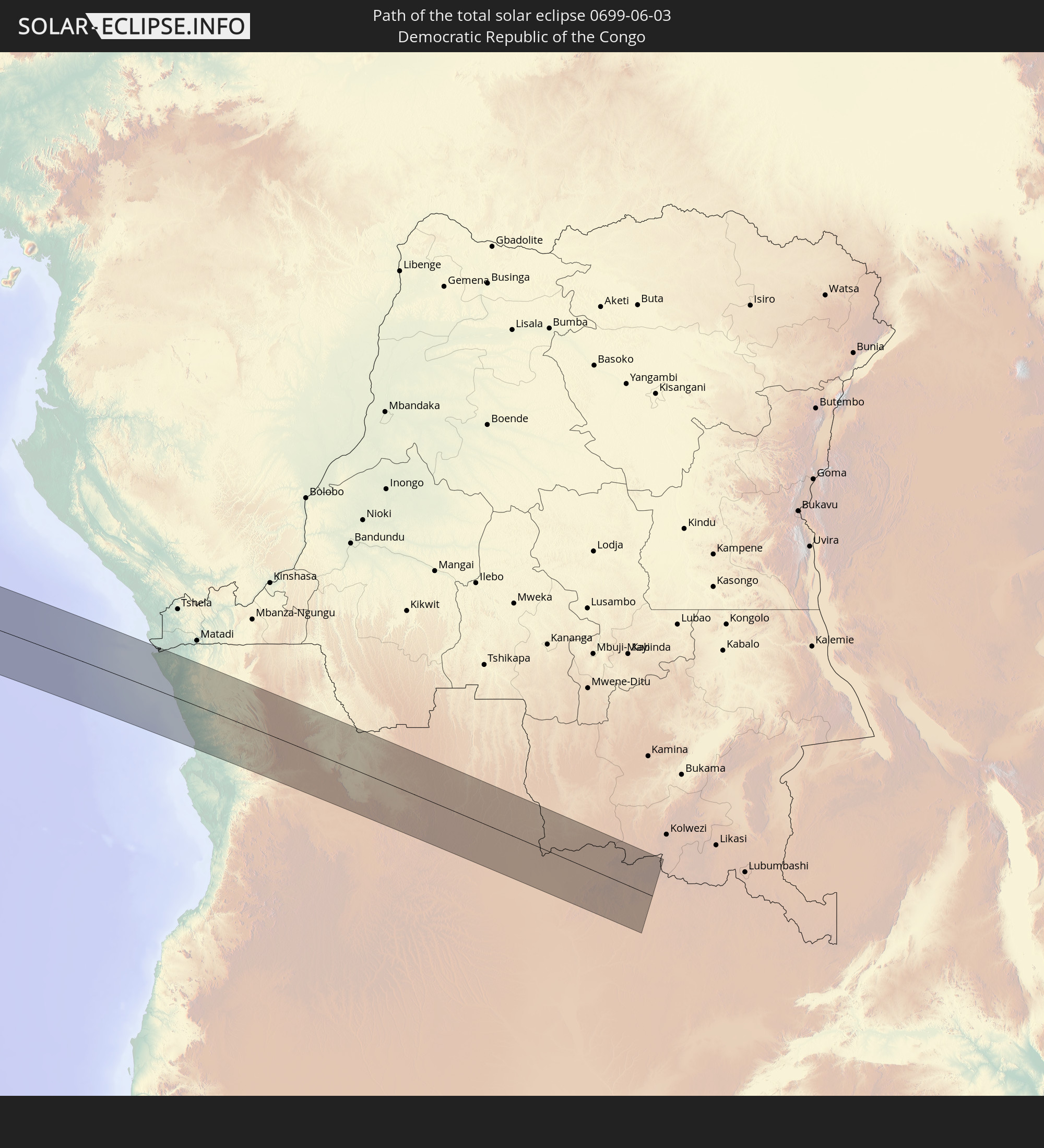 Demokratische Republik Kongo
 Sambia
In den folgenden Ländern ist die Sonnenfinsternis partiell zu sehen
 Antarktika
 Chile
Chile
 Ecuador
 Kolumbien
 Peru
Peru
 Brasilien
 Argentinien
 Venezuela
 Bolivien
 Paraguay
 Trinidad und Tobago
 Guadeloupe
 Grenada
 Dominica
 St. Vincent und die Grenadinen
 Falklandinseln
 Guyana
 Martinique
 St. Lucia
 Barbados
 Uruguay
 Suriname
 Französisch-Guayana
 Südgeorgien und die Südlichen Sandwichinseln
 Portugal
 Kap Verde
 Spanien
 Senegal
 Mauretanien
 Gambia
 Guinea-Bissau
 Guinea
 St. Helena
 Sierra Leone
 Marokko
 Mali
Mali
 Liberia
 Algerien
 Elfenbeinküste
 Burkina Faso
 Ghana
Ghana
 Togo
Togo
 Niger
Niger
 Benin
Benin
 Nigeria
 Äquatorialguinea
 São Tomé und Príncipe
 Kamerun
 Gabun
Gabun
 Libyen
 Republik Kongo
 Angola
 Namibia
 Demokratische Republik Kongo
 Tschad
 Zentralafrikanische Republik
 Südafrika
 Botswana
 Sudan
Sudan
 Sambia
 Eritrea
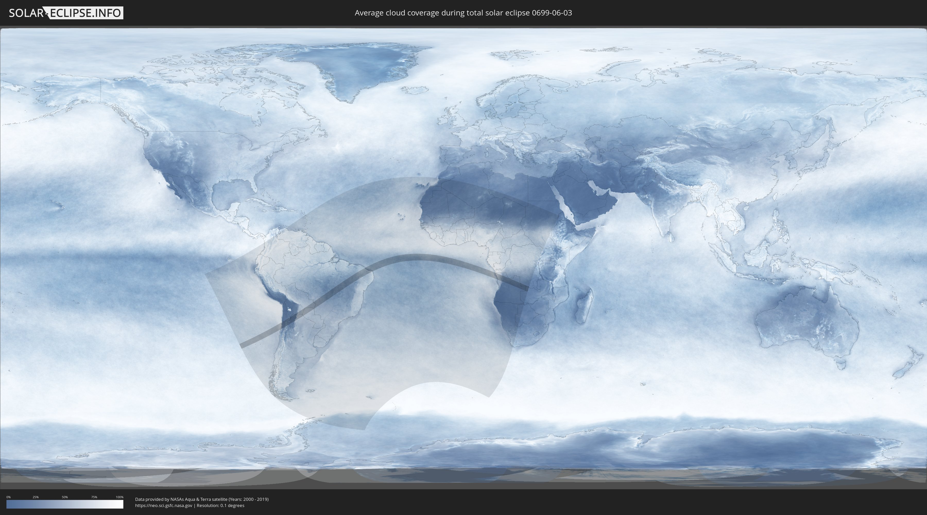
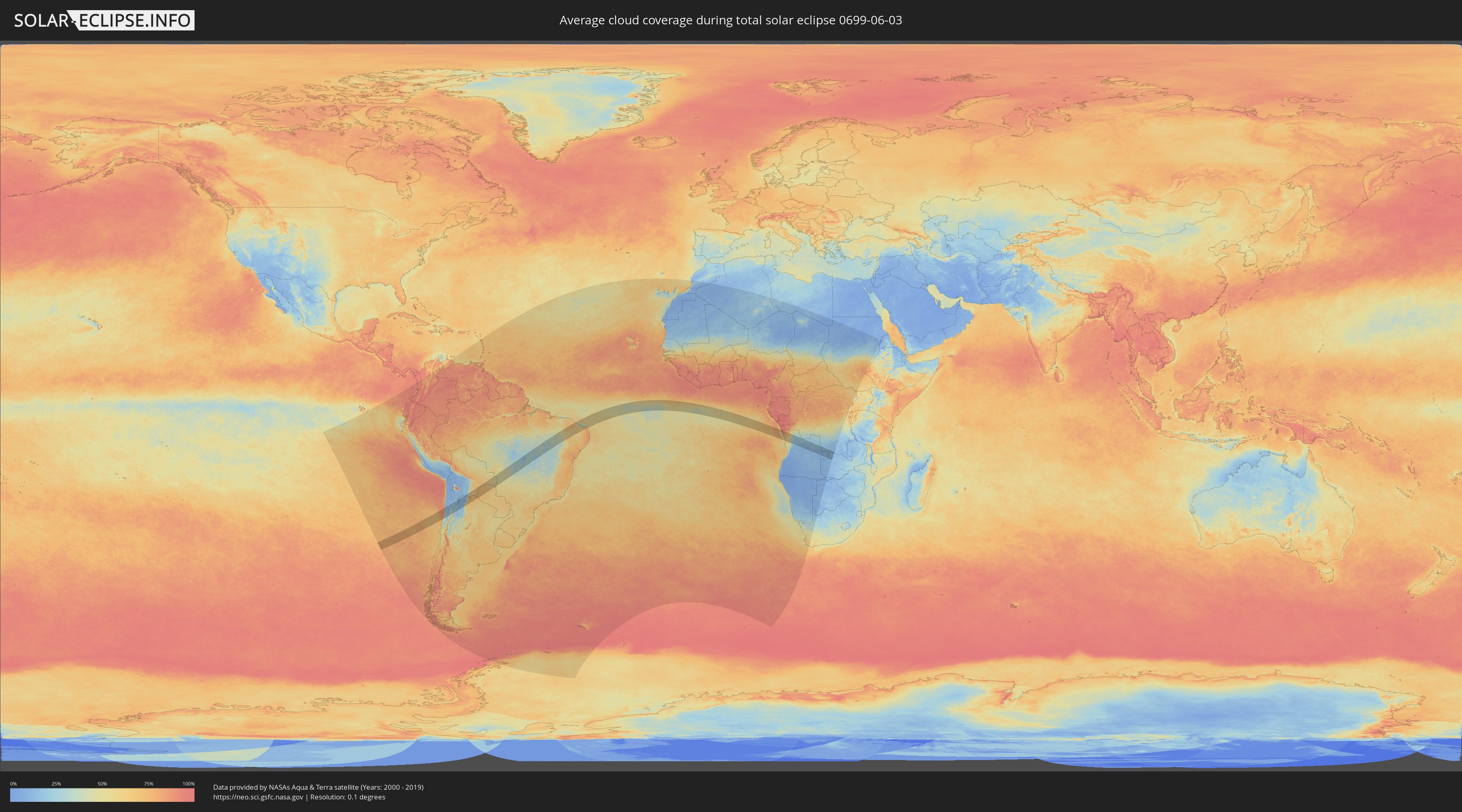
Wie wird das Wetter während der totalen Sonnenfinsternis am 03.06.0699?
Wo ist der beste Ort, um die totale Sonnenfinsternis vom 03.06.0699 zu beobachten?
Die folgenden Karten zeigen die durchschnittliche Bewölkung für den Tag, an dem die totale Sonnenfinsternis
stattfindet. Mit Hilfe der Karten lässt sich der Ort entlang des Finsternispfades eingrenzen,
der die besten Aussichen auf einen klaren wolkenfreien Himmel bietet.
Trotzdem muss man immer lokale Gegenenheiten beachten und sollte sich genau über das Wetter an seinem
gewählten Beobachtungsort informieren.
Die Daten stammen von den beiden NASA-Satelliten
AQUA und TERRA
und wurden über einen Zeitraum von 19 Jahren (2000 - 2019) gemittelt.
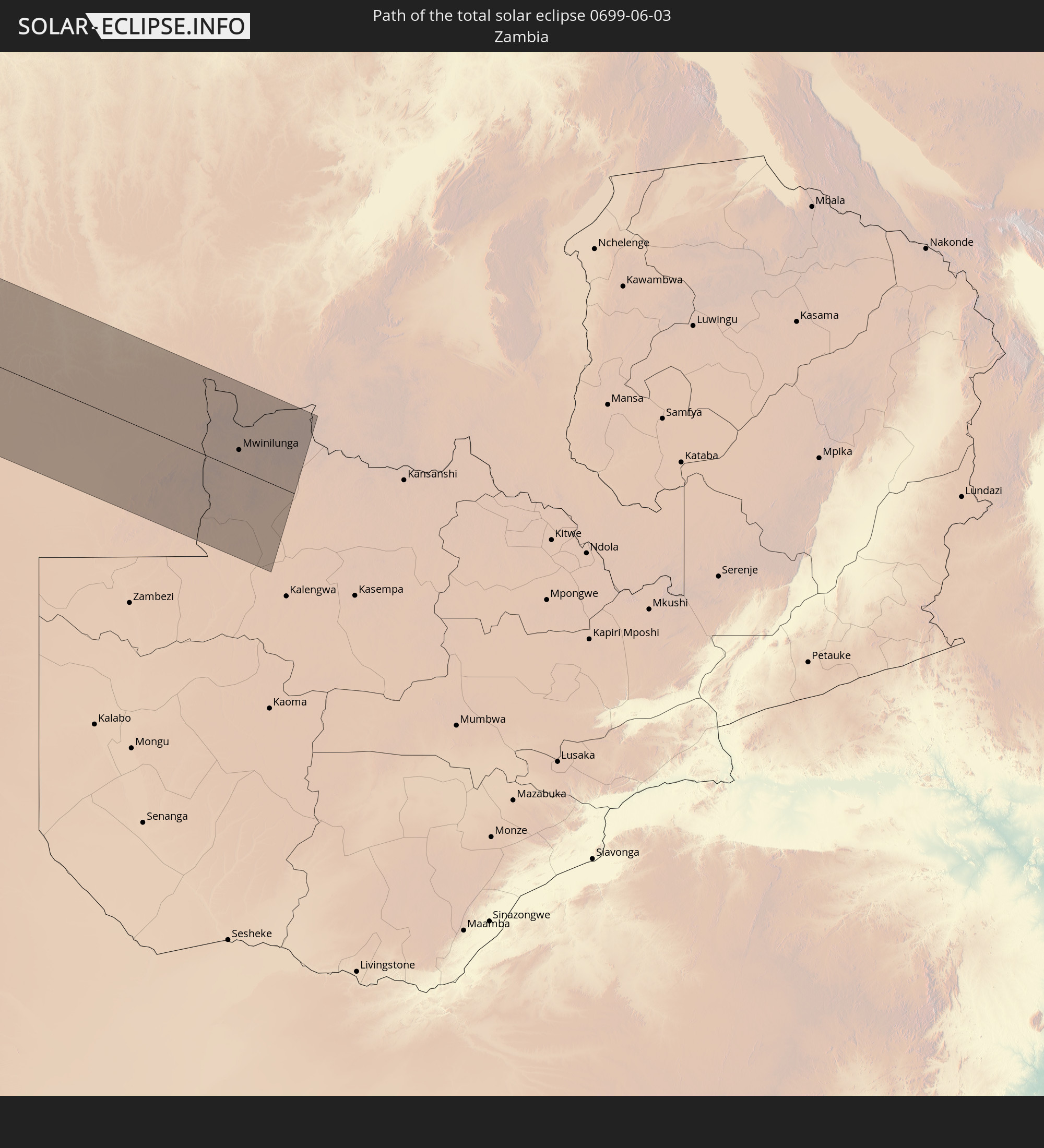
Detaillierte Länderkarten
 Chile
Chile
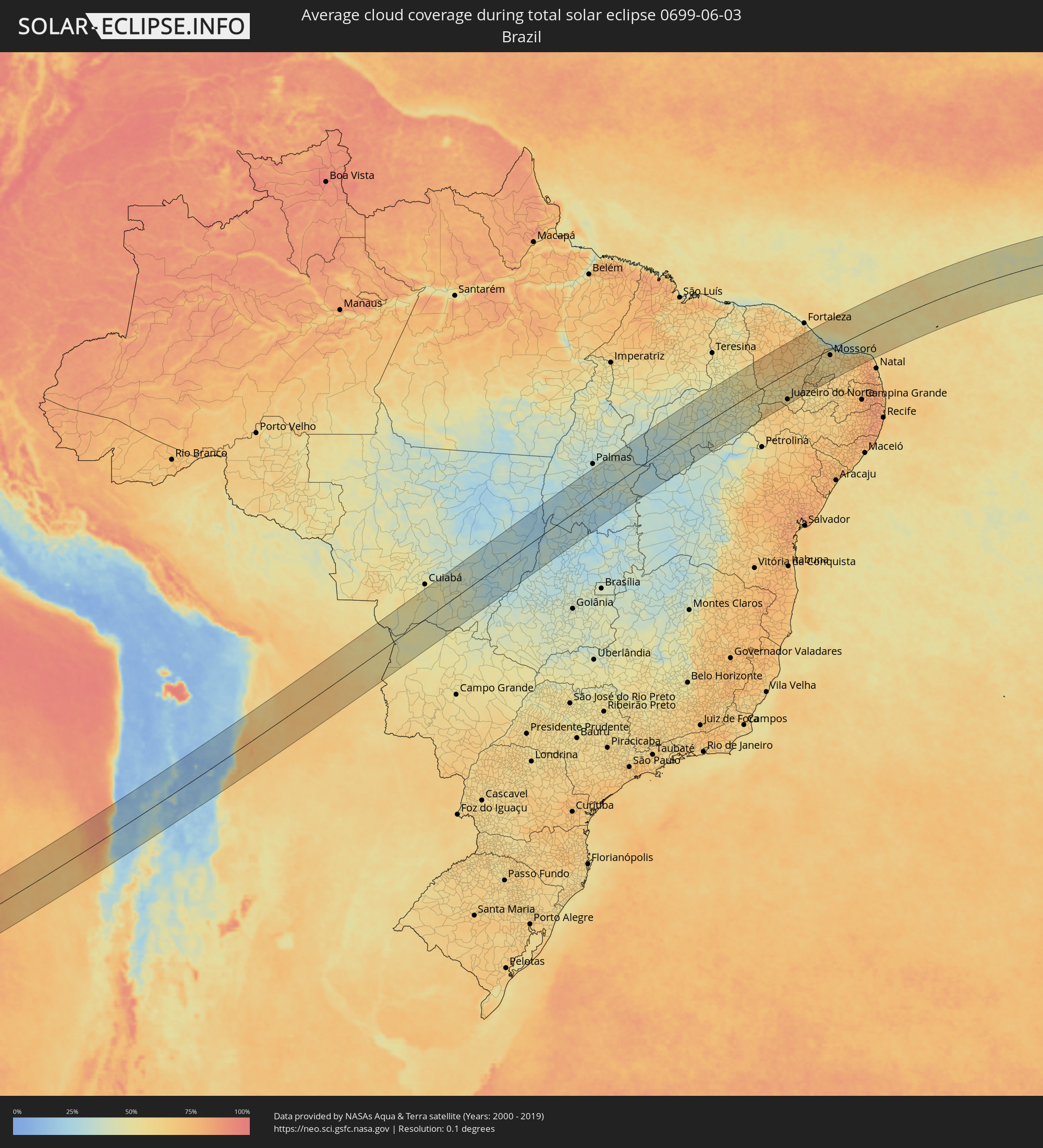 Brasilien
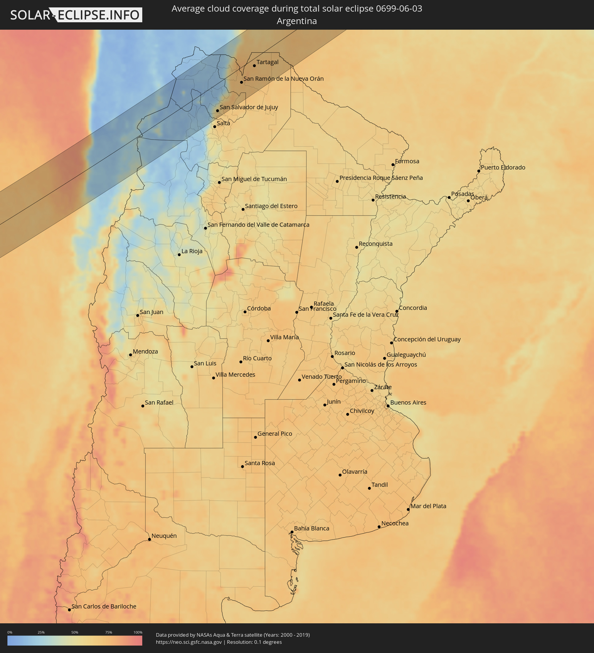 Argentinien
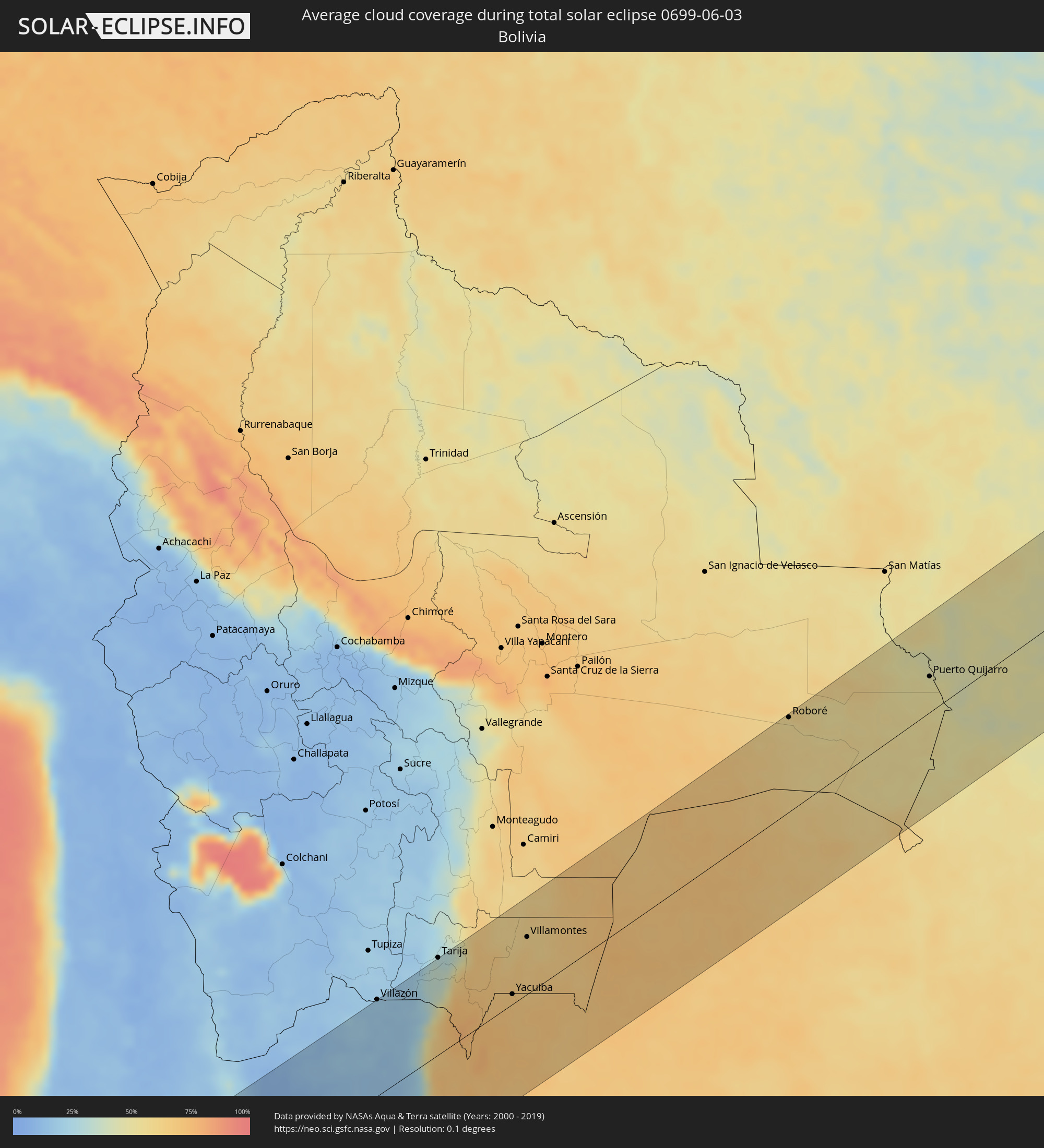 Bolivien
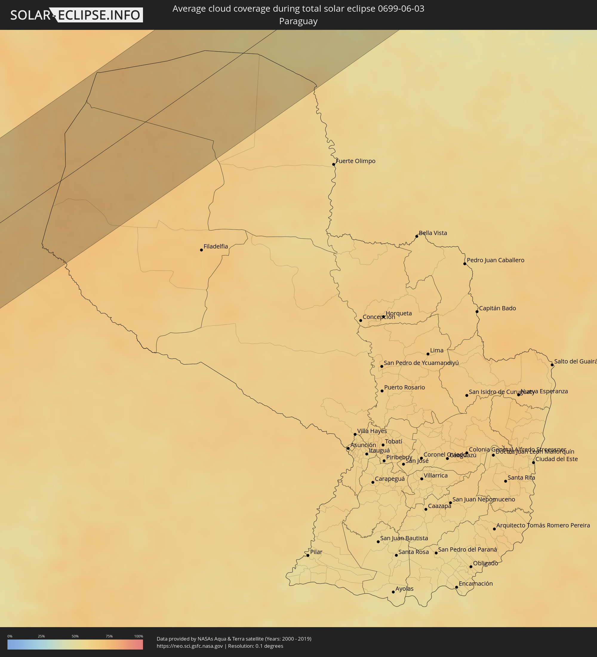 Paraguay
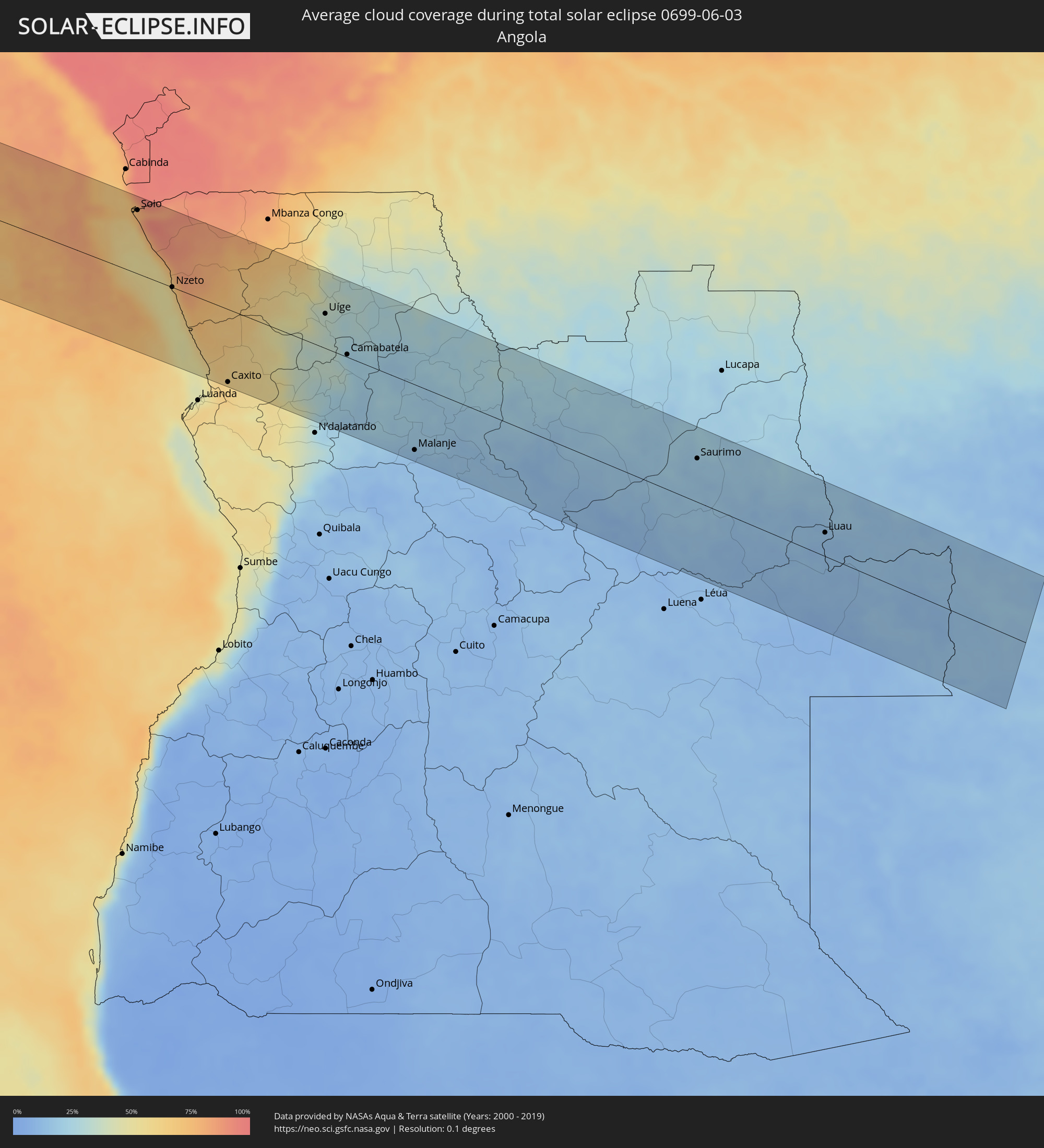 Angola
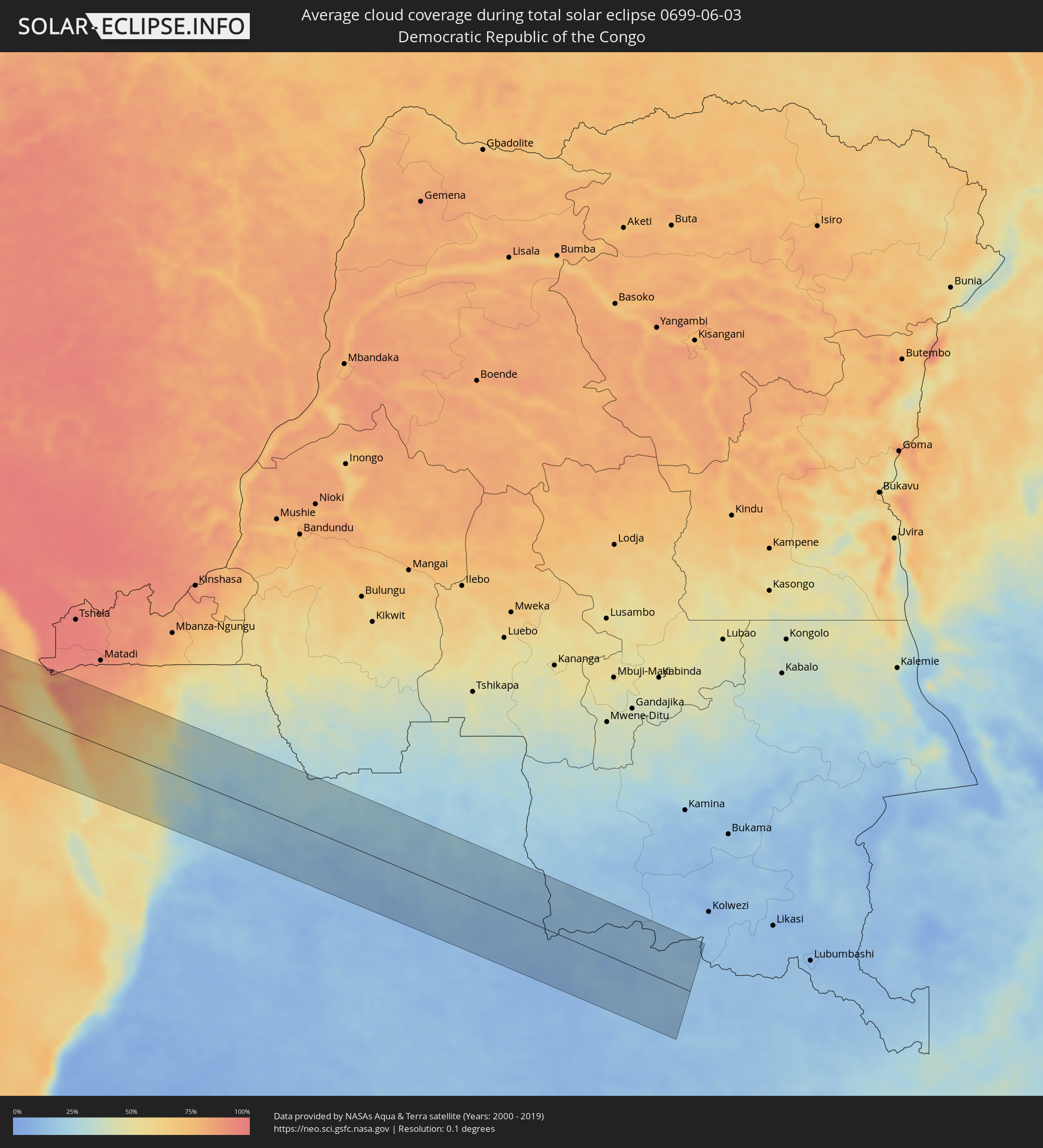 Demokratische Republik Kongo
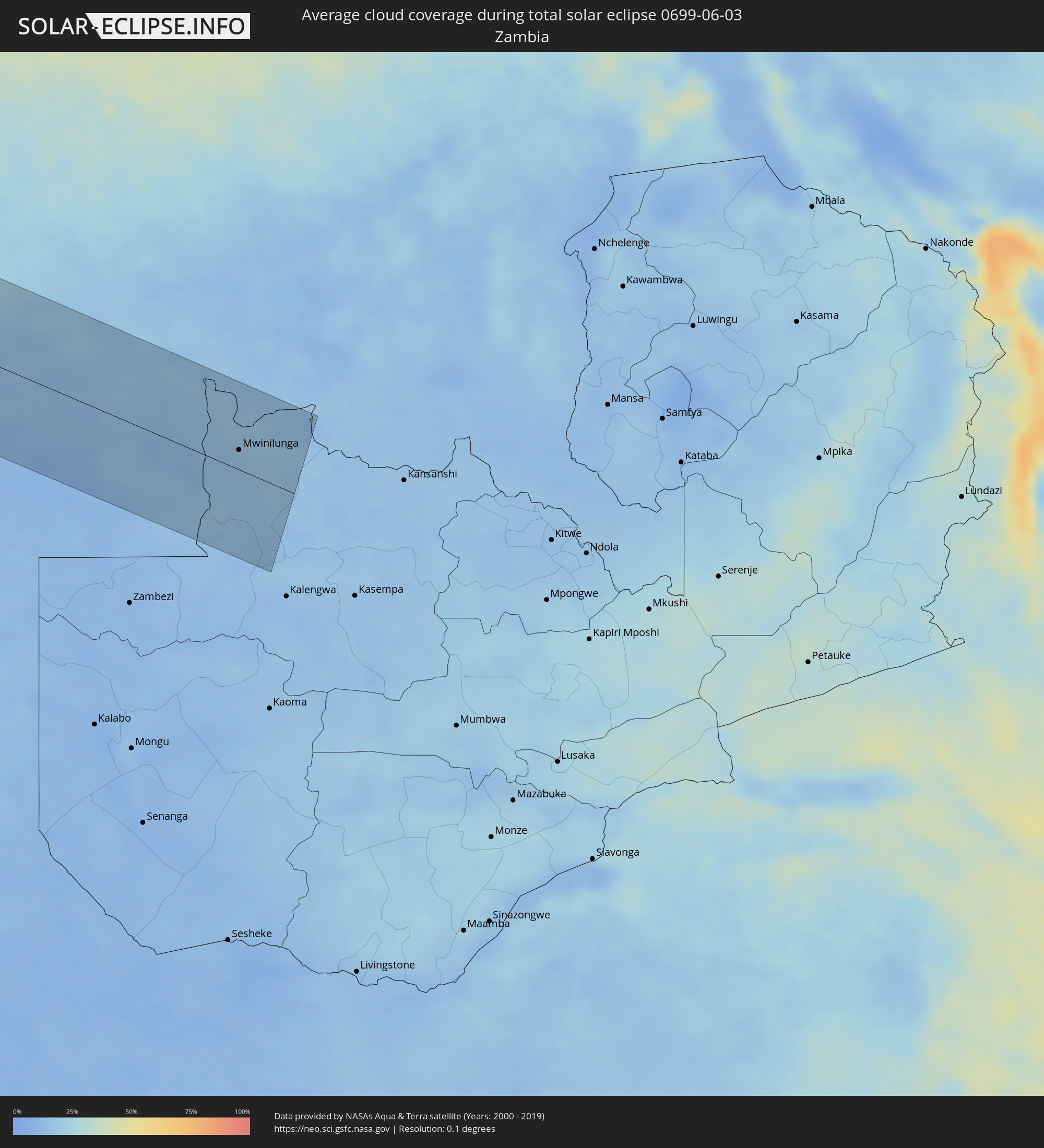 Sambia
Orte im Finsternispfad
Die nachfolgene Tabelle zeigt Städte und Orte mit mehr als 5.000 Einwohnern, die sich im Finsternispfad befinden. Städte mit mehr als 100.000 Einwohnern sind dick gekennzeichnet. Mit einem Klick auf den Ort öffnet sich eine Detailkarte die die Lage des jeweiligen Ortes zusammen mit dem Verlauf der zentralen Finsternis präsentiert.
| Ort | Typ | Dauer der Verfinsterung | Ortszeit bei maximaler Verfinsterung | Entfernung zur Zentrallinie | Ø Bewölkung |
|
Taltal, Antofagasta
|
total | - | 08:11:08 UTC-04:42 | 81 km | 53% |
|
Copiapó, Atacama
|
total | - | 08:11:23 UTC-04:42 | 111 km | 30% |
|
Diego de Almagro, Atacama
|
total | - | 08:11:30 UTC-04:42 | 32 km | 22% |
|
Abra Pampa, Jujuy Province
|
total | - | 08:41:17 UTC-04:16 | 64 km | 18% |
|
Villazón, Potosí
|
total | - | 08:25:40 UTC-04:32 | 117 km | 19% |
|
La Quiaca, Jujuy Province
|
total | - | 08:41:28 UTC-04:16 | 115 km | 19% |
|
Tilcara, Jujuy Province
|
total | - | 08:41:31 UTC-04:16 | 35 km | 16% |
|
Humahuaca, Jujuy Province
|
total | - | 08:41:34 UTC-04:16 | 1 km | 14% |
|
San Salvador de Jujuy, Jujuy Province
|
total | - | 08:41:32 UTC-04:16 | 95 km | 63% |
|
Palpalá, Jujuy Province
|
total | - | 08:41:36 UTC-04:16 | 106 km | 65% |
|
Fraile Pintado, Jujuy Province
|
total | - | 08:42:02 UTC-04:16 | 100 km | 68% |
|
Libertador General San Martín, Jujuy Province
|
total | - | 08:42:03 UTC-04:16 | 88 km | 70% |
|
Calilegua, Jujuy Province
|
total | - | 08:42:04 UTC-04:16 | 86 km | 70% |
|
Caimancito, Jujuy Province
|
total | - | 08:42:15 UTC-04:16 | 93 km | 66% |
|
Yuto, Jujuy Province
|
total | - | 08:42:23 UTC-04:16 | 91 km | 65% |
|
San Ramón de la Nueva Orán, Salta Province
|
total | - | 08:42:35 UTC-04:16 | 53 km | 71% |
|
Embarcación, Salta Province
|
total | - | 08:42:48 UTC-04:16 | 73 km | 69% |
|
General Enrique Mosconi, Salta Province
|
total | - | 08:43:11 UTC-04:16 | 33 km | 72% |
|
Tartagal, Salta Province
|
total | - | 08:43:12 UTC-04:16 | 27 km | 72% |
|
Yacuiba, Tarija
|
total | - | 08:27:37 UTC-04:32 | 12 km | 69% |
|
Villamontes, Tarija
|
total | - | 08:27:59 UTC-04:32 | 69 km | 63% |
|
Roboré, Santa Cruz
|
total | - | 08:33:11 UTC-04:32 | 115 km | 55% |
|
Puerto Quijarro, Santa Cruz
|
total | - | 08:36:04 UTC-04:32 | 44 km | 49% |
|
Corumbá, Mato Grosso do Sul
|
total | - | 09:29:52 UTC-03:38 | 74 km | 52% |
|
Poconé, Mato Grosso
|
total | - | 09:32:32 UTC-03:38 | 112 km | 52% |
|
Lucas, Mato Grosso
|
total | - | 09:33:31 UTC-03:38 | 62 km | 41% |
|
Jaciara, Mato Grosso
|
total | - | 09:35:12 UTC-03:38 | 35 km | 42% |
|
Rondonópolis, Mato Grosso
|
total | - | 09:35:27 UTC-03:38 | 31 km | 44% |
|
Porangatu, Goiás
|
total | - | 10:18:57 UTC-03:06 | 101 km | 29% |
|
Gurupi, Tocantins
|
total | - | 10:52:52 UTC-02:34 | 50 km | 31% |
|
Oeiras, Piauí
|
total | - | 11:12:30 UTC-02:34 | 62 km | 41% |
|
Picos, Piauí
|
total | - | 11:14:06 UTC-02:34 | 19 km | 52% |
|
Araripina, Pernambuco
|
total | - | 11:30:28 UTC-02:19 | 84 km | 60% |
|
Várzea Alegre, Ceará
|
total | - | 11:18:38 UTC-02:34 | 122 km | 70% |
|
São João dos Inhamuns, Ceará
|
total | - | 11:18:13 UTC-02:34 | 54 km | 64% |
|
Boa Viagem, Ceará
|
total | - | 11:20:34 UTC-02:34 | 108 km | 73% |
|
Pedra Branca, Ceará
|
total | - | 11:20:16 UTC-02:34 | 75 km | 73% |
|
Acopiara, Ceará
|
total | - | 11:20:17 UTC-02:34 | 1 km | 63% |
|
Juazeiro do Norte, Ceará
|
total | - | 11:19:31 UTC-02:34 | 116 km | 59% |
|
Iguatu, Ceará
|
total | - | 11:20:26 UTC-02:34 | 35 km | 59% |
|
Quixeramobim, Ceará
|
total | - | 11:21:39 UTC-02:34 | 77 km | 67% |
|
Quixadá, Ceará
|
total | - | 11:22:37 UTC-02:34 | 84 km | 69% |
|
Icó, Ceará
|
total | - | 11:21:33 UTC-02:34 | 63 km | 60% |
|
Jaguaribe, Ceará
|
total | - | 11:22:43 UTC-02:34 | 27 km | 64% |
|
Cajazeiras, Paraíba
|
total | - | 11:21:52 UTC-02:34 | 127 km | 57% |
|
Pacajus, Ceará
|
total | - | 11:24:58 UTC-02:34 | 132 km | 69% |
|
Morada Nova, Ceará
|
total | - | 11:24:12 UTC-02:34 | 36 km | 62% |
|
Cascavel, Ceará
|
total | - | 11:25:36 UTC-02:34 | 124 km | 57% |
|
Sousa, Paraíba
|
total | - | 11:22:53 UTC-02:34 | 132 km | 58% |
|
Limoeiro do Norte, Ceará
|
total | - | 11:24:55 UTC-02:34 | 18 km | 63% |
|
Russas, Ceará
|
total | - | 11:25:28 UTC-02:34 | 31 km | 64% |
|
Jaguaruana, Ceará
|
total | - | 11:26:06 UTC-02:34 | 31 km | 65% |
|
Aracati, Ceará
|
total | - | 11:26:25 UTC-02:34 | 57 km | 58% |
|
São Bento, Paraíba
|
total | - | 11:24:41 UTC-02:34 | 112 km | 63% |
|
Mossoró, Rio Grande do Norte
|
total | - | 11:26:56 UTC-02:34 | 26 km | 59% |
|
Açu, Rio Grande do Norte
|
total | - | 11:27:44 UTC-02:34 | 87 km | 56% |
|
João Câmara, Rio Grande do Norte
|
total | - | 11:30:51 UTC-02:34 | 139 km | 79% |
|
Soio, Zaire
|
total | - | 16:04:43 UTC+00:13 | 94 km | 84% |
|
Nzeto, Zaire
|
total | - | 16:04:42 UTC+00:13 | 0 km | 68% |
|
Caxito, Bengo
|
total | - | 16:04:44 UTC+00:13 | 107 km | 59% |
|
Uíge, Uíge
|
total | - | 16:06:00 UTC+00:13 | 51 km | 33% |
|
Camabatela, Cuanza Norte
|
total | - | 16:05:58 UTC+00:13 | 4 km | 23% |
|
Malanje, Malanje
|
total | - | 16:05:58 UTC+00:13 | 95 km | 12% |
|
Saurimo, Lunda Sul
|
total | - | 16:07:47 UTC+00:13 | 63 km | 18% |
|
Luau, Moxico
|
total | - | 16:07:58 UTC+00:13 | 34 km | 13% |
|
Mwinilunga, North-Western
|
total | - | 18:04:50 UTC+02:10 | 24 km | 15% |