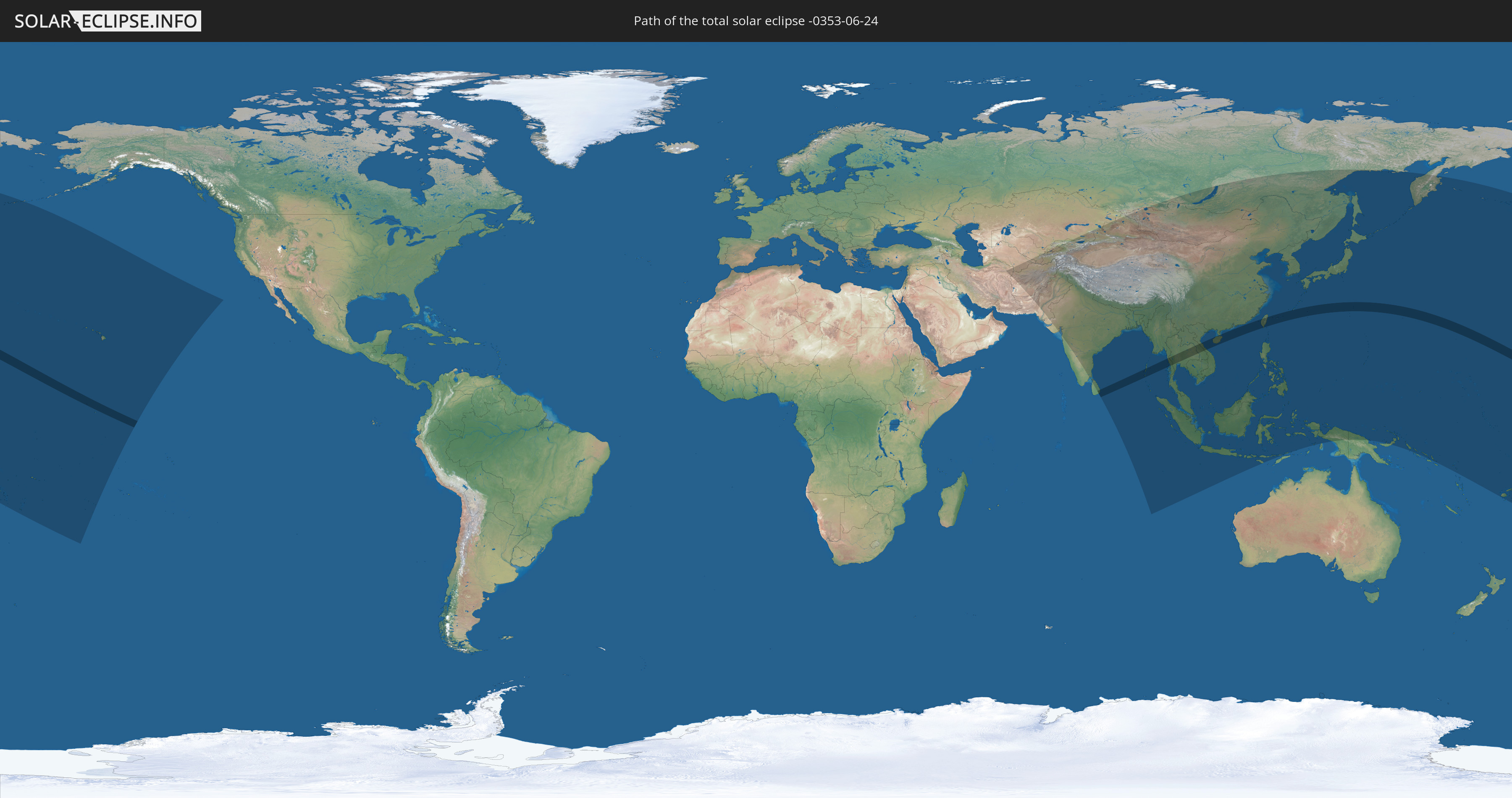
Total solar eclipse of 06/24/-0353
| Day of week: | Saturday |
| Maximum duration of eclipse: | 06m22s |
| Maximum width of eclipse path: | 235 km |
| Saros cycle: | 60 |
| Coverage: | 100% |
| Magnitude: | 1.0721 |
| Gamma: | 0.0505 |
Wo kann man die Sonnenfinsternis vom 06/24/-0353 sehen?
Die Sonnenfinsternis am 06/24/-0353 kann man in 55 Ländern als partielle Sonnenfinsternis beobachten.
Der Finsternispfad verläuft durch 11 Länder. Nur in diesen Ländern ist sie als total Sonnenfinsternis zu sehen.
In den folgenden Ländern ist die Sonnenfinsternis total zu sehen
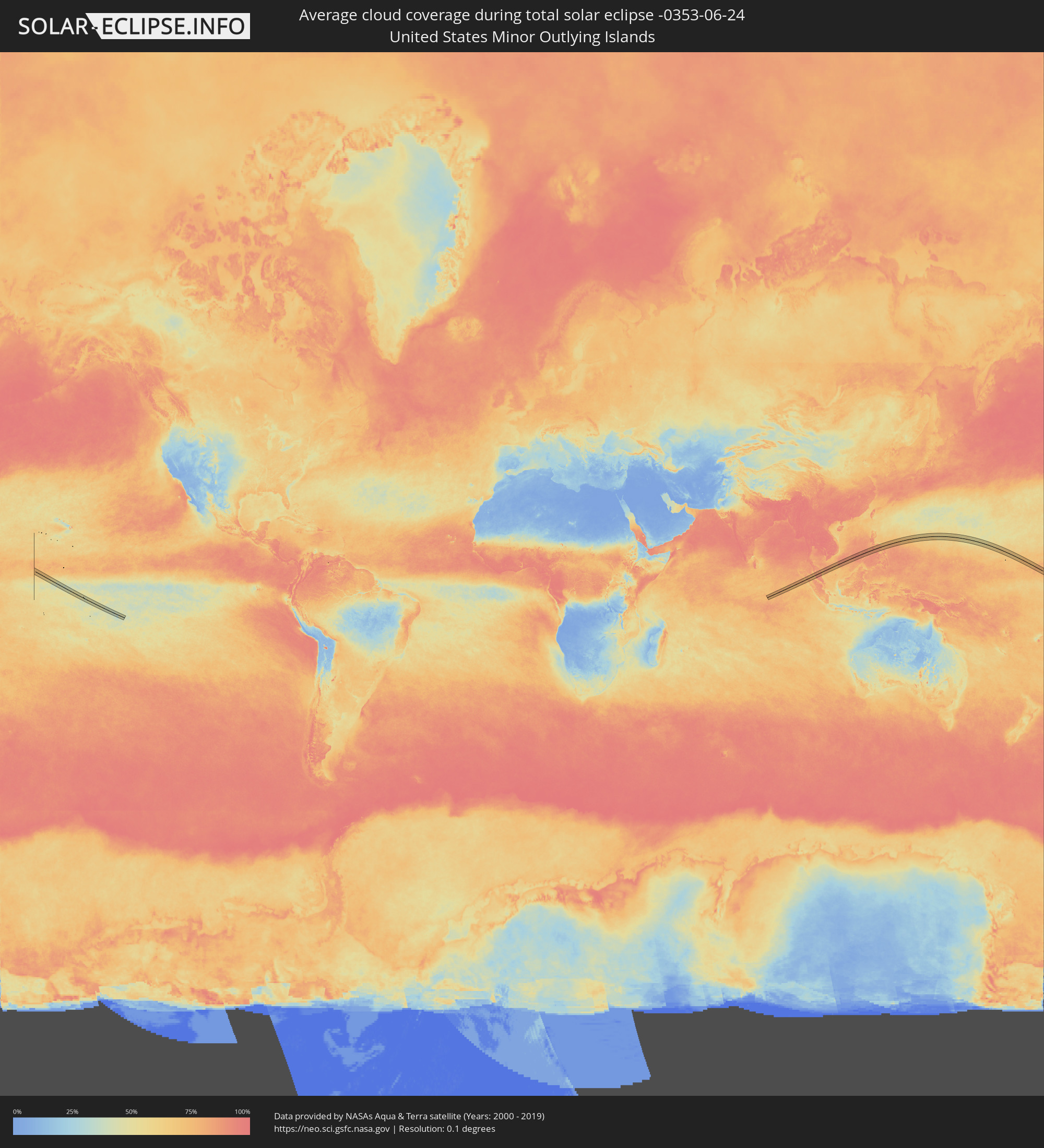
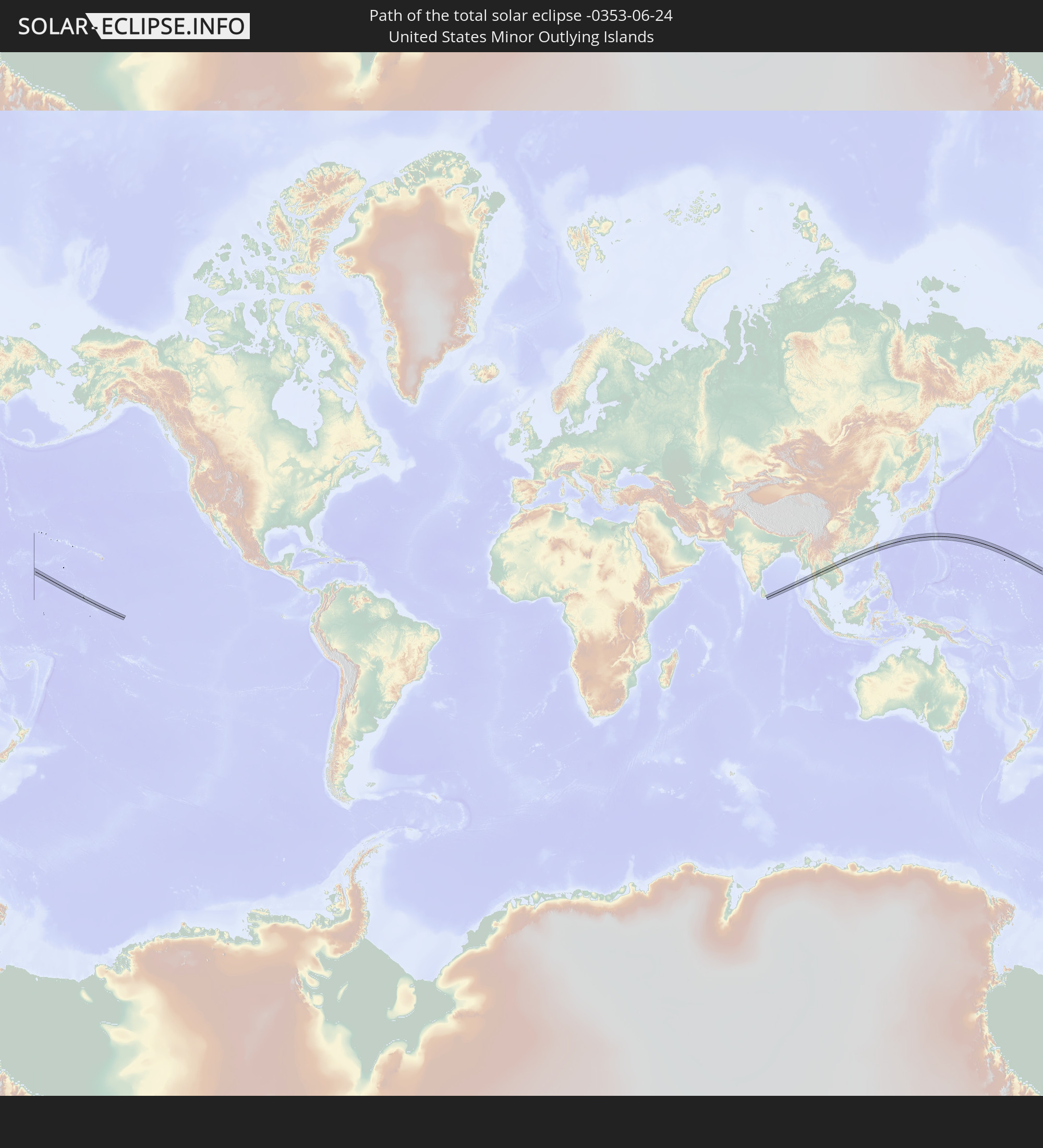 United States Minor Outlying Islands
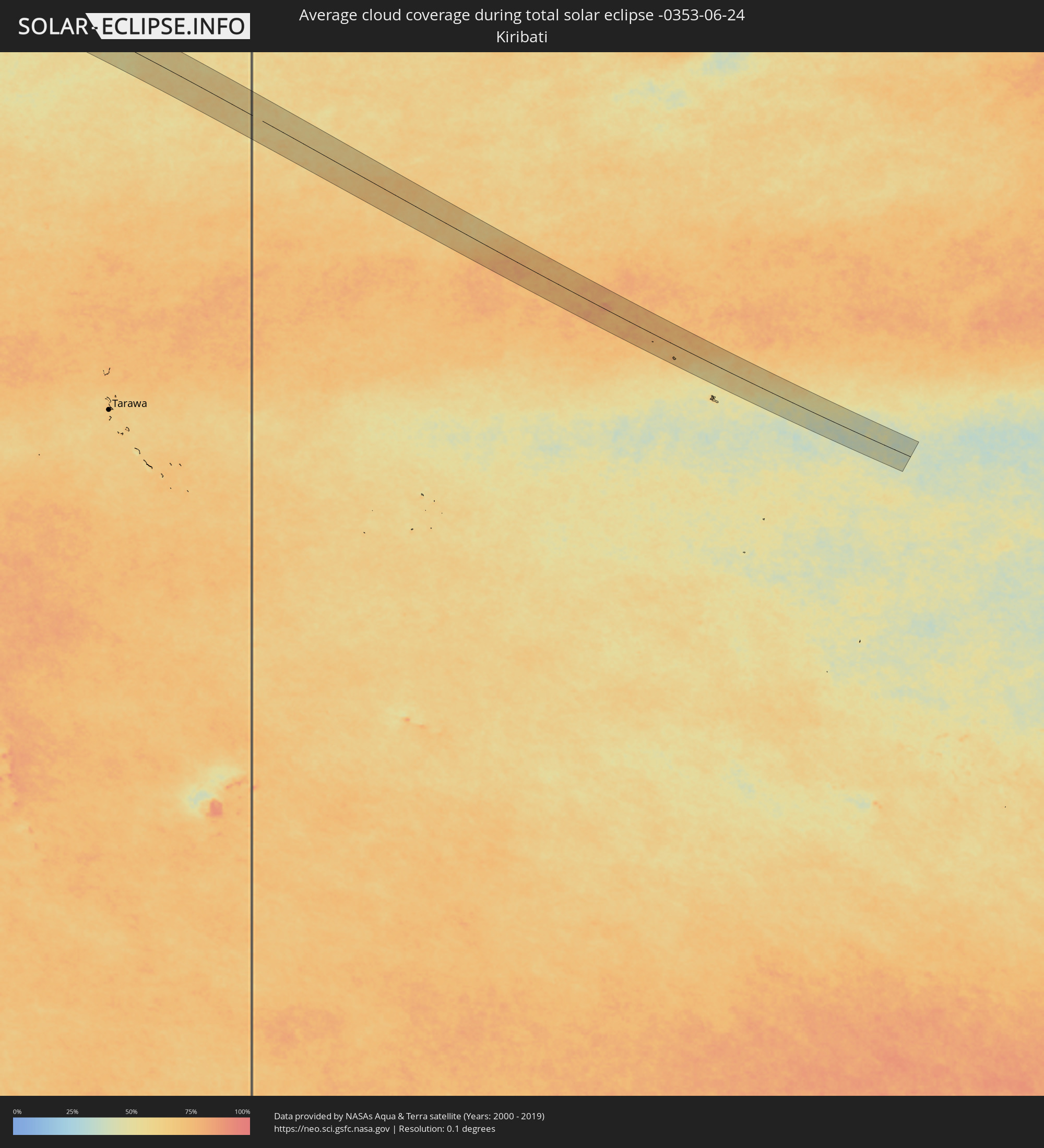
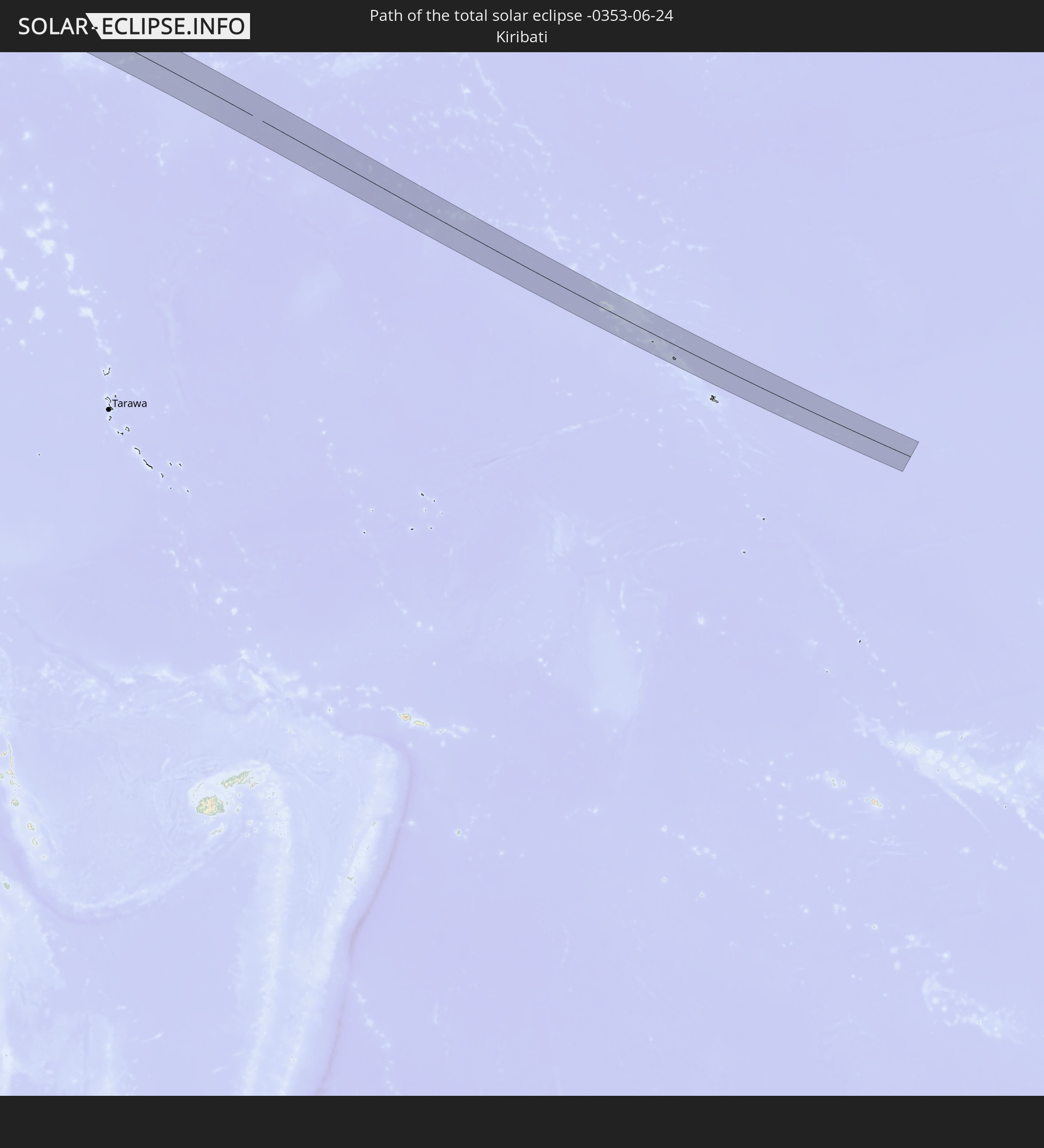 Kiribati
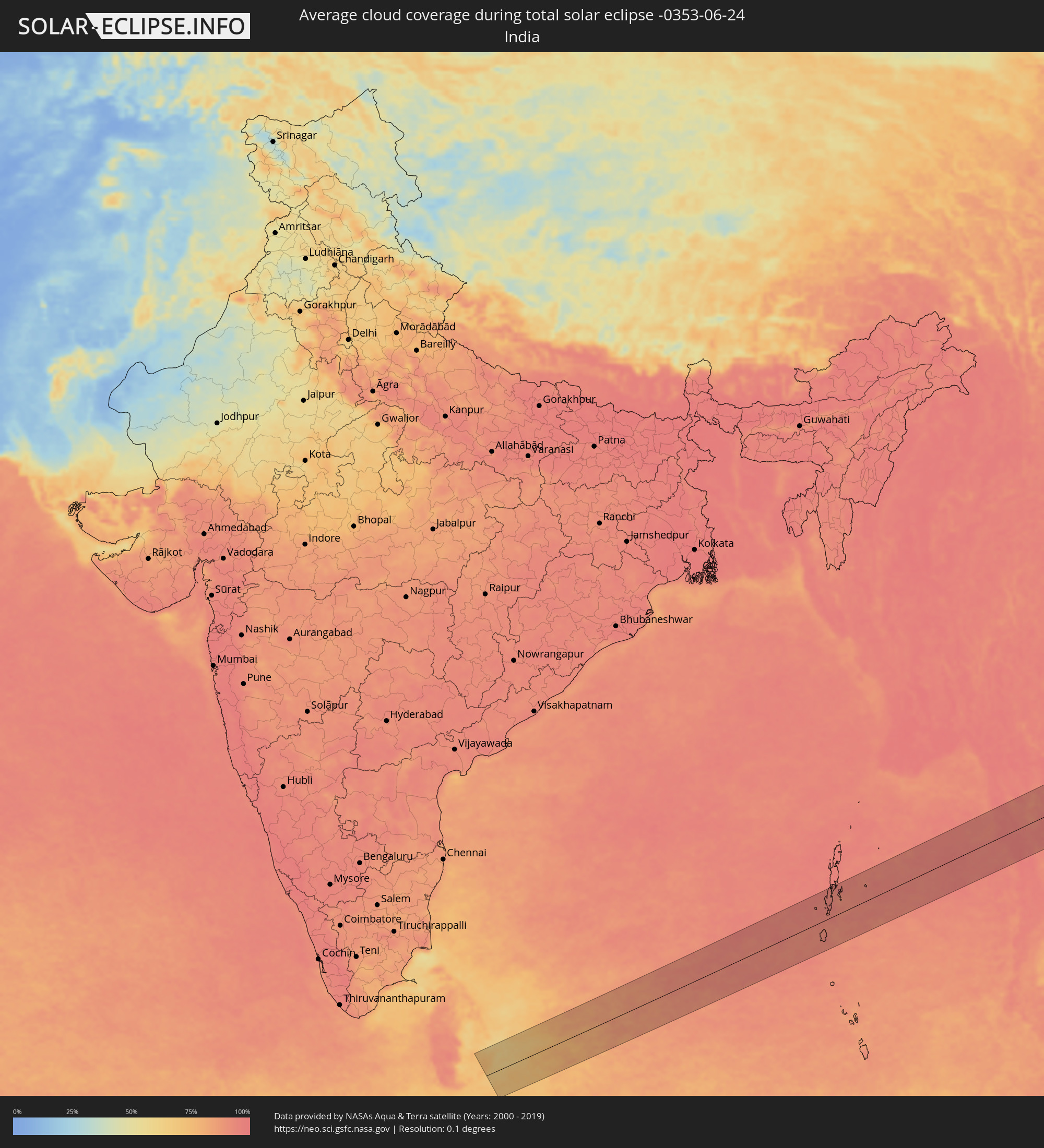
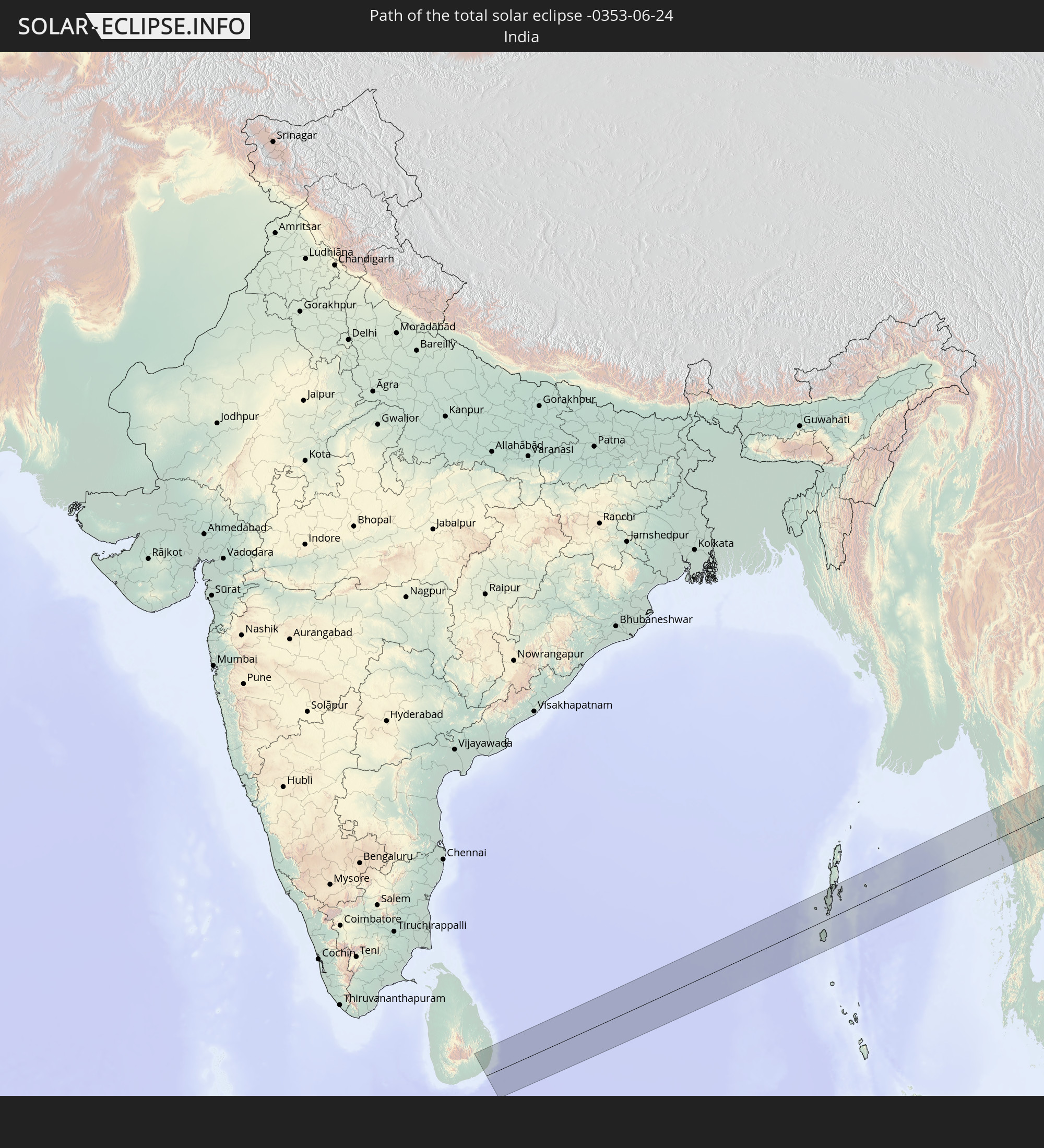 India
India
 China
China
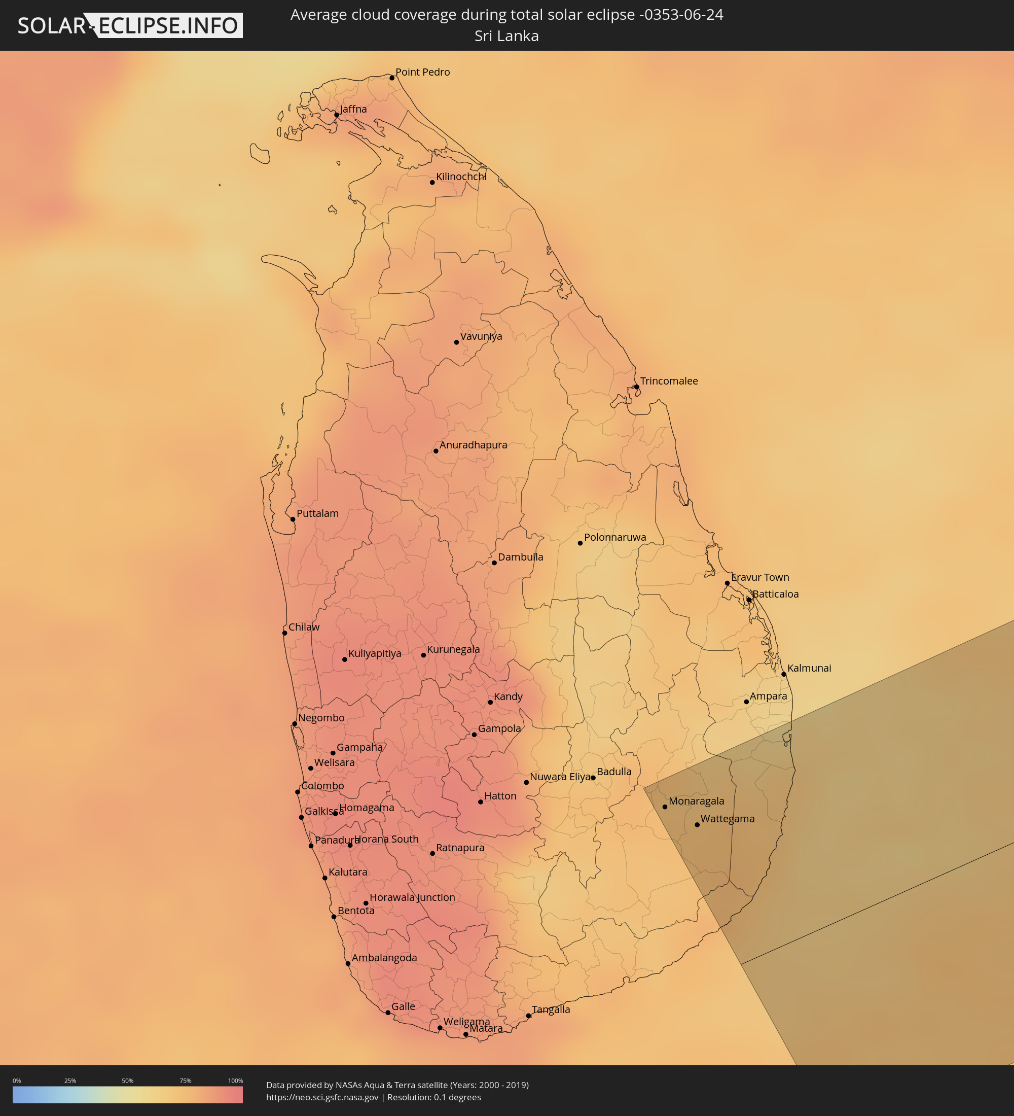
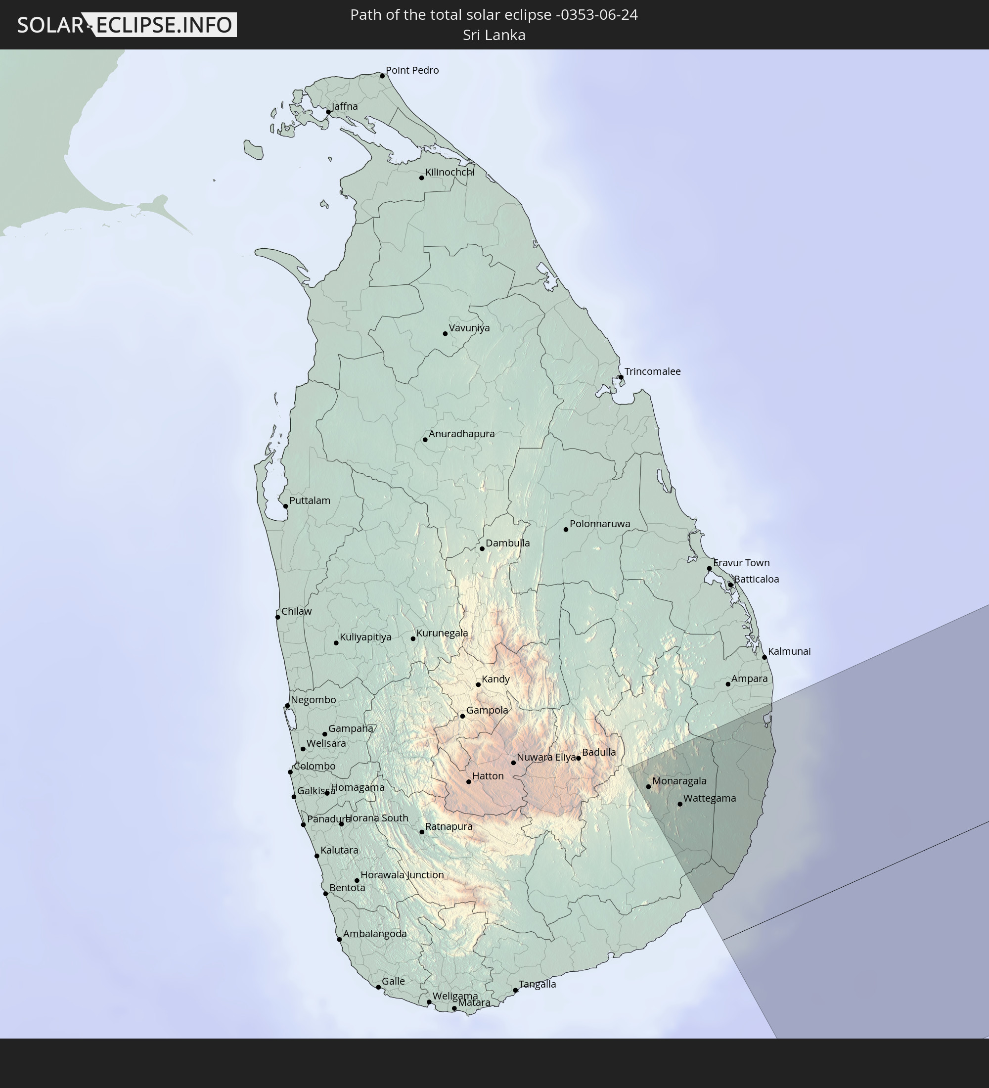 Sri Lanka
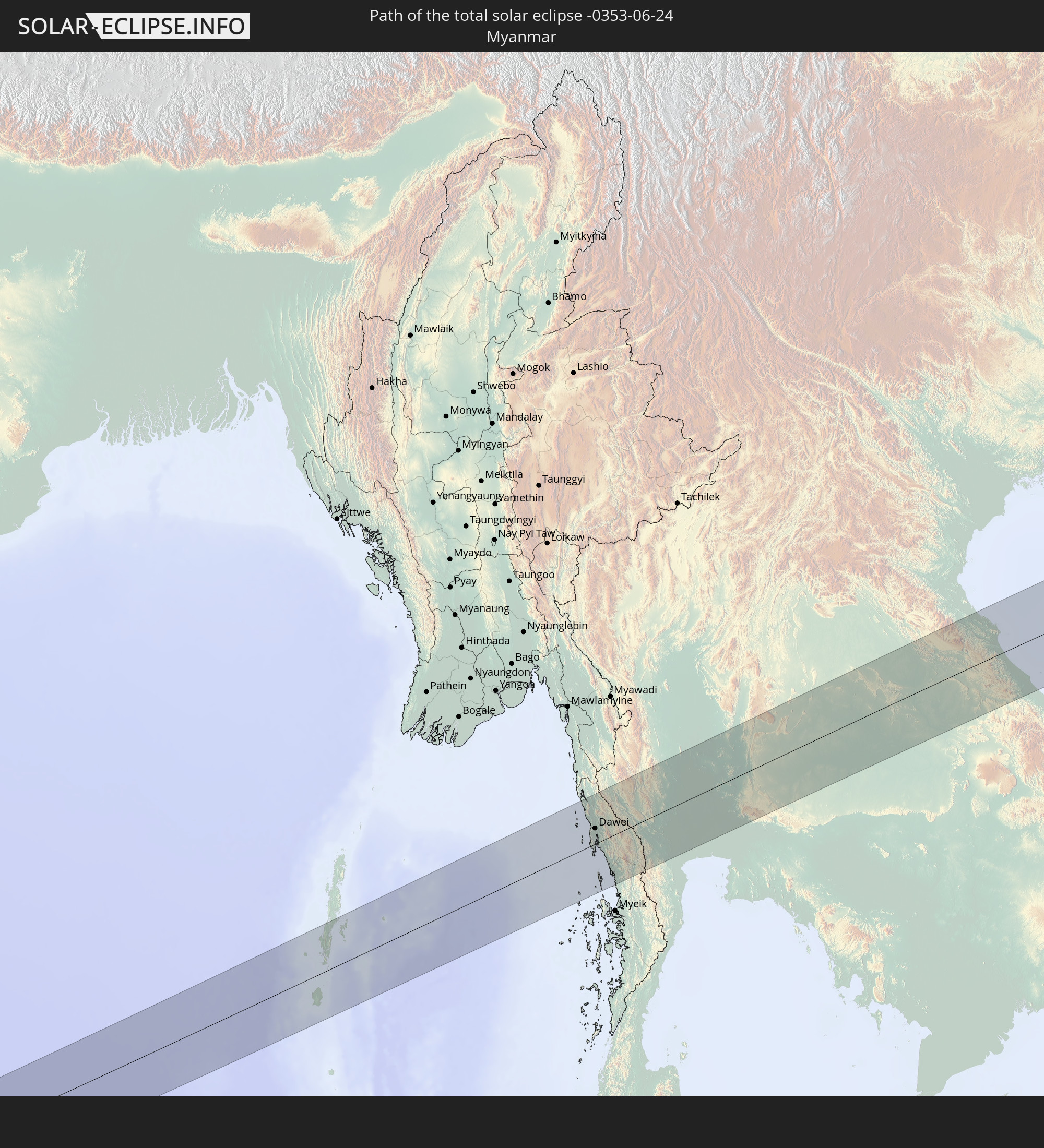 Myanmar
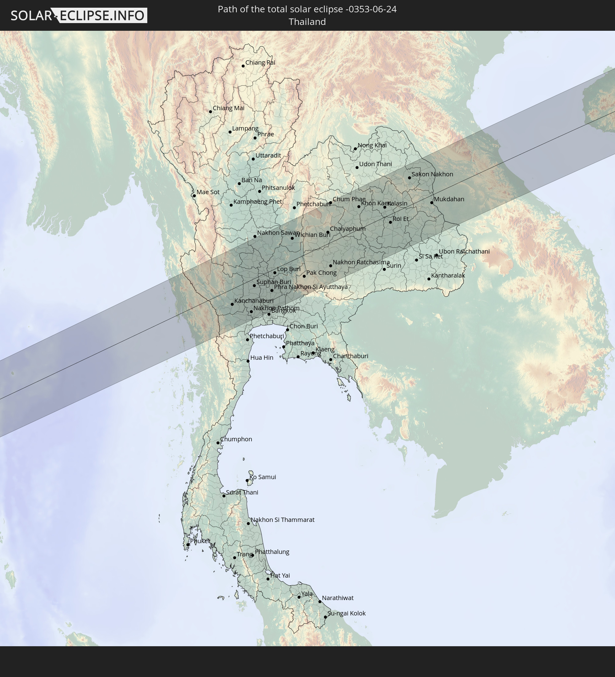 Thailand
 Laos
Laos
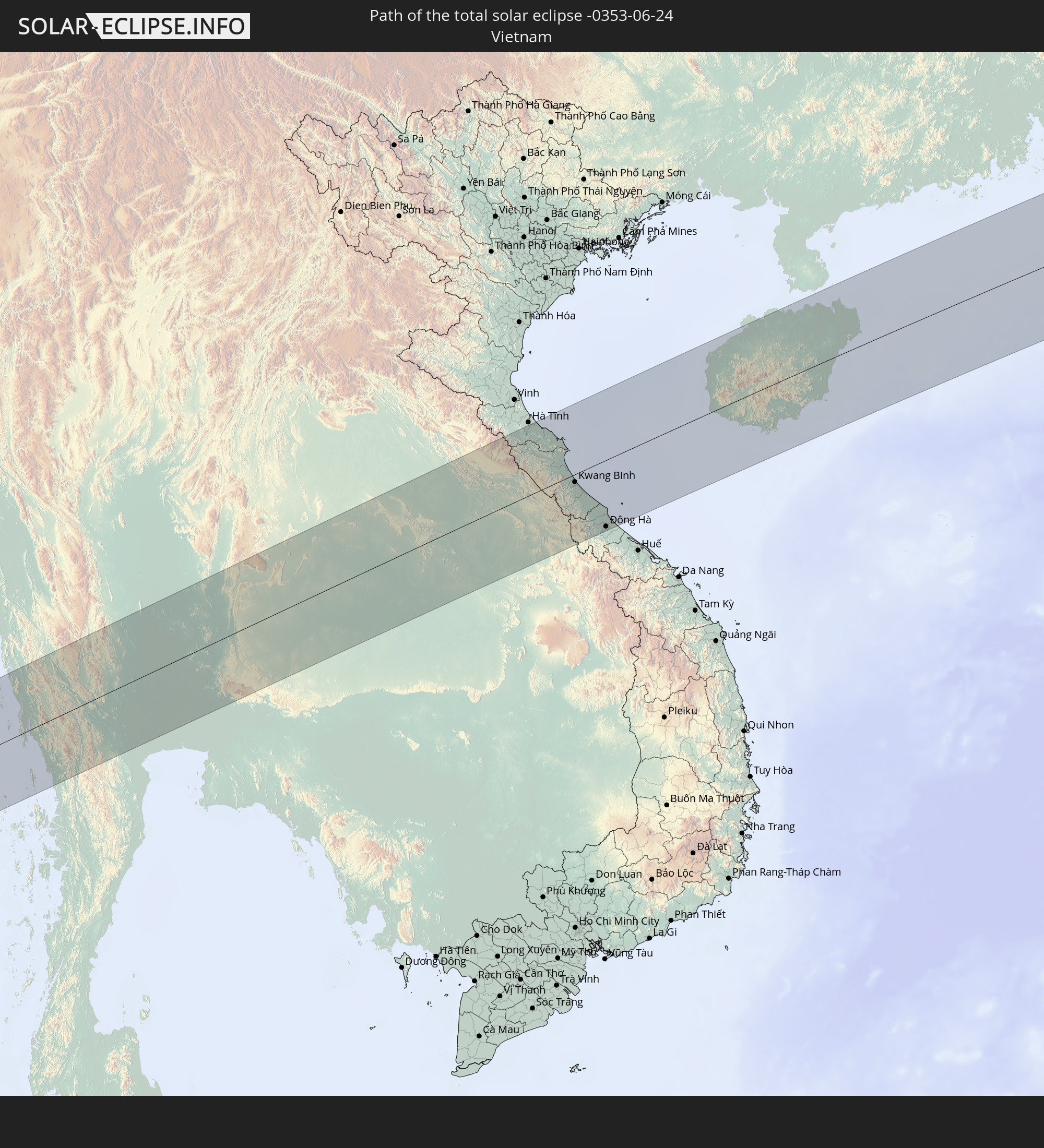 Vietnam
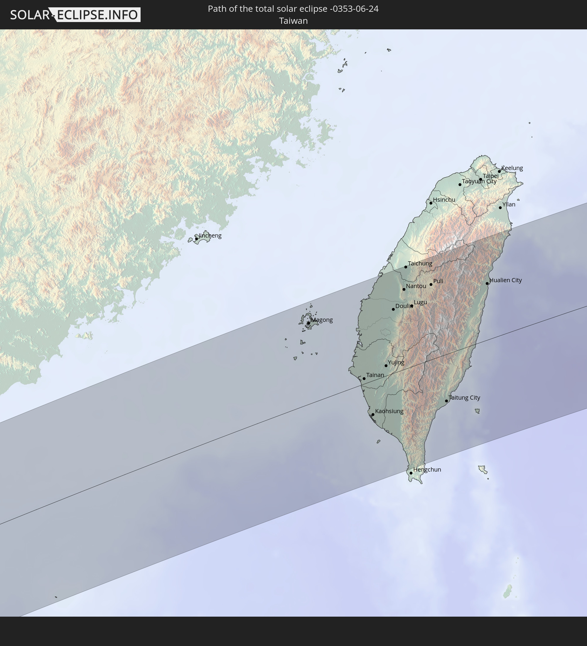 Taiwan
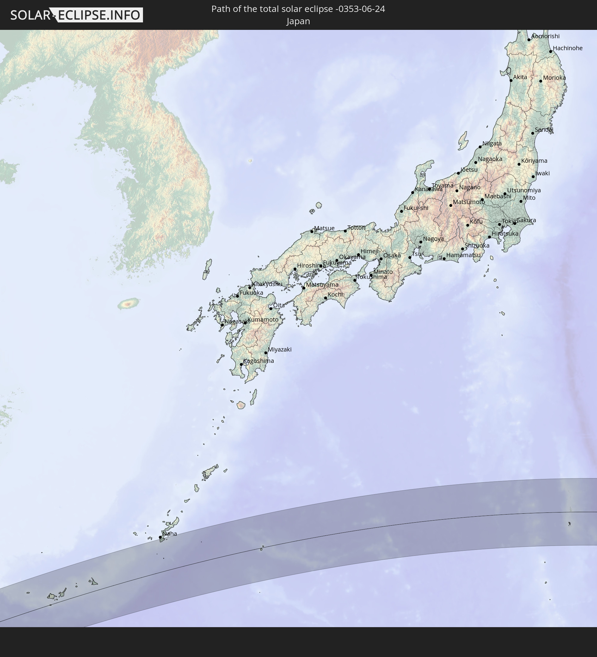 Japan
Japan
In den folgenden Ländern ist die Sonnenfinsternis partiell zu sehen
 Fiji
Fiji
 Russia
 United States
 United States Minor Outlying Islands
 Wallis and Futuna
 Tonga
Tonga
 Kiribati
 Samoa
Samoa
 Tokelau
 American Samoa
 Niue
Niue
 Cook Islands
 Iran
Iran
 Kazakhstan
 Turkmenistan
 Uzbekistan
 Afghanistan
 Pakistan
 Tajikistan
 India
India
 Kyrgyzstan
 China
China
 Sri Lanka
 Nepal
Nepal
 Mongolia
 Bangladesh
 Bhutan
 Myanmar
 Indonesia
 Cocos Islands
 Thailand
 Malaysia
 Laos
Laos
 Vietnam
 Cambodia
 Singapore
 Christmas Island
 Macau
Macau
 Hong Kong
 Brunei
 Taiwan
 Philippines
 Japan
Japan
 East Timor
 North Korea
 South Korea
 Palau
Palau
 Federated States of Micronesia
 Papua New Guinea
 Guam
Guam
 Northern Mariana Islands
 Solomon Islands
 Marshall Islands
 Nauru
Nauru
 Tuvalu
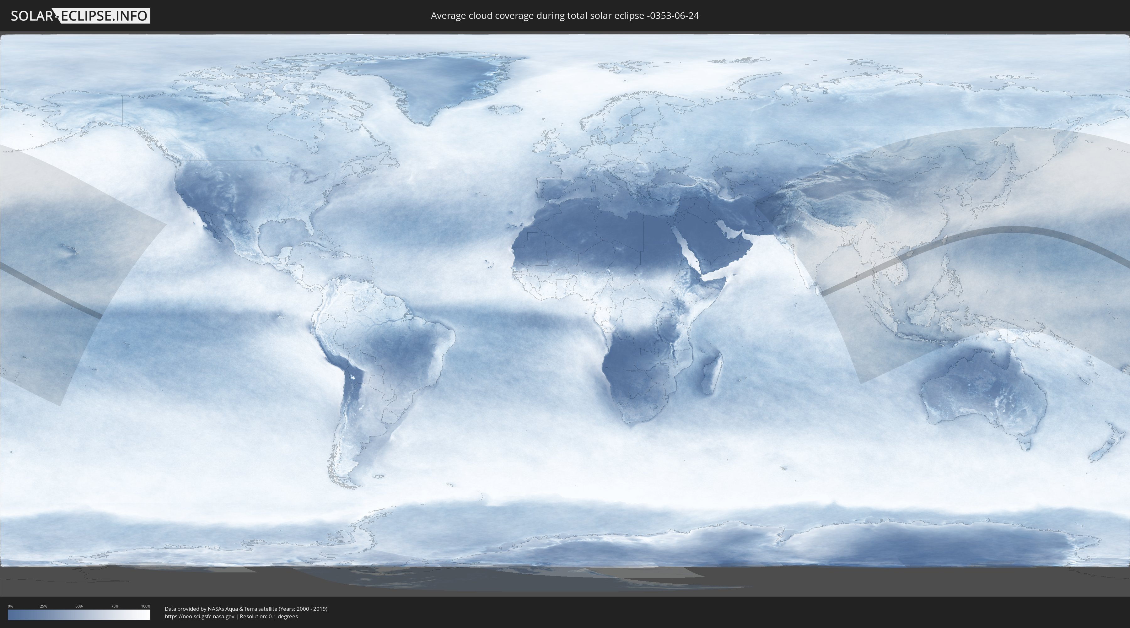
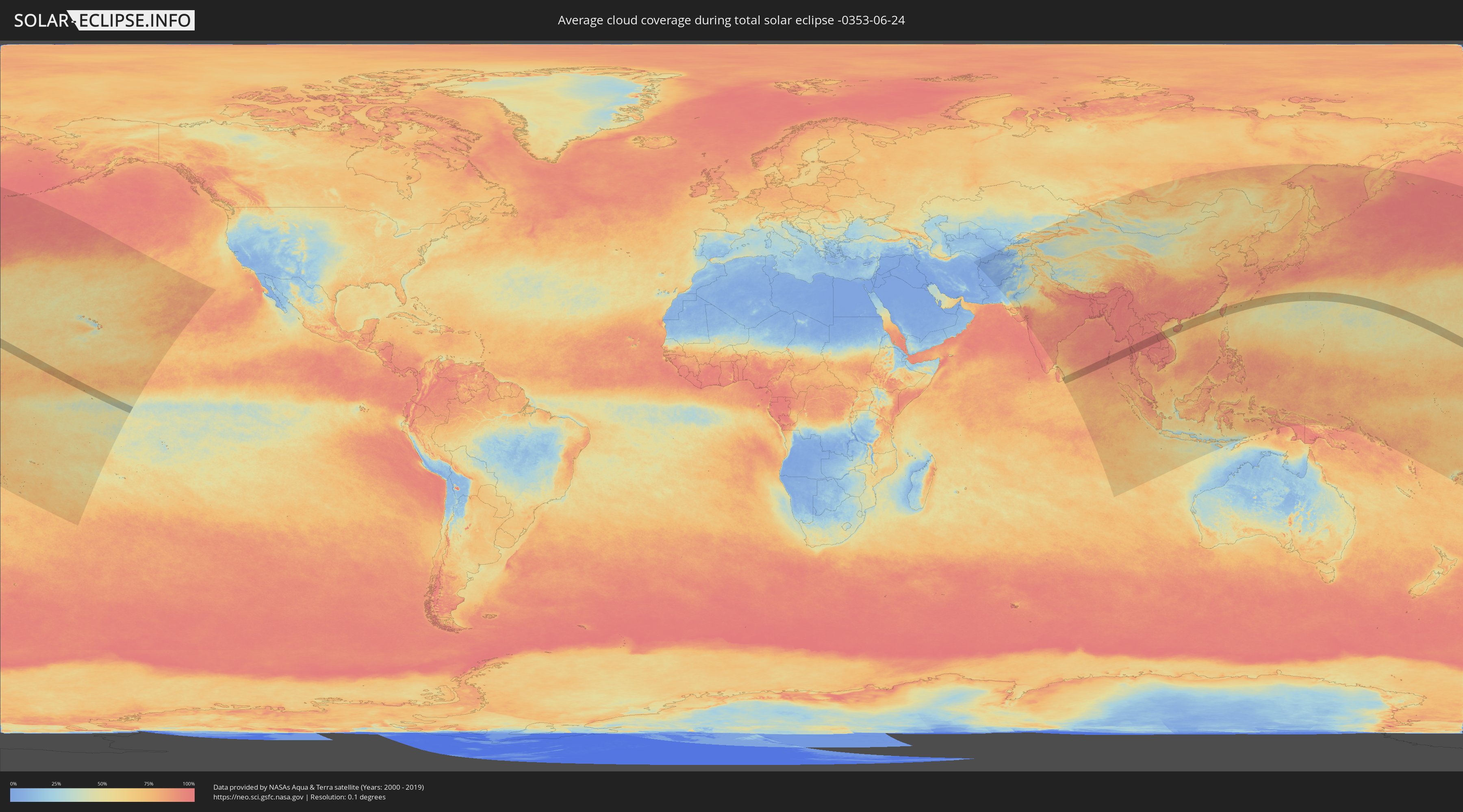
How will be the weather during the total solar eclipse on 06/24/-0353?
Where is the best place to see the total solar eclipse of 06/24/-0353?
The following maps show the average cloud coverage for the day of the total solar eclipse.
With the help of these maps, it is possible to find the place along the eclipse path, which has the best
chance of a cloudless sky.
Nevertheless, you should consider local circumstances and inform about the weather of your chosen
observation site.
The data is provided by NASAs satellites
AQUA and TERRA.
The cloud maps are averaged over a period of 19 years (2000 - 2019).
Detailed country maps
 United States Minor Outlying Islands
 Kiribati
 India
India
 China
China
 Sri Lanka
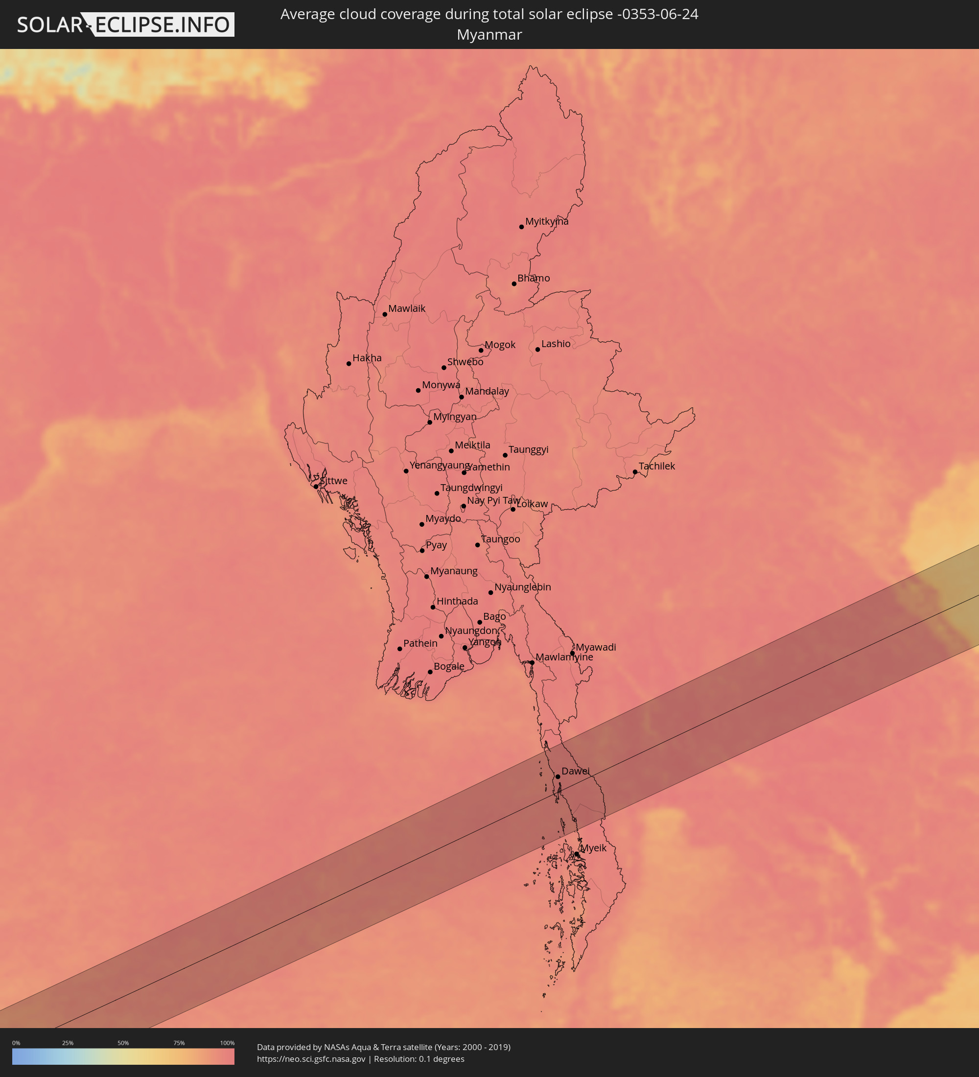 Myanmar
 Thailand
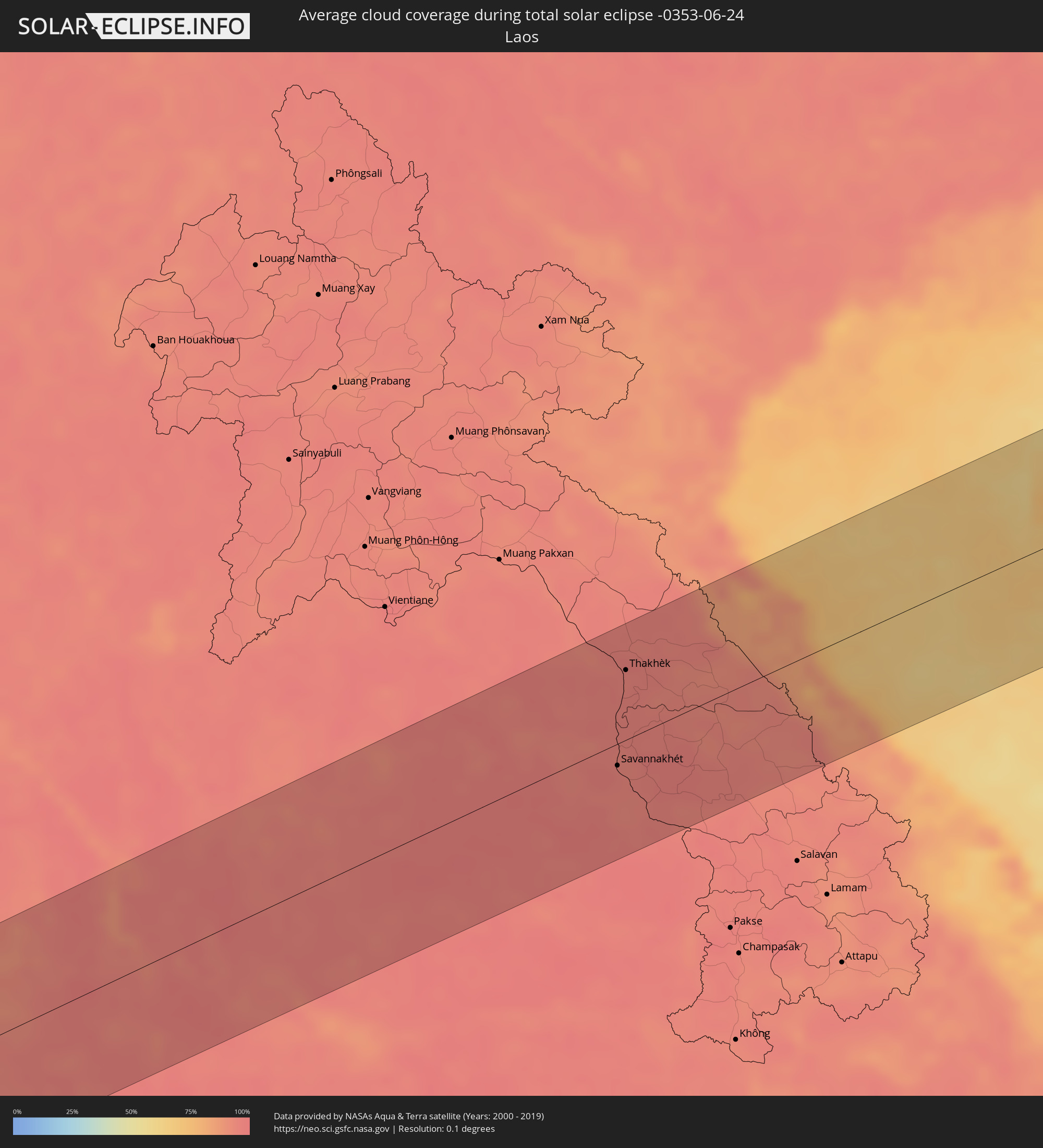 Laos
Laos
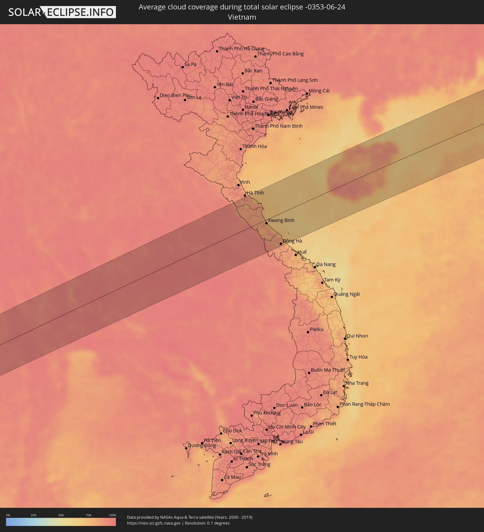 Vietnam
 Taiwan
 Japan
Japan
Cities inside the path of the eclipse
The following table shows all locations with a population of more than 5,000 inside the eclipse path. Cities which have more than 100,000 inhabitants are marked bold. A click at the locations opens a detailed map.
| City | Type | Eclipse duration | Local time of max. eclipse | Distance to central line | Ø Cloud coverage |
|
Monaragala, Uva
|
total | - | 05:37:59 UTC+05:19 | 79 km | 73% |
|
Wattegama, Uva
|
total | - | 05:37:56 UTC+05:19 | 65 km | 74% |
|
Bamboo Flat, Andaman and Nicobar Islands
|
total | - | 05:42:05 UTC+05:21 | 45 km | 95% |
|
Port Blair, Andaman and Nicobar Islands
|
total | - | 05:42:04 UTC+05:21 | 40 km | 95% |
|
Dawei, Tanintharyi
|
total | - | 06:48:56 UTC+06:24 | 31 km | 97% |
|
Kanchanaburi, Kanchanaburi
|
total | - | 07:06:47 UTC+06:42 | 40 km | 95% |
|
Tha Maka, Kanchanaburi
|
total | - | 07:06:49 UTC+06:42 | 60 km | 95% |
|
Ratchaburi, Ratchaburi
|
total | - | 07:06:36 UTC+06:42 | 99 km | 96% |
|
Ban Pong, Ratchaburi
|
total | - | 07:06:49 UTC+06:42 | 74 km | 94% |
|
Nakhon Pathom, Nakhon Pathom
|
total | - | 07:06:54 UTC+06:42 | 81 km | 95% |
|
Suphan Buri, Suphan Buri
|
total | - | 07:07:24 UTC+06:42 | 19 km | 96% |
|
Mueang Nonthaburi, Nonthaburi
|
total | - | 07:07:10 UTC+06:42 | 99 km | 96% |
|
Phra Nakhon Si Ayutthaya, Phra Nakhon Si Ayutthaya
|
total | - | 07:07:33 UTC+06:42 | 52 km | 97% |
|
Khlong Luang, Pathum Thani
|
total | - | 07:07:23 UTC+06:42 | 84 km | 96% |
|
Lop Buri, Lop Buri
|
total | - | 07:07:54 UTC+06:42 | 11 km | 97% |
|
Ban Lam Luk Ka, Pathum Thani
|
total | - | 07:07:24 UTC+06:42 | 99 km | 95% |
|
Phra Phutthabat, Sara Buri
|
total | - | 07:07:56 UTC+06:42 | 25 km | 97% |
|
Nong Khae, Sara Buri
|
total | - | 07:07:42 UTC+06:42 | 67 km | 97% |
|
Saraburi, Sara Buri
|
total | - | 07:07:52 UTC+06:42 | 50 km | 98% |
|
Pak Chong, Nakhon Ratchasima
|
total | - | 07:08:16 UTC+06:42 | 55 km | 95% |
|
Chaiyaphum, Chaiyaphum
|
total | - | 07:09:26 UTC+06:42 | 28 km | 95% |
|
Chum Phae, Khon Kaen
|
total | - | 07:10:02 UTC+06:42 | 99 km | 95% |
|
Nakhon Ratchasima, Nakhon Ratchasima
|
total | - | 07:08:51 UTC+06:42 | 60 km | 96% |
|
Khon Kaen, Khon Kaen
|
total | - | 07:10:25 UTC+06:42 | 55 km | 96% |
|
Maha Sarakham, Maha Sarakham
|
total | - | 07:10:31 UTC+06:42 | 8 km | 97% |
|
Kalasin, Kalasin
|
total | - | 07:10:51 UTC+06:42 | 23 km | 97% |
|
Sakon Nakhon, Sakon Nakhon
|
total | - | 07:11:52 UTC+06:42 | 68 km | 97% |
|
Mukdahan, Mukdahan
|
total | - | 07:11:47 UTC+06:42 | 20 km | 95% |
|
Savannakhét, Savannahkhét
|
total | - | 07:11:50 UTC+06:42 | 19 km | 94% |
|
Thakhèk, Khammouan
|
total | - | 07:12:33 UTC+06:42 | 62 km | 95% |
|
Kwang Binh, Quảng Bình
|
total | - | 07:38:36 UTC+07:06 | 12 km | 87% |
|
Ðông Hà, Quảng Trị
|
total | - | 07:38:29 UTC+07:06 | 99 km | 85% |
|
Sanya, Hainan
|
total | - | 08:35:11 UTC+08:00 | 59 km | 72% |
|
Lincheng, Hainan
|
total | - | 08:36:48 UTC+08:00 | 102 km | 90% |
|
Jinjiang, Hainan
|
total | - | 08:36:57 UTC+08:00 | 70 km | 83% |
|
Xiuying, Hainan
|
total | - | 08:37:29 UTC+08:00 | 86 km | 90% |
|
Haikou, Hainan
|
total | - | 08:37:34 UTC+08:00 | 88 km | 90% |
|
Qiongshan, Hainan
|
total | - | 08:37:33 UTC+08:00 | 84 km | 87% |
|
Wanning, Hainan
|
total | - | 08:36:32 UTC+08:00 | 41 km | 85% |
|
Magong, Taiwan
|
total | - | 08:52:37 UTC+08:00 | 87 km | 71% |
|
Tainan, Taiwan
|
total | - | 08:53:06 UTC+08:00 | 5 km | 79% |
|
Kaohsiung, Takao
|
total | - | 08:52:56 UTC+08:00 | 37 km | 73% |
|
Yujing, Taiwan
|
total | - | 08:53:37 UTC+08:00 | 11 km | 83% |
|
Douliu, Taiwan
|
total | - | 08:54:16 UTC+08:00 | 69 km | 91% |
|
Nantou, Taiwan
|
total | - | 08:54:38 UTC+08:00 | 87 km | 91% |
|
Taichung, Taiwan
|
total | - | 08:54:53 UTC+08:00 | 110 km | 92% |
|
Zhongxing New Village, Taiwan
|
total | - | 08:54:43 UTC+08:00 | 90 km | 92% |
|
Lugu, Taiwan
|
total | - | 08:54:38 UTC+08:00 | 66 km | 93% |
|
Puli, Taiwan
|
total | - | 08:55:11 UTC+08:00 | 81 km | 84% |
|
Taitung City, Taiwan
|
total | - | 08:54:25 UTC+08:00 | 51 km | 72% |
|
Hualien City, Taiwan
|
total | - | 08:56:14 UTC+08:00 | 61 km | 76% |
|
Ishigaki, Okinawa
|
total | - | 10:01:01 UTC+09:00 | 18 km | 68% |
|
Hirara, Okinawa
|
total | - | 10:03:31 UTC+09:00 | 33 km | 71% |
|
Itoman, Okinawa
|
total | - | 10:09:10 UTC+09:00 | 109 km | 72% |