Total solar eclipse of 03/05/-0682
| Day of week: | Thursday |
| Maximum duration of eclipse: | 03m23s |
| Maximum width of eclipse path: | 121 km |
| Saros cycle: | 48 |
| Coverage: | 100% |
| Magnitude: | 1.0356 |
| Gamma: | -0.1429 |
Wo kann man die Sonnenfinsternis vom 03/05/-0682 sehen?
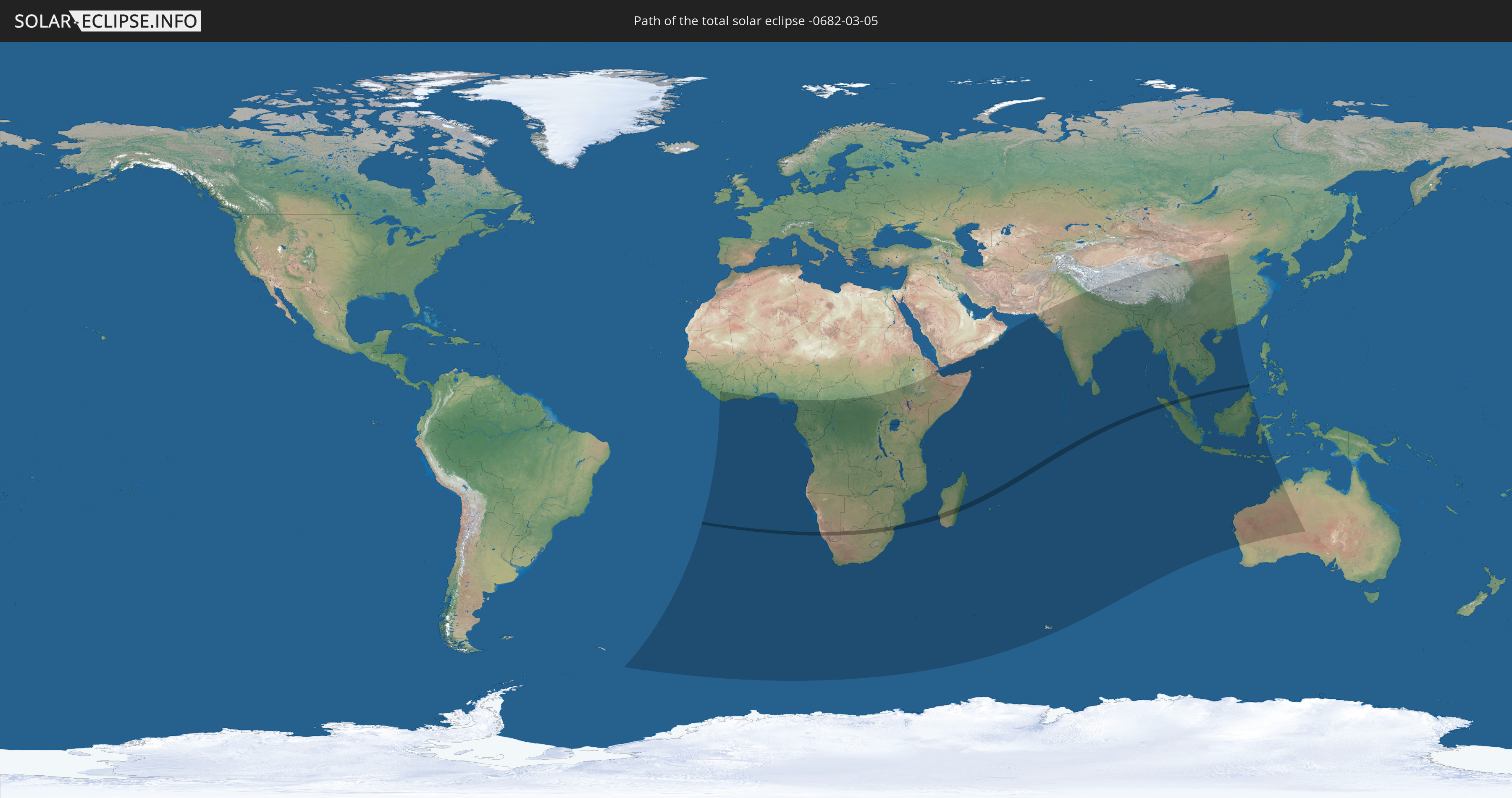
Die Sonnenfinsternis am 03/05/-0682 kann man in 65 Ländern als partielle Sonnenfinsternis beobachten.
Der Finsternispfad verläuft durch 10 Länder. Nur in diesen Ländern ist sie als total Sonnenfinsternis zu sehen.
In den folgenden Ländern ist die Sonnenfinsternis total zu sehen
 Namibia
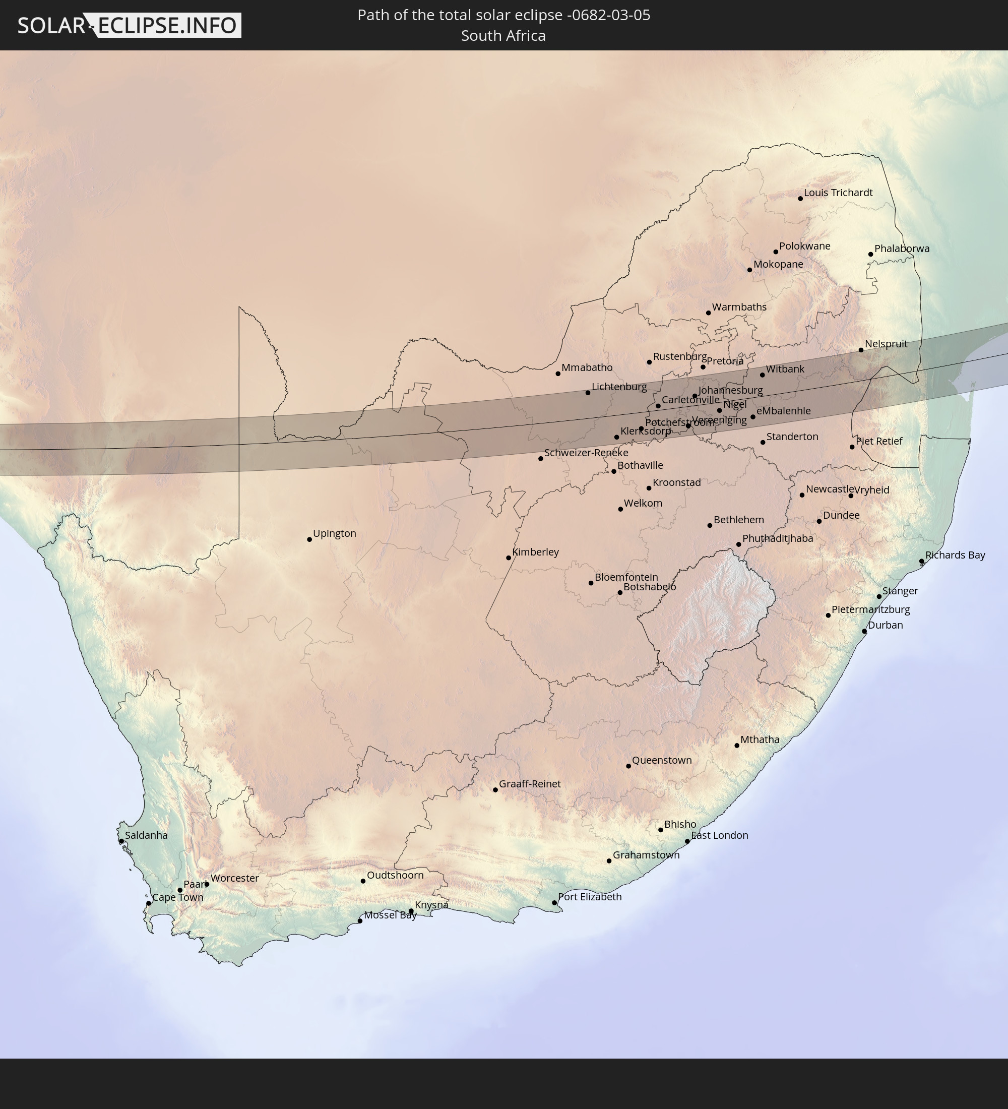 South Africa
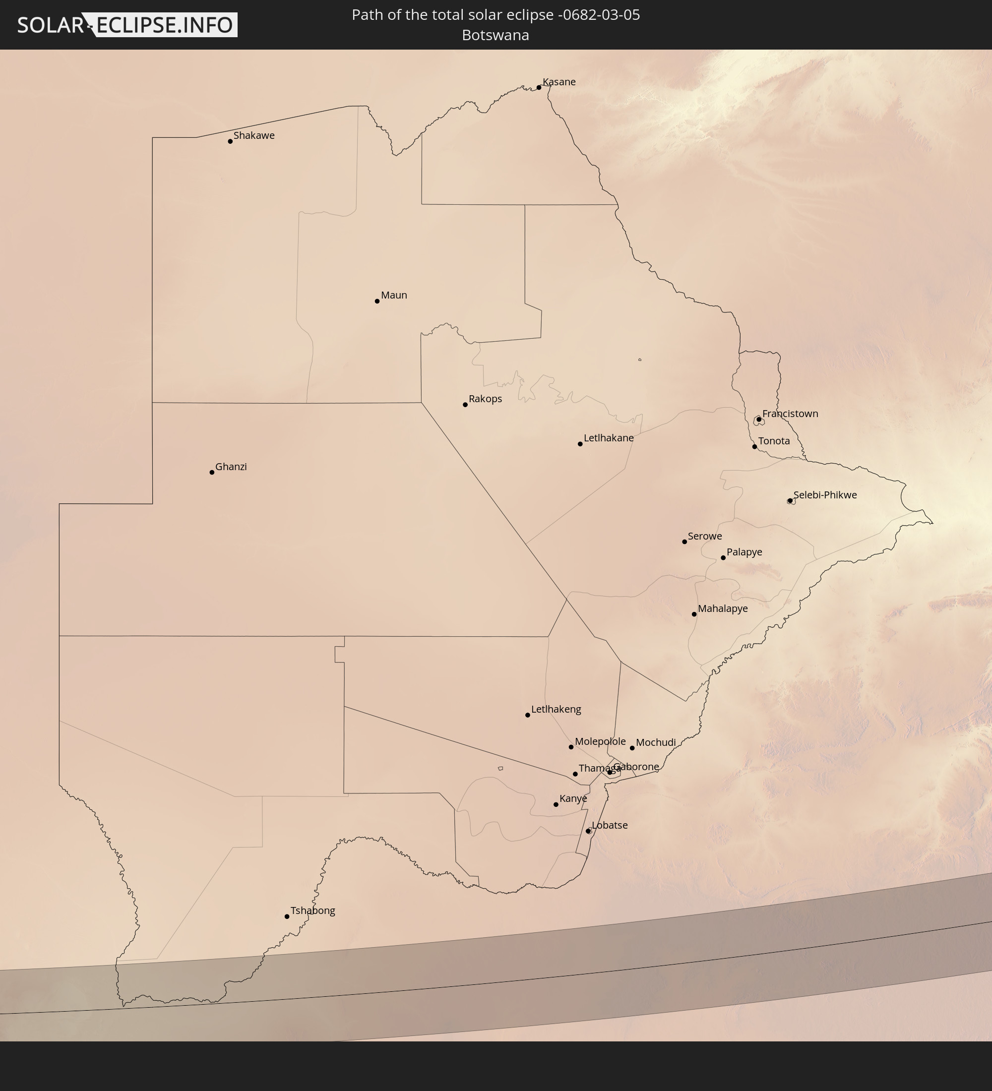 Botswana
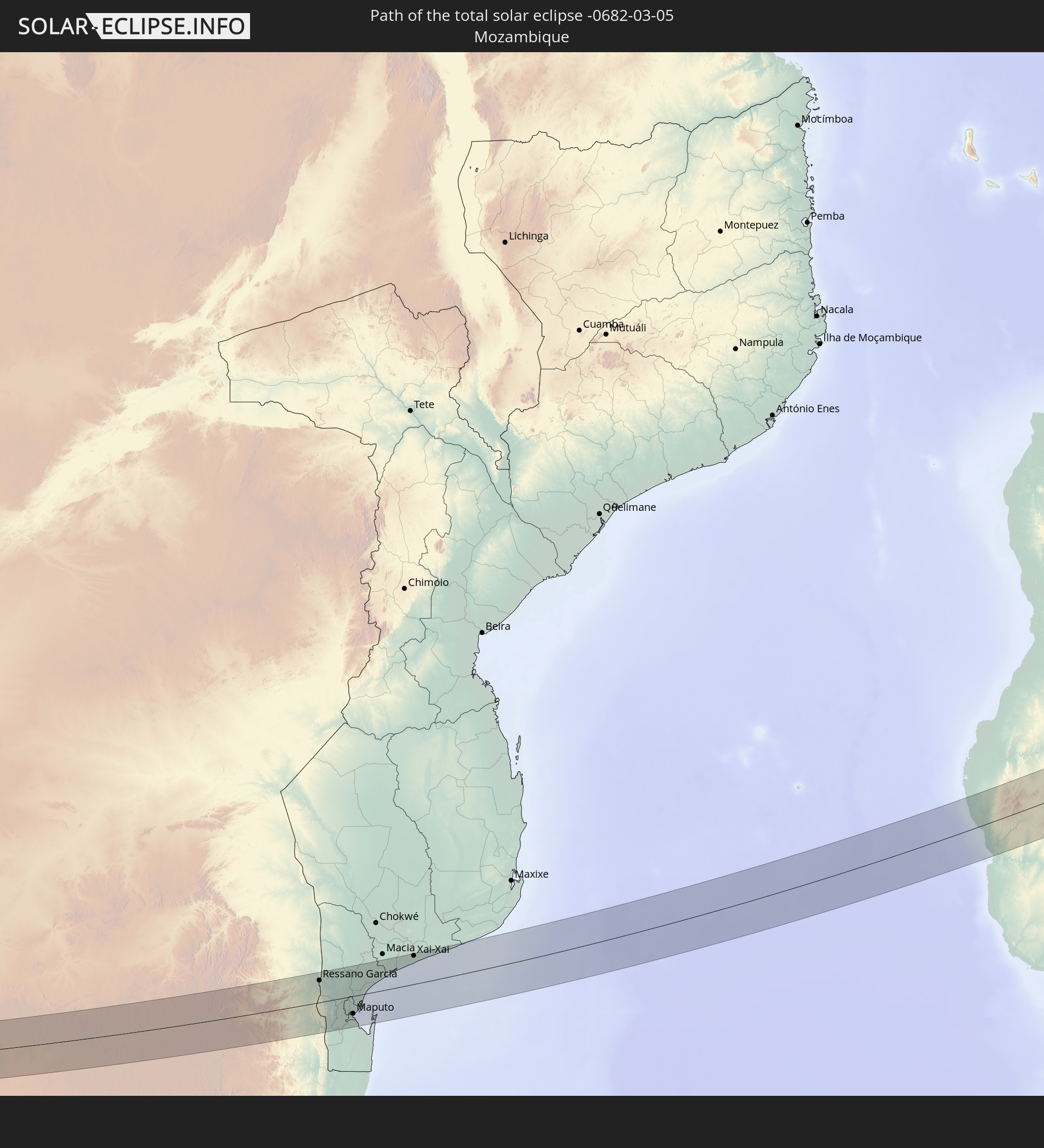 Mozambique
 Swaziland
 Madagascar
 British Indian Ocean Territory
 Indonesia
 Malaysia
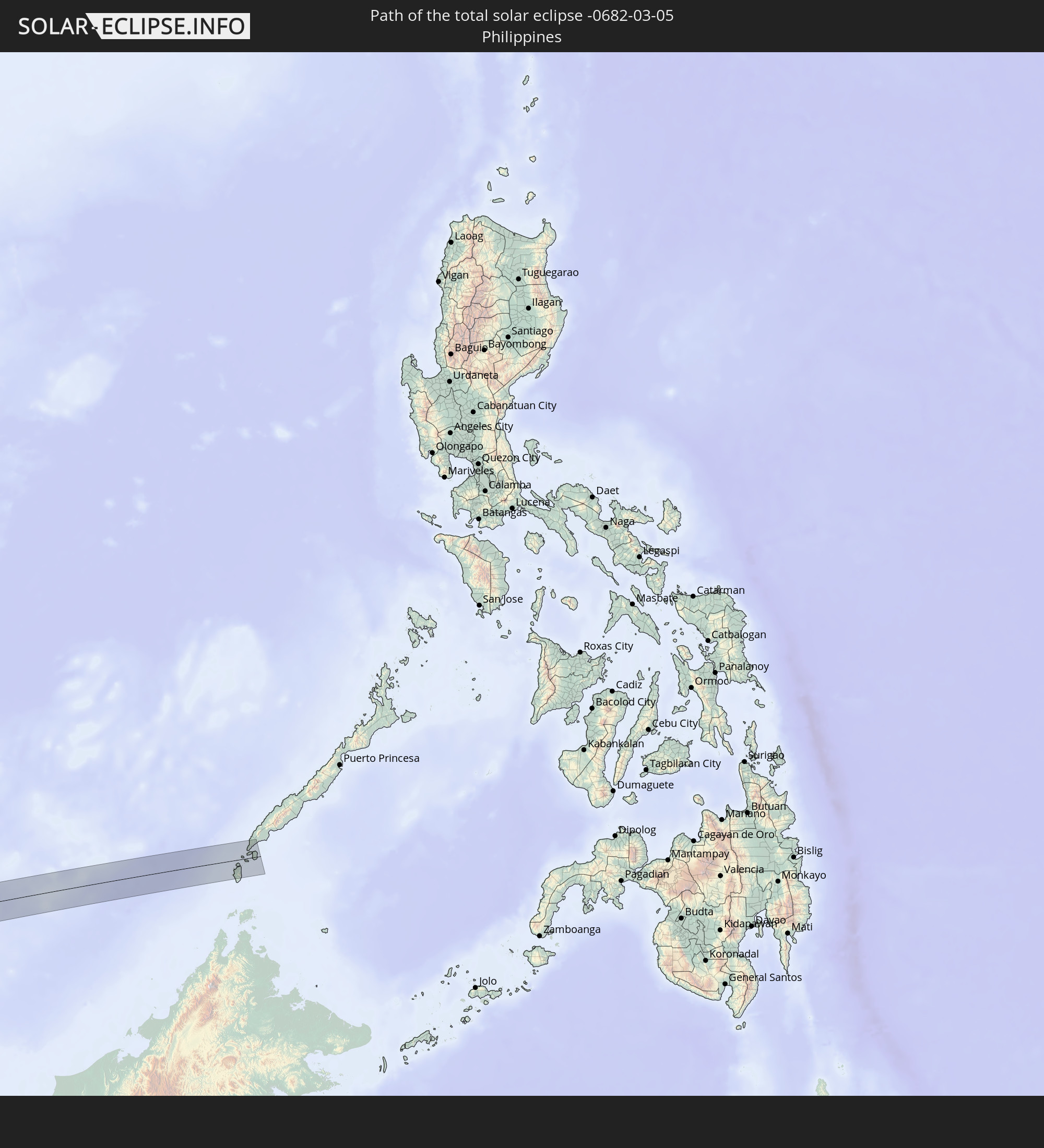 Philippines
In den folgenden Ländern ist die Sonnenfinsternis partiell zu sehen
 South Georgia and the South Sandwich Islands
 Saint Helena, Ascension and Tristan da Cunha
 Liberia
 Ivory Coast
 Ghana
Ghana
 Nigeria
 Bouvet Island
 Equatorial Guinea
 São Tomé and Príncipe
 Cameroon
 Gabon
Gabon
 Republic of the Congo
 Angola
 Namibia
 Democratic Republic of the Congo
 Central African Republic
 South Africa
 Botswana
 Zambia
 Zimbabwe
 Lesotho
 Rwanda
 Burundi
 Tanzania
 Uganda
 Mozambique
 Swaziland
 Malawi
 Ethiopia
 Kenya
Kenya
 French Southern and Antarctic Lands
 Somalia
 Djibouti
 Yemen
Yemen
 Madagascar
 Comoros
 Mayotte
 Seychelles
 Oman
Oman
 Réunion
 Mauritius
 Pakistan
 India
India
 British Indian Ocean Territory
 Maldives
 China
China
 Sri Lanka
 Nepal
Nepal
 Bangladesh
 Bhutan
 Myanmar
 Indonesia
 Cocos Islands
 Thailand
 Malaysia
 Laos
Laos
 Vietnam
 Cambodia
 Singapore
 Christmas Island
 Australia
 Macau
Macau
 Hong Kong
 Brunei
 Philippines
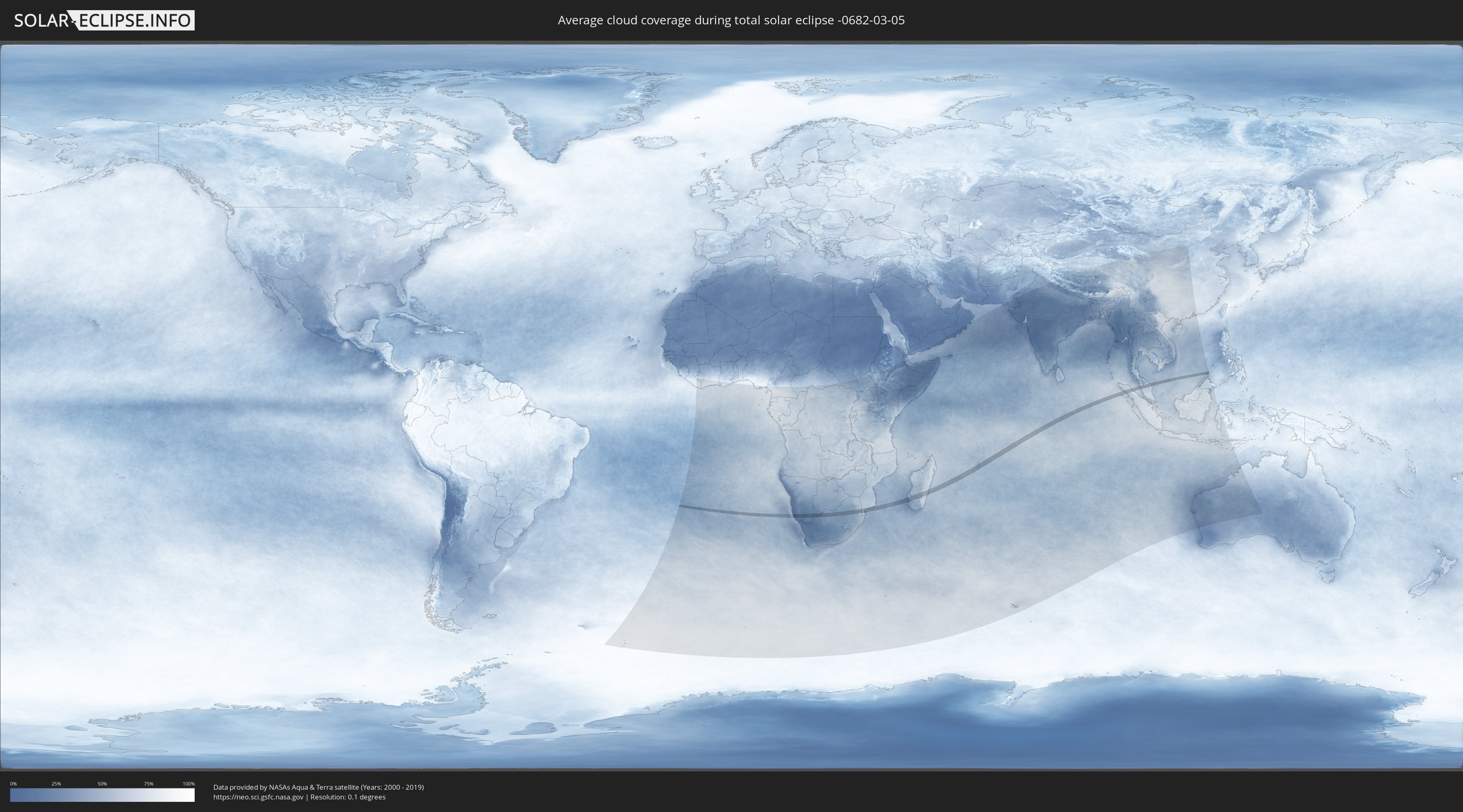
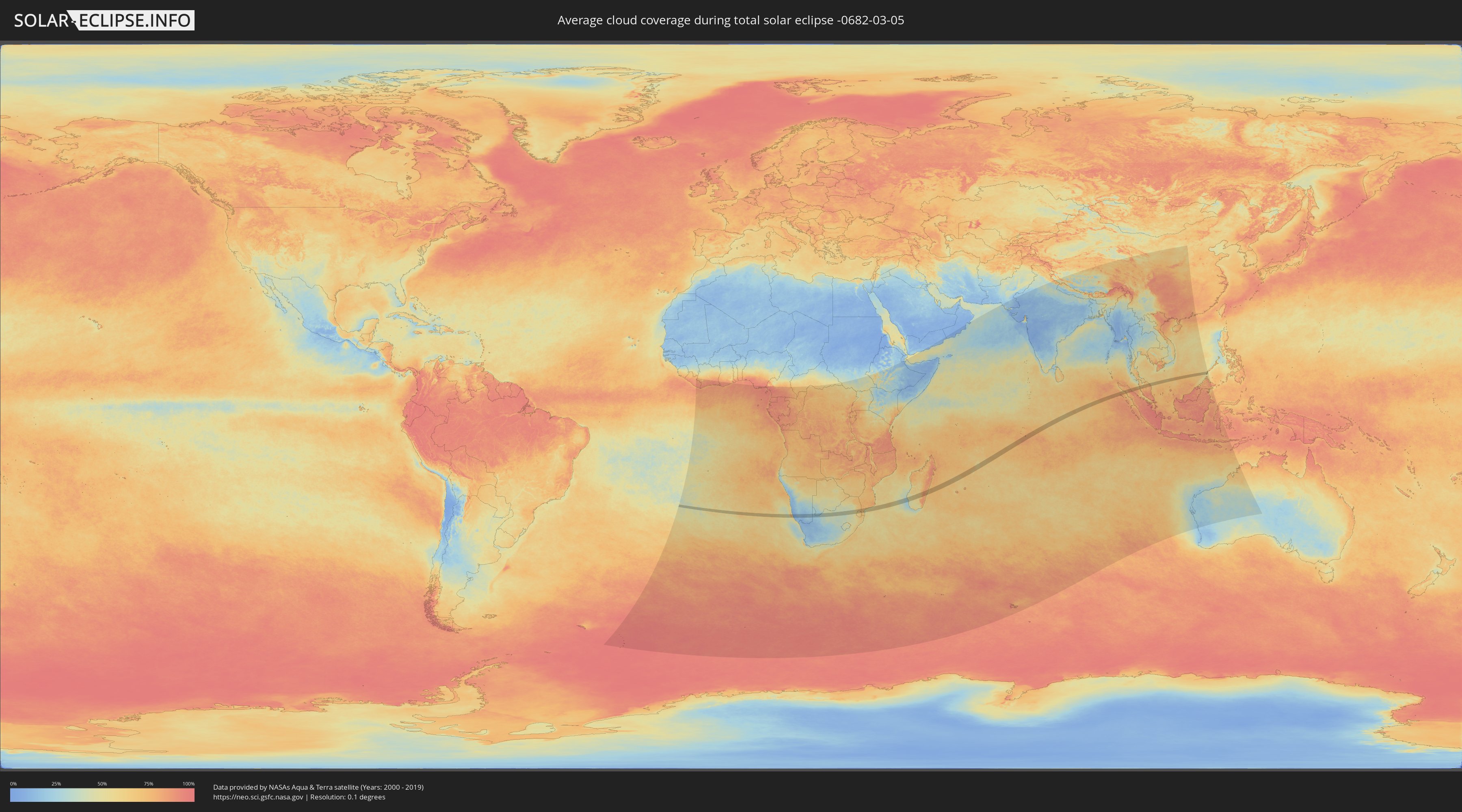
How will be the weather during the total solar eclipse on 03/05/-0682?
Where is the best place to see the total solar eclipse of 03/05/-0682?
The following maps show the average cloud coverage for the day of the total solar eclipse.
With the help of these maps, it is possible to find the place along the eclipse path, which has the best
chance of a cloudless sky.
Nevertheless, you should consider local circumstances and inform about the weather of your chosen
observation site.
The data is provided by NASAs satellites
AQUA and TERRA.
The cloud maps are averaged over a period of 19 years (2000 - 2019).
Detailed country maps
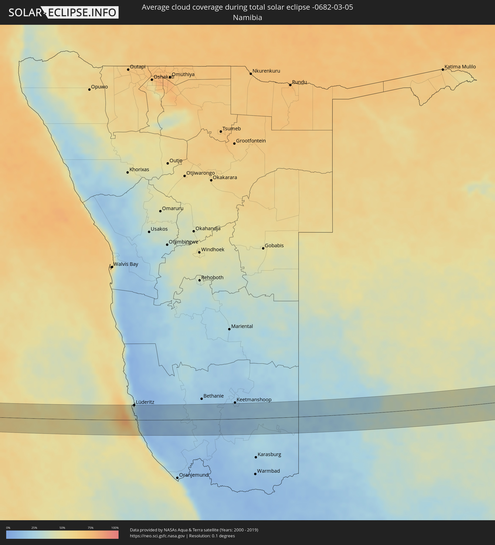 Namibia
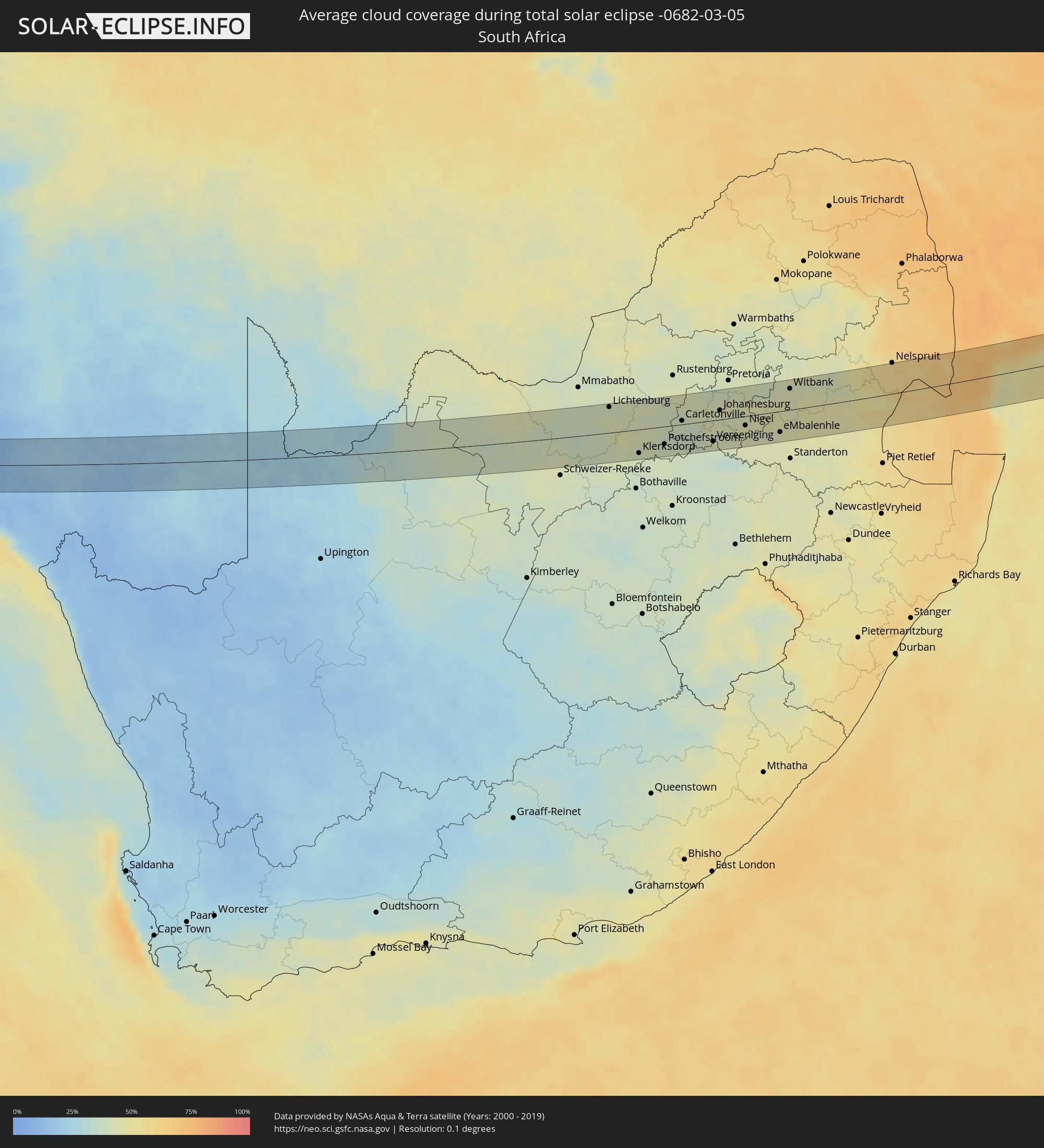 South Africa
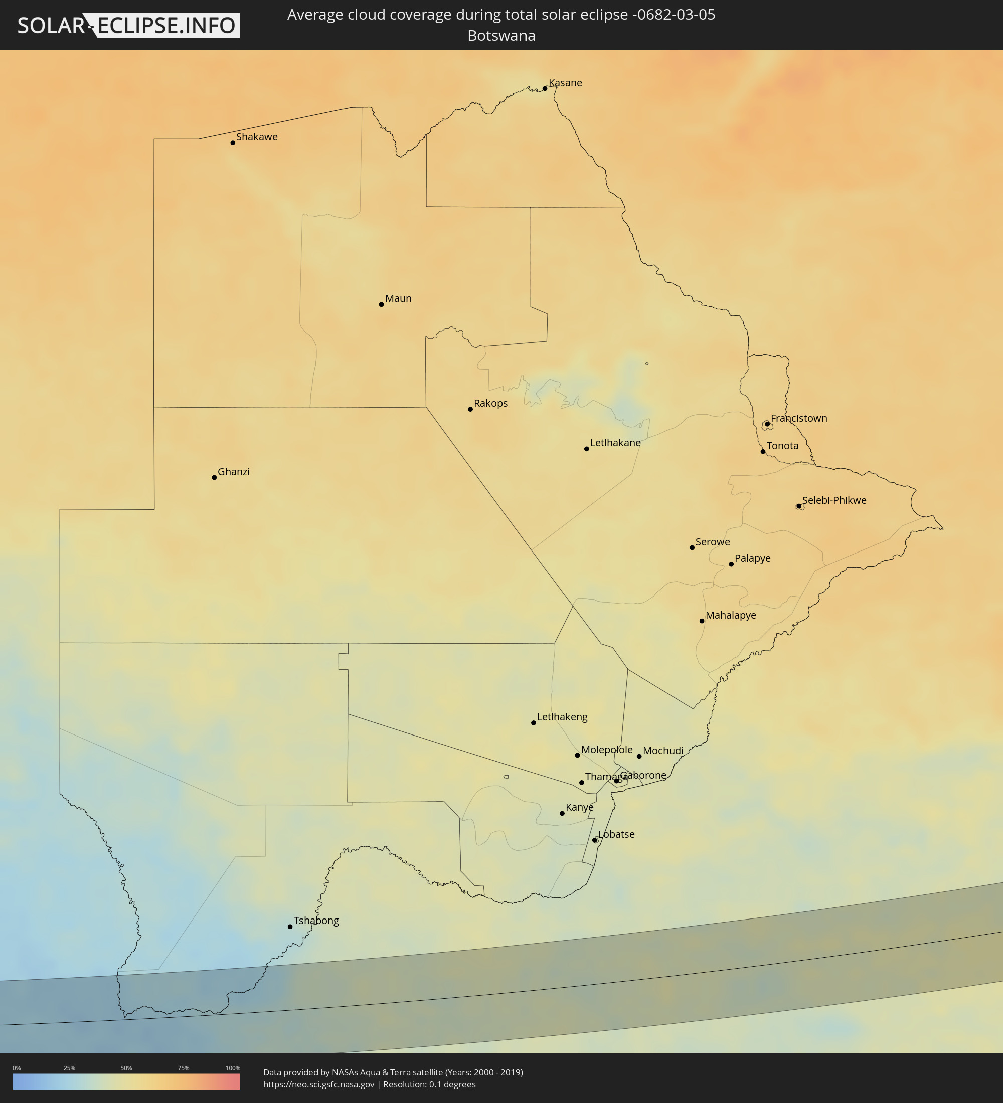 Botswana
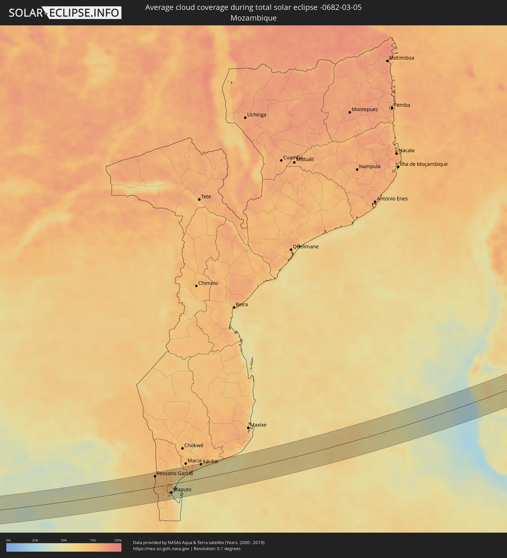 Mozambique
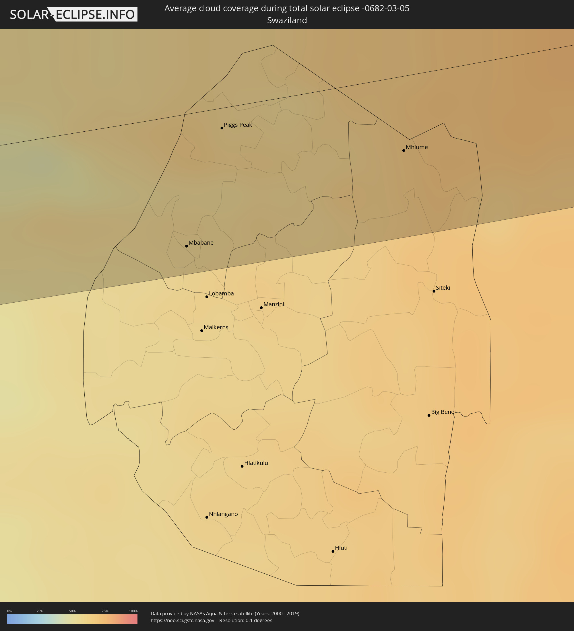 Swaziland
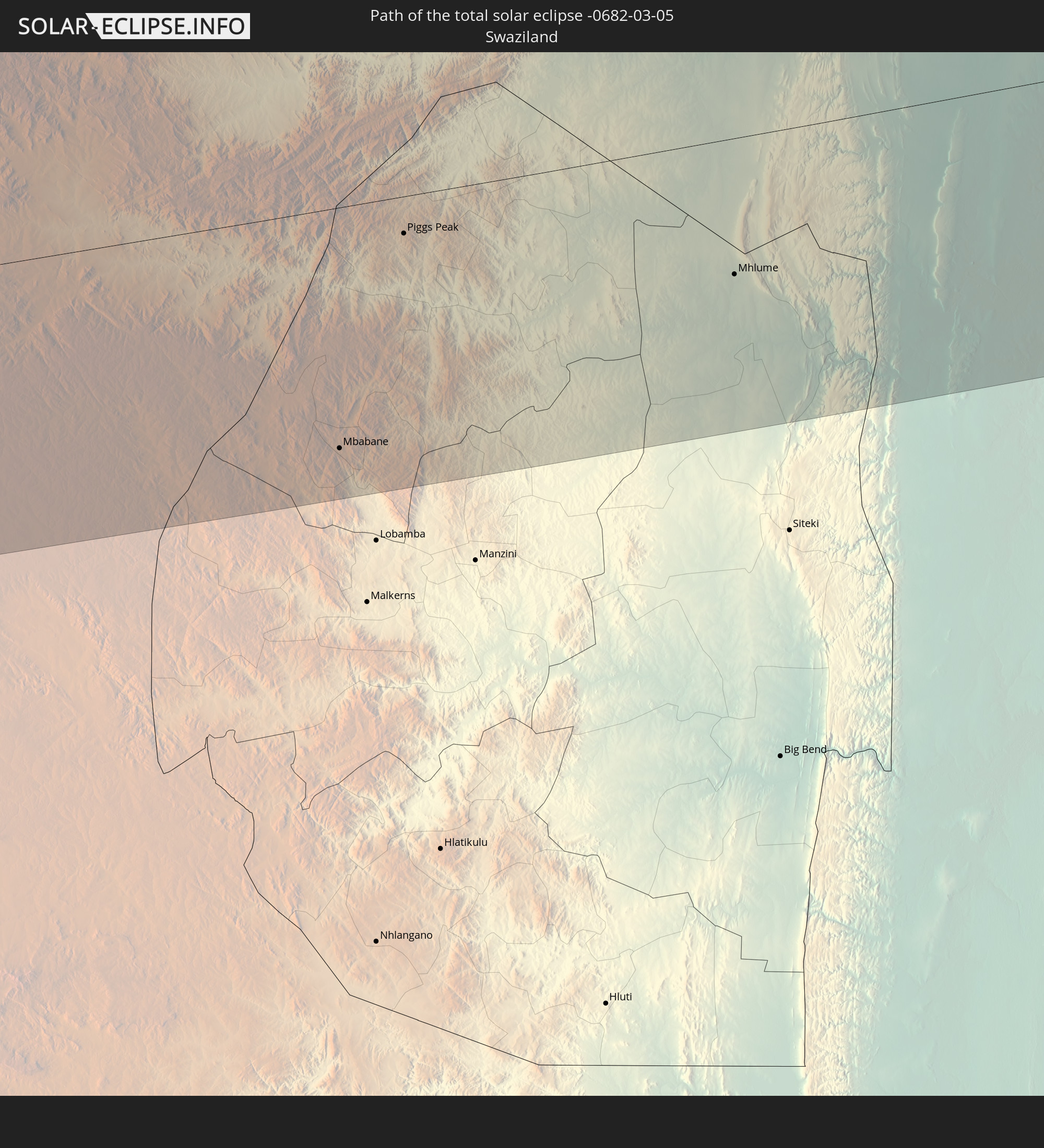
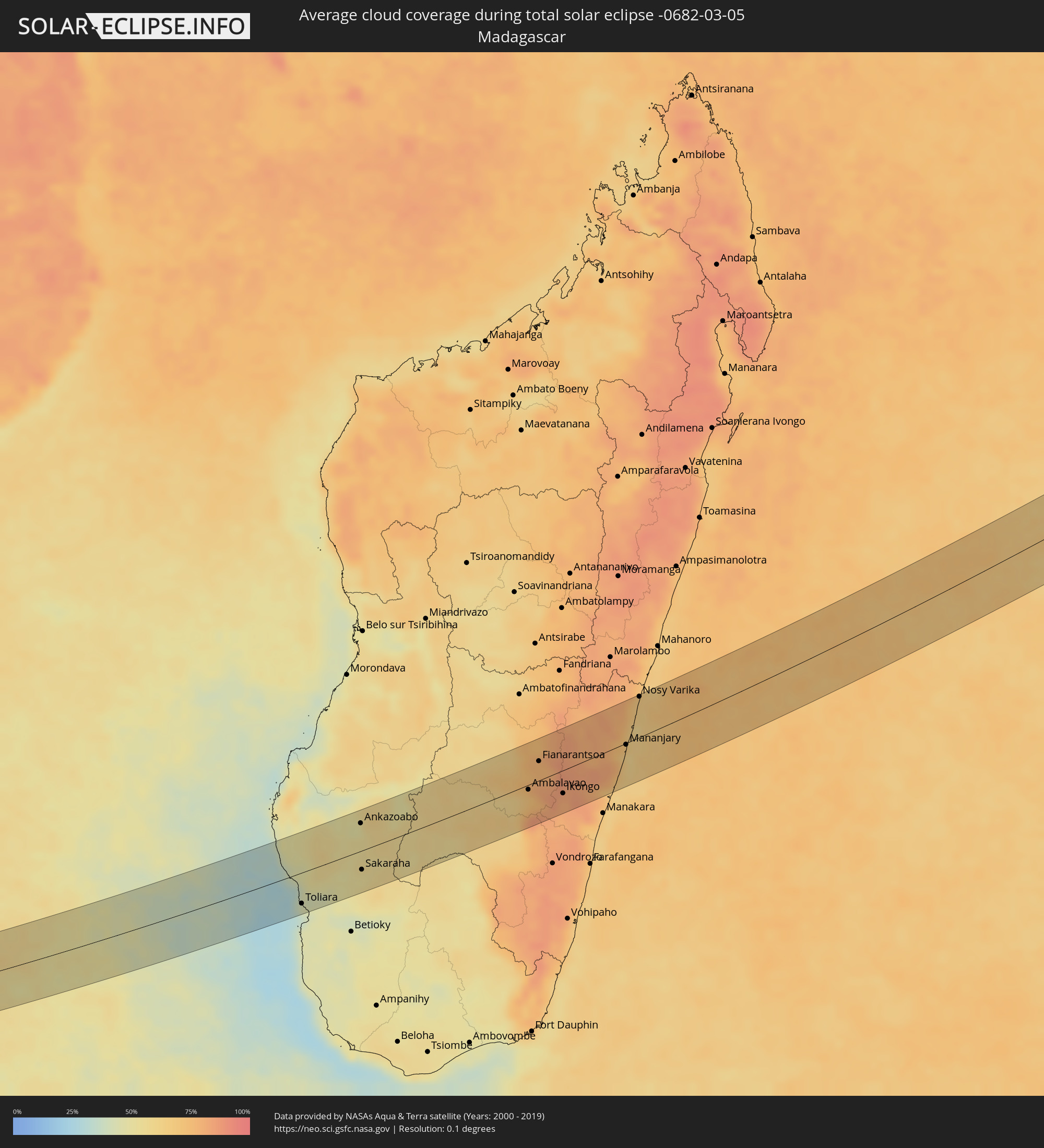 Madagascar
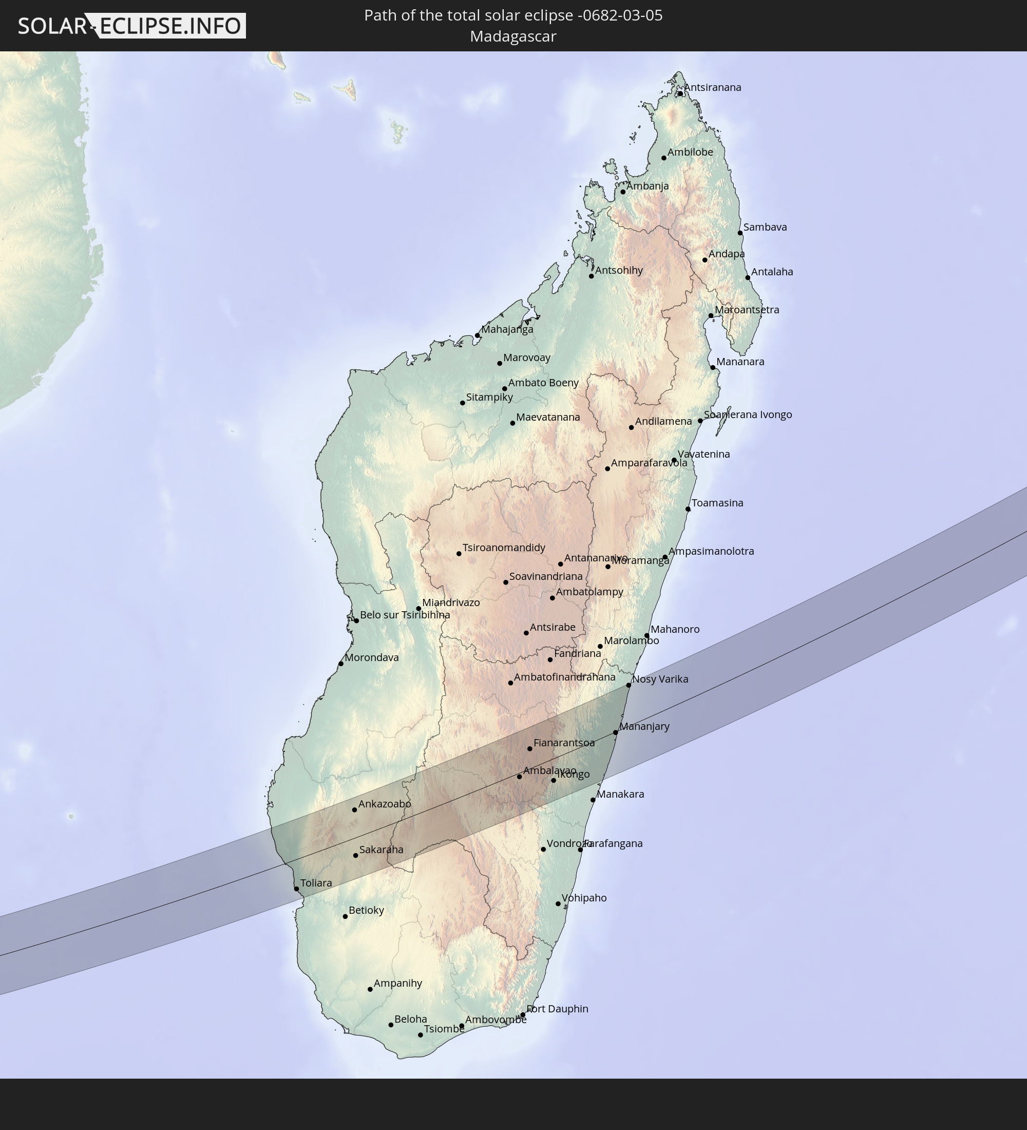
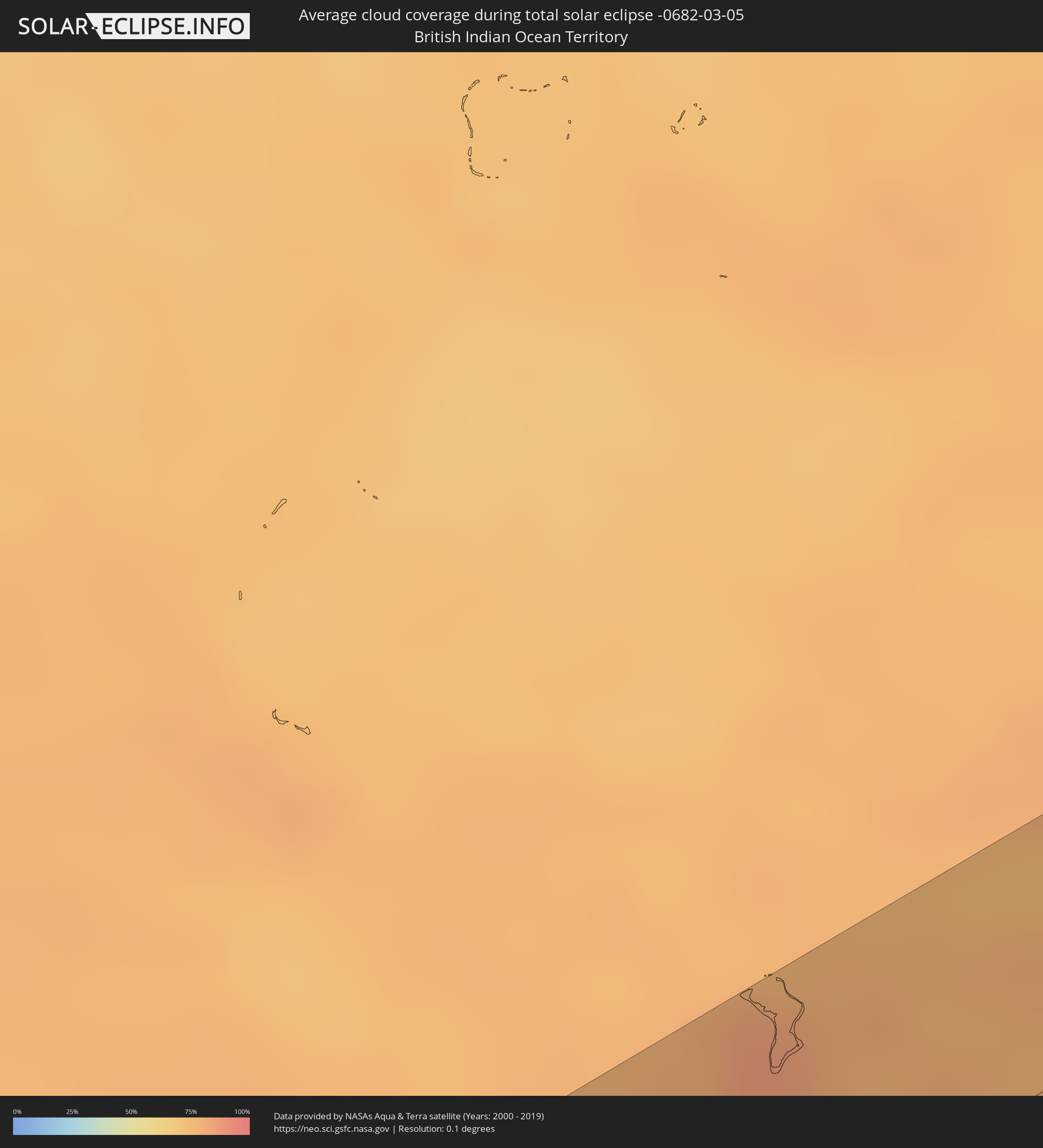 British Indian Ocean Territory
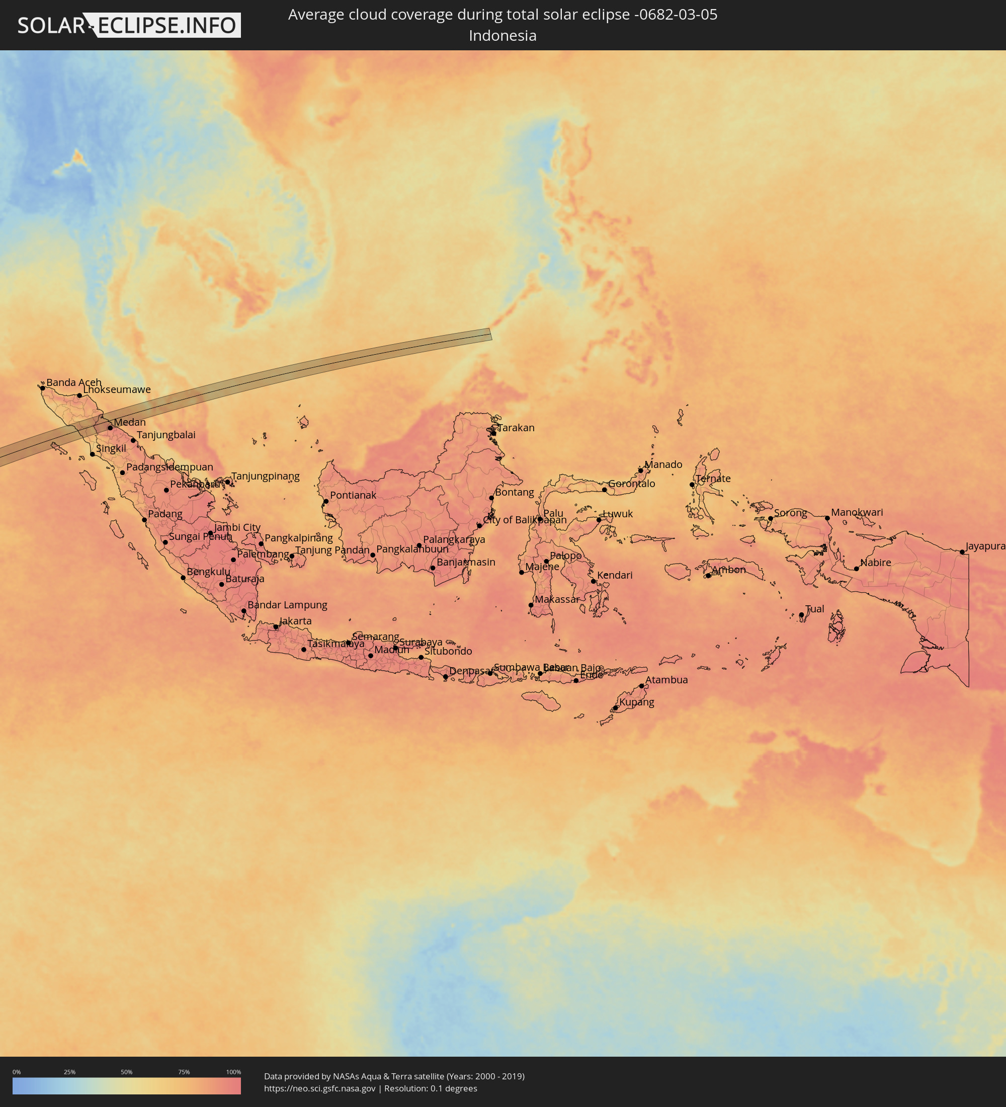 Indonesia
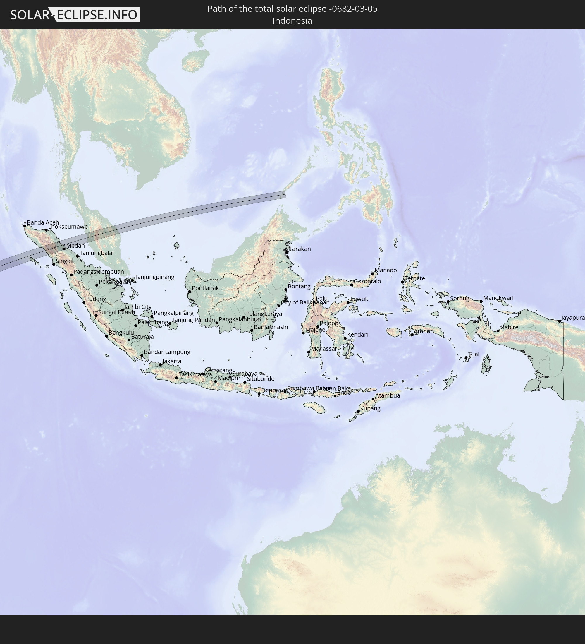
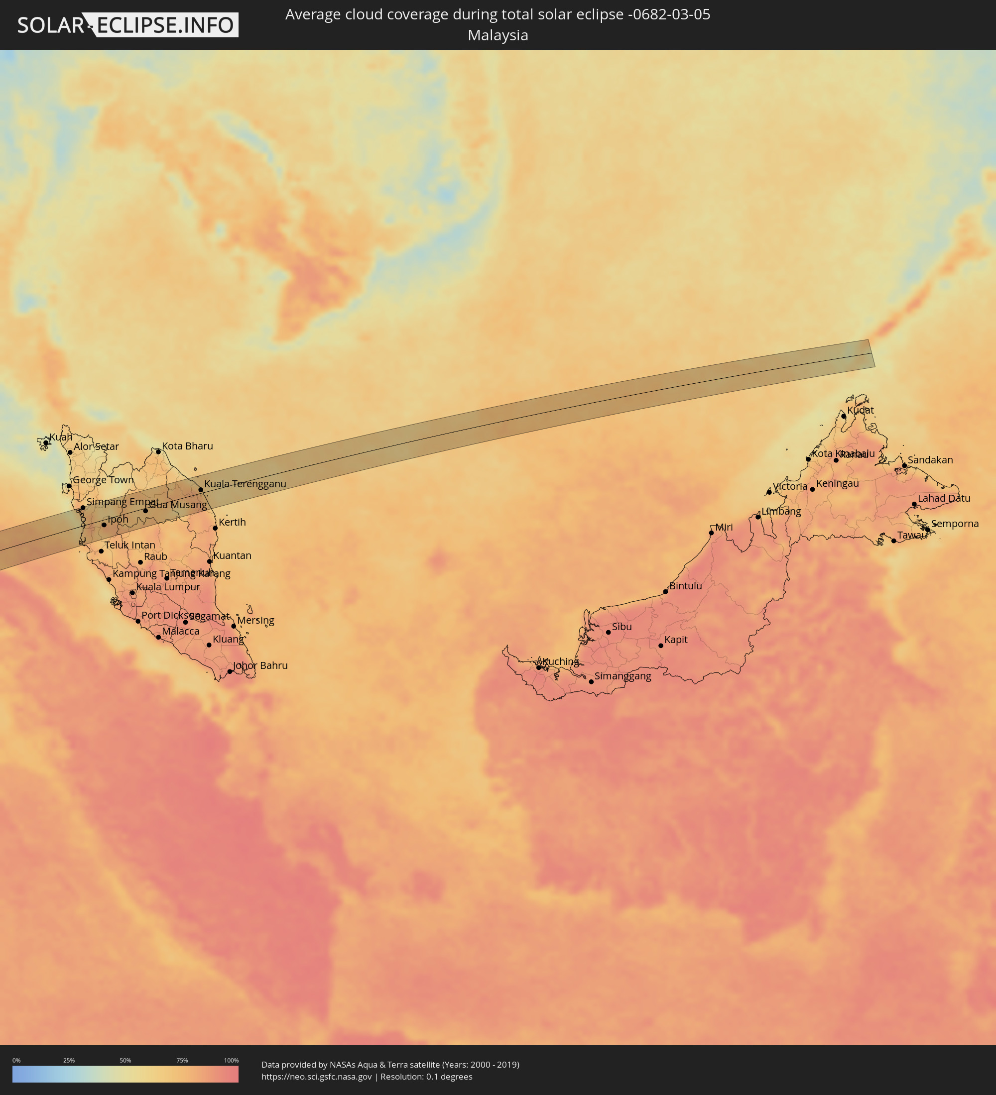 Malaysia
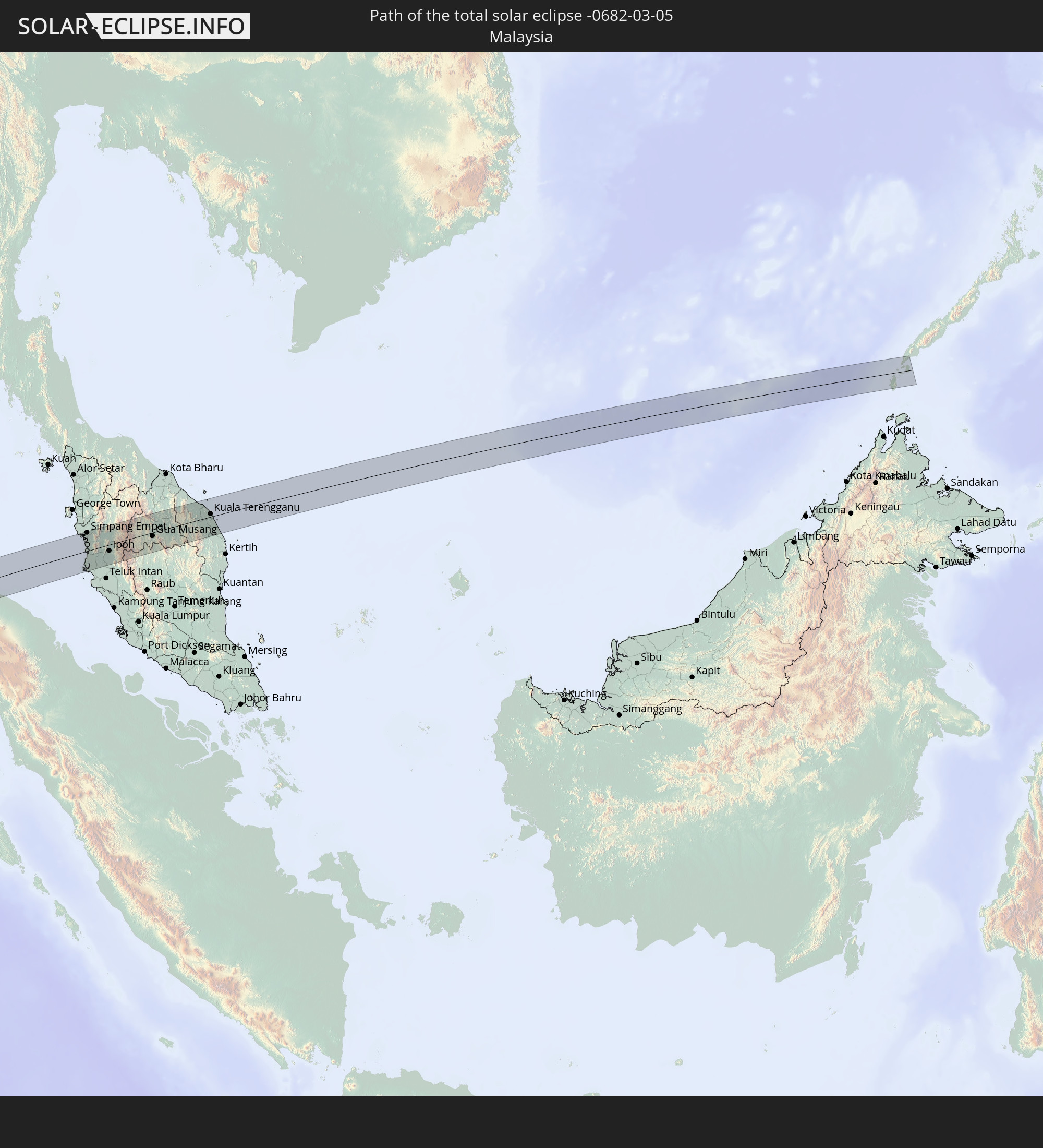
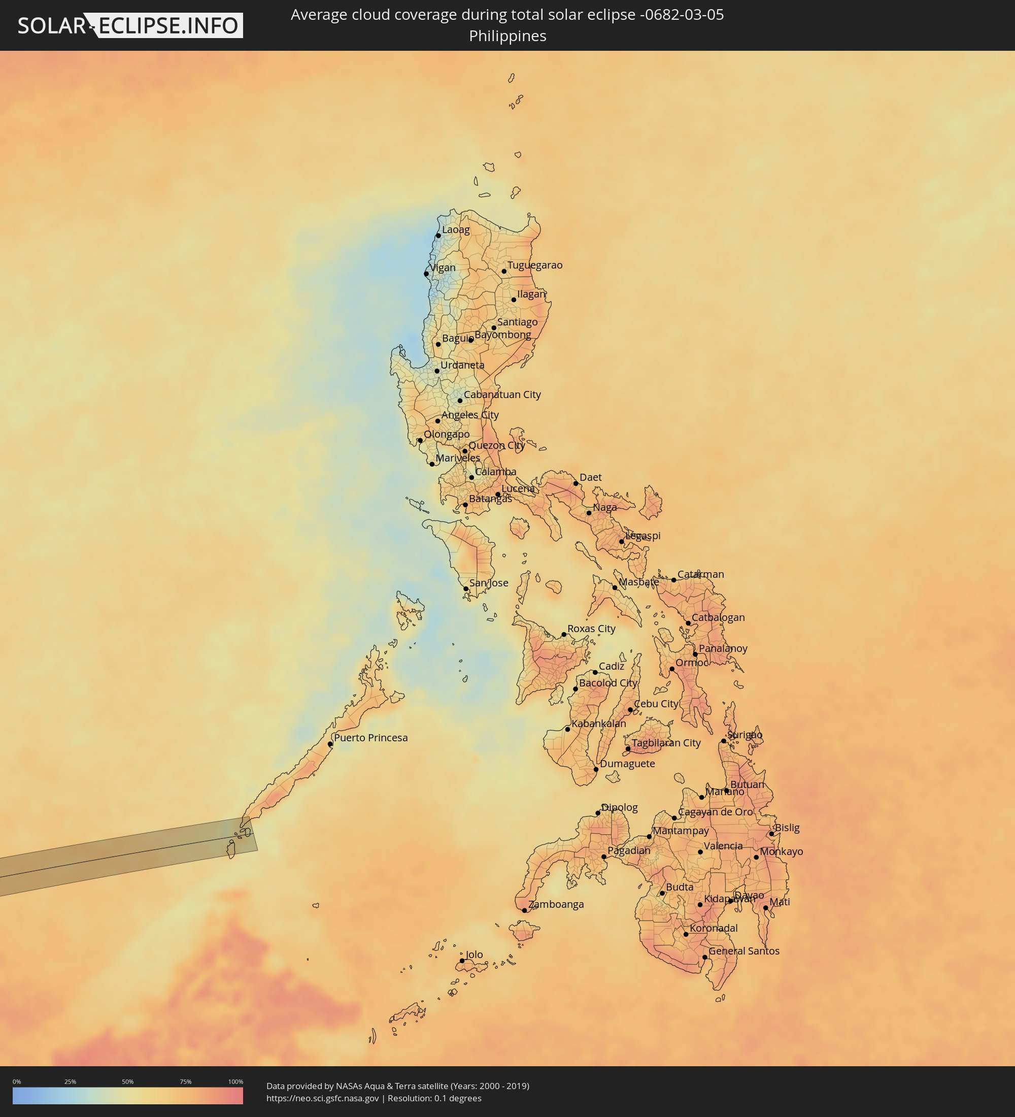 Philippines
Cities inside the path of the eclipse
The following table shows all locations with a population of more than 5,000 inside the eclipse path. Cities which have more than 100,000 inhabitants are marked bold. A click at the locations opens a detailed map.
| City | Type | Eclipse duration | Local time of max. eclipse | Distance to central line | Ø Cloud coverage |
|
Lüderitz, Karas
|
total | - | 08:33:26 UTC+01:30 | 43 km | 16% |
|
Vryburg, North-West
|
total | - | 08:45:05 UTC+01:30 | 31 km | 41% |
|
Lichtenburg, North-West
|
total | - | 08:47:10 UTC+01:30 | 43 km | 42% |
|
Klerksdorp, North-West
|
total | - | 08:47:58 UTC+01:30 | 40 km | 40% |
|
Stilfontein, North-West
|
total | - | 08:48:07 UTC+01:30 | 40 km | 40% |
|
Potchefstroom, North-West
|
total | - | 08:48:38 UTC+01:30 | 30 km | 38% |
|
Carletonville, Gauteng
|
total | - | 08:49:06 UTC+01:30 | 6 km | 38% |
|
Fochville, North-West
|
total | - | 08:49:15 UTC+01:30 | 9 km | 36% |
|
Westonaria, Gauteng
|
total | - | 08:49:30 UTC+01:30 | 8 km | 40% |
|
Randfontein, Gauteng
|
total | - | 08:49:36 UTC+01:30 | 22 km | 42% |
|
Krugersdorp, Gauteng
|
total | - | 08:49:43 UTC+01:30 | 32 km | 45% |
|
Sasolburg, Orange Free State
|
total | - | 08:49:46 UTC+01:30 | 49 km | 36% |
|
Soweto, Gauteng
|
total | - | 08:49:51 UTC+01:30 | 11 km | 42% |
|
Vereeniging, Gauteng
|
total | - | 08:49:57 UTC+01:30 | 35 km | 38% |
|
Diepsloot, Gauteng
|
total | - | 08:50:06 UTC+01:30 | 46 km | 40% |
|
Johannesburg, Gauteng
|
total | - | 08:50:09 UTC+01:30 | 15 km | 41% |
|
Tembisa, Gauteng
|
total | - | 08:50:27 UTC+01:30 | 36 km | 43% |
|
Benoni, Gauteng
|
total | - | 08:50:36 UTC+01:30 | 13 km | 42% |
|
Heidelberg, Gauteng
|
total | - | 08:50:39 UTC+01:30 | 22 km | 43% |
|
Nigel, Gauteng
|
total | - | 08:50:51 UTC+01:30 | 16 km | 43% |
|
Delmas, Mpumalanga
|
total | - | 08:51:12 UTC+01:30 | 13 km | 45% |
|
eMbalenhle, Mpumalanga
|
total | - | 08:51:49 UTC+01:30 | 35 km | 45% |
|
Witbank, Mpumalanga
|
total | - | 08:52:09 UTC+01:30 | 36 km | 45% |
|
Middelburg, Mpumalanga
|
total | - | 08:52:33 UTC+01:30 | 43 km | 44% |
|
Bethal, Mpumalanga
|
total | - | 08:52:29 UTC+01:30 | 32 km | 46% |
|
Barberton, Mpumalanga
|
total | - | 08:55:19 UTC+01:30 | 16 km | 64% |
|
Mbabane, Hhohho
|
total | - | 08:55:23 UTC+01:30 | 43 km | 57% |
|
Piggs Peak, Hhohho
|
total | - | 08:55:39 UTC+01:30 | 7 km | 56% |
|
Mhlume, Lubombo
|
total | - | 08:56:43 UTC+01:30 | 24 km | 66% |
|
Ressano Garcia, Maputo
|
total | - | 09:37:25 UTC+02:10 | 38 km | 65% |
|
Matola, Maputo
|
total | - | 09:38:10 UTC+02:10 | 28 km | 62% |
|
Maputo, Maputo City
|
total | - | 09:38:24 UTC+02:10 | 30 km | 55% |
|
Xai-Xai, Gaza
|
total | - | 09:40:38 UTC+02:10 | 49 km | 56% |
|
Toliara, Atsimo-Andrefana
|
total | - | 10:20:11 UTC+02:27 | 43 km | 37% |
|
Behompy, Atsimo-Andrefana
|
total | - | 10:20:41 UTC+02:27 | 39 km | 45% |
|
Ankazoabo, Atsimo-Andrefana
|
total | - | 10:23:06 UTC+02:27 | 38 km | 49% |
|
Sakaraha, Atsimo-Andrefana
|
total | - | 10:22:37 UTC+02:27 | 26 km | 51% |
|
Ranohira, Ihorombe
|
total | - | 10:25:05 UTC+02:27 | 15 km | 56% |
|
Ihosy, Ihorombe
|
total | - | 10:26:56 UTC+02:27 | 34 km | 62% |
|
Ambalavao, Upper Matsiatra
|
total | - | 10:29:29 UTC+02:27 | 7 km | 68% |
|
Fianarantsoa, Upper Matsiatra
|
total | - | 10:30:15 UTC+02:27 | 26 km | 77% |
|
Fandrandava, Upper Matsiatra
|
total | - | 10:30:36 UTC+02:27 | 13 km | 80% |
|
Ikongo, Vatovavy Fitovinany
|
total | - | 10:30:41 UTC+02:27 | 32 km | 81% |
|
Ifanadiana, Vatovavy Fitovinany
|
total | - | 10:31:48 UTC+02:27 | 20 km | 83% |
|
Vohimanitra, Vatovavy Fitovinany
|
total | - | 10:31:33 UTC+02:27 | 24 km | 82% |
|
Mananjary, Vatovavy Fitovinany
|
total | - | 10:33:40 UTC+02:27 | 2 km | 66% |
|
Nosy Varika, Vatovavy Fitovinany
|
total | - | 10:34:52 UTC+02:27 | 56 km | 66% |
|
Pangkalan Brandan, North Sumatra
|
total | - | 17:20:50 UTC+07:07 | 15 km | 84% |
|
Tanjungtiram, North Sumatra
|
total | - | 17:20:55 UTC+07:07 | 16 km | 73% |
|
Stabat, North Sumatra
|
total | - | 17:20:43 UTC+07:07 | 21 km | 91% |
|
Binjai, North Sumatra
|
total | - | 17:20:39 UTC+07:07 | 36 km | 90% |
|
Sunggal, North Sumatra
|
total | - | 17:20:42 UTC+07:07 | 43 km | 94% |
|
Medan, North Sumatra
|
total | - | 17:20:45 UTC+07:07 | 44 km | 95% |
|
Labuhan Deli, North Sumatra
|
total | - | 17:20:51 UTC+07:07 | 29 km | 93% |
|
Belawan, North Sumatra
|
total | - | 17:20:54 UTC+07:07 | 24 km | 87% |
|
Pantai Remis, Perak
|
total | - | 17:10:41 UTC+06:55 | 13 km | 68% |
|
Lumut, Perak
|
total | - | 17:10:32 UTC+06:55 | 37 km | 72% |
|
Simpang Empat, Perak
|
total | - | 17:11:01 UTC+06:55 | 40 km | 76% |
|
Taiping, Perak
|
total | - | 17:11:00 UTC+06:55 | 26 km | 76% |
|
Kuala Kangsar, Perak
|
total | - | 17:11:03 UTC+06:55 | 11 km | 70% |
|
Batu Gajah, Perak
|
total | - | 17:10:55 UTC+06:55 | 24 km | 69% |
|
Ipoh, Perak
|
total | - | 17:11:00 UTC+06:55 | 13 km | 79% |
|
Tanah Rata, Pahang
|
total | - | 17:11:04 UTC+06:55 | 35 km | 79% |
|
Gua Musang, Kelantan
|
total | - | 17:11:38 UTC+06:55 | 8 km | 71% |
|
Kuala Terengganu, Terengganu
|
total | - | 17:12:26 UTC+06:55 | 6 km | 79% |
|
Marang, Terengganu
|
total | - | 17:12:23 UTC+06:55 | 9 km | 73% |
|
Balabac, Mimaropa
|
total | - | 18:20:45 UTC+08:00 | 21 km | 63% |