Total solar eclipse of 08/26/-0831
| Day of week: | Monday |
| Maximum duration of eclipse: | 04m40s |
| Maximum width of eclipse path: | 186 km |
| Saros cycle: | 41 |
| Coverage: | 100% |
| Magnitude: | 1.0499 |
| Gamma: | -0.4635 |
Wo kann man die Sonnenfinsternis vom 08/26/-0831 sehen?
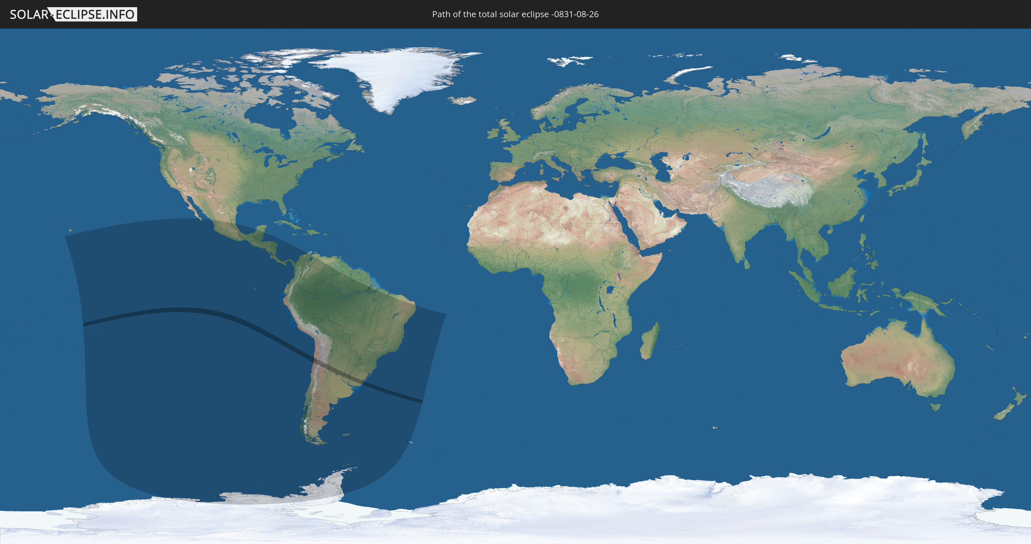
Die Sonnenfinsternis am 08/26/-0831 kann man in 26 Ländern als partielle Sonnenfinsternis beobachten.
Der Finsternispfad verläuft durch 4 Länder. Nur in diesen Ländern ist sie als total Sonnenfinsternis zu sehen.
In den folgenden Ländern ist die Sonnenfinsternis total zu sehen
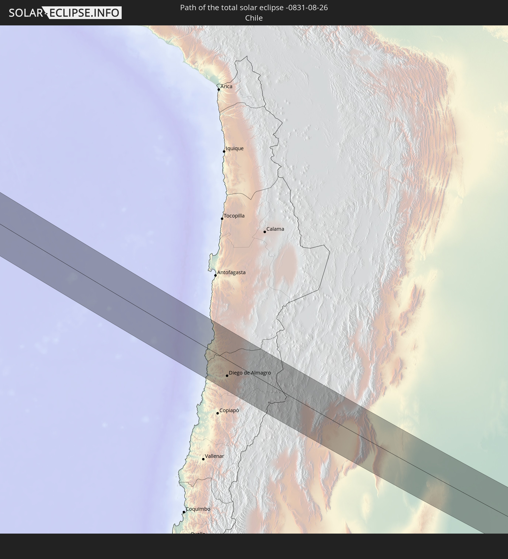 Chile
Chile
 Brazil
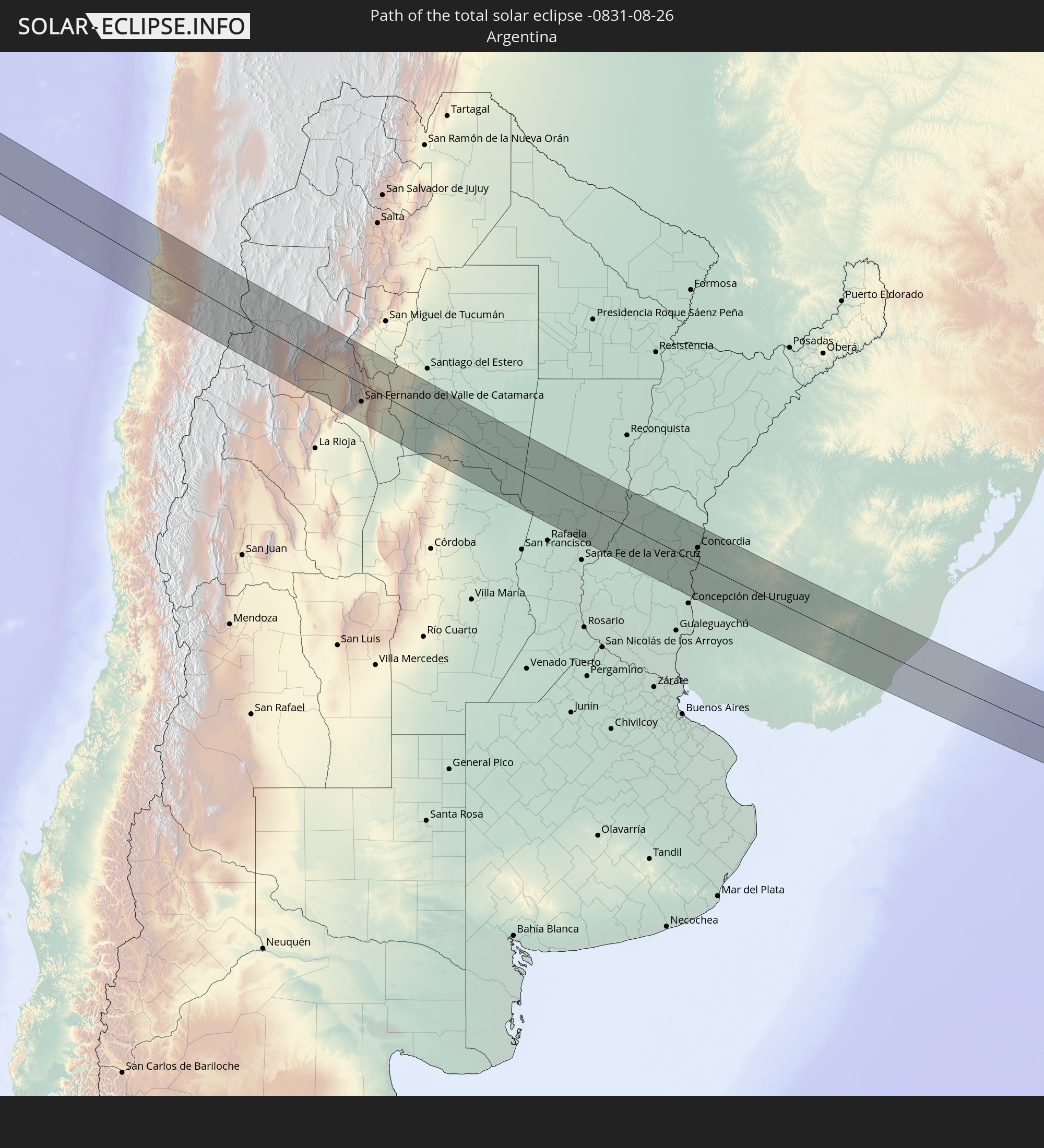 Argentina
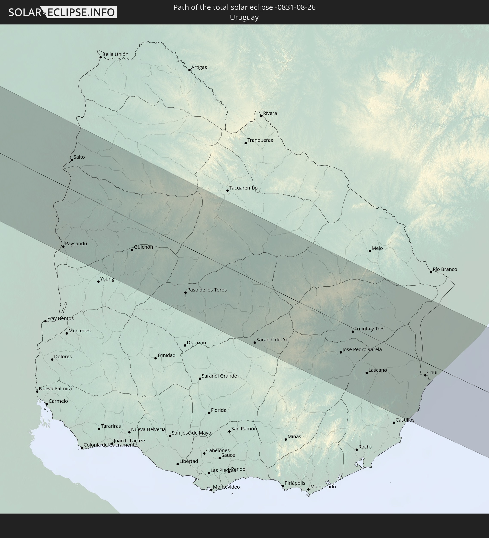 Uruguay
In den folgenden Ländern ist die Sonnenfinsternis partiell zu sehen


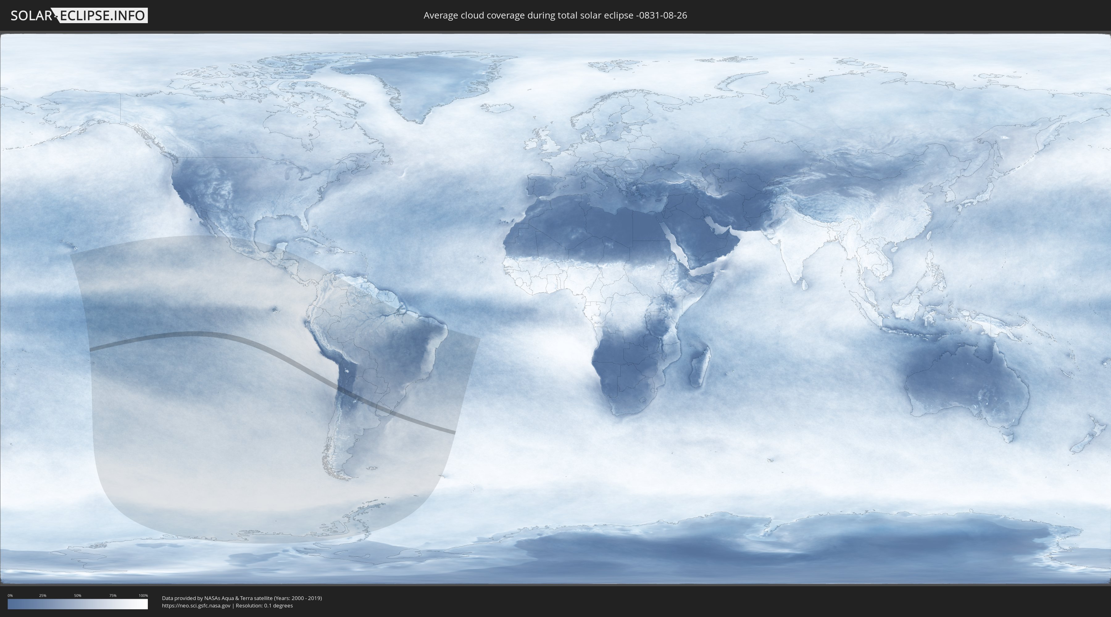
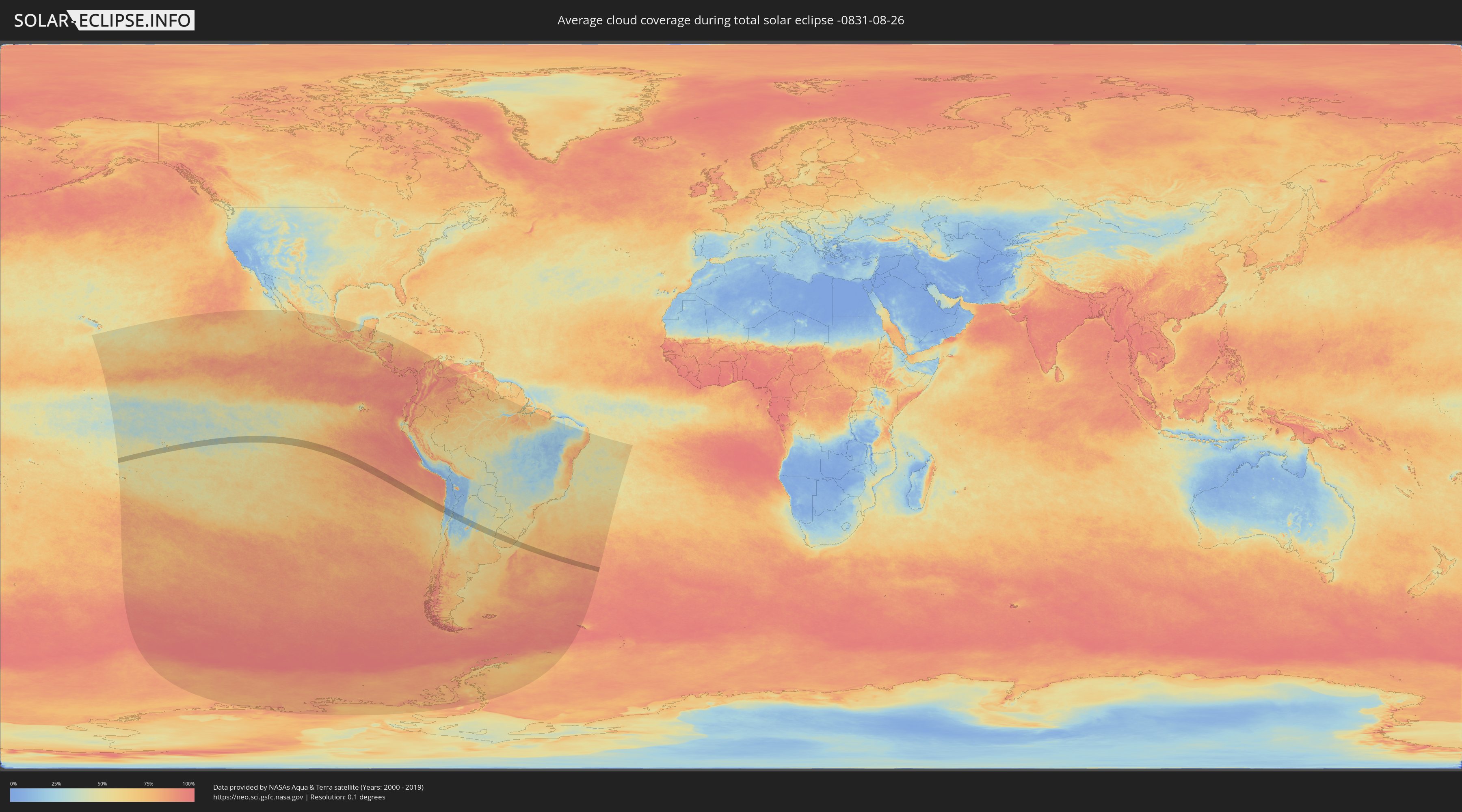
How will be the weather during the total solar eclipse on 08/26/-0831?
Where is the best place to see the total solar eclipse of 08/26/-0831?
The following maps show the average cloud coverage for the day of the total solar eclipse.
With the help of these maps, it is possible to find the place along the eclipse path, which has the best
chance of a cloudless sky.
Nevertheless, you should consider local circumstances and inform about the weather of your chosen
observation site.
The data is provided by NASAs satellites
AQUA and TERRA.
The cloud maps are averaged over a period of 19 years (2000 - 2019).
Detailed country maps
 Chile
Chile
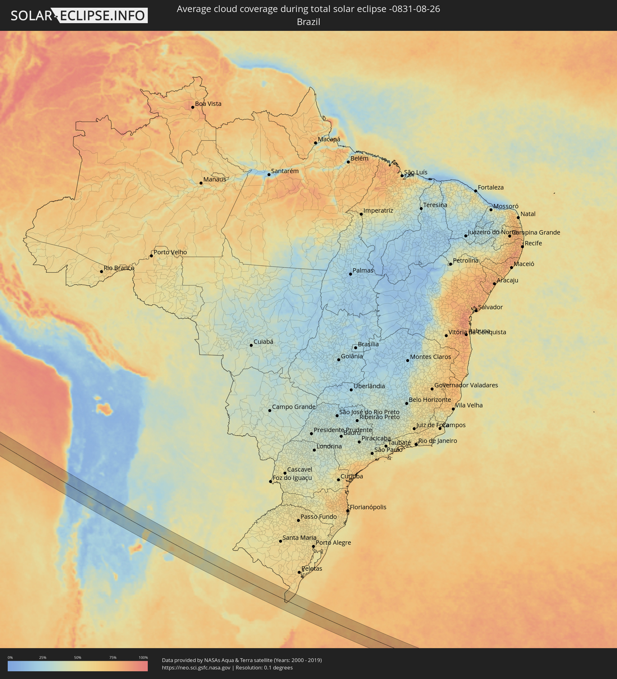 Brazil
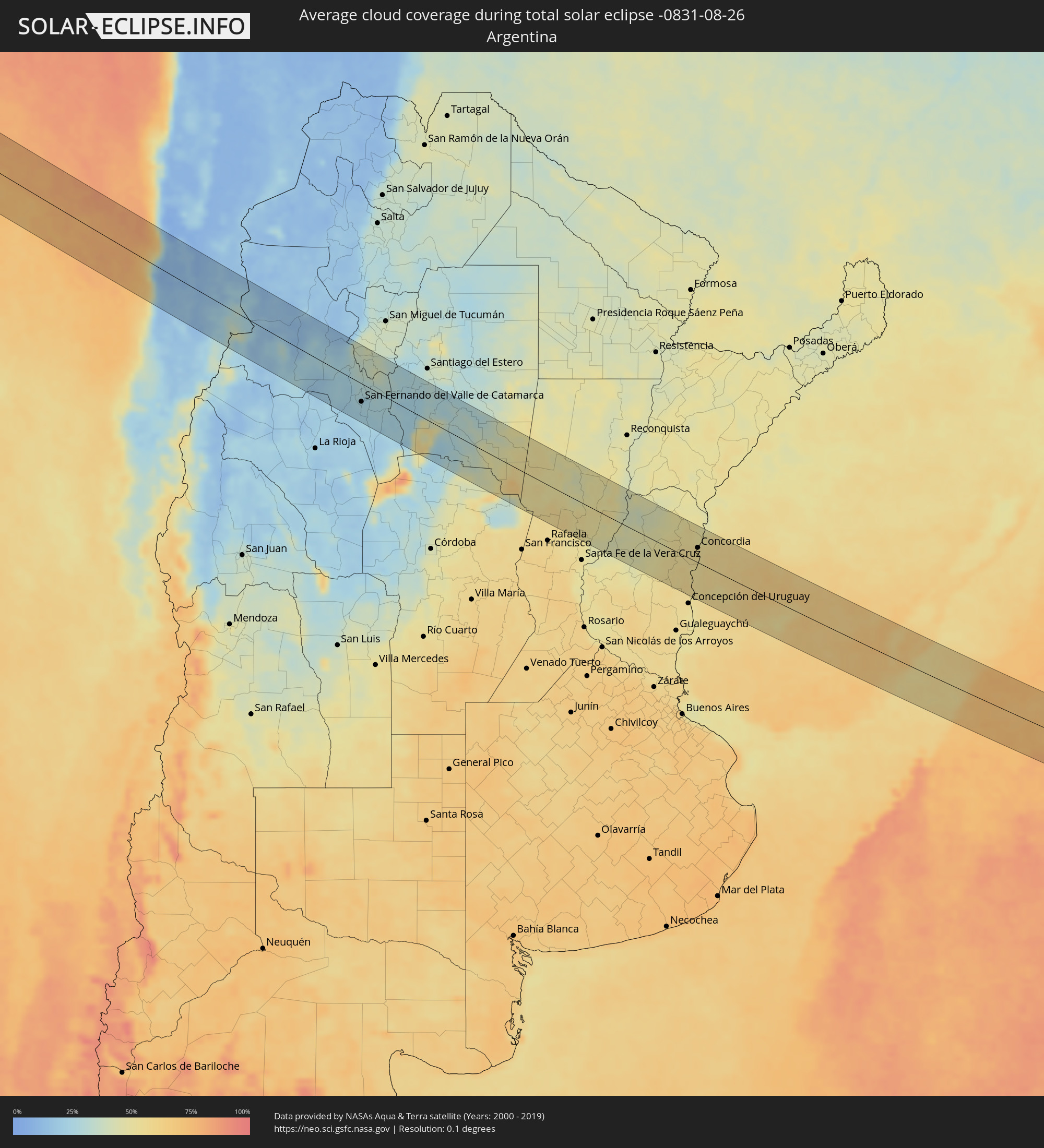 Argentina
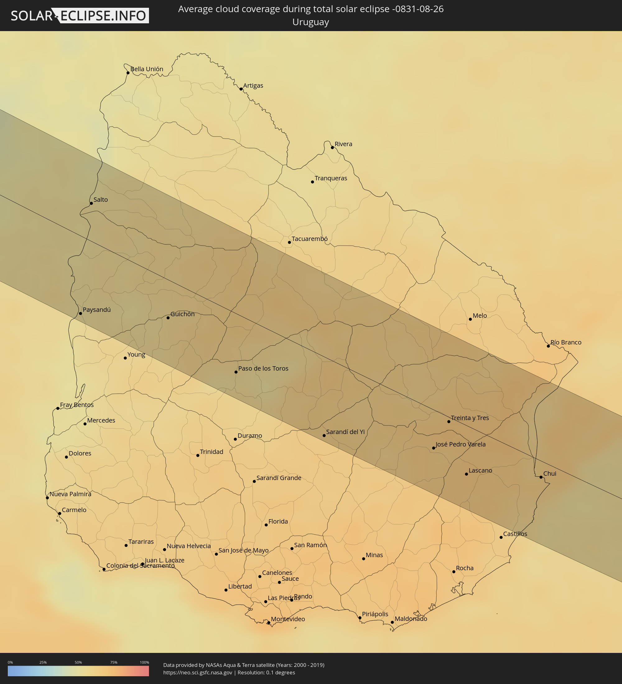 Uruguay
Cities inside the path of the eclipse
The following table shows all locations with a population of more than 5,000 inside the eclipse path. Cities which have more than 100,000 inhabitants are marked bold. A click at the locations opens a detailed map.
| City | Type | Eclipse duration | Local time of max. eclipse | Distance to central line | Ø Cloud coverage |
 Taltal, Antofagasta
|
total | - | 14:13:46 UTC-04:42 | 28 km | 40% |
|
Diego de Almagro, Atacama
|
total | - | 14:14:46 UTC-04:42 | 42 km | 13% |
 Fiambalá, Catamarca Province
|
total | - | 14:44:49 UTC-04:16 | 48 km | 25% |
|
Andalgalá, Catamarca Province
|
total | - | 14:46:42 UTC-04:16 | 23 km | 25% |
|
Capayán, Catamarca Province
|
total | - | 14:47:13 UTC-04:16 | 77 km | 19% |
|
Huillapima, Catamarca Province
|
total | - | 14:47:19 UTC-04:16 | 70 km | 22% |
|
San Fernando del Valle de Catamarca, Catamarca Province
|
total | - | 14:47:34 UTC-04:16 | 36 km | 25% |
|
Aguilares, Tucumán Province
|
total | - | 14:47:41 UTC-04:16 | 73 km | 38% |
|
La Cocha, Tucumán Province
|
total | - | 14:47:47 UTC-04:16 | 42 km | 38% |
|
Los Altos, Catamarca Province
|
total | - | 14:47:55 UTC-04:16 | 19 km | 34% |
|
Graneros, Tucumán Province
|
total | - | 14:47:57 UTC-04:16 | 61 km | 38% |
|
Icaño, Catamarca Province
|
total | - | 14:48:14 UTC-04:16 | 58 km | 22% |
|
Villa Ojo de Agua, Santiago del Estero Province
|
total | - | 14:50:25 UTC-04:16 | 38 km | 27% |
|
Ceres, Santa Fe Province
|
total | - | 14:52:36 UTC-04:16 | 5 km | 52% |
|
San Cristóbal, Santa Fe Province
|
total | - | 14:53:25 UTC-04:16 | 5 km | 51% |
|
San Justo, Santa Fe Province
|
total | - | 14:54:08 UTC-04:16 | 24 km | 51% |
|
Villa Hernandarias, Entre Ríos Province
|
total | - | 14:54:46 UTC-04:16 | 40 km | 43% |
|
San Javier, Santa Fe Province
|
total | - | 14:54:54 UTC-04:16 | 27 km | 47% |
|
Santa Elena, Entre Ríos Province
|
total | - | 14:55:01 UTC-04:16 | 4 km | 47% |
|
La Paz, Entre Ríos Province
|
total | - | 14:55:12 UTC-04:16 | 23 km | 40% |
|
Bovril, Entre Ríos Province
|
total | - | 14:55:21 UTC-04:16 | 28 km | 46% |
|
Villaguay, Entre Ríos Province
|
total | - | 14:55:43 UTC-04:16 | 61 km | 53% |
|
Federal, Entre Ríos Province
|
total | - | 14:56:06 UTC-04:16 | 39 km | 49% |
|
San Salvador, Entre Ríos Province
|
total | - | 14:56:18 UTC-04:16 | 15 km | 53% |
|
Villa Elisa, Entre Ríos Province
|
total | - | 14:56:19 UTC-04:16 | 64 km | 55% |
 Paysandú, Paysandú
|
total | - | 15:28:34 UTC-03:44 | 66 km | 53% |
|
Concordia, Entre Ríos Province
|
total | - | 14:56:50 UTC-04:16 | 29 km | 53% |
|
Salto, Salto
|
total | - | 15:28:51 UTC-03:44 | 32 km | 53% |
|
Guichón, Paysandú
|
total | - | 15:29:26 UTC-03:44 | 32 km | 58% |
|
Paso de los Toros, Tacuarembó
|
total | - | 15:30:00 UTC-03:44 | 50 km | 56% |
|
Sarandí del Yi, Durazno
|
total | - | 15:30:41 UTC-03:44 | 66 km | 65% |
|
José Pedro Varela, Lavalleja
|
total | - | 15:31:38 UTC-03:44 | 32 km | 65% |
|
Treinta y Tres, Treinta y Tres
|
total | - | 15:31:50 UTC-03:44 | 4 km | 70% |
|
Lascano, Rocha
|
total | - | 15:31:51 UTC-03:44 | 41 km | 66% |
|
Chui, Rocha
|
total | - | 15:32:29 UTC-03:44 | 14 km | 63% |
 Chuí, Rio Grande do Sul
|
total | - | 15:32:29 UTC-03:44 | 13 km | 63% |
|
Santa Vitória do Palmar, Rio Grande do Sul
|
total | - | 16:11:00 UTC-03:06 | 8 km | 66% |