Total solar eclipse of 07/24/-1973
| Day of week: | Thursday |
| Maximum duration of eclipse: | 05m38s |
| Maximum width of eclipse path: | 201 km |
| Saros cycle: | 14 |
| Coverage: | 100% |
| Magnitude: | 1.0601 |
| Gamma: | -0.1865 |
Wo kann man die Sonnenfinsternis vom 07/24/-1973 sehen?
Die Sonnenfinsternis am 07/24/-1973 kann man in 101 Ländern als partielle Sonnenfinsternis beobachten.
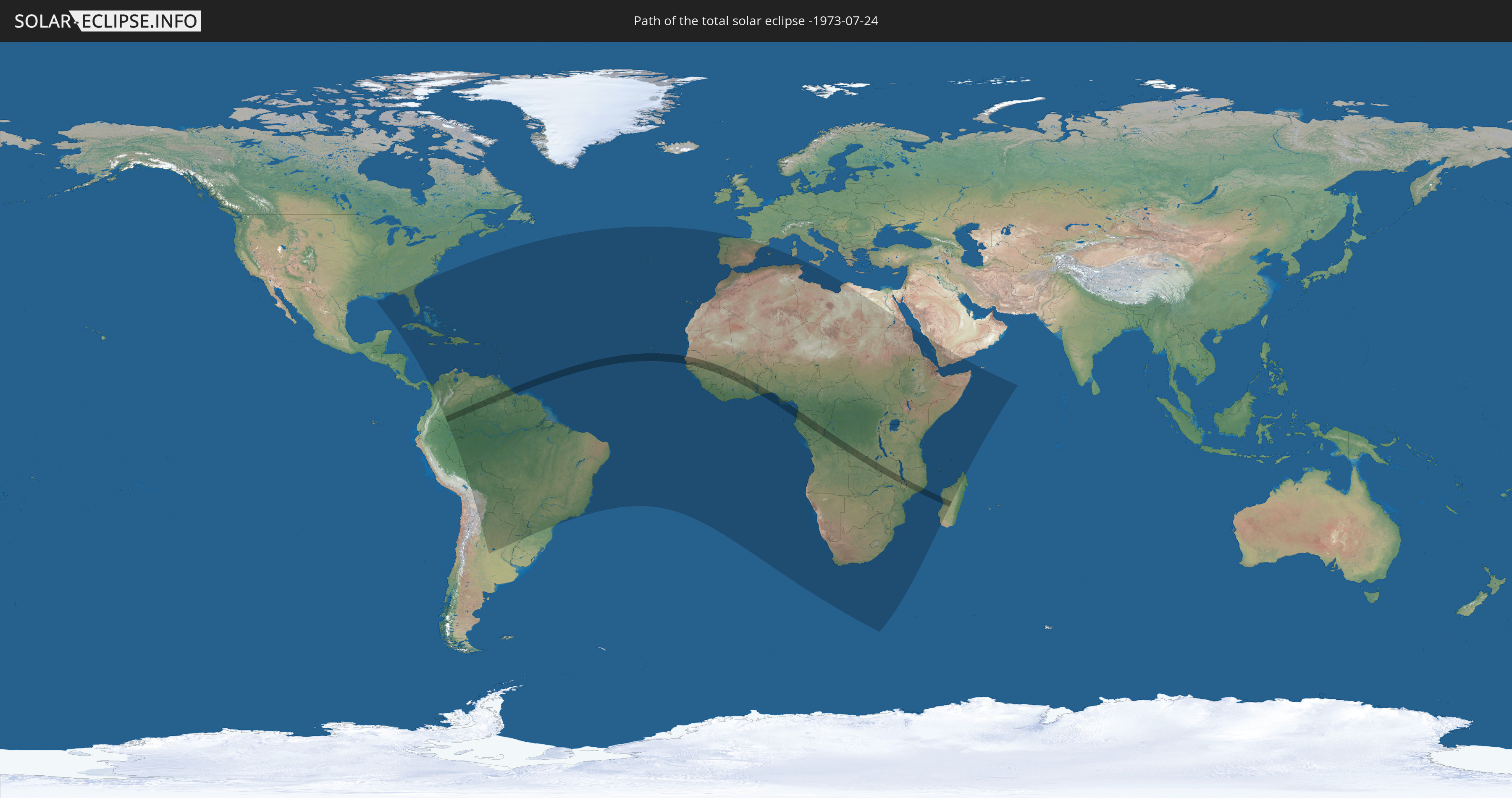
Der Finsternispfad verläuft durch 26 Länder. Nur in diesen Ländern ist sie als total Sonnenfinsternis zu sehen.
In den folgenden Ländern ist die Sonnenfinsternis total zu sehen
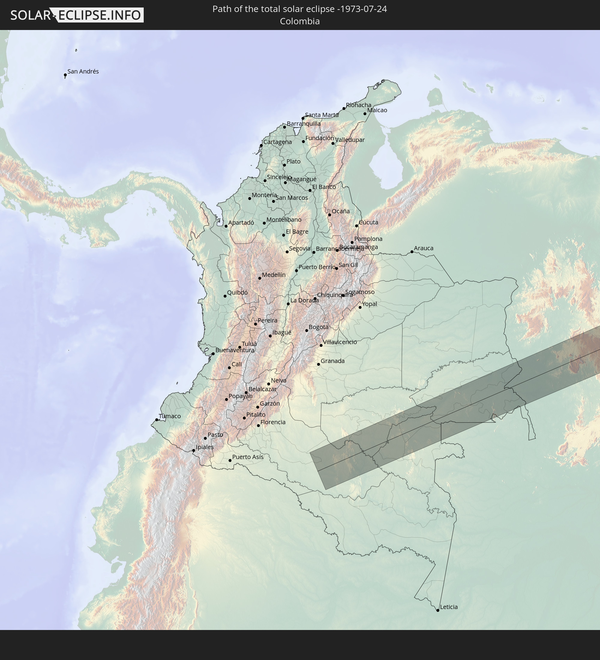 Colombia
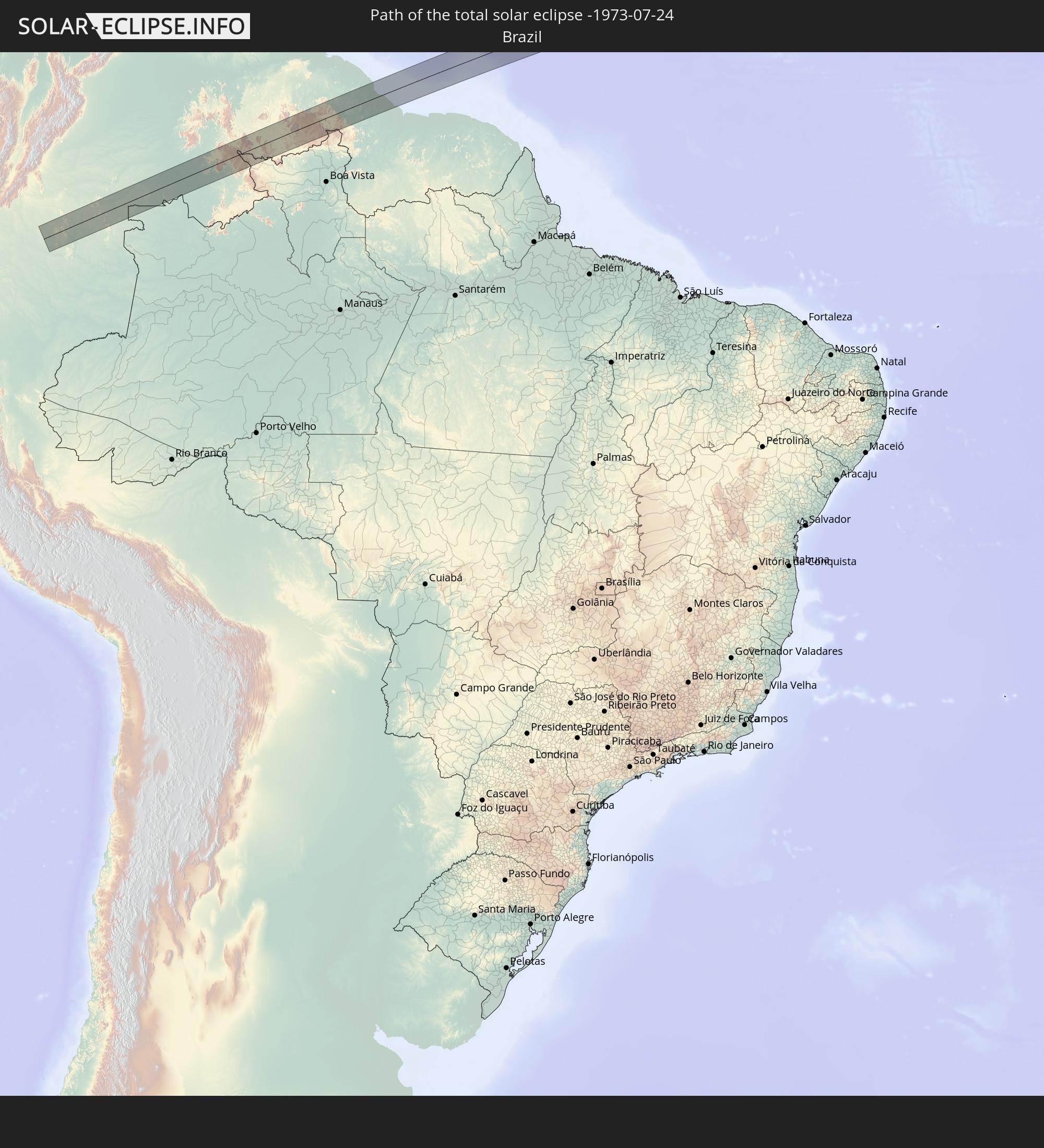 Brazil
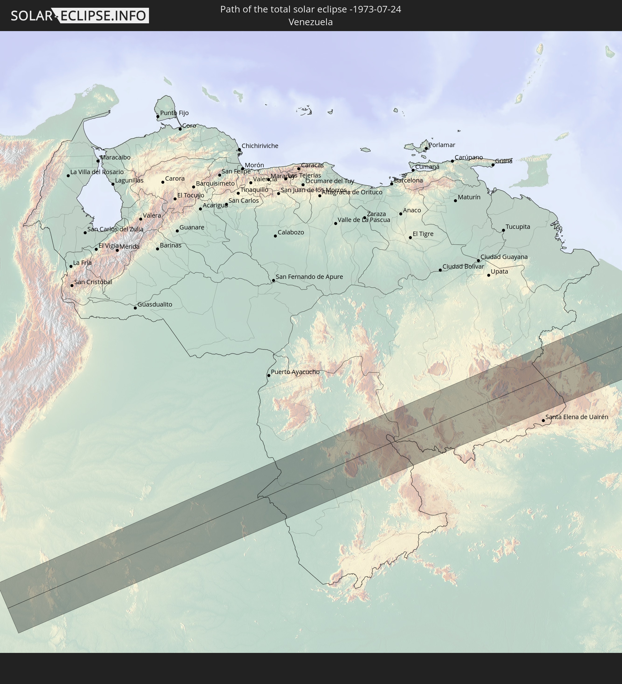 Venezuela
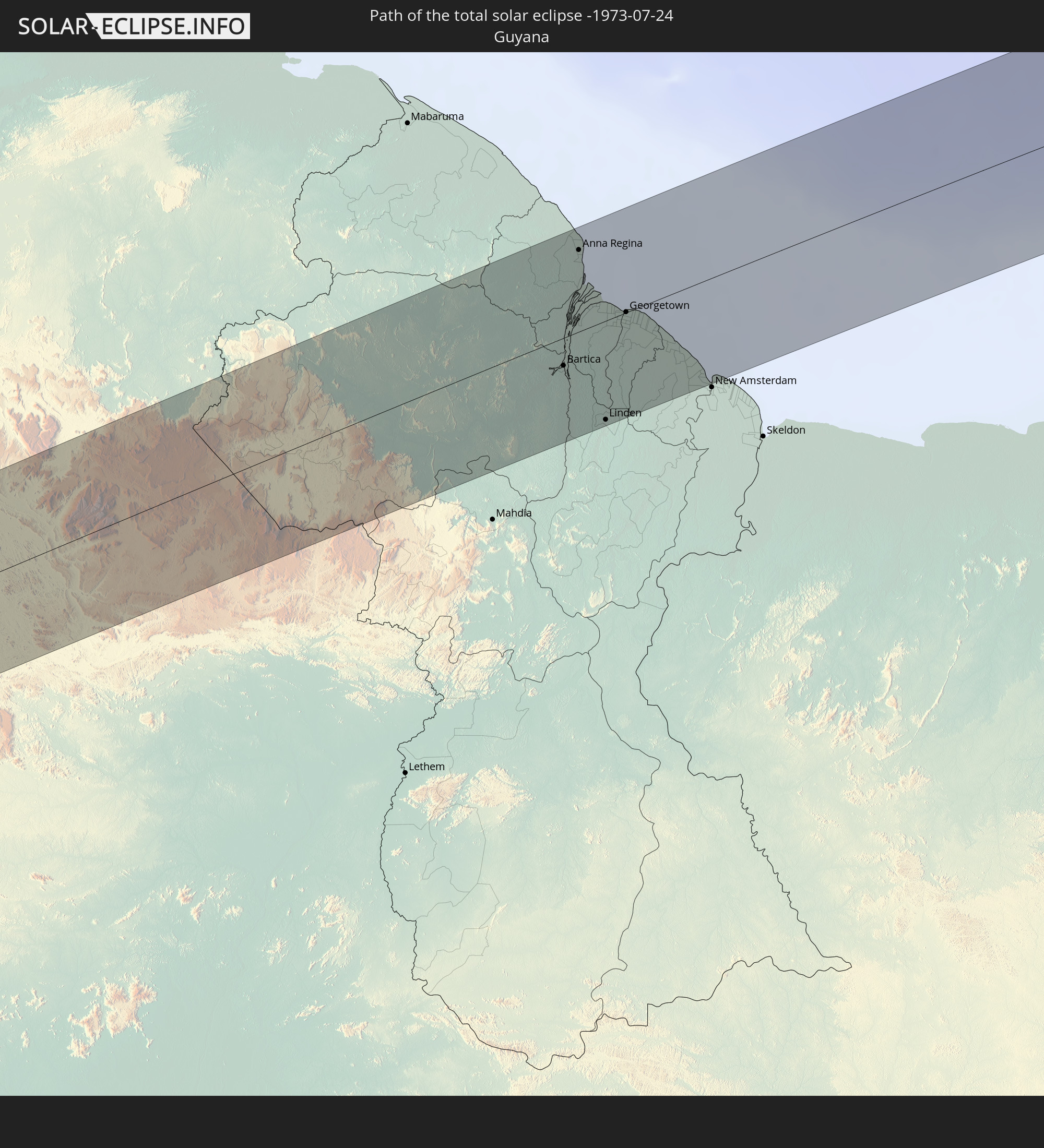 Guyana
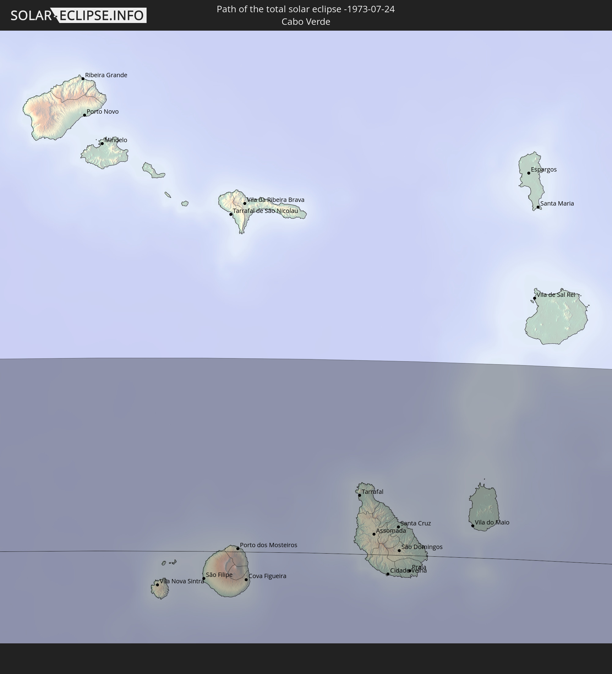 Cabo Verde
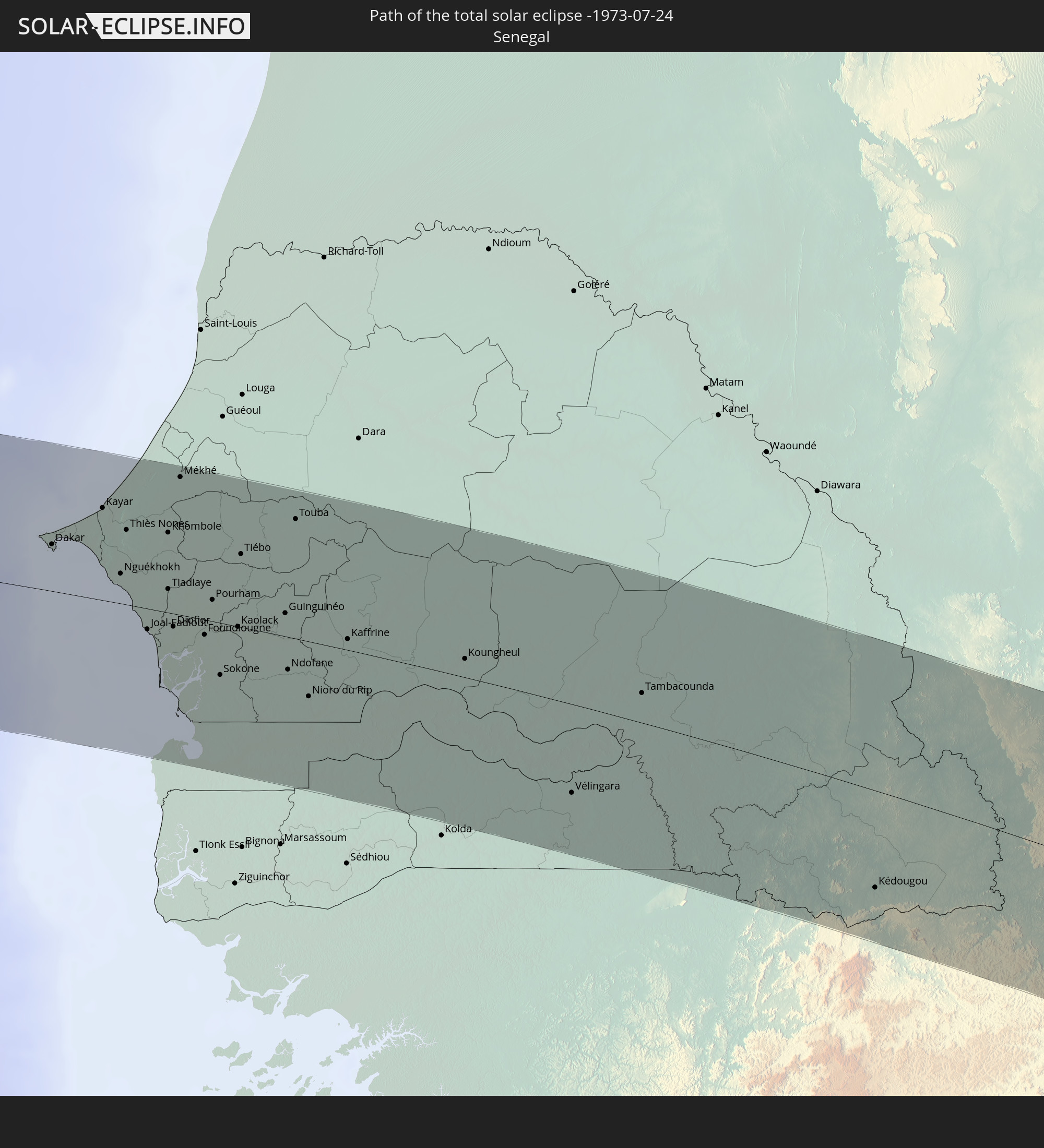 Senegal
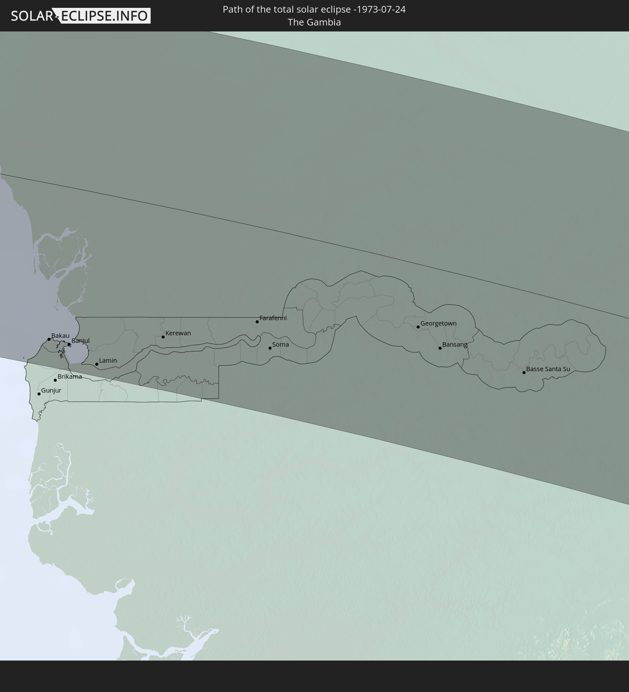 The Gambia
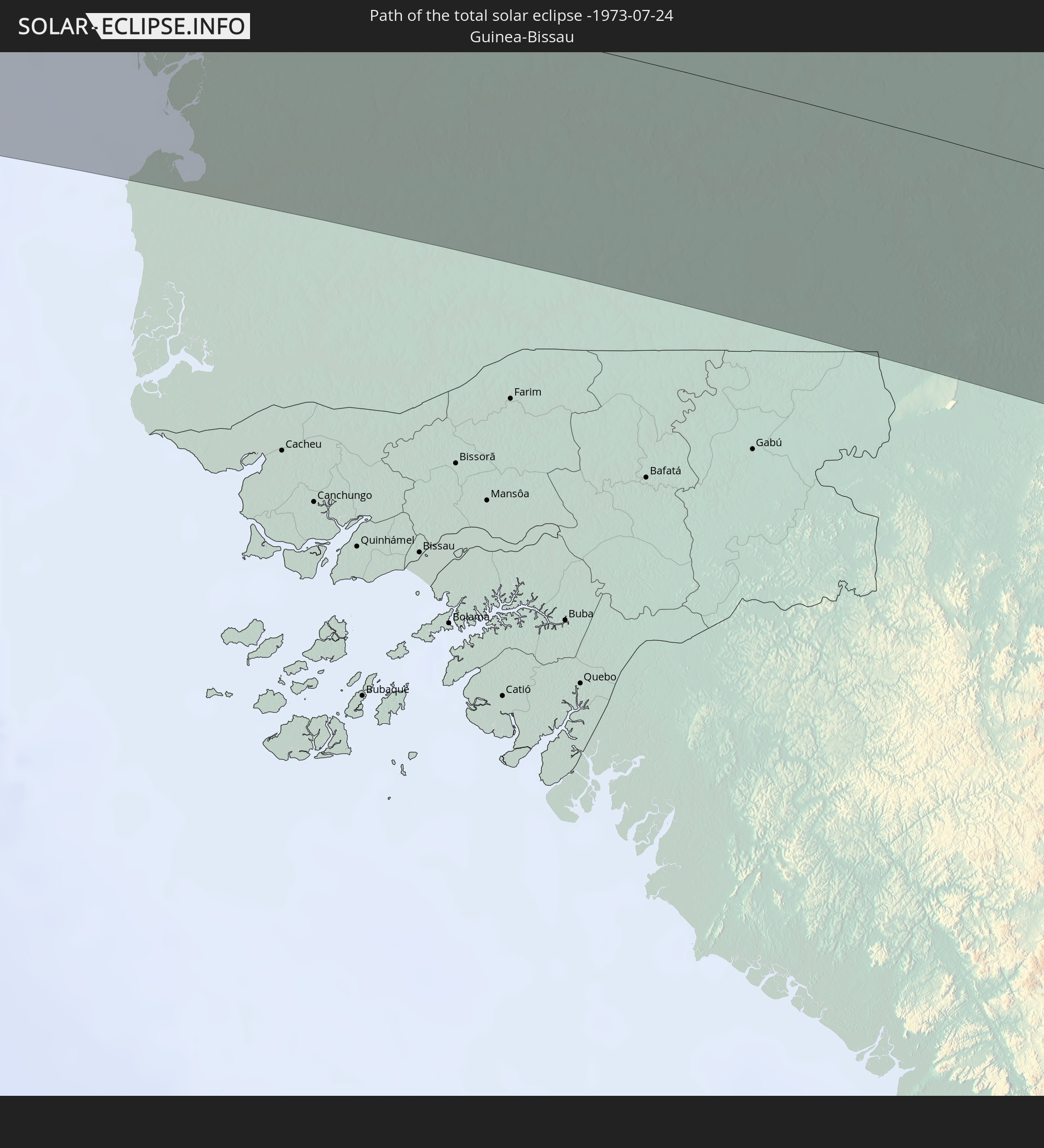 Guinea-Bissau
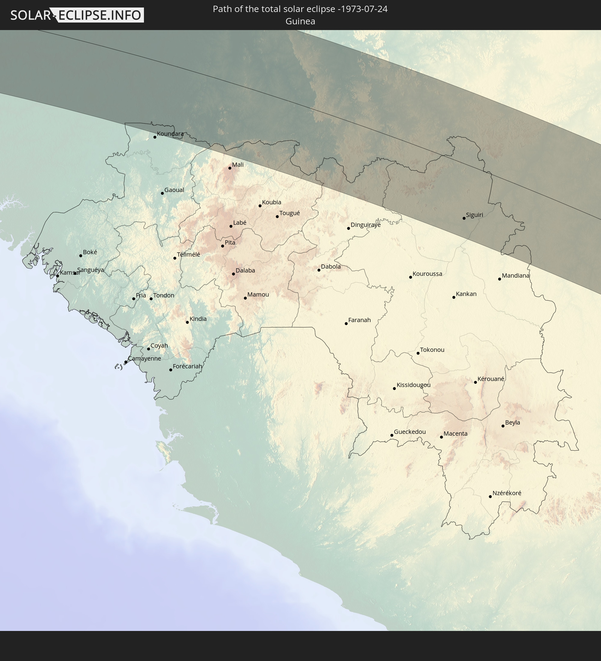 Guinea
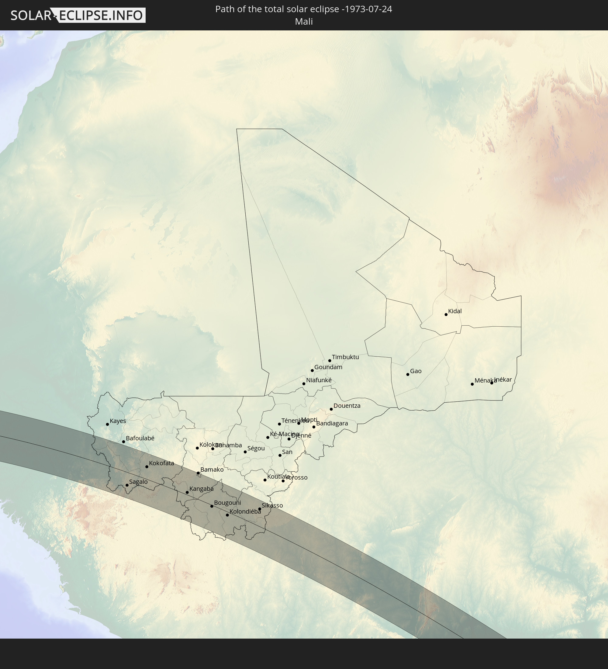 Mali
Mali
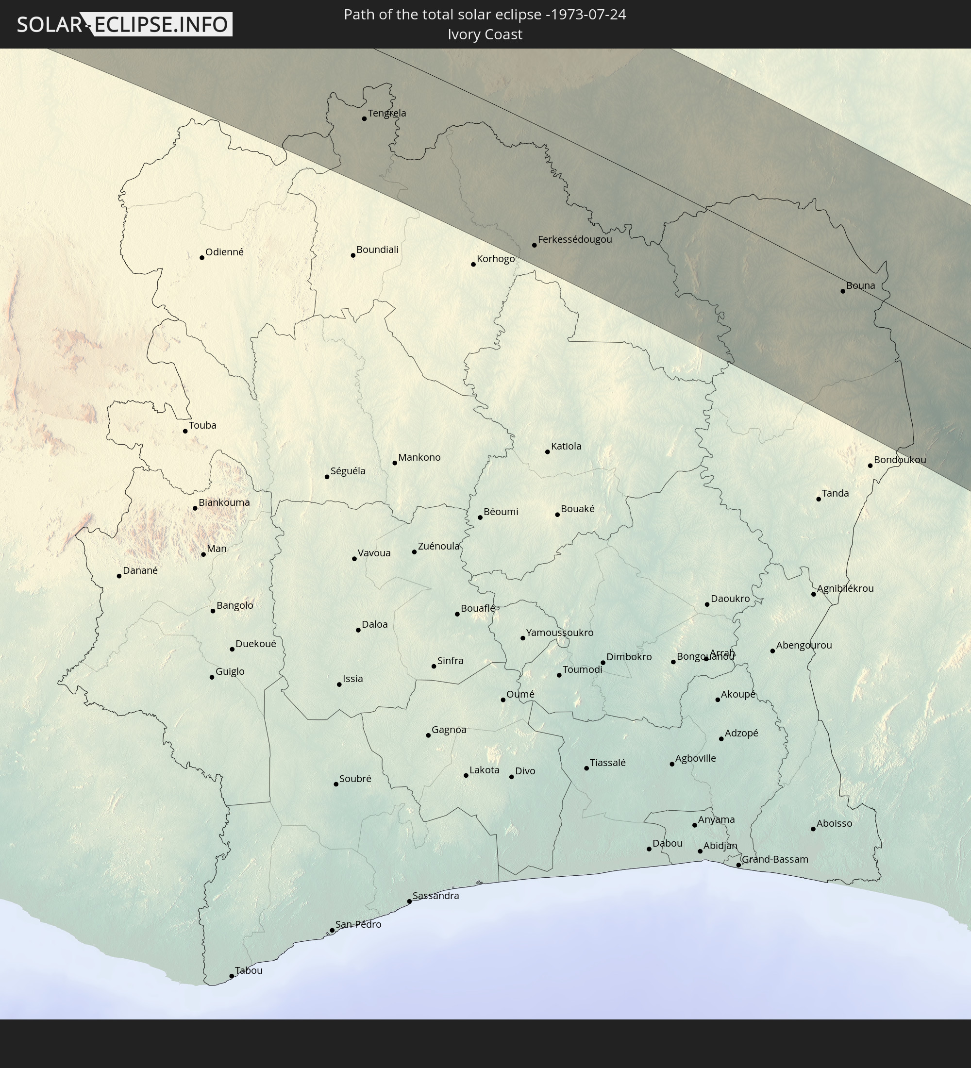 Ivory Coast
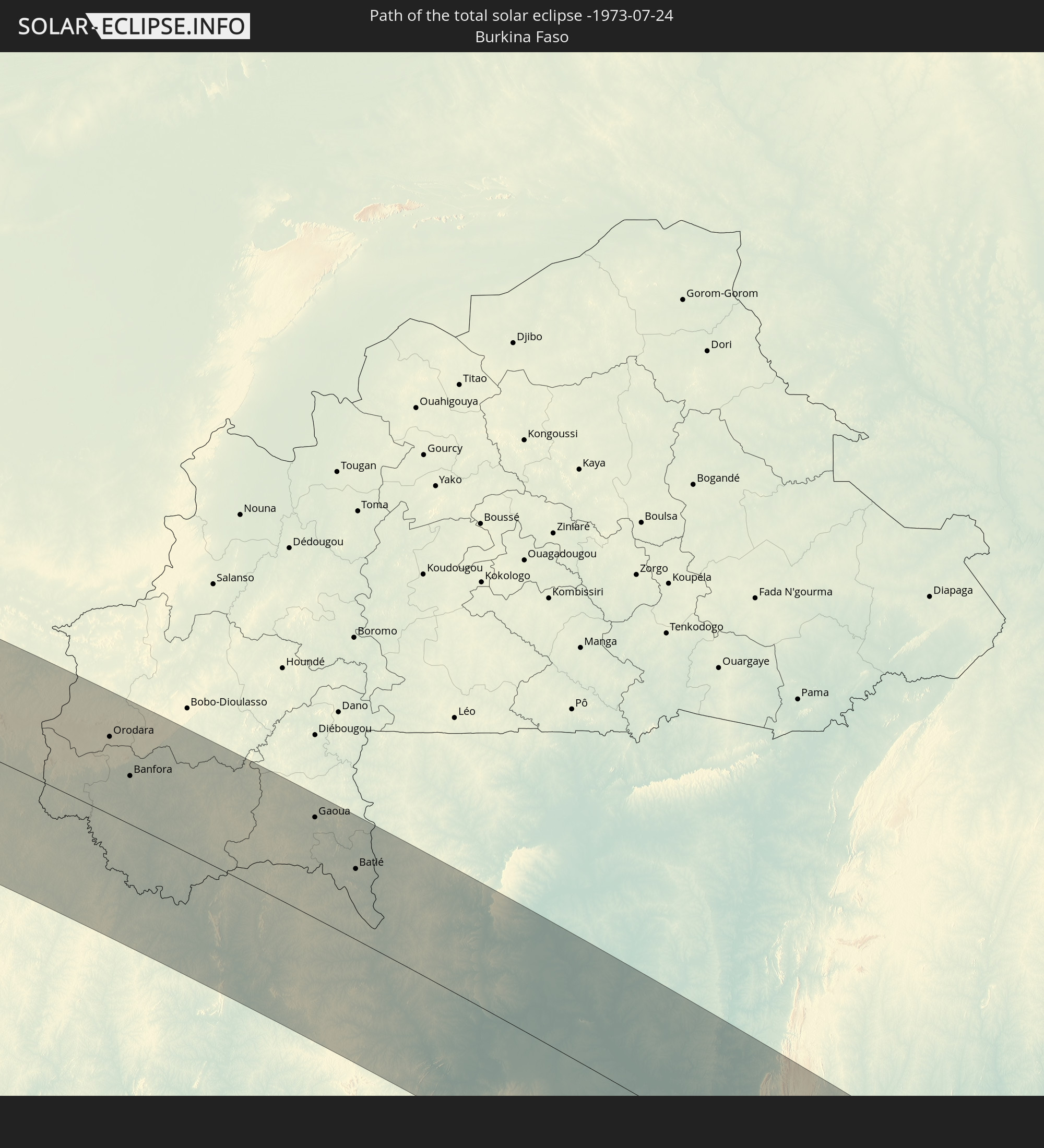 Burkina Faso
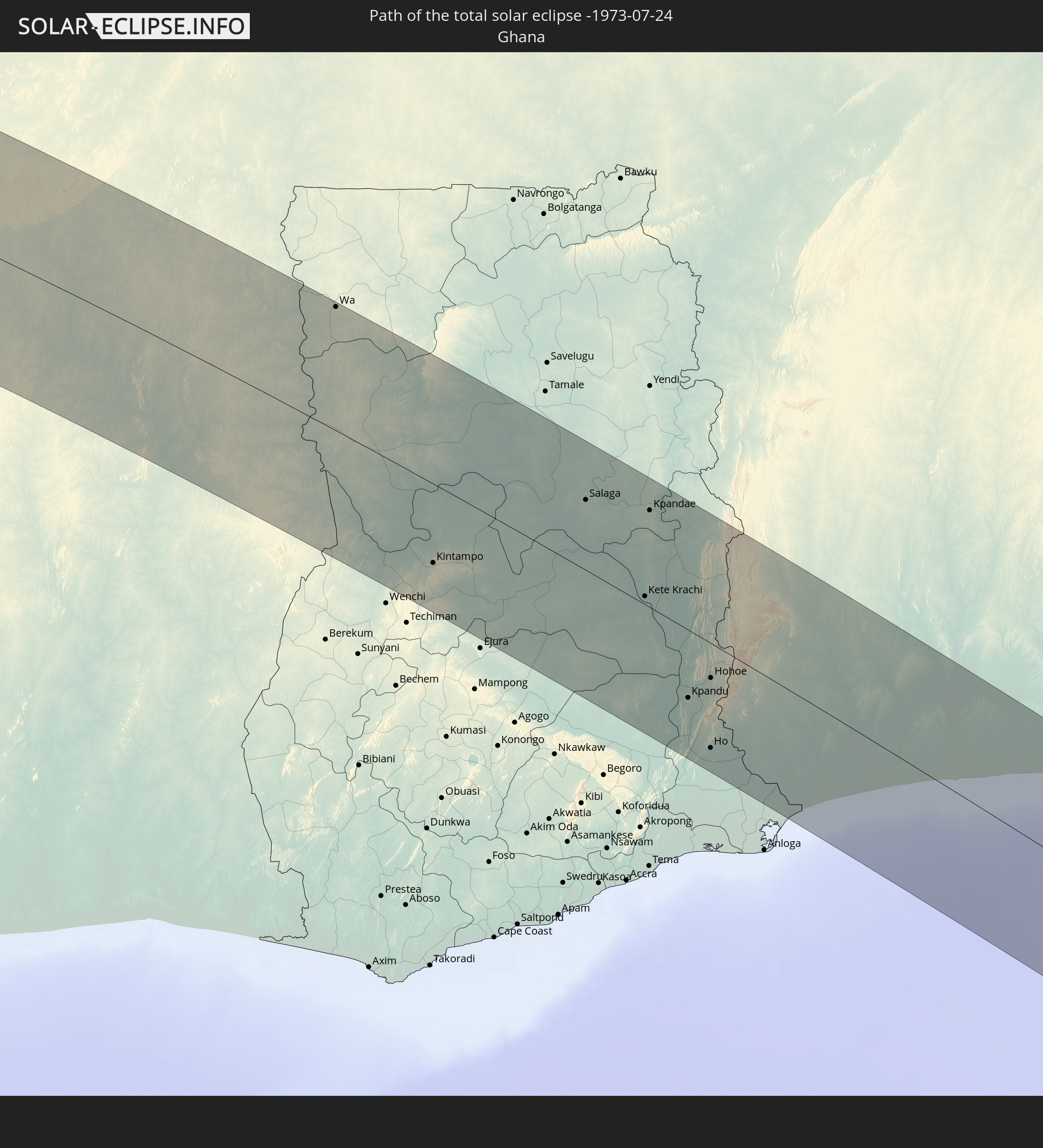 Ghana
Ghana
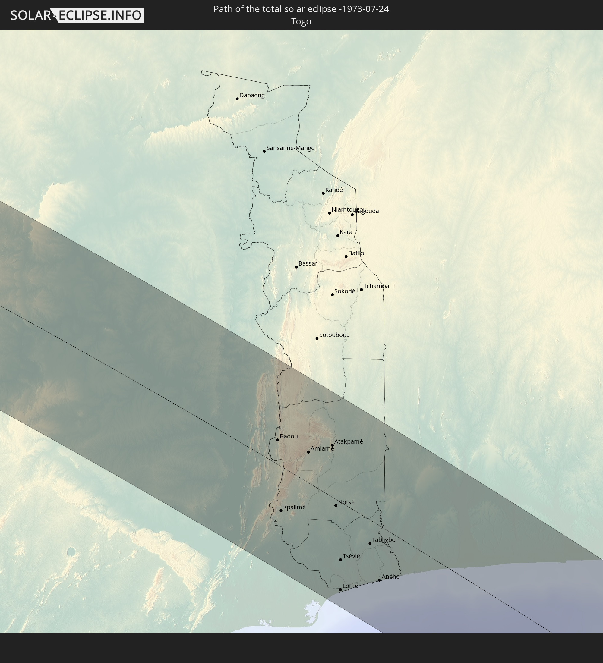 Togo
Togo
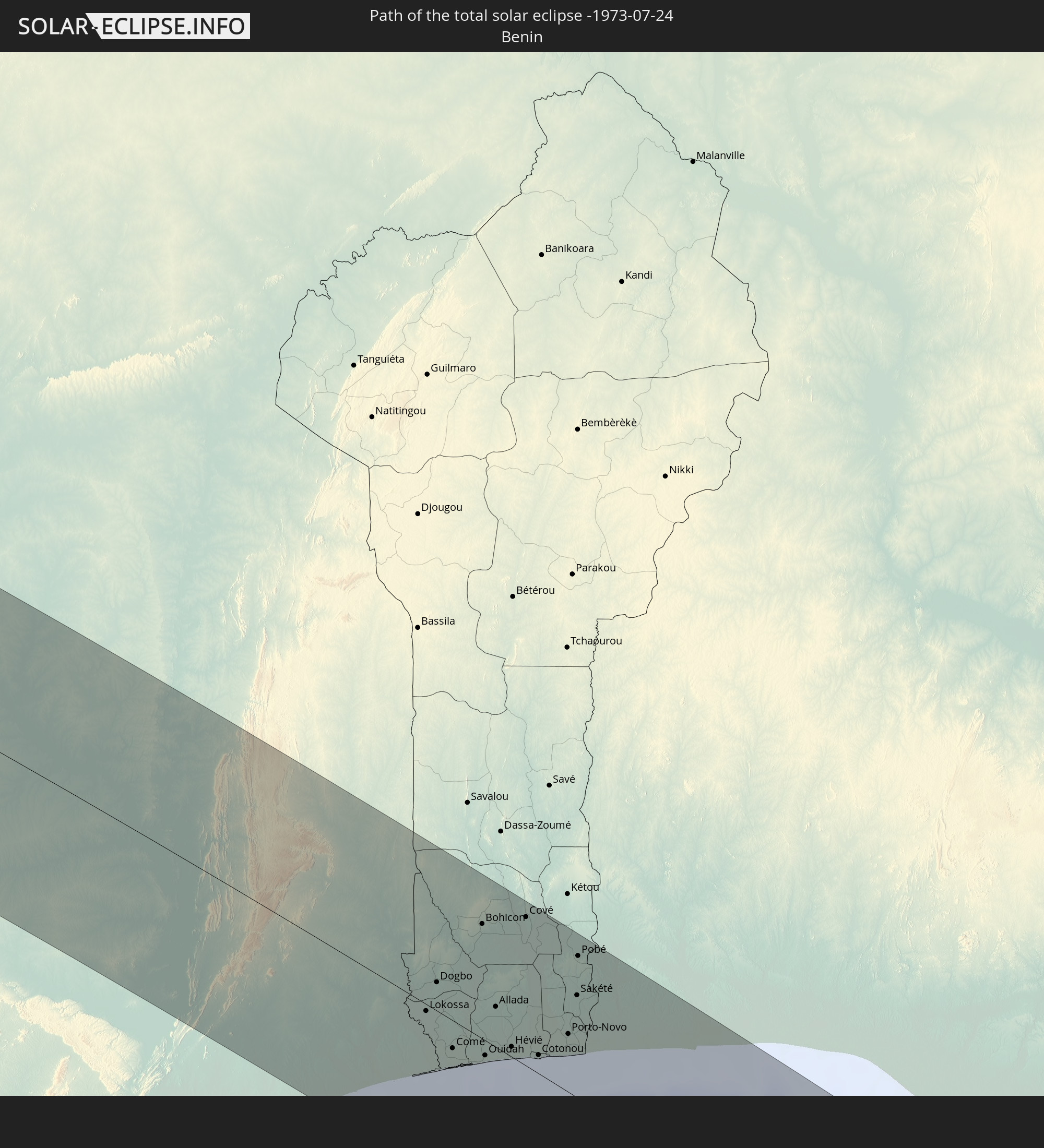 Benin
Benin
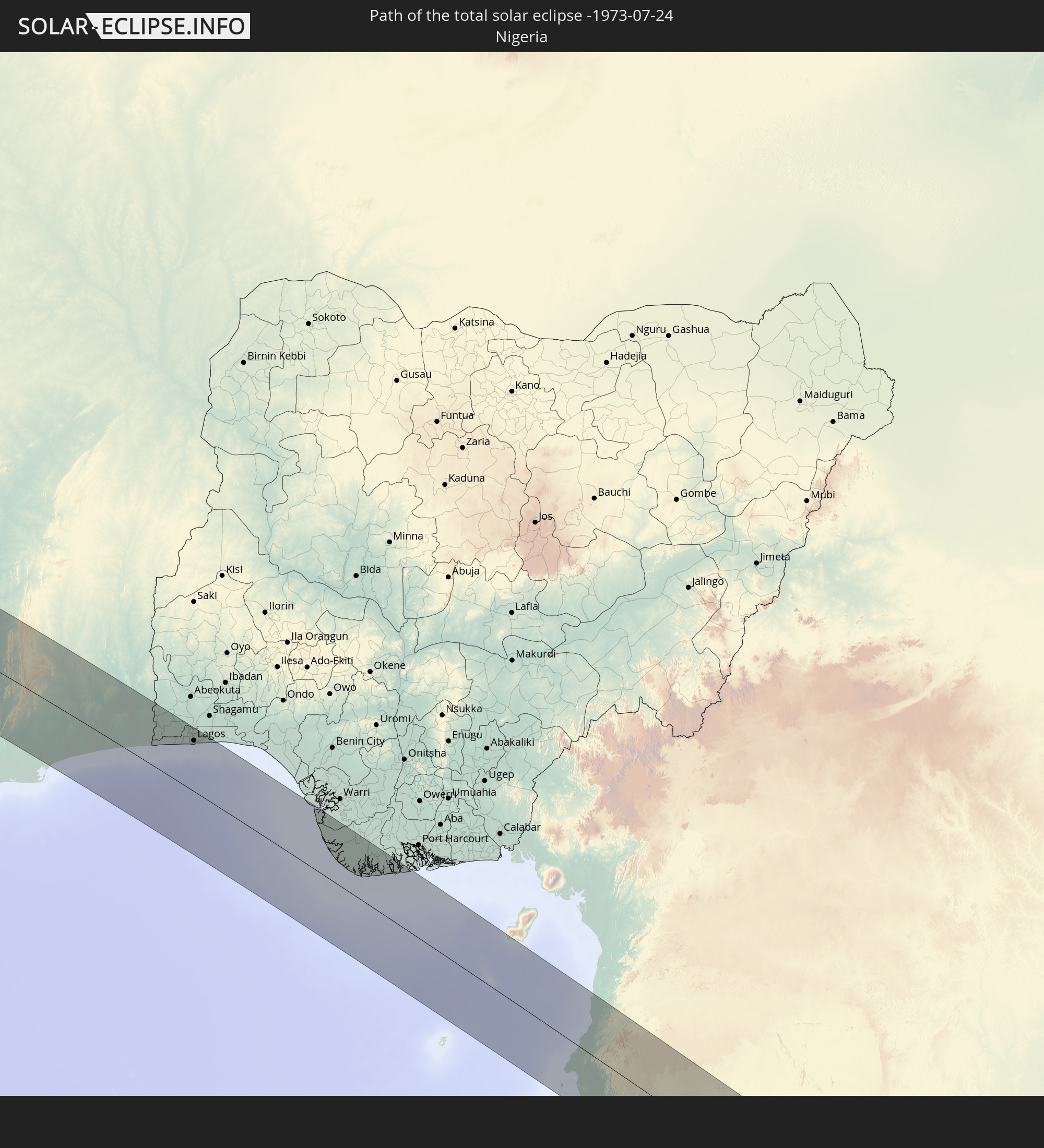 Nigeria
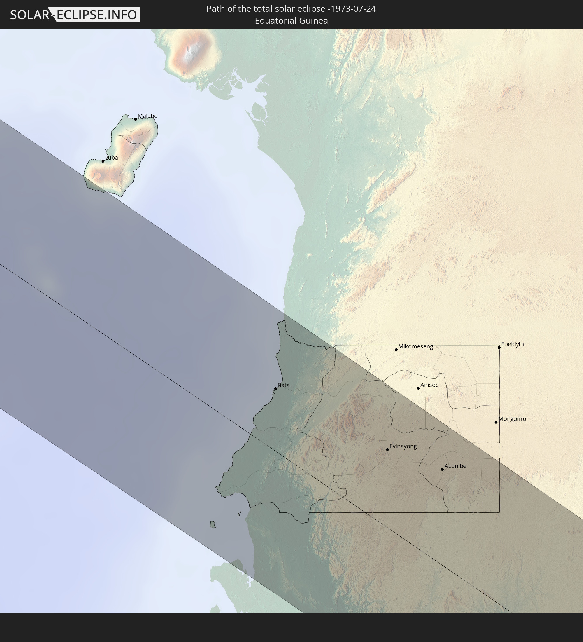 Equatorial Guinea
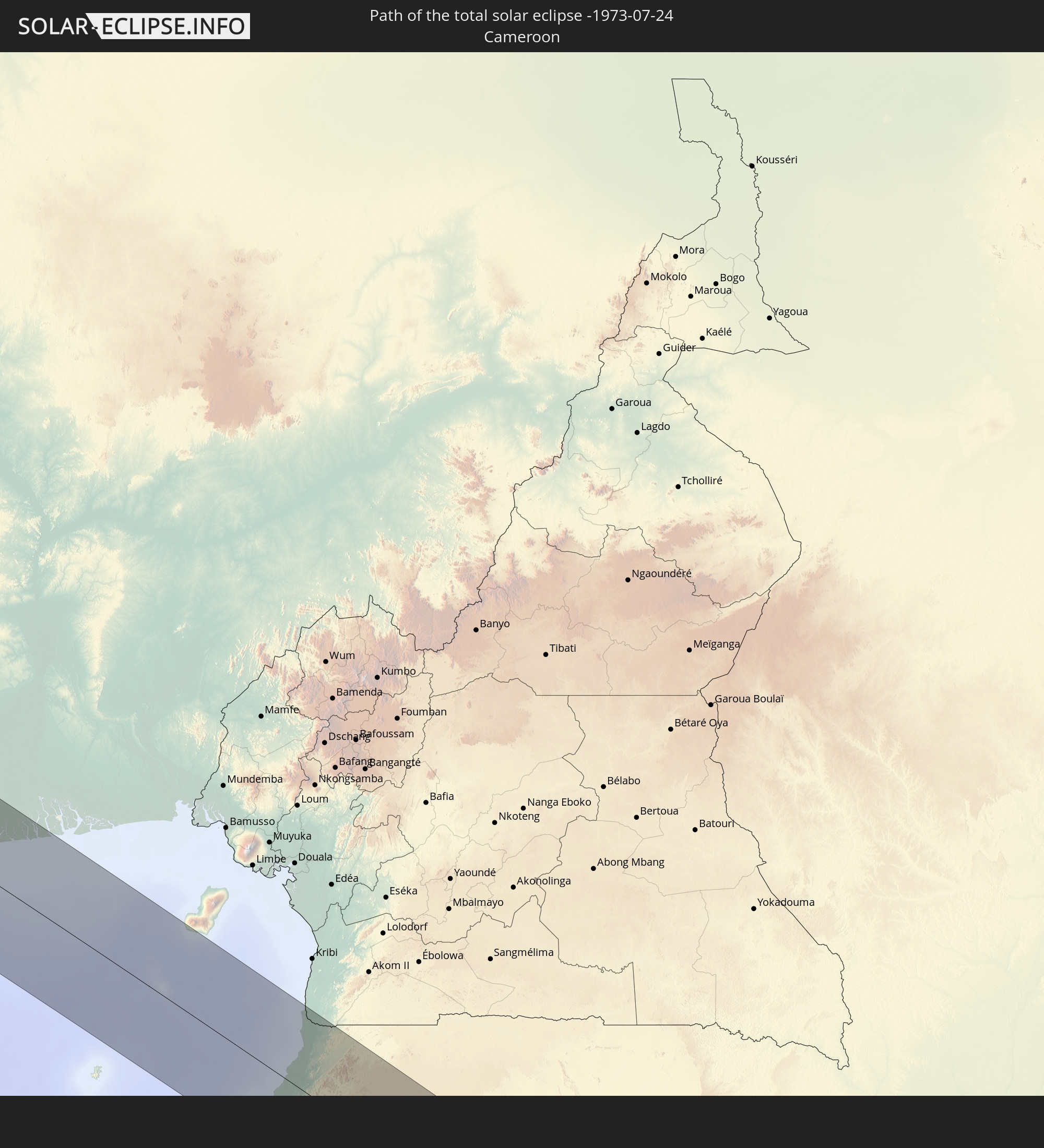 Cameroon
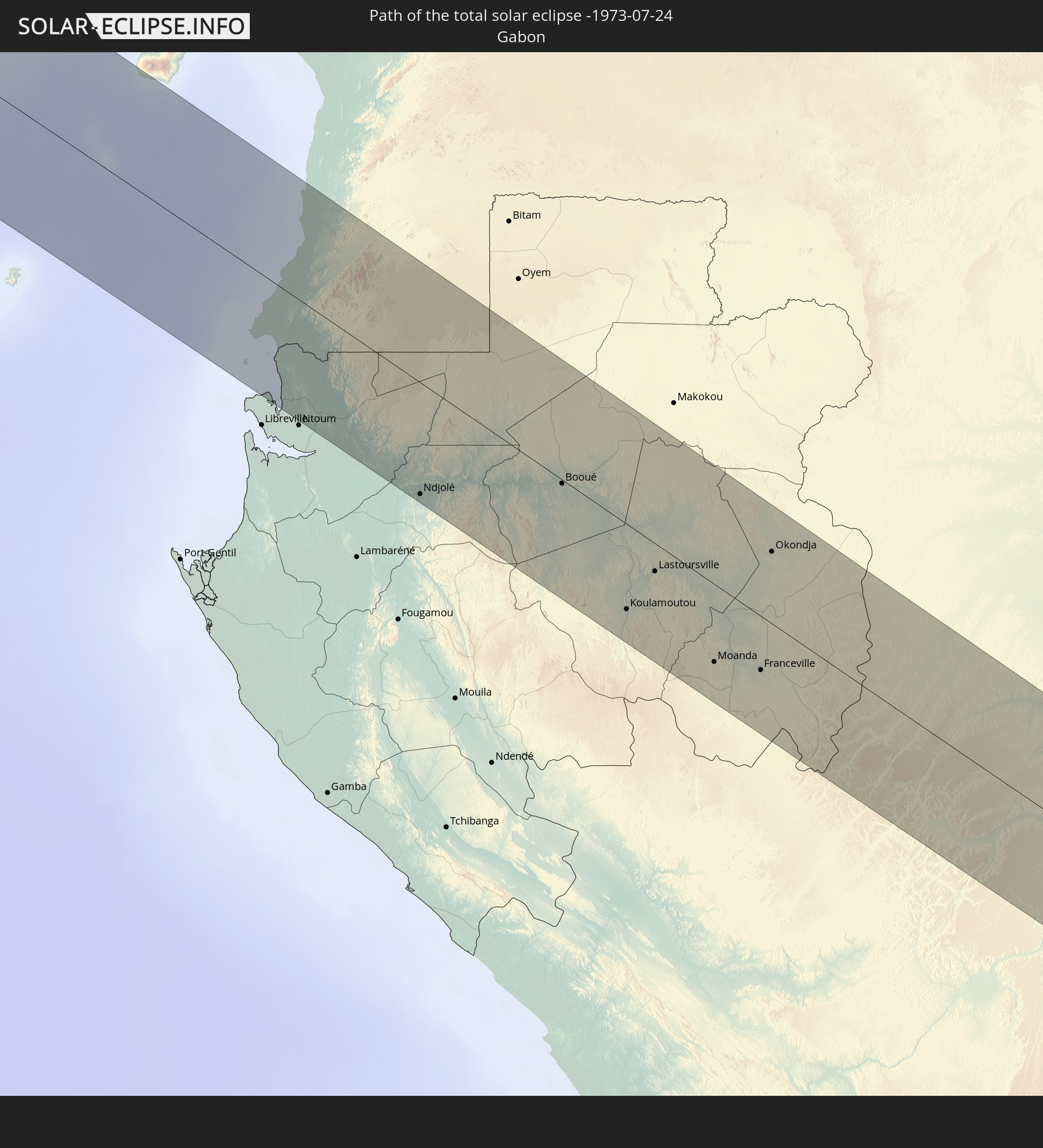 Gabon
Gabon
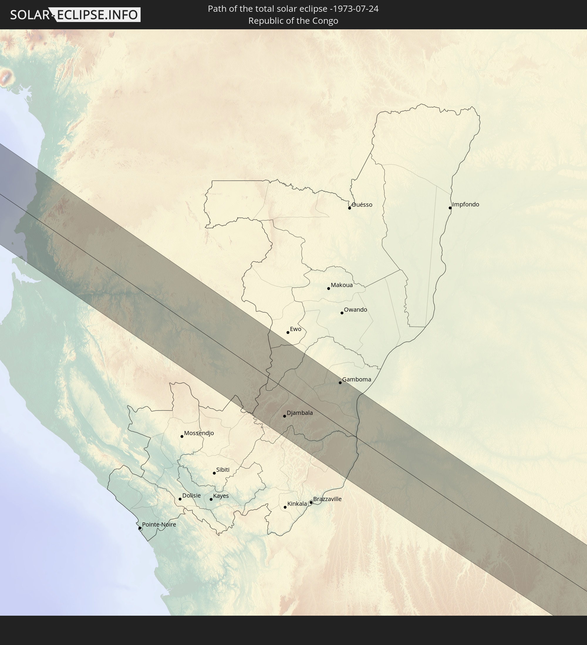 Republic of the Congo
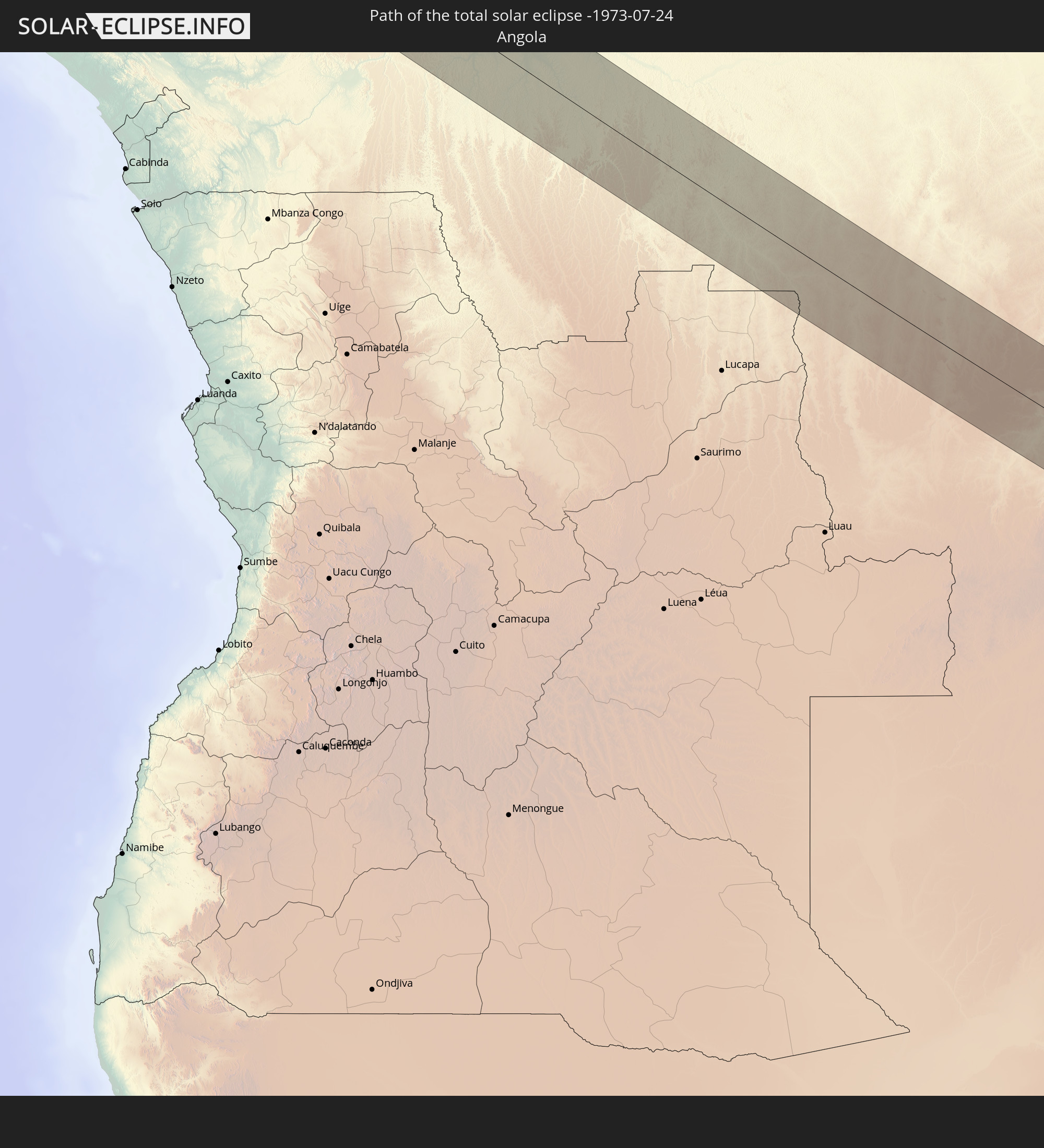 Angola
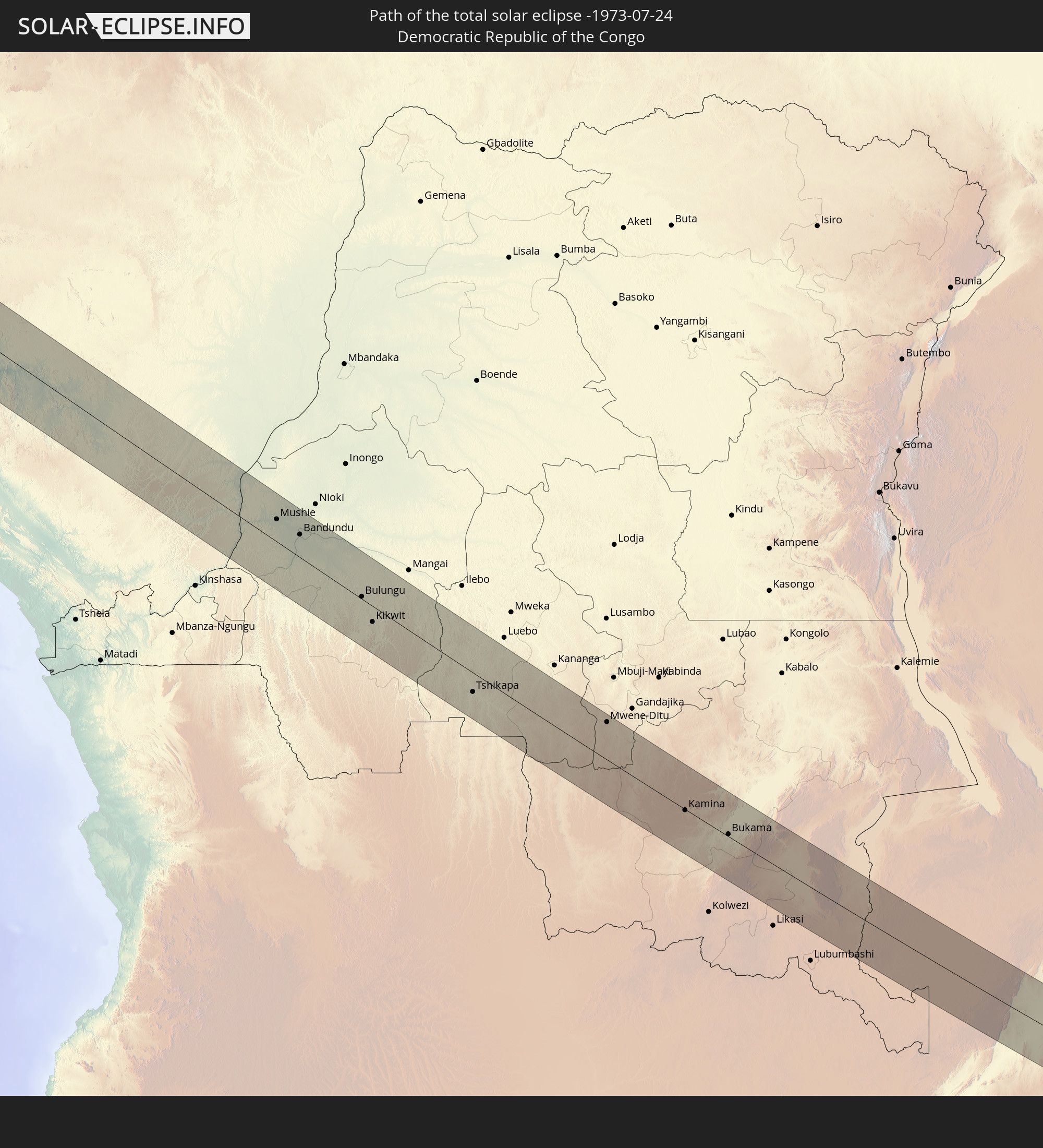 Democratic Republic of the Congo
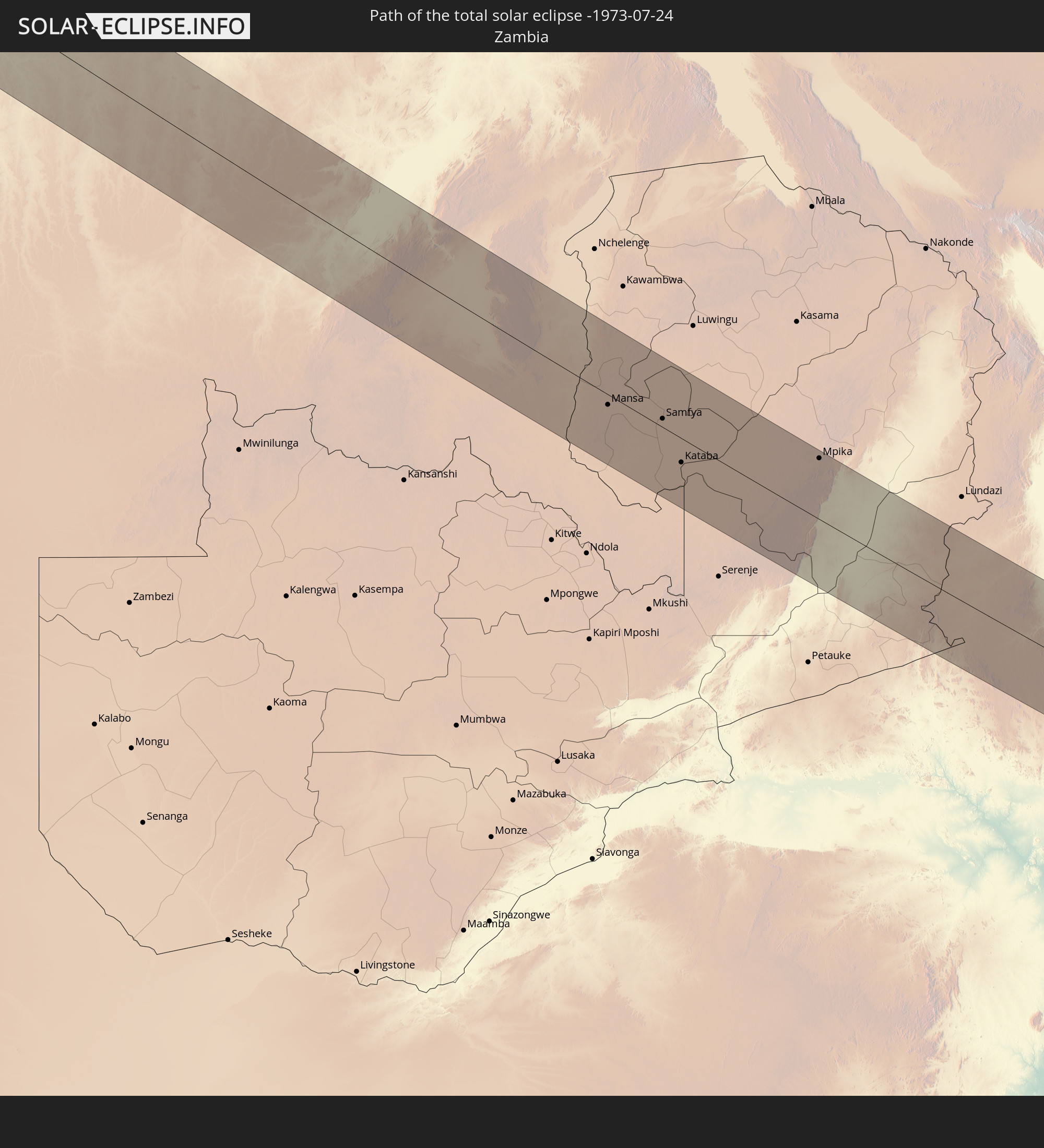 Zambia
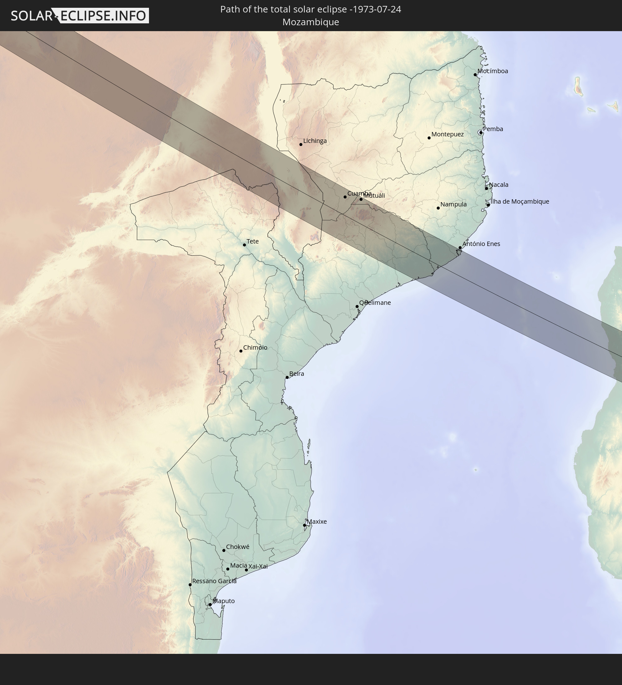 Mozambique
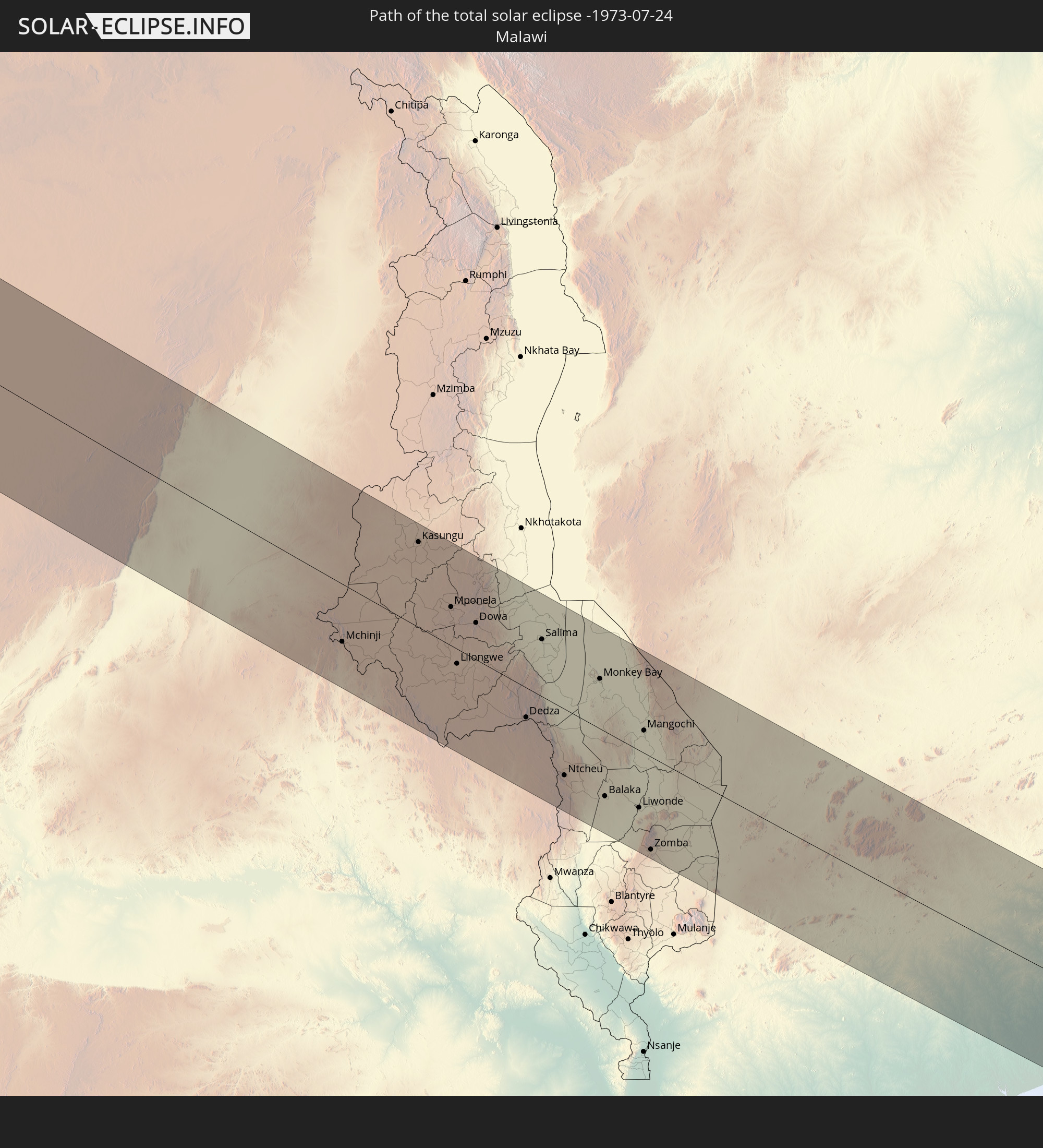 Malawi
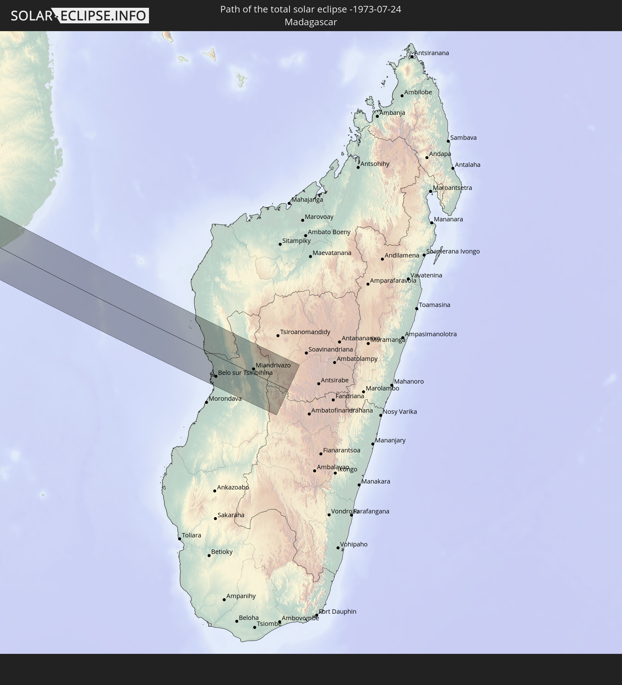 Madagascar
In den folgenden Ländern ist die Sonnenfinsternis partiell zu sehen
 United States
 United States Minor Outlying Islands
 Cuba
Cuba
 Panama
 Colombia
 Cayman Islands
 Peru
Peru
 The Bahamas
 Jamaica
 Haiti
Haiti
 Brazil
 Argentina
 Venezuela
 Turks and Caicos Islands
 Dominican Republic
 Aruba
Aruba
 Bolivia
 Puerto Rico
 United States Virgin Islands
 Bermuda
 British Virgin Islands
 Anguilla
 Collectivity of Saint Martin
 Saint Barthélemy
 Saint Kitts and Nevis
 Paraguay
 Antigua and Barbuda
 Montserrat
 Trinidad and Tobago
 Guadeloupe
 Grenada
 Dominica
 Saint Vincent and the Grenadines
 Guyana
 Martinique
 Saint Lucia
 Barbados
 Suriname
 French Guiana
 Portugal
 Cabo Verde
 Spain
Spain
 Senegal
 Mauritania
 The Gambia
 Guinea-Bissau
 Guinea
 Saint Helena, Ascension and Tristan da Cunha
 Sierra Leone
 Morocco
 Mali
Mali
 Liberia
 Algeria
 Ivory Coast
 Burkina Faso
 Gibraltar
 Ghana
Ghana
 Togo
Togo
 Niger
Niger
 Benin
Benin
 Nigeria
 Equatorial Guinea
 São Tomé and Príncipe
 Italy
Italy
 Tunisia
 Cameroon
 Gabon
Gabon
 Libya
Libya
 Republic of the Congo
 Angola
 Namibia
 Democratic Republic of the Congo
 Chad
Chad
 Malta
Malta
 Central African Republic
 South Africa
 Botswana
 Sudan
Sudan
 Zambia
 Egypt
Egypt
 Zimbabwe
 Lesotho
 Rwanda
 Burundi
 Tanzania
 Uganda
 Mozambique
 Swaziland
 Malawi
 Ethiopia
 Kenya
Kenya
 Saudi Arabia
 Eritrea
 French Southern and Antarctic Lands
 Somalia
 Djibouti
 Yemen
Yemen
 Madagascar
 Comoros
 Mayotte
 Seychelles
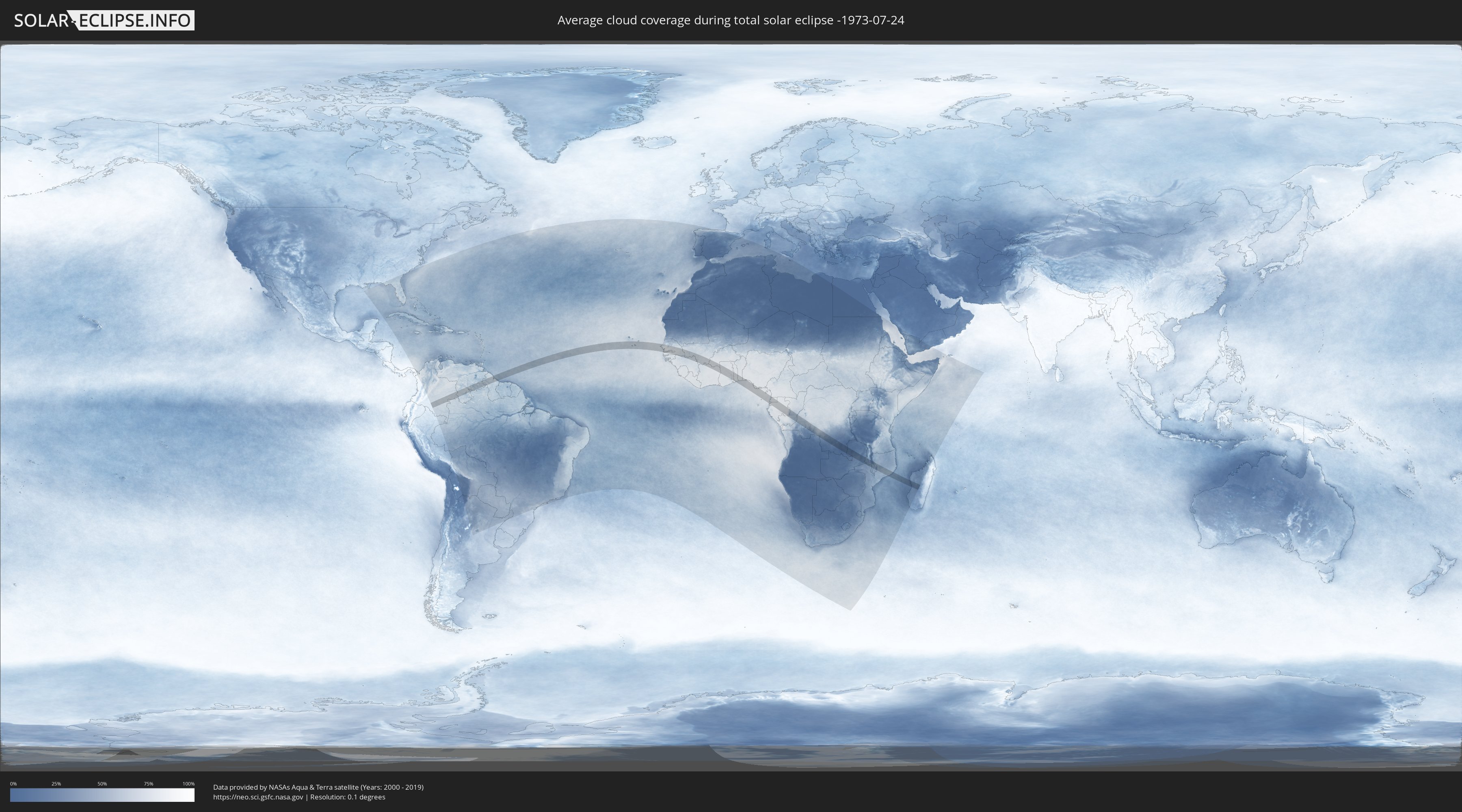
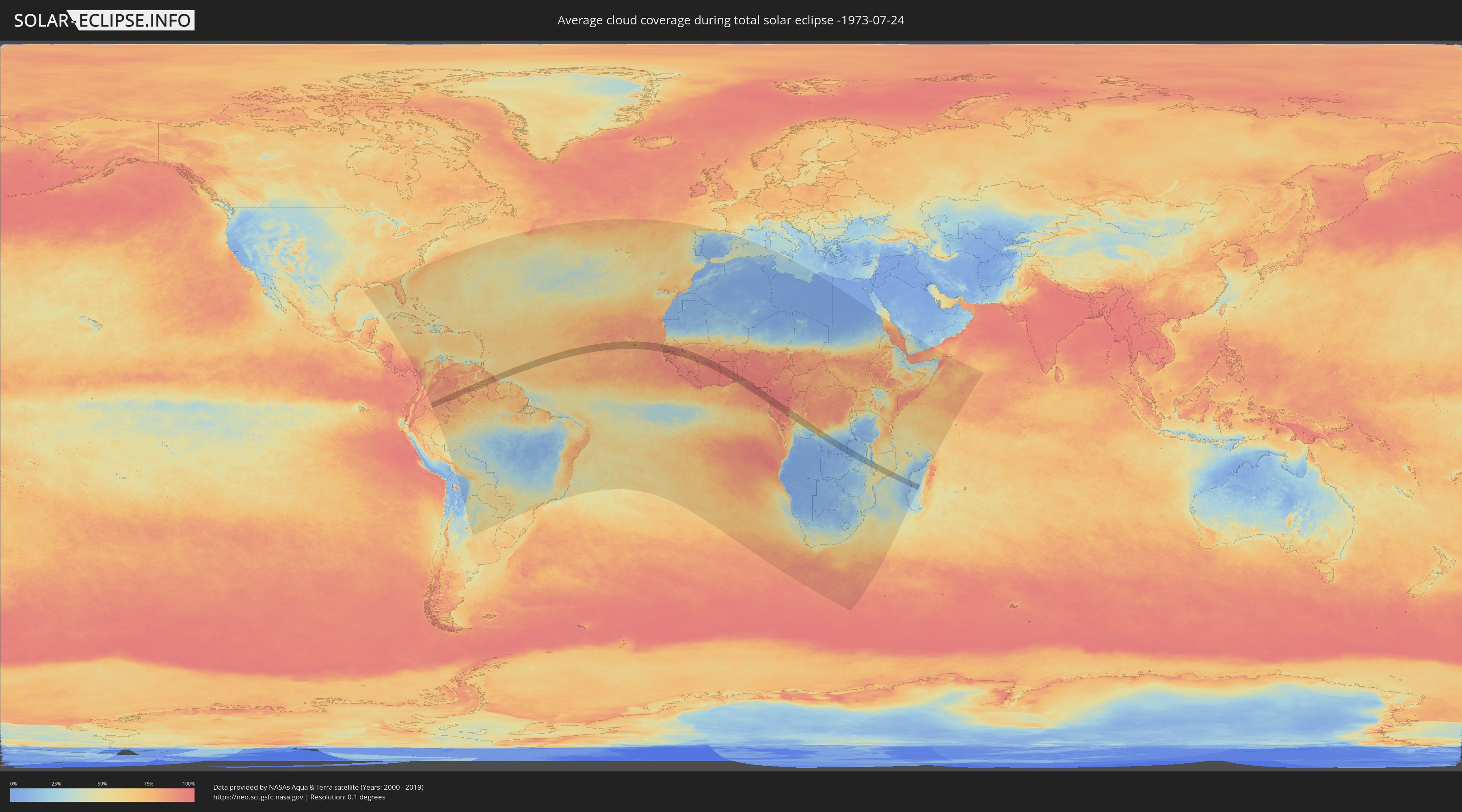
How will be the weather during the total solar eclipse on 07/24/-1973?
Where is the best place to see the total solar eclipse of 07/24/-1973?
The following maps show the average cloud coverage for the day of the total solar eclipse.
With the help of these maps, it is possible to find the place along the eclipse path, which has the best
chance of a cloudless sky.
Nevertheless, you should consider local circumstances and inform about the weather of your chosen
observation site.
The data is provided by NASAs satellites
AQUA and TERRA.
The cloud maps are averaged over a period of 19 years (2000 - 2019).
Detailed country maps
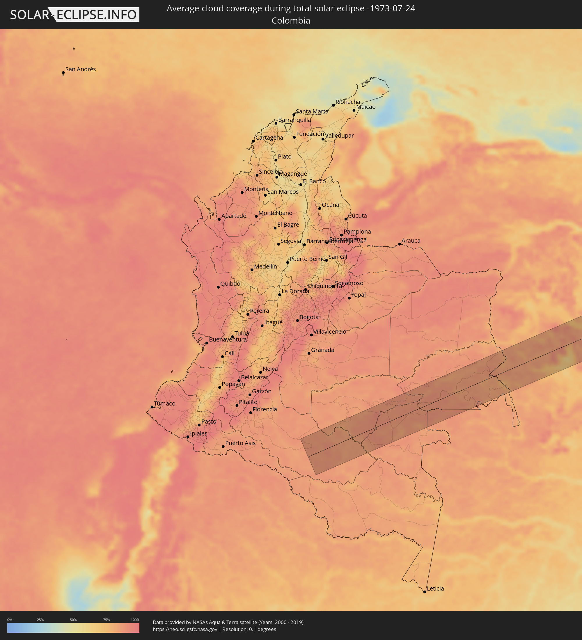 Colombia
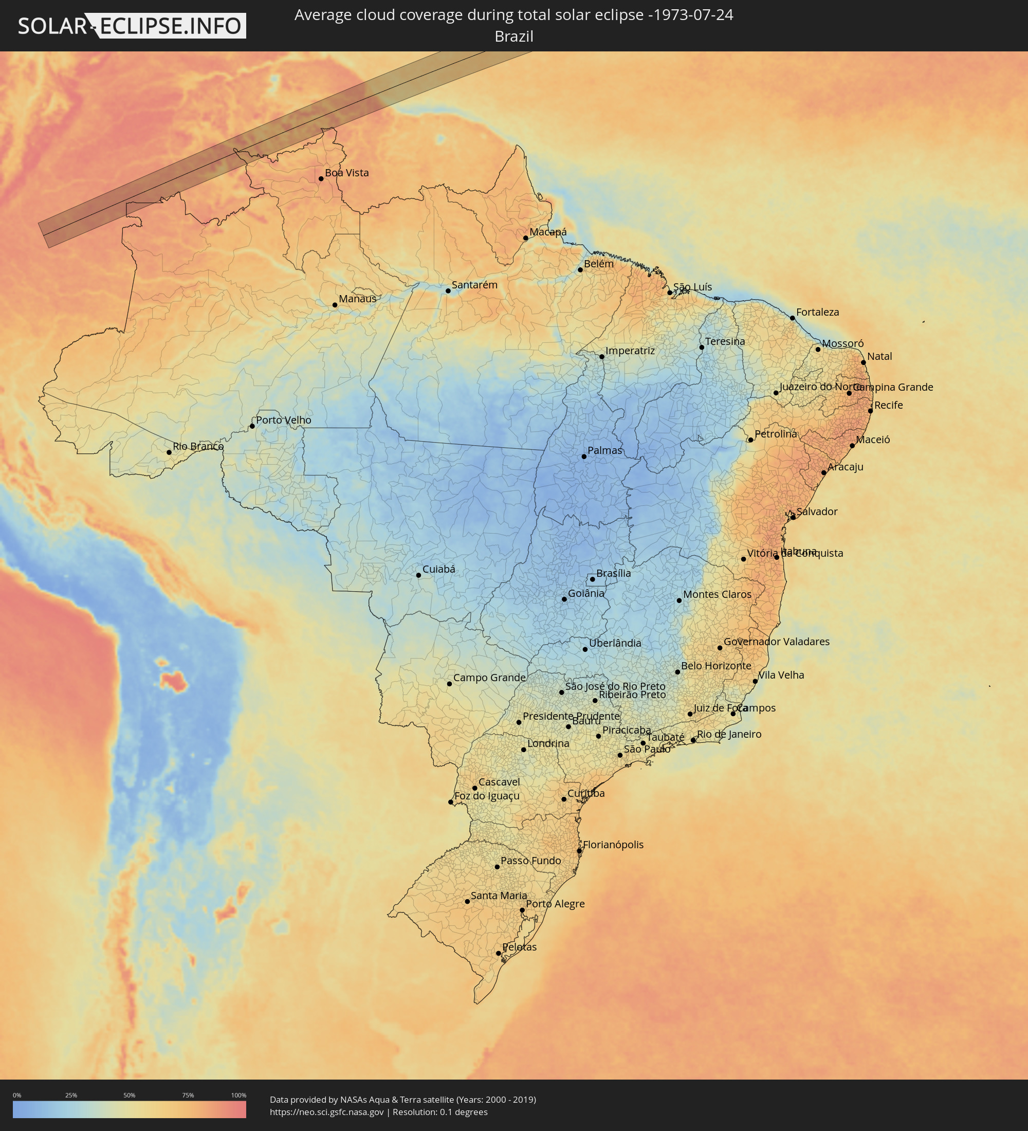 Brazil
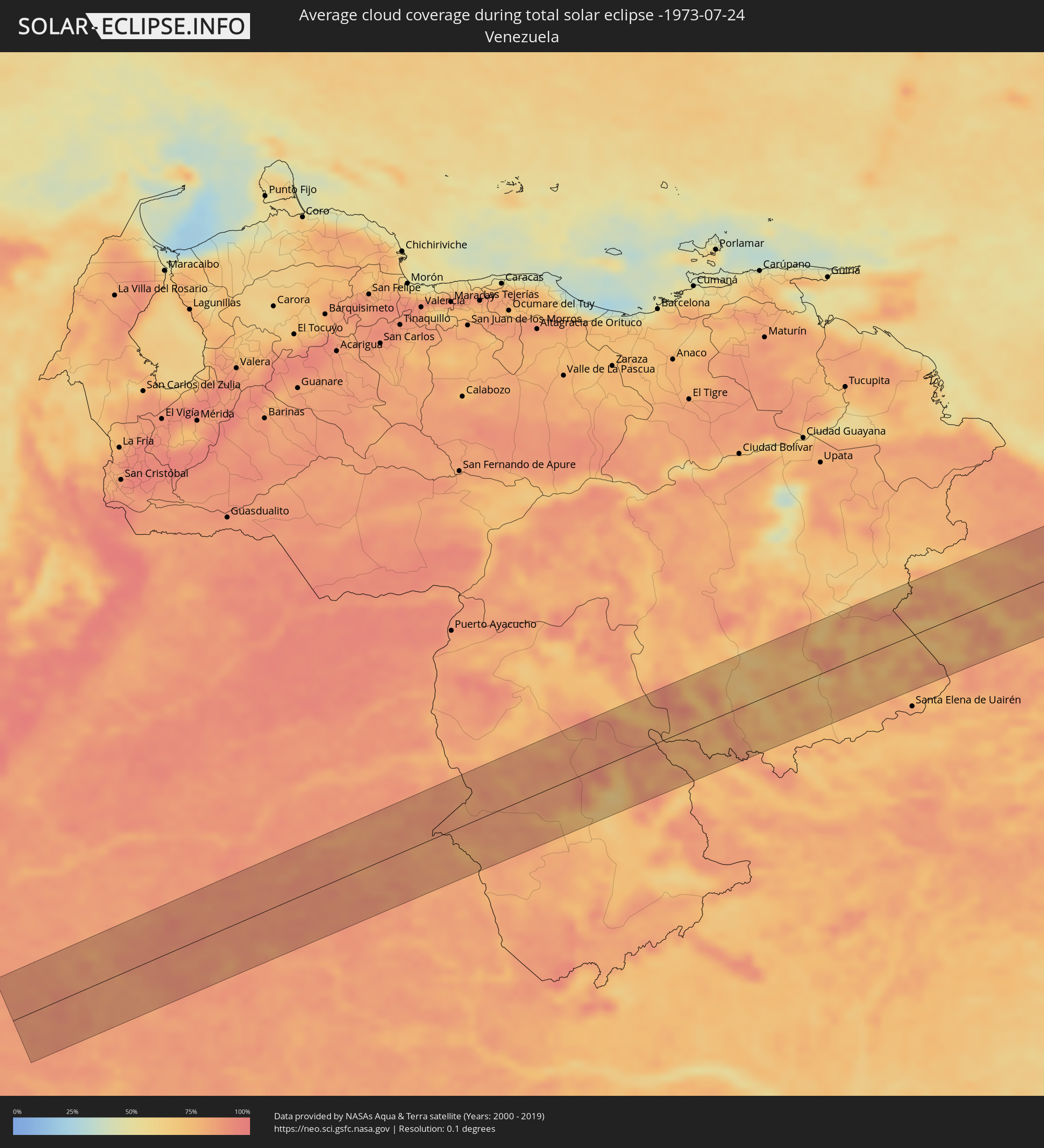 Venezuela
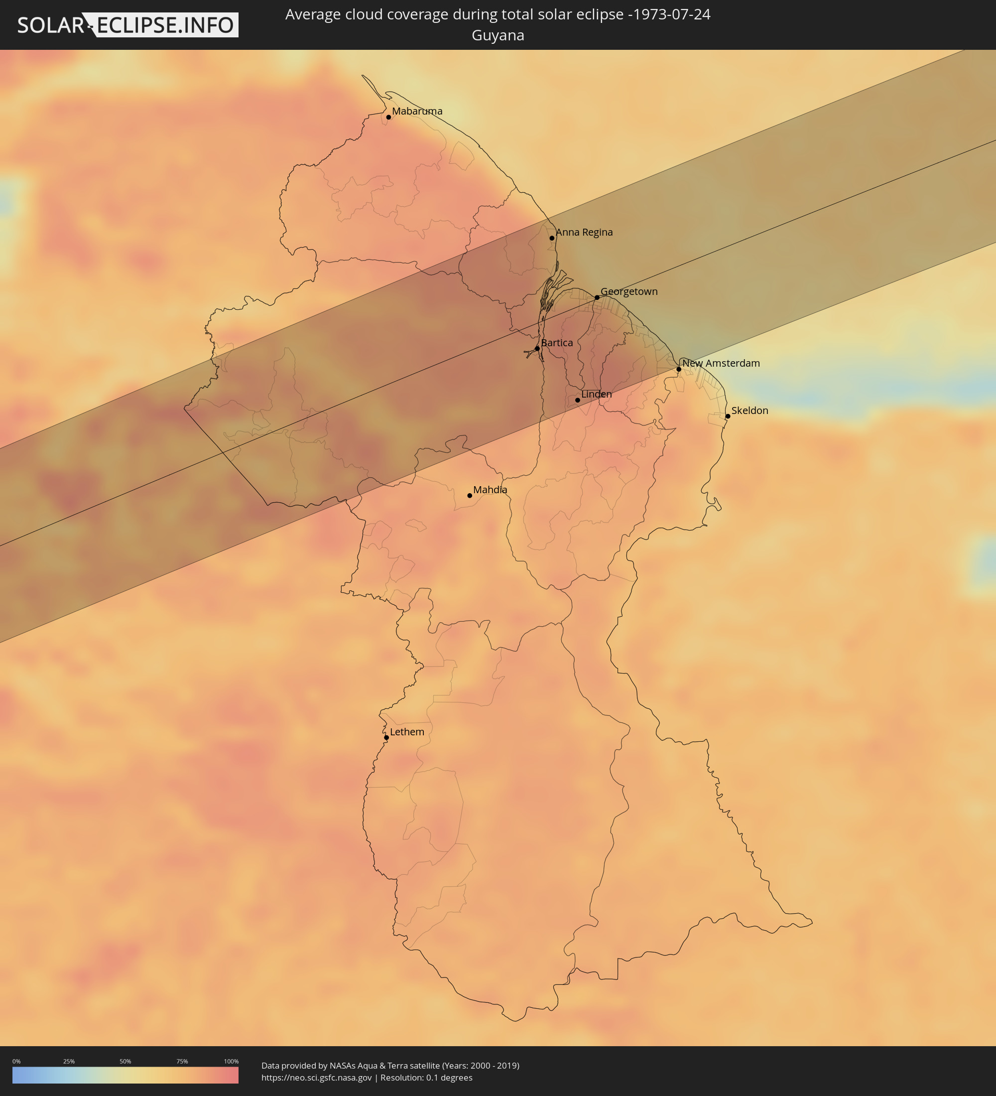 Guyana
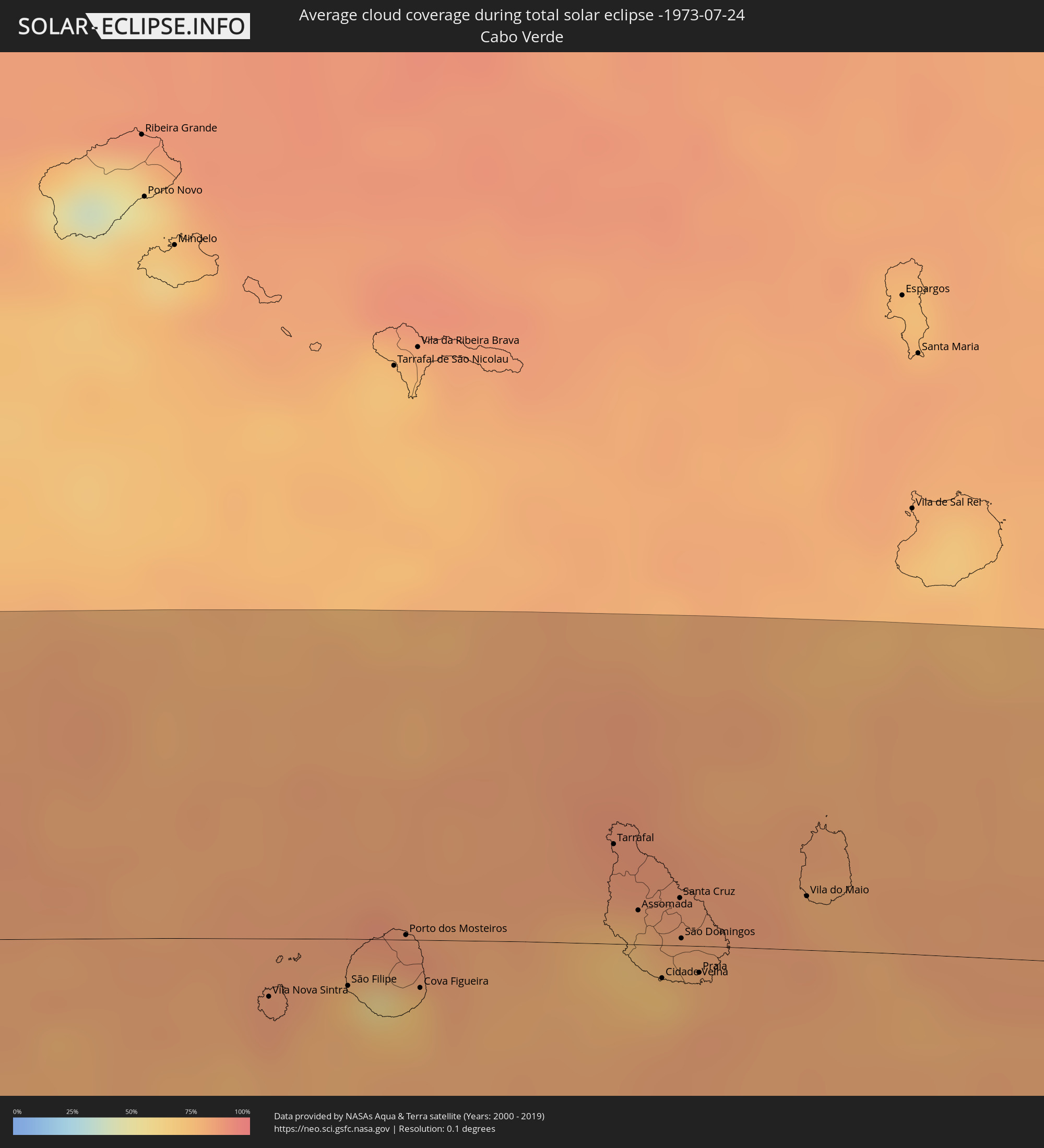 Cabo Verde
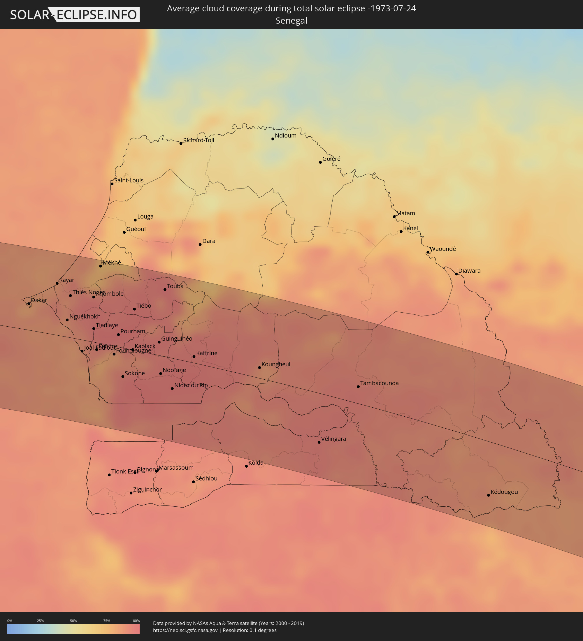 Senegal
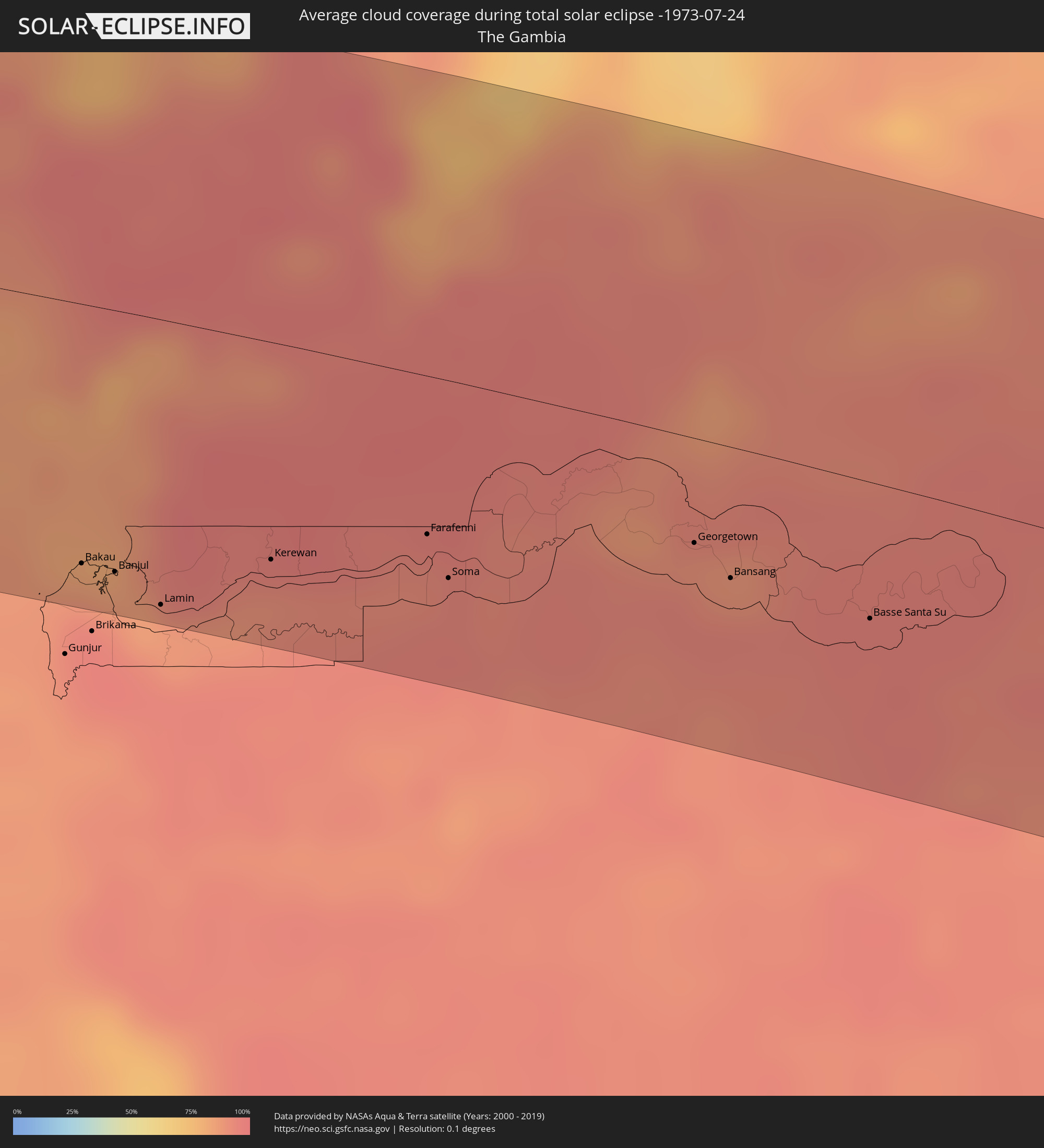 The Gambia
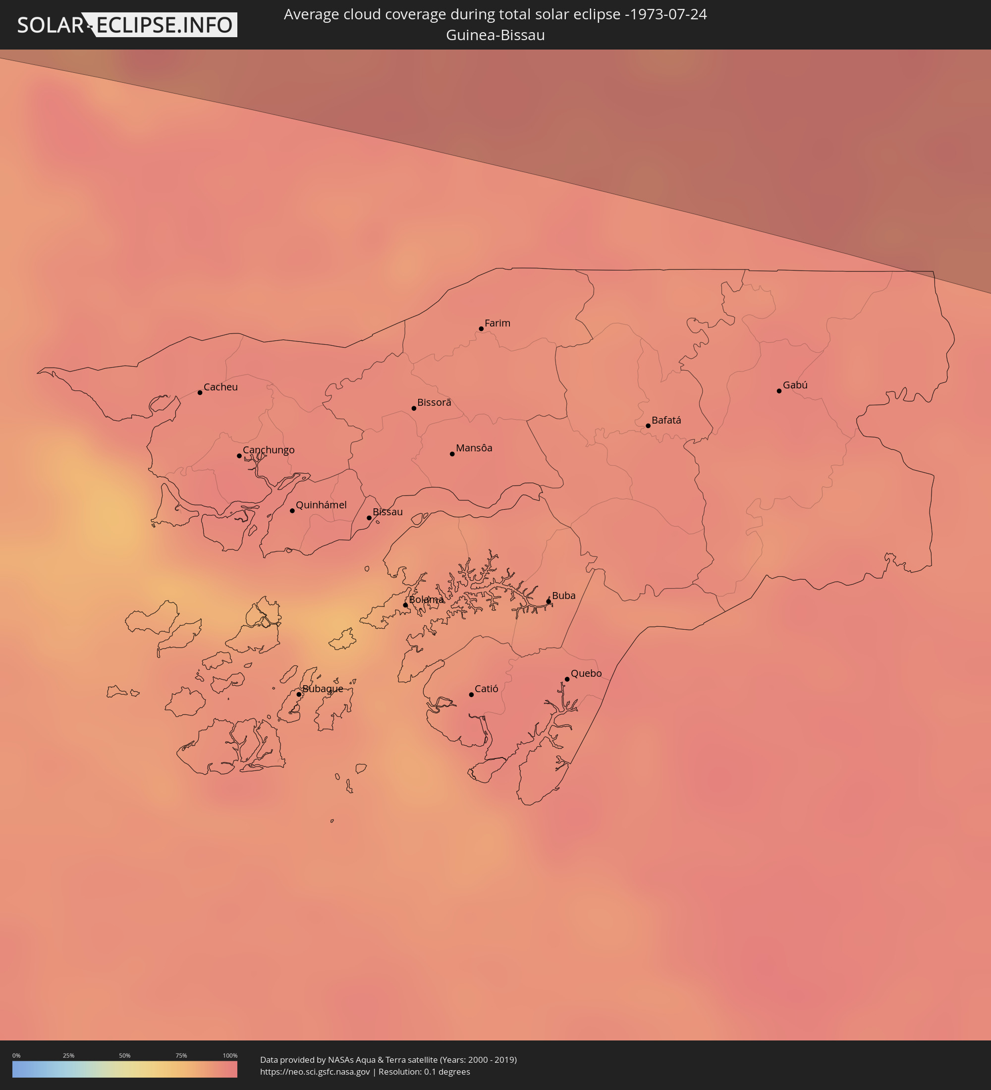 Guinea-Bissau
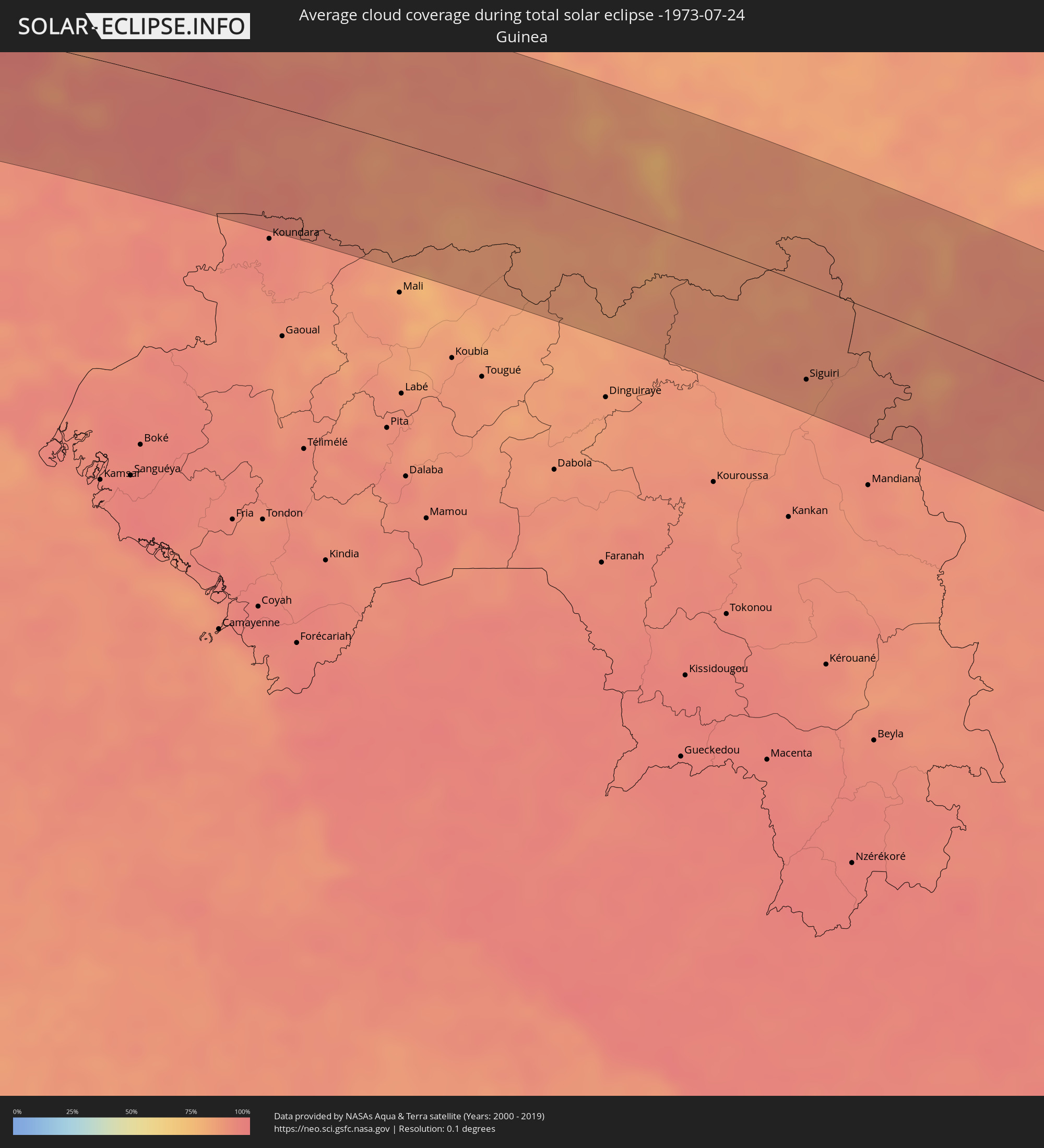 Guinea
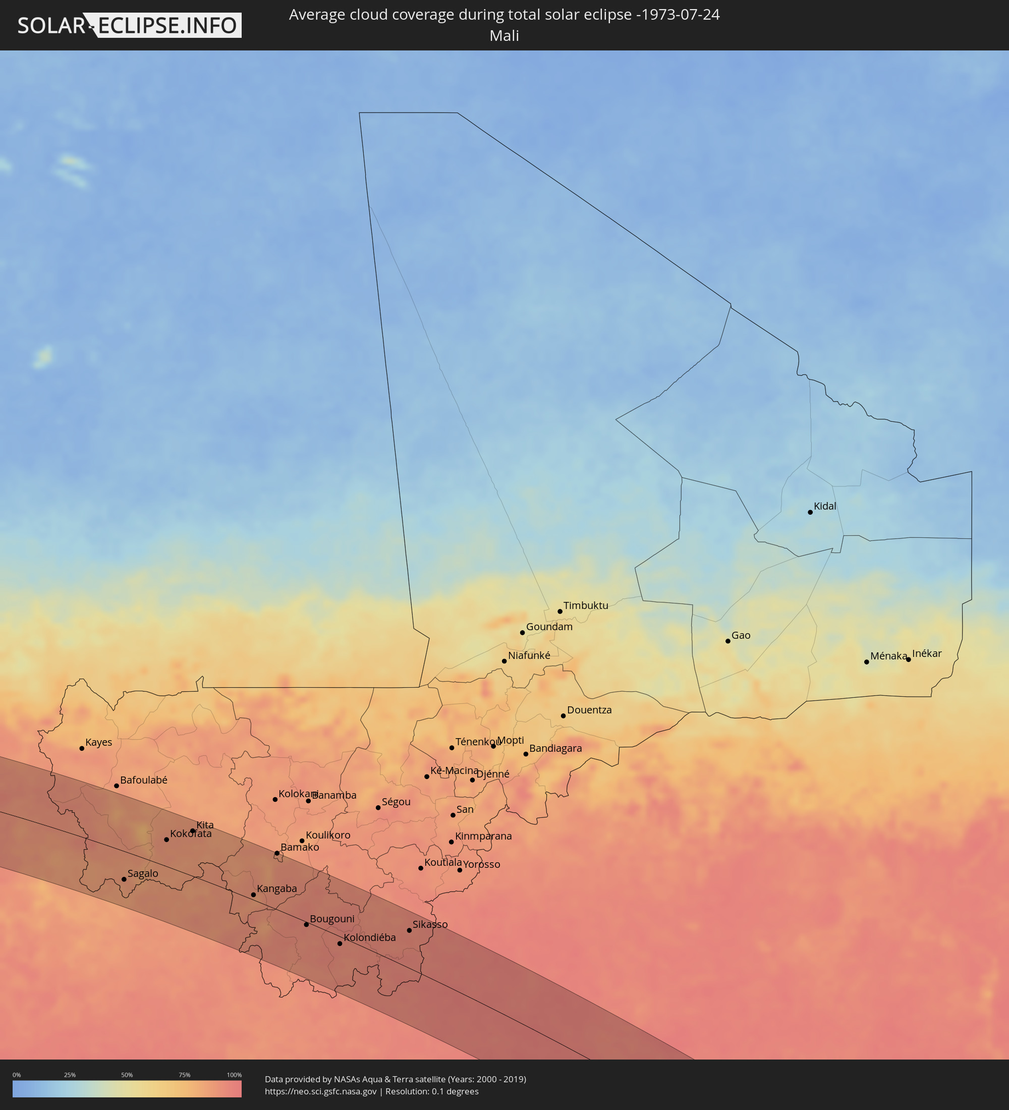 Mali
Mali
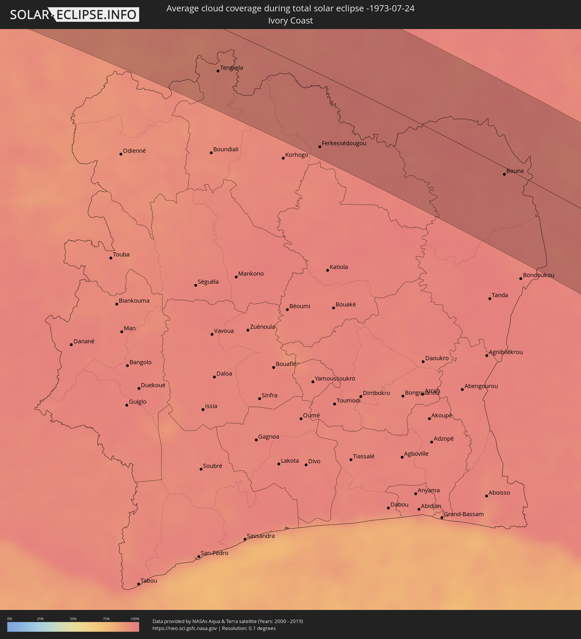 Ivory Coast
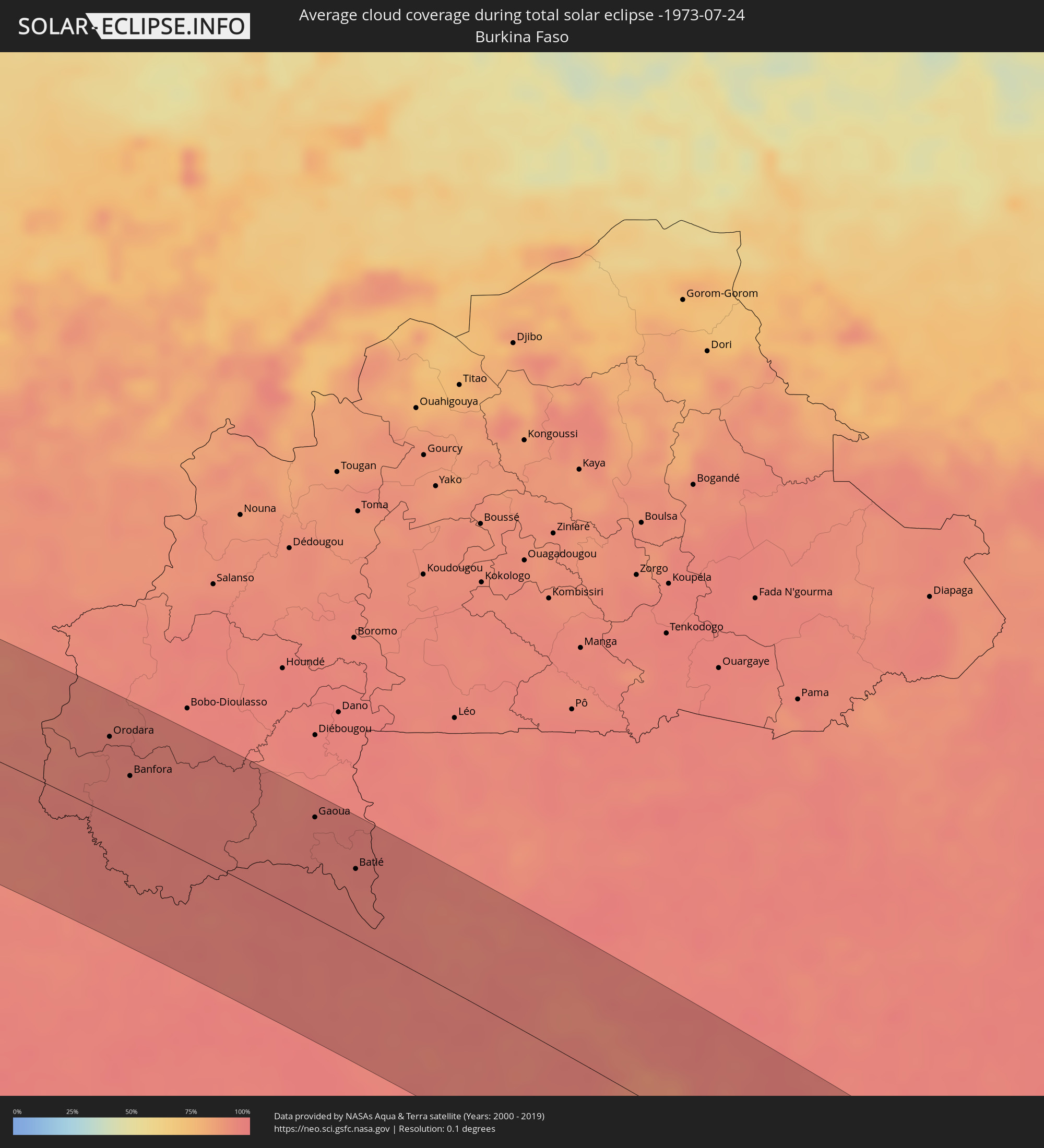 Burkina Faso
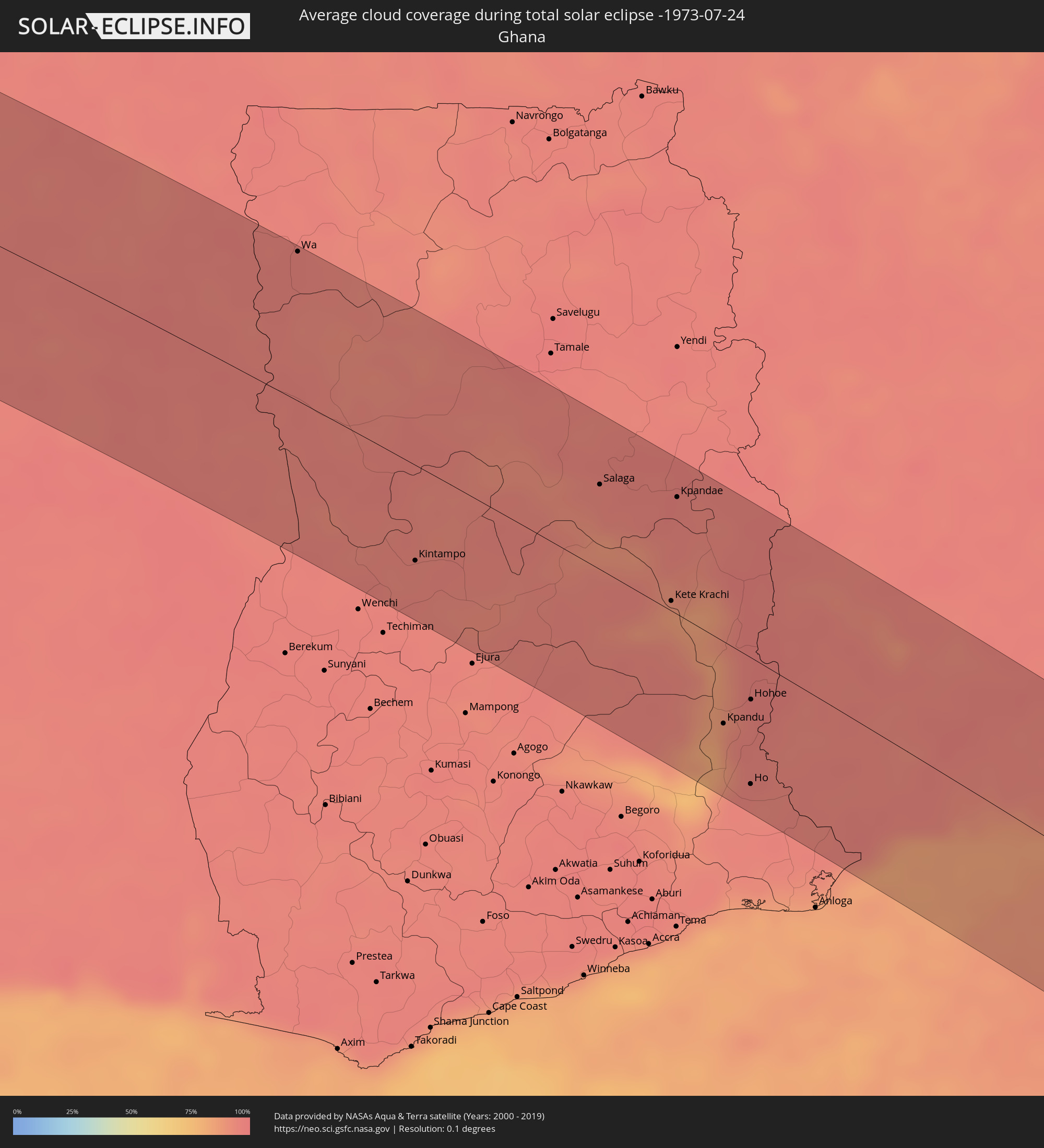 Ghana
Ghana
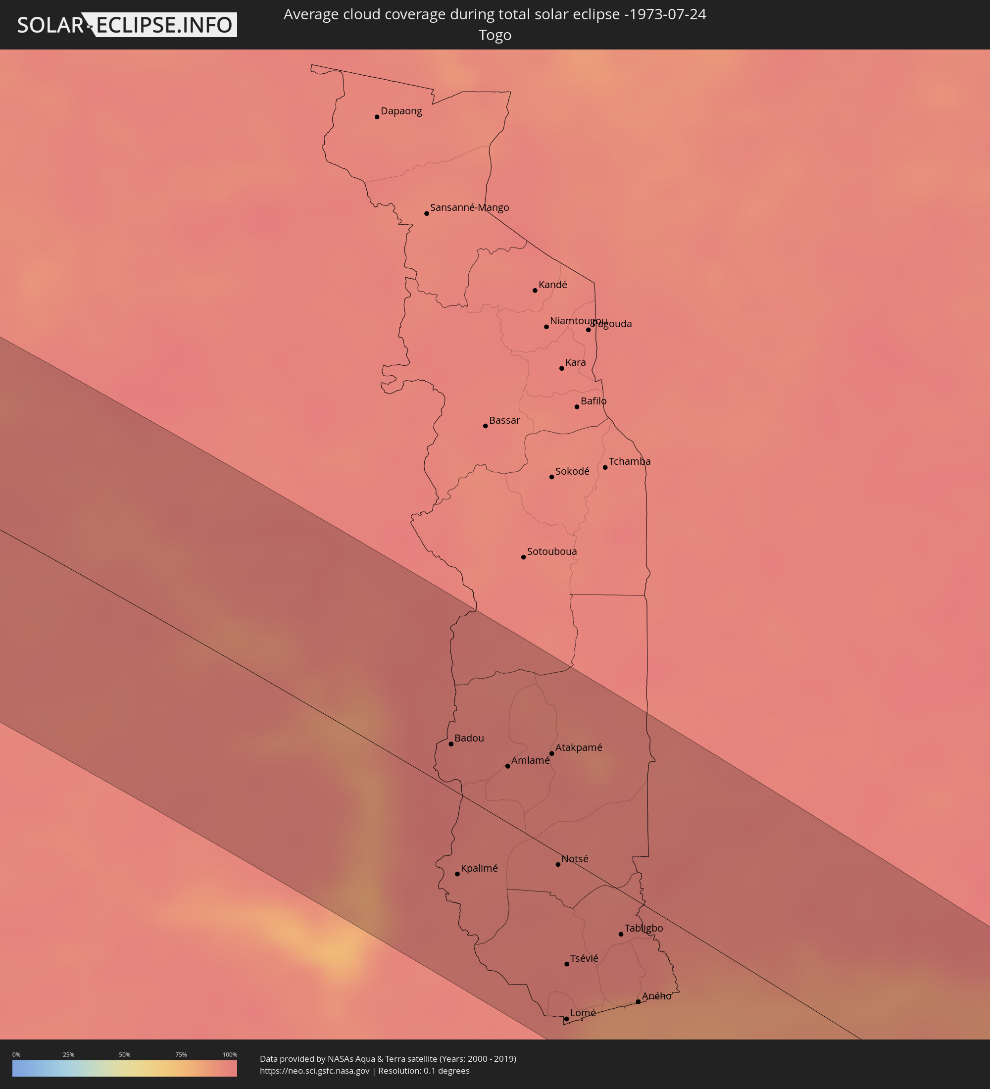 Togo
Togo
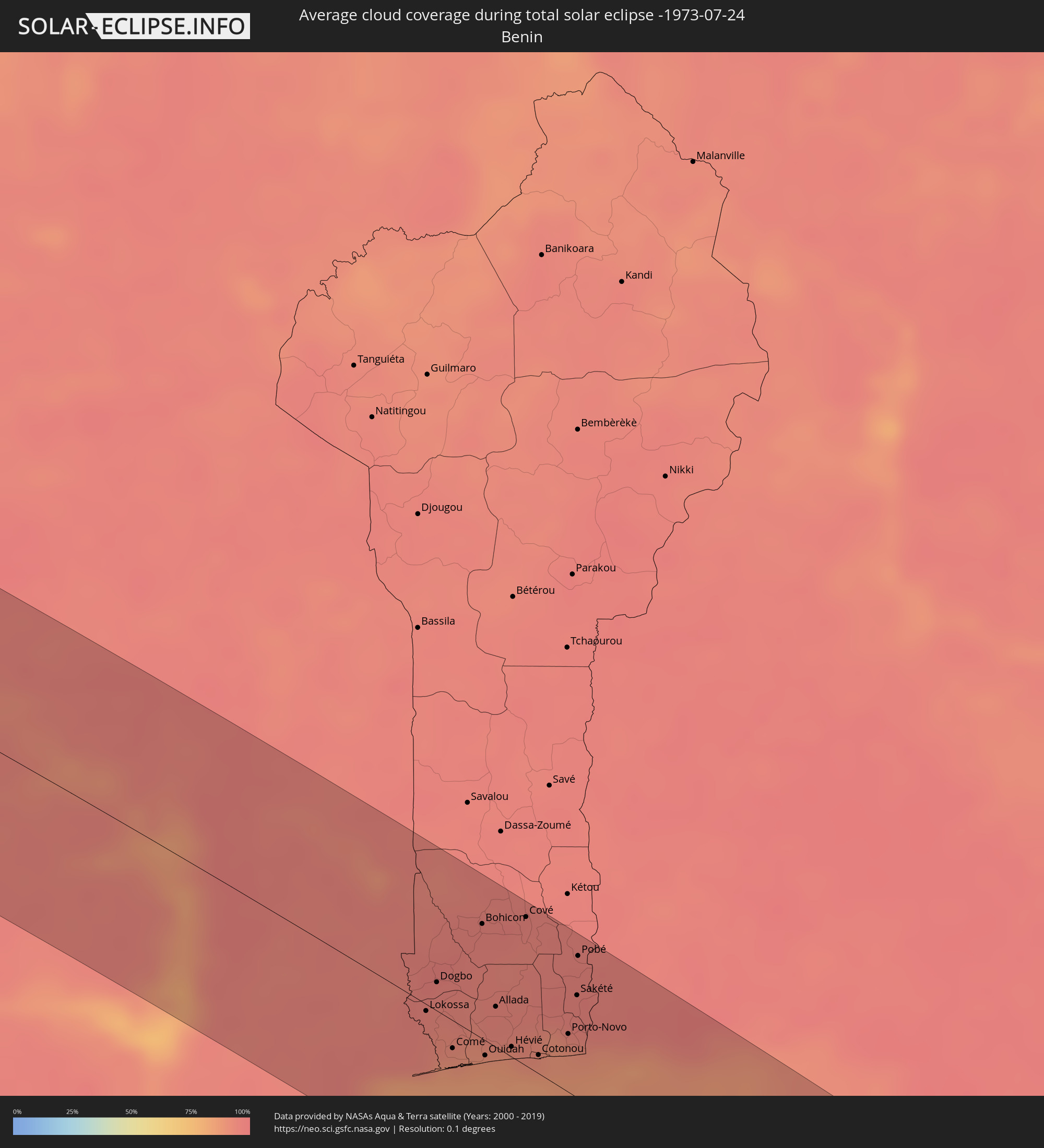 Benin
Benin
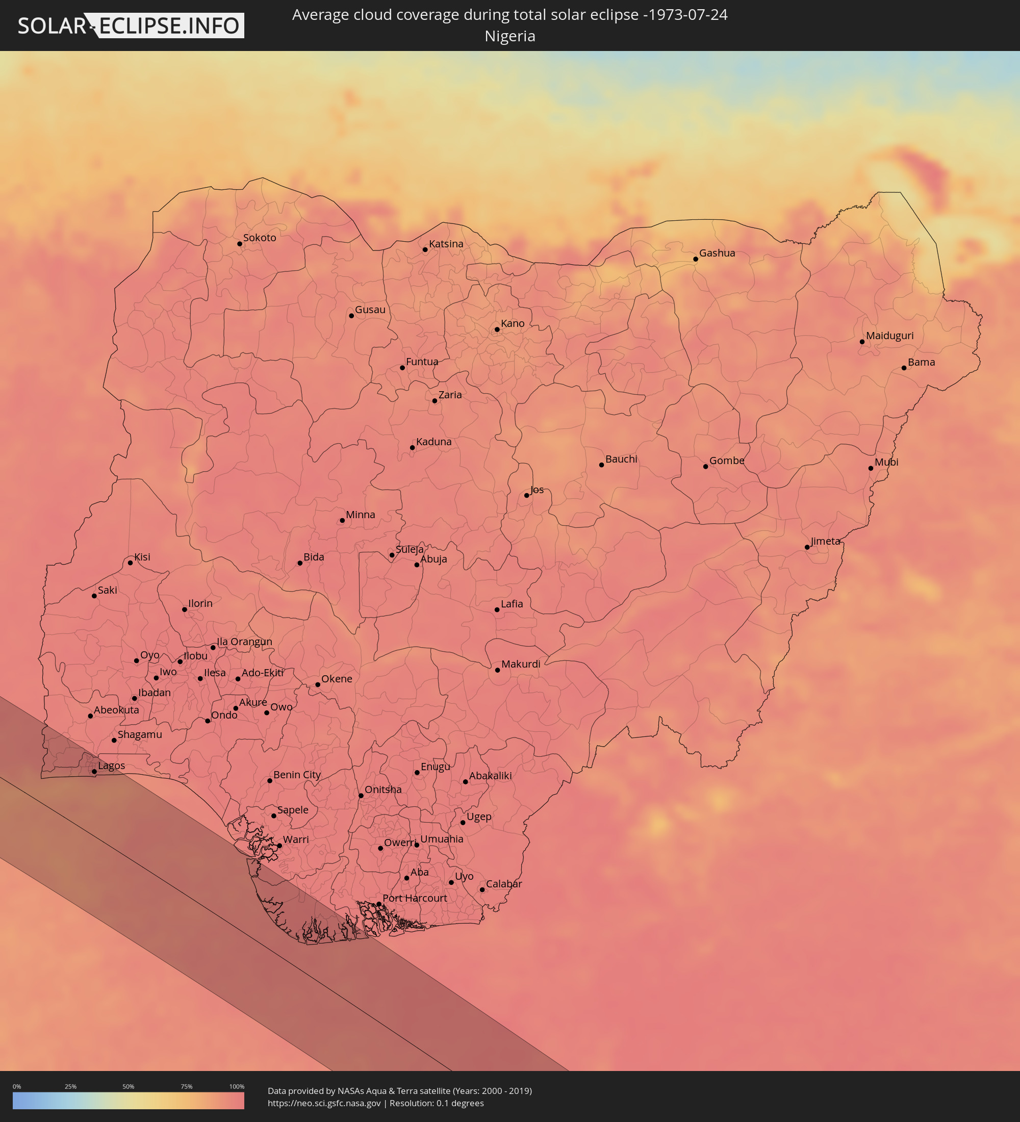 Nigeria
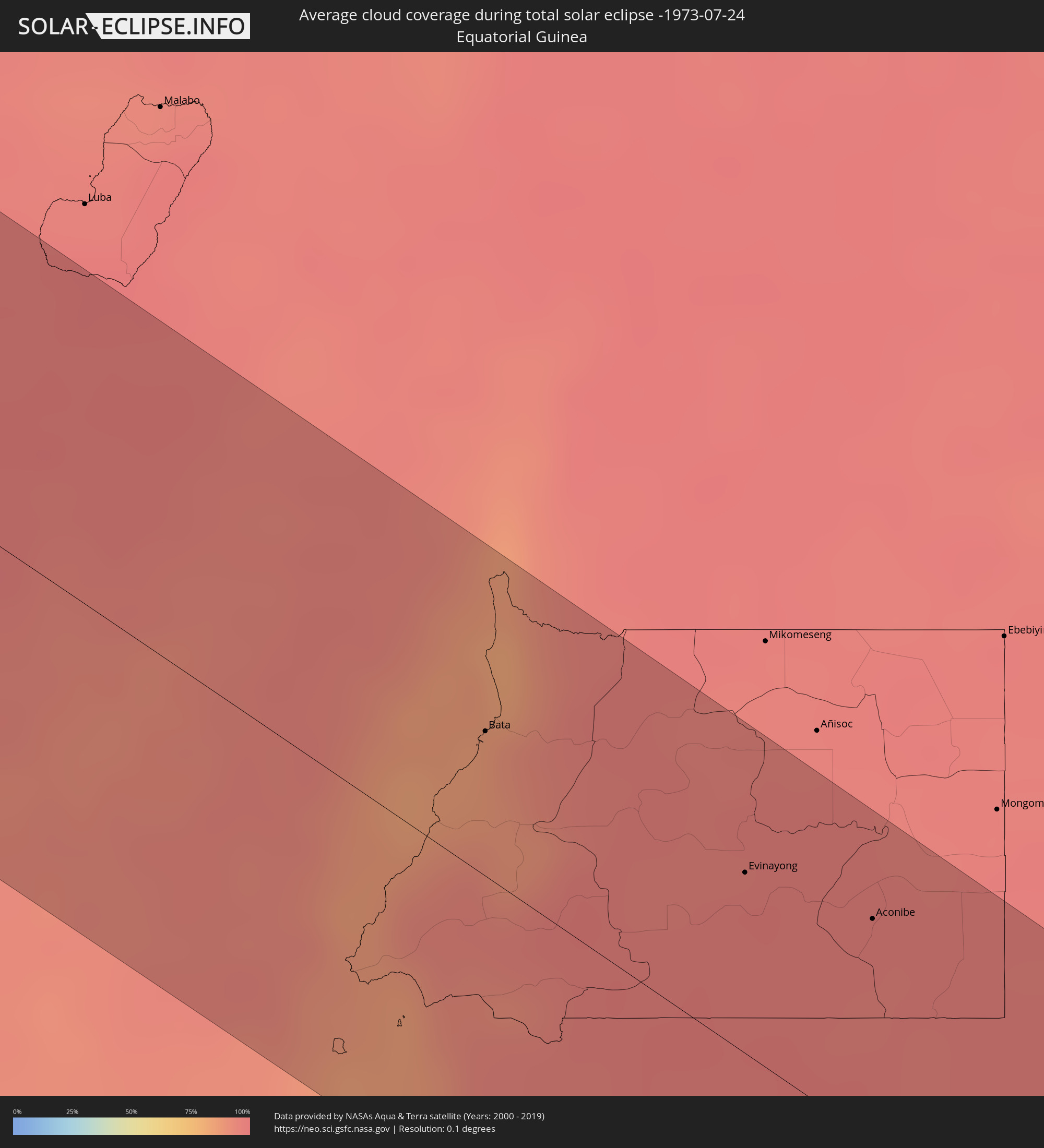 Equatorial Guinea
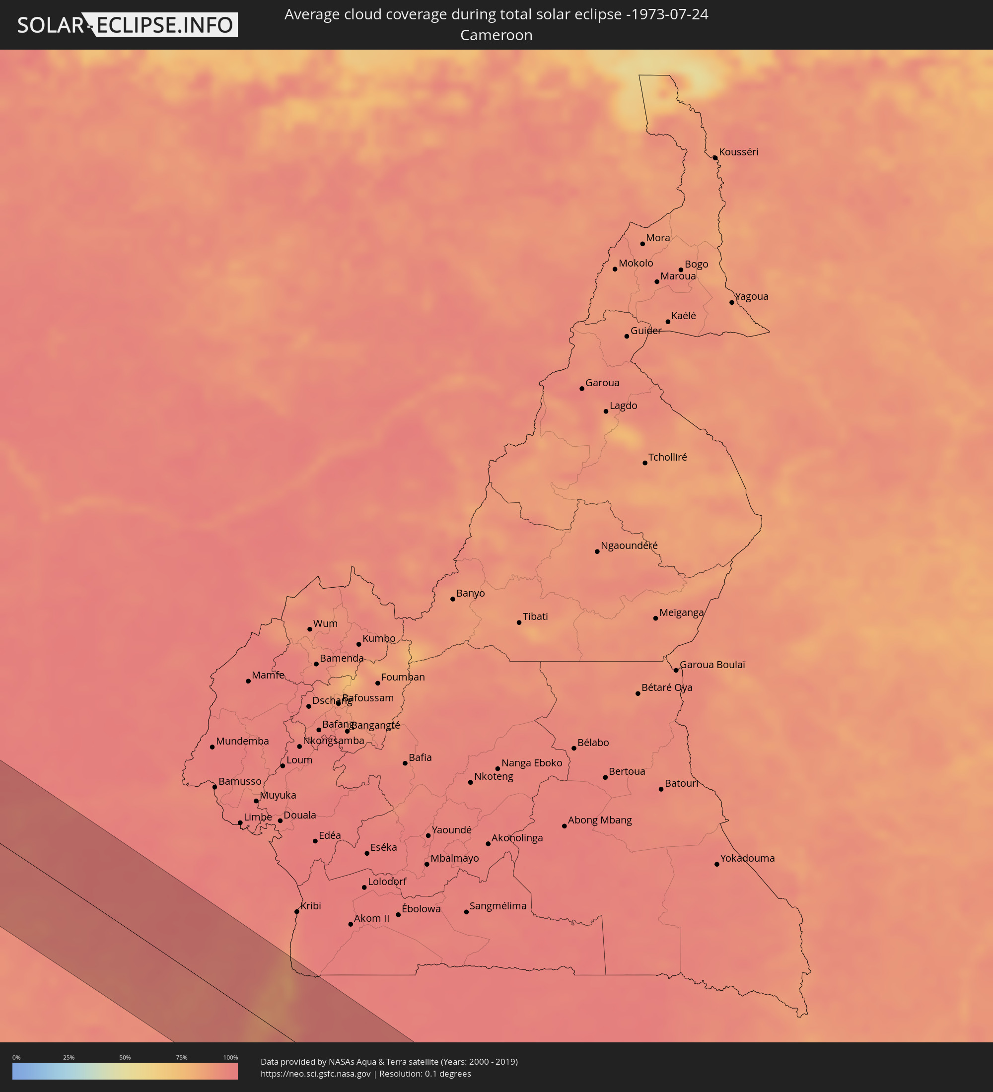 Cameroon
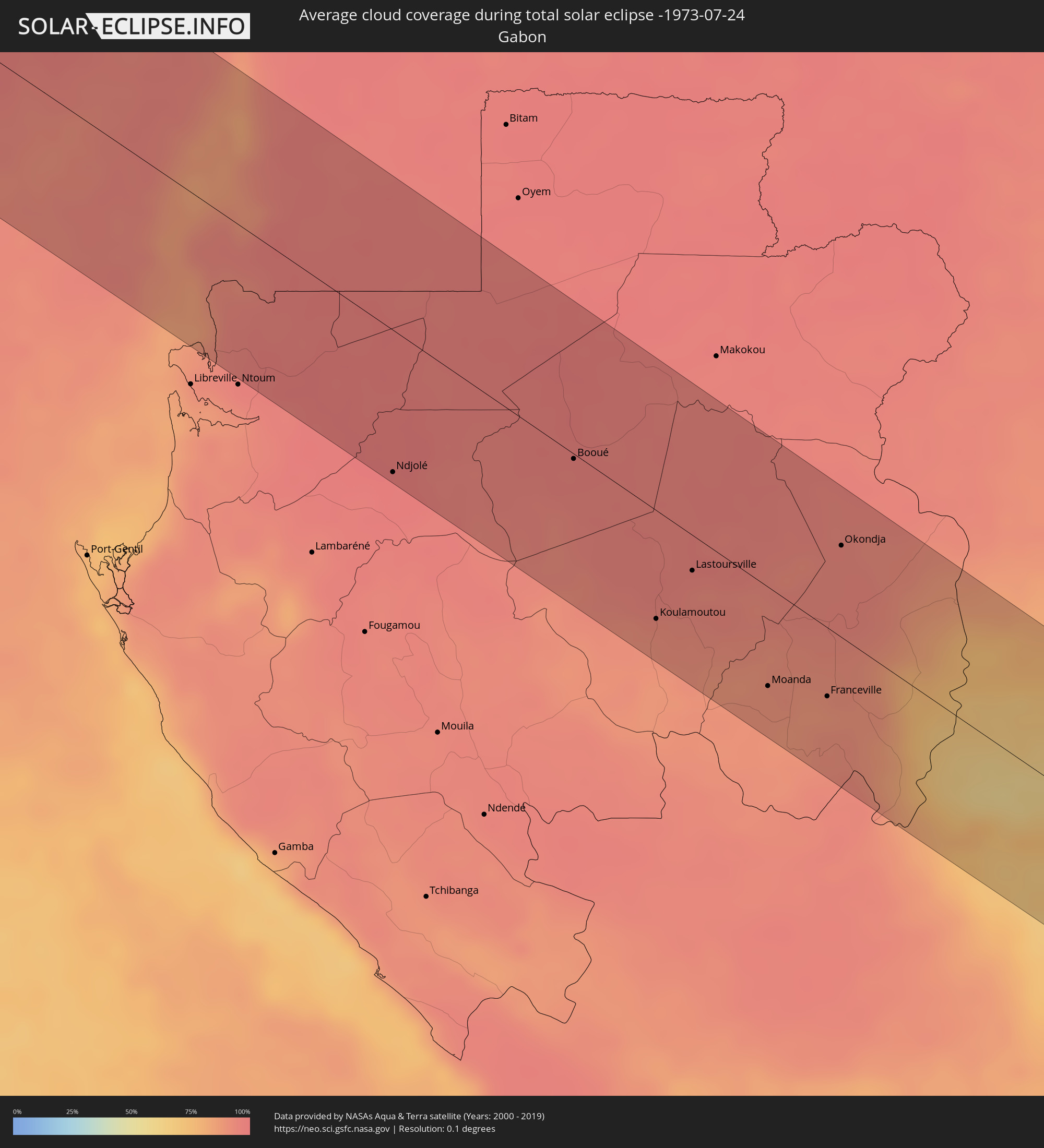 Gabon
Gabon
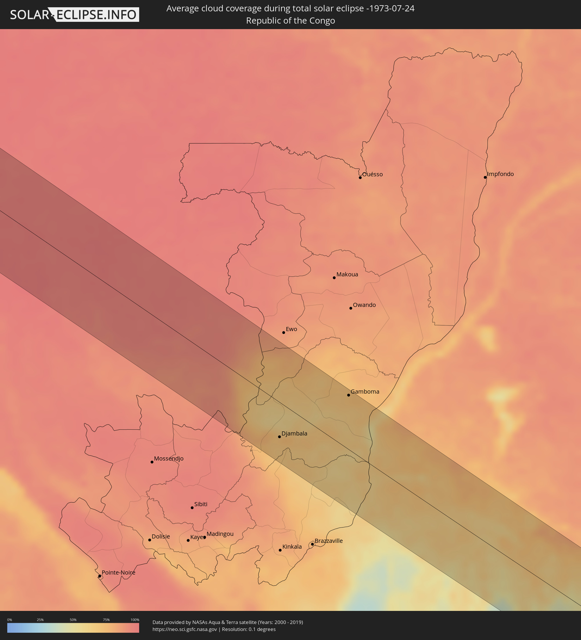 Republic of the Congo
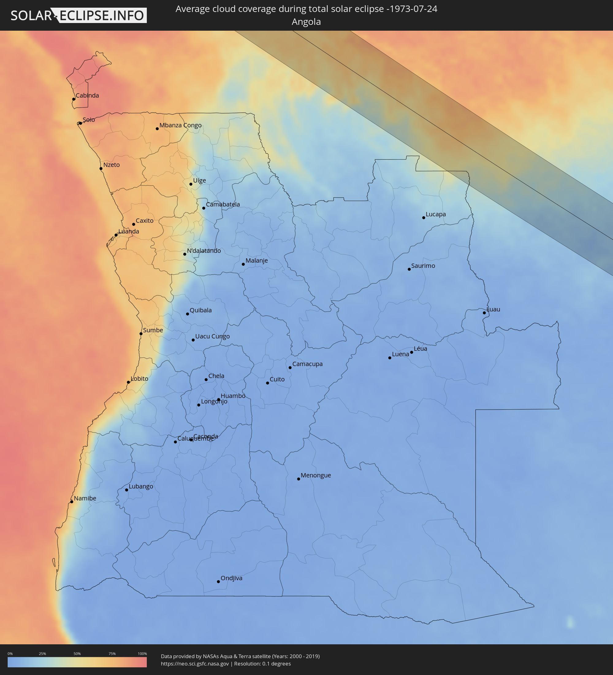 Angola
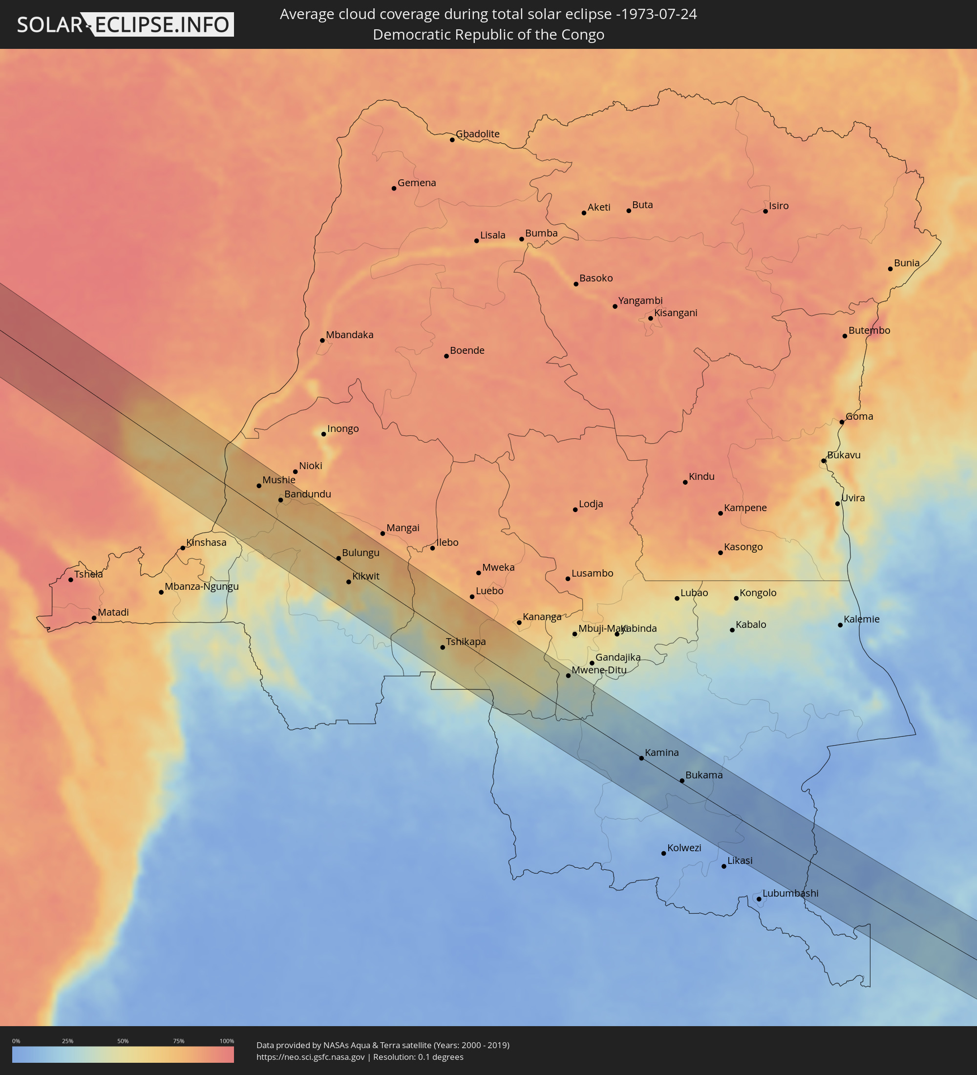 Democratic Republic of the Congo
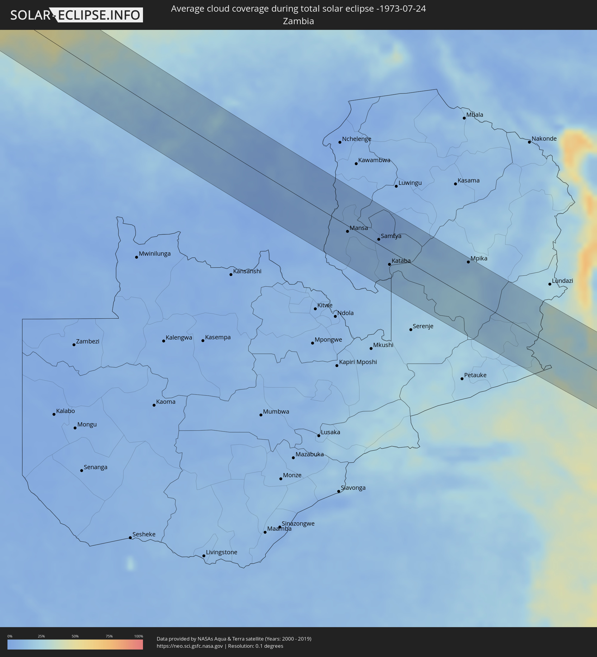 Zambia
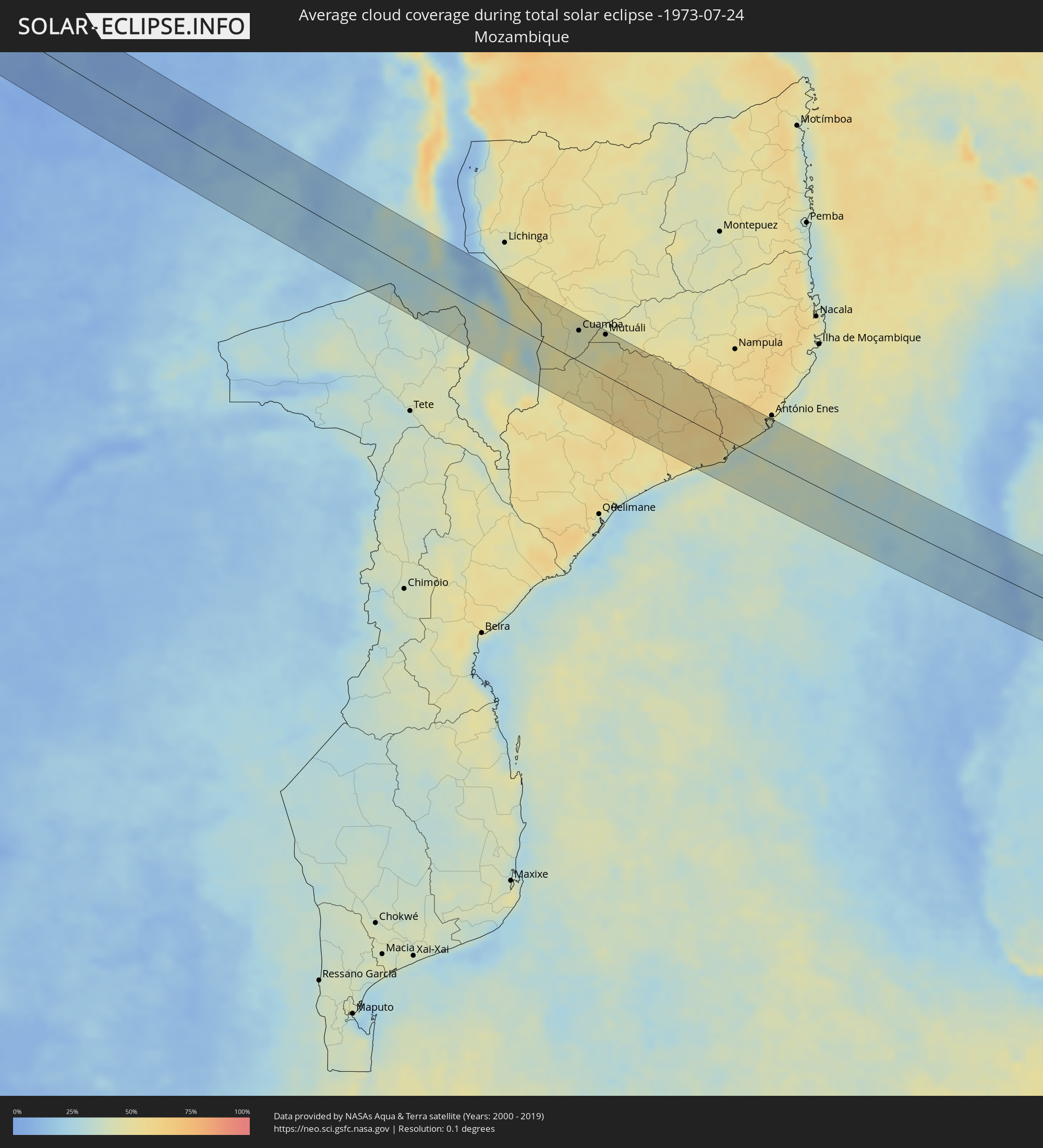 Mozambique
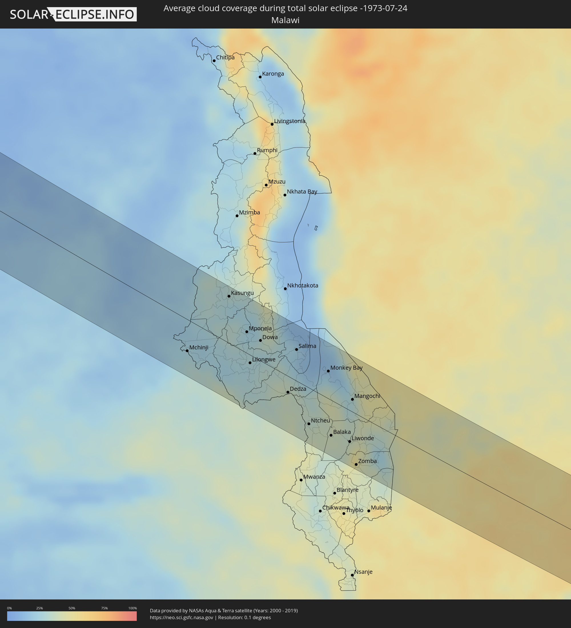 Malawi
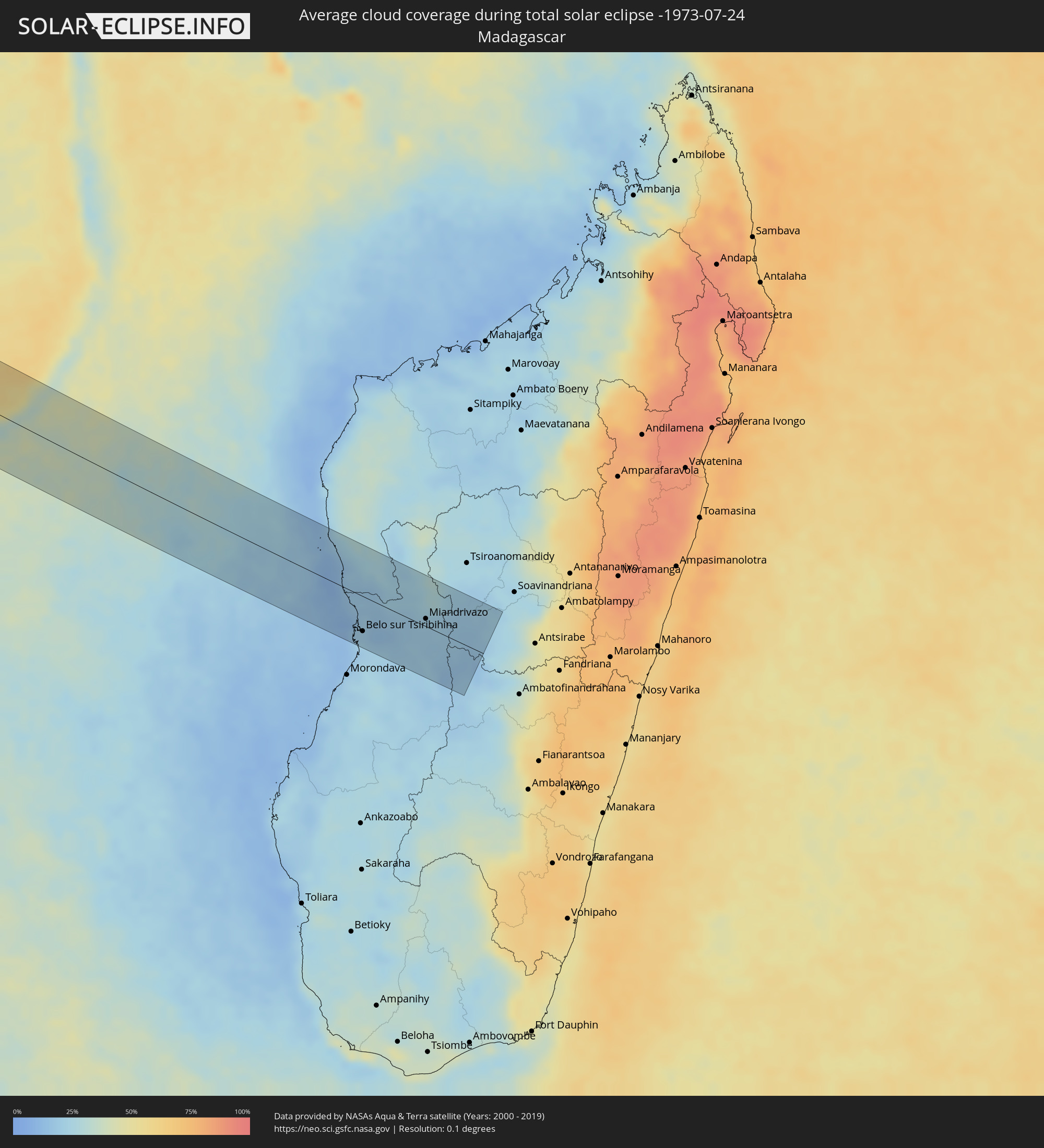 Madagascar
Cities inside the path of the eclipse
The following table shows all locations with a population of more than 5,000 inside the eclipse path. Cities which have more than 100,000 inhabitants are marked bold. A click at the locations opens a detailed map.
| City | Type | Eclipse duration | Local time of max. eclipse | Distance to central line | Ø Cloud coverage |
|
Mitú, Vaupés
|
total | - | 05:56:51 UTC-04:56 | 47 km | 82% |
|
Bartica, Cuyuni-Mazaruni
|
total | - | 07:05:05 UTC-03:52 | 21 km | 83% |
|
Anna Regina, Pomeroon-Supenaam
|
total | - | 07:05:20 UTC-03:52 | 62 km | 73% |
|
Linden, Upper Demerara-Berbice
|
total | - | 07:05:13 UTC-03:52 | 76 km | 86% |
|
Vreed-en-Hoop, Essequibo Islands-West Demerara
|
total | - | 07:05:26 UTC-03:52 | 3 km | 82% |
|
Georgetown, Demerara-Mahaica
|
total | - | 07:05:27 UTC-03:52 | 1 km | 82% |
|
Fort Wellington, Mahaica-Berbice
|
total | - | 07:05:44 UTC-03:52 | 65 km | 67% |
|
Rosignol, Mahaica-Berbice
|
total | - | 07:05:45 UTC-03:52 | 80 km | 71% |
|
São Filipe, São Filipe
|
total | - | 10:20:59 UTC-01:34 | 14 km | 78% |
|
Cova Figueira, Santa Catarina do Fogo
|
total | - | 10:21:32 UTC-01:34 | 14 km | 74% |
|
Tarrafal, Tarrafal
|
total | - | 10:22:54 UTC-01:34 | 30 km | 84% |
|
Picos, São Salvador do Mundo
|
total | - | 10:23:17 UTC-01:34 | 9 km | 78% |
|
Cidade Velha, Ribeira Grande de Santiago
|
total | - | 10:23:22 UTC-01:34 | 10 km | 80% |
|
Calheta, São Miguel
|
total | - | 10:23:21 UTC-01:34 | 20 km | 83% |
|
Santa Cruz, Santa Cruz
|
total | - | 10:23:27 UTC-01:34 | 14 km | 78% |
|
São Domingos, São Domingos
|
total | - | 10:23:29 UTC-01:34 | 2 km | 72% |
|
Praia, Praia
|
total | - | 10:23:39 UTC-01:34 | 8 km | 83% |
|
Vila do Maio, Maio
|
total | - | 10:24:25 UTC-01:34 | 16 km | 83% |
|
Dakar, Dakar
|
total | - | 11:59:02 UTC-00:16 | 32 km | 87% |
|
Thiès Nones, Thiès
|
total | - | 12:00:23 UTC-00:16 | 51 km | 88% |
|
Joal-Fadiout, Thiès
|
total | - | 12:01:11 UTC-00:16 | 14 km | 87% |
|
Bakau, Banjul
|
total | - | 12:02:07 UTC-00:16 | 86 km | 88% |
|
Abuko, Western
|
total | - | 12:02:14 UTC-00:16 | 94 km | 94% |
|
Barra, North Bank
|
total | - | 12:02:31 UTC-00:16 | 83 km | 87% |
|
Essau, North Bank
|
total | - | 12:02:33 UTC-00:16 | 82 km | 87% |
|
Lamin, North Bank
|
total | - | 12:02:57 UTC-00:16 | 95 km | 88% |
|
Pourham, Fatick
|
total | - | 12:02:17 UTC-00:16 | 15 km | 95% |
|
Kaolack, Kaolack
|
total | - | 12:02:53 UTC-00:16 | 0 km | 89% |
|
Tiébo, Diourbel
|
total | - | 12:02:38 UTC-00:16 | 49 km | 97% |
|
Touba, Diourbel
|
total | - | 12:03:30 UTC-00:16 | 81 km | 90% |
|
Farafenni, North Bank
|
total | - | 12:05:17 UTC-00:16 | 52 km | 93% |
|
Kaffrine, Kaffrine
|
total | - | 12:05:02 UTC-00:16 | 7 km | 97% |
|
Soma, Lower River
|
total | - | 12:05:35 UTC-00:16 | 65 km | 94% |
|
Bansang, Central River
|
total | - | 12:08:14 UTC-00:16 | 43 km | 94% |
|
Basse Santa Su, Upper River
|
total | - | 12:09:39 UTC-00:16 | 45 km | 95% |
|
Sabi, Upper River
|
total | - | 12:09:45 UTC-00:16 | 53 km | 95% |
|
Vélingara, Kolda
|
total | - | 12:10:04 UTC-00:16 | 59 km | 96% |
|
Tambacounda, Tambacounda
|
total | - | 12:10:53 UTC-00:16 | 20 km | 96% |
|
Youkounkoun, Boke
|
total | - | 12:13:36 UTC-00:16 | 97 km | 93% |
|
Diré
|
total | - | 12:20:17 UTC-00:16 | 52 km | 83% |
|
Sagalo, Kayes
|
total | - | 12:21:09 UTC-00:16 | 52 km | 83% |
|
Kokofata
|
total | - | 12:22:39 UTC-00:16 | 47 km | 88% |
|
Kita, Kayes
|
total | - | 12:23:49 UTC-00:16 | 81 km | 88% |
|
Siguiri, Kankan
|
total | - | 12:26:28 UTC-00:16 | 75 km | 87% |
|
Kangaba, Koulikoro
|
total | - | 12:28:05 UTC-00:16 | 8 km | 86% |
|
Bamako, Bamako
|
total | - | 12:28:28 UTC-00:16 | 99 km | 87% |
|
Bougouni, Sikasso
|
total | - | 12:31:19 UTC-00:16 | 5 km | 92% |
|
Kolondiéba, Sikasso
|
total | - | 12:33:22 UTC-00:16 | 13 km | 93% |
|
Tengrela, Savanes
|
total | - | 12:35:26 UTC-00:16 | 53 km | 93% |
|
Sikasso, Sikasso
|
total | - | 12:36:30 UTC-00:16 | 65 km | 92% |
|
Ferkessédougou, Savanes
|
total | - | 12:39:51 UTC-00:16 | 86 km | 95% |
|
Orodara, Hauts-Bassins
|
total | - | 12:38:56 UTC-00:16 | 63 km | 95% |
|
Banfora, Cascades
|
total | - | 12:39:46 UTC-00:16 | 39 km | 95% |
|
Gaoua, Sud-Ouest
|
total | - | 12:44:12 UTC-00:16 | 80 km | 96% |
|
Bouna, Zanzan
|
total | - | 12:46:09 UTC-00:16 | 8 km | 96% |
|
Batié, Sud-Ouest
|
total | - | 12:45:35 UTC-00:16 | 56 km | 96% |
|
Wa, Upper West
|
total | - | 13:01:42 UTC-00:00 | 95 km | 96% |
|
Kintampo, Brong-Ahafo
|
total | - | 13:06:11 UTC-00:00 | 60 km | 94% |
|
Salaga, Northern
|
total | - | 13:08:34 UTC-00:00 | 53 km | 95% |
|
Kete Krachi
|
total | - | 13:10:41 UTC-00:00 | 6 km | 85% |
|
Kpandae
|
total | - | 13:09:55 UTC-00:00 | 73 km | 96% |
|
Kpandu, Volta
|
total | - | 13:12:31 UTC-00:00 | 51 km | 92% |
|
Ho, Volta
|
total | - | 13:13:26 UTC-00:00 | 79 km | 94% |
|
Hohoe, Volta
|
total | - | 13:12:45 UTC-00:00 | 26 km | 97% |
|
Badou, Plateaux
|
total | - | 12:57:14 UTC-00:16 | 22 km | 97% |
|
Kpalimé, Plateaux
|
total | - | 12:58:11 UTC-00:16 | 41 km | 95% |
|
Amlamé, Plateaux
|
total | - | 12:58:05 UTC-00:16 | 28 km | 95% |
|
Atakpamé, Plateaux
|
total | - | 12:58:33 UTC-00:16 | 48 km | 95% |
|
Notsé, Plateaux
|
total | - | 12:59:22 UTC-00:16 | 6 km | 95% |
|
Lomé, Maritime
|
total | - | 13:00:30 UTC-00:16 | 81 km | 85% |
|
Tsévié, Maritime
|
total | - | 13:00:09 UTC-00:16 | 53 km | 96% |
|
Tabligbo, Maritime
|
total | - | 13:00:37 UTC-00:16 | 22 km | 95% |
|
Vogan, Maritime
|
total | - | 13:01:00 UTC-00:16 | 44 km | 85% |
|
Aného, Maritime
|
total | - | 13:01:16 UTC-00:16 | 50 km | 83% |
|
Lokossa, Mono
|
total | - | 13:30:45 UTC+00:13 | 4 km | 94% |
|
Dogbo, Kouffo
|
total | - | 13:30:41 UTC+00:13 | 17 km | 95% |
|
Comé, Mono
|
total | - | 13:31:25 UTC+00:13 | 16 km | 89% |
|
Bohicon, Zou
|
total | - | 13:30:52 UTC+00:13 | 67 km | 96% |
|
Ouidah, Atlantique
|
total | - | 13:31:57 UTC+00:13 | 9 km | 87% |
|
Cové, Zou
|
total | - | 13:31:26 UTC+00:13 | 87 km | 95% |
|
Cotonou, Littoral
|
total | - | 13:32:41 UTC+00:13 | 11 km | 90% |
|
Porto-Novo, Ouémé
|
total | - | 13:32:56 UTC+00:13 | 34 km | 90% |
|
Sakété, Plateau
|
total | - | 13:32:46 UTC+00:13 | 60 km | 96% |
|
Pobé, Plateau
|
total | - | 13:32:28 UTC+00:13 | 83 km | 96% |
|
Idi Iroko, Ogun
|
total | - | 13:33:03 UTC+00:13 | 55 km | 94% |
|
Badagry, Lagos
|
total | - | 13:33:40 UTC+00:13 | 43 km | 86% |
|
Ado Odo, Ogun
|
total | - | 13:33:32 UTC+00:13 | 63 km | 94% |
|
Ilaro, Ogun
|
total | - | 13:33:21 UTC+00:13 | 95 km | 96% |
|
Ikeja, Lagos
|
total | - | 13:34:26 UTC+00:13 | 87 km | 97% |
|
Makoko, Lagos
|
total | - | 13:34:40 UTC+00:13 | 80 km | 95% |
|
Lagos, Lagos
|
total | - | 13:34:44 UTC+00:13 | 77 km | 95% |
|
Ebute Ikorodu, Lagos
|
total | - | 13:34:45 UTC+00:13 | 96 km | 94% |
|
Twon-Brass, Bayelsa
|
total | - | 13:43:17 UTC+00:13 | 48 km | 96% |
|
Bata, Litoral
|
total | - | 13:52:37 UTC+00:13 | 40 km | 90% |
|
Evinayong, Centro Sur
|
total | - | 13:54:24 UTC+00:13 | 50 km | 97% |
|
Ndjolé, Moyen-Ogooué
|
total | - | 13:56:29 UTC+00:13 | 85 km | 98% |
|
Aconibe, Wele-Nzas
|
total | - | 13:55:11 UTC+00:13 | 62 km | 97% |
|
Booué, Ogooué-Ivindo
|
total | - | 13:58:15 UTC+00:13 | 3 km | 97% |
|
Koulamoutou, Ogooué-Lolo
|
total | - | 14:00:07 UTC+00:13 | 65 km | 92% |
|
Lastoursville, Ogooué-Lolo
|
total | - | 14:00:10 UTC+00:13 | 21 km | 94% |
|
Mounana, Haut-Ogooué
|
total | - | 14:01:25 UTC+00:13 | 47 km | 90% |
|
Moanda, Haut-Ogooué
|
total | - | 14:01:38 UTC+00:13 | 59 km | 90% |
|
Franceville, Haut-Ogooué
|
total | - | 14:02:15 UTC+00:13 | 41 km | 89% |
|
Okondja, Haut-Ogooué
|
total | - | 14:01:26 UTC+00:13 | 55 km | 95% |
|
Djambala, Plateaux
|
total | - | 14:04:44 UTC+00:13 | 51 km | 71% |
|
Gamboma, Plateaux
|
total | - | 14:05:36 UTC+00:13 | 80 km | 68% |
|
Bolobo, Bandundu
|
total | - | 14:06:20 UTC+00:13 | 77 km | 53% |
|
Mushie, Bandundu
|
total | - | 14:07:58 UTC+00:13 | 41 km | 67% |
|
Bandundu, Bandundu
|
total | - | 14:08:47 UTC+00:13 | 42 km | 70% |
|
Bulungu, Bandundu
|
total | - | 14:11:13 UTC+00:13 | 4 km | 65% |
|
Kikwit, Bandundu
|
total | - | 14:11:50 UTC+00:13 | 29 km | 56% |
|
Tshikapa, Kasaï-Occidental
|
total | - | 16:11:41 UTC+02:10 | 35 km | 48% |
|
Mwene-Ditu, Kasaï-Oriental
|
total | - | 16:14:33 UTC+02:10 | 69 km | 37% |
|
Kamina, Katanga
|
total | - | 16:16:51 UTC+02:10 | 2 km | 13% |
|
Bukama, Katanga
|
total | - | 16:17:45 UTC+02:10 | 4 km | 12% |
|
Mansa, Luapula
|
total | - | 16:20:44 UTC+02:10 | 12 km | 8% |
|
Samfya, Luapula
|
total | - | 16:21:12 UTC+02:10 | 10 km | 7% |
|
Kataba, Copperbelt
|
total | - | 16:21:32 UTC+02:10 | 27 km | 11% |
|
Mpika, Muchinga Province
|
total | - | 16:22:24 UTC+02:10 | 69 km | 14% |
|
Mchinji, Central Region
|
total | - | 16:23:43 UTC+02:10 | 43 km | 28% |
|
Kasungu, Central Region
|
total | - | 16:23:44 UTC+02:10 | 63 km | 26% |
|
Lilongwe, Central Region
|
total | - | 16:24:08 UTC+02:10 | 11 km | 28% |
|
Dedza, Central Region
|
total | - | 16:24:28 UTC+02:10 | 22 km | 38% |
|
Salima, Central Region
|
total | - | 16:24:21 UTC+02:10 | 43 km | 17% |
|
Monkey Bay, Southern Region
|
total | - | 16:24:36 UTC+02:10 | 37 km | 25% |
|
Balaka, Southern Region
|
total | - | 16:24:50 UTC+02:10 | 48 km | 39% |
|
Liwonde, Southern Region
|
total | - | 16:24:57 UTC+02:10 | 43 km | 38% |
|
Mangochi, Southern Region
|
total | - | 16:24:49 UTC+02:10 | 17 km | 31% |
|
Zomba, Southern Region
|
total | - | 16:25:03 UTC+02:10 | 69 km | 43% |
|
Cuamba, Niassa
|
total | - | 16:25:19 UTC+02:10 | 51 km | 42% |
|
Mutuáli, Nampula
|
total | - | 16:25:28 UTC+02:10 | 68 km | 43% |
|
Belo sur Tsiribihina, Menabe
|
total | - | 16:44:11 UTC+02:27 | 48 km | 20% |
|
Miandrivazo, Menabe
|
total | - | 16:44:13 UTC+02:27 | 10 km | 21% |