Total solar eclipse of 03/01/0192
| Day of week: | Thursday |
| Maximum duration of eclipse: | 03m44s |
| Maximum width of eclipse path: | 318 km |
| Saros cycle: | 62 |
| Coverage: | 100% |
| Magnitude: | 1.0507 |
| Gamma: | 0.8505 |
Wo kann man die Sonnenfinsternis vom 03/01/0192 sehen?
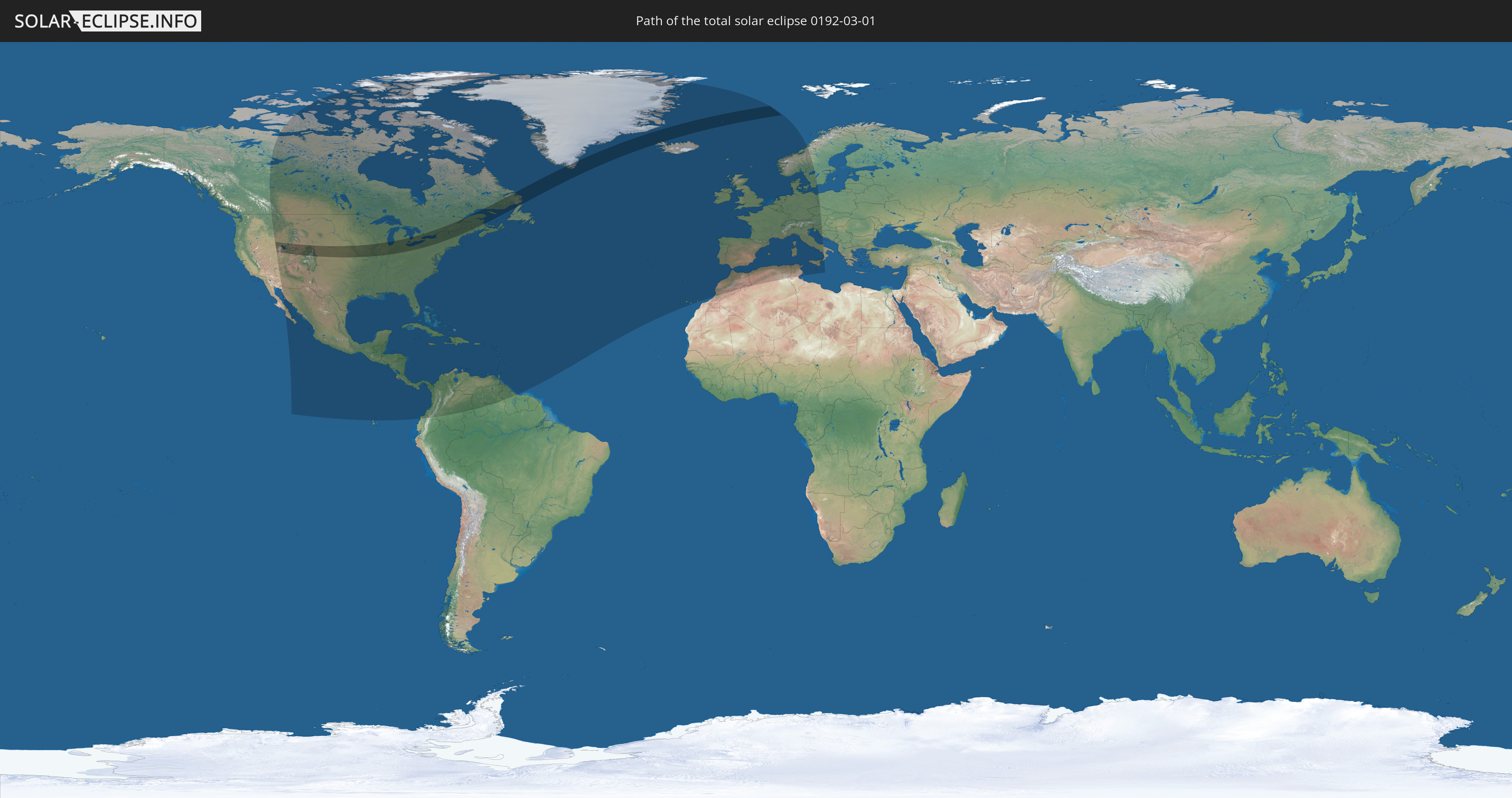
Die Sonnenfinsternis am 03/01/0192 kann man in 79 Ländern als partielle Sonnenfinsternis beobachten.
Der Finsternispfad verläuft durch 5 Länder. Nur in diesen Ländern ist sie als total Sonnenfinsternis zu sehen.
In den folgenden Ländern ist die Sonnenfinsternis total zu sehen
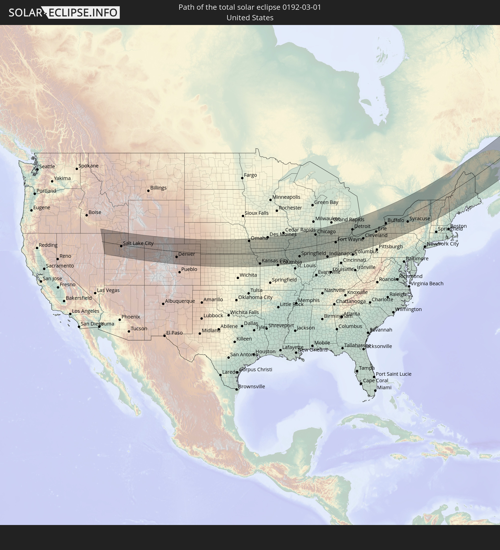 United States
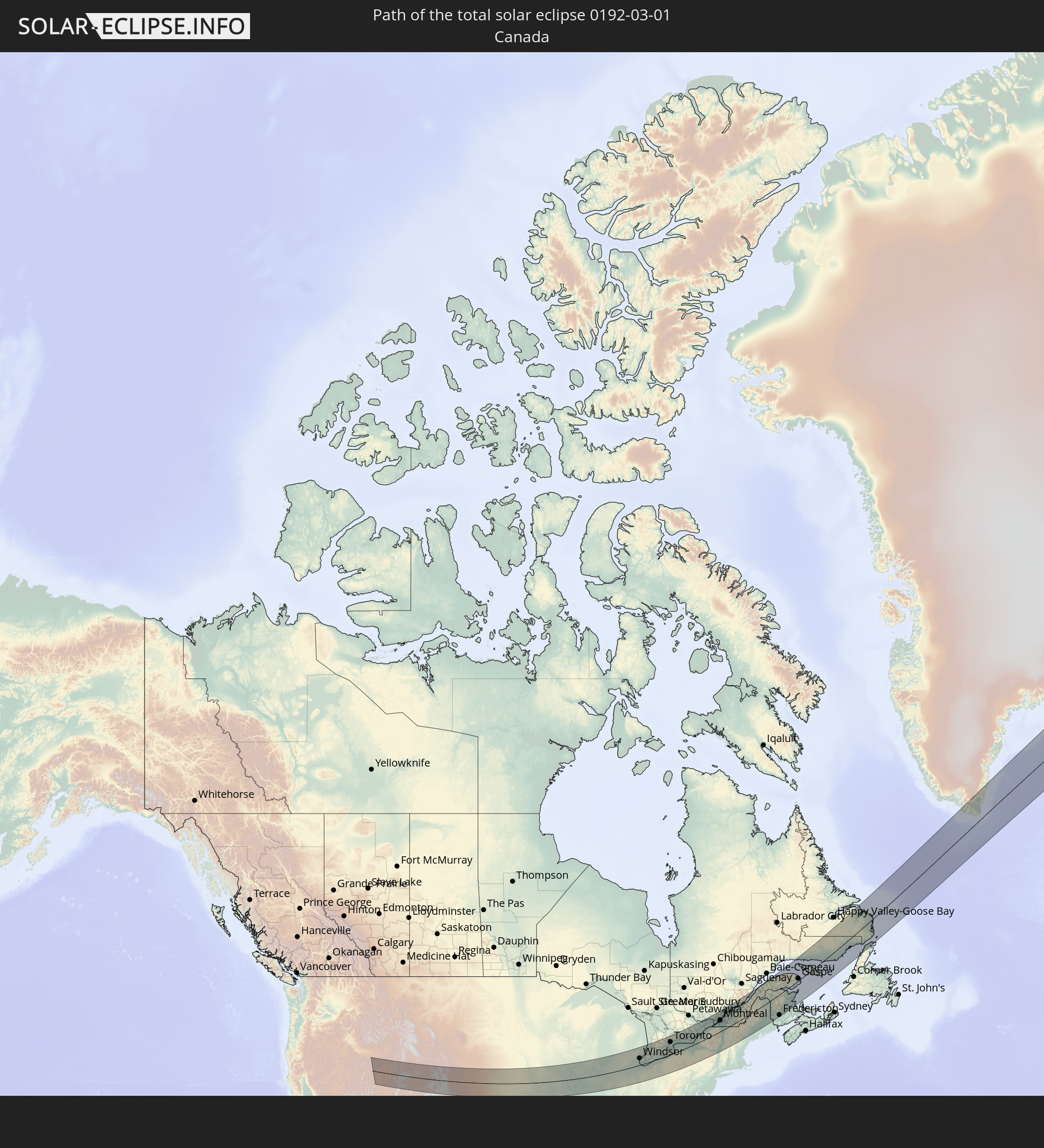 Canada
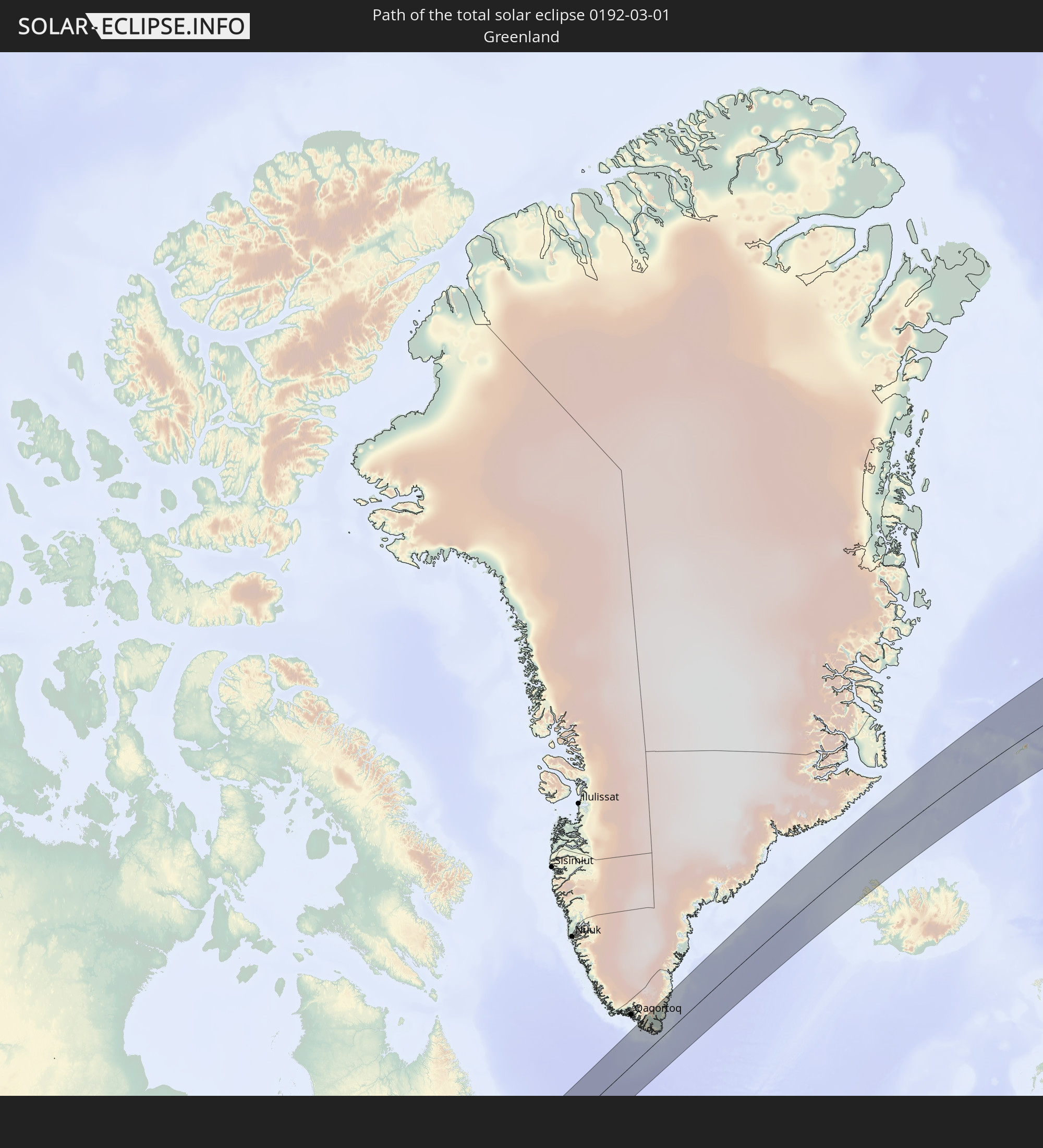 Greenland
 Iceland
 Svalbard and Jan Mayen
In den folgenden Ländern ist die Sonnenfinsternis partiell zu sehen
 United States
 United States Minor Outlying Islands
 Canada
 Mexico
 Greenland
 Guatemala
 Ecuador
 El Salvador
 Honduras
 Belize
 Nicaragua
 Costa Rica
 Cuba
Cuba
 Panama
 Colombia
 Cayman Islands
 The Bahamas
 Jamaica
 Haiti
Haiti
 Brazil
 Venezuela
 Turks and Caicos Islands
 Dominican Republic
 Aruba
Aruba
 Puerto Rico
 United States Virgin Islands
 Bermuda
 British Virgin Islands
 Anguilla
 Collectivity of Saint Martin
 Saint Barthélemy
 Saint Kitts and Nevis
 Antigua and Barbuda
 Montserrat
 Trinidad and Tobago
 Guadeloupe
 Grenada
 Dominica
 Saint Vincent and the Grenadines
 Guyana
 Martinique
 Saint Lucia
 Barbados
 Saint Pierre and Miquelon
 Portugal
 Iceland
 Spain
Spain
 Morocco
 Republic of Ireland
 Svalbard and Jan Mayen
 Algeria
 United Kingdom
 Faroe Islands
 Gibraltar
 France
 Isle of Man
 Guernsey
 Jersey
 Andorra
 Belgium
 Netherlands
 Norway
 Luxembourg
 Germany
 Switzerland
 Italy
Italy
 Monaco
 Tunisia
 Denmark
 Liechtenstein
 Austria
 Sweden
 Czechia
 San Marino
 Vatican City
 Slovenia
 Croatia
 Poland
 Malta
Malta
How will be the weather during the total solar eclipse on 03/01/0192?
Where is the best place to see the total solar eclipse of 03/01/0192?
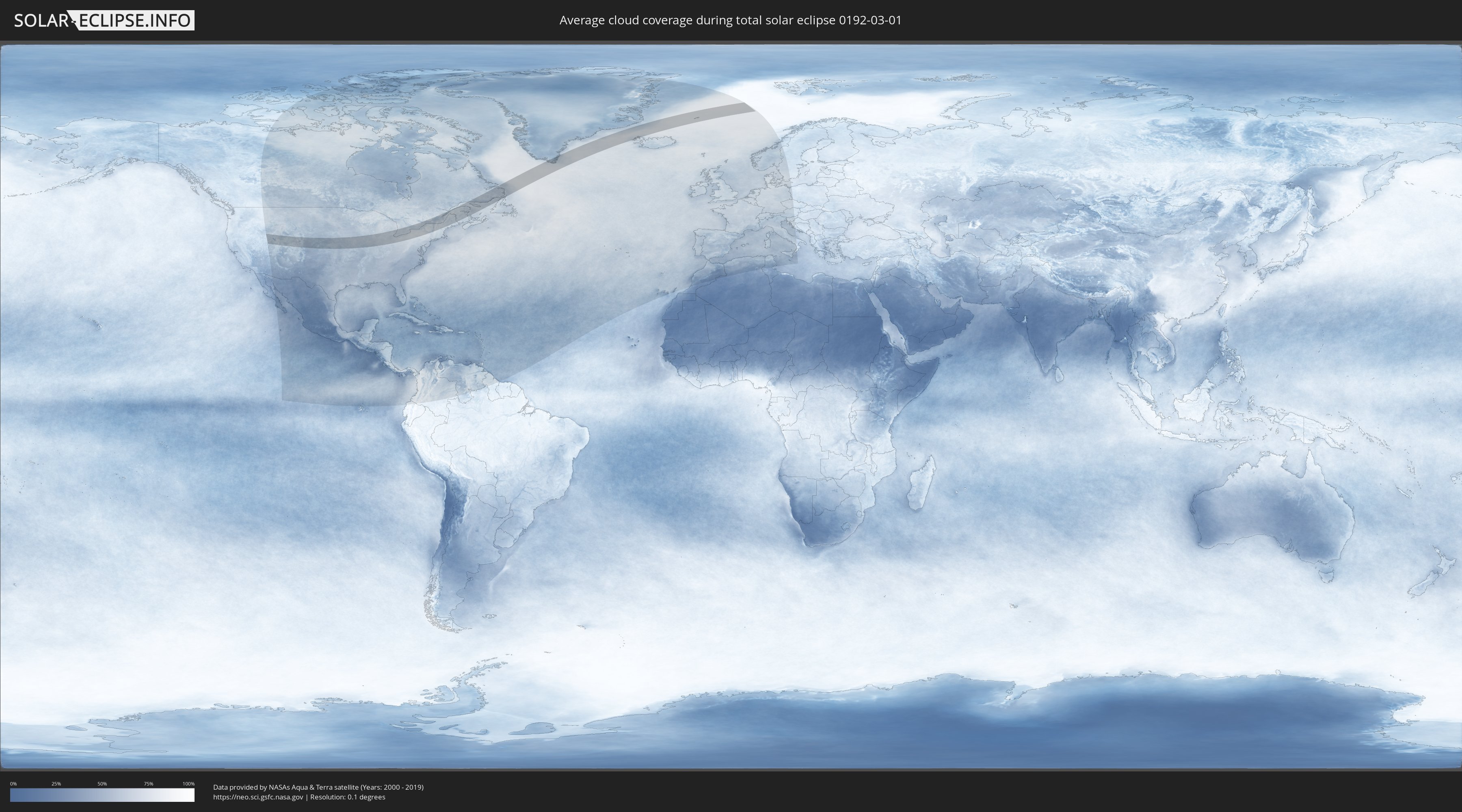
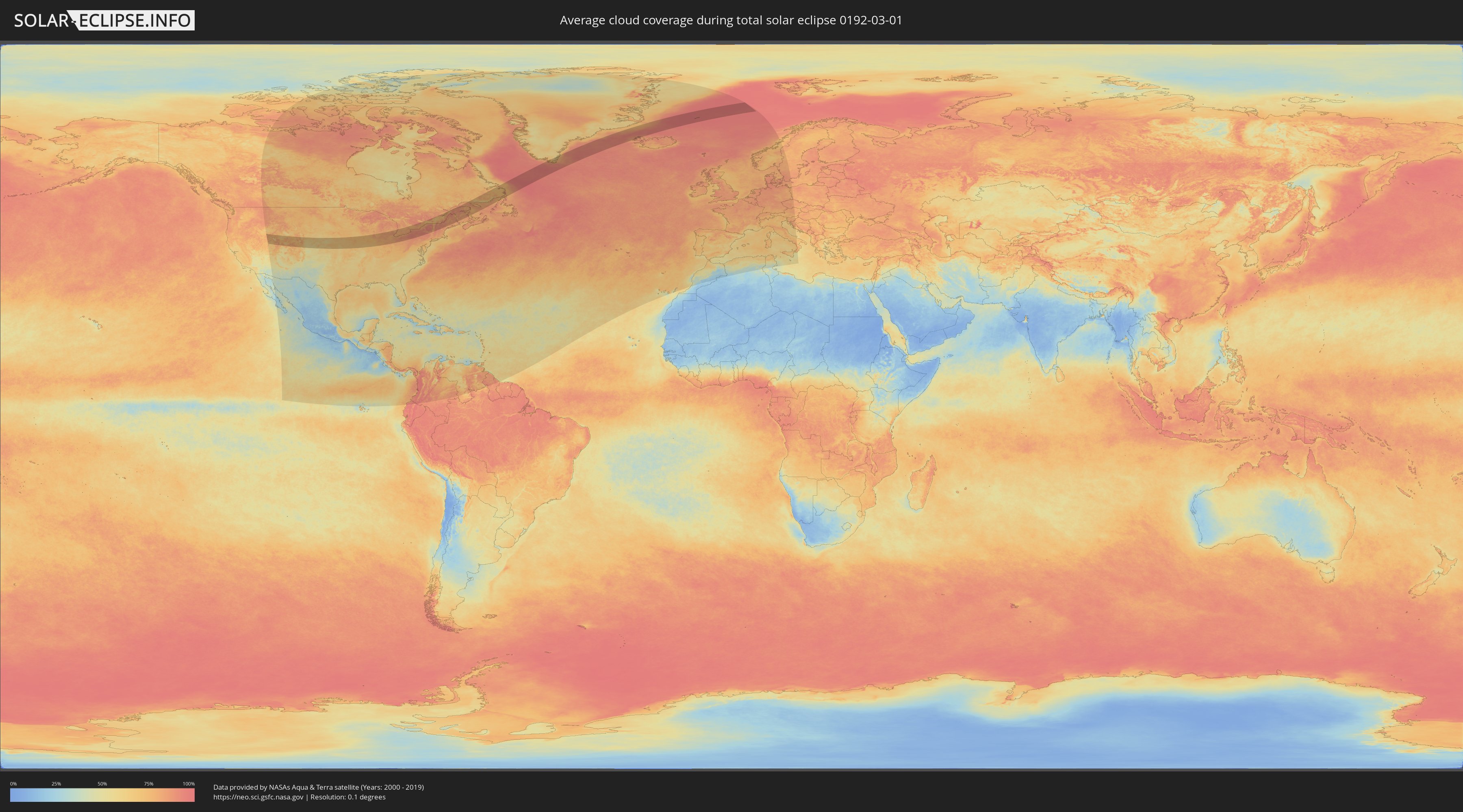
The following maps show the average cloud coverage for the day of the total solar eclipse.
With the help of these maps, it is possible to find the place along the eclipse path, which has the best
chance of a cloudless sky.
Nevertheless, you should consider local circumstances and inform about the weather of your chosen
observation site.
The data is provided by NASAs satellites
AQUA and TERRA.
The cloud maps are averaged over a period of 19 years (2000 - 2019).
Detailed country maps
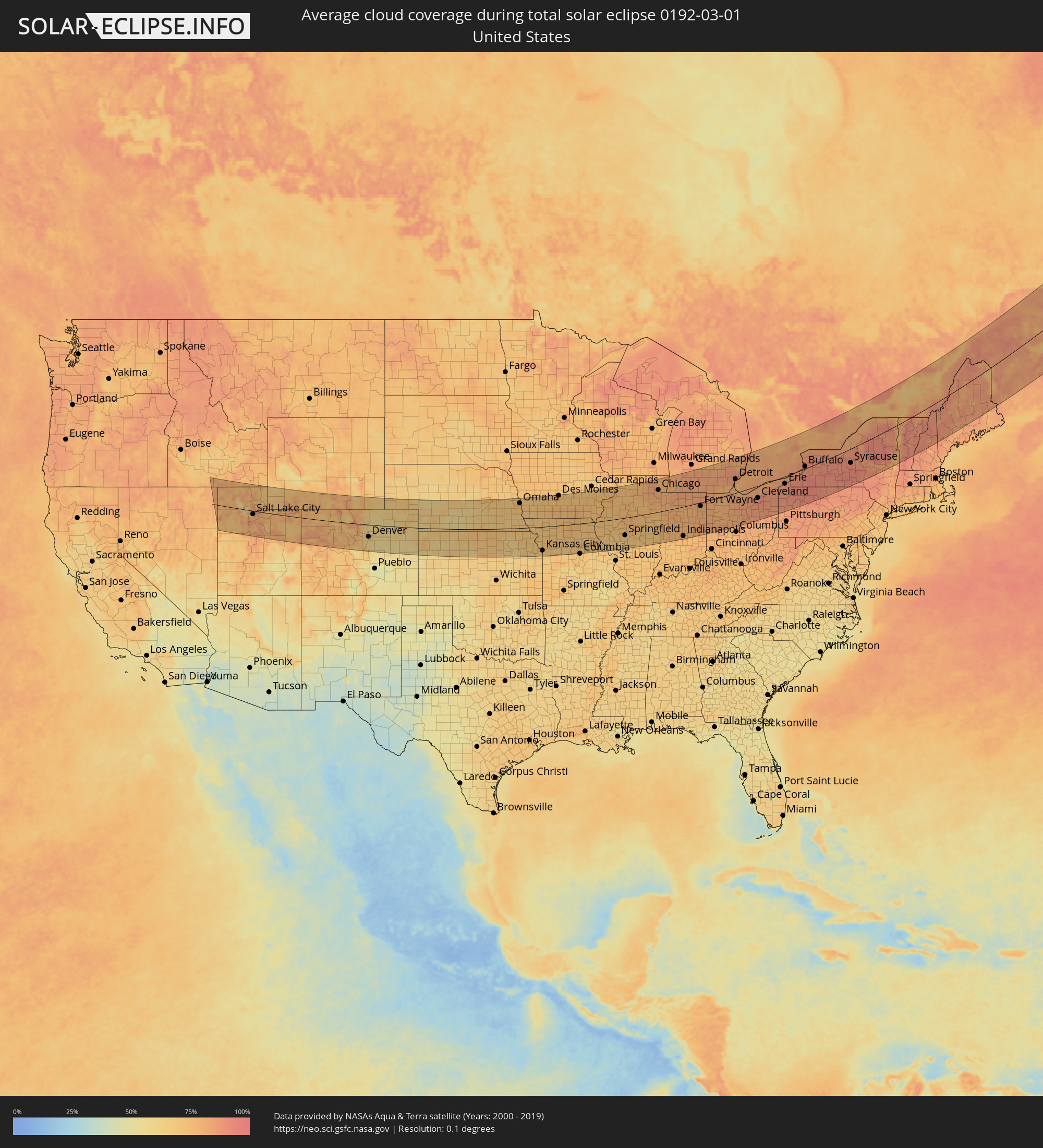 United States
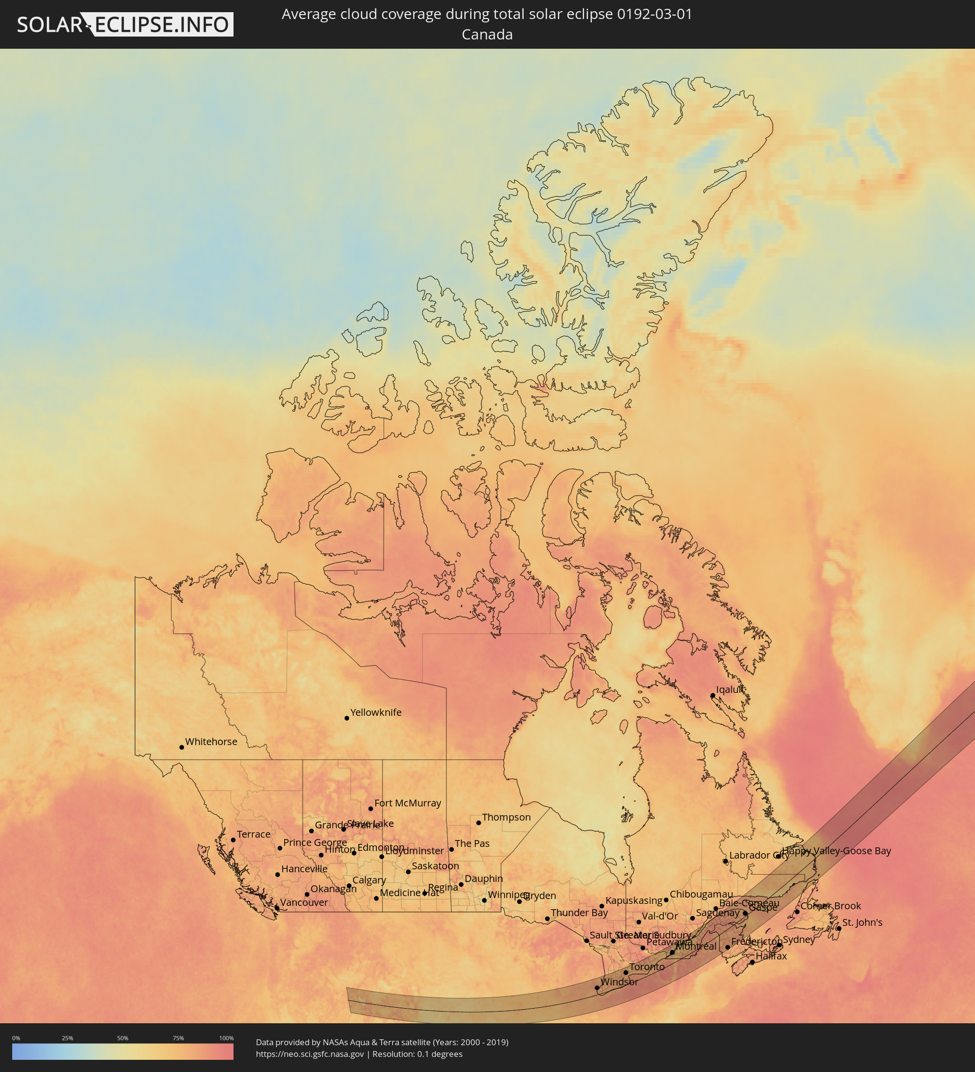 Canada
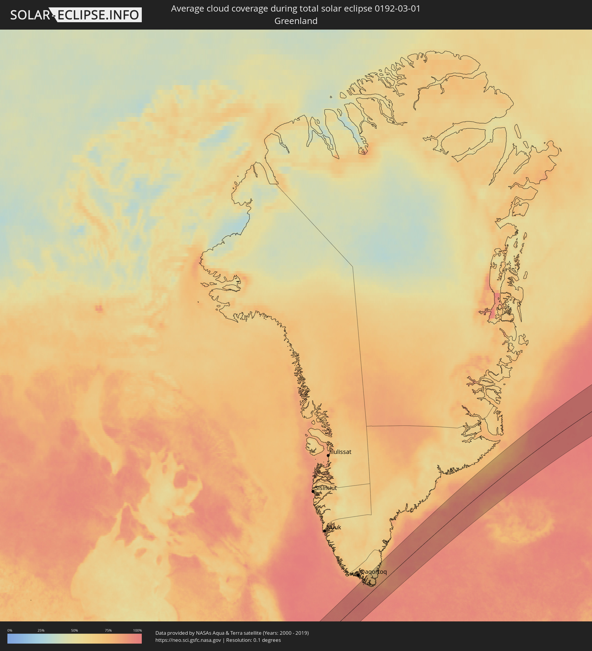 Greenland
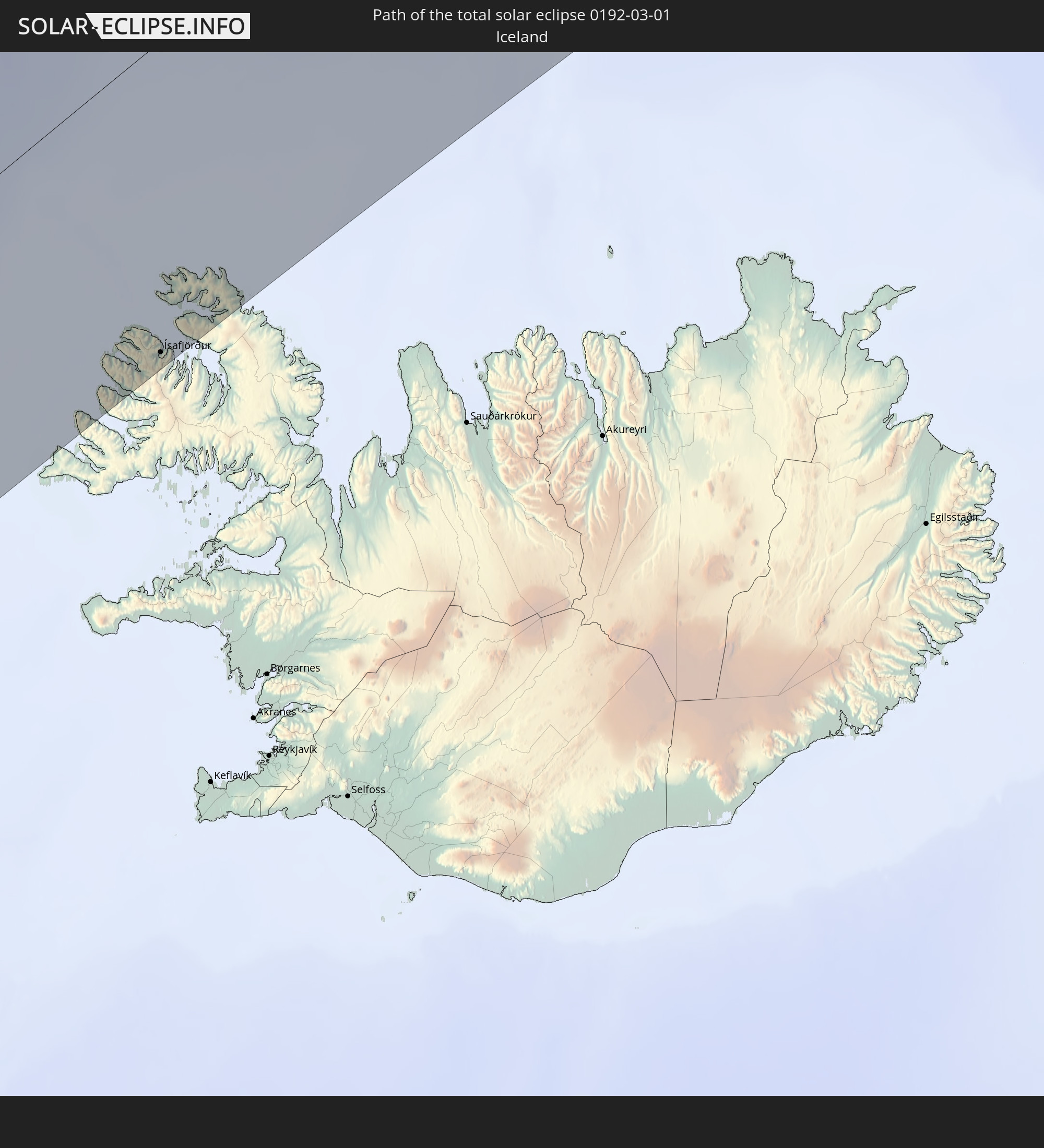
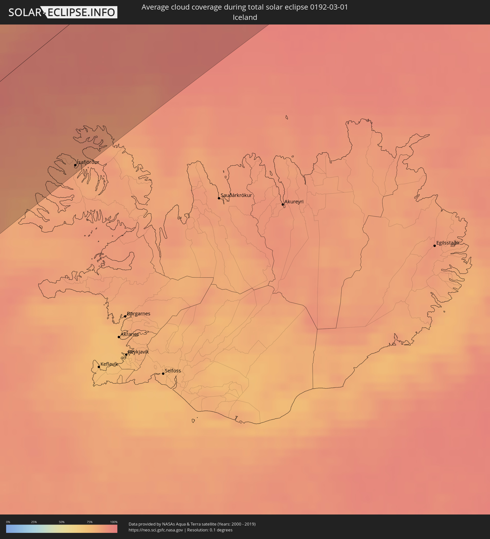 Iceland
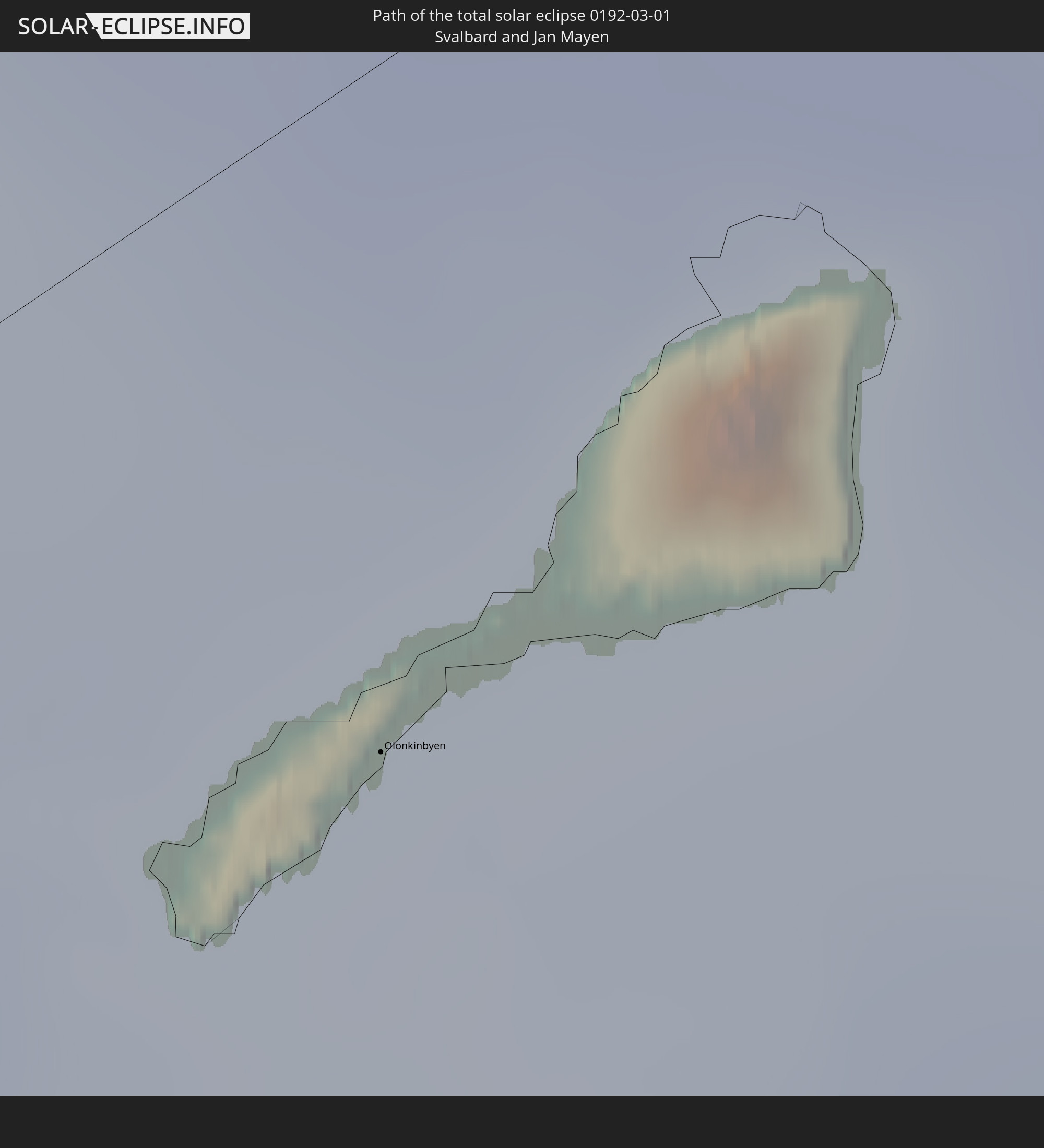
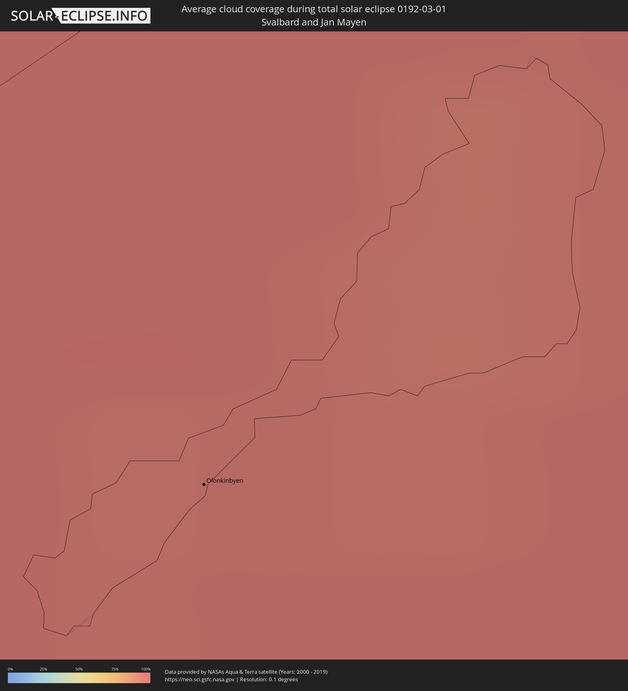 Svalbard and Jan Mayen
Cities inside the path of the eclipse
The following table shows all locations with a population of more than 5,000 inside the eclipse path. Cities which have more than 100,000 inhabitants are marked bold. A click at the locations opens a detailed map.
| City | Type | Eclipse duration | Local time of max. eclipse | Distance to central line | Ø Cloud coverage |
|
Ogden, Utah
|
total | - | 07:19:06 UTC-07:00 | 33 km | 83% |
|
West Jordan, Utah
|
total | - | 07:18:09 UTC-07:00 | 34 km | 81% |
|
Salt Lake City, Utah
|
total | - | 07:18:24 UTC-07:00 | 17 km | 81% |
|
Provo, Utah
|
total | - | 07:17:38 UTC-07:00 | 72 km | 74% |
|
Boulder, Colorado
|
total | - | 07:19:38 UTC-07:00 | 32 km | 67% |
|
Longmont, Colorado
|
total | - | 07:19:58 UTC-07:00 | 14 km | 62% |
|
Fort Collins, Colorado
|
total | - | 07:20:38 UTC-07:00 | 33 km | 68% |
|
Denver, Colorado
|
total | - | 07:19:20 UTC-07:00 | 60 km | 61% |
|
Centennial, Colorado
|
total | - | 07:19:08 UTC-07:00 | 77 km | 61% |
|
Greeley, Colorado
|
total | - | 07:20:34 UTC-07:00 | 17 km | 59% |
|
Lincoln, Nebraska
|
total | - | 08:26:06 UTC-06:00 | 77 km | 73% |
|
Omaha, Nebraska
|
total | - | 08:27:24 UTC-06:00 | 125 km | 75% |
|
Topeka, Kansas
|
total | - | 08:23:59 UTC-06:00 | 122 km | 68% |
|
Lawrence, Kansas
|
total | - | 08:24:12 UTC-06:00 | 132 km | 66% |
|
Saint Joseph, Missouri
|
total | - | 08:25:49 UTC-06:00 | 45 km | 72% |
|
Olathe, Kansas
|
total | - | 08:24:24 UTC-06:00 | 144 km | 69% |
|
Overland Park, Kansas
|
total | - | 08:24:41 UTC-06:00 | 134 km | 67% |
|
Kansas City, Missouri
|
total | - | 08:24:56 UTC-06:00 | 121 km | 65% |
|
Lee's Summit, Missouri
|
total | - | 08:24:48 UTC-06:00 | 143 km | 65% |
|
East Independence, Missouri
|
total | - | 08:25:07 UTC-06:00 | 123 km | 65% |
|
Des Moines, Iowa
|
total | - | 08:29:51 UTC-06:00 | 151 km | 78% |
|
Davenport, Iowa
|
total | - | 08:32:26 UTC-06:00 | 113 km | 79% |
|
Springfield, Illinois
|
total | - | 08:30:31 UTC-06:00 | 88 km | 72% |
|
Peoria, Illinois
|
total | - | 08:32:01 UTC-06:00 | 9 km | 78% |
|
Bloomington, Illinois
|
total | - | 08:32:16 UTC-06:00 | 22 km | 77% |
|
Aurora, Illinois
|
total | - | 08:35:02 UTC-06:00 | 108 km | 82% |
|
Elgin, Illinois
|
total | - | 08:35:32 UTC-06:00 | 138 km | 81% |
|
Champaign, Illinois
|
total | - | 08:32:26 UTC-06:00 | 73 km | 72% |
|
Joliet, Illinois
|
total | - | 08:34:54 UTC-06:00 | 79 km | 78% |
|
Chicago, Illinois
|
total | - | 08:35:53 UTC-06:00 | 107 km | 84% |
|
Hammond, Indiana
|
total | - | 08:35:36 UTC-06:00 | 76 km | 80% |
|
South Bend, Indiana
|
total | - | 09:37:06 UTC-05:00 | 64 km | 84% |
|
Indianapolis, Indiana
|
total | - | 09:34:06 UTC-05:00 | 145 km | 76% |
|
Carmel, Indiana
|
total | - | 09:34:29 UTC-05:00 | 123 km | 77% |
|
Fort Wayne, Indiana
|
total | - | 09:37:27 UTC-05:00 | 17 km | 82% |
|
Lansing, Michigan
|
total | - | 09:40:41 UTC-05:00 | 143 km | 83% |
|
Ann Arbor, Michigan
|
total | - | 09:40:53 UTC-05:00 | 76 km | 85% |
|
Flint, Michigan
|
total | - | 09:42:07 UTC-05:00 | 153 km | 85% |
|
Toledo, Ohio
|
total | - | 09:40:07 UTC-05:00 | 6 km | 82% |
|
Livonia, Michigan
|
total | - | 09:41:29 UTC-05:00 | 77 km | 86% |
|
Troy, Michigan
|
total | - | 09:42:06 UTC-05:00 | 97 km | 86% |
|
Detroit, Michigan
|
total | - | 09:41:47 UTC-05:00 | 65 km | 80% |
|
Warren, Michigan
|
total | - | 09:42:02 UTC-05:00 | 80 km | 86% |
|
Windsor, Ontario
|
total | - | 09:41:46 UTC-05:00 | 61 km | 80% |
|
Clinton, Michigan
|
total | - | 09:42:21 UTC-05:00 | 89 km | 85% |
|
Sarnia, Ontario
|
total | - | 09:43:35 UTC-05:00 | 118 km | 84% |
|
Cleveland, Ohio
|
total | - | 09:42:06 UTC-05:00 | 57 km | 87% |
|
Akron, Ohio
|
total | - | 09:41:40 UTC-05:00 | 105 km | 87% |
|
London, Ontario
|
total | - | 09:45:01 UTC-05:00 | 88 km | 84% |
|
St. Thomas, Ontario
|
total | - | 09:44:45 UTC-05:00 | 64 km | 81% |
|
Woodstock, Ontario
|
total | - | 09:45:51 UTC-05:00 | 90 km | 78% |
|
Kitchener, Ontario
|
total | - | 09:46:36 UTC-05:00 | 114 km | 80% |
|
Norfolk County, Ontario
|
total | - | 09:45:50 UTC-05:00 | 48 km | 80% |
|
Cambridge, Ontario
|
total | - | 09:46:45 UTC-05:00 | 101 km | 83% |
|
Brantford, Ontario
|
total | - | 09:46:27 UTC-05:00 | 76 km | 80% |
|
Guelph, Ontario
|
total | - | 09:47:07 UTC-05:00 | 119 km | 81% |
|
Orangeville, Ontario
|
total | - | 09:47:53 UTC-05:00 | 153 km | 78% |
|
Erie, Pennsylvania
|
total | - | 09:45:07 UTC-05:00 | 34 km | 87% |
|
Milton, Ontario
|
total | - | 09:47:32 UTC-05:00 | 105 km | 82% |
|
Hamilton, Ontario
|
total | - | 09:47:10 UTC-05:00 | 76 km | 82% |
|
Burlington, Ontario
|
total | - | 09:47:23 UTC-05:00 | 90 km | 82% |
|
Mississauga, Ontario
|
total | - | 09:47:55 UTC-05:00 | 105 km | 82% |
|
Vaughan, Ontario
|
total | - | 09:48:31 UTC-05:00 | 126 km | 88% |
|
Newmarket, Ontario
|
total | - | 09:48:53 UTC-05:00 | 147 km | 82% |
|
Toronto, Ontario
|
total | - | 09:48:25 UTC-05:00 | 110 km | 85% |
|
Scarborough, Ontario
|
total | - | 09:48:44 UTC-05:00 | 112 km | 87% |
|
Welland, Ontario
|
total | - | 09:47:31 UTC-05:00 | 31 km | 86% |
|
St. Catharines, Ontario
|
total | - | 09:47:49 UTC-05:00 | 50 km | 85% |
|
Niagara Falls, Ontario
|
total | - | 09:47:56 UTC-05:00 | 37 km | 88% |
|
Ajax, Ontario
|
total | - | 09:49:08 UTC-05:00 | 113 km | 82% |
|
Buffalo, New York
|
total | - | 09:47:51 UTC-05:00 | 9 km | 87% |
|
Oshawa, Ontario
|
total | - | 09:49:27 UTC-05:00 | 113 km | 78% |
|
Peterborough, Ontario
|
total | - | 09:50:45 UTC-05:00 | 137 km | 77% |
|
Rochester, New York
|
total | - | 09:49:56 UTC-05:00 | 3 km | 90% |
|
Belleville, Ontario
|
total | - | 09:51:46 UTC-05:00 | 93 km | 82% |
|
Kingston, Ontario
|
total | - | 09:53:04 UTC-05:00 | 69 km | 79% |
|
Syracuse, New York
|
total | - | 09:51:46 UTC-05:00 | 62 km | 91% |
|
Ottawa, Ontario
|
total | - | 09:55:51 UTC-05:00 | 159 km | 83% |
|
Cornwall, Ontario
|
total | - | 09:56:36 UTC-05:00 | 84 km | 81% |
|
Salaberry-de-Valleyfield, Quebec
|
total | - | 09:57:46 UTC-05:00 | 85 km | 70% |
|
Mirabel, Quebec
|
total | - | 09:58:24 UTC-05:00 | 122 km | 71% |
|
Saint-Jérôme, Quebec
|
total | - | 09:58:41 UTC-05:00 | 132 km | 77% |
|
Blainville, Quebec
|
total | - | 09:58:42 UTC-05:00 | 116 km | 76% |
|
Dollard-Des Ormeaux, Quebec
|
total | - | 09:58:32 UTC-05:00 | 97 km | 81% |
|
Terrebonne, Quebec
|
total | - | 09:59:04 UTC-05:00 | 110 km | 81% |
|
Montréal, Quebec
|
total | - | 09:58:53 UTC-05:00 | 90 km | 85% |
|
Repentigny, Quebec
|
total | - | 09:59:24 UTC-05:00 | 107 km | 78% |
|
Joliette, Quebec
|
total | - | 09:59:49 UTC-05:00 | 132 km | 69% |
|
Saint-Jean-sur-Richelieu, Quebec
|
total | - | 09:59:03 UTC-05:00 | 58 km | 72% |
|
Sorel-Tracy, Quebec
|
total | - | 10:00:16 UTC-05:00 | 122 km | 67% |
|
Saint-Hyacinthe, Quebec
|
total | - | 09:59:56 UTC-05:00 | 77 km | 72% |
|
Shawinigan, Quebec
|
total | - | 10:01:31 UTC-05:00 | 159 km | 74% |
|
Granby, Quebec
|
total | - | 09:59:56 UTC-05:00 | 46 km | 77% |
|
Trois-Rivières, Quebec
|
total | - | 10:01:29 UTC-05:00 | 130 km | 66% |
|
Drummondville, Quebec
|
total | - | 10:00:57 UTC-05:00 | 83 km | 74% |
|
Victoriaville, Quebec
|
total | - | 10:01:54 UTC-05:00 | 78 km | 70% |
|
Sherbrooke, Quebec
|
total | - | 10:01:07 UTC-05:00 | 13 km | 80% |
|
Québec, Quebec
|
total | - | 10:03:59 UTC-05:00 | 120 km | 72% |
|
Rimouski, Quebec
|
total | - | 10:09:52 UTC-05:00 | 158 km | 85% |
|
Fredericton, New Brunswick
|
total | - | 10:55:07 UTC-04:14 | 151 km | 82% |
|
Ísafjörður, Westfjords
|
total | - | 14:35:28 UTC-01:28 | 122 km | 84% |
|
Olonkinbyen, Jan Mayen
|
total | - | 17:05:55 UTC+01:00 | 32 km | 96% |