Total solar eclipse of 04/20/1148
| Day of week: | Tuesday |
| Maximum duration of eclipse: | 04m35s |
| Maximum width of eclipse path: | 172 km |
| Saros cycle: | 105 |
| Coverage: | 100% |
| Magnitude: | 1.052 |
| Gamma: | -0.0765 |
Wo kann man die Sonnenfinsternis vom 04/20/1148 sehen?
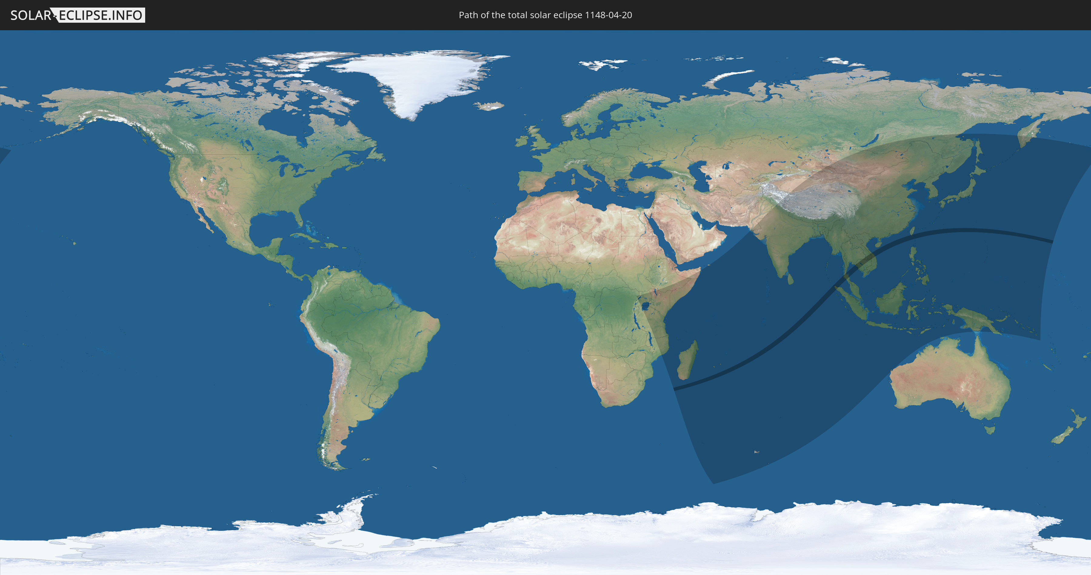
Die Sonnenfinsternis am 04/20/1148 kann man in 56 Ländern als partielle Sonnenfinsternis beobachten.
Der Finsternispfad verläuft durch 7 Länder. Nur in diesen Ländern ist sie als total Sonnenfinsternis zu sehen.
In den folgenden Ländern ist die Sonnenfinsternis total zu sehen
 Indonesia
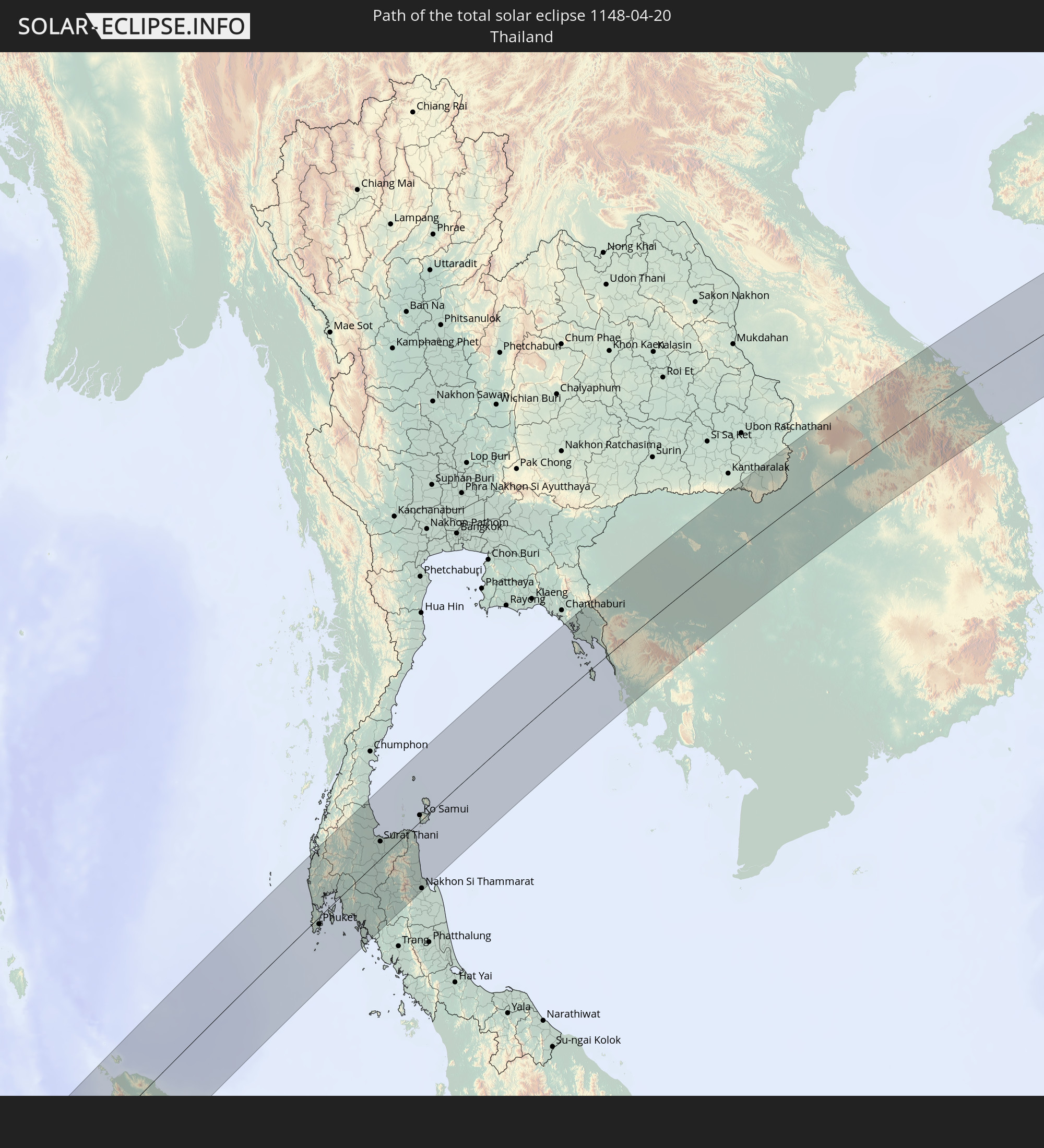 Thailand
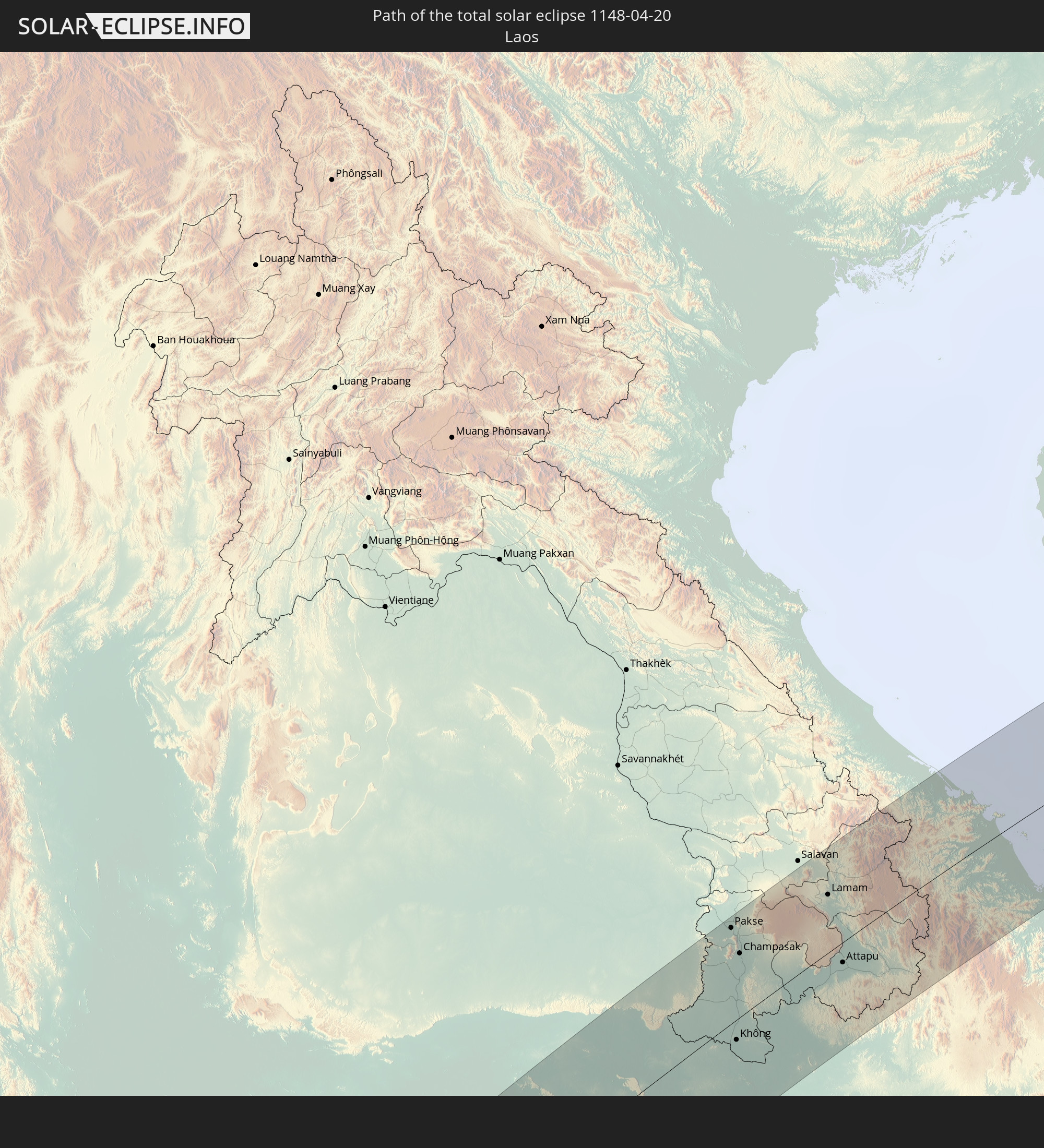 Laos
Laos
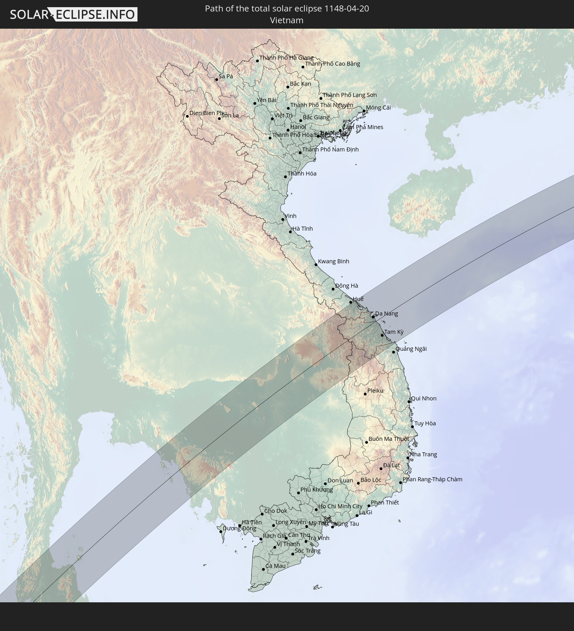 Vietnam
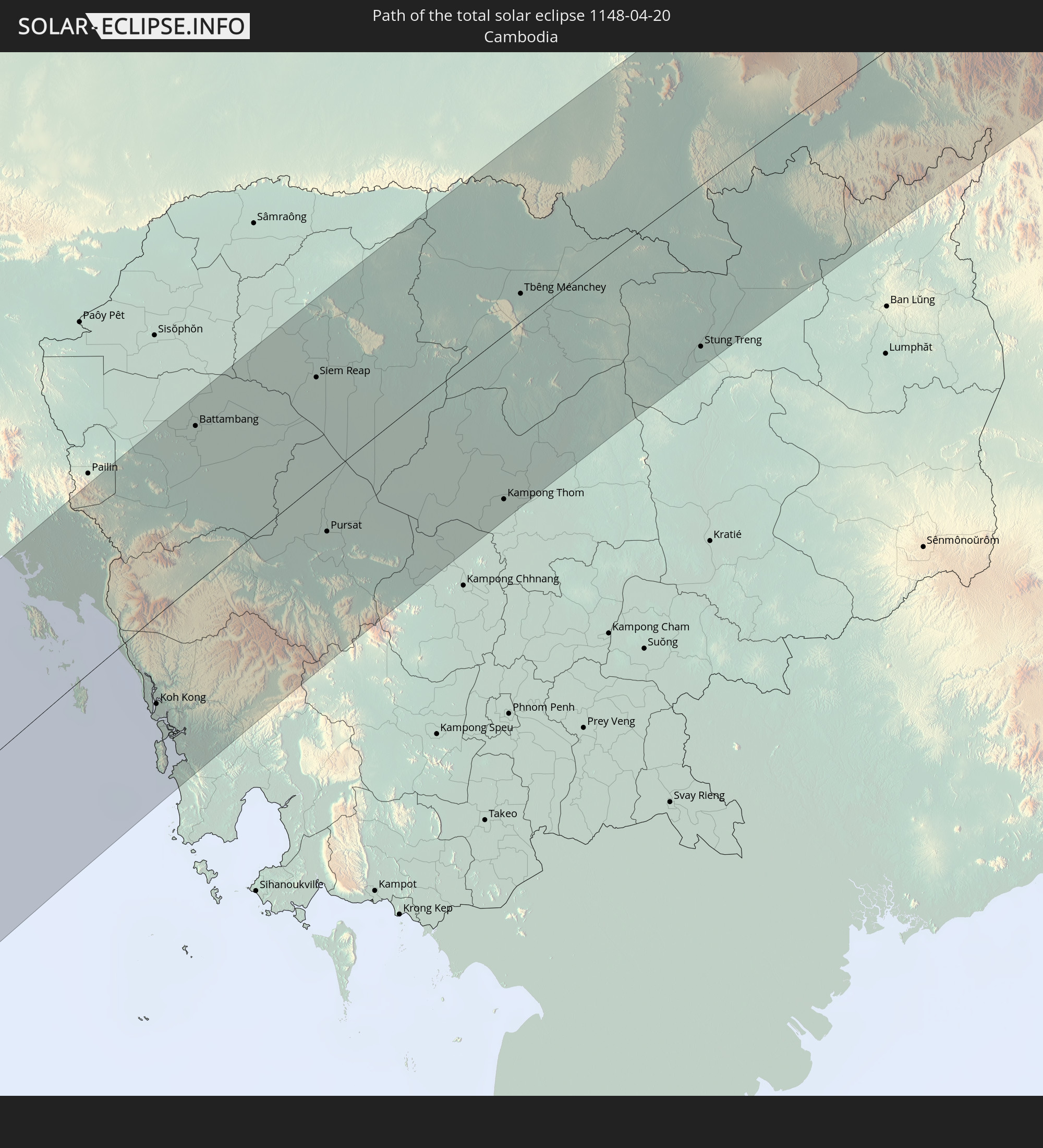 Cambodia
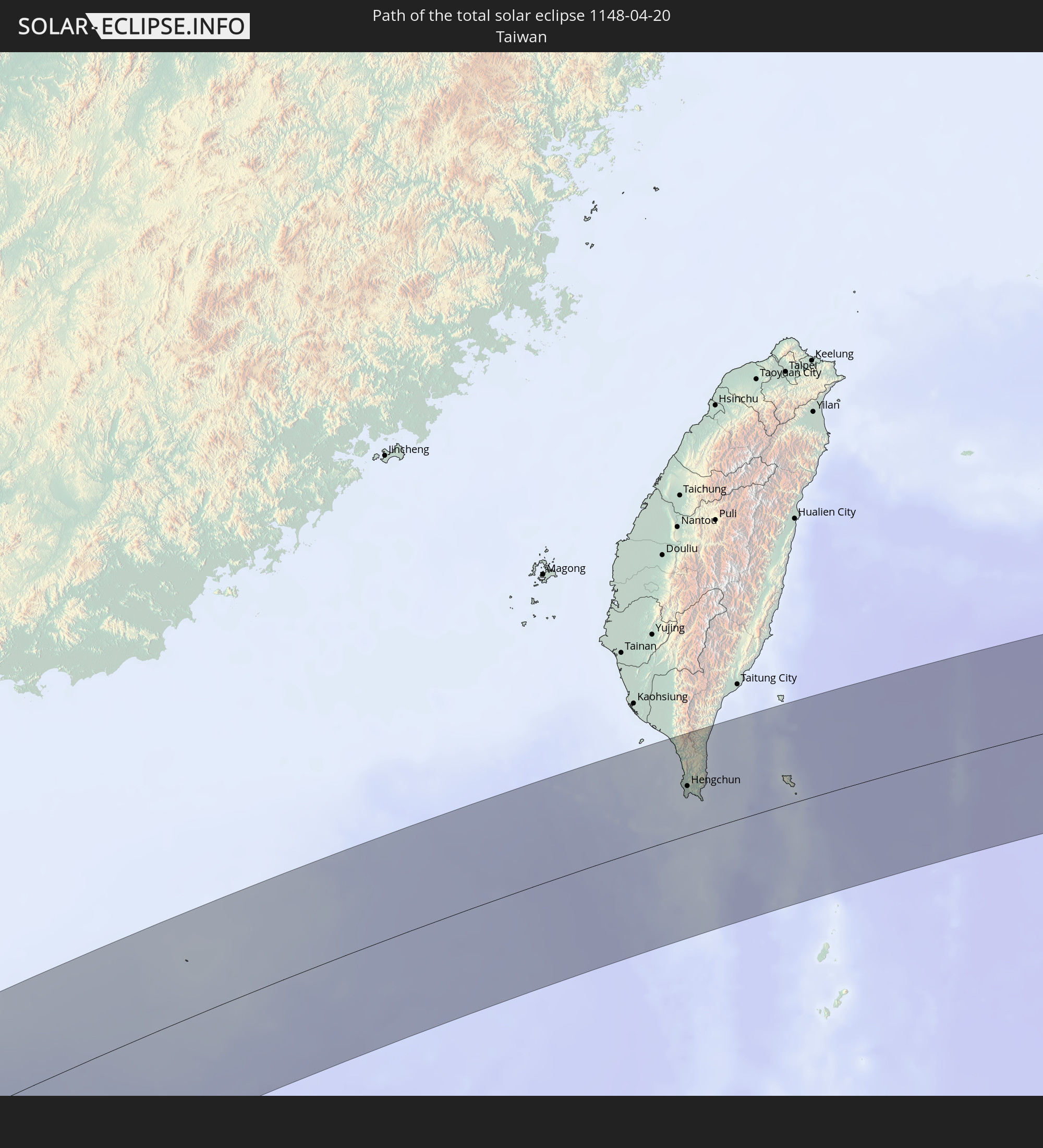 Taiwan
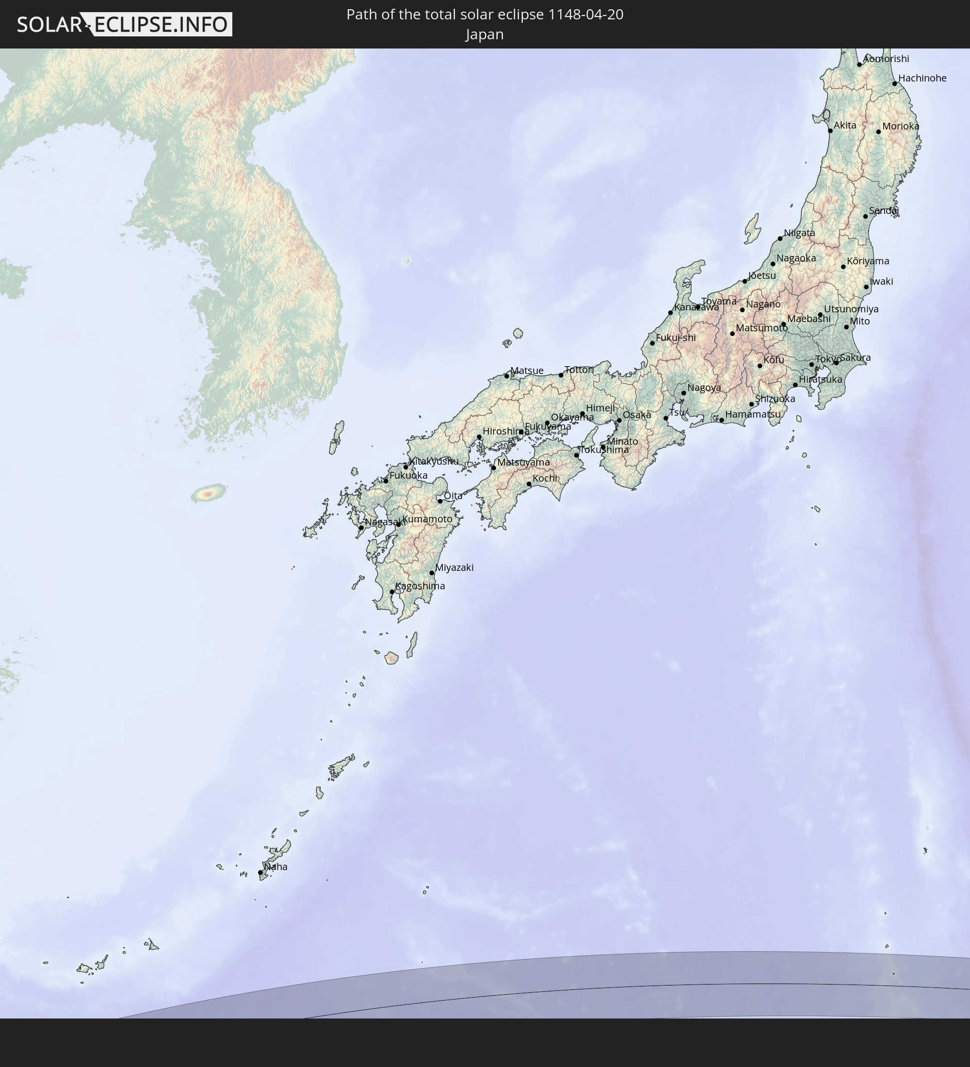 Japan
Japan
In den folgenden Ländern ist die Sonnenfinsternis partiell zu sehen
 Russia
 United States
 United States Minor Outlying Islands
 Democratic Republic of the Congo
 Tanzania
 Uganda
 Mozambique
 Ethiopia
 Kenya
Kenya
 French Southern and Antarctic Lands
 Somalia
 Yemen
Yemen
 Madagascar
 Comoros
 Mayotte
 Seychelles
 Réunion
 Mauritius
 Pakistan
 India
India
 British Indian Ocean Territory
 Heard Island and McDonald Islands
 Maldives
 China
China
 Sri Lanka
 Nepal
Nepal
 Mongolia
 Bangladesh
 Bhutan
 Myanmar
 Indonesia
 Cocos Islands
 Thailand
 Malaysia
 Laos
Laos
 Vietnam
 Cambodia
 Singapore
 Christmas Island
 Australia
 Macau
Macau
 Hong Kong
 Brunei
 Taiwan
 Philippines
 Japan
Japan
 East Timor
 North Korea
 South Korea
 Palau
Palau
 Federated States of Micronesia
 Papua New Guinea
 Guam
Guam
 Northern Mariana Islands
 Solomon Islands
 Marshall Islands
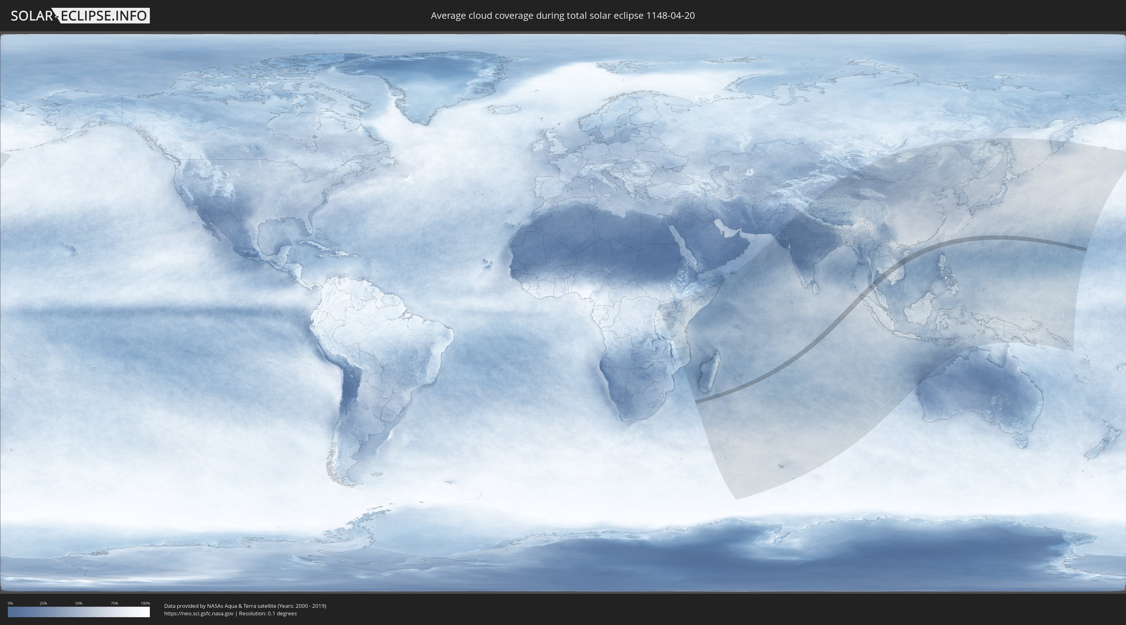
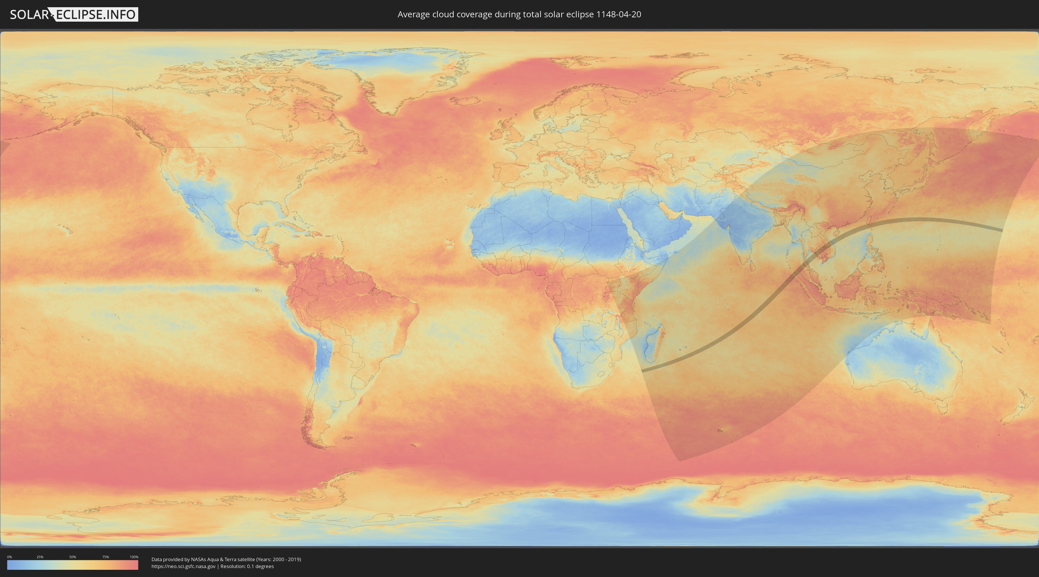
How will be the weather during the total solar eclipse on 04/20/1148?
Where is the best place to see the total solar eclipse of 04/20/1148?
The following maps show the average cloud coverage for the day of the total solar eclipse.
With the help of these maps, it is possible to find the place along the eclipse path, which has the best
chance of a cloudless sky.
Nevertheless, you should consider local circumstances and inform about the weather of your chosen
observation site.
The data is provided by NASAs satellites
AQUA and TERRA.
The cloud maps are averaged over a period of 19 years (2000 - 2019).
Detailed country maps
 Indonesia
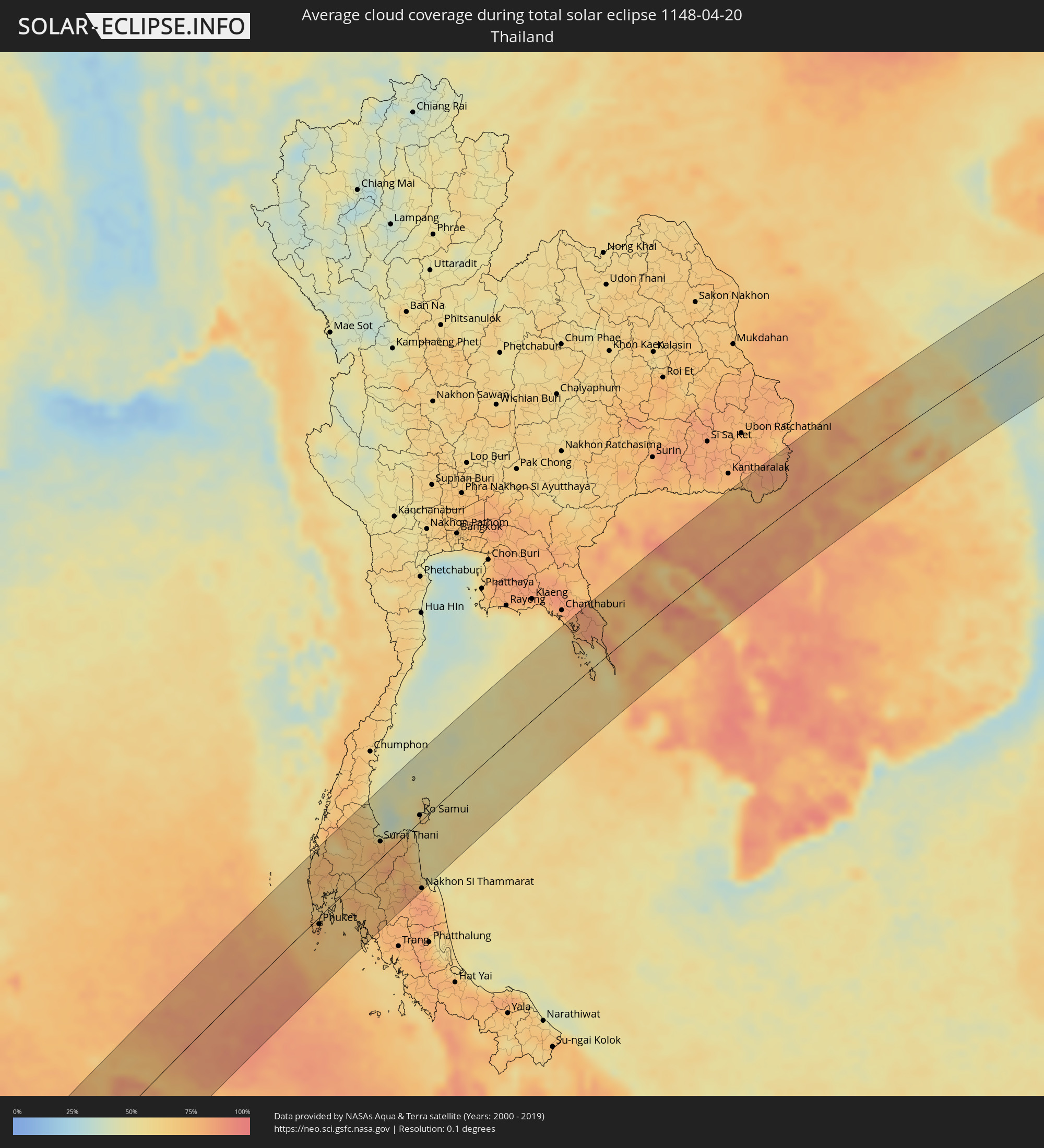 Thailand
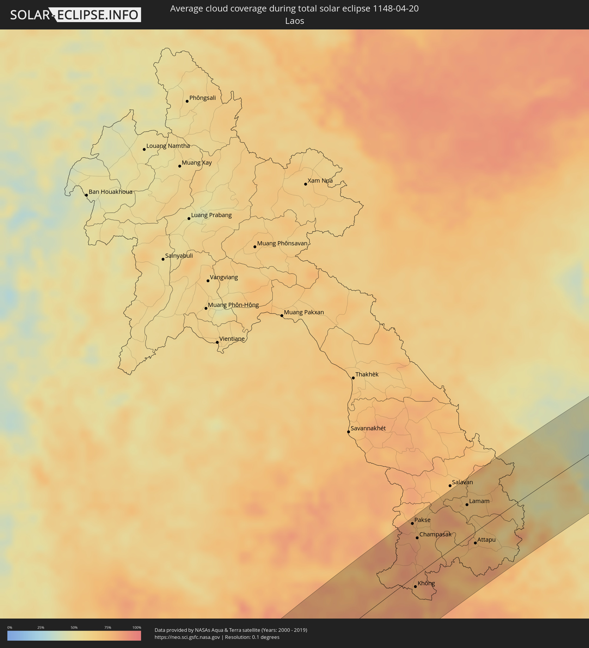 Laos
Laos
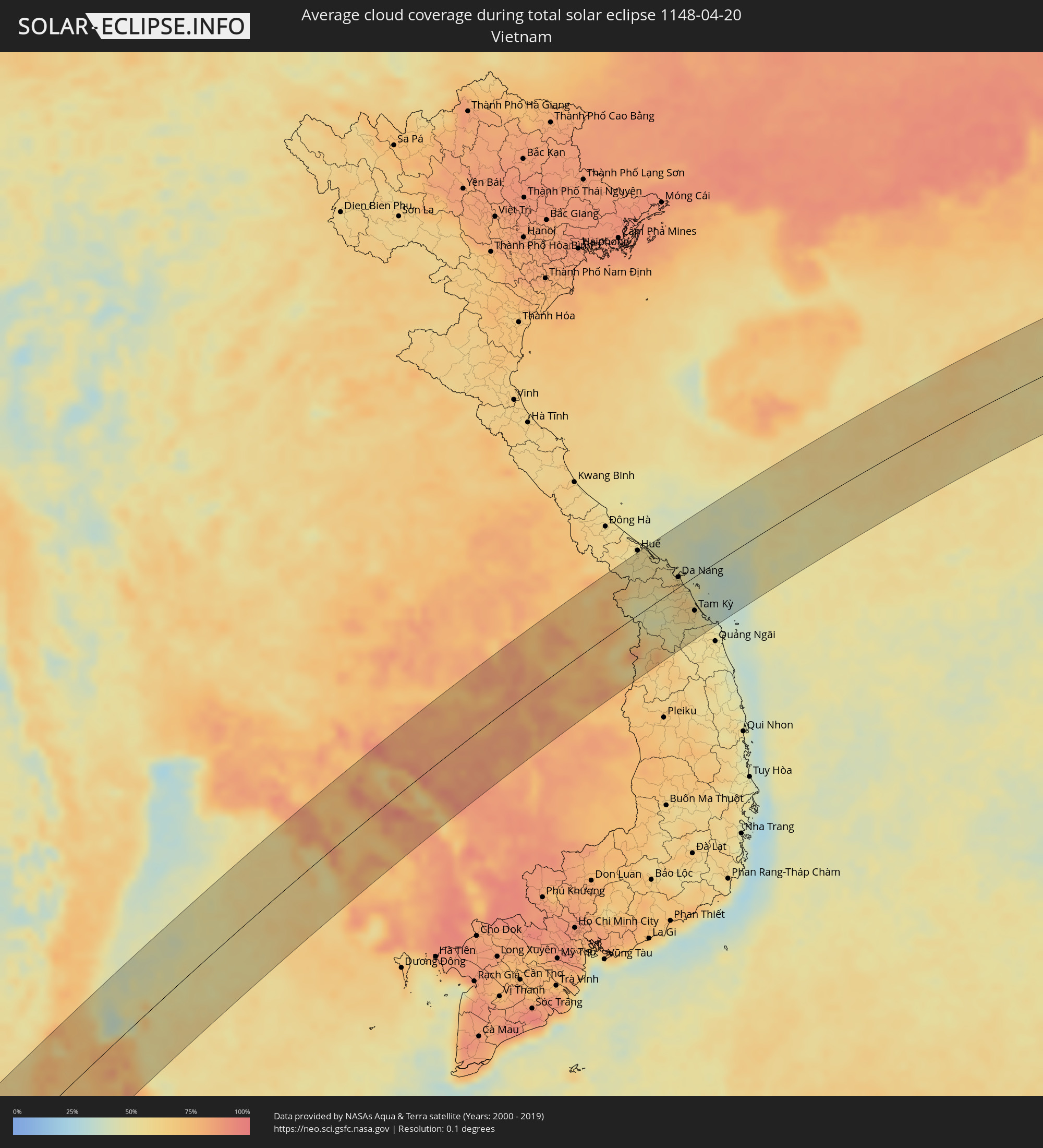 Vietnam
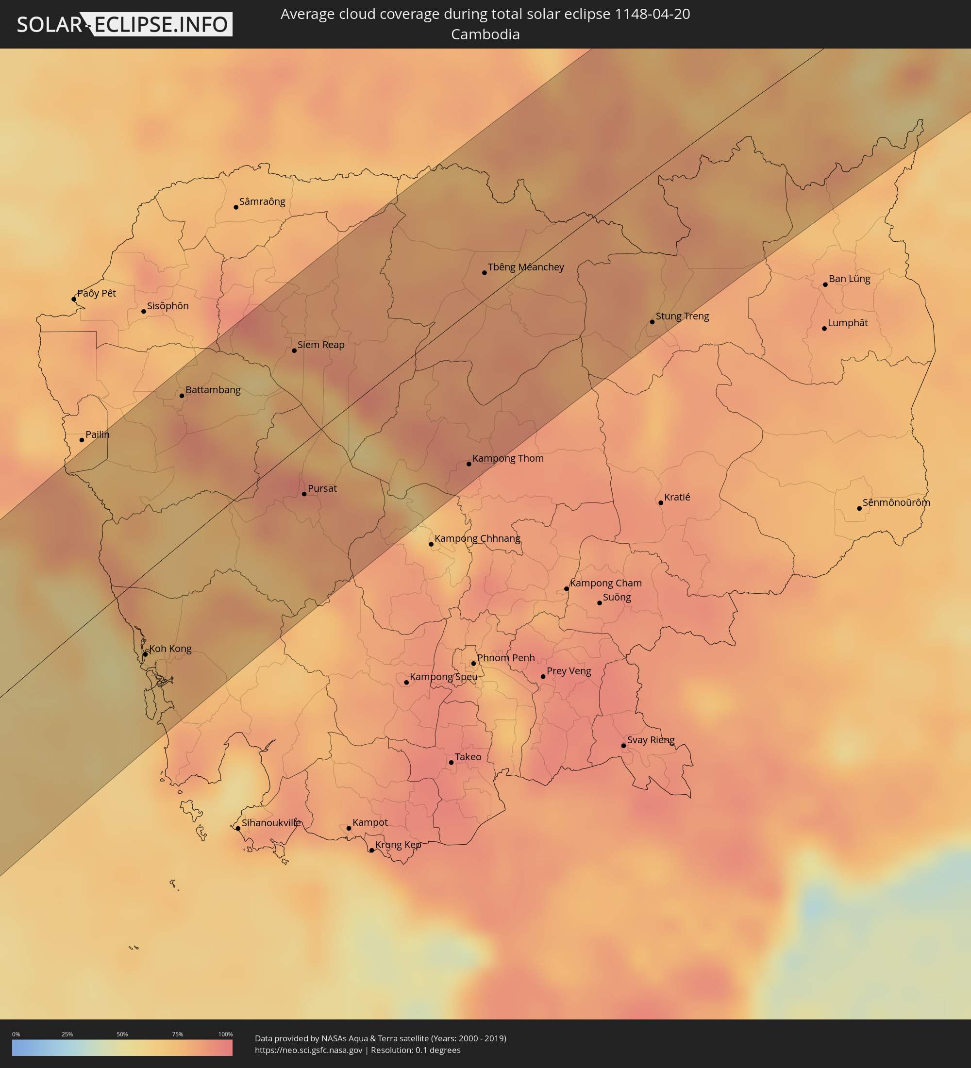 Cambodia
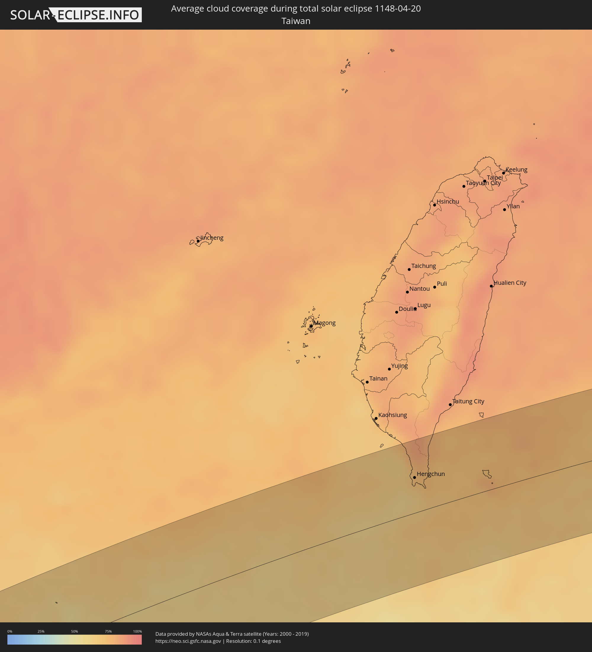 Taiwan
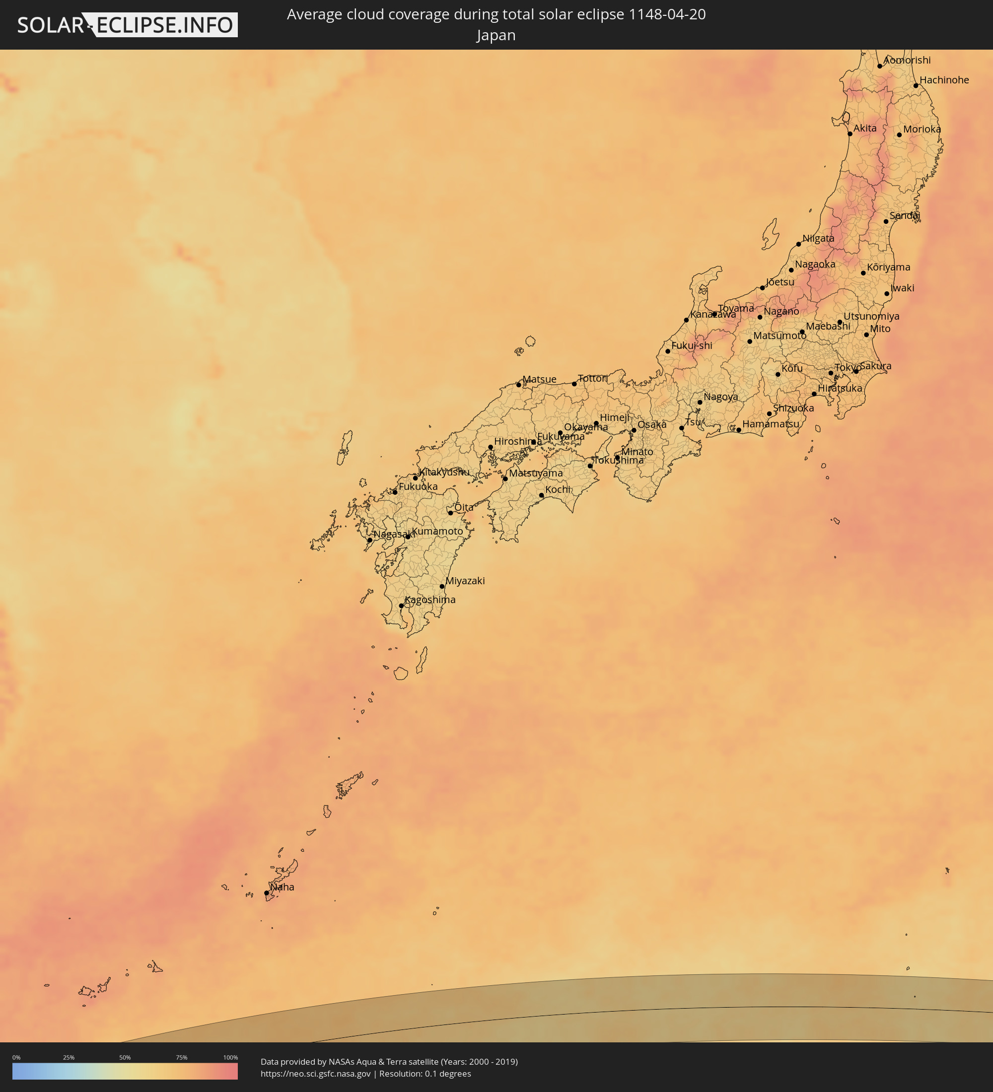 Japan
Japan
Cities inside the path of the eclipse
The following table shows all locations with a population of more than 5,000 inside the eclipse path. Cities which have more than 100,000 inhabitants are marked bold. A click at the locations opens a detailed map.
| City | Type | Eclipse duration | Local time of max. eclipse | Distance to central line | Ø Cloud coverage |
|
Sabang, Aceh
|
total | - | 12:11:49 UTC+07:07 | 73 km | 74% |
|
Banda Aceh, Aceh
|
total | - | 12:11:09 UTC+07:07 | 45 km | 83% |
|
Sigli, Aceh
|
total | - | 12:12:06 UTC+07:07 | 17 km | 77% |
|
Reuleuet, Aceh
|
total | - | 12:12:25 UTC+07:07 | 56 km | 85% |
|
Patong, Phuket
|
total | - | 11:56:50 UTC+06:42 | 1 km | 73% |
|
Ban Karon, Phuket
|
total | - | 11:56:45 UTC+06:42 | 4 km | 73% |
|
Rawai, Phuket
|
total | - | 11:56:40 UTC+06:42 | 12 km | 73% |
|
Kathu, Phuket
|
total | - | 11:56:58 UTC+06:42 | 2 km | 73% |
|
Ban Chalong, Phuket
|
total | - | 11:56:50 UTC+06:42 | 8 km | 73% |
|
Wichit, Phuket
|
total | - | 11:57:01 UTC+06:42 | 8 km | 77% |
|
Ban Talat Nua, Phuket
|
total | - | 11:57:00 UTC+06:42 | 8 km | 77% |
|
Ban Ko Kaeo, Phuket
|
total | - | 11:57:08 UTC+06:42 | 5 km | 77% |
|
Phuket, Phuket
|
total | - | 11:57:03 UTC+06:42 | 9 km | 77% |
|
Ban Talat Yai, Phuket
|
total | - | 11:57:02 UTC+06:42 | 9 km | 77% |
|
Ban Ratsada, Phuket
|
total | - | 11:57:06 UTC+06:42 | 8 km | 77% |
|
Phang Nga, Phangnga
|
total | - | 11:58:27 UTC+06:42 | 26 km | 72% |
|
Ban Phru Nai, Phangnga
|
total | - | 11:57:35 UTC+06:42 | 18 km | 64% |
|
Ao Luek, Krabi
|
total | - | 11:58:42 UTC+06:42 | 6 km | 67% |
|
Ban Ao Nang, Phangnga
|
total | - | 11:58:14 UTC+06:42 | 28 km | 64% |
|
Krabi, Krabi
|
total | - | 11:58:30 UTC+06:42 | 33 km | 70% |
|
Nuea Khlong, Krabi
|
total | - | 11:58:41 UTC+06:42 | 40 km | 73% |
|
Saladan, Krabi
|
total | - | 11:57:50 UTC+06:42 | 80 km | 65% |
|
Chai Buri, Surat Thani
|
total | - | 11:59:38 UTC+06:42 | 15 km | 70% |
|
Chaiya, Surat Thani
|
total | - | 12:01:44 UTC+06:42 | 51 km | 61% |
|
Phunphin, Surat Thani
|
total | - | 12:01:16 UTC+06:42 | 26 km | 77% |
|
Surat Thani, Surat Thani
|
total | - | 12:01:32 UTC+06:42 | 21 km | 76% |
|
Ban Na San, Surat Thani
|
total | - | 12:00:55 UTC+06:42 | 9 km | 81% |
|
Wiang Sa, Surat Thani
|
total | - | 12:00:36 UTC+06:42 | 22 km | 73% |
|
Tham Phannara, Nakhon Si Thammarat
|
total | - | 12:00:14 UTC+06:42 | 42 km | 73% |
|
Chawang, Nakhon Si Thammarat
|
total | - | 12:00:28 UTC+06:42 | 50 km | 74% |
|
Thung Song, Nakhon Si Thammarat
|
total | - | 12:00:20 UTC+06:42 | 84 km | 79% |
|
Don Sak, Surat Thani
|
total | - | 12:02:39 UTC+06:42 | 8 km | 68% |
|
Ko Samui, Surat Thani
|
total | - | 12:03:37 UTC+06:42 | 8 km | 56% |
|
Nakhon Si Thammarat, Nakhon Si Thammarat
|
total | - | 12:01:29 UTC+06:42 | 84 km | 84% |
|
Ko Pha Ngan, Nakhon Si Thammarat
|
total | - | 12:04:15 UTC+06:42 | 19 km | 65% |
|
Khlung, Chanthaburi
|
total | - | 12:14:17 UTC+06:42 | 85 km | 77% |
|
Trat, Trat
|
total | - | 12:14:31 UTC+06:42 | 46 km | 62% |
|
Bo Rai, Trat
|
total | - | 12:15:12 UTC+06:42 | 73 km | 84% |
|
Koh Kong, Koh Kong
|
total | - | 12:14:21 UTC+06:42 | 40 km | 65% |
|
Smach Mean Chey, Koh Kong
|
total | - | 12:14:20 UTC+06:42 | 50 km | 62% |
|
Battambang, Battambang
|
total | - | 12:17:39 UTC+06:42 | 72 km | 84% |
|
Siem Reap, Siem Reap
|
total | - | 12:19:36 UTC+06:42 | 49 km | 84% |
|
Pursat, Pursat
|
total | - | 12:18:11 UTC+06:42 | 26 km | 79% |
|
Kampong Thom, Kampong Thom
|
total | - | 12:20:41 UTC+06:42 | 77 km | 89% |
|
Tbêng Méanchey, Preah Vihear
|
total | - | 12:22:54 UTC+06:42 | 13 km | 83% |
|
Pakse, Champasak
|
total | - | 12:27:04 UTC+06:42 | 77 km | 80% |
|
Không, Champasak
|
total | - | 12:25:24 UTC+06:42 | 16 km | 78% |
|
Champasak, Champasak
|
total | - | 12:26:50 UTC+06:42 | 51 km | 79% |
|
Stung Treng, Stung Treng
|
total | - | 12:24:36 UTC+06:42 | 77 km | 84% |
|
Lamam, Xékong
|
total | - | 12:29:34 UTC+06:42 | 47 km | 70% |
|
Attapu, Attapu
|
total | - | 12:28:49 UTC+06:42 | 16 km | 76% |
|
Da Nang, Đà Nẵng
|
total | - | 12:58:39 UTC+07:06 | 14 km | 63% |
|
Hội An, Quảng Nam
|
total | - | 12:58:36 UTC+07:06 | 10 km | 57% |
|
Tam Kỳ, Quảng Nam
|
total | - | 12:58:24 UTC+07:06 | 47 km | 55% |
|
Hengchun, Taiwan
|
total | - | 14:25:47 UTC+08:00 | 39 km | 65% |