Ringförmige Sonnenfinsternis vom 11.10.-0089
| Wochentag: | Dienstag |
| Maximale Dauer der Verfinsterung: | 06m12s |
| Maximale Breite des Finsternispfades: | 186 km |
| Saroszyklus: | 71 |
| Bedeckungsgrad: | 94.9% |
| Magnitude: | 0.9494 |
| Gamma: | -0.0036 |
Wo kann man die Sonnenfinsternis vom 11.10.-0089 sehen?
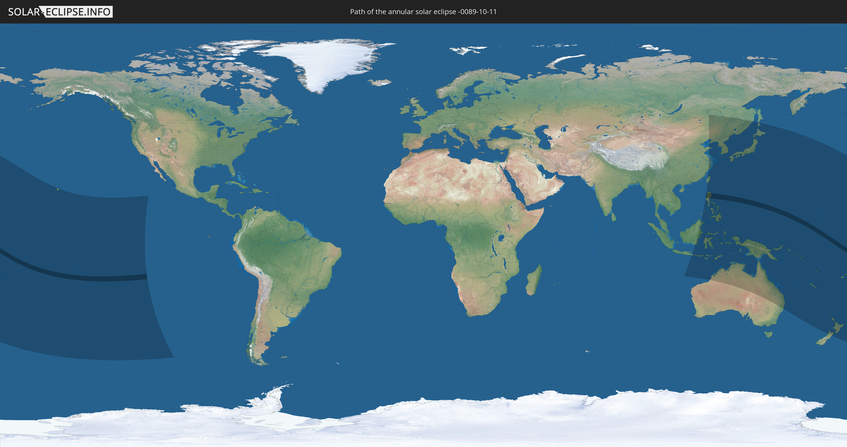
Die Sonnenfinsternis am 11.10.-0089 kann man in 37 Ländern als partielle Sonnenfinsternis beobachten.
Der Finsternispfad verläuft durch 6 Länder. Nur in diesen Ländern ist sie als ringförmige Sonnenfinsternis zu sehen.
In den folgenden Ländern ist die Sonnenfinsternis ringförmig zu sehen
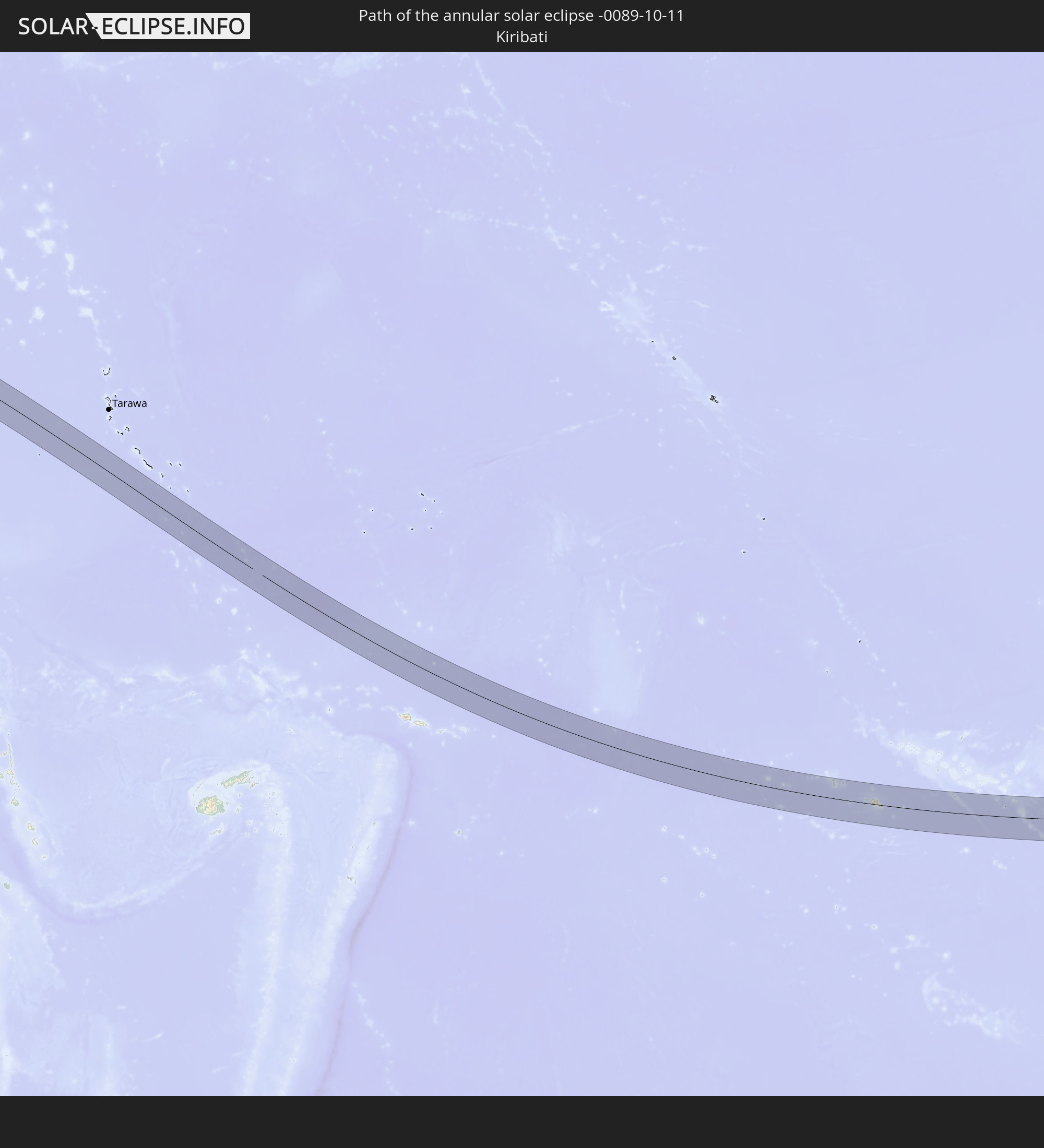 Kiribati
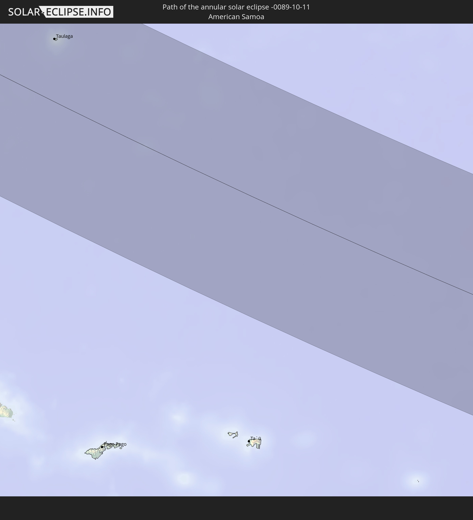 Amerikanisch-Samoa
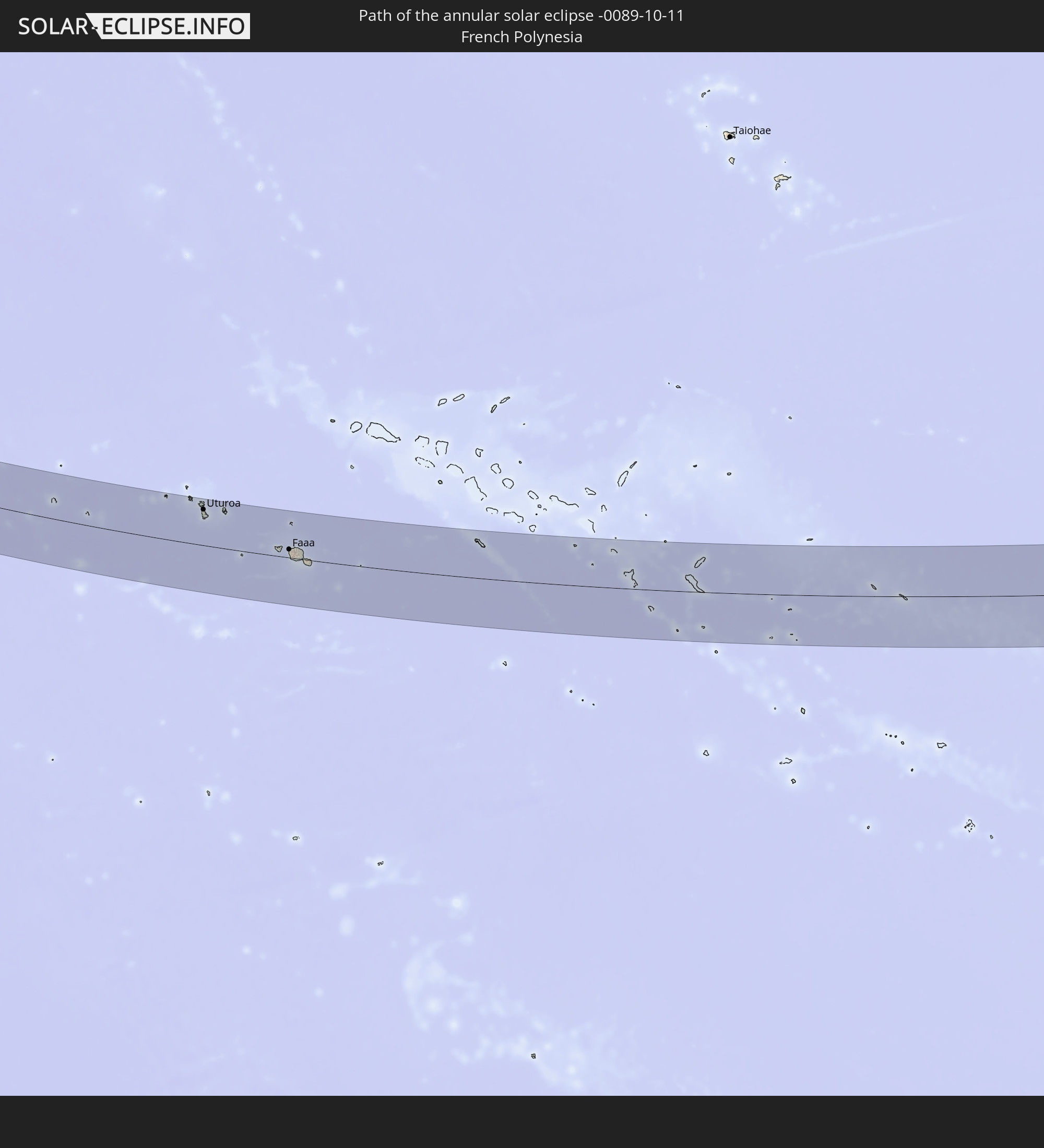 Französisch-Polynesien
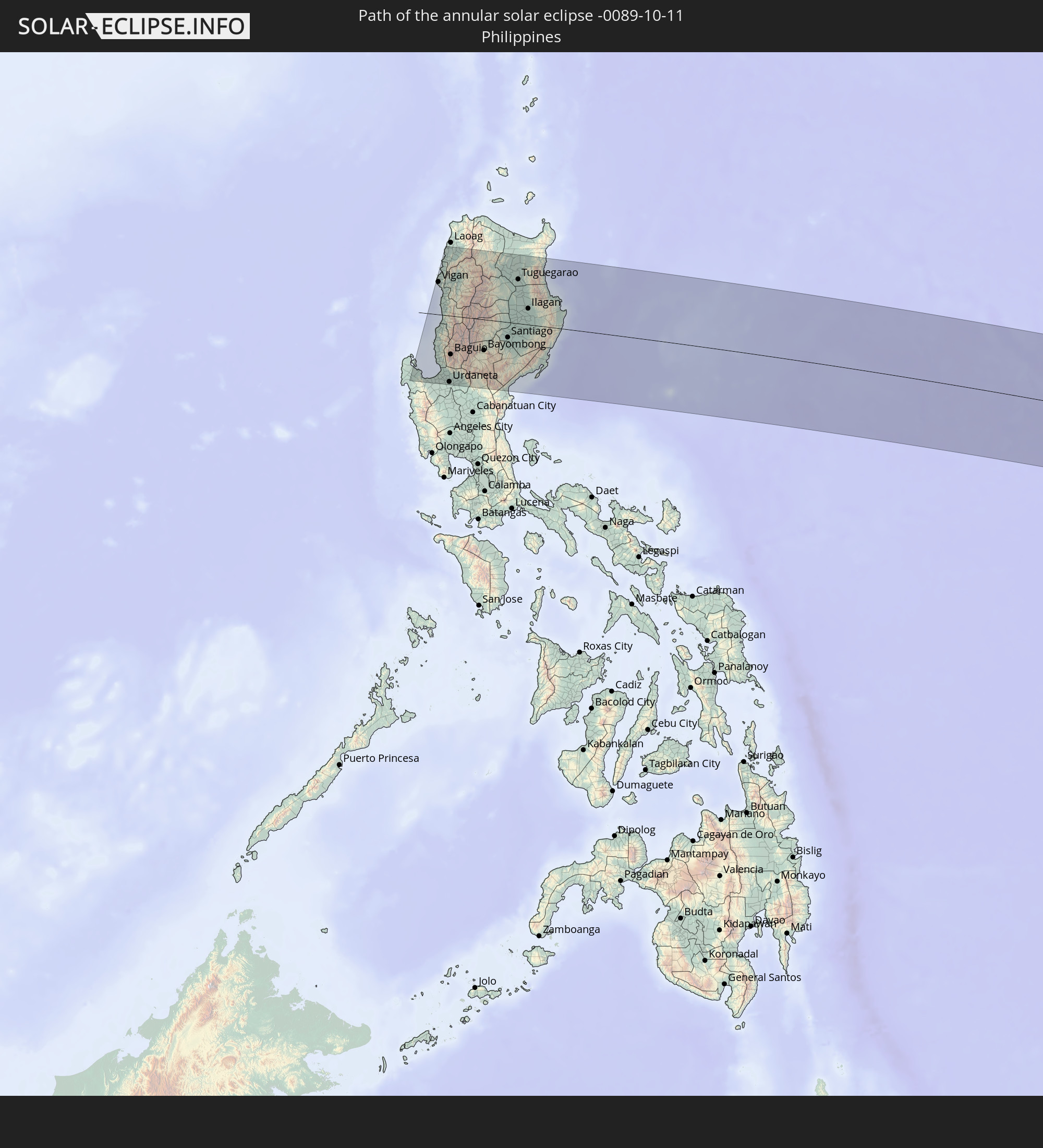 Philippinen
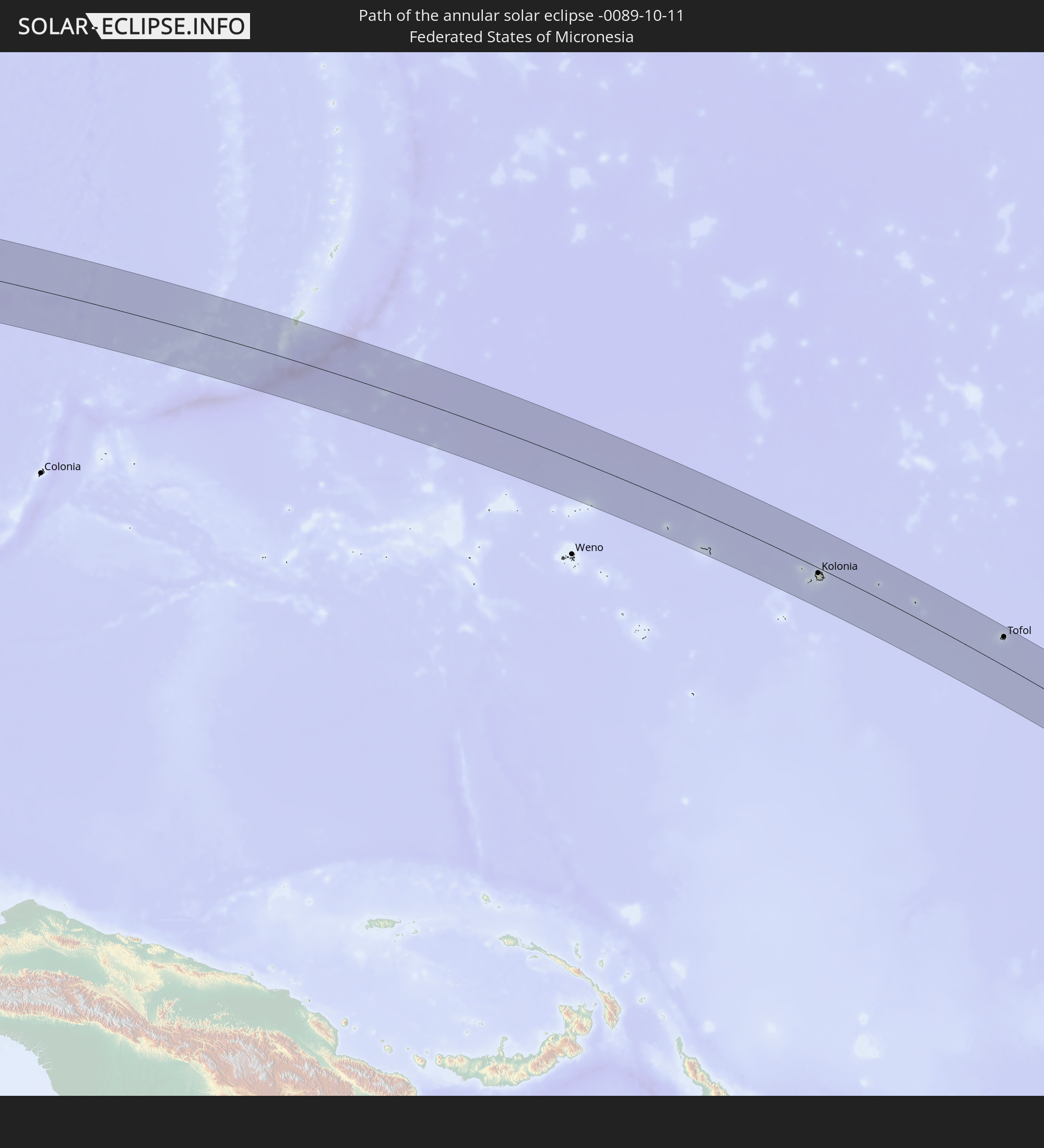 Föderierte Staaten von Mikronesien
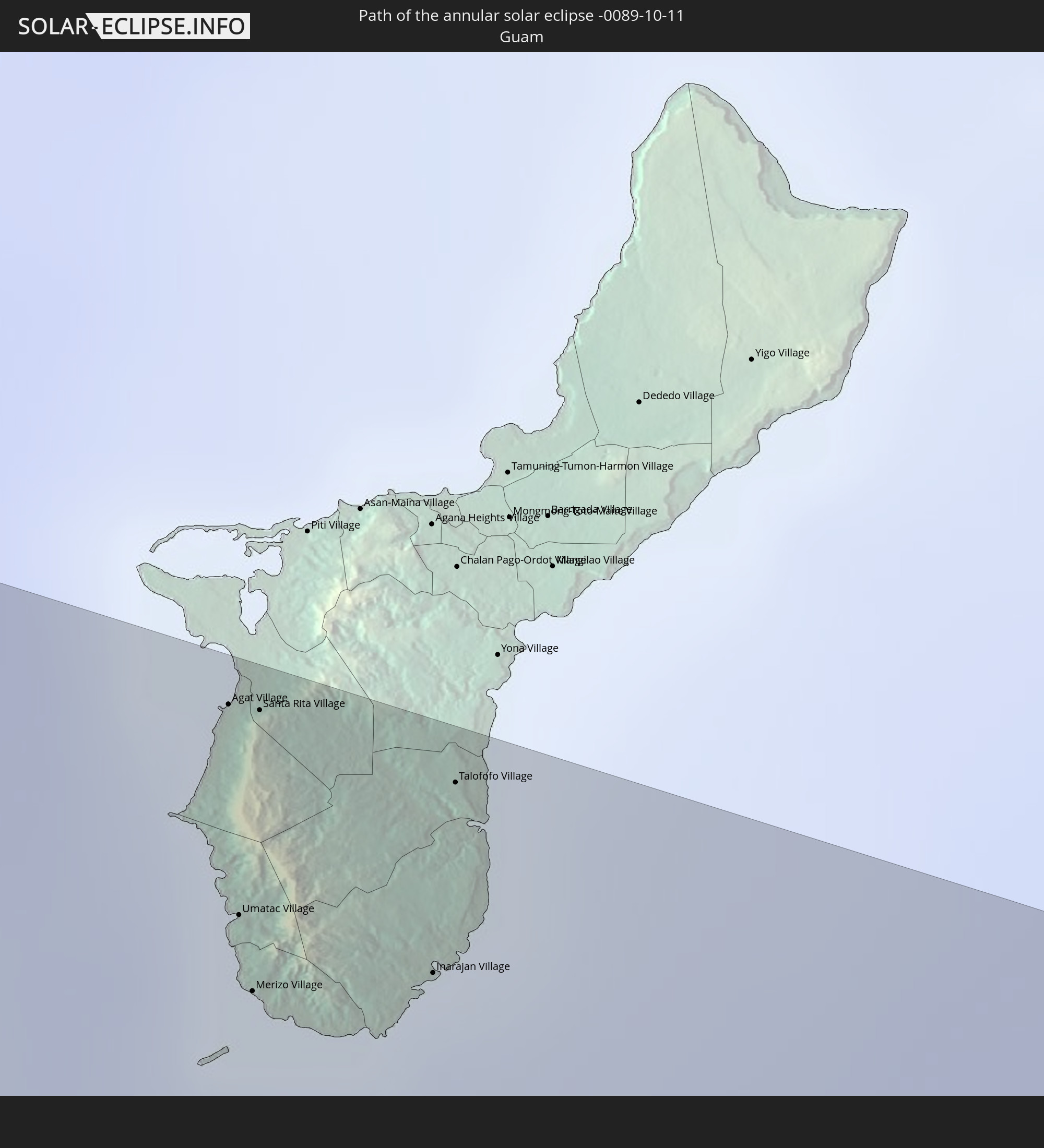 Guam
Guam
In den folgenden Ländern ist die Sonnenfinsternis partiell zu sehen
 Russland
 Fidschi
 Vereinigte Staaten
 Neuseeland
 United States Minor Outlying Islands
 Wallis und Futuna
 Tonga
Tonga
 Kiribati
 Samoa
Samoa
 Tokelau
 Amerikanisch-Samoa
 Niue
Niue
 Cookinseln
 Französisch-Polynesien
 Pitcairninseln
 Volksrepublik China
 Indonesien
 Malaysia
 Australien
 Taiwan
 Philippinen
 Japan
Japan
 Osttimor
 Nordkorea
 Südkorea
 Palau
Palau
 Föderierte Staaten von Mikronesien
 Papua-Neuguinea
 Guam
Guam
 Nördliche Marianen
 Salomonen
 Neukaledonien
 Marshallinseln
 Vanuatu
 Nauru
Nauru
 Norfolkinsel
 Tuvalu
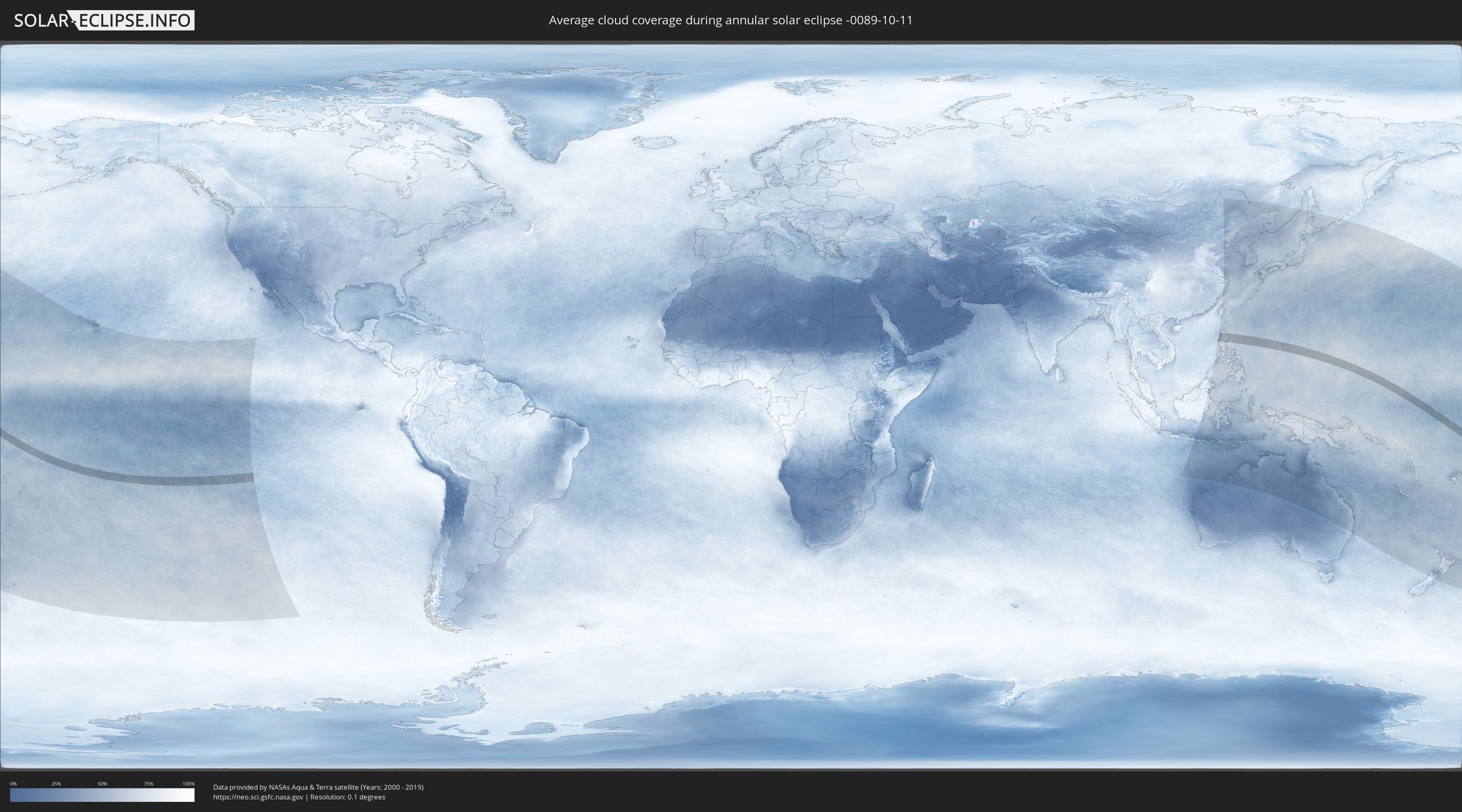
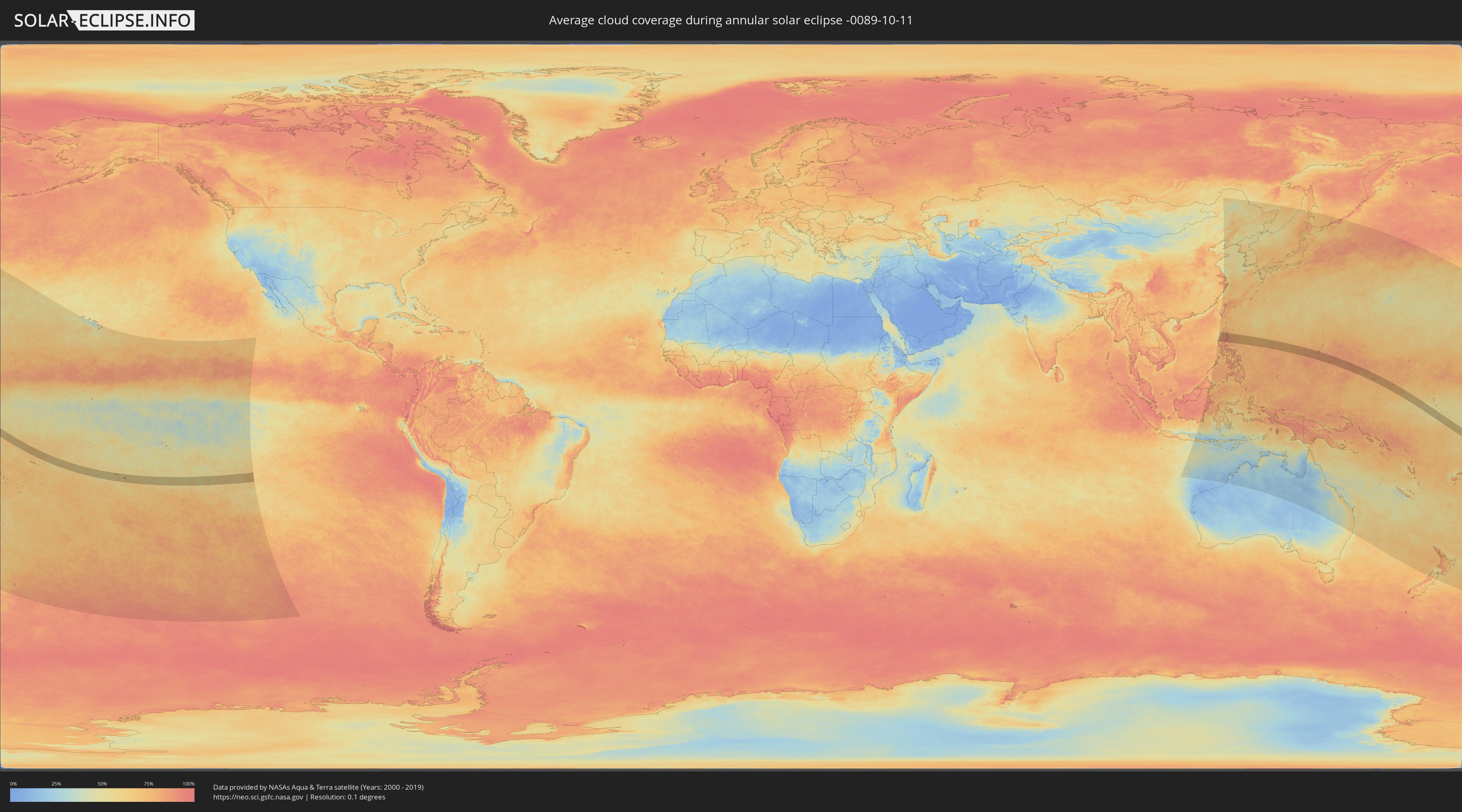
Wie wird das Wetter während der ringförmigen Sonnenfinsternis am 11.10.-0089?
Wo ist der beste Ort, um die ringförmige Sonnenfinsternis vom 11.10.-0089 zu beobachten?
Die folgenden Karten zeigen die durchschnittliche Bewölkung für den Tag, an dem die ringförmige Sonnenfinsternis
stattfindet. Mit Hilfe der Karten lässt sich der Ort entlang des Finsternispfades eingrenzen,
der die besten Aussichen auf einen klaren wolkenfreien Himmel bietet.
Trotzdem muss man immer lokale Gegenenheiten beachten und sollte sich genau über das Wetter an seinem
gewählten Beobachtungsort informieren.
Die Daten stammen von den beiden NASA-Satelliten
AQUA und TERRA
und wurden über einen Zeitraum von 19 Jahren (2000 - 2019) gemittelt.
Detaillierte Länderkarten
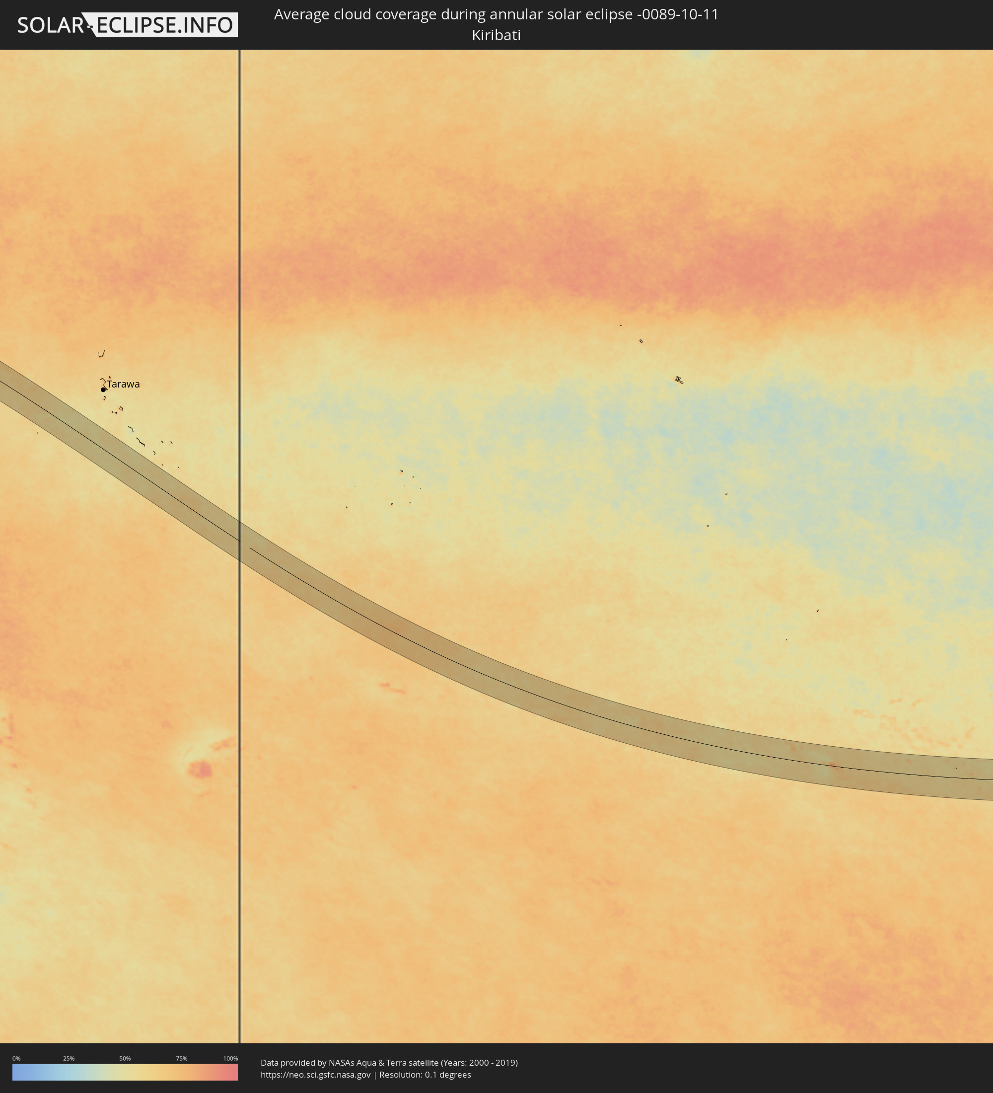 Kiribati
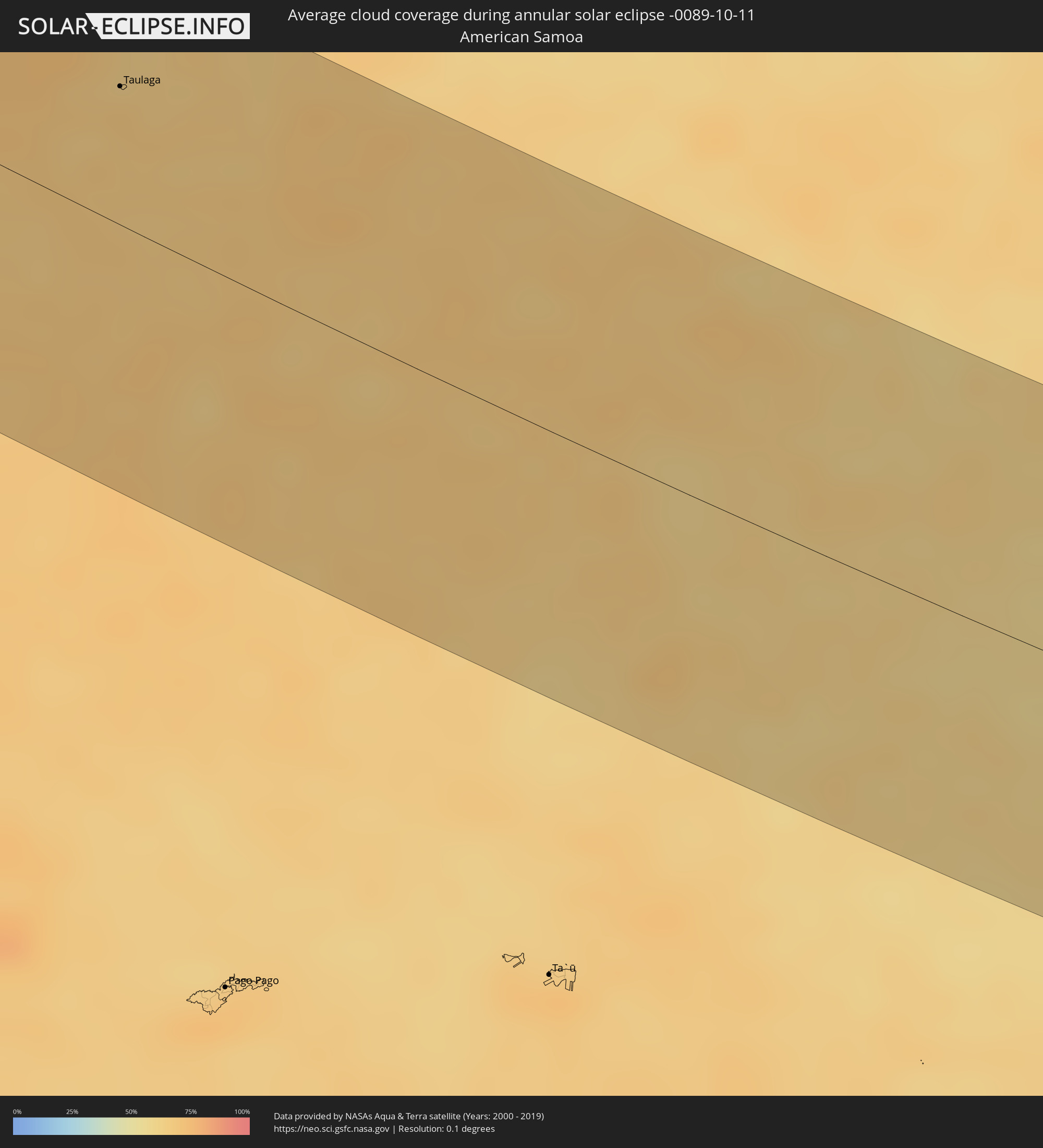 Amerikanisch-Samoa
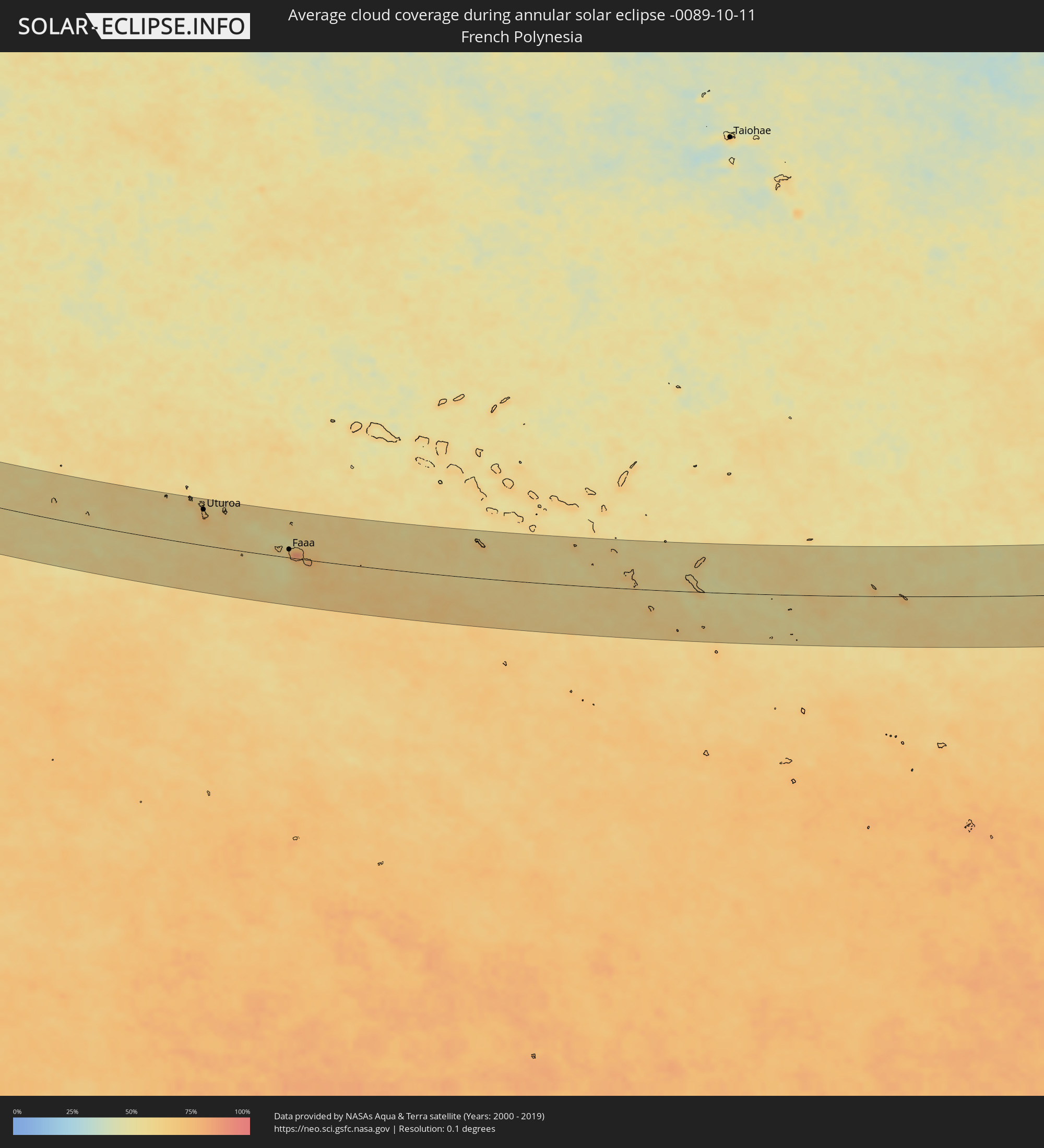 Französisch-Polynesien
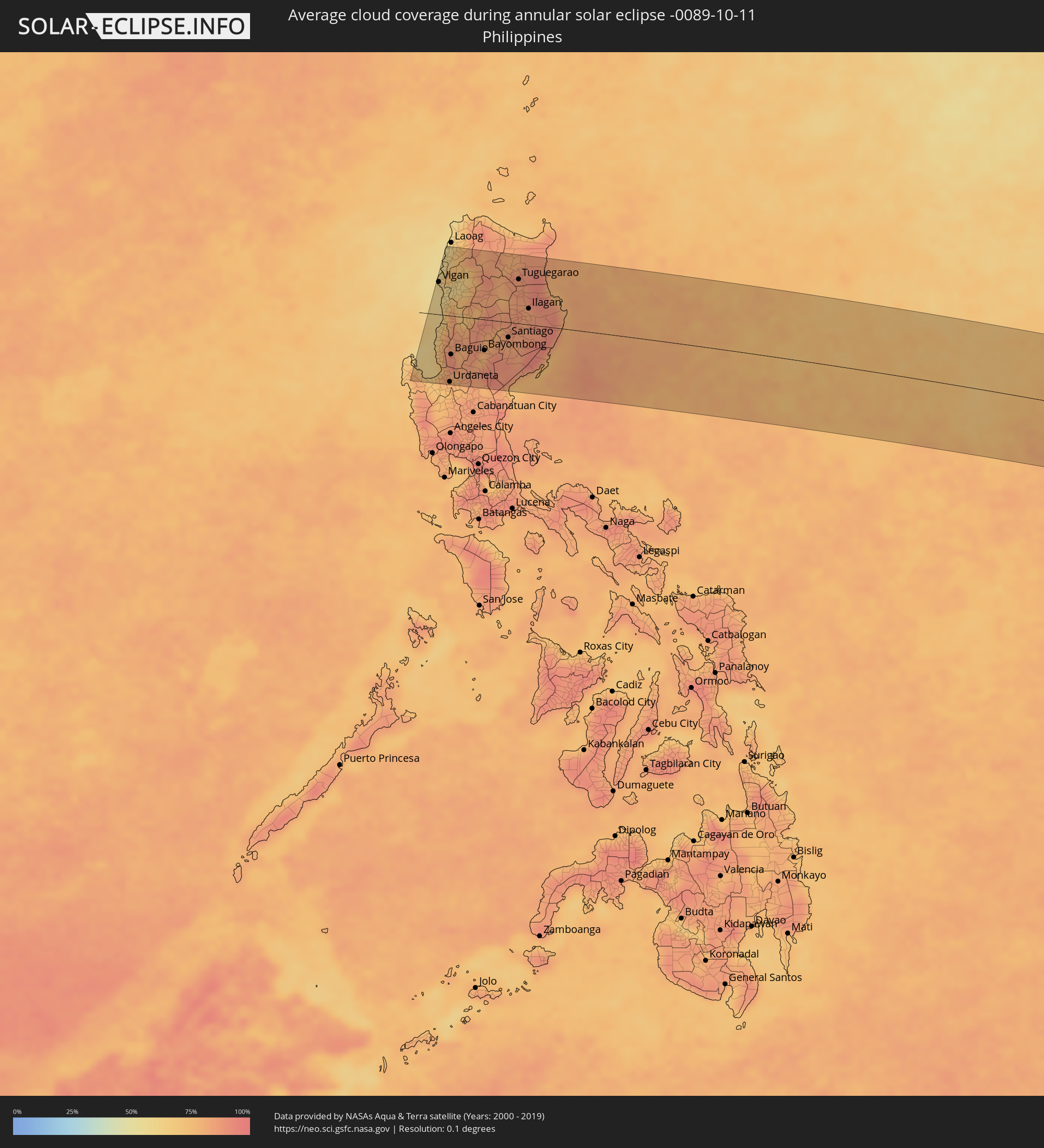 Philippinen
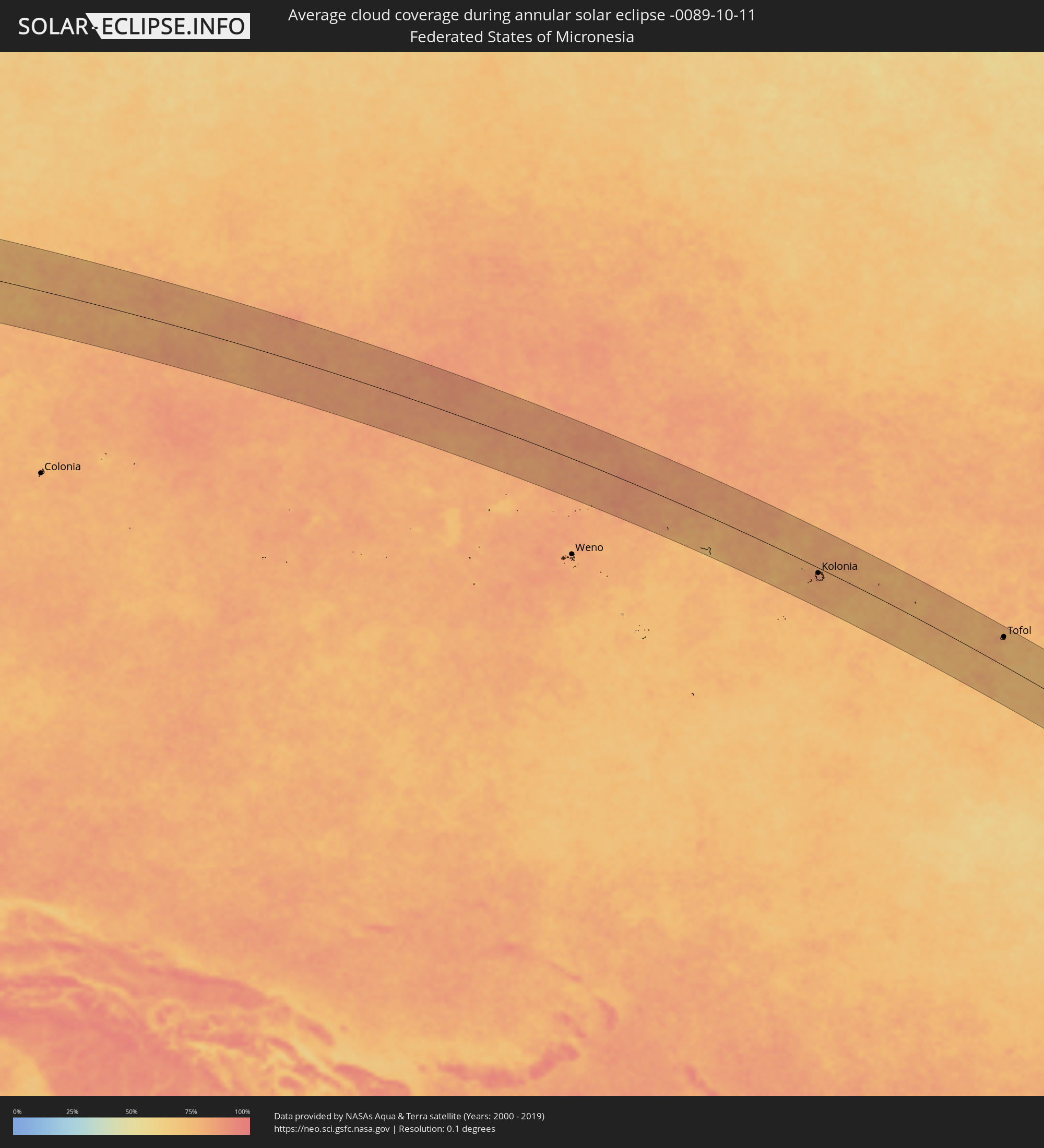 Föderierte Staaten von Mikronesien
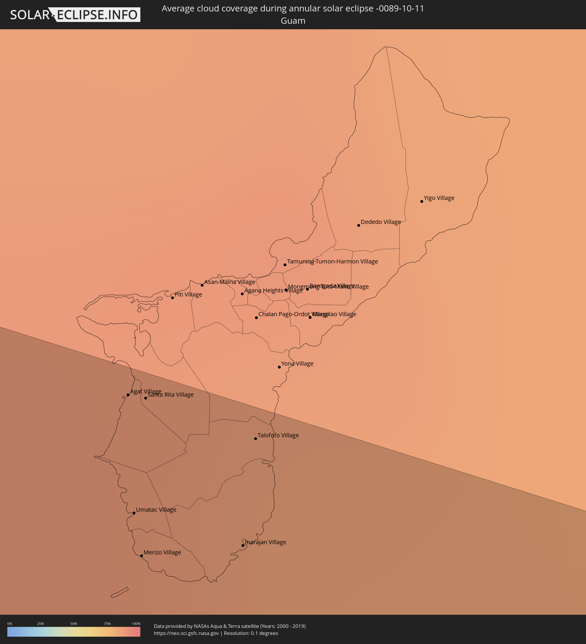 Guam
Guam
Orte im Finsternispfad
Die nachfolgene Tabelle zeigt Städte und Orte mit mehr als 5.000 Einwohnern, die sich im Finsternispfad befinden. Städte mit mehr als 100.000 Einwohnern sind dick gekennzeichnet. Mit einem Klick auf den Ort öffnet sich eine Detailkarte die die Lage des jeweiligen Ortes zusammen mit dem Verlauf der zentralen Finsternis präsentiert.
| Ort | Typ | Dauer der Verfinsterung | Ortszeit bei maximaler Verfinsterung | Entfernung zur Zentrallinie | Ø Bewölkung |
|
Taulaga, Swains Island
|
ringförmig | - | 00:30:00 UTC+00:00 | 50 km | 67% |
|
Uturoa, Leeward Islands
|
ringförmig | - | 15:23:43 UTC-09:58 | 81 km | 66% |
|
Punaauia, Îles du Vent
|
ringförmig | - | 15:27:00 UTC-09:58 | 9 km | 73% |
|
Faaa, Îles du Vent
|
ringförmig | - | 15:26:58 UTC-09:58 | 18 km | 73% |
|
Paea, Îles du Vent
|
ringförmig | - | 15:27:02 UTC-09:58 | 4 km | 65% |
|
Papeete, Îles du Vent
|
ringförmig | - | 15:27:01 UTC-09:58 | 20 km | 65% |
|
Papao, Îles du Vent
|
ringförmig | - | 15:27:06 UTC-09:58 | 3 km | 53% |
|
Pirae, Îles du Vent
|
ringförmig | - | 01:25:19 UTC+00:00 | 23 km | 71% |
|
Arue, Îles du Vent
|
ringförmig | - | 15:27:07 UTC-09:58 | 24 km | 71% |
|
Mahina, Îles du Vent
|
ringförmig | - | 15:27:07 UTC-09:58 | 25 km | 71% |
|
Afaahiti
|
ringförmig | - | 15:27:31 UTC-09:58 | 1 km | 69% |
|
Alaminos, Ilocos
|
ringförmig | - | 05:56:22 UTC+08:00 | 104 km | 74% |
|
Agoo, Ilocos
|
ringförmig | - | 05:56:22 UTC+08:00 | 111 km | 69% |
|
Lingayen, Ilocos
|
ringförmig | - | 05:56:23 UTC+08:00 | 116 km | 70% |
|
San Fernando, Ilocos
|
ringförmig | - | 05:56:18 UTC+08:00 | 49 km | 64% |
|
Aringay, Ilocos
|
ringförmig | - | 05:56:20 UTC+08:00 | 74 km | 75% |
|
Vigan, Ilocos
|
ringförmig | - | 05:56:12 UTC+08:00 | 57 km | 63% |
|
Mangaldan, Ilocos
|
ringförmig | - | 05:56:23 UTC+08:00 | 109 km | 79% |
|
Tagudin, Ilocos
|
ringförmig | - | 05:56:16 UTC+08:00 | 13 km | 67% |
|
Candon, Ilocos
|
ringförmig | - | 05:56:14 UTC+08:00 | 16 km | 72% |
|
Cabugao, Ilocos
|
ringförmig | - | 05:56:11 UTC+08:00 | 82 km | 74% |
|
Subusub, Ilocos
|
ringförmig | - | 05:56:21 UTC+08:00 | 90 km | 81% |
|
Sison, Ilocos
|
ringförmig | - | 05:56:22 UTC+08:00 | 96 km | 81% |
|
Batac City, Ilocos
|
ringförmig | - | 05:56:10 UTC+08:00 | 113 km | 64% |
|
Urdaneta, Ilocos
|
ringförmig | - | 05:56:23 UTC+08:00 | 117 km | 78% |
|
Baguio, Cordillera
|
ringförmig | - | 05:56:20 UTC+08:00 | 68 km | 89% |
|
Carusucan, Ilocos
|
ringförmig | - | 05:56:24 UTC+08:00 | 118 km | 78% |
|
Kibungan, Cordillera
|
ringförmig | - | 05:56:18 UTC+08:00 | 37 km | 86% |
|
Guiset East, Ilocos
|
ringförmig | - | 05:56:23 UTC+08:00 | 106 km | 81% |
|
Mankayan, Cordillera
|
ringförmig | - | 05:56:17 UTC+08:00 | 17 km | 77% |
|
Bontoc, Cordillera
|
ringförmig | - | 05:56:15 UTC+08:00 | 10 km | 79% |
|
Aritao, Cagayan Valley
|
ringförmig | - | 05:56:21 UTC+08:00 | 76 km | 80% |
|
Carranglan, Central Luzon
|
ringförmig | - | 05:56:24 UTC+08:00 | 113 km | 85% |
|
Pasil, Cordillera
|
ringförmig | - | 05:56:14 UTC+08:00 | 45 km | 83% |
|
Bayombong, Cagayan Valley
|
ringförmig | - | 05:56:20 UTC+08:00 | 55 km | 78% |
|
Diadi, Cagayan Valley
|
ringförmig | - | 05:56:18 UTC+08:00 | 25 km | 83% |
|
Tabuk, Cordillera
|
ringförmig | - | 05:56:13 UTC+08:00 | 59 km | 81% |
|
Cabarroguis, Cagayan Valley
|
ringförmig | - | 05:56:20 UTC+08:00 | 47 km | 84% |
|
Santiago, Cagayan Valley
|
ringförmig | - | 05:56:19 UTC+08:00 | 27 km | 84% |
|
Saguday, Cagayan Valley
|
ringförmig | - | 05:56:20 UTC+08:00 | 43 km | 85% |
|
San Mateo, Cagayan Valley
|
ringförmig | - | 05:56:18 UTC+08:00 | 5 km | 88% |
|
Batal, Cagayan Valley
|
ringförmig | - | 05:56:19 UTC+08:00 | 26 km | 84% |
|
Quezon, Cagayan Valley
|
ringförmig | - | 05:56:15 UTC+08:00 | 43 km | 83% |
|
Roxas, Cagayan Valley
|
ringförmig | - | 05:56:16 UTC+08:00 | 22 km | 85% |
|
Maddela, Cagayan Valley
|
ringförmig | - | 05:56:22 UTC+08:00 | 64 km | 86% |
|
Alicia, Cagayan Valley
|
ringförmig | - | 05:56:19 UTC+08:00 | 15 km | 84% |
|
Tuguegarao, Cagayan Valley
|
ringförmig | - | 05:56:13 UTC+08:00 | 78 km | 85% |
|
Cabagan, Cagayan Valley
|
ringförmig | - | 05:56:14 UTC+08:00 | 58 km | 86% |
|
Naguilian, Cagayan Valley
|
ringförmig | - | 05:56:17 UTC+08:00 | 14 km | 83% |
|
Ilagan, Cagayan Valley
|
ringförmig | - | 05:56:17 UTC+08:00 | 28 km | 83% |
|
San Mariano, Cagayan Valley
|
ringförmig | - | 05:56:18 UTC+08:00 | 11 km | 88% |
|
Agat Village, Agat
|
ringförmig | - | 08:08:29 UTC+10:00 | 107 km | 86% |
|
Umatac Village, Umatac
|
ringförmig | - | 08:08:32 UTC+10:00 | 98 km | 85% |
|
Merizo Village, Merizo
|
ringförmig | - | 08:08:33 UTC+10:00 | 94 km | 85% |
|
Santa Rita Village, Santa Rita
|
ringförmig | - | 08:08:29 UTC+10:00 | 107 km | 86% |
|
Inarajan Village, Inarajan
|
ringförmig | - | 08:08:38 UTC+10:00 | 98 km | 85% |
|
Talofofo Village, Talofofo
|
ringförmig | - | 08:08:36 UTC+10:00 | 107 km | 83% |
|
Palikir - National Government Center, Pohnpei
|
ringförmig | - | 09:33:32 UTC+11:00 | 20 km | 87% |
|
Kolonia Town, Pohnpei
|
ringförmig | - | 09:33:34 UTC+11:00 | 14 km | 84% |
|
Kolonia, Pohnpei
|
ringförmig | - | 09:33:34 UTC+11:00 | 14 km | 84% |
|
Tofol, Kosrae
|
ringförmig | - | 09:45:38 UTC+11:00 | 73 km | 79% |