Totale Sonnenfinsternis vom 31.01.-0234
| Wochentag: | Mittwoch |
| Maximale Dauer der Verfinsterung: | 03m24s |
| Maximale Breite des Finsternispfades: | 122 km |
| Saroszyklus: | 56 |
| Bedeckungsgrad: | 100% |
| Magnitude: | 1.0337 |
| Gamma: | 0.3623 |
Wo kann man die Sonnenfinsternis vom 31.01.-0234 sehen?
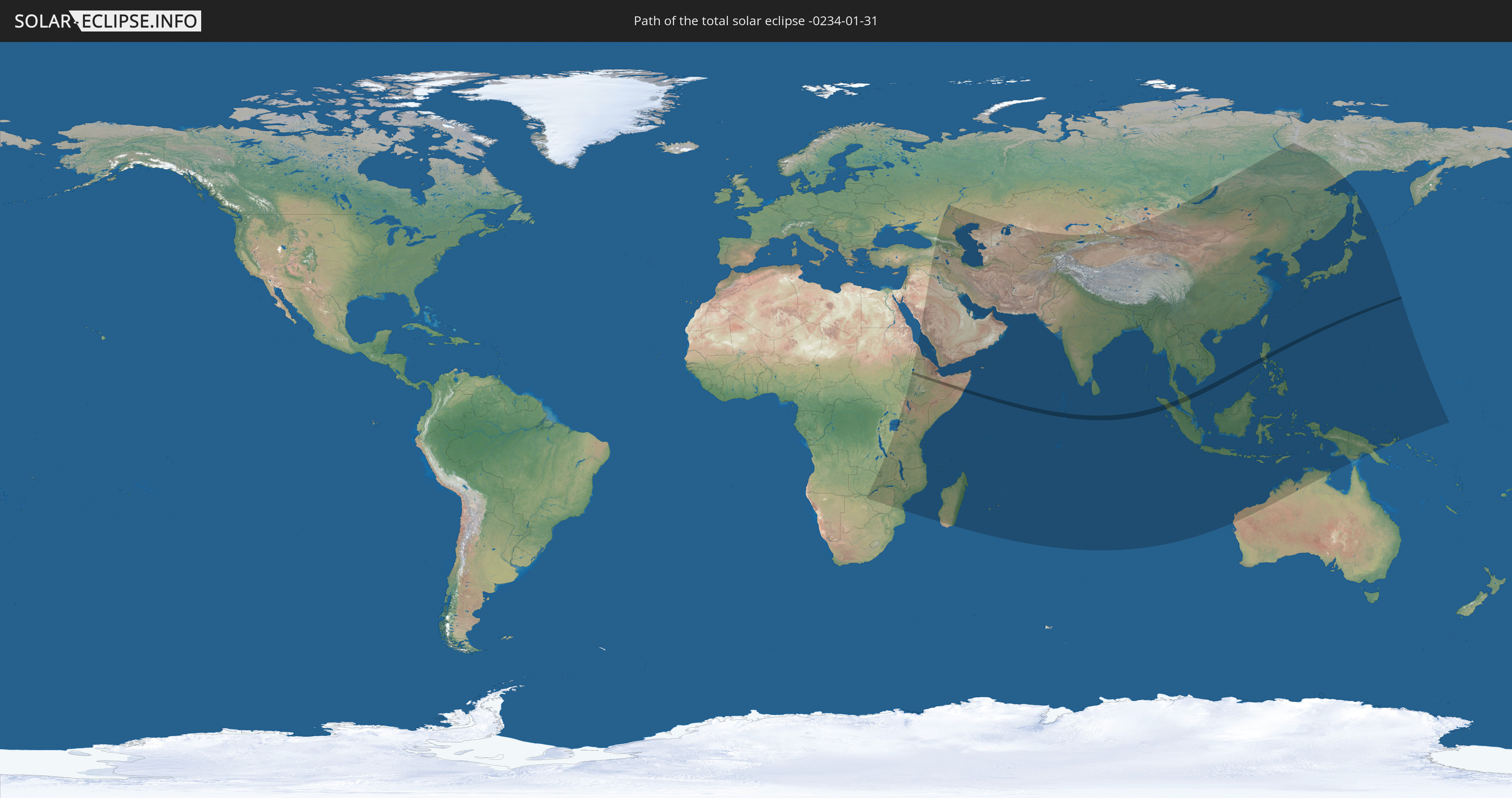
Die Sonnenfinsternis am 31.01.-0234 kann man in 76 Ländern als partielle Sonnenfinsternis beobachten.
Der Finsternispfad verläuft durch 7 Länder. Nur in diesen Ländern ist sie als totale Sonnenfinsternis zu sehen.
In den folgenden Ländern ist die Sonnenfinsternis total zu sehen
 Äthiopien
 Somalia
 Malediven
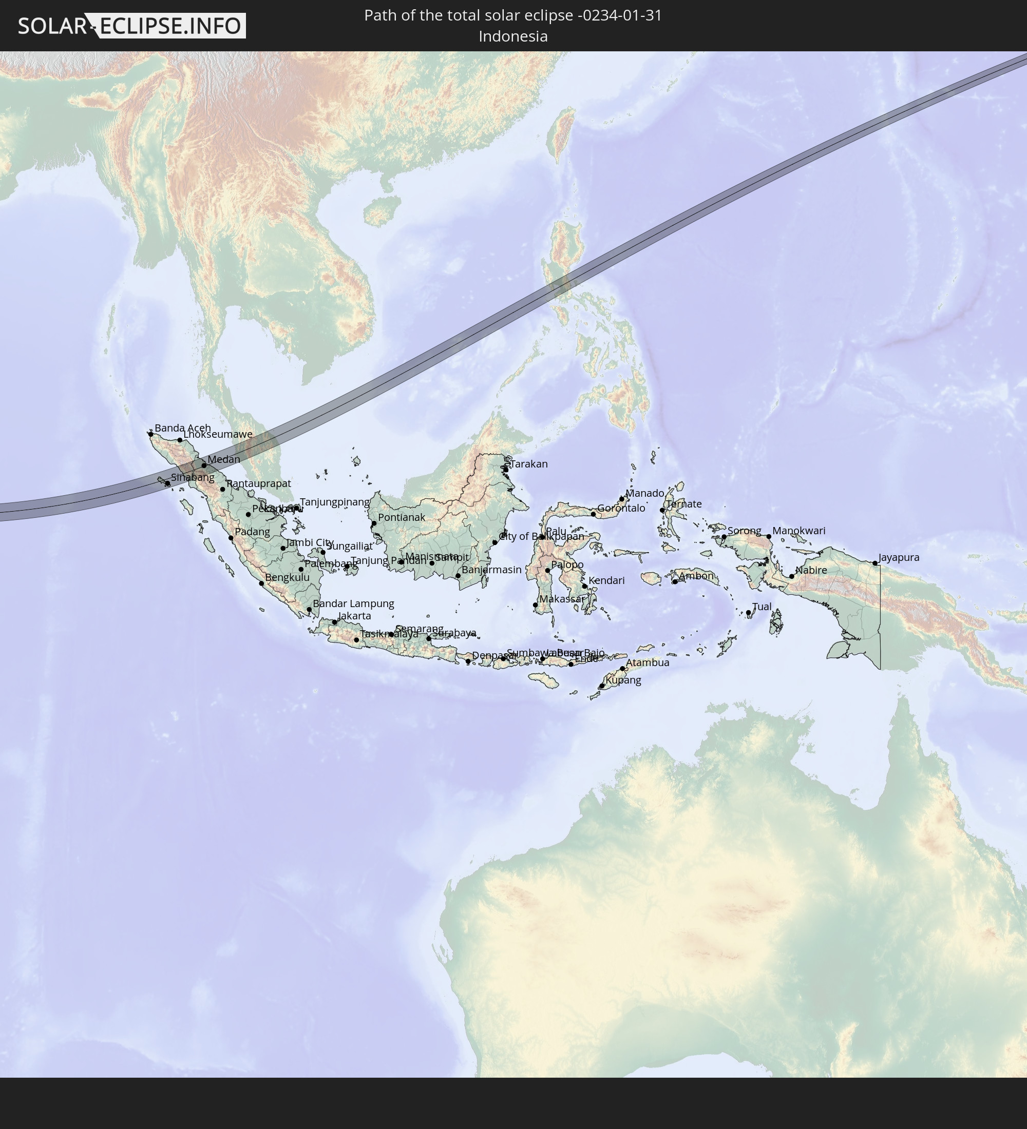 Indonesien
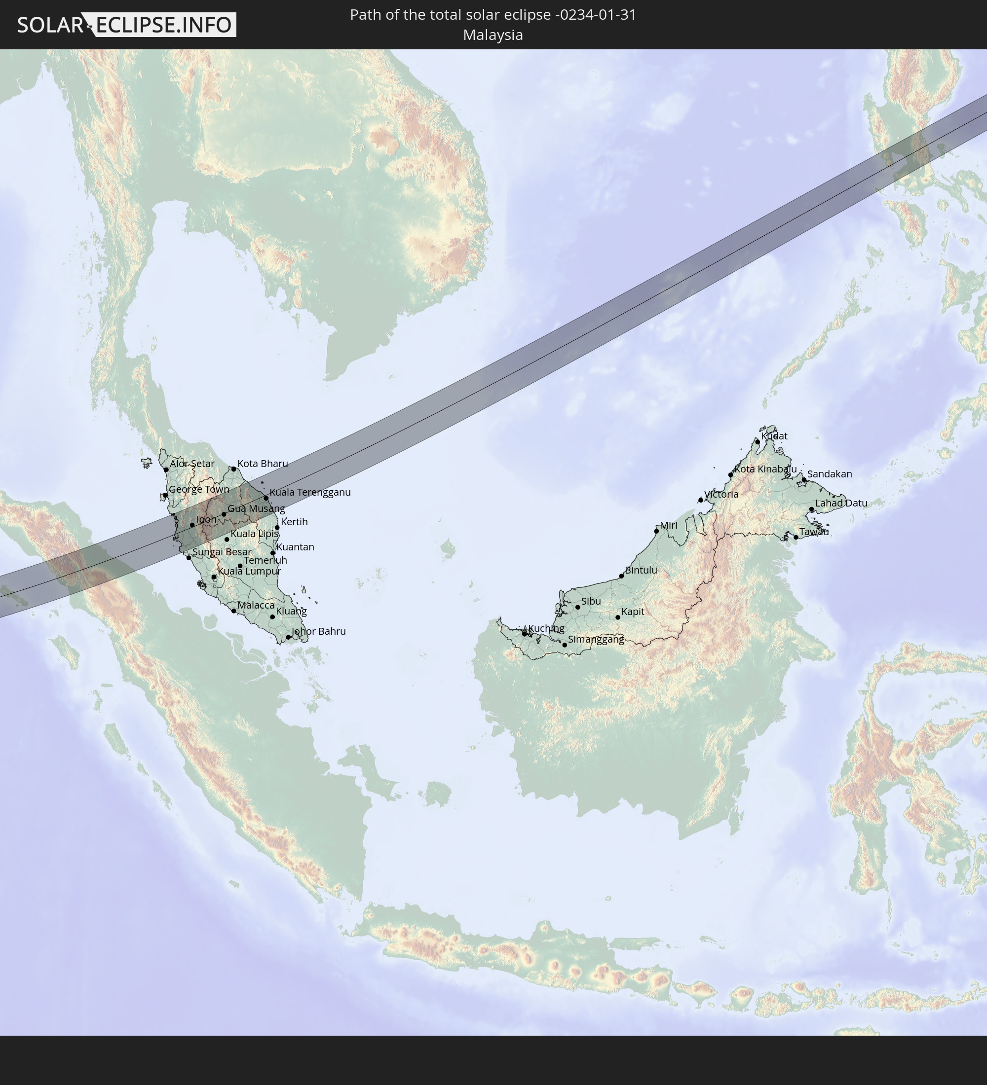 Malaysia
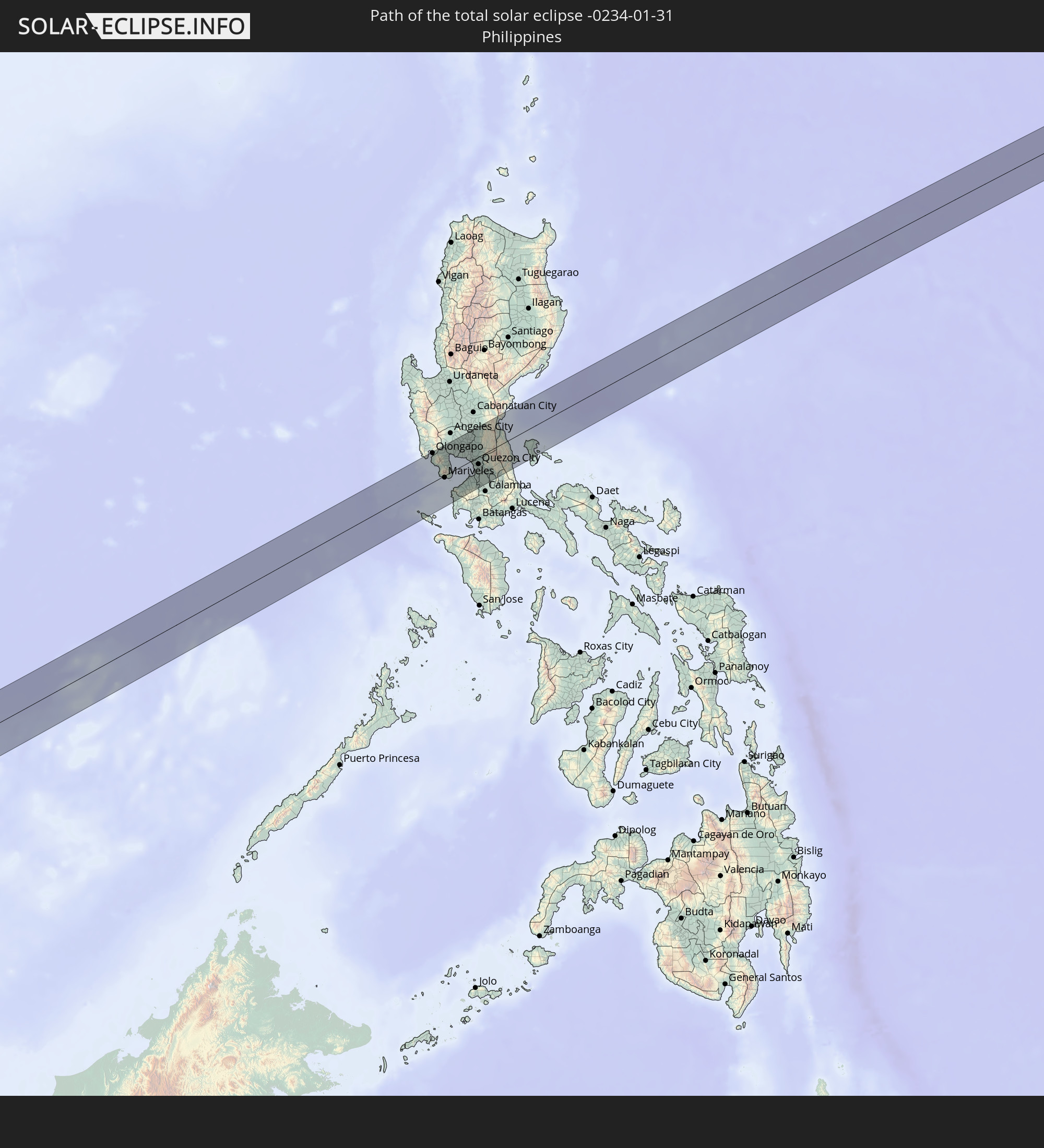 Philippinen
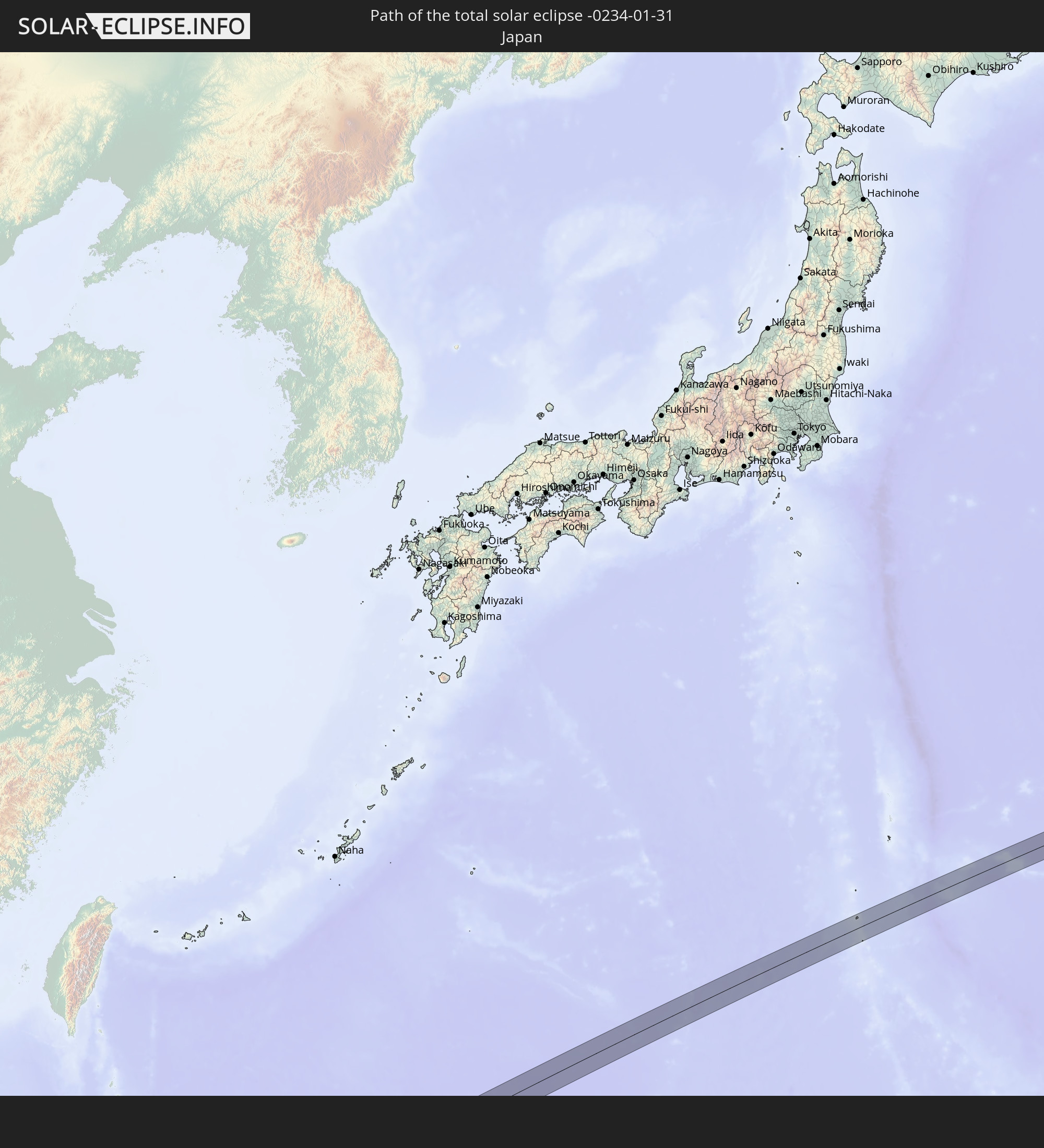 Japan
Japan
In den folgenden Ländern ist die Sonnenfinsternis partiell zu sehen
 Russland
 Demokratische Republik Kongo
 Sudan
Sudan
 Sambia
 Simbabwe
 Türkei
 Tansania
 Uganda
 Mosambik
 Malawi
 Äthiopien
 Kenia
Kenia
 Saudi-Arabien
 Syrien
 Eritrea
 Irak
Irak
 Georgien
 Französische Süd- und Antarktisgebiete
 Somalia
 Dschibuti
 Jemen
Jemen
 Madagaskar
 Komoren
 Armenien
 Iran
Iran
 Aserbaidschan
 Mayotte
 Seychellen
 Kasachstan
 Kuwait
 Bahrain
 Katar
Katar
 Vereinigte Arabische Emirate
 Oman
Oman
 Turkmenistan
 Réunion
 Usbekistan
 Mauritius
 Afghanistan
 Pakistan
 Tadschikistan
 Indien
 Kirgisistan
 Britisches Territorium im Indischen Ozean
 Malediven
 Volksrepublik China
 Sri Lanka
 Nepal
Nepal
 Mongolei
 Bangladesch
 Bhutan
 Myanmar
 Indonesien
 Kokosinseln
 Thailand
 Malaysia
 Laos
Laos
 Vietnam
 Kambodscha
 Singapur
 Weihnachtsinsel
 Australien
 Macau
Macau
 Hongkong
 Brunei
 Taiwan
 Philippinen
 Japan
Japan
 Osttimor
 Nordkorea
 Südkorea
 Palau
Palau
 Föderierte Staaten von Mikronesien
 Papua-Neuguinea
 Guam
Guam
 Nördliche Marianen
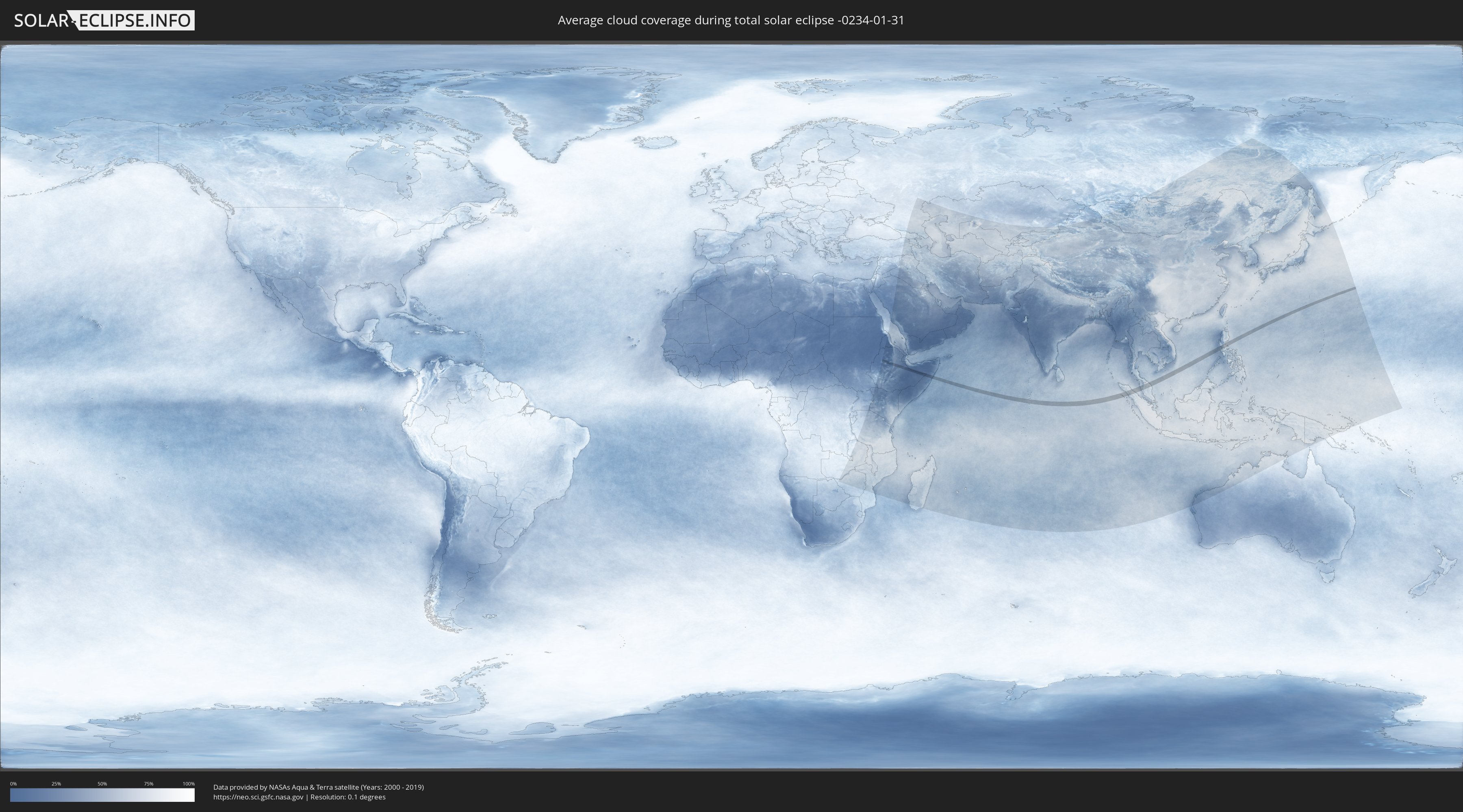
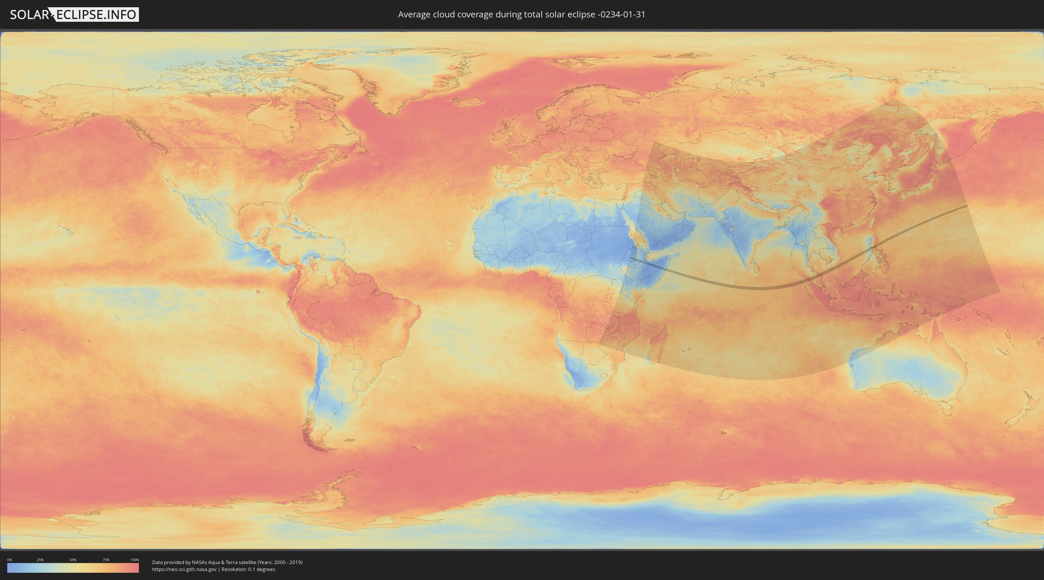
Wie wird das Wetter während der totalen Sonnenfinsternis am 31.01.-0234?
Wo ist der beste Ort, um die totale Sonnenfinsternis vom 31.01.-0234 zu beobachten?
Die folgenden Karten zeigen die durchschnittliche Bewölkung für den Tag, an dem die totale Sonnenfinsternis
stattfindet. Mit Hilfe der Karten lässt sich der Ort entlang des Finsternispfades eingrenzen,
der die besten Aussichen auf einen klaren wolkenfreien Himmel bietet.
Trotzdem muss man immer lokale Gegenenheiten beachten und sollte sich genau über das Wetter an seinem
gewählten Beobachtungsort informieren.
Die Daten stammen von den beiden NASA-Satelliten
AQUA und TERRA
und wurden über einen Zeitraum von 19 Jahren (2000 - 2019) gemittelt.
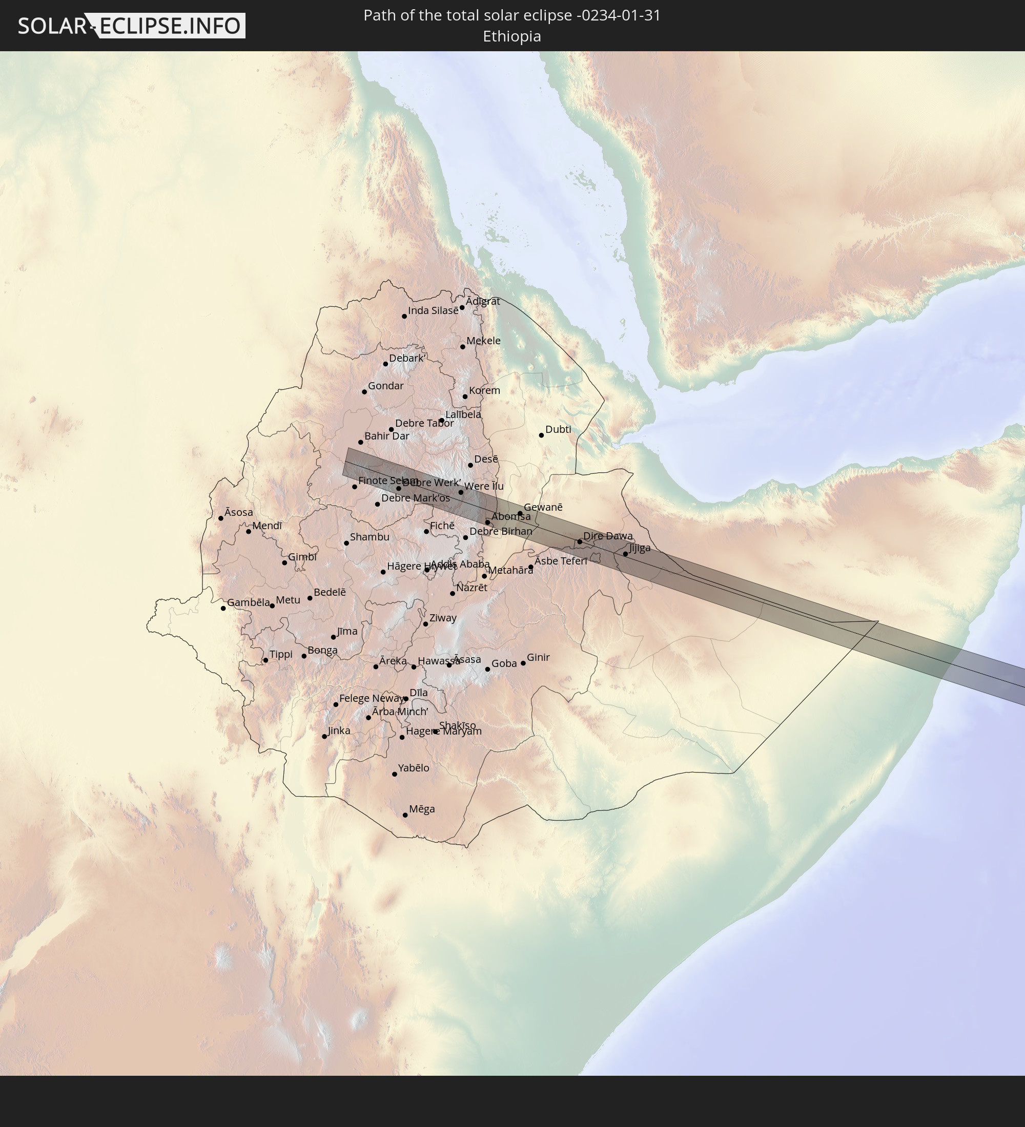
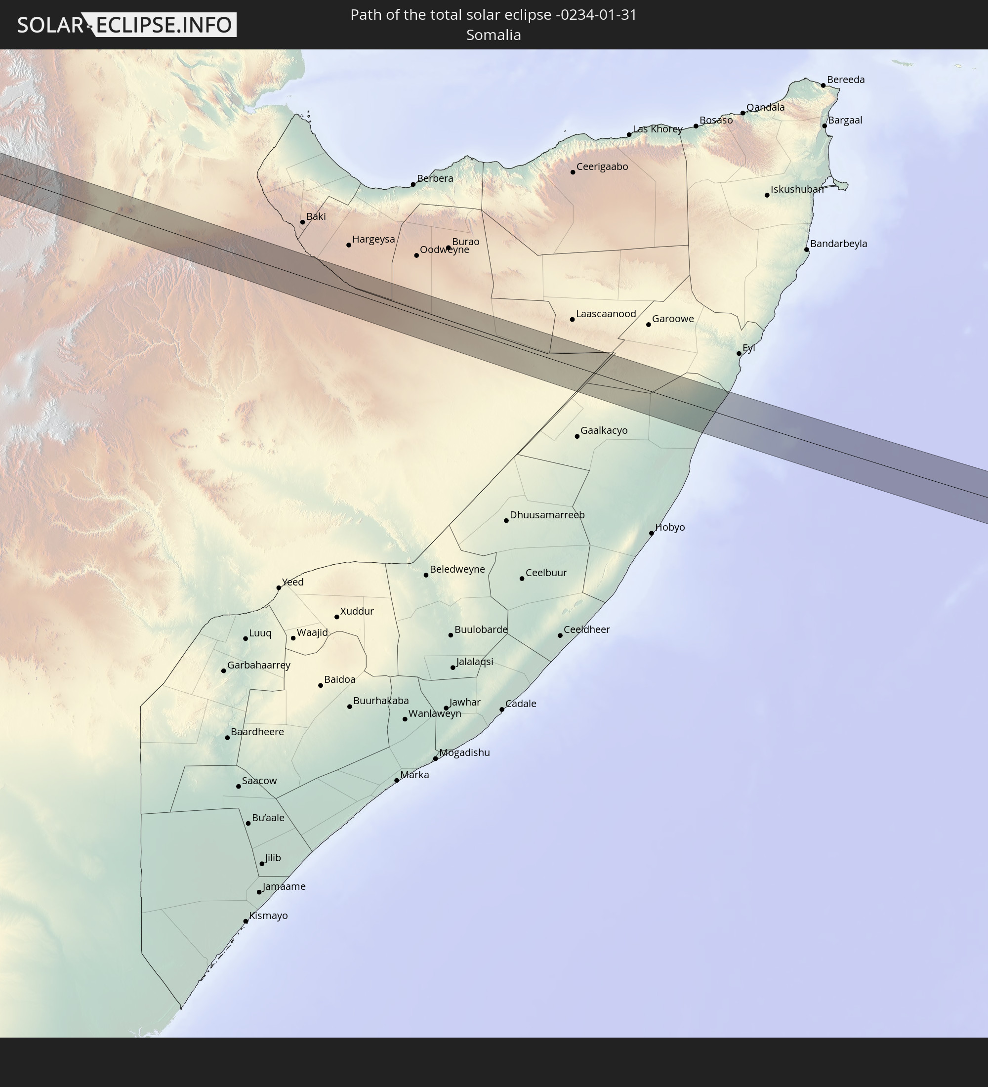
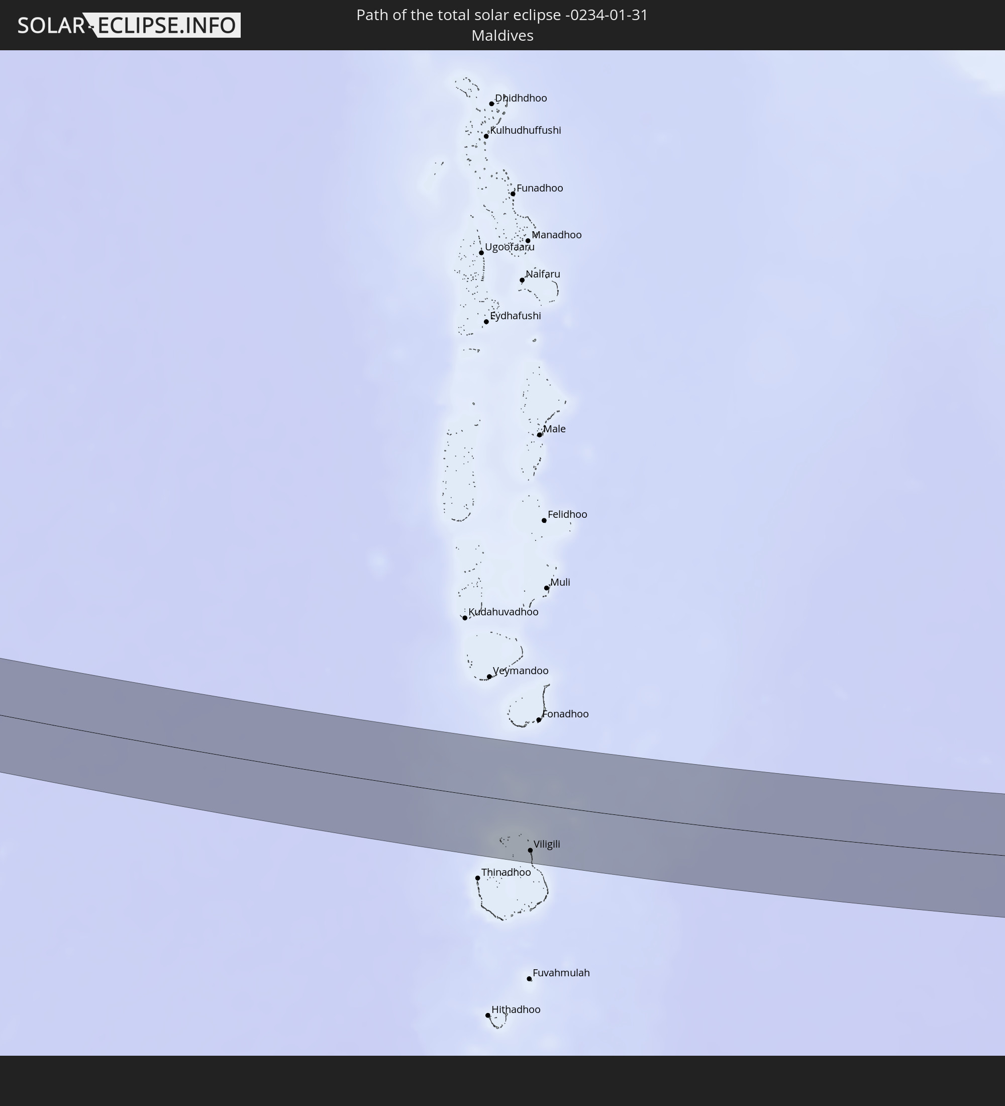
Detaillierte Länderkarten
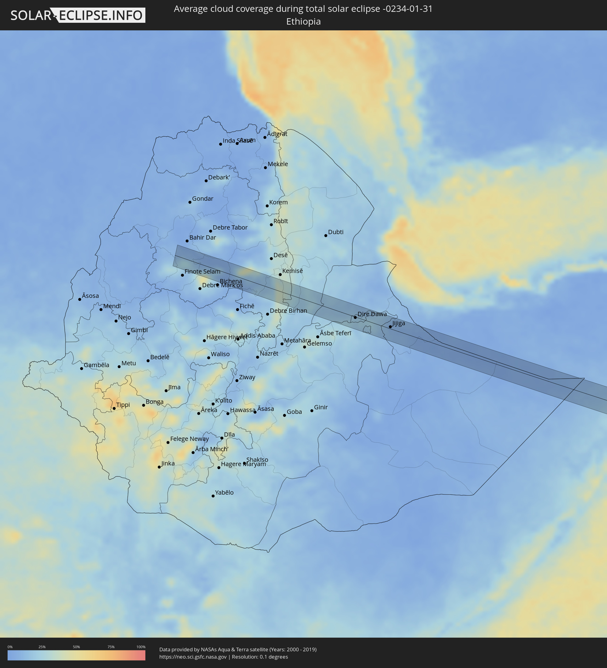 Äthiopien
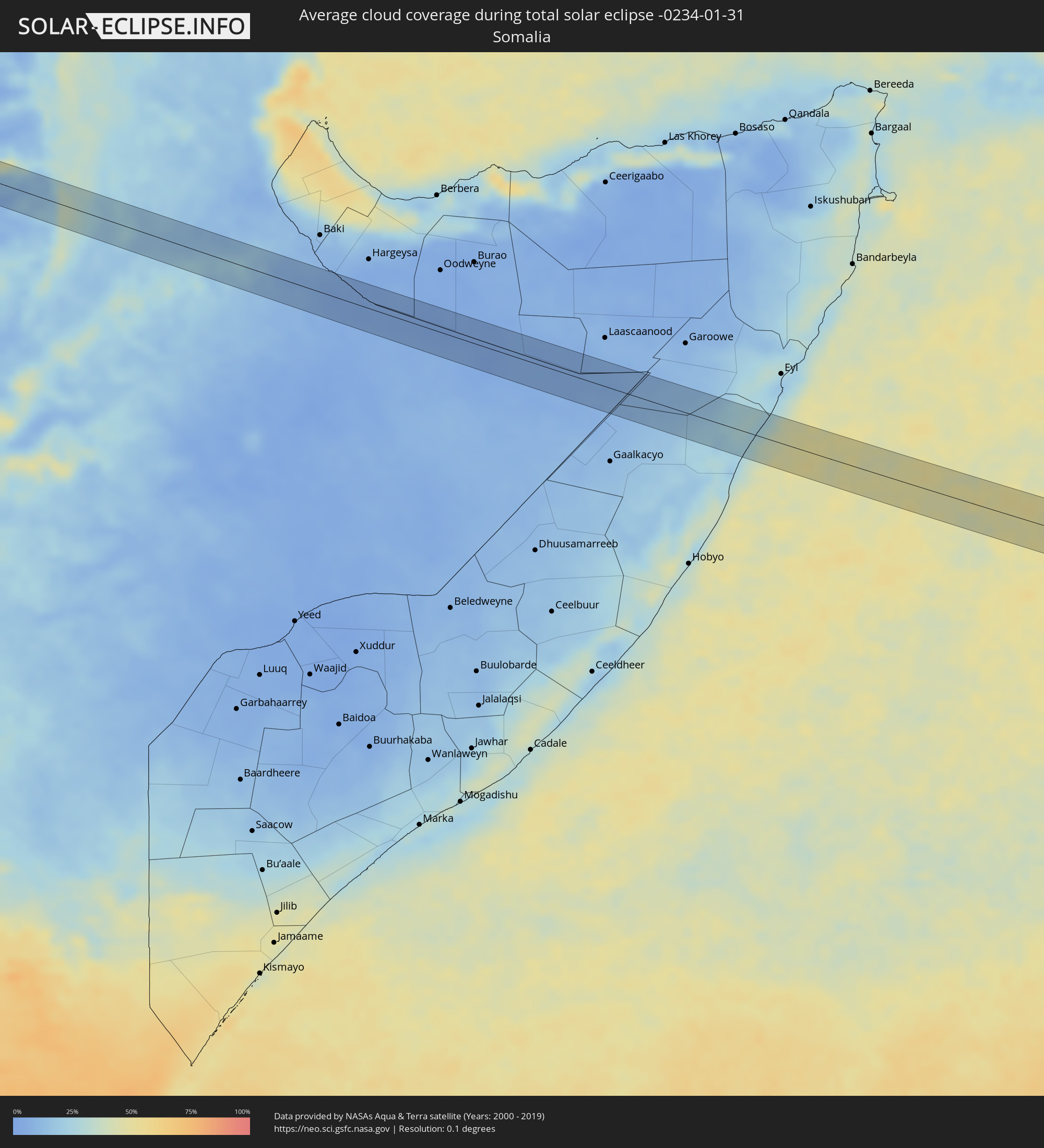 Somalia
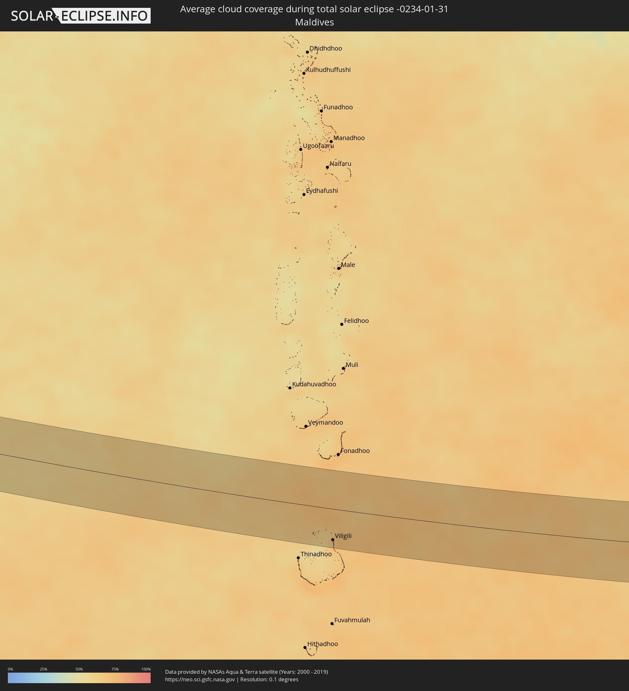 Malediven
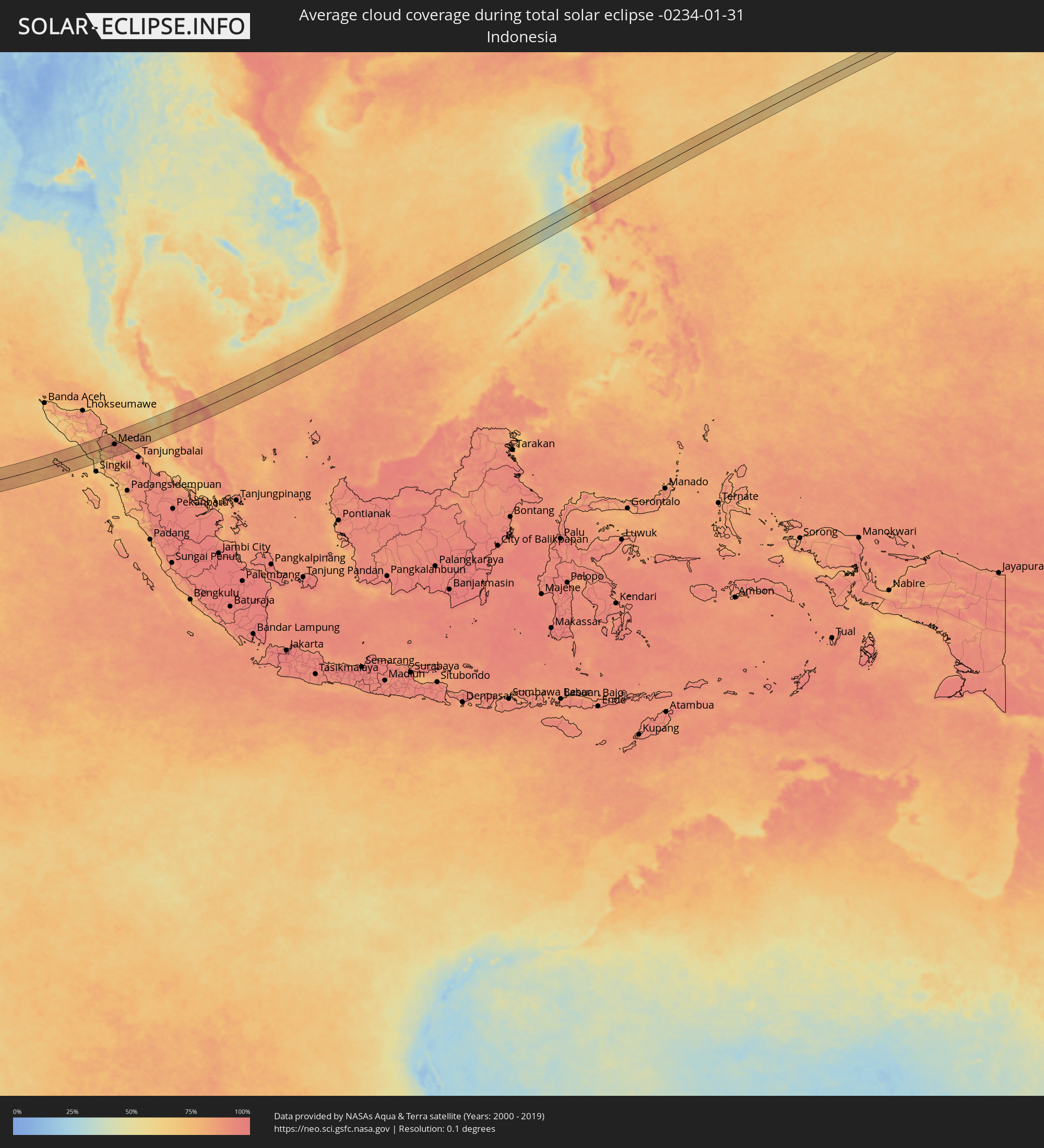 Indonesien
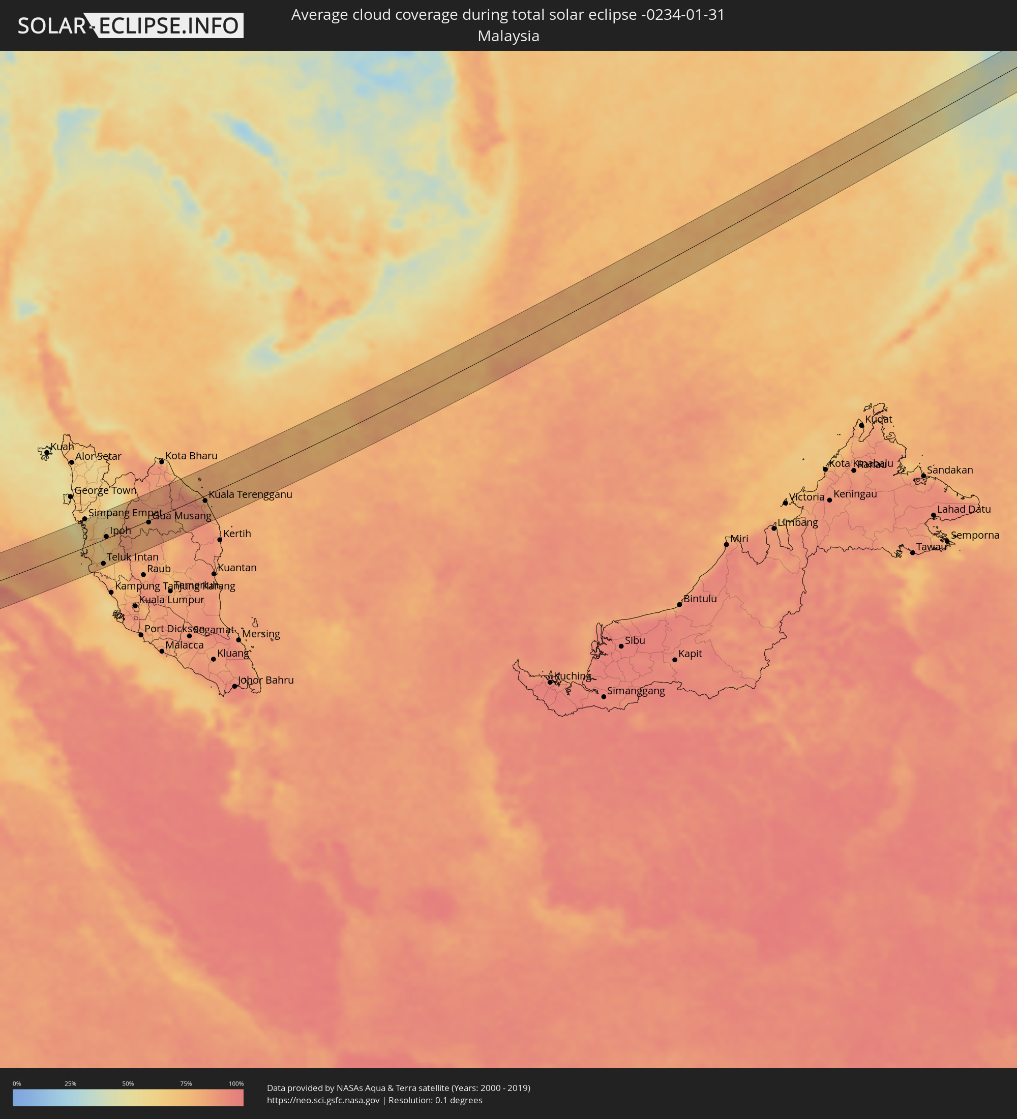 Malaysia
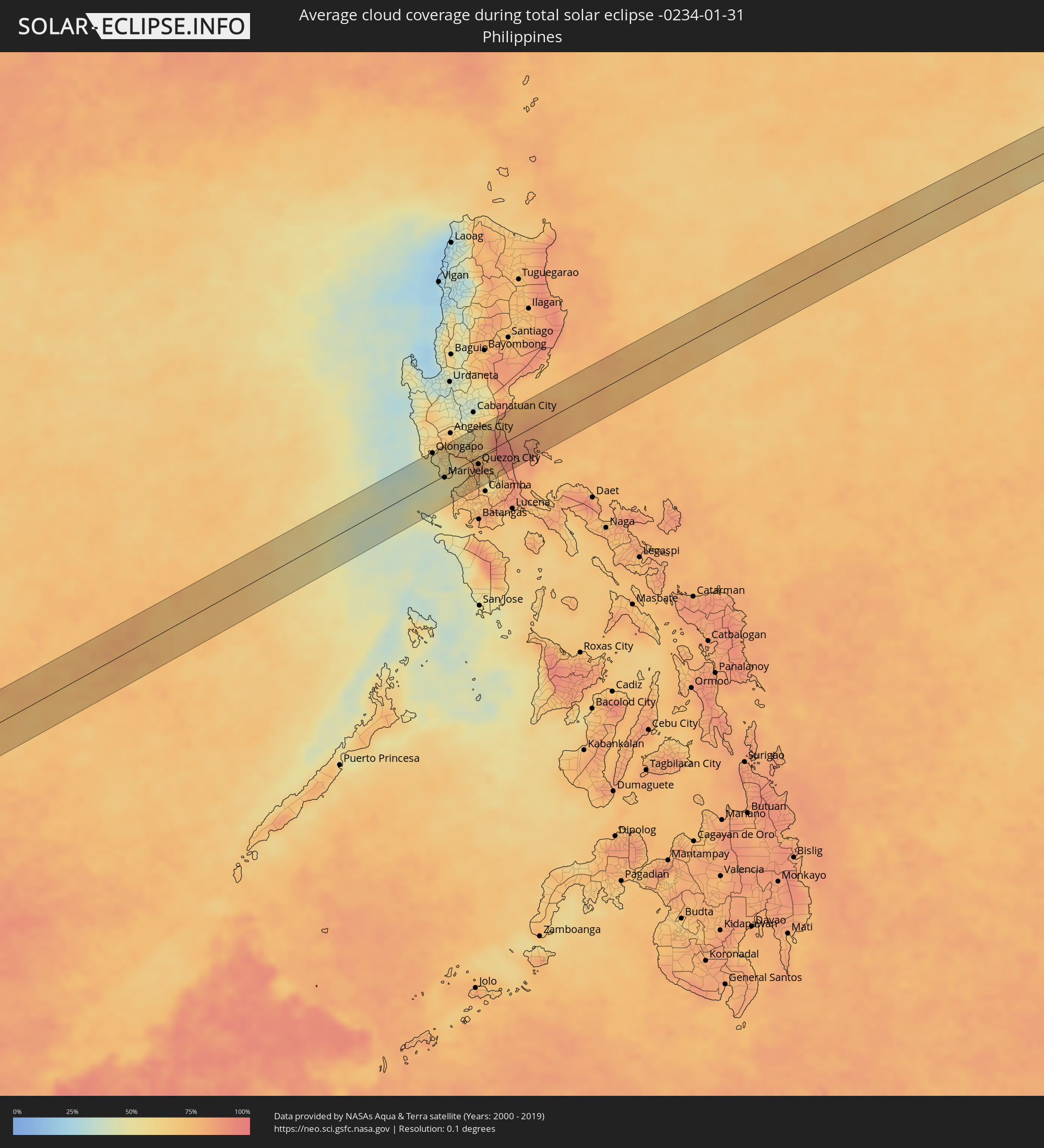 Philippinen
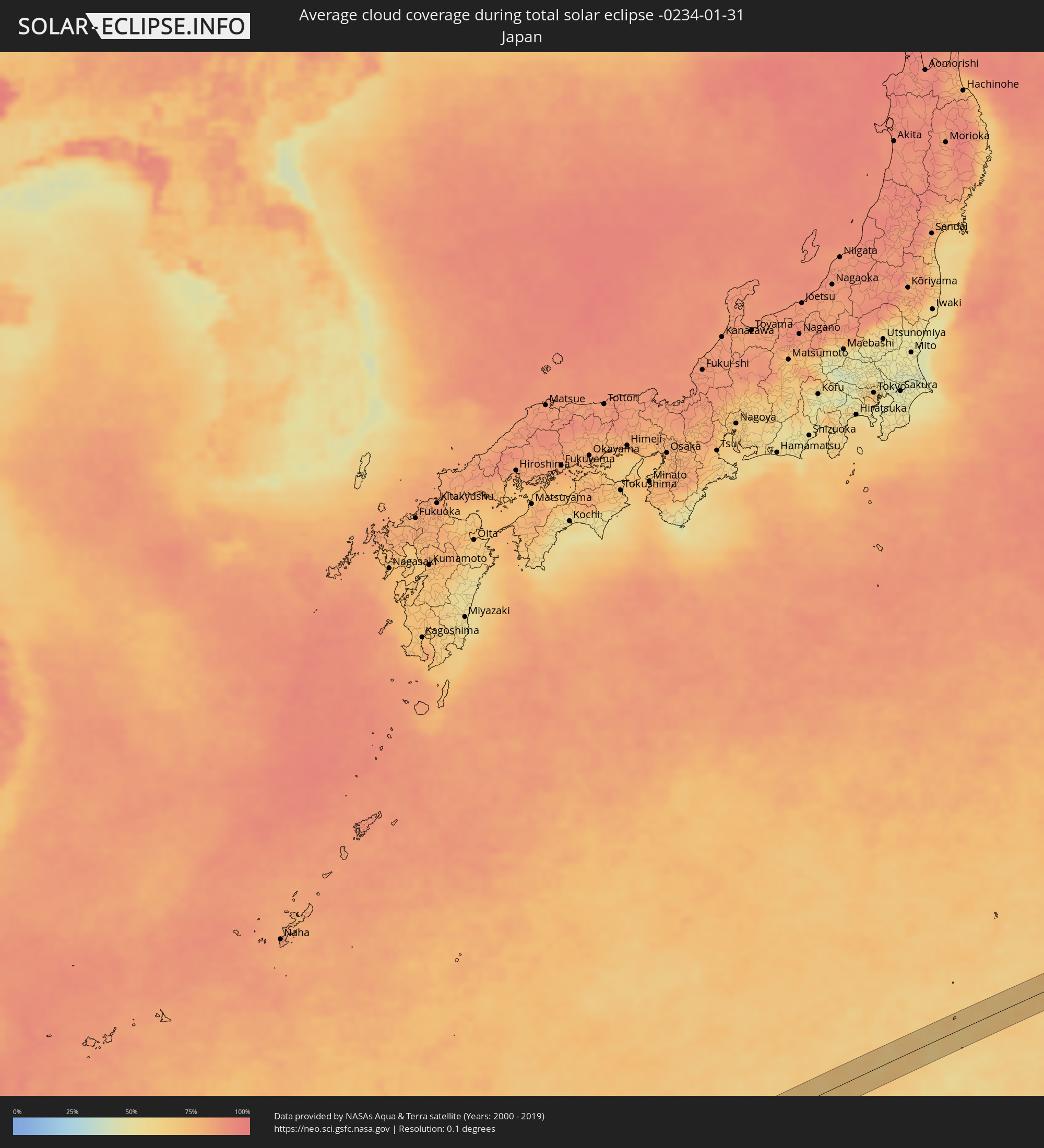 Japan
Japan
Orte im Finsternispfad
Die nachfolgene Tabelle zeigt Städte und Orte mit mehr als 5.000 Einwohnern, die sich im Finsternispfad befinden. Städte mit mehr als 100.000 Einwohnern sind dick gekennzeichnet. Mit einem Klick auf den Ort öffnet sich eine Detailkarte die die Lage des jeweiligen Ortes zusammen mit dem Verlauf der zentralen Finsternis präsentiert.
| Ort | Typ | Dauer der Verfinsterung | Ortszeit bei maximaler Verfinsterung | Entfernung zur Zentrallinie | Ø Bewölkung |
|
Addiet Canna, Amhara
|
total | - | 06:31:52 UTC+02:27 | 19 km | 9% |
|
Debre Werk’, Amhara
|
total | - | 06:31:45 UTC+02:27 | 20 km | 15% |
|
Were Īlu, Amhara
|
total | - | 06:31:58 UTC+02:27 | 17 km | 14% |
|
Abomsa, Amhara
|
total | - | 06:31:52 UTC+02:27 | 28 km | 31% |
|
Gewanē, Āfar
|
total | - | 06:32:06 UTC+02:27 | 15 km | 22% |
|
Dire Dawa, Dire Dawa
|
total | - | 06:32:14 UTC+02:27 | 2 km | 19% |
|
Harar, Harari
|
total | - | 06:32:13 UTC+02:27 | 23 km | 19% |
|
Jijiga, Somali
|
total | - | 06:32:27 UTC+02:27 | 5 km | 8% |
|
Viligili, Gaafu Alifu Atholhu
|
total | - | 09:32:22 UTC+04:54 | 43 km | 68% |
|
Sinabang, Aceh
|
total | - | 12:53:00 UTC+07:07 | 36 km | 80% |
|
Pangkalan Brandan, North Sumatra
|
total | - | 13:00:24 UTC+07:07 | 58 km | 86% |
|
Tanjungtiram, North Sumatra
|
total | - | 13:00:43 UTC+07:07 | 59 km | 78% |
|
Stabat, North Sumatra
|
total | - | 13:00:40 UTC+07:07 | 21 km | 94% |
|
Binjai, North Sumatra
|
total | - | 13:00:39 UTC+07:07 | 6 km | 93% |
|
Kabanjahe, North Sumatra
|
total | - | 13:00:12 UTC+07:07 | 46 km | 83% |
|
Berastagi, North Sumatra
|
total | - | 13:00:21 UTC+07:07 | 37 km | 84% |
|
Sunggal, North Sumatra
|
total | - | 13:01:02 UTC+07:07 | 1 km | 95% |
|
Medan, North Sumatra
|
total | - | 13:01:12 UTC+07:07 | 3 km | 94% |
|
Labuhan Deli, North Sumatra
|
total | - | 13:01:22 UTC+07:07 | 12 km | 94% |
|
Belawan, North Sumatra
|
total | - | 13:01:26 UTC+07:07 | 17 km | 87% |
|
Deli Tua, North Sumatra
|
total | - | 13:01:11 UTC+07:07 | 11 km | 92% |
|
Percut, North Sumatra
|
total | - | 13:01:51 UTC+07:07 | 6 km | 94% |
|
Perbaungan, North Sumatra
|
total | - | 13:02:05 UTC+07:07 | 15 km | 93% |
|
Tebingtinggi, North Sumatra
|
total | - | 13:02:30 UTC+07:07 | 48 km | 91% |
|
Pantai Remis, Perak
|
total | - | 12:56:15 UTC+06:55 | 9 km | 65% |
|
Lumut, Perak
|
total | - | 12:56:03 UTC+06:55 | 14 km | 69% |
|
Simpang Empat, Perak
|
total | - | 12:56:44 UTC+06:55 | 60 km | 68% |
|
Taiping, Perak
|
total | - | 12:56:57 UTC+06:55 | 45 km | 74% |
|
Kuala Kangsar, Perak
|
total | - | 12:57:28 UTC+06:55 | 28 km | 62% |
|
Teluk Intan, Perak
|
total | - | 12:57:02 UTC+06:55 | 52 km | 74% |
|
Batu Gajah, Perak
|
total | - | 12:57:31 UTC+06:55 | 7 km | 64% |
|
Ipoh, Perak
|
total | - | 12:57:45 UTC+06:55 | 3 km | 75% |
|
Kampar, Perak
|
total | - | 12:57:41 UTC+06:55 | 29 km | 72% |
|
Tapah Road, Perak
|
total | - | 12:57:42 UTC+06:55 | 45 km | 69% |
|
Bidur, Perak
|
total | - | 12:57:54 UTC+06:55 | 54 km | 73% |
|
Tanah Rata, Pahang
|
total | - | 12:58:31 UTC+06:55 | 22 km | 84% |
|
Gua Musang, Kelantan
|
total | - | 13:00:39 UTC+06:55 | 5 km | 81% |
|
Jertih, Terengganu
|
total | - | 13:02:59 UTC+06:55 | 59 km | 86% |
|
Kuala Terengganu, Terengganu
|
total | - | 13:04:30 UTC+06:55 | 12 km | 87% |
|
Marang, Terengganu
|
total | - | 13:04:35 UTC+06:55 | 27 km | 82% |
|
Morong, Central Luzon
|
total | - | 14:54:43 UTC+08:00 | 32 km | 50% |
|
Olongapo, Central Luzon
|
total | - | 14:54:49 UTC+08:00 | 46 km | 48% |
|
Dinalupihan, Central Luzon
|
total | - | 14:55:07 UTC+08:00 | 42 km | 58% |
|
Mariveles, Central Luzon
|
total | - | 14:54:59 UTC+08:00 | 3 km | 46% |
|
Balanga, Central Luzon
|
total | - | 14:55:10 UTC+08:00 | 18 km | 56% |
|
Pulungmasle, Central Luzon
|
total | - | 14:55:20 UTC+08:00 | 48 km | 63% |
|
San Roque Dau First, Central Luzon
|
total | - | 14:55:21 UTC+08:00 | 45 km | 63% |
|
Nasugbu, Calabarzon
|
total | - | 14:55:03 UTC+08:00 | 47 km | 71% |
|
Guagua, Central Luzon
|
total | - | 14:55:27 UTC+08:00 | 41 km | 63% |
|
Minalin, Central Luzon
|
total | - | 14:55:31 UTC+08:00 | 39 km | 61% |
|
Lourdes, Central Luzon
|
total | - | 14:55:32 UTC+08:00 | 38 km | 61% |
|
San Fernando, Central Luzon
|
total | - | 14:55:34 UTC+08:00 | 44 km | 61% |
|
Naic, Calabarzon
|
total | - | 14:55:23 UTC+08:00 | 29 km | 71% |
|
San Jose, Central Luzon
|
total | - | 14:55:43 UTC+08:00 | 40 km | 58% |
|
General Emilio Aguinaldo, Calabarzon
|
total | - | 14:55:22 UTC+08:00 | 44 km | 72% |
|
Malolos, Central Luzon
|
total | - | 14:55:41 UTC+08:00 | 20 km | 72% |
|
Palangue, Calabarzon
|
total | - | 14:55:26 UTC+08:00 | 35 km | 71% |
|
Halayhay, Calabarzon
|
total | - | 14:55:29 UTC+08:00 | 26 km | 66% |
|
Balucuc, Central Luzon
|
total | - | 14:55:44 UTC+08:00 | 30 km | 58% |
|
Candaba, Central Luzon
|
total | - | 14:55:49 UTC+08:00 | 43 km | 51% |
|
Paradahan, Calabarzon
|
total | - | 14:55:32 UTC+08:00 | 34 km | 76% |
|
Lambakin, Central Luzon
|
total | - | 14:55:44 UTC+08:00 | 8 km | 75% |
|
Indang, Calabarzon
|
total | - | 14:55:30 UTC+08:00 | 47 km | 75% |
|
Bahay Pare, Central Luzon
|
total | - | 14:55:52 UTC+08:00 | 34 km | 67% |
|
Baliuag, Central Luzon
|
total | - | 14:55:52 UTC+08:00 | 26 km | 67% |
|
Culianin, Central Luzon
|
total | - | 14:55:51 UTC+08:00 | 22 km | 69% |
|
Cavite City, Calabarzon
|
total | - | 14:55:40 UTC+08:00 | 20 km | 73% |
|
Dasmariñas, Calabarzon
|
total | - | 14:55:40 UTC+08:00 | 37 km | 76% |
|
Camias, Central Luzon
|
total | - | 14:56:04 UTC+08:00 | 43 km | 64% |
|
San Miguel, Central Luzon
|
total | - | 14:56:04 UTC+08:00 | 40 km | 71% |
|
Del Monte, Calabarzon
|
total | - | 14:55:56 UTC+08:00 | 11 km | 79% |
|
San Jose del Monte, Central Luzon
|
total | - | 14:56:03 UTC+08:00 | 5 km | 77% |
|
Quezon City, Metro Manila
|
total | - | 14:55:59 UTC+08:00 | 12 km | 76% |
|
Sibul, Central Luzon
|
total | - | 14:56:13 UTC+08:00 | 38 km | 67% |
|
Santa Rosa, Calabarzon
|
total | - | 14:55:56 UTC+08:00 | 48 km | 71% |
|
Binangonan, Calabarzon
|
total | - | 14:56:08 UTC+08:00 | 37 km | 58% |
|
Rodriguez, Calabarzon
|
total | - | 14:56:16 UTC+08:00 | 9 km | 75% |
|
Quisao, Calabarzon
|
total | - | 14:56:21 UTC+08:00 | 47 km | 58% |
|
Sampaloc, Calabarzon
|
total | - | 14:56:26 UTC+08:00 | 38 km | 70% |
|
Real, Calabarzon
|
total | - | 14:56:52 UTC+08:00 | 39 km | 88% |