Totale Sonnenfinsternis vom 30.12.-0289
| Wochentag: | Montag |
| Maximale Dauer der Verfinsterung: | 02m04s |
| Maximale Breite des Finsternispfades: | 71 km |
| Saroszyklus: | 56 |
| Bedeckungsgrad: | 100% |
| Magnitude: | 1.0196 |
| Gamma: | 0.3258 |
Wo kann man die Sonnenfinsternis vom 30.12.-0289 sehen?
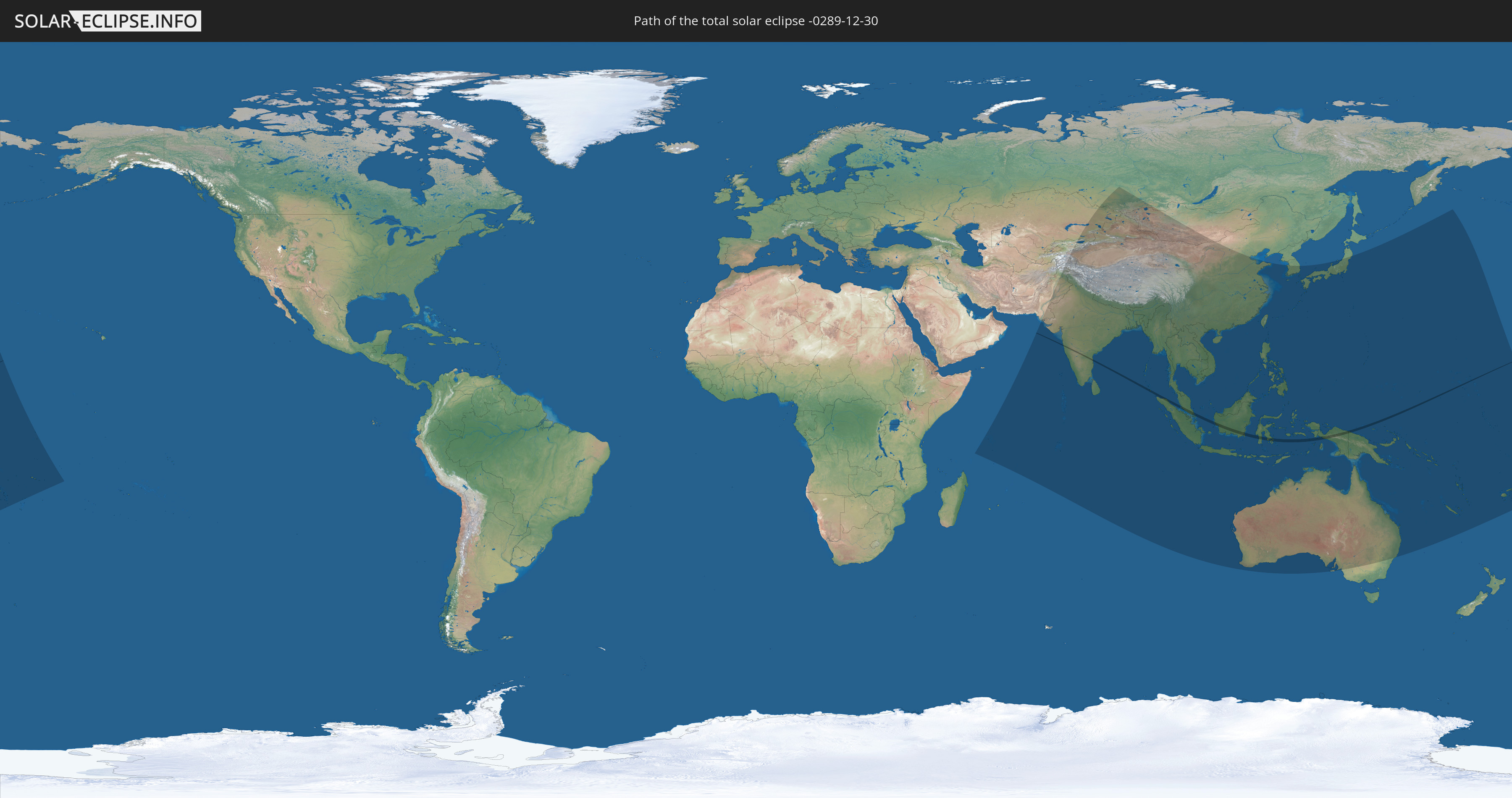
Die Sonnenfinsternis am 30.12.-0289 kann man in 54 Ländern als partielle Sonnenfinsternis beobachten.
Der Finsternispfad verläuft durch 6 Länder. Nur in diesen Ländern ist sie als totale Sonnenfinsternis zu sehen.
In den folgenden Ländern ist die Sonnenfinsternis total zu sehen
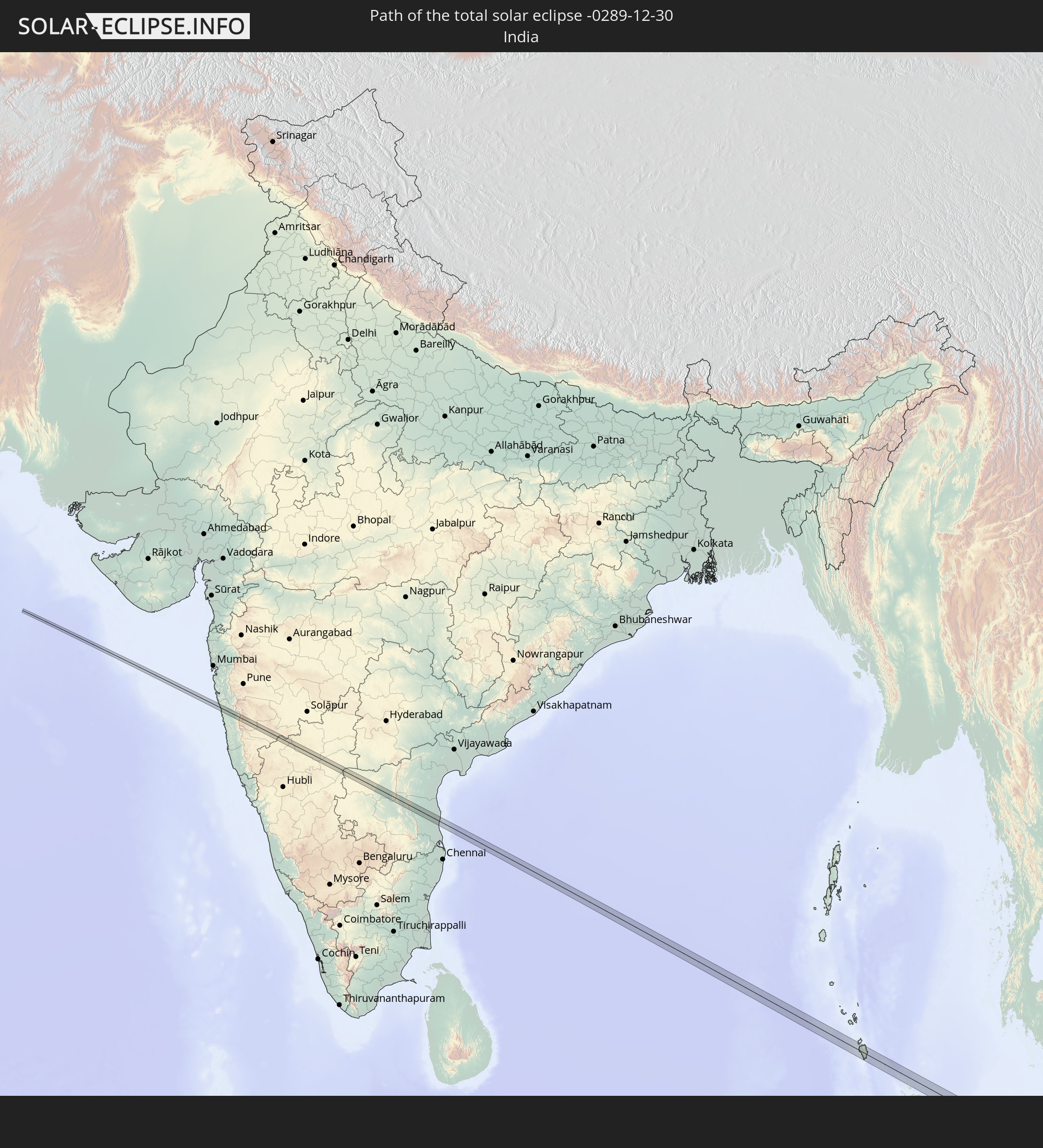 Indien
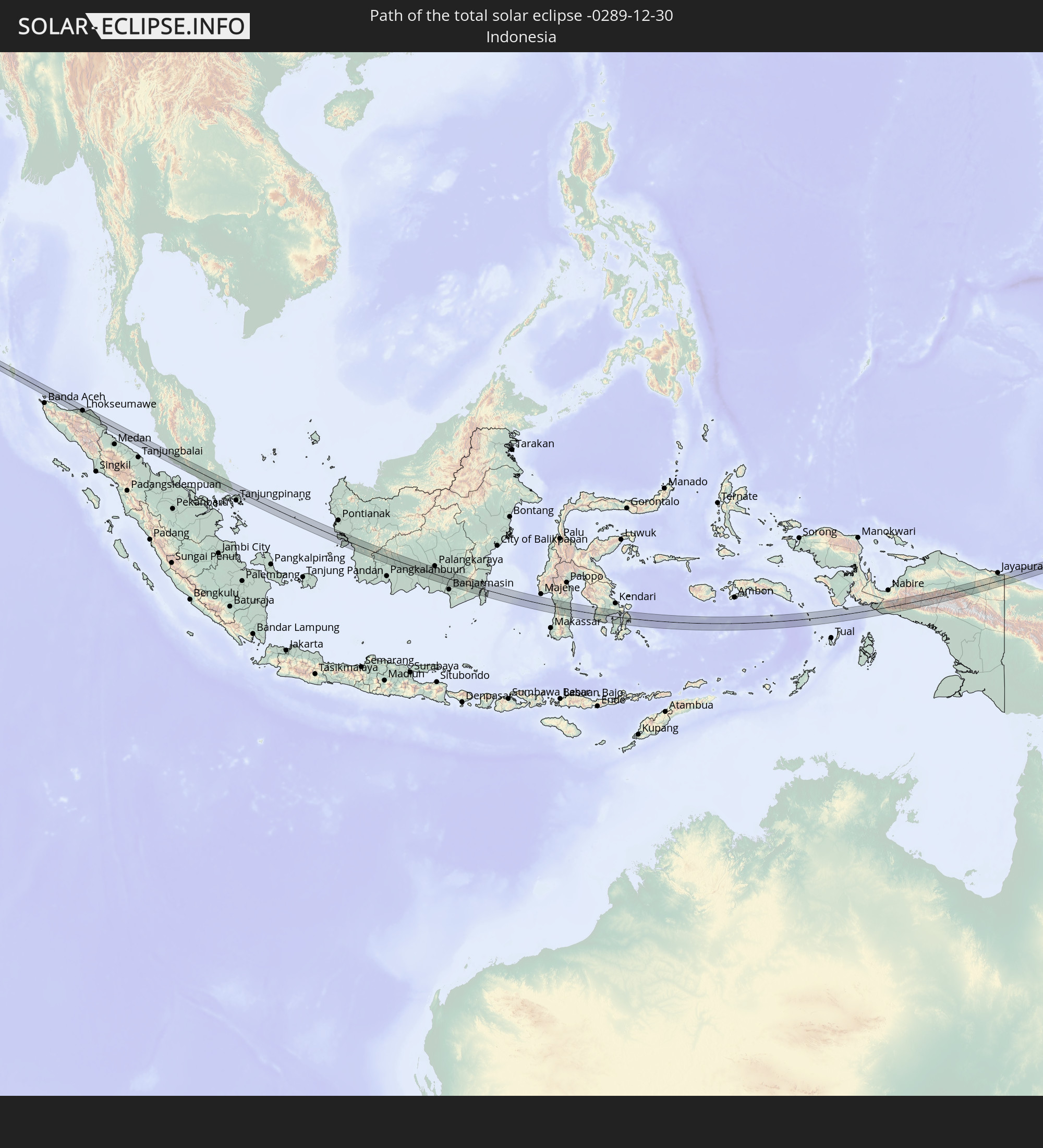 Indonesien
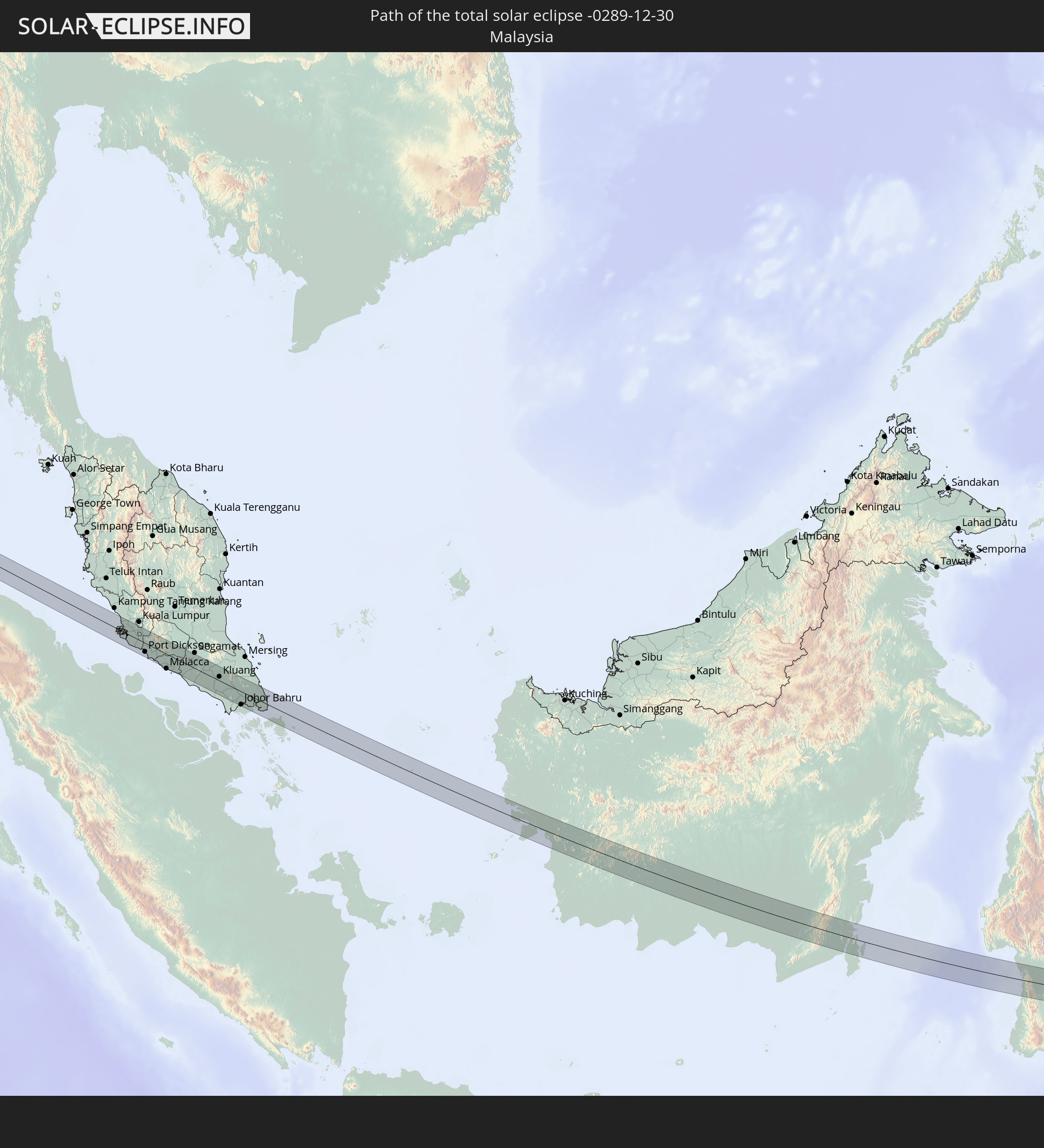 Malaysia
 Singapur
 Papua-Neuguinea
 Marshallinseln
In den folgenden Ländern ist die Sonnenfinsternis partiell zu sehen
 Russland
 Fidschi
 United States Minor Outlying Islands
 Wallis und Futuna
 Tonga
Tonga
 Kiribati
 Samoa
Samoa
 Tokelau
 Amerikanisch-Samoa
 Seychellen
 Kasachstan
 Afghanistan
 Pakistan
 Tadschikistan
 Indien
 Kirgisistan
 Britisches Territorium im Indischen Ozean
 Malediven
 Volksrepublik China
 Sri Lanka
 Nepal
Nepal
 Mongolei
 Bangladesch
 Bhutan
 Myanmar
 Indonesien
 Kokosinseln
 Thailand
 Malaysia
 Laos
Laos
 Vietnam
 Kambodscha
 Singapur
 Weihnachtsinsel
 Australien
 Macau
Macau
 Hongkong
 Brunei
 Taiwan
 Philippinen
 Japan
Japan
 Osttimor
 Südkorea
 Palau
Palau
 Föderierte Staaten von Mikronesien
 Papua-Neuguinea
 Guam
Guam
 Nördliche Marianen
 Salomonen
 Neukaledonien
 Marshallinseln
 Vanuatu
 Nauru
Nauru
 Tuvalu
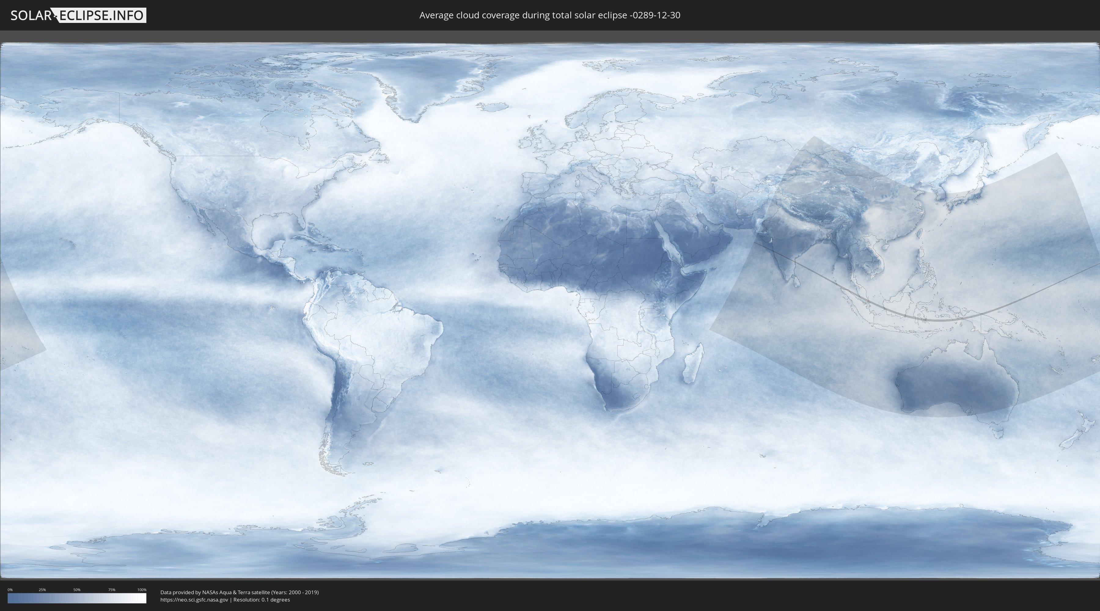
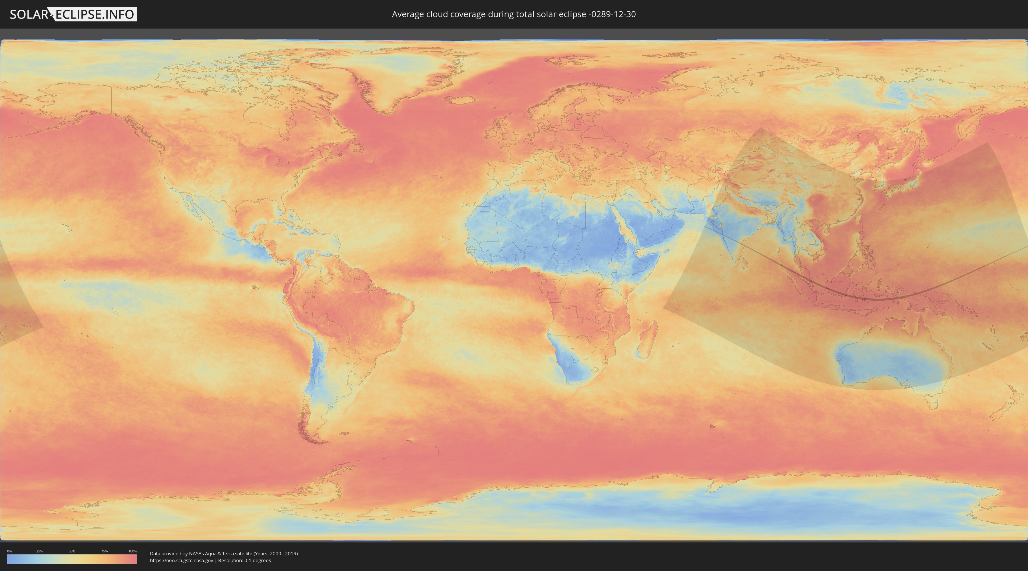
Wie wird das Wetter während der totalen Sonnenfinsternis am 30.12.-0289?
Wo ist der beste Ort, um die totale Sonnenfinsternis vom 30.12.-0289 zu beobachten?
Die folgenden Karten zeigen die durchschnittliche Bewölkung für den Tag, an dem die totale Sonnenfinsternis
stattfindet. Mit Hilfe der Karten lässt sich der Ort entlang des Finsternispfades eingrenzen,
der die besten Aussichen auf einen klaren wolkenfreien Himmel bietet.
Trotzdem muss man immer lokale Gegenenheiten beachten und sollte sich genau über das Wetter an seinem
gewählten Beobachtungsort informieren.
Die Daten stammen von den beiden NASA-Satelliten
AQUA und TERRA
und wurden über einen Zeitraum von 19 Jahren (2000 - 2019) gemittelt.
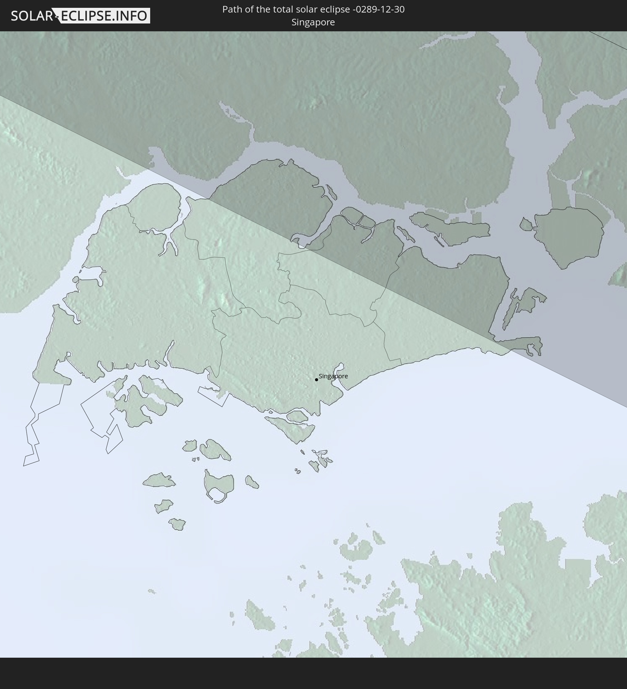
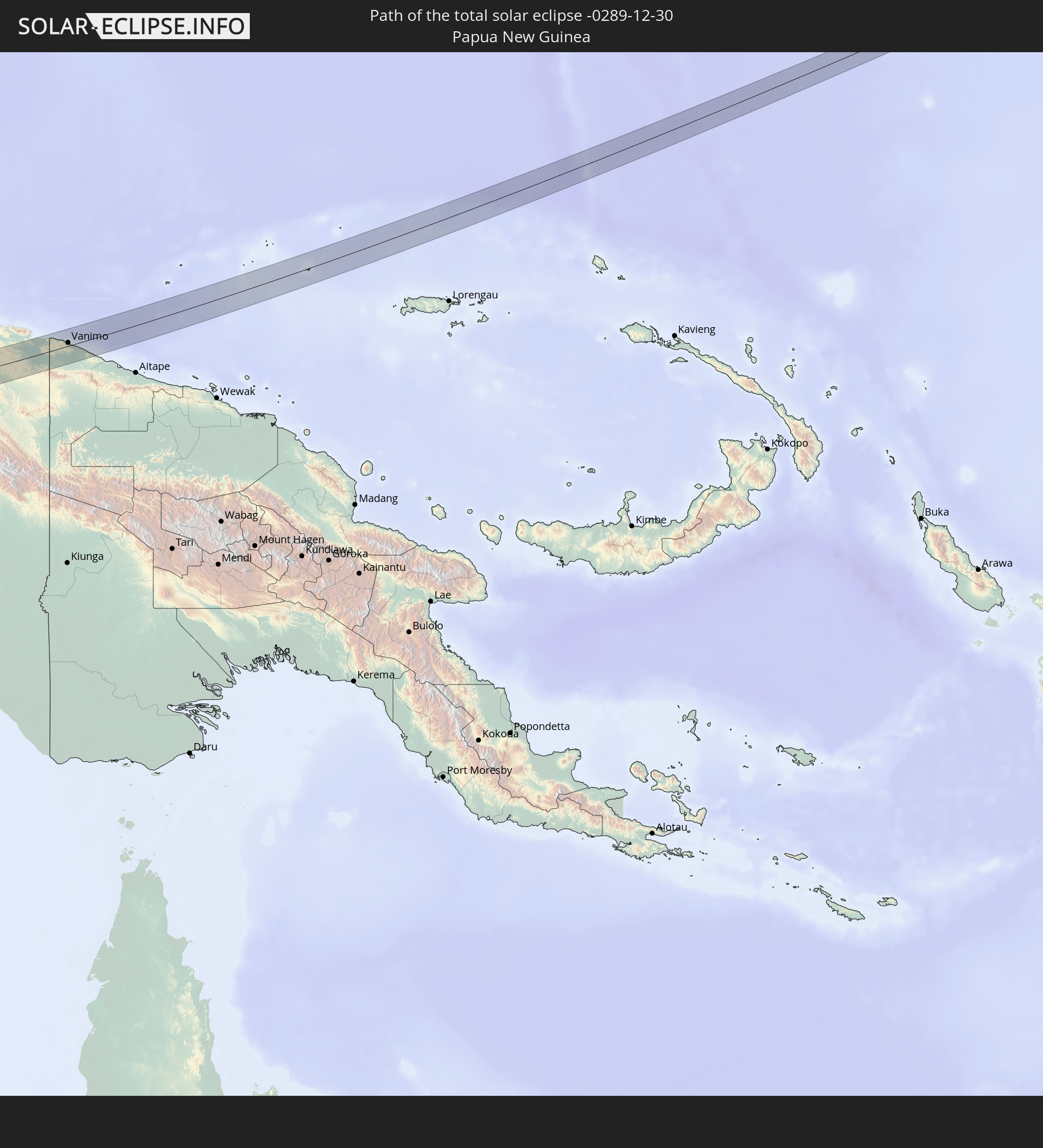
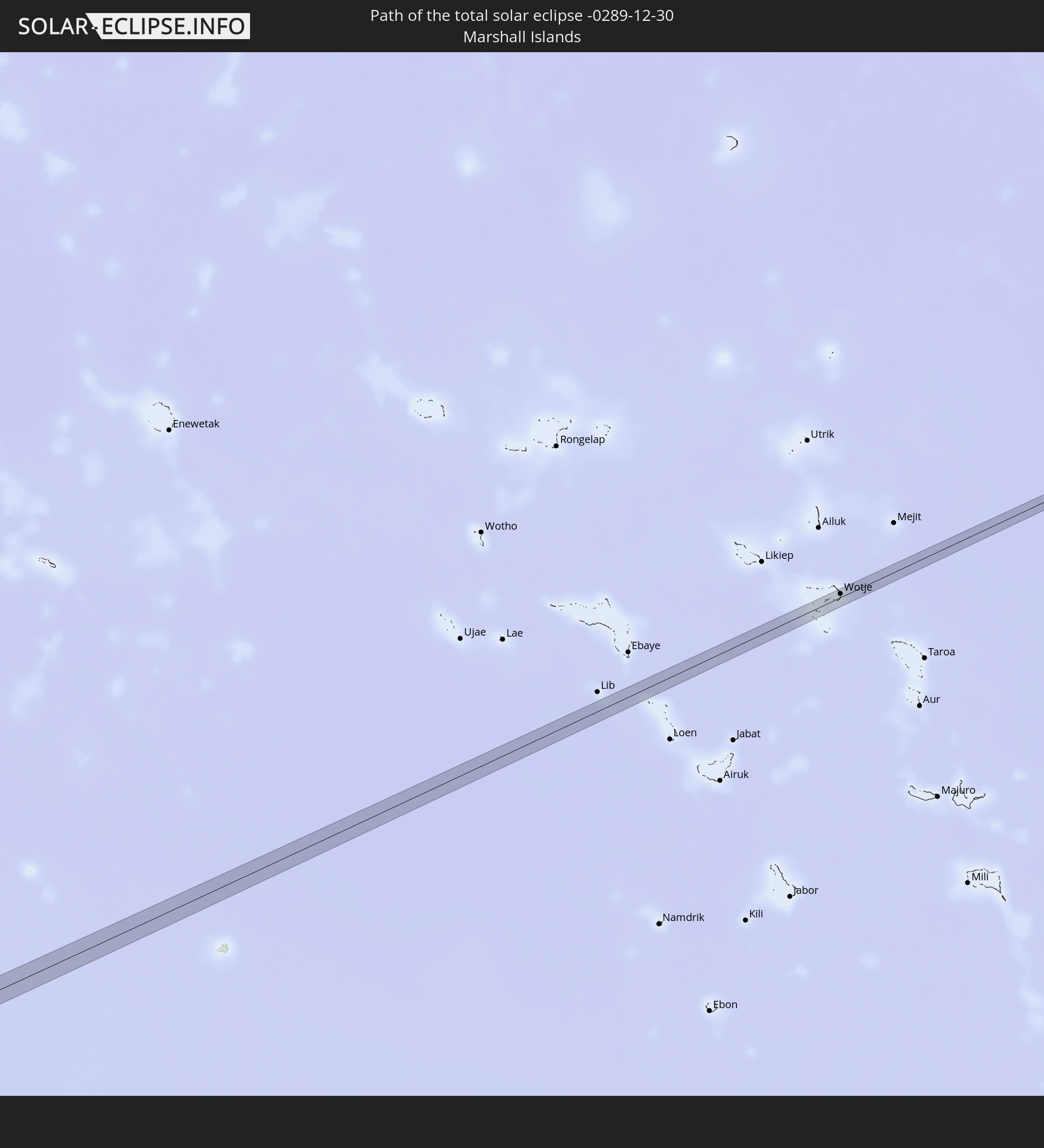
Detaillierte Länderkarten
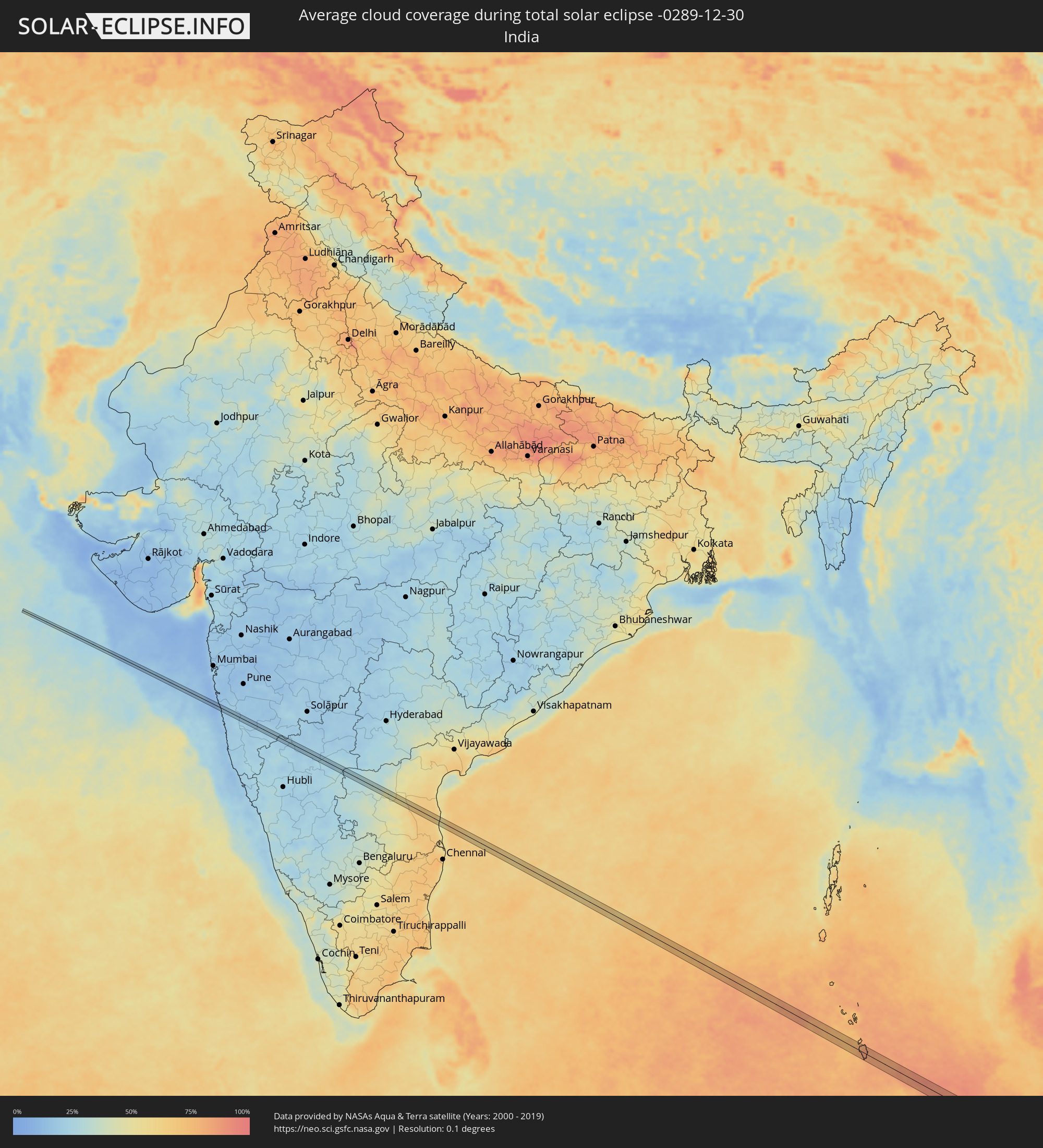 Indien
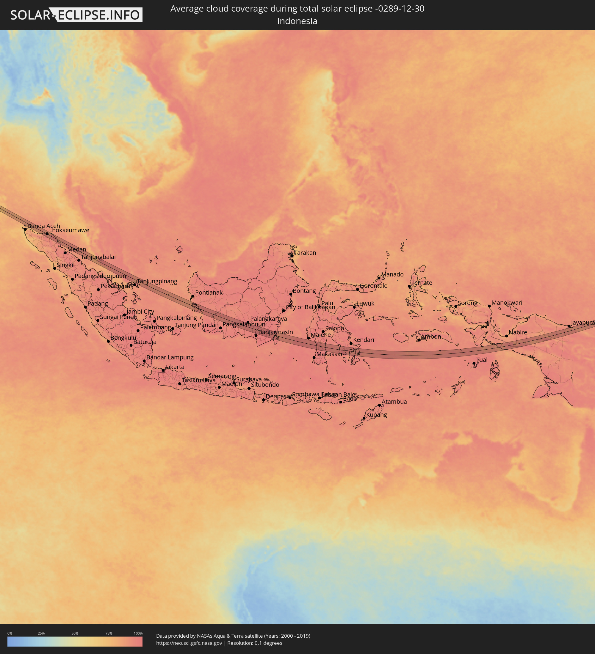 Indonesien
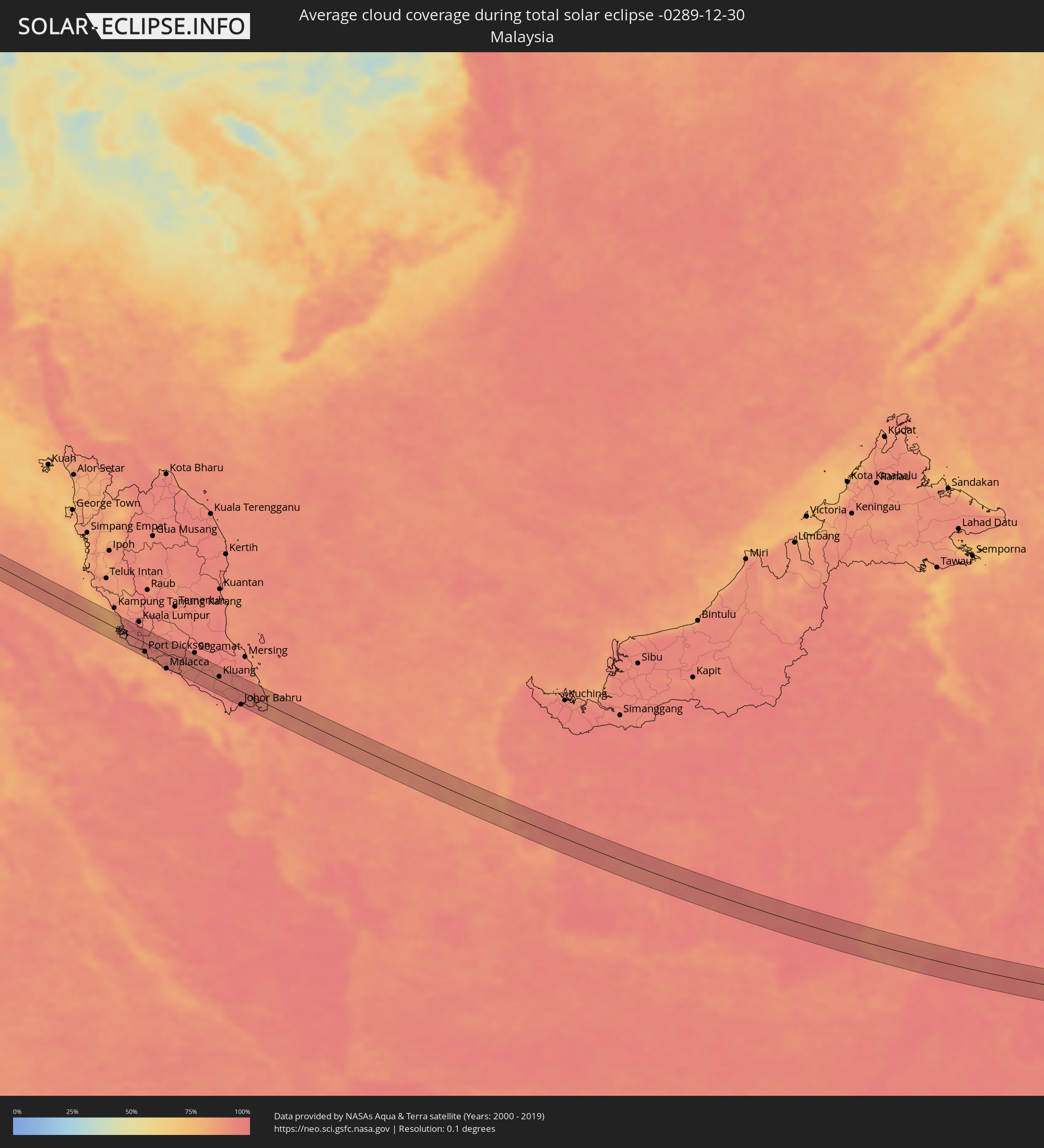 Malaysia
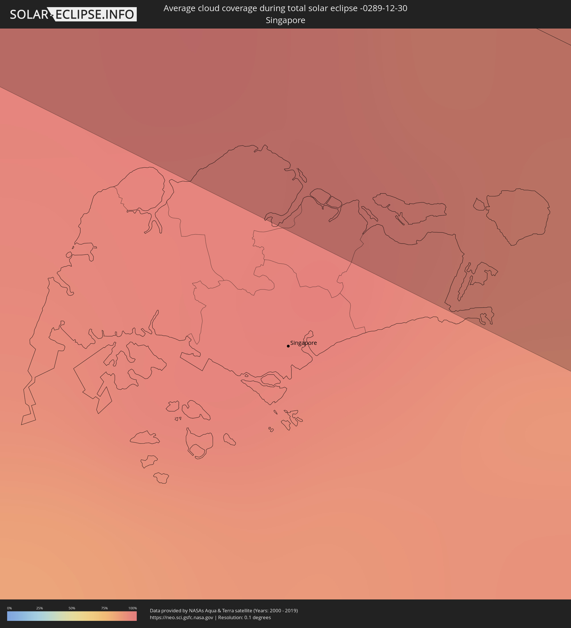 Singapur
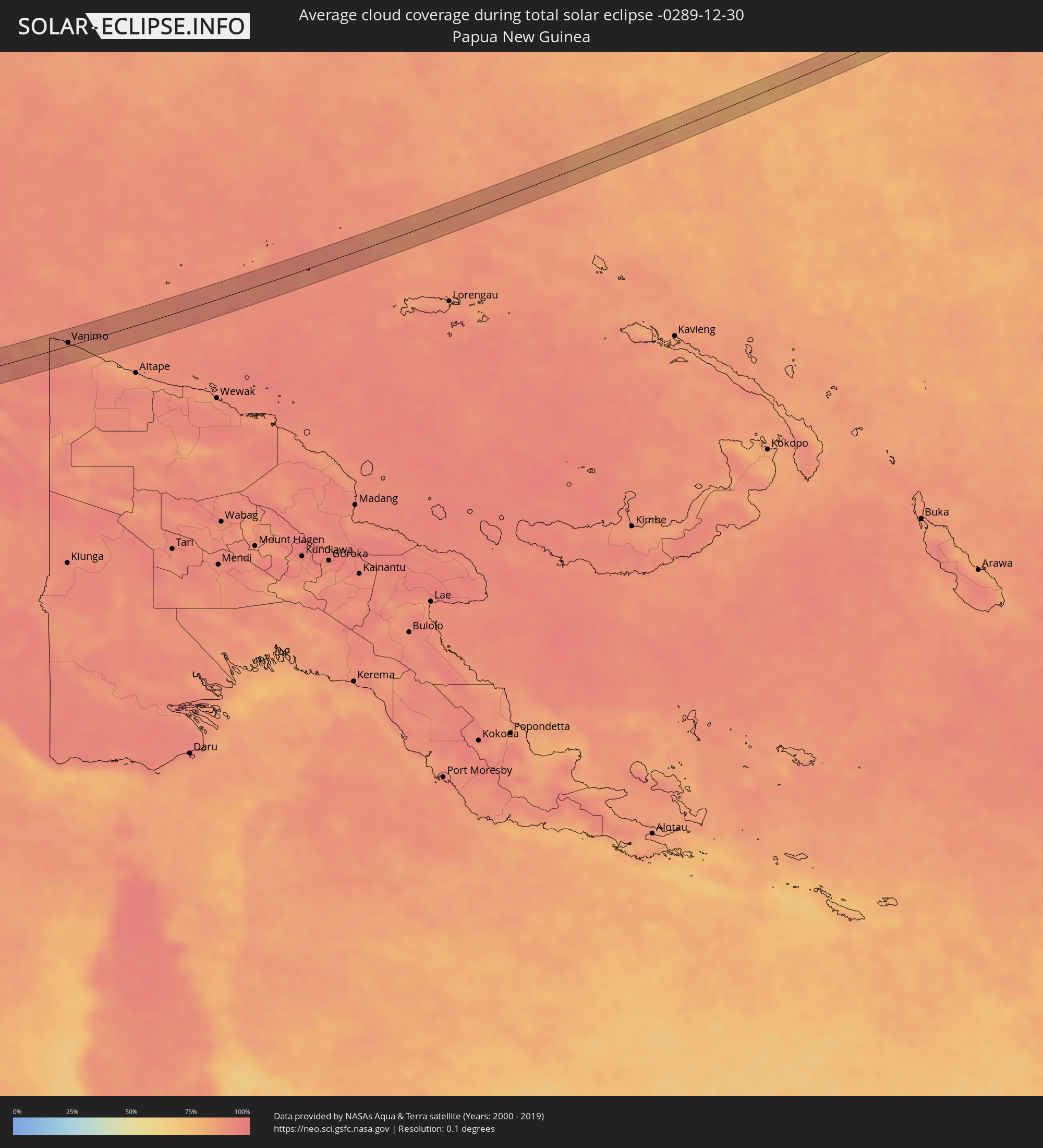 Papua-Neuguinea
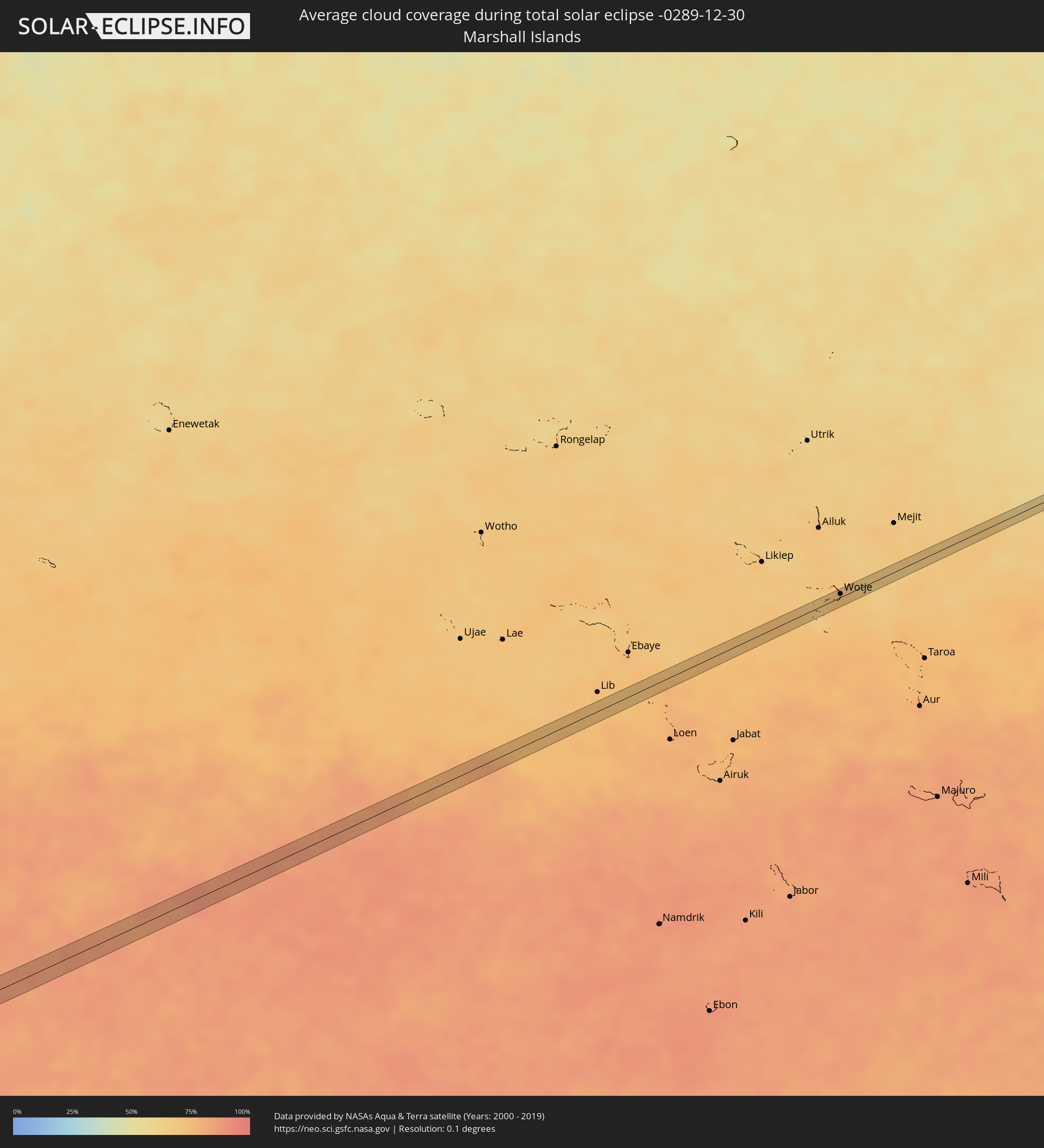 Marshallinseln
Orte im Finsternispfad
Die nachfolgene Tabelle zeigt Städte und Orte mit mehr als 5.000 Einwohnern, die sich im Finsternispfad befinden. Städte mit mehr als 100.000 Einwohnern sind dick gekennzeichnet. Mit einem Klick auf den Ort öffnet sich eine Detailkarte die die Lage des jeweiligen Ortes zusammen mit dem Verlauf der zentralen Finsternis präsentiert.
| Ort | Typ | Dauer der Verfinsterung | Ortszeit bei maximaler Verfinsterung | Entfernung zur Zentrallinie | Ø Bewölkung |
|
Harnai, Maharashtra
|
total | - | 07:39:33 UTC+05:21 | 1 km | 14% |
|
Jalgaon, Maharashtra
|
total | - | 07:39:34 UTC+05:21 | 2 km | 17% |
|
Khed, Maharashtra
|
total | - | 07:39:38 UTC+05:21 | 6 km | 17% |
|
Chiplūn, Maharashtra
|
total | - | 07:39:39 UTC+05:21 | 7 km | 20% |
|
Koynanagar, Maharashtra
|
total | - | 07:39:43 UTC+05:21 | 8 km | 23% |
|
Pātan, Maharashtra
|
total | - | 07:39:46 UTC+05:21 | 4 km | 22% |
|
Malkapur, Maharashtra
|
total | - | 07:39:51 UTC+05:21 | 2 km | 19% |
|
Karād, Maharashtra
|
total | - | 07:39:51 UTC+05:21 | 1 km | 19% |
|
Tāsgaon, Maharashtra
|
total | - | 07:39:59 UTC+05:21 | 4 km | 21% |
|
Muddebihāl, Karnataka
|
total | - | 07:40:34 UTC+05:21 | 1 km | 20% |
|
Lingsugūr, Karnataka
|
total | - | 07:40:44 UTC+05:21 | 3 km | 24% |
|
Mānvi, Karnataka
|
total | - | 07:40:58 UTC+05:21 | 12 km | 23% |
|
Kosigi, Andhra Pradesh
|
total | - | 07:41:03 UTC+05:21 | 8 km | 25% |
|
Emmiganūr, Andhra Pradesh
|
total | - | 07:41:10 UTC+05:21 | 12 km | 26% |
|
Dhone, Andhra Pradesh
|
total | - | 07:41:21 UTC+05:21 | 6 km | 34% |
|
Banganapalle, Andhra Pradesh
|
total | - | 07:41:32 UTC+05:21 | 4 km | 40% |
|
Badvel, Andhra Pradesh
|
total | - | 07:41:59 UTC+05:21 | 11 km | 59% |
|
Kovūr, Andhra Pradesh
|
total | - | 07:42:32 UTC+05:21 | 12 km | 65% |
|
Nellore, Andhra Pradesh
|
total | - | 07:42:32 UTC+05:21 | 7 km | 65% |
|
Bireun, Aceh
|
total | - | 09:48:44 UTC+07:07 | 20 km | 90% |
|
Lhokseumawe, Aceh
|
total | - | 09:49:28 UTC+07:07 | 1 km | 87% |
|
Langsa, Aceh
|
total | - | 09:51:12 UTC+07:07 | 26 km | 92% |
|
Kampong Dungun, Perak
|
total | - | 09:46:15 UTC+06:55 | 25 km | 84% |
|
Klang, Selangor
|
total | - | 09:46:37 UTC+06:55 | 13 km | 94% |
|
Jenjarum, Selangor
|
total | - | 09:46:48 UTC+06:55 | 1 km | 91% |
|
Banting, Selangor
|
total | - | 09:46:51 UTC+06:55 | 6 km | 89% |
|
Tanjung Sepat, Selangor
|
total | - | 09:47:04 UTC+06:55 | 18 km | 89% |
|
Putra Heights, Selangor
|
total | - | 09:46:53 UTC+06:55 | 16 km | 96% |
|
Putrajaya, Putrajaya
|
total | - | 09:47:09 UTC+06:55 | 16 km | 95% |
|
Sungai Pelek New Village
|
total | - | 09:47:21 UTC+06:55 | 12 km | 91% |
|
Sepang, Selangor
|
total | - | 09:47:25 UTC+06:55 | 5 km | 91% |
|
Kampung Baharu Nilai, Negeri Sembilan
|
total | - | 09:47:27 UTC+06:55 | 8 km | 95% |
|
Port Dickson, Negeri Sembilan
|
total | - | 09:47:38 UTC+06:55 | 18 km | 84% |
|
Semenyih, Selangor
|
total | - | 09:47:27 UTC+06:55 | 25 km | 97% |
|
Seremban, Negeri Sembilan
|
total | - | 09:47:47 UTC+06:55 | 8 km | 95% |
|
Kampong Masjid Tanah, Melaka
|
total | - | 09:48:22 UTC+06:55 | 21 km | 88% |
|
Sungai Udang, Melaka
|
total | - | 09:48:28 UTC+06:55 | 27 km | 86% |
|
Bukit Rambai, Melaka
|
total | - | 09:48:34 UTC+06:55 | 26 km | 93% |
|
Alor Gajah, Melaka
|
total | - | 09:48:32 UTC+06:55 | 13 km | 94% |
|
Tampin, Negeri Sembilan
|
total | - | 09:48:32 UTC+06:55 | 3 km | 94% |
|
Batu Berendam, Melaka
|
total | - | 09:48:42 UTC+06:55 | 24 km | 86% |
|
Kuala Pilah, Negeri Sembilan
|
total | - | 09:48:24 UTC+06:55 | 25 km | 95% |
|
Kampung Ayer Keroh, Melaka
|
total | - | 09:48:45 UTC+06:55 | 21 km | 94% |
|
Kampung Bukit Baharu, Melaka
|
total | - | 09:48:48 UTC+06:55 | 25 km | 88% |
|
Kampung Ayer Molek, Melaka
|
total | - | 09:48:53 UTC+06:55 | 23 km | 88% |
|
Bemban, Melaka
|
total | - | 09:48:57 UTC+06:55 | 16 km | 93% |
|
Tangkak, Johor
|
total | - | 09:49:18 UTC+06:55 | 7 km | 93% |
|
Muar, Johor
|
total | - | 09:49:29 UTC+06:55 | 28 km | 88% |
|
Bakri, Johor
|
total | - | 09:49:40 UTC+06:55 | 24 km | 92% |
|
Labis, Johor
|
total | - | 09:50:13 UTC+06:55 | 28 km | 95% |
|
Yong Peng, Johor
|
total | - | 09:50:33 UTC+06:55 | 6 km | 94% |
|
Parit Raja, Johor
|
total | - | 09:50:44 UTC+06:55 | 18 km | 95% |
|
Kampung Simpang Renggam, Johor
|
total | - | 09:51:10 UTC+06:55 | 13 km | 95% |
|
Kluang, Johor
|
total | - | 09:51:04 UTC+06:55 | 8 km | 91% |
|
Kelapa Sawit, Johor
|
total | - | 09:51:46 UTC+06:55 | 17 km | 95% |
|
Kulai, Johor
|
total | - | 09:51:55 UTC+06:55 | 15 km | 96% |
|
Taman Senai, Johor
|
total | - | 09:52:02 UTC+06:55 | 19 km | 96% |
|
Skudai, Johor
|
total | - | 09:52:07 UTC+06:55 | 24 km | 95% |
|
Johor Bahru, Johor
|
total | - | 09:52:23 UTC+06:55 | 27 km | 95% |
|
Ulu Tiram, Johor
|
total | - | 09:52:25 UTC+06:55 | 10 km | 96% |
|
Kampung Pasir Gudang Baru, Johor
|
total | - | 09:52:38 UTC+06:55 | 20 km | 96% |
|
Kota Tinggi, Johor
|
total | - | 09:52:31 UTC+06:55 | 8 km | 93% |
|
Sampit, Central Kalimantan
|
total | - | 10:30:23 UTC+07:07 | 30 km | 96% |
|
Kualakapuas, Central Kalimantan
|
total | - | 10:34:58 UTC+07:07 | 29 km | 96% |
|
Parepare, South Sulawesi
|
total | - | 11:42:38 UTC+07:57 | 12 km | 96% |
|
Sengkang, South Sulawesi
|
total | - | 11:44:02 UTC+07:57 | 9 km | 94% |
|
Watampone, South Sulawesi
|
total | - | 11:45:13 UTC+07:57 | 30 km | 97% |
|
Vanimo, Sandaun
|
total | - | 14:53:26 UTC+10:00 | 8 km | 89% |
|
Vanimo, Sandaun
|
total | - | 14:53:31 UTC+10:00 | 5 km | 89% |
|
Wotje, Wotje Atoll
|
total | - | 16:35:32 UTC+11:00 | 4 km | 75% |