Total solar eclipse of 12/30/-0289
| Day of week: | Monday |
| Maximum duration of eclipse: | 02m04s |
| Maximum width of eclipse path: | 71 km |
| Saros cycle: | 56 |
| Coverage: | 100% |
| Magnitude: | 1.0196 |
| Gamma: | 0.3258 |
Wo kann man die Sonnenfinsternis vom 12/30/-0289 sehen?
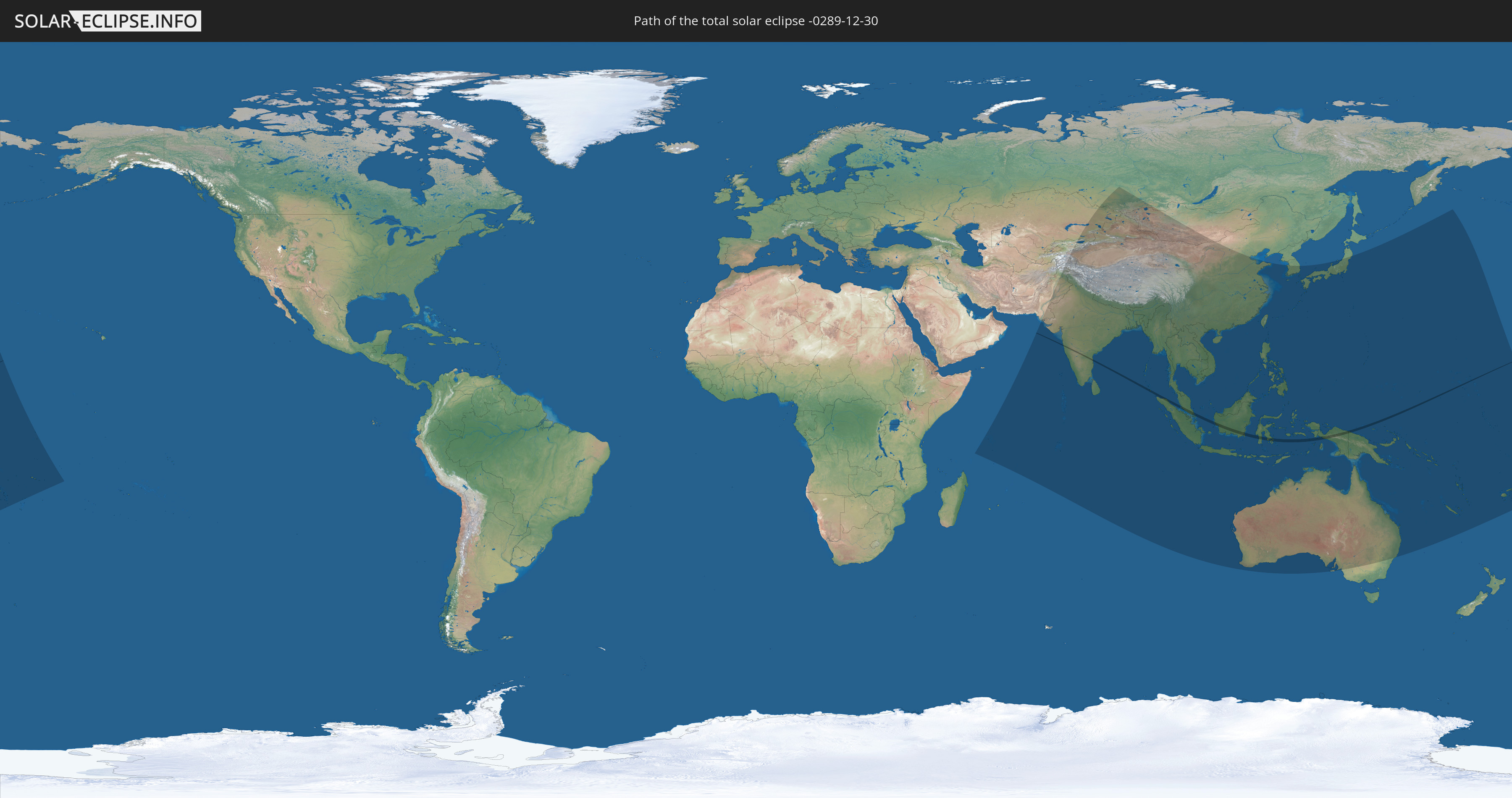
Die Sonnenfinsternis am 12/30/-0289 kann man in 54 Ländern als partielle Sonnenfinsternis beobachten.
Der Finsternispfad verläuft durch 6 Länder. Nur in diesen Ländern ist sie als total Sonnenfinsternis zu sehen.
In den folgenden Ländern ist die Sonnenfinsternis total zu sehen
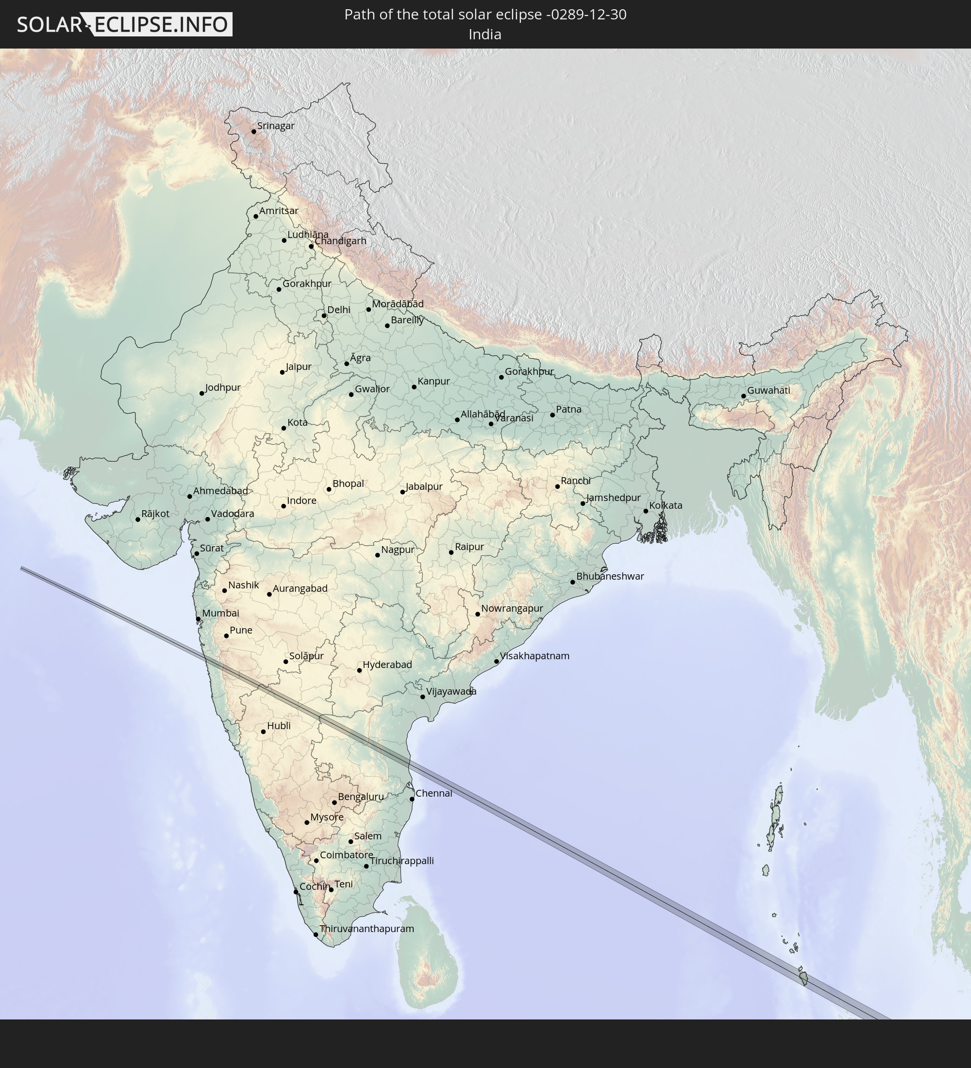 India
India
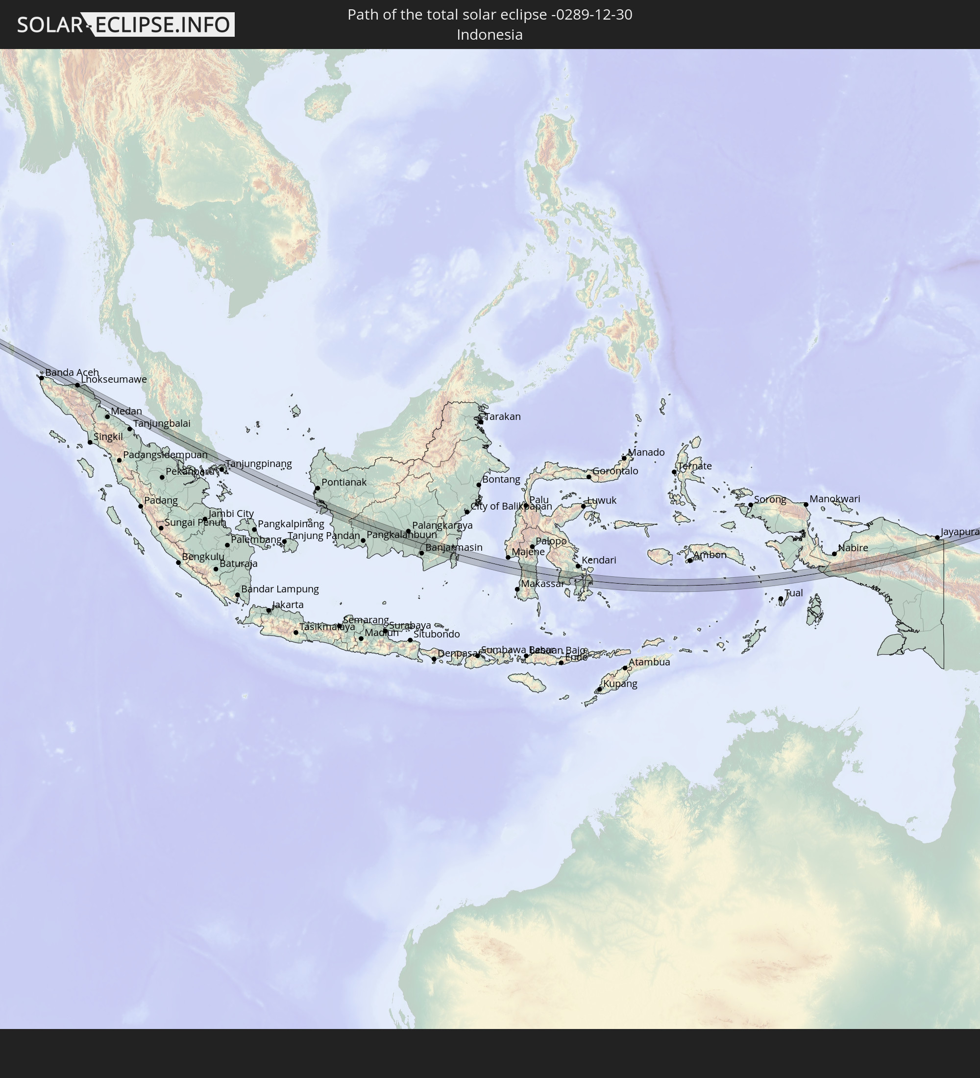 Indonesia
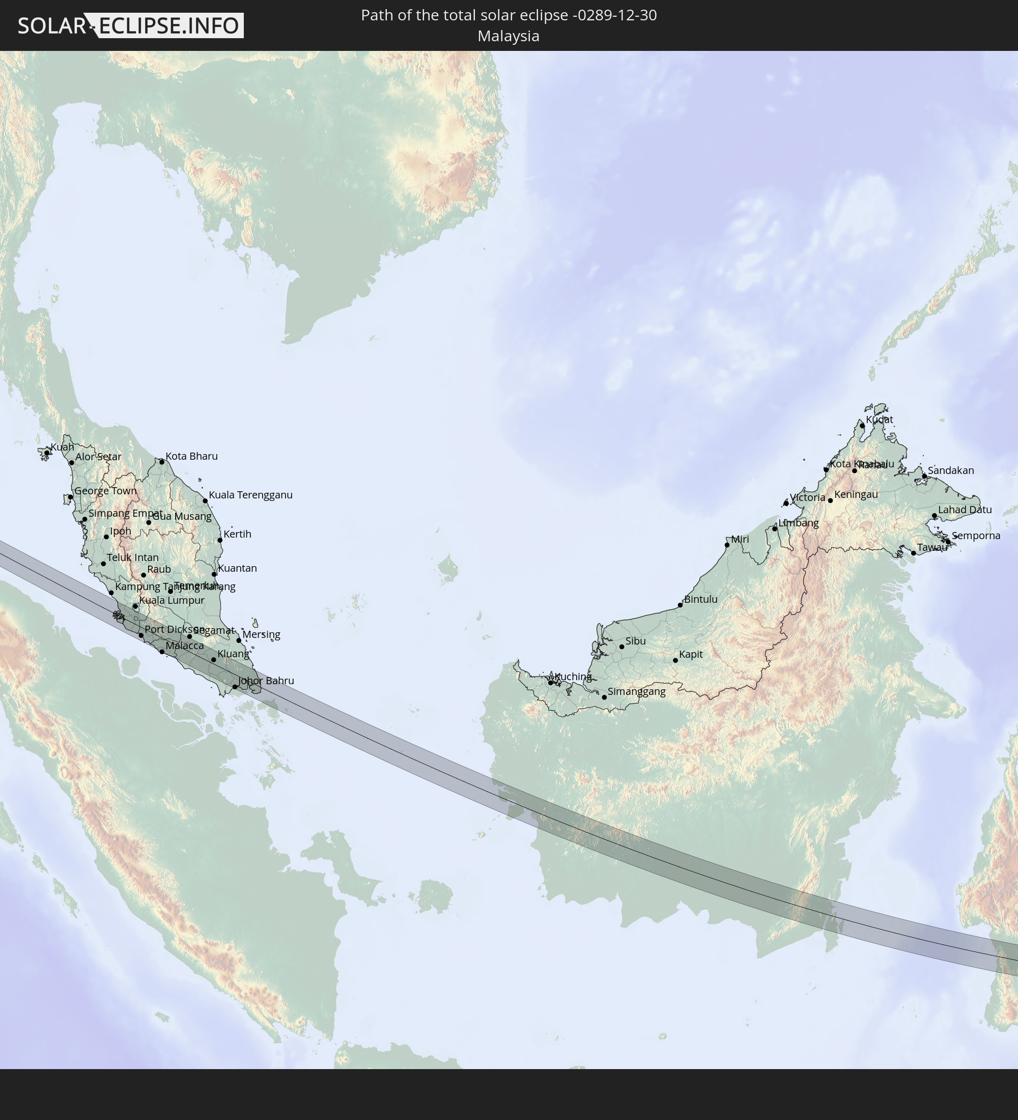 Malaysia
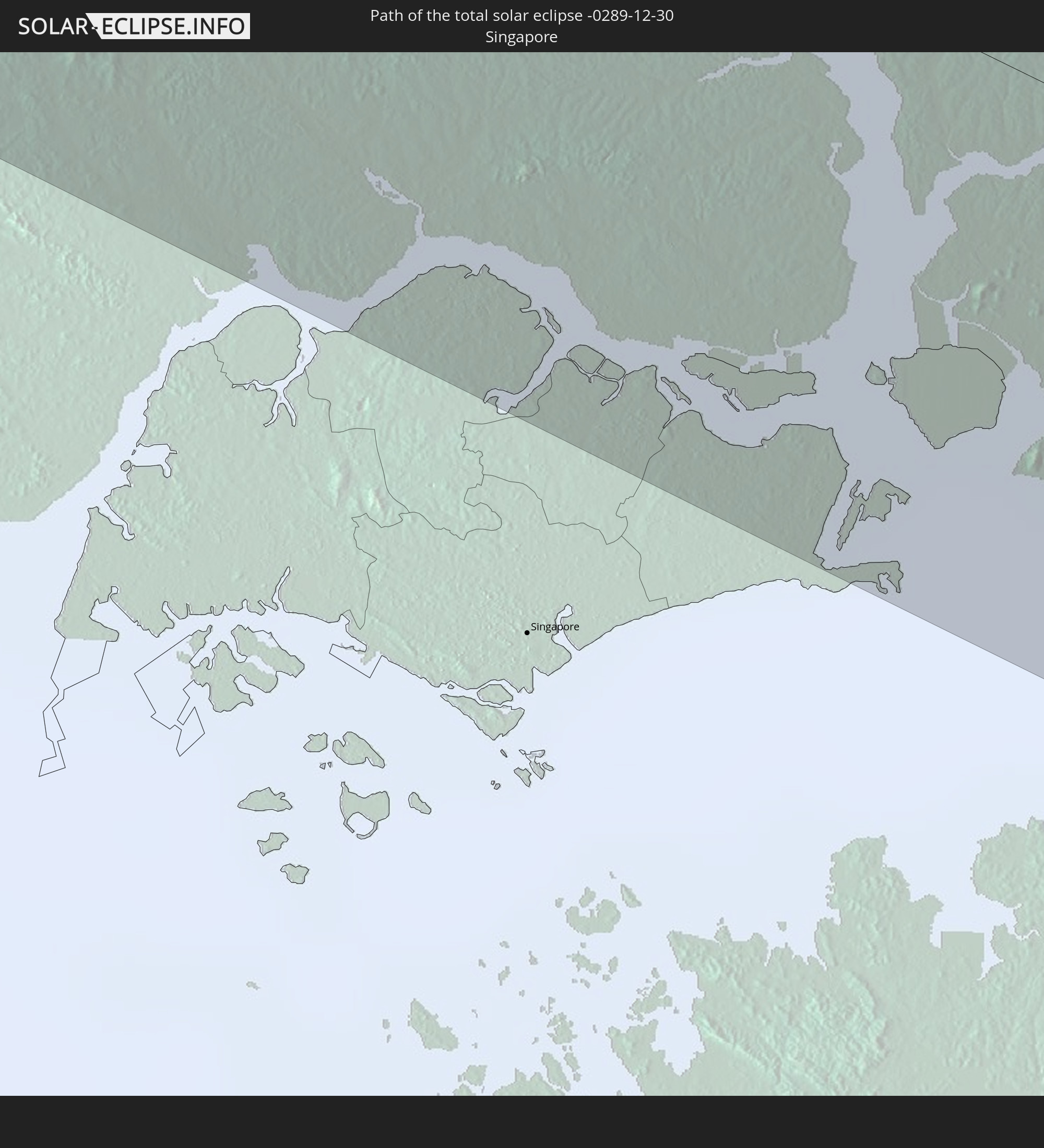 Singapore
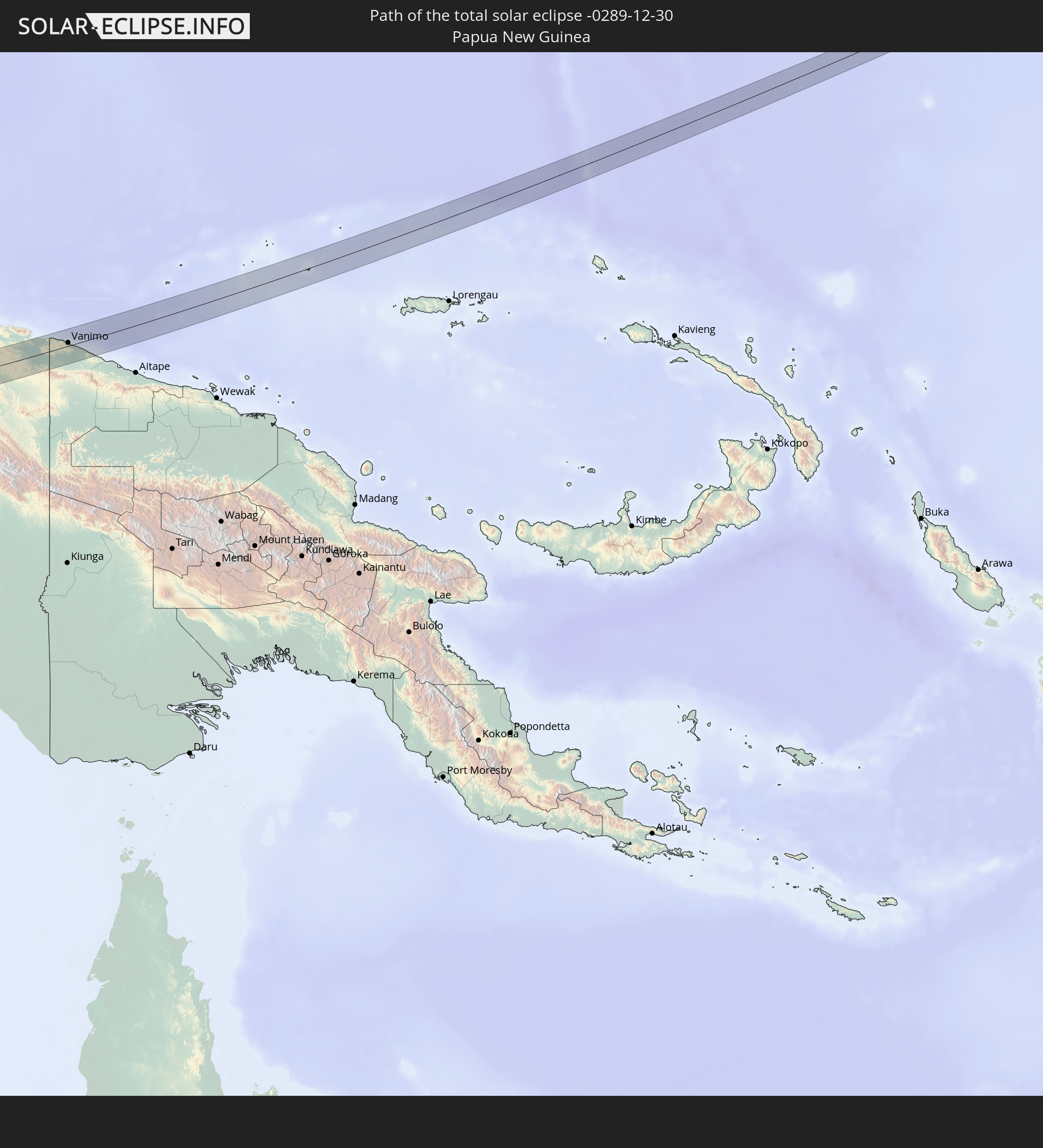 Papua New Guinea
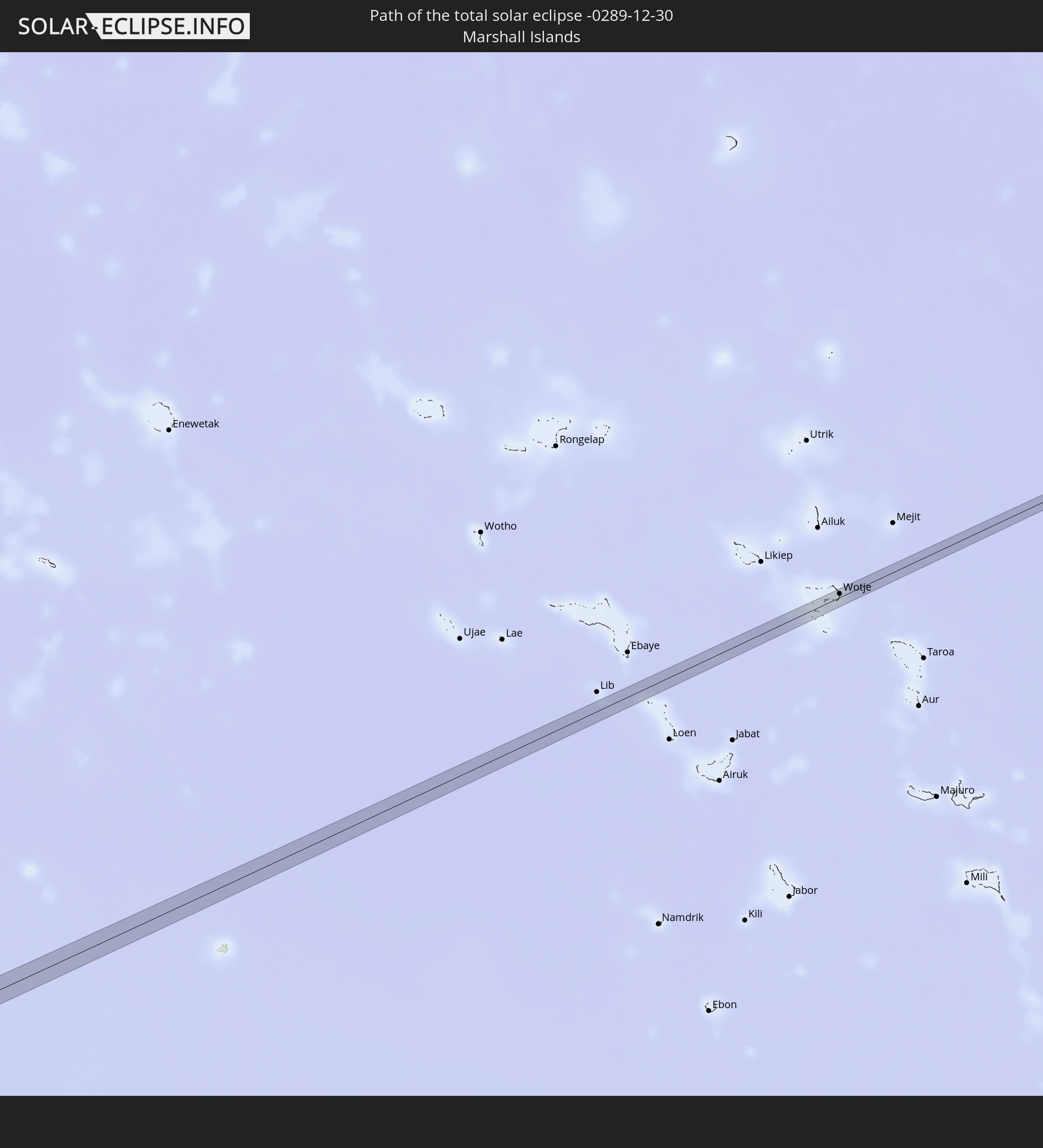 Marshall Islands
In den folgenden Ländern ist die Sonnenfinsternis partiell zu sehen
 Russia
 Fiji
Fiji
 United States Minor Outlying Islands
 Wallis and Futuna
 Tonga
Tonga
 Kiribati
 Samoa
Samoa
 Tokelau
 American Samoa
 Seychelles
 Kazakhstan
 Afghanistan
 Pakistan
 Tajikistan
 India
India
 Kyrgyzstan
 British Indian Ocean Territory
 Maldives
 China
China
 Sri Lanka
 Nepal
Nepal
 Mongolia
 Bangladesh
 Bhutan
 Myanmar
 Indonesia
 Cocos Islands
 Thailand
 Malaysia
 Laos
Laos
 Vietnam
 Cambodia
 Singapore
 Christmas Island
 Australia
 Macau
Macau
 Hong Kong
 Brunei
 Taiwan
 Philippines
 Japan
Japan
 East Timor
 South Korea
 Palau
Palau
 Federated States of Micronesia
 Papua New Guinea
 Guam
Guam
 Northern Mariana Islands
 Solomon Islands
 New Caledonia
 Marshall Islands
 Vanuatu
 Nauru
Nauru
 Tuvalu
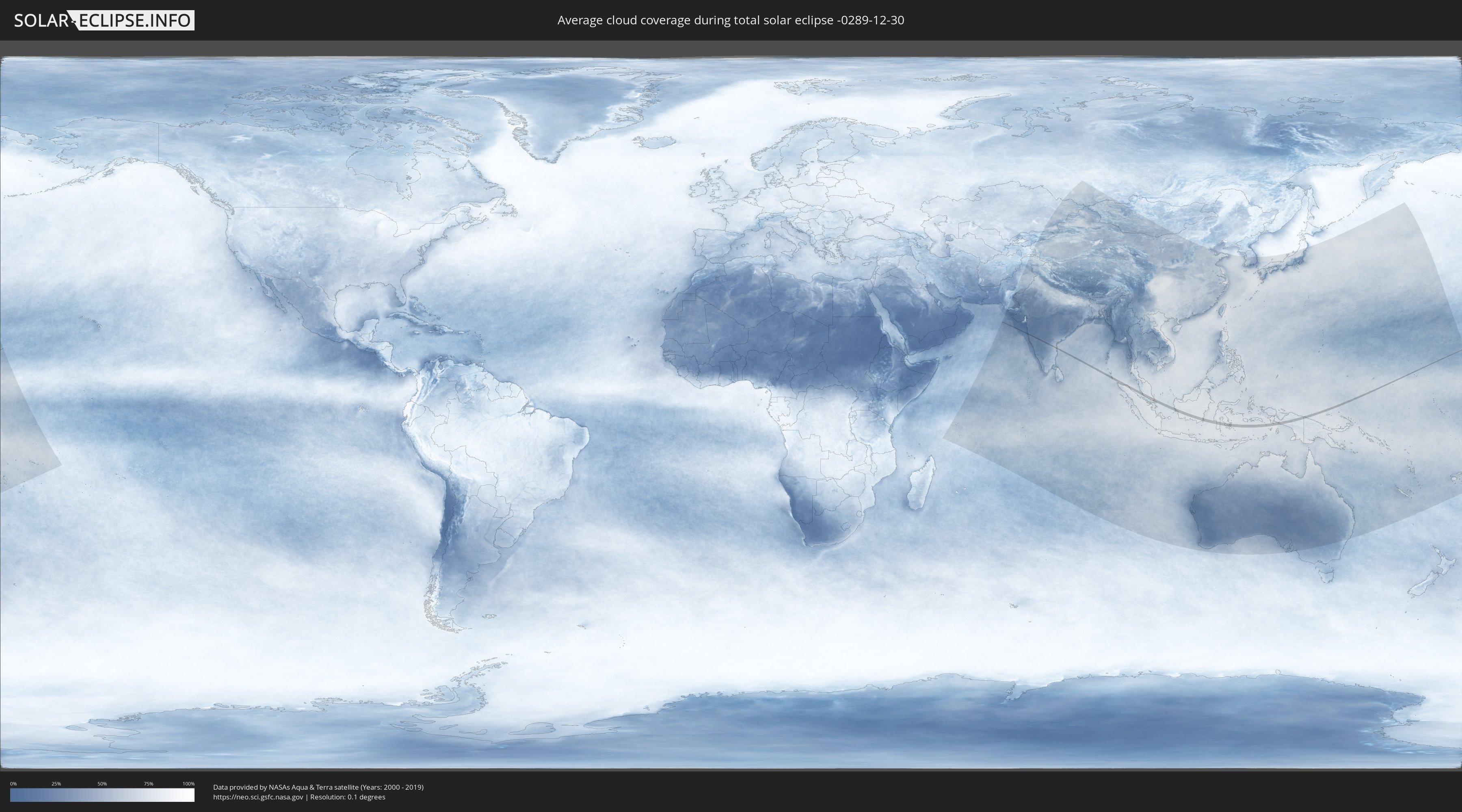
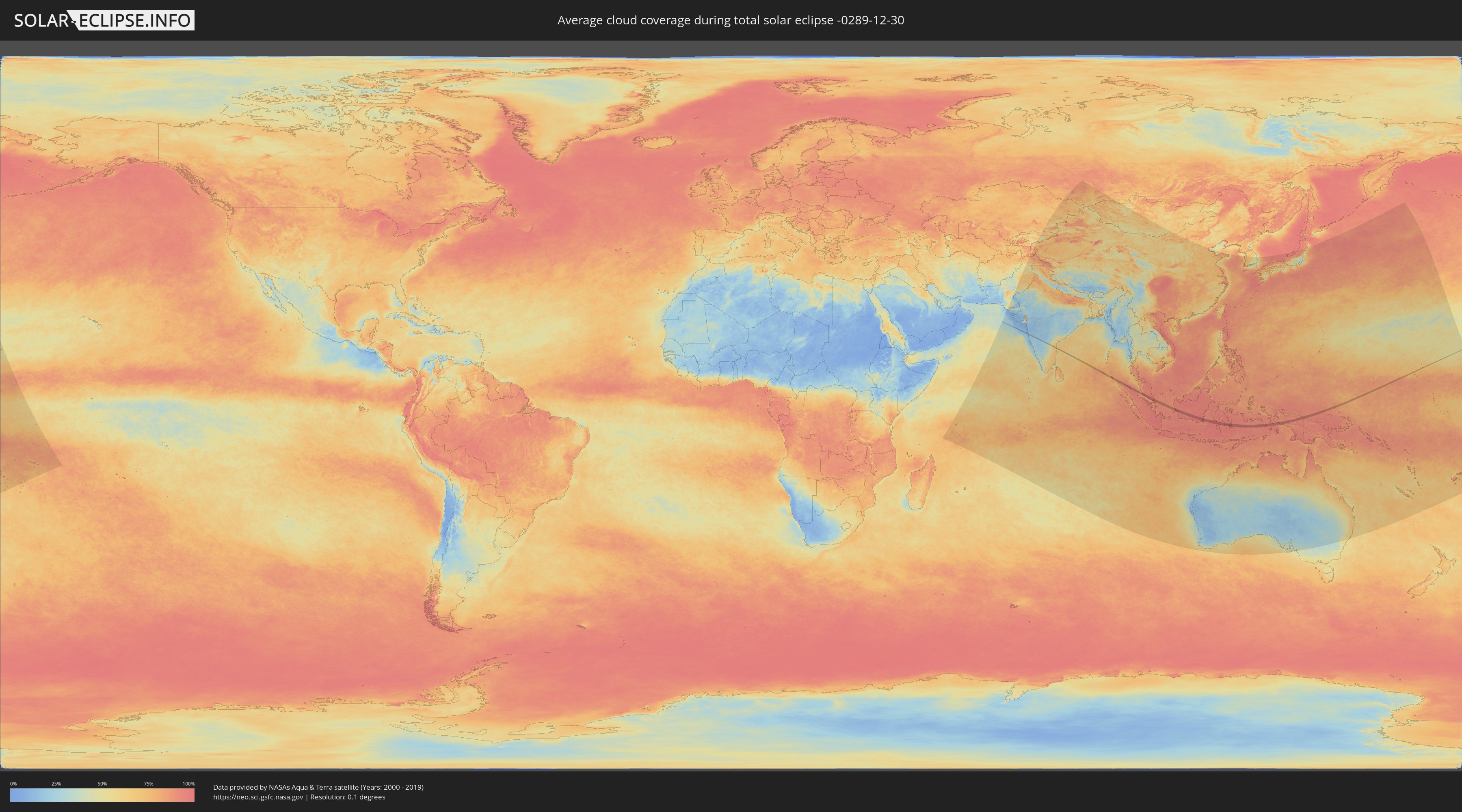
How will be the weather during the total solar eclipse on 12/30/-0289?
Where is the best place to see the total solar eclipse of 12/30/-0289?
The following maps show the average cloud coverage for the day of the total solar eclipse.
With the help of these maps, it is possible to find the place along the eclipse path, which has the best
chance of a cloudless sky.
Nevertheless, you should consider local circumstances and inform about the weather of your chosen
observation site.
The data is provided by NASAs satellites
AQUA and TERRA.
The cloud maps are averaged over a period of 19 years (2000 - 2019).
Detailed country maps
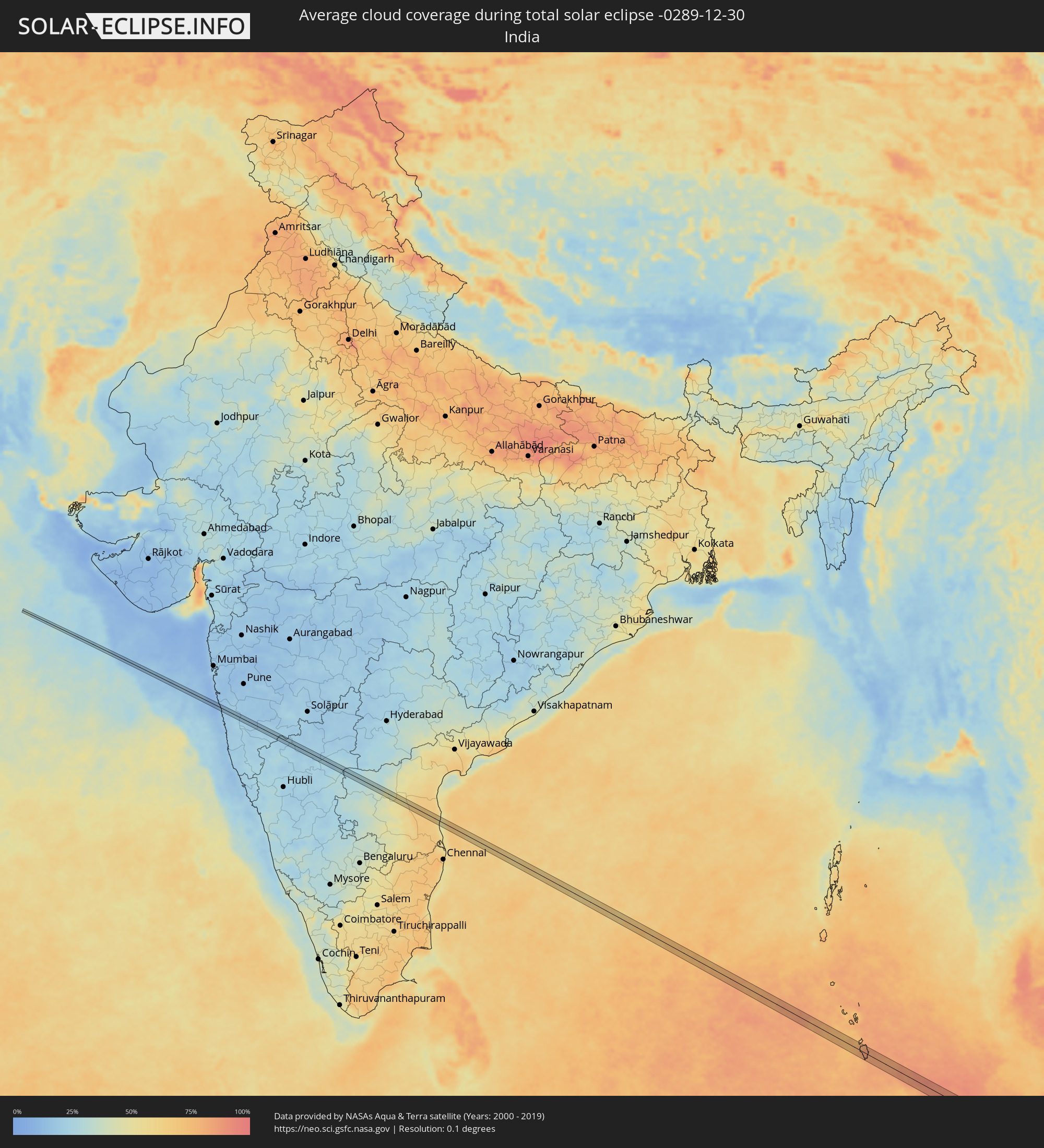 India
India
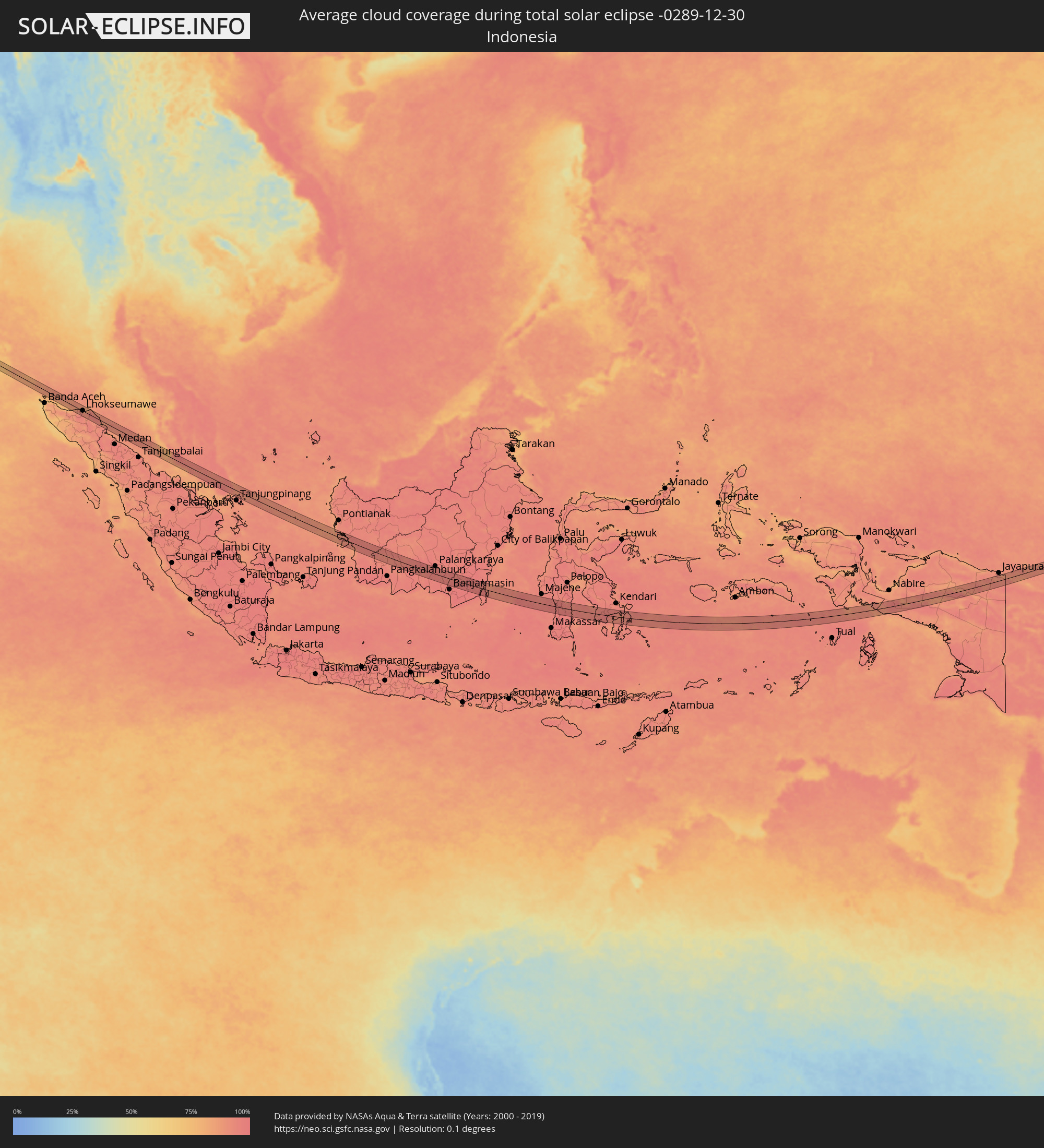 Indonesia
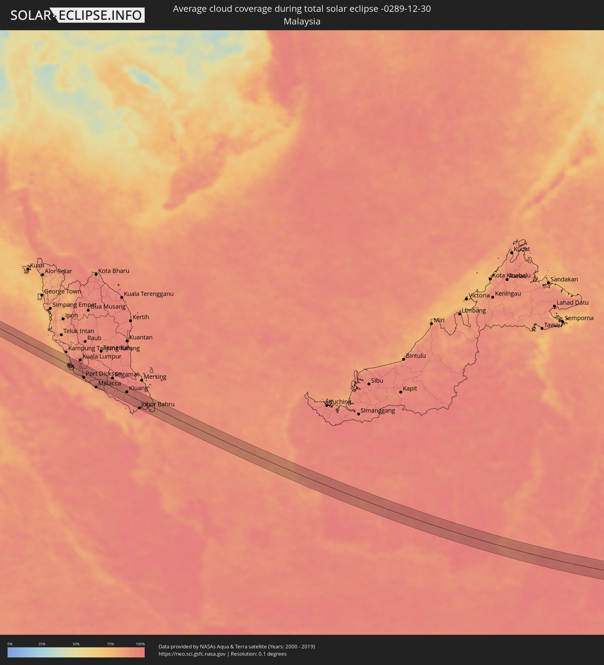 Malaysia
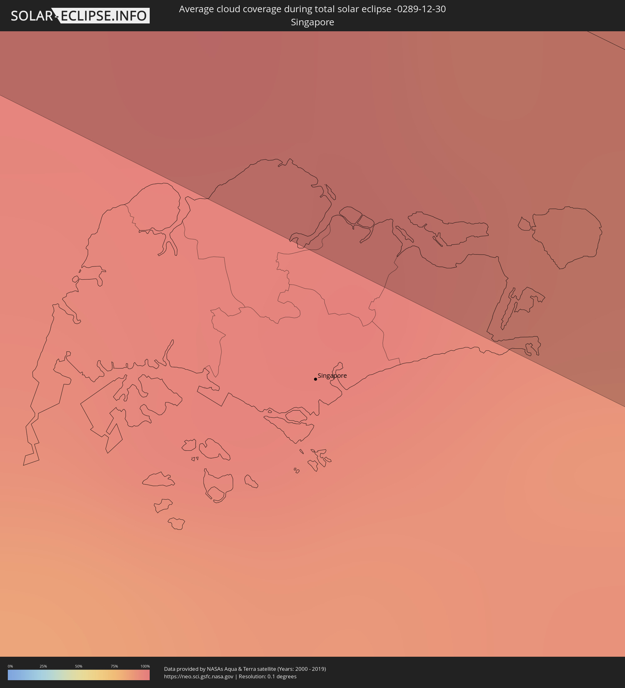 Singapore
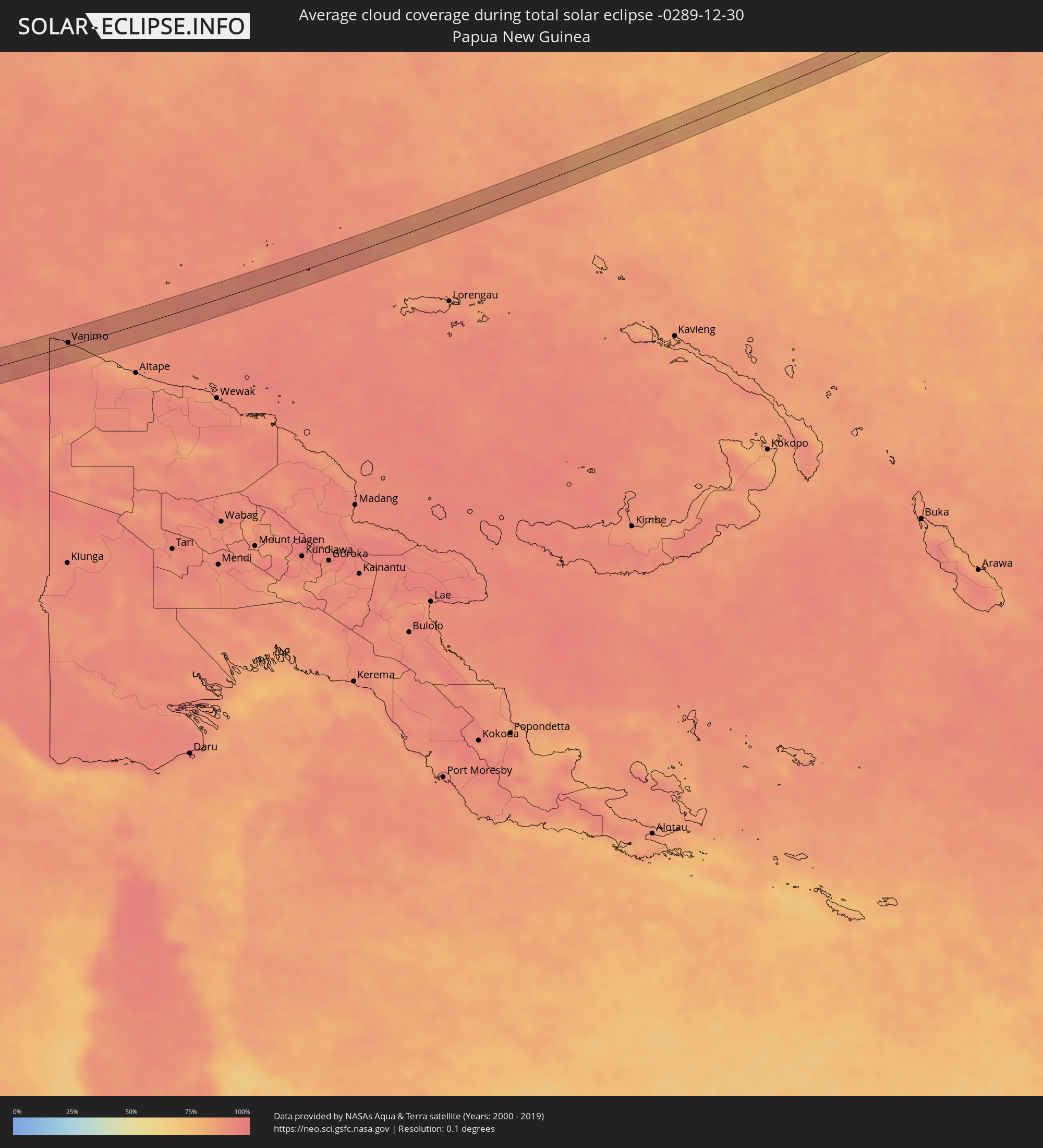 Papua New Guinea
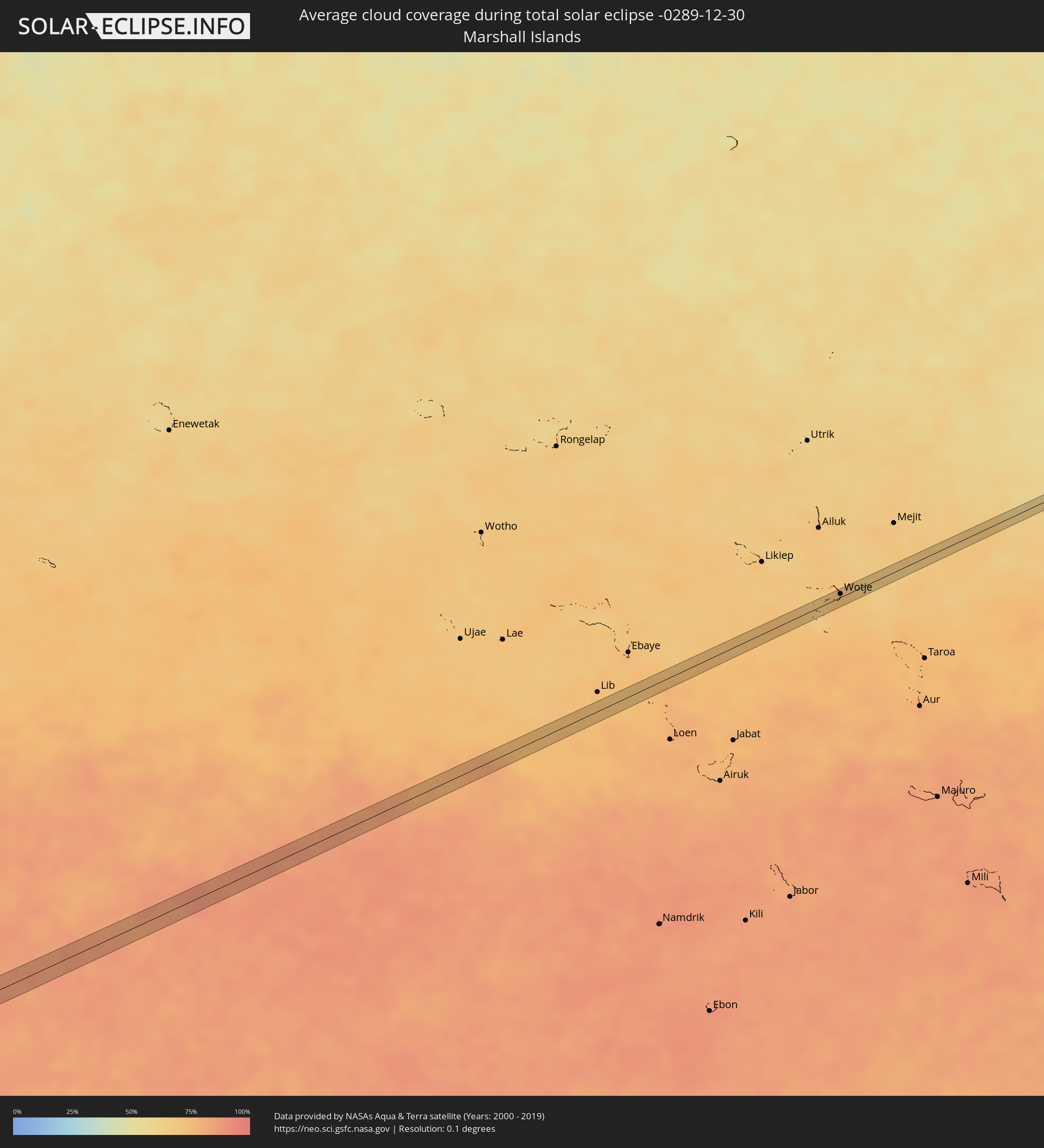 Marshall Islands
Cities inside the path of the eclipse
The following table shows all locations with a population of more than 5,000 inside the eclipse path. Cities which have more than 100,000 inhabitants are marked bold. A click at the locations opens a detailed map.
| City | Type | Eclipse duration | Local time of max. eclipse | Distance to central line | Ø Cloud coverage |
|
Harnai, Maharashtra
|
total | - | 07:39:33 UTC+05:21 | 1 km | 14% |
|
Jalgaon, Maharashtra
|
total | - | 07:39:34 UTC+05:21 | 2 km | 17% |
|
Khed, Maharashtra
|
total | - | 07:39:38 UTC+05:21 | 6 km | 17% |
|
Chiplūn, Maharashtra
|
total | - | 07:39:39 UTC+05:21 | 7 km | 20% |
|
Koynanagar, Maharashtra
|
total | - | 07:39:43 UTC+05:21 | 8 km | 23% |
|
Pātan, Maharashtra
|
total | - | 07:39:46 UTC+05:21 | 4 km | 22% |
|
Malkapur, Maharashtra
|
total | - | 07:39:51 UTC+05:21 | 2 km | 19% |
|
Karād, Maharashtra
|
total | - | 07:39:51 UTC+05:21 | 1 km | 19% |
|
Tāsgaon, Maharashtra
|
total | - | 07:39:59 UTC+05:21 | 4 km | 21% |
|
Muddebihāl, Karnataka
|
total | - | 07:40:34 UTC+05:21 | 1 km | 20% |
|
Lingsugūr, Karnataka
|
total | - | 07:40:44 UTC+05:21 | 3 km | 24% |
|
Mānvi, Karnataka
|
total | - | 07:40:58 UTC+05:21 | 12 km | 23% |
|
Kosigi, Andhra Pradesh
|
total | - | 07:41:03 UTC+05:21 | 8 km | 25% |
|
Emmiganūr, Andhra Pradesh
|
total | - | 07:41:10 UTC+05:21 | 12 km | 26% |
|
Dhone, Andhra Pradesh
|
total | - | 07:41:21 UTC+05:21 | 6 km | 34% |
|
Banganapalle, Andhra Pradesh
|
total | - | 07:41:32 UTC+05:21 | 4 km | 40% |
|
Badvel, Andhra Pradesh
|
total | - | 07:41:59 UTC+05:21 | 11 km | 59% |
|
Kovūr, Andhra Pradesh
|
total | - | 07:42:32 UTC+05:21 | 12 km | 65% |
|
Nellore, Andhra Pradesh
|
total | - | 07:42:32 UTC+05:21 | 7 km | 65% |
|
Bireun, Aceh
|
total | - | 09:48:44 UTC+07:07 | 20 km | 90% |
|
Lhokseumawe, Aceh
|
total | - | 09:49:28 UTC+07:07 | 1 km | 87% |
|
Langsa, Aceh
|
total | - | 09:51:12 UTC+07:07 | 26 km | 92% |
|
Kampong Dungun, Perak
|
total | - | 09:46:15 UTC+06:55 | 25 km | 84% |
|
Klang, Selangor
|
total | - | 09:46:37 UTC+06:55 | 13 km | 94% |
|
Jenjarum, Selangor
|
total | - | 09:46:48 UTC+06:55 | 1 km | 91% |
|
Banting, Selangor
|
total | - | 09:46:51 UTC+06:55 | 6 km | 89% |
|
Tanjung Sepat, Selangor
|
total | - | 09:47:04 UTC+06:55 | 18 km | 89% |
|
Putra Heights, Selangor
|
total | - | 09:46:53 UTC+06:55 | 16 km | 96% |
|
Putrajaya, Putrajaya
|
total | - | 09:47:09 UTC+06:55 | 16 km | 95% |
|
Sungai Pelek New Village
|
total | - | 09:47:21 UTC+06:55 | 12 km | 91% |
|
Sepang, Selangor
|
total | - | 09:47:25 UTC+06:55 | 5 km | 91% |
|
Kampung Baharu Nilai, Negeri Sembilan
|
total | - | 09:47:27 UTC+06:55 | 8 km | 95% |
|
Port Dickson, Negeri Sembilan
|
total | - | 09:47:38 UTC+06:55 | 18 km | 84% |
|
Semenyih, Selangor
|
total | - | 09:47:27 UTC+06:55 | 25 km | 97% |
|
Seremban, Negeri Sembilan
|
total | - | 09:47:47 UTC+06:55 | 8 km | 95% |
|
Kampong Masjid Tanah, Melaka
|
total | - | 09:48:22 UTC+06:55 | 21 km | 88% |
|
Sungai Udang, Melaka
|
total | - | 09:48:28 UTC+06:55 | 27 km | 86% |
|
Bukit Rambai, Melaka
|
total | - | 09:48:34 UTC+06:55 | 26 km | 93% |
|
Alor Gajah, Melaka
|
total | - | 09:48:32 UTC+06:55 | 13 km | 94% |
|
Tampin, Negeri Sembilan
|
total | - | 09:48:32 UTC+06:55 | 3 km | 94% |
|
Batu Berendam, Melaka
|
total | - | 09:48:42 UTC+06:55 | 24 km | 86% |
|
Kuala Pilah, Negeri Sembilan
|
total | - | 09:48:24 UTC+06:55 | 25 km | 95% |
|
Kampung Ayer Keroh, Melaka
|
total | - | 09:48:45 UTC+06:55 | 21 km | 94% |
|
Kampung Bukit Baharu, Melaka
|
total | - | 09:48:48 UTC+06:55 | 25 km | 88% |
|
Kampung Ayer Molek, Melaka
|
total | - | 09:48:53 UTC+06:55 | 23 km | 88% |
|
Bemban, Melaka
|
total | - | 09:48:57 UTC+06:55 | 16 km | 93% |
|
Tangkak, Johor
|
total | - | 09:49:18 UTC+06:55 | 7 km | 93% |
|
Muar, Johor
|
total | - | 09:49:29 UTC+06:55 | 28 km | 88% |
|
Bakri, Johor
|
total | - | 09:49:40 UTC+06:55 | 24 km | 92% |
|
Labis, Johor
|
total | - | 09:50:13 UTC+06:55 | 28 km | 95% |
|
Yong Peng, Johor
|
total | - | 09:50:33 UTC+06:55 | 6 km | 94% |
|
Parit Raja, Johor
|
total | - | 09:50:44 UTC+06:55 | 18 km | 95% |
|
Kampung Simpang Renggam, Johor
|
total | - | 09:51:10 UTC+06:55 | 13 km | 95% |
|
Kluang, Johor
|
total | - | 09:51:04 UTC+06:55 | 8 km | 91% |
|
Kelapa Sawit, Johor
|
total | - | 09:51:46 UTC+06:55 | 17 km | 95% |
|
Kulai, Johor
|
total | - | 09:51:55 UTC+06:55 | 15 km | 96% |
|
Taman Senai, Johor
|
total | - | 09:52:02 UTC+06:55 | 19 km | 96% |
|
Skudai, Johor
|
total | - | 09:52:07 UTC+06:55 | 24 km | 95% |
|
Johor Bahru, Johor
|
total | - | 09:52:23 UTC+06:55 | 27 km | 95% |
|
Ulu Tiram, Johor
|
total | - | 09:52:25 UTC+06:55 | 10 km | 96% |
|
Kampung Pasir Gudang Baru, Johor
|
total | - | 09:52:38 UTC+06:55 | 20 km | 96% |
|
Kota Tinggi, Johor
|
total | - | 09:52:31 UTC+06:55 | 8 km | 93% |
|
Sampit, Central Kalimantan
|
total | - | 10:30:23 UTC+07:07 | 30 km | 96% |
|
Kualakapuas, Central Kalimantan
|
total | - | 10:34:58 UTC+07:07 | 29 km | 96% |
|
Parepare, South Sulawesi
|
total | - | 11:42:38 UTC+07:57 | 12 km | 96% |
|
Sengkang, South Sulawesi
|
total | - | 11:44:02 UTC+07:57 | 9 km | 94% |
|
Watampone, South Sulawesi
|
total | - | 11:45:13 UTC+07:57 | 30 km | 97% |
|
Vanimo, Sandaun
|
total | - | 14:53:26 UTC+10:00 | 8 km | 89% |
|
Vanimo, Sandaun
|
total | - | 14:53:31 UTC+10:00 | 5 km | 89% |
|
Wotje, Wotje Atoll
|
total | - | 16:35:32 UTC+11:00 | 4 km | 75% |