Totale Sonnenfinsternis vom 16.01.-0447
| Wochentag: | Donnerstag |
| Maximale Dauer der Verfinsterung: | 01m46s |
| Maximale Breite des Finsternispfades: | 66 km |
| Saroszyklus: | 53 |
| Bedeckungsgrad: | 100% |
| Magnitude: | 1.0191 |
| Gamma: | -0.1232 |
Wo kann man die Sonnenfinsternis vom 16.01.-0447 sehen?
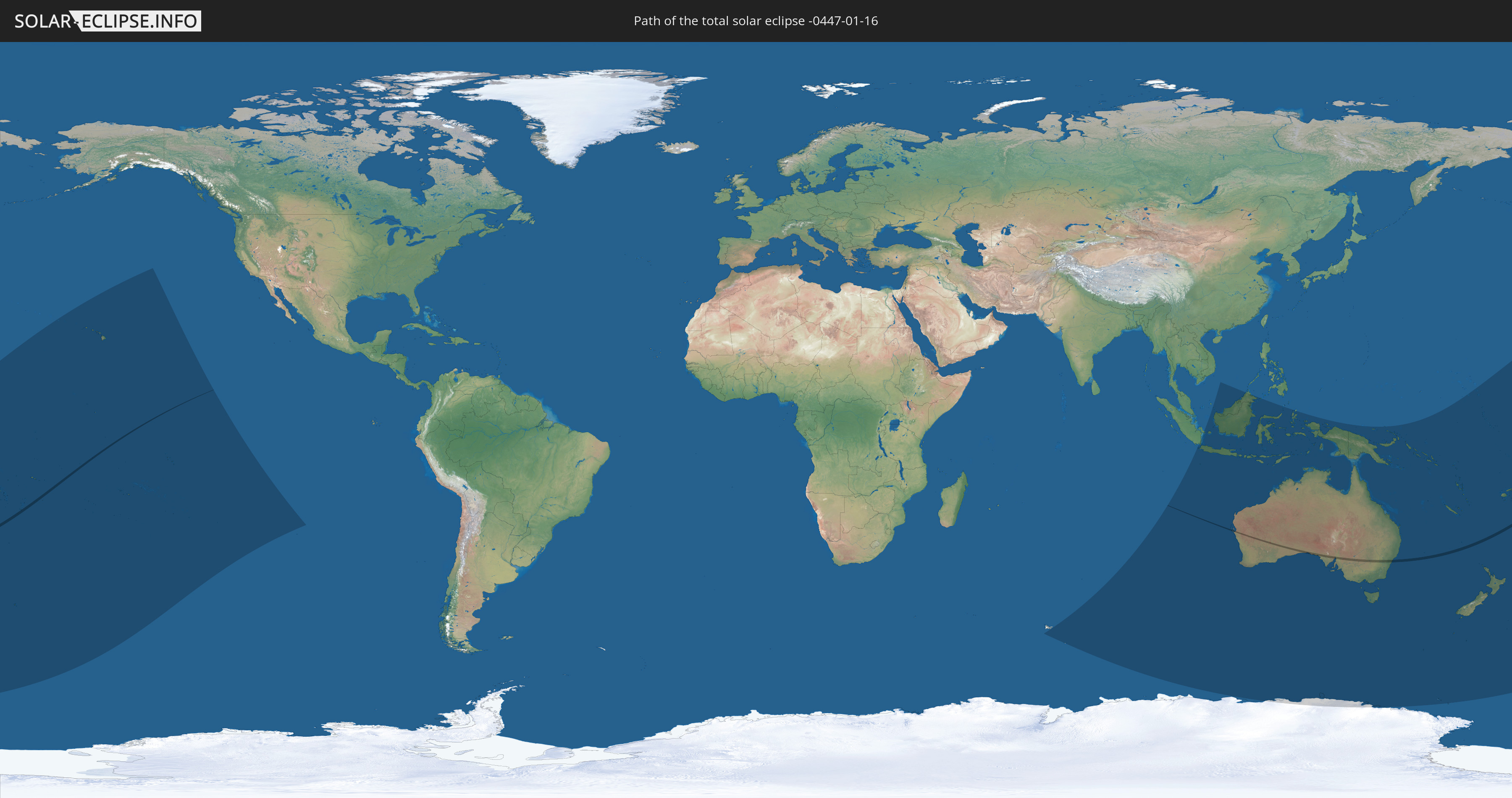
Die Sonnenfinsternis am 16.01.-0447 kann man in 32 Ländern als partielle Sonnenfinsternis beobachten.
Der Finsternispfad verläuft durch 3 Länder. Nur in diesen Ländern ist sie als totale Sonnenfinsternis zu sehen.
In den folgenden Ländern ist die Sonnenfinsternis total zu sehen
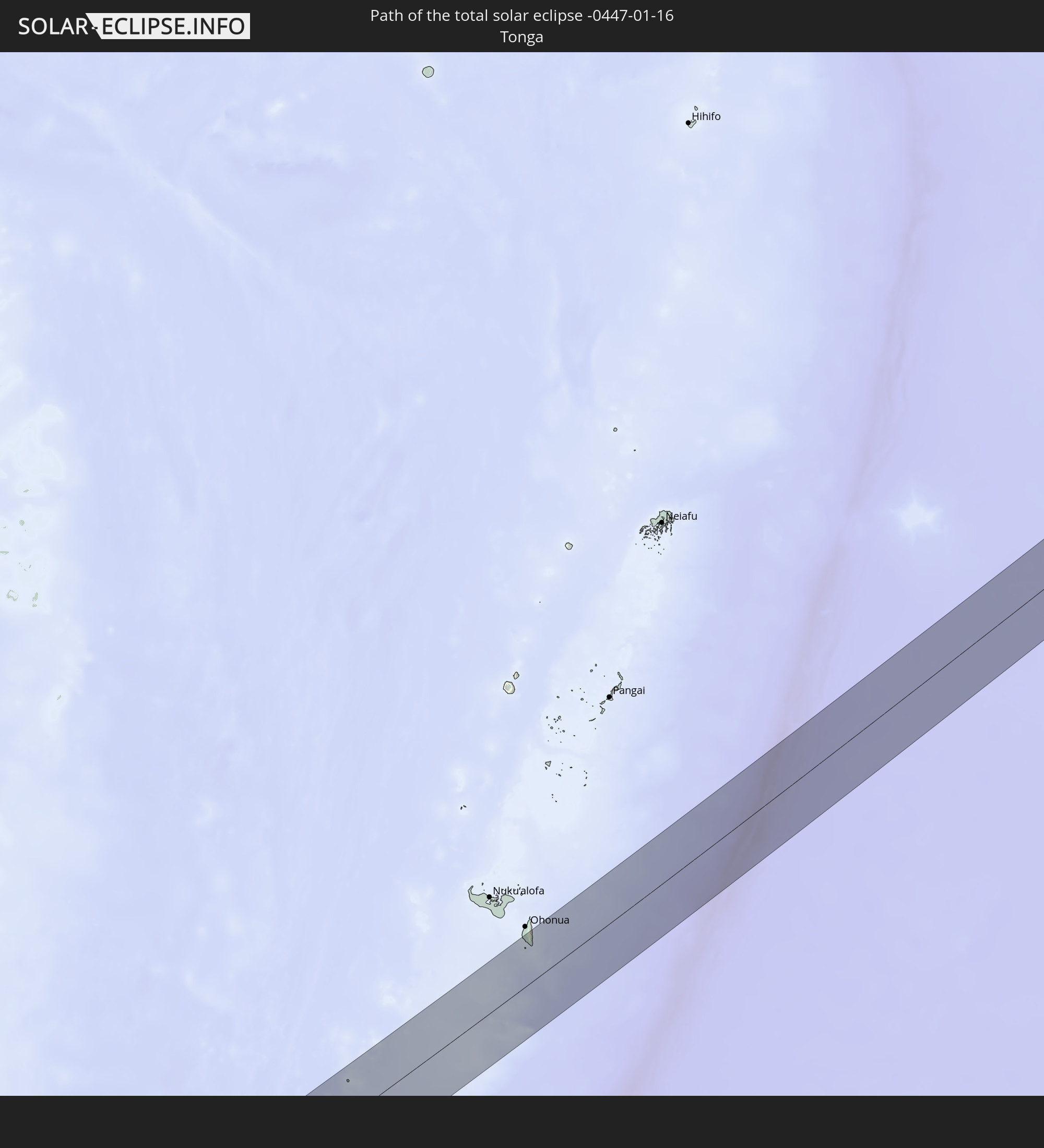 Tonga
Tonga
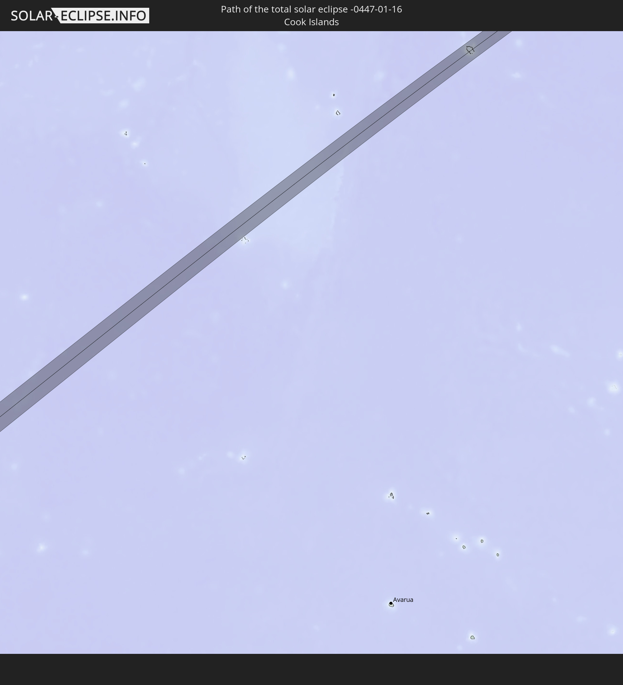 Cookinseln
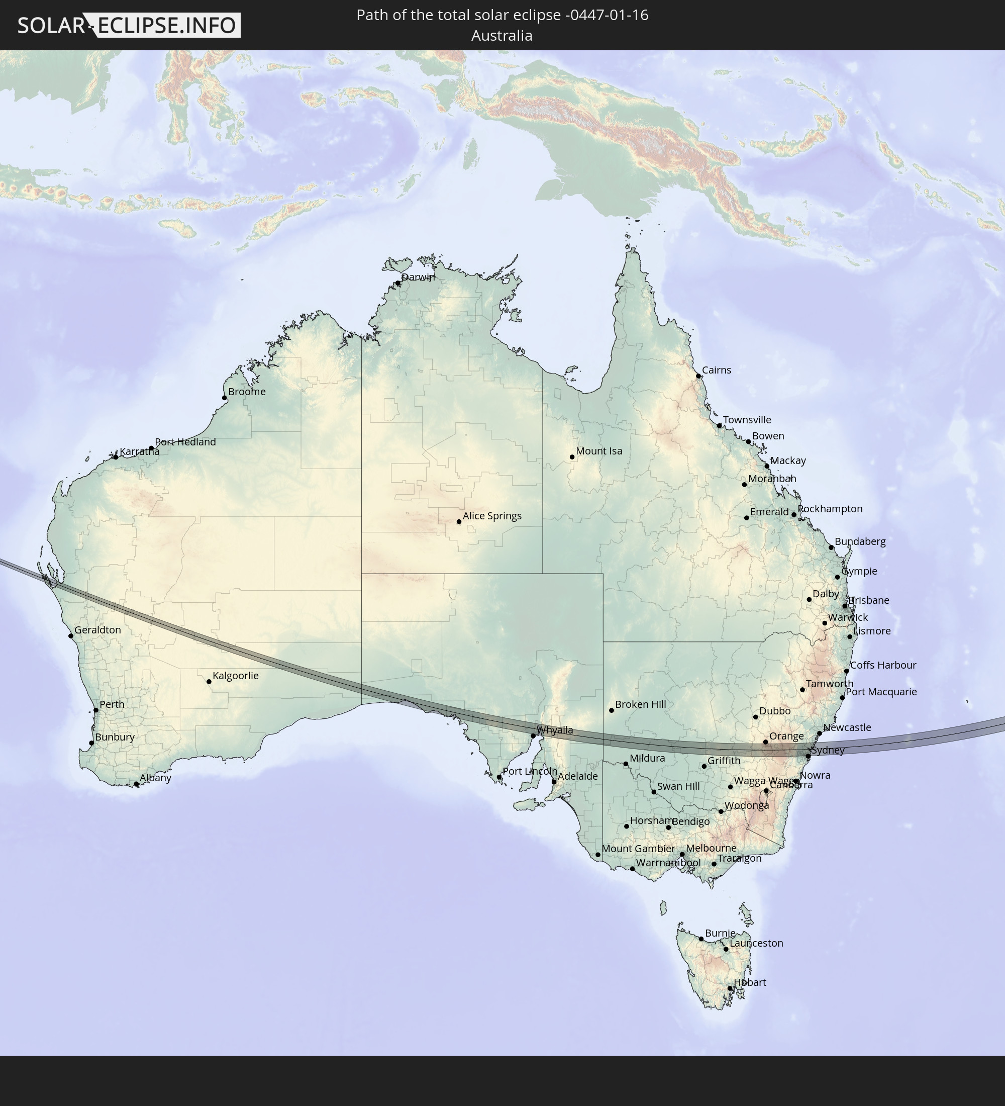 Australien
In den folgenden Ländern ist die Sonnenfinsternis partiell zu sehen
 Fidschi
 Antarktika
 Vereinigte Staaten
 Neuseeland
 United States Minor Outlying Islands
 Wallis und Futuna
 Tonga
Tonga
 Kiribati
 Samoa
Samoa
 Tokelau
 Amerikanisch-Samoa
 Niue
Niue
 Cookinseln
 Französisch-Polynesien
 Pitcairninseln
 Französische Süd- und Antarktisgebiete
 Heard und McDonaldinseln
 Indonesien
 Malaysia
 Weihnachtsinsel
 Australien
 Brunei
 Philippinen
 Osttimor
 Papua-Neuguinea
 Salomonen
 Neukaledonien
 Marshallinseln
 Vanuatu
 Nauru
Nauru
 Norfolkinsel
 Tuvalu
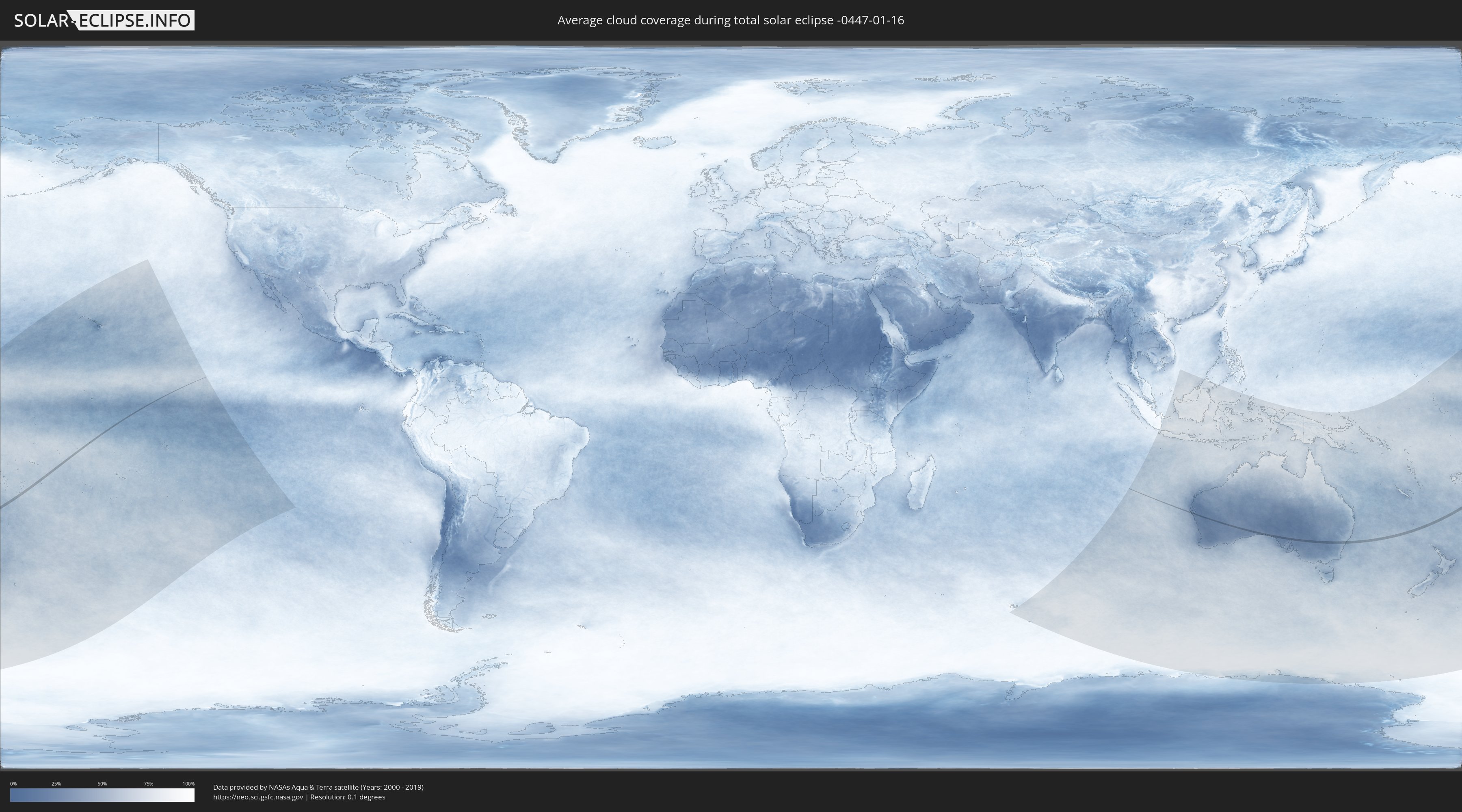
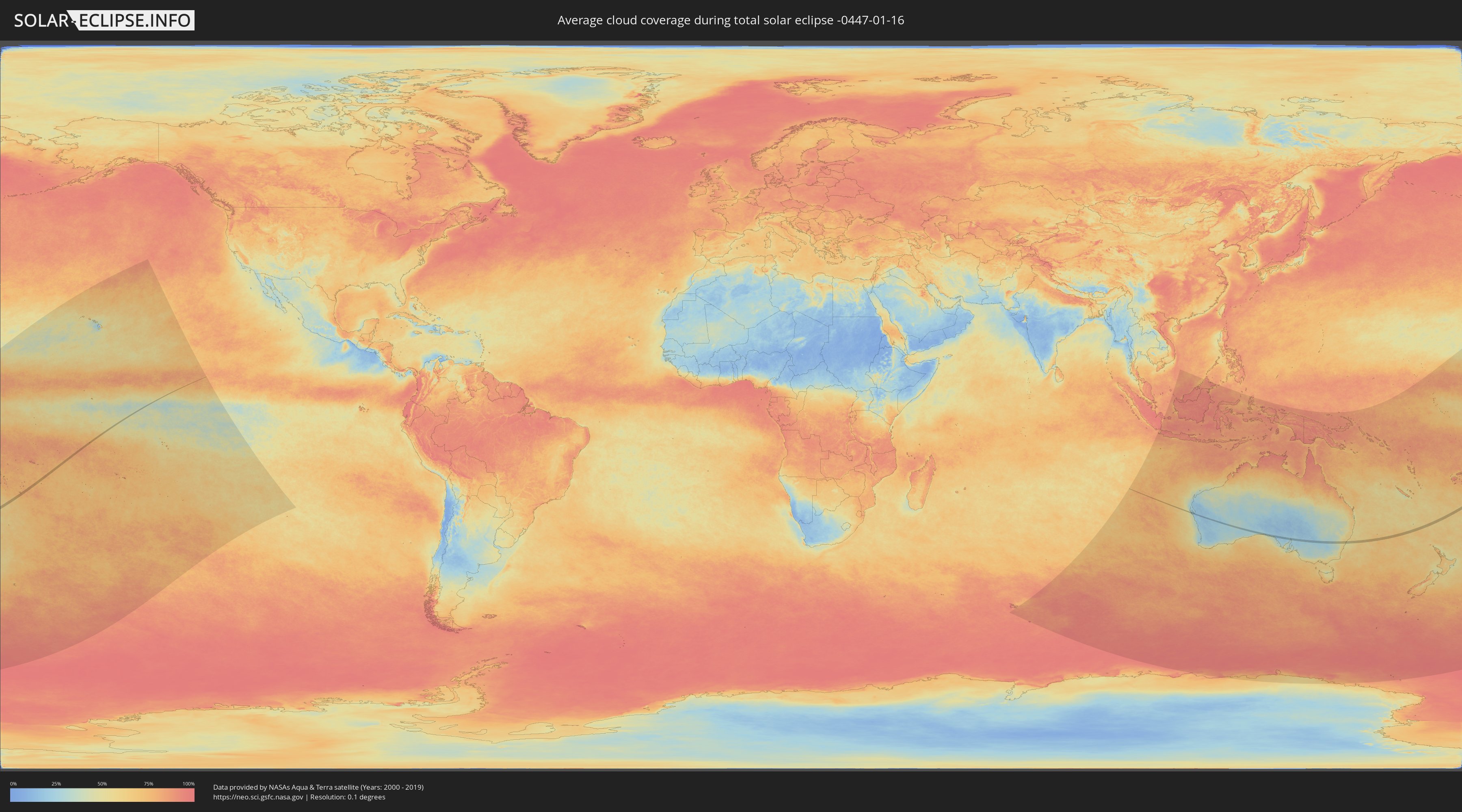
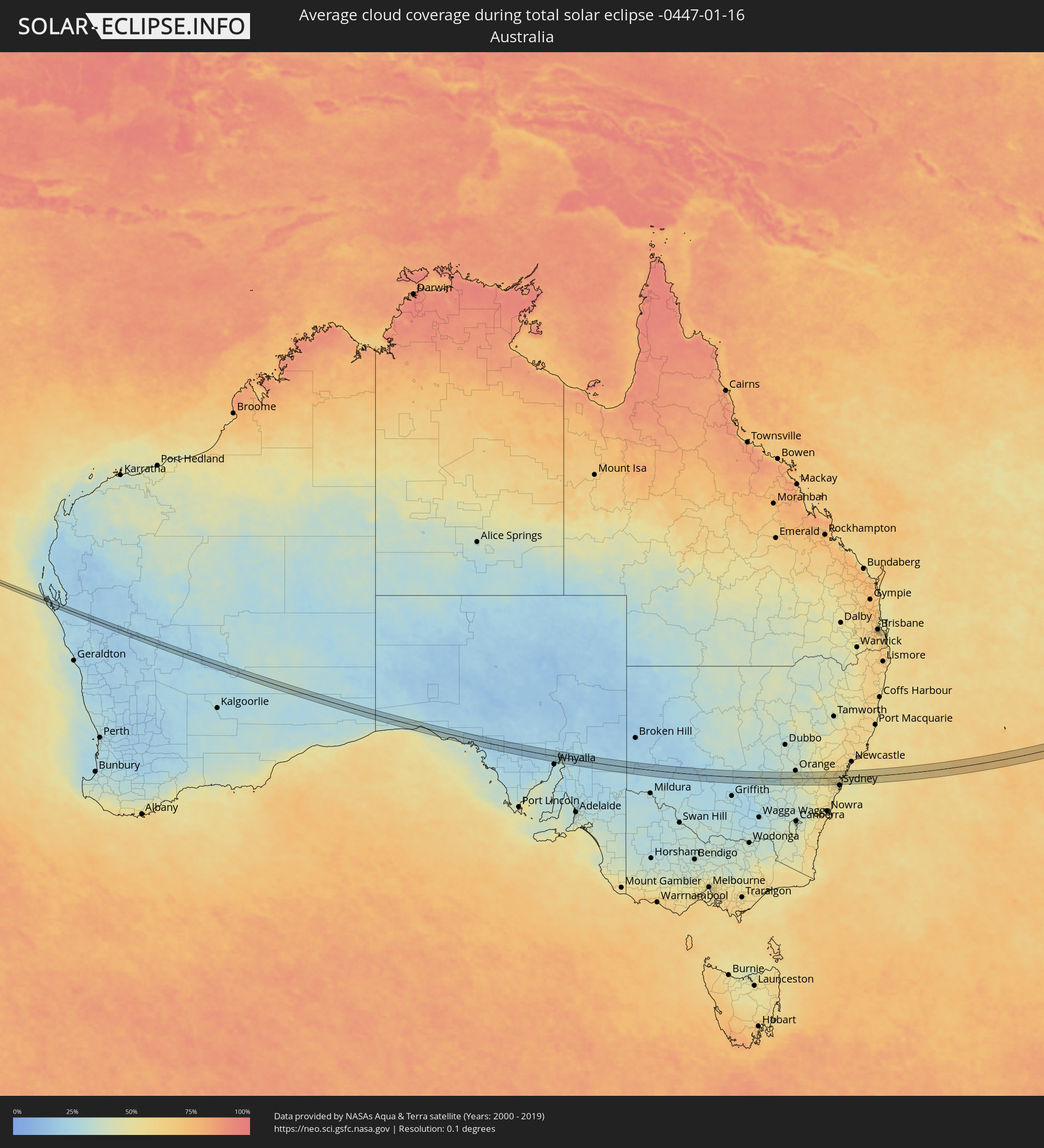
Wie wird das Wetter während der totalen Sonnenfinsternis am 16.01.-0447?
Wo ist der beste Ort, um die totale Sonnenfinsternis vom 16.01.-0447 zu beobachten?
Die folgenden Karten zeigen die durchschnittliche Bewölkung für den Tag, an dem die totale Sonnenfinsternis
stattfindet. Mit Hilfe der Karten lässt sich der Ort entlang des Finsternispfades eingrenzen,
der die besten Aussichen auf einen klaren wolkenfreien Himmel bietet.
Trotzdem muss man immer lokale Gegenenheiten beachten und sollte sich genau über das Wetter an seinem
gewählten Beobachtungsort informieren.
Die Daten stammen von den beiden NASA-Satelliten
AQUA und TERRA
und wurden über einen Zeitraum von 19 Jahren (2000 - 2019) gemittelt.
Detaillierte Länderkarten
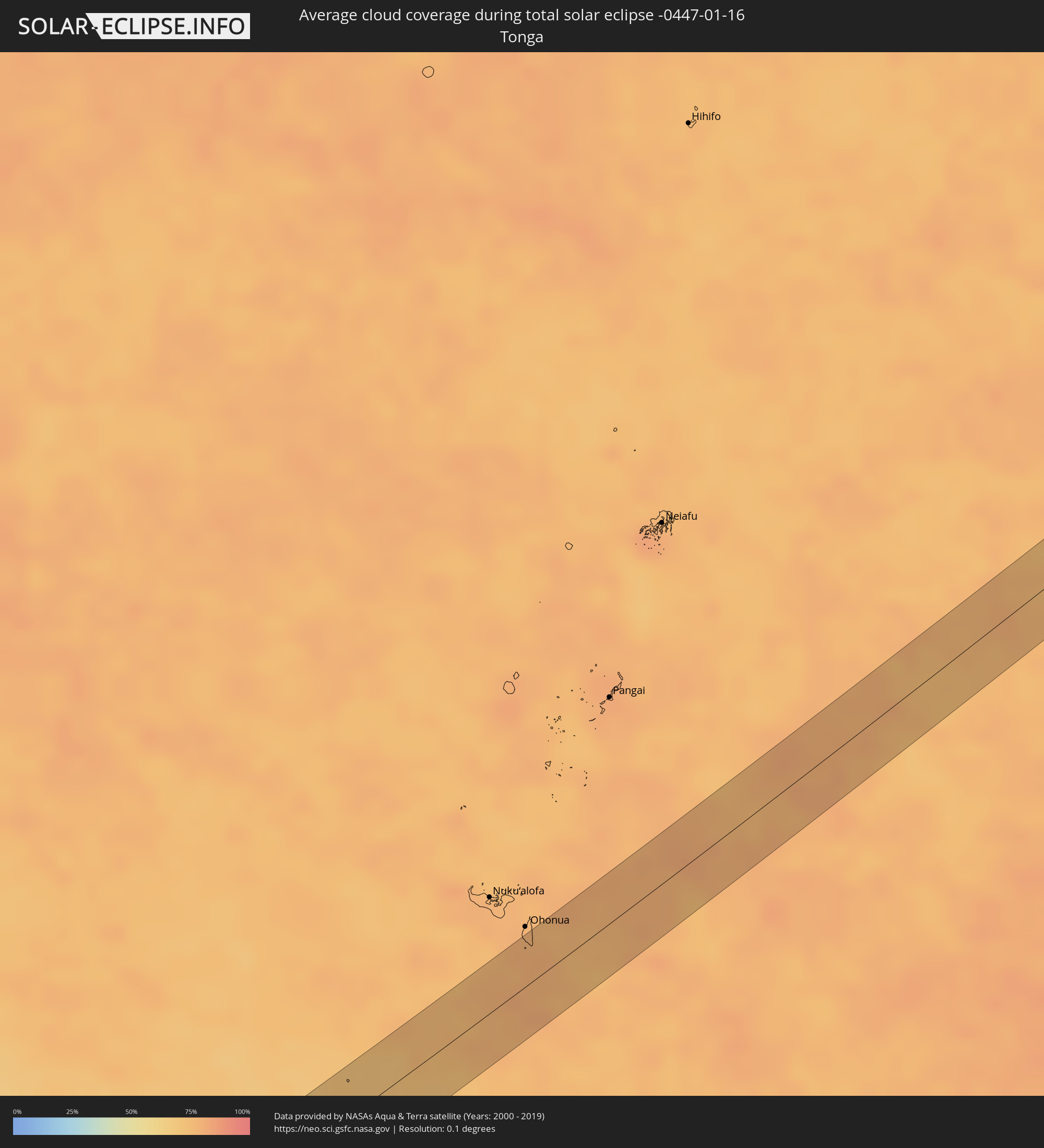 Tonga
Tonga
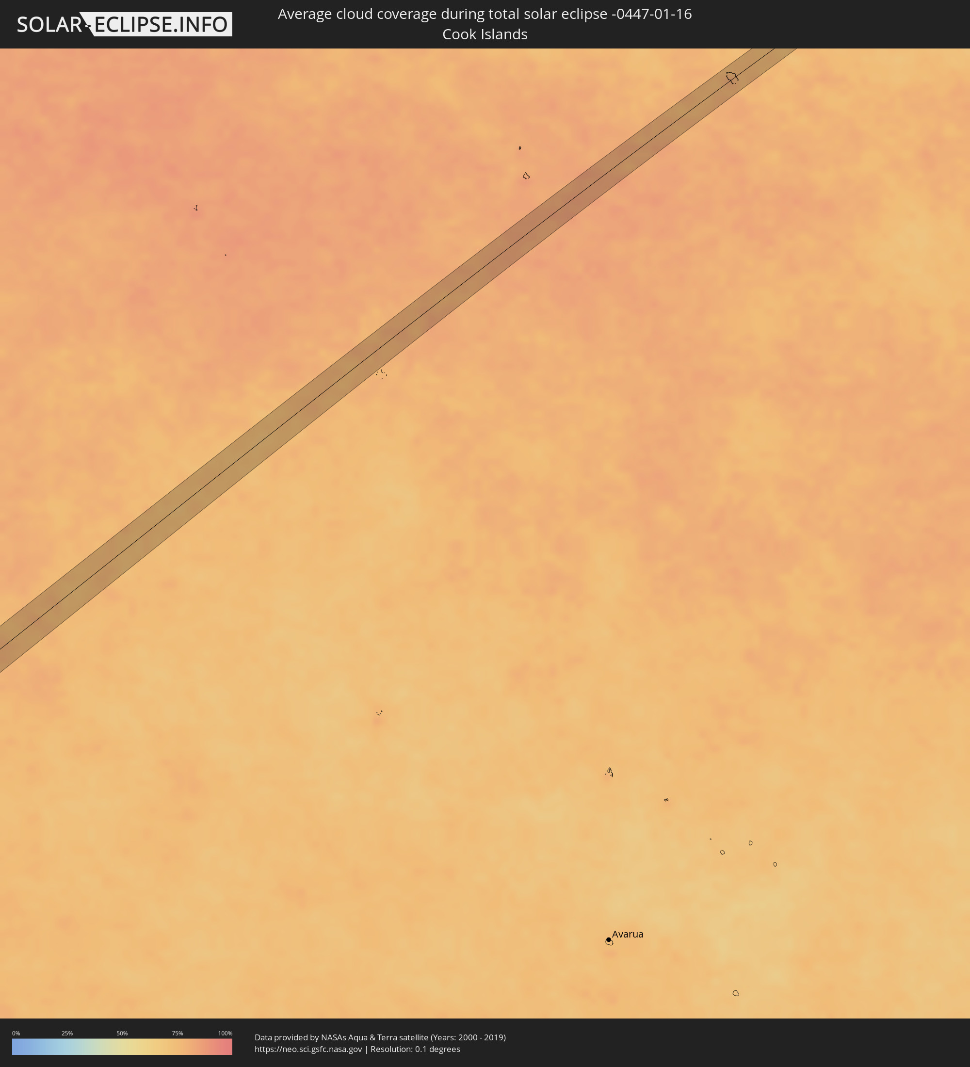 Cookinseln
 Australien
Orte im Finsternispfad
Die nachfolgene Tabelle zeigt Städte und Orte mit mehr als 5.000 Einwohnern, die sich im Finsternispfad befinden. Städte mit mehr als 100.000 Einwohnern sind dick gekennzeichnet. Mit einem Klick auf den Ort öffnet sich eine Detailkarte die die Lage des jeweiligen Ortes zusammen mit dem Verlauf der zentralen Finsternis präsentiert.
| Ort | Typ | Dauer der Verfinsterung | Ortszeit bei maximaler Verfinsterung | Entfernung zur Zentrallinie | Ø Bewölkung |
|
Cowra, New South Wales
|
total | - | 09:56:07 UTC+10:00 | 28 km | 37% |
|
Bathurst, New South Wales
|
total | - | 09:57:46 UTC+10:00 | 19 km | 41% |
|
Kelso, New South Wales
|
total | - | 09:57:48 UTC+10:00 | 19 km | 41% |
|
Lithgow, New South Wales
|
total | - | 09:58:53 UTC+10:00 | 11 km | 44% |
|
Katoomba, New South Wales
|
total | - | 09:59:15 UTC+10:00 | 16 km | 50% |
|
Blaxland, New South Wales
|
total | - | 09:59:50 UTC+10:00 | 20 km | 52% |
|
Glenbrook, New South Wales
|
total | - | 09:59:53 UTC+10:00 | 22 km | 52% |
|
Glenmore Park, New South Wales
|
total | - | 09:59:59 UTC+10:00 | 25 km | 53% |
|
Penrith, New South Wales
|
total | - | 10:00:02 UTC+10:00 | 20 km | 53% |
|
Kingswood Park, New South Wales
|
total | - | 10:00:04 UTC+10:00 | 22 km | 53% |
|
Cambridge Park, New South Wales
|
total | - | 10:00:05 UTC+10:00 | 20 km | 52% |
|
Richmond, New South Wales
|
total | - | 10:00:08 UTC+10:00 | 4 km | 51% |
|
South Windsor, New South Wales
|
total | - | 10:00:14 UTC+10:00 | 6 km | 51% |
|
Mount Druitt, New South Wales
|
total | - | 10:00:17 UTC+10:00 | 22 km | 54% |
|
Glendenning, New South Wales
|
total | - | 10:00:21 UTC+10:00 | 20 km | 54% |
|
Doonside, New South Wales
|
total | - | 10:00:23 UTC+10:00 | 22 km | 55% |
|
Riverstone, New South Wales
|
total | - | 10:00:22 UTC+10:00 | 13 km | 54% |
|
Quakers Hill, New South Wales
|
total | - | 10:00:25 UTC+10:00 | 19 km | 54% |
|
Rouse Hill, New South Wales
|
total | - | 10:00:28 UTC+10:00 | 13 km | 54% |
|
Blacktown, New South Wales
|
total | - | 10:00:29 UTC+10:00 | 23 km | 55% |
|
Stanhope Gardens, New South Wales
|
total | - | 10:00:30 UTC+10:00 | 18 km | 54% |
|
Beaumont Hills, New South Wales
|
total | - | 10:00:31 UTC+10:00 | 15 km | 54% |
|
Northmead, New South Wales
|
total | - | 10:00:37 UTC+10:00 | 25 km | 54% |
|
Baulkham Hills, New South Wales
|
total | - | 10:00:38 UTC+10:00 | 22 km | 54% |
|
City of Parramatta, New South Wales
|
total | - | 10:00:39 UTC+10:00 | 28 km | 54% |
|
Glenhaven, New South Wales
|
total | - | 10:00:38 UTC+10:00 | 15 km | 53% |
|
Castle Hill, New South Wales
|
total | - | 10:00:39 UTC+10:00 | 19 km | 53% |
|
Paramatta, New South Wales
|
total | - | 10:00:40 UTC+10:00 | 28 km | 54% |
|
Kenthurst, New South Wales
|
total | - | 10:00:39 UTC+10:00 | 10 km | 53% |
|
Harris Park, New South Wales
|
total | - | 10:00:40 UTC+10:00 | 29 km | 54% |
|
Telopea, New South Wales
|
total | - | 10:00:44 UTC+10:00 | 26 km | 54% |
|
West Pennant, New South Wales
|
total | - | 10:00:44 UTC+10:00 | 21 km | 53% |
|
Carlingford, New South Wales
|
total | - | 10:00:45 UTC+10:00 | 25 km | 54% |
|
Ermington, New South Wales
|
total | - | 10:00:46 UTC+10:00 | 28 km | 52% |
|
Beecroft, New South Wales
|
total | - | 10:00:47 UTC+10:00 | 21 km | 52% |
|
Pennant Hills, New South Wales
|
total | - | 10:00:47 UTC+10:00 | 20 km | 52% |
|
West Ryde, New South Wales
|
total | - | 10:00:48 UTC+10:00 | 27 km | 52% |
|
Epping, New South Wales
|
total | - | 10:00:49 UTC+10:00 | 24 km | 52% |
|
Hornsby Heights, New South Wales
|
total | - | 10:00:50 UTC+10:00 | 12 km | 52% |
|
Hornsby, New South Wales
|
total | - | 10:00:51 UTC+10:00 | 16 km | 52% |
|
Marsfield, New South Wales
|
total | - | 10:00:52 UTC+10:00 | 24 km | 52% |
|
Macquarie Park, New South Wales
|
total | - | 10:00:52 UTC+10:00 | 24 km | 52% |
|
Mount Colah, New South Wales
|
total | - | 10:00:53 UTC+10:00 | 14 km | 52% |
|
North Ryde, New South Wales
|
total | - | 10:00:54 UTC+10:00 | 27 km | 52% |
|
Berowra Heights, New South Wales
|
total | - | 10:00:55 UTC+10:00 | 6 km | 52% |
|
Pymble, New South Wales
|
total | - | 10:00:56 UTC+10:00 | 21 km | 52% |
|
Killara, New South Wales
|
total | - | 10:00:58 UTC+10:00 | 23 km | 51% |
|
Lane Cove North, New South Wales
|
total | - | 10:00:59 UTC+10:00 | 28 km | 51% |
|
Lindfield, New South Wales
|
total | - | 10:00:59 UTC+10:00 | 25 km | 51% |
|
Artarmon, New South Wales
|
total | - | 10:01:01 UTC+10:00 | 29 km | 51% |
|
Chatswood, New South Wales
|
total | - | 10:01:01 UTC+10:00 | 27 km | 51% |
|
Forestville, New South Wales
|
total | - | 10:01:04 UTC+10:00 | 24 km | 51% |
|
Cammeray, New South Wales
|
total | - | 10:01:05 UTC+10:00 | 30 km | 51% |
|
Allambie Heights, New South Wales
|
total | - | 10:01:09 UTC+10:00 | 24 km | 51% |
|
Balgowlah, New South Wales
|
total | - | 10:01:10 UTC+10:00 | 27 km | 51% |
|
Fairlight, New South Wales
|
total | - | 10:01:12 UTC+10:00 | 27 km | 51% |
|
Narraweena, New South Wales
|
total | - | 10:01:12 UTC+10:00 | 22 km | 51% |
|
Freshwater, New South Wales
|
total | - | 10:01:14 UTC+10:00 | 25 km | 51% |
|
Manly, New South Wales
|
total | - | 10:01:14 UTC+10:00 | 27 km | 51% |
|
North Narrabeen, New South Wales
|
total | - | 10:01:14 UTC+10:00 | 17 km | 50% |
|
Narrabeen, New South Wales
|
total | - | 10:01:15 UTC+10:00 | 18 km | 50% |
|
Dee Why, New South Wales
|
total | - | 10:01:15 UTC+10:00 | 22 km | 51% |
|
Umina, New South Wales
|
total | - | 10:01:16 UTC+10:00 | 3 km | 53% |
|
Newport, New South Wales
|
total | - | 10:01:17 UTC+10:00 | 12 km | 50% |
|
Narara, New South Wales
|
total | - | 10:01:20 UTC+10:00 | 17 km | 51% |
|
Lisarow, New South Wales
|
total | - | 10:01:22 UTC+10:00 | 19 km | 51% |
|
Berkeley Vale, New South Wales
|
total | - | 10:01:30 UTC+10:00 | 22 km | 51% |
|
Bateau Bay, New South Wales
|
total | - | 10:01:34 UTC+10:00 | 18 km | 48% |
|
Long Jetty, New South Wales
|
total | - | 10:01:36 UTC+10:00 | 21 km | 48% |