Totale Sonnenfinsternis vom 09.03.-0506
| Wochentag: | Mittwoch |
| Maximale Dauer der Verfinsterung: | 03m59s |
| Maximale Breite des Finsternispfades: | 288 km |
| Saroszyklus: | 41 |
| Bedeckungsgrad: | 100% |
| Magnitude: | 1.0594 |
| Gamma: | -0.7454 |
Wo kann man die Sonnenfinsternis vom 09.03.-0506 sehen?
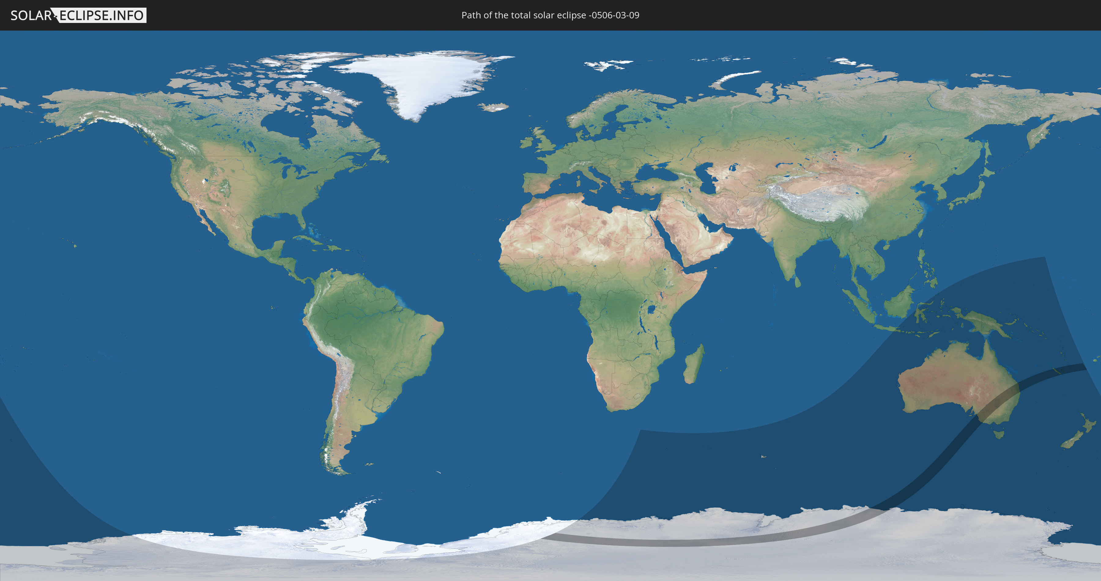
Die Sonnenfinsternis am 09.03.-0506 kann man in 15 Ländern als partielle Sonnenfinsternis beobachten.
Der Finsternispfad verläuft durch 4 Länder. Nur in diesen Ländern ist sie als totale Sonnenfinsternis zu sehen.
In den folgenden Ländern ist die Sonnenfinsternis total zu sehen
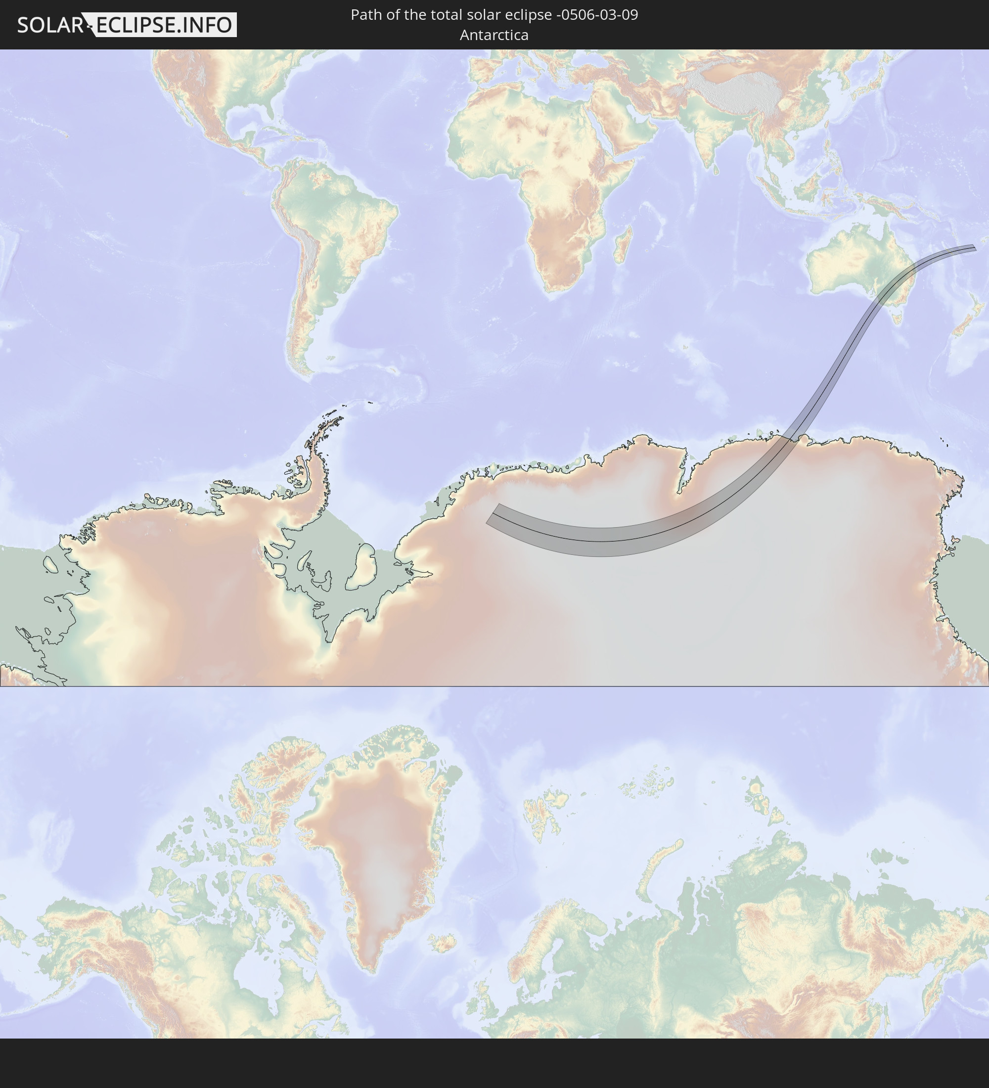 Antarktika
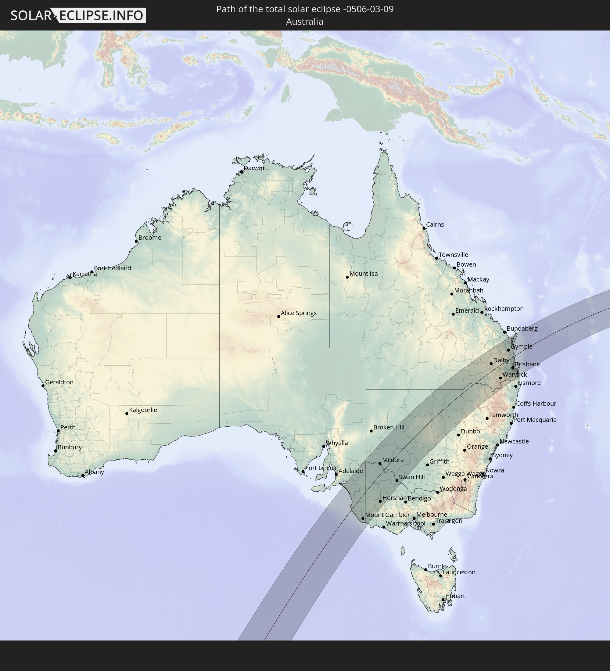 Australien
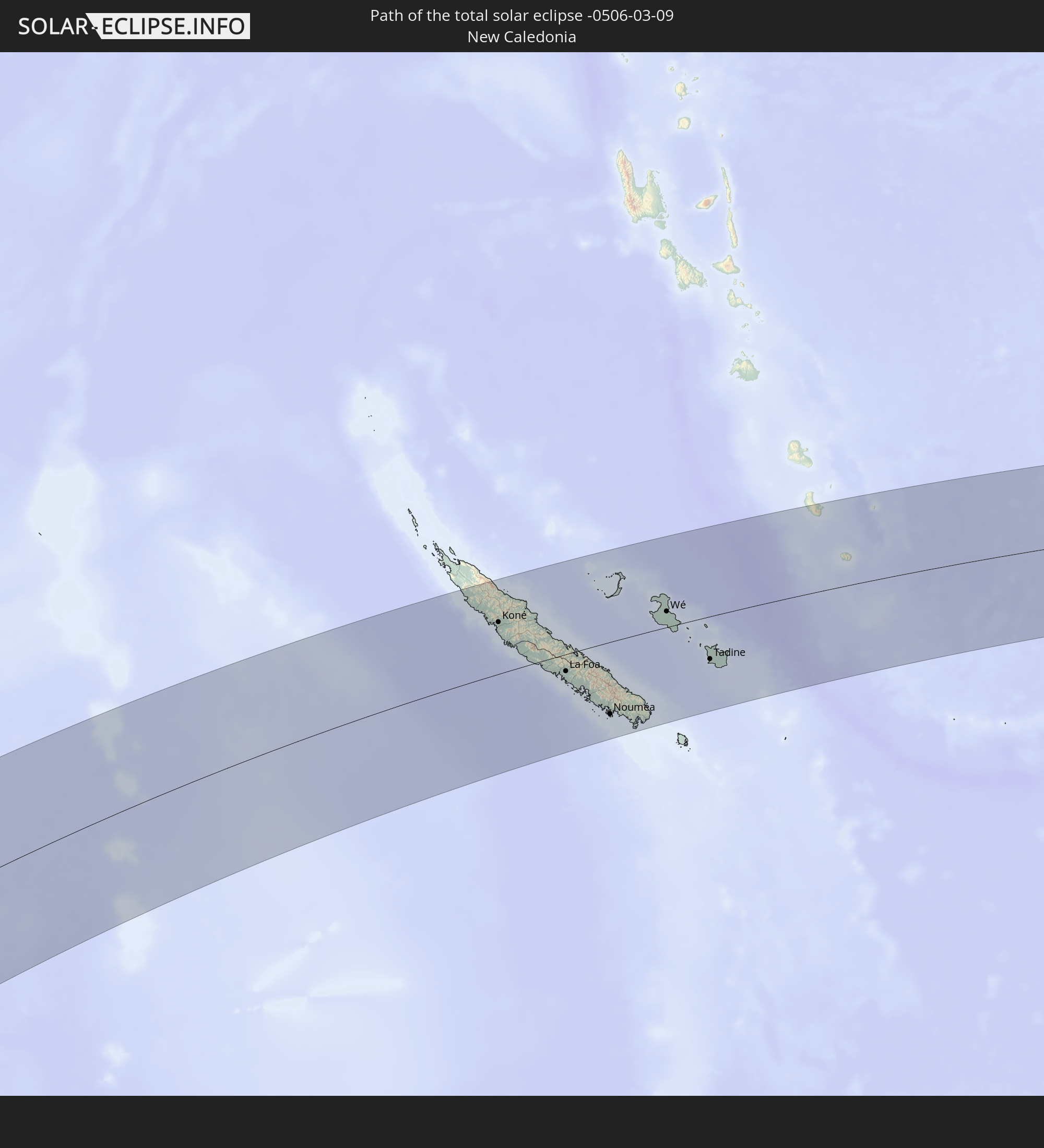 Neukaledonien
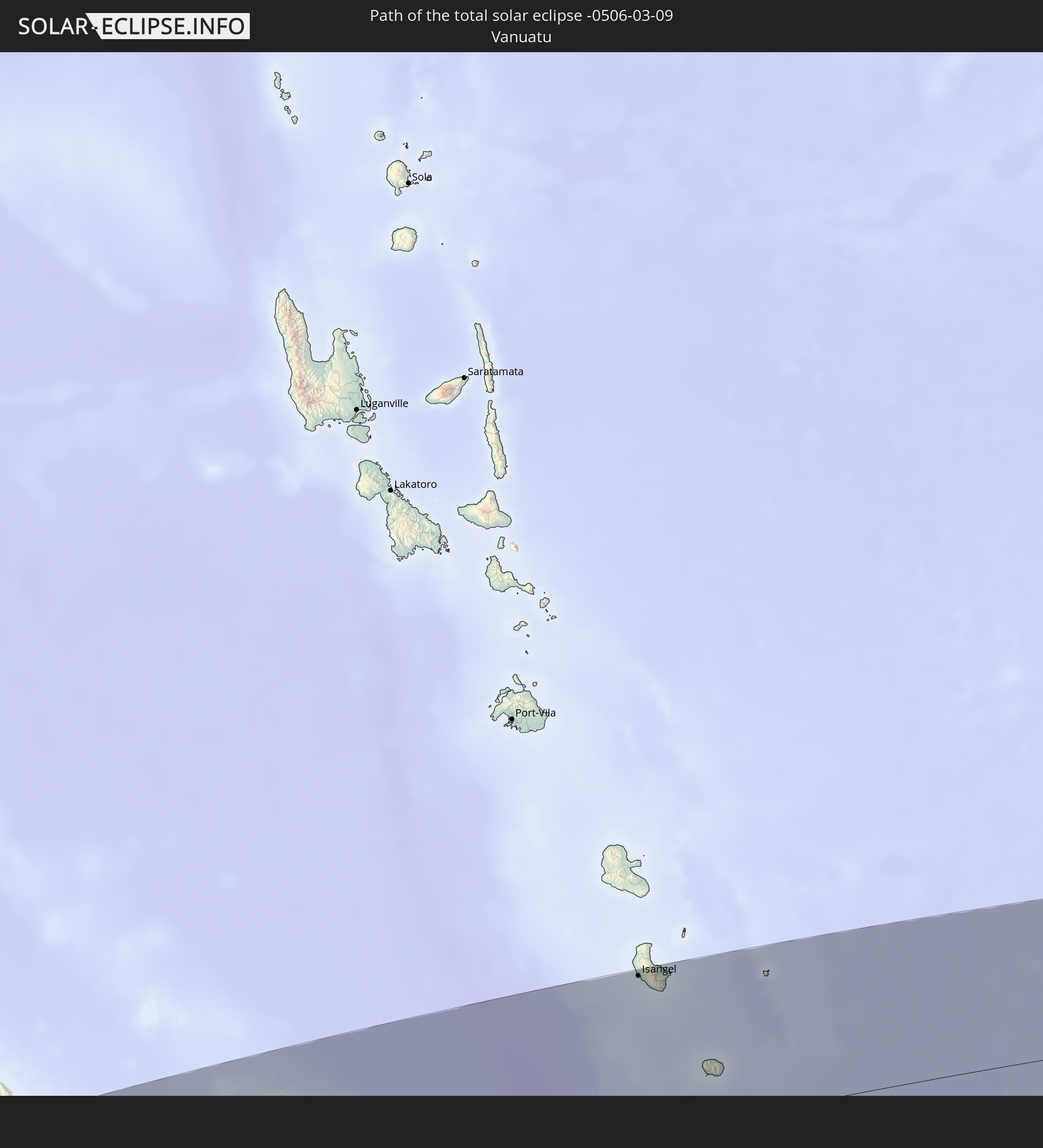 Vanuatu
In den folgenden Ländern ist die Sonnenfinsternis partiell zu sehen


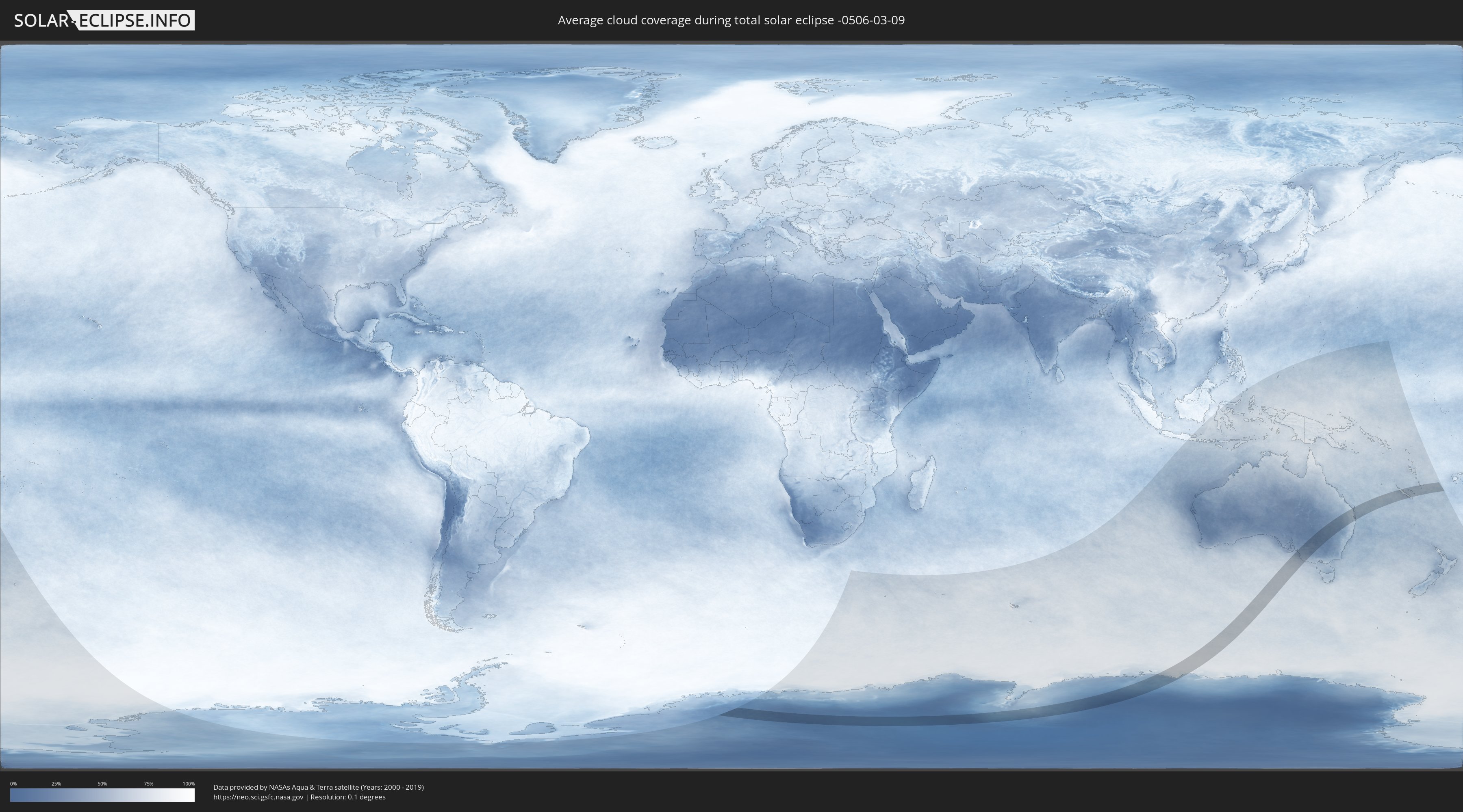
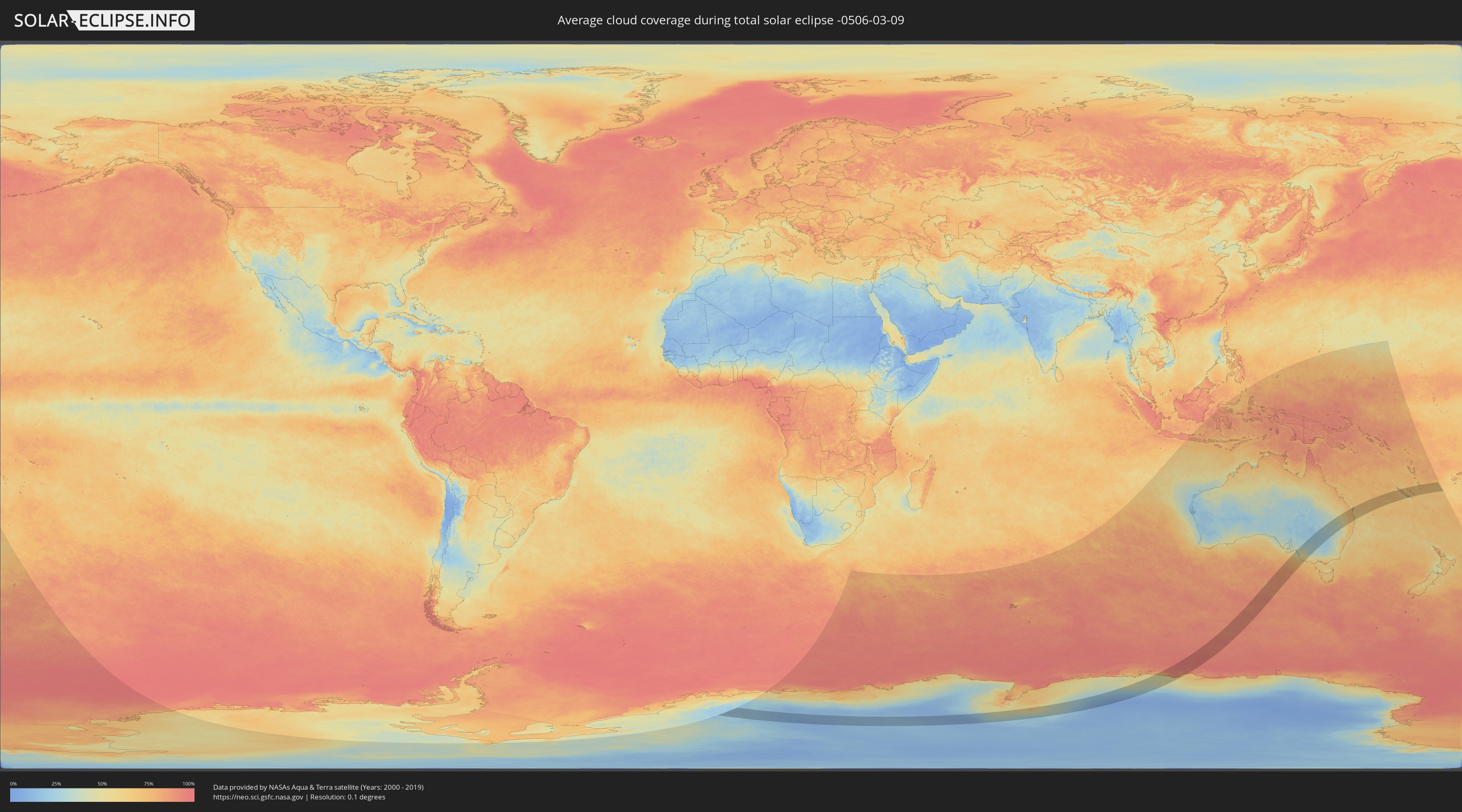
Wie wird das Wetter während der totalen Sonnenfinsternis am 09.03.-0506?
Wo ist der beste Ort, um die totale Sonnenfinsternis vom 09.03.-0506 zu beobachten?
Die folgenden Karten zeigen die durchschnittliche Bewölkung für den Tag, an dem die totale Sonnenfinsternis
stattfindet. Mit Hilfe der Karten lässt sich der Ort entlang des Finsternispfades eingrenzen,
der die besten Aussichen auf einen klaren wolkenfreien Himmel bietet.
Trotzdem muss man immer lokale Gegenenheiten beachten und sollte sich genau über das Wetter an seinem
gewählten Beobachtungsort informieren.
Die Daten stammen von den beiden NASA-Satelliten
AQUA und TERRA
und wurden über einen Zeitraum von 19 Jahren (2000 - 2019) gemittelt.
Detaillierte Länderkarten
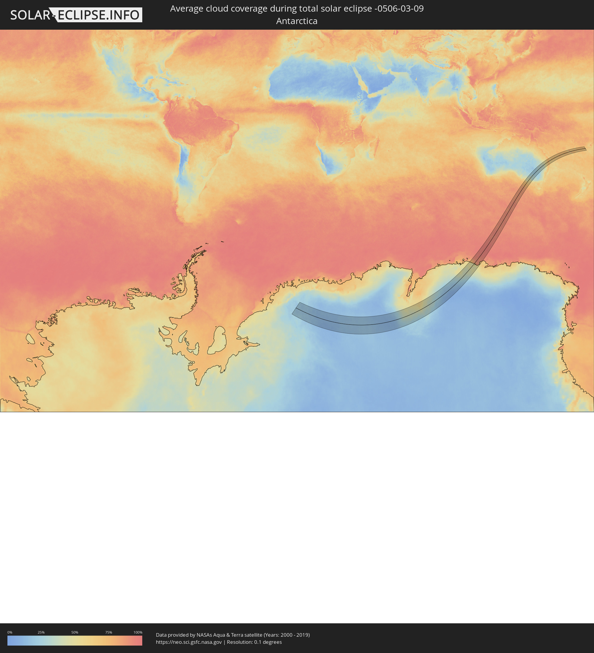 Antarktika
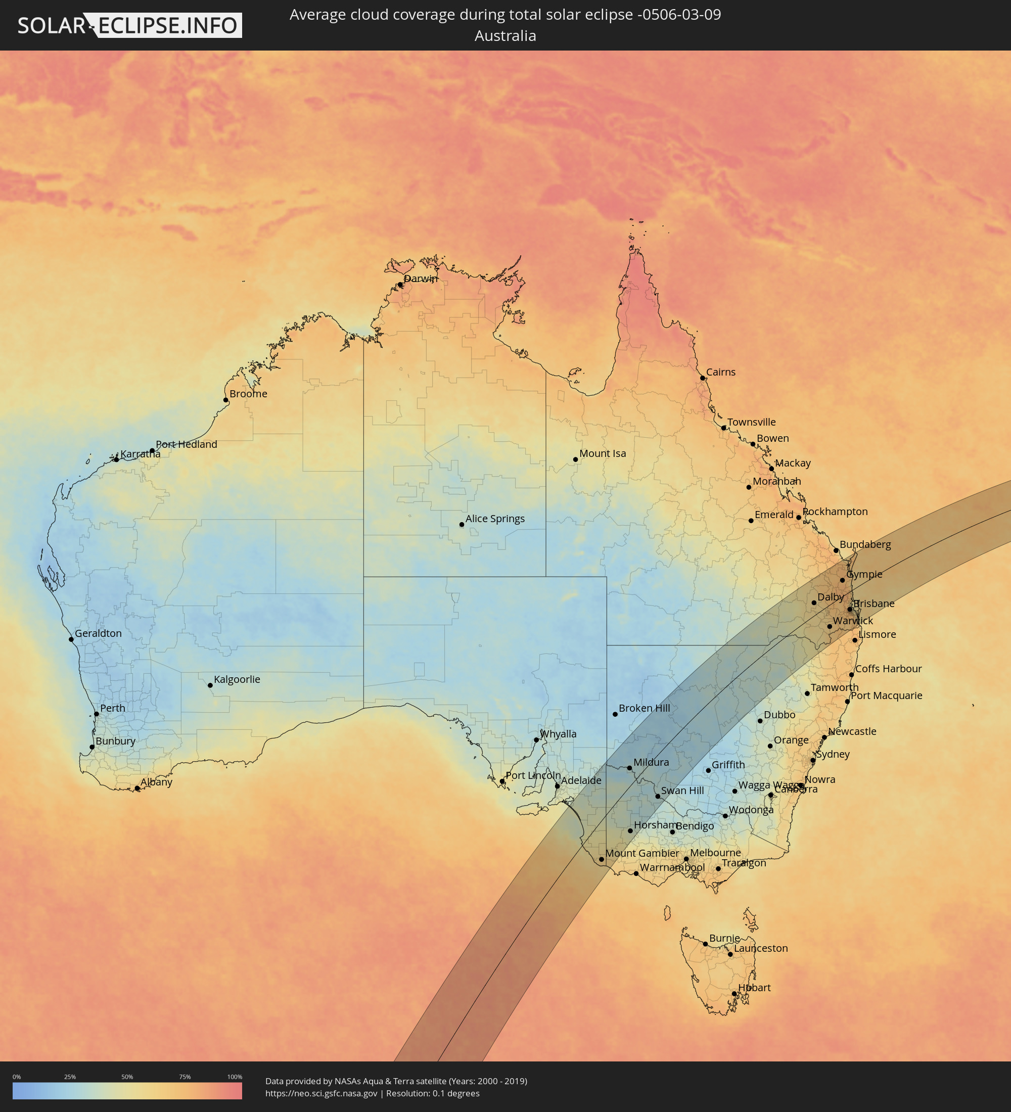 Australien
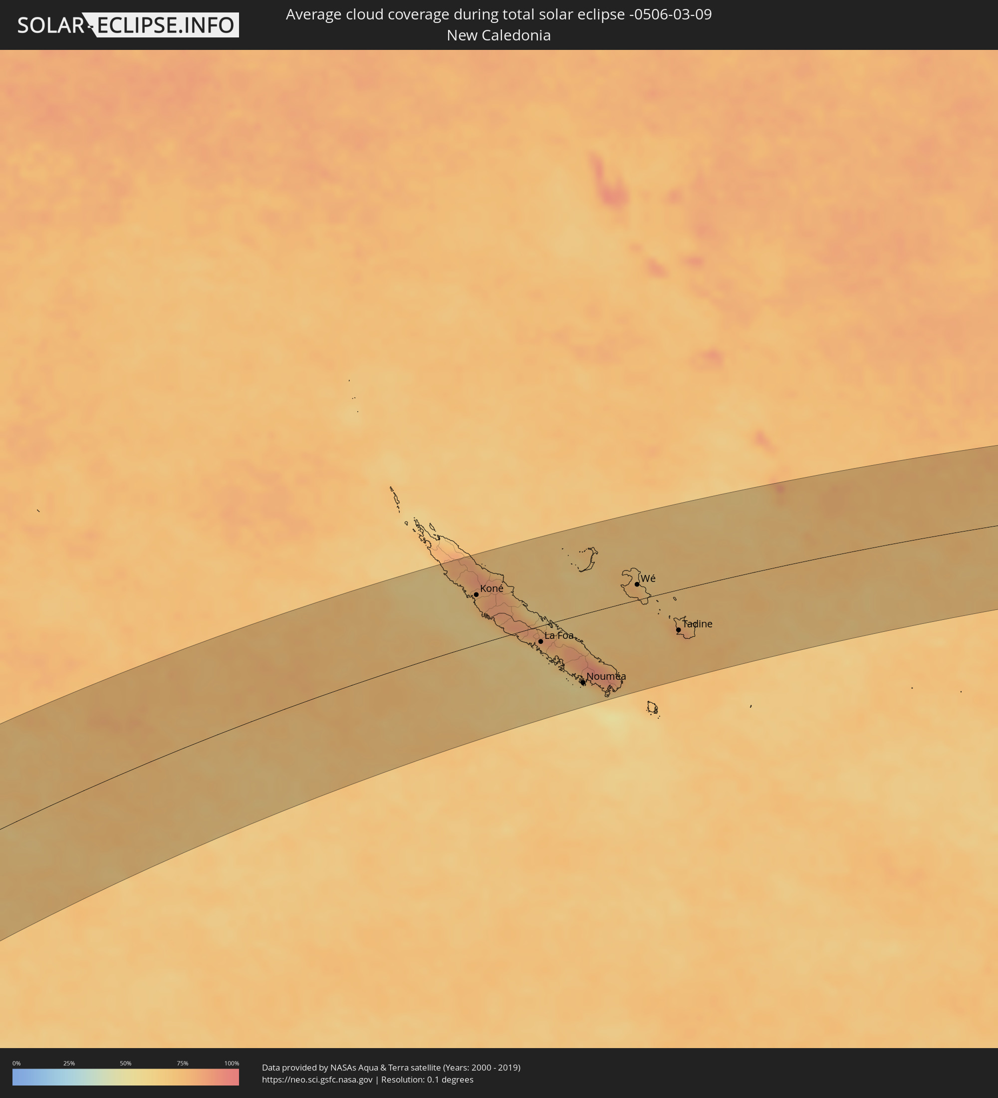 Neukaledonien
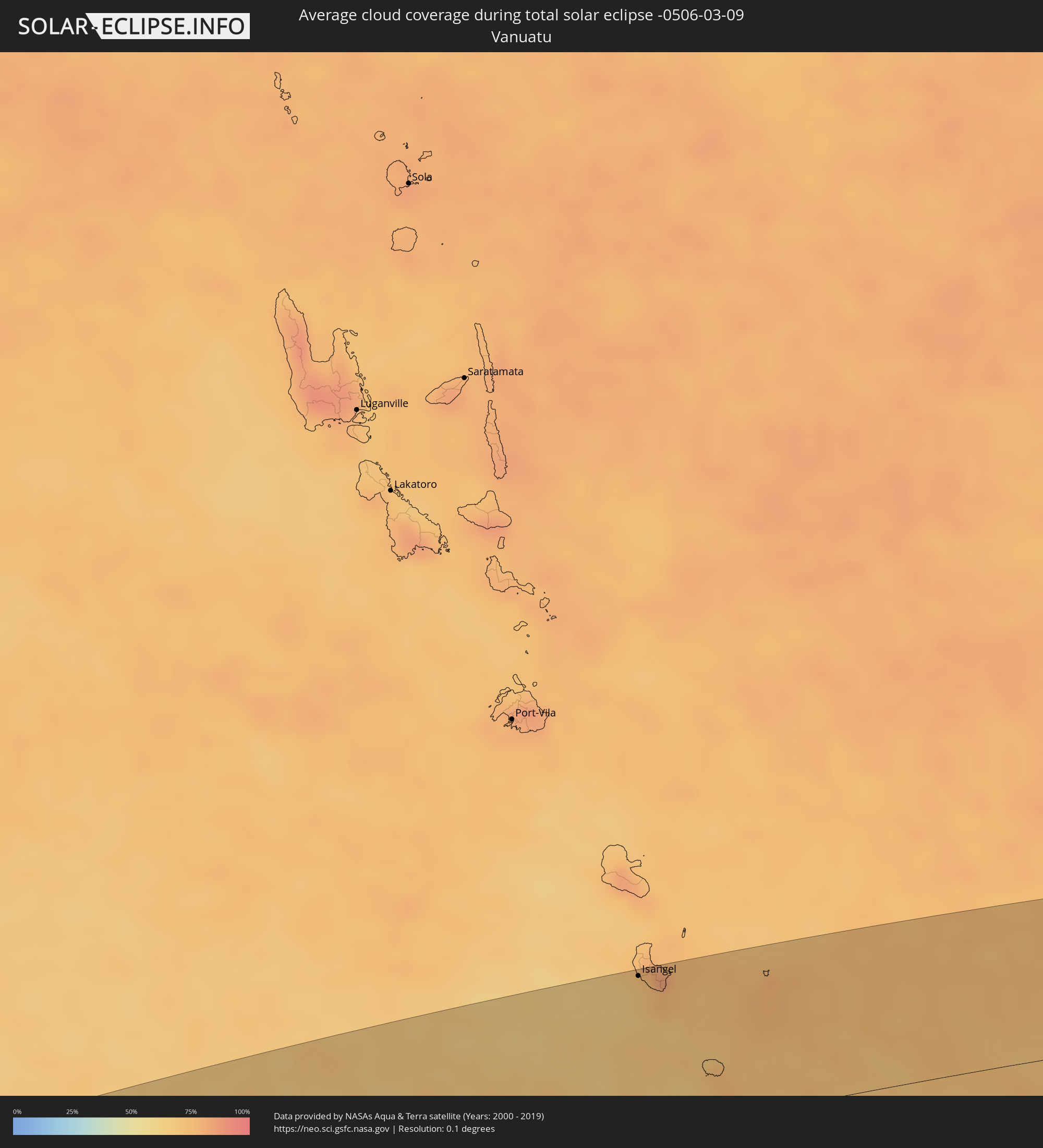 Vanuatu
Orte im Finsternispfad
Die nachfolgene Tabelle zeigt Städte und Orte mit mehr als 5.000 Einwohnern, die sich im Finsternispfad befinden. Städte mit mehr als 100.000 Einwohnern sind dick gekennzeichnet. Mit einem Klick auf den Ort öffnet sich eine Detailkarte die die Lage des jeweiligen Ortes zusammen mit dem Verlauf der zentralen Finsternis präsentiert.
| Ort | Typ | Dauer der Verfinsterung | Ortszeit bei maximaler Verfinsterung | Entfernung zur Zentrallinie | Ø Bewölkung |
 Mount Gambier, South Australia
|
total | - | 15:32:31 UTC+09:30 | 108 km | 63% |
|
Mildura, Victoria
|
total | - | 16:10:36 UTC+10:00 | 52 km | 32% |
|
Horsham, Victoria
|
total | - | 16:05:48 UTC+10:00 | 131 km | 43% |
|
Swan Hill, Victoria
|
total | - | 16:09:28 UTC+10:00 | 129 km | 33% |
|
Narrabri, New South Wales
|
total | - | 16:22:59 UTC+10:00 | 144 km | 35% |
|
Moree, New South Wales
|
total | - | 16:24:36 UTC+10:00 | 73 km | 37% |
|
Dalby, Queensland
|
total | - | 16:29:26 UTC+10:00 | 48 km | 59% |
|
Kingaroy, Queensland
|
total | - | 16:30:50 UTC+10:00 | 75 km | 70% |
|
Toowoomba, Queensland
|
total | - | 16:29:06 UTC+10:00 | 25 km | 67% |
|
Rangeville, Queensland
|
total | - | 16:29:04 UTC+10:00 | 29 km | 67% |
|
Warwick, Queensland
|
total | - | 16:27:59 UTC+10:00 | 90 km | 62% |
|
Gatton, Queensland
|
total | - | 16:29:16 UTC+10:00 | 43 km | 69% |
|
Gympie, Queensland
|
total | - | 16:31:50 UTC+10:00 | 63 km | 75% |
|
Maryborough, Queensland
|
total | - | 16:32:58 UTC+10:00 | 122 km | 74% |
|
Brassall, Queensland
|
total | - | 16:29:25 UTC+10:00 | 73 km | 71% |
|
Raceview, Queensland
|
total | - | 16:29:22 UTC+10:00 | 78 km | 73% |
|
Booval, Queensland
|
total | - | 16:29:24 UTC+10:00 | 76 km | 73% |
|
Redbank Plains, Queensland
|
total | - | 16:29:23 UTC+10:00 | 83 km | 74% |
|
Samford Valley, Queensland
|
total | - | 16:29:52 UTC+10:00 | 58 km | 73% |
|
Goodna, Queensland
|
total | - | 16:29:28 UTC+10:00 | 82 km | 74% |
|
Urangan, Queensland
|
total | - | 16:33:29 UTC+10:00 | 135 km | 67% |
|
Springfield, Queensland
|
total | - | 16:29:24 UTC+10:00 | 87 km | 73% |
|
Ferny Hills, Queensland
|
total | - | 16:29:51 UTC+10:00 | 64 km | 73% |
|
Caboolture, Queensland
|
total | - | 16:30:24 UTC+10:00 | 36 km | 59% |
|
Burpengary, Queensland
|
total | - | 16:30:17 UTC+10:00 | 43 km | 63% |
|
Nambour, Queensland
|
total | - | 16:31:12 UTC+10:00 | 6 km | 74% |
|
Taringa, Queensland
|
total | - | 16:29:43 UTC+10:00 | 75 km | 73% |
|
Everton Park, Queensland
|
total | - | 16:29:52 UTC+10:00 | 68 km | 72% |
|
Strathpine, Queensland
|
total | - | 16:30:02 UTC+10:00 | 59 km | 68% |
|
Bridegman Downs, Queensland
|
total | - | 16:29:57 UTC+10:00 | 64 km | 72% |
|
Stafford Heights, Queensland
|
total | - | 16:29:54 UTC+10:00 | 68 km | 72% |
|
Murrumba Downs, Queensland
|
total | - | 16:30:07 UTC+10:00 | 56 km | 68% |
|
Stafford, Queensland
|
total | - | 16:29:52 UTC+10:00 | 70 km | 72% |
|
Chermside West, Queensland
|
total | - | 16:29:55 UTC+10:00 | 68 km | 72% |
|
Brisbane, Queensland
|
total | - | 16:29:46 UTC+10:00 | 76 km | 73% |
|
Windsor, Queensland
|
total | - | 16:29:50 UTC+10:00 | 73 km | 72% |
|
Bracken Ridge, Queensland
|
total | - | 16:30:02 UTC+10:00 | 62 km | 68% |
|
Annerley, Queensland
|
total | - | 16:29:42 UTC+10:00 | 80 km | 73% |
|
Tarragindi, Queensland
|
total | - | 16:29:40 UTC+10:00 | 82 km | 73% |
|
Tewantin, Queensland
|
total | - | 16:31:39 UTC+10:00 | 24 km | 70% |
|
Zillmere, Queensland
|
total | - | 16:29:58 UTC+10:00 | 67 km | 72% |
|
Wavell Heights, Queensland
|
total | - | 16:29:55 UTC+10:00 | 70 km | 72% |
|
Greenslopes, Queensland
|
total | - | 16:29:43 UTC+10:00 | 81 km | 73% |
|
Brighton, Queensland
|
total | - | 16:30:05 UTC+10:00 | 62 km | 58% |
|
Noosaville, Queensland
|
total | - | 16:31:39 UTC+10:00 | 22 km | 60% |
|
Morningside, Queensland
|
total | - | 16:29:48 UTC+10:00 | 78 km | 70% |
|
Camp Hill, Queensland
|
total | - | 16:29:45 UTC+10:00 | 81 km | 70% |
|
Clontarf, Queensland
|
total | - | 16:30:10 UTC+10:00 | 59 km | 58% |
|
Mount Gravatt East, Queensland
|
total | - | 16:29:40 UTC+10:00 | 86 km | 70% |
|
Upper Mount Gravatt, Queensland
|
total | - | 16:29:38 UTC+10:00 | 88 km | 73% |
|
Coolum Beach, Queensland
|
total | - | 16:31:26 UTC+10:00 | 9 km | 61% |
|
Little Mountain, Queensland
|
total | - | 16:31:00 UTC+10:00 | 16 km | 63% |
|
Margate, Queensland
|
total | - | 16:30:11 UTC+10:00 | 59 km | 52% |
|
Mansfield, Queensland
|
total | - | 16:29:41 UTC+10:00 | 87 km | 70% |
|
Scarborough, Queensland
|
total | - | 16:30:16 UTC+10:00 | 56 km | 52% |
|
Logan City, Queensland
|
total | - | 16:29:30 UTC+10:00 | 96 km | 73% |
|
Mooloolaba, Queensland
|
total | - | 16:31:11 UTC+10:00 | 8 km | 64% |
|
Caloundra, Queensland
|
total | - | 16:30:58 UTC+10:00 | 19 km | 63% |
|
Springwood, Queensland
|
total | - | 16:29:34 UTC+10:00 | 95 km | 73% |
|
Waterford West, Queensland
|
total | - | 16:29:26 UTC+10:00 | 102 km | 70% |
|
Bongaree, Queensland
|
total | - | 16:30:30 UTC+10:00 | 47 km | 53% |
|
Tamborine Mountain, Queensland
|
total | - | 16:28:58 UTC+10:00 | 132 km | 72% |
|
Beenleigh, Queensland
|
total | - | 16:29:25 UTC+10:00 | 108 km | 71% |
|
Wellington Point, Queensland
|
total | - | 16:29:51 UTC+10:00 | 89 km | 57% |
|
Cleveland, Queensland
|
total | - | 16:29:47 UTC+10:00 | 94 km | 57% |
|
Oxenford, Queensland
|
total | - | 16:29:10 UTC+10:00 | 131 km | 69% |
|
Gold Coast, Queensland
|
total | - | 16:29:01 UTC+10:00 | 147 km | 62% |
 Koné, North Province
|
total | - | 17:49:08 UTC+11:05 | 73 km | 75% |
|
La Foa, South Province
|
total | - | 17:48:15 UTC+11:05 | 24 km | 68% |
|
Païta, South Province
|
total | - | 17:47:39 UTC+11:05 | 84 km | 74% |
|
Dumbéa, South Province
|
total | - | 17:47:38 UTC+11:05 | 88 km | 73% |
|
Nouméa, South Province
|
total | - | 17:47:27 UTC+11:05 | 102 km | 59% |
|
Mont-Dore, South Province
|
total | - | 17:47:29 UTC+11:05 | 104 km | 66% |
|
Wé, Loyalty Islands
|
total | - | 17:49:28 UTC+11:05 | 23 km | 70% |
|
Tadine, Loyalty Islands
|
total | - | 17:48:34 UTC+11:05 | 61 km | 73% |
 Isangel, Tafea
|
total | - | 17:58:50 UTC+11:13 | 124 km | 72% |