Totale Sonnenfinsternis vom 06.04.-0628
| Wochentag: | Samstag |
| Maximale Dauer der Verfinsterung: | 03m26s |
| Maximale Breite des Finsternispfades: | 118 km |
| Saroszyklus: | 48 |
| Bedeckungsgrad: | 100% |
| Magnitude: | 1.0349 |
| Gamma: | 0.0221 |
Wo kann man die Sonnenfinsternis vom 06.04.-0628 sehen?
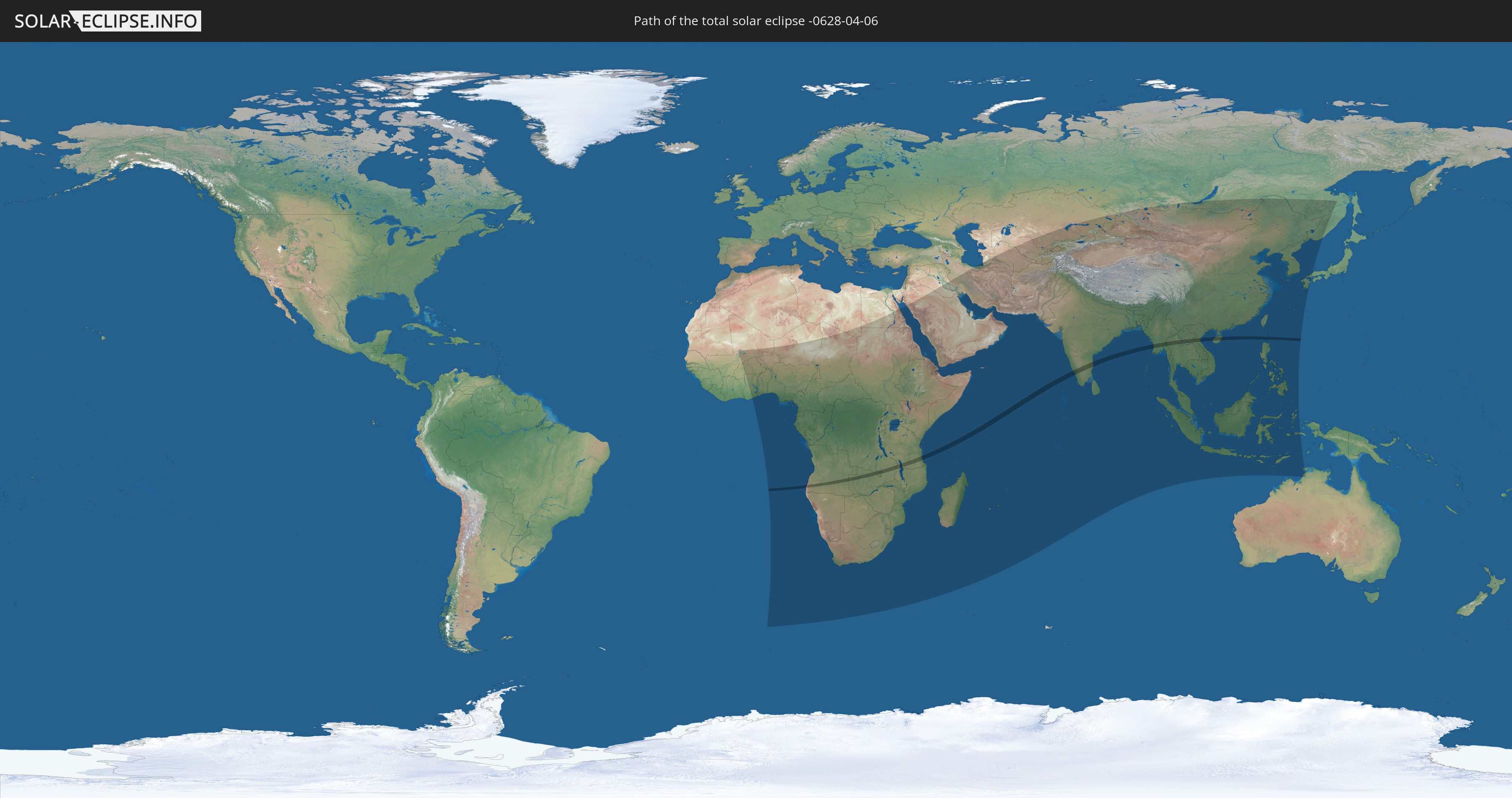
Die Sonnenfinsternis am 06.04.-0628 kann man in 90 Ländern als partielle Sonnenfinsternis beobachten.
Der Finsternispfad verläuft durch 12 Länder. Nur in diesen Ländern ist sie als totale Sonnenfinsternis zu sehen.
In den folgenden Ländern ist die Sonnenfinsternis total zu sehen
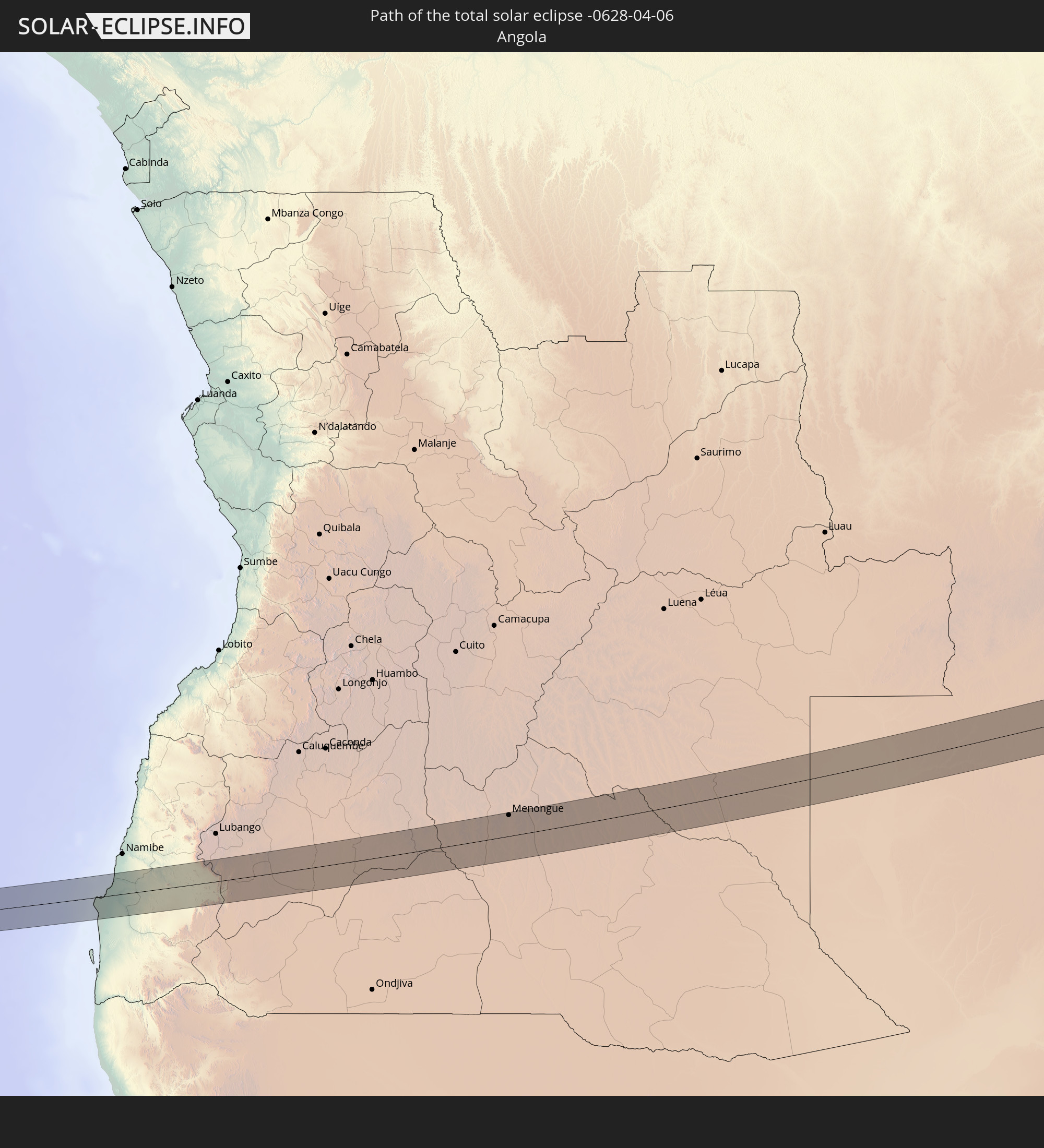 Angola
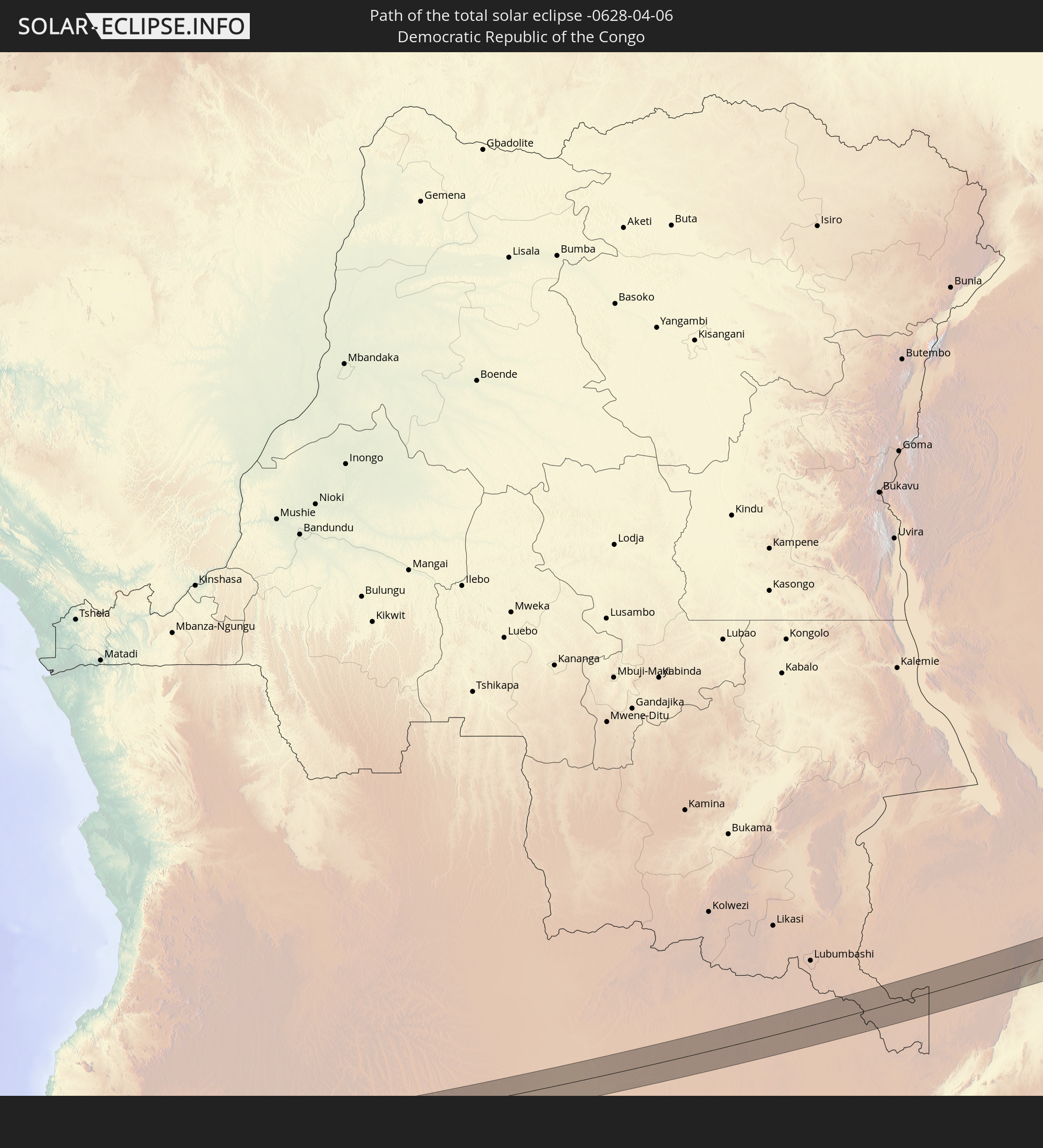 Demokratische Republik Kongo
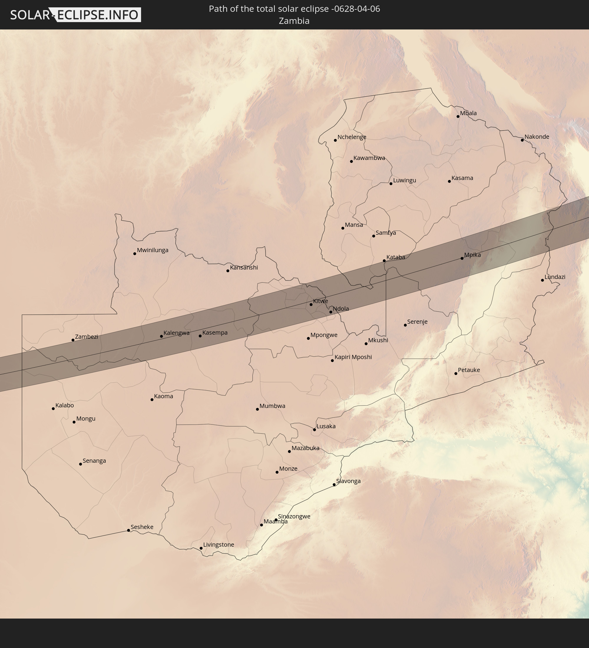 Sambia
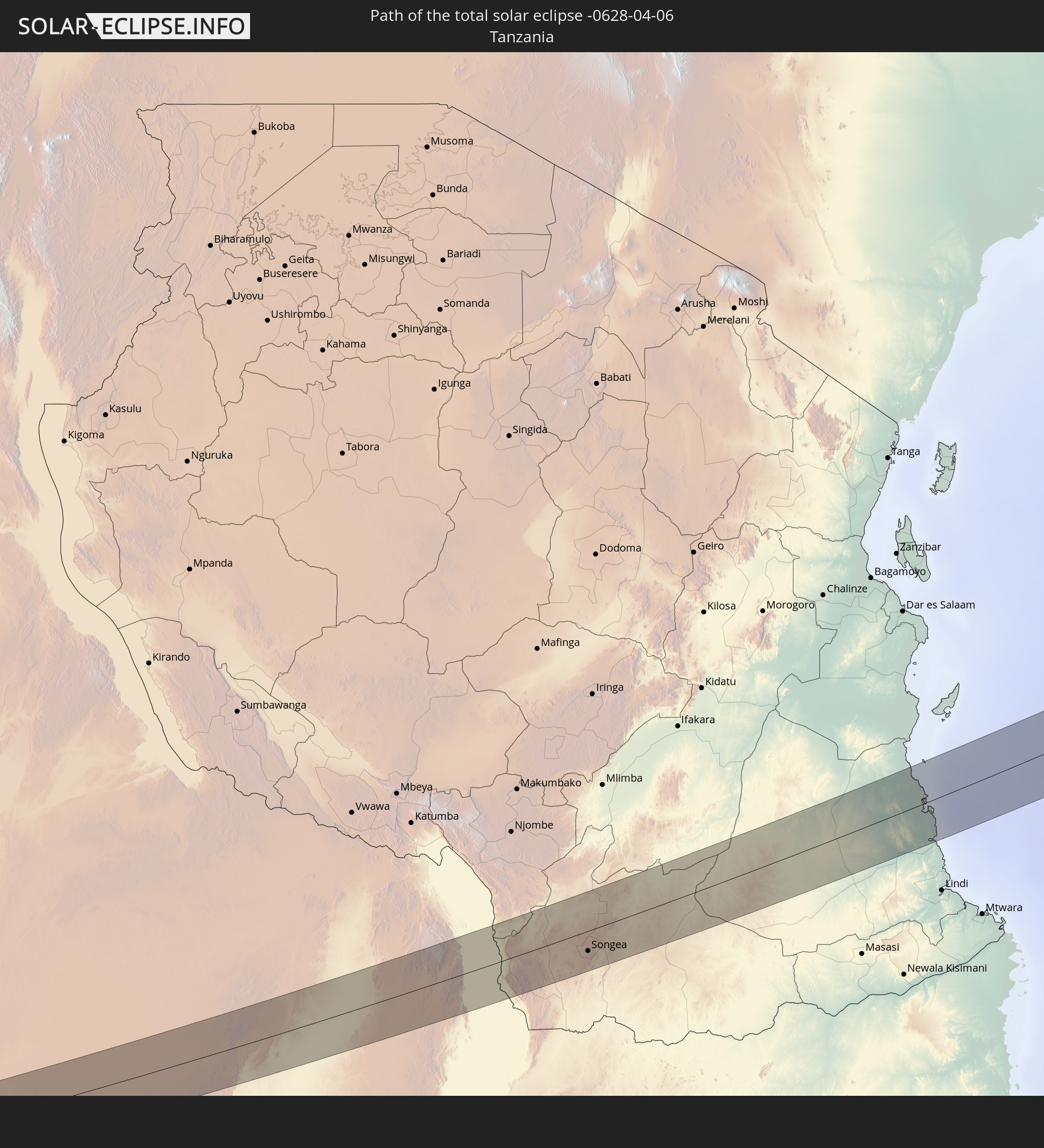 Tansania
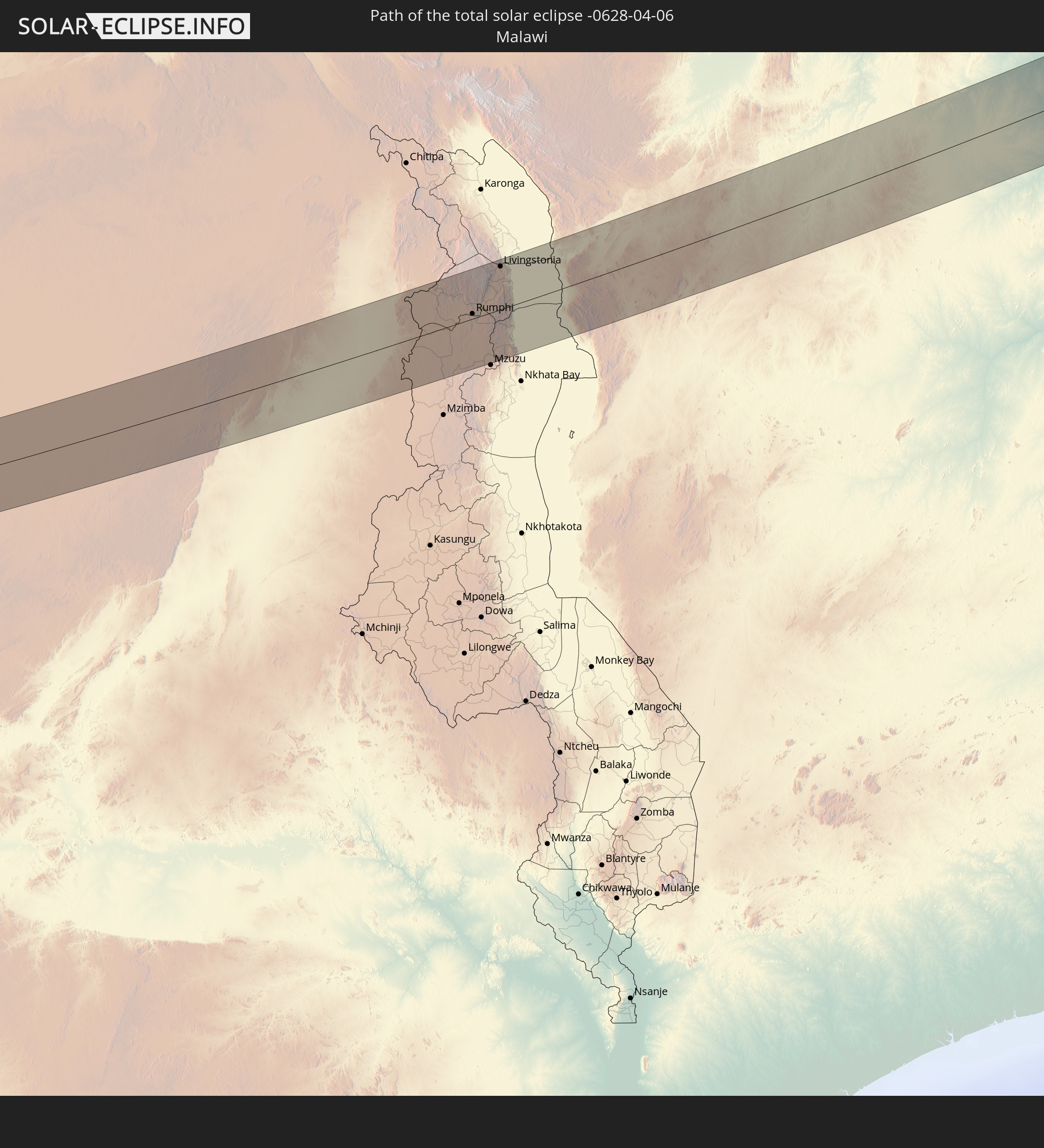 Malawi
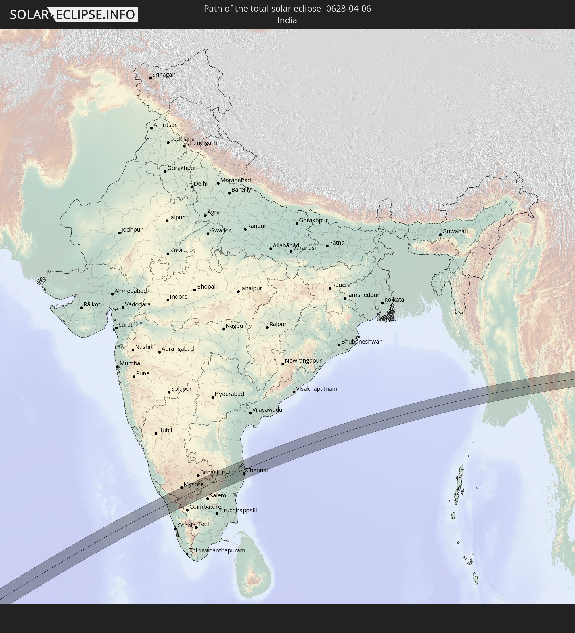 Indien
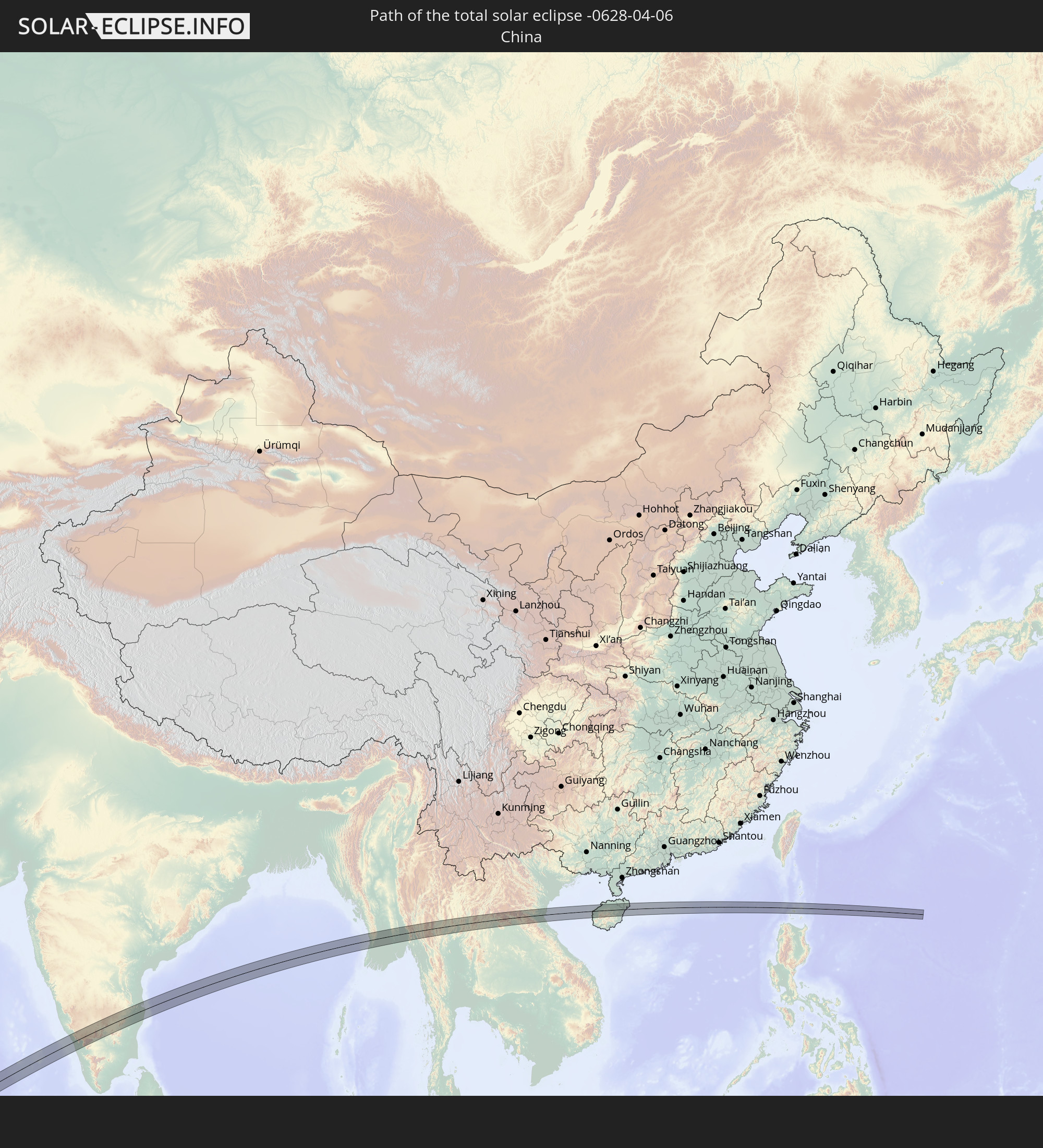 Volksrepublik China
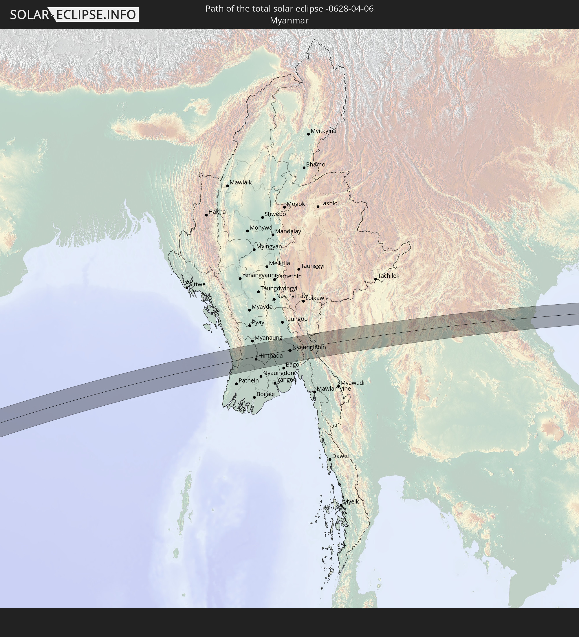 Myanmar
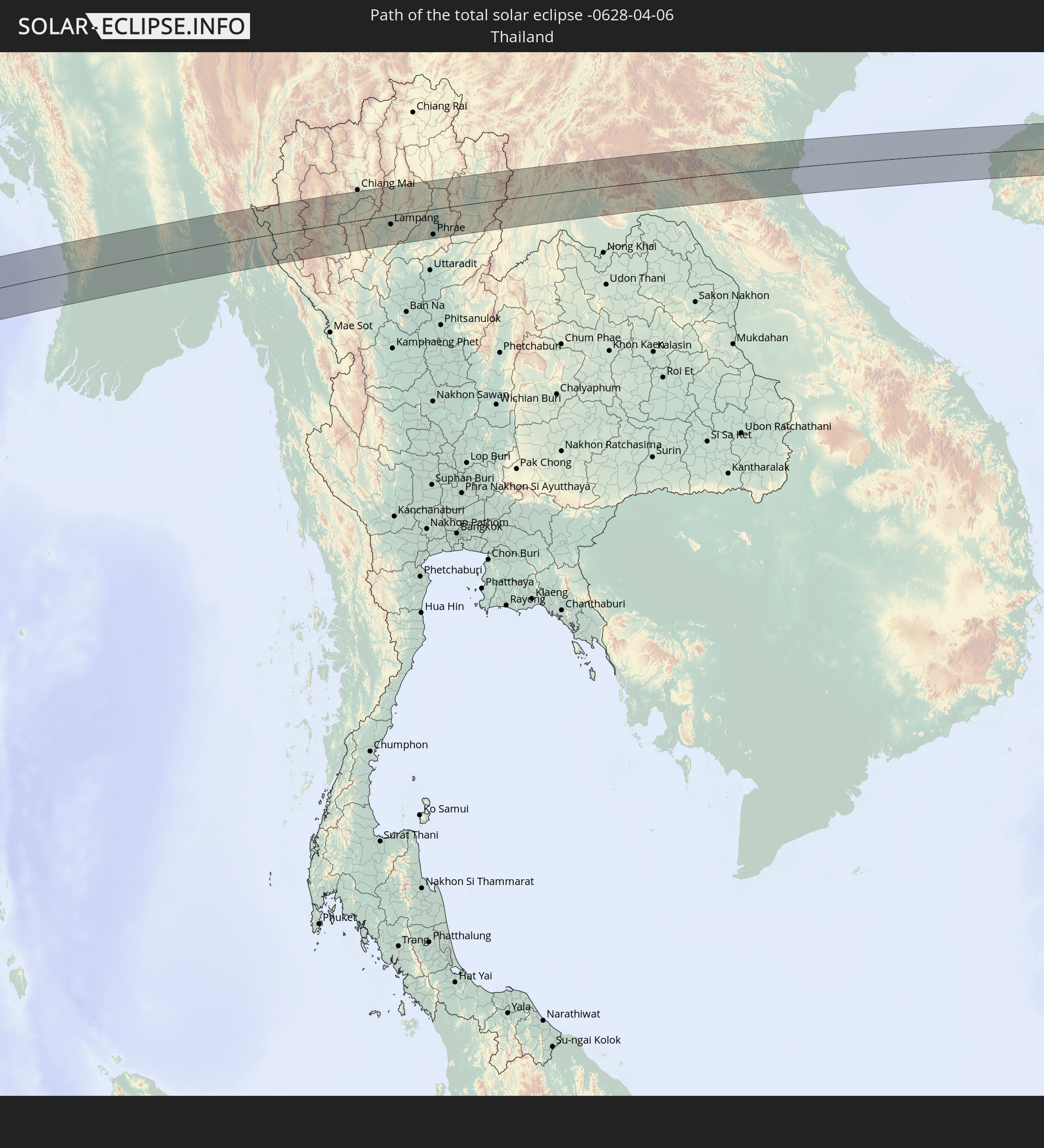 Thailand
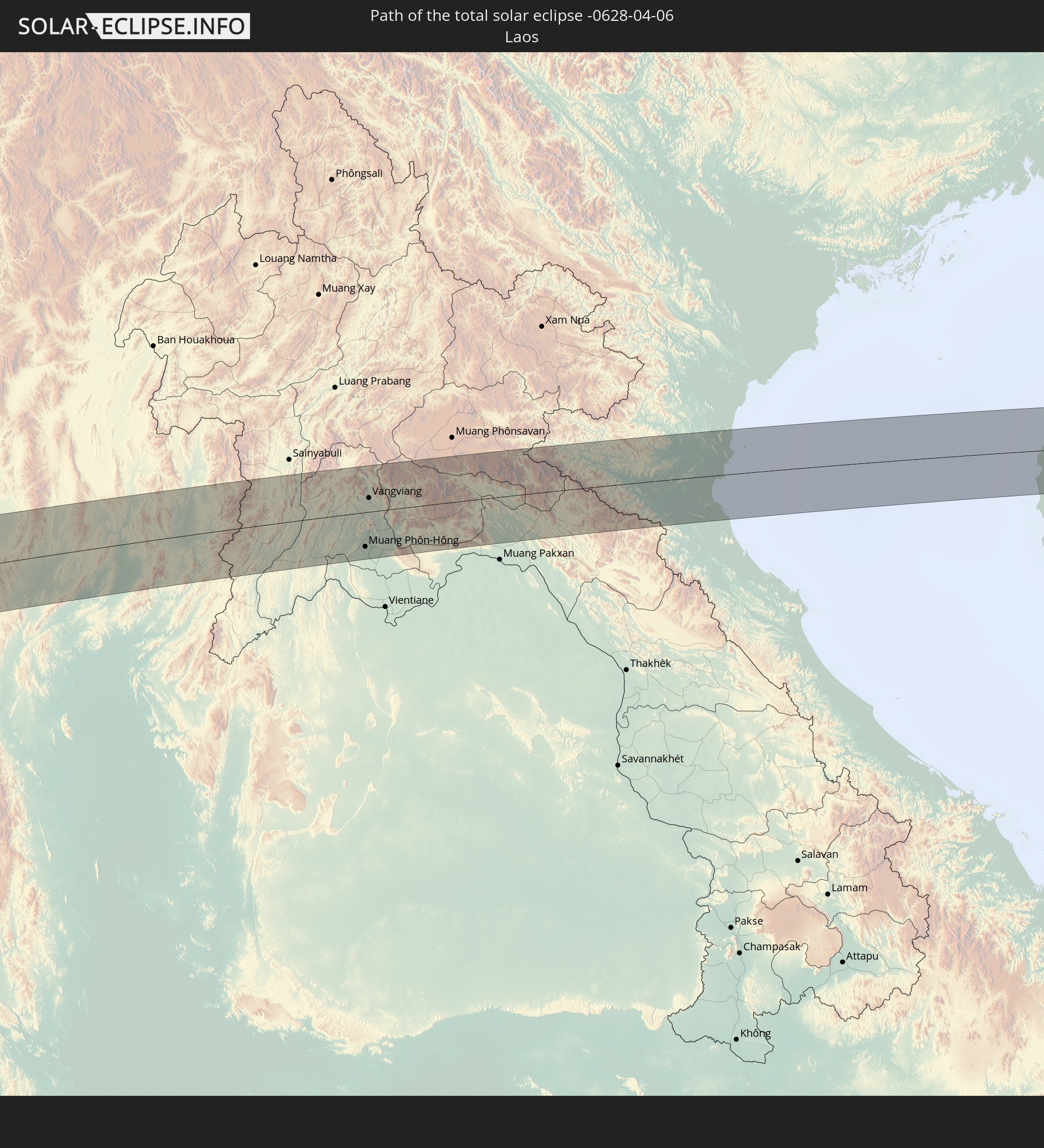 Laos
Laos
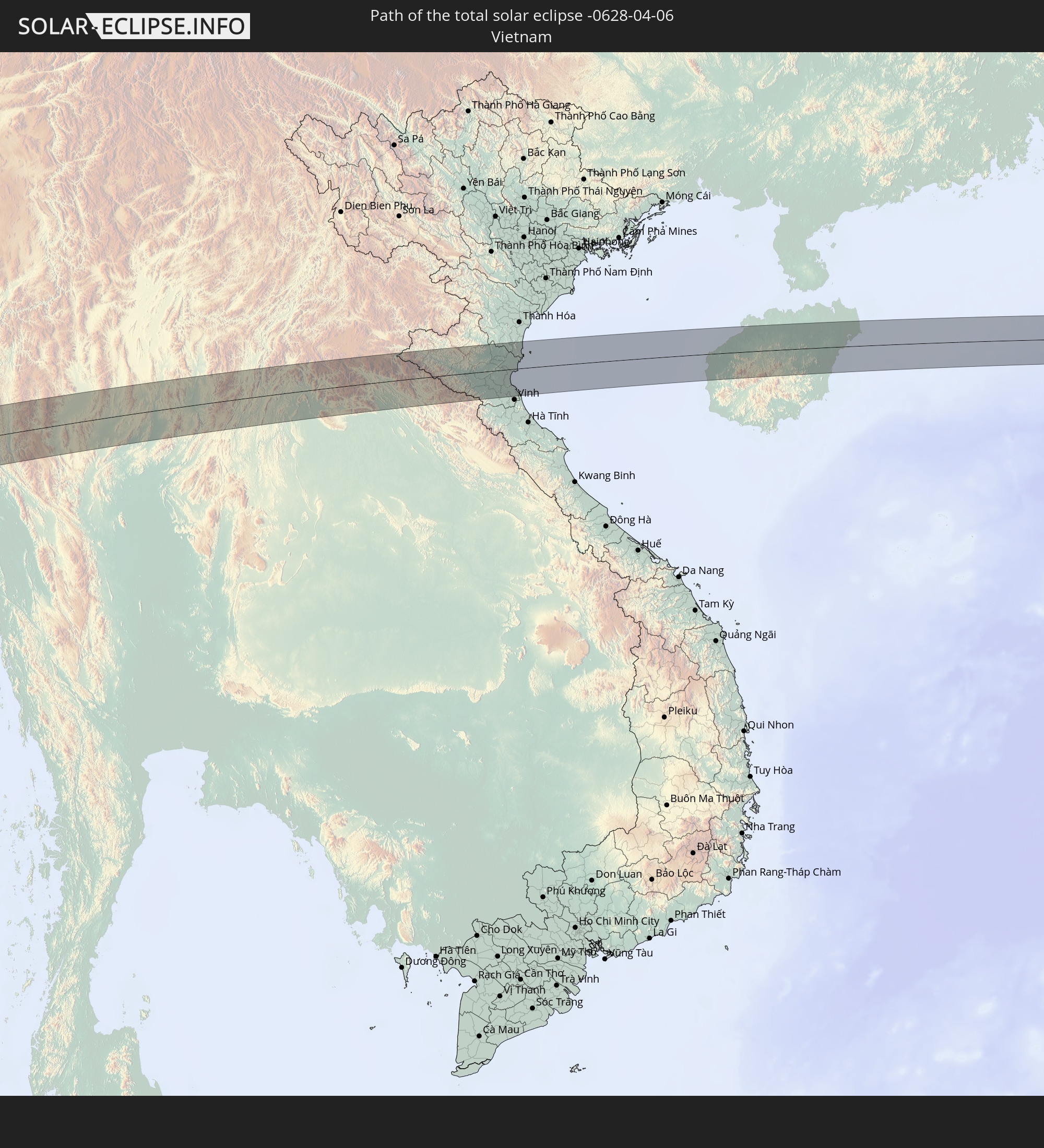 Vietnam
 Philippinen
In den folgenden Ländern ist die Sonnenfinsternis partiell zu sehen
 Russland
 Mali
Mali
 Burkina Faso
 Ghana
Ghana
 Togo
Togo
 Niger
Niger
 Benin
Benin
 Nigeria
 Äquatorialguinea
 São Tomé und Príncipe
 Kamerun
 Gabun
Gabun
 Libyen
 Republik Kongo
 Angola
 Namibia
 Demokratische Republik Kongo
 Tschad
 Zentralafrikanische Republik
 Südafrika
 Botswana
 Sudan
Sudan
 Sambia
 Ägypten
 Simbabwe
 Lesotho
 Ruanda
 Burundi
 Tansania
 Uganda
 Mosambik
 Swasiland
 Malawi
 Äthiopien
 Kenia
Kenia
 Saudi-Arabien
 Eritrea
 Irak
Irak
 Französische Süd- und Antarktisgebiete
 Somalia
 Dschibuti
 Jemen
Jemen
 Madagaskar
 Komoren
 Iran
Iran
 Mayotte
 Seychellen
 Kasachstan
 Kuwait
 Bahrain
 Katar
Katar
 Vereinigte Arabische Emirate
 Oman
Oman
 Turkmenistan
 Réunion
 Usbekistan
 Mauritius
 Afghanistan
 Pakistan
 Tadschikistan
 Indien
 Kirgisistan
 Britisches Territorium im Indischen Ozean
 Malediven
 Volksrepublik China
 Sri Lanka
 Nepal
Nepal
 Mongolei
 Bangladesch
 Bhutan
 Myanmar
 Indonesien
 Kokosinseln
 Thailand
 Malaysia
 Laos
Laos
 Vietnam
 Kambodscha
 Singapur
 Weihnachtsinsel
 Australien
 Macau
Macau
 Hongkong
 Brunei
 Taiwan
 Philippinen
 Japan
Japan
 Osttimor
 Nordkorea
 Südkorea
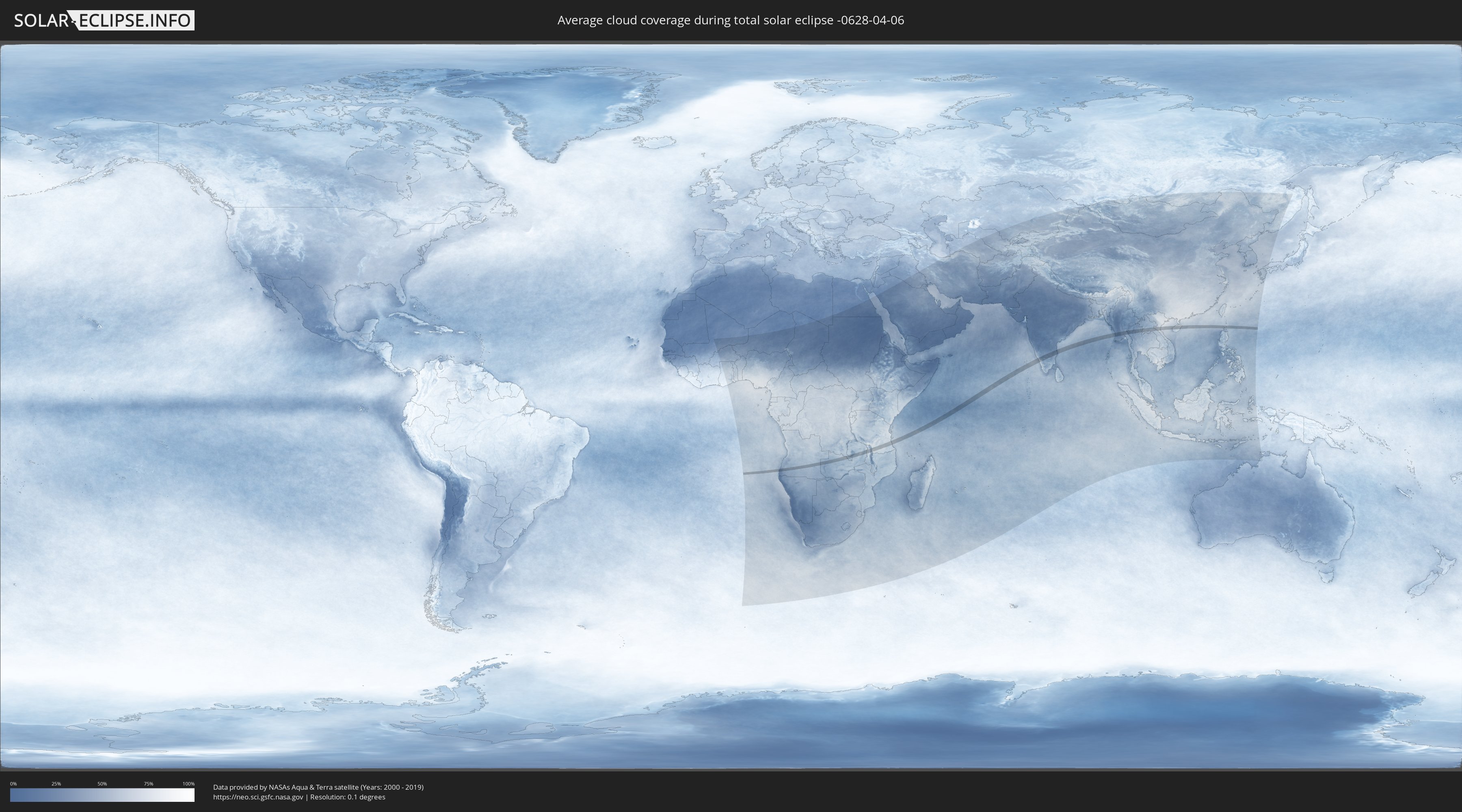
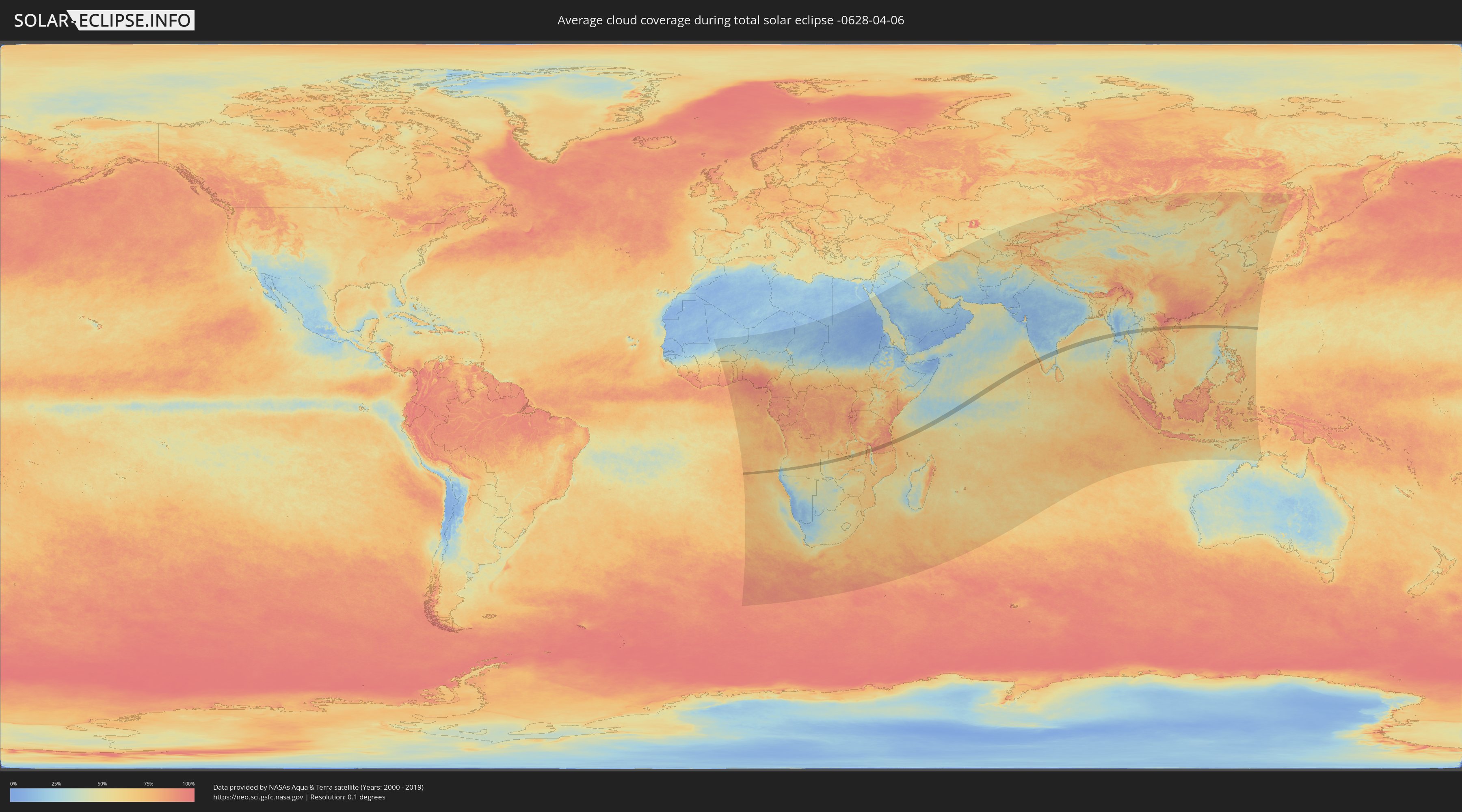
Wie wird das Wetter während der totalen Sonnenfinsternis am 06.04.-0628?
Wo ist der beste Ort, um die totale Sonnenfinsternis vom 06.04.-0628 zu beobachten?
Die folgenden Karten zeigen die durchschnittliche Bewölkung für den Tag, an dem die totale Sonnenfinsternis
stattfindet. Mit Hilfe der Karten lässt sich der Ort entlang des Finsternispfades eingrenzen,
der die besten Aussichen auf einen klaren wolkenfreien Himmel bietet.
Trotzdem muss man immer lokale Gegenenheiten beachten und sollte sich genau über das Wetter an seinem
gewählten Beobachtungsort informieren.
Die Daten stammen von den beiden NASA-Satelliten
AQUA und TERRA
und wurden über einen Zeitraum von 19 Jahren (2000 - 2019) gemittelt.
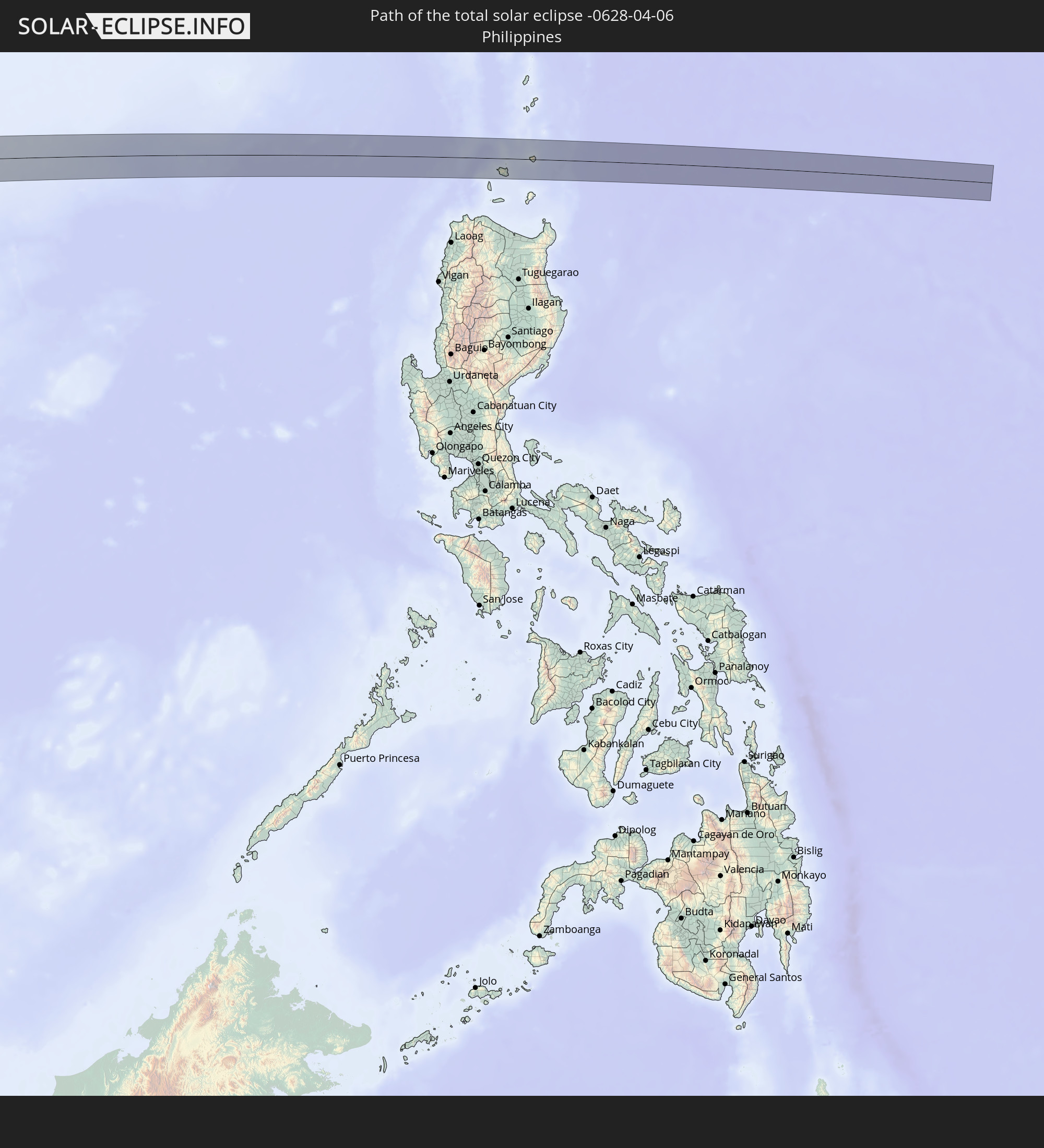
Detaillierte Länderkarten
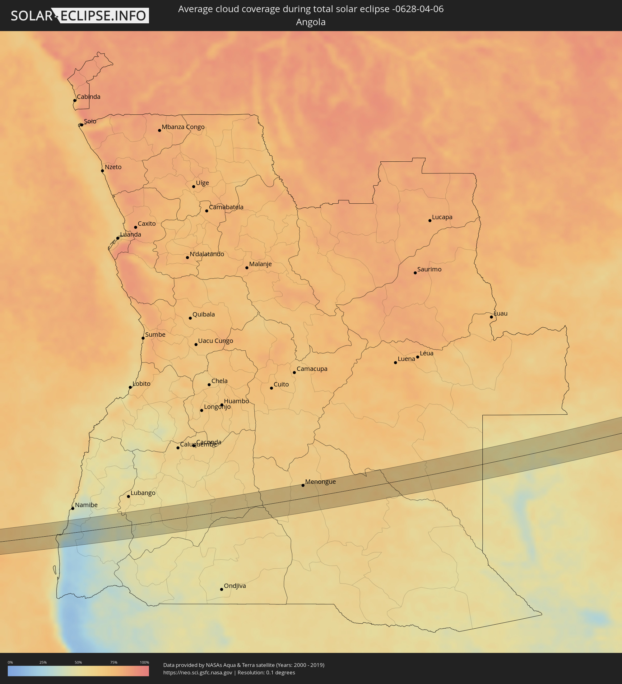 Angola
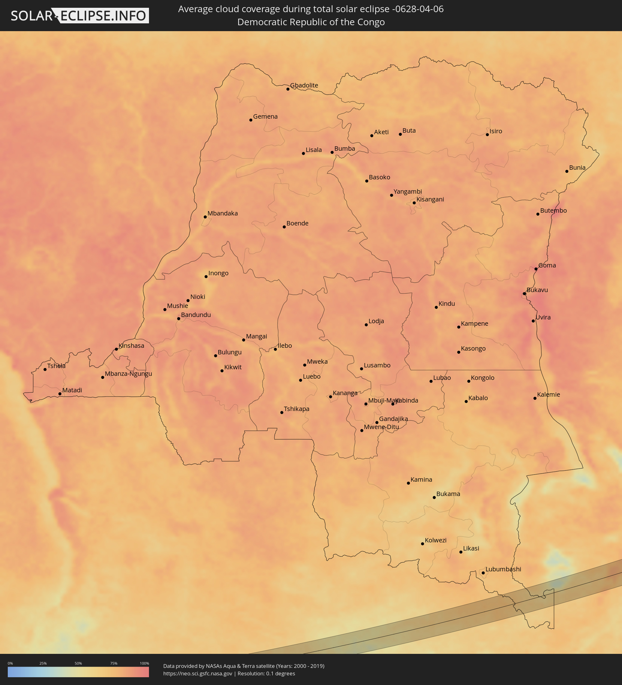 Demokratische Republik Kongo
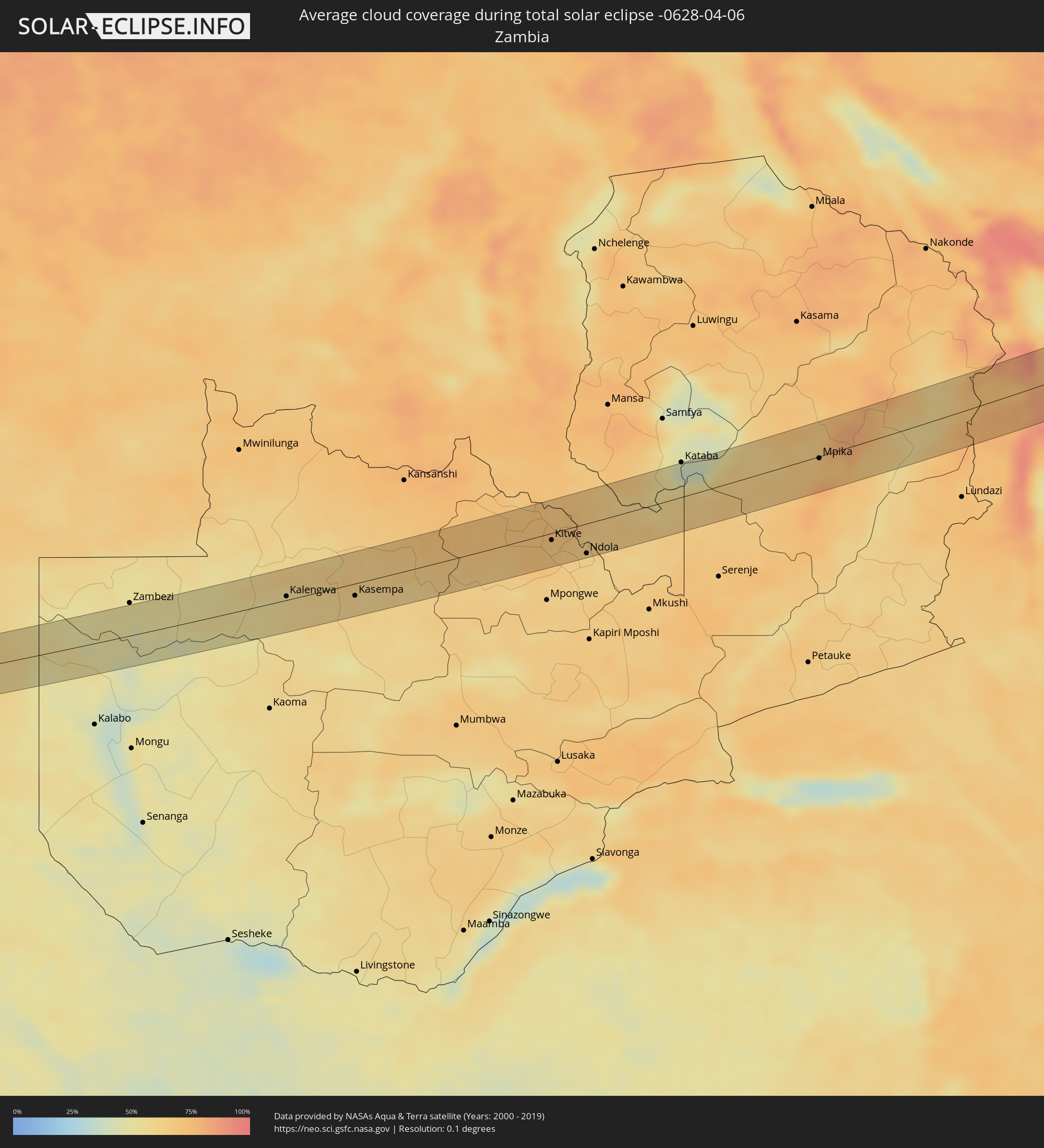 Sambia
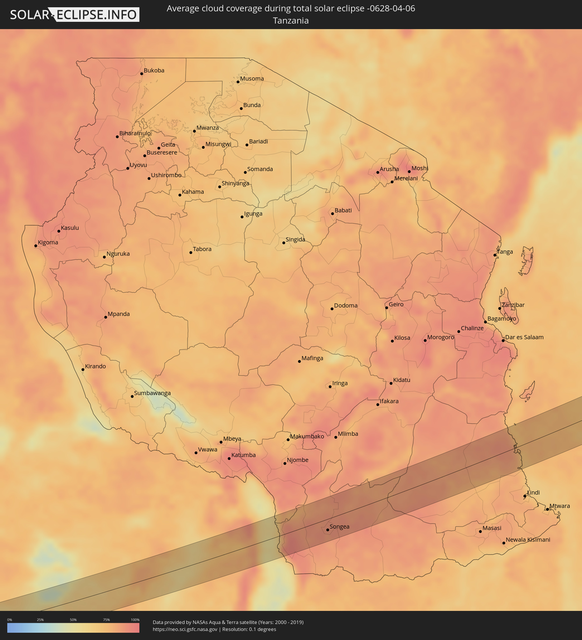 Tansania
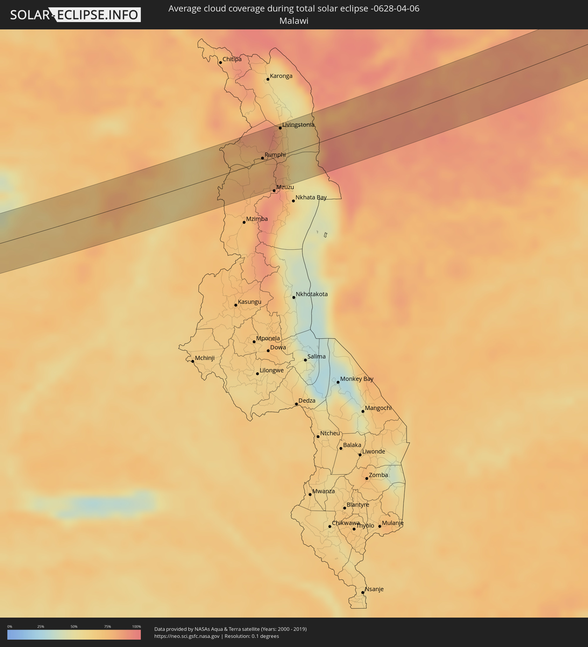 Malawi
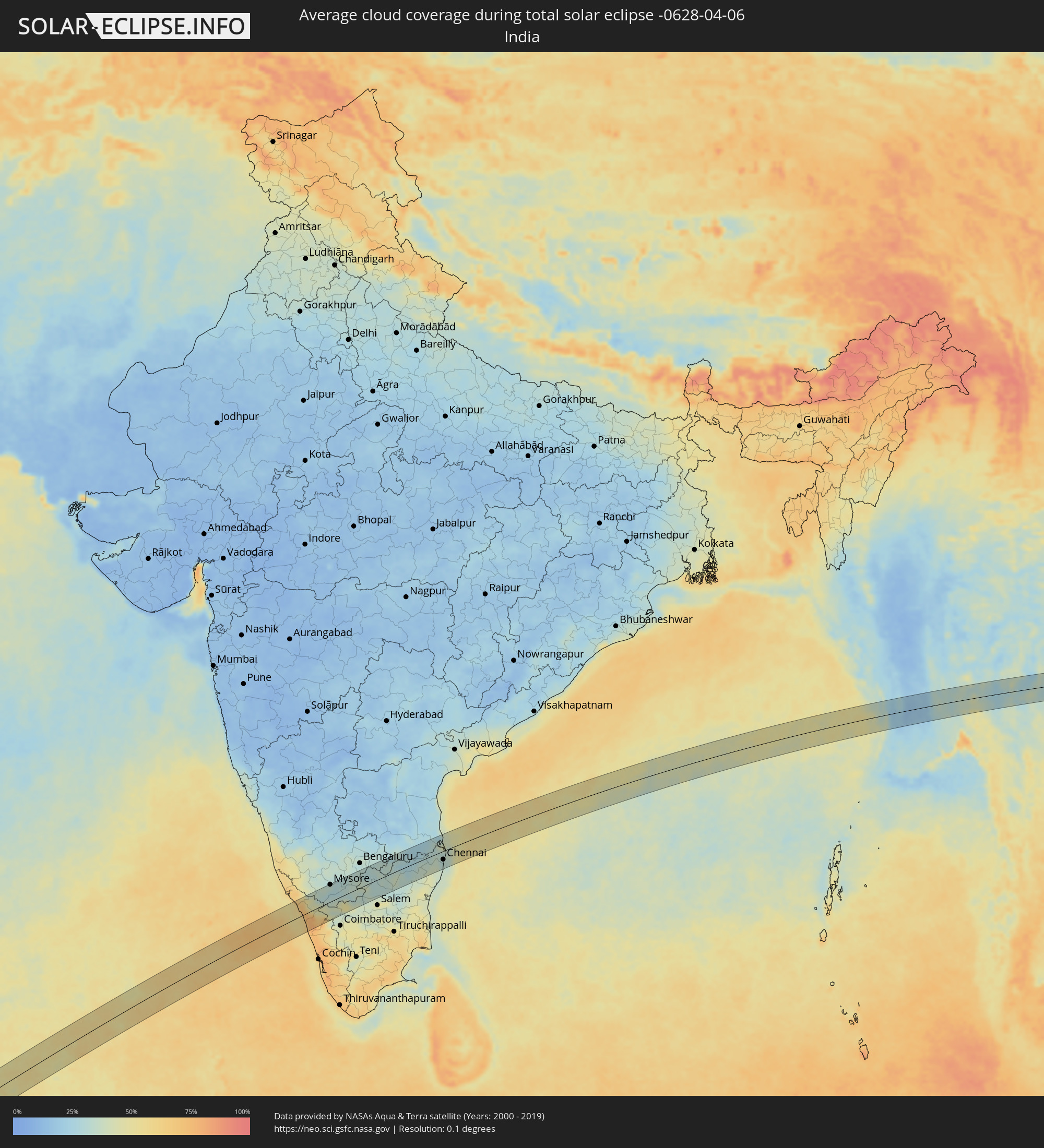 Indien
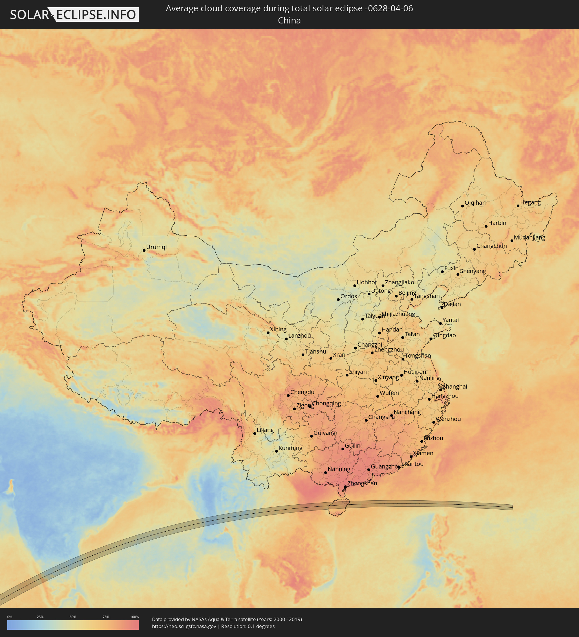 Volksrepublik China
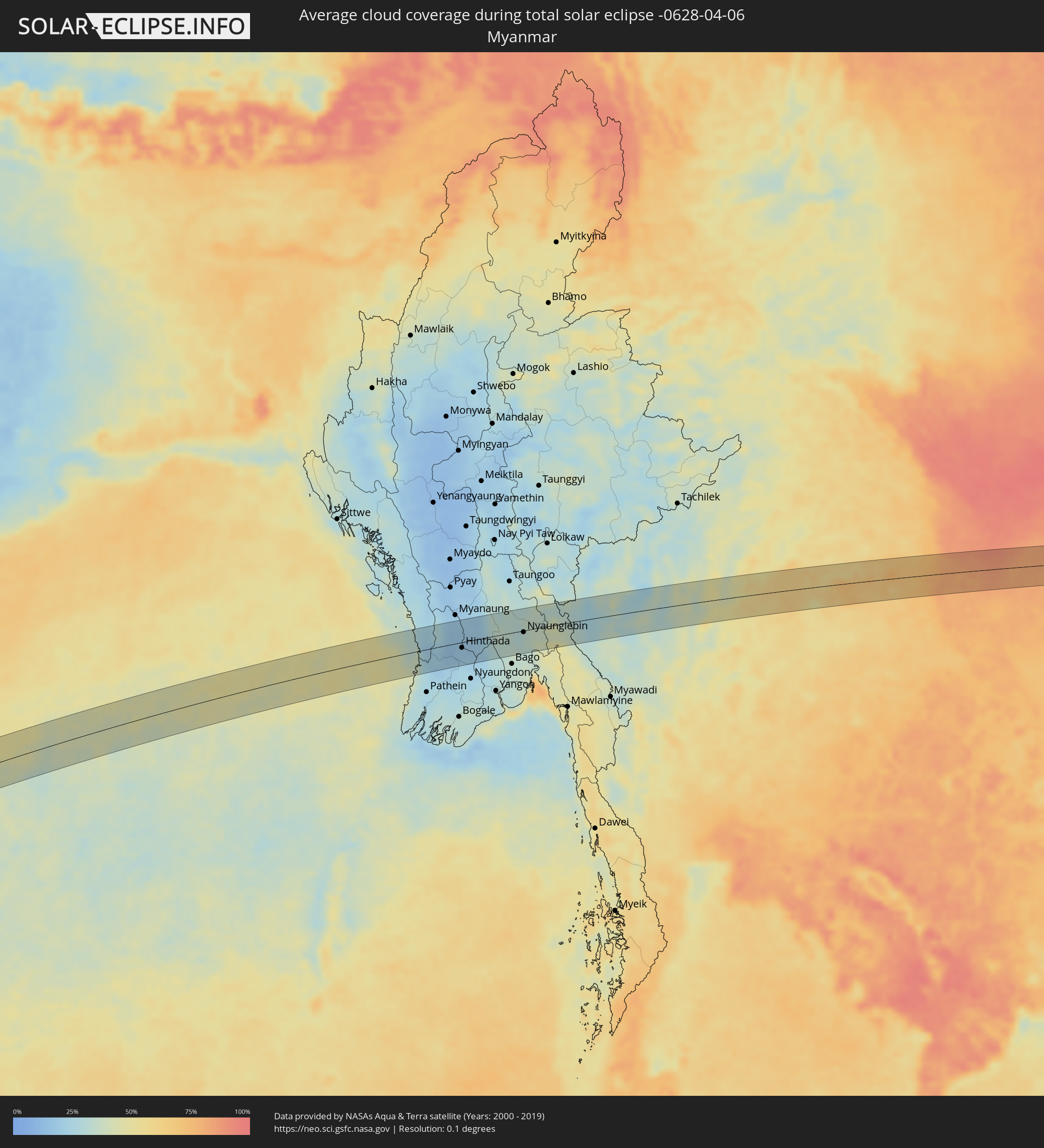 Myanmar
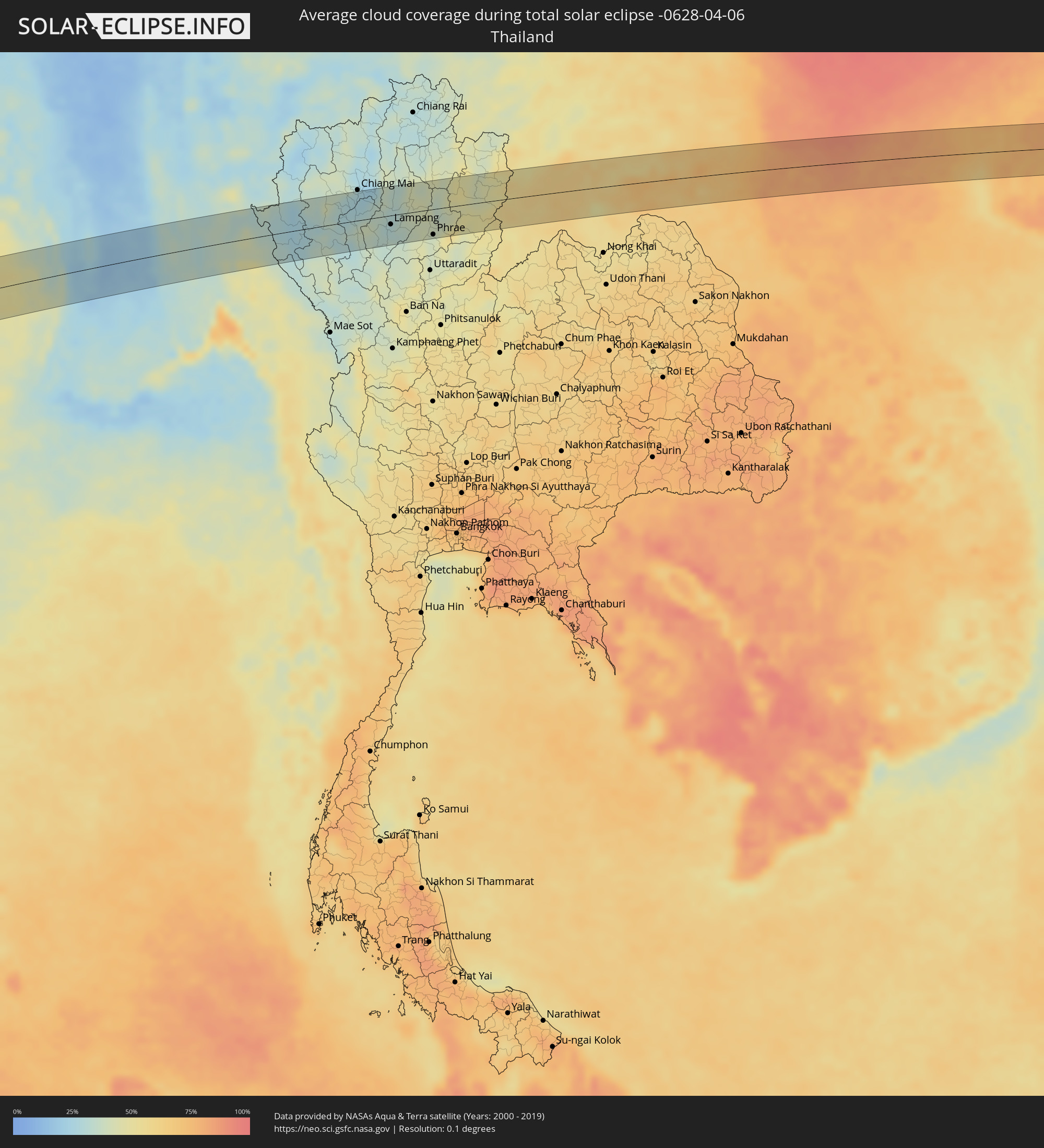 Thailand
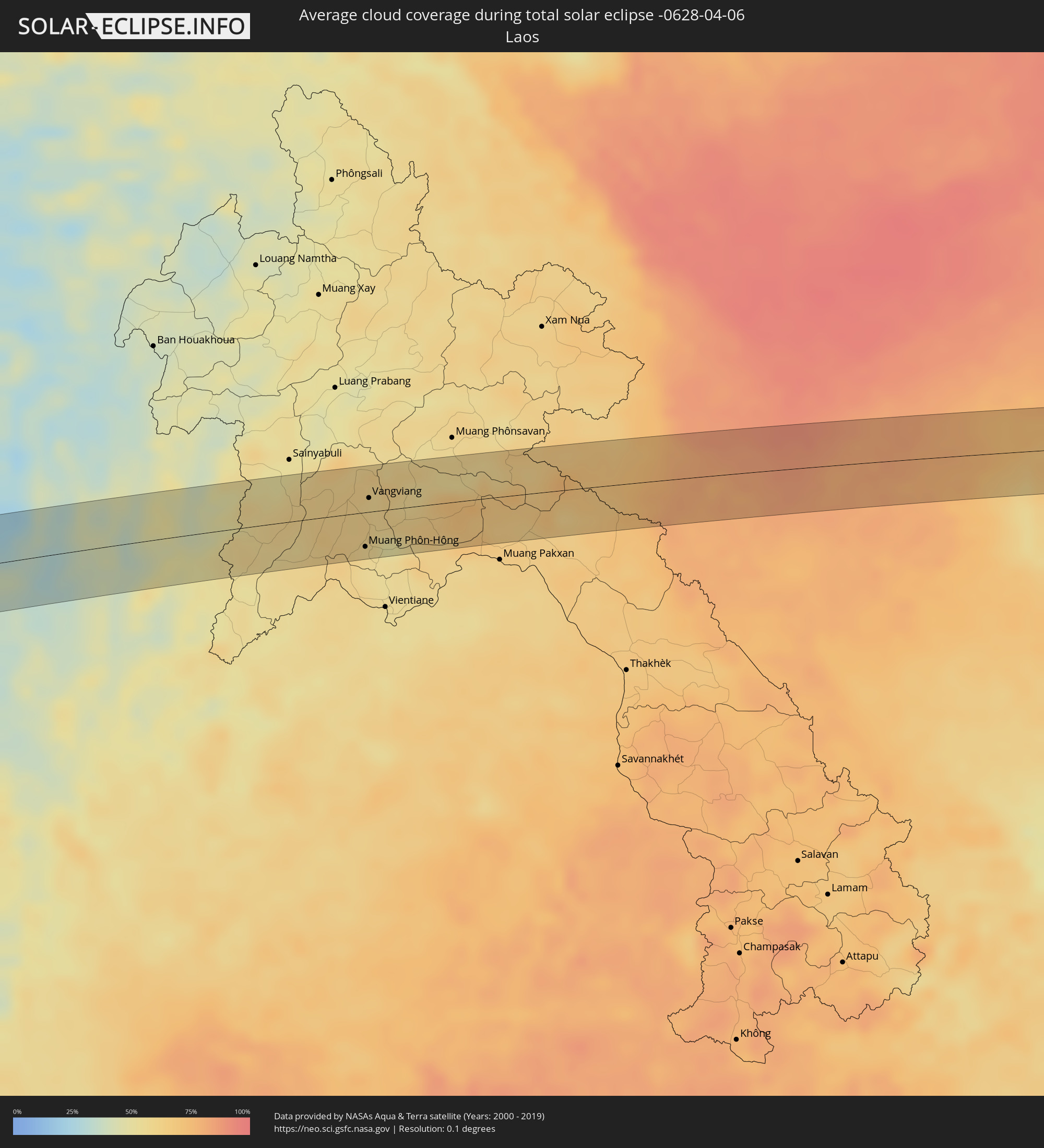 Laos
Laos
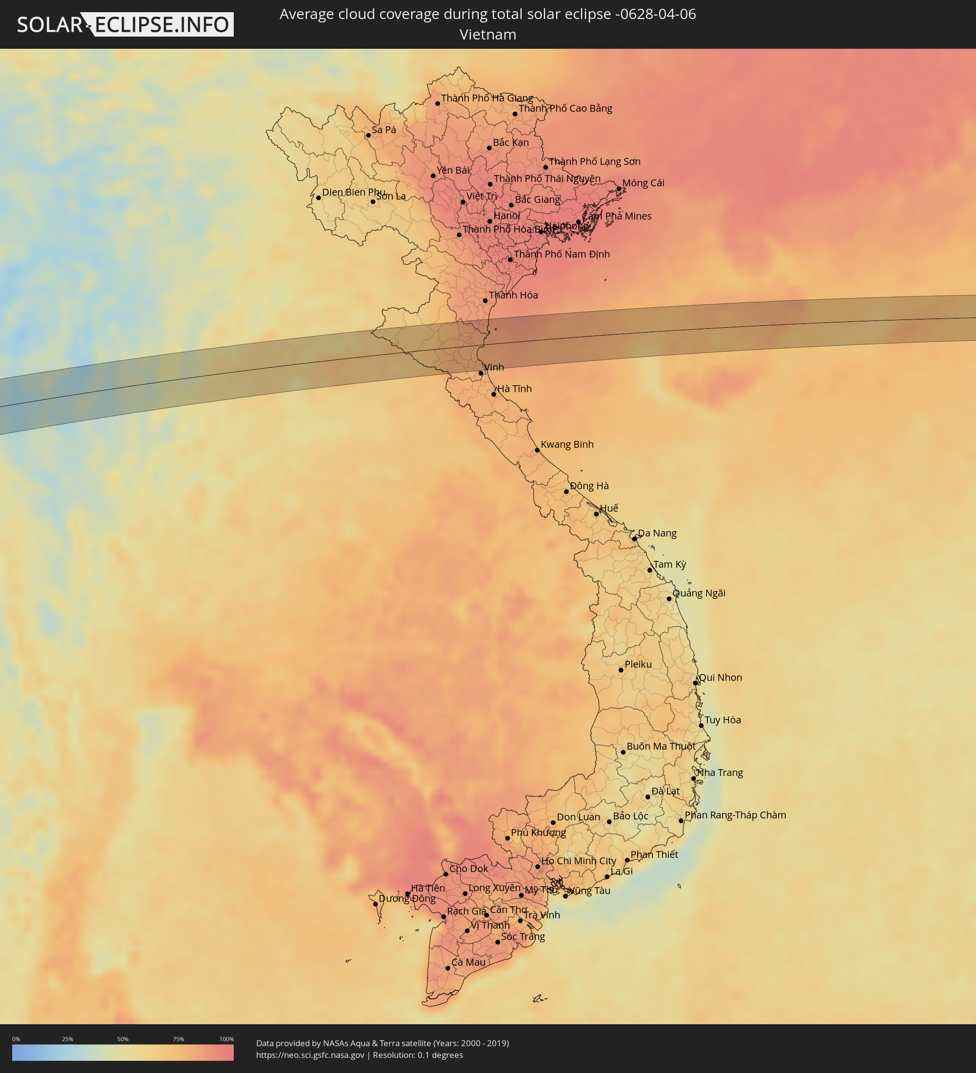 Vietnam
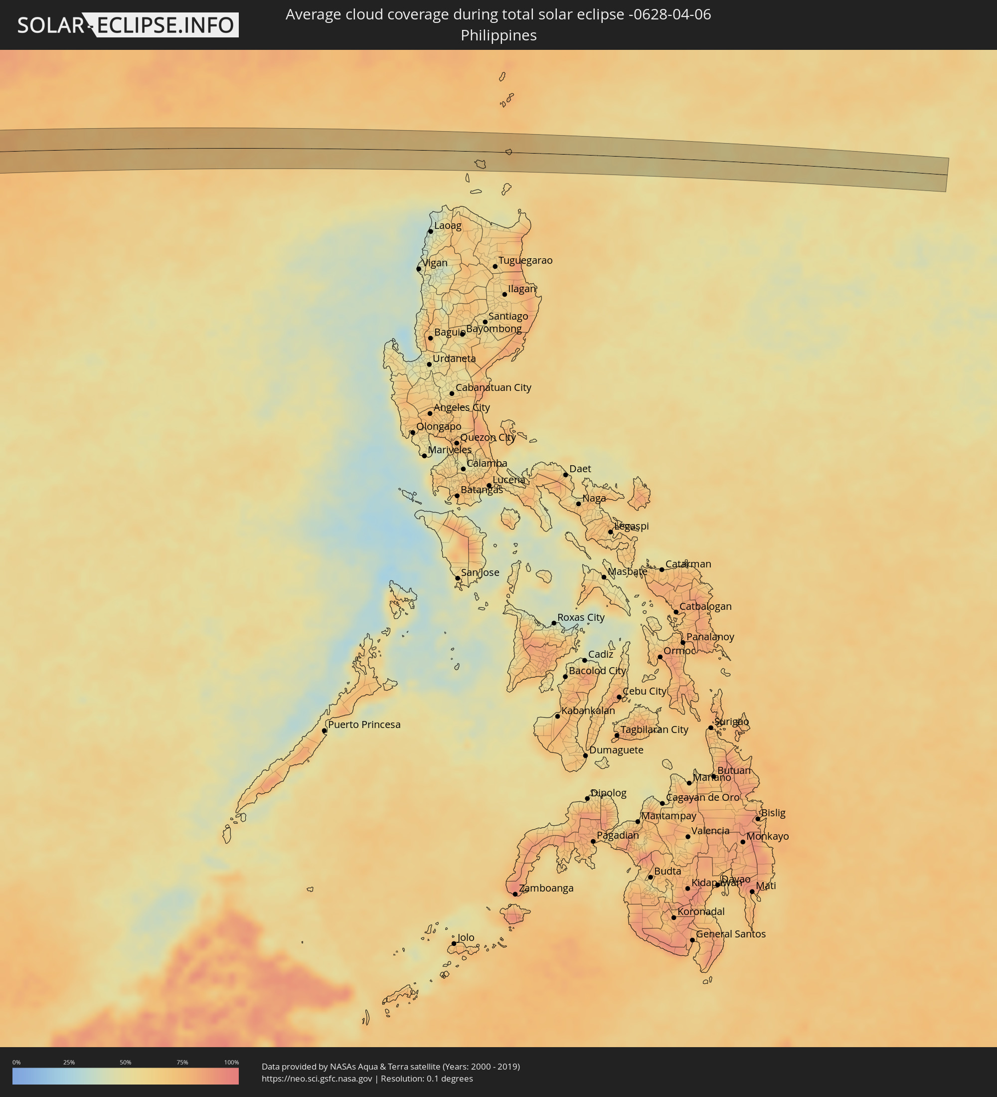 Philippinen
Orte im Finsternispfad
Die nachfolgene Tabelle zeigt Städte und Orte mit mehr als 5.000 Einwohnern, die sich im Finsternispfad befinden. Städte mit mehr als 100.000 Einwohnern sind dick gekennzeichnet. Mit einem Klick auf den Ort öffnet sich eine Detailkarte die die Lage des jeweiligen Ortes zusammen mit dem Verlauf der zentralen Finsternis präsentiert.
| Ort | Typ | Dauer der Verfinsterung | Ortszeit bei maximaler Verfinsterung | Entfernung zur Zentrallinie | Ø Bewölkung |
|
Menongue, Cuando Cobango
|
total | - | 06:13:47 UTC+00:13 | 32 km | 61% |
|
Mufumbwe, North-Western
|
total | - | 08:15:29 UTC+02:10 | 14 km | 54% |
|
Kalengwa, North-Western
|
total | - | 08:15:44 UTC+02:10 | 5 km | 57% |
|
Kasempa, North-Western
|
total | - | 08:16:26 UTC+02:10 | 15 km | 61% |
|
Kalulushi, Copperbelt
|
total | - | 08:18:46 UTC+02:10 | 10 km | 70% |
|
Kitwe, Copperbelt
|
total | - | 08:18:54 UTC+02:10 | 9 km | 69% |
|
Mufulira, Copperbelt
|
total | - | 08:19:04 UTC+02:10 | 17 km | 73% |
|
Ndola, Copperbelt
|
total | - | 08:19:14 UTC+02:10 | 38 km | 62% |
|
Mpika, Muchinga Province
|
total | - | 08:22:51 UTC+02:10 | 2 km | 72% |
|
Rumphi, Northern Region
|
total | - | 08:26:16 UTC+02:10 | 5 km | 75% |
|
Livingstonia, Northern Region
|
total | - | 08:26:53 UTC+02:10 | 39 km | 79% |
|
Manda, Njombe
|
total | - | 08:27:36 UTC+02:10 | 37 km | 69% |
|
Liuli, Ruvuma
|
total | - | 08:27:13 UTC+02:10 | 29 km | 63% |
|
Matiri, Ruvuma
|
total | - | 08:44:45 UTC+02:27 | 4 km | 94% |
|
Mbinga, Ruvuma
|
total | - | 08:44:46 UTC+02:27 | 27 km | 92% |
|
Kigonsera, Ruvuma
|
total | - | 08:44:54 UTC+02:27 | 14 km | 88% |
|
Maposeni, Ruvuma
|
total | - | 08:45:32 UTC+02:27 | 4 km | 88% |
|
Songea, Ruvuma
|
total | - | 08:45:48 UTC+02:27 | 24 km | 89% |
|
Liwale, Lindi
|
total | - | 08:49:47 UTC+02:27 | 15 km | 86% |
|
Tellicherry, Kerala
|
total | - | 13:44:01 UTC+05:21 | 54 km | 57% |
|
Badagara, Kerala
|
total | - | 13:44:03 UTC+05:21 | 34 km | 55% |
|
Kozhikode, Kerala
|
total | - | 13:44:05 UTC+05:21 | 10 km | 58% |
|
Manjeri, Kerala
|
total | - | 13:44:46 UTC+05:21 | 40 km | 79% |
|
Mysore, Karnataka
|
total | - | 13:47:35 UTC+05:21 | 54 km | 32% |
|
Ooty, Tamil Nadu
|
total | - | 13:46:36 UTC+05:21 | 37 km | 44% |
|
Chamrajnagar, Karnataka
|
total | - | 13:47:51 UTC+05:21 | 2 km | 40% |
|
Mettur, Tamil Nadu
|
total | - | 13:49:48 UTC+05:21 | 51 km | 39% |
|
Hosūr, Tamil Nadu
|
total | - | 13:51:01 UTC+05:21 | 43 km | 29% |
|
Dharmapuri, Tamil Nadu
|
total | - | 13:51:05 UTC+05:21 | 33 km | 36% |
|
Krishnagiri, Tamil Nadu
|
total | - | 13:51:41 UTC+05:21 | 4 km | 31% |
|
Robertsonpet, Karnataka
|
total | - | 13:52:21 UTC+05:21 | 46 km | 32% |
|
Vaniyambadi, Tamil Nadu
|
total | - | 13:52:51 UTC+05:21 | 3 km | 32% |
|
Ambur, Tamil Nadu
|
total | - | 13:53:13 UTC+05:21 | 10 km | 32% |
|
Gudiyatham, Tamil Nadu
|
total | - | 13:53:46 UTC+05:21 | 18 km | 28% |
|
Vellore, Tamil Nadu
|
total | - | 13:54:20 UTC+05:21 | 4 km | 26% |
|
Ārani, Tamil Nadu
|
total | - | 13:54:25 UTC+05:21 | 28 km | 32% |
|
Arakkonam, Tamil Nadu
|
total | - | 13:55:48 UTC+05:21 | 2 km | 33% |
|
Kānchipuram, Tamil Nadu
|
total | - | 13:55:35 UTC+05:21 | 29 km | 37% |
|
Chengalpattu, Tamil Nadu
|
total | - | 13:56:04 UTC+05:21 | 55 km | 39% |
|
Āvadi, Tamil Nadu
|
total | - | 13:56:51 UTC+05:21 | 18 km | 35% |
|
Pallāvaram, Tamil Nadu
|
total | - | 13:56:47 UTC+05:21 | 34 km | 32% |
|
Chennai, Tamil Nadu
|
total | - | 13:57:13 UTC+05:21 | 27 km | 32% |
|
Hinthada, Ayeyarwady
|
total | - | 15:32:53 UTC+06:24 | 12 km | 20% |
|
Letpandan, Bago
|
total | - | 15:33:21 UTC+06:24 | 3 km | 21% |
|
Tharyarwady, Bago
|
total | - | 15:33:21 UTC+06:24 | 18 km | 19% |
|
Nyaunglebin, Bago
|
total | - | 15:34:46 UTC+06:24 | 3 km | 32% |
|
Pa Pae, Mae Hong Son
|
total | - | 15:53:56 UTC+06:42 | 6 km | 24% |
|
Chom Thong, Chiang Mai
|
total | - | 15:54:46 UTC+06:42 | 13 km | 30% |
|
San Pa Tong, Chiang Mai
|
total | - | 15:55:06 UTC+06:42 | 32 km | 27% |
|
Hang Dong, Chiang Mai
|
total | - | 15:55:09 UTC+06:42 | 38 km | 27% |
|
Pa Sang, Lamphun
|
total | - | 15:55:08 UTC+06:42 | 20 km | 28% |
|
Lamphun, Lamphun
|
total | - | 15:55:14 UTC+06:42 | 25 km | 26% |
|
San Kamphaeng, Chiang Mai
|
total | - | 15:55:25 UTC+06:42 | 42 km | 26% |
|
Mae Tha, Lamphun
|
total | - | 15:55:22 UTC+06:42 | 10 km | 31% |
|
Lampang, Lampang
|
total | - | 15:55:45 UTC+06:42 | 14 km | 30% |
|
Long, Phrae
|
total | - | 15:56:07 UTC+06:42 | 44 km | 39% |
|
Phrae, Phrae
|
total | - | 15:56:30 UTC+06:42 | 40 km | 39% |
|
Rong Kwang, Phrae
|
total | - | 15:56:46 UTC+06:42 | 22 km | 41% |
|
Nan, Nan
|
total | - | 15:57:24 UTC+06:42 | 21 km | 41% |
|
Muang Phôn-Hông, Vientiane Province
|
total | - | 15:59:10 UTC+06:42 | 33 km | 58% |
|
Vangviang, Vientiane Province
|
total | - | 15:59:17 UTC+06:42 | 13 km | 62% |
|
Jinjiang, Hainan
|
total | - | 17:23:58 UTC+08:00 | 35 km | 77% |