Totale Sonnenfinsternis vom 05.04.-0674
| Wochentag: | Mittwoch |
| Maximale Dauer der Verfinsterung: | 04m58s |
| Maximale Breite des Finsternispfades: | 306 km |
| Saroszyklus: | 57 |
| Bedeckungsgrad: | 100% |
| Magnitude: | 1.0706 |
| Gamma: | 0.674 |
Wo kann man die Sonnenfinsternis vom 05.04.-0674 sehen?
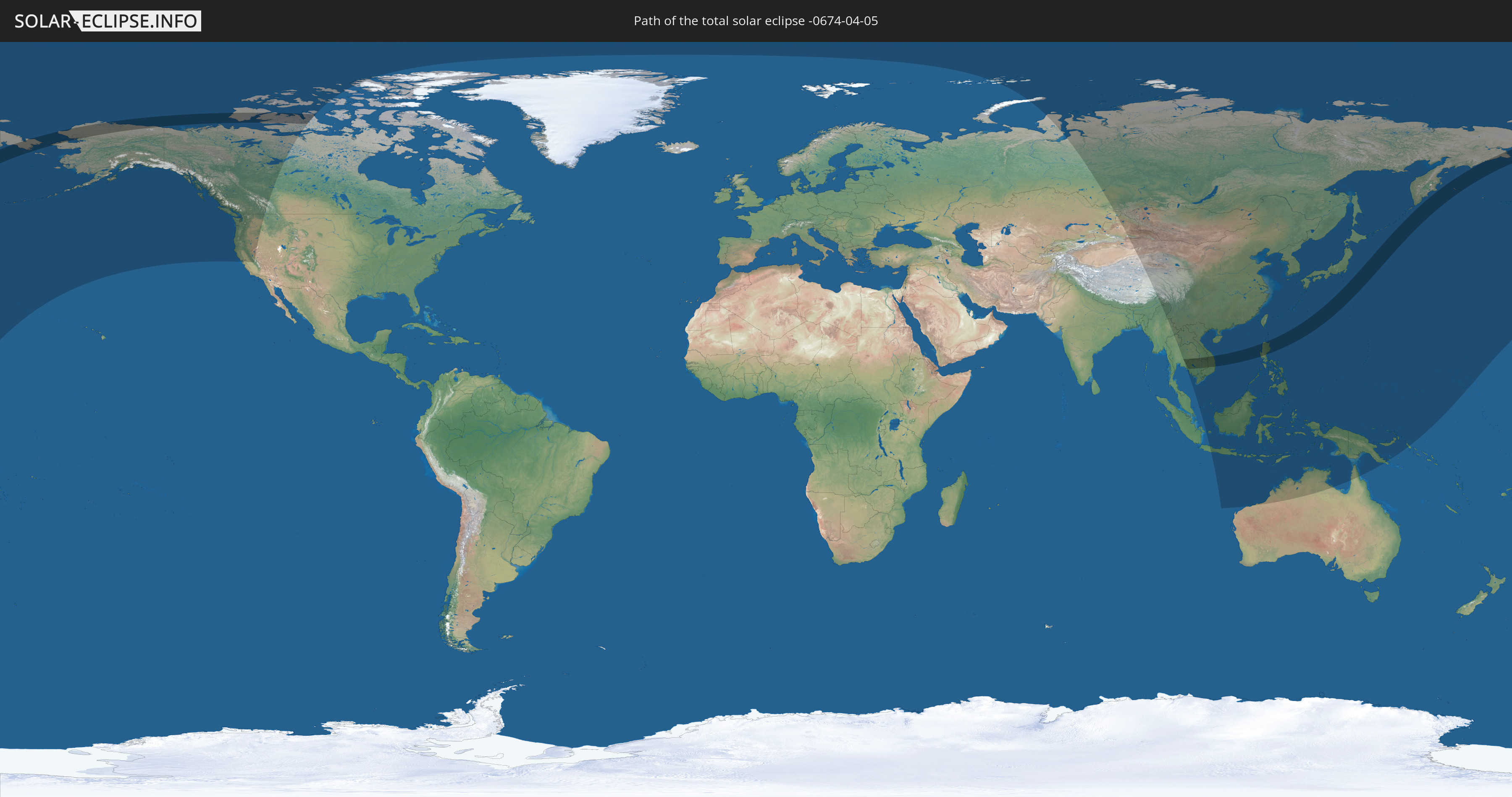
Die Sonnenfinsternis am 05.04.-0674 kann man in 31 Ländern als partielle Sonnenfinsternis beobachten.
Der Finsternispfad verläuft durch 8 Länder. Nur in diesen Ländern ist sie als totale Sonnenfinsternis zu sehen.
In den folgenden Ländern ist die Sonnenfinsternis total zu sehen
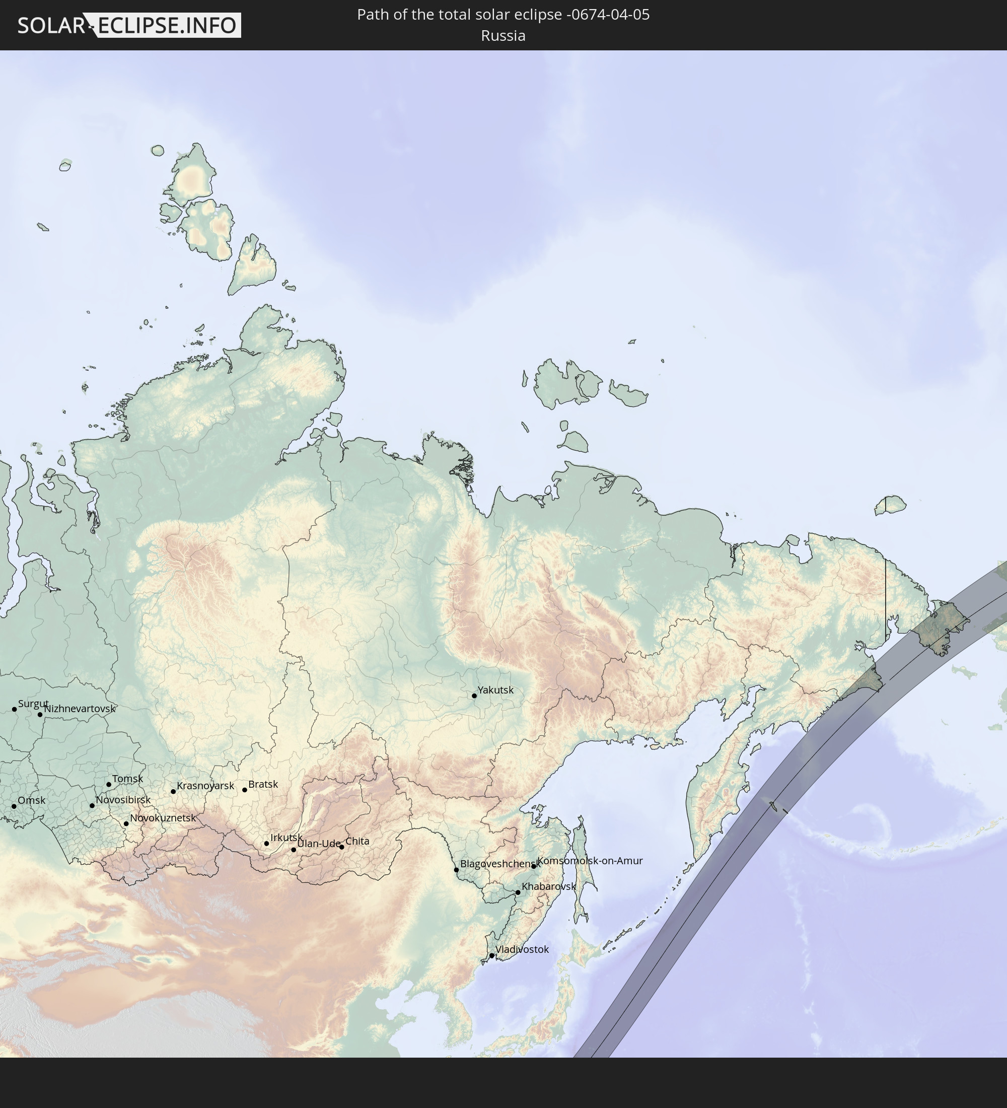 Russland
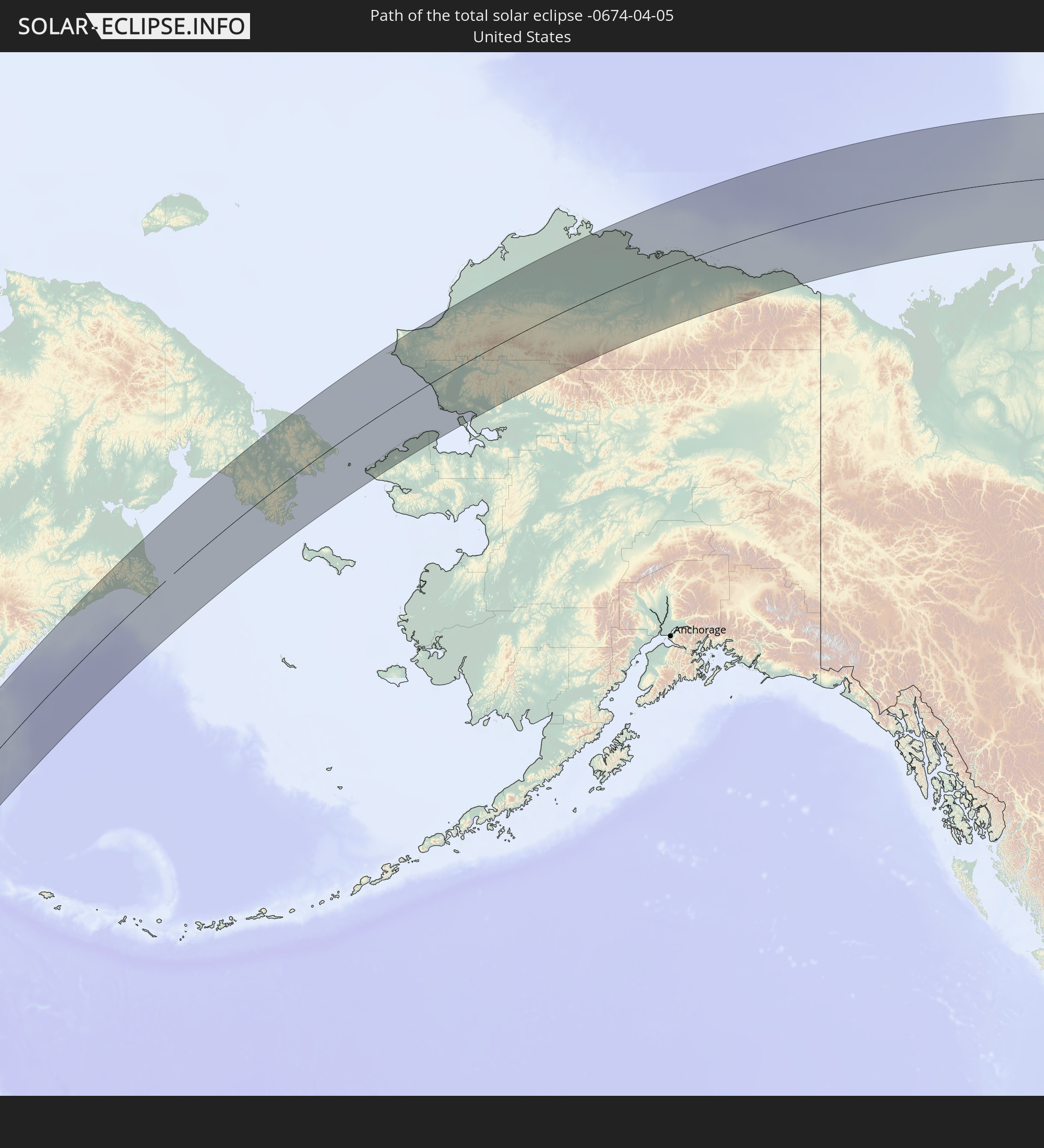 Vereinigte Staaten
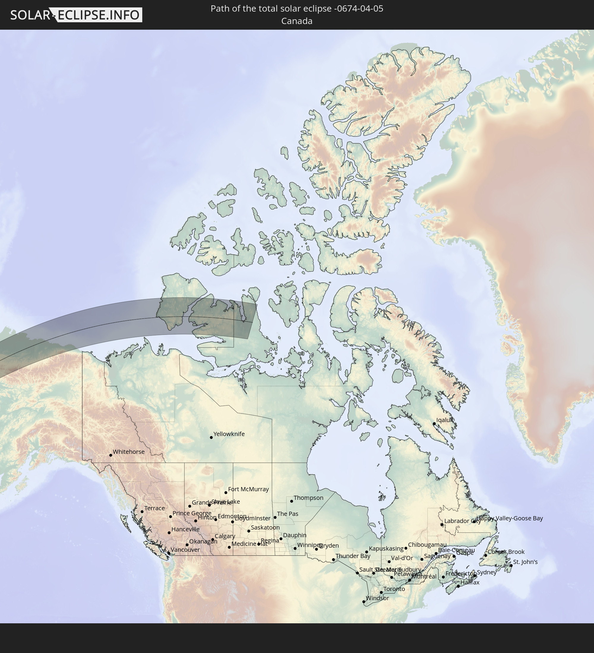 Kanada
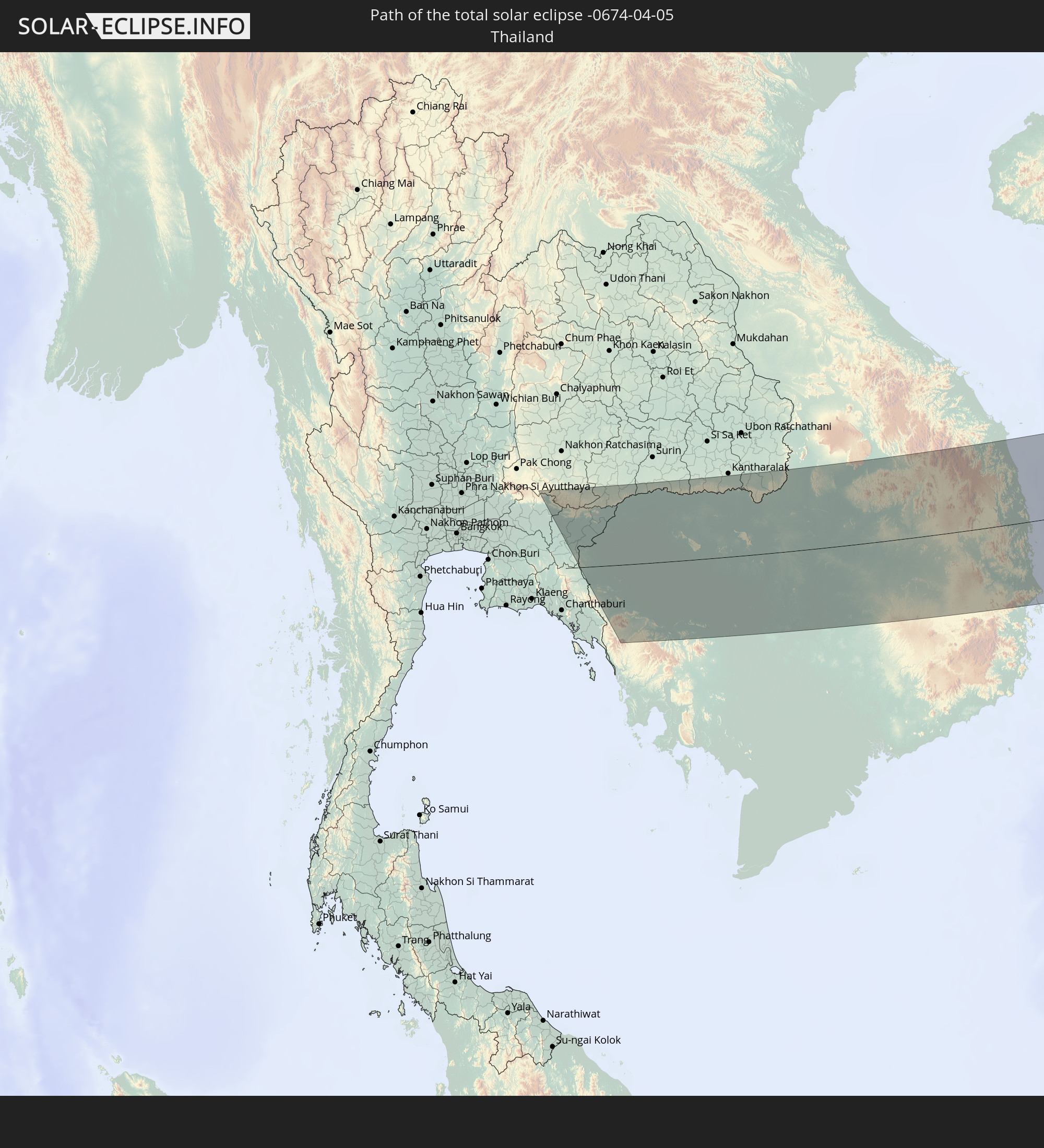 Thailand
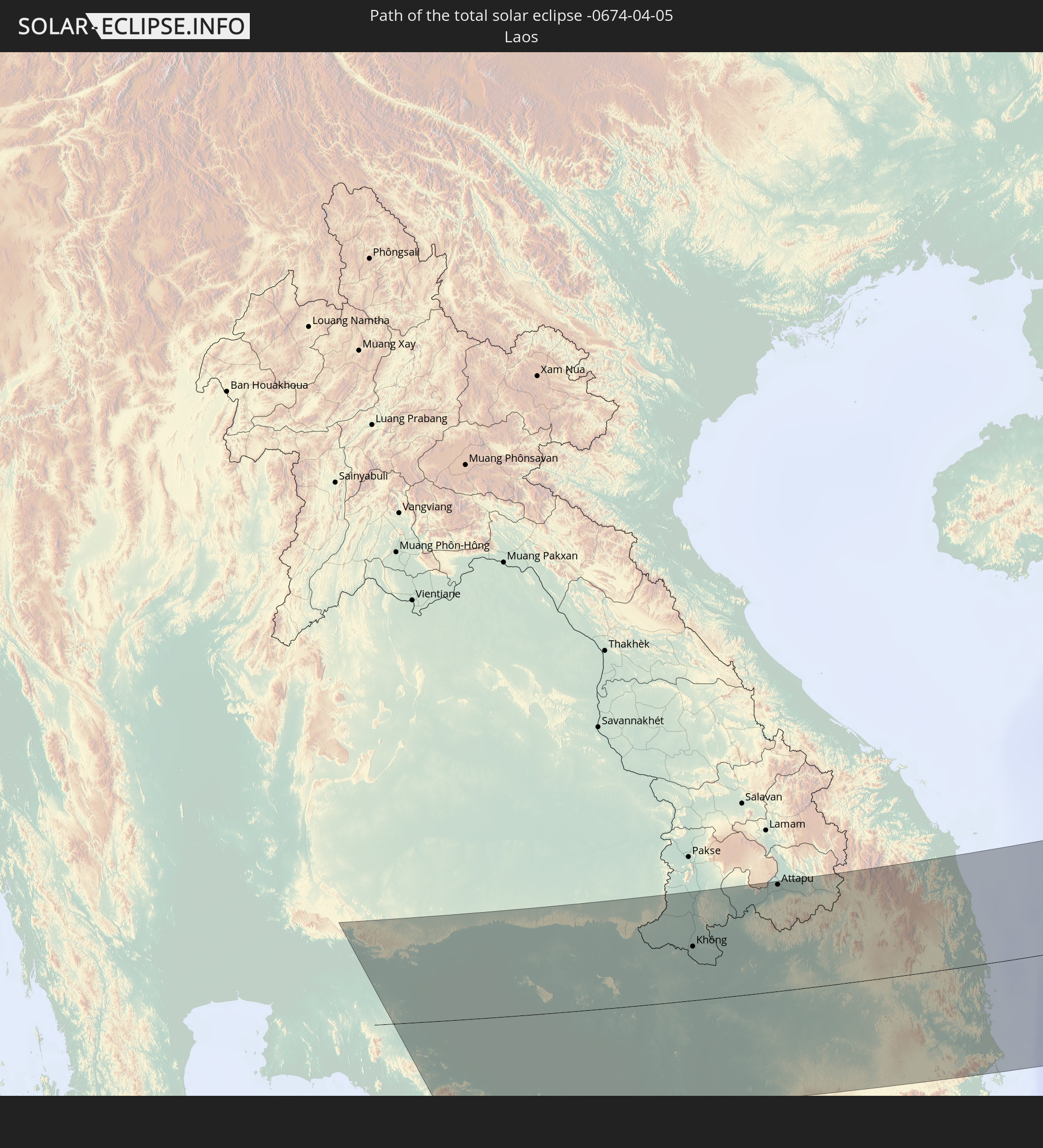 Laos
Laos
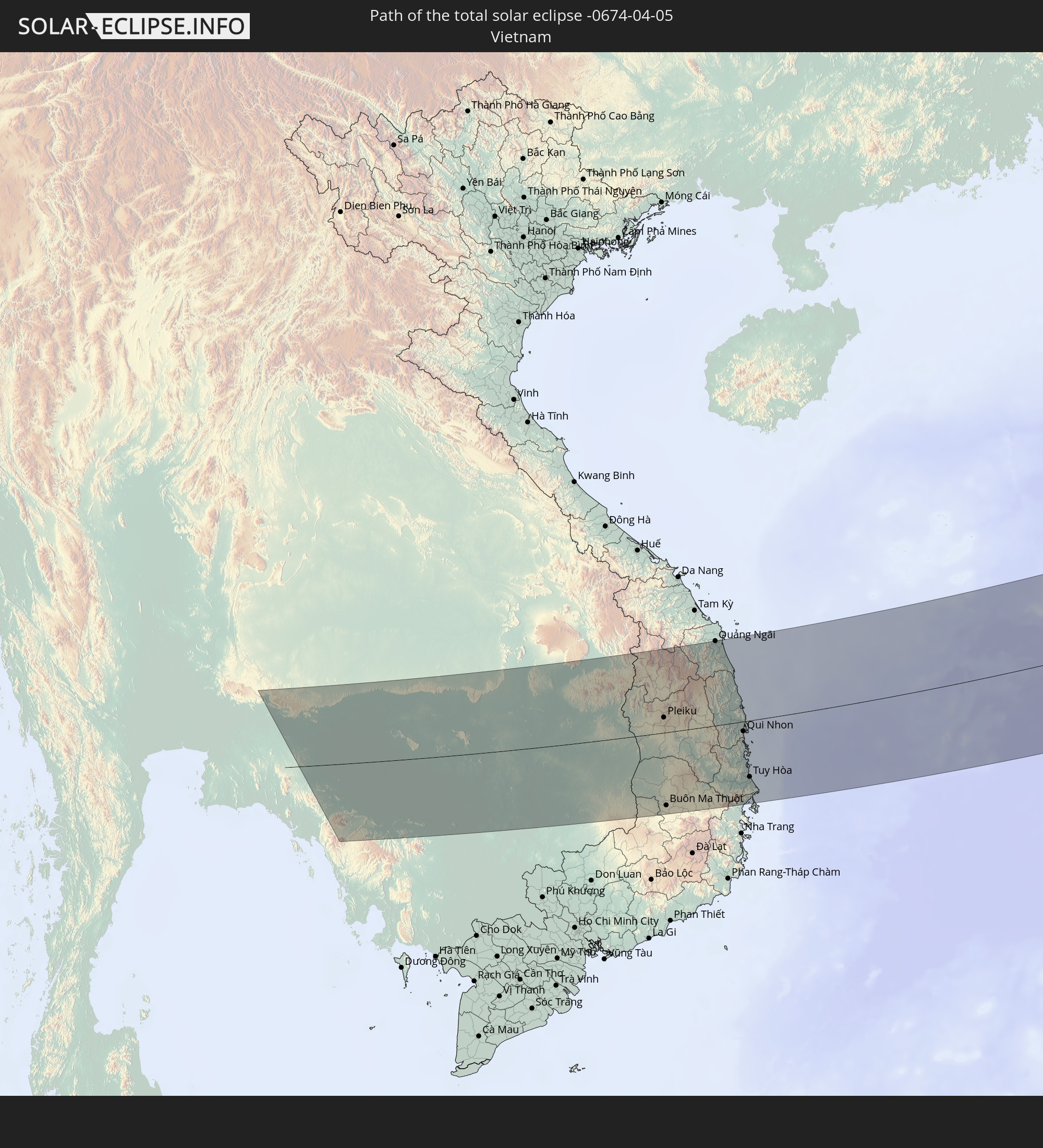 Vietnam
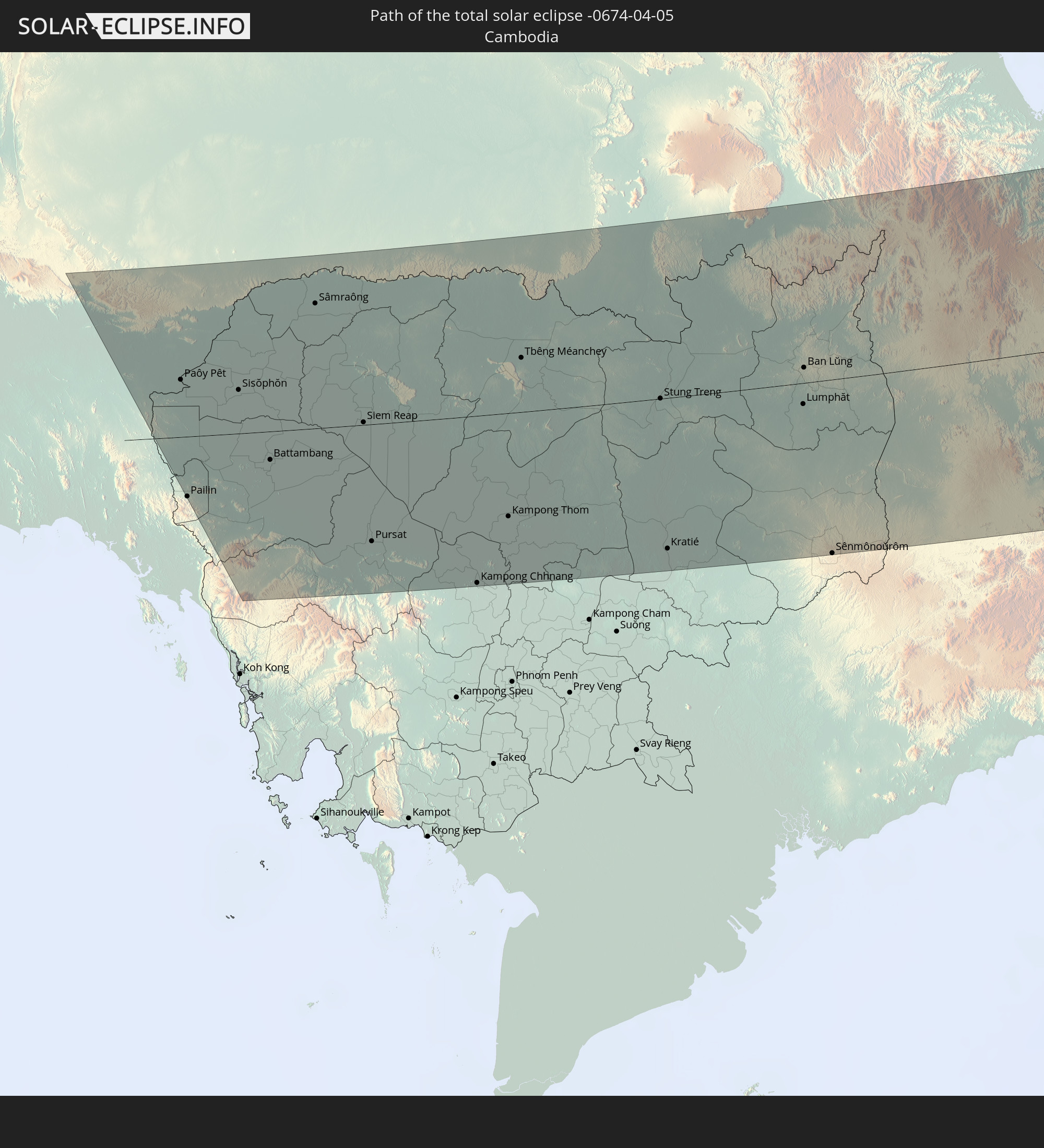 Kambodscha
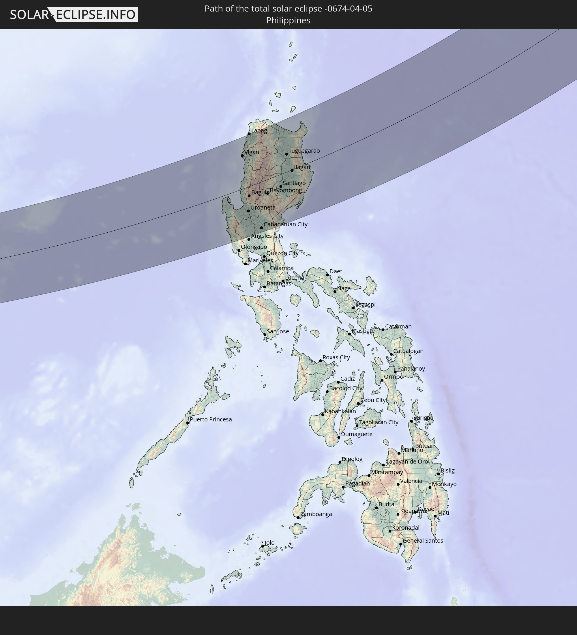 Philippinen
In den folgenden Ländern ist die Sonnenfinsternis partiell zu sehen
 Russland
 Vereinigte Staaten
 United States Minor Outlying Islands
 Kanada
 Kasachstan
 Indien
 Volksrepublik China
 Mongolei
 Myanmar
 Indonesien
 Thailand
 Malaysia
 Laos
Laos
 Vietnam
 Kambodscha
 Australien
 Macau
Macau
 Hongkong
 Brunei
 Taiwan
 Philippinen
 Japan
Japan
 Osttimor
 Nordkorea
 Südkorea
 Palau
Palau
 Föderierte Staaten von Mikronesien
 Papua-Neuguinea
 Guam
Guam
 Nördliche Marianen
 Marshallinseln
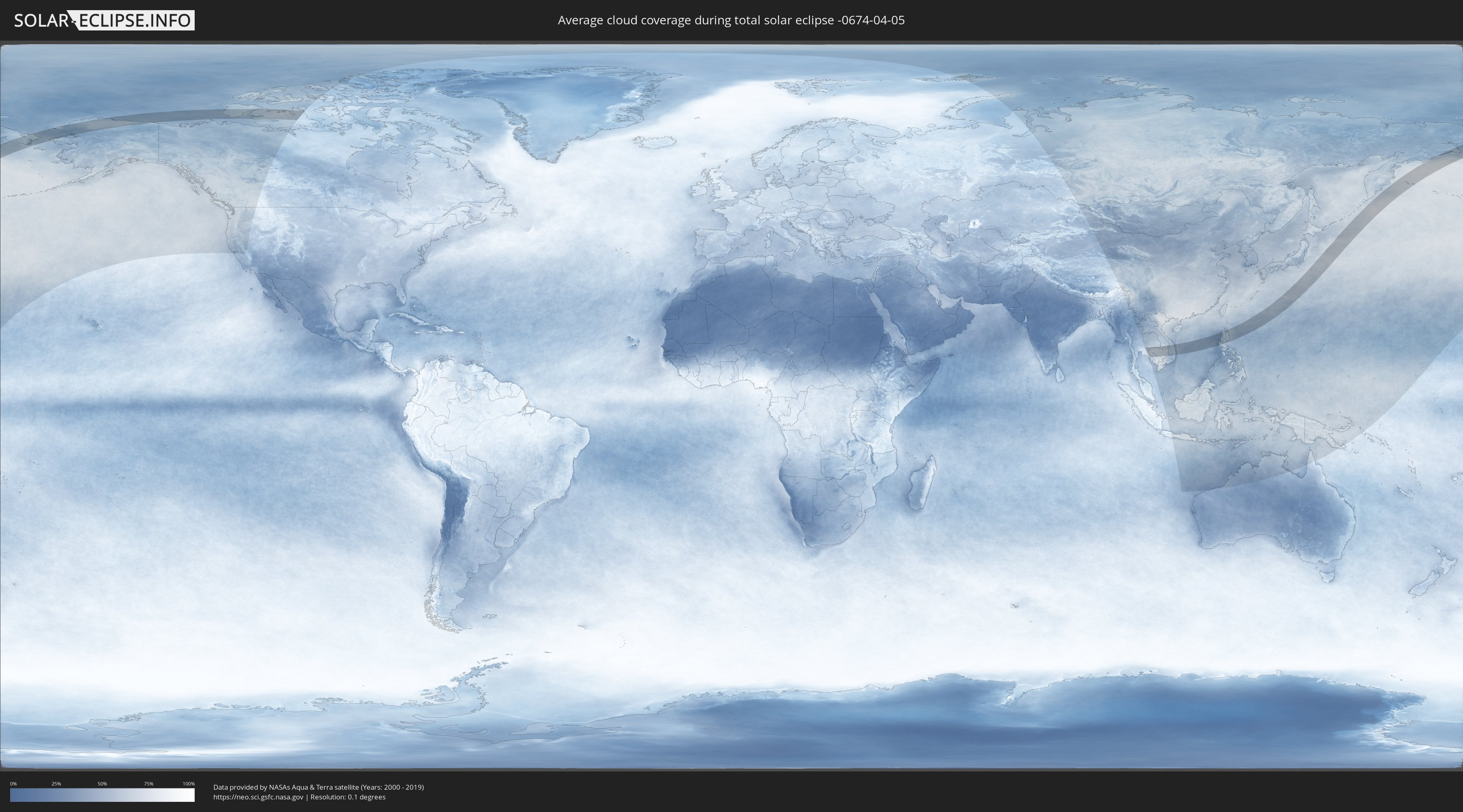
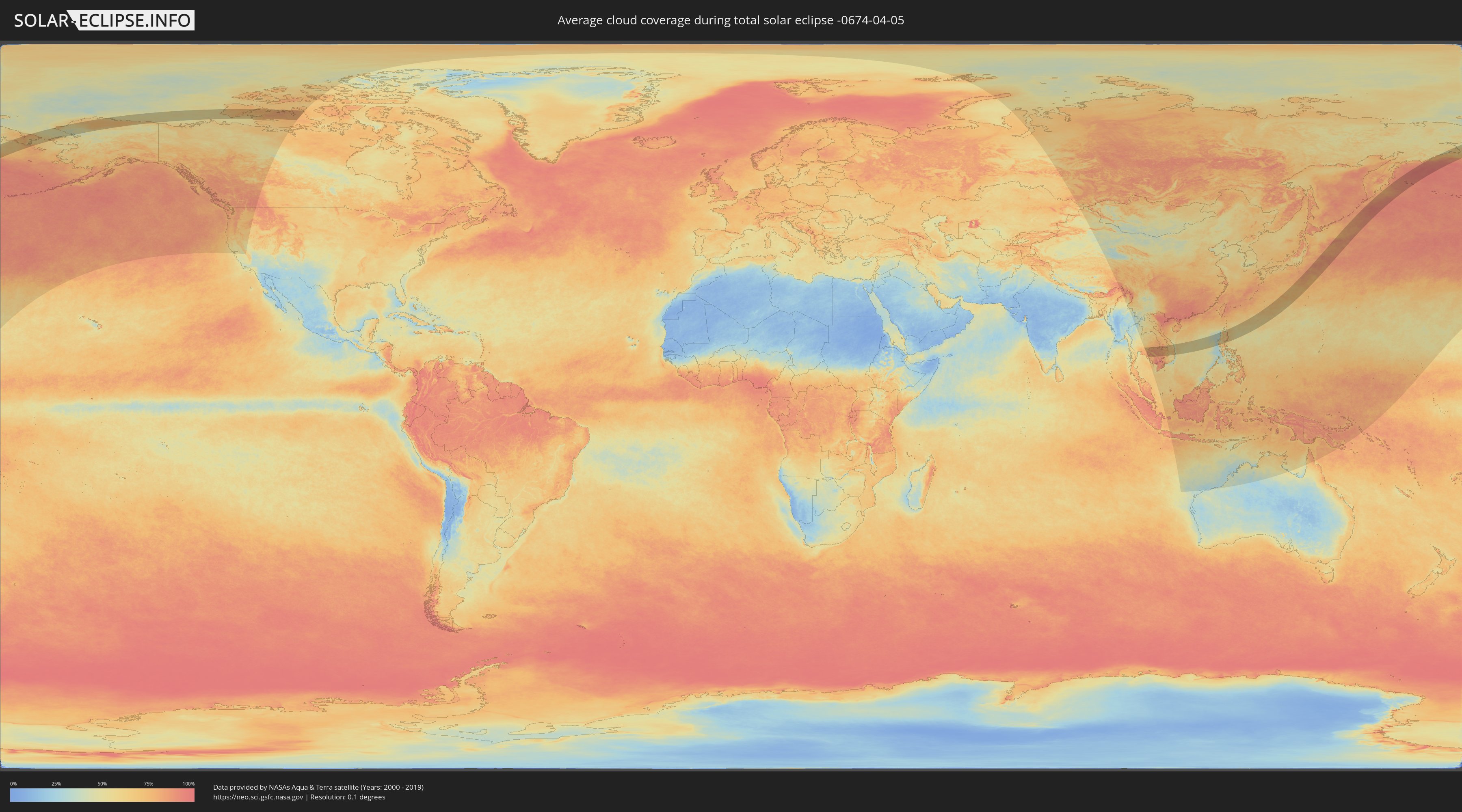
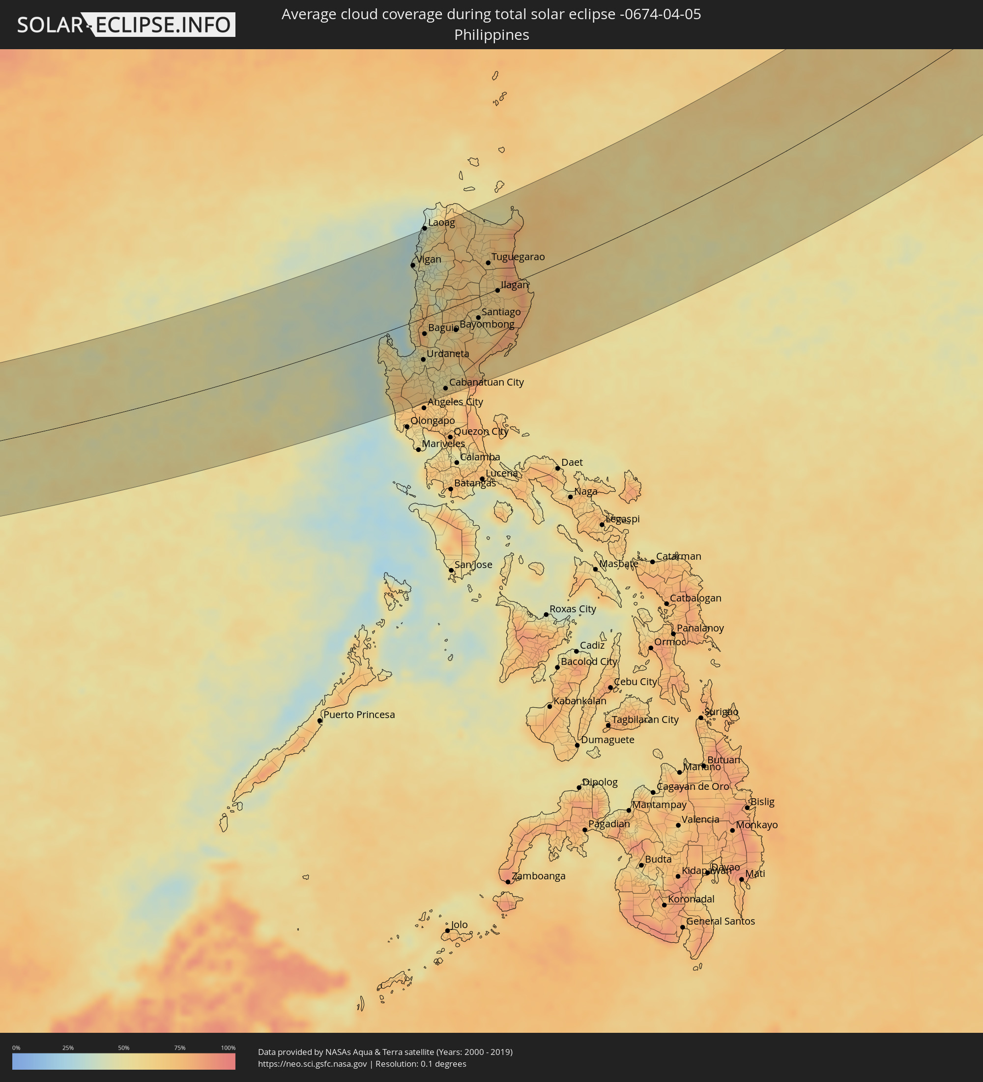
Wie wird das Wetter während der totalen Sonnenfinsternis am 05.04.-0674?
Wo ist der beste Ort, um die totale Sonnenfinsternis vom 05.04.-0674 zu beobachten?
Die folgenden Karten zeigen die durchschnittliche Bewölkung für den Tag, an dem die totale Sonnenfinsternis
stattfindet. Mit Hilfe der Karten lässt sich der Ort entlang des Finsternispfades eingrenzen,
der die besten Aussichen auf einen klaren wolkenfreien Himmel bietet.
Trotzdem muss man immer lokale Gegenenheiten beachten und sollte sich genau über das Wetter an seinem
gewählten Beobachtungsort informieren.
Die Daten stammen von den beiden NASA-Satelliten
AQUA und TERRA
und wurden über einen Zeitraum von 19 Jahren (2000 - 2019) gemittelt.
Detaillierte Länderkarten
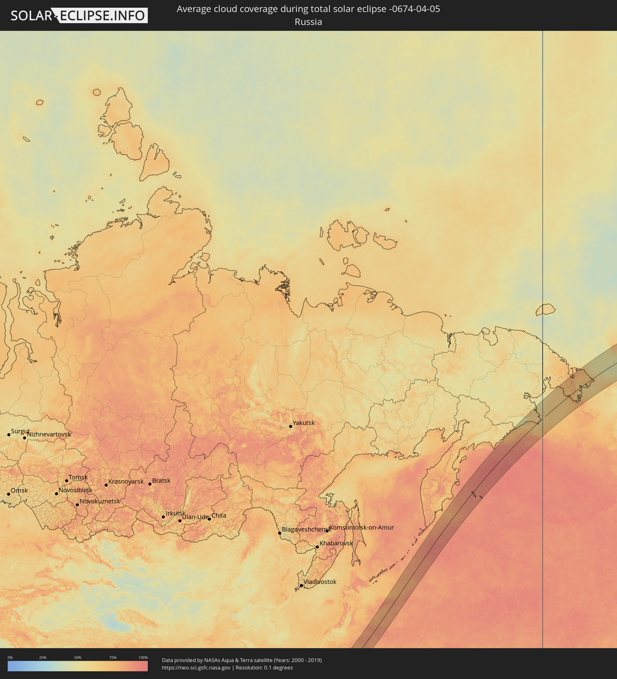 Russland
 Vereinigte Staaten
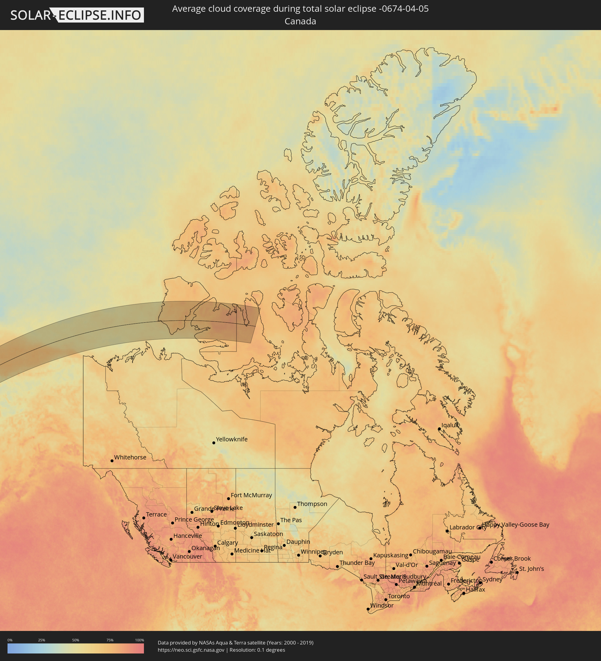 Kanada
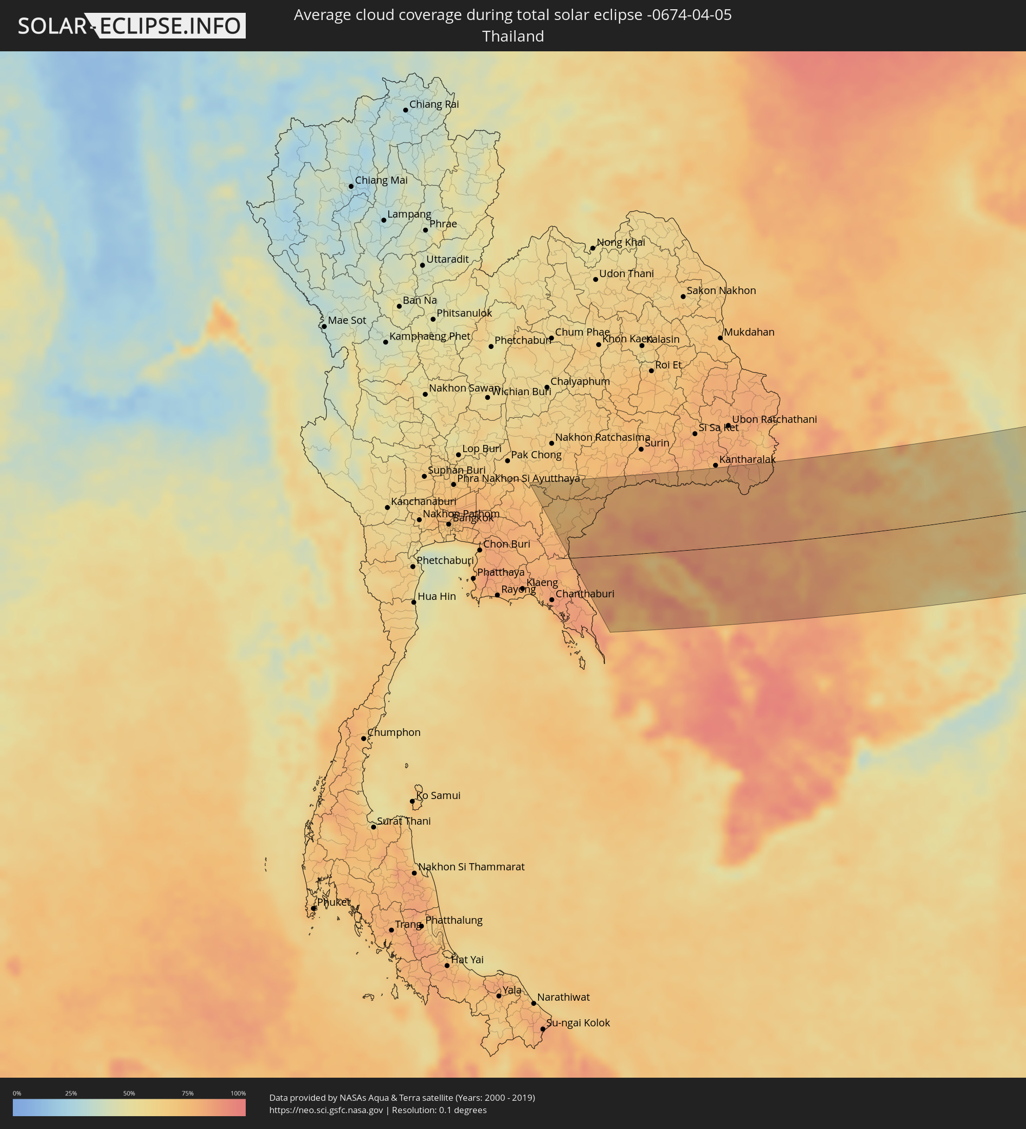 Thailand
 Laos
Laos
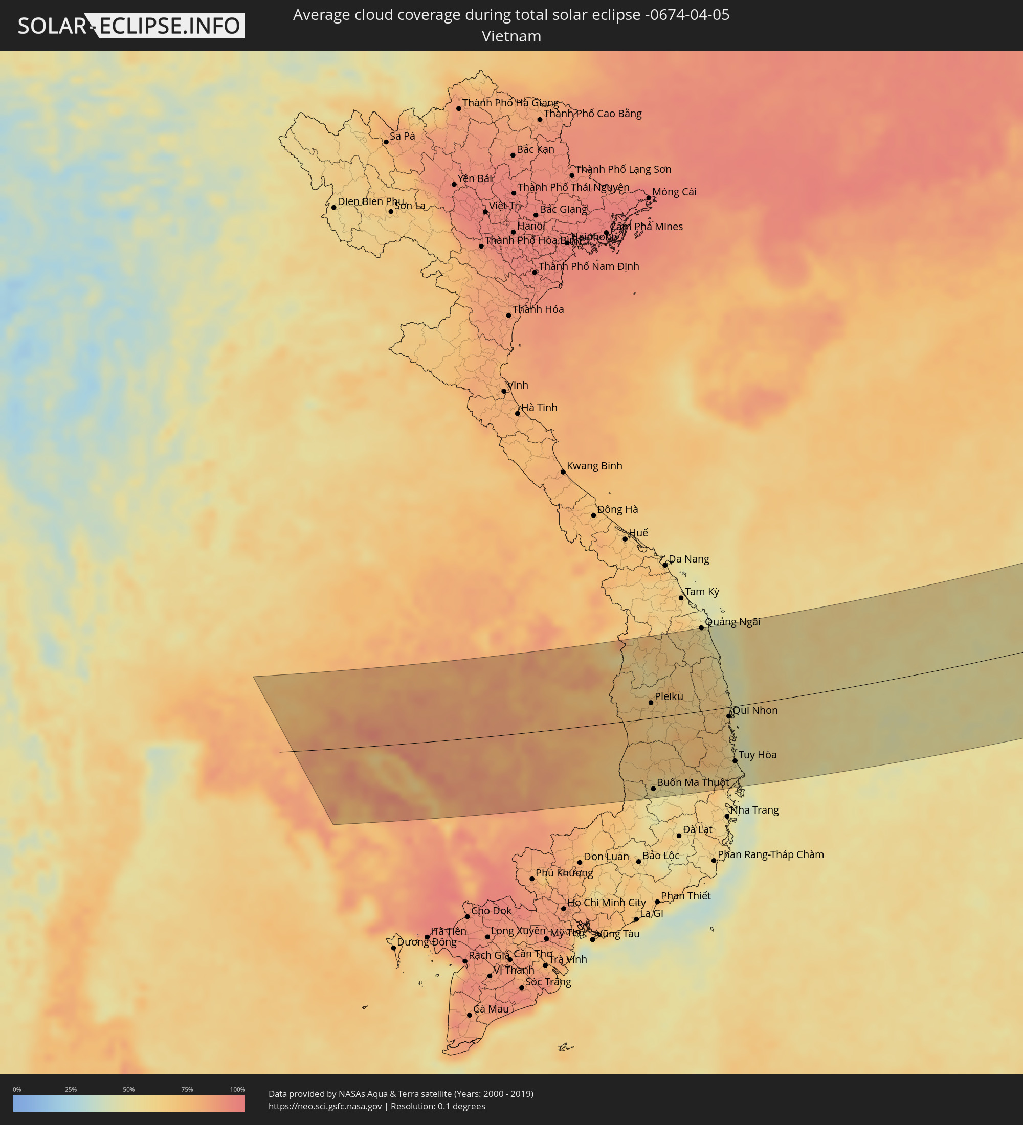 Vietnam
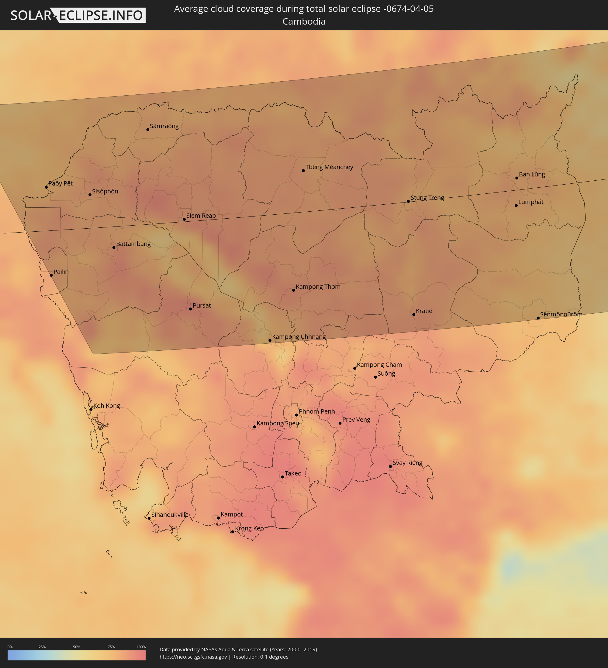 Kambodscha
 Philippinen
Orte im Finsternispfad
Die nachfolgene Tabelle zeigt Städte und Orte mit mehr als 5.000 Einwohnern, die sich im Finsternispfad befinden. Städte mit mehr als 100.000 Einwohnern sind dick gekennzeichnet. Mit einem Klick auf den Ort öffnet sich eine Detailkarte die die Lage des jeweiligen Ortes zusammen mit dem Verlauf der zentralen Finsternis präsentiert.
| Ort | Typ | Dauer der Verfinsterung | Ortszeit bei maximaler Verfinsterung | Entfernung zur Zentrallinie | Ø Bewölkung |
|
Sa Kaeo, Sa Kaeo
|
total | - | 05:55:51 UTC+06:42 | 65 km | 73% |
|
Soeng Sang, Nakhon Ratchasima
|
total | - | 05:56:35 UTC+06:42 | 130 km | 72% |
|
Aranyaprathet, Sa Kaeo
|
total | - | 05:55:41 UTC+06:42 | 49 km | 75% |
|
Paôy Pêt, Banteay Meanchey
|
total | - | 05:55:38 UTC+06:42 | 44 km | 76% |
|
Pailin, Pailin
|
total | - | 05:54:39 UTC+06:42 | 46 km | 82% |
|
Sisŏphŏn, Banteay Meanchey
|
total | - | 05:55:32 UTC+06:42 | 34 km | 79% |
|
Battambang, Battambang
|
total | - | 05:54:56 UTC+06:42 | 22 km | 86% |
|
Sâmraông, Ŏtâr Méanchey
|
total | - | 05:56:15 UTC+06:42 | 96 km | 78% |
|
Siem Reap, Siem Reap
|
total | - | 05:55:14 UTC+06:42 | 2 km | 85% |
|
Pursat, Pursat
|
total | - | 05:54:13 UTC+06:42 | 90 km | 83% |
|
Kampong Chhnang, Kampong Chhnang
|
total | - | 05:53:52 UTC+06:42 | 128 km | 76% |
|
Kampong Thom, Kampong Thom
|
total | - | 05:54:25 UTC+06:42 | 79 km | 86% |
|
Tbêng Méanchey, Preah Vihear
|
total | - | 05:55:47 UTC+06:42 | 42 km | 83% |
|
Không, Champasak
|
total | - | 05:56:12 UTC+06:42 | 67 km | 78% |
|
Stung Treng, Stung Treng
|
total | - | 05:55:27 UTC+06:42 | 0 km | 82% |
|
Kratié, Kratie
|
total | - | 05:54:09 UTC+06:42 | 115 km | 85% |
|
Attapu, Attapu
|
total | - | 05:57:09 UTC+06:42 | 132 km | 77% |
|
Lumphăt, Ratanakiri
|
total | - | 05:55:27 UTC+06:42 | 16 km | 75% |
|
Ban Lŭng, Ratanakiri
|
total | - | 05:55:47 UTC+06:42 | 12 km | 79% |
|
Sênmônoŭrôm, Mondolkiri
|
total | - | 05:54:10 UTC+06:42 | 133 km | 74% |
|
Pleiku, Gia Lai
|
total | - | 06:20:46 UTC+07:06 | 25 km | 67% |
|
Kon Tum, Kon Tum
|
total | - | 06:21:16 UTC+07:06 | 66 km | 56% |
|
Buôn Ma Thuột, Ðắc Lắk
|
total | - | 06:19:05 UTC+07:06 | 121 km | 54% |
|
Quảng Ngãi, Quảng Ngãi
|
total | - | 06:22:22 UTC+07:06 | 139 km | 56% |
|
Sông Cầu, Phú Yên
|
total | - | 06:20:13 UTC+07:06 | 52 km | 60% |
|
Qui Nhon, Bình Định
|
total | - | 06:20:38 UTC+07:06 | 16 km | 62% |
|
Tuy Hòa, Phú Yên
|
total | - | 06:19:46 UTC+07:06 | 93 km | 54% |
|
Santa Cruz, Central Luzon
|
total | - | 07:19:52 UTC+08:00 | 73 km | 50% |
|
Masinloc, Central Luzon
|
total | - | 07:19:32 UTC+08:00 | 98 km | 68% |
|
Iba, Central Luzon
|
total | - | 07:19:14 UTC+08:00 | 121 km | 50% |
|
Agoo, Ilocos
|
total | - | 07:20:26 UTC+08:00 | 46 km | 47% |
|
Lingayen, Ilocos
|
total | - | 07:20:24 UTC+08:00 | 57 km | 44% |
|
San Fernando, Ilocos
|
total | - | 07:21:21 UTC+08:00 | 2 km | 45% |
|
Urbiztondo, Ilocos
|
total | - | 07:20:08 UTC+08:00 | 82 km | 49% |
|
Aringay, Ilocos
|
total | - | 07:21:02 UTC+08:00 | 23 km | 60% |
|
Vigan, Ilocos
|
total | - | 07:22:53 UTC+08:00 | 99 km | 43% |
|
Mangaldan, Ilocos
|
total | - | 07:20:33 UTC+08:00 | 59 km | 45% |
|
Camiling, Central Luzon
|
total | - | 07:19:58 UTC+08:00 | 99 km | 60% |
|
Tagudin, Ilocos
|
total | - | 07:21:55 UTC+08:00 | 30 km | 49% |
|
Candon, Ilocos
|
total | - | 07:22:19 UTC+08:00 | 57 km | 52% |
|
Batac City, Ilocos
|
total | - | 07:23:44 UTC+08:00 | 142 km | 43% |
|
Urdaneta, Ilocos
|
total | - | 07:20:29 UTC+08:00 | 75 km | 50% |
|
Paniqui, Central Luzon
|
total | - | 07:20:01 UTC+08:00 | 107 km | 58% |
|
Capas, Central Luzon
|
total | - | 07:19:31 UTC+08:00 | 143 km | 70% |
|
Baguio, Cordillera
|
total | - | 07:21:11 UTC+08:00 | 29 km | 67% |
|
Laoag, Ilocos
|
total | - | 07:23:58 UTC+08:00 | 156 km | 39% |
|
Tarlac City, Central Luzon
|
total | - | 07:19:44 UTC+08:00 | 127 km | 65% |
|
Guiset East, Ilocos
|
total | - | 07:20:41 UTC+08:00 | 69 km | 50% |
|
Guimba, Central Luzon
|
total | - | 07:20:06 UTC+08:00 | 115 km | 50% |
|
Mankayan, Cordillera
|
total | - | 07:21:58 UTC+08:00 | 10 km | 48% |
|
San Francisco, Central Luzon
|
total | - | 07:19:40 UTC+08:00 | 149 km | 64% |
|
Muñoz, Central Luzon
|
total | - | 07:20:15 UTC+08:00 | 114 km | 51% |
|
Cabanatuan City, Central Luzon
|
total | - | 07:19:55 UTC+08:00 | 140 km | 68% |
|
Bongabon, Central Luzon
|
total | - | 07:20:14 UTC+08:00 | 132 km | 64% |
|
Bayombong, Cagayan Valley
|
total | - | 07:21:33 UTC+08:00 | 43 km | 56% |
|
Diadi, Cagayan Valley
|
total | - | 07:22:02 UTC+08:00 | 26 km | 59% |
|
Tabuk, Cordillera
|
total | - | 07:23:16 UTC+08:00 | 47 km | 59% |
|
Santiago, Cagayan Valley
|
total | - | 07:22:04 UTC+08:00 | 37 km | 56% |
|
San Mateo, Cagayan Valley
|
total | - | 07:22:24 UTC+08:00 | 19 km | 60% |
|
Roxas, Cagayan Valley
|
total | - | 07:22:47 UTC+08:00 | 4 km | 61% |
|
Aparri, Cagayan Valley
|
total | - | 07:24:46 UTC+08:00 | 131 km | 53% |
|
Magapit, Aguiguican, Cagayan Valley
|
total | - | 07:24:23 UTC+08:00 | 104 km | 66% |
|
Alicia, Cagayan Valley
|
total | - | 07:22:18 UTC+08:00 | 34 km | 62% |
|
Tuguegarao, Cagayan Valley
|
total | - | 07:23:38 UTC+08:00 | 52 km | 65% |
|
Cabagan, Cagayan Valley
|
total | - | 07:23:21 UTC+08:00 | 30 km | 62% |
|
Ilagan, Cagayan Valley
|
total | - | 07:22:59 UTC+08:00 | 3 km | 64% |
|
San Mariano, Cagayan Valley
|
total | - | 07:22:47 UTC+08:00 | 25 km | 64% |