Totale Sonnenfinsternis vom 18.07.-0689
| Wochentag: | Donnerstag |
| Maximale Dauer der Verfinsterung: | 06m35s |
| Maximale Breite des Finsternispfades: | 240 km |
| Saroszyklus: | 54 |
| Bedeckungsgrad: | 100% |
| Magnitude: | 1.0724 |
| Gamma: | -0.1957 |
Wo kann man die Sonnenfinsternis vom 18.07.-0689 sehen?
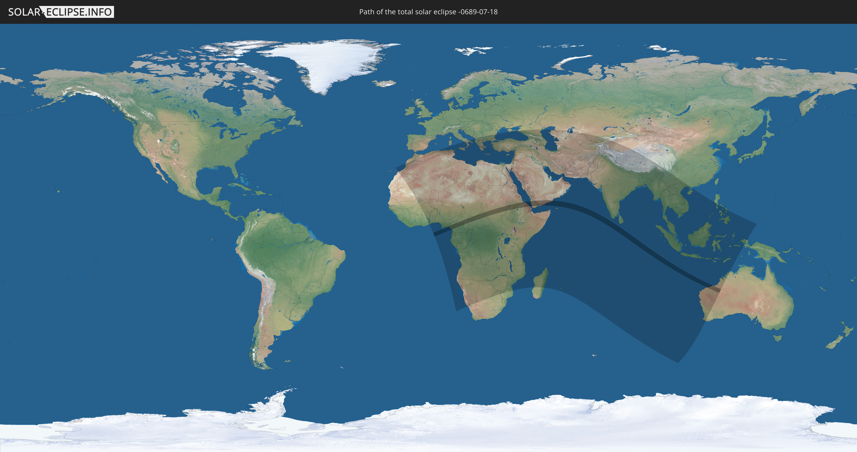
Die Sonnenfinsternis am 18.07.-0689 kann man in 105 Ländern als partielle Sonnenfinsternis beobachten.
Der Finsternispfad verläuft durch 12 Länder. Nur in diesen Ländern ist sie als totale Sonnenfinsternis zu sehen.
In den folgenden Ländern ist die Sonnenfinsternis total zu sehen
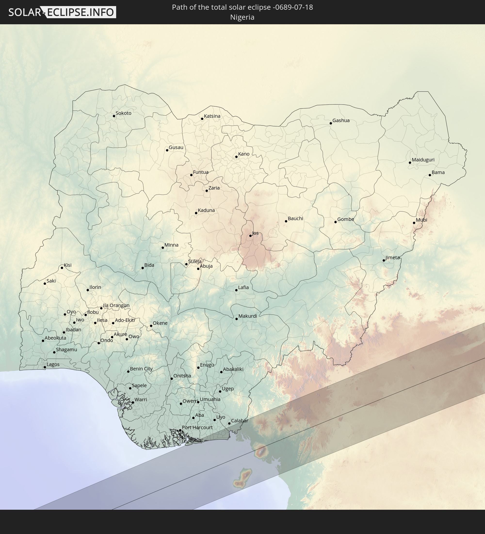 Nigeria
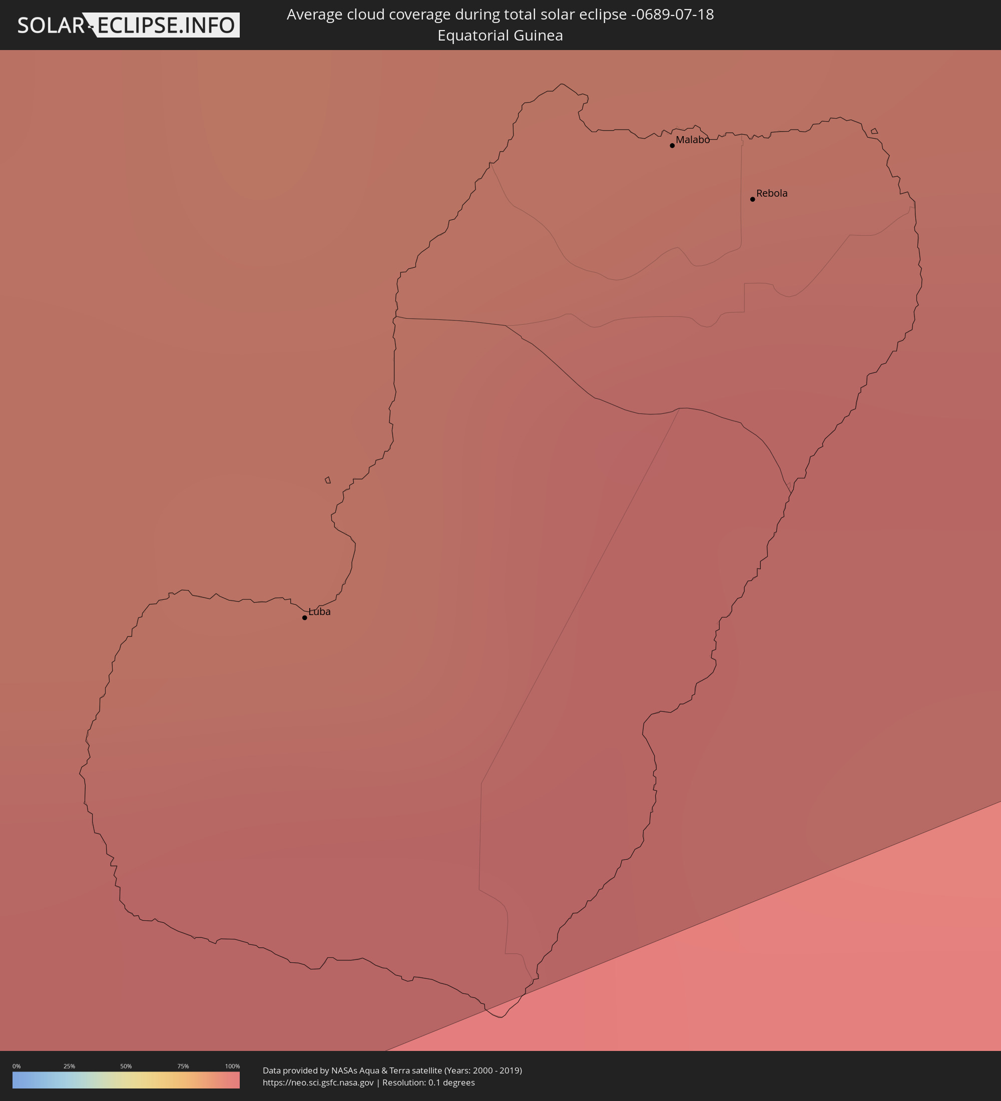
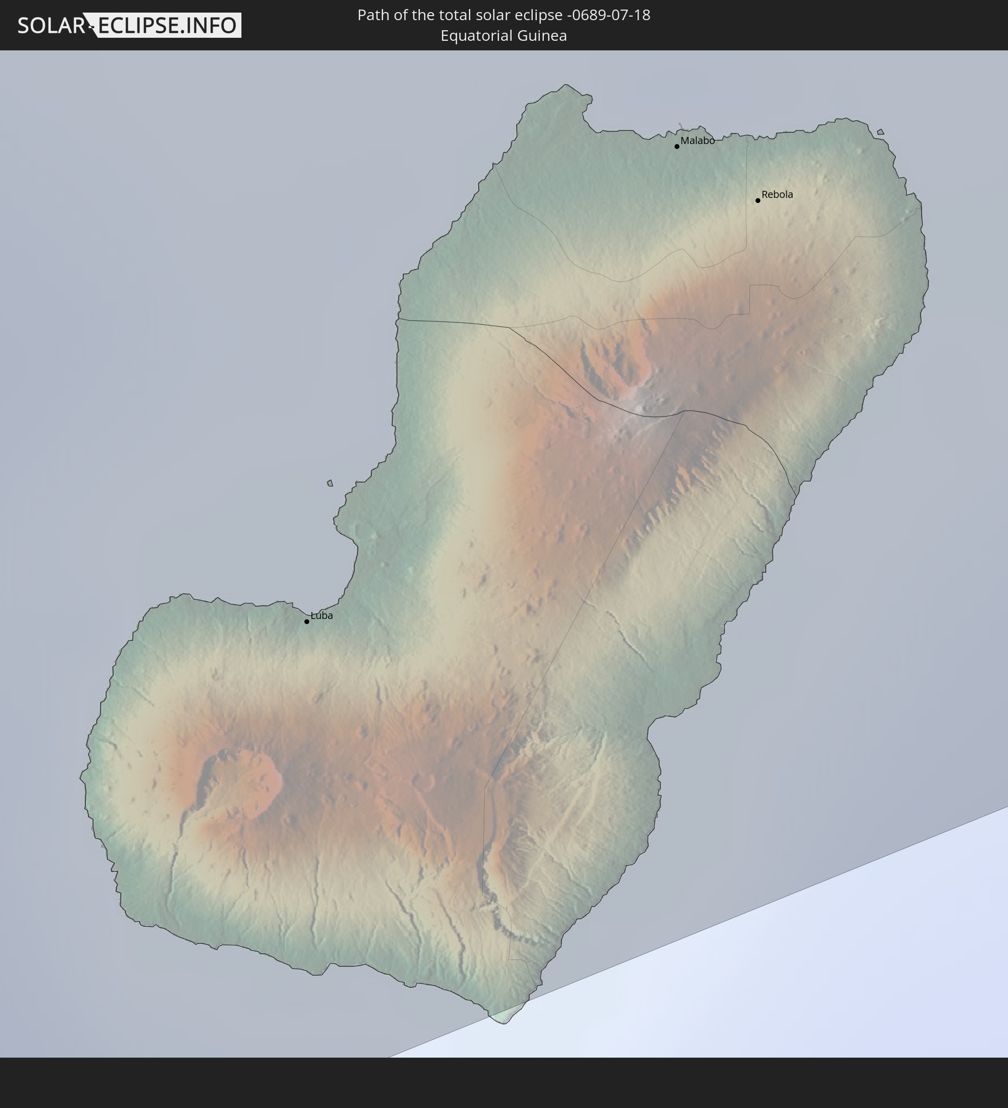 Äquatorialguinea
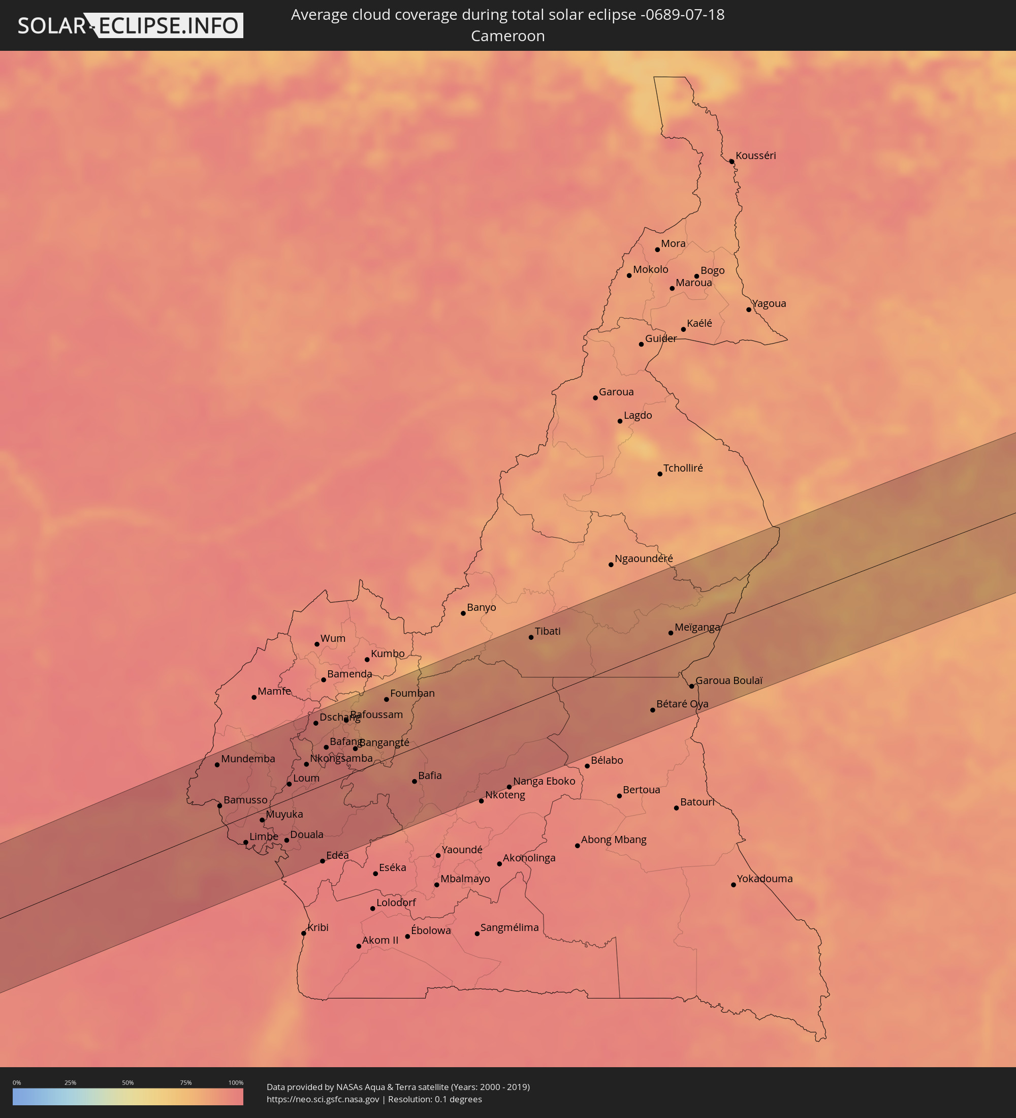
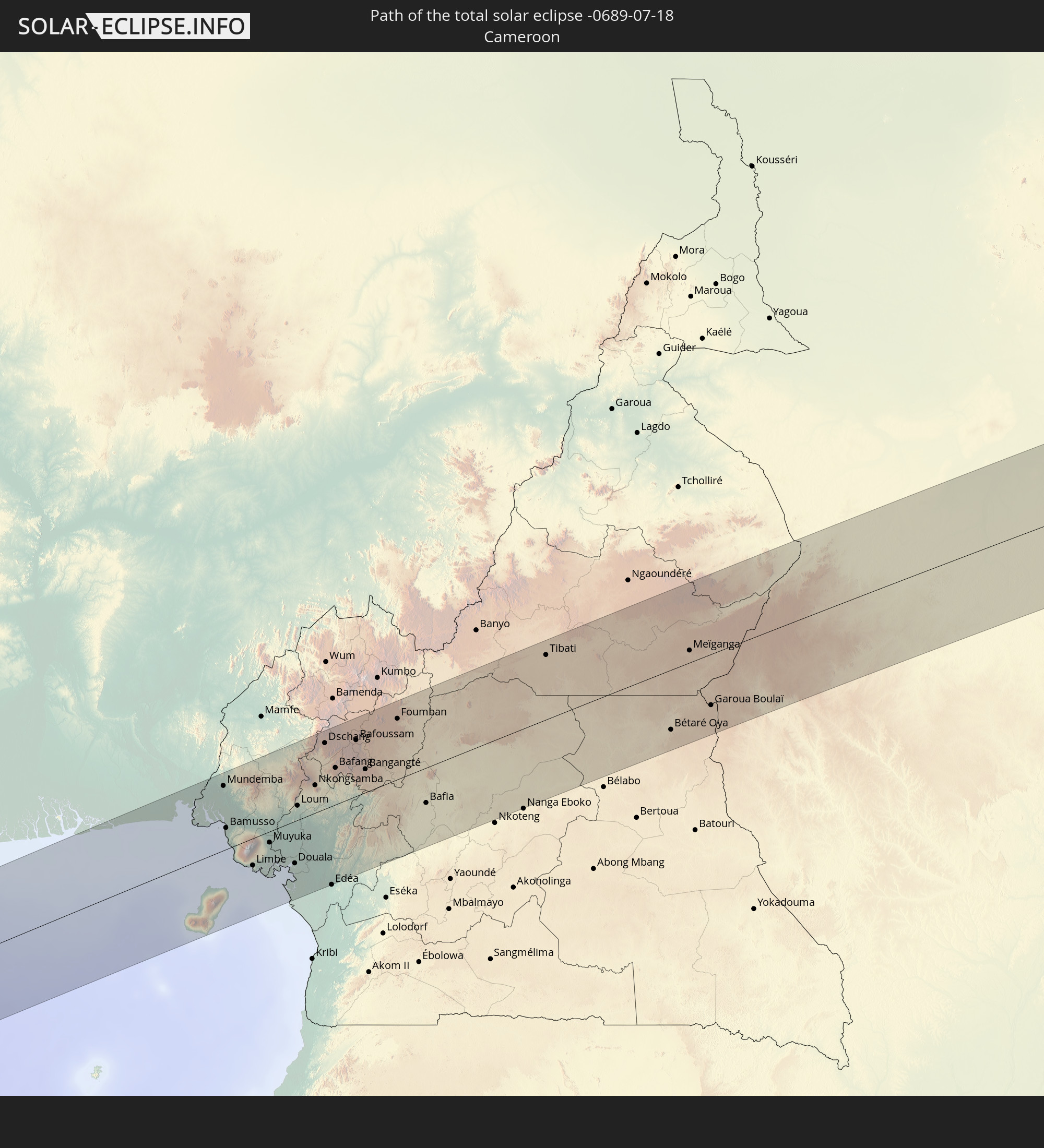 Kamerun
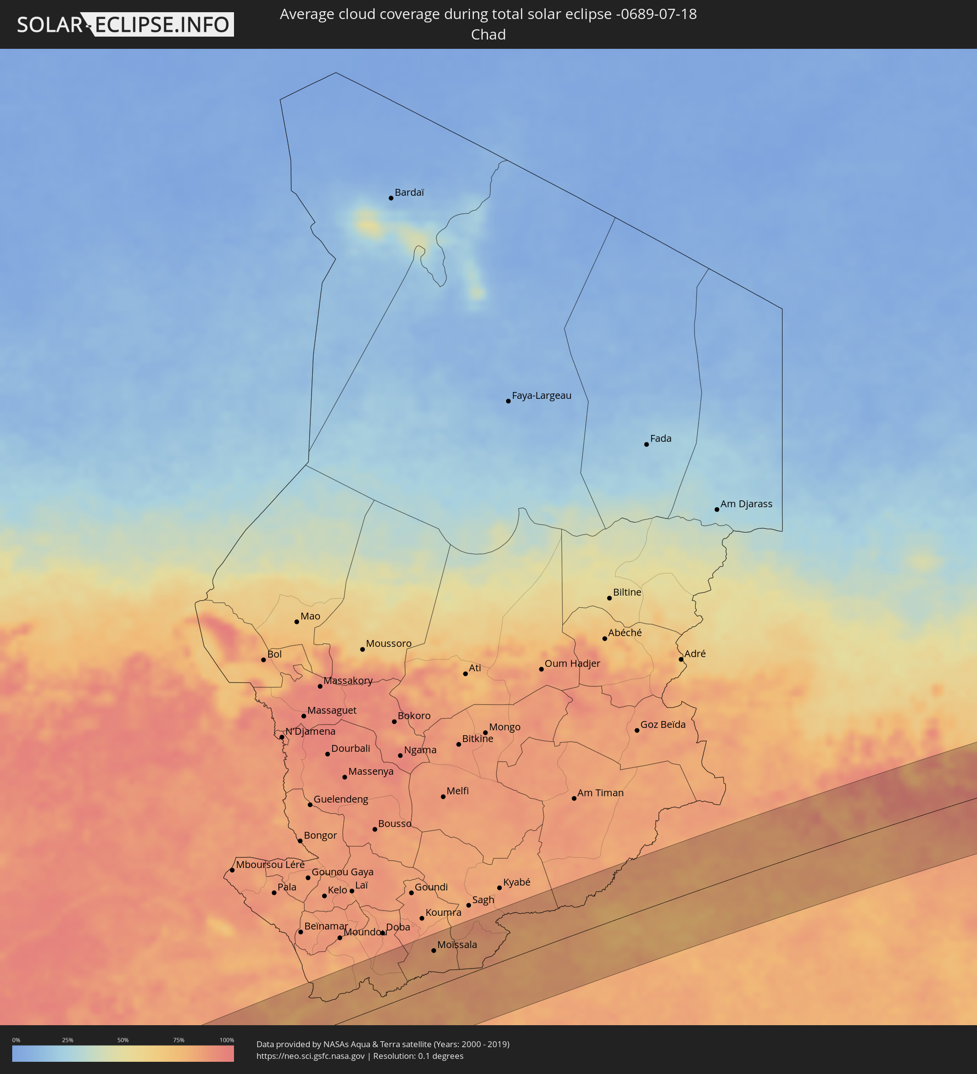
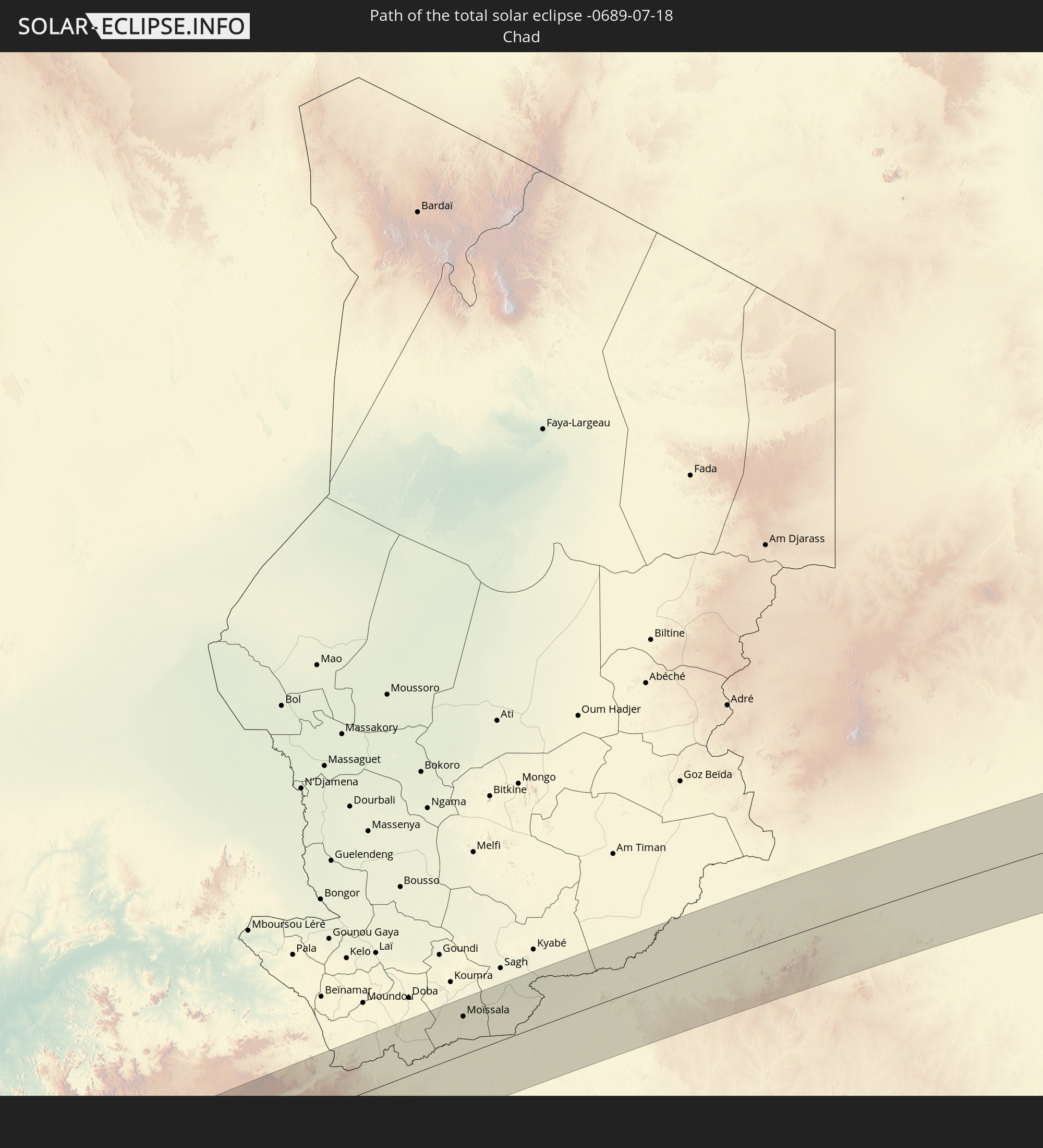 Tschad
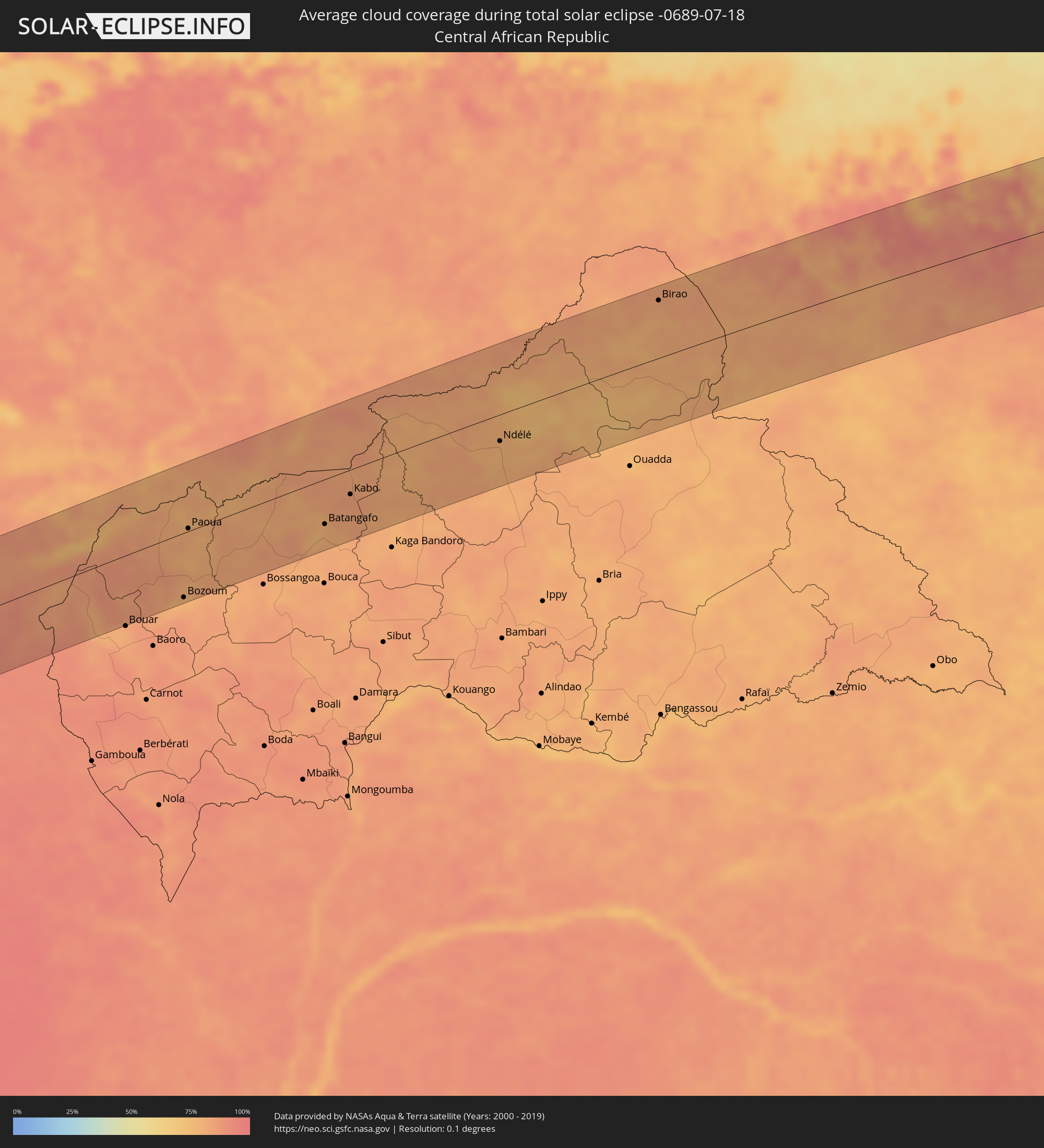
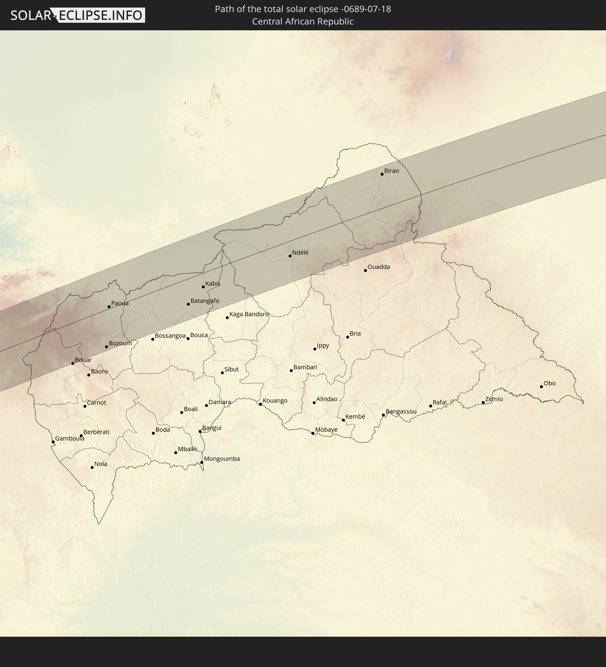 Zentralafrikanische Republik
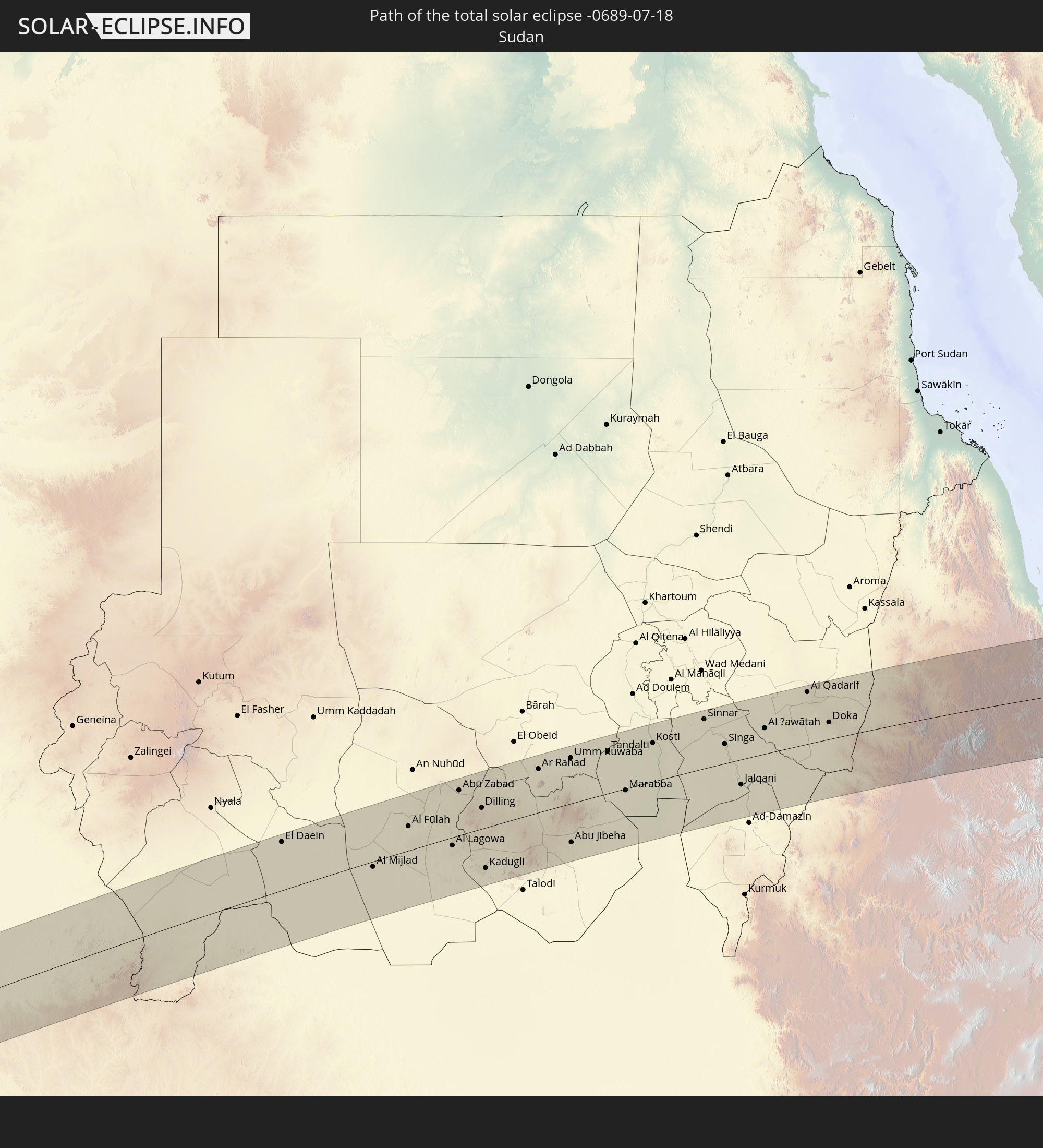 Sudan
Sudan
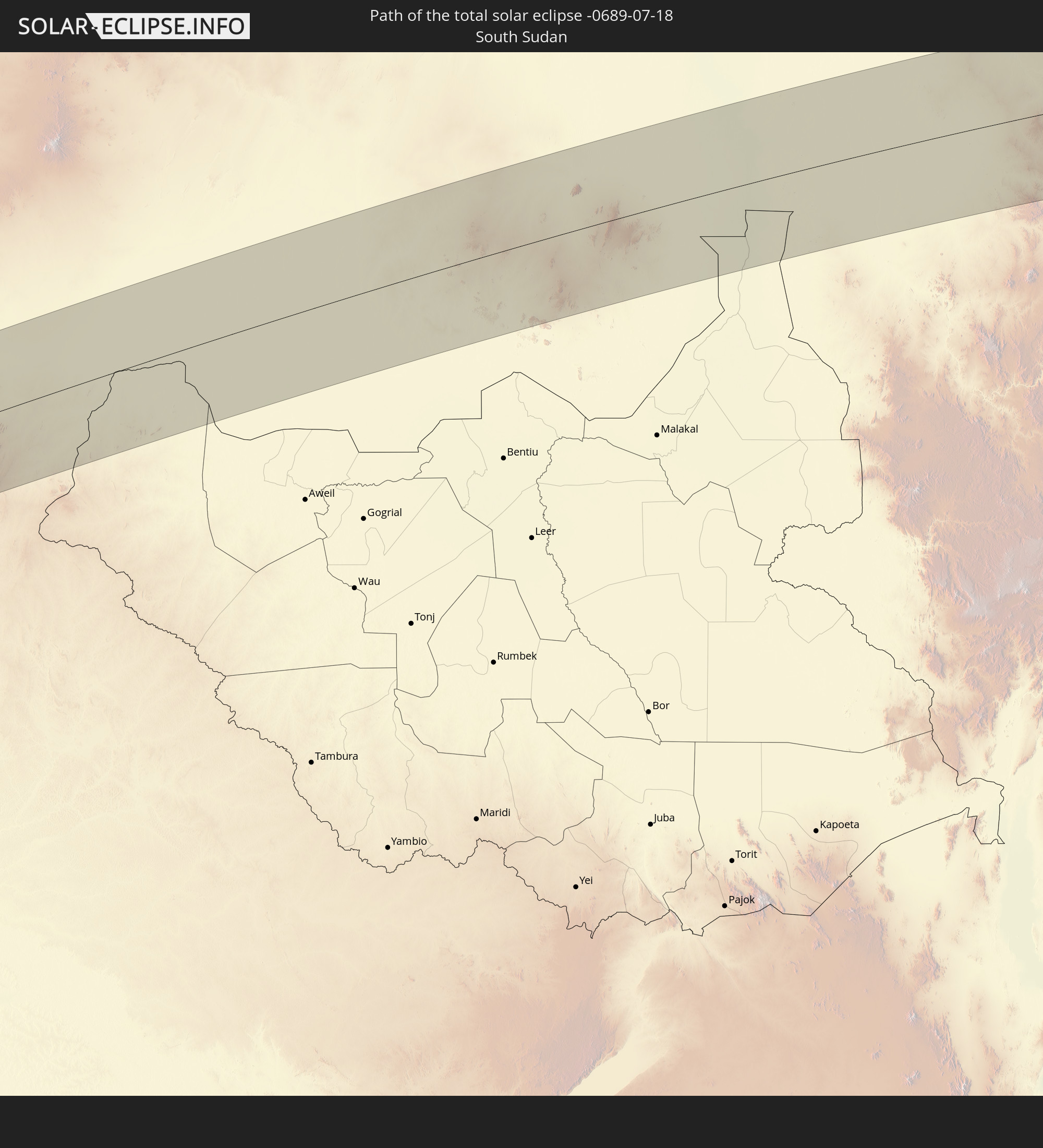 Südsudan
 Äthiopien
 Eritrea
 Jemen
Jemen
 Malediven
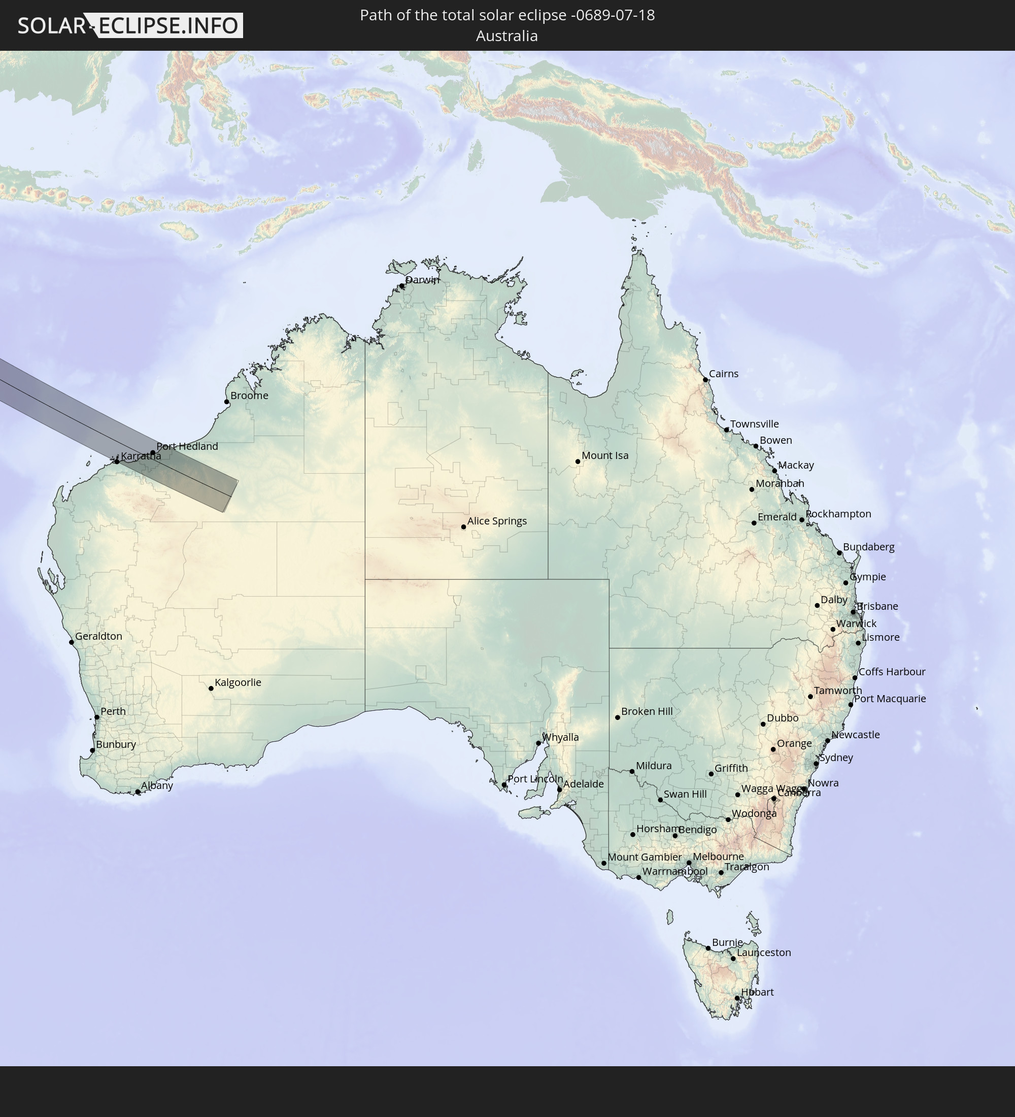 Australien
In den folgenden Ländern ist die Sonnenfinsternis partiell zu sehen
 Russland
 Spanien
 Mauretanien
 Marokko
 Mali
Mali
 Algerien
 Burkina Faso
 Ghana
Ghana
 Togo
Togo
 Niger
Niger
 Benin
Benin
 Nigeria
 Äquatorialguinea
 São Tomé und Príncipe
 Italien
 Tunesien
 Kamerun
 Gabun
Gabun
 Libyen
 Republik Kongo
 Angola
 Namibia
 Demokratische Republik Kongo
 Tschad
 Malta
Malta
 Zentralafrikanische Republik
 Südafrika
 Serbien
 Albanien
 Griechenland
 Botswana
 Mazedonien
 Sudan
Sudan
 Sambia
 Ukraine
 Bulgarien
 Ägypten
 Simbabwe
 Türkei
 Ruanda
 Burundi
 Tansania
 Uganda
 Mosambik
 Republik Zypern
 Malawi
 Äthiopien
 Kenia
Kenia
 Staat Palästina
 Israel
 Saudi-Arabien
 Jordanien
 Libanon
 Syrien
 Eritrea
 Irak
Irak
 Georgien
 Französische Süd- und Antarktisgebiete
 Somalia
 Dschibuti
 Jemen
Jemen
 Madagaskar
 Komoren
 Armenien
 Iran
Iran
 Aserbaidschan
 Mayotte
 Seychellen
 Kasachstan
 Kuwait
 Bahrain
 Katar
Katar
 Vereinigte Arabische Emirate
 Oman
Oman
 Turkmenistan
 Réunion
 Usbekistan
 Mauritius
 Afghanistan
 Pakistan
 Tadschikistan
 Indien
 Kirgisistan
 Britisches Territorium im Indischen Ozean
 Malediven
 Volksrepublik China
 Sri Lanka
 Nepal
Nepal
 Bangladesch
 Bhutan
 Myanmar
 Indonesien
 Kokosinseln
 Thailand
 Malaysia
 Laos
Laos
 Vietnam
 Kambodscha
 Singapur
 Weihnachtsinsel
 Australien
 Brunei
 Philippinen
 Osttimor
 Palau
Palau
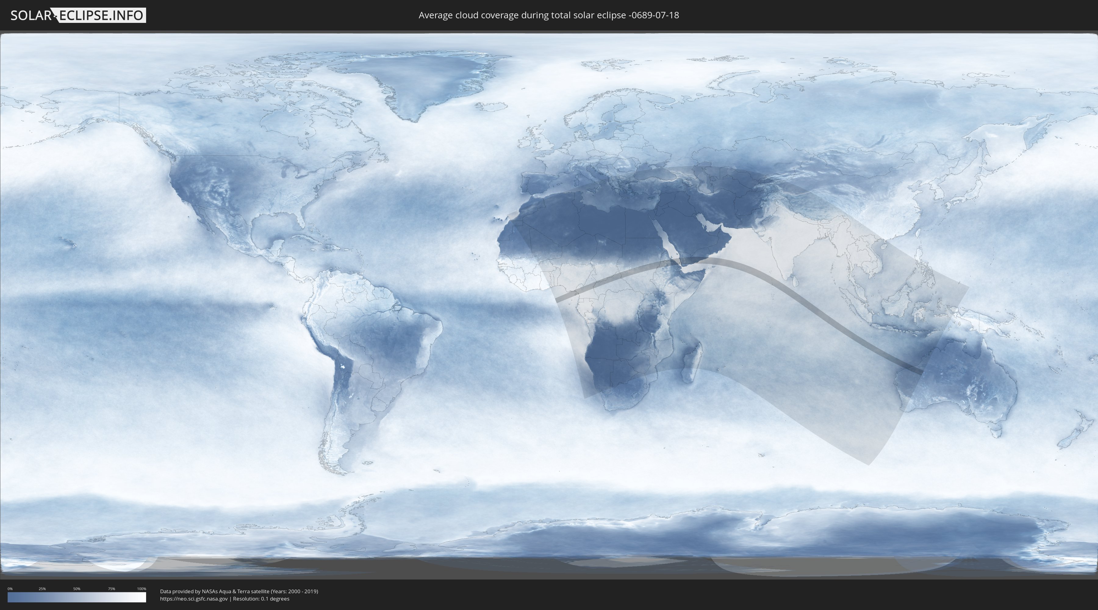
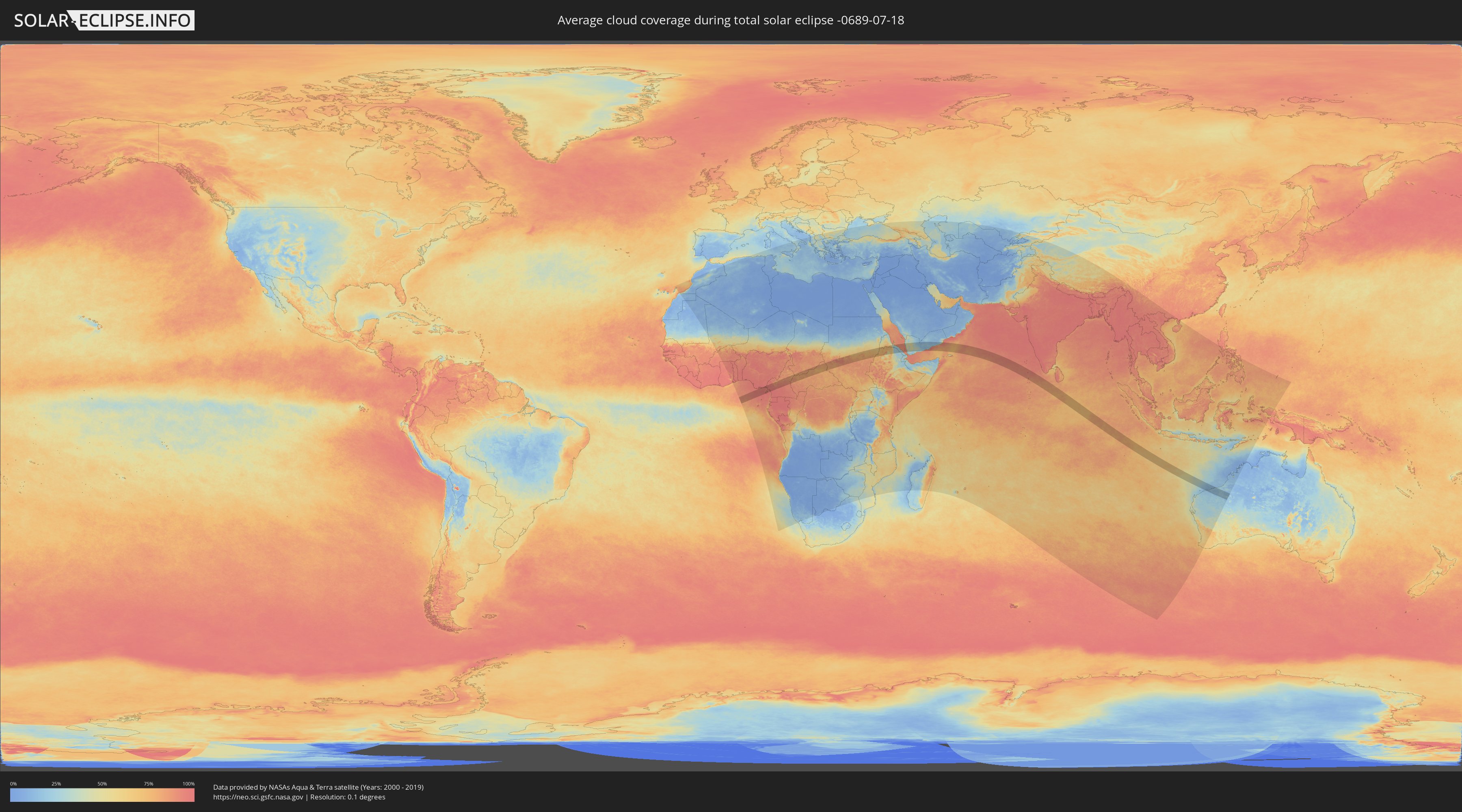
Wie wird das Wetter während der totalen Sonnenfinsternis am 18.07.-0689?
Wo ist der beste Ort, um die totale Sonnenfinsternis vom 18.07.-0689 zu beobachten?
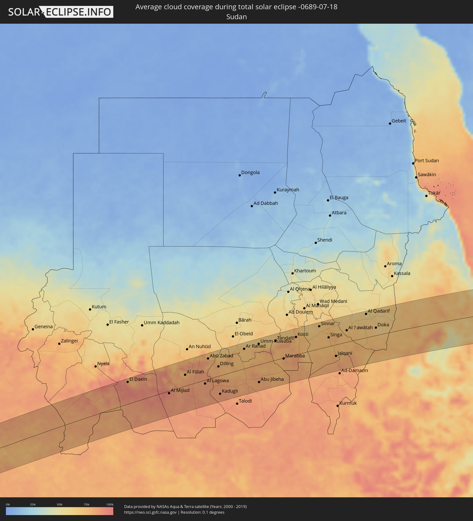
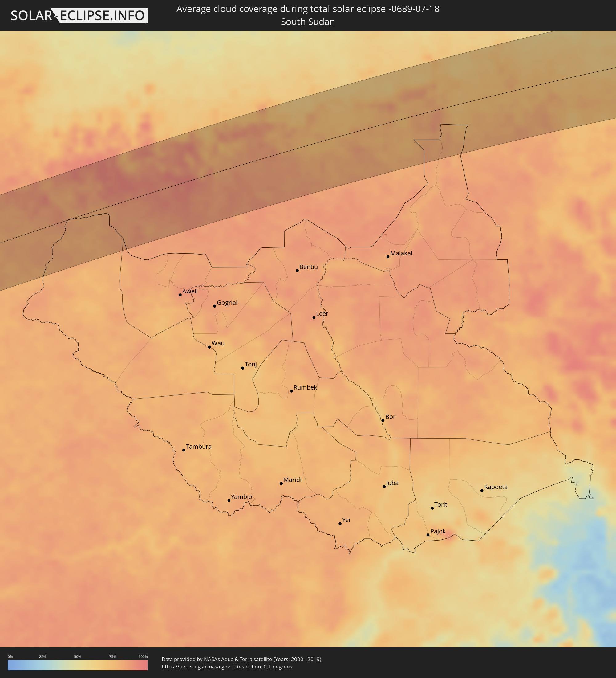
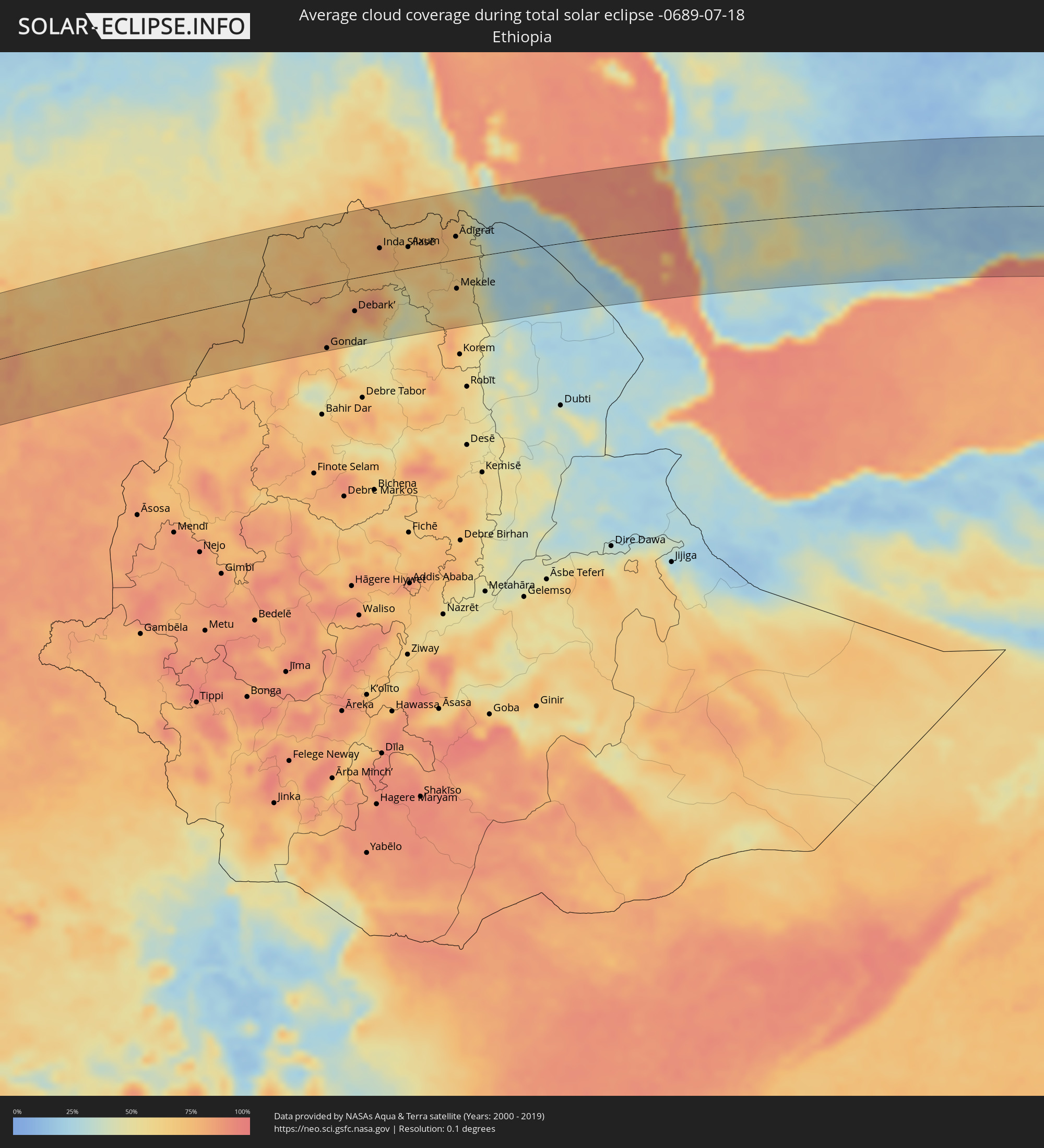
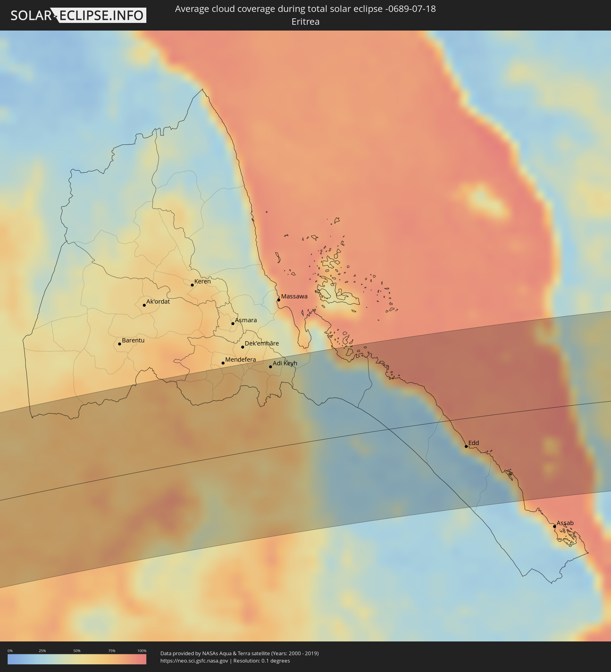
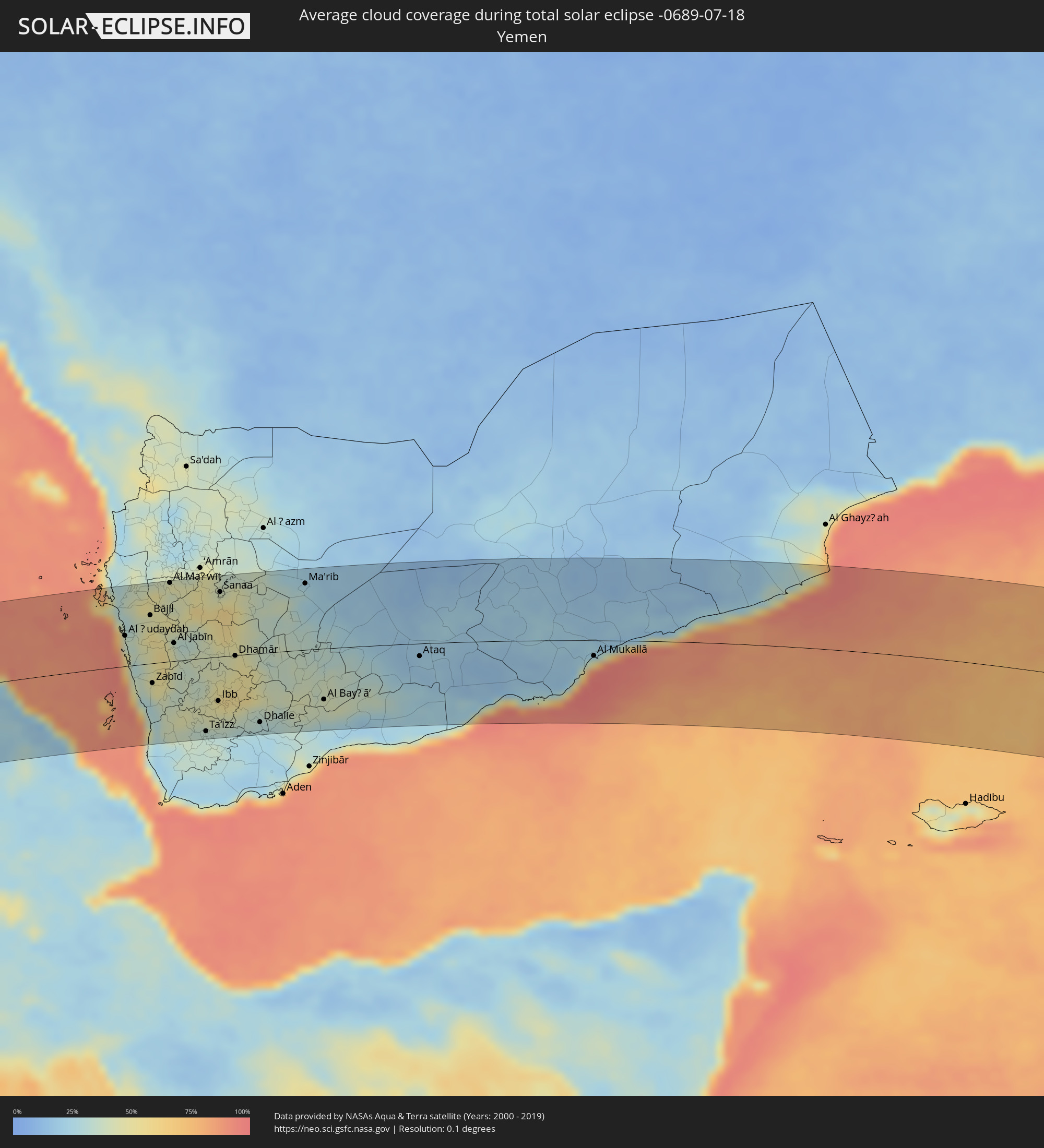
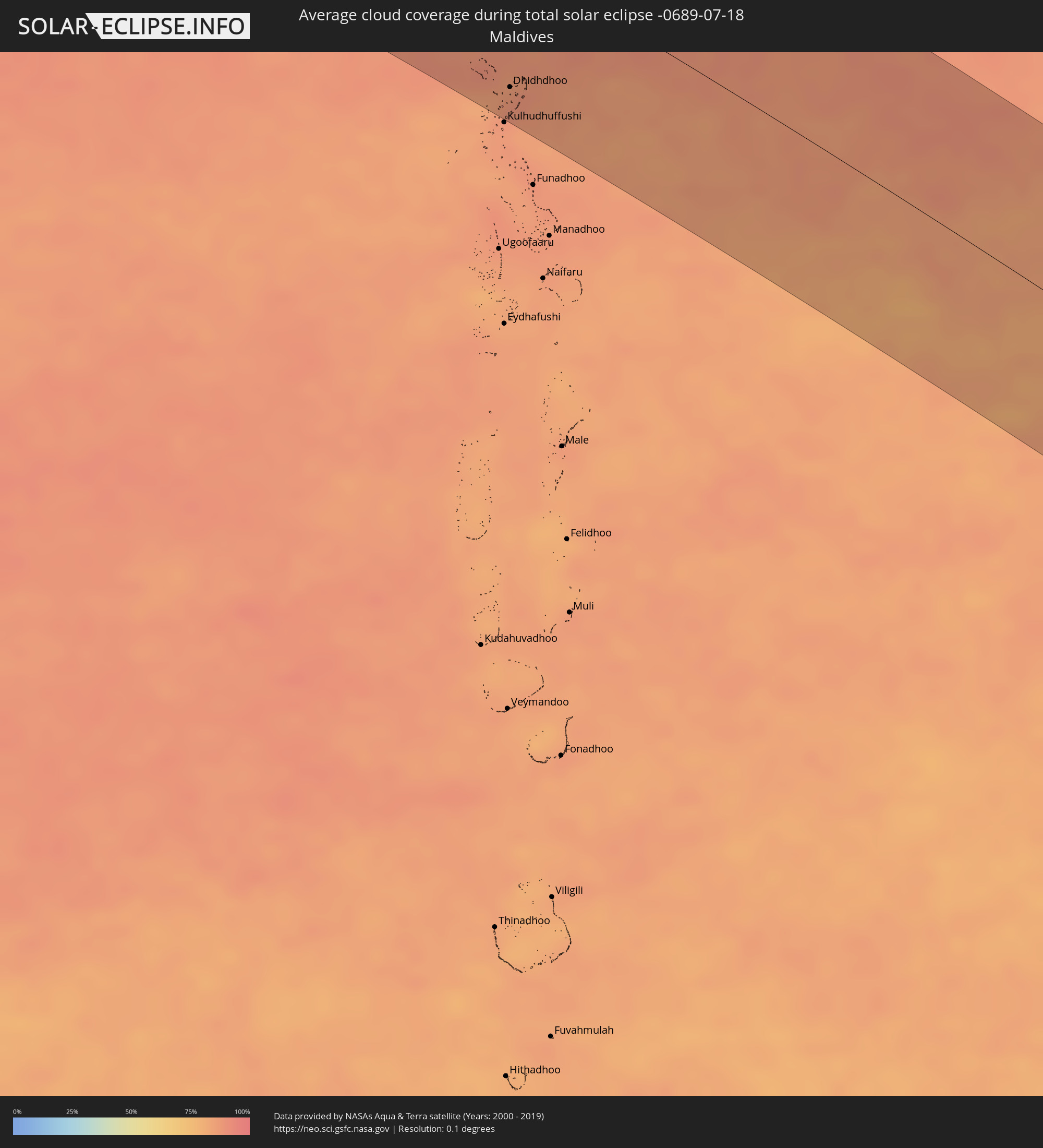
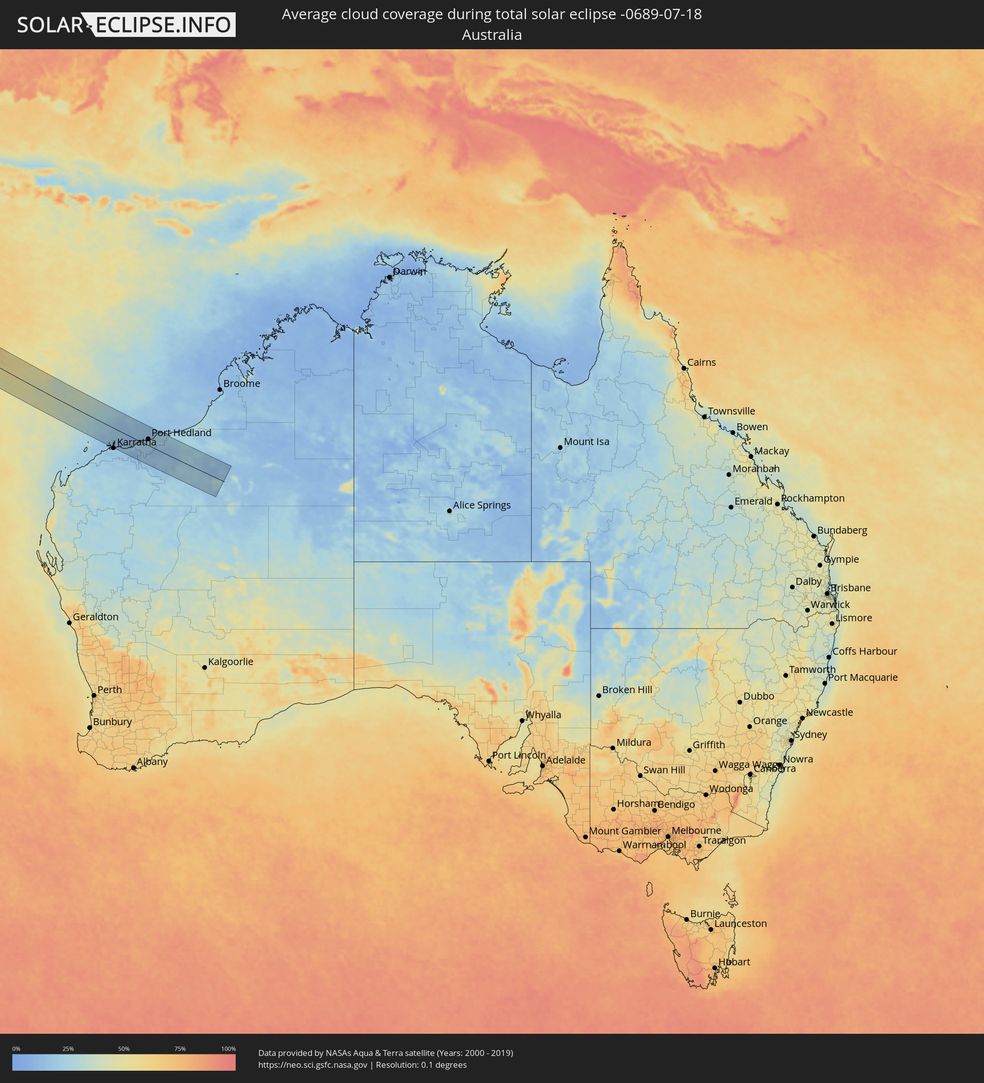
Die folgenden Karten zeigen die durchschnittliche Bewölkung für den Tag, an dem die totale Sonnenfinsternis
stattfindet. Mit Hilfe der Karten lässt sich der Ort entlang des Finsternispfades eingrenzen,
der die besten Aussichen auf einen klaren wolkenfreien Himmel bietet.
Trotzdem muss man immer lokale Gegenenheiten beachten und sollte sich genau über das Wetter an seinem
gewählten Beobachtungsort informieren.
Die Daten stammen von den beiden NASA-Satelliten
AQUA und TERRA
und wurden über einen Zeitraum von 19 Jahren (2000 - 2019) gemittelt.
Detaillierte Länderkarten
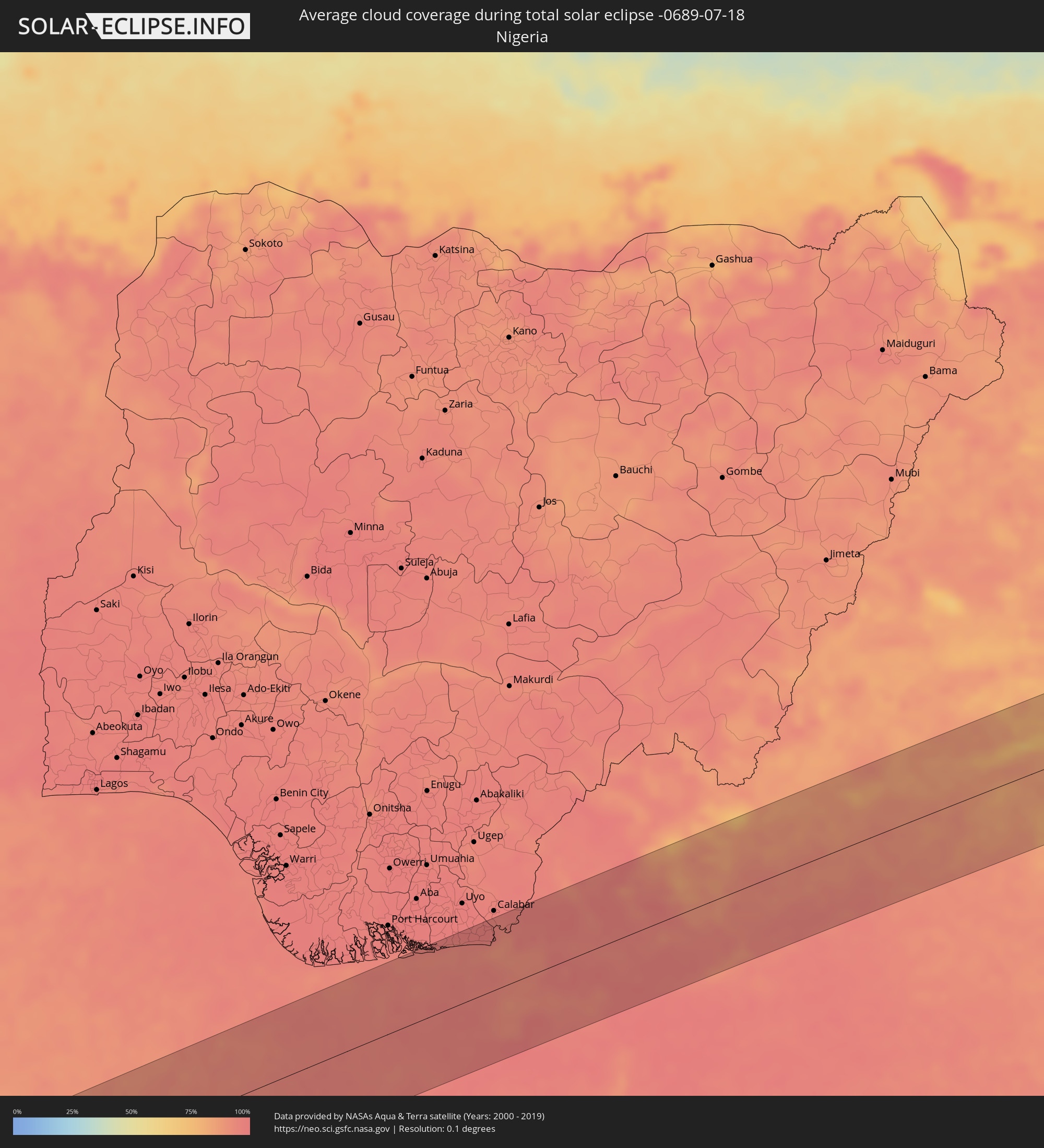 Nigeria
 Äquatorialguinea
 Kamerun
 Tschad
 Zentralafrikanische Republik
 Sudan
Sudan
 Südsudan
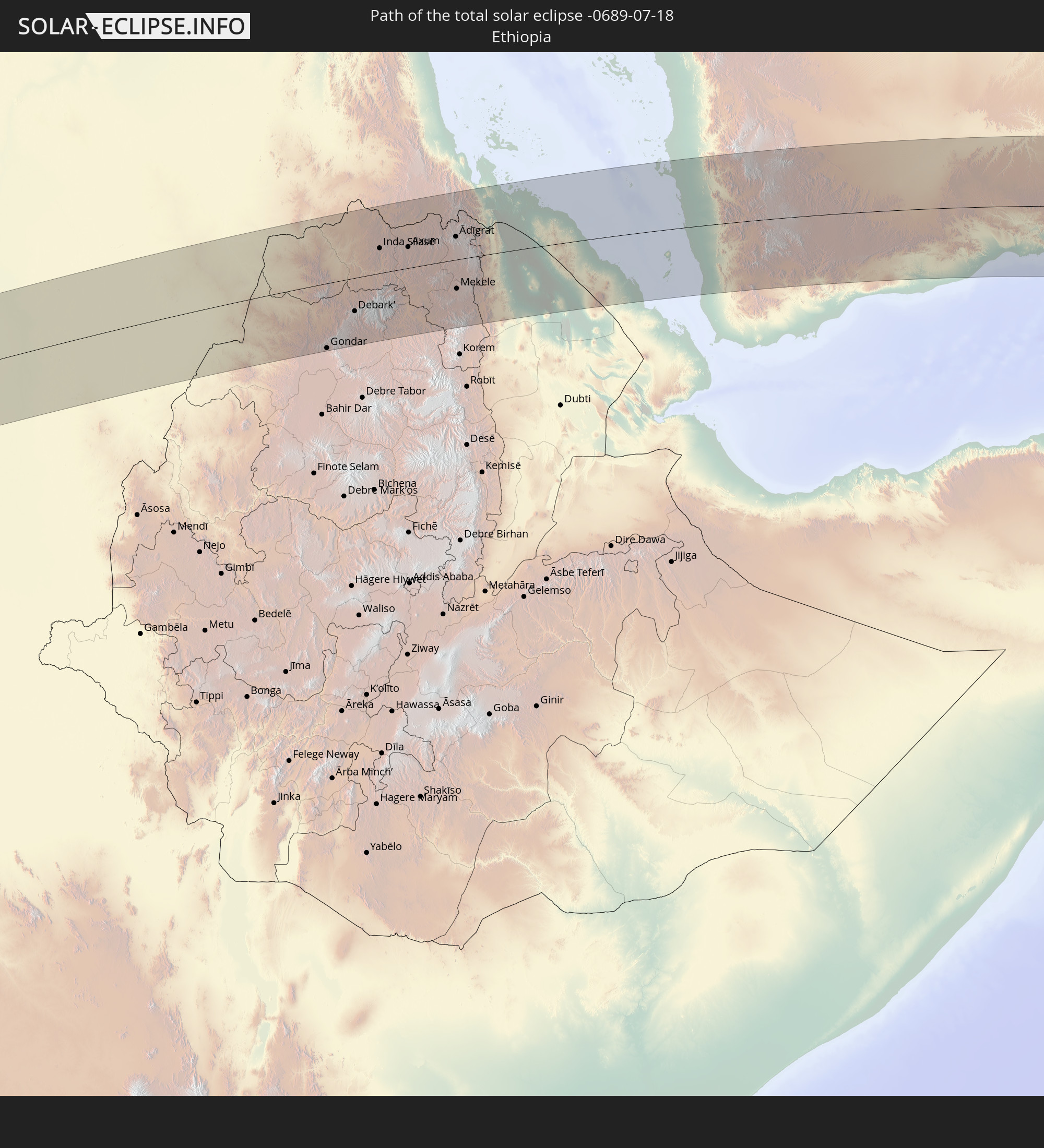
 Äthiopien
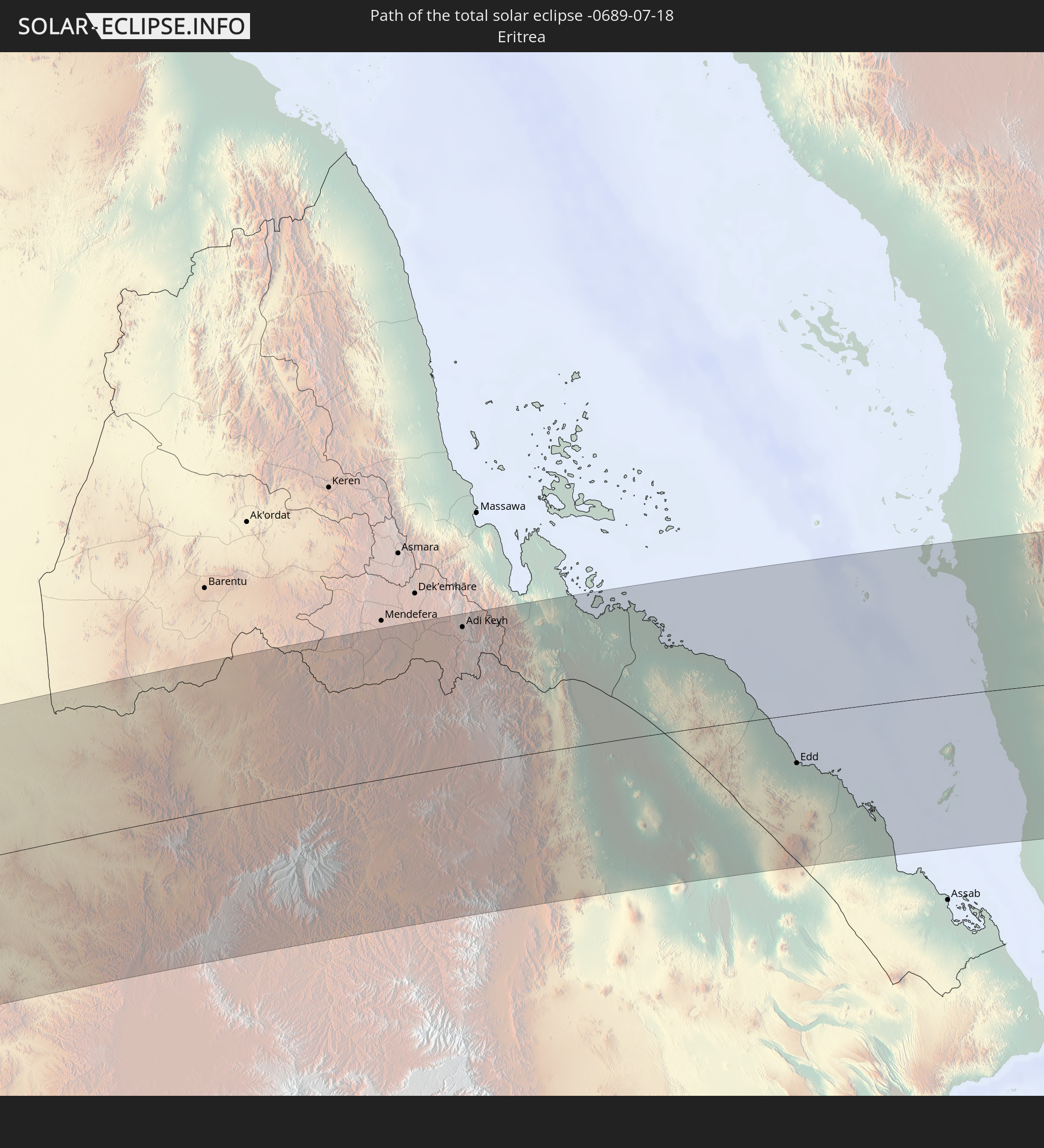
 Eritrea
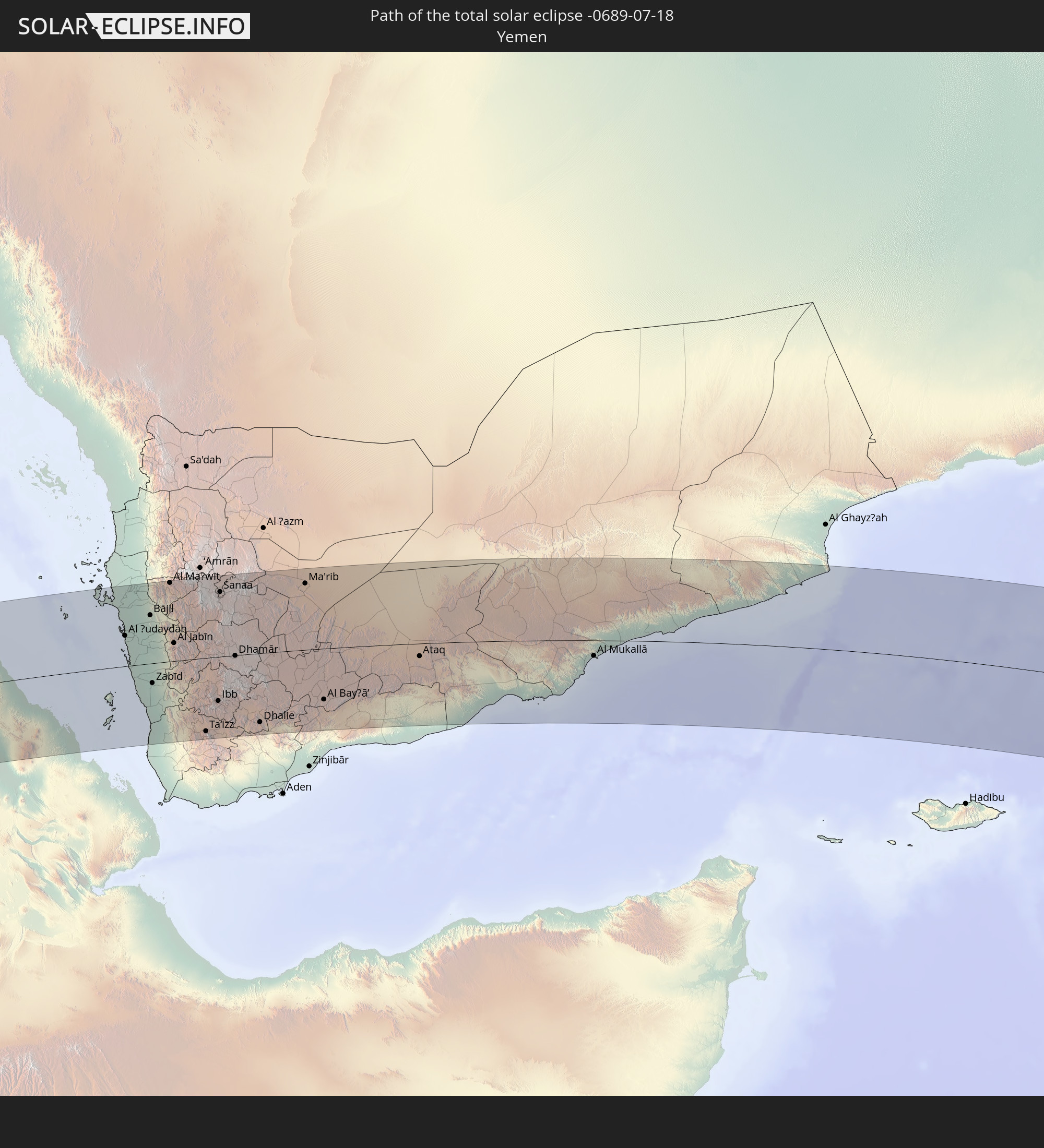
 Jemen
Jemen
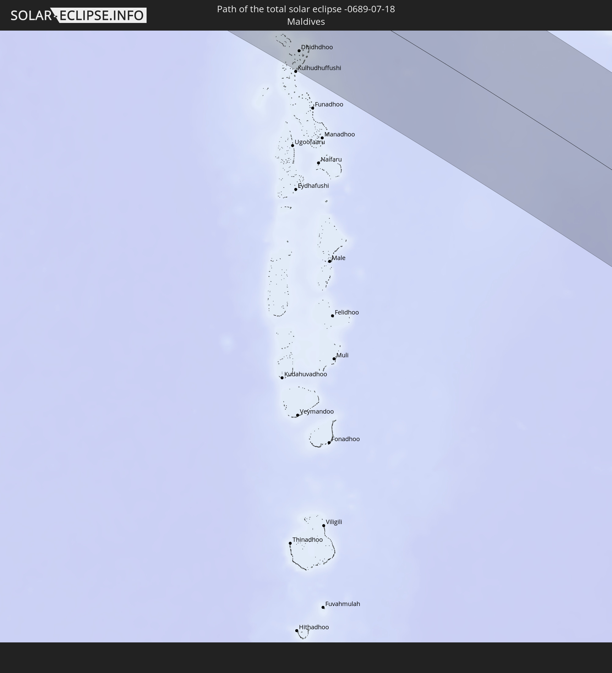
 Malediven
 Australien
Orte im Finsternispfad
Die nachfolgene Tabelle zeigt Städte und Orte mit mehr als 5.000 Einwohnern, die sich im Finsternispfad befinden. Städte mit mehr als 100.000 Einwohnern sind dick gekennzeichnet. Mit einem Klick auf den Ort öffnet sich eine Detailkarte die die Lage des jeweiligen Ortes zusammen mit dem Verlauf der zentralen Finsternis präsentiert.
| Ort | Typ | Dauer der Verfinsterung | Ortszeit bei maximaler Verfinsterung | Entfernung zur Zentrallinie | Ø Bewölkung |
|
Eket, Akwa Ibom
|
total | - | 06:03:11 UTC+00:13 | 86 km | 94% |
|
Esuk Oron, Akwa Ibom
|
total | - | 06:03:16 UTC+00:13 | 88 km | 96% |
|
Ikang, Cross River
|
total | - | 06:03:19 UTC+00:13 | 75 km | 95% |
|
Luba, Bioko Sur
|
total | - | 06:03:16 UTC+00:13 | 63 km | 94% |
|
Malabo, Bioko Norte
|
total | - | 06:03:20 UTC+00:13 | 43 km | 94% |
|
Rebola, Bioko Norte
|
total | - | 06:03:21 UTC+00:13 | 48 km | 97% |
|
Limbe, South-West
|
total | - | 06:03:27 UTC+00:13 | 32 km | 94% |
|
Tiko, South-West
|
total | - | 06:03:30 UTC+00:13 | 33 km | 96% |
|
Kumba, South-West
|
total | - | 06:03:33 UTC+00:13 | 21 km | 94% |
|
Mbanga, Littoral
|
total | - | 06:03:34 UTC+00:13 | 2 km | 94% |
|
Douala, Littoral
|
total | - | 06:03:35 UTC+00:13 | 51 km | 94% |
|
Loum, Littoral
|
total | - | 06:03:38 UTC+00:13 | 17 km | 95% |
|
Manjo, Littoral
|
total | - | 06:03:40 UTC+00:13 | 26 km | 96% |
|
Fontem, South-West
|
total | - | 06:03:44 UTC+00:13 | 88 km | 97% |
|
Nkongsamba, Littoral
|
total | - | 06:03:42 UTC+00:13 | 33 km | 96% |
|
Dschang, West
|
total | - | 06:03:47 UTC+00:13 | 79 km | 94% |
|
Bafang, West
|
total | - | 06:03:47 UTC+00:13 | 44 km | 95% |
|
Mbouda, West
|
total | - | 06:03:51 UTC+00:13 | 89 km | 87% |
|
Bafoussam, West
|
total | - | 06:03:53 UTC+00:13 | 67 km | 90% |
|
Bangangté, West
|
total | - | 06:03:54 UTC+00:13 | 28 km | 94% |
|
Foumbot, West
|
total | - | 06:03:58 UTC+00:13 | 61 km | 84% |
|
Foumban, West
|
total | - | 06:04:04 UTC+00:13 | 73 km | 87% |
|
Bafia, Centre
|
total | - | 06:04:06 UTC+00:13 | 42 km | 92% |
|
Meïganga, Adamaoua
|
total | - | 06:05:31 UTC+00:13 | 14 km | 87% |
|
Garoua Boulaï, East
|
total | - | 06:05:34 UTC+00:13 | 61 km | 86% |
|
Bozoum, Ouham-Pendé
|
total | - | 06:06:34 UTC+00:13 | 90 km | 78% |
|
Paoua, Ouham-Pendé
|
total | - | 06:06:43 UTC+00:13 | 4 km | 80% |
|
Béboto, Logone Oriental
|
total | - | 06:53:46 UTC+01:00 | 91 km | 85% |
|
Moïssala, Mandoul
|
total | - | 06:54:17 UTC+01:00 | 66 km | 81% |
|
Batangafo, Ouham
|
total | - | 06:07:51 UTC+00:13 | 63 km | 79% |
|
Kabo, Ouham
|
total | - | 06:08:08 UTC+00:13 | 34 km | 85% |
|
Ndélé, Bamingui-Bangoran
|
total | - | 06:09:43 UTC+00:13 | 37 km | 78% |
|
Birao, Vakaga
|
total | - | 06:11:49 UTC+00:13 | 81 km | 81% |
|
El Daein, Eastern Darfur
|
total | - | 08:11:52 UTC+02:10 | 89 km | 90% |
|
Al Mijlad, West Kordofan State
|
total | - | 08:13:34 UTC+02:10 | 10 km | 88% |
|
Abū Zabad, West Kordofan State
|
total | - | 08:15:40 UTC+02:10 | 83 km | 81% |
|
Dilling, Southern Kordofan
|
total | - | 08:16:07 UTC+02:10 | 38 km | 76% |
|
Kadugli, Southern Kordofan
|
total | - | 08:16:01 UTC+02:10 | 75 km | 85% |
|
Ar Rahad, North Kordofan
|
total | - | 08:17:33 UTC+02:10 | 80 km | 70% |
|
Umm Ruwaba, North Kordofan
|
total | - | 08:18:21 UTC+02:10 | 84 km | 67% |
|
Abu Jibeha, Southern Kordofan
|
total | - | 08:18:06 UTC+02:10 | 72 km | 81% |
|
Tandaltī, White Nile
|
total | - | 08:19:16 UTC+02:10 | 77 km | 74% |
|
Marabba, White Nile
|
total | - | 08:19:36 UTC+02:10 | 3 km | 80% |
|
Kosti, White Nile
|
total | - | 08:20:26 UTC+02:10 | 71 km | 73% |
|
Sinnar, Sinnār
|
total | - | 08:21:51 UTC+02:10 | 91 km | 68% |
|
Maiurno, Sinnār
|
total | - | 08:21:59 UTC+02:10 | 72 km | 71% |
|
As Sūkī, Sinnār
|
total | - | 08:22:18 UTC+02:10 | 56 km | 72% |
|
Singa, Sinnār
|
total | - | 08:22:20 UTC+02:10 | 36 km | 74% |
|
Ad Dindar, Sinnār
|
total | - | 08:22:43 UTC+02:10 | 36 km | 77% |
|
Al Ḩawātah, Al Qaḑārif
|
total | - | 08:23:29 UTC+02:10 | 48 km | 70% |
|
Al Qadarif, Al Qaḑārif
|
total | - | 08:24:47 UTC+02:10 | 96 km | 64% |
|
Doka, Al Qaḑārif
|
total | - | 08:25:20 UTC+02:10 | 31 km | 66% |
|
Gondar, Amhara
|
total | - | 08:45:19 UTC+02:27 | 107 km | 77% |
|
Dabat, Amhara
|
total | - | 08:45:53 UTC+02:27 | 71 km | 76% |
|
Debark’, Amhara
|
total | - | 08:46:09 UTC+02:27 | 55 km | 81% |
|
Inda Silasē, Tigray
|
total | - | 08:46:56 UTC+02:27 | 41 km | 78% |
|
Axum, Tigray
|
total | - | 08:47:44 UTC+02:27 | 34 km | 73% |
|
Adi Keyh, Debub
|
total | - | 08:49:01 UTC+02:27 | 102 km | 73% |
|
Ādīgrat, Tigray
|
total | - | 08:49:08 UTC+02:27 | 38 km | 70% |
|
Mekele, Tigray
|
total | - | 08:49:07 UTC+02:27 | 48 km | 66% |
|
Edd, Southern Red Sea
|
total | - | 08:53:33 UTC+02:27 | 36 km | 21% |
|
Al Ḩudaydah, Muḩāfaz̧at al Ḩudaydah
|
total | - | 09:35:47 UTC+03:06 | 43 km | 38% |
|
Bājil, Muḩāfaz̧at al Ḩudaydah
|
total | - | 09:36:29 UTC+03:06 | 68 km | 46% |
|
Zabīd, Muḩāfaz̧at al Ḩudaydah
|
total | - | 09:36:35 UTC+03:06 | 28 km | 38% |
|
Bayt al Faqīh, Muḩāfaz̧at al Ḩudaydah
|
total | - | 09:36:35 UTC+03:06 | 8 km | 43% |
|
Al Maḩwīt, Al Maḩwīt
|
total | - | 09:37:02 UTC+03:06 | 111 km | 45% |
|
Ta‘izz, Ta‘izz
|
total | - | 09:38:11 UTC+03:06 | 104 km | 34% |
|
Dhī as Sufāl, Ibb
|
total | - | 09:38:22 UTC+03:06 | 76 km | 41% |
|
Ibb, Ibb
|
total | - | 09:38:31 UTC+03:06 | 62 km | 48% |
|
Sanaa, Sanaa
|
total | - | 09:38:28 UTC+03:06 | 91 km | 47% |
|
Saḩar, Sanaa
|
total | - | 09:38:42 UTC+03:06 | 86 km | 59% |
|
Sayyān, Sanaa
|
total | - | 09:38:44 UTC+03:06 | 70 km | 58% |
|
Yarīm, Ibb
|
total | - | 09:38:55 UTC+03:06 | 28 km | 50% |
|
Dhamār, Dhamār
|
total | - | 09:38:58 UTC+03:06 | 1 km | 46% |
|
Dhalie, Aḑ Ḑāli‘
|
total | - | 09:39:47 UTC+03:06 | 98 km | 28% |
|
Ma'rib, Ma’rib
|
total | - | 09:40:57 UTC+03:06 | 94 km | 30% |
|
Al Bayḑā’, Al Bayḑāʼ
|
total | - | 09:41:41 UTC+03:06 | 72 km | 39% |
|
Jawf al Maqbābah, Abyan
|
total | - | 09:42:19 UTC+03:06 | 90 km | 26% |
|
Ataq, Shabwah
|
total | - | 09:44:34 UTC+03:06 | 18 km | 18% |
|
Al Mukallā, Muḩāfaz̧at Ḩaḑramawt
|
total | - | 09:50:11 UTC+03:06 | 22 km | 84% |
|
Dhidhdhoo, Haa Alifu Atholhu
|
total | - | 12:52:02 UTC+04:54 | 93 km | 86% |
|
Port Hedland, Western Australia
|
total | - | 17:10:40 UTC+08:00 | 29 km | 24% |