Totale Sonnenfinsternis vom 12.03.-0859
| Wochentag: | Dienstag |
| Maximale Dauer der Verfinsterung: | 03m52s |
| Maximale Breite des Finsternispfades: | 156 km |
| Saroszyklus: | 45 |
| Bedeckungsgrad: | 100% |
| Magnitude: | 1.0447 |
| Gamma: | 0.3192 |
Wo kann man die Sonnenfinsternis vom 12.03.-0859 sehen?
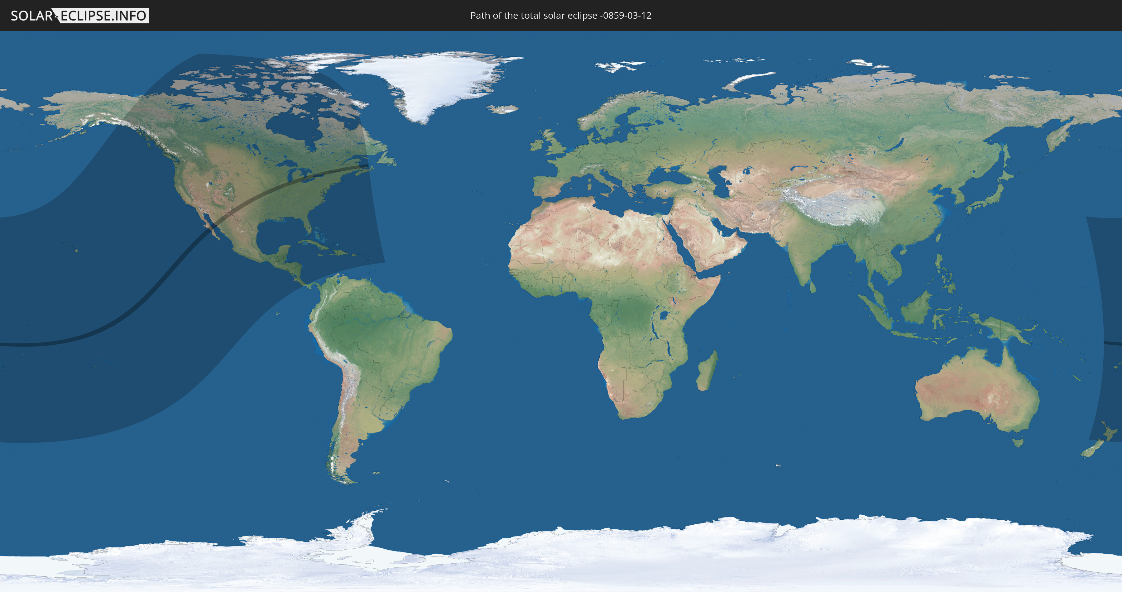
Die Sonnenfinsternis am 12.03.-0859 kann man in 45 Ländern als partielle Sonnenfinsternis beobachten.
Der Finsternispfad verläuft durch 6 Länder. Nur in diesen Ländern ist sie als totale Sonnenfinsternis zu sehen.
In den folgenden Ländern ist die Sonnenfinsternis total zu sehen
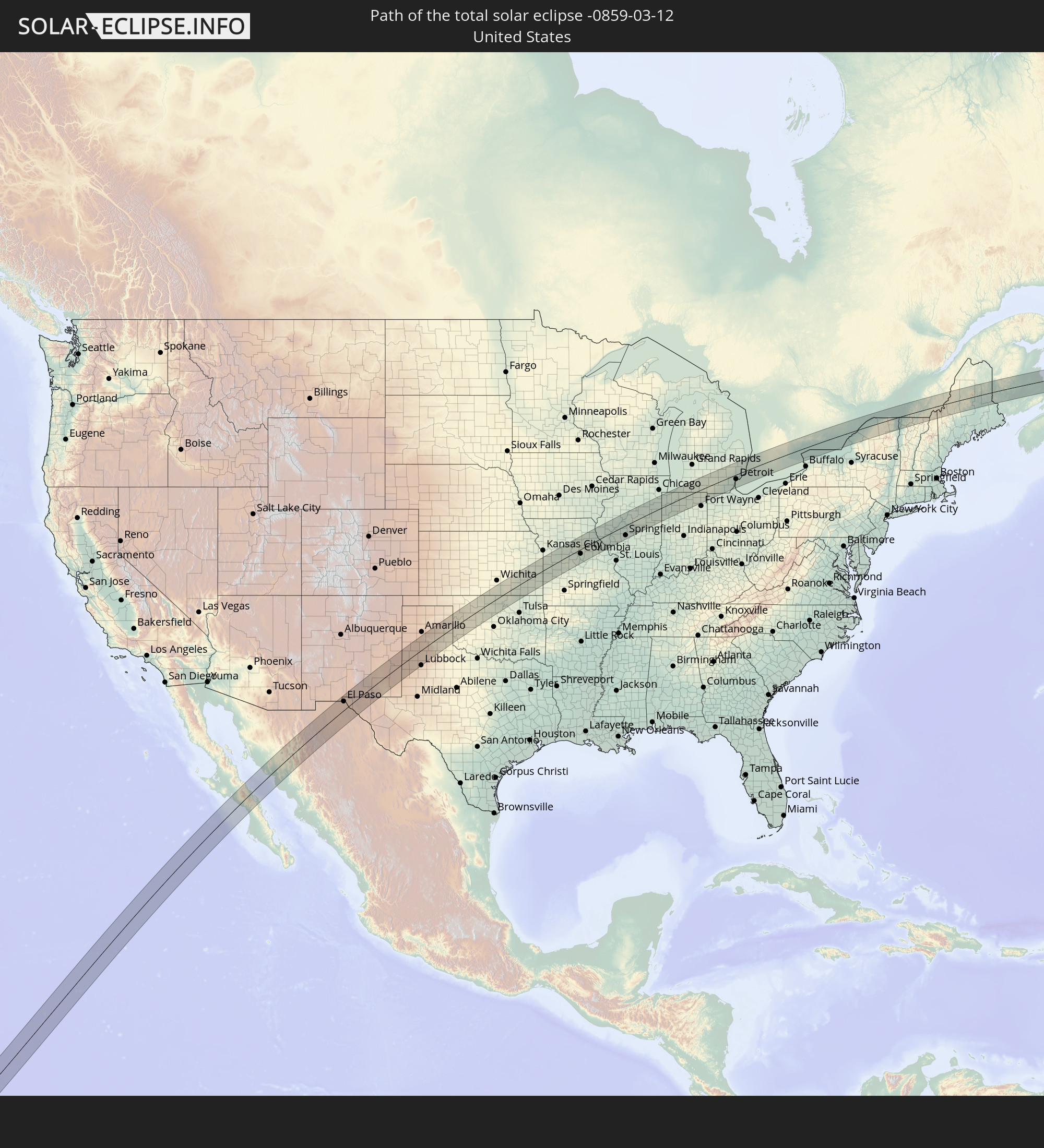 Vereinigte Staaten
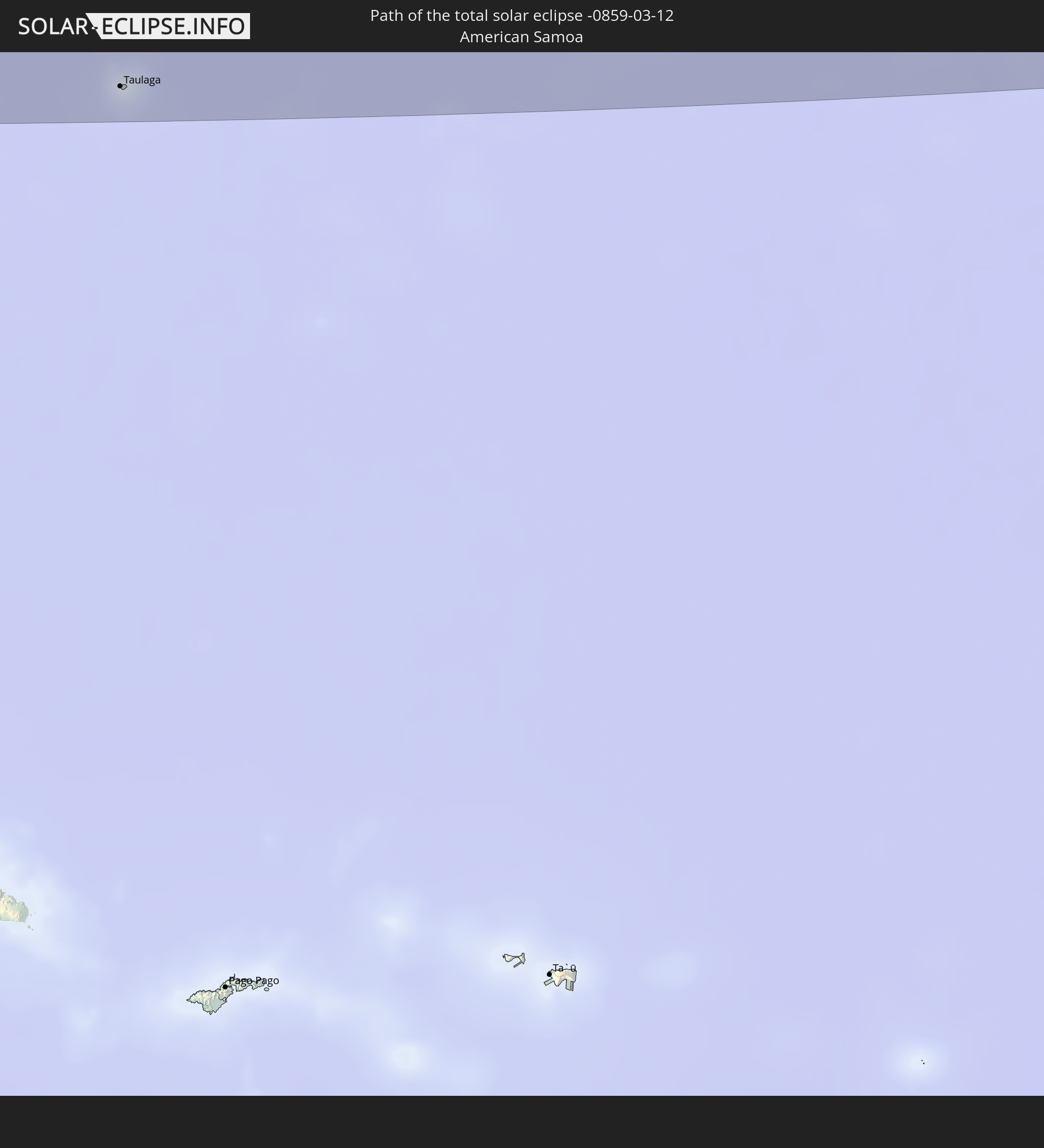 Amerikanisch-Samoa
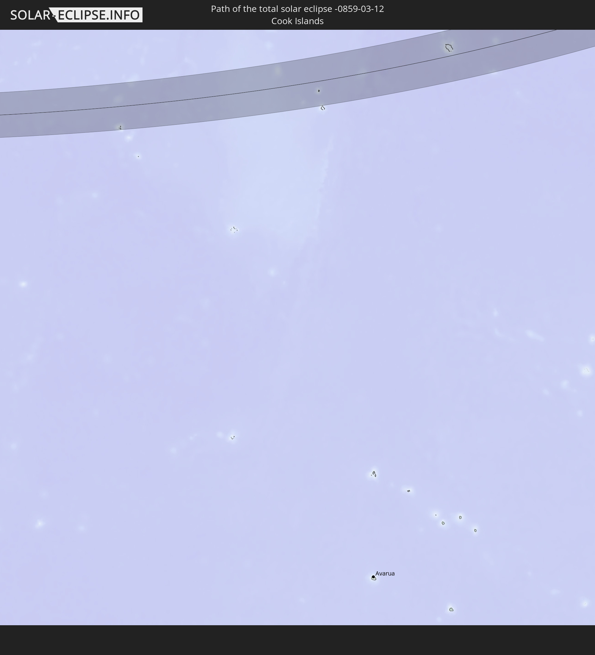 Cookinseln
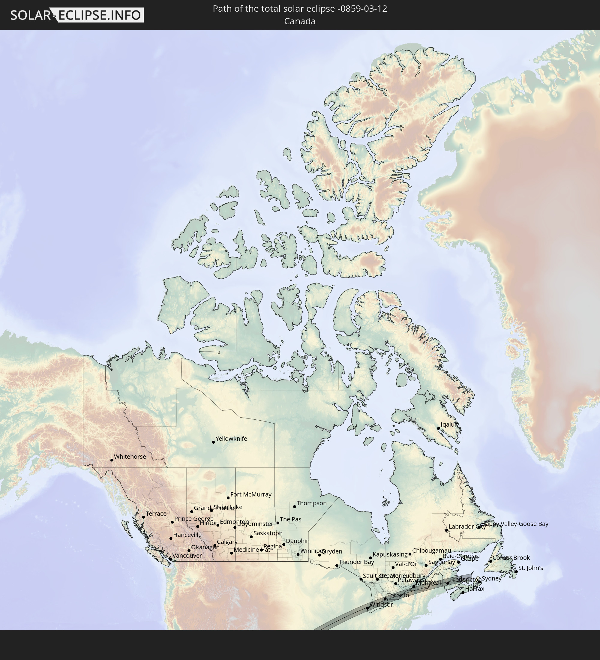 Kanada
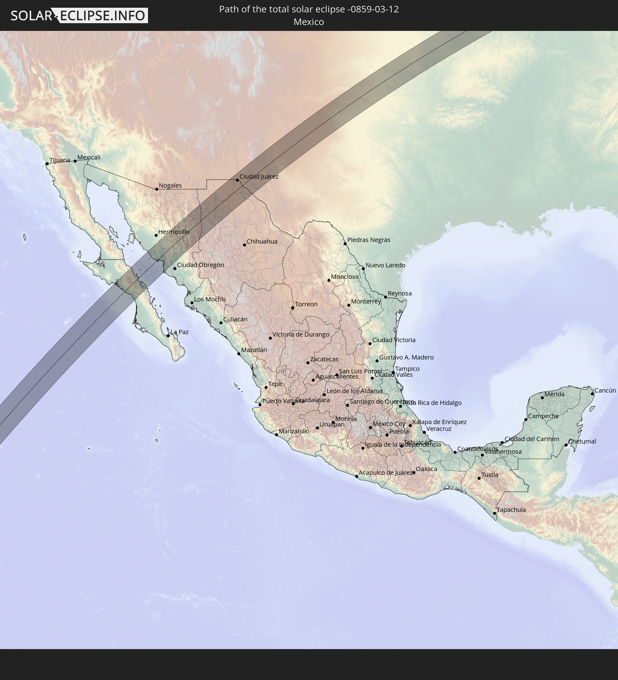 Mexiko
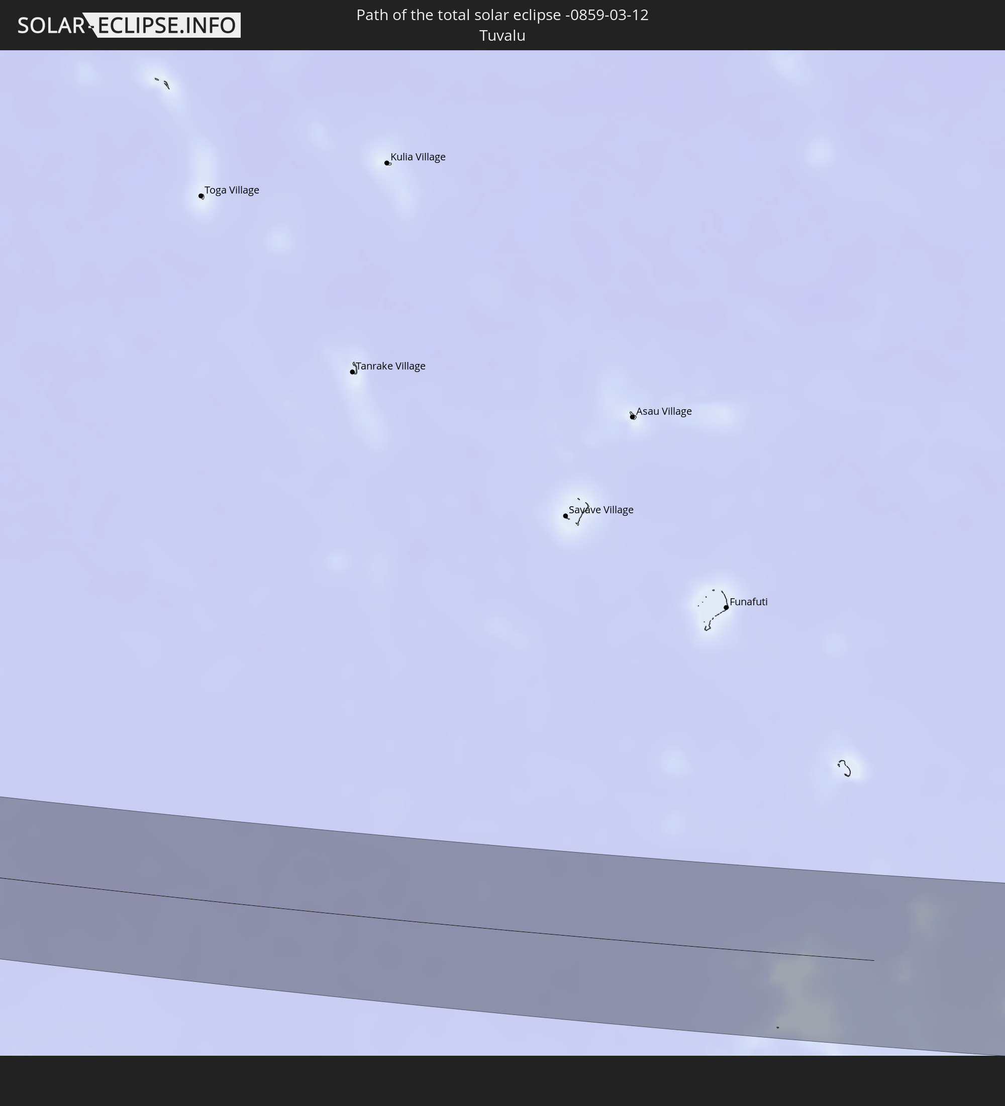 Tuvalu
In den folgenden Ländern ist die Sonnenfinsternis partiell zu sehen
 Fidschi
 Vereinigte Staaten
 Neuseeland
 United States Minor Outlying Islands
 Wallis und Futuna
 Tonga
Tonga
 Kiribati
 Samoa
Samoa
 Tokelau
 Amerikanisch-Samoa
 Niue
Niue
 Cookinseln
 Französisch-Polynesien
 Kanada
 Pitcairninseln
 Mexiko
 Grönland
 Guatemala
 El Salvador
 Honduras
 Belize
 Nicaragua
 Costa Rica
 Kuba
Kuba
 Panama
 Kolumbien
 Kaimaninseln
 Bahamas
 Jamaika
 Haiti
Haiti
 Turks- und Caicosinseln
 Dominikanische Republik
 Puerto Rico
 Amerikanische Jungferninseln
 Bermuda
 Britische Jungferninseln
 Anguilla
 Saint-Martin
 Saint-Barthélemy
 St. Kitts und Nevis
 Antigua und Barbuda
 Montserrat
 Guadeloupe
 Dominica
 Tuvalu
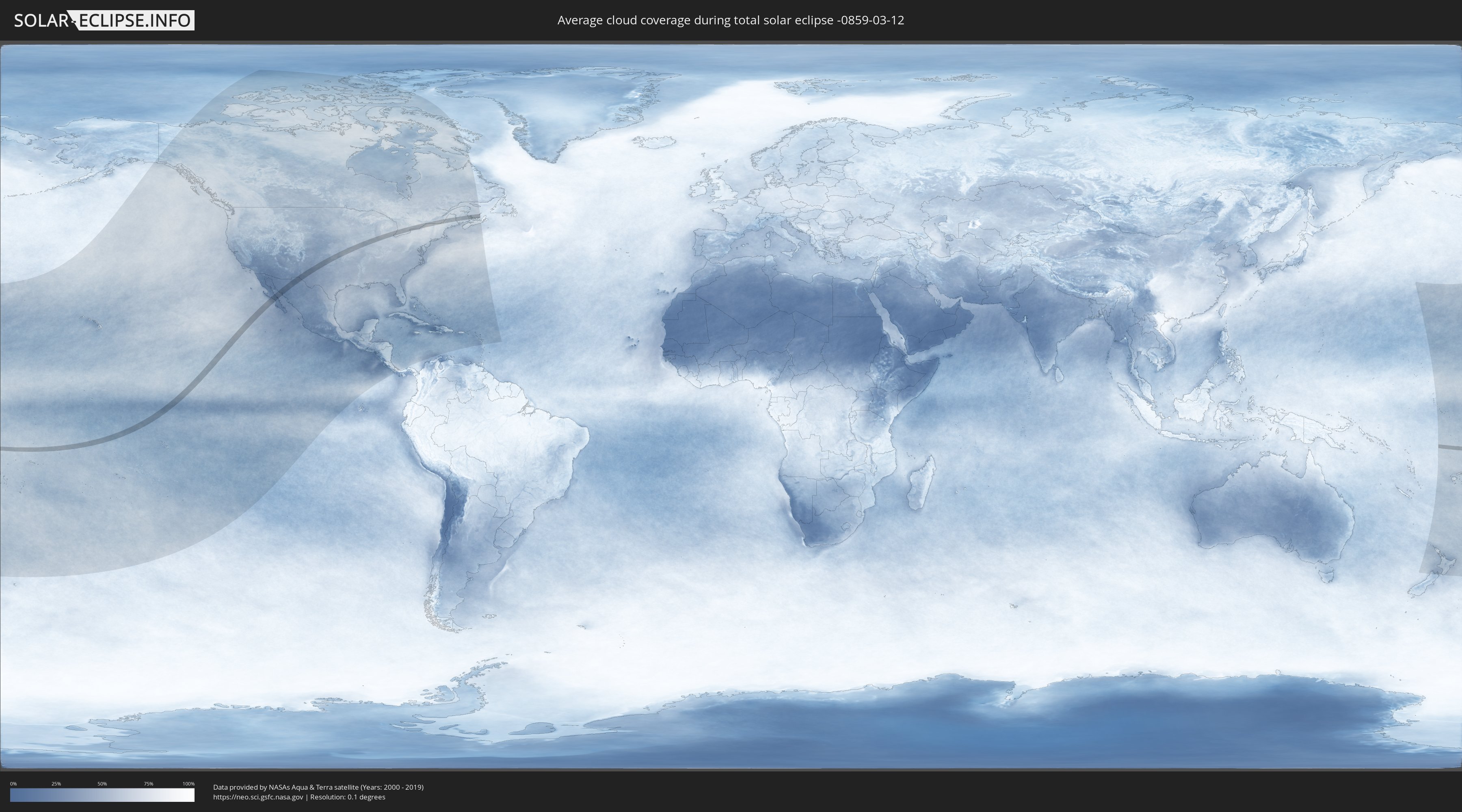
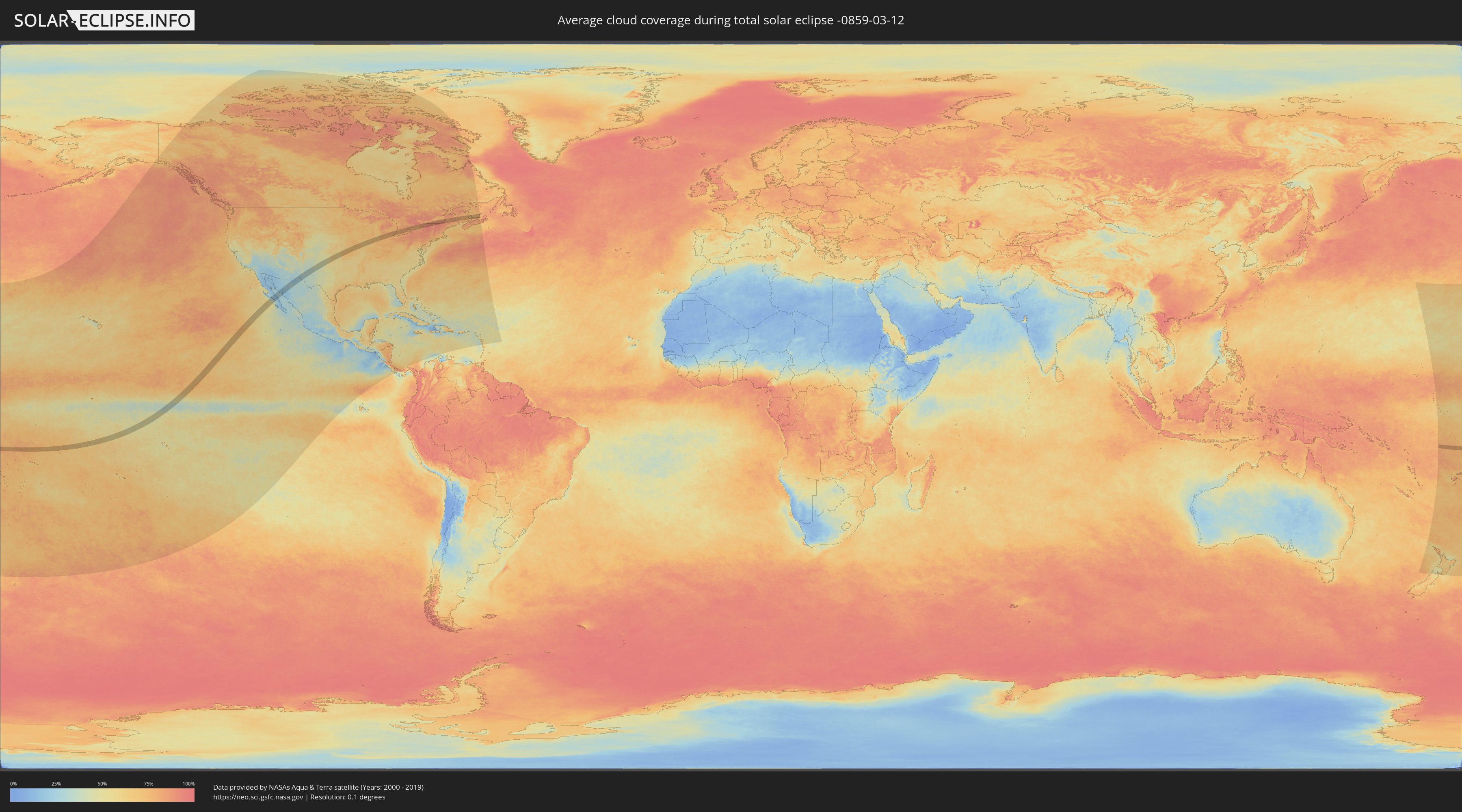
Wie wird das Wetter während der totalen Sonnenfinsternis am 12.03.-0859?
Wo ist der beste Ort, um die totale Sonnenfinsternis vom 12.03.-0859 zu beobachten?
Die folgenden Karten zeigen die durchschnittliche Bewölkung für den Tag, an dem die totale Sonnenfinsternis
stattfindet. Mit Hilfe der Karten lässt sich der Ort entlang des Finsternispfades eingrenzen,
der die besten Aussichen auf einen klaren wolkenfreien Himmel bietet.
Trotzdem muss man immer lokale Gegenenheiten beachten und sollte sich genau über das Wetter an seinem
gewählten Beobachtungsort informieren.
Die Daten stammen von den beiden NASA-Satelliten
AQUA und TERRA
und wurden über einen Zeitraum von 19 Jahren (2000 - 2019) gemittelt.
Detaillierte Länderkarten
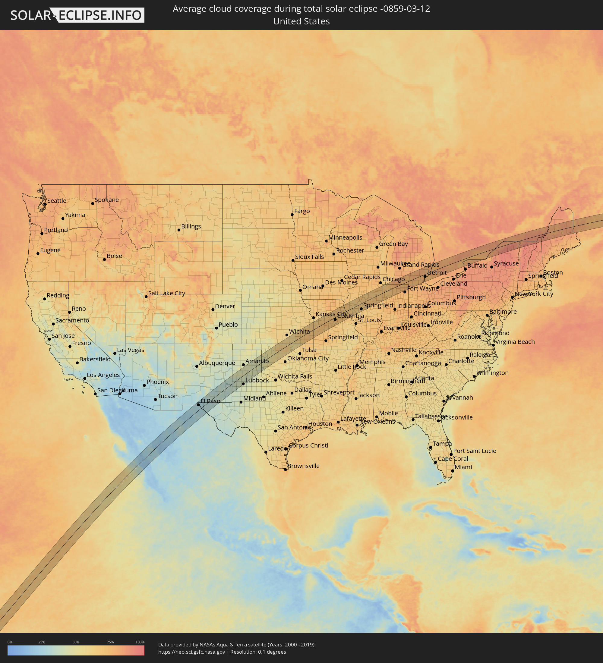 Vereinigte Staaten
 Amerikanisch-Samoa
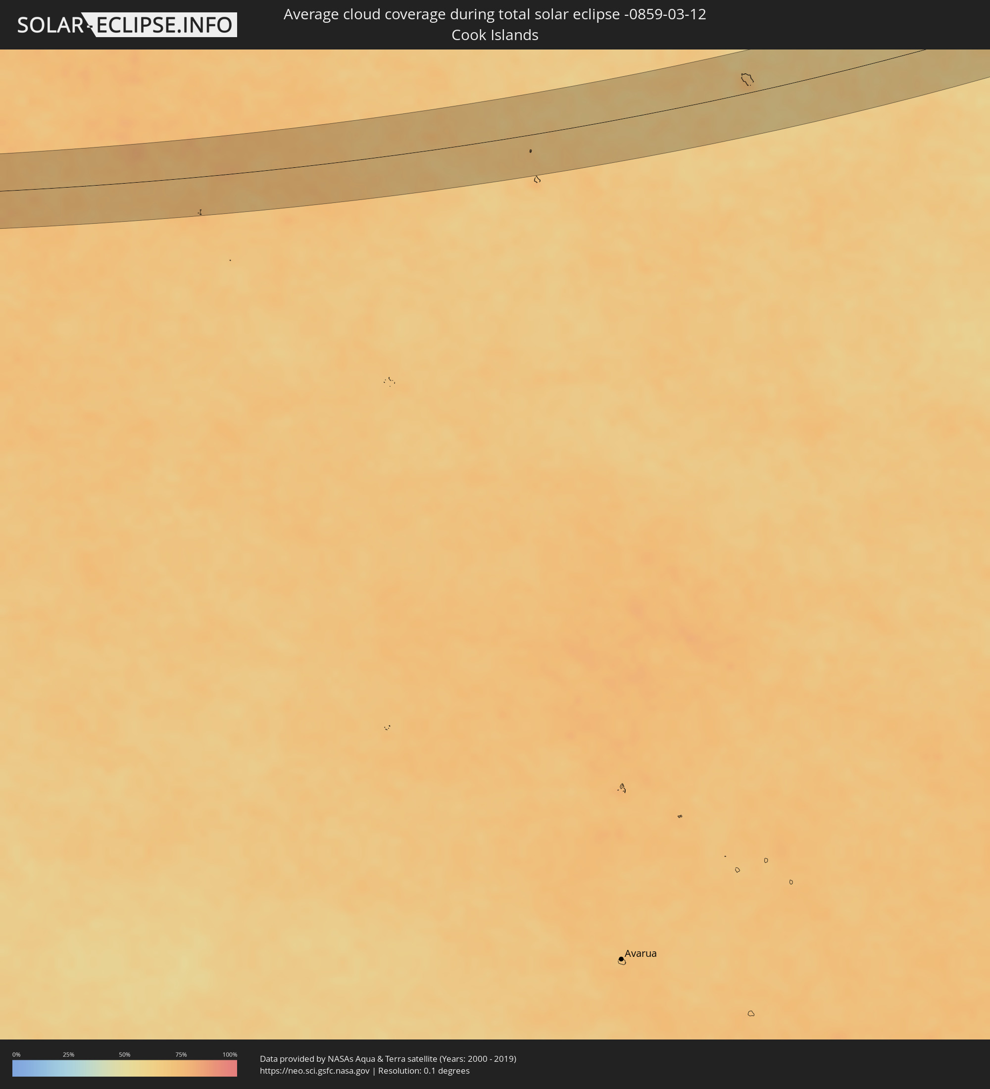 Cookinseln
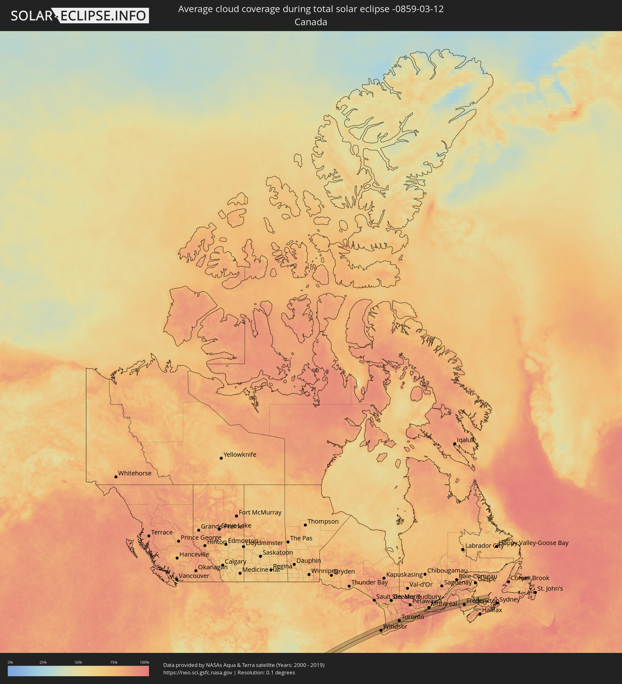 Kanada
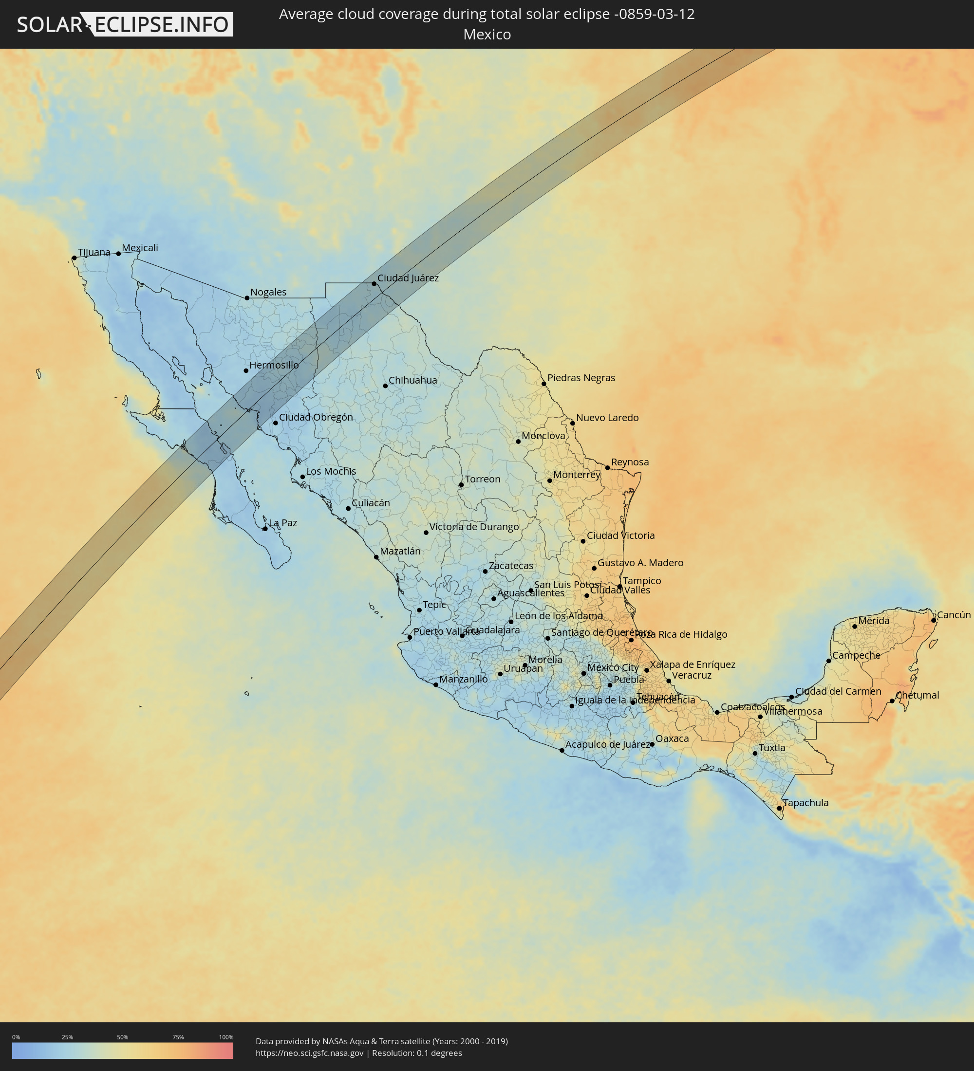 Mexiko
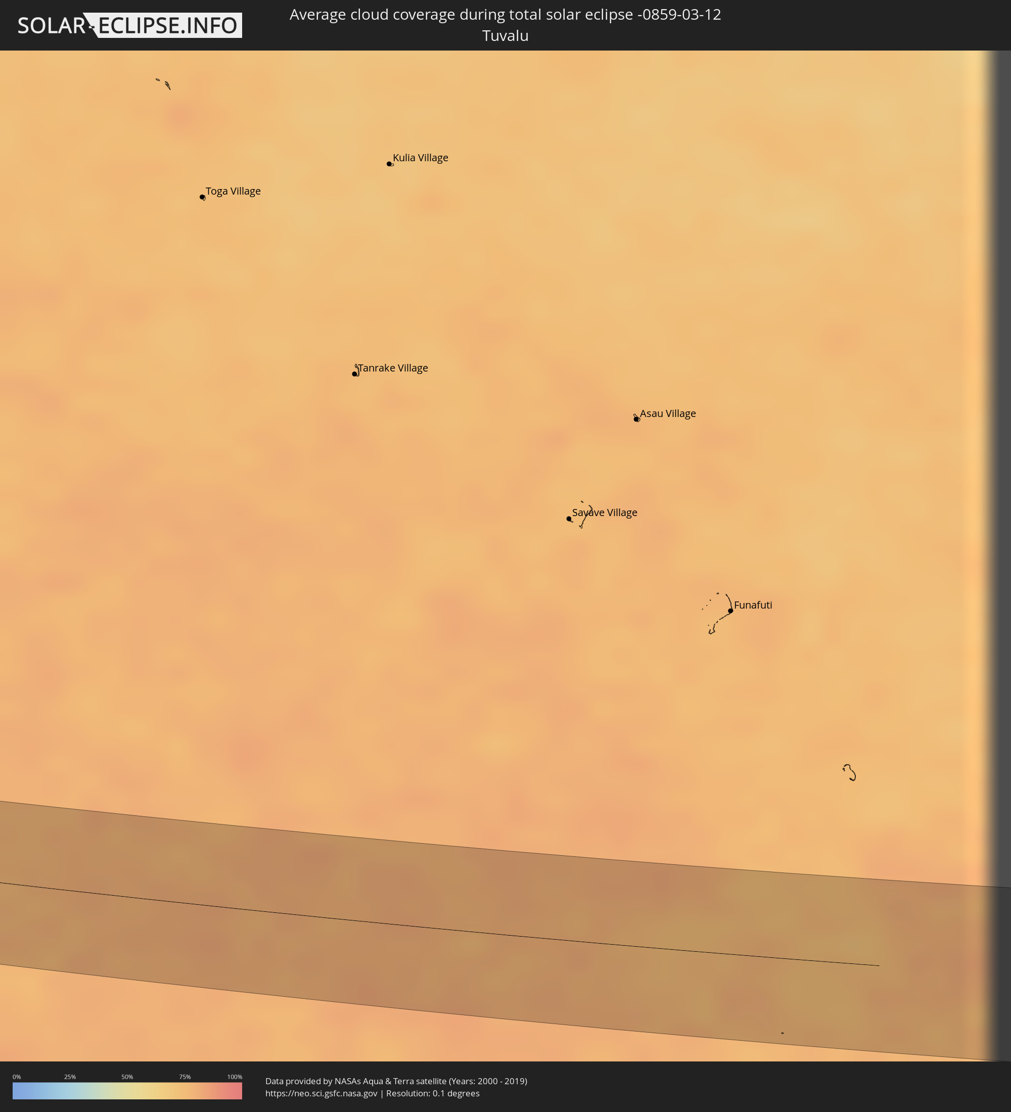 Tuvalu
Orte im Finsternispfad
Die nachfolgene Tabelle zeigt Städte und Orte mit mehr als 5.000 Einwohnern, die sich im Finsternispfad befinden. Städte mit mehr als 100.000 Einwohnern sind dick gekennzeichnet. Mit einem Klick auf den Ort öffnet sich eine Detailkarte die die Lage des jeweiligen Ortes zusammen mit dem Verlauf der zentralen Finsternis präsentiert.
| Ort | Typ | Dauer der Verfinsterung | Ortszeit bei maximaler Verfinsterung | Entfernung zur Zentrallinie | Ø Bewölkung |
|
Taulaga, Swains Island
|
total | - | 18:36:25 UTC+00:00 | 43 km | 75% |
|
Santa Rosalia, Baja California Sur
|
total | - | 14:05:27 UTC-07:05 | 45 km | 17% |
|
Heroica Guaymas, Sonora
|
total | - | 13:49:53 UTC-07:23 | 2 km | 25% |
|
Empalme, Sonora
|
total | - | 13:50:03 UTC-07:23 | 4 km | 21% |
|
Potam, Sonora
|
total | - | 13:50:14 UTC-07:23 | 58 km | 22% |
|
Vicam, Sonora
|
total | - | 13:50:26 UTC-07:23 | 65 km | 23% |
|
Benito Juárez, Chihuahua
|
total | - | 14:14:04 UTC-07:05 | 43 km | 28% |
|
Nuevo Casas Grandes, Chihuahua
|
total | - | 14:14:44 UTC-07:05 | 11 km | 23% |
|
Buenaventura, Chihuahua
|
total | - | 14:14:47 UTC-07:05 | 65 km | 29% |
|
Miguel Ahumada, Chihuahua
|
total | - | 14:16:43 UTC-07:05 | 58 km | 28% |
|
El Paso, Texas
|
total | - | 14:23:24 UTC-07:00 | 38 km | 28% |
|
Ciudad Juárez, Chihuahua
|
total | - | 14:17:43 UTC-07:05 | 36 km | 28% |
|
Chaparral, New Mexico
|
total | - | 14:23:45 UTC-07:00 | 55 km | 28% |
|
Socorro, Texas
|
total | - | 14:23:33 UTC-07:00 | 18 km | 27% |
|
Roswell, New Mexico
|
total | - | 14:27:02 UTC-07:00 | 65 km | 34% |
|
Carlsbad, New Mexico
|
total | - | 14:26:40 UTC-07:00 | 37 km | 35% |
|
Plainview, Texas
|
total | - | 15:30:44 UTC-06:00 | 21 km | 39% |
|
Pampa, Texas
|
total | - | 15:32:16 UTC-06:00 | 62 km | 41% |
|
Enid, Oklahoma
|
total | - | 15:35:46 UTC-06:00 | 14 km | 59% |
|
Ponca City, Oklahoma
|
total | - | 15:36:38 UTC-06:00 | 23 km | 61% |
|
Belton, Missouri
|
total | - | 15:39:31 UTC-06:00 | 60 km | 67% |
|
Warrensburg, Missouri
|
total | - | 15:40:10 UTC-06:00 | 21 km | 72% |
|
Sedalia, Missouri
|
total | - | 15:40:35 UTC-06:00 | 6 km | 72% |
|
Columbia, Missouri
|
total | - | 15:41:20 UTC-06:00 | 20 km | 71% |
|
Quincy, Illinois
|
total | - | 15:42:11 UTC-06:00 | 38 km | 70% |
|
Hannibal, Missouri
|
total | - | 15:42:12 UTC-06:00 | 14 km | 71% |
|
Jacksonville, Illinois
|
total | - | 15:43:02 UTC-06:00 | 29 km | 65% |
|
Canton, Illinois
|
total | - | 15:43:14 UTC-06:00 | 45 km | 69% |
|
Springfield, Illinois
|
total | - | 15:43:28 UTC-06:00 | 45 km | 68% |
|
Peoria, Illinois
|
total | - | 15:43:33 UTC-06:00 | 42 km | 71% |
|
Washington, Illinois
|
total | - | 15:43:41 UTC-06:00 | 36 km | 68% |
|
Lincoln, Illinois
|
total | - | 15:43:41 UTC-06:00 | 21 km | 67% |
|
Bloomington, Illinois
|
total | - | 15:43:57 UTC-06:00 | 2 km | 71% |
|
Kankakee, Illinois
|
total | - | 15:44:43 UTC-06:00 | 20 km | 66% |
|
Park Forest, Illinois
|
total | - | 15:44:50 UTC-06:00 | 50 km | 73% |
|
Hammond, Indiana
|
total | - | 15:44:57 UTC-06:00 | 53 km | 69% |
|
Merrillville, Indiana
|
total | - | 15:45:03 UTC-06:00 | 37 km | 69% |
|
Portage, Indiana
|
total | - | 15:45:09 UTC-06:00 | 41 km | 67% |
|
Michigan City, Indiana
|
total | - | 15:45:19 UTC-06:00 | 44 km | 69% |
|
LaPorte, Indiana
|
total | - | 15:45:26 UTC-06:00 | 29 km | 73% |
|
South Bend, Indiana
|
total | - | 16:45:43 UTC-05:00 | 20 km | 75% |
|
Elkhart, Indiana
|
total | - | 16:45:53 UTC-05:00 | 10 km | 76% |
|
Goshen, Indiana
|
total | - | 16:45:59 UTC-05:00 | 5 km | 77% |
|
Portage, Michigan
|
total | - | 16:46:05 UTC-05:00 | 49 km | 79% |
|
Battle Creek, Michigan
|
total | - | 16:46:18 UTC-05:00 | 47 km | 77% |
|
Jackson, Michigan
|
total | - | 16:46:45 UTC-05:00 | 15 km | 77% |
|
Adrian, Michigan
|
total | - | 16:47:00 UTC-05:00 | 33 km | 74% |
|
Ann Arbor, Michigan
|
total | - | 16:47:07 UTC-05:00 | 4 km | 76% |
|
Novi, Michigan
|
total | - | 16:47:14 UTC-05:00 | 9 km | 78% |
|
Waterford, Michigan
|
total | - | 16:47:14 UTC-05:00 | 28 km | 81% |
|
Monroe, Michigan
|
total | - | 16:47:21 UTC-05:00 | 52 km | 78% |
|
Livonia, Michigan
|
total | - | 16:47:19 UTC-05:00 | 7 km | 76% |
|
Taylor, Michigan
|
total | - | 16:47:22 UTC-05:00 | 22 km | 79% |
|
Southfield, Michigan
|
total | - | 16:47:22 UTC-05:00 | 0 km | 75% |
|
Troy, Michigan
|
total | - | 16:47:23 UTC-05:00 | 11 km | 78% |
|
Detroit, Michigan
|
total | - | 16:47:29 UTC-05:00 | 20 km | 76% |
|
Warren, Michigan
|
total | - | 16:47:28 UTC-05:00 | 6 km | 79% |
|
Windsor, Ontario
|
total | - | 16:47:30 UTC-05:00 | 24 km | 76% |
|
Clinton, Michigan
|
total | - | 16:47:31 UTC-05:00 | 2 km | 77% |
|
Port Huron, Michigan
|
total | - | 16:47:42 UTC-05:00 | 26 km | 81% |
|
Sarnia, Ontario
|
total | - | 16:47:43 UTC-05:00 | 26 km | 81% |
|
London, Ontario
|
total | - | 16:48:17 UTC-05:00 | 8 km | 86% |
|
St. Thomas, Ontario
|
total | - | 16:48:21 UTC-05:00 | 32 km | 81% |
|
Stratford, Ontario
|
total | - | 16:48:21 UTC-05:00 | 23 km | 79% |
|
Ingersoll, Ontario
|
total | - | 16:48:27 UTC-05:00 | 13 km | 79% |
|
Woodstock, Ontario
|
total | - | 16:48:30 UTC-05:00 | 7 km | 80% |
|
Kitchener, Ontario
|
total | - | 16:48:32 UTC-05:00 | 16 km | 79% |
|
Norfolk County, Ontario
|
total | - | 16:48:43 UTC-05:00 | 49 km | 81% |
|
Cambridge, Ontario
|
total | - | 16:48:39 UTC-05:00 | 4 km | 81% |
|
Brantford, Ontario
|
total | - | 16:48:43 UTC-05:00 | 21 km | 80% |
|
Guelph, Ontario
|
total | - | 16:48:38 UTC-05:00 | 22 km | 81% |
|
Orangeville, Ontario
|
total | - | 16:48:37 UTC-05:00 | 56 km | 81% |
|
Milton, Ontario
|
total | - | 16:48:48 UTC-05:00 | 8 km | 81% |
|
Hamilton, Ontario
|
total | - | 16:48:53 UTC-05:00 | 21 km | 82% |
|
Burlington, Ontario
|
total | - | 16:48:51 UTC-05:00 | 7 km | 81% |
|
Mississauga, Ontario
|
total | - | 16:48:53 UTC-05:00 | 8 km | 84% |
|
Vaughan, Ontario
|
total | - | 16:48:54 UTC-05:00 | 31 km | 85% |
|
Newmarket, Ontario
|
total | - | 16:48:51 UTC-05:00 | 52 km | 85% |
|
Toronto, Ontario
|
total | - | 16:48:58 UTC-05:00 | 14 km | 83% |
|
Scarborough, Ontario
|
total | - | 16:49:01 UTC-05:00 | 17 km | 83% |
|
St. Catharines, Ontario
|
total | - | 16:49:10 UTC-05:00 | 46 km | 81% |
|
Thorold, Ontario
|
total | - | 16:49:12 UTC-05:00 | 53 km | 84% |
|
Ajax, Ontario
|
total | - | 16:49:06 UTC-05:00 | 19 km | 81% |
|
Oshawa, Ontario
|
total | - | 16:49:10 UTC-05:00 | 19 km | 78% |
|
Peterborough, Ontario
|
total | - | 16:49:16 UTC-05:00 | 47 km | 83% |
|
Cobourg, Ontario
|
total | - | 16:49:26 UTC-05:00 | 7 km | 78% |
|
Belleville, Ontario
|
total | - | 16:49:41 UTC-05:00 | 8 km | 81% |
|
Prince Edward, Ontario
|
total | - | 16:49:47 UTC-05:00 | 13 km | 77% |
|
Greater Napanee, Ontario
|
total | - | 16:49:49 UTC-05:00 | 6 km | 77% |
|
Kingston, Ontario
|
total | - | 16:50:00 UTC-05:00 | 8 km | 78% |
|
Watertown, New York
|
total | - | 16:50:17 UTC-05:00 | 49 km | 87% |
|
Brockville, Ontario
|
total | - | 16:50:10 UTC-05:00 | 11 km | 82% |
|
Cornwall, Ontario
|
total | - | 16:50:21 UTC-05:00 | 33 km | 84% |
|
Salaberry-de-Valleyfield, Quebec
|
total | - | 16:50:28 UTC-05:00 | 44 km | 81% |
|
Beauharnois, Quebec
|
total | - | 16:50:31 UTC-05:00 | 45 km | 80% |
|
Châteauguay, Quebec
|
total | - | 16:50:32 UTC-05:00 | 49 km | 83% |
|
Saint-Constant, Quebec
|
total | - | 16:50:35 UTC-05:00 | 43 km | 84% |
|
Candiac, Quebec
|
total | - | 16:50:36 UTC-05:00 | 44 km | 83% |
|
La Prairie, Quebec
|
total | - | 16:50:35 UTC-05:00 | 47 km | 83% |
|
Brossard, Quebec
|
total | - | 16:50:35 UTC-05:00 | 50 km | 84% |
|
Plattsburgh, New York
|
total | - | 16:50:52 UTC-05:00 | 30 km | 86% |
|
Chambly, Quebec
|
total | - | 16:50:38 UTC-05:00 | 46 km | 83% |
|
Saint-Jean-sur-Richelieu, Quebec
|
total | - | 16:50:42 UTC-05:00 | 30 km | 83% |
|
Granby, Quebec
|
total | - | 16:50:49 UTC-05:00 | 28 km | 87% |
|
Magog, Quebec
|
total | - | 16:51:02 UTC-05:00 | 2 km | 89% |
|
Sherbrooke, Quebec
|
total | - | 16:51:03 UTC-05:00 | 11 km | 88% |
|
Fredericton, New Brunswick
|
total | - | 17:37:31 UTC-04:14 | 30 km | 81% |
|
Lutes Mountain, New Brunswick
|
total | - | 17:37:40 UTC-04:14 | 38 km | 77% |
|
Moncton, New Brunswick
|
total | - | 17:37:42 UTC-04:14 | 44 km | 78% |
|
Dieppe, New Brunswick
|
total | - | 17:37:43 UTC-04:14 | 48 km | 77% |
|
Summerside, Prince Edward Island
|
total | - | 17:37:40 UTC-04:14 | 27 km | 71% |