Totale Sonnenfinsternis vom 22.05.-0928
| Wochentag: | Montag |
| Maximale Dauer der Verfinsterung: | 04m39s |
| Maximale Breite des Finsternispfades: | 157 km |
| Saroszyklus: | 42 |
| Bedeckungsgrad: | 100% |
| Magnitude: | 1.047 |
| Gamma: | -0.0771 |
Wo kann man die Sonnenfinsternis vom 22.05.-0928 sehen?
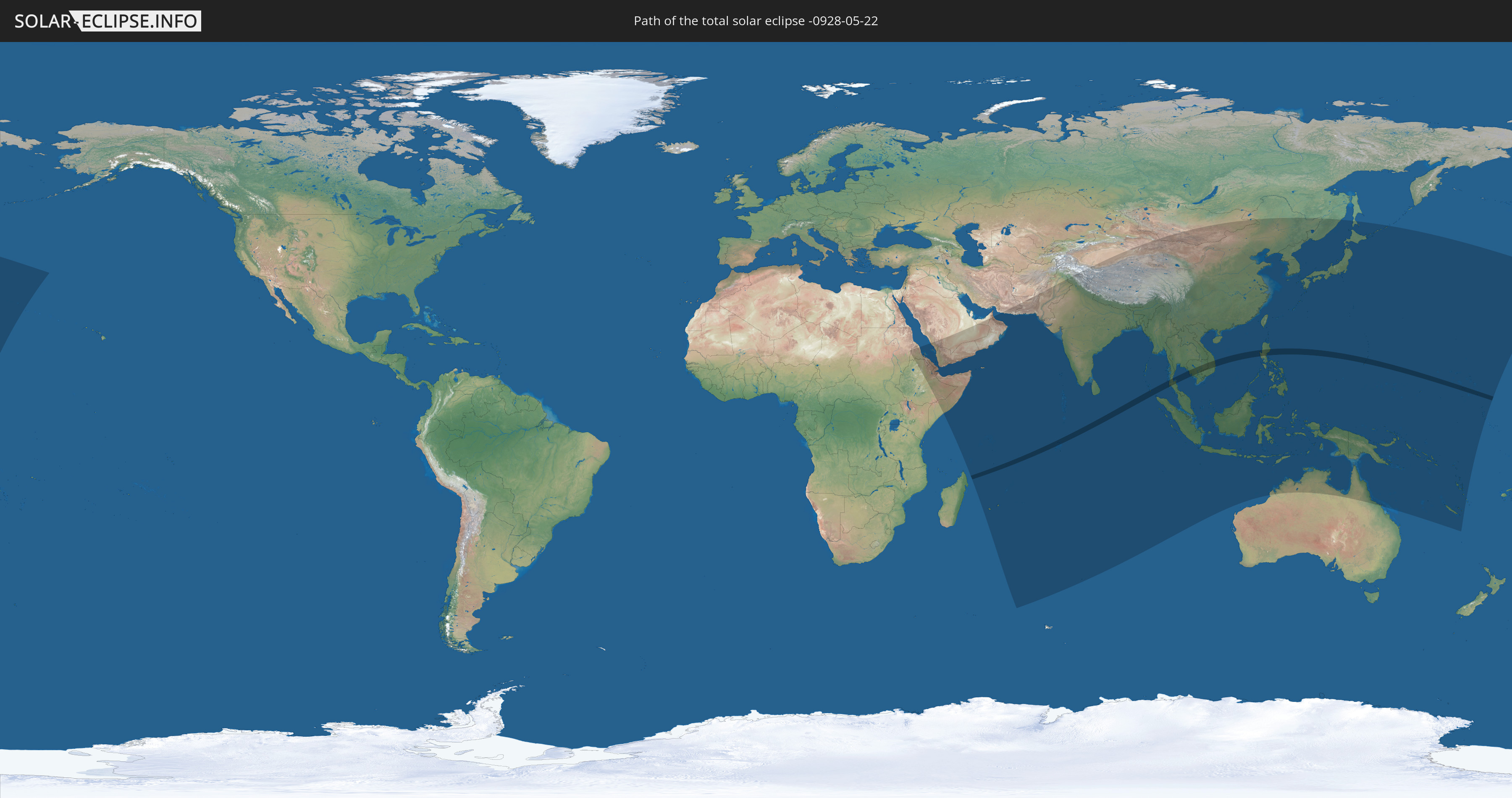
Die Sonnenfinsternis am 22.05.-0928 kann man in 57 Ländern als partielle Sonnenfinsternis beobachten.
Der Finsternispfad verläuft durch 10 Länder. Nur in diesen Ländern ist sie als totale Sonnenfinsternis zu sehen.
In den folgenden Ländern ist die Sonnenfinsternis total zu sehen
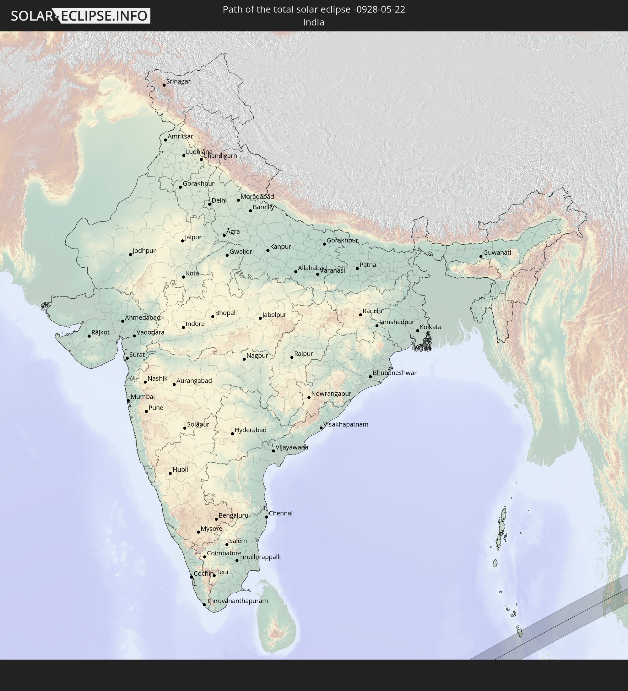 Indien
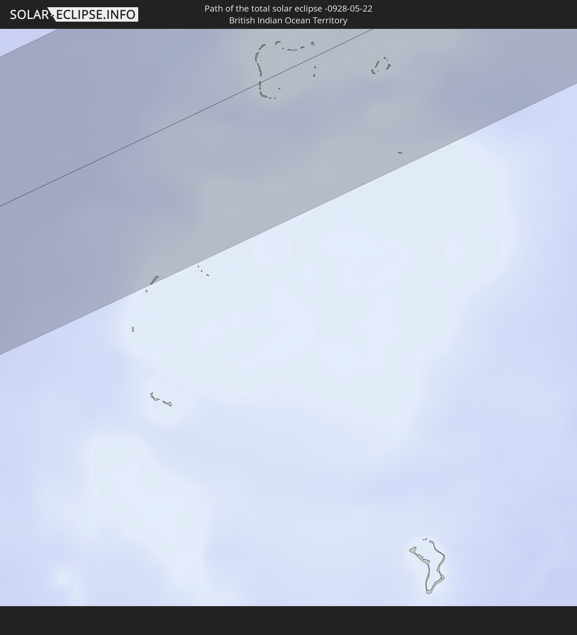 Britisches Territorium im Indischen Ozean
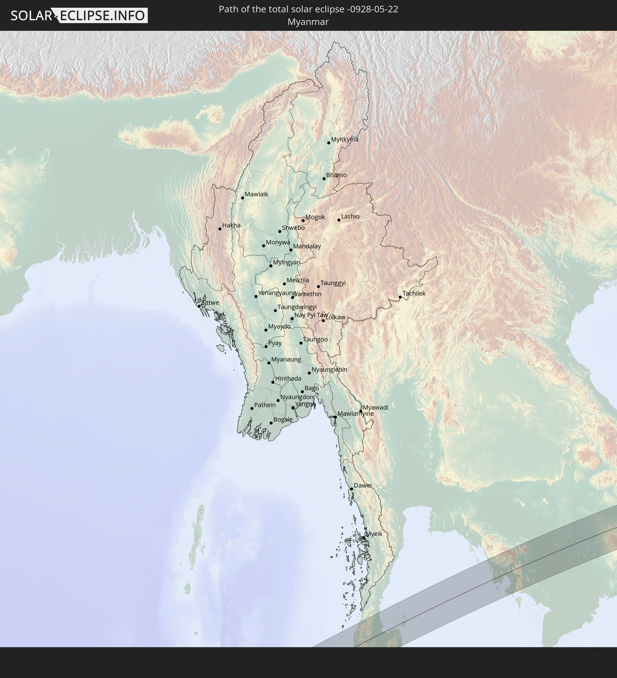 Myanmar
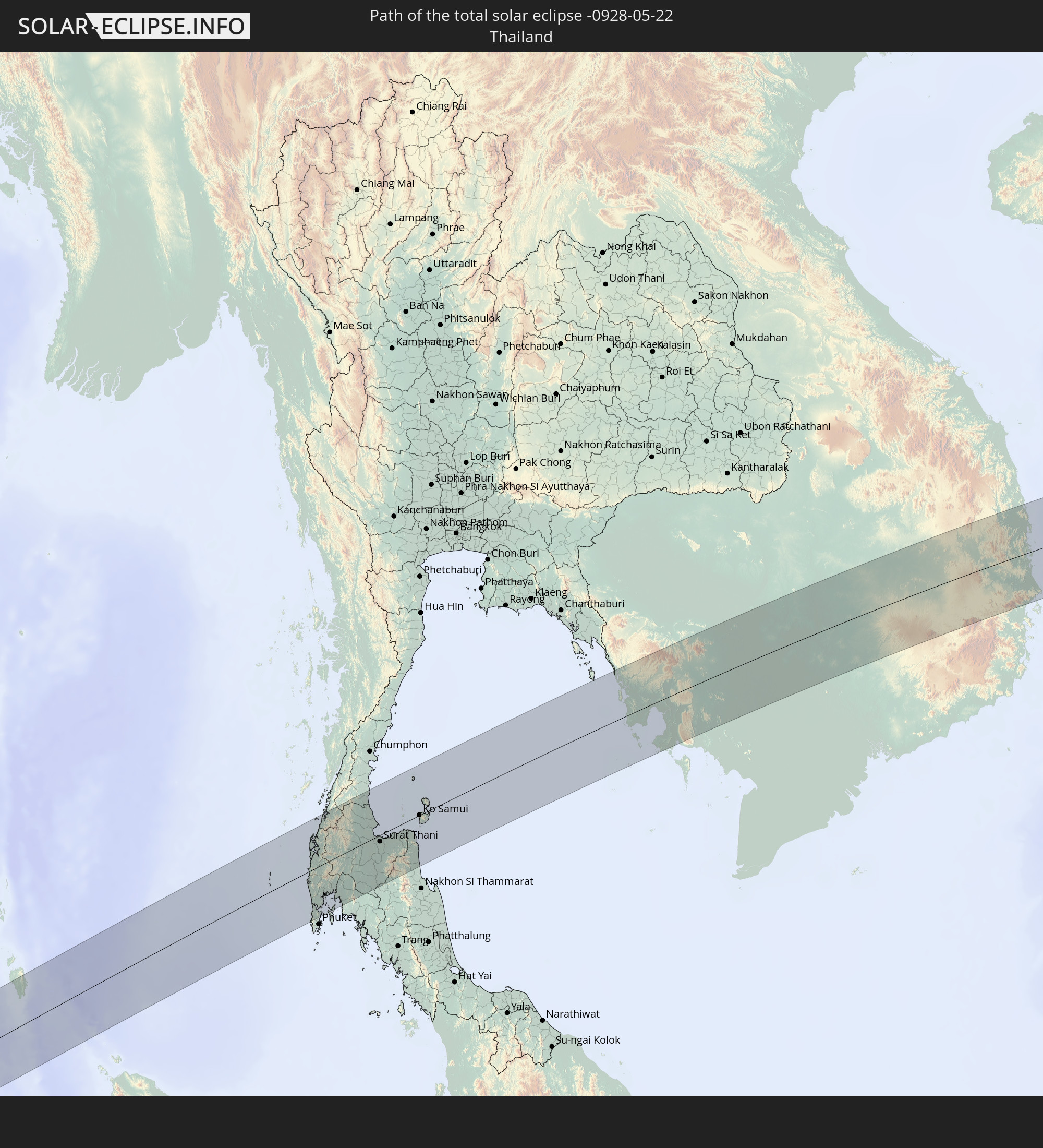 Thailand
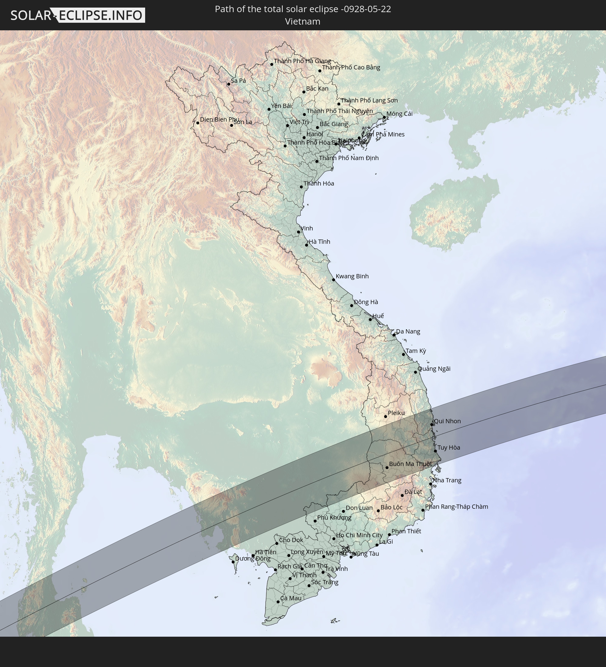 Vietnam
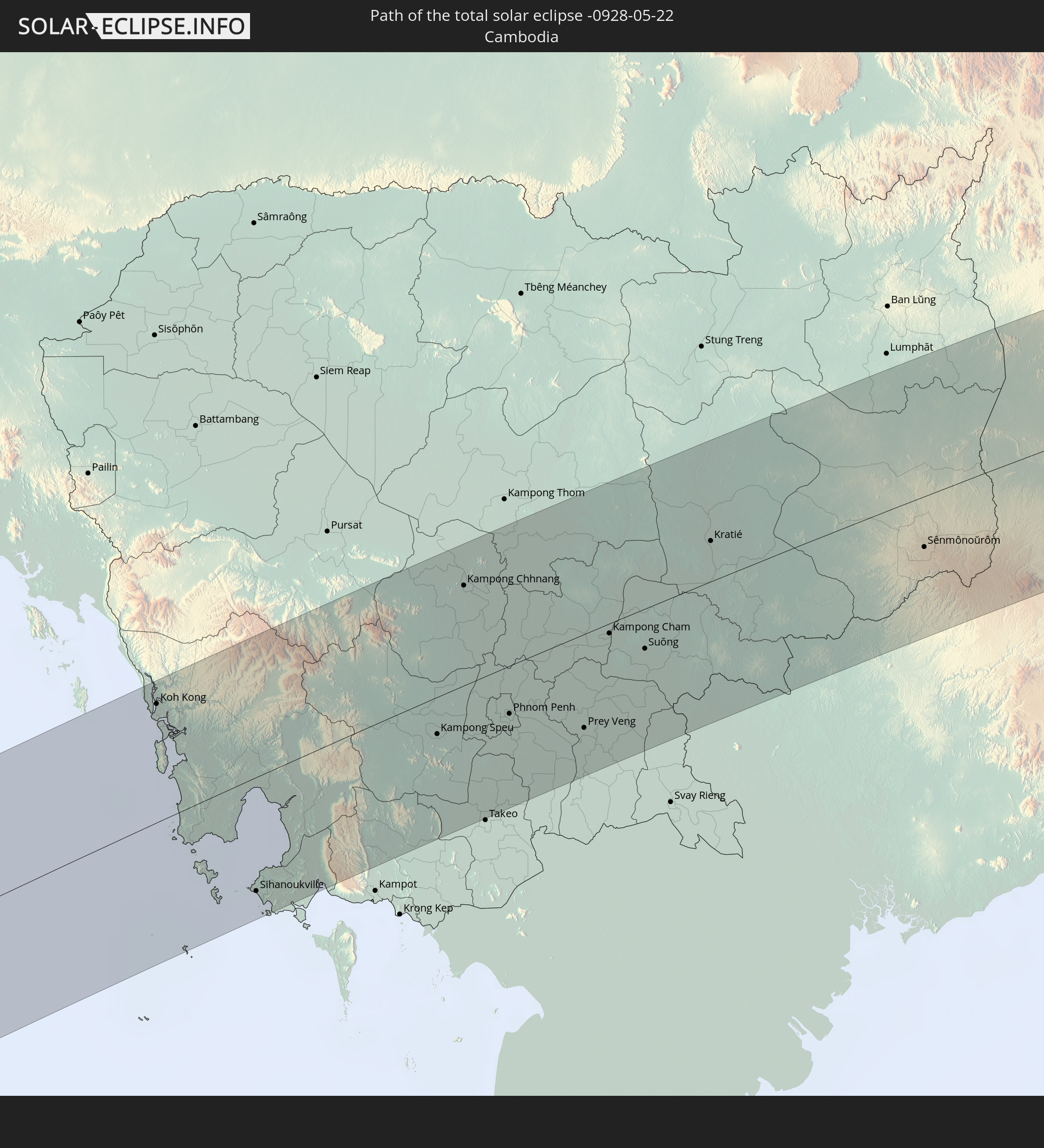 Kambodscha
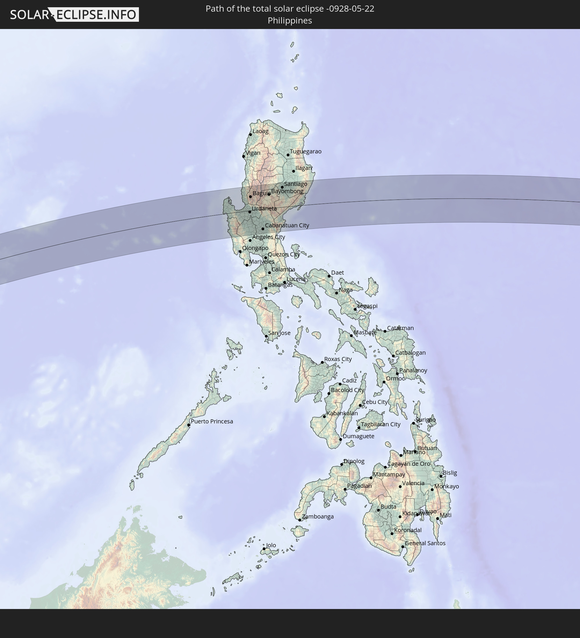 Philippinen
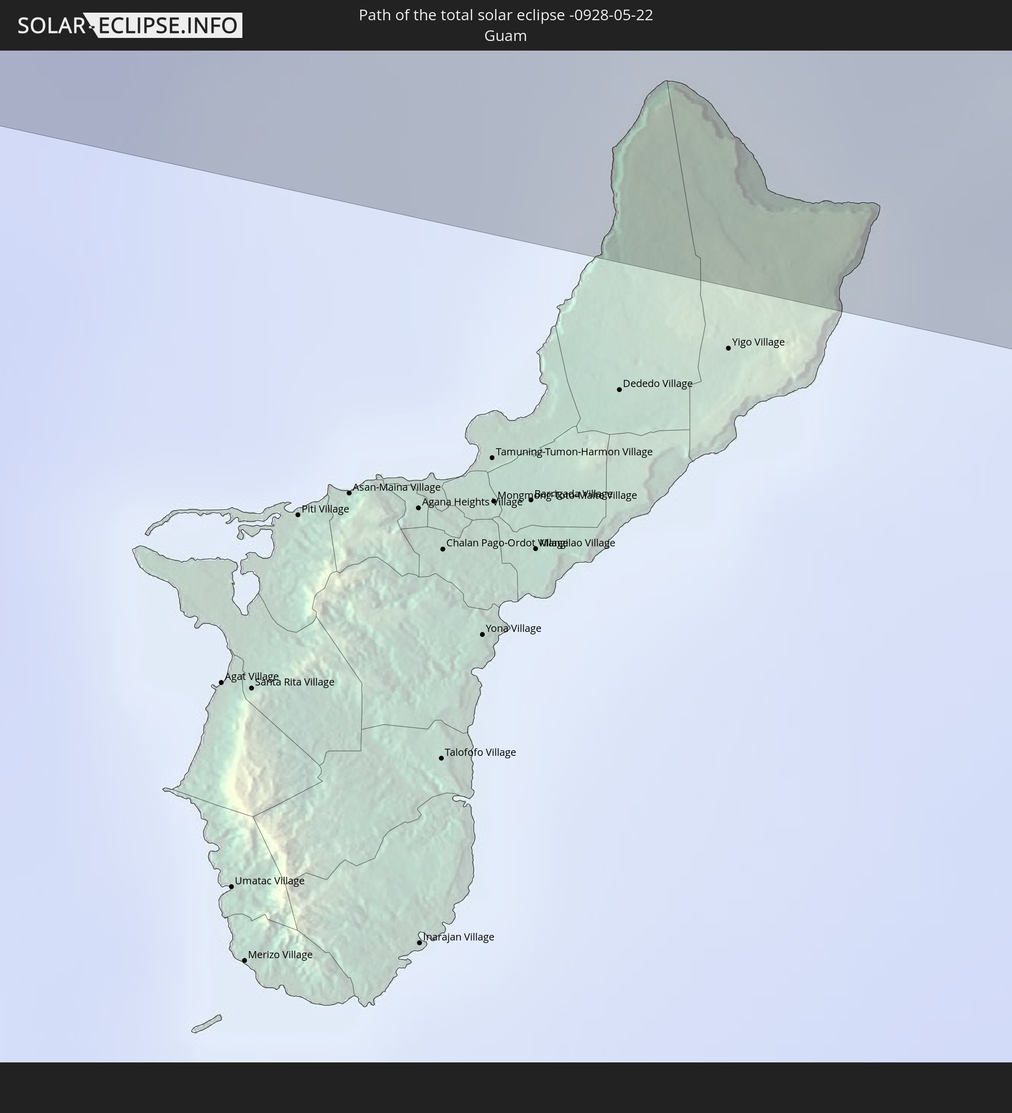 Guam
Guam
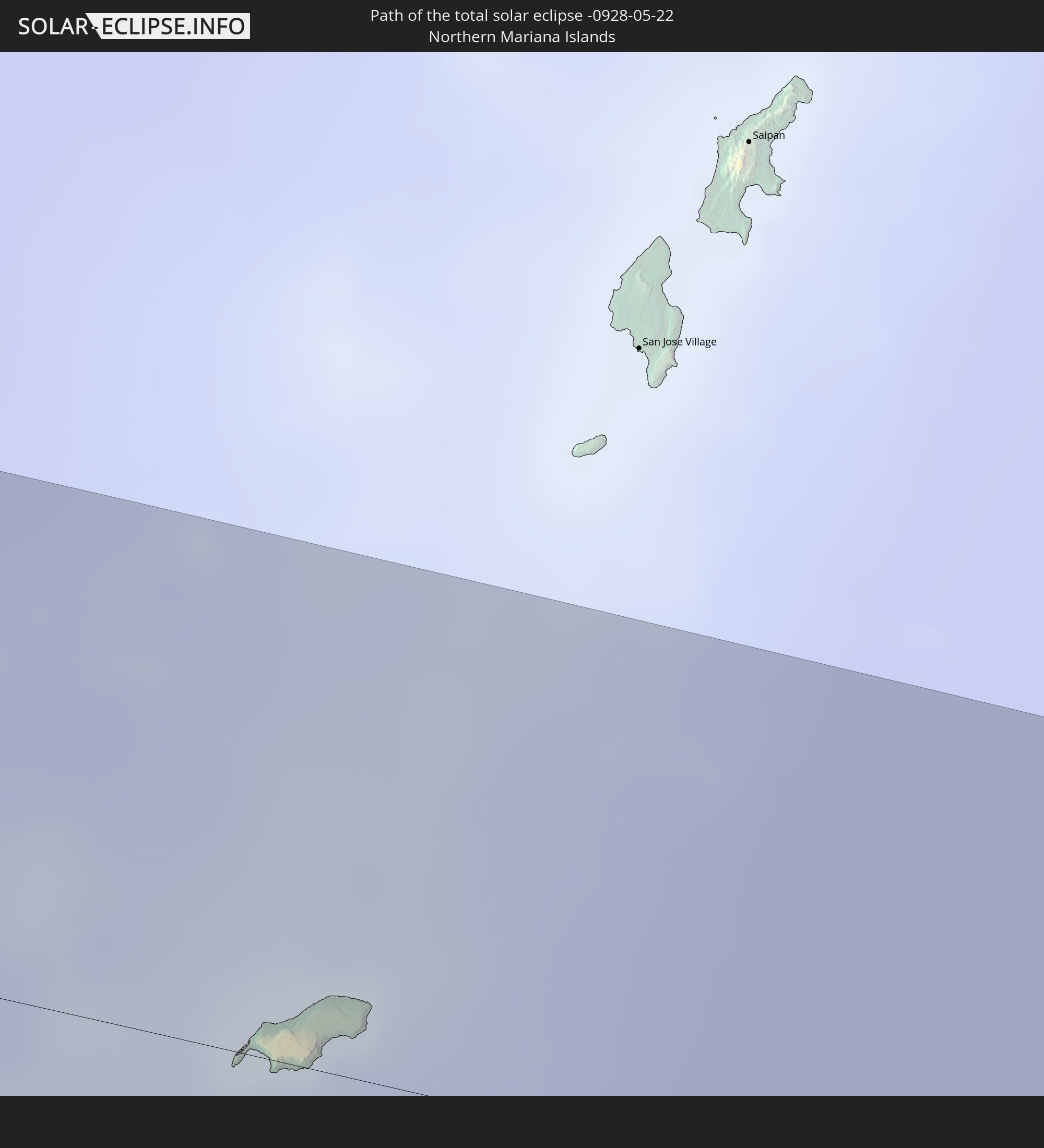 Nördliche Marianen
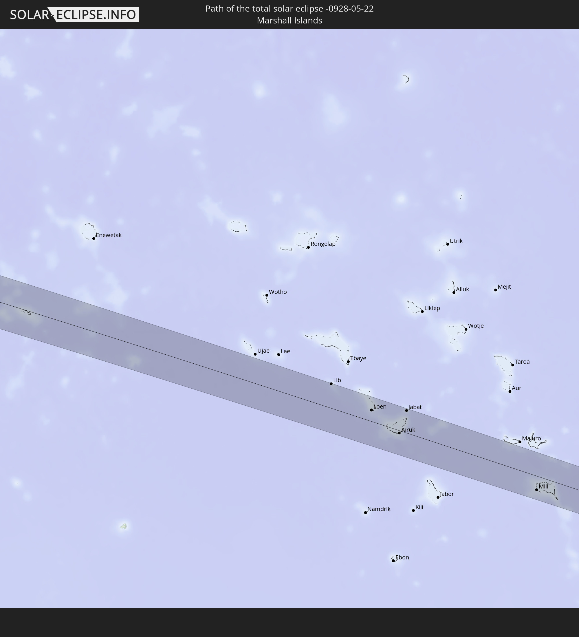 Marshallinseln
In den folgenden Ländern ist die Sonnenfinsternis partiell zu sehen
 Russland
 United States Minor Outlying Islands
 Kiribati
 Sudan
Sudan
 Äthiopien
 Saudi-Arabien
 Eritrea
 Französische Süd- und Antarktisgebiete
 Somalia
 Dschibuti
 Jemen
Jemen
 Iran
Iran
 Seychellen
 Vereinigte Arabische Emirate
 Oman
Oman
 Réunion
 Mauritius
 Pakistan
 Indien
 Britisches Territorium im Indischen Ozean
 Malediven
 Volksrepublik China
 Sri Lanka
 Nepal
Nepal
 Mongolei
 Bangladesch
 Bhutan
 Myanmar
 Indonesien
 Kokosinseln
 Thailand
 Malaysia
 Laos
Laos
 Vietnam
 Kambodscha
 Singapur
 Weihnachtsinsel
 Australien
 Macau
Macau
 Hongkong
 Brunei
 Taiwan
 Philippinen
 Japan
Japan
 Osttimor
 Nordkorea
 Südkorea
 Palau
Palau
 Föderierte Staaten von Mikronesien
 Papua-Neuguinea
 Guam
Guam
 Nördliche Marianen
 Salomonen
 Neukaledonien
 Marshallinseln
 Vanuatu
 Nauru
Nauru
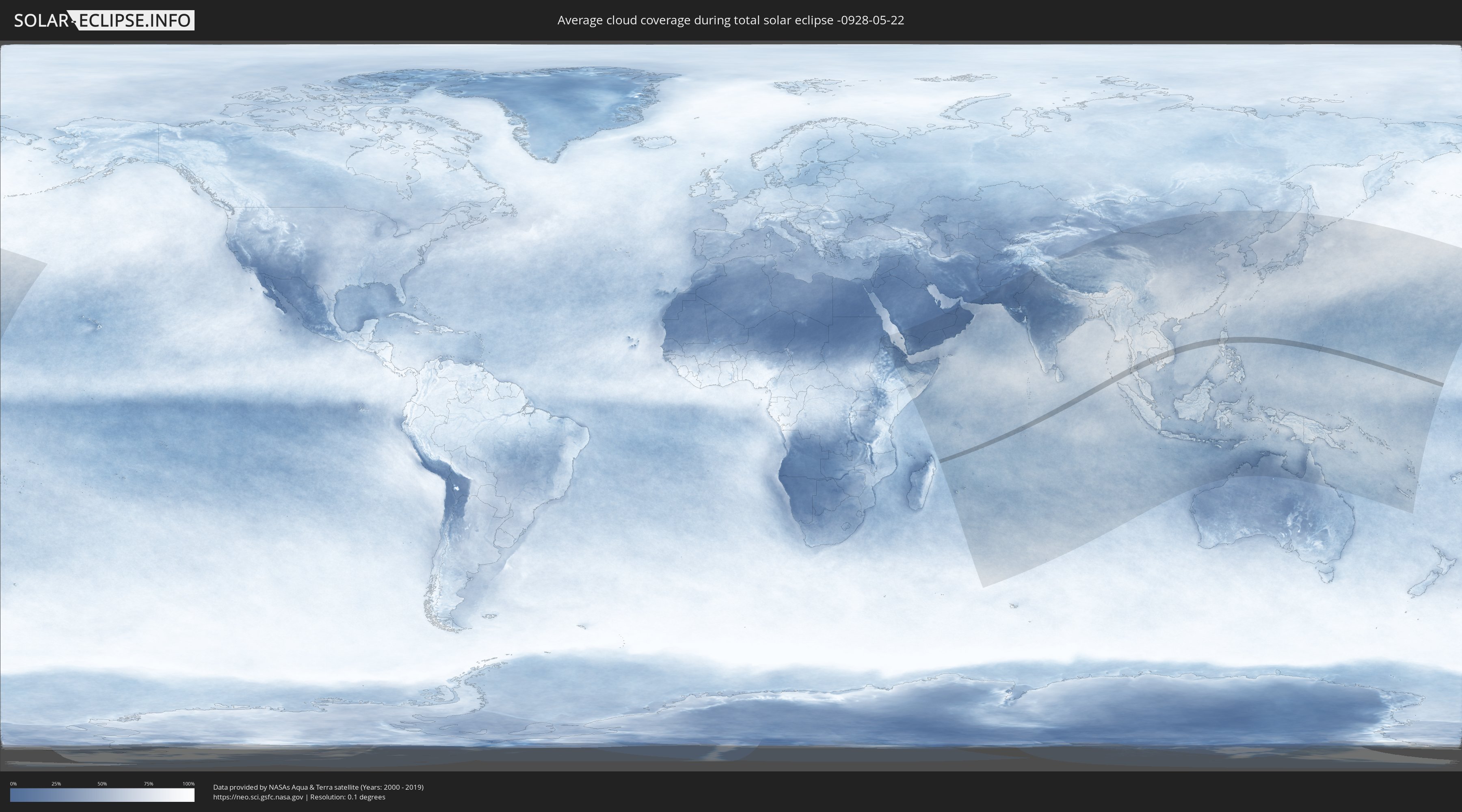
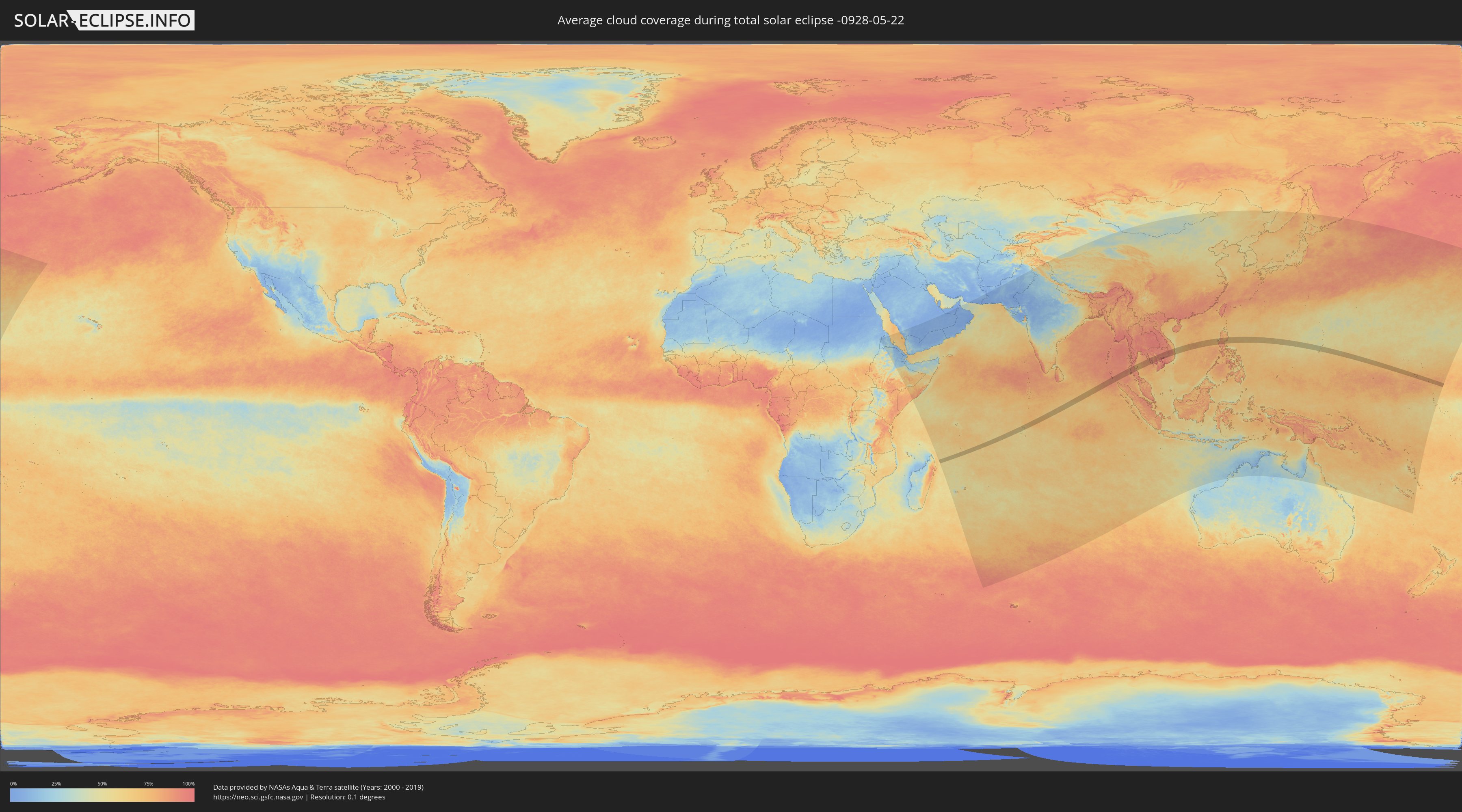
Wie wird das Wetter während der totalen Sonnenfinsternis am 22.05.-0928?
Wo ist der beste Ort, um die totale Sonnenfinsternis vom 22.05.-0928 zu beobachten?
Die folgenden Karten zeigen die durchschnittliche Bewölkung für den Tag, an dem die totale Sonnenfinsternis
stattfindet. Mit Hilfe der Karten lässt sich der Ort entlang des Finsternispfades eingrenzen,
der die besten Aussichen auf einen klaren wolkenfreien Himmel bietet.
Trotzdem muss man immer lokale Gegenenheiten beachten und sollte sich genau über das Wetter an seinem
gewählten Beobachtungsort informieren.
Die Daten stammen von den beiden NASA-Satelliten
AQUA und TERRA
und wurden über einen Zeitraum von 19 Jahren (2000 - 2019) gemittelt.
Detaillierte Länderkarten
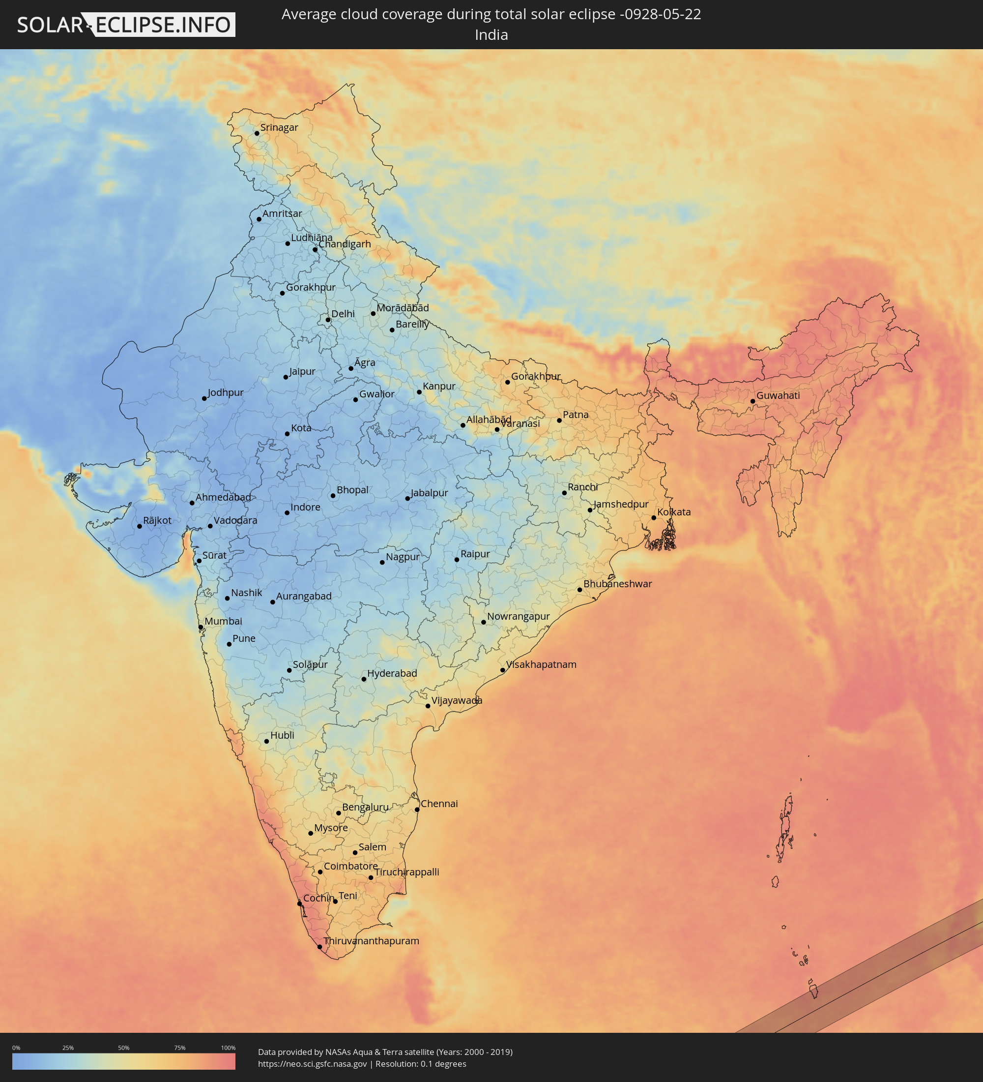 Indien
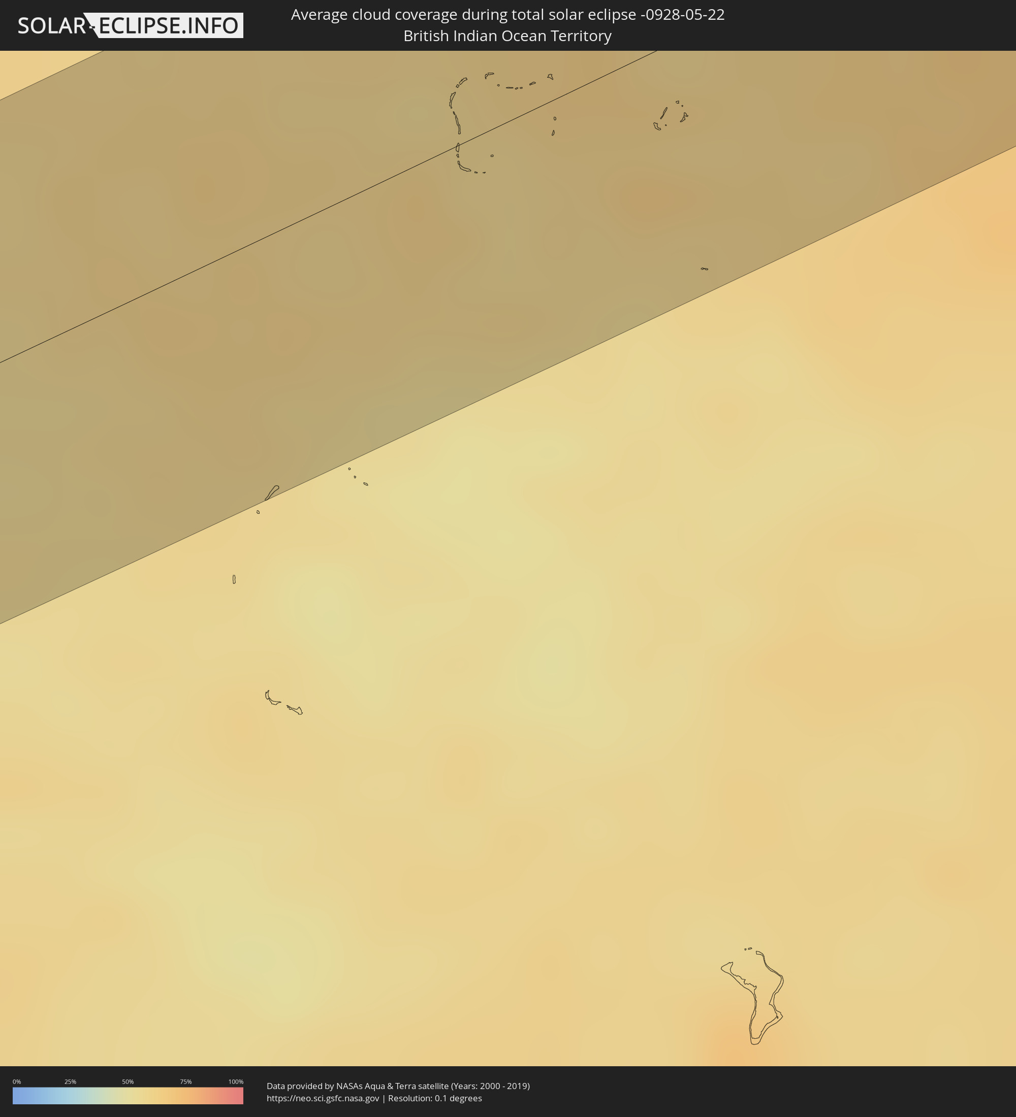 Britisches Territorium im Indischen Ozean
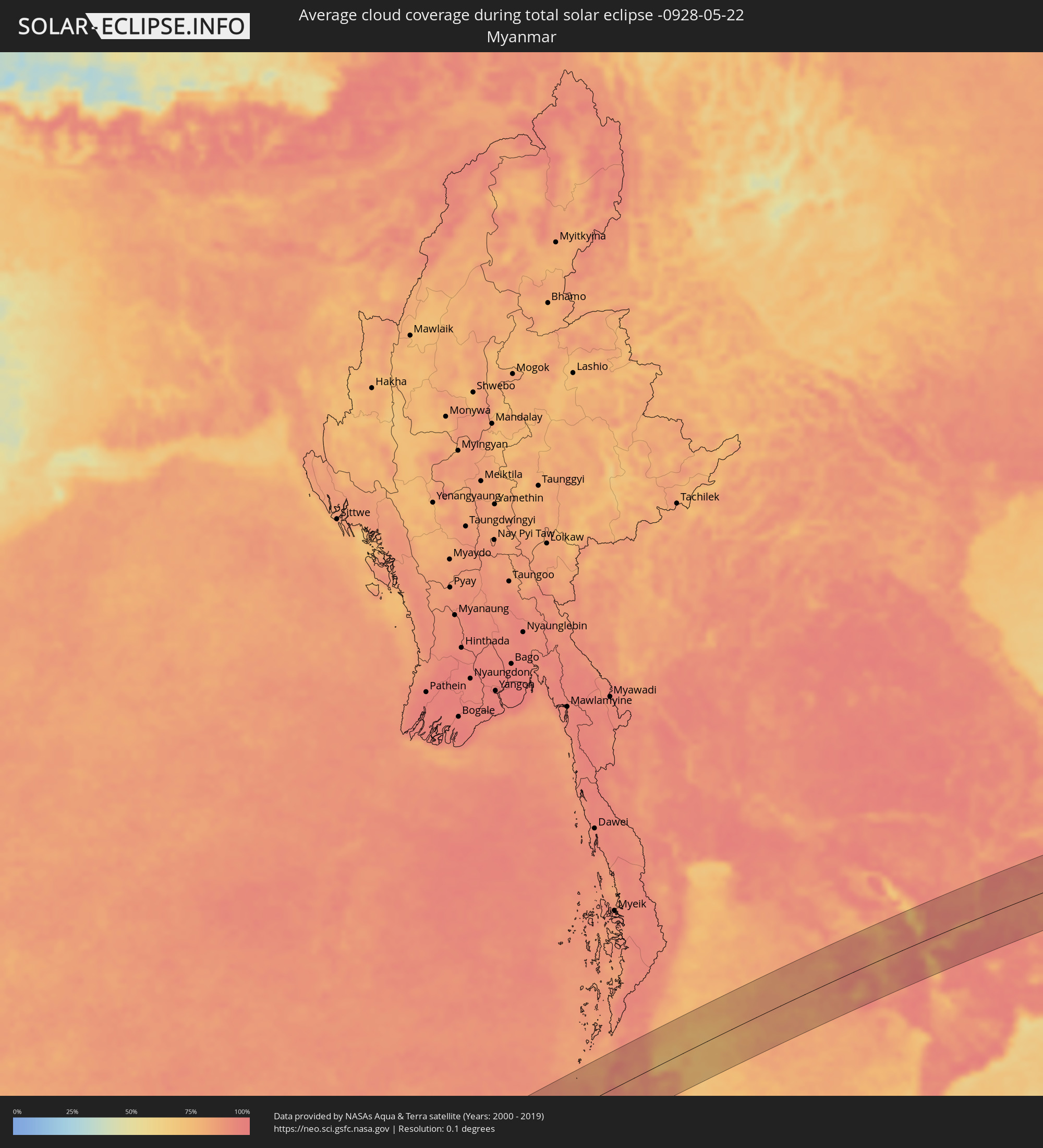 Myanmar
 Thailand
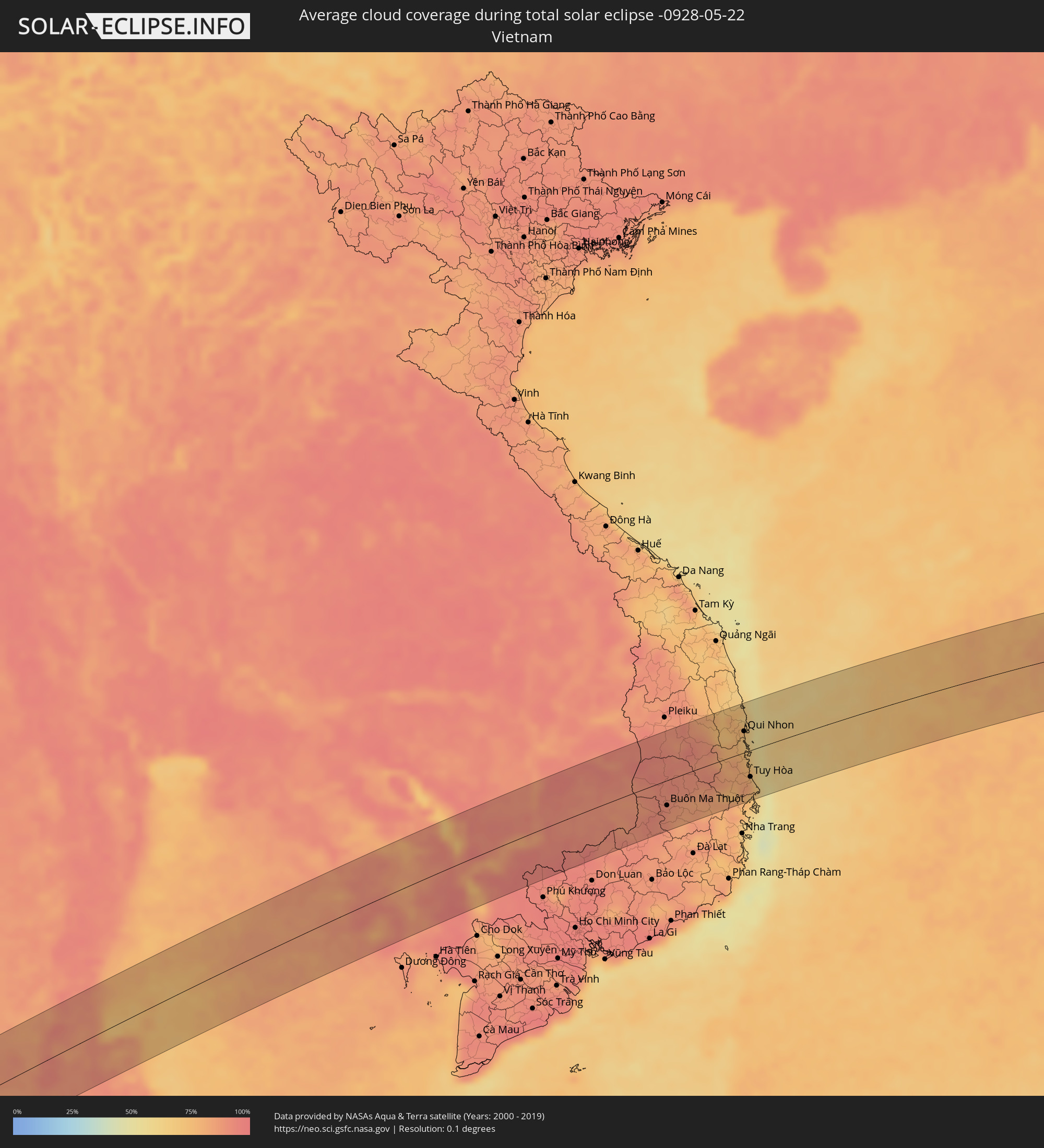 Vietnam
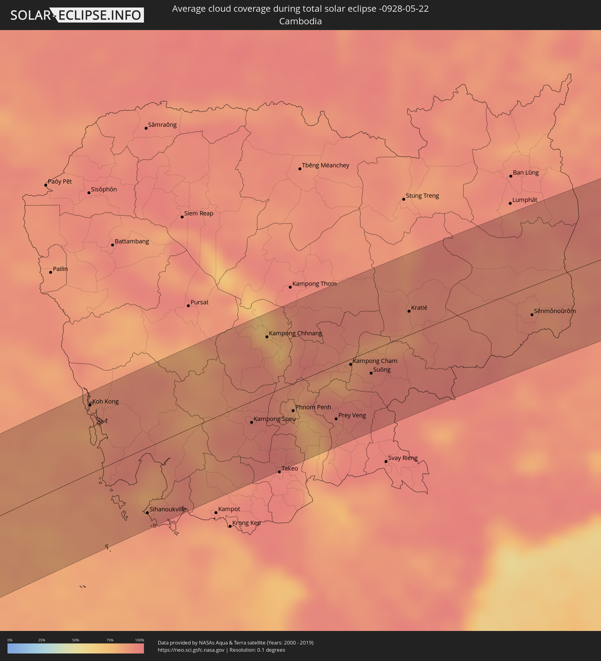 Kambodscha
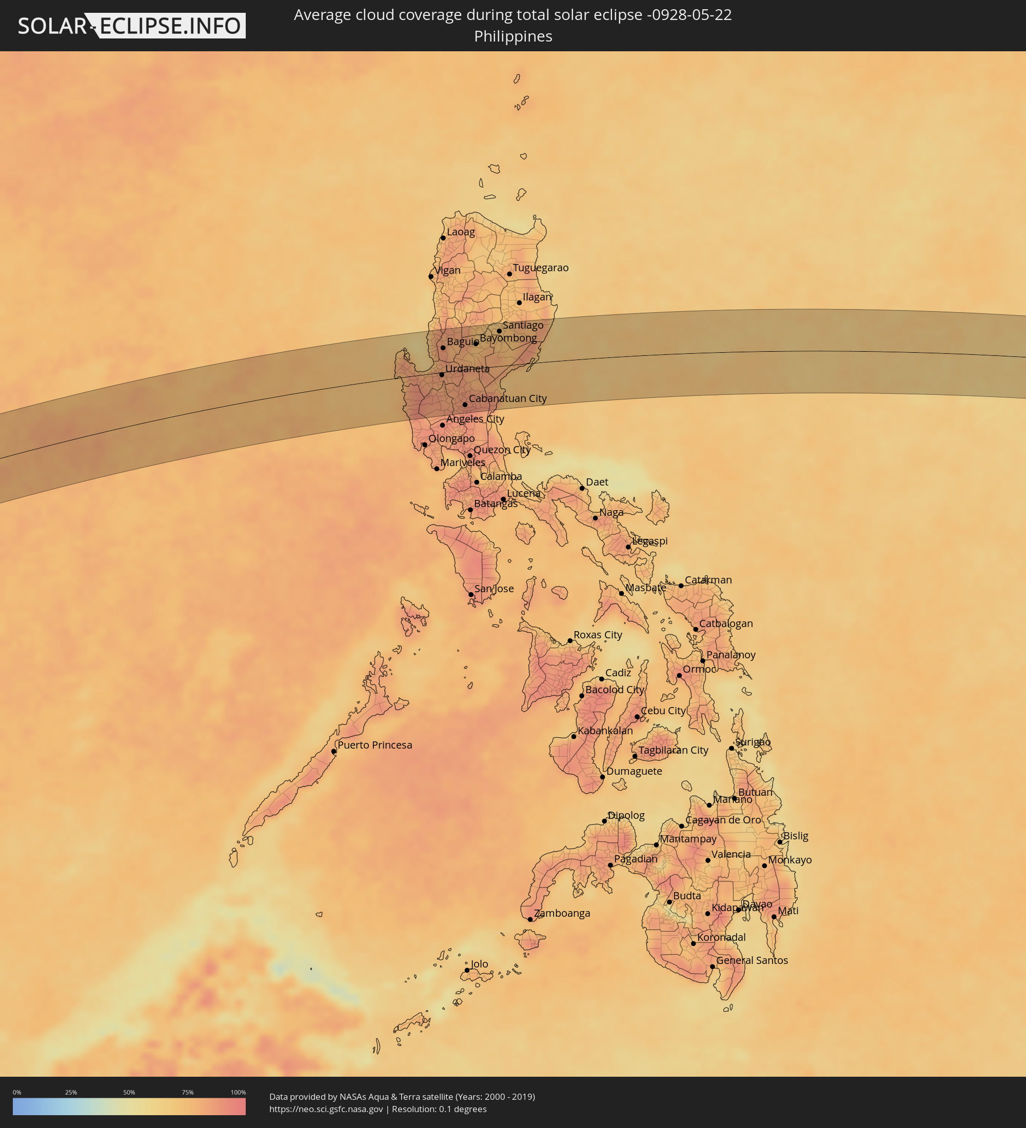 Philippinen
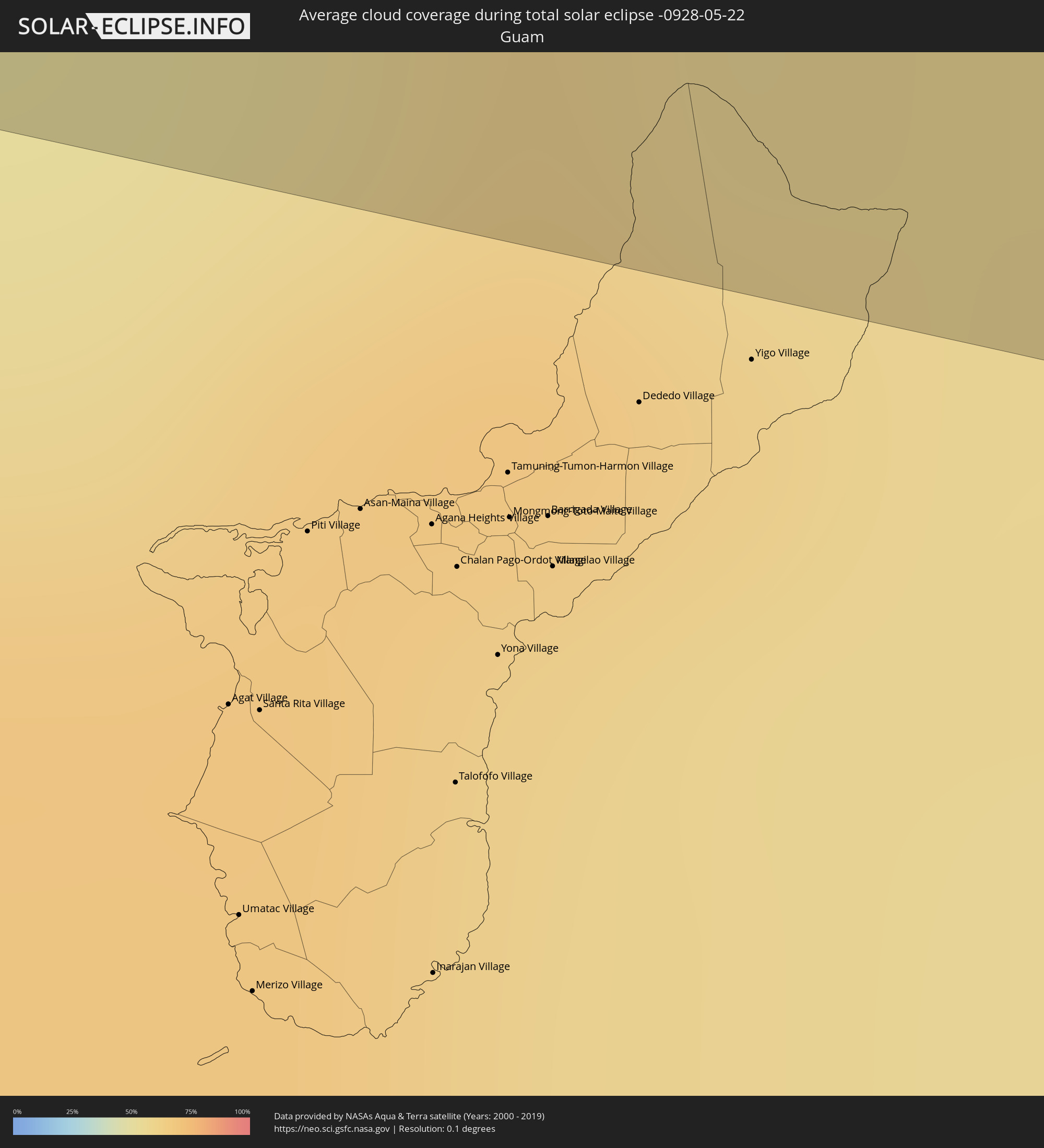 Guam
Guam
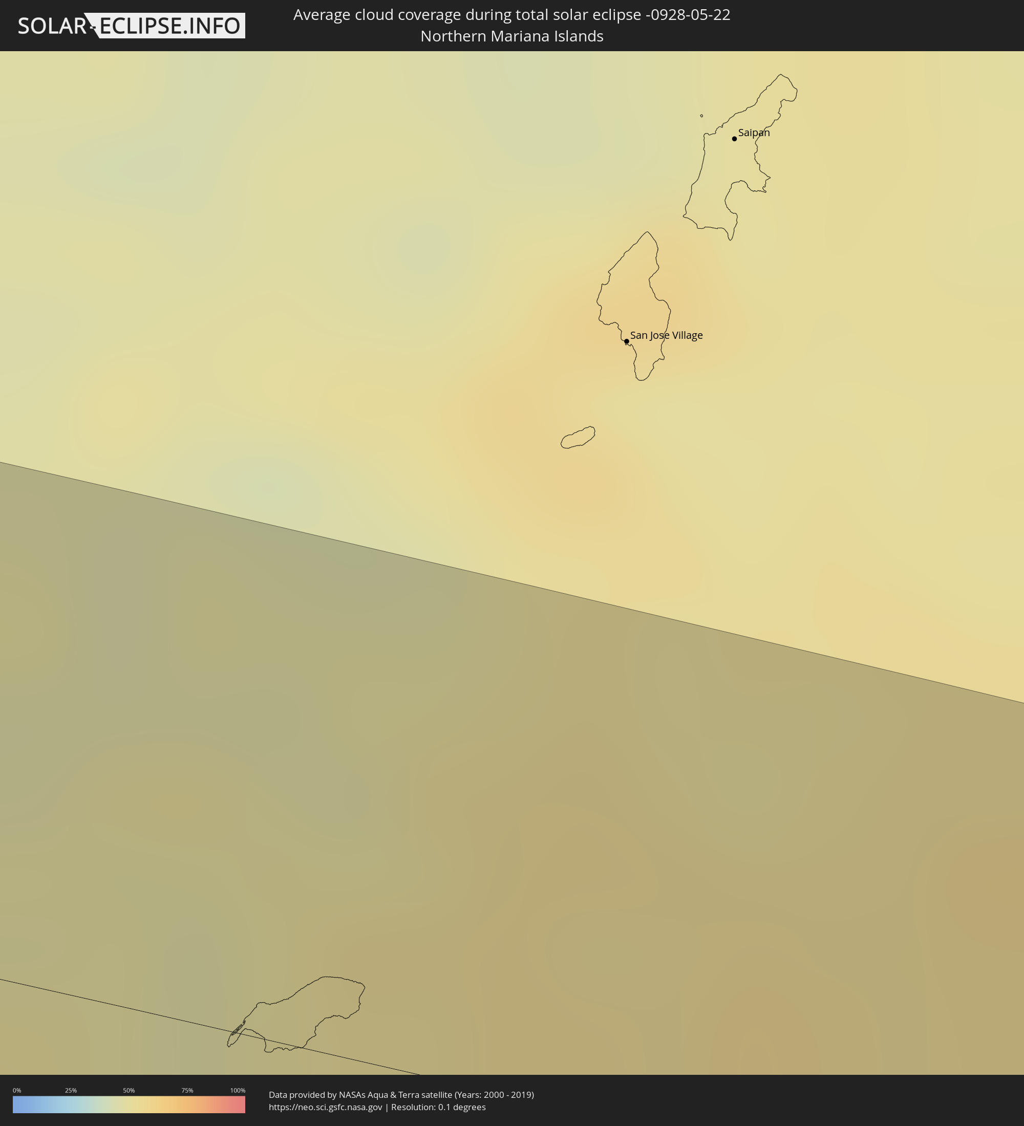 Nördliche Marianen
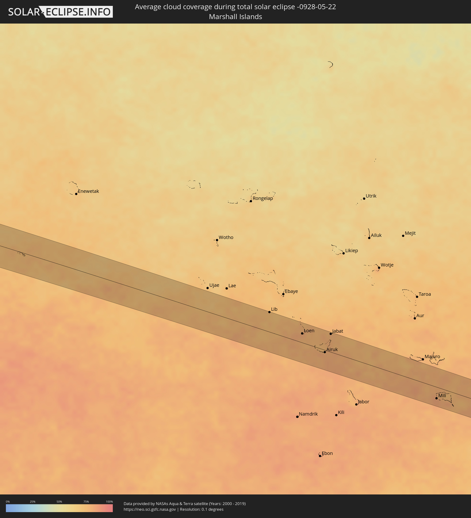 Marshallinseln
Orte im Finsternispfad
Die nachfolgene Tabelle zeigt Städte und Orte mit mehr als 5.000 Einwohnern, die sich im Finsternispfad befinden. Städte mit mehr als 100.000 Einwohnern sind dick gekennzeichnet. Mit einem Klick auf den Ort öffnet sich eine Detailkarte die die Lage des jeweiligen Ortes zusammen mit dem Verlauf der zentralen Finsternis präsentiert.
| Ort | Typ | Dauer der Verfinsterung | Ortszeit bei maximaler Verfinsterung | Entfernung zur Zentrallinie | Ø Bewölkung |
|
Phang Nga, Phangnga
|
total | - | 10:30:42 UTC+06:42 | 38 km | 89% |
|
Ao Luek, Krabi
|
total | - | 10:31:05 UTC+06:42 | 55 km | 83% |
|
Chai Buri, Surat Thani
|
total | - | 10:32:05 UTC+06:42 | 64 km | 89% |
|
Chaiya, Surat Thani
|
total | - | 10:33:34 UTC+06:42 | 21 km | 87% |
|
Phunphin, Surat Thani
|
total | - | 10:33:18 UTC+06:42 | 8 km | 90% |
|
Surat Thani, Surat Thani
|
total | - | 10:33:36 UTC+06:42 | 10 km | 88% |
|
Ban Na San, Surat Thani
|
total | - | 10:33:14 UTC+06:42 | 45 km | 88% |
|
Wiang Sa, Surat Thani
|
total | - | 10:33:02 UTC+06:42 | 61 km | 90% |
|
Don Sak, Surat Thani
|
total | - | 10:34:44 UTC+06:42 | 10 km | 85% |
|
Ko Samui, Surat Thani
|
total | - | 10:35:39 UTC+06:42 | 1 km | 73% |
|
Ko Pha Ngan, Nakhon Si Thammarat
|
total | - | 10:36:10 UTC+06:42 | 17 km | 75% |
|
Koh Kong, Koh Kong
|
total | - | 10:46:26 UTC+06:42 | 65 km | 84% |
|
Smach Mean Chey, Koh Kong
|
total | - | 10:46:29 UTC+06:42 | 55 km | 80% |
|
Sihanoukville, Preah Sihanouk
|
total | - | 10:46:42 UTC+06:42 | 62 km | 88% |
|
Kampong Speu, Kampong Speu
|
total | - | 10:50:32 UTC+06:42 | 20 km | 93% |
|
Kampong Chhnang, Kampong Chhnang
|
total | - | 10:51:56 UTC+06:42 | 55 km | 80% |
|
Phnom Penh, Phnom Penh
|
total | - | 10:51:48 UTC+06:42 | 26 km | 91% |
|
Ta Khmau, Kandal
|
total | - | 10:51:48 UTC+06:42 | 36 km | 82% |
|
Prey Veng, Prey Veng
|
total | - | 10:52:54 UTC+06:42 | 52 km | 90% |
|
Kampong Cham, Kampong Cham
|
total | - | 10:53:54 UTC+06:42 | 5 km | 86% |
|
Suŏng, Tboung Khmum
|
total | - | 10:54:22 UTC+06:42 | 22 km | 94% |
|
Kratié, Kratie
|
total | - | 10:56:06 UTC+06:42 | 22 km | 88% |
|
Sênmônoŭrôm, Mondolkiri
|
total | - | 10:59:30 UTC+06:42 | 28 km | 91% |
|
Buôn Ma Thuột, Ðắc Lắk
|
total | - | 11:26:53 UTC+07:06 | 39 km | 91% |
|
Sông Cầu, Phú Yên
|
total | - | 11:31:19 UTC+07:06 | 0 km | 76% |
|
Qui Nhon, Bình Định
|
total | - | 11:31:40 UTC+07:06 | 33 km | 70% |
|
Tuy Hòa, Phú Yên
|
total | - | 11:31:14 UTC+07:06 | 42 km | 82% |
|
Santa Cruz, Central Luzon
|
total | - | 12:59:15 UTC+08:00 | 20 km | 75% |
|
Zaragoza, Ilocos
|
total | - | 12:59:39 UTC+08:00 | 48 km | 74% |
|
Masinloc, Central Luzon
|
total | - | 12:59:16 UTC+08:00 | 46 km | 85% |
|
Iba, Central Luzon
|
total | - | 12:59:15 UTC+08:00 | 69 km | 79% |
|
Alaminos, Ilocos
|
total | - | 12:59:39 UTC+08:00 | 22 km | 83% |
|
Agoo, Ilocos
|
total | - | 12:59:58 UTC+08:00 | 13 km | 80% |
|
Lingayen, Ilocos
|
total | - | 13:00:20 UTC+08:00 | 4 km | 82% |
|
San Fernando, Ilocos
|
total | - | 13:00:51 UTC+08:00 | 69 km | 65% |
|
Urbiztondo, Ilocos
|
total | - | 13:00:32 UTC+08:00 | 19 km | 85% |
|
Aringay, Ilocos
|
total | - | 13:00:52 UTC+08:00 | 44 km | 77% |
|
Mayantoc, Central Luzon
|
total | - | 13:00:35 UTC+08:00 | 42 km | 86% |
|
Mangaldan, Ilocos
|
total | - | 13:00:51 UTC+08:00 | 7 km | 80% |
|
Camiling, Central Luzon
|
total | - | 13:00:43 UTC+08:00 | 35 km | 87% |
|
Sison, Ilocos
|
total | - | 13:01:14 UTC+08:00 | 17 km | 80% |
|
Alcala, Ilocos
|
total | - | 13:01:07 UTC+08:00 | 19 km | 80% |
|
Urdaneta, Ilocos
|
total | - | 13:01:19 UTC+08:00 | 5 km | 83% |
|
Paniqui, Central Luzon
|
total | - | 13:01:12 UTC+08:00 | 39 km | 82% |
|
Capas, Central Luzon
|
total | - | 13:01:05 UTC+08:00 | 77 km | 91% |
|
Baguio, Cordillera
|
total | - | 13:01:34 UTC+08:00 | 43 km | 86% |
|
Tarlac City, Central Luzon
|
total | - | 13:01:10 UTC+08:00 | 60 km | 86% |
|
Kibungan, Cordillera
|
total | - | 13:01:52 UTC+08:00 | 73 km | 84% |
|
Cuyapo, Central Luzon
|
total | - | 13:01:30 UTC+08:00 | 28 km | 84% |
|
Loacan, Cordillera
|
total | - | 13:01:50 UTC+08:00 | 57 km | 82% |
|
Guiset East, Ilocos
|
total | - | 13:01:41 UTC+08:00 | 3 km | 84% |
|
Guimba, Central Luzon
|
total | - | 13:01:45 UTC+08:00 | 43 km | 85% |
|
San Francisco, Central Luzon
|
total | - | 13:01:50 UTC+08:00 | 77 km | 88% |
|
Lupao, Central Luzon
|
total | - | 13:02:14 UTC+08:00 | 20 km | 86% |
|
Muñoz, Central Luzon
|
total | - | 13:02:11 UTC+08:00 | 38 km | 88% |
|
Cabanatuan City, Central Luzon
|
total | - | 13:02:16 UTC+08:00 | 64 km | 91% |
|
Aritao, Cagayan Valley
|
total | - | 13:02:48 UTC+08:00 | 25 km | 76% |
|
Carranglan, Central Luzon
|
total | - | 13:02:45 UTC+08:00 | 13 km | 80% |
|
Bongabon, Central Luzon
|
total | - | 13:02:51 UTC+08:00 | 50 km | 90% |
|
Bayombong, Cagayan Valley
|
total | - | 13:03:13 UTC+08:00 | 44 km | 73% |
|
Gabaldon, Central Luzon
|
total | - | 13:03:21 UTC+08:00 | 72 km | 83% |
|
Diadi, Cagayan Valley
|
total | - | 13:03:55 UTC+08:00 | 69 km | 74% |
|
Maria Aurora, Central Luzon
|
total | - | 13:03:53 UTC+08:00 | 36 km | 75% |
|
Santiago, Cagayan Valley
|
total | - | 13:04:27 UTC+08:00 | 62 km | 73% |
|
Saguday, Cagayan Valley
|
total | - | 13:04:26 UTC+08:00 | 46 km | 75% |
|
Maddela, Cagayan Valley
|
total | - | 13:04:42 UTC+08:00 | 23 km | 74% |
|
Alicia, Cagayan Valley
|
total | - | 13:04:54 UTC+08:00 | 71 km | 73% |
|
Lib, Lib Island
|
total | - | 17:15:10 UTC+11:00 | 54 km | 74% |
|
Loen, Namu Atoll
|
total | - | 17:15:29 UTC+11:00 | 25 km | 80% |
|
Airuk, Ailinglaplap Atoll
|
total | - | 17:15:42 UTC+11:00 | 6 km | 79% |
|
Jabat, Jabat Island
|
total | - | 17:15:38 UTC+11:00 | 49 km | 78% |
|
Mili, Mili Atoll
|
total | - | 17:16:18 UTC+11:00 | 31 km | 83% |