Totale Sonnenfinsternis vom 06.01.-0986
| Wochentag: | Dienstag |
| Maximale Dauer der Verfinsterung: | 03m59s |
| Maximale Breite des Finsternispfades: | 158 km |
| Saroszyklus: | 35 |
| Bedeckungsgrad: | 100% |
| Magnitude: | 1.0467 |
| Gamma: | -0.1735 |
Wo kann man die Sonnenfinsternis vom 06.01.-0986 sehen?
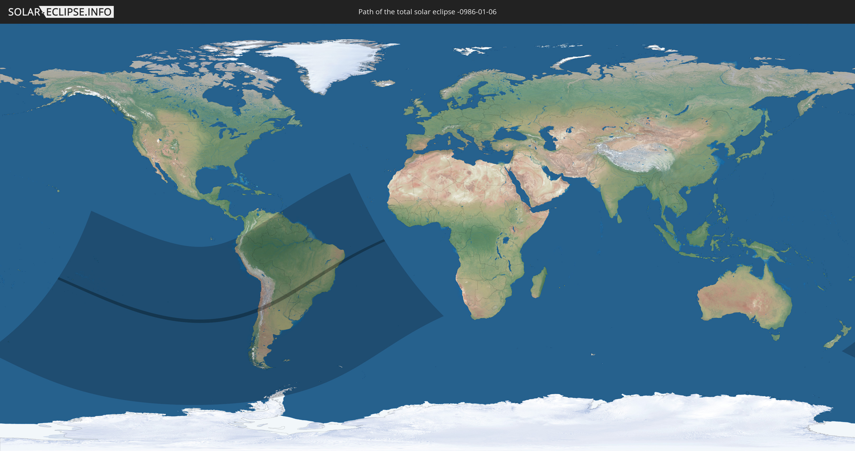
Die Sonnenfinsternis am 06.01.-0986 kann man in 23 Ländern als partielle Sonnenfinsternis beobachten.
Der Finsternispfad verläuft durch 4 Länder. Nur in diesen Ländern ist sie als totale Sonnenfinsternis zu sehen.
In den folgenden Ländern ist die Sonnenfinsternis total zu sehen
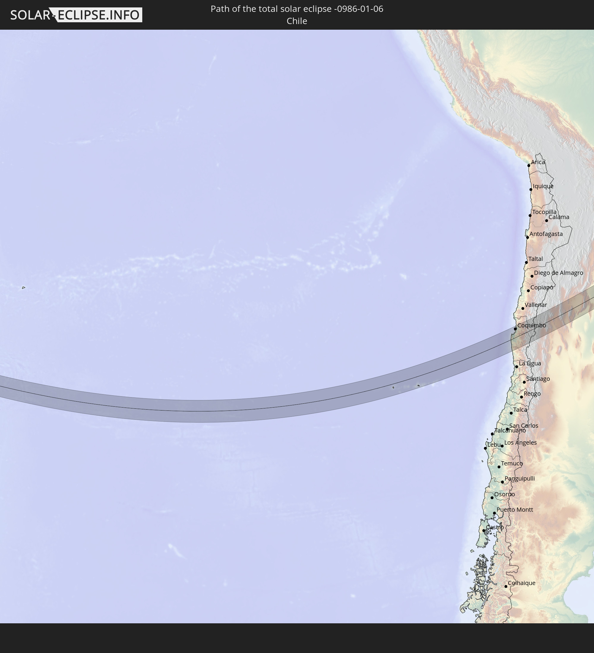 Chile
Chile
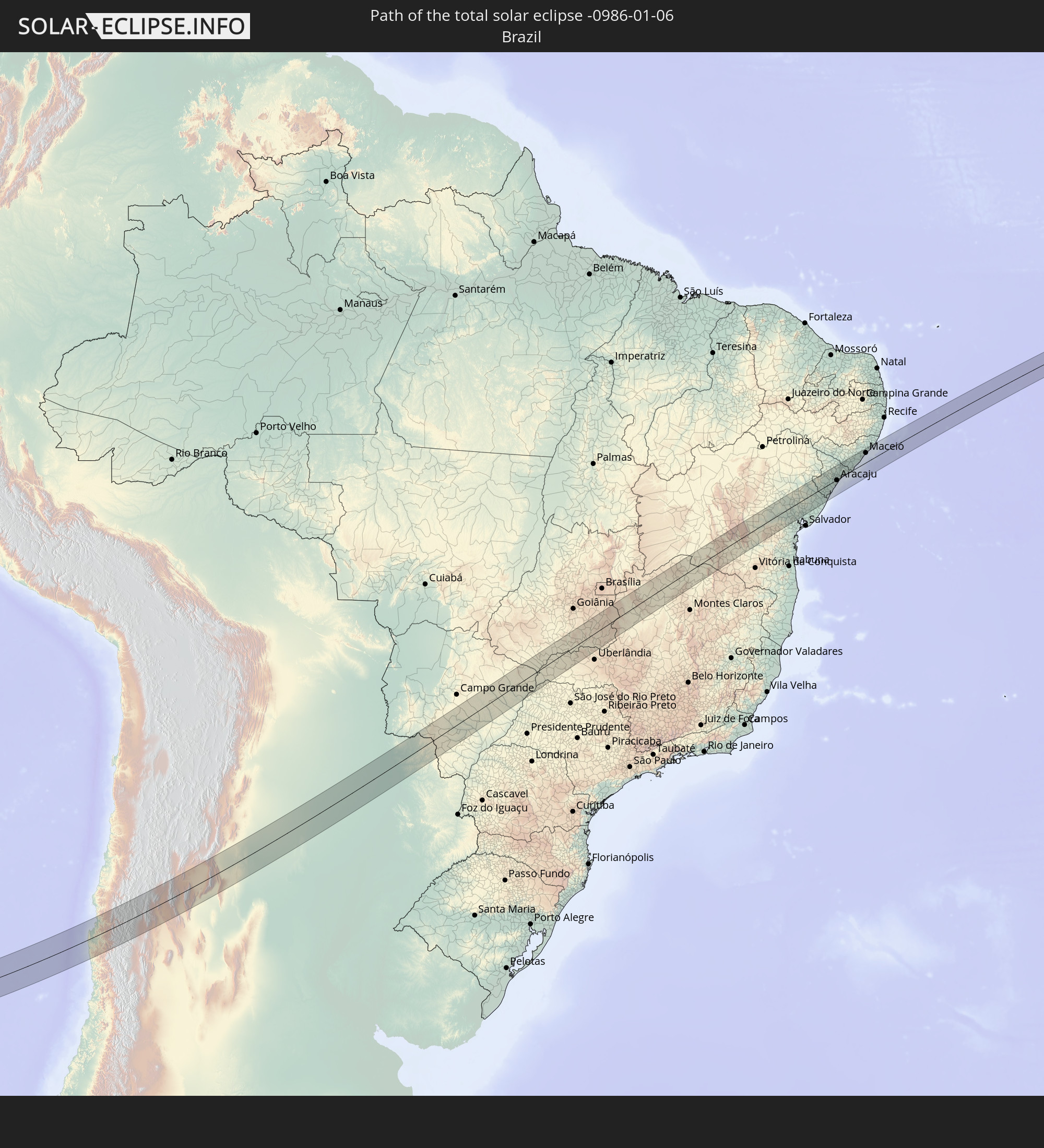 Brasilien
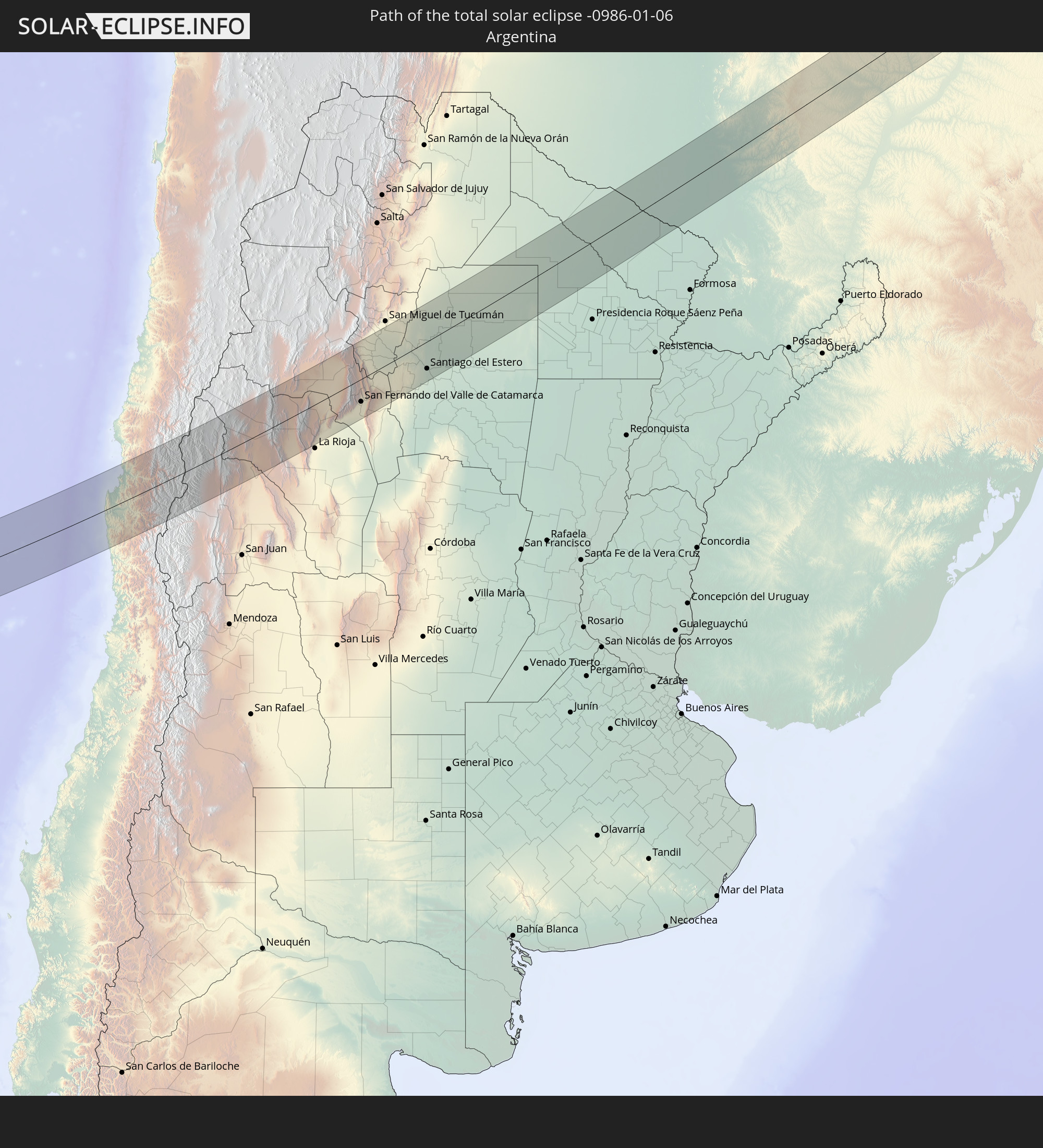 Argentinien
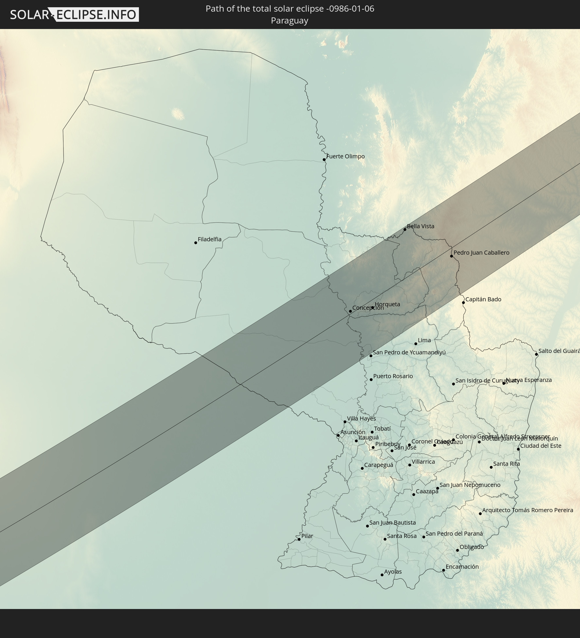 Paraguay
In den folgenden Ländern ist die Sonnenfinsternis partiell zu sehen
 Antarktika
 Neuseeland
 Kiribati
 Cookinseln
 Französisch-Polynesien
 Pitcairninseln
 Chile
Chile
 Ecuador
 Kolumbien
 Peru
Peru
 Brasilien
 Argentinien
 Venezuela
 Bolivien
 Paraguay
 Trinidad und Tobago
 Falklandinseln
 Guyana
 Uruguay
 Suriname
 Französisch-Guayana
 Südgeorgien und die Südlichen Sandwichinseln
 St. Helena
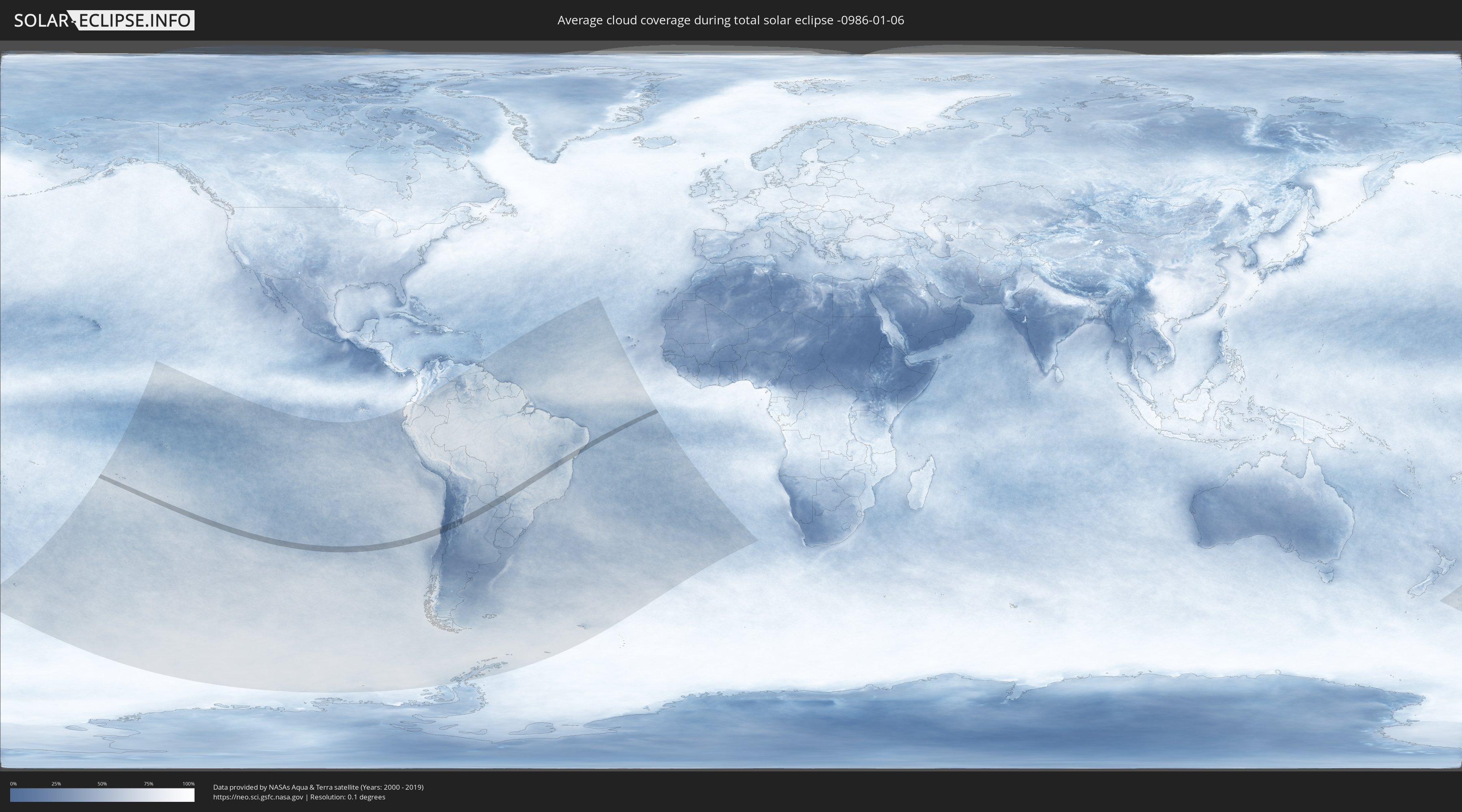
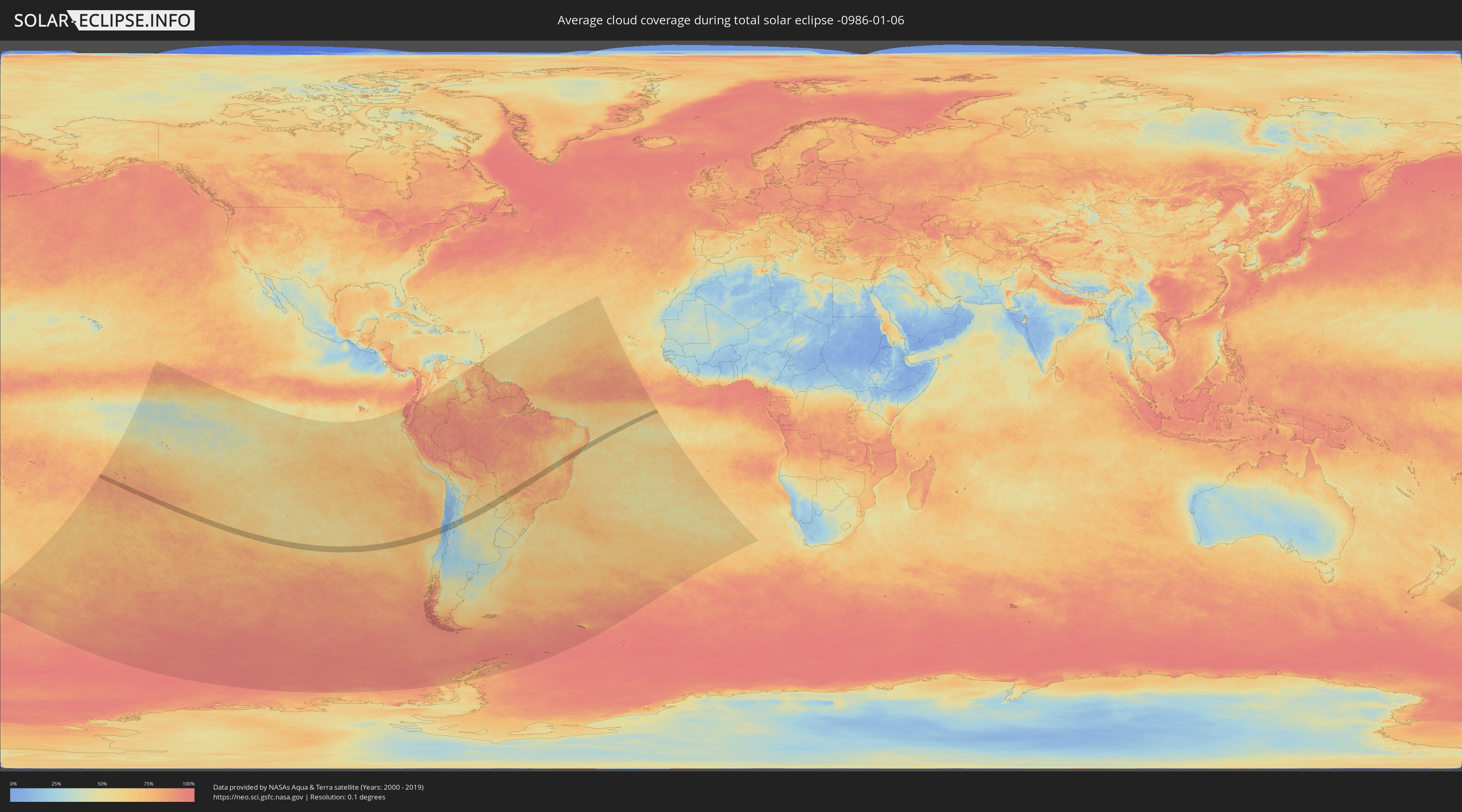
Wie wird das Wetter während der totalen Sonnenfinsternis am 06.01.-0986?
Wo ist der beste Ort, um die totale Sonnenfinsternis vom 06.01.-0986 zu beobachten?
Die folgenden Karten zeigen die durchschnittliche Bewölkung für den Tag, an dem die totale Sonnenfinsternis
stattfindet. Mit Hilfe der Karten lässt sich der Ort entlang des Finsternispfades eingrenzen,
der die besten Aussichen auf einen klaren wolkenfreien Himmel bietet.
Trotzdem muss man immer lokale Gegenenheiten beachten und sollte sich genau über das Wetter an seinem
gewählten Beobachtungsort informieren.
Die Daten stammen von den beiden NASA-Satelliten
AQUA und TERRA
und wurden über einen Zeitraum von 19 Jahren (2000 - 2019) gemittelt.
Detaillierte Länderkarten
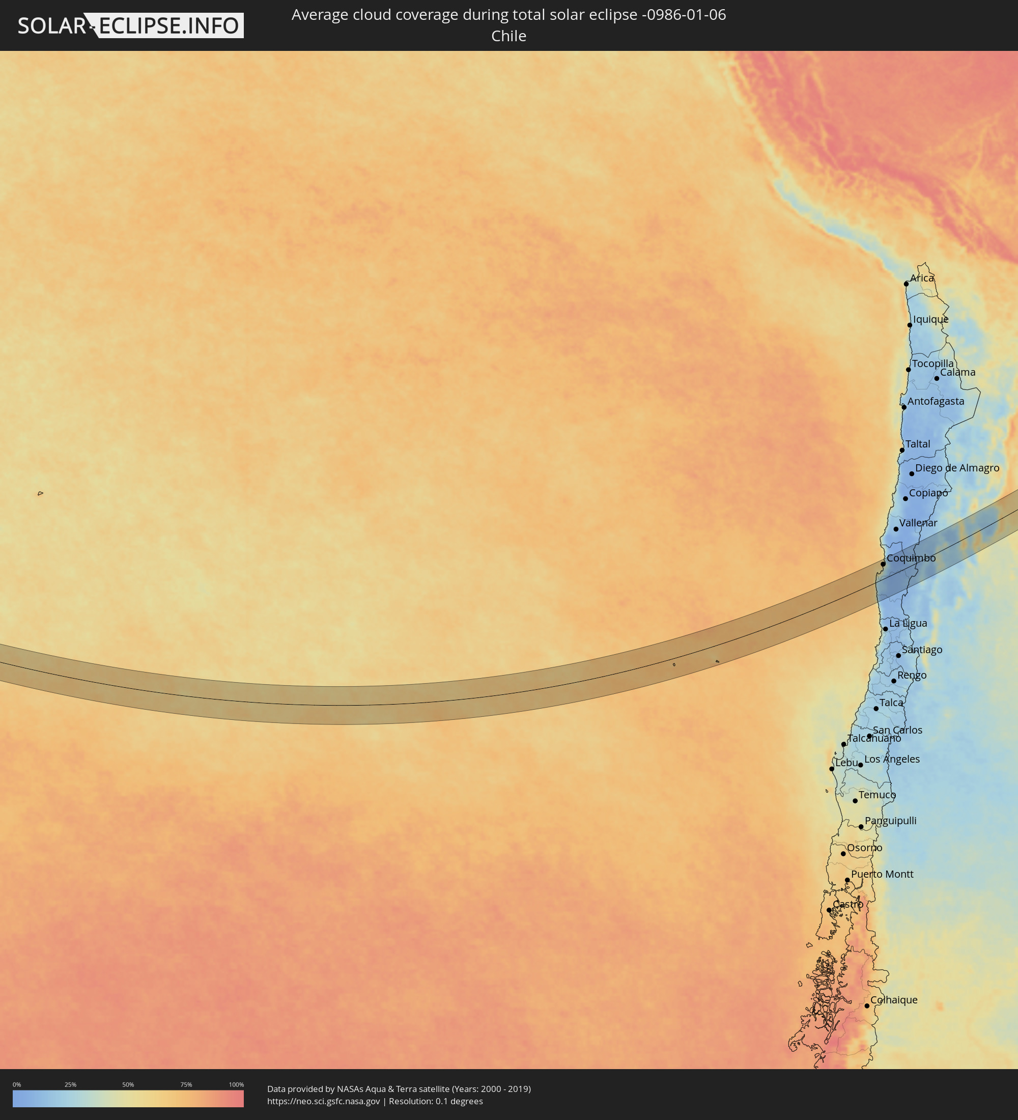 Chile
Chile
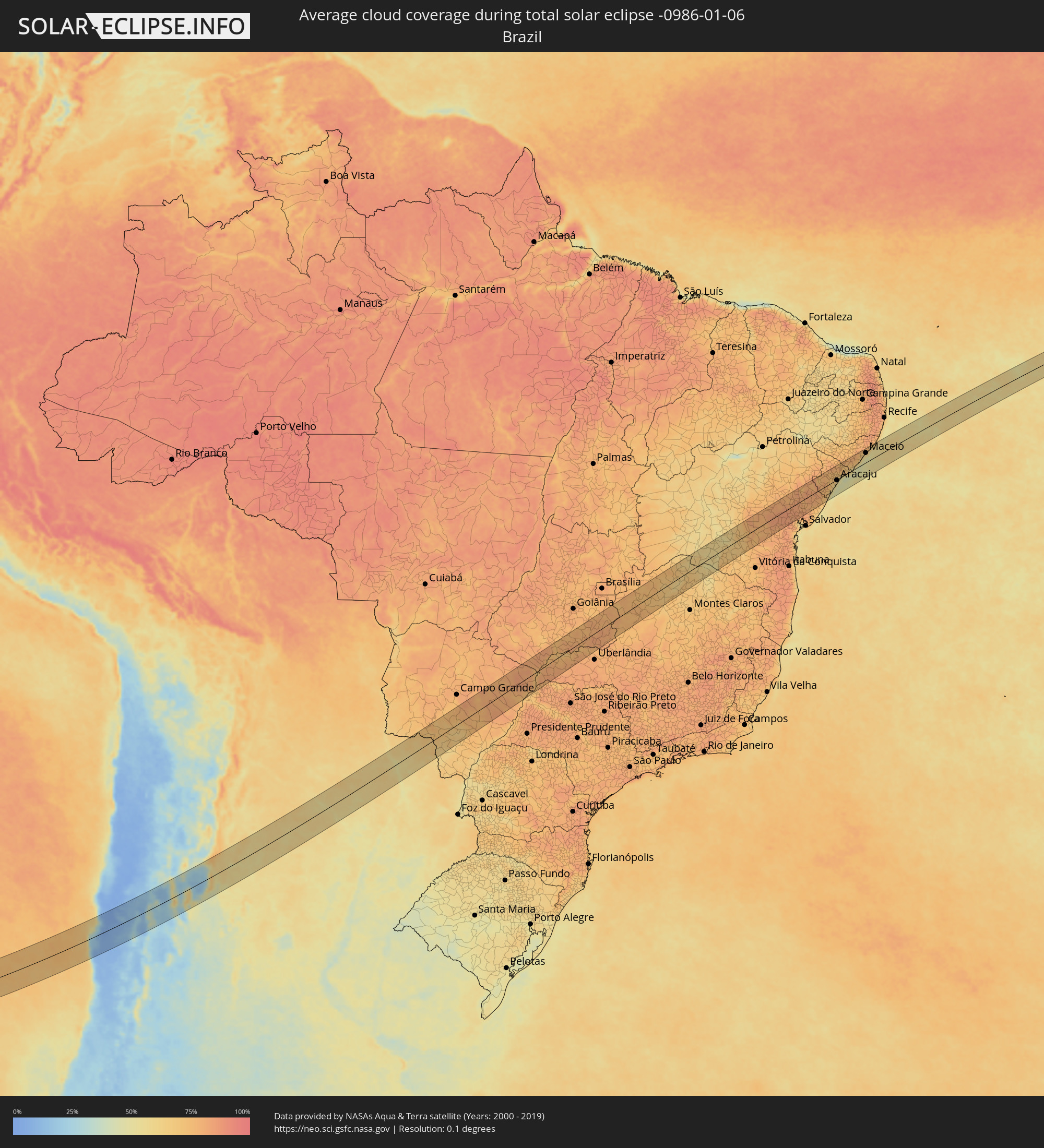 Brasilien
 Argentinien
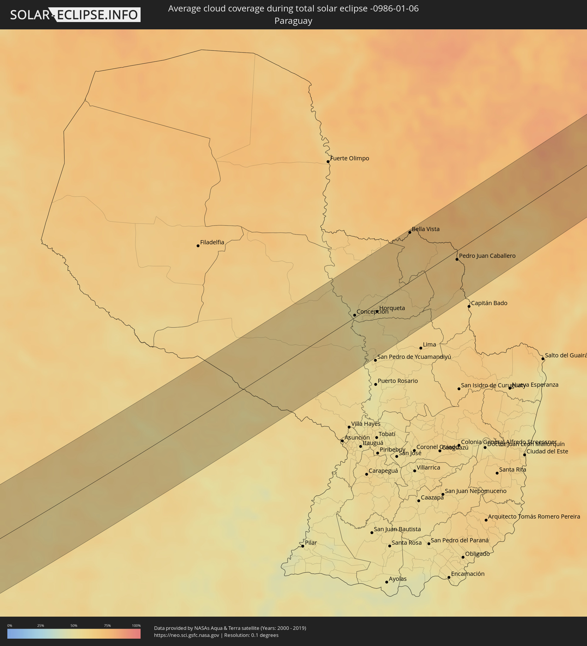 Paraguay
Orte im Finsternispfad
Die nachfolgene Tabelle zeigt Städte und Orte mit mehr als 5.000 Einwohnern, die sich im Finsternispfad befinden. Städte mit mehr als 100.000 Einwohnern sind dick gekennzeichnet. Mit einem Klick auf den Ort öffnet sich eine Detailkarte die die Lage des jeweiligen Ortes zusammen mit dem Verlauf der zentralen Finsternis präsentiert.
| Ort | Typ | Dauer der Verfinsterung | Ortszeit bei maximaler Verfinsterung | Entfernung zur Zentrallinie | Ø Bewölkung |
|
Coquimbo, Coquimbo
|
total | - | 13:25:20 UTC-04:42 | 55 km | 39% |
|
La Serena, Coquimbo
|
total | - | 13:25:35 UTC-04:42 | 57 km | 37% |
|
Ovalle, Coquimbo
|
total | - | 13:24:49 UTC-04:42 | 16 km | 13% |
|
Monte Patria, Coquimbo
|
total | - | 13:25:11 UTC-04:42 | 35 km | 7% |
|
Vicuña, Coquimbo
|
total | - | 13:26:32 UTC-04:42 | 21 km | 6% |
|
Chilecito, La Rioja Province
|
total | - | 14:00:01 UTC-04:16 | 33 km | 31% |
|
Arauco, La Rioja Province
|
total | - | 14:02:09 UTC-04:16 | 8 km | 23% |
|
Andalgalá, Catamarca Province
|
total | - | 14:04:25 UTC-04:16 | 65 km | 32% |
|
Capayán, Catamarca Province
|
total | - | 14:03:17 UTC-04:16 | 61 km | 44% |
|
Huillapima, Catamarca Province
|
total | - | 14:03:28 UTC-04:16 | 60 km | 44% |
|
San Fernando del Valle de Catamarca, Catamarca Province
|
total | - | 14:04:11 UTC-04:16 | 45 km | 47% |
|
Aguilares, Tucumán Province
|
total | - | 14:05:57 UTC-04:16 | 48 km | 60% |
|
La Cocha, Tucumán Province
|
total | - | 14:05:33 UTC-04:16 | 12 km | 59% |
|
Los Altos, Catamarca Province
|
total | - | 14:05:18 UTC-04:16 | 18 km | 58% |
|
Monteros, Tucumán Province
|
total | - | 14:06:33 UTC-04:16 | 68 km | 60% |
|
Graneros, Tucumán Province
|
total | - | 14:05:58 UTC-04:16 | 18 km | 58% |
|
Famaillá, Tucumán Province
|
total | - | 14:06:53 UTC-04:16 | 74 km | 59% |
|
Simoca, Tucumán Province
|
total | - | 14:06:40 UTC-04:16 | 52 km | 58% |
|
Bella Vista, Tucumán Province
|
total | - | 14:07:06 UTC-04:16 | 71 km | 56% |
|
Termas de Río Hondo, Santiago del Estero Province
|
total | - | 14:07:14 UTC-04:16 | 5 km | 52% |
|
Santiago del Estero, Santiago del Estero Province
|
total | - | 14:07:52 UTC-04:16 | 53 km | 55% |
|
Clodomira, Santiago del Estero Province
|
total | - | 14:08:25 UTC-04:16 | 39 km | 54% |
|
Beltrán, Santiago del Estero Province
|
total | - | 14:08:10 UTC-04:16 | 67 km | 52% |
|
Campo Gallo, Santiago del Estero Province
|
total | - | 14:12:03 UTC-04:16 | 8 km | 59% |
|
Los Frentones, Chaco Province
|
total | - | 14:14:41 UTC-04:16 | 65 km | 58% |
|
Castelli, Chaco Province
|
total | - | 14:16:37 UTC-04:16 | 63 km | 60% |
|
Las Lomitas, Formosa Province
|
total | - | 14:18:29 UTC-04:16 | 52 km | 58% |
|
Ibarreta, Formosa Province
|
total | - | 14:18:53 UTC-04:16 | 35 km | 57% |
|
Comandante Fontana, Formosa Province
|
total | - | 14:18:59 UTC-04:16 | 56 km | 55% |
|
Concepción, Concepción
|
total | - | 14:51:14 UTC-03:50 | 3 km | 51% |
|
Horqueta, Concepción
|
total | - | 14:51:51 UTC-03:50 | 13 km | 54% |
|
Bella Vista, Amambay
|
total | - | 14:54:20 UTC-03:50 | 70 km | 68% |
|
Pedro Juan Caballero, Amambay
|
total | - | 14:54:47 UTC-03:50 | 13 km | 68% |
|
Ponta Porã, Mato Grosso do Sul
|
total | - | 15:07:01 UTC-03:38 | 12 km | 68% |
|
Maracaju, Mato Grosso do Sul
|
total | - | 15:09:03 UTC-03:38 | 42 km | 67% |
|
Dourados, Mato Grosso do Sul
|
total | - | 15:08:39 UTC-03:38 | 35 km | 69% |
|
Ilha Solteira, São Paulo
|
total | - | 15:47:13 UTC-03:06 | 68 km | 69% |
|
Paranaíba, Mato Grosso do Sul
|
total | - | 15:16:25 UTC-03:38 | 7 km | 78% |
|
Santa Fé do Sul, São Paulo
|
total | - | 15:47:58 UTC-03:06 | 72 km | 73% |
|
Quirinópolis, Goiás
|
total | - | 15:50:51 UTC-03:06 | 64 km | 82% |
|
Iturama, Minas Gerais
|
total | - | 15:49:23 UTC-03:06 | 70 km | 79% |
|
Ituiutaba, Minas Gerais
|
total | - | 15:51:08 UTC-03:06 | 43 km | 79% |
|
Goiatuba, Goiás
|
total | - | 15:52:31 UTC-03:06 | 40 km | 77% |
|
Itumbiara, Goiás
|
total | - | 15:52:07 UTC-03:06 | 6 km | 74% |
|
Morrinhos, Goiás
|
total | - | 15:53:08 UTC-03:06 | 51 km | 79% |
|
Tupaciguara, Minas Gerais
|
total | - | 15:52:22 UTC-03:06 | 52 km | 79% |
|
Caldas Novas, Goiás
|
total | - | 15:53:33 UTC-03:06 | 22 km | 75% |
|
Pires do Rio, Goiás
|
total | - | 15:54:27 UTC-03:06 | 43 km | 80% |
|
Catalão, Goiás
|
total | - | 15:53:37 UTC-03:06 | 57 km | 82% |
|
Cristalina, Goiás
|
total | - | 15:55:43 UTC-03:06 | 54 km | 79% |
|
Unaí, Minas Gerais
|
total | - | 15:56:51 UTC-03:06 | 50 km | 77% |
|
Paracatu, Minas Gerais
|
total | - | 15:55:46 UTC-03:06 | 32 km | 76% |
|
São Francisco, Minas Gerais
|
total | - | 15:58:57 UTC-03:06 | 31 km | 65% |
|
Januária, Minas Gerais
|
total | - | 15:59:53 UTC-03:06 | 17 km | 58% |
|
Guanambi, Bahia
|
total | - | 16:34:54 UTC-02:34 | 9 km | 58% |
|
Caetité, Bahia
|
total | - | 16:35:16 UTC-02:34 | 6 km | 59% |
|
Brumado, Bahia
|
total | - | 16:35:36 UTC-02:34 | 53 km | 70% |
|
Vera Cruz, Bahia
|
total | - | 16:37:43 UTC-02:34 | 58 km | 79% |
|
Itaberaba, Bahia
|
total | - | 16:38:14 UTC-02:34 | 26 km | 81% |
|
Iaçu, Bahia
|
total | - | 16:38:01 UTC-02:34 | 2 km | 80% |
|
Ipirá, Bahia
|
total | - | 16:38:55 UTC-02:34 | 29 km | 83% |
|
Amargosa, Bahia
|
total | - | 16:38:02 UTC-02:34 | 61 km | 81% |
|
Conceição do Coité, Bahia
|
total | - | 16:39:45 UTC-02:34 | 59 km | 79% |
|
Santo Estêvão, Bahia
|
total | - | 16:38:51 UTC-02:34 | 25 km | 83% |
|
Cruz das Almas, Bahia
|
total | - | 16:38:40 UTC-02:34 | 56 km | 77% |
|
Serrinha, Bahia
|
total | - | 16:39:47 UTC-02:34 | 34 km | 80% |
|
Feira de Santana, Bahia
|
total | - | 16:39:10 UTC-02:34 | 25 km | 84% |
|
Alagoinhas, Bahia
|
total | - | 16:39:33 UTC-02:34 | 44 km | 80% |
|
Entre Rios, Bahia
|
total | - | 16:39:54 UTC-02:34 | 45 km | 79% |
|
Tobias Barreto, Sergipe
|
total | - | 16:40:43 UTC-02:34 | 23 km | 82% |
|
Rio Real, Bahia
|
total | - | 16:40:26 UTC-02:34 | 10 km | 81% |
|
Lagarto, Sergipe
|
total | - | 16:41:08 UTC-02:34 | 29 km | 79% |
|
Estância, Sergipe
|
total | - | 16:40:52 UTC-02:34 | 17 km | 61% |
|
Itabaiana, Sergipe
|
total | - | 16:41:27 UTC-02:34 | 38 km | 75% |
|
São Cristóvão, Sergipe
|
total | - | 16:41:12 UTC-02:34 | 6 km | 58% |
|
Laranjeiras, Sergipe
|
total | - | 16:41:26 UTC-02:34 | 12 km | 67% |
|
Aracaju, Sergipe
|
total | - | 16:41:22 UTC-02:34 | 3 km | 58% |
|
Propriá, Sergipe
|
total | - | 16:42:08 UTC-02:34 | 51 km | 70% |
|
Penedo, Alagoas
|
total | - | 16:42:09 UTC-02:34 | 29 km | 66% |
|
Coruripe, Alagoas
|
total | - | 16:42:28 UTC-02:34 | 22 km | 60% |
|
São Miguel dos Campos, Alagoas
|
total | - | 16:42:49 UTC-02:34 | 50 km | 72% |
|
Marechal Deodoro, Alagoas
|
total | - | 16:42:57 UTC-02:34 | 46 km | 62% |
|
Maceió, Alagoas
|
total | - | 16:43:03 UTC-02:34 | 42 km | 50% |