Totale Sonnenfinsternis vom 07.05.-1160
| Wochentag: | Samstag |
| Maximale Dauer der Verfinsterung: | 06m45s |
| Maximale Breite des Finsternispfades: | 271 km |
| Saroszyklus: | 29 |
| Bedeckungsgrad: | 100% |
| Magnitude: | 1.0806 |
| Gamma: | -0.299 |
Wo kann man die Sonnenfinsternis vom 07.05.-1160 sehen?
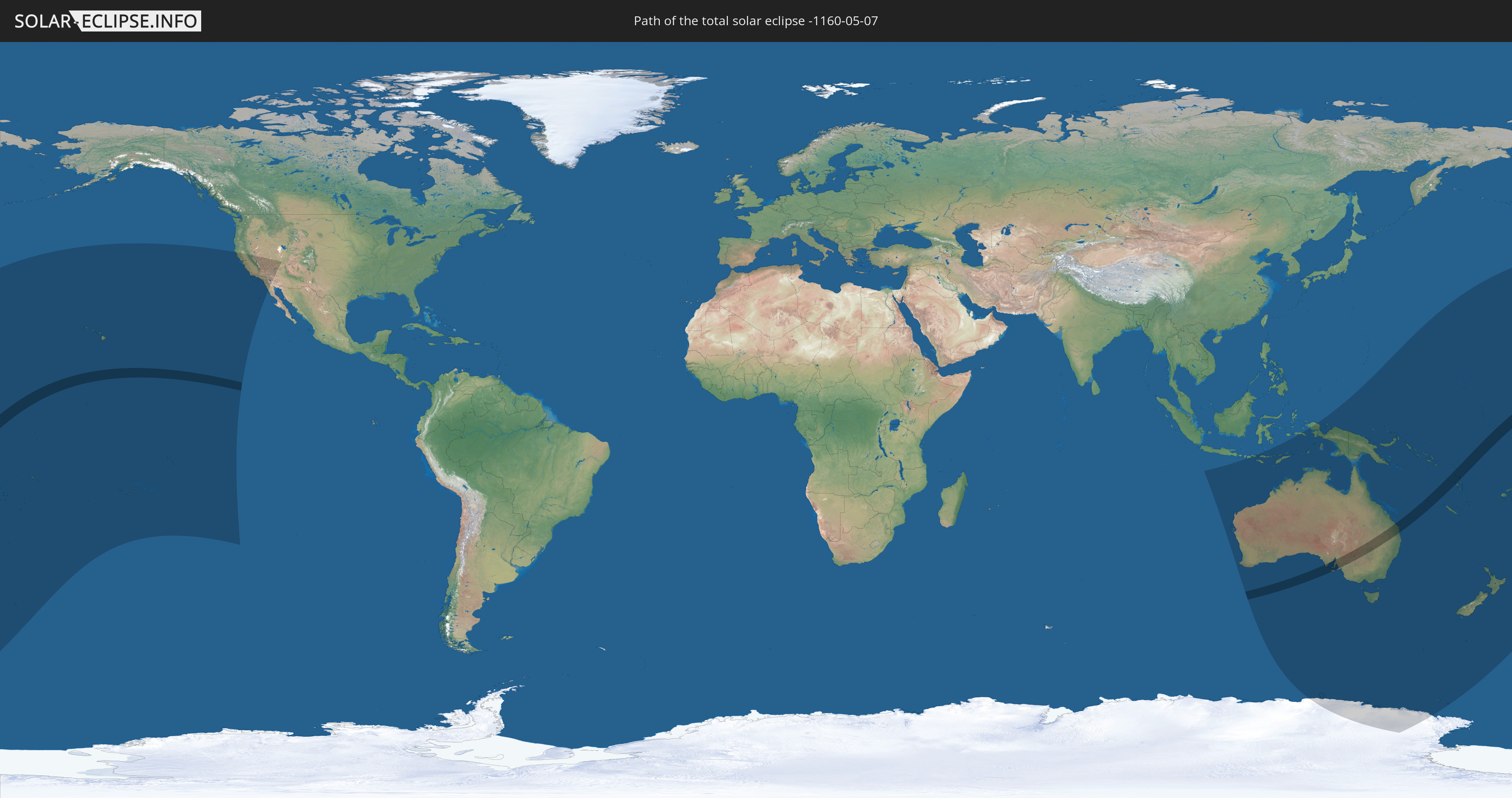
Die Sonnenfinsternis am 07.05.-1160 kann man in 28 Ländern als partielle Sonnenfinsternis beobachten.
Der Finsternispfad verläuft durch 5 Länder. Nur in diesen Ländern ist sie als totale Sonnenfinsternis zu sehen.
In den folgenden Ländern ist die Sonnenfinsternis total zu sehen
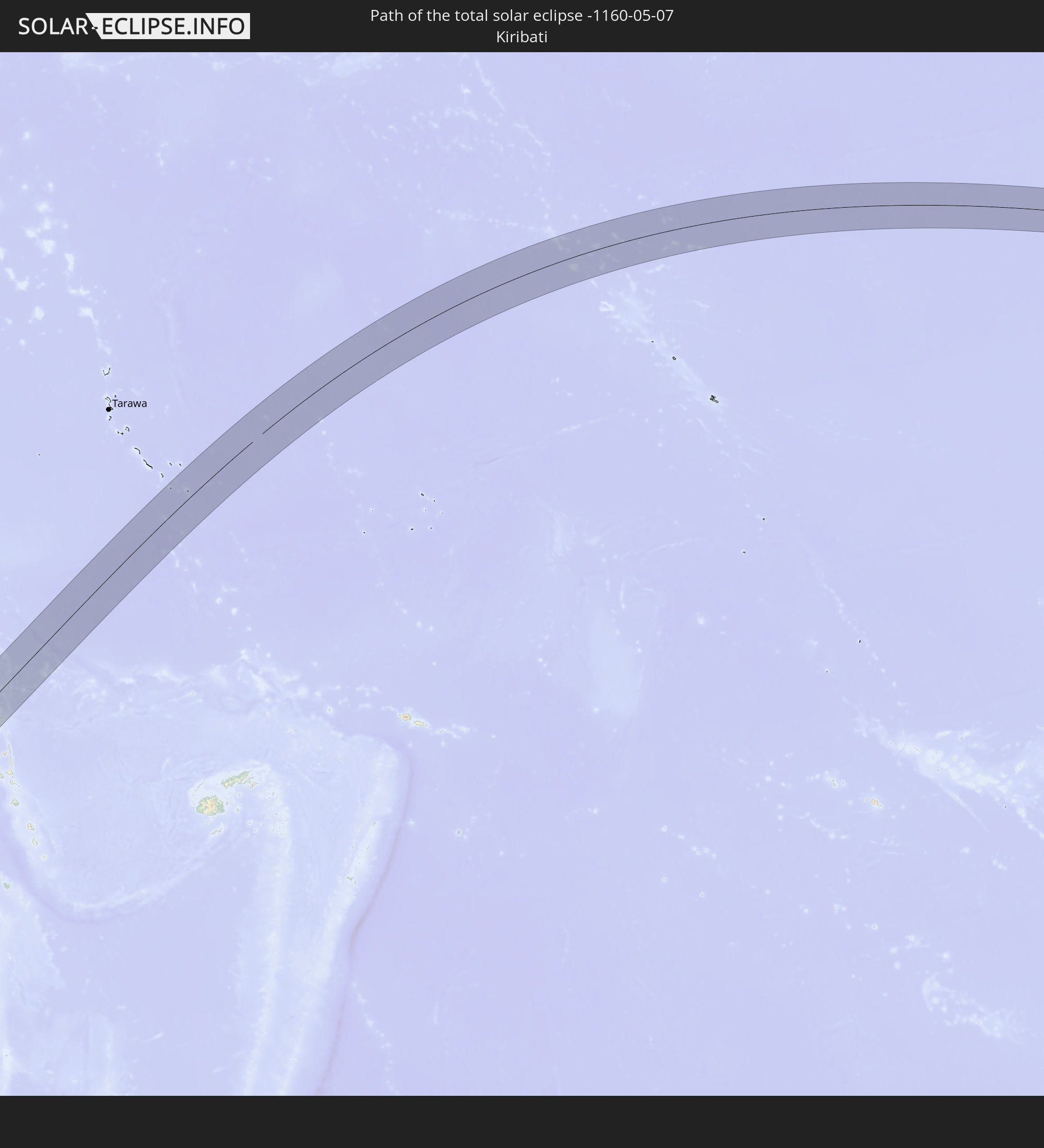 Kiribati
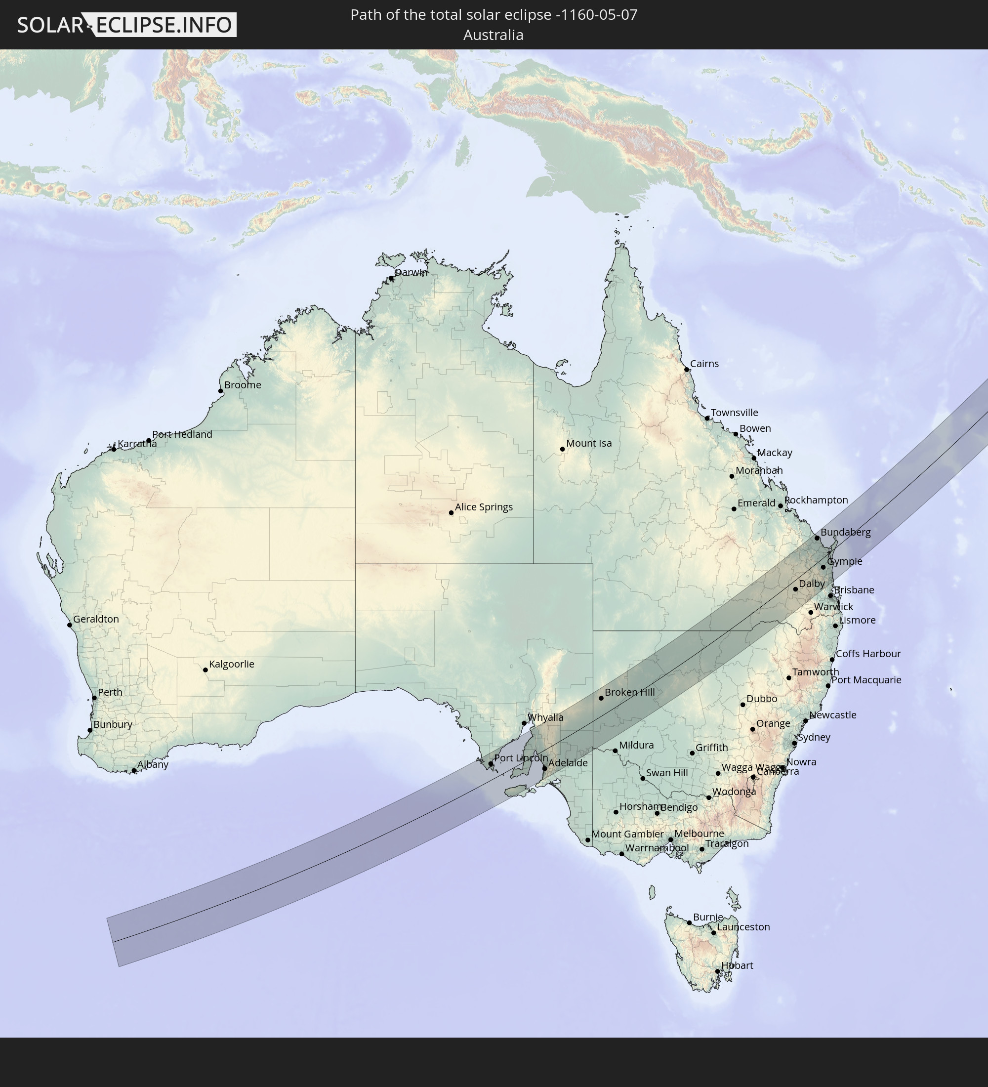 Australien
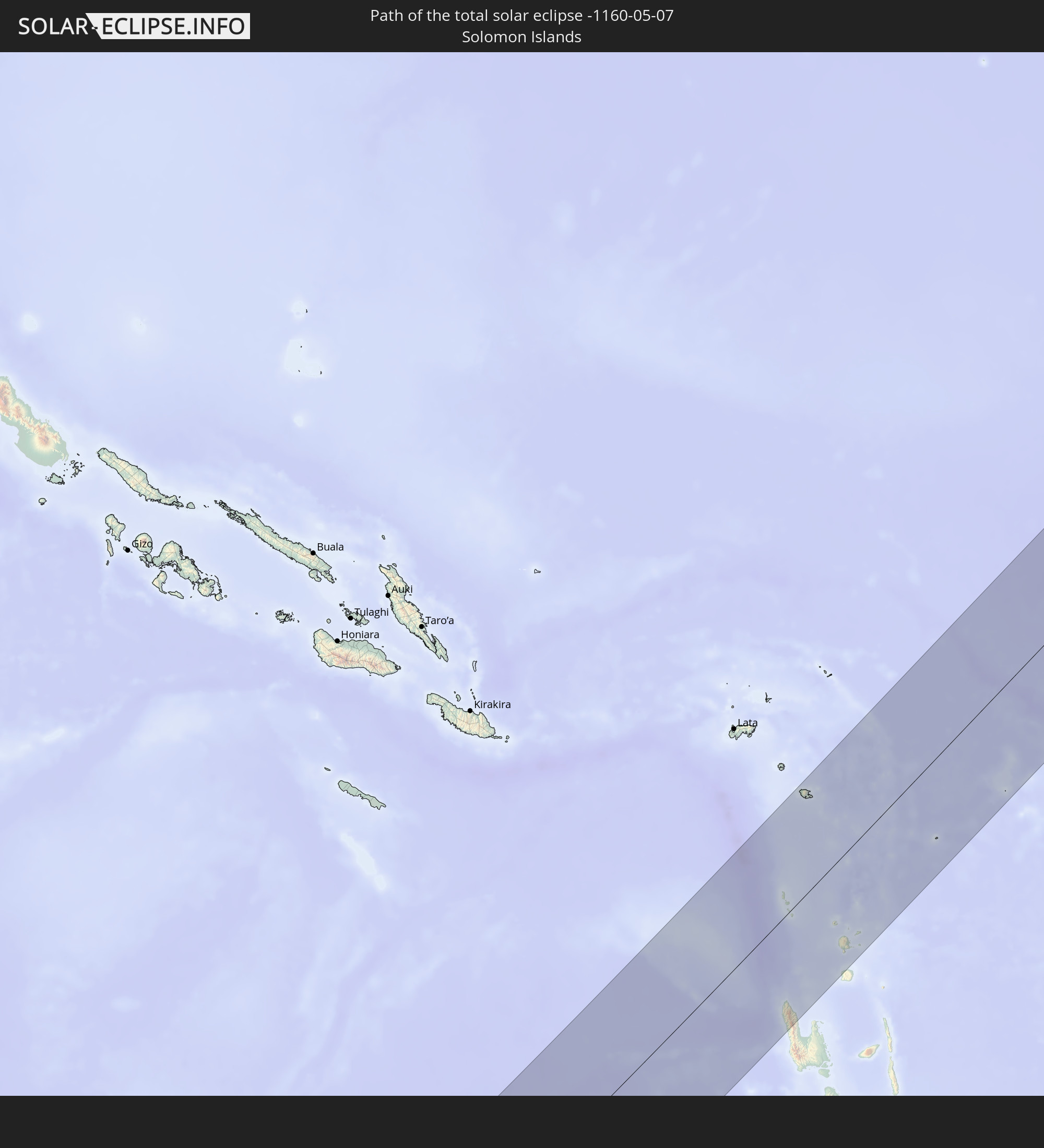 Salomonen
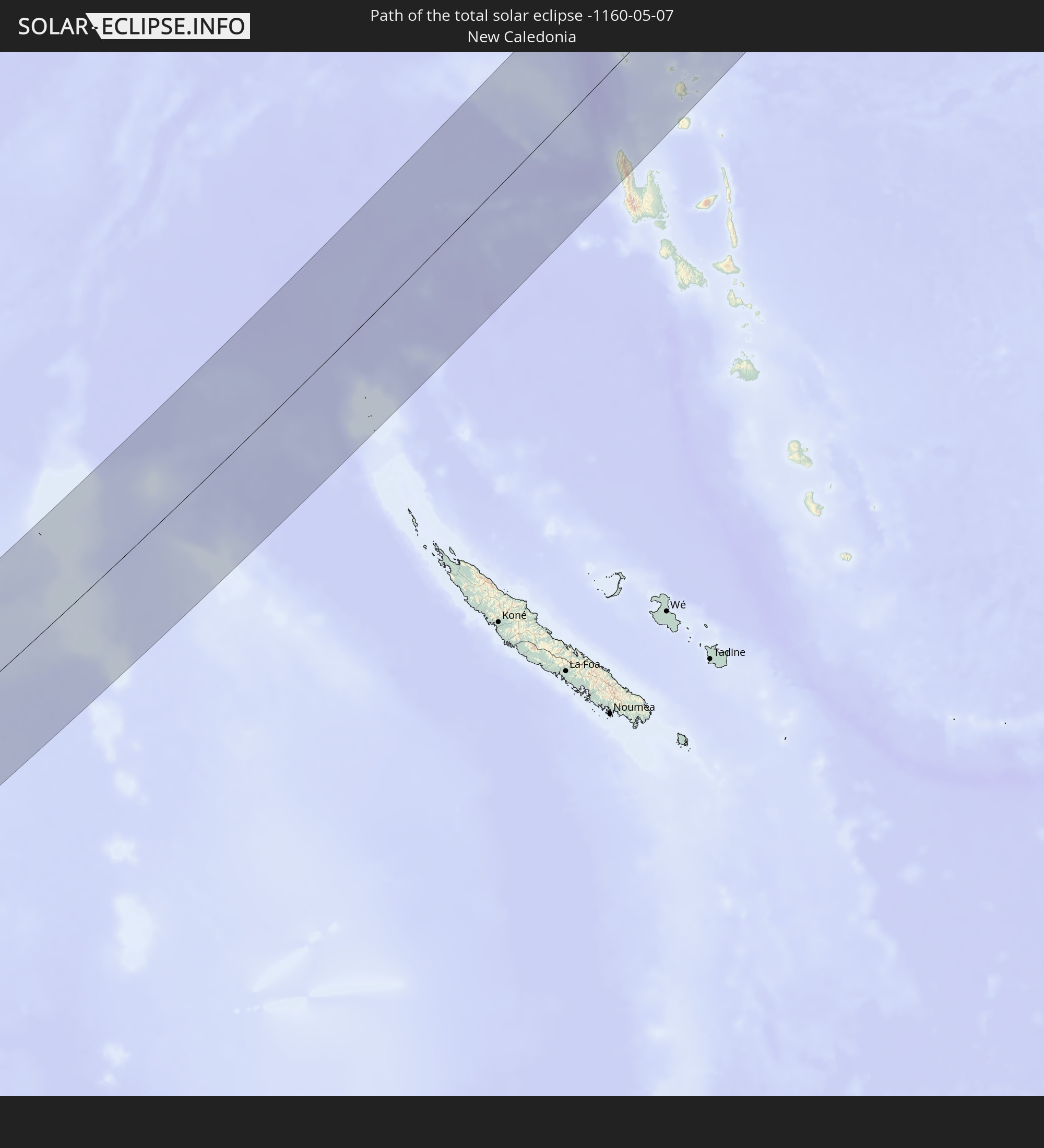 Neukaledonien
 Vanuatu
In den folgenden Ländern ist die Sonnenfinsternis partiell zu sehen
 Fidschi
 Antarktika
 Vereinigte Staaten
 Neuseeland
 United States Minor Outlying Islands
 Wallis und Futuna
 Tonga
Tonga
 Kiribati
 Samoa
Samoa
 Tokelau
 Amerikanisch-Samoa
 Niue
Niue
 Cookinseln
 Französisch-Polynesien
 Pitcairninseln
 Mexiko
 Indonesien
 Australien
 Osttimor
 Föderierte Staaten von Mikronesien
 Papua-Neuguinea
 Salomonen
 Neukaledonien
 Marshallinseln
 Vanuatu
 Nauru
Nauru
 Norfolkinsel
 Tuvalu
Wie wird das Wetter während der totalen Sonnenfinsternis am 07.05.-1160?
Wo ist der beste Ort, um die totale Sonnenfinsternis vom 07.05.-1160 zu beobachten?
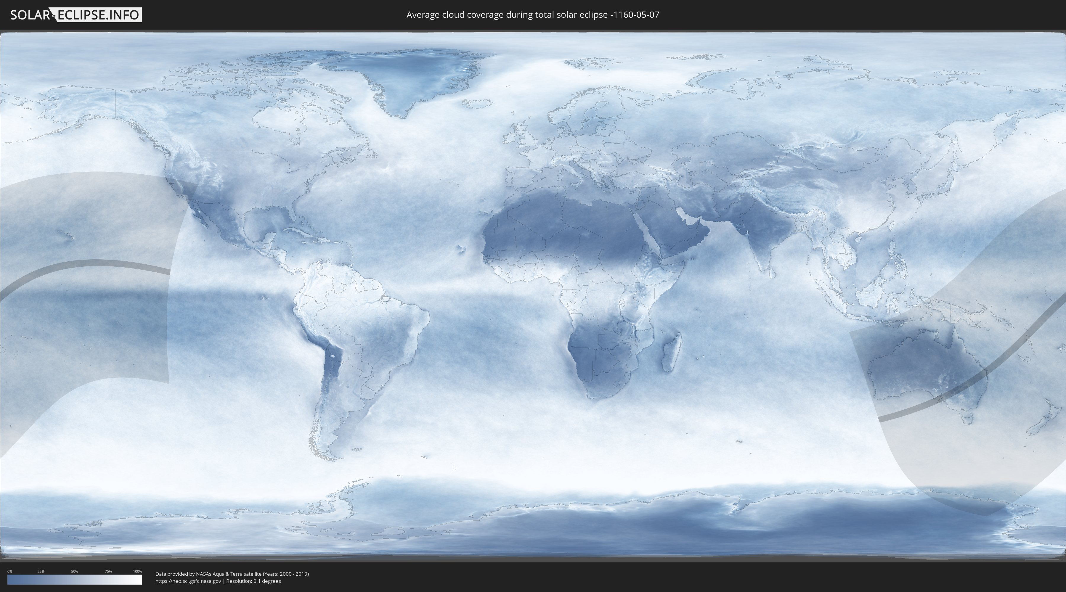
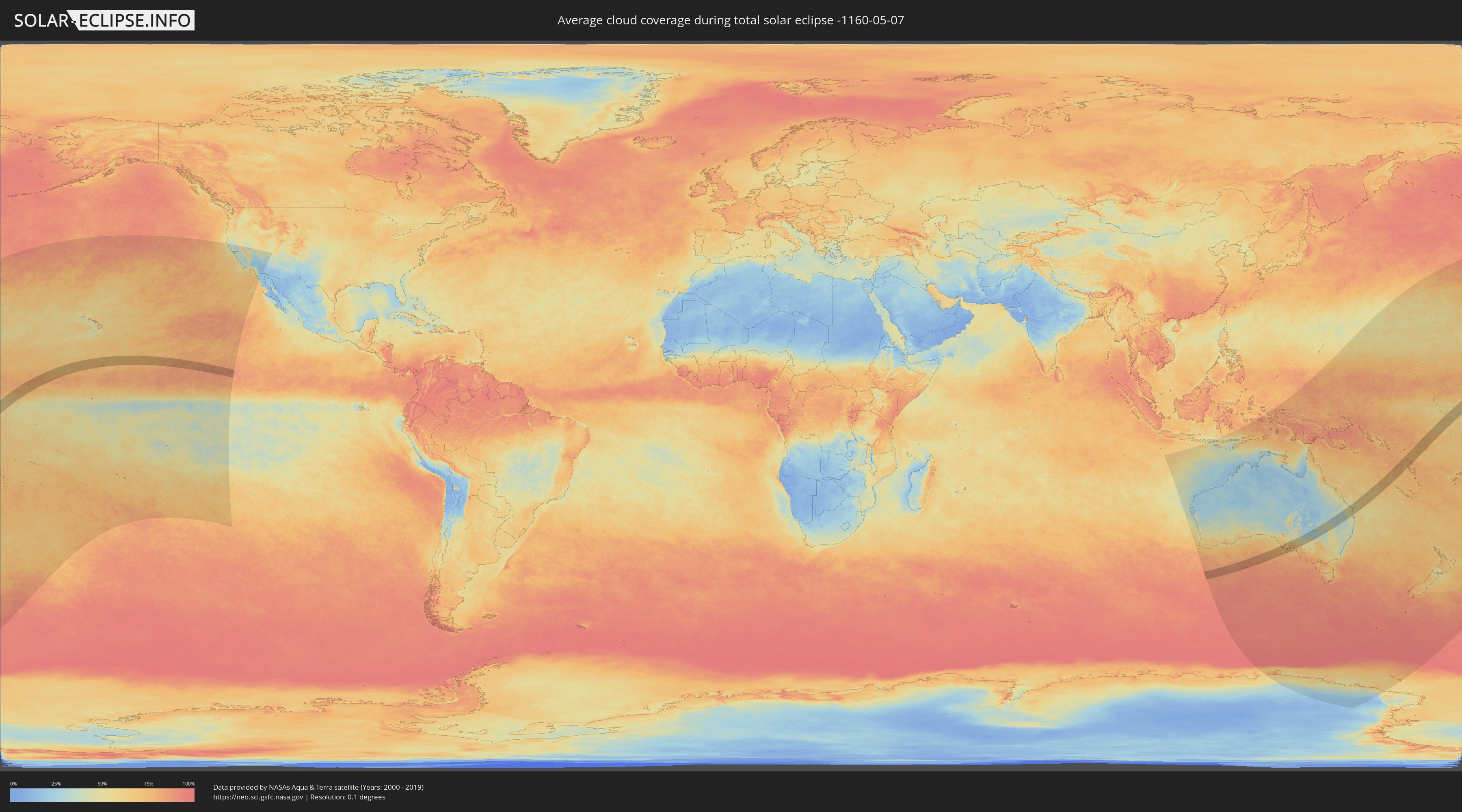
Die folgenden Karten zeigen die durchschnittliche Bewölkung für den Tag, an dem die totale Sonnenfinsternis
stattfindet. Mit Hilfe der Karten lässt sich der Ort entlang des Finsternispfades eingrenzen,
der die besten Aussichen auf einen klaren wolkenfreien Himmel bietet.
Trotzdem muss man immer lokale Gegenenheiten beachten und sollte sich genau über das Wetter an seinem
gewählten Beobachtungsort informieren.
Die Daten stammen von den beiden NASA-Satelliten
AQUA und TERRA
und wurden über einen Zeitraum von 19 Jahren (2000 - 2019) gemittelt.
Detaillierte Länderkarten
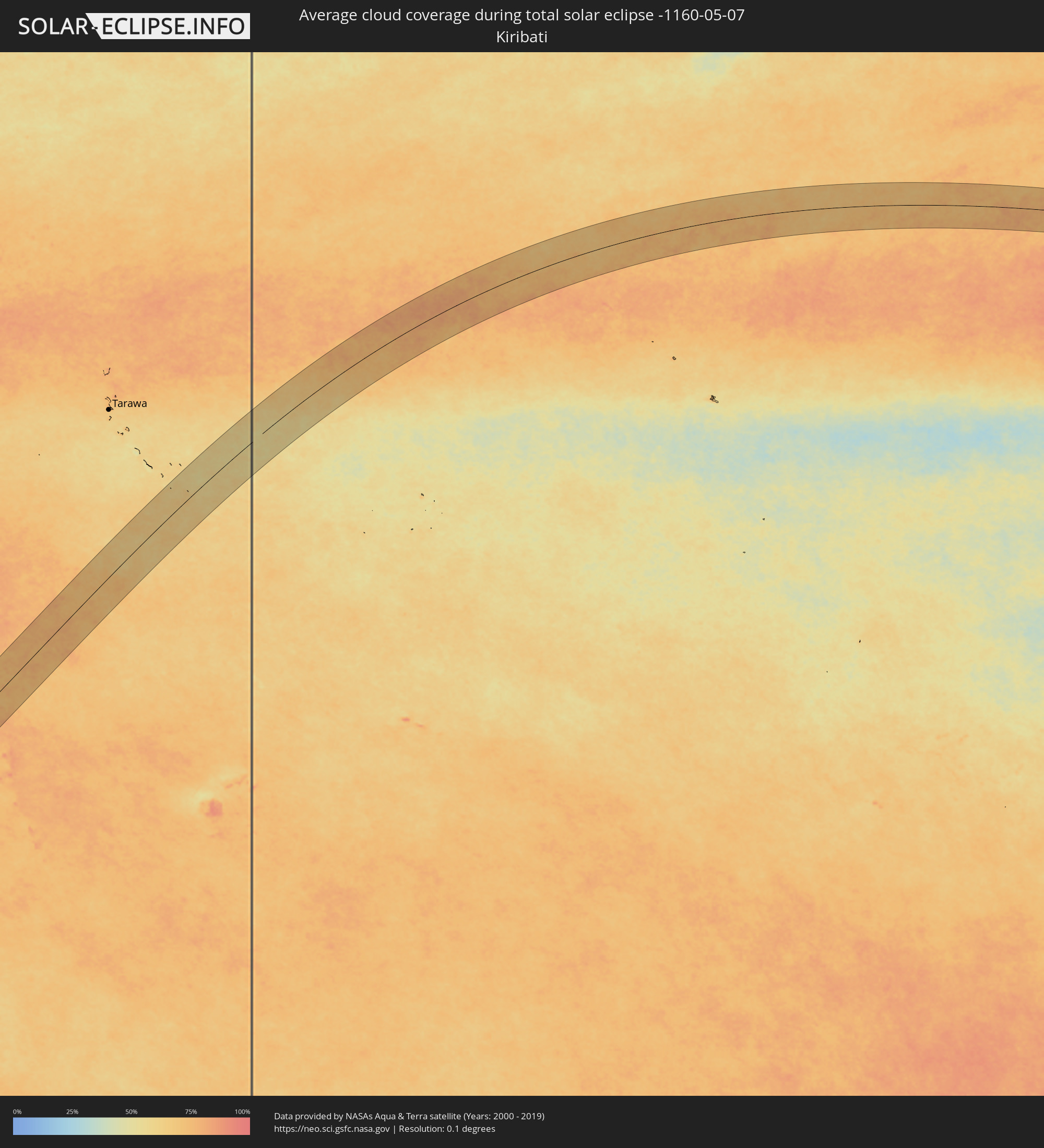 Kiribati
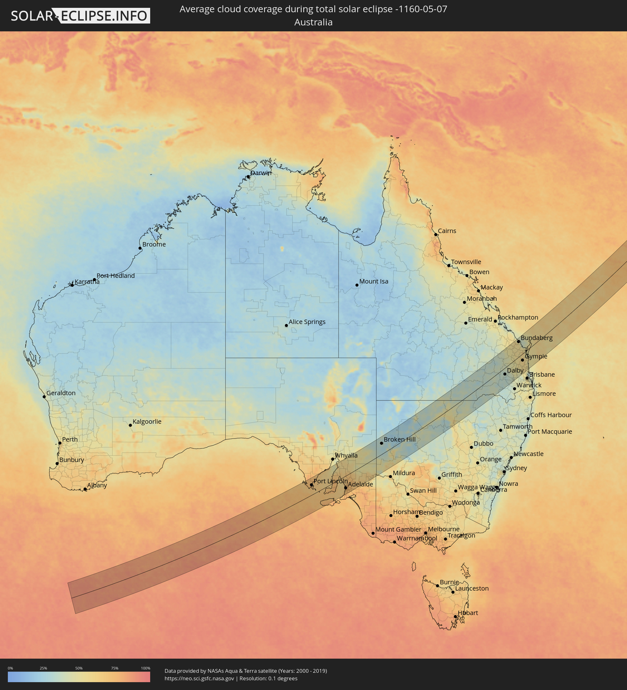 Australien
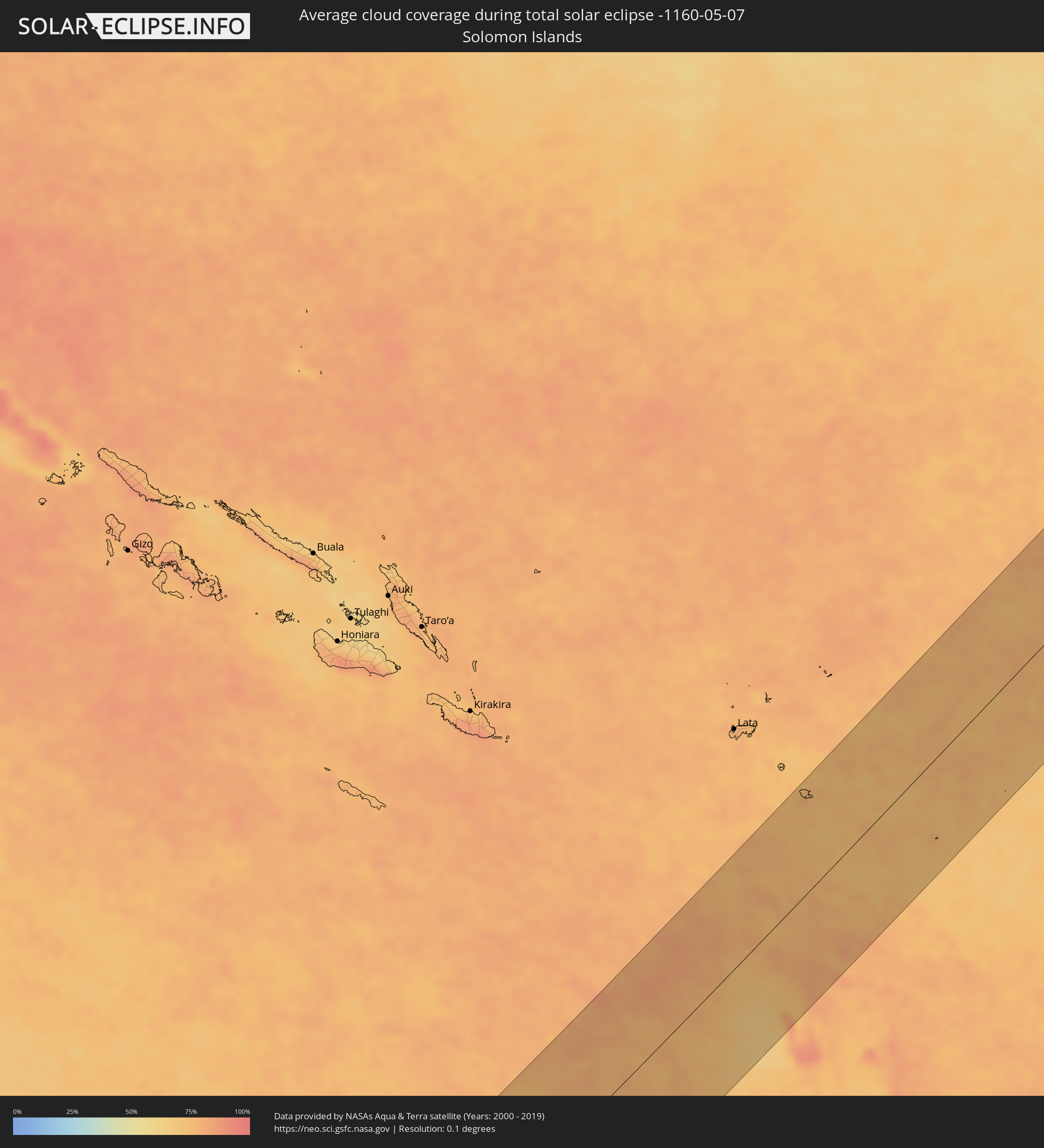 Salomonen
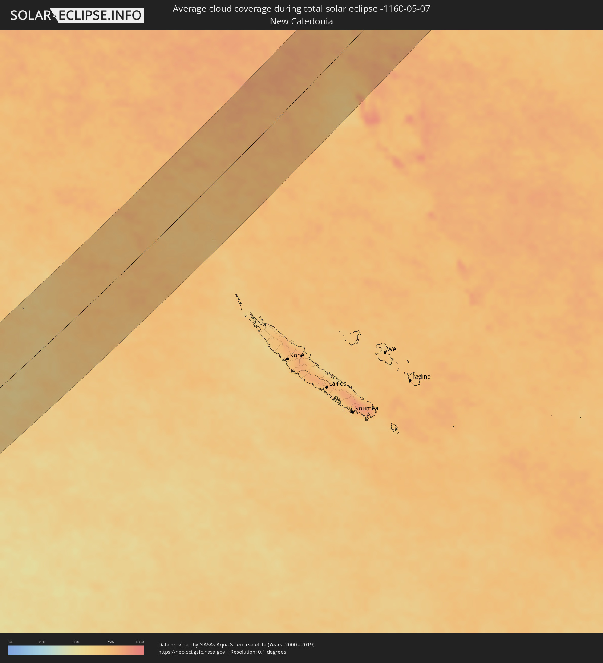 Neukaledonien
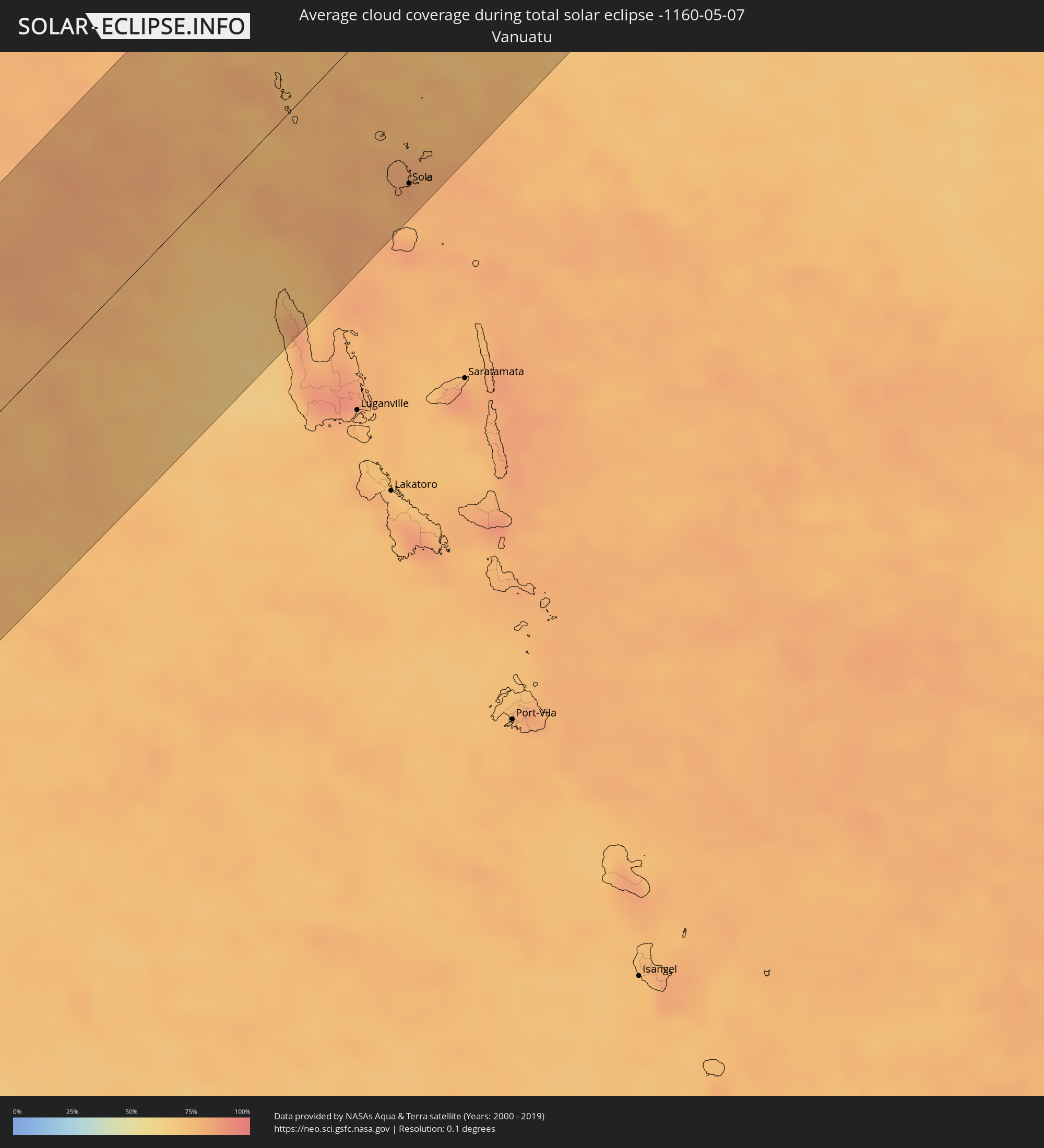 Vanuatu
Orte im Finsternispfad
Die nachfolgene Tabelle zeigt Städte und Orte mit mehr als 5.000 Einwohnern, die sich im Finsternispfad befinden. Städte mit mehr als 100.000 Einwohnern sind dick gekennzeichnet. Mit einem Klick auf den Ort öffnet sich eine Detailkarte die die Lage des jeweiligen Ortes zusammen mit dem Verlauf der zentralen Finsternis präsentiert.
| Ort | Typ | Dauer der Verfinsterung | Ortszeit bei maximaler Verfinsterung | Entfernung zur Zentrallinie | Ø Bewölkung |
|
Port Lincoln, South Australia
|
total | - | 08:30:10 UTC+09:30 | 63 km | 71% |
|
Aldinga, South Australia
|
total | - | 08:31:39 UTC+09:30 | 107 km | 76% |
|
Grange, South Australia
|
total | - | 08:31:41 UTC+09:30 | 71 km | 69% |
|
Henley Beach, South Australia
|
total | - | 08:31:41 UTC+09:30 | 73 km | 69% |
|
Seaton, South Australia
|
total | - | 08:31:42 UTC+09:30 | 72 km | 69% |
|
Morphett Vale, South Australia
|
total | - | 08:31:41 UTC+09:30 | 94 km | 72% |
|
Findon, South Australia
|
total | - | 08:31:43 UTC+09:30 | 73 km | 69% |
|
Happy Valley, South Australia
|
total | - | 08:31:42 UTC+09:30 | 90 km | 72% |
|
North Adelaide, South Australia
|
total | - | 08:31:45 UTC+09:30 | 76 km | 73% |
|
Prospect, South Australia
|
total | - | 08:31:45 UTC+09:30 | 74 km | 73% |
|
Adelaide, South Australia
|
total | - | 08:31:45 UTC+09:30 | 78 km | 73% |
|
Ingle Farm, South Australia
|
total | - | 08:31:47 UTC+09:30 | 71 km | 74% |
|
Salisbury, South Australia
|
total | - | 08:31:47 UTC+09:30 | 64 km | 74% |
|
Klemzig, South Australia
|
total | - | 08:31:47 UTC+09:30 | 75 km | 73% |
|
Campbelltown, South Australia
|
total | - | 08:31:48 UTC+09:30 | 77 km | 74% |
|
Paradise, South Australia
|
total | - | 08:31:48 UTC+09:30 | 76 km | 74% |
|
Modbury, South Australia
|
total | - | 08:31:49 UTC+09:30 | 73 km | 74% |
|
Athelstone, South Australia
|
total | - | 08:31:49 UTC+09:30 | 77 km | 74% |
|
Hope Valley, South Australia
|
total | - | 08:31:49 UTC+09:30 | 74 km | 74% |
|
Adelaide Hills, South Australia
|
total | - | 08:31:49 UTC+09:30 | 82 km | 74% |
|
Golden Grove, South Australia
|
total | - | 08:31:51 UTC+09:30 | 71 km | 74% |
|
Gawler, South Australia
|
total | - | 08:31:53 UTC+09:30 | 54 km | 76% |
|
Mount Barker, South Australia
|
total | - | 08:31:54 UTC+09:30 | 104 km | 72% |
|
Nuriootpa, South Australia
|
total | - | 08:32:03 UTC+09:30 | 52 km | 72% |
|
Broken Hill, New South Wales
|
total | - | 08:34:13 UTC+09:30 | 68 km | 30% |
|
Goondiwindi, Queensland
|
total | - | 09:13:22 UTC+10:00 | 103 km | 39% |
|
Dalby, Queensland
|
total | - | 09:15:12 UTC+10:00 | 40 km | 34% |
|
Kingaroy, Queensland
|
total | - | 09:16:15 UTC+10:00 | 20 km | 47% |
|
Darling Heights, Queensland
|
total | - | 09:15:38 UTC+10:00 | 118 km | 41% |
|
Toowoomba, Queensland
|
total | - | 09:15:41 UTC+10:00 | 116 km | 43% |
|
East Toowoomba, Queensland
|
total | - | 09:15:42 UTC+10:00 | 118 km | 43% |
|
Rangeville, Queensland
|
total | - | 09:15:42 UTC+10:00 | 119 km | 43% |
|
Bundaberg, Queensland
|
total | - | 09:18:04 UTC+10:00 | 94 km | 56% |
|
Gympie, Queensland
|
total | - | 09:17:25 UTC+10:00 | 41 km | 59% |
|
Maryborough, Queensland
|
total | - | 09:17:57 UTC+10:00 | 13 km | 59% |
|
Torquay, Queensland
|
total | - | 09:18:20 UTC+10:00 | 24 km | 50% |
|
Urangan, Queensland
|
total | - | 09:18:22 UTC+10:00 | 21 km | 50% |
|
Nambour, Queensland
|
total | - | 09:17:26 UTC+10:00 | 97 km | 54% |
|
Tewantin, Queensland
|
total | - | 09:17:41 UTC+10:00 | 82 km | 53% |
|
Buderim, Queensland
|
total | - | 09:17:30 UTC+10:00 | 108 km | 49% |
|
Noosaville, Queensland
|
total | - | 09:17:43 UTC+10:00 | 84 km | 47% |
|
Coolum Beach, Queensland
|
total | - | 09:17:39 UTC+10:00 | 97 km | 47% |
|
Little Mountain, Queensland
|
total | - | 09:17:28 UTC+10:00 | 119 km | 48% |
|
Mooloolaba, Queensland
|
total | - | 09:17:34 UTC+10:00 | 112 km | 49% |
|
Sola, Torba
|
total | - | 11:06:27 UTC+11:13 | 110 km | 79% |