Totale Sonnenfinsternis vom 19.09.-1167
| Wochentag: | Samstag |
| Maximale Dauer der Verfinsterung: | 03m14s |
| Maximale Breite des Finsternispfades: | 114 km |
| Saroszyklus: | 35 |
| Bedeckungsgrad: | 100% |
| Magnitude: | 1.0336 |
| Gamma: | -0.1239 |
Wo kann man die Sonnenfinsternis vom 19.09.-1167 sehen?
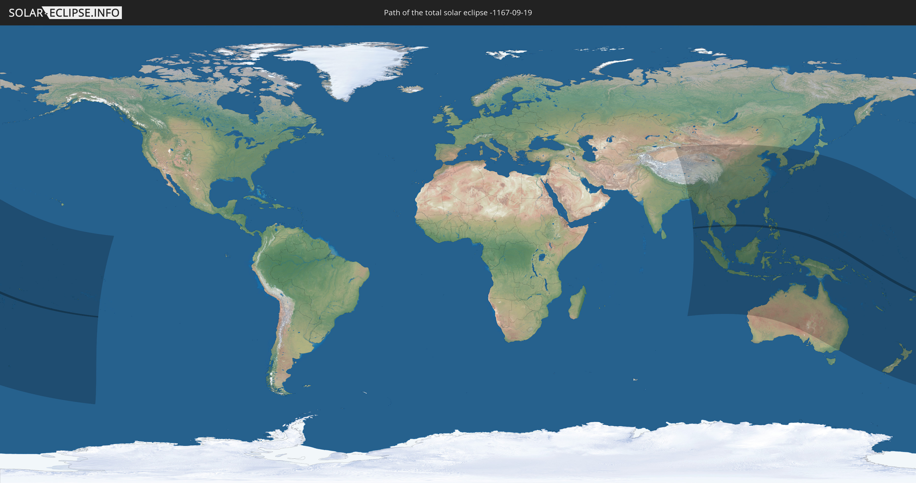
Die Sonnenfinsternis am 19.09.-1167 kann man in 49 Ländern als partielle Sonnenfinsternis beobachten.
Der Finsternispfad verläuft durch 10 Länder. Nur in diesen Ländern ist sie als totale Sonnenfinsternis zu sehen.
In den folgenden Ländern ist die Sonnenfinsternis total zu sehen
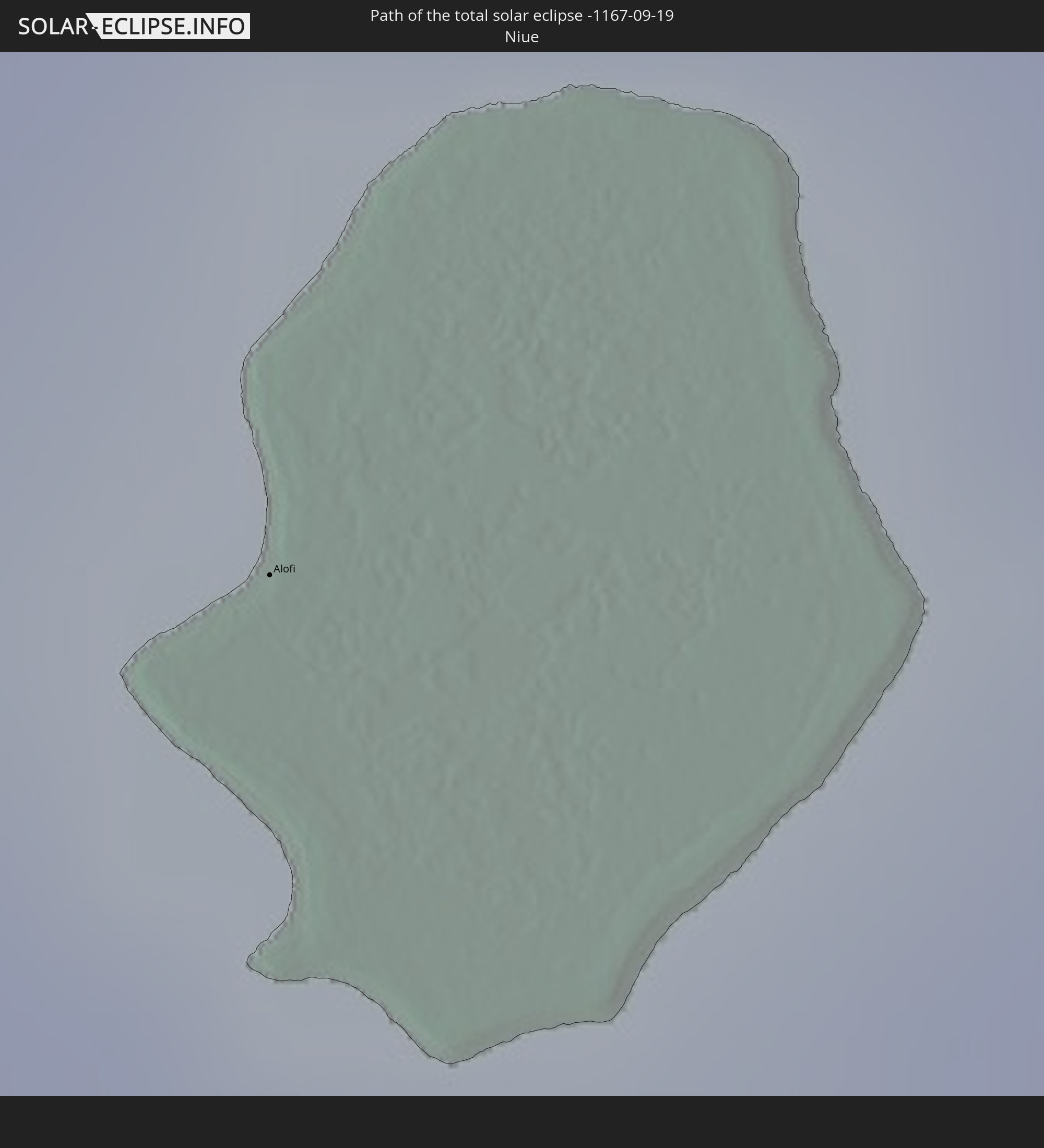 Niue
Niue
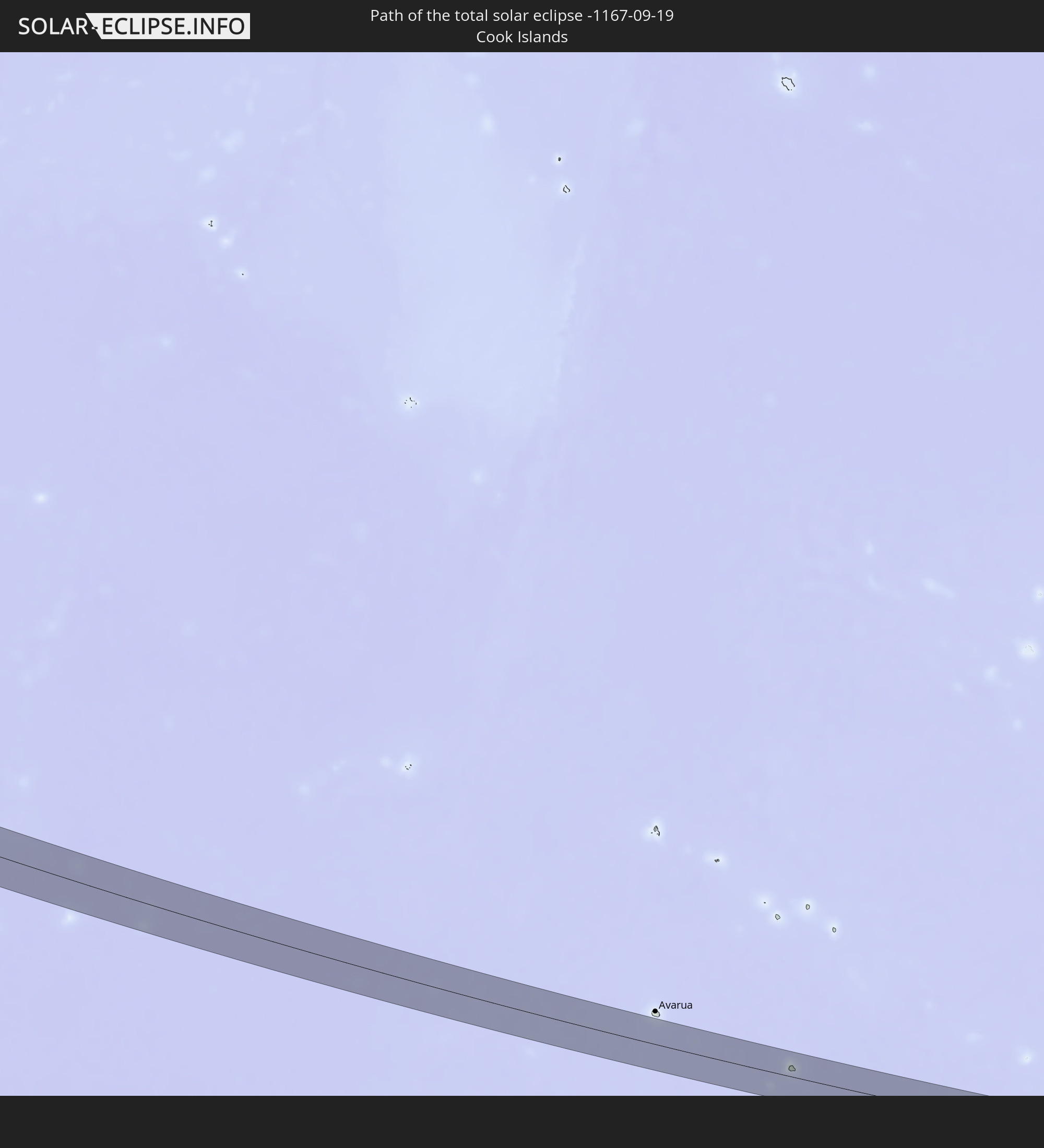 Cookinseln
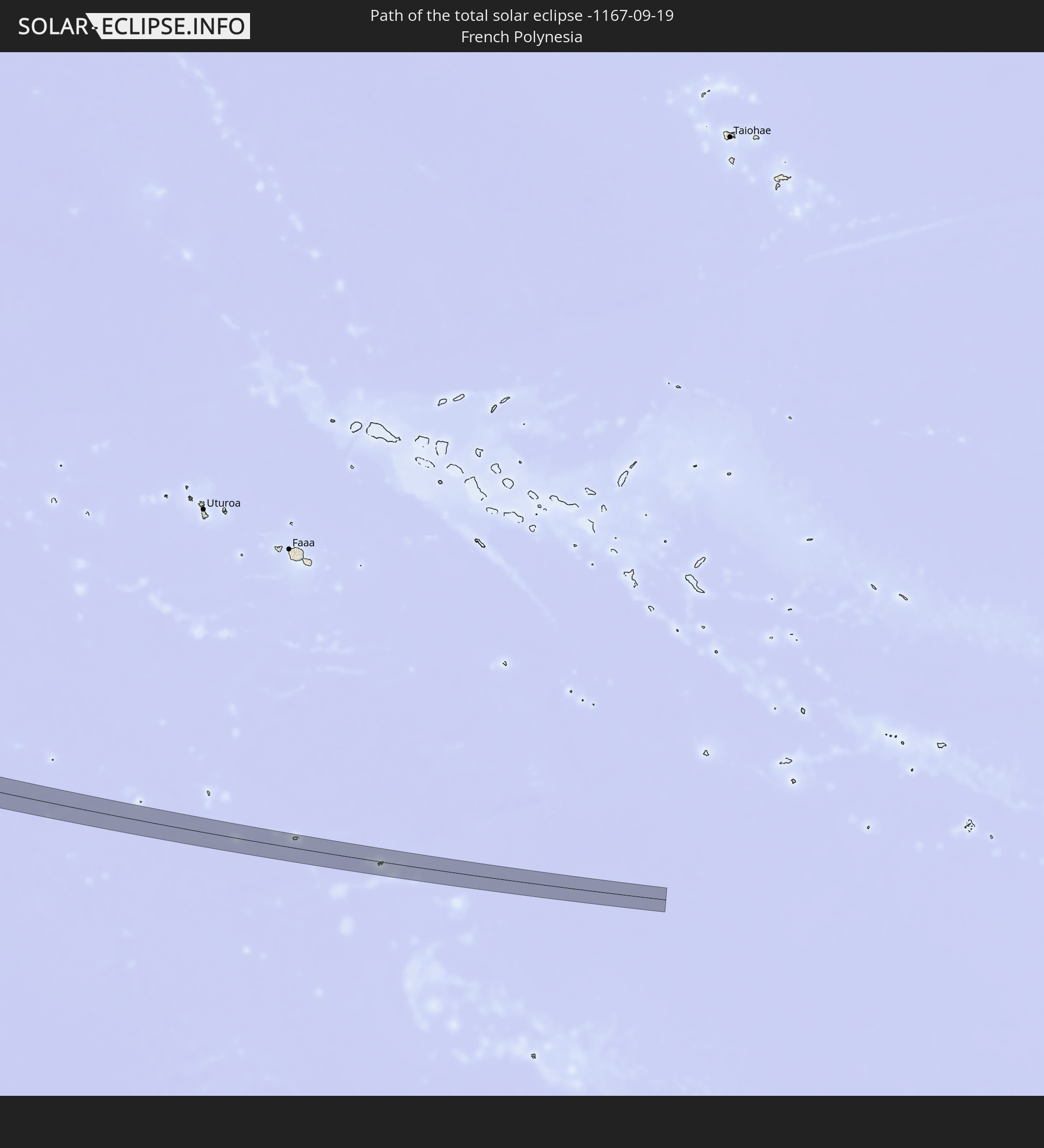 Französisch-Polynesien
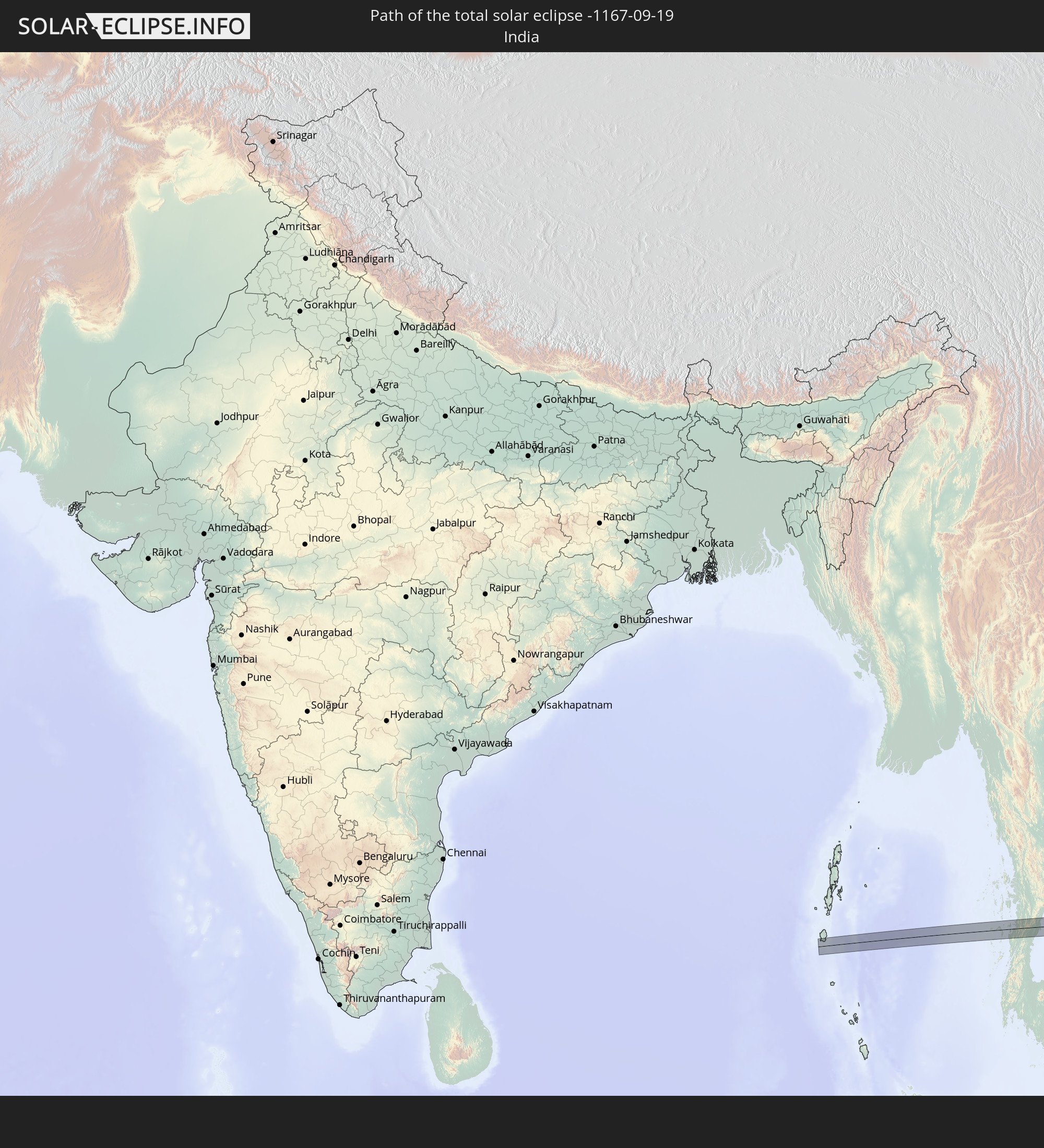 Indien
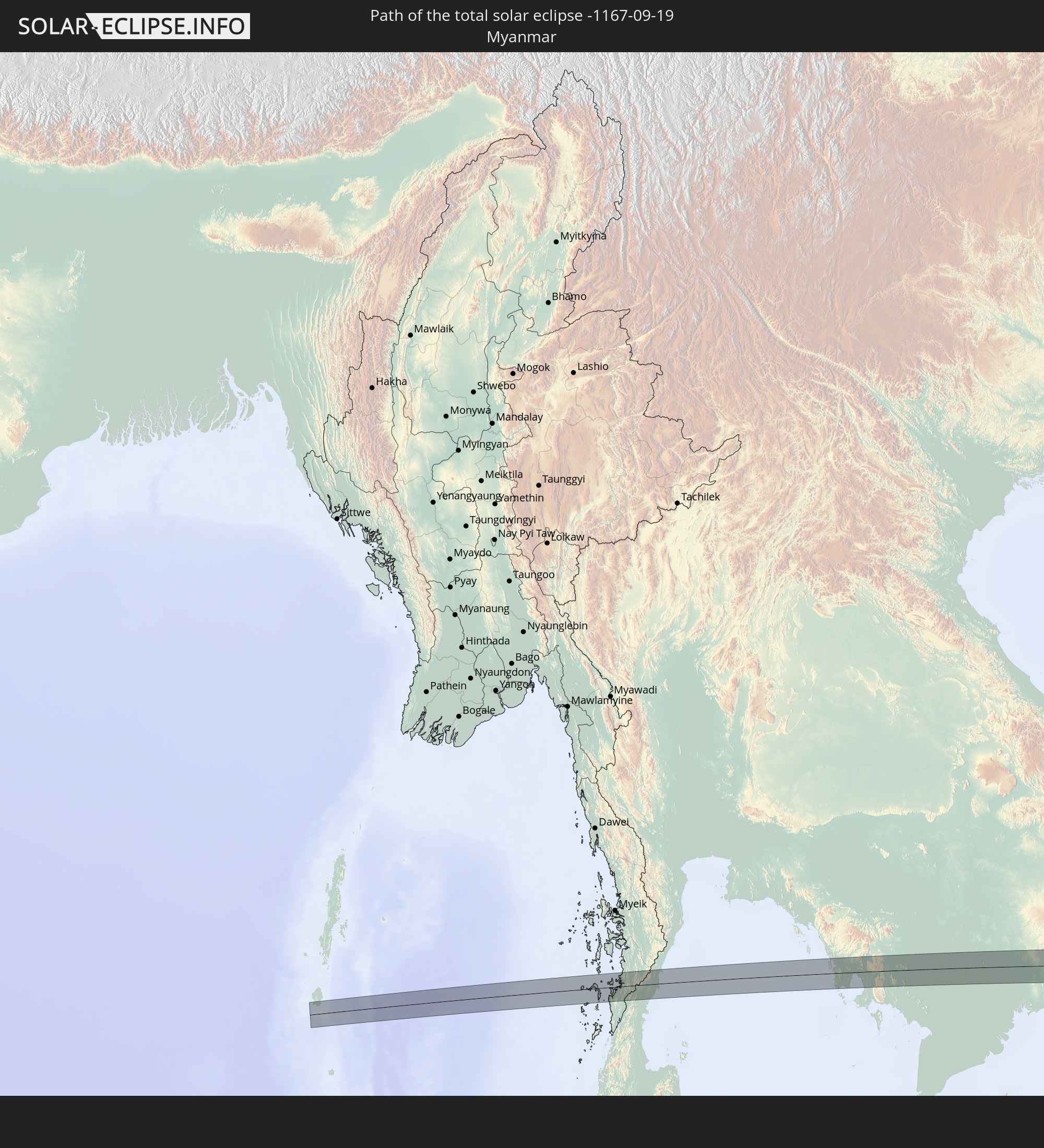 Myanmar
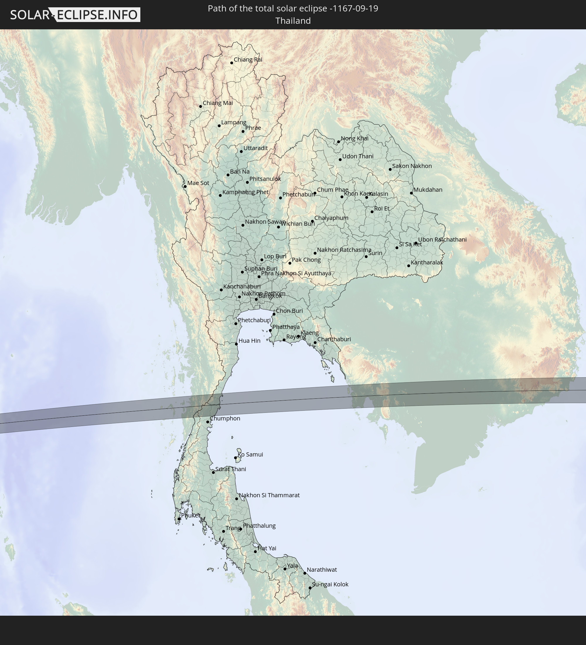 Thailand
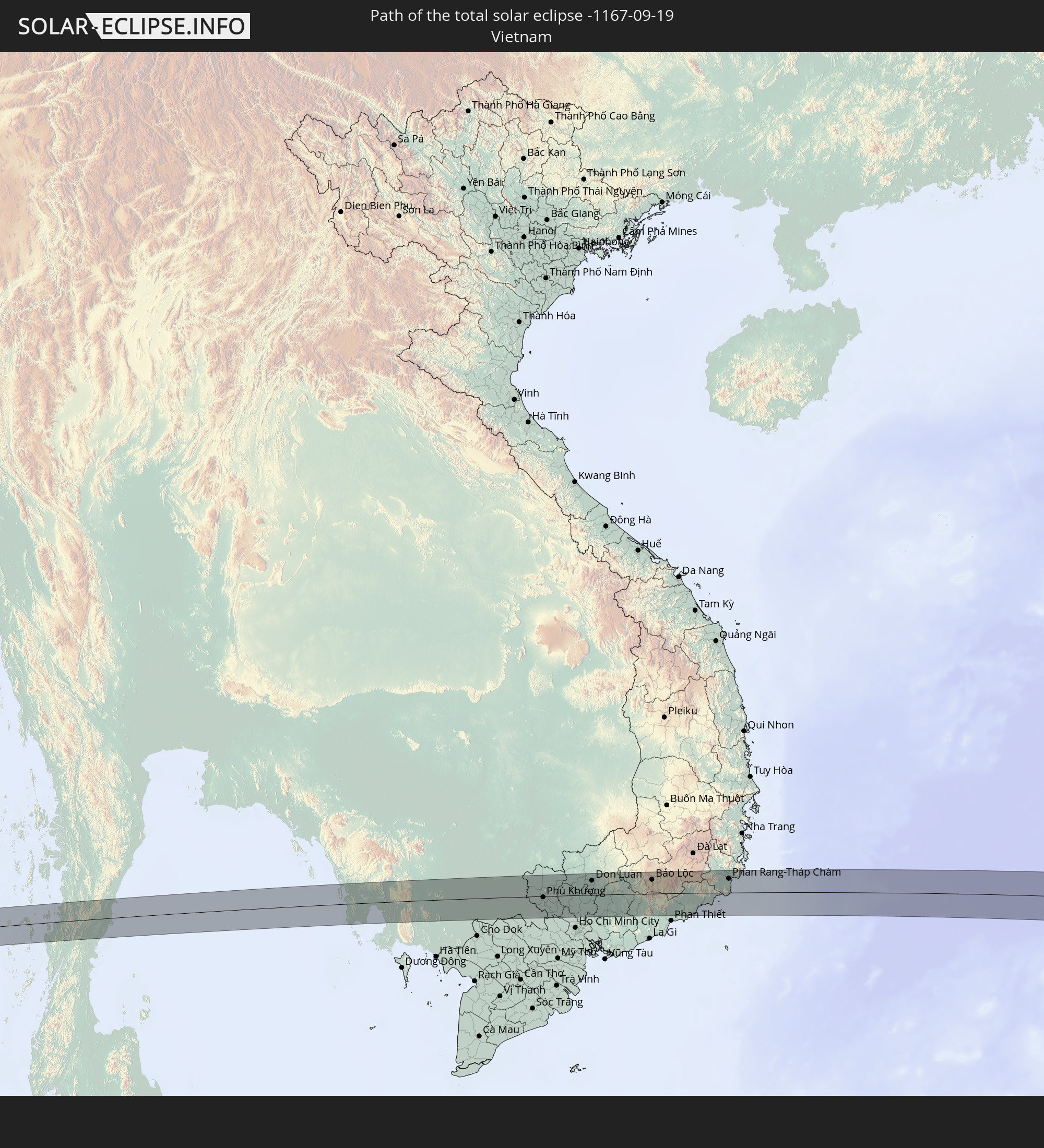 Vietnam
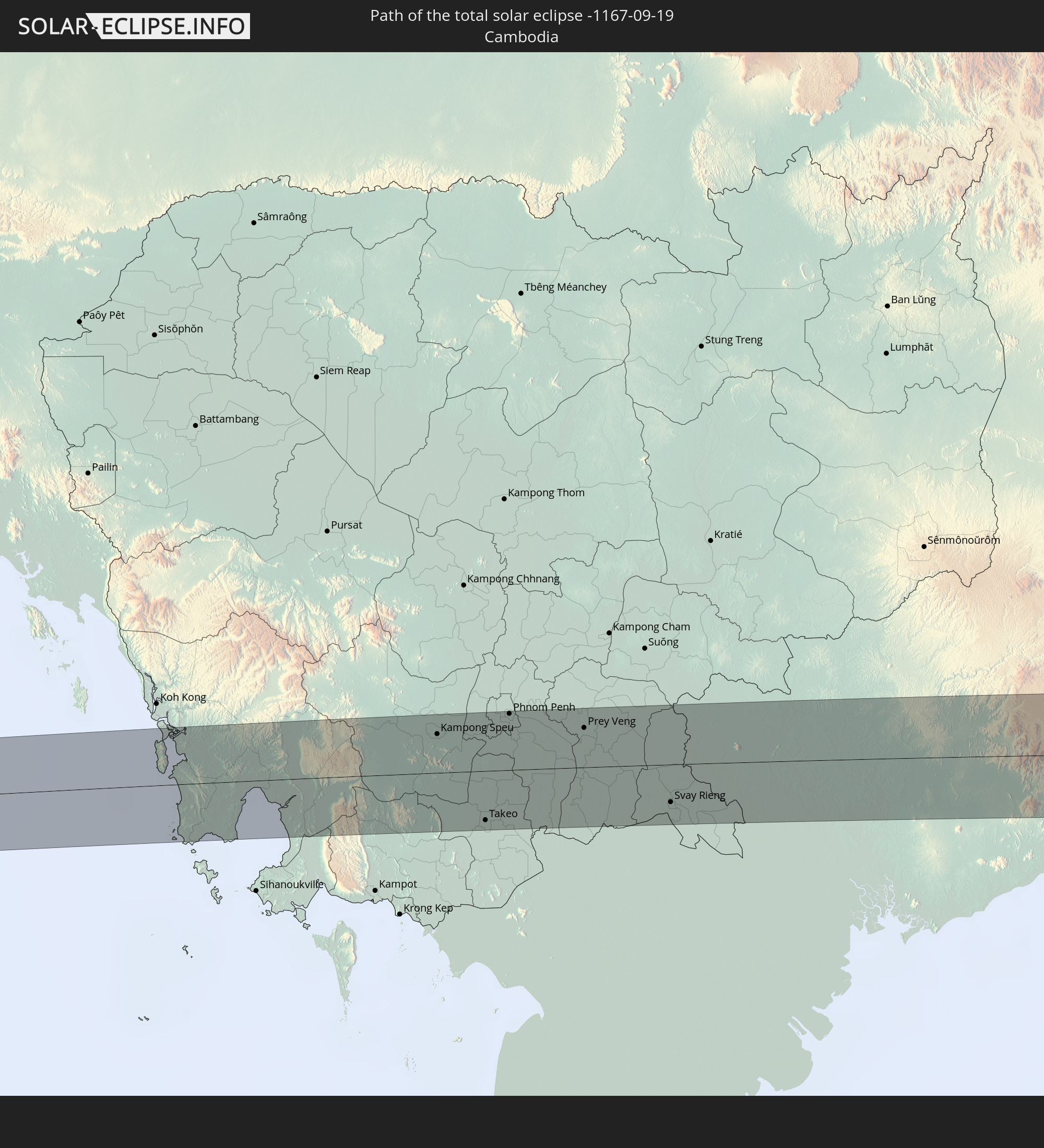 Kambodscha
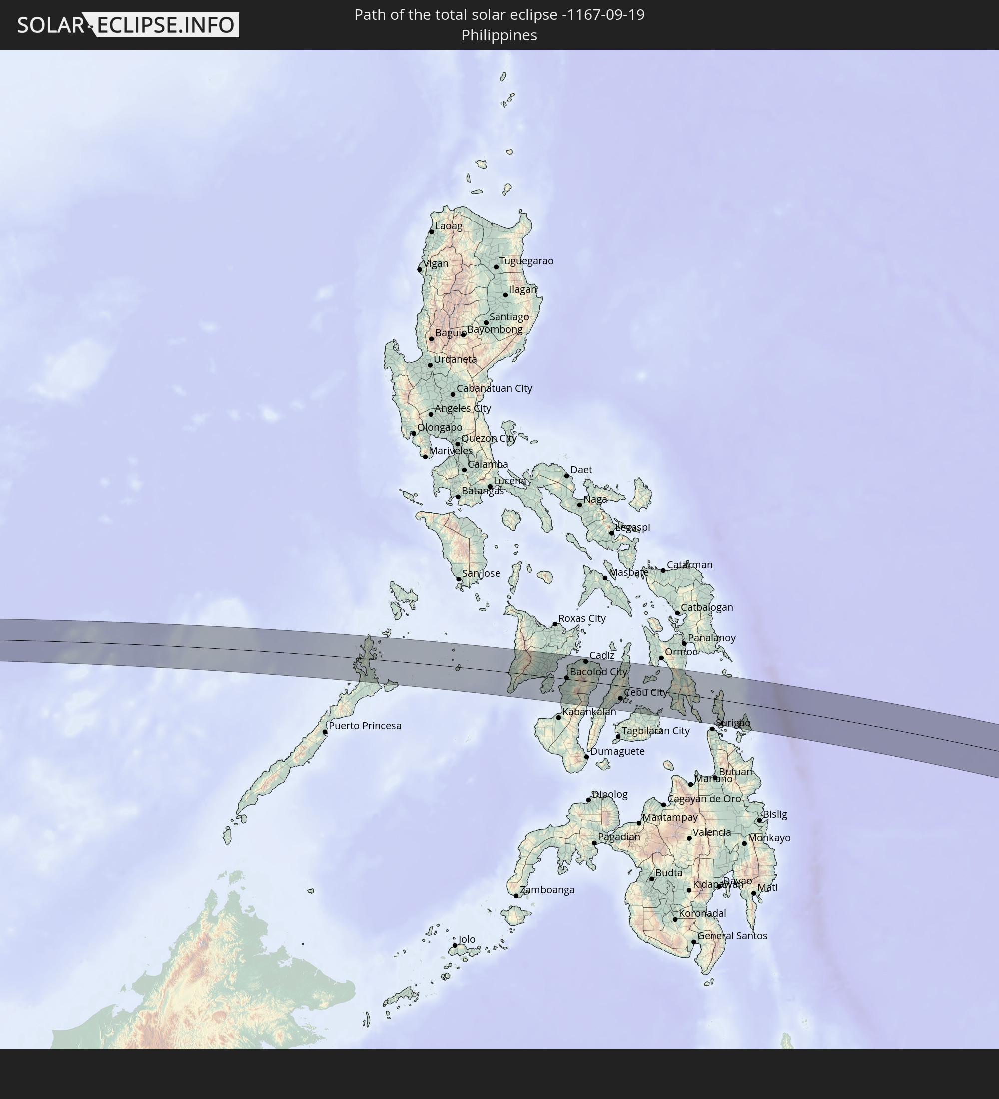 Philippinen
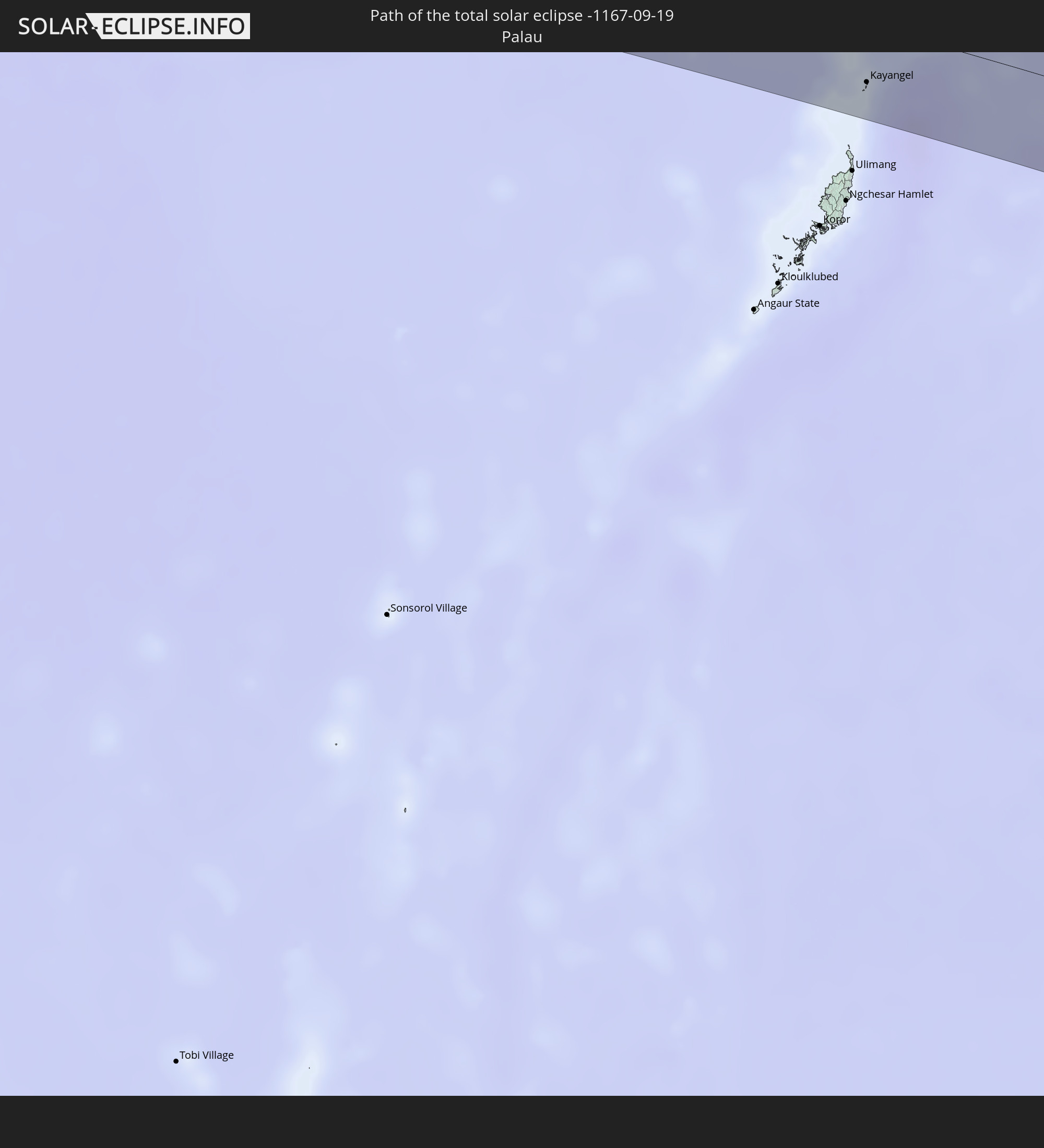 Palau
Palau
In den folgenden Ländern ist die Sonnenfinsternis partiell zu sehen
 Fidschi
 Neuseeland
 United States Minor Outlying Islands
 Wallis und Futuna
 Tonga
Tonga
 Kiribati
 Samoa
Samoa
 Tokelau
 Amerikanisch-Samoa
 Niue
Niue
 Cookinseln
 Französisch-Polynesien
 Indien
 Volksrepublik China
 Mongolei
 Bangladesch
 Bhutan
 Myanmar
 Indonesien
 Kokosinseln
 Thailand
 Malaysia
 Laos
Laos
 Vietnam
 Kambodscha
 Singapur
 Weihnachtsinsel
 Australien
 Macau
Macau
 Hongkong
 Brunei
 Taiwan
 Philippinen
 Japan
Japan
 Osttimor
 Nordkorea
 Südkorea
 Palau
Palau
 Föderierte Staaten von Mikronesien
 Papua-Neuguinea
 Guam
Guam
 Nördliche Marianen
 Salomonen
 Neukaledonien
 Marshallinseln
 Vanuatu
 Nauru
Nauru
 Norfolkinsel
 Tuvalu
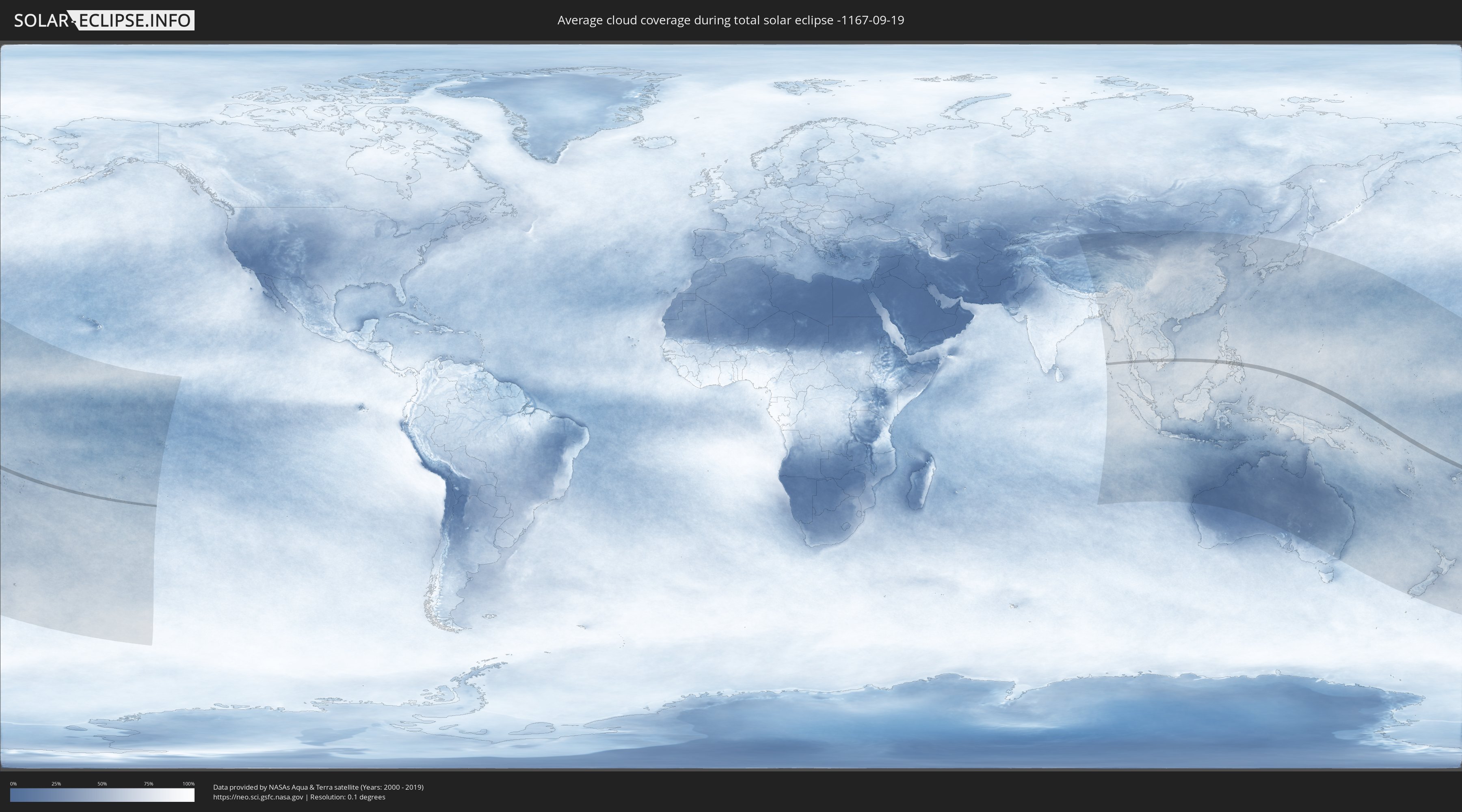
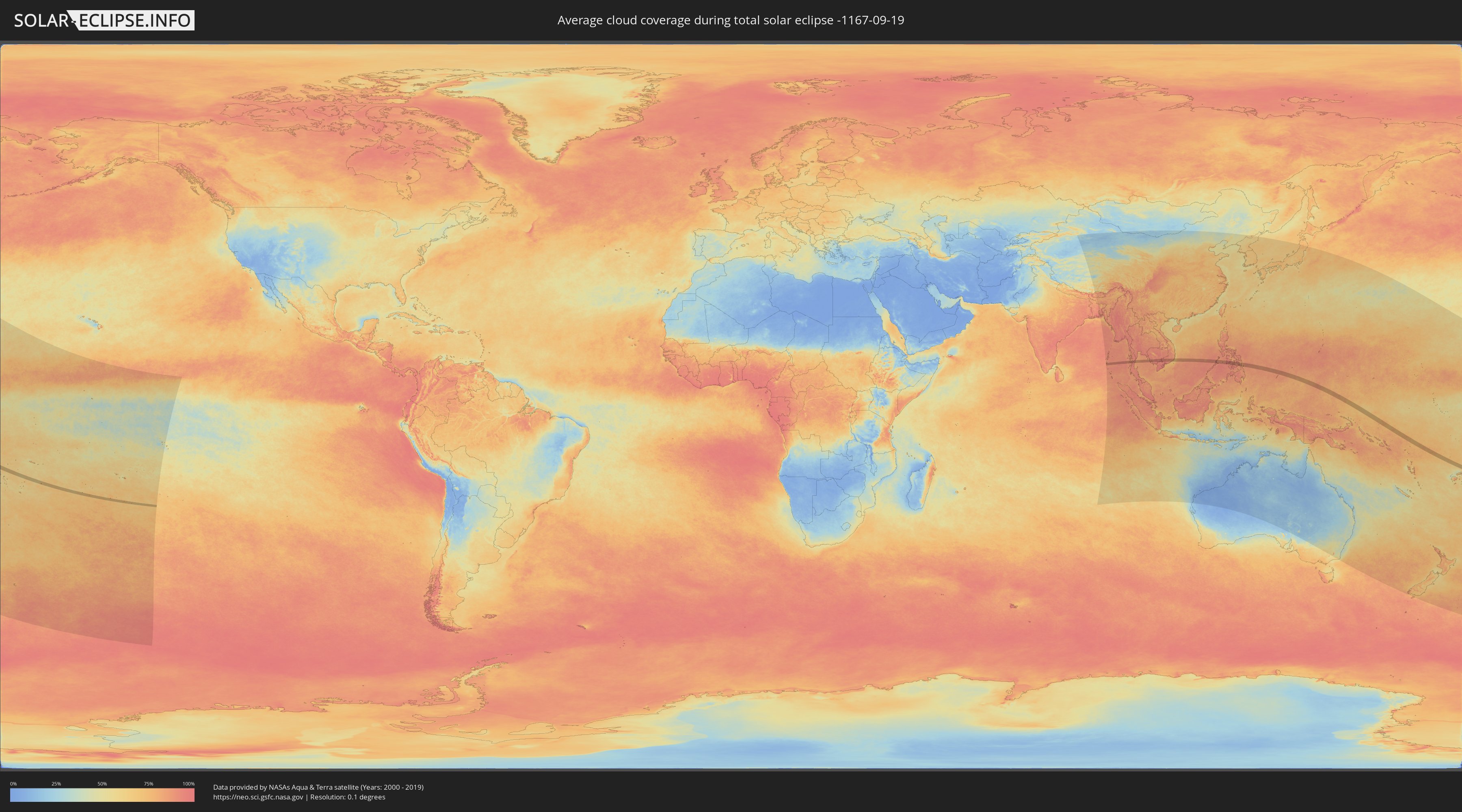
Wie wird das Wetter während der totalen Sonnenfinsternis am 19.09.-1167?
Wo ist der beste Ort, um die totale Sonnenfinsternis vom 19.09.-1167 zu beobachten?
Die folgenden Karten zeigen die durchschnittliche Bewölkung für den Tag, an dem die totale Sonnenfinsternis
stattfindet. Mit Hilfe der Karten lässt sich der Ort entlang des Finsternispfades eingrenzen,
der die besten Aussichen auf einen klaren wolkenfreien Himmel bietet.
Trotzdem muss man immer lokale Gegenenheiten beachten und sollte sich genau über das Wetter an seinem
gewählten Beobachtungsort informieren.
Die Daten stammen von den beiden NASA-Satelliten
AQUA und TERRA
und wurden über einen Zeitraum von 19 Jahren (2000 - 2019) gemittelt.
Detaillierte Länderkarten
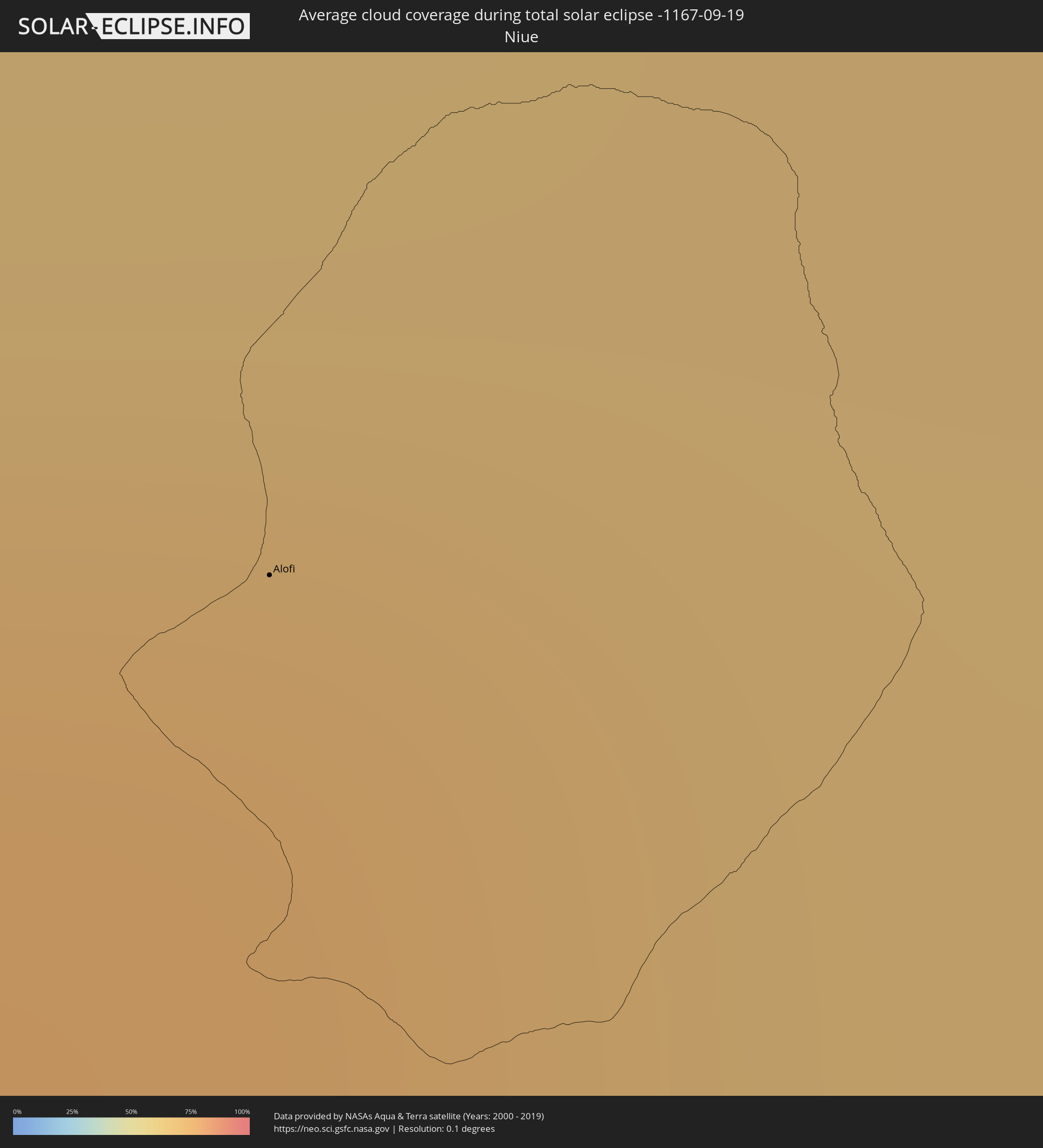 Niue
Niue
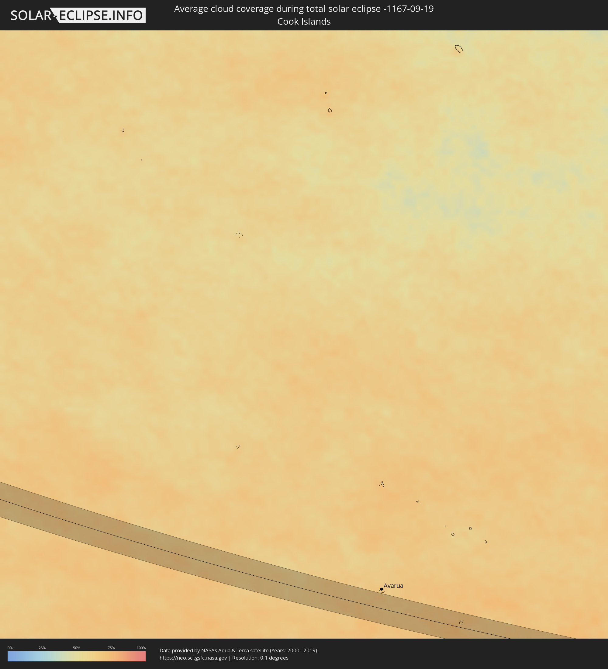 Cookinseln
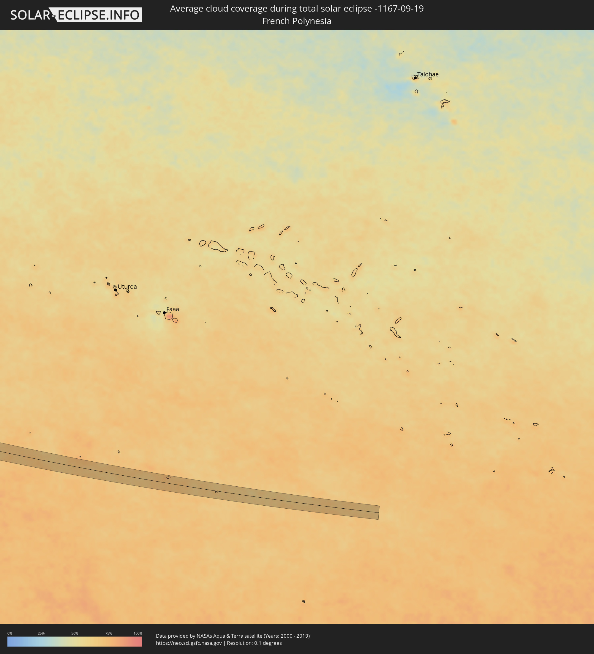 Französisch-Polynesien
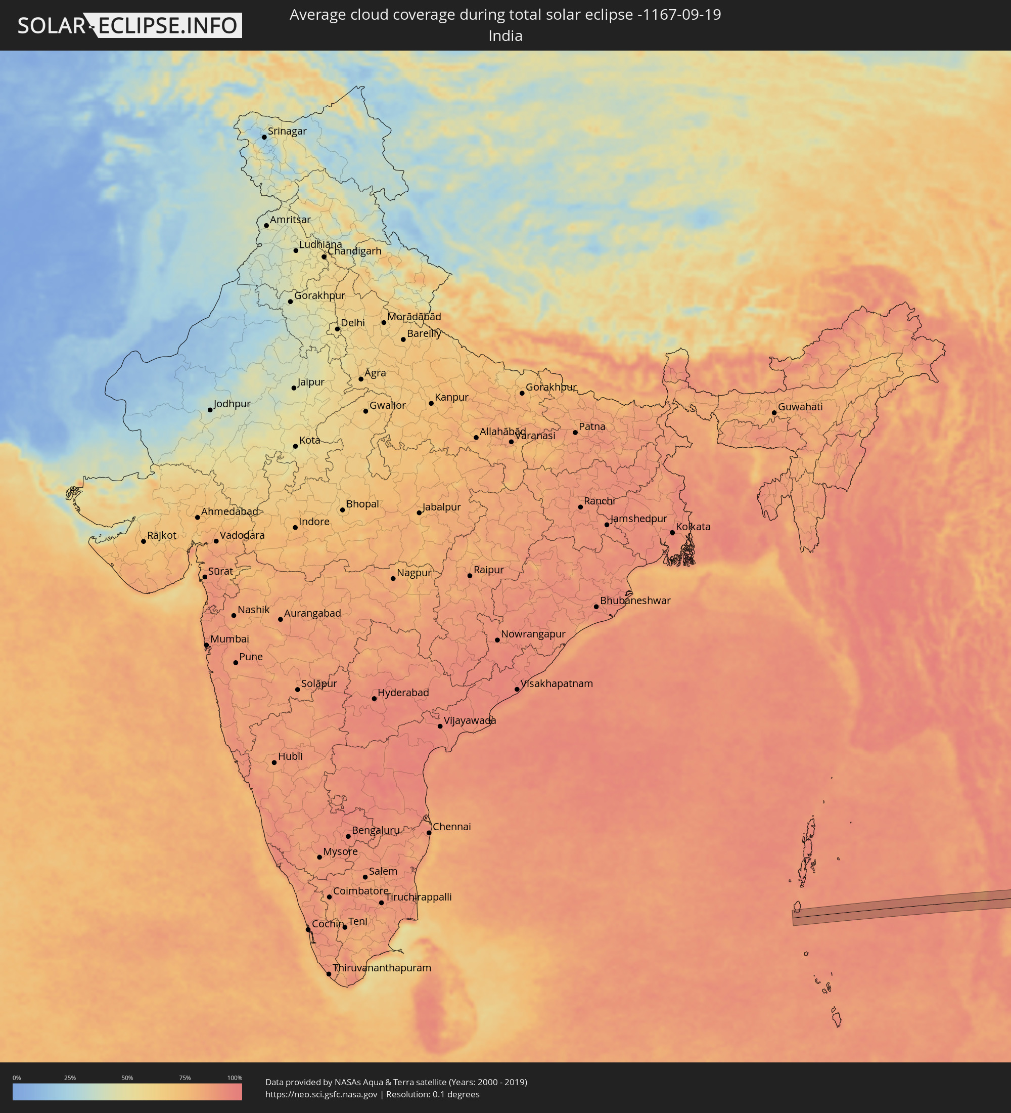 Indien
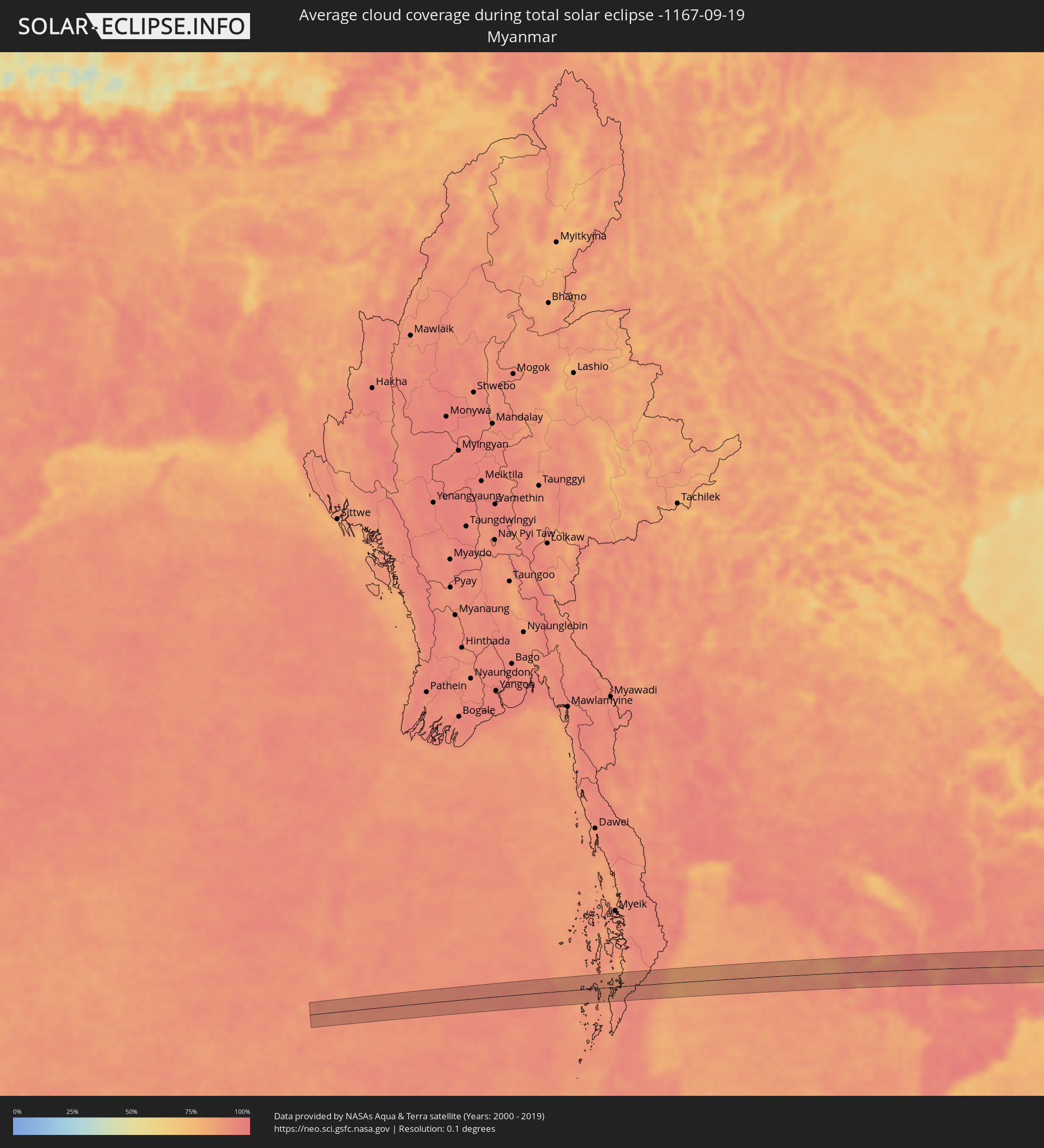 Myanmar
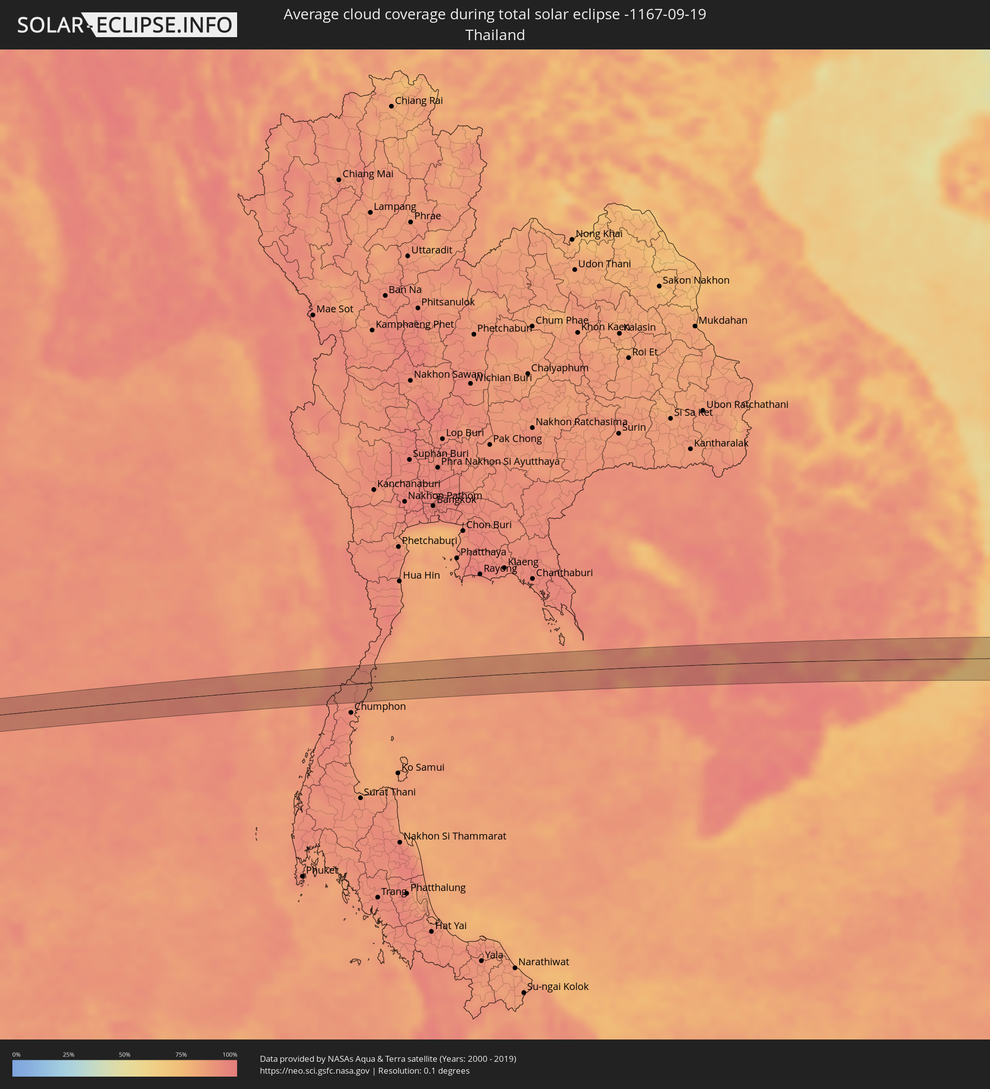 Thailand
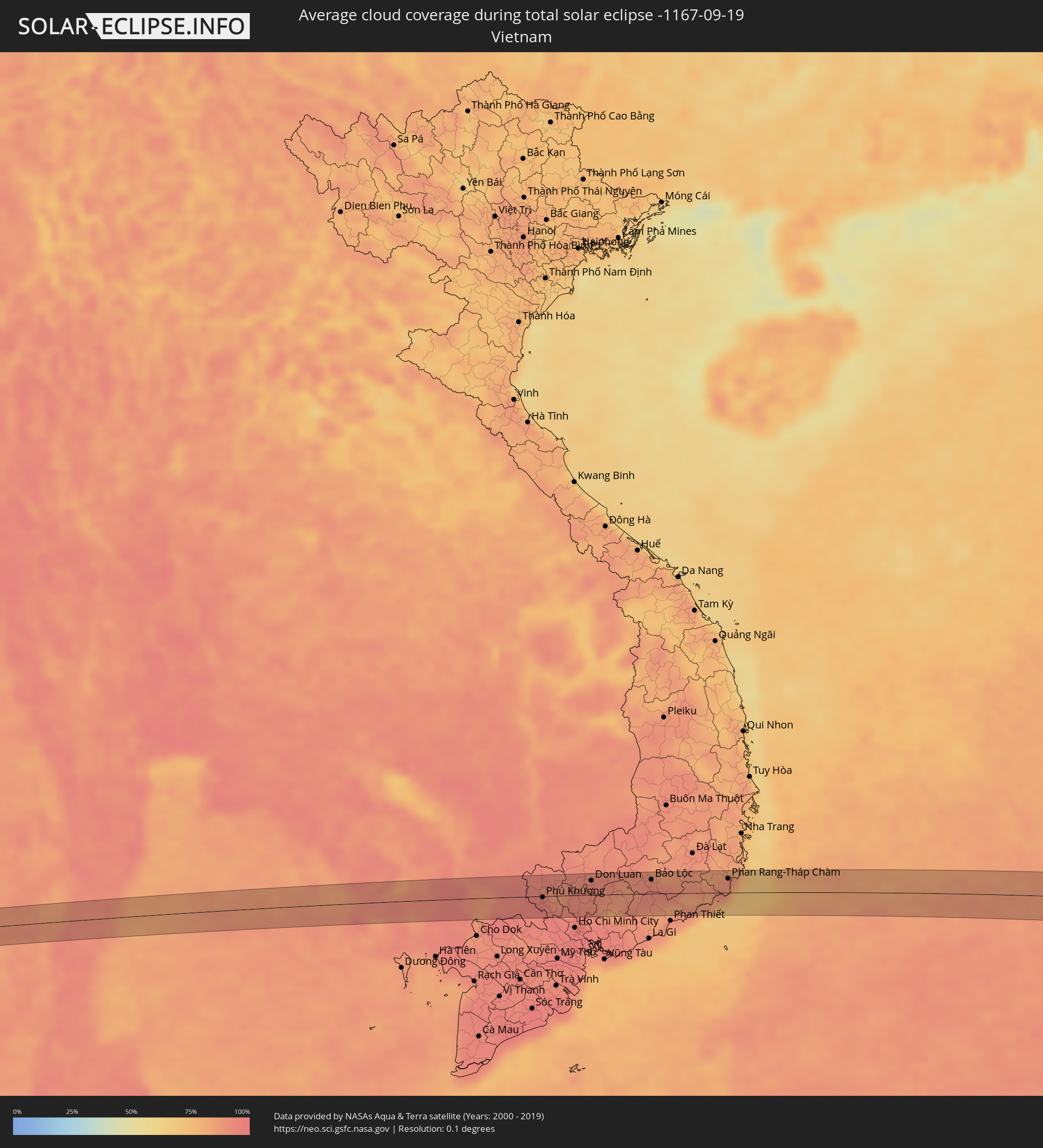 Vietnam
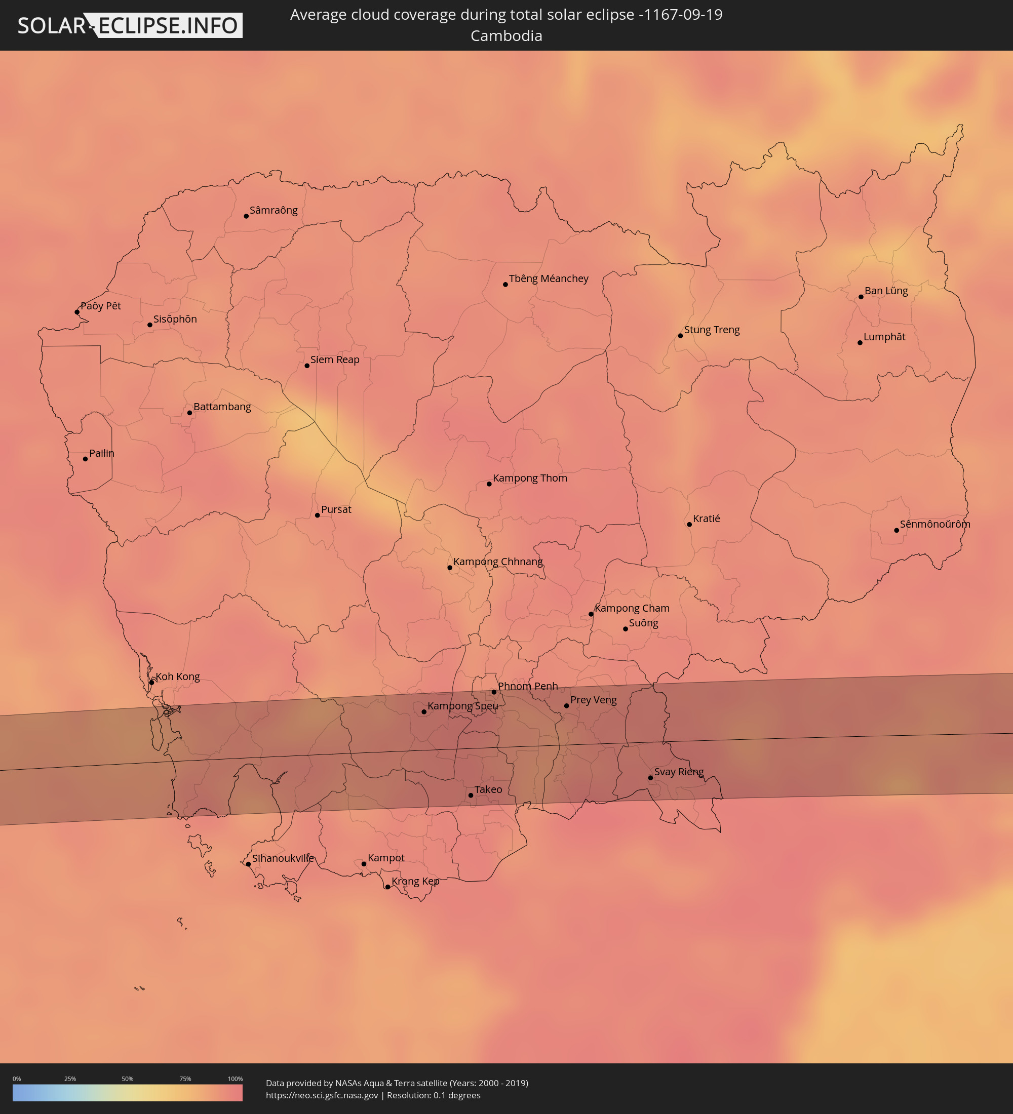 Kambodscha
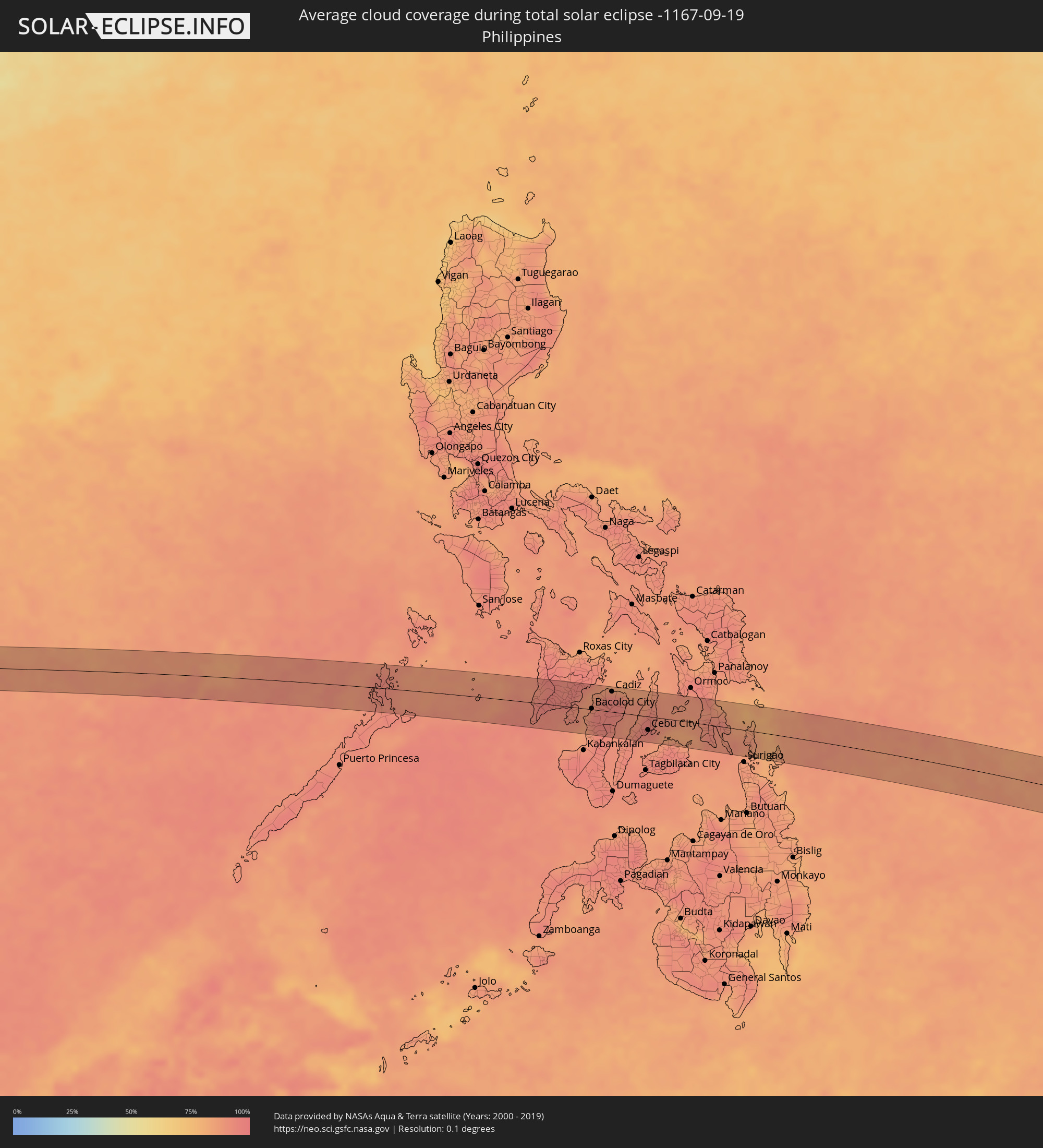 Philippinen
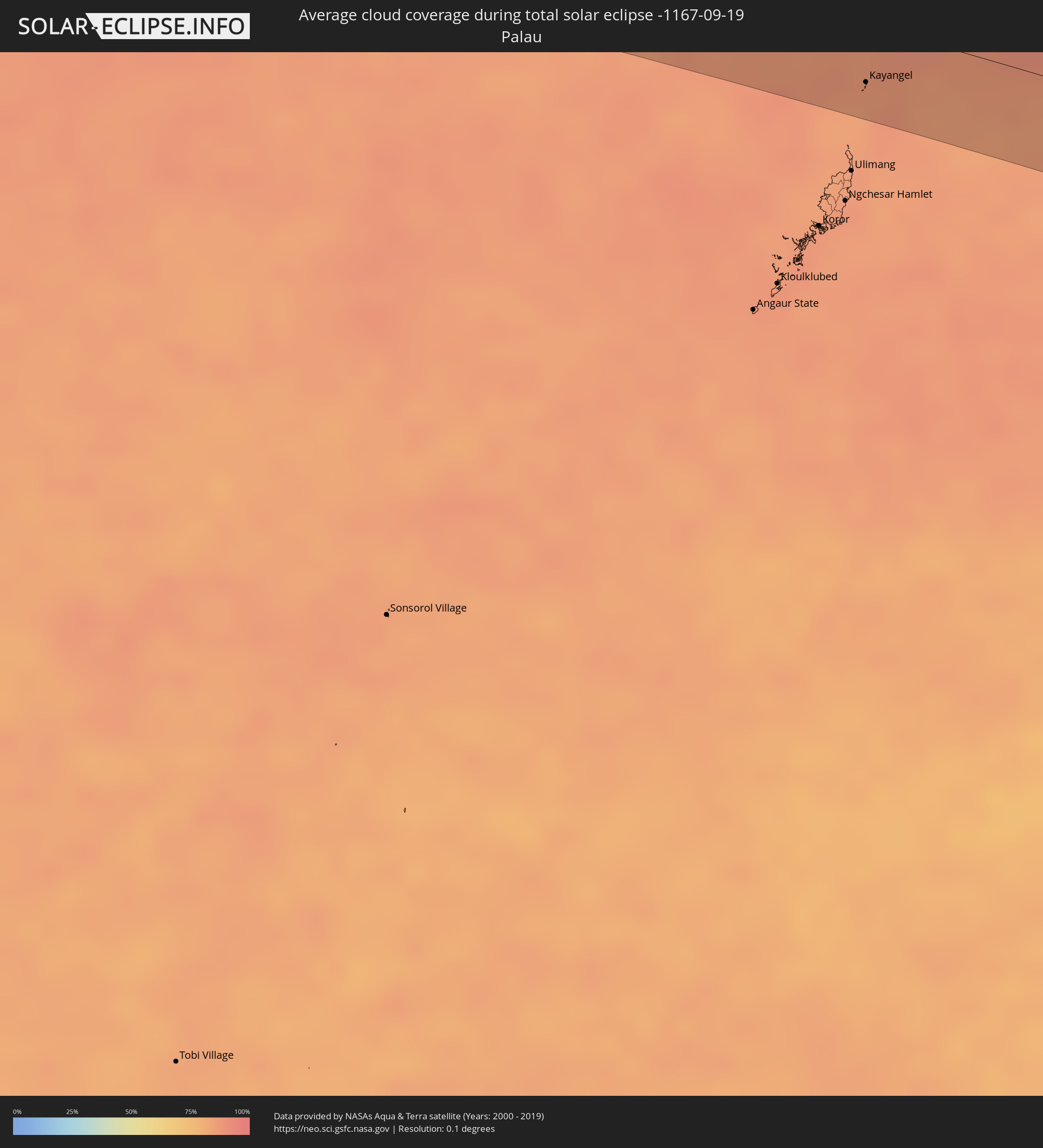 Palau
Palau
Orte im Finsternispfad
Die nachfolgene Tabelle zeigt Städte und Orte mit mehr als 5.000 Einwohnern, die sich im Finsternispfad befinden. Städte mit mehr als 100.000 Einwohnern sind dick gekennzeichnet. Mit einem Klick auf den Ort öffnet sich eine Detailkarte die die Lage des jeweiligen Ortes zusammen mit dem Verlauf der zentralen Finsternis präsentiert.
| Ort | Typ | Dauer der Verfinsterung | Ortszeit bei maximaler Verfinsterung | Entfernung zur Zentrallinie | Ø Bewölkung |
|
Alofi
|
total | - | 15:39:15 UTC-11:20 | 22 km | 73% |
|
Bang Saphan, Prachuap Khiri Khan
|
total | - | 06:27:43 UTC+06:42 | 27 km | 89% |
|
Kampong Speu, Kampong Speu
|
total | - | 06:29:25 UTC+06:42 | 23 km | 94% |
|
Phumĭ Véal Srê, Takeo
|
total | - | 06:29:38 UTC+06:42 | 31 km | 93% |
|
Takeo, Takeo
|
total | - | 06:29:38 UTC+06:42 | 29 km | 93% |
|
Phnom Penh, Phnom Penh
|
total | - | 06:29:35 UTC+06:42 | 34 km | 96% |
|
Ta Khmau, Kandal
|
total | - | 06:29:37 UTC+06:42 | 25 km | 90% |
|
Prey Veng, Prey Veng
|
total | - | 06:29:47 UTC+06:42 | 24 km | 86% |
|
Svay Rieng, Svay Rieng
|
total | - | 06:30:06 UTC+06:42 | 22 km | 95% |
|
Tây Ninh, Tây Ninh
|
total | - | 06:54:48 UTC+07:06 | 1 km | 96% |
|
Phú Khương, Tây Ninh
|
total | - | 06:54:50 UTC+07:06 | 2 km | 96% |
|
Don Luan, Bình Phước
|
total | - | 06:55:10 UTC+07:06 | 24 km | 92% |
|
Bảo Lộc, Lâm Đồng
|
total | - | 06:55:42 UTC+07:06 | 23 km | 92% |
|
Phan Rang-Tháp Chàm, Ninh Thuận
|
total | - | 06:56:25 UTC+07:06 | 23 km | 86% |
|
El Nido, Mimaropa
|
total | - | 07:59:03 UTC+08:00 | 20 km | 93% |
|
Taytay, Mimaropa
|
total | - | 07:59:20 UTC+08:00 | 20 km | 90% |
|
Cuyo, Mimaropa
|
total | - | 08:01:07 UTC+08:00 | 1 km | 89% |
|
Miagao, Western Visayas
|
total | - | 08:02:47 UTC+08:00 | 10 km | 93% |
|
Tigbauan, Western Visayas
|
total | - | 08:02:57 UTC+08:00 | 5 km | 91% |
|
Janiuay, Western Visayas
|
total | - | 08:02:59 UTC+08:00 | 27 km | 95% |
|
Iloilo, Western Visayas
|
total | - | 08:03:11 UTC+08:00 | 1 km | 91% |
|
Barotac Nuevo, Western Visayas
|
total | - | 08:03:17 UTC+08:00 | 23 km | 91% |
|
Bago City, Western Visayas
|
total | - | 08:03:38 UTC+08:00 | 15 km | 85% |
|
Hinigaran, Western Visayas
|
total | - | 08:03:47 UTC+08:00 | 44 km | 88% |
|
Barotac Viejo, Western Visayas
|
total | - | 08:03:24 UTC+08:00 | 42 km | 86% |
|
La Carlota, Western Visayas
|
total | - | 08:03:48 UTC+08:00 | 26 km | 89% |
|
Bacolod City, Western Visayas
|
total | - | 08:03:43 UTC+08:00 | 1 km | 95% |
|
La Castellana, Western Visayas
|
total | - | 08:03:59 UTC+08:00 | 36 km | 92% |
|
Victorias, Western Visayas
|
total | - | 08:03:46 UTC+08:00 | 29 km | 93% |
|
Minuyan, Western Visayas
|
total | - | 08:04:00 UTC+08:00 | 13 km | 96% |
|
Canlaon, Central Visayas
|
total | - | 08:04:14 UTC+08:00 | 26 km | 94% |
|
Cadiz, Western Visayas
|
total | - | 08:04:02 UTC+08:00 | 37 km | 95% |
|
Ualog, Western Visayas
|
total | - | 08:04:22 UTC+08:00 | 3 km | 91% |
|
Escalante, Western Visayas
|
total | - | 08:04:23 UTC+08:00 | 28 km | 91% |
|
Tutay, Central Visayas
|
total | - | 08:04:48 UTC+08:00 | 37 km | 93% |
|
Toledo, Central Visayas
|
total | - | 08:04:48 UTC+08:00 | 21 km | 89% |
|
Balamban, Central Visayas
|
total | - | 08:04:51 UTC+08:00 | 6 km | 90% |
|
Naga, Central Visayas
|
total | - | 08:05:04 UTC+08:00 | 38 km | 90% |
|
Cebu City, Central Visayas
|
total | - | 08:05:11 UTC+08:00 | 24 km | 92% |
|
Catmon, Central Visayas
|
total | - | 08:05:08 UTC+08:00 | 21 km | 91% |
|
Danao, Central Visayas
|
total | - | 08:05:16 UTC+08:00 | 0 km | 91% |
|
Talibon, Central Visayas
|
total | - | 08:05:54 UTC+08:00 | 37 km | 94% |
|
San Francisco, Central Visayas
|
total | - | 08:05:43 UTC+08:00 | 19 km | 87% |
|
Bato, Eastern Visayas
|
total | - | 08:06:28 UTC+08:00 | 10 km | 90% |
|
Baybay, Eastern Visayas
|
total | - | 08:06:18 UTC+08:00 | 29 km | 87% |
|
Maasin, Eastern Visayas
|
total | - | 08:06:39 UTC+08:00 | 30 km | 89% |
|
Sogod, Eastern Visayas
|
total | - | 08:06:43 UTC+08:00 | 1 km | 90% |
|
Abuyog, Eastern Visayas
|
total | - | 08:06:34 UTC+08:00 | 40 km | 88% |
|
Kayangel, Kayangel
|
total | - | 09:25:32 UTC+09:00 | 32 km | 86% |