Totale Sonnenfinsternis vom 15.04.-1196
| Wochentag: | Dienstag |
| Maximale Dauer der Verfinsterung: | 06m16s |
| Maximale Breite des Finsternispfades: | 252 km |
| Saroszyklus: | 29 |
| Bedeckungsgrad: | 100% |
| Magnitude: | 1.0772 |
| Gamma: | -0.1542 |
Wo kann man die Sonnenfinsternis vom 15.04.-1196 sehen?
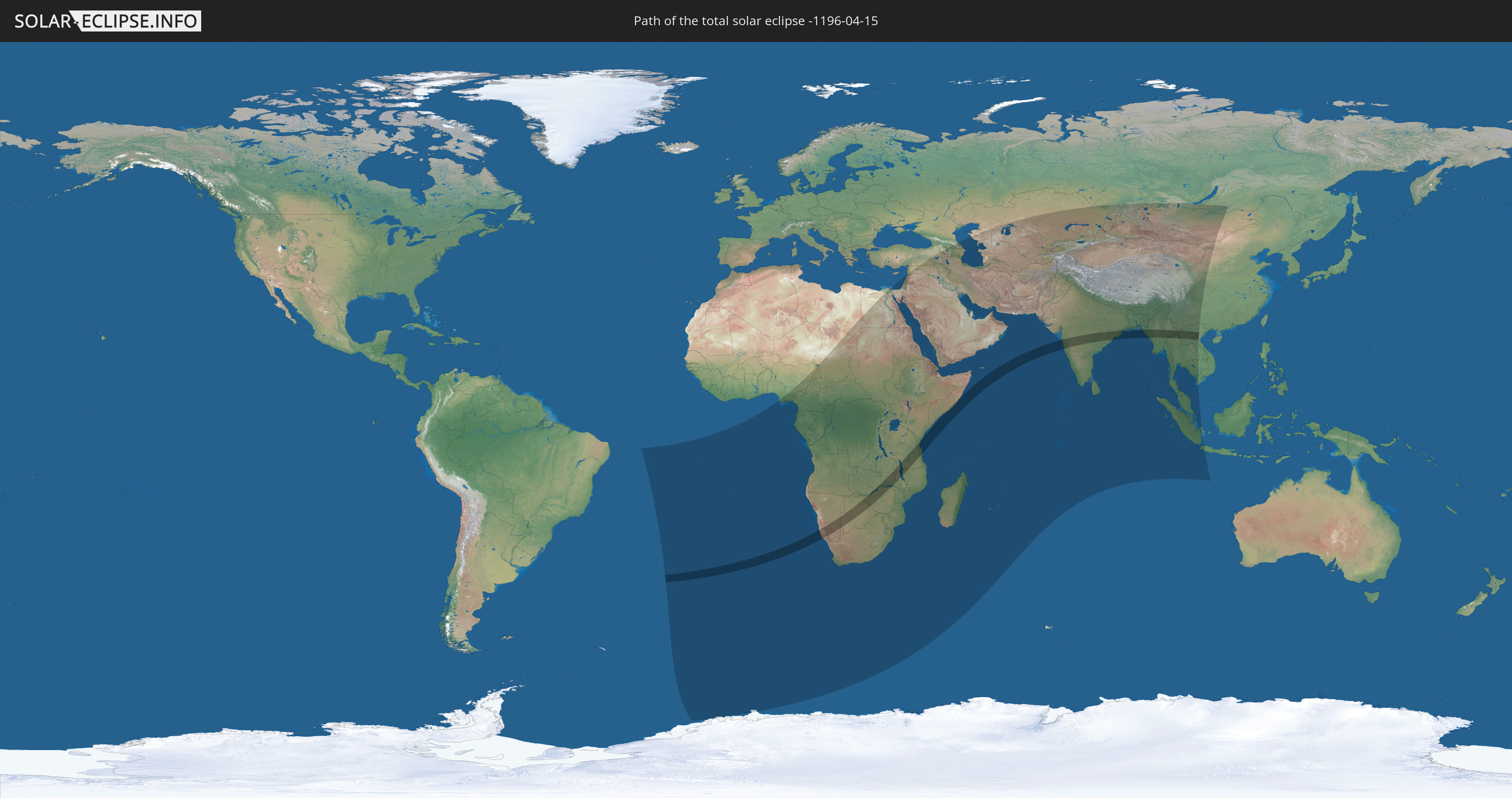
Die Sonnenfinsternis am 15.04.-1196 kann man in 86 Ländern als partielle Sonnenfinsternis beobachten.
Der Finsternispfad verläuft durch 18 Länder. Nur in diesen Ländern ist sie als totale Sonnenfinsternis zu sehen.
In den folgenden Ländern ist die Sonnenfinsternis total zu sehen
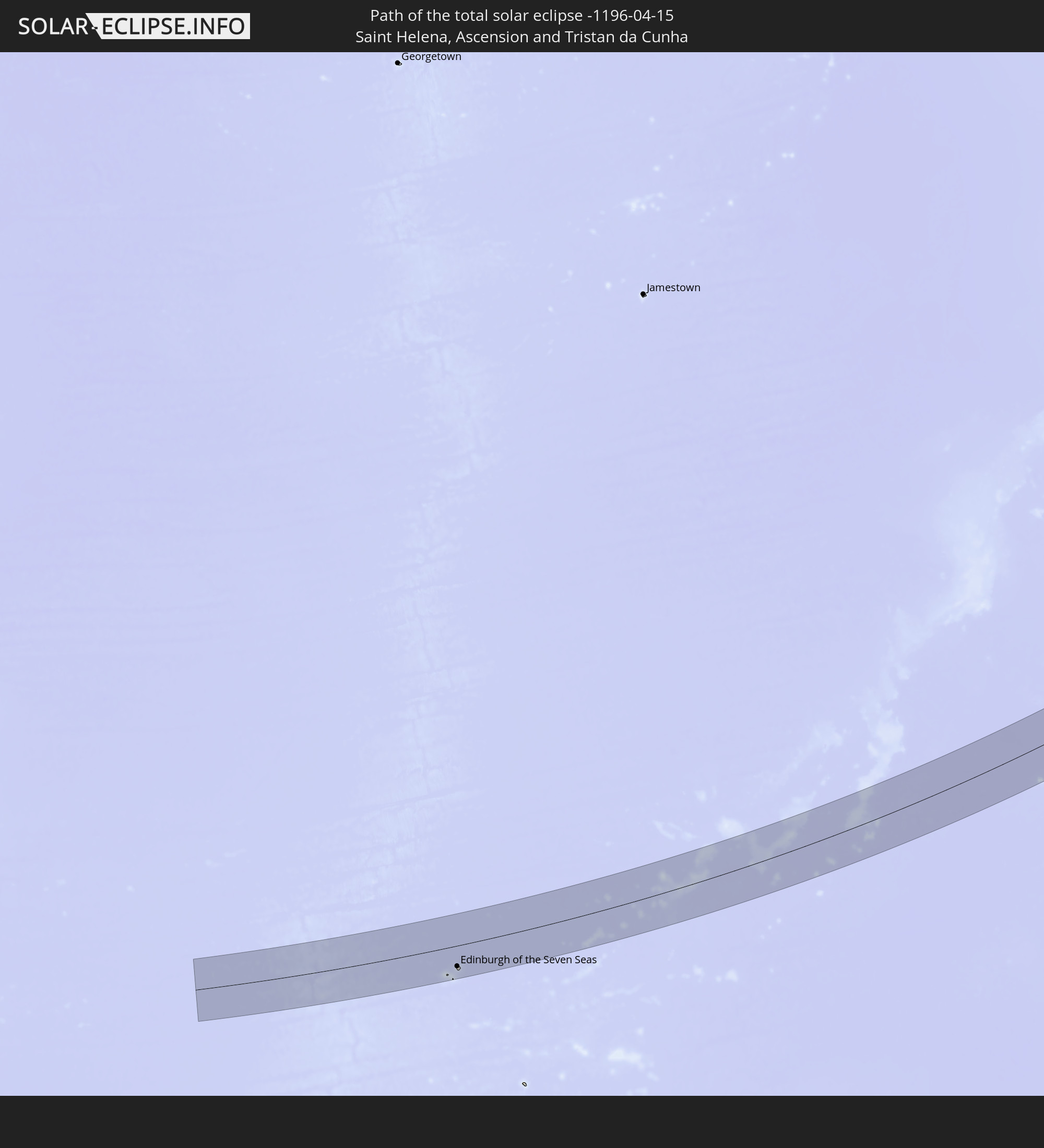 St. Helena
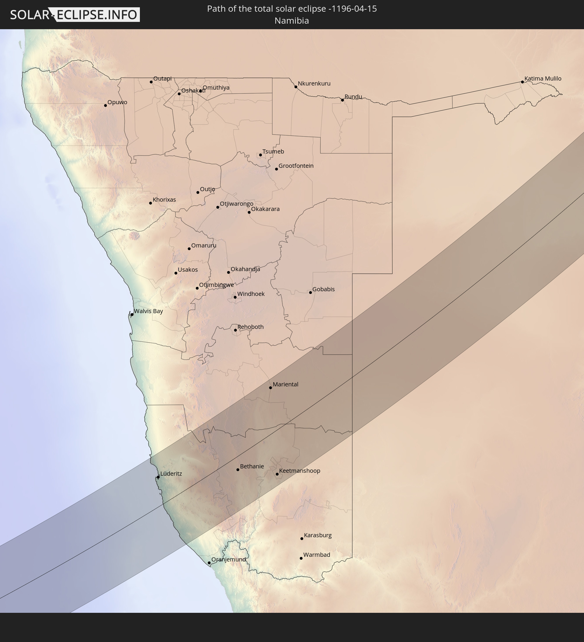 Namibia
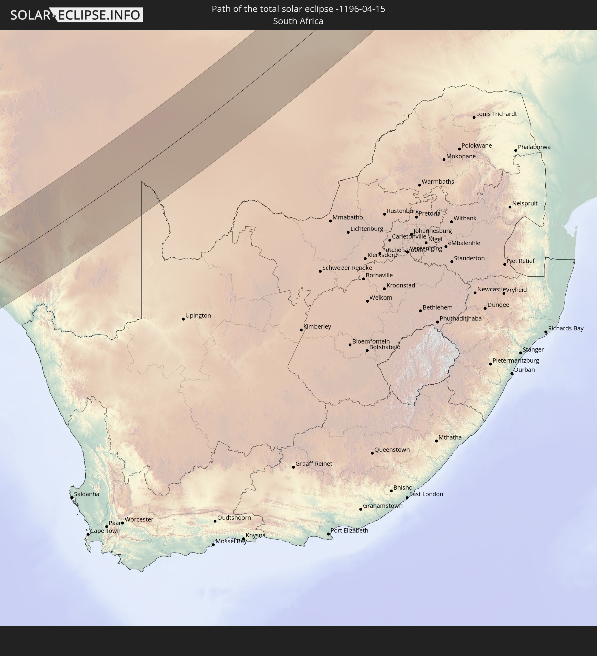 Südafrika
 Botswana
 Sambia
 Simbabwe
 Tansania
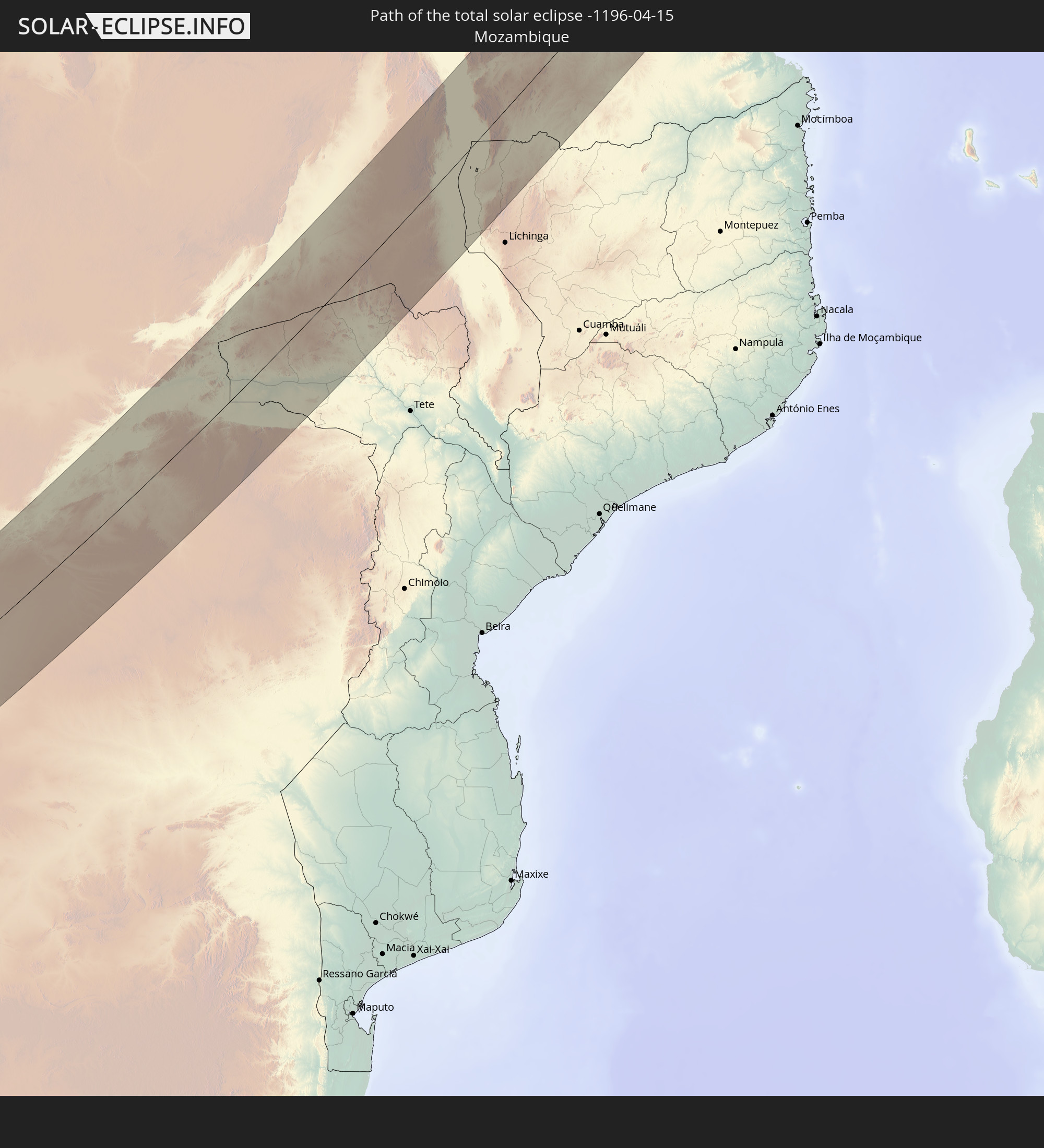 Mosambik
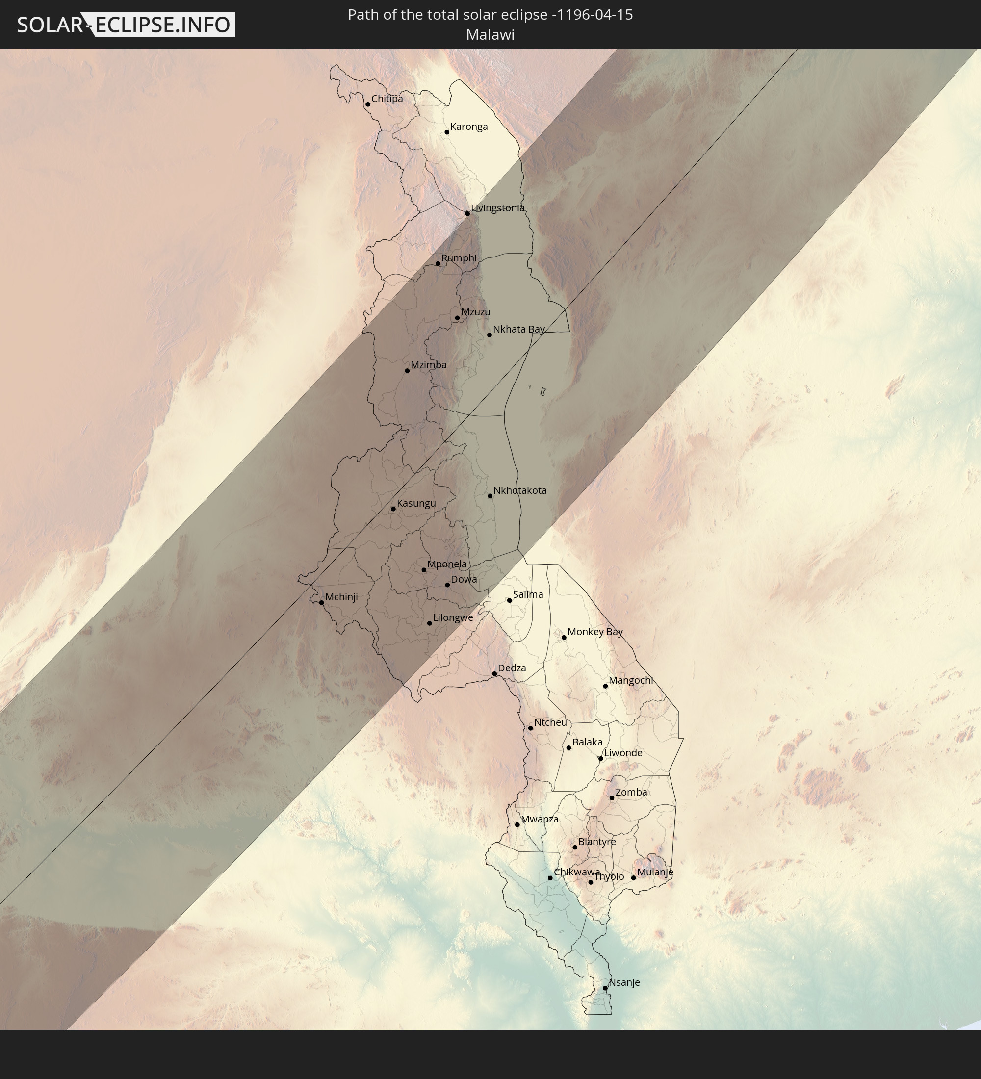 Malawi
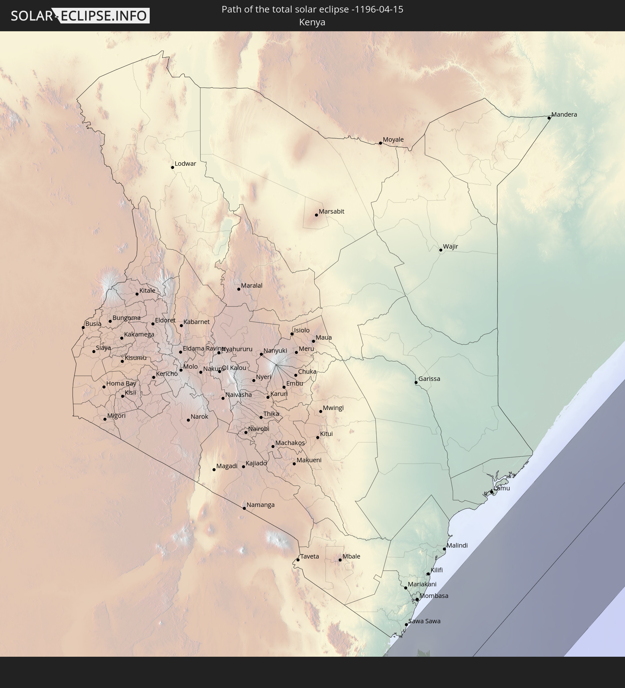 Kenia
Kenia
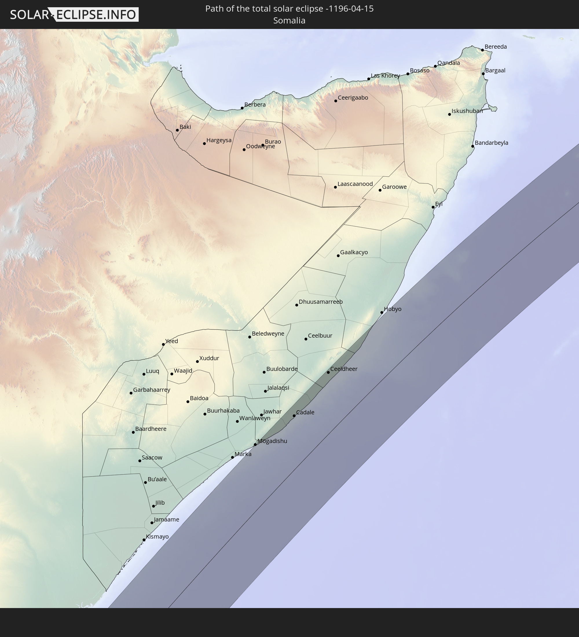 Somalia
 Indien
 Volksrepublik China
 Bangladesch
 Myanmar
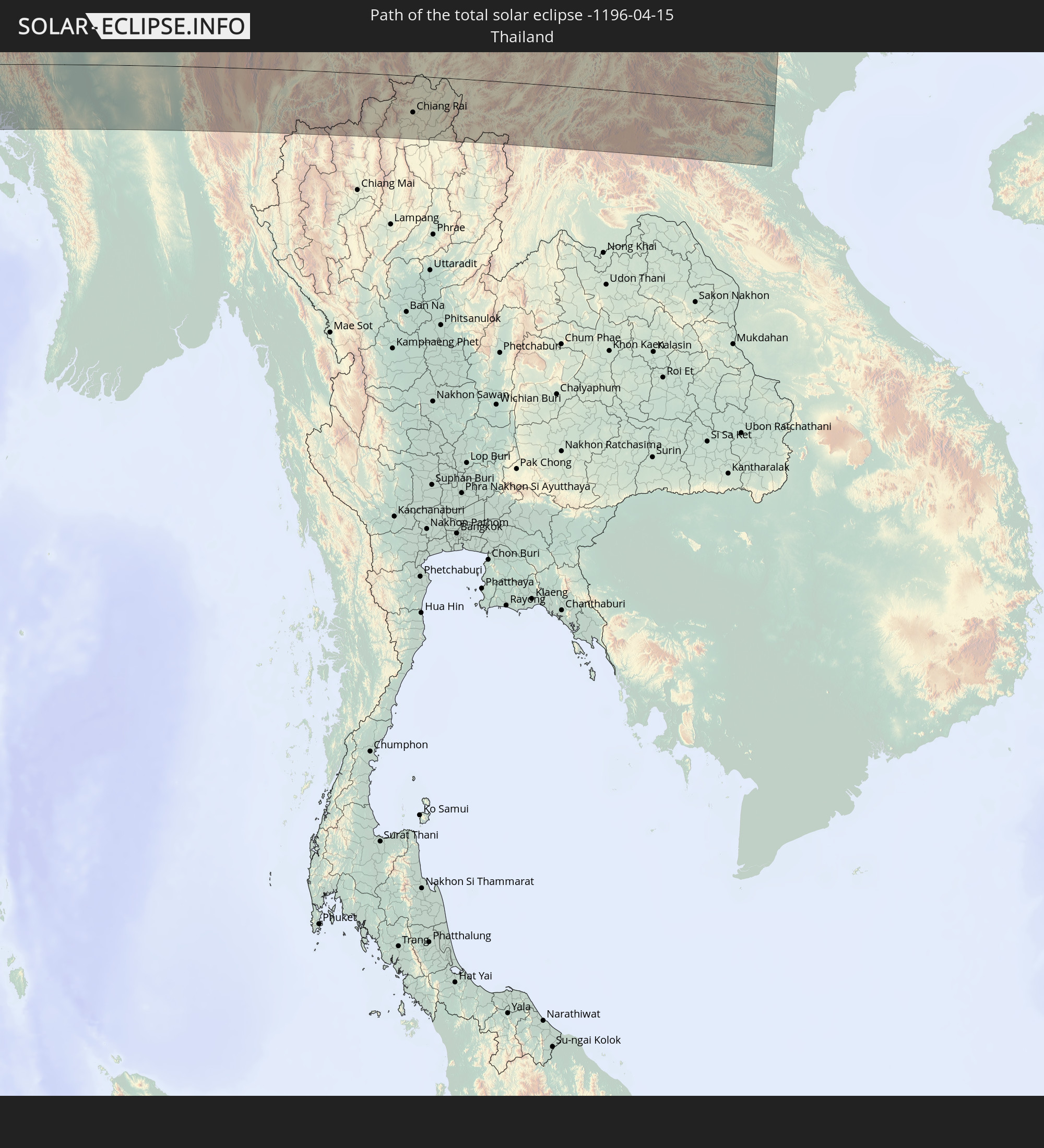 Thailand
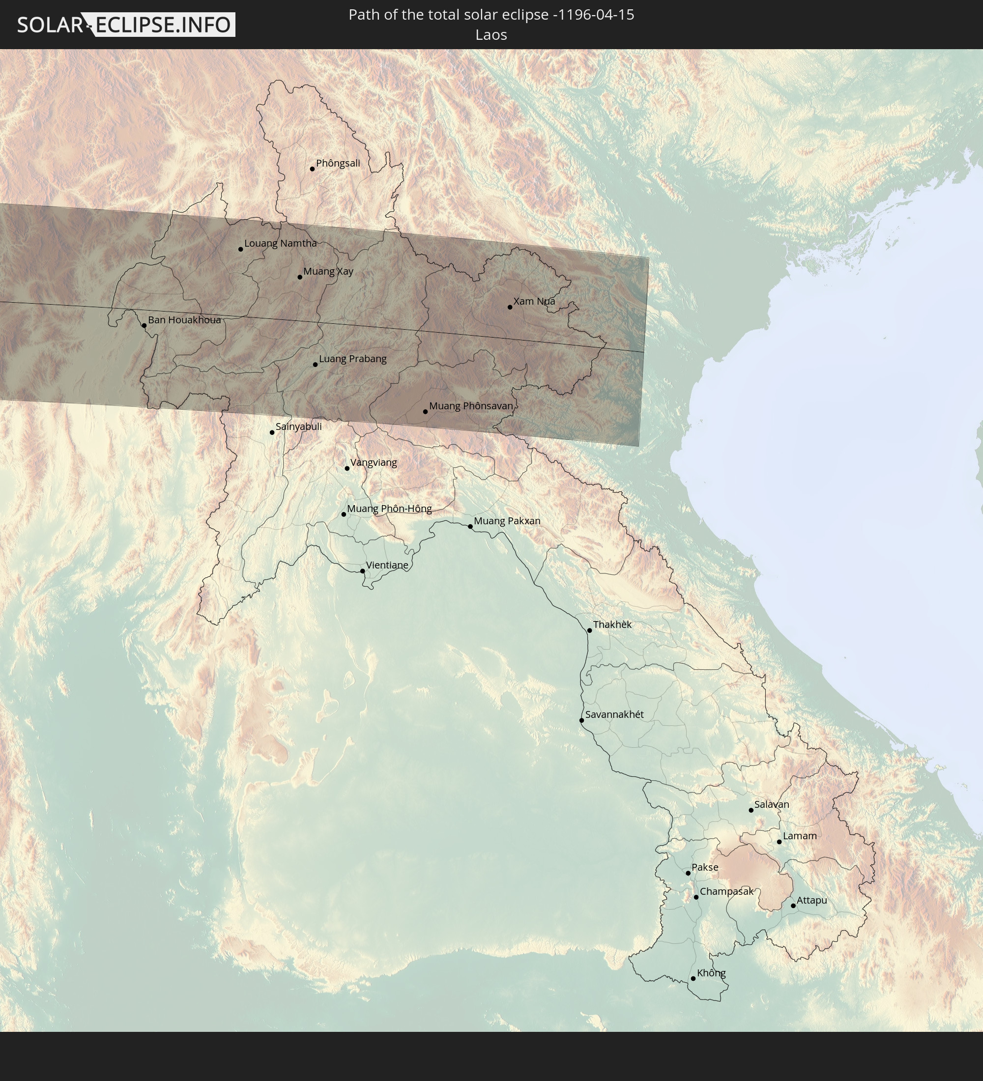 Laos
Laos
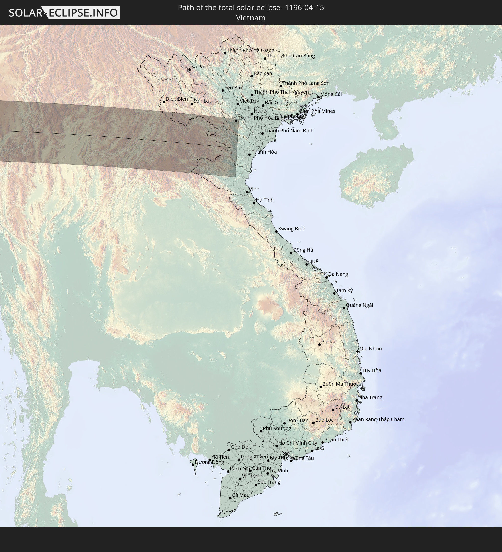 Vietnam
In den folgenden Ländern ist die Sonnenfinsternis partiell zu sehen
 Antarktika
 Russland
 St. Helena
 Nigeria
 Bouvetinsel
 Äquatorialguinea
 São Tomé und Príncipe
 Kamerun
 Gabun
Gabun
 Libyen
 Republik Kongo
 Angola
 Namibia
 Demokratische Republik Kongo
 Tschad
 Zentralafrikanische Republik
 Südafrika
 Botswana
 Sudan
Sudan
 Sambia
 Ägypten
 Simbabwe
 Türkei
 Lesotho
 Ruanda
 Burundi
 Tansania
 Uganda
 Mosambik
 Swasiland
 Malawi
 Äthiopien
 Kenia
Kenia
 Staat Palästina
 Israel
 Saudi-Arabien
 Jordanien
 Libanon
 Syrien
 Eritrea
 Irak
Irak
 Georgien
 Französische Süd- und Antarktisgebiete
 Somalia
 Dschibuti
 Jemen
Jemen
 Madagaskar
 Komoren
 Armenien
 Iran
Iran
 Aserbaidschan
 Mayotte
 Seychellen
 Kasachstan
 Kuwait
 Bahrain
 Katar
Katar
 Vereinigte Arabische Emirate
 Oman
Oman
 Turkmenistan
 Réunion
 Usbekistan
 Mauritius
 Afghanistan
 Pakistan
 Tadschikistan
 Indien
 Kirgisistan
 Britisches Territorium im Indischen Ozean
 Malediven
 Volksrepublik China
 Sri Lanka
 Nepal
Nepal
 Mongolei
 Bangladesch
 Bhutan
 Myanmar
 Indonesien
 Kokosinseln
 Thailand
 Malaysia
 Laos
Laos
 Vietnam
 Kambodscha
 Singapur
 Weihnachtsinsel
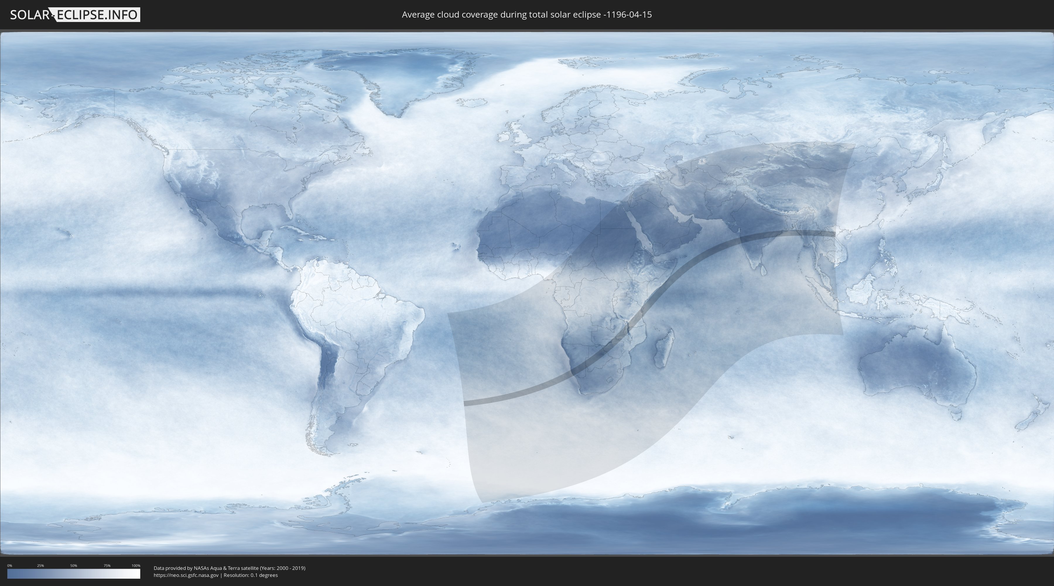
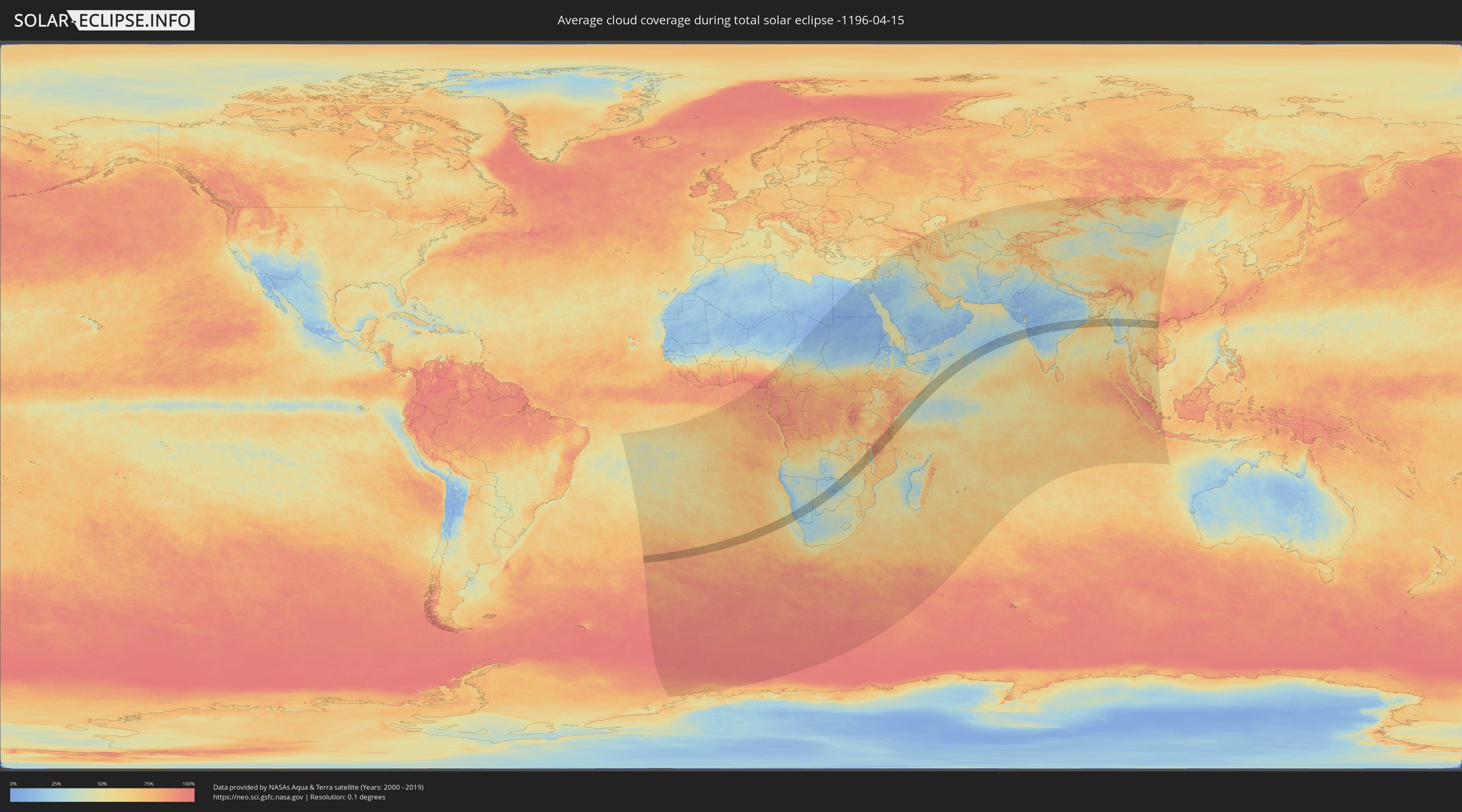
Wie wird das Wetter während der totalen Sonnenfinsternis am 15.04.-1196?
Wo ist der beste Ort, um die totale Sonnenfinsternis vom 15.04.-1196 zu beobachten?
Die folgenden Karten zeigen die durchschnittliche Bewölkung für den Tag, an dem die totale Sonnenfinsternis
stattfindet. Mit Hilfe der Karten lässt sich der Ort entlang des Finsternispfades eingrenzen,
der die besten Aussichen auf einen klaren wolkenfreien Himmel bietet.
Trotzdem muss man immer lokale Gegenenheiten beachten und sollte sich genau über das Wetter an seinem
gewählten Beobachtungsort informieren.
Die Daten stammen von den beiden NASA-Satelliten
AQUA und TERRA
und wurden über einen Zeitraum von 19 Jahren (2000 - 2019) gemittelt.
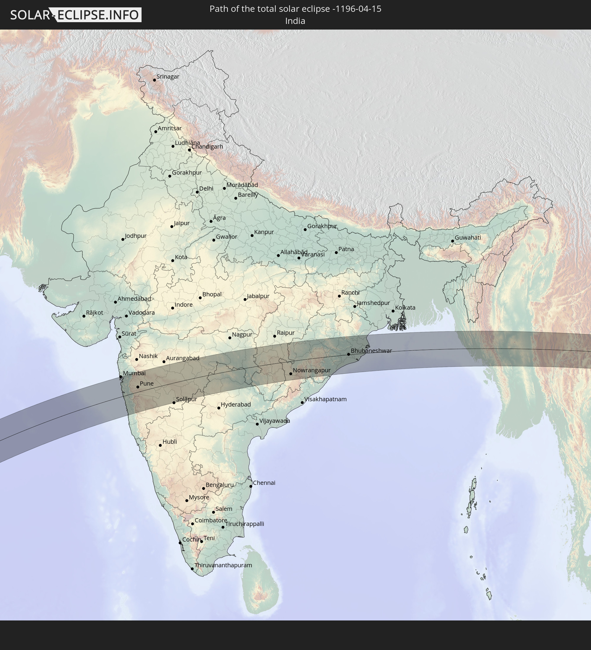
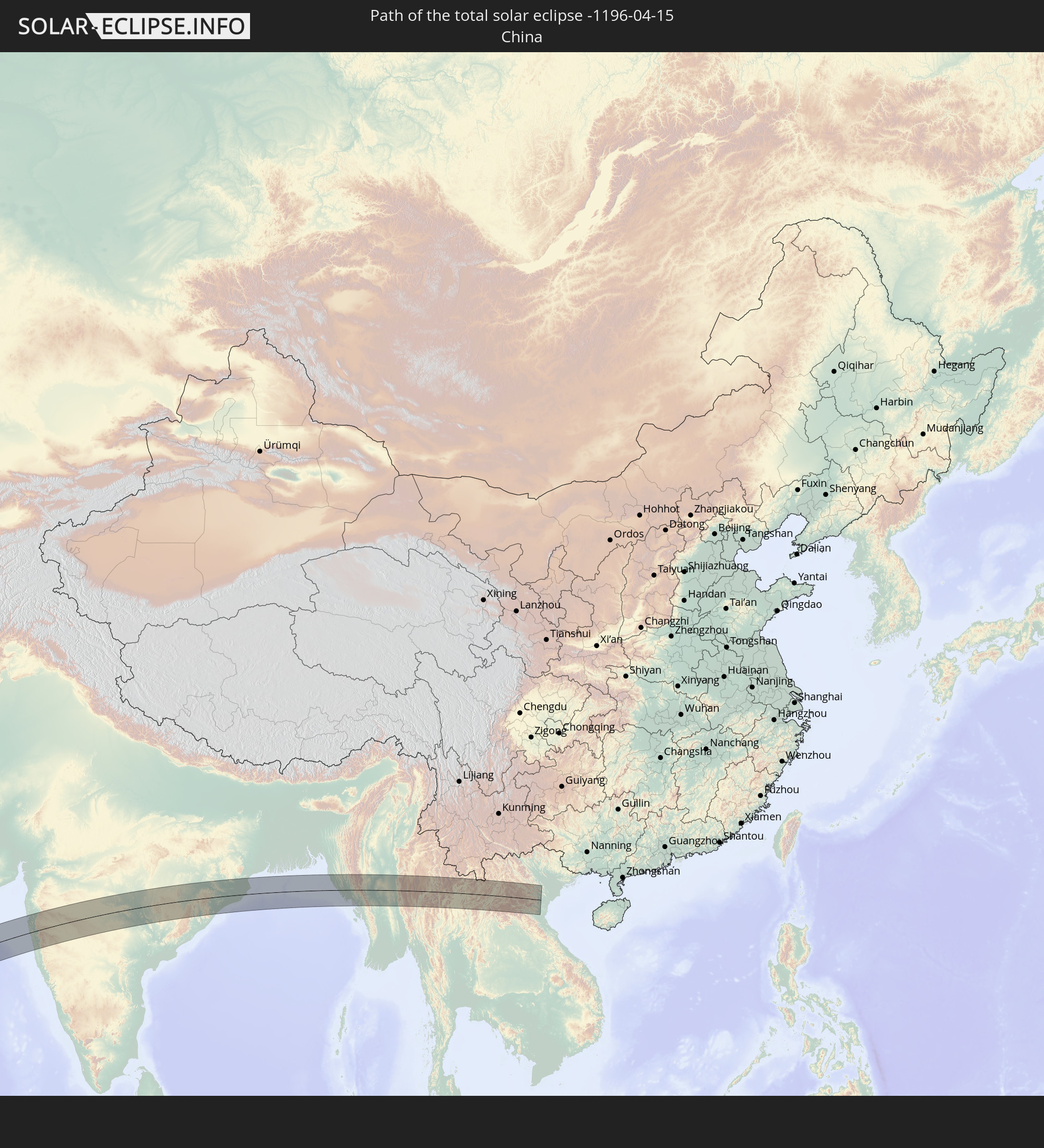
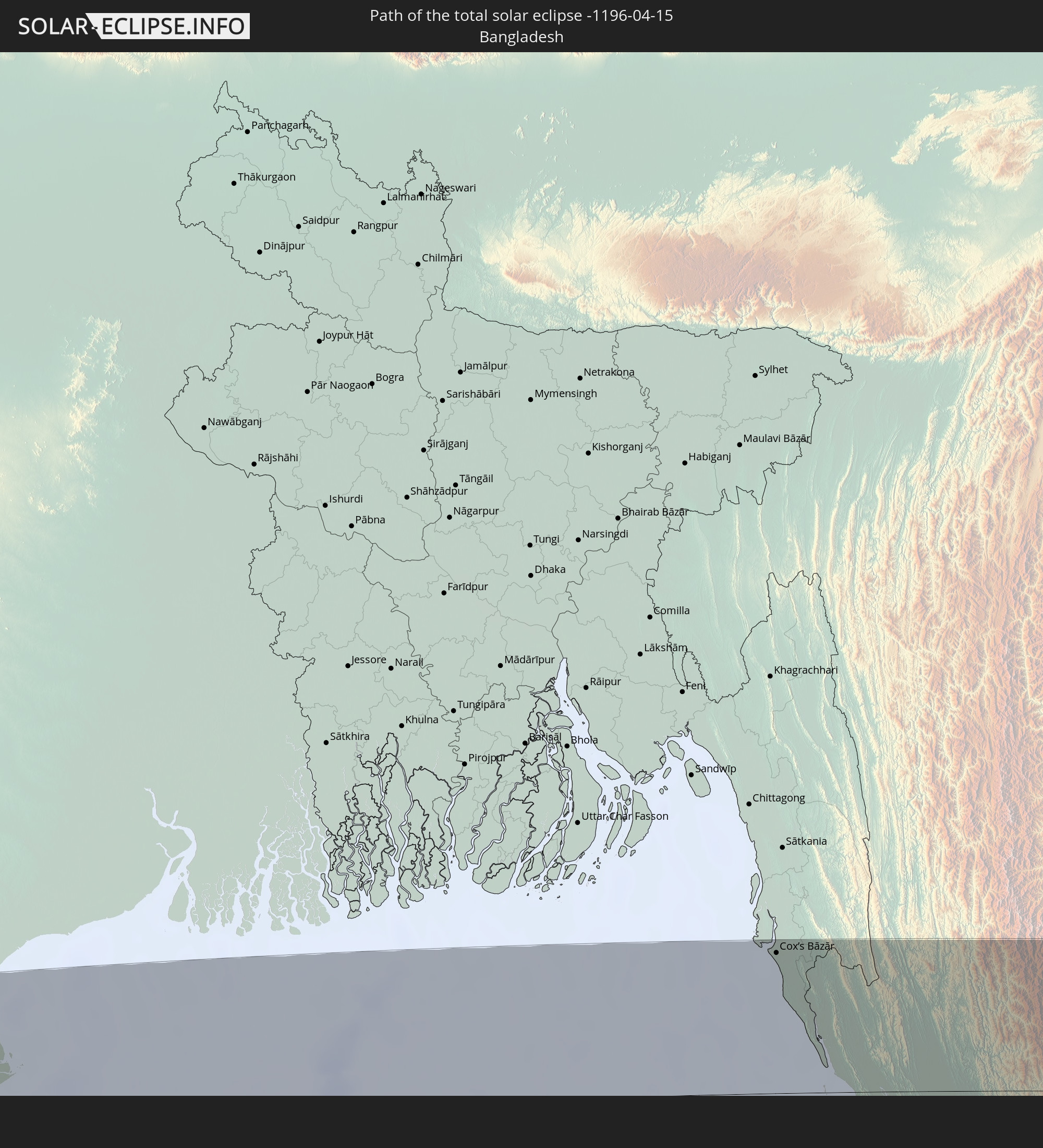
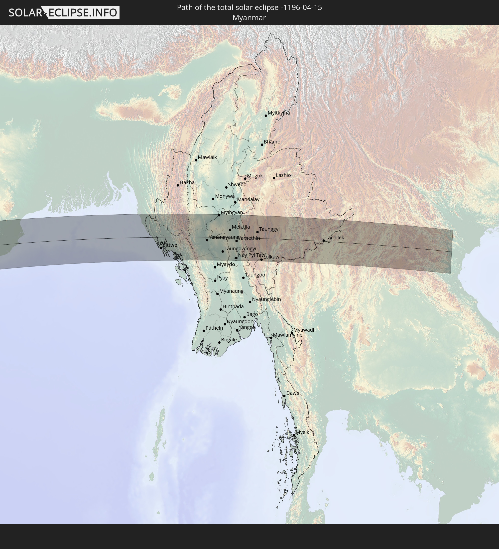
Detaillierte Länderkarten
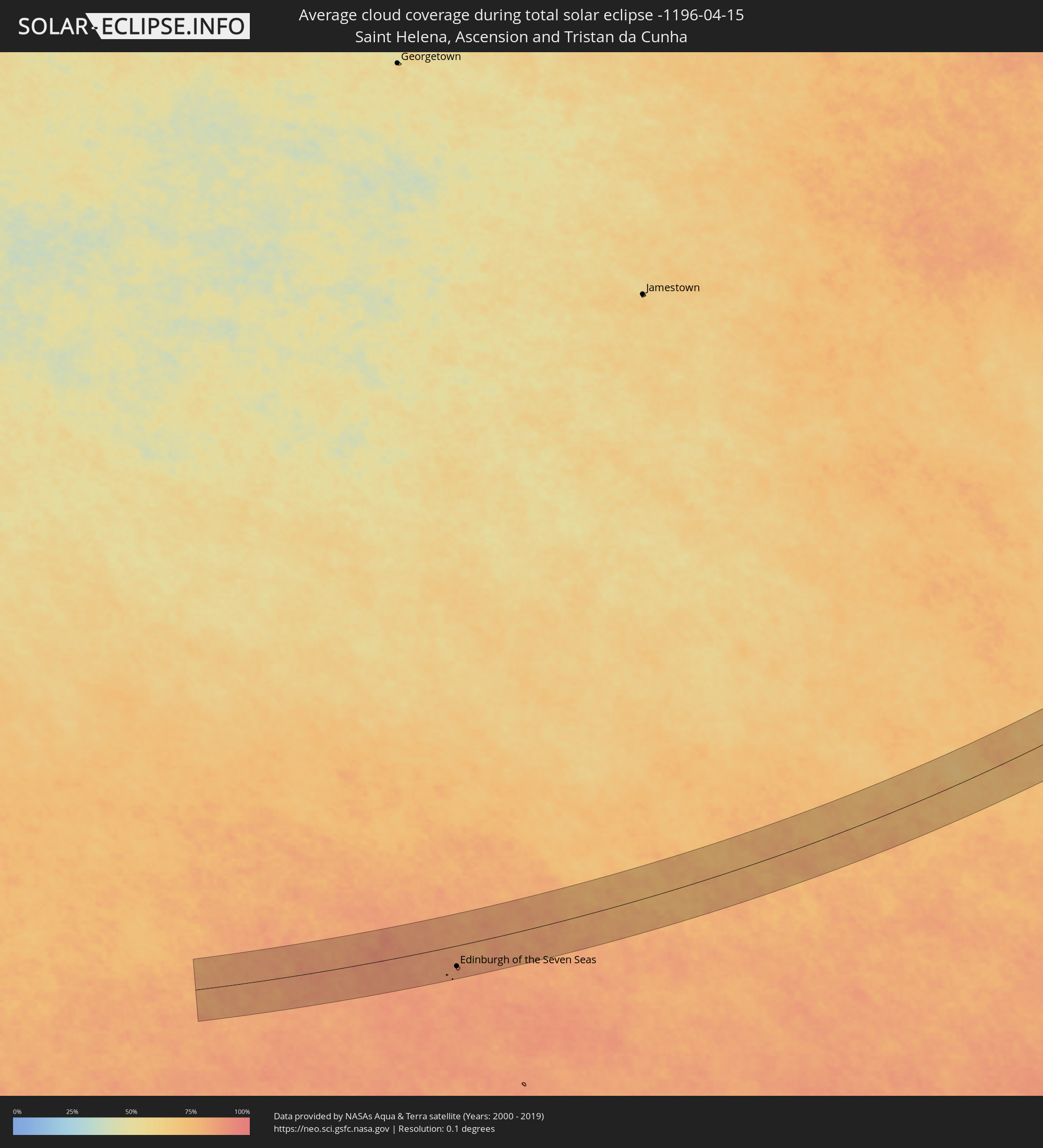 St. Helena
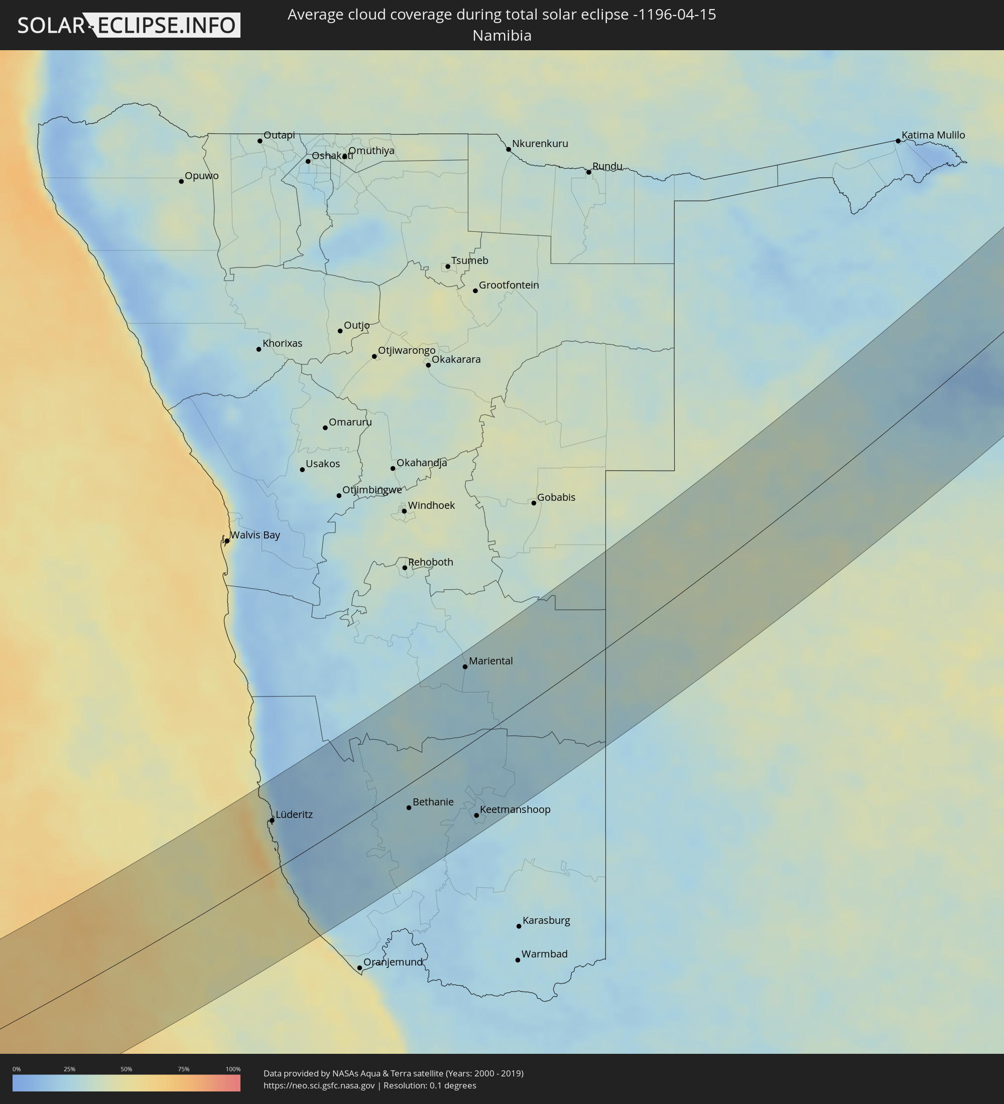 Namibia
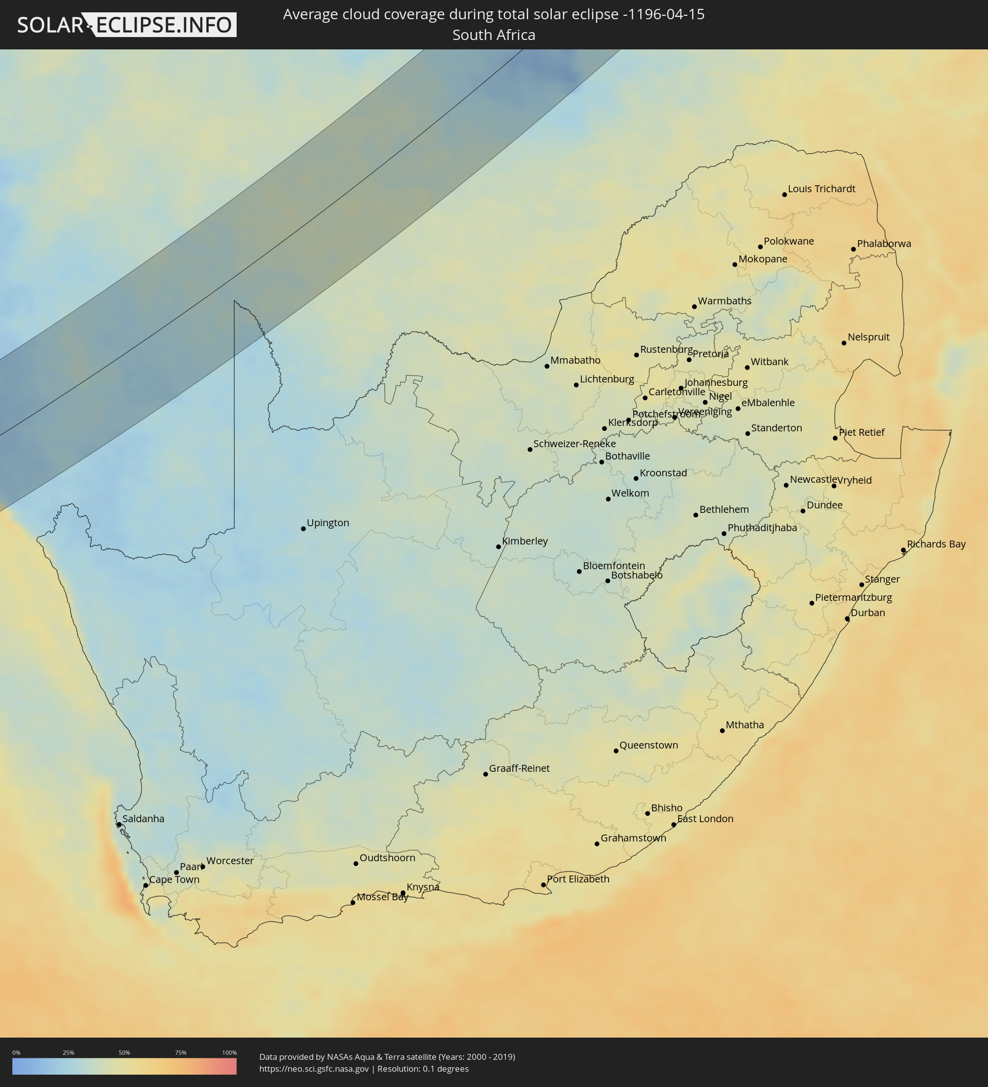 Südafrika
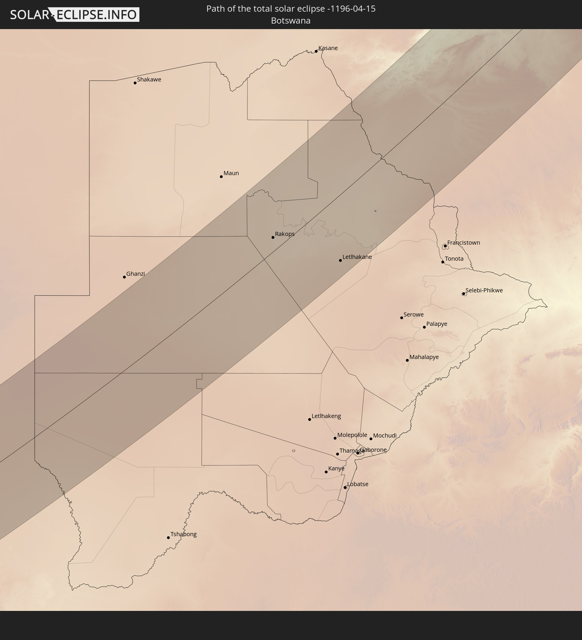
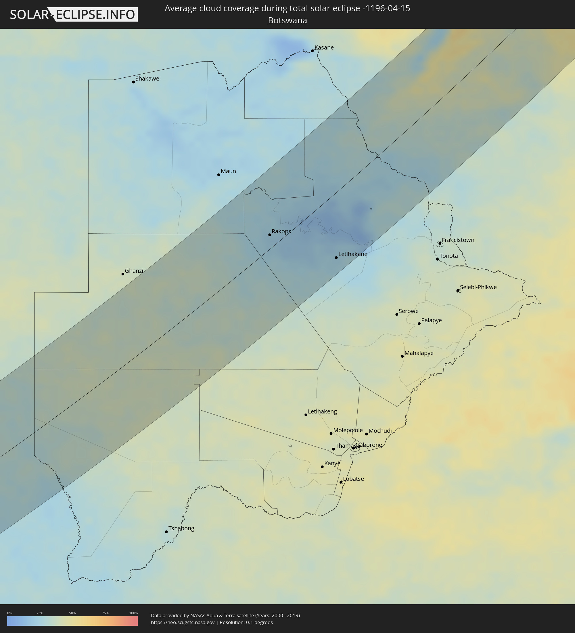 Botswana
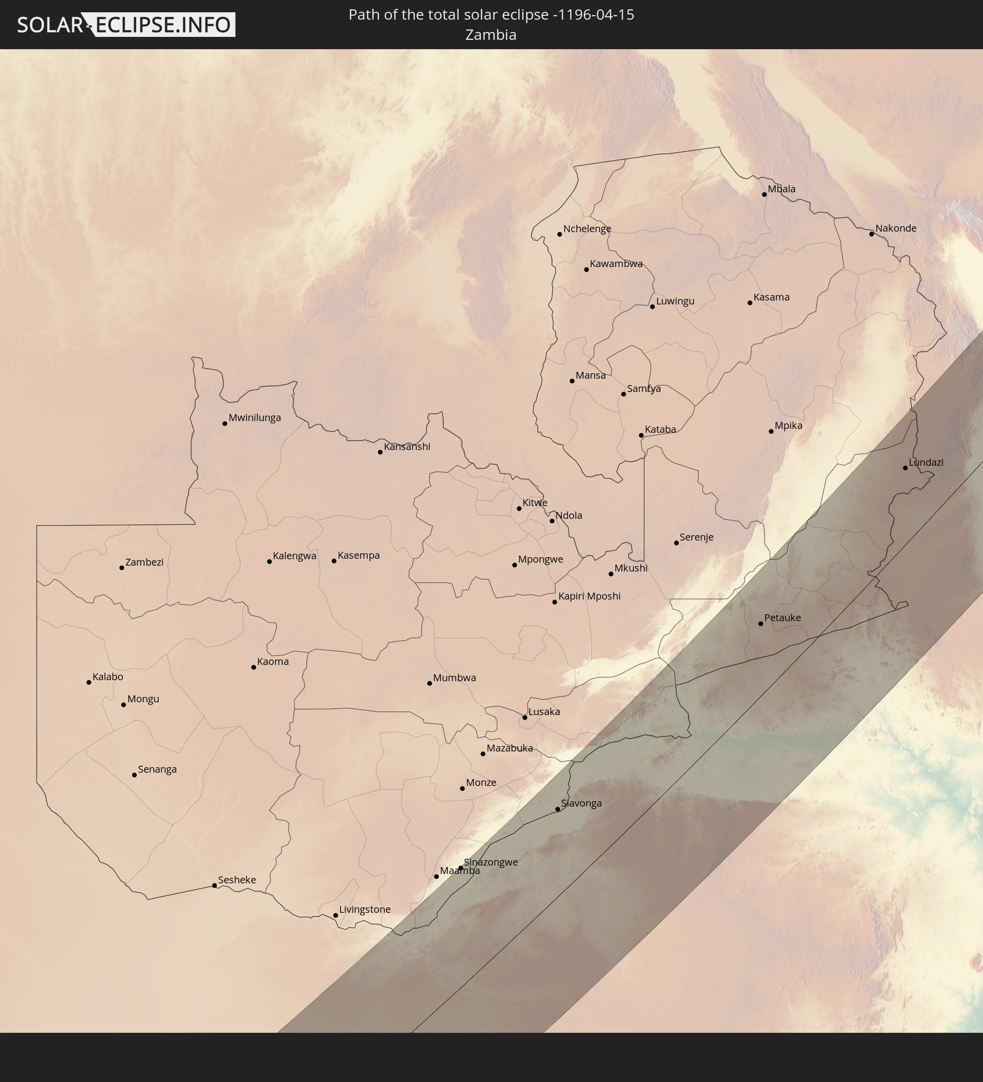
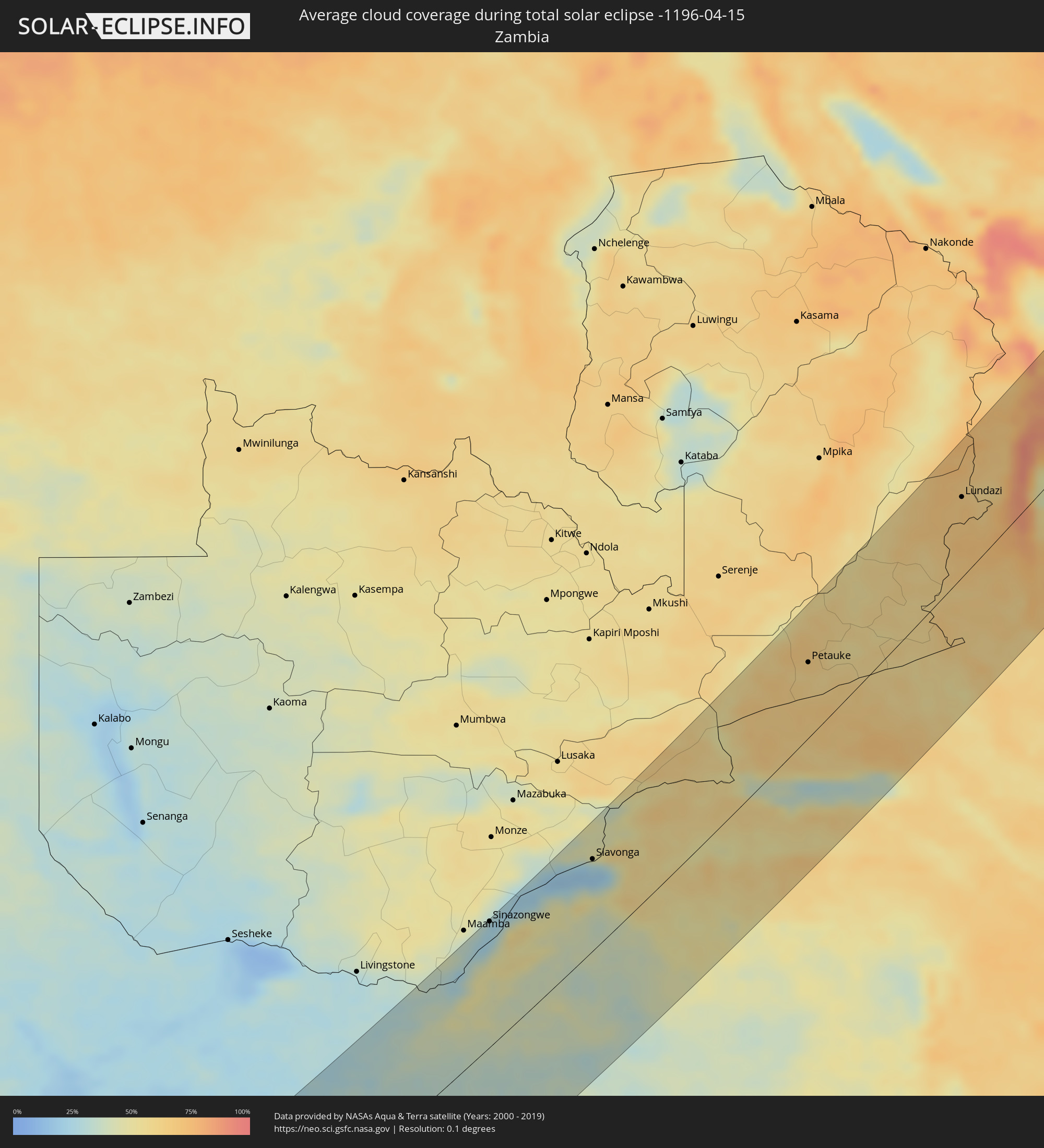 Sambia
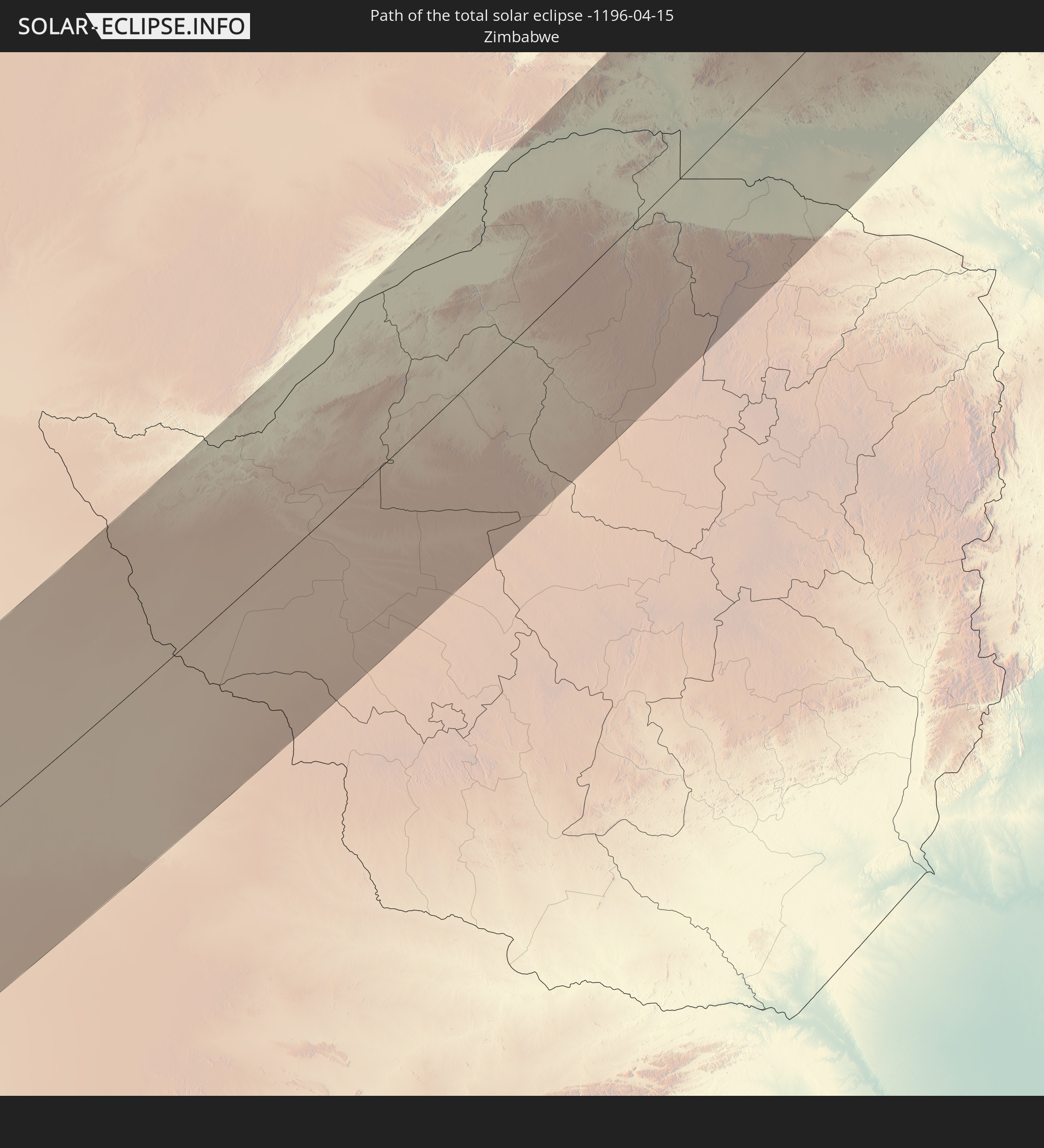
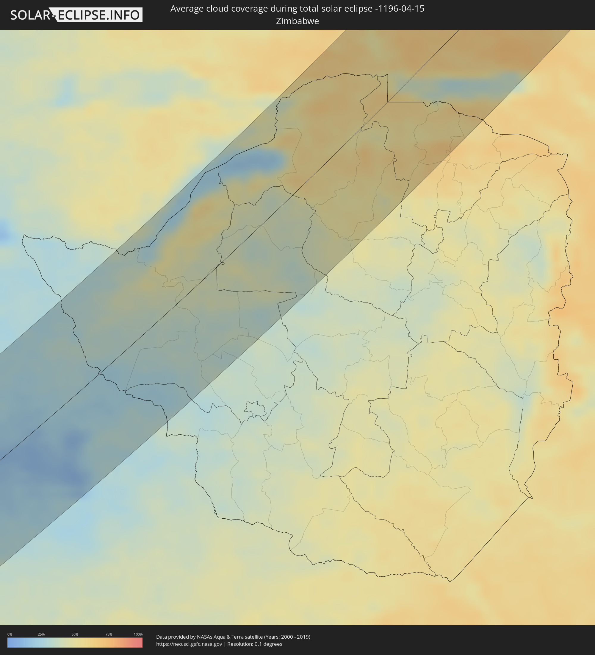 Simbabwe
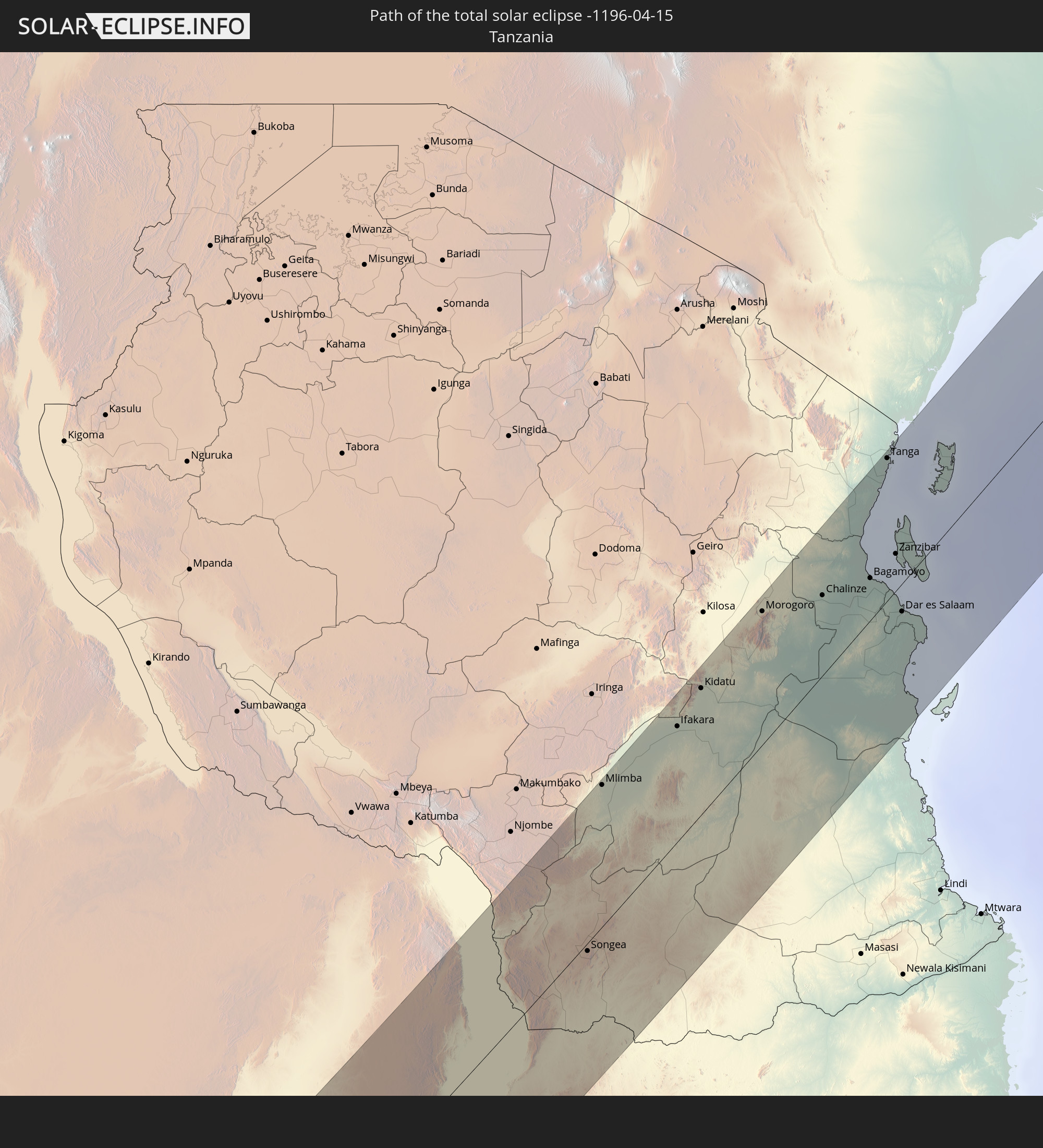
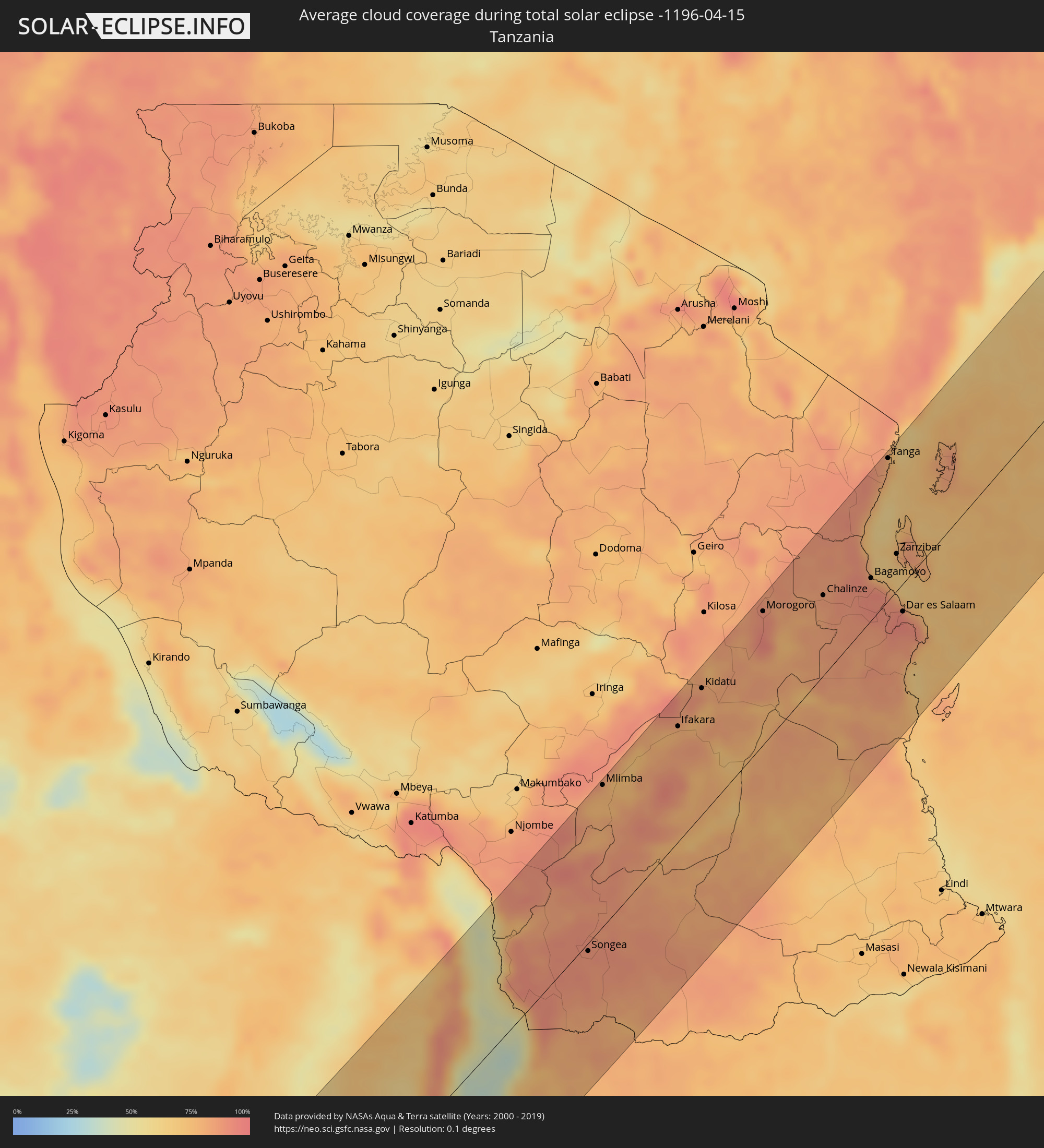 Tansania
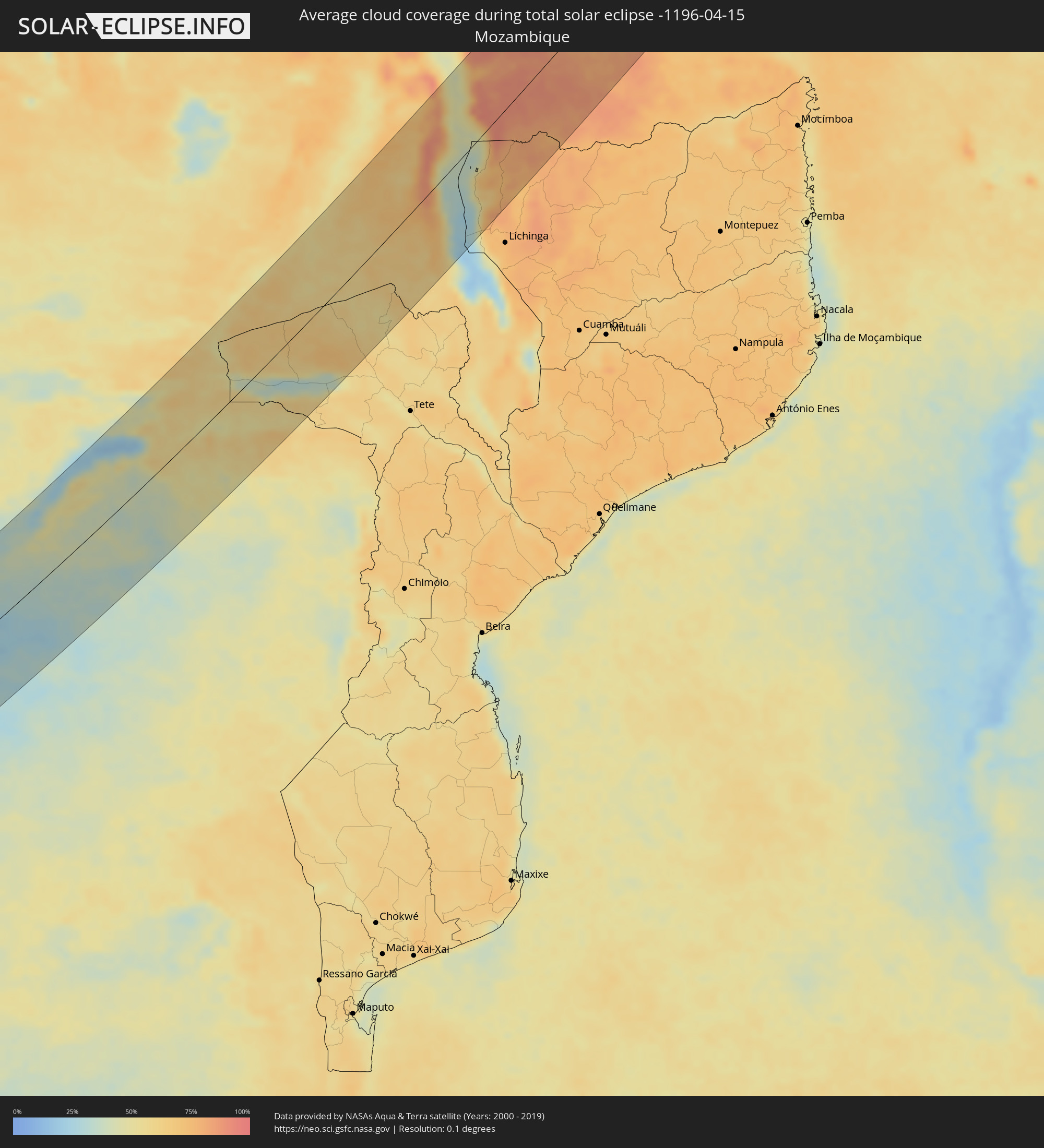 Mosambik
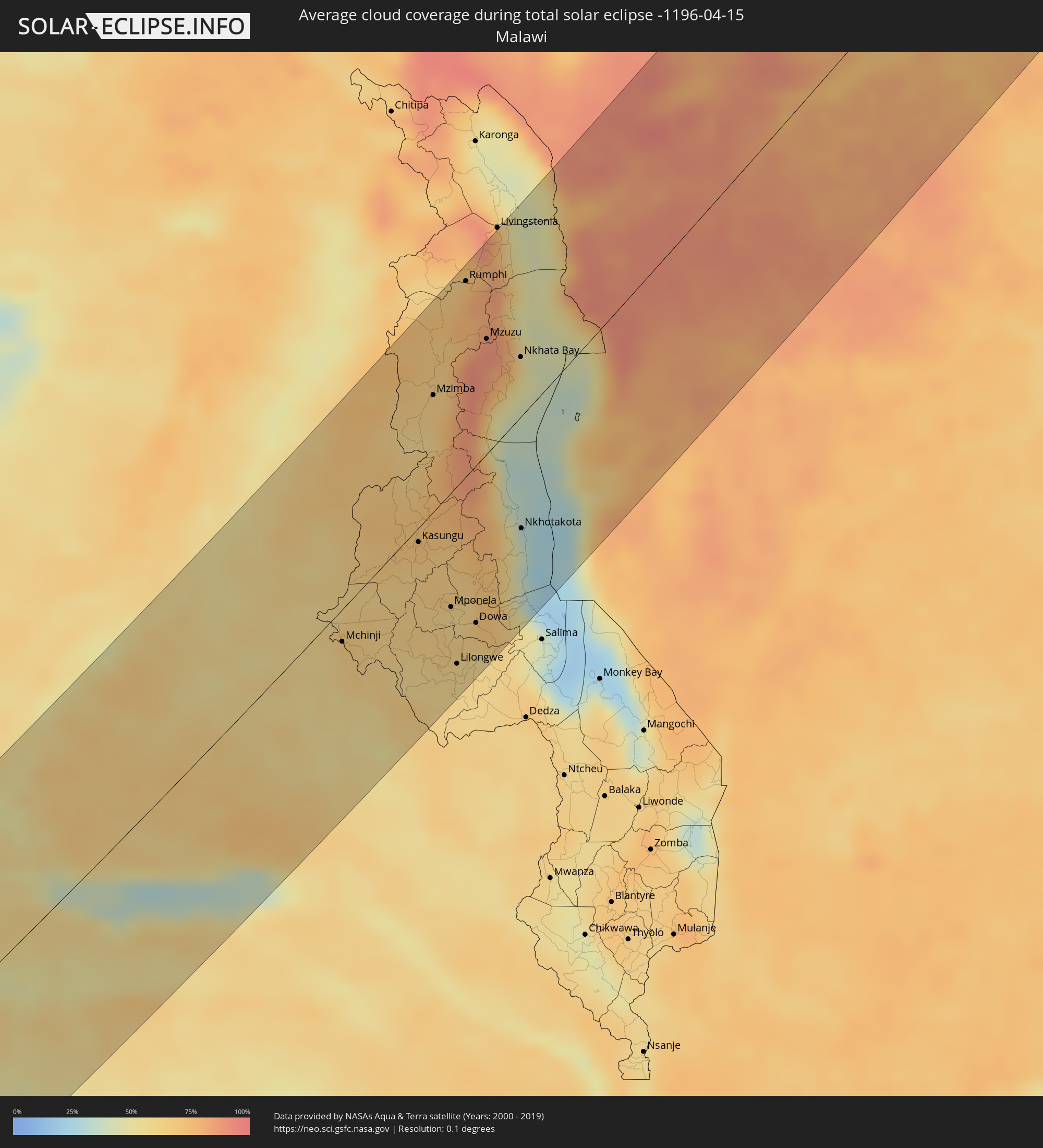 Malawi
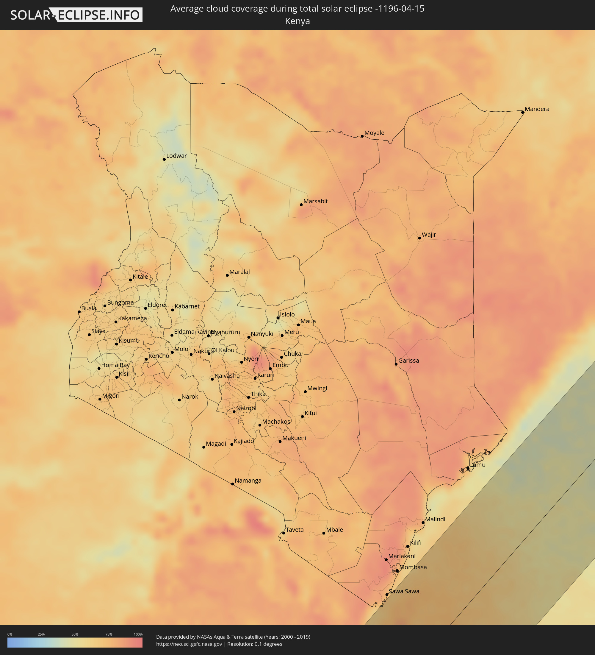 Kenia
Kenia
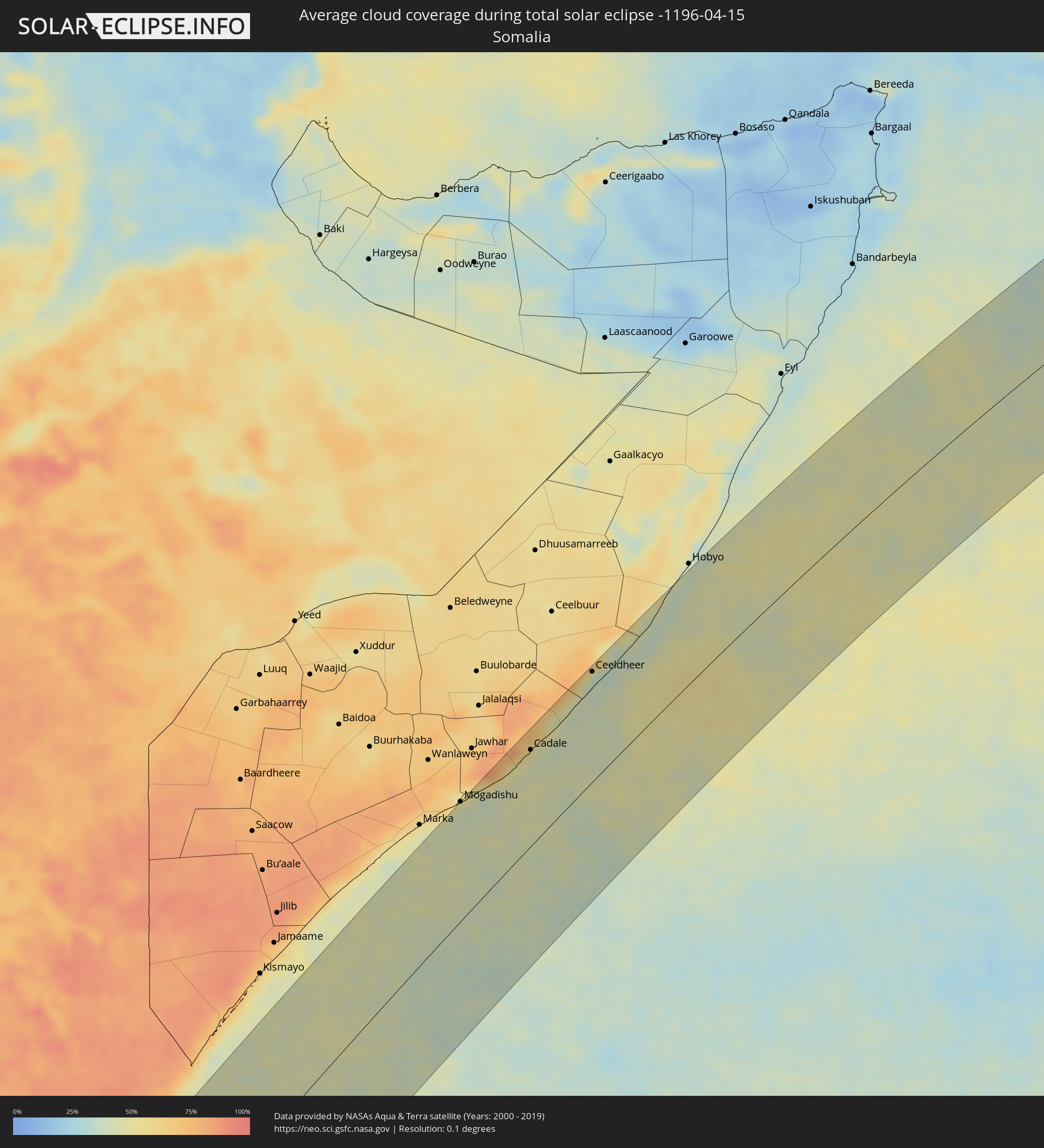 Somalia
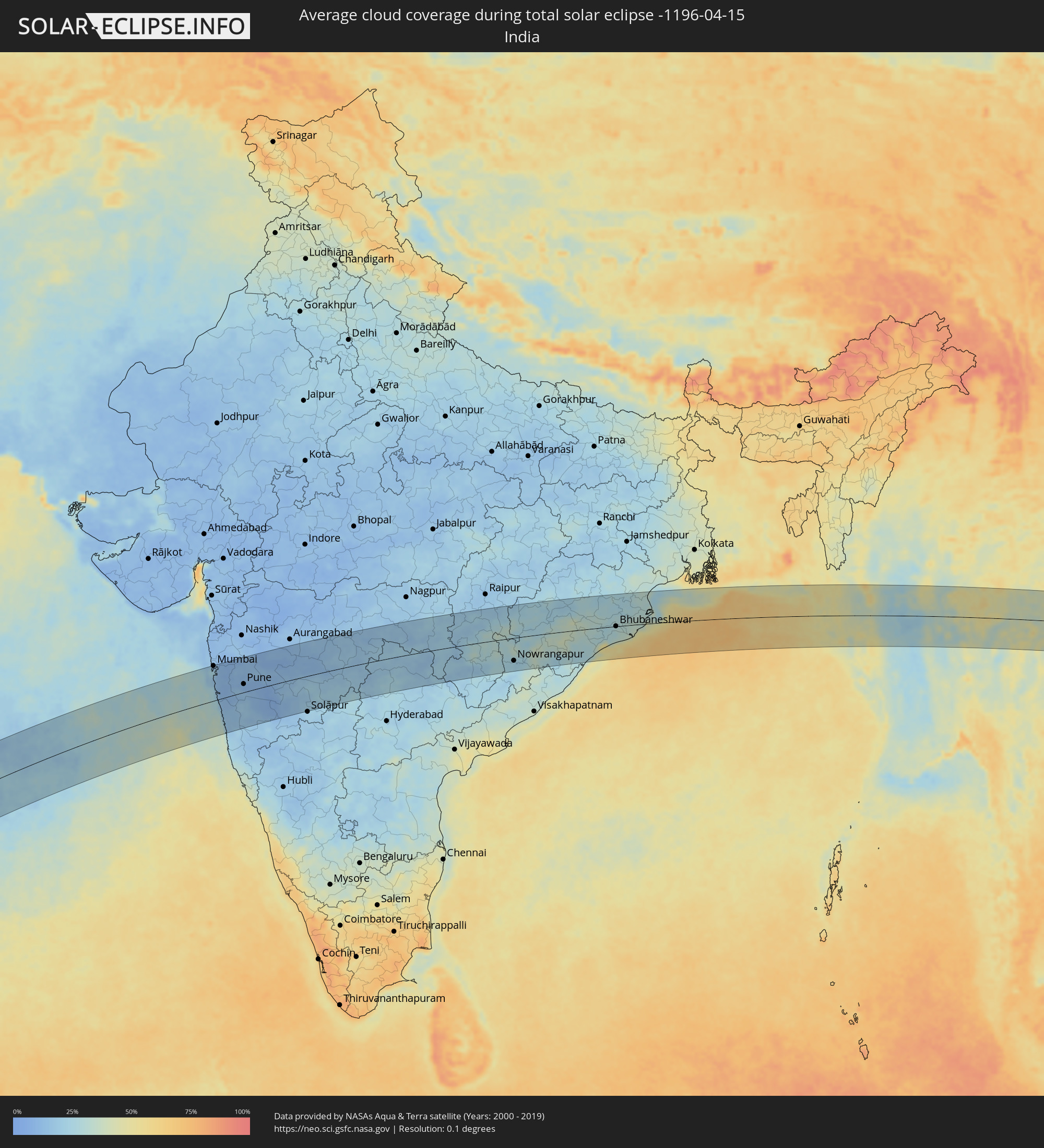 Indien
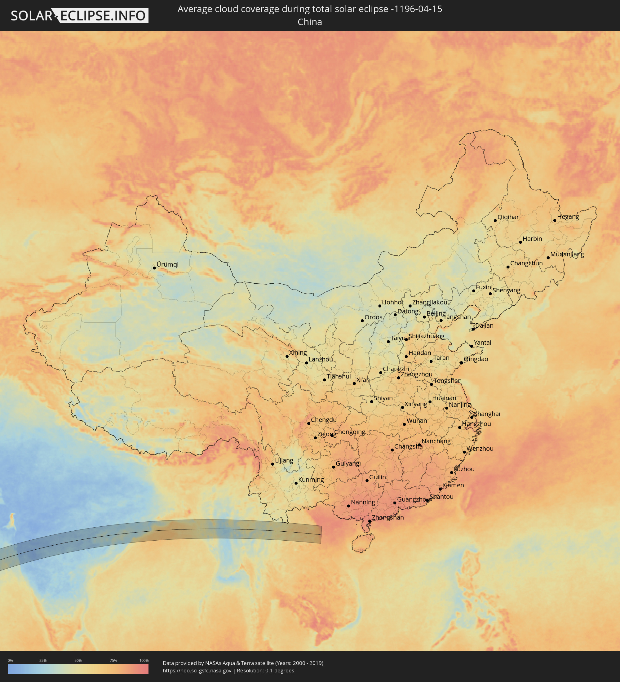 Volksrepublik China
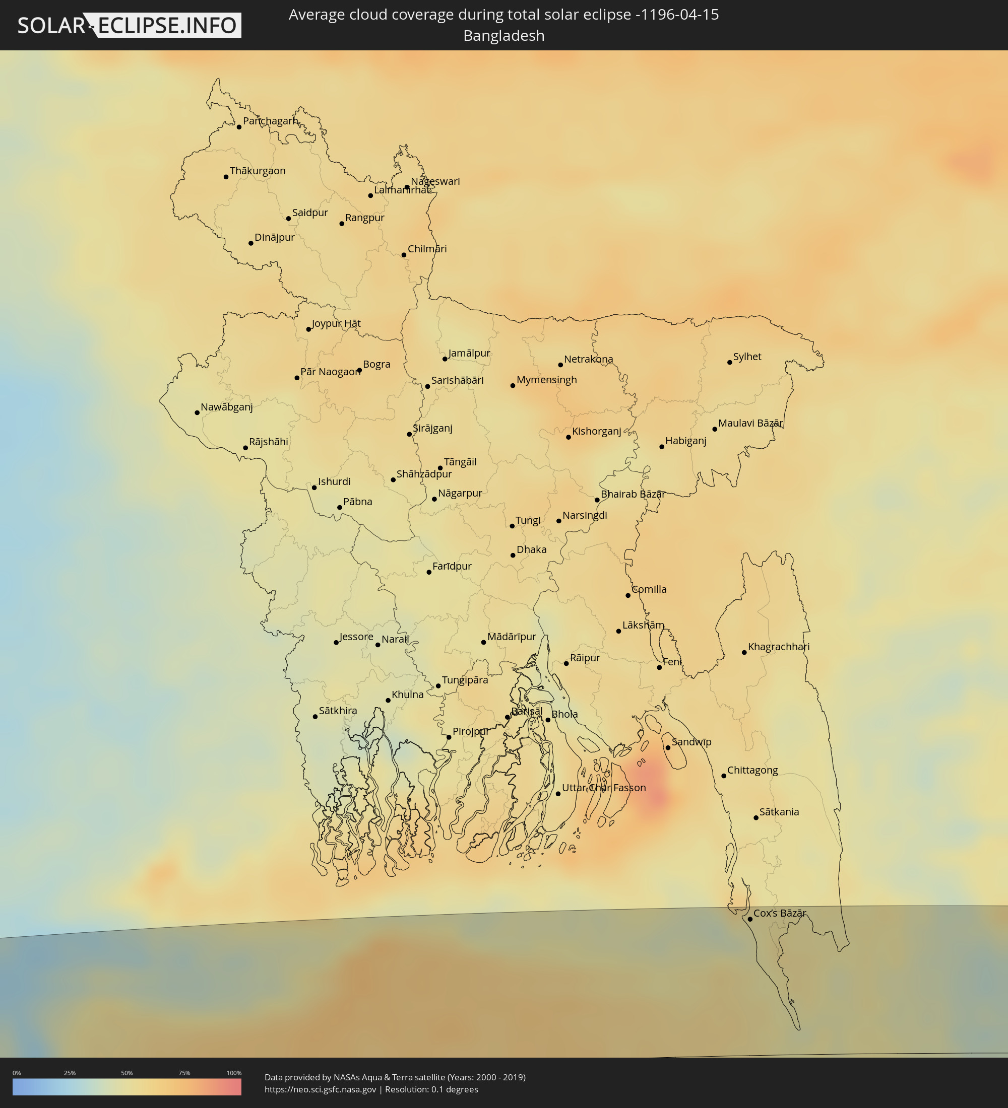 Bangladesch
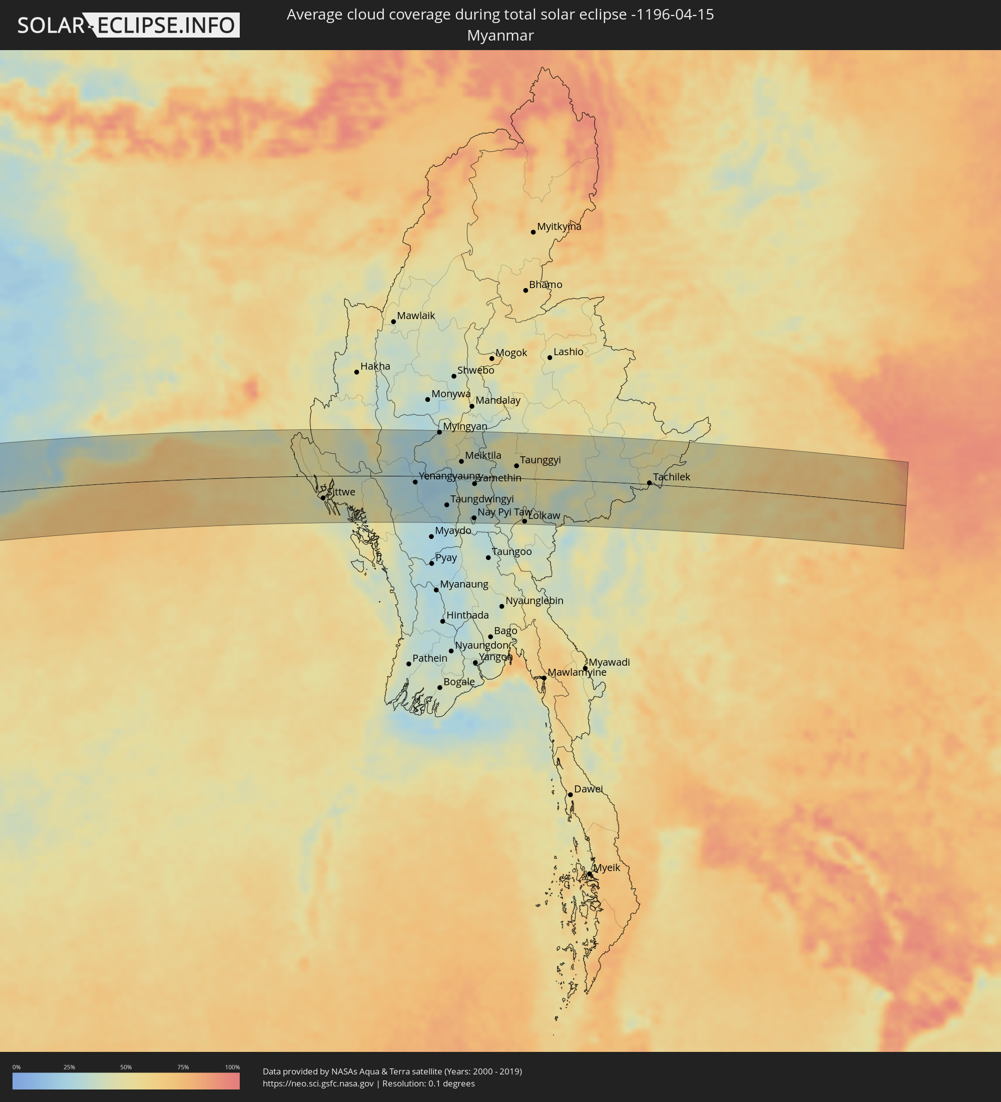 Myanmar
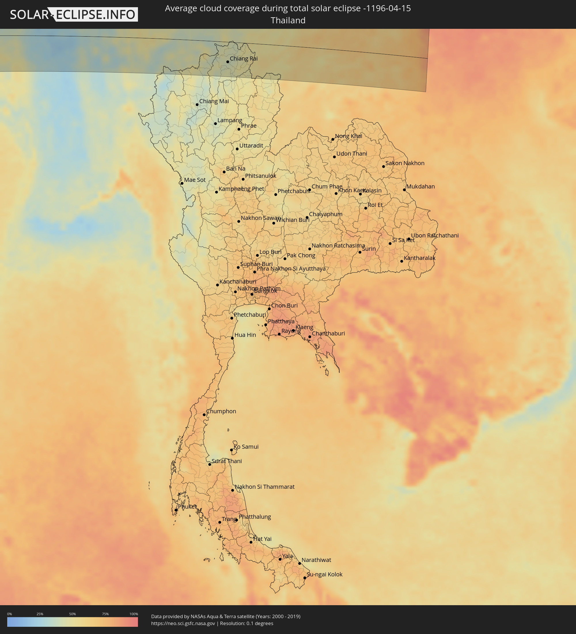 Thailand
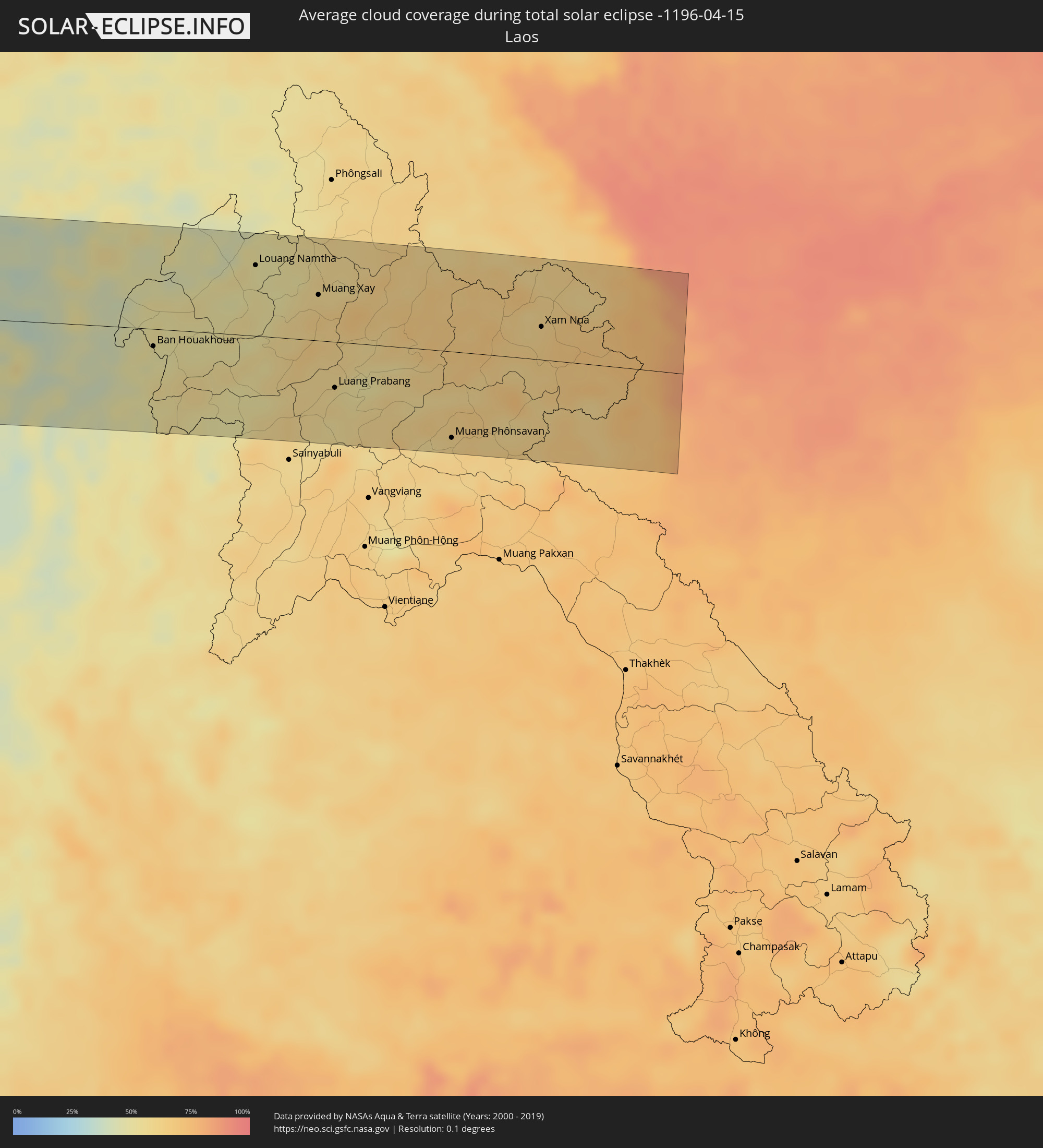 Laos
Laos
 Vietnam
Orte im Finsternispfad
Die nachfolgene Tabelle zeigt Städte und Orte mit mehr als 5.000 Einwohnern, die sich im Finsternispfad befinden. Städte mit mehr als 100.000 Einwohnern sind dick gekennzeichnet. Mit einem Klick auf den Ort öffnet sich eine Detailkarte die die Lage des jeweiligen Ortes zusammen mit dem Verlauf der zentralen Finsternis präsentiert.
| Ort | Typ | Dauer der Verfinsterung | Ortszeit bei maximaler Verfinsterung | Entfernung zur Zentrallinie | Ø Bewölkung |
|
Edinburgh of the Seven Seas, Tristan da Cunha
|
total | - | 07:29:35 UTC-00:16 | 64 km | 86% |
|
Lüderitz, Karas
|
total | - | 09:35:36 UTC+01:30 | 62 km | 21% |
|
Bethanie, Karas
|
total | - | 09:37:51 UTC+01:30 | 29 km | 27% |
|
Mariental, Hardap
|
total | - | 09:40:23 UTC+01:30 | 96 km | 25% |
|
Keetmanshoop, Karas
|
total | - | 09:38:51 UTC+01:30 | 93 km | 24% |
|
Rakops, Central
|
total | - | 10:32:39 UTC+02:10 | 20 km | 20% |
|
Orapa, Central
|
total | - | 10:33:41 UTC+02:10 | 72 km | 23% |
|
Letlhakane, Central
|
total | - | 10:33:51 UTC+02:10 | 96 km | 25% |
|
Sinazongwe, Southern
|
total | - | 10:42:12 UTC+02:10 | 118 km | 25% |
|
Siavonga, Southern
|
total | - | 10:45:11 UTC+02:10 | 85 km | 28% |
|
Petauke, Eastern
|
total | - | 10:52:58 UTC+02:10 | 69 km | 65% |
|
Mchinji, Central Region
|
total | - | 10:56:15 UTC+02:10 | 19 km | 64% |
|
Lundazi, Eastern
|
total | - | 10:59:23 UTC+02:10 | 72 km | 67% |
|
Kasungu, Central Region
|
total | - | 10:58:35 UTC+02:10 | 8 km | 68% |
|
Mzimba, Northern Region
|
total | - | 11:00:47 UTC+02:10 | 68 km | 64% |
|
Mponela, Central Region
|
total | - | 10:58:08 UTC+02:10 | 67 km | 60% |
|
Lilongwe, Central Region
|
total | - | 10:57:27 UTC+02:10 | 103 km | 58% |
|
Rumphi, Northern Region
|
total | - | 11:02:50 UTC+02:10 | 114 km | 76% |
|
Ntchisi, Central Region
|
total | - | 10:58:26 UTC+02:10 | 80 km | 65% |
|
Dowa, Central Region
|
total | - | 10:58:15 UTC+02:10 | 91 km | 63% |
|
Mzuzu, Northern Region
|
total | - | 11:02:17 UTC+02:10 | 67 km | 89% |
|
Nkhata Bay, Northern Region
|
total | - | 11:02:29 UTC+02:10 | 35 km | 56% |
|
Nkhotakota, Central Region
|
total | - | 11:00:07 UTC+02:10 | 65 km | 39% |
|
Songea, Ruvuma
|
total | - | 11:23:26 UTC+02:27 | 7 km | 89% |
|
Mlimba, Morogoro
|
total | - | 11:27:18 UTC+02:27 | 119 km | 78% |
|
Malinyi, Morogoro
|
total | - | 11:27:35 UTC+02:27 | 83 km | 78% |
|
Ifakara, Morogoro
|
total | - | 11:30:06 UTC+02:27 | 96 km | 80% |
|
Kidatu, Morogoro
|
total | - | 11:31:26 UTC+02:27 | 106 km | 81% |
|
Morogoro, Morogoro
|
total | - | 11:34:25 UTC+02:27 | 111 km | 90% |
|
Chalinze, Pwani
|
total | - | 11:36:01 UTC+02:27 | 67 km | 86% |
|
Mvomero, Pwani
|
total | - | 11:37:21 UTC+02:27 | 69 km | 91% |
|
Mlandizi, Pwani
|
total | - | 11:36:35 UTC+02:27 | 31 km | 90% |
|
Bagamoyo, Pwani
|
total | - | 11:37:24 UTC+02:27 | 35 km | 86% |
|
Kibiti, Pwani
|
total | - | 11:34:55 UTC+02:27 | 61 km | 85% |
|
Bungu, Pwani
|
total | - | 11:35:18 UTC+02:27 | 65 km | 84% |
|
Tanga, Tanga
|
total | - | 11:40:31 UTC+02:27 | 119 km | 76% |
|
Zanzibar, Zanzibar Urban/West
|
total | - | 11:38:29 UTC+02:27 | 31 km | 67% |
|
Mkuranga, Pwani
|
total | - | 11:36:36 UTC+02:27 | 40 km | 87% |
|
Dar es Salaam, Dar es Salaam
|
total | - | 11:37:18 UTC+02:27 | 23 km | 90% |
|
Mogadishu, Banaadir
|
total | - | 12:06:37 UTC+02:27 | 127 km | 46% |
|
Cadale, Middle Shabele
|
total | - | 12:09:55 UTC+02:27 | 103 km | 56% |
|
Ceeldheer, Galguduud
|
total | - | 12:13:42 UTC+02:27 | 120 km | 35% |
|
Mumbai, Maharashtra
|
total | - | 16:10:48 UTC+05:21 | 114 km | 18% |
|
Panvel, Maharashtra
|
total | - | 16:11:00 UTC+05:21 | 98 km | 11% |
|
Pune, Maharashtra
|
total | - | 16:11:27 UTC+05:21 | 27 km | 9% |
|
Ahmadnagar, Maharashtra
|
total | - | 16:12:50 UTC+05:21 | 65 km | 11% |
|
Latur, Maharashtra
|
total | - | 16:14:12 UTC+05:21 | 56 km | 21% |
|
Parbhani, Maharashtra
|
total | - | 16:15:00 UTC+05:21 | 34 km | 16% |
|
Nanded, Maharashtra
|
total | - | 16:15:28 UTC+05:21 | 10 km | 16% |
|
Nizāmābād, Telangana
|
total | - | 16:15:53 UTC+05:21 | 60 km | 20% |
|
Karīmnagar, Telangana
|
total | - | 16:16:42 UTC+05:21 | 106 km | 22% |
|
Chānda, Maharashtra
|
total | - | 16:17:45 UTC+05:21 | 56 km | 14% |
|
Rāmgundam, Telangana
|
total | - | 16:17:13 UTC+05:21 | 72 km | 18% |
|
Nowrangapur, Odisha
|
total | - | 16:20:02 UTC+05:21 | 76 km | 23% |
|
Brahmapur, Odisha
|
total | - | 16:21:44 UTC+05:21 | 96 km | 30% |
|
Puri, Odisha
|
total | - | 16:22:39 UTC+05:21 | 52 km | 48% |
|
Bhubaneshwar, Odisha
|
total | - | 16:22:52 UTC+05:21 | 0 km | 30% |
|
Cuttack, Odisha
|
total | - | 16:22:58 UTC+05:21 | 21 km | 31% |
|
Cox’s Bāzār, Chittagong
|
total | - | 16:58:40 UTC+05:53 | 95 km | 45% |
|
Teknāf, Chittagong
|
total | - | 16:58:37 UTC+05:53 | 30 km | 46% |
|
Sittwe, Rakhine
|
total | - | 17:30:06 UTC+06:24 | 50 km | 44% |
|
Chauk, Magway
|
total | - | 17:31:01 UTC+06:24 | 34 km | 26% |
|
Yenangyaung, Magway
|
total | - | 17:30:55 UTC+06:24 | 14 km | 26% |
|
Minbu, Magway
|
total | - | 17:30:50 UTC+06:24 | 46 km | 25% |
|
Magway, Magway
|
total | - | 17:30:50 UTC+06:24 | 50 km | 26% |
|
Pakokku, Magway
|
total | - | 17:31:13 UTC+06:24 | 83 km | 35% |
|
Myingyan, Mandalay
|
total | - | 17:31:20 UTC+06:24 | 97 km | 36% |
|
Taungdwingyi, Magway
|
total | - | 17:31:00 UTC+06:24 | 65 km | 28% |
|
Meiktila, Mandalay
|
total | - | 17:31:20 UTC+06:24 | 33 km | 36% |
|
Nay Pyi Taw, Nay Pyi Taw
|
total | - | 17:31:06 UTC+06:24 | 92 km | 31% |
|
Yamethin, Mandalay
|
total | - | 17:31:18 UTC+06:24 | 16 km | 38% |
|
Pyinmana, Nay Pyi Taw
|
total | - | 17:31:07 UTC+06:24 | 93 km | 30% |
|
Taunggyi, Shan
|
total | - | 17:31:38 UTC+06:24 | 26 km | 44% |
|
Loikaw, Kayah
|
total | - | 17:31:23 UTC+06:24 | 97 km | 42% |
|
Fang, Chiang Mai
|
total | - | 17:49:12 UTC+06:42 | 61 km | 42% |
|
Chiang Rai, Chiang Rai
|
total | - | 17:49:19 UTC+06:42 | 58 km | 40% |
|
Mae Chan, Chiang Rai
|
total | - | 17:49:23 UTC+06:42 | 32 km | 42% |
|
Mae Sai, Chiang Rai
|
total | - | 17:49:27 UTC+06:42 | 1 km | 44% |
|
Tachilek, Shan
|
total | - | 17:49:27 UTC+06:42 | 2 km | 44% |
|
Chiang Saen, Chiang Rai
|
total | - | 17:49:27 UTC+06:42 | 16 km | 42% |
|
Chiang Kham, Phayao
|
total | - | 17:49:18 UTC+06:42 | 98 km | 48% |
|
Chiang Khong, Chiang Rai
|
total | - | 17:49:30 UTC+06:42 | 15 km | 50% |
|
Ban Houayxay, Bokeo Province
|
total | - | 17:49:30 UTC+06:42 | 14 km | 50% |
|
Ban Houakhoua, Bokeo Province
|
total | - | 17:49:30 UTC+06:42 | 17 km | 49% |
|
Louang Namtha, Loungnamtha
|
total | - | 17:49:47 UTC+06:42 | 68 km | 52% |
|
Muang Xay, Oudômxai
|
total | - | 17:49:48 UTC+06:42 | 44 km | 62% |
|
Luang Prabang, Louangphabang
|
total | - | 17:49:39 UTC+06:42 | 44 km | 56% |
|
Muang Phônsavan, Xiangkhoang
|
total | - | 17:49:40 UTC+06:42 | 83 km | 61% |
|
Xam Nua, Houaphan
|
total | - | 17:49:55 UTC+06:42 | 32 km | 63% |
|
Thành Phố Hòa Bình, Hòa Bình
|
total | - | 18:14:38 UTC+07:06 | 89 km | 84% |