Totale Sonnenfinsternis vom 01.04.-1409
| Wochentag: | Mittwoch |
| Maximale Dauer der Verfinsterung: | 06m09s |
| Maximale Breite des Finsternispfades: | 227 km |
| Saroszyklus: | 26 |
| Bedeckungsgrad: | 100% |
| Magnitude: | 1.069 |
| Gamma: | -0.1337 |
Wo kann man die Sonnenfinsternis vom 01.04.-1409 sehen?
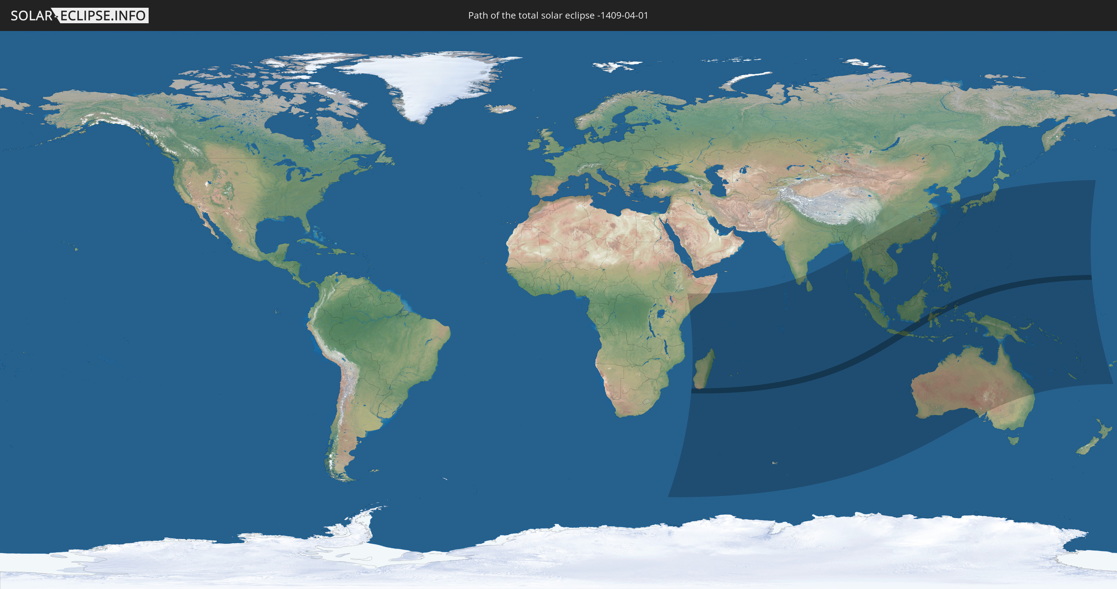
Die Sonnenfinsternis am 01.04.-1409 kann man in 47 Ländern als partielle Sonnenfinsternis beobachten.
Der Finsternispfad verläuft durch 6 Länder. Nur in diesen Ländern ist sie als totale Sonnenfinsternis zu sehen.
In den folgenden Ländern ist die Sonnenfinsternis total zu sehen
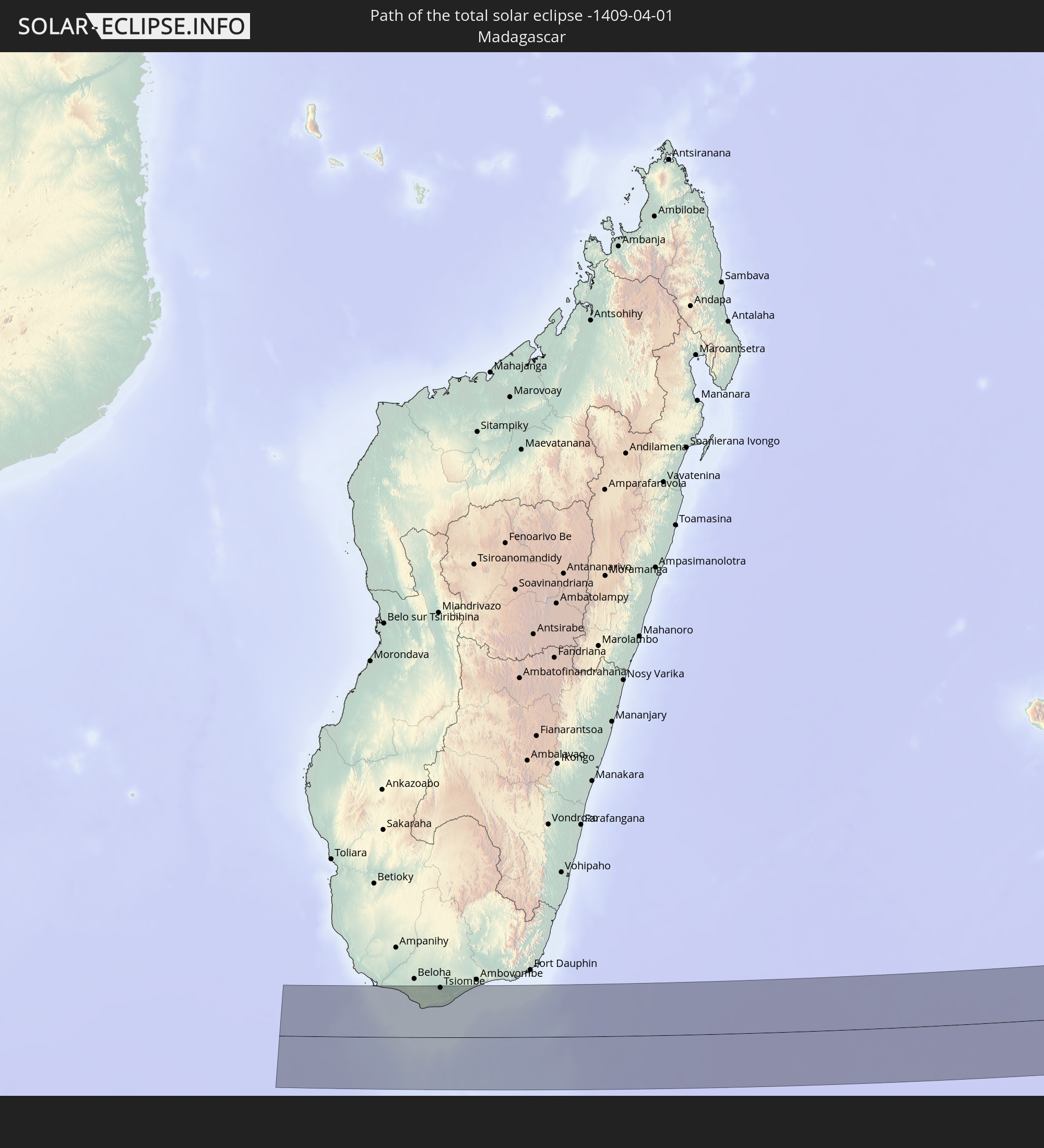 Madagaskar
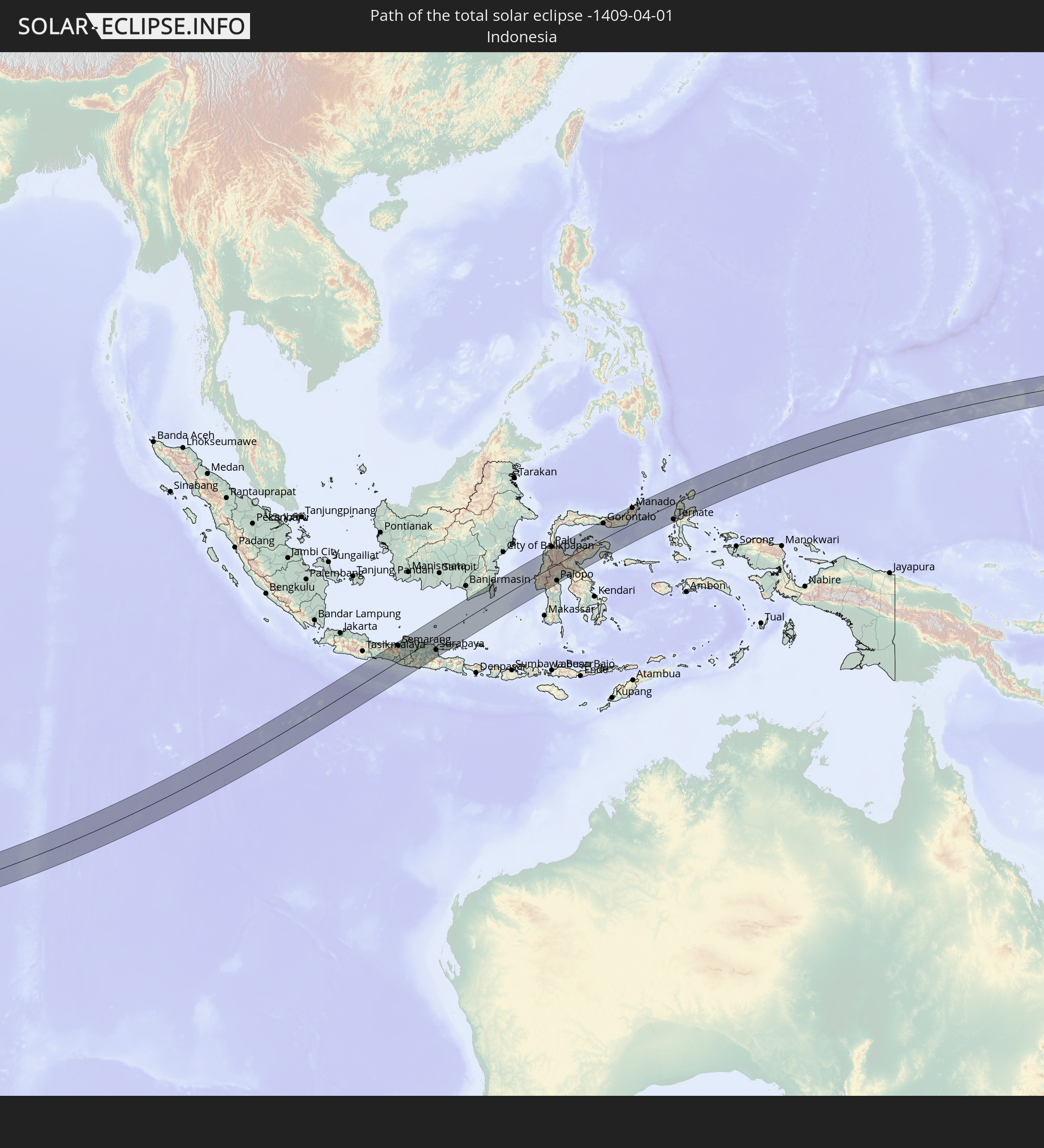 Indonesien
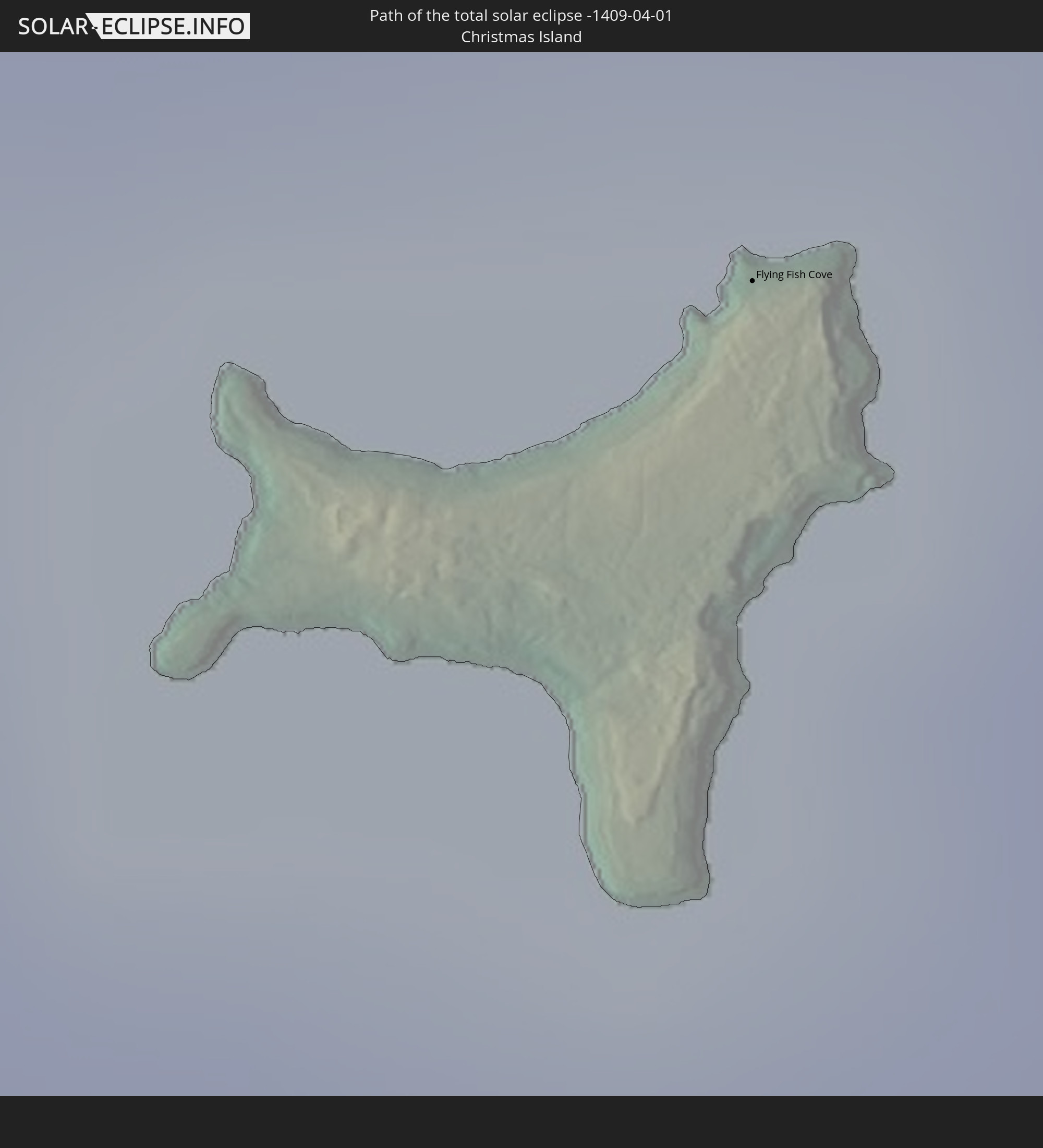 Weihnachtsinsel
 Palau
Palau
 Föderierte Staaten von Mikronesien
 Marshallinseln
In den folgenden Ländern ist die Sonnenfinsternis partiell zu sehen
 United States Minor Outlying Islands
 Kiribati
 Äthiopien
 Kenia
Kenia
 Französische Süd- und Antarktisgebiete
 Somalia
 Madagaskar
 Komoren
 Mayotte
 Seychellen
 Réunion
 Mauritius
 Indien
 Britisches Territorium im Indischen Ozean
 Heard und McDonaldinseln
 Malediven
 Volksrepublik China
 Sri Lanka
 Myanmar
 Indonesien
 Kokosinseln
 Thailand
 Malaysia
 Laos
Laos
 Vietnam
 Kambodscha
 Singapur
 Weihnachtsinsel
 Australien
 Macau
Macau
 Hongkong
 Brunei
 Taiwan
 Philippinen
 Japan
Japan
 Osttimor
 Südkorea
 Palau
Palau
 Föderierte Staaten von Mikronesien
 Papua-Neuguinea
 Guam
Guam
 Nördliche Marianen
 Salomonen
 Neukaledonien
 Marshallinseln
 Vanuatu
 Nauru
Nauru
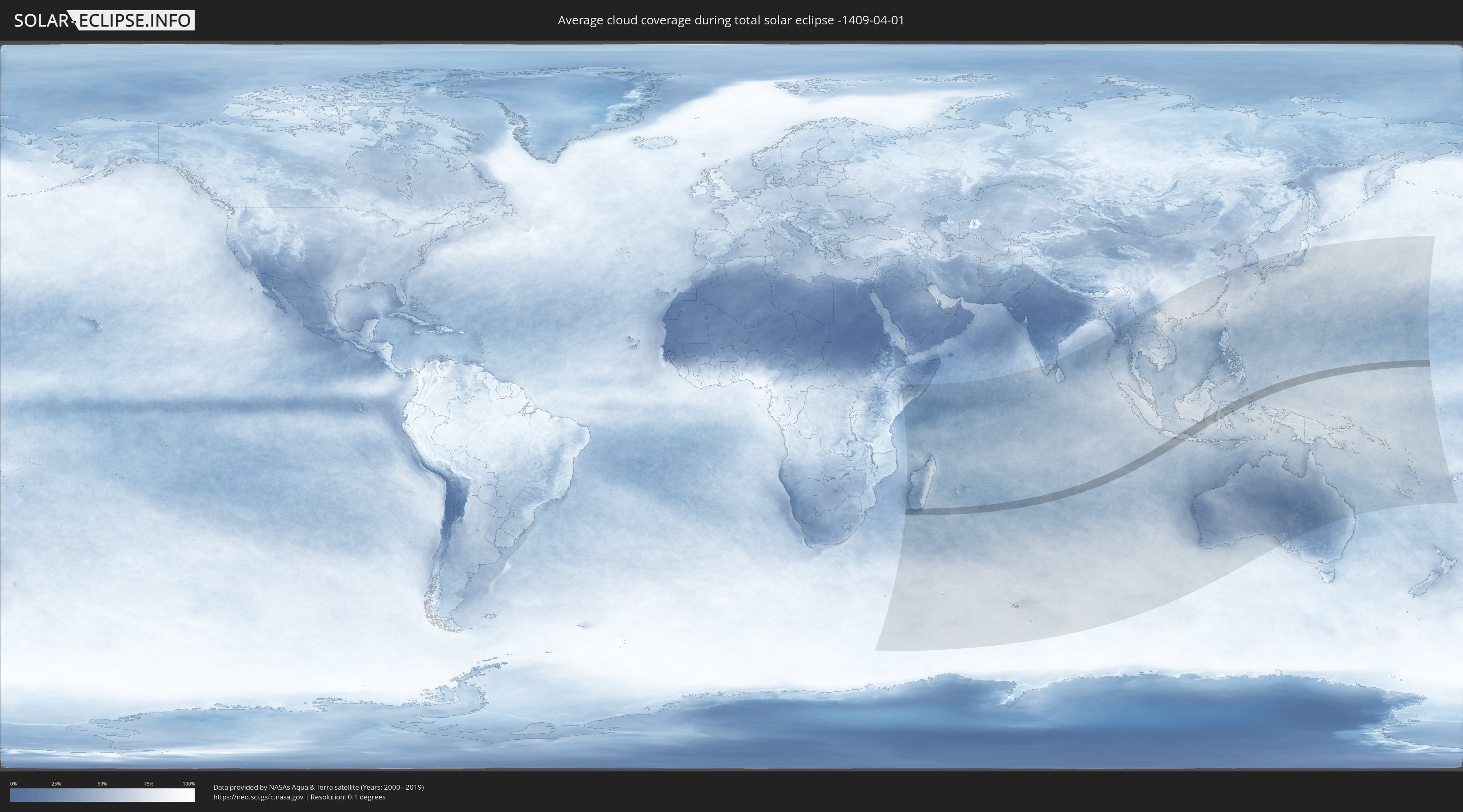
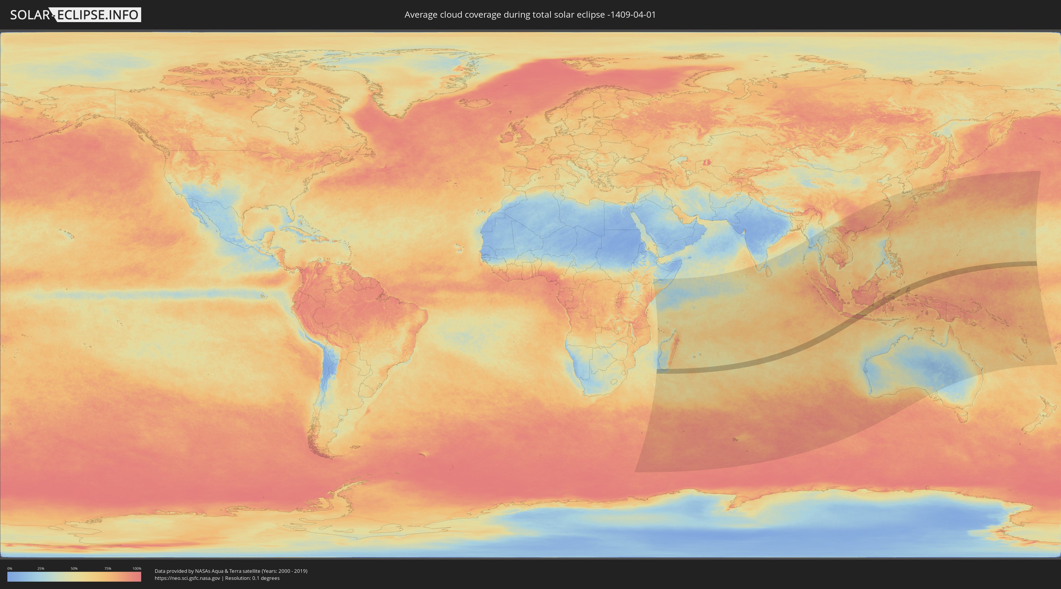
Wie wird das Wetter während der totalen Sonnenfinsternis am 01.04.-1409?
Wo ist der beste Ort, um die totale Sonnenfinsternis vom 01.04.-1409 zu beobachten?
Die folgenden Karten zeigen die durchschnittliche Bewölkung für den Tag, an dem die totale Sonnenfinsternis
stattfindet. Mit Hilfe der Karten lässt sich der Ort entlang des Finsternispfades eingrenzen,
der die besten Aussichen auf einen klaren wolkenfreien Himmel bietet.
Trotzdem muss man immer lokale Gegenenheiten beachten und sollte sich genau über das Wetter an seinem
gewählten Beobachtungsort informieren.
Die Daten stammen von den beiden NASA-Satelliten
AQUA und TERRA
und wurden über einen Zeitraum von 19 Jahren (2000 - 2019) gemittelt.
Detaillierte Länderkarten
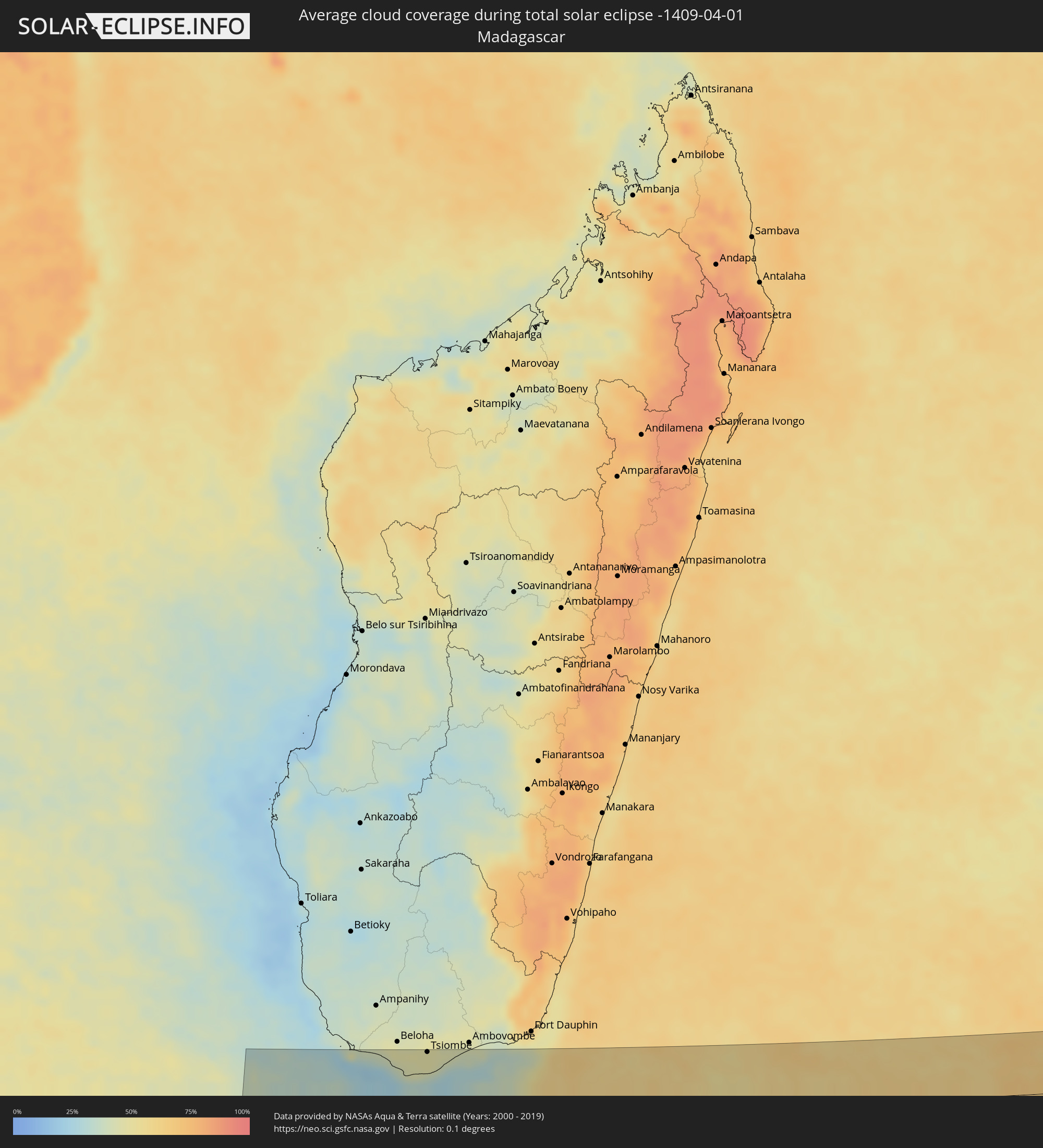 Madagaskar
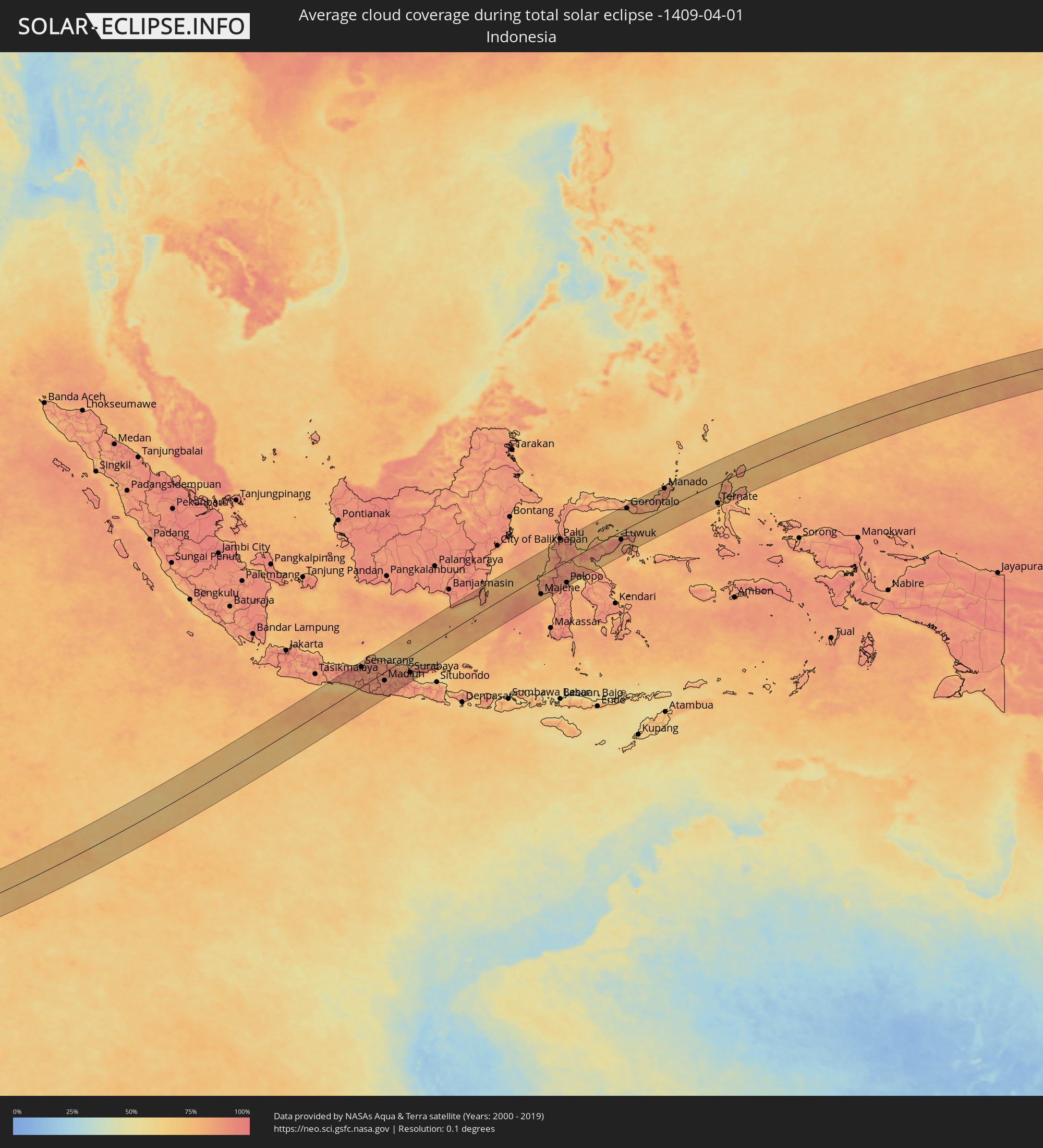 Indonesien
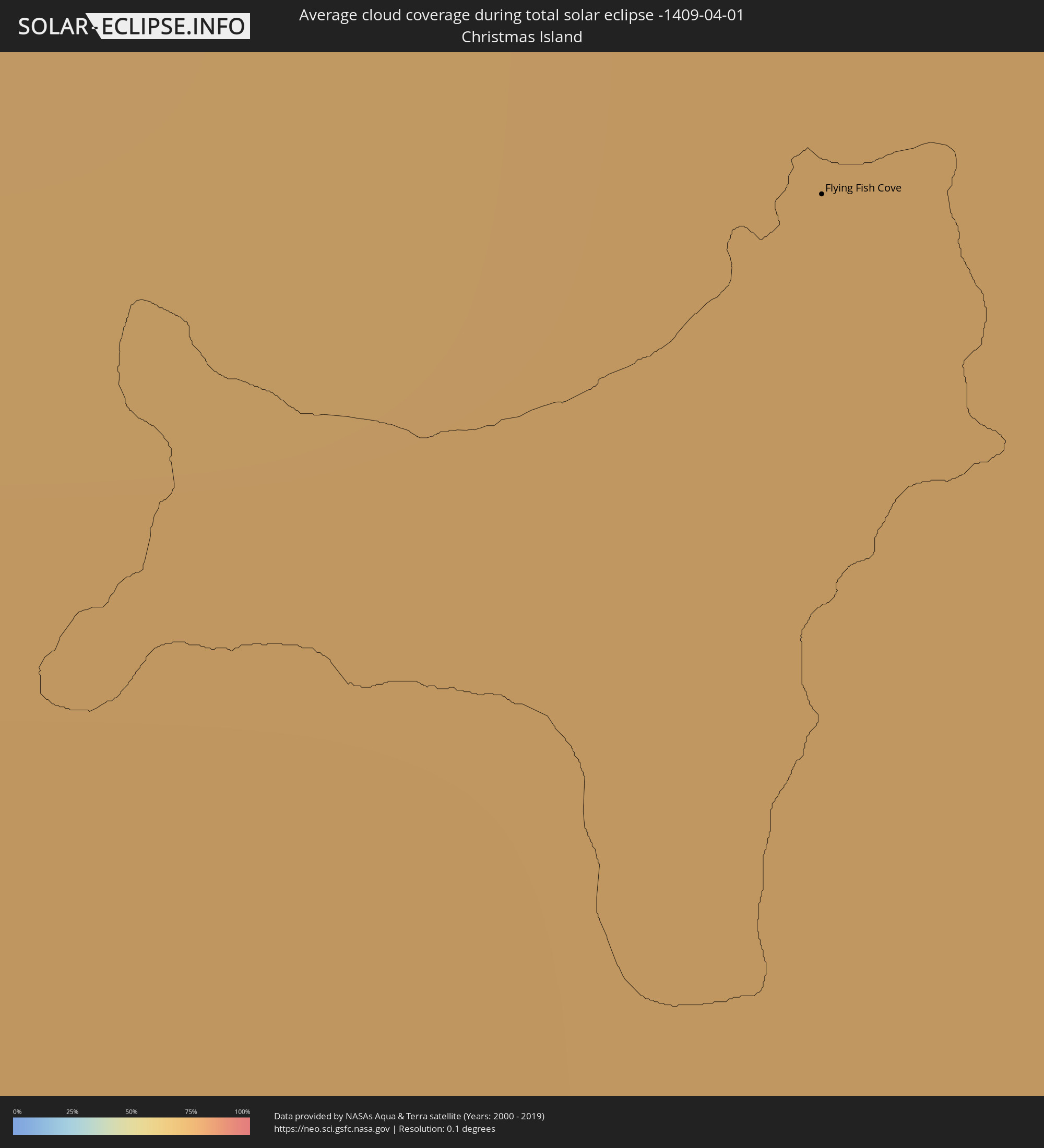 Weihnachtsinsel
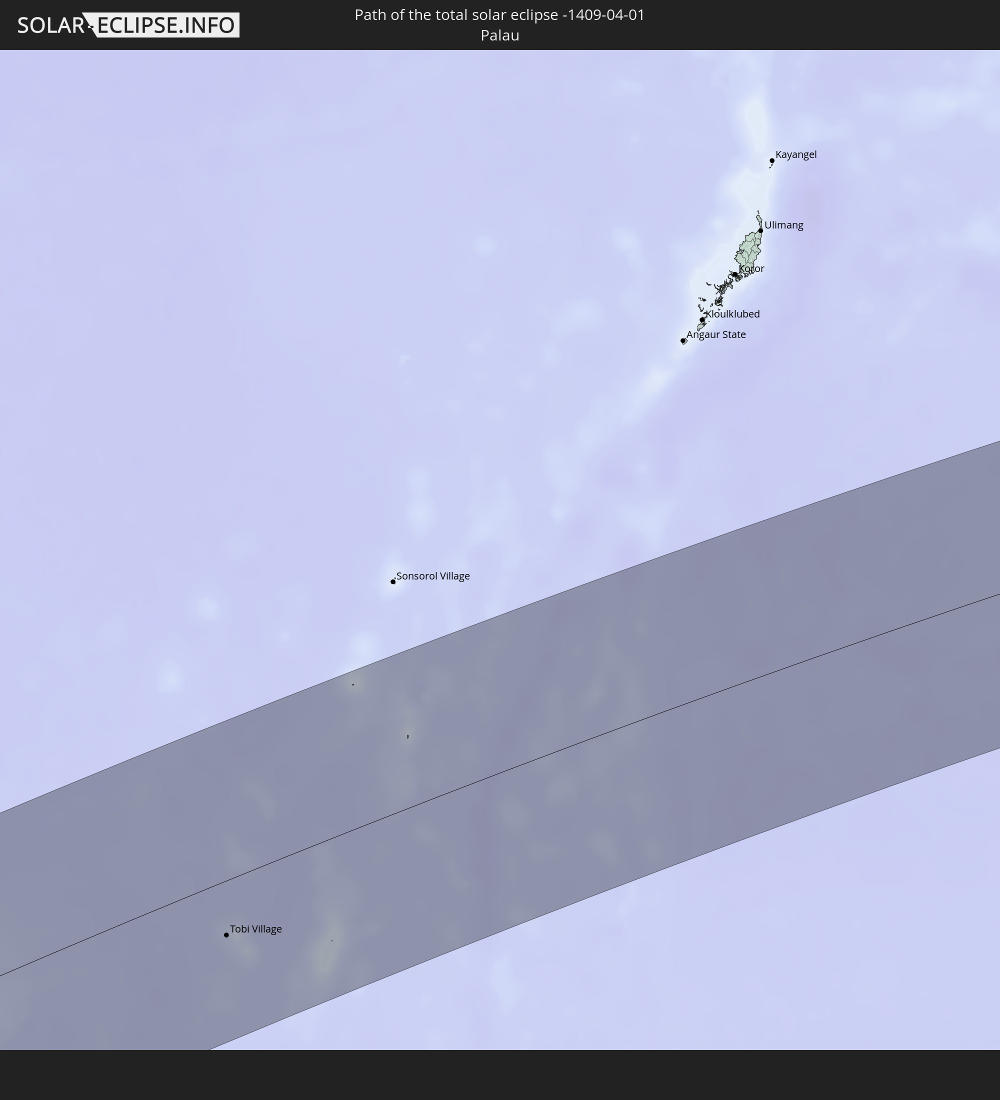
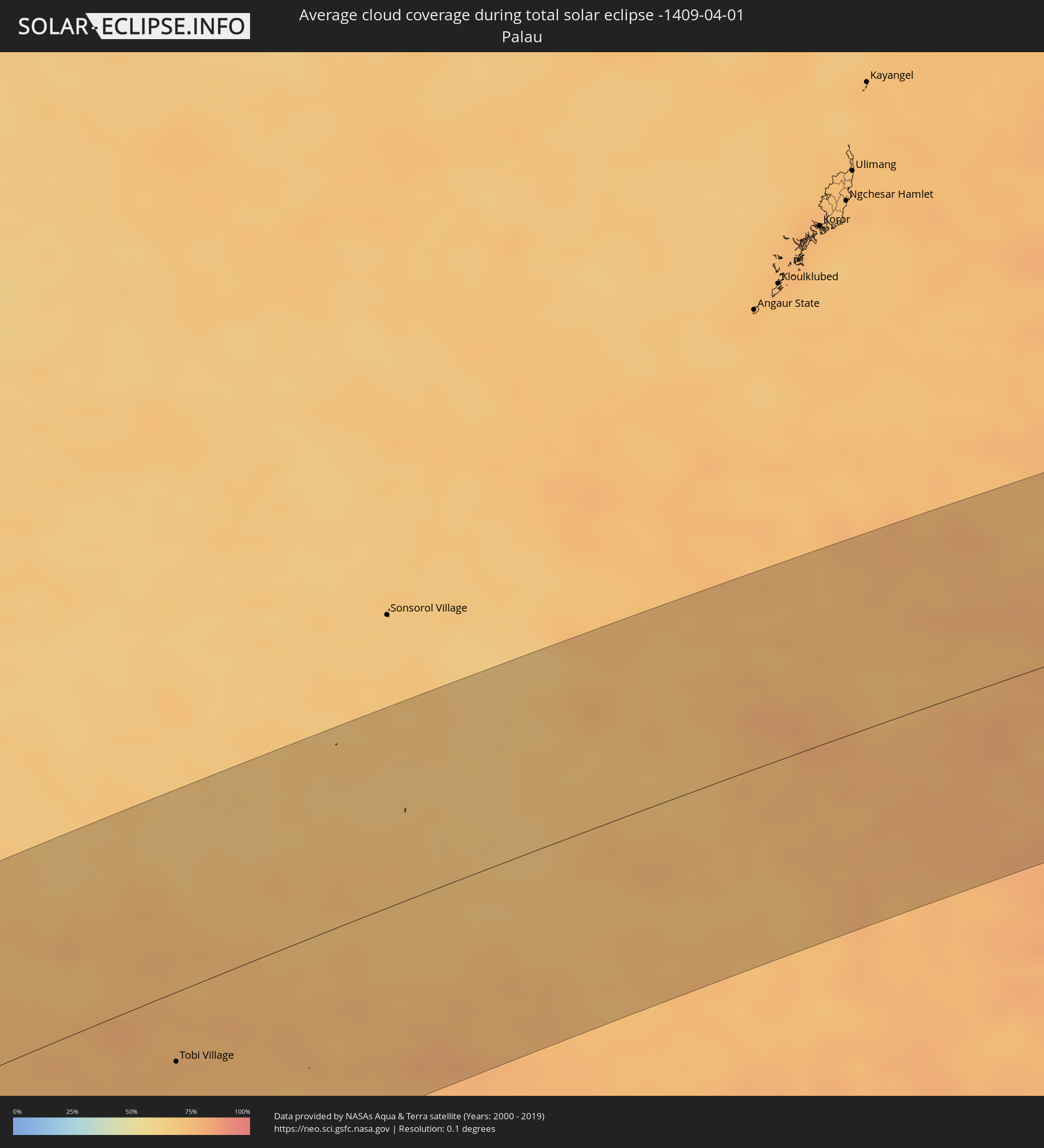 Palau
Palau
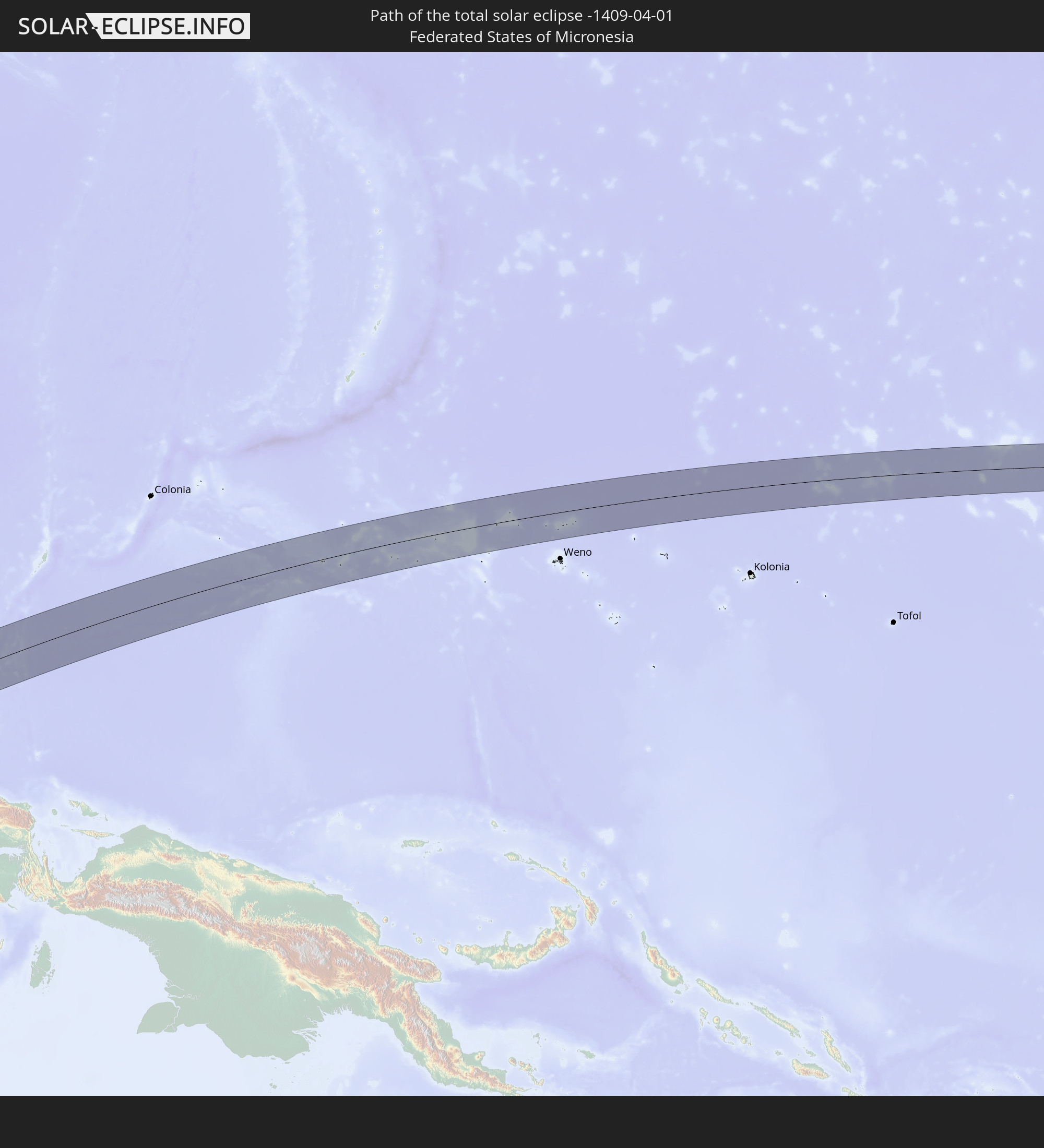
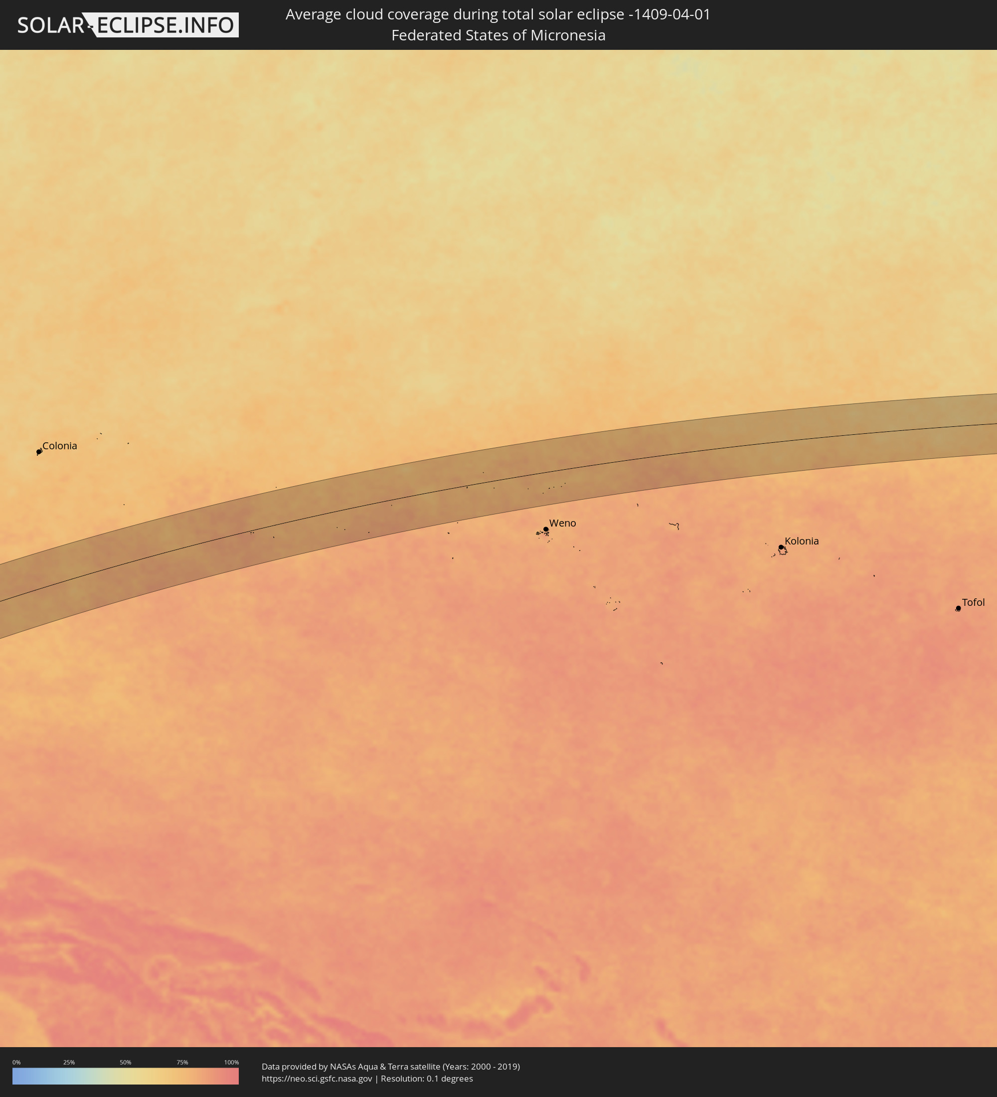 Föderierte Staaten von Mikronesien
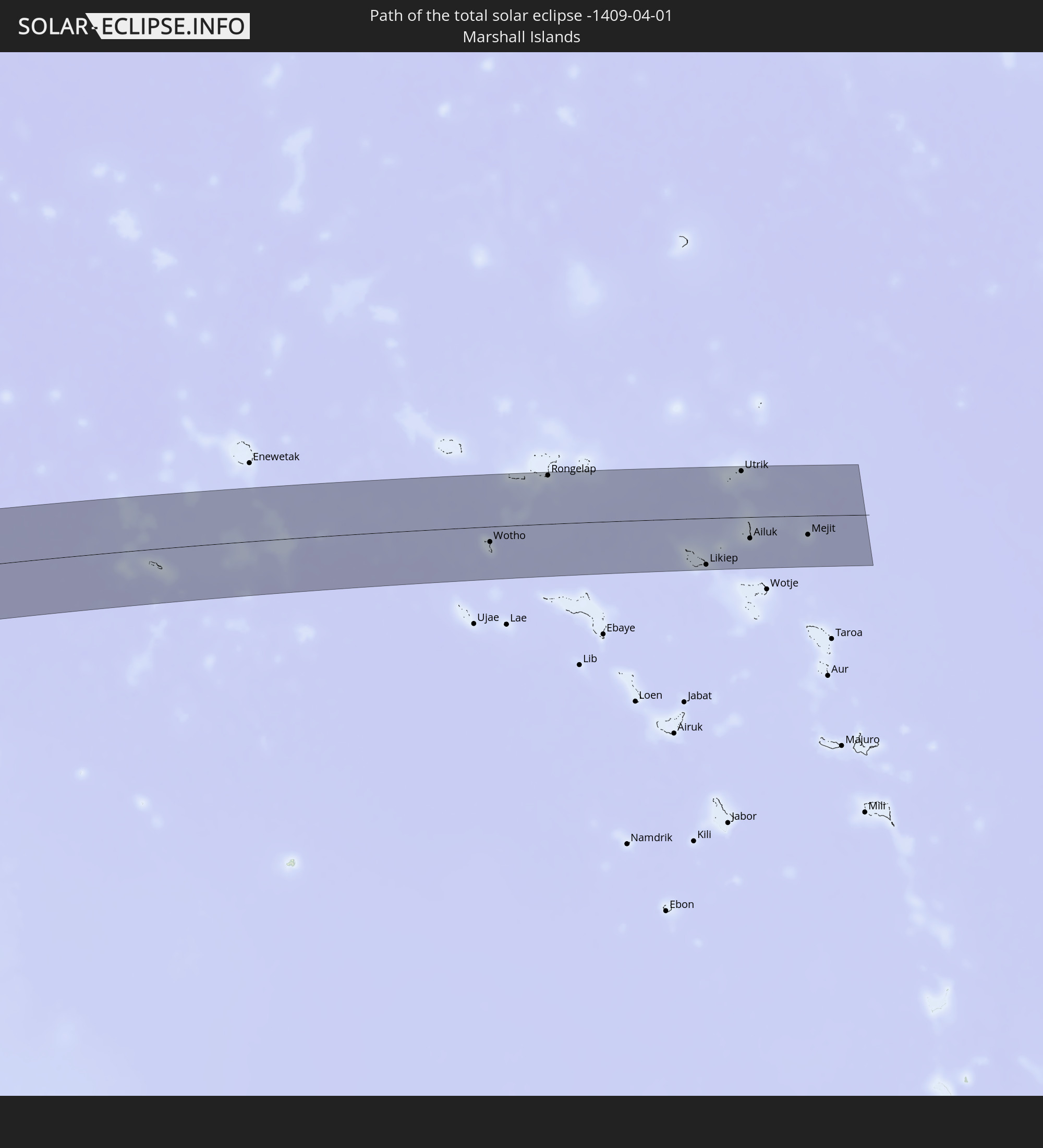
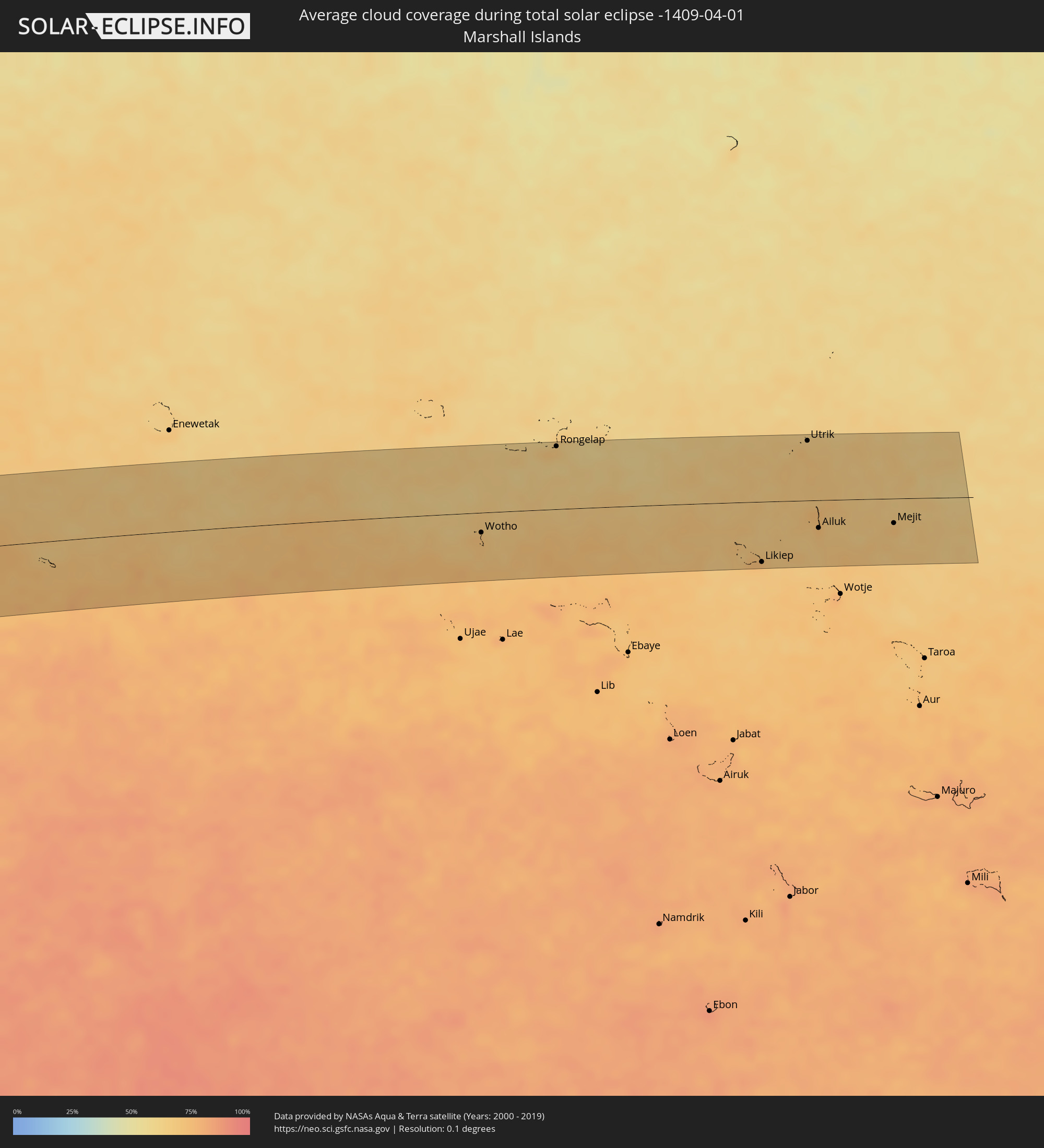 Marshallinseln
Orte im Finsternispfad
Die nachfolgene Tabelle zeigt Städte und Orte mit mehr als 5.000 Einwohnern, die sich im Finsternispfad befinden. Städte mit mehr als 100.000 Einwohnern sind dick gekennzeichnet. Mit einem Klick auf den Ort öffnet sich eine Detailkarte die die Lage des jeweiligen Ortes zusammen mit dem Verlauf der zentralen Finsternis präsentiert.
| Ort | Typ | Dauer der Verfinsterung | Ortszeit bei maximaler Verfinsterung | Entfernung zur Zentrallinie | Ø Bewölkung |
|
Tranovaho, Androy
|
total | - | 05:42:12 UTC+02:27 | 83 km | 41% |
|
Tsiombe, Androy
|
total | - | 05:42:14 UTC+02:27 | 83 km | 47% |
|
Flying Fish Cove
|
total | - | 11:43:00 UTC+07:00 | 41 km | 73% |
|
Sokaraja, Central Java
|
total | - | 12:04:04 UTC+07:07 | 110 km | 89% |
|
Wonosobo, Central Java
|
total | - | 12:05:48 UTC+07:07 | 84 km | 88% |
|
Weleri, Central Java
|
total | - | 12:06:50 UTC+07:07 | 110 km | 91% |
|
Magelang, Central Java
|
total | - | 12:06:25 UTC+07:07 | 54 km | 85% |
|
Yogyakarta, Yogyakarta
|
total | - | 12:06:16 UTC+07:07 | 15 km | 92% |
|
Ungaran, Central Java
|
total | - | 12:07:26 UTC+07:07 | 75 km | 91% |
|
Semarang, Central Java
|
total | - | 12:07:43 UTC+07:07 | 87 km | 88% |
|
Salatiga, Central Java
|
total | - | 12:07:21 UTC+07:07 | 51 km | 88% |
|
Boyolali, Central Java
|
total | - | 12:07:17 UTC+07:07 | 26 km | 86% |
|
Klaten, Central Java
|
total | - | 12:07:02 UTC+07:07 | 9 km | 88% |
|
Pecangaan, Central Java
|
total | - | 12:08:56 UTC+07:07 | 98 km | 89% |
|
Surakarta, Central Java
|
total | - | 12:07:51 UTC+07:07 | 10 km | 89% |
|
Kudus, Central Java
|
total | - | 12:09:06 UTC+07:07 | 80 km | 88% |
|
Purwodadi, Central Java
|
total | - | 12:08:50 UTC+07:07 | 49 km | 90% |
|
Sragen, Central Java
|
total | - | 12:08:33 UTC+07:07 | 11 km | 89% |
|
Pati, Central Java
|
total | - | 12:09:41 UTC+07:07 | 73 km | 88% |
|
Ponorogo, East Java
|
total | - | 12:08:58 UTC+07:07 | 56 km | 87% |
|
Madiun, East Java
|
total | - | 12:09:30 UTC+07:07 | 38 km | 90% |
|
Bojonegoro, East Java
|
total | - | 12:11:12 UTC+07:07 | 14 km | 88% |
|
Nganjuk, East Java
|
total | - | 12:10:31 UTC+07:07 | 58 km | 89% |
|
Kedungwaru, East Java
|
total | - | 12:09:48 UTC+07:07 | 102 km | 88% |
|
Kediri, East Java
|
total | - | 12:10:28 UTC+07:07 | 84 km | 87% |
|
Tuban, East Java
|
total | - | 12:12:04 UTC+07:07 | 1 km | 83% |
|
Kertosono, East Java
|
total | - | 12:11:03 UTC+07:07 | 67 km | 88% |
|
Pare, East Java
|
total | - | 12:11:00 UTC+07:07 | 90 km | 89% |
|
Jombang, East Java
|
total | - | 12:11:27 UTC+07:07 | 72 km | 89% |
|
Lamongan, East Java
|
total | - | 12:12:37 UTC+07:07 | 42 km | 86% |
|
Mojokerto, East Java
|
total | - | 12:12:05 UTC+07:07 | 76 km | 88% |
|
Kebomas, East Java
|
total | - | 12:13:05 UTC+07:07 | 60 km | 89% |
|
Sidoarjo, East Java
|
total | - | 12:12:50 UTC+07:07 | 91 km | 87% |
|
Bangkalan, East Java
|
total | - | 12:13:32 UTC+07:07 | 54 km | 79% |
|
Surabaya, East Java
|
total | - | 12:13:15 UTC+07:07 | 74 km | 80% |
|
Bangil, East Java
|
total | - | 12:12:51 UTC+07:07 | 111 km | 86% |
|
Pamekasan, East Java
|
total | - | 12:15:14 UTC+07:07 | 108 km | 77% |
|
Polewali, West Sulawesi
|
total | - | 13:26:04 UTC+07:57 | 93 km | 82% |
|
Palopo, South Sulawesi
|
total | - | 13:28:46 UTC+07:57 | 98 km | 83% |
|
Gorontalo, Gorontalo
|
total | - | 13:40:30 UTC+07:57 | 93 km | 74% |
|
Manado, North Sulawesi
|
total | - | 13:45:38 UTC+07:57 | 96 km | 78% |
|
Bitung, North Sulawesi
|
total | - | 13:46:19 UTC+07:57 | 77 km | 77% |
|
Ternate, North Maluku
|
total | - | 15:15:08 UTC+09:22 | 96 km | 73% |
|
Tobi Village, Hatohobei
|
total | - | 15:02:11 UTC+09:00 | 37 km | 76% |
|
Wotho, Wotho Atoll
|
total | - | 17:39:28 UTC+11:00 | 26 km | 71% |
|
Rongelap, Rongelap Atoll
|
total | - | 17:39:53 UTC+11:00 | 81 km | 69% |
|
Likiep, Likiep Atoll
|
total | - | 17:39:47 UTC+11:00 | 78 km | 70% |
|
Utrik, Utrik Atoll
|
total | - | 17:40:11 UTC+11:00 | 77 km | 71% |
|
Ailuk, Ailuk Atoll
|
total | - | 17:39:56 UTC+11:00 | 36 km | 69% |
|
Mejit, Mejit Island
|
total | - | 17:39:59 UTC+11:00 | 32 km | 72% |