Totale Sonnenfinsternis vom 03.07.-1423
| Wochentag: | Dienstag |
| Maximale Dauer der Verfinsterung: | 04m27s |
| Maximale Breite des Finsternispfades: | 202 km |
| Saroszyklus: | 33 |
| Bedeckungsgrad: | 100% |
| Magnitude: | 1.0566 |
| Gamma: | 0.3805 |
Wo kann man die Sonnenfinsternis vom 03.07.-1423 sehen?
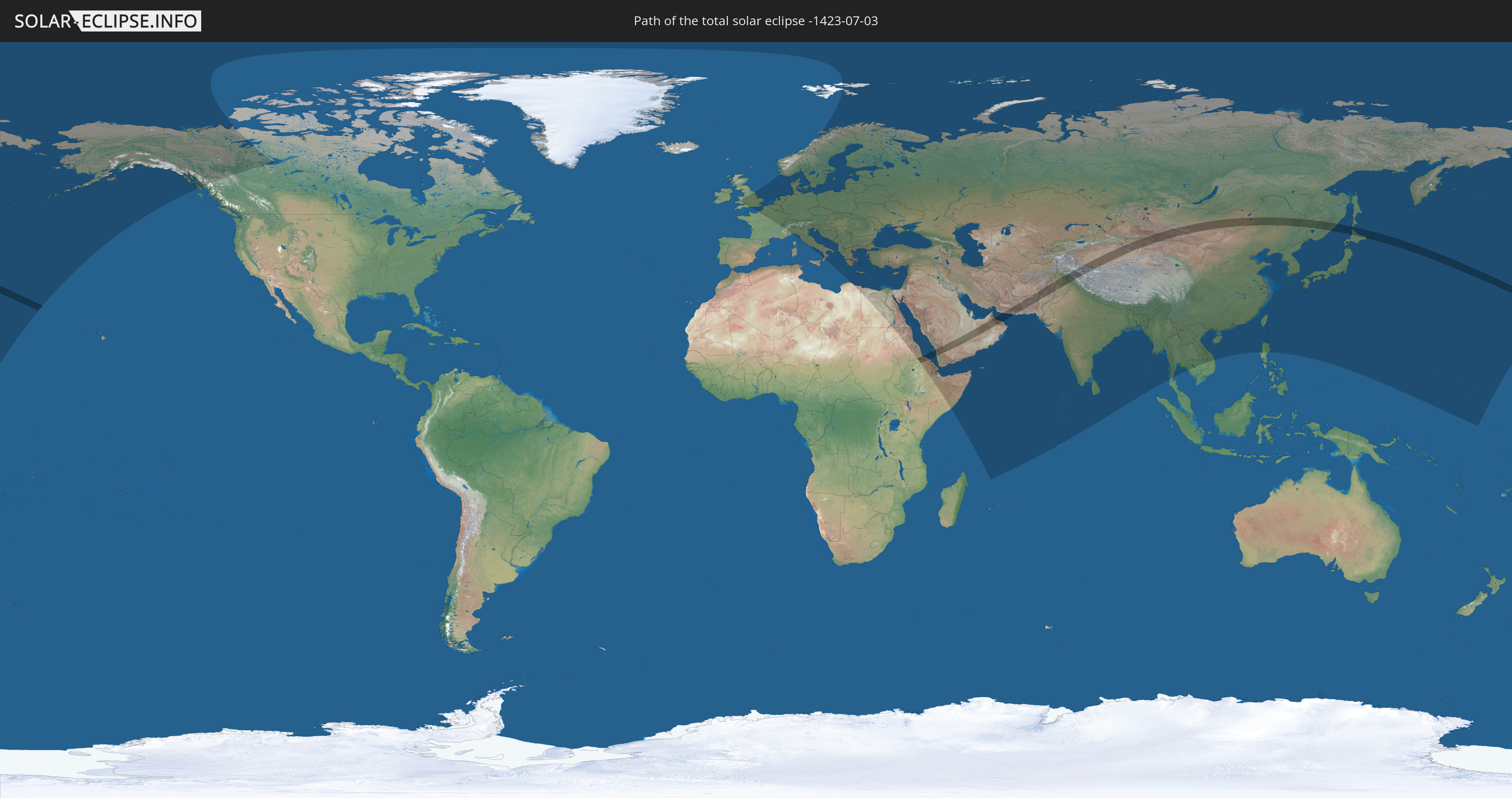
Die Sonnenfinsternis am 03.07.-1423 kann man in 103 Ländern als partielle Sonnenfinsternis beobachten.
Der Finsternispfad verläuft durch 14 Länder. Nur in diesen Ländern ist sie als totale Sonnenfinsternis zu sehen.
In den folgenden Ländern ist die Sonnenfinsternis total zu sehen
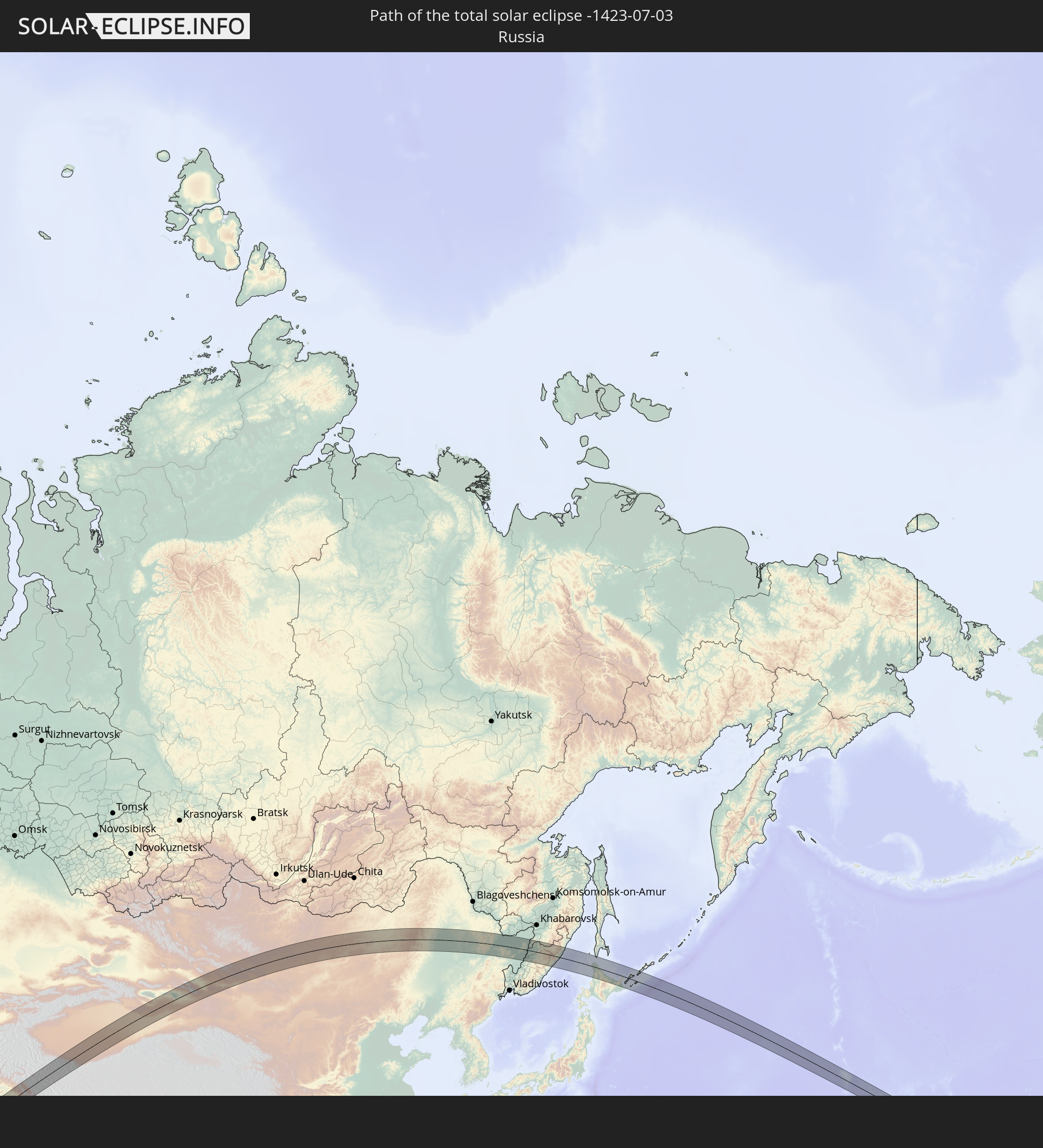 Russland
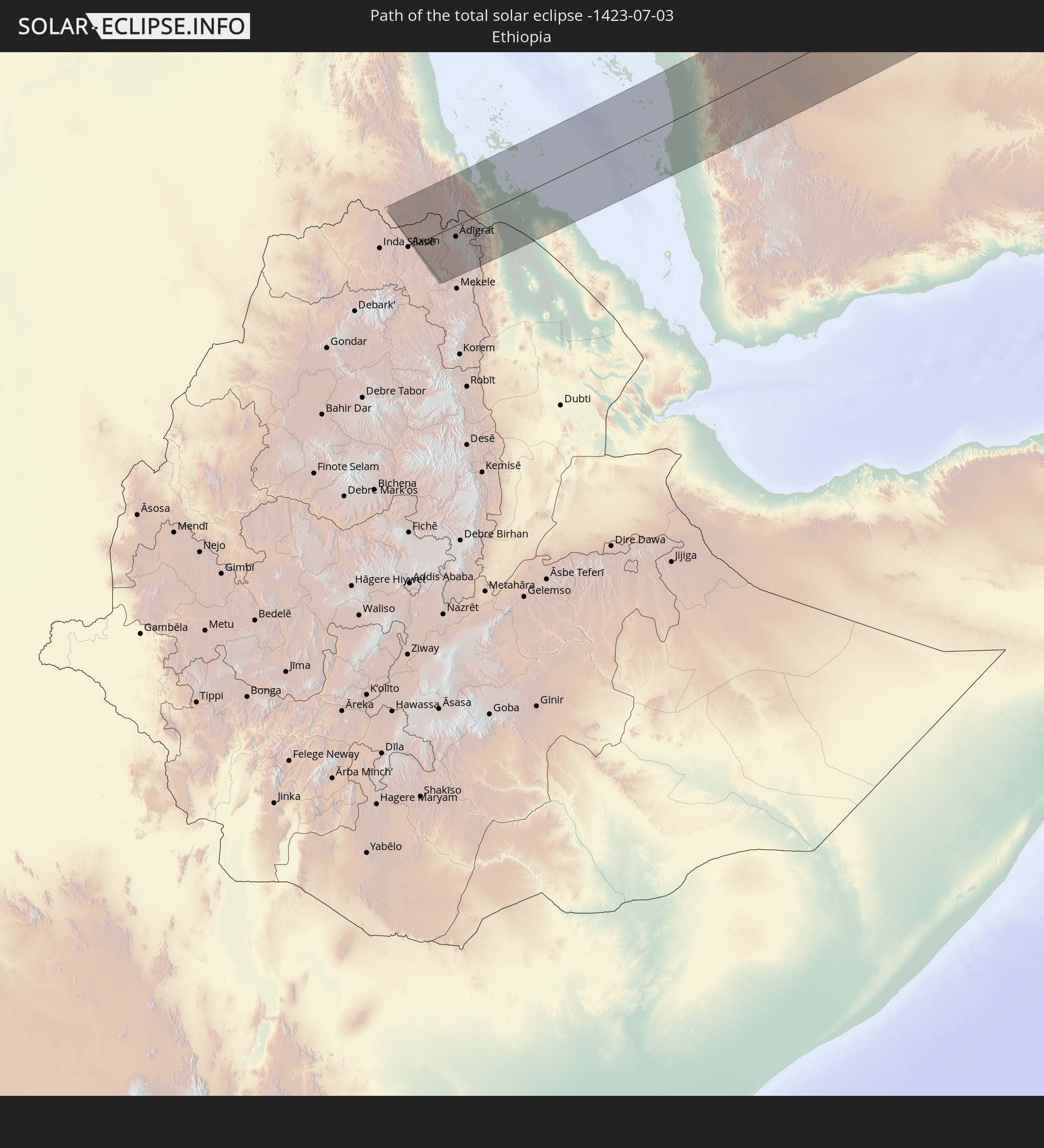 Äthiopien
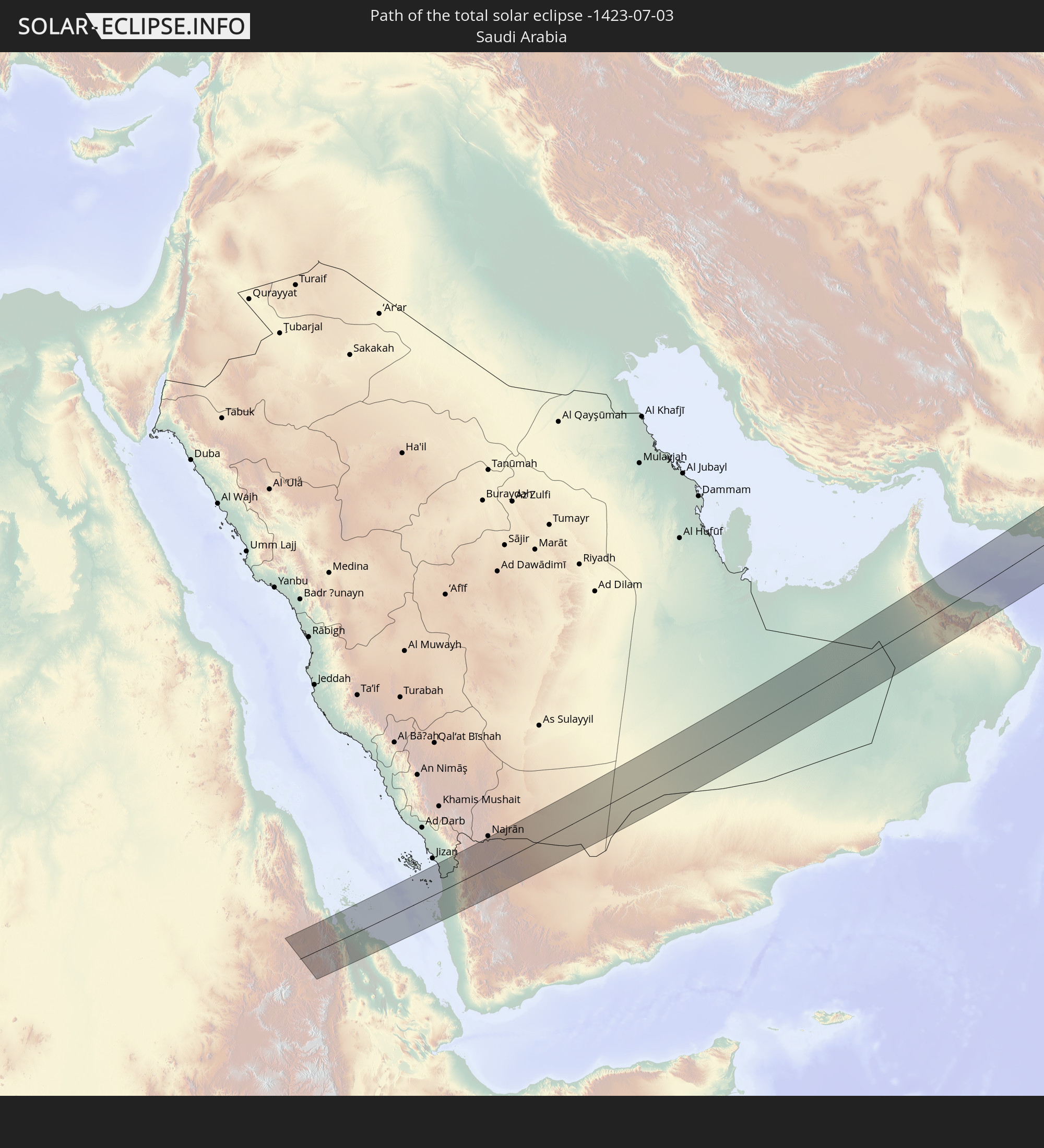 Saudi-Arabien
 Eritrea
 Jemen
Jemen
 Iran
Iran
 Vereinigte Arabische Emirate
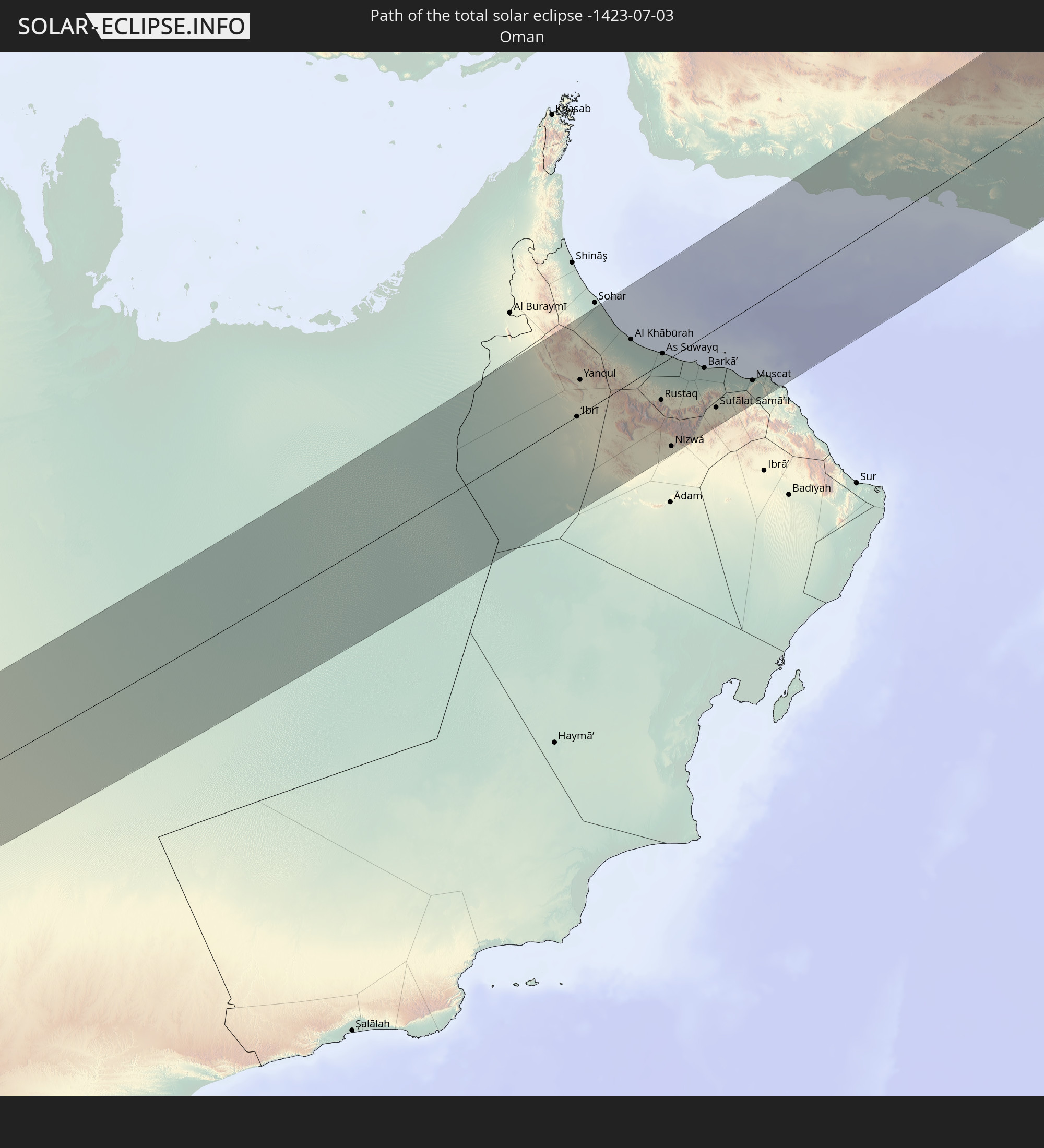 Oman
Oman
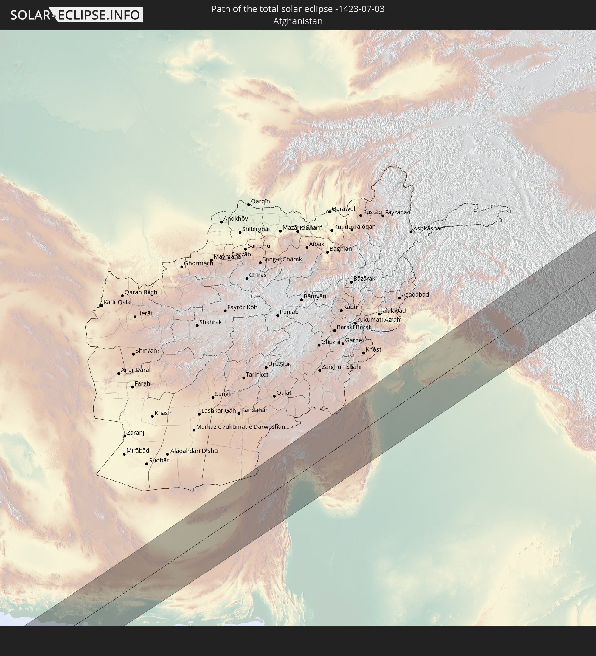 Afghanistan
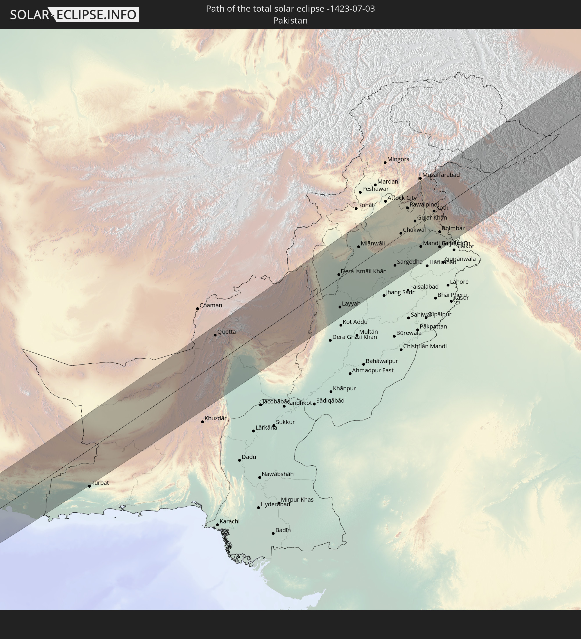 Pakistan
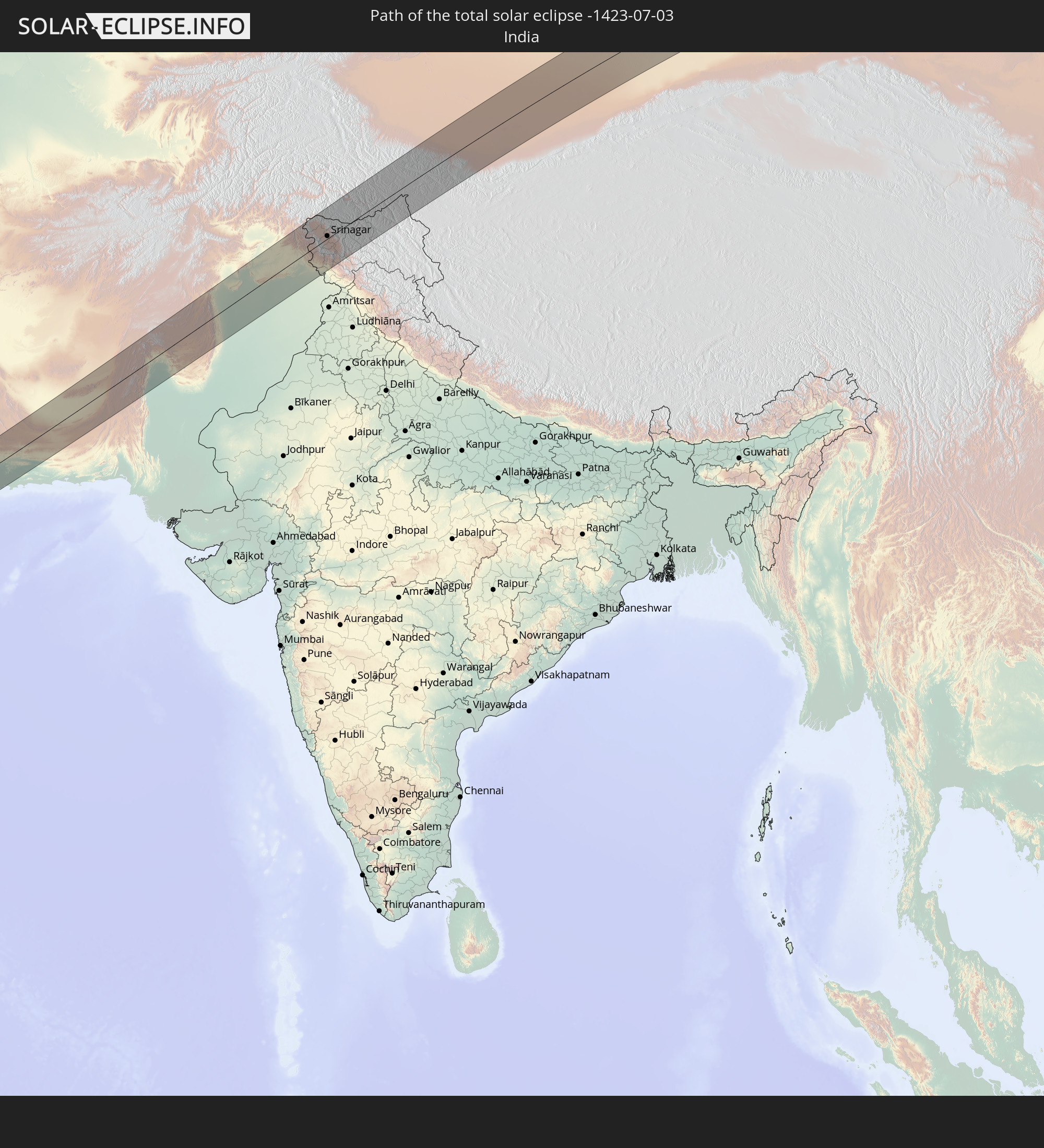 Indien
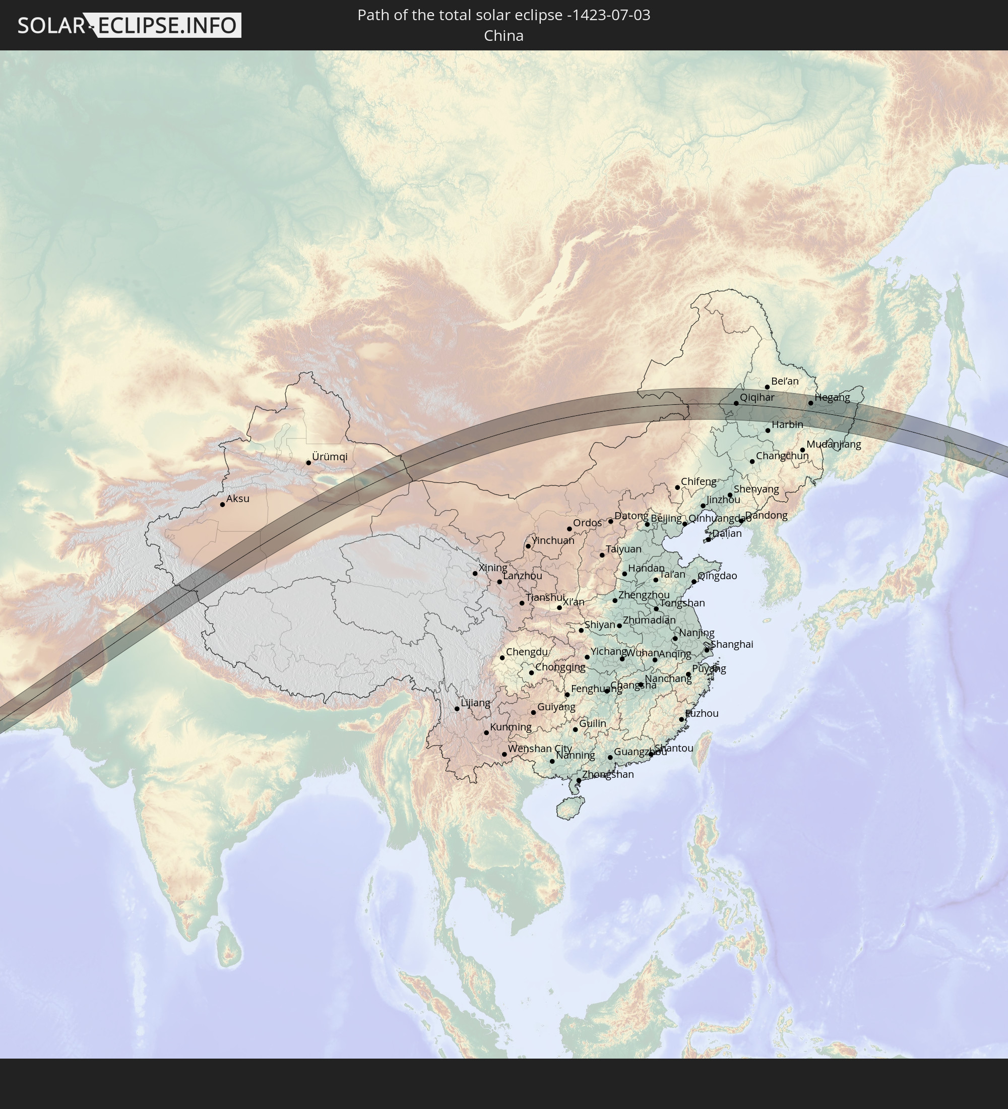 Volksrepublik China
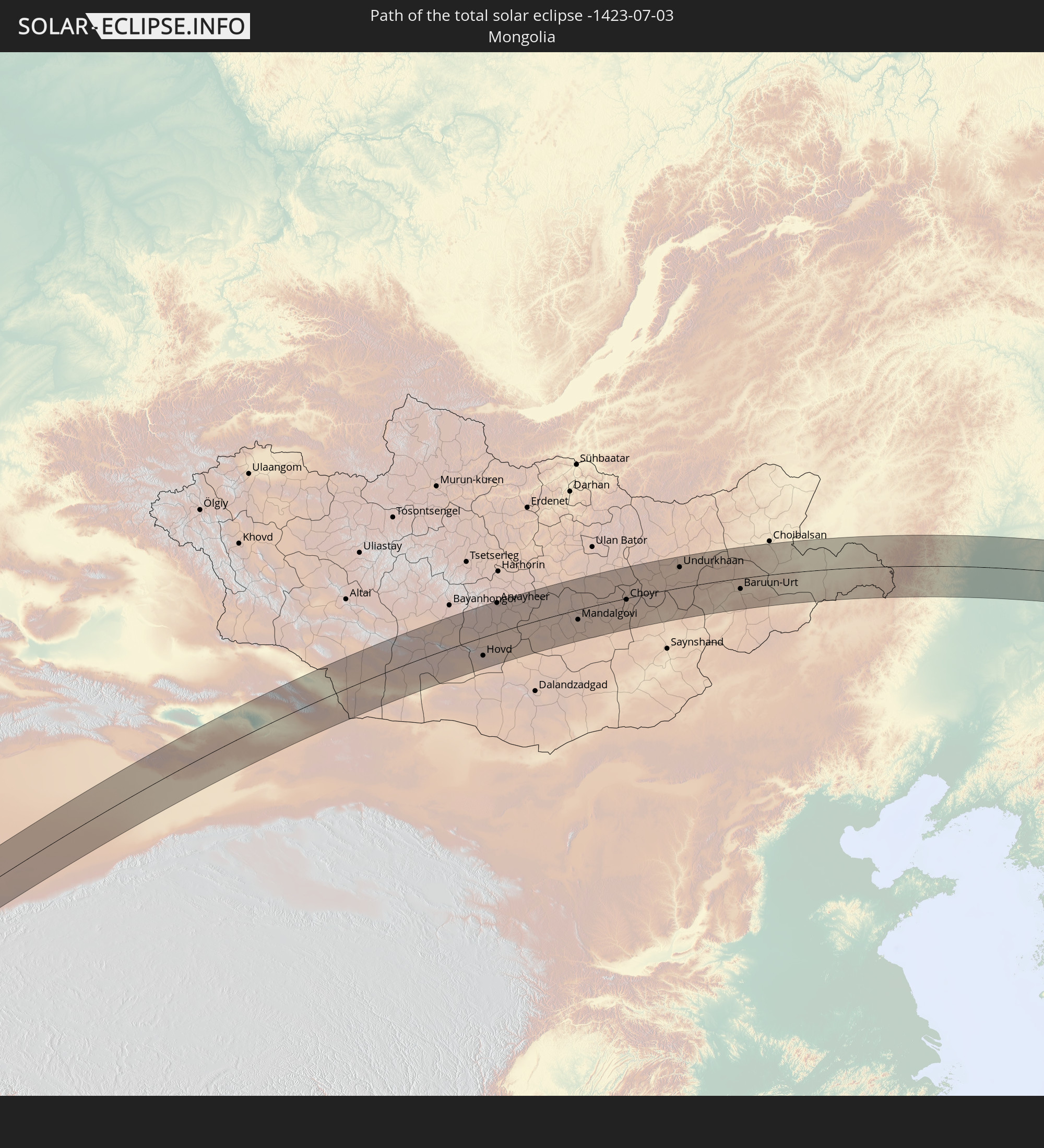 Mongolei
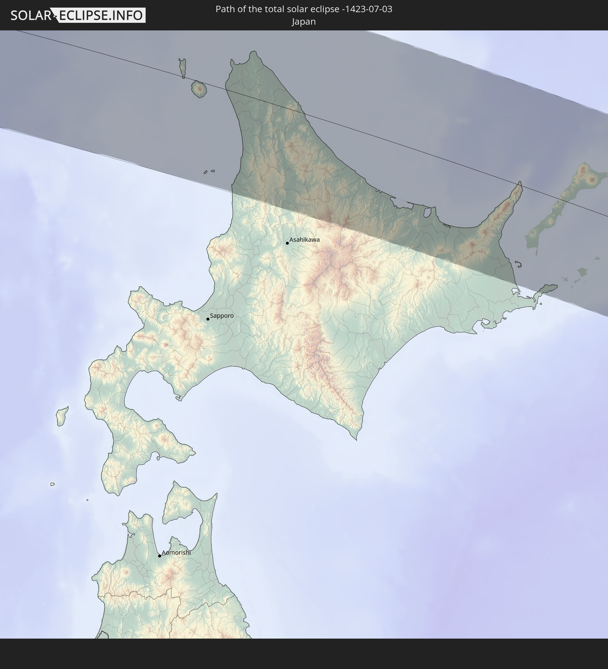 Japan
Japan
In den folgenden Ländern ist die Sonnenfinsternis partiell zu sehen
 Russland
 Vereinigte Staaten
 United States Minor Outlying Islands
 Kiribati
 Kanada
 Spitzbergen
 Vereinigtes Königreich
 Frankreich
 Belgien
 Niederlande
 Norwegen
 Luxemburg
 Deutschland
 Schweiz
 Italien
 Dänemark
 Libyen
 Liechtenstein
 Österreich
 Schweden
 Tschechien
 San Marino
 Vatikanstadt
 Slowenien
 Kroatien
 Polen
Polen
 Bosnien und Herzegowina
 Ungarn
 Slowakei
 Montenegro
 Serbien
 Albanien
 Åland Islands
 Griechenland
 Rumänien
 Mazedonien
 Finnland
 Litauen
 Lettland
 Estland
 Sudan
Sudan
 Ukraine
 Bulgarien
 Weißrussland
 Ägypten
 Türkei
 Moldawien
 Republik Zypern
 Äthiopien
 Staat Palästina
 Israel
 Saudi-Arabien
 Jordanien
 Libanon
 Syrien
 Eritrea
 Irak
Irak
 Georgien
 Somalia
 Dschibuti
 Jemen
Jemen
 Armenien
 Iran
Iran
 Aserbaidschan
 Seychellen
 Kasachstan
 Kuwait
 Bahrain
 Katar
Katar
 Vereinigte Arabische Emirate
 Oman
Oman
 Turkmenistan
 Usbekistan
 Mauritius
 Afghanistan
 Pakistan
 Tadschikistan
 Indien
 Kirgisistan
 Britisches Territorium im Indischen Ozean
 Malediven
 Volksrepublik China
 Sri Lanka
 Nepal
Nepal
 Mongolei
 Bangladesch
 Bhutan
 Myanmar
 Thailand
 Laos
Laos
 Vietnam
 Kambodscha
 Macau
Macau
 Hongkong
 Taiwan
 Philippinen
 Japan
Japan
 Nordkorea
 Südkorea
 Föderierte Staaten von Mikronesien
 Guam
Guam
 Nördliche Marianen
 Marshallinseln
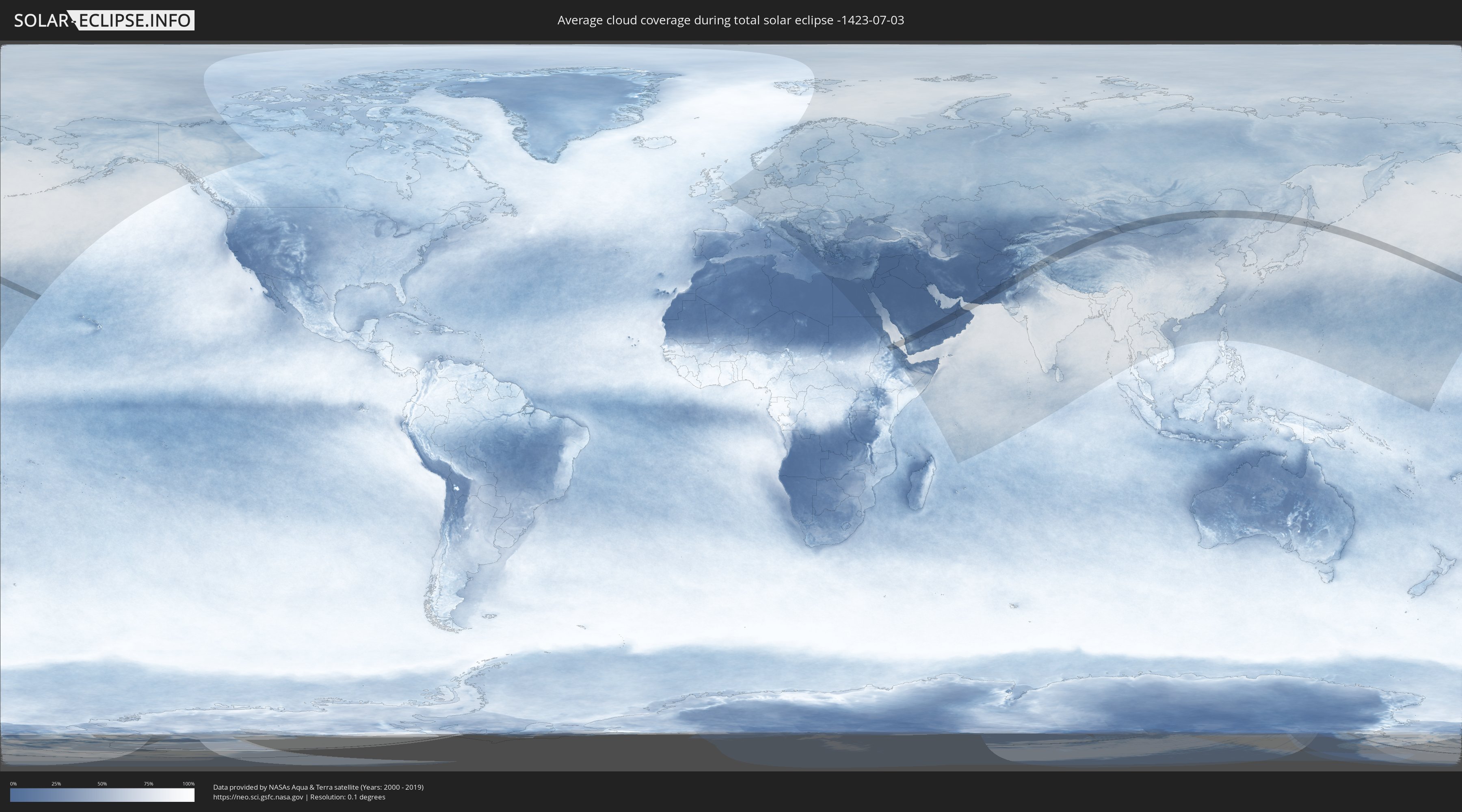
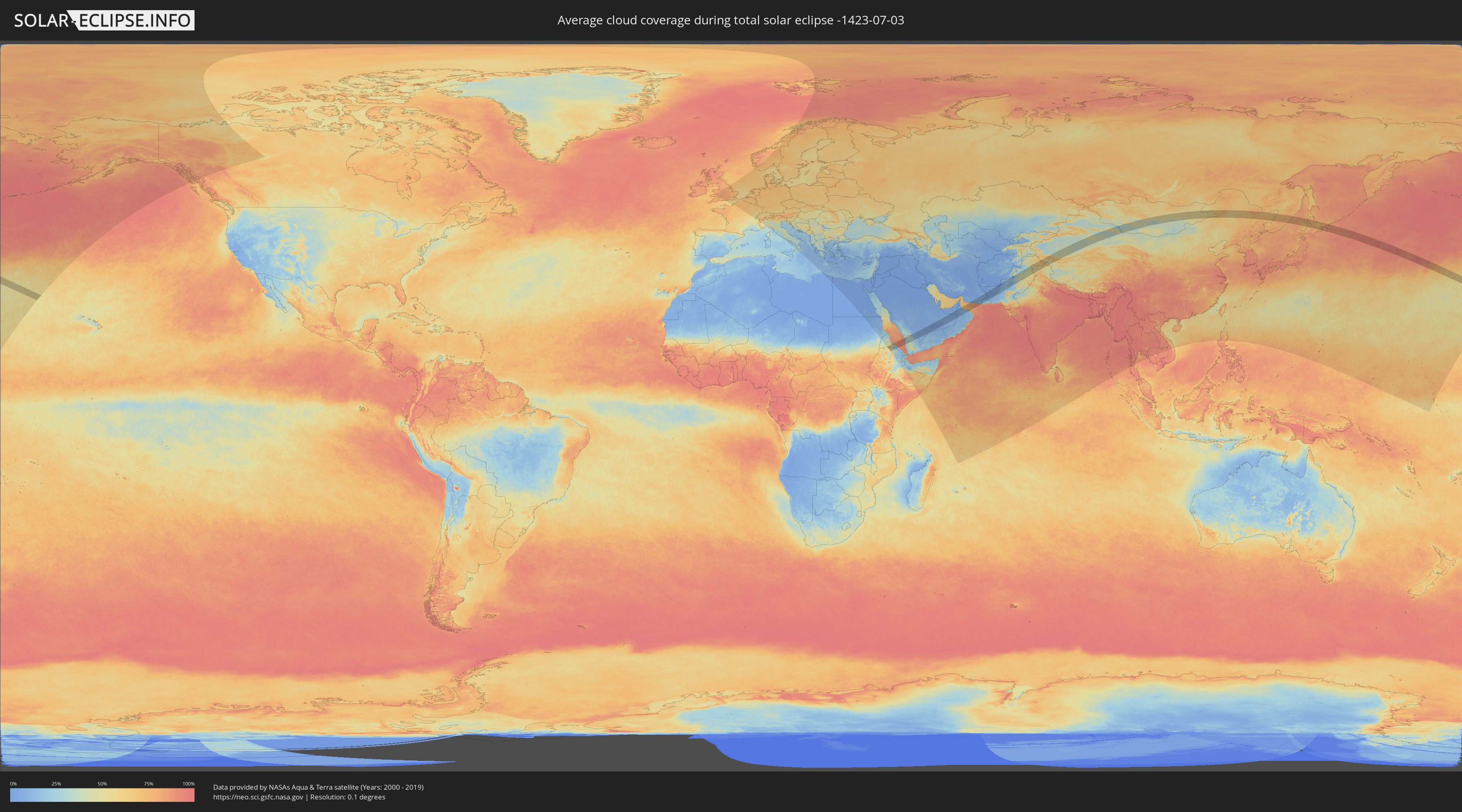
Wie wird das Wetter während der totalen Sonnenfinsternis am 03.07.-1423?
Wo ist der beste Ort, um die totale Sonnenfinsternis vom 03.07.-1423 zu beobachten?
Die folgenden Karten zeigen die durchschnittliche Bewölkung für den Tag, an dem die totale Sonnenfinsternis
stattfindet. Mit Hilfe der Karten lässt sich der Ort entlang des Finsternispfades eingrenzen,
der die besten Aussichen auf einen klaren wolkenfreien Himmel bietet.
Trotzdem muss man immer lokale Gegenenheiten beachten und sollte sich genau über das Wetter an seinem
gewählten Beobachtungsort informieren.
Die Daten stammen von den beiden NASA-Satelliten
AQUA und TERRA
und wurden über einen Zeitraum von 19 Jahren (2000 - 2019) gemittelt.
Detaillierte Länderkarten
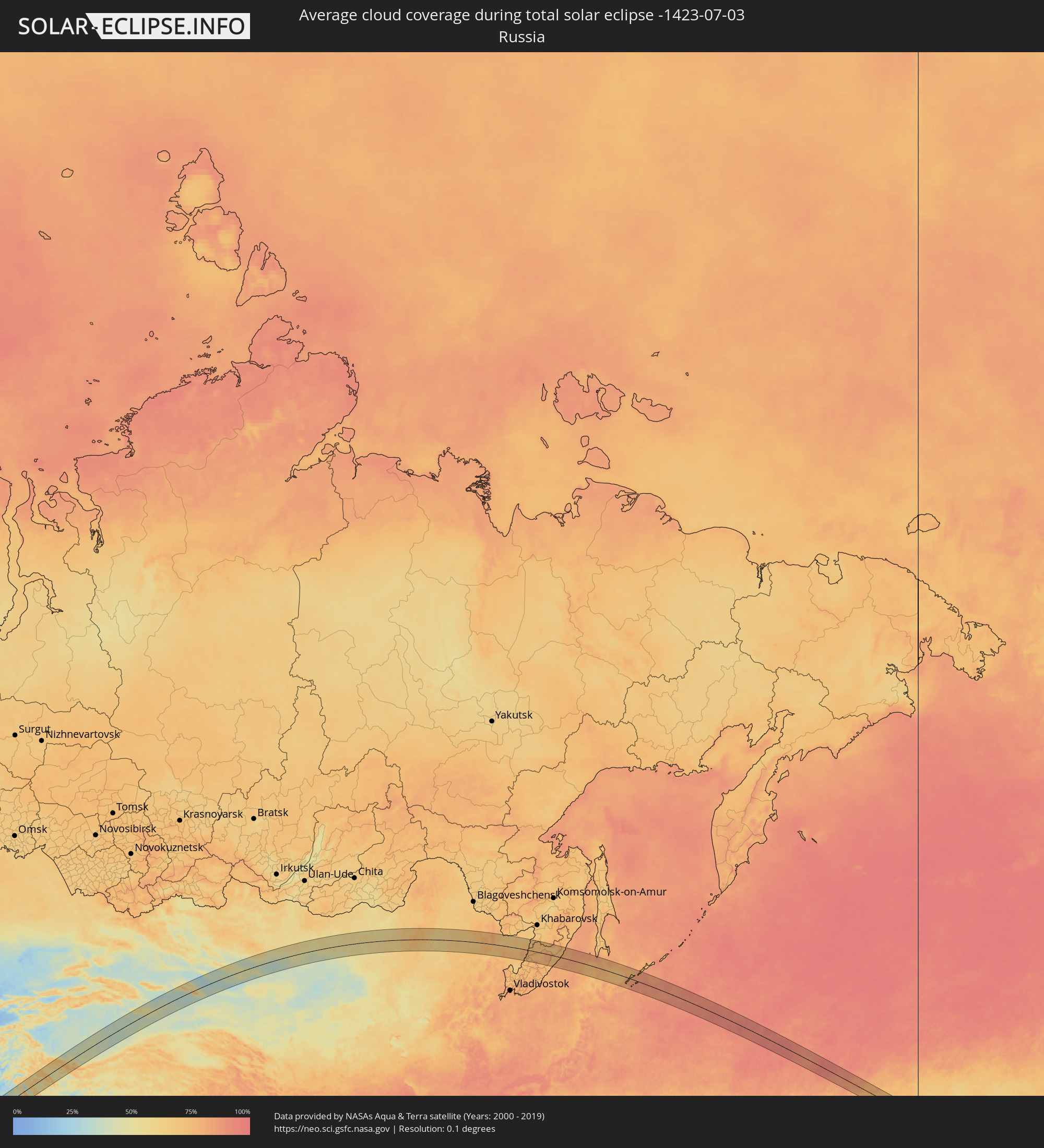 Russland
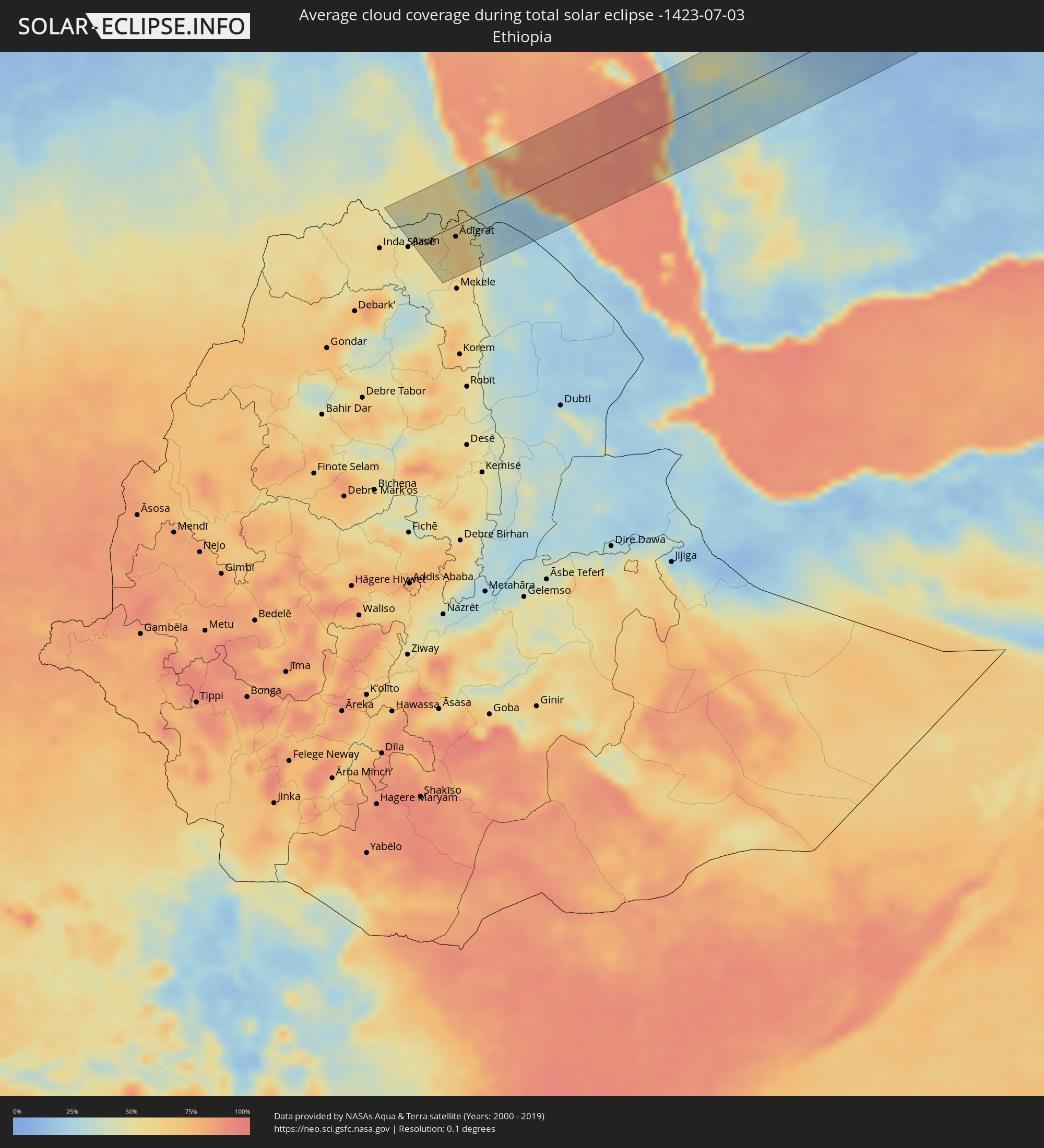 Äthiopien
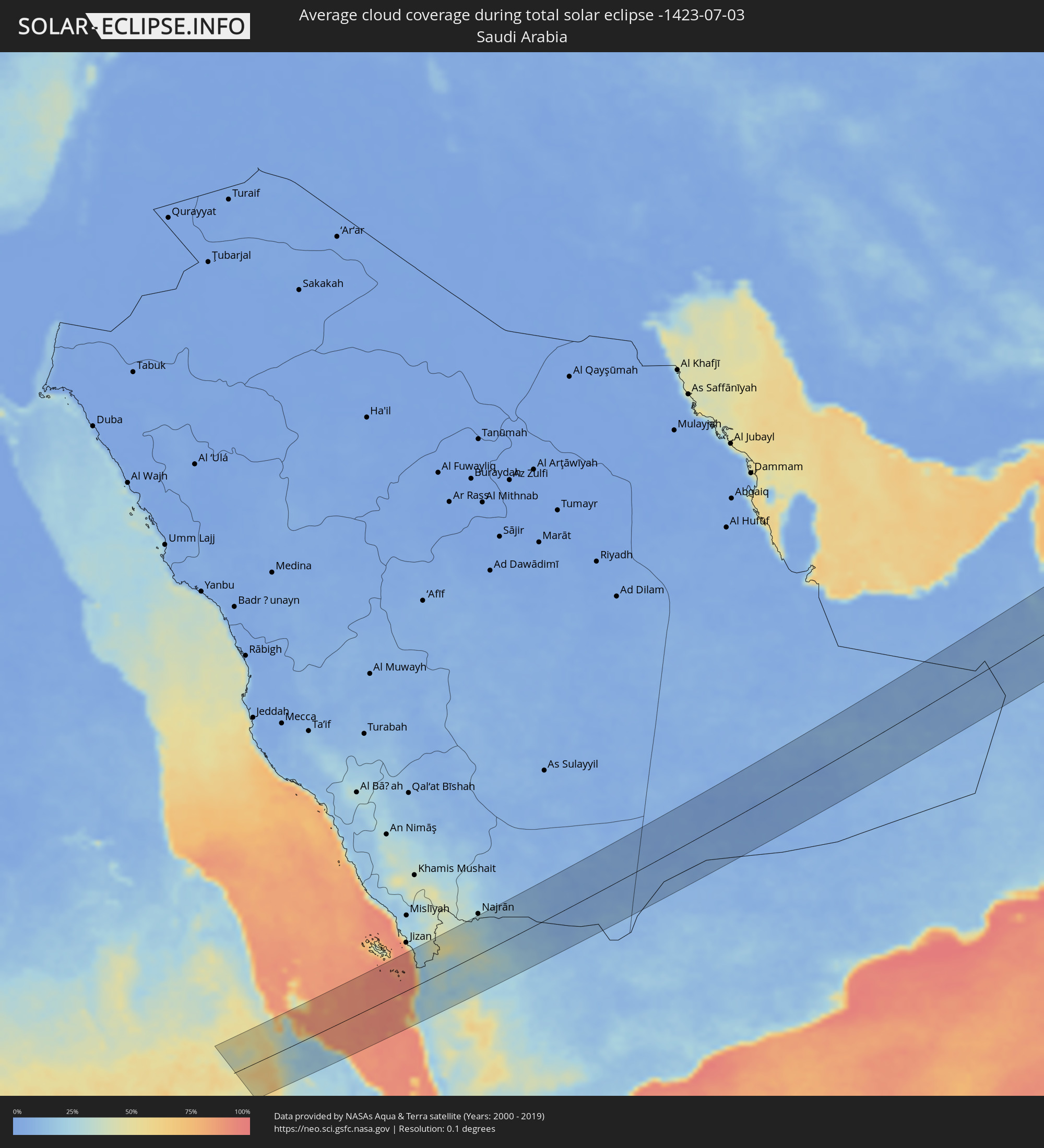 Saudi-Arabien
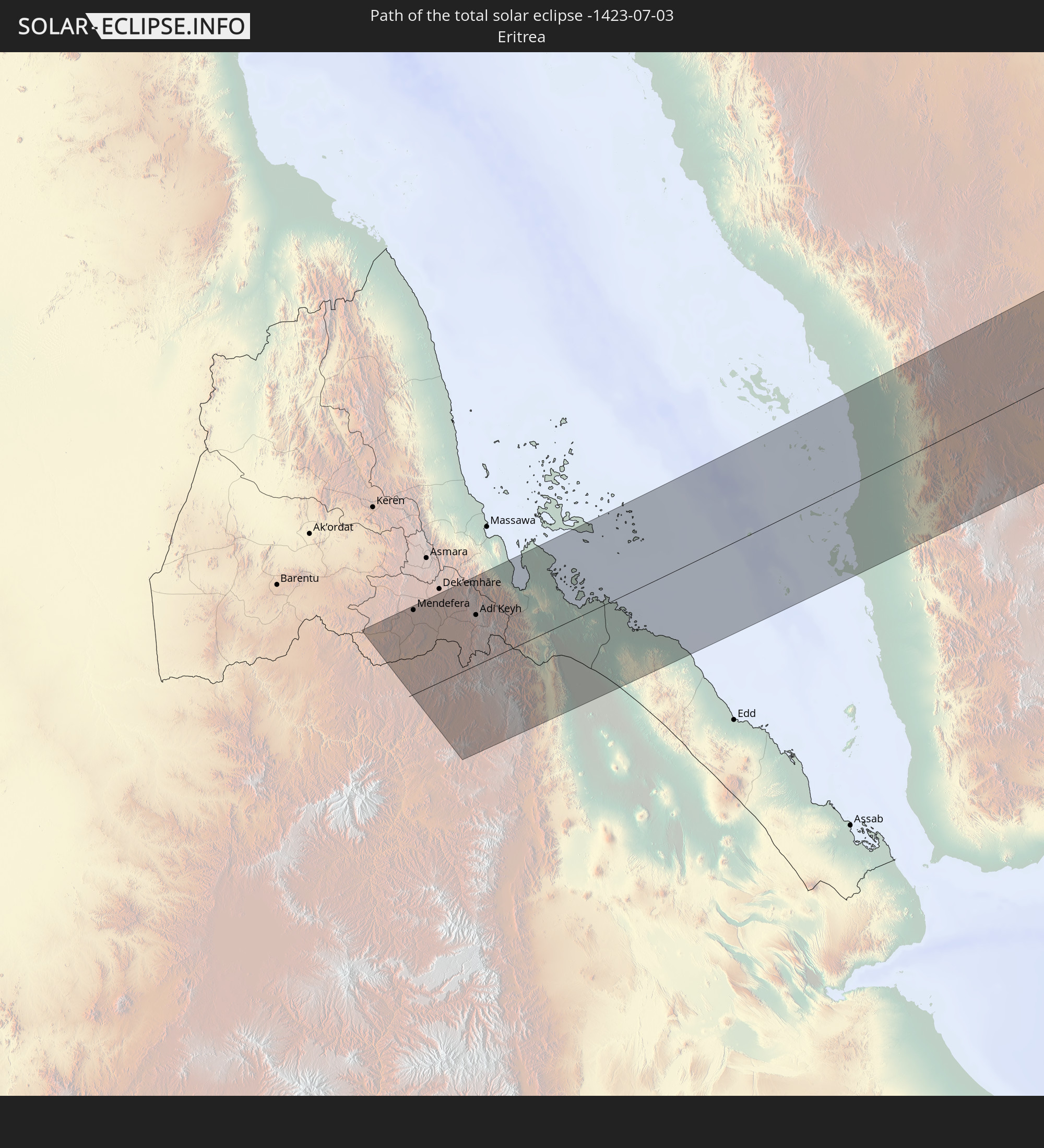
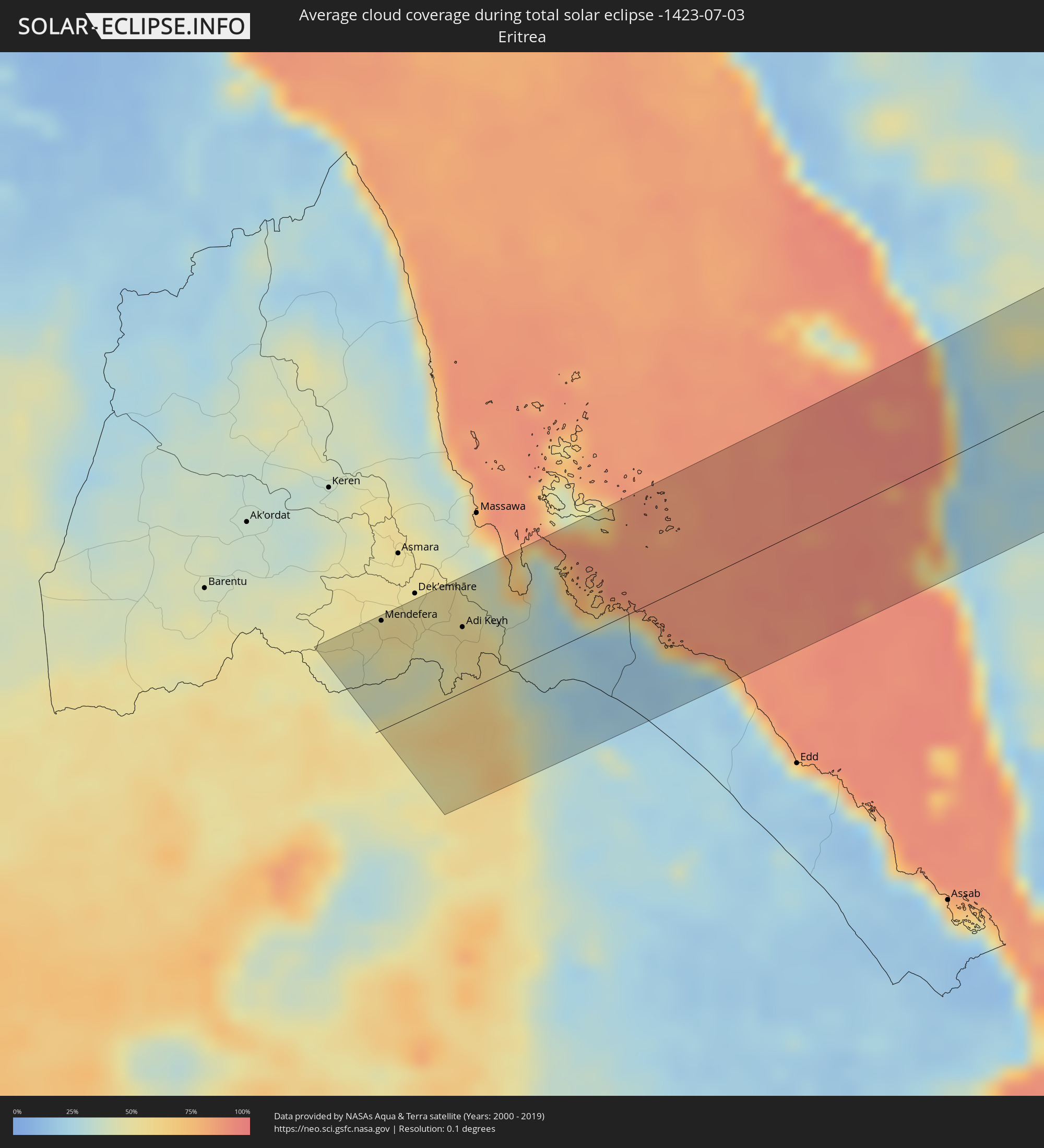 Eritrea
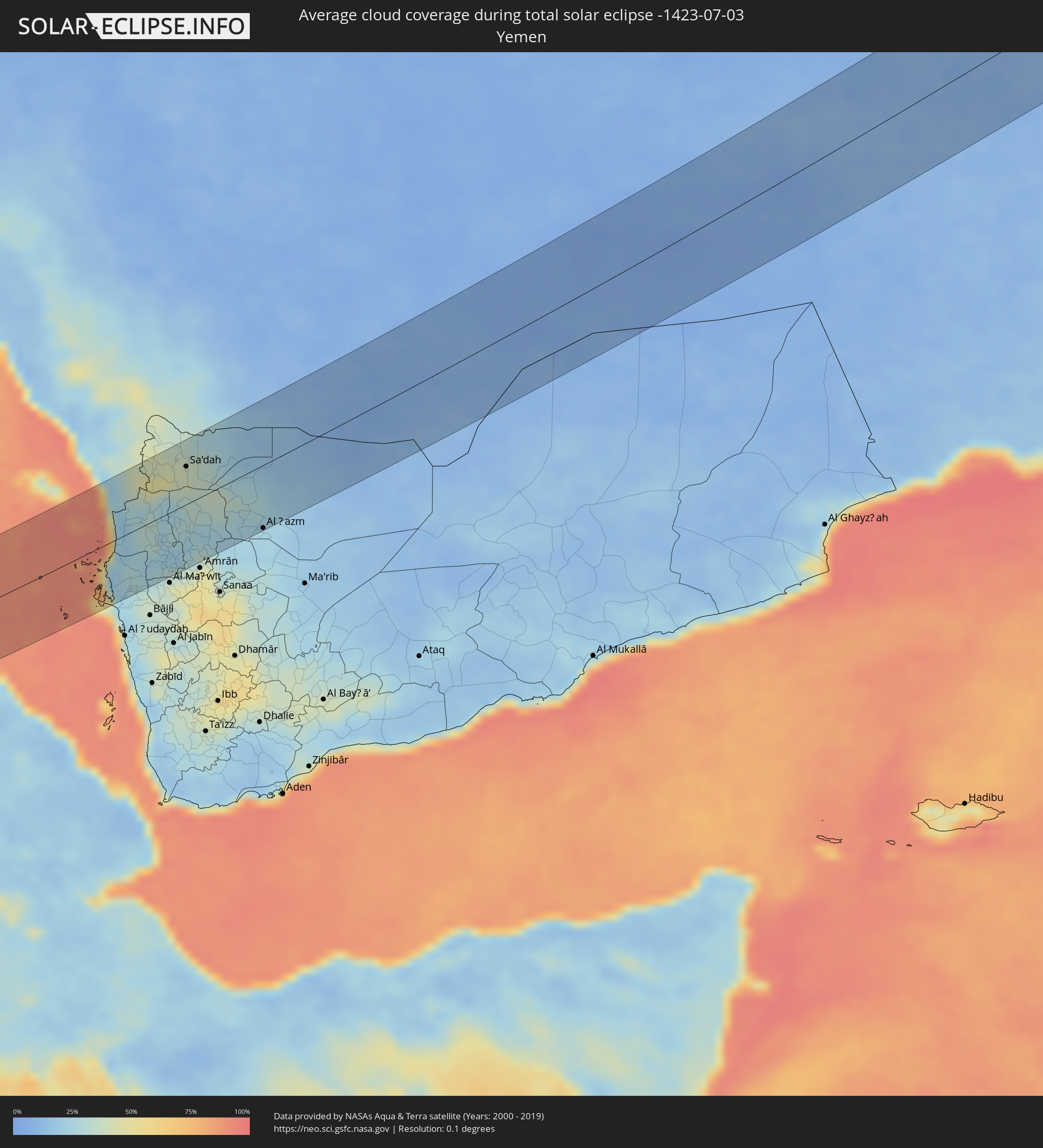 Jemen
Jemen
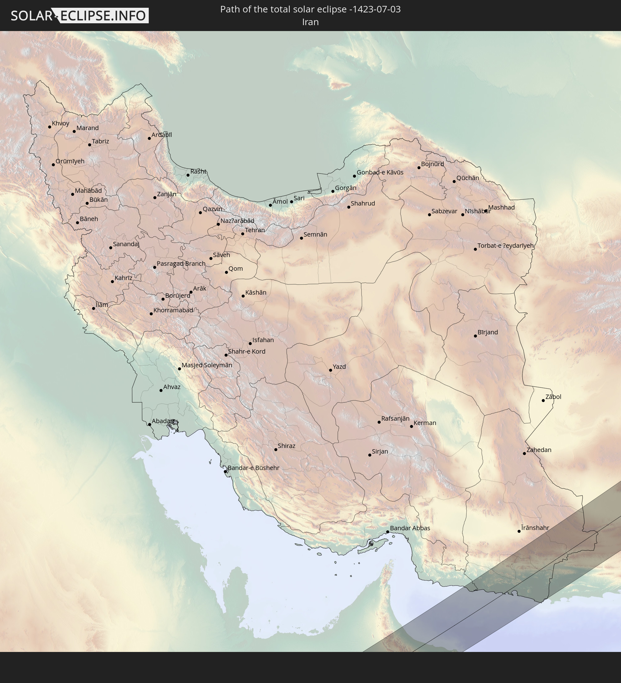
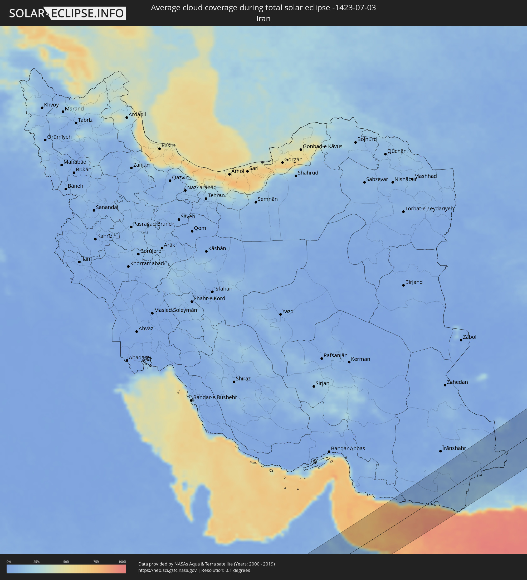 Iran
Iran
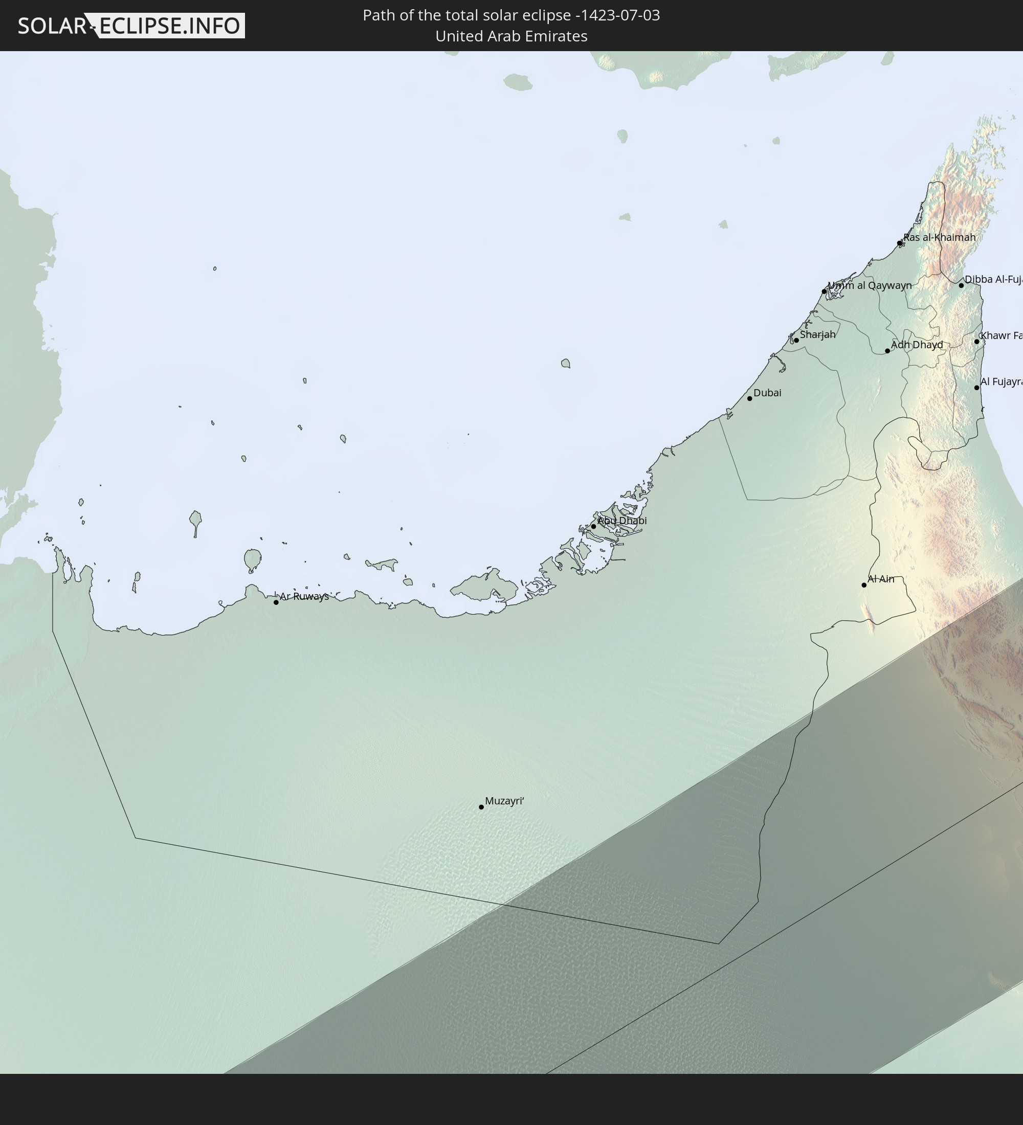
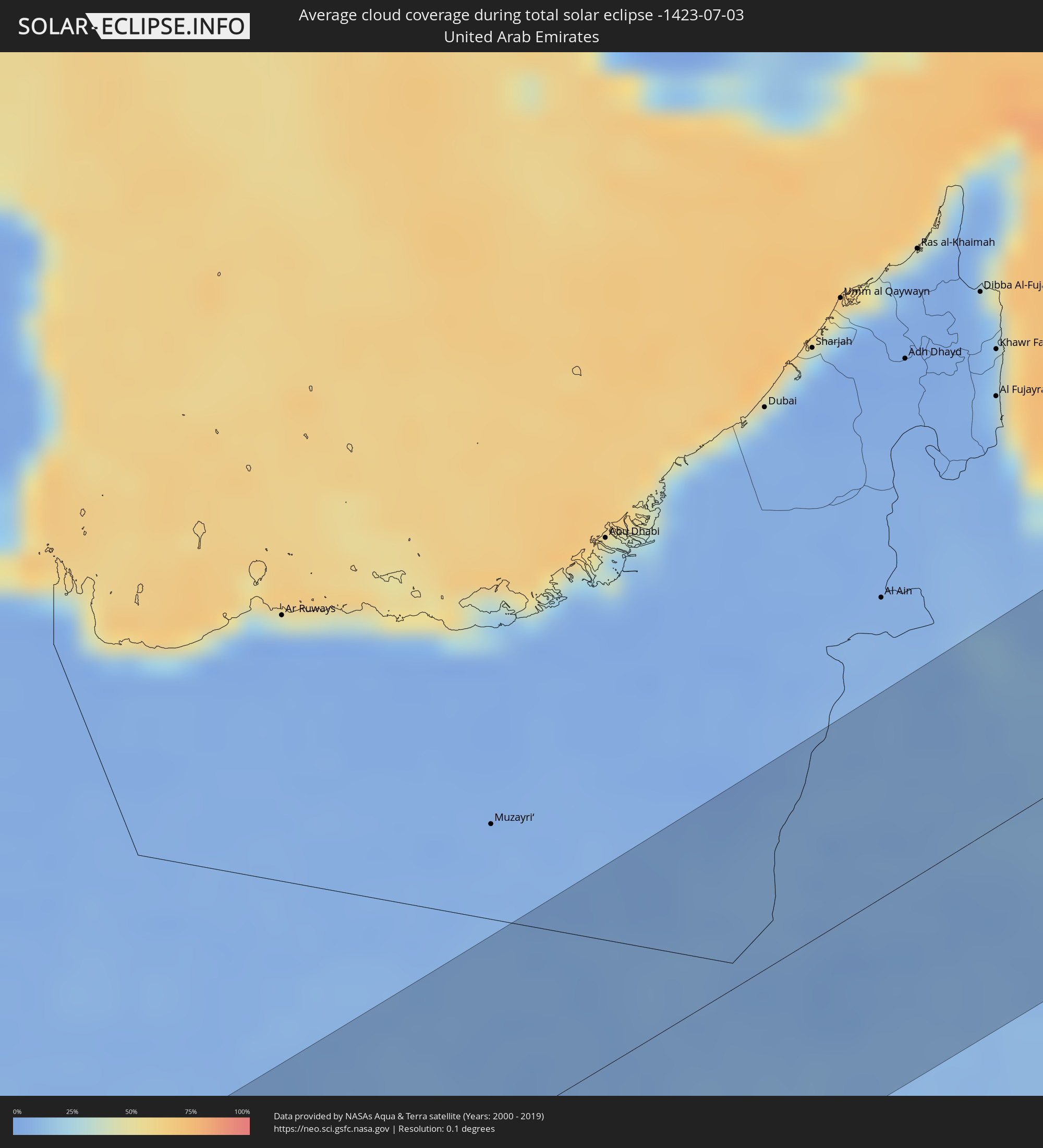 Vereinigte Arabische Emirate
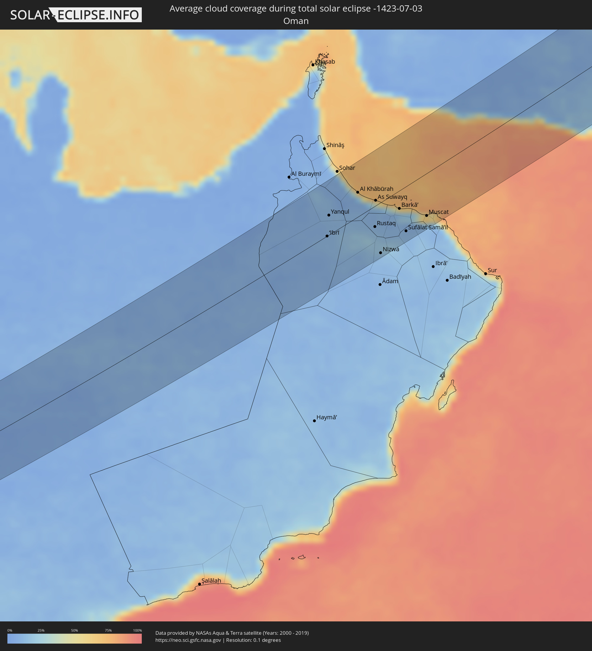 Oman
Oman
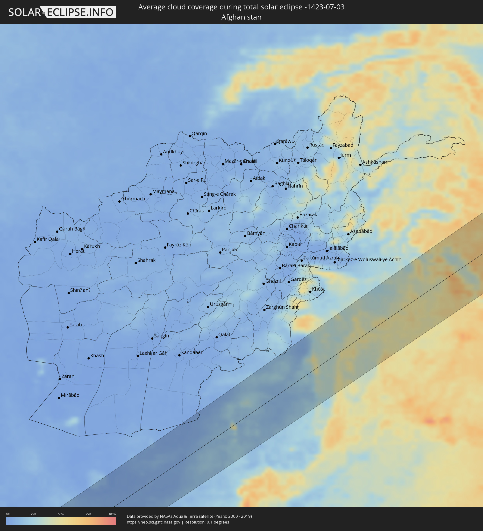 Afghanistan
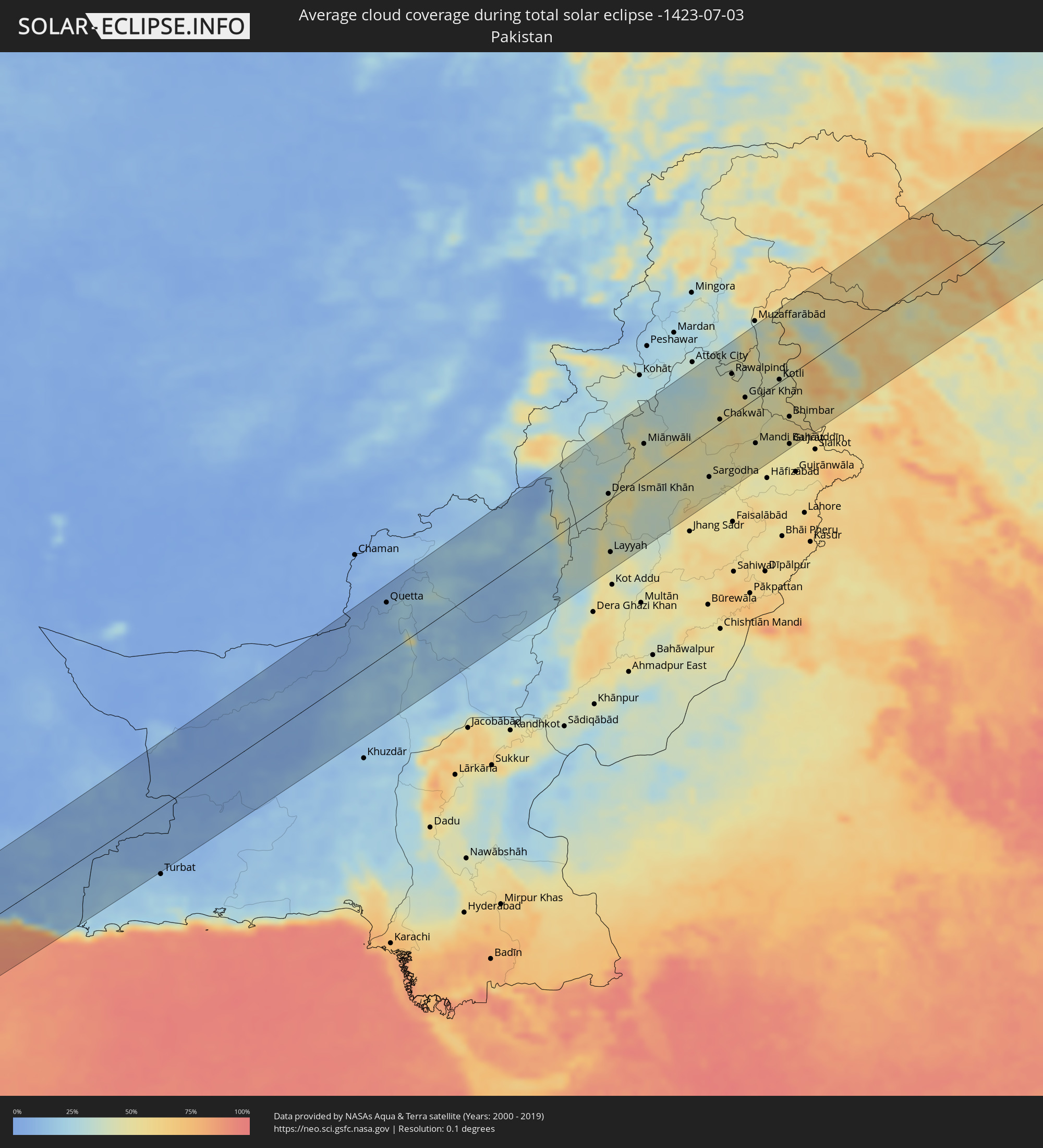 Pakistan
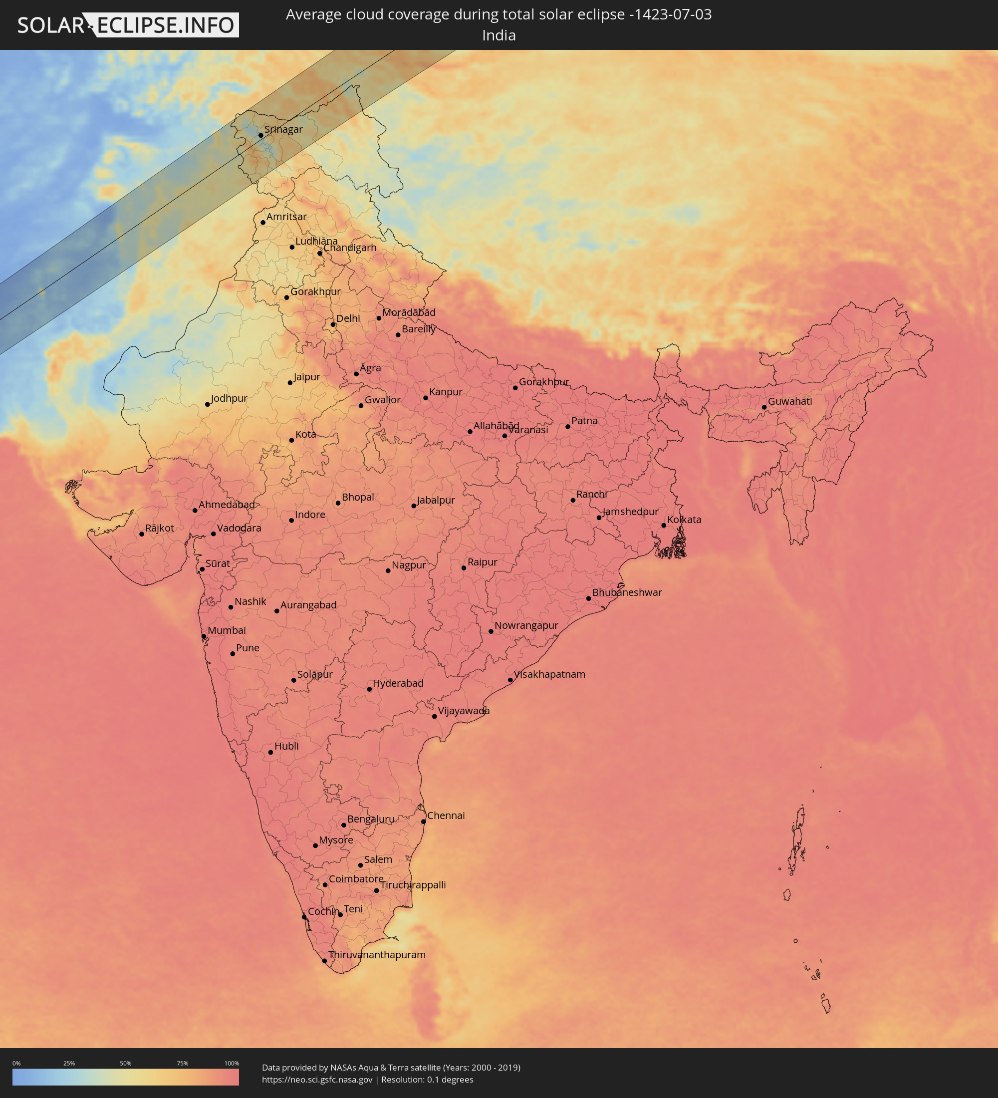 Indien
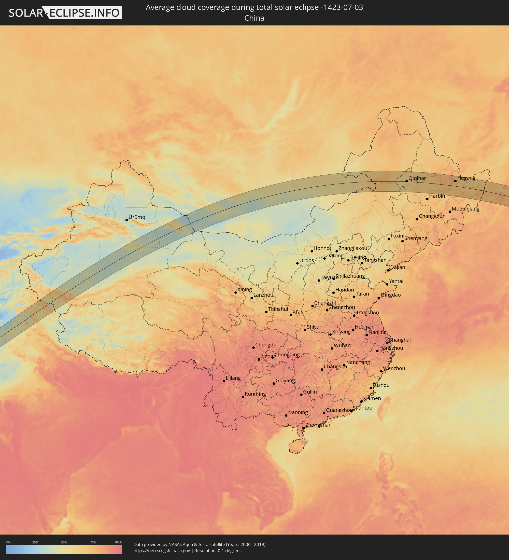 Volksrepublik China
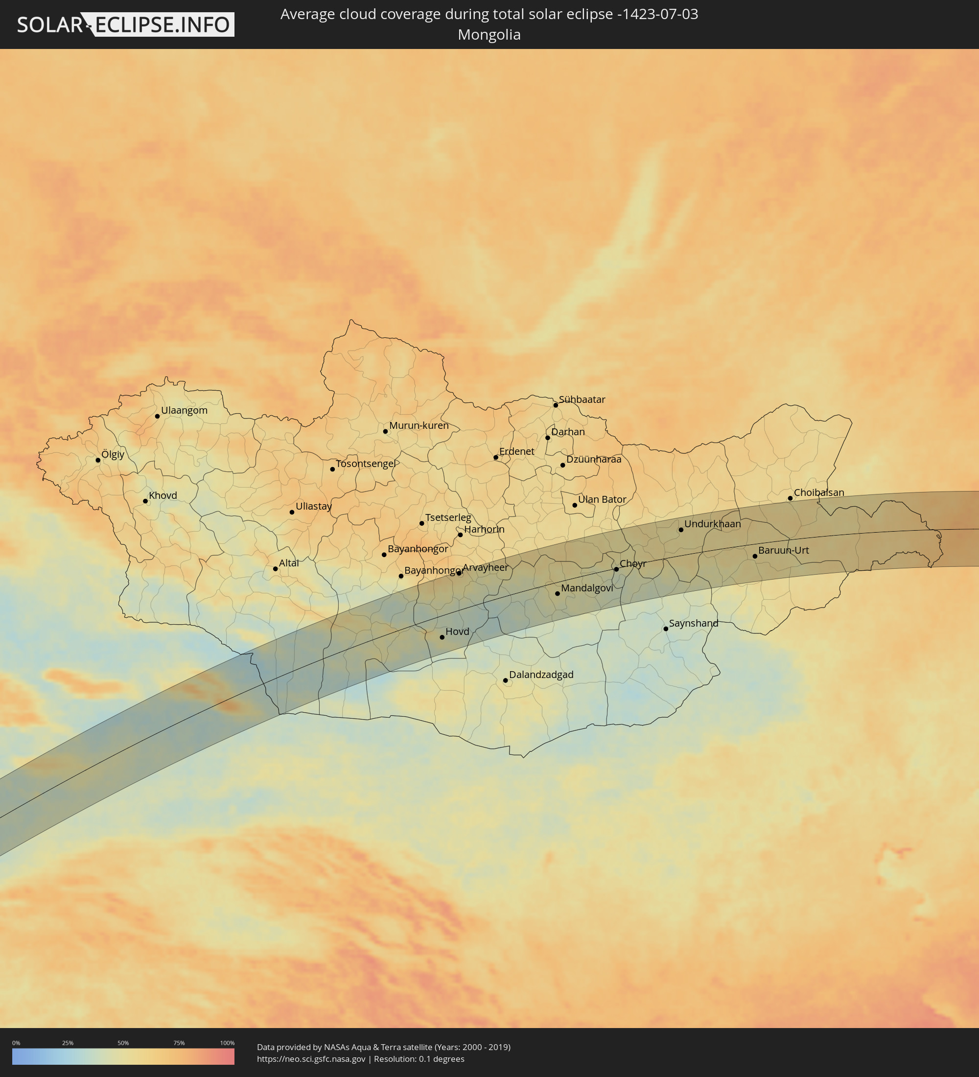 Mongolei
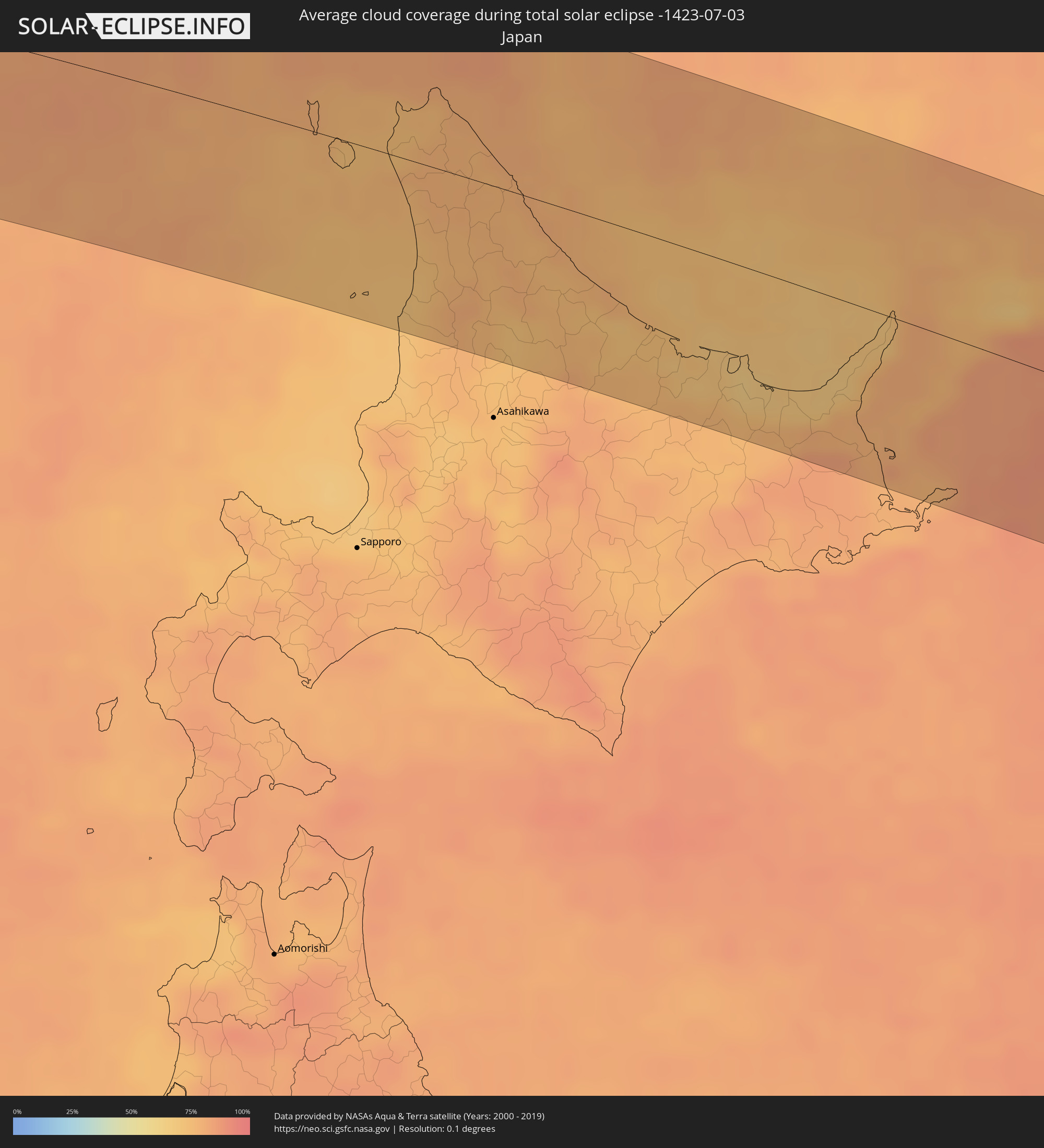 Japan
Japan
Orte im Finsternispfad
Die nachfolgene Tabelle zeigt Städte und Orte mit mehr als 5.000 Einwohnern, die sich im Finsternispfad befinden. Städte mit mehr als 100.000 Einwohnern sind dick gekennzeichnet. Mit einem Klick auf den Ort öffnet sich eine Detailkarte die die Lage des jeweiligen Ortes zusammen mit dem Verlauf der zentralen Finsternis präsentiert.
| Ort | Typ | Dauer der Verfinsterung | Ortszeit bei maximaler Verfinsterung | Entfernung zur Zentrallinie | Ø Bewölkung |
|
Mendefera, Debub
|
total | - | 05:21:36 UTC+02:27 | 75 km | 52% |
|
Adi Keyh, Debub
|
total | - | 05:21:22 UTC+02:27 | 44 km | 55% |
|
Ādīgrat, Tigray
|
total | - | 05:20:53 UTC+02:27 | 17 km | 64% |
|
Al Jarādīyah, Jizan
|
total | - | 06:01:26 UTC+03:06 | 52 km | 24% |
|
Şāmitah, Jizan
|
total | - | 06:01:26 UTC+03:06 | 53 km | 24% |
|
Ḩajjah, Ḩajjah
|
total | - | 06:00:28 UTC+03:06 | 69 km | 33% |
|
Sa'dah, Şa‘dah
|
total | - | 06:01:33 UTC+03:06 | 47 km | 40% |
|
Al Ḩazm, Al Jawf
|
total | - | 06:00:37 UTC+03:06 | 79 km | 24% |
|
‘Ibrī, Az̧ Z̧āhirah
|
total | - | 06:42:11 UTC+03:41 | 1 km | 11% |
|
Yanqul, Az̧ Z̧āhirah
|
total | - | 06:42:38 UTC+03:41 | 32 km | 10% |
|
Şaḩam, Al Batinah North Governorate
|
total | - | 06:43:25 UTC+03:41 | 69 km | 33% |
|
Al Khābūrah, Al Batinah North Governorate
|
total | - | 06:43:14 UTC+03:41 | 40 km | 23% |
|
Bahlā’, Muḩāfaz̧at ad Dākhilīyah
|
total | - | 06:42:01 UTC+03:41 | 67 km | 13% |
|
Rustaq, Al Batinah South Governorate
|
total | - | 06:42:33 UTC+03:41 | 34 km | 15% |
|
As Suwayq, Al Batinah North Governorate
|
total | - | 06:43:07 UTC+03:41 | 8 km | 13% |
|
Bayt al ‘Awābī, Al Batinah South Governorate
|
total | - | 06:42:28 UTC+03:41 | 48 km | 16% |
|
Nizwá, Muḩāfaz̧at ad Dākhilīyah
|
total | - | 06:42:00 UTC+03:41 | 83 km | 12% |
|
Barkā’, Al Batinah South Governorate
|
total | - | 06:43:02 UTC+03:41 | 29 km | 18% |
|
Sufālat Samā’il, Muḩāfaz̧at ad Dākhilīyah
|
total | - | 06:42:35 UTC+03:41 | 73 km | 11% |
|
Bidbid, Muḩāfaz̧at ad Dākhilīyah
|
total | - | 06:42:43 UTC+03:41 | 71 km | 11% |
|
Seeb, Muḩāfaz̧at Masqaţ
|
total | - | 06:43:04 UTC+03:41 | 49 km | 33% |
|
Bawshar, Muḩāfaz̧at Masqaţ
|
total | - | 06:42:58 UTC+03:41 | 71 km | 20% |
|
Muscat, Muḩāfaz̧at Masqaţ
|
total | - | 06:43:00 UTC+03:41 | 69 km | 20% |
|
Chabahar, Sistan and Baluchestan
|
total | - | 06:30:22 UTC+03:25 | 31 km | 79% |
|
Qaşr-e Qand, Sistan and Baluchestan
|
total | - | 06:31:40 UTC+03:25 | 52 km | 10% |
|
Quetta, Balochistān
|
total | - | 07:42:39 UTC+04:28 | 71 km | 10% |
|
Dera Ismāīl Khān, Khyber Pakhtunkhwa
|
total | - | 07:47:45 UTC+04:28 | 9 km | 49% |
|
Layyah, Punjab
|
total | - | 07:46:26 UTC+04:28 | 73 km | 48% |
|
Bhakkar, Punjab
|
total | - | 07:47:33 UTC+04:28 | 19 km | 45% |
|
Miānwāli, Punjab
|
total | - | 07:49:22 UTC+04:28 | 43 km | 45% |
|
Khushāb, Punjab
|
total | - | 07:49:36 UTC+04:28 | 27 km | 49% |
|
Sargodha, Punjab
|
total | - | 07:49:32 UTC+04:28 | 63 km | 46% |
|
Chakwāl, Punjab
|
total | - | 07:51:01 UTC+04:28 | 5 km | 45% |
|
Bhalwāl, Punjab
|
total | - | 07:50:01 UTC+04:28 | 58 km | 49% |
|
Rawalpindi, Punjab
|
total | - | 07:52:14 UTC+04:28 | 55 km | 46% |
|
Abbottābād, Khyber Pakhtunkhwa
|
total | - | 07:53:14 UTC+04:28 | 97 km | 37% |
|
Mandi Bahāuddīn, Punjab
|
total | - | 07:51:00 UTC+04:28 | 60 km | 47% |
|
Jhelum, Punjab
|
total | - | 07:51:46 UTC+04:28 | 41 km | 48% |
|
Khāriān, Punjab
|
total | - | 07:51:43 UTC+04:28 | 60 km | 49% |
|
Kotli, Azad Kashmir
|
total | - | 07:52:50 UTC+04:28 | 3 km | 45% |
|
Bhimbar, Azad Kashmir
|
total | - | 07:52:08 UTC+04:28 | 56 km | 55% |
|
Gujrāt, Punjab
|
total | - | 07:51:30 UTC+04:28 | 93 km | 48% |
|
Pūnch, Kashmir
|
total | - | 08:46:22 UTC+05:21 | 16 km | 45% |
|
Kupwāra, Kashmir
|
total | - | 08:46:56 UTC+05:21 | 31 km | 72% |
|
Rajaori, Kashmir
|
total | - | 08:45:56 UTC+05:21 | 31 km | 54% |
|
Bāramūla, Kashmir
|
total | - | 08:47:17 UTC+05:21 | 44 km | 44% |
|
Pattan, Kashmir
|
total | - | 08:47:24 UTC+05:21 | 28 km | 35% |
|
Hājan, Kashmir
|
total | - | 08:47:41 UTC+05:21 | 38 km | 32% |
|
Bandipura, Kashmir
|
total | - | 08:47:54 UTC+05:21 | 47 km | 31% |
|
Sumbal, Kashmir
|
total | - | 08:47:36 UTC+05:21 | 30 km | 35% |
|
Gāndarbal, Kashmir
|
total | - | 08:47:43 UTC+05:21 | 23 km | 37% |
|
Srinagar, Kashmir
|
total | - | 08:47:31 UTC+05:21 | 8 km | 36% |
|
Riāsi, Kashmir
|
total | - | 08:45:57 UTC+05:21 | 86 km | 55% |
|
Shupīyan, Kashmir
|
total | - | 08:46:58 UTC+05:21 | 27 km | 55% |
|
Pulwama, Kashmir
|
total | - | 08:47:16 UTC+05:21 | 16 km | 37% |
|
Kulgam, Kashmir
|
total | - | 08:47:01 UTC+05:21 | 44 km | 51% |
|
Trāl, Kashmir
|
total | - | 08:47:33 UTC+05:21 | 23 km | 35% |
|
Anantnag, Kashmir
|
total | - | 08:47:17 UTC+05:21 | 43 km | 36% |
|
Kargil, Kashmir
|
total | - | 08:49:31 UTC+05:21 | 17 km | 47% |
|
Hotan, Xinjiang Uyghur Autonomous Region
|
total | - | 11:36:28 UTC+08:00 | 29 km | 49% |
|
Hami, Xinjiang Uyghur Autonomous Region
|
total | - | 12:03:45 UTC+08:00 | 9 km | 36% |
|
Hovd, Övörhangay
|
total | - | 11:28:03 UTC+07:07 | 60 km | 46% |
|
Arvayheer, Övörhangay
|
total | - | 11:30:27 UTC+07:07 | 95 km | 56% |
|
Mandalgovi, Middle Govĭ
|
total | - | 11:36:15 UTC+07:07 | 32 km | 47% |
|
Choyr, Govĭ-Sumber
|
total | - | 11:40:21 UTC+07:07 | 5 km | 42% |
|
Undurkhaan, Hentiy
|
total | - | 11:44:52 UTC+07:07 | 66 km | 53% |
|
Baruun-Urt, Sühbaatar
|
total | - | 11:49:22 UTC+07:07 | 35 km | 51% |
|
Zhalantun, Inner Mongolia
|
total | - | 12:58:12 UTC+08:00 | 74 km | 64% |
|
Hulan Ergi, Heilongjiang
|
total | - | 12:59:59 UTC+08:00 | 14 km | 62% |
|
Qiqihar, Heilongjiang
|
total | - | 13:00:29 UTC+08:00 | 3 km | 63% |
|
Fendou, Heilongjiang
|
total | - | 13:02:17 UTC+08:00 | 72 km | 69% |
|
Honggang, Heilongjiang
|
total | - | 13:02:26 UTC+08:00 | 98 km | 70% |
|
Longfeng, Heilongjiang
|
total | - | 13:02:45 UTC+08:00 | 83 km | 66% |
|
Anda, Heilongjiang
|
total | - | 13:03:10 UTC+08:00 | 96 km | 69% |
|
Hailun, Heilongjiang
|
total | - | 13:05:18 UTC+08:00 | 30 km | 68% |
|
Suihua, Heilongjiang
|
total | - | 13:05:49 UTC+08:00 | 60 km | 71% |
|
Yichun, Heilongjiang
|
total | - | 13:08:08 UTC+08:00 | 75 km | 75% |
|
Lianhe, Heilongjiang
|
total | - | 13:09:08 UTC+08:00 | 13 km | 74% |
|
Hegang, Heilongjiang
|
total | - | 13:10:33 UTC+08:00 | 48 km | 73% |
|
Jiamusi, Heilongjiang
|
total | - | 13:10:59 UTC+08:00 | 13 km | 73% |
|
Amurzet, Jewish Autonomous Oblast
|
total | - | 13:59:00 UTC+08:47 | 94 km | 68% |
|
Shuangyashan, Heilongjiang
|
total | - | 13:12:23 UTC+08:00 | 22 km | 75% |
|
Baoshan, Heilongjiang
|
total | - | 13:12:51 UTC+08:00 | 27 km | 71% |
|
Dal’nerechensk, Primorskiy
|
total | - | 14:04:20 UTC+08:47 | 65 km | 75% |
|
Luchegorsk, Primorskiy
|
total | - | 14:04:31 UTC+08:47 | 1 km | 75% |
|
Bikin, Khabarovsk Krai
|
total | - | 14:04:17 UTC+08:47 | 39 km | 71% |
|
Wakkanai, Hokkaido
|
total | - | 14:27:56 UTC+09:00 | 27 km | 73% |
|
Makubetsu, Hokkaido
|
total | - | 14:28:09 UTC+09:00 | 27 km | 75% |
|
Nayoro, Hokkaido
|
total | - | 14:30:04 UTC+09:00 | 67 km | 72% |
|
Mombetsu, Hokkaido
|
total | - | 14:31:08 UTC+09:00 | 45 km | 74% |
|
Kitami, Hokkaido
|
total | - | 14:32:23 UTC+09:00 | 90 km | 76% |
|
Bihoro, Hokkaido
|
total | - | 14:32:37 UTC+09:00 | 83 km | 75% |
|
Abashiri, Hokkaido
|
total | - | 14:32:34 UTC+09:00 | 58 km | 68% |
|
Shibetsu, Hokkaido
|
total | - | 14:33:58 UTC+09:00 | 73 km | 79% |
|
Nemuro, Hokkaido
|
total | - | 14:34:51 UTC+09:00 | 97 km | 83% |
|
Yuzhno-Kurilsk, Sakhalin
|
total | - | 15:49:11 UTC+10:14 | 15 km | 84% |