Totale Sonnenfinsternis vom 22.10.-1615
| Wochentag: | Montag |
| Maximale Dauer der Verfinsterung: | 01m40s |
| Maximale Breite des Finsternispfades: | 67 km |
| Saroszyklus: | 27 |
| Bedeckungsgrad: | 100% |
| Magnitude: | 1.0176 |
| Gamma: | 0.4467 |
Wo kann man die Sonnenfinsternis vom 22.10.-1615 sehen?
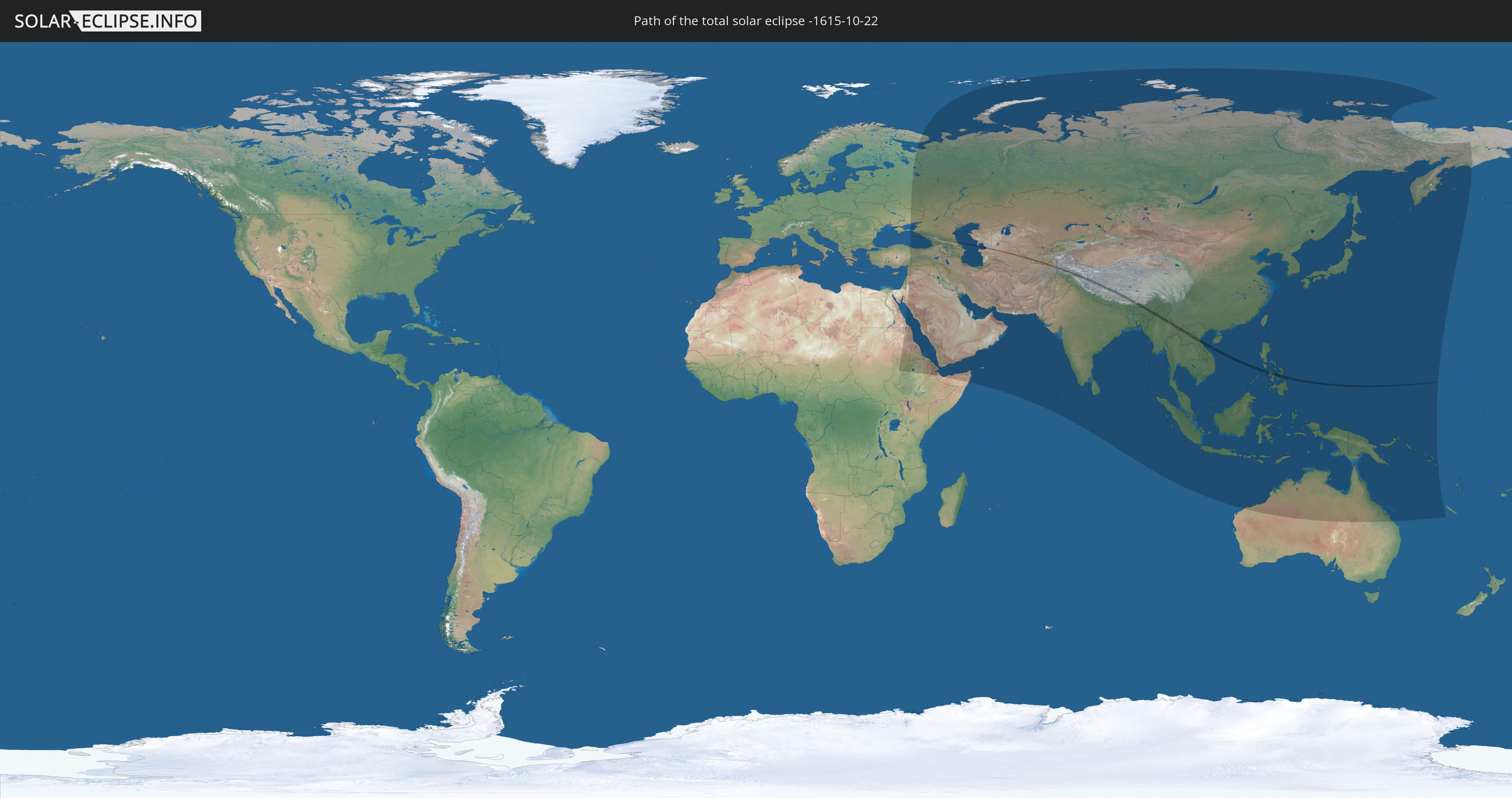
Die Sonnenfinsternis am 22.10.-1615 kann man in 67 Ländern als partielle Sonnenfinsternis beobachten.
Der Finsternispfad verläuft durch 15 Länder. Nur in diesen Ländern ist sie als totale Sonnenfinsternis zu sehen.
In den folgenden Ländern ist die Sonnenfinsternis total zu sehen
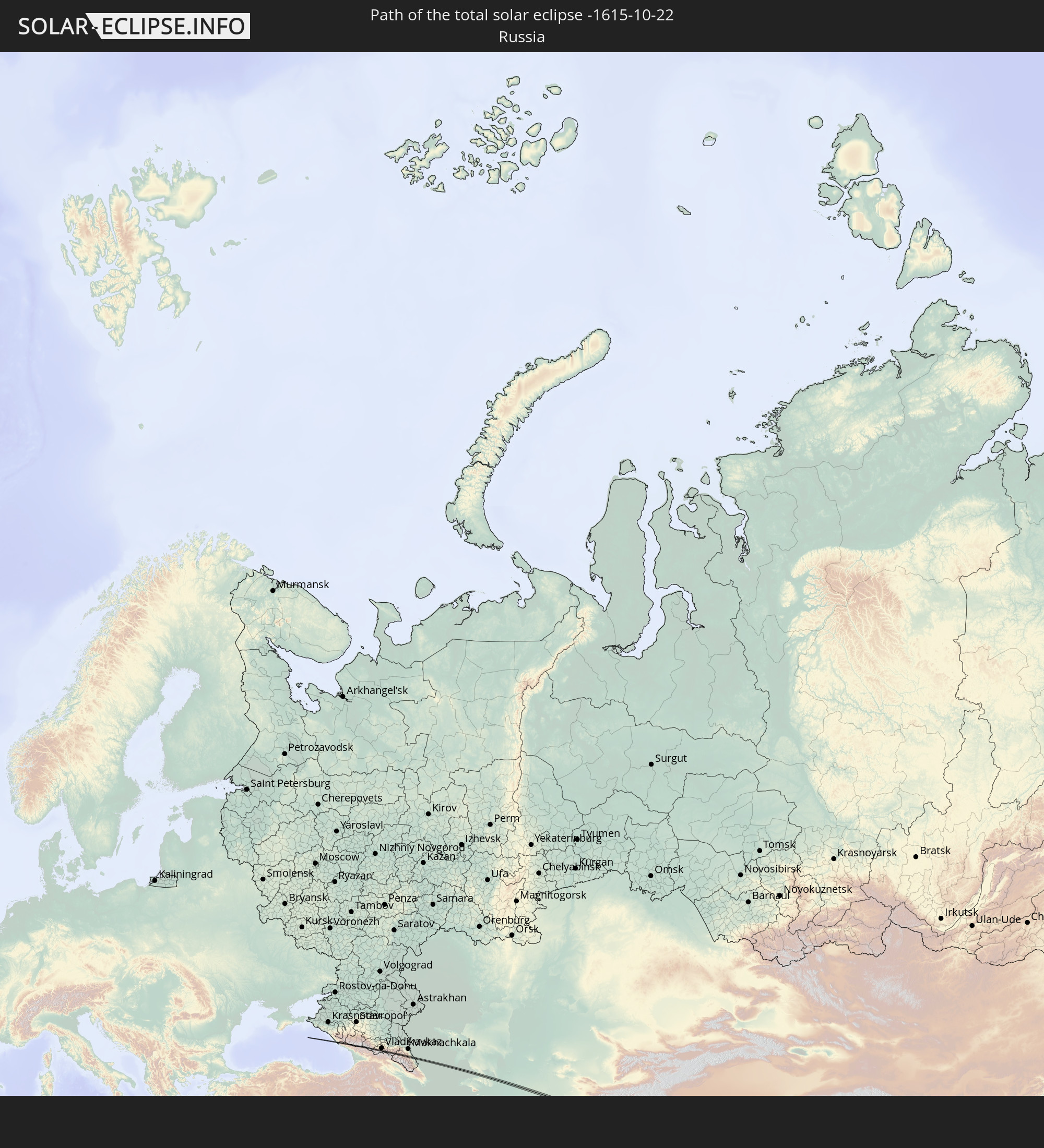 Russland
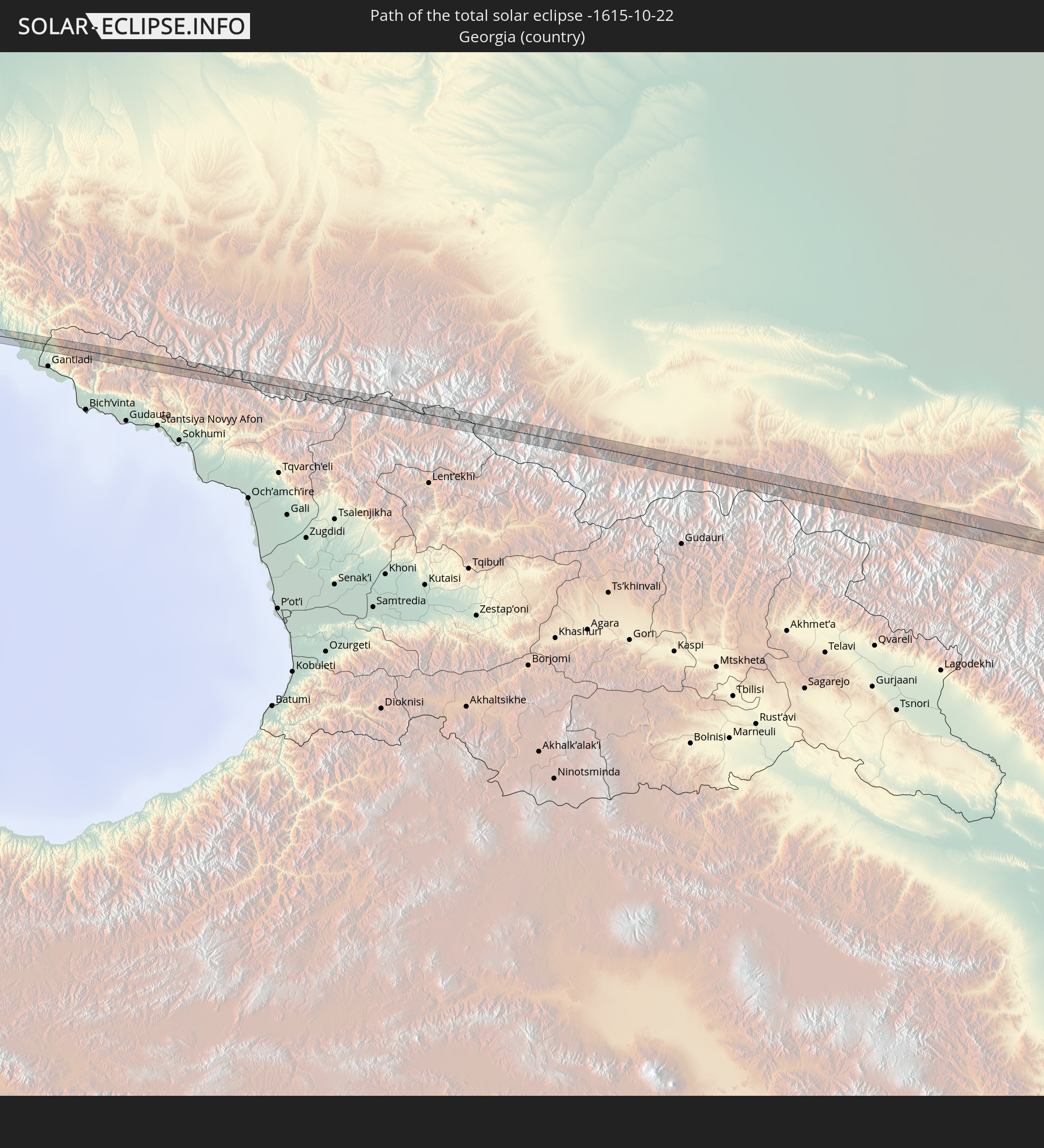 Georgien
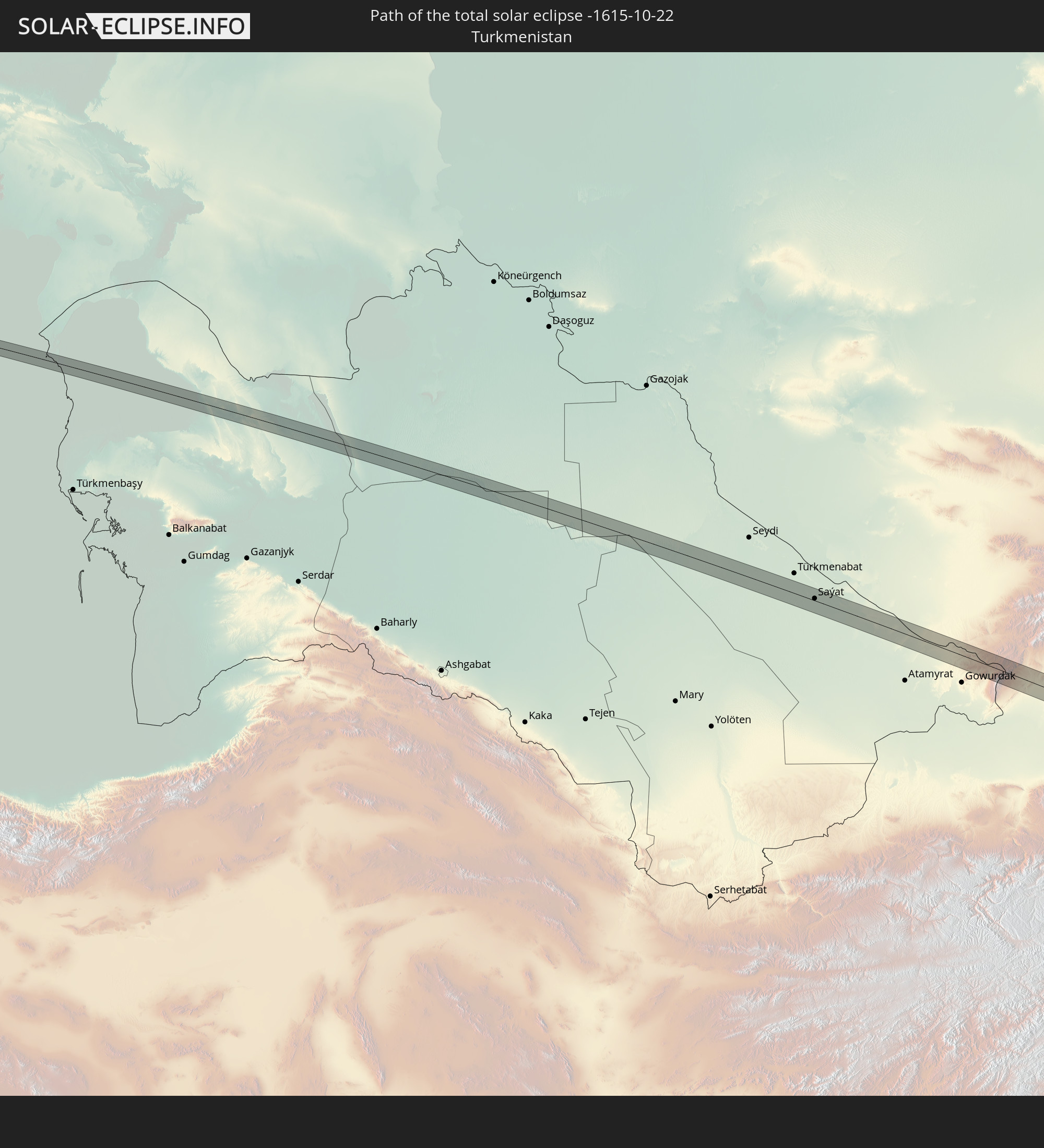 Turkmenistan
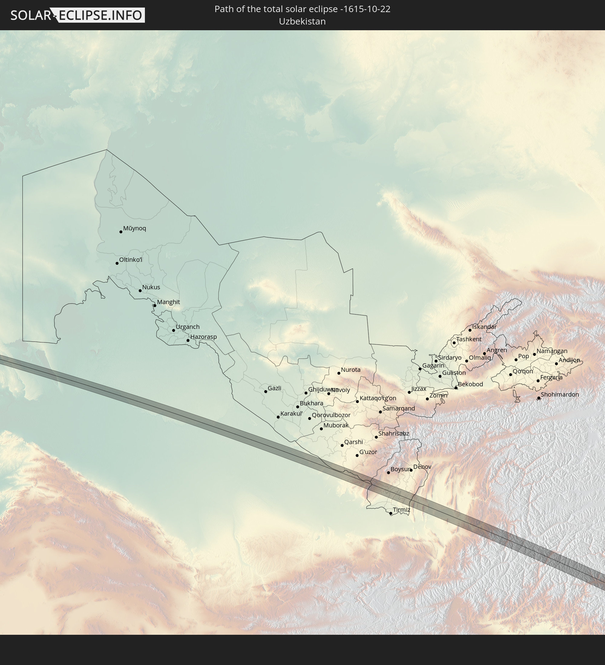 Usbekistan
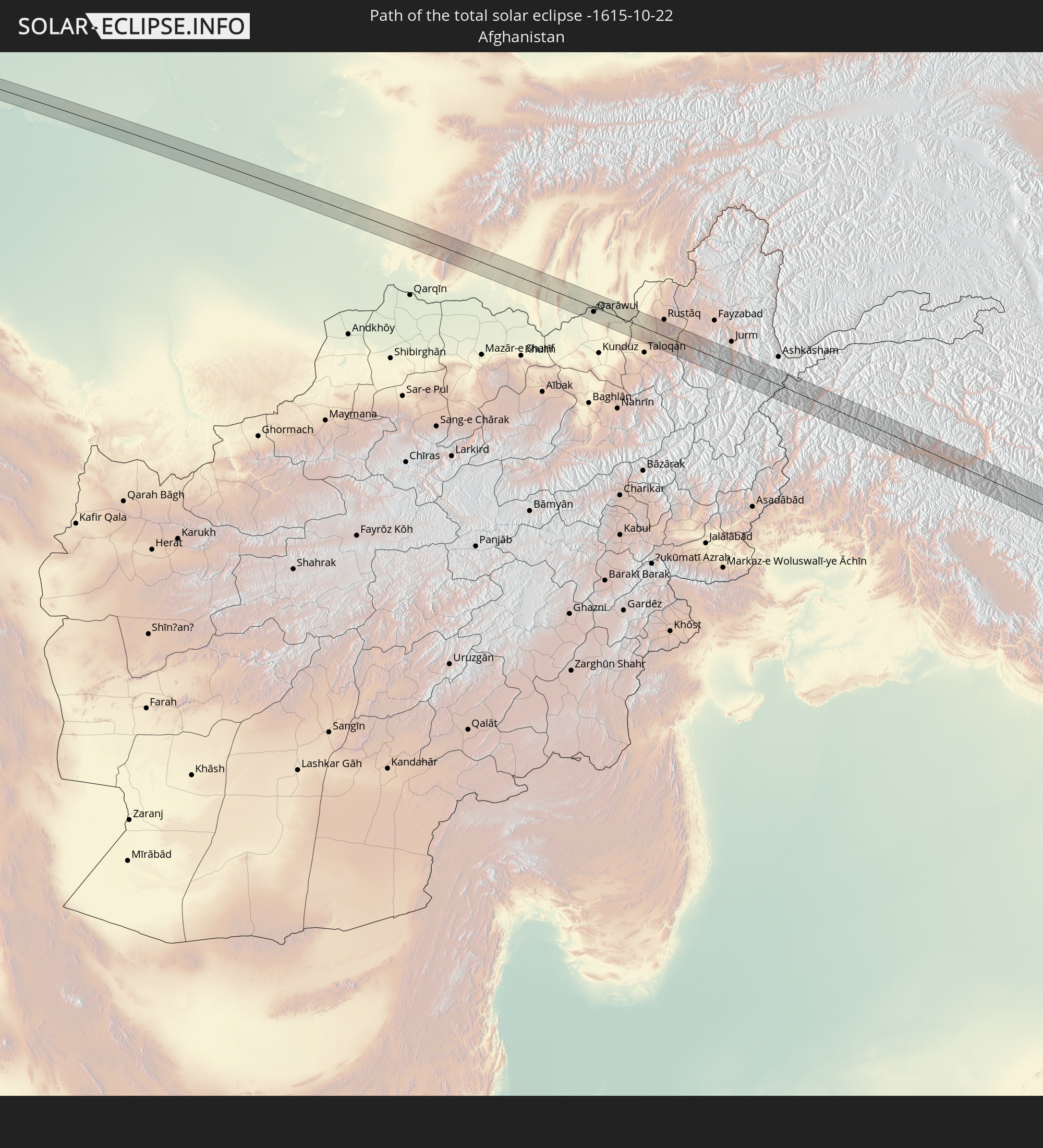 Afghanistan
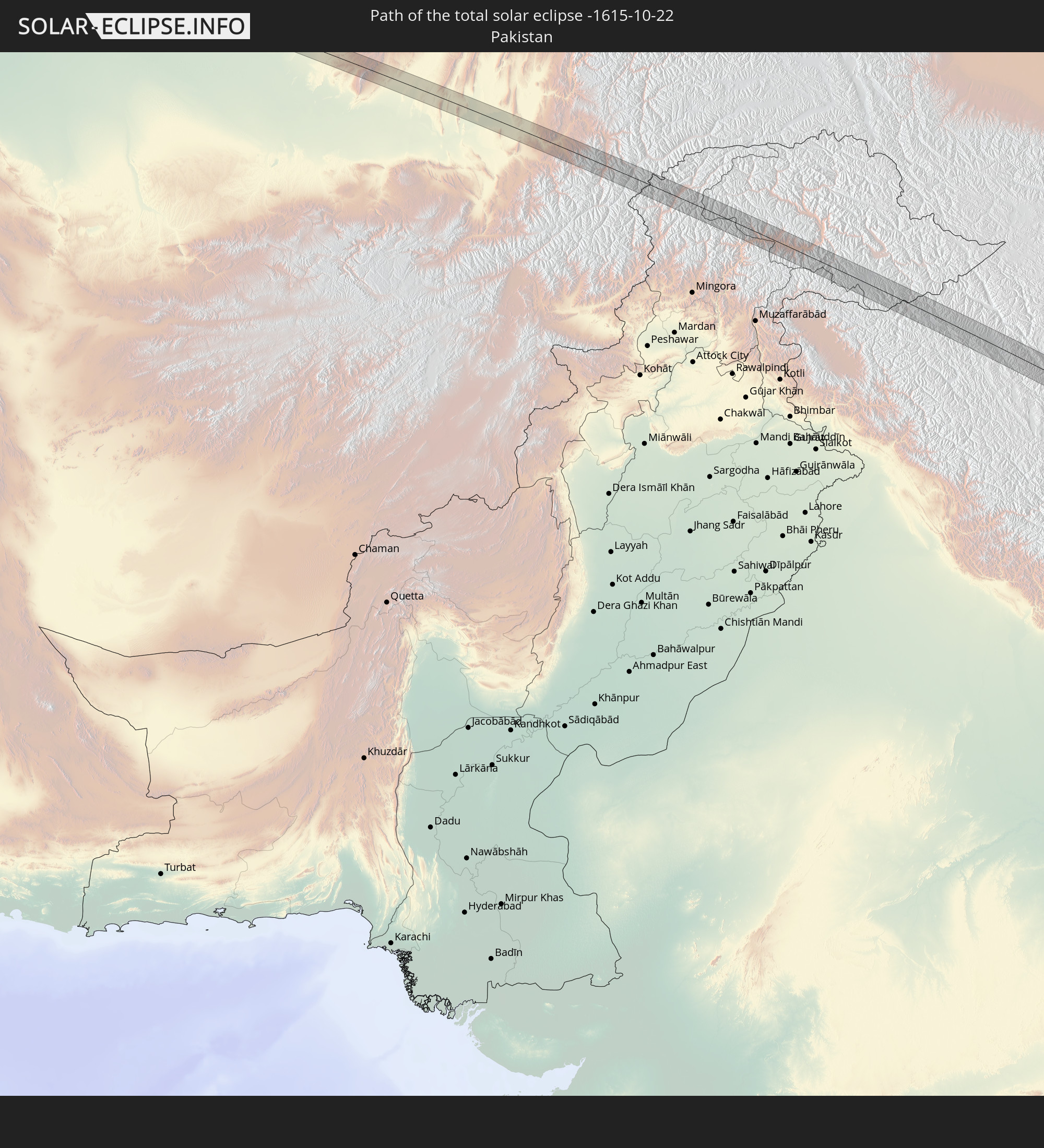 Pakistan
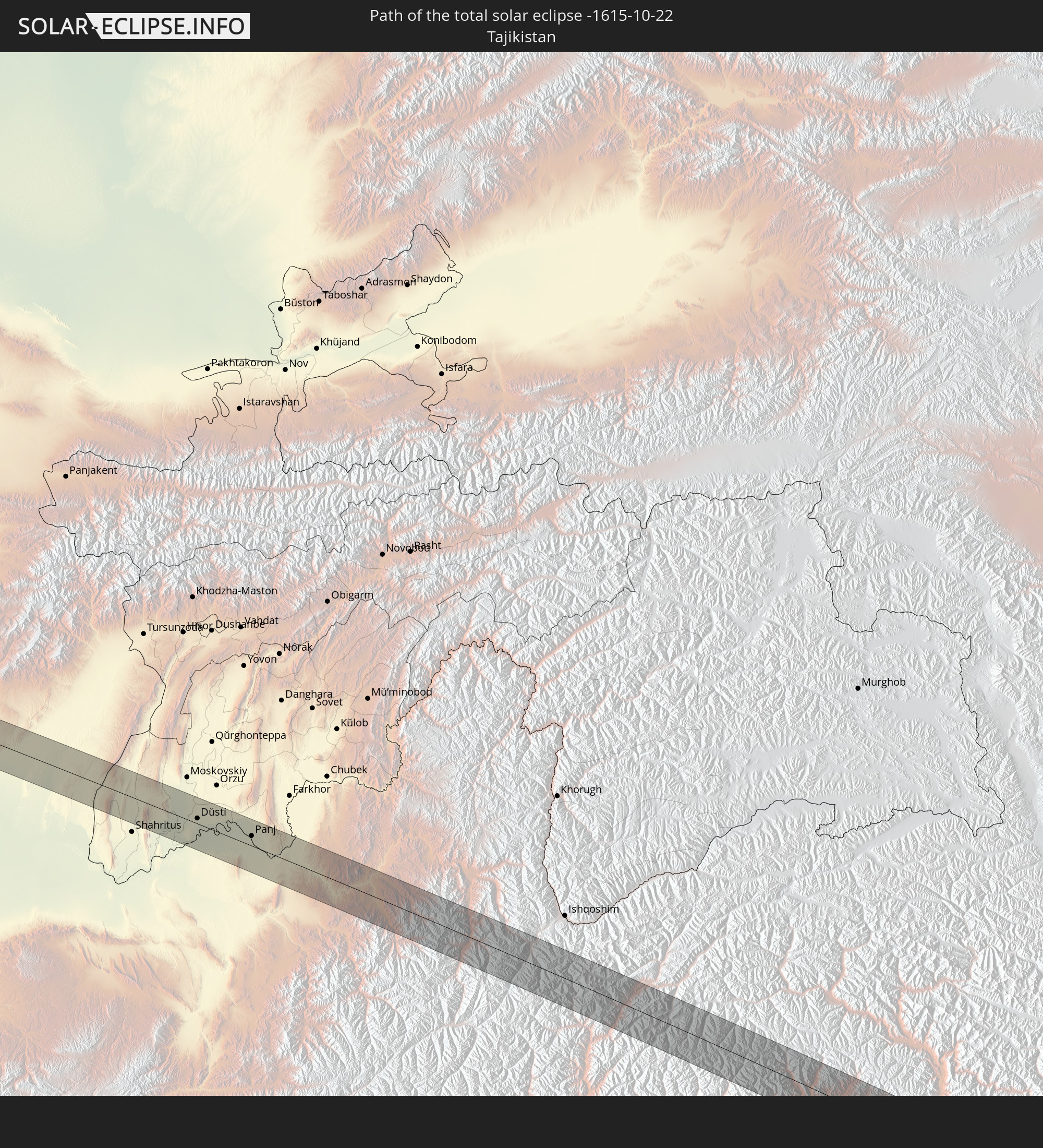 Tadschikistan
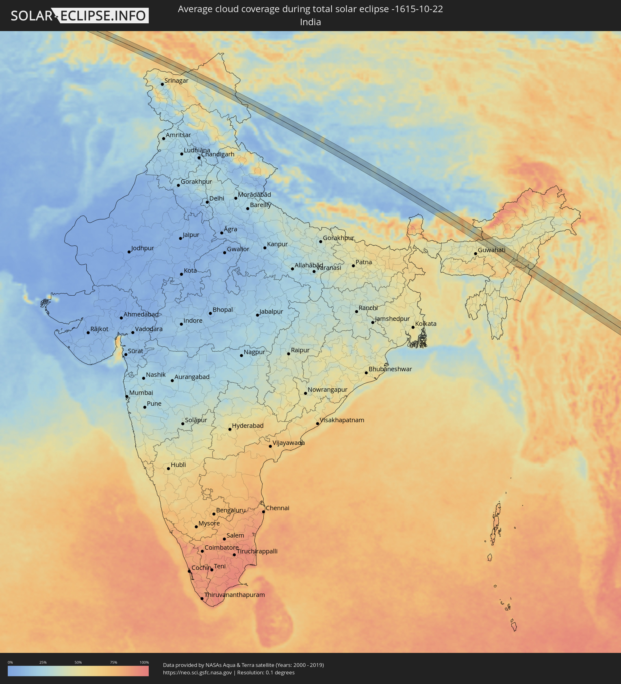
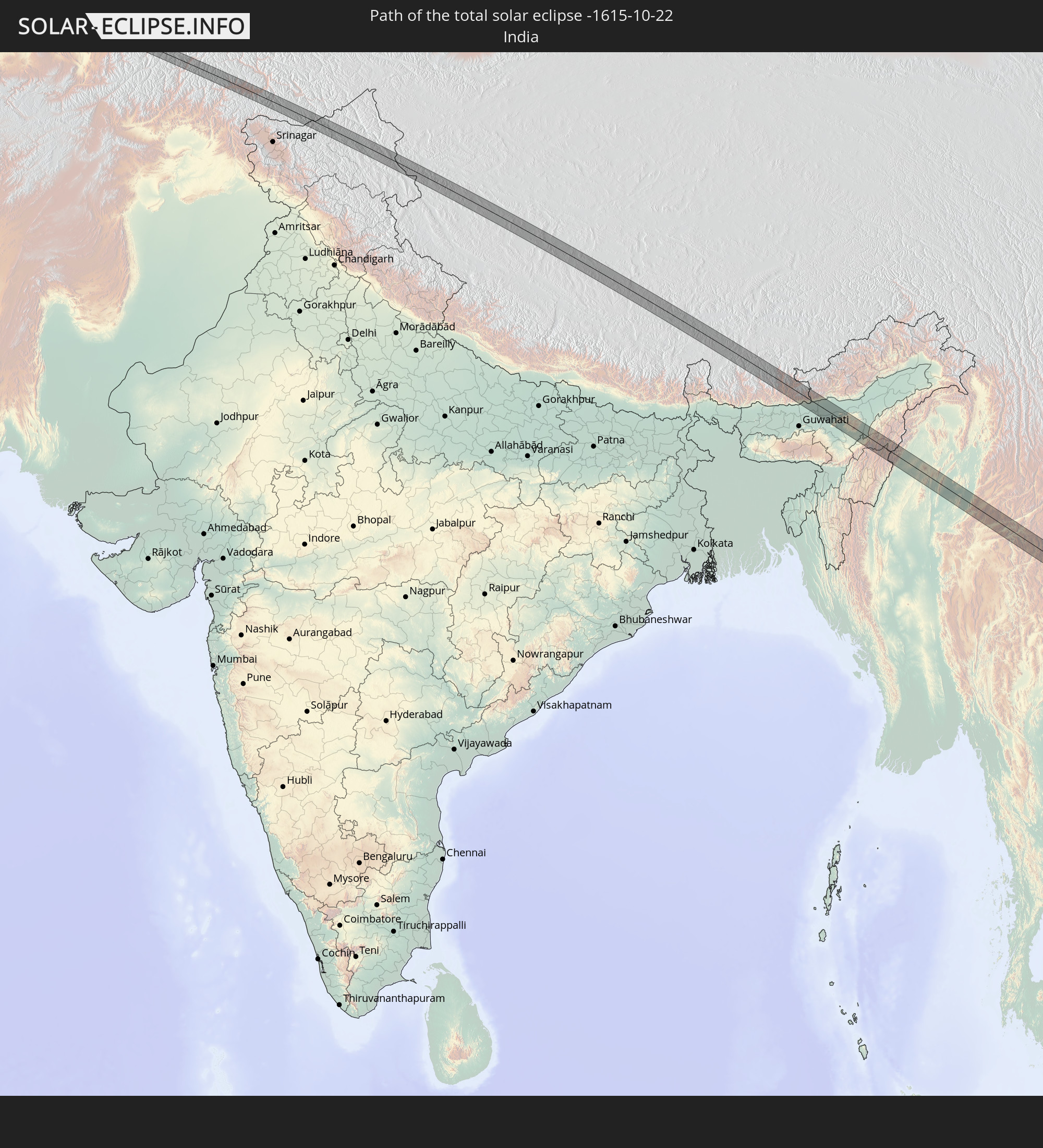 Indien
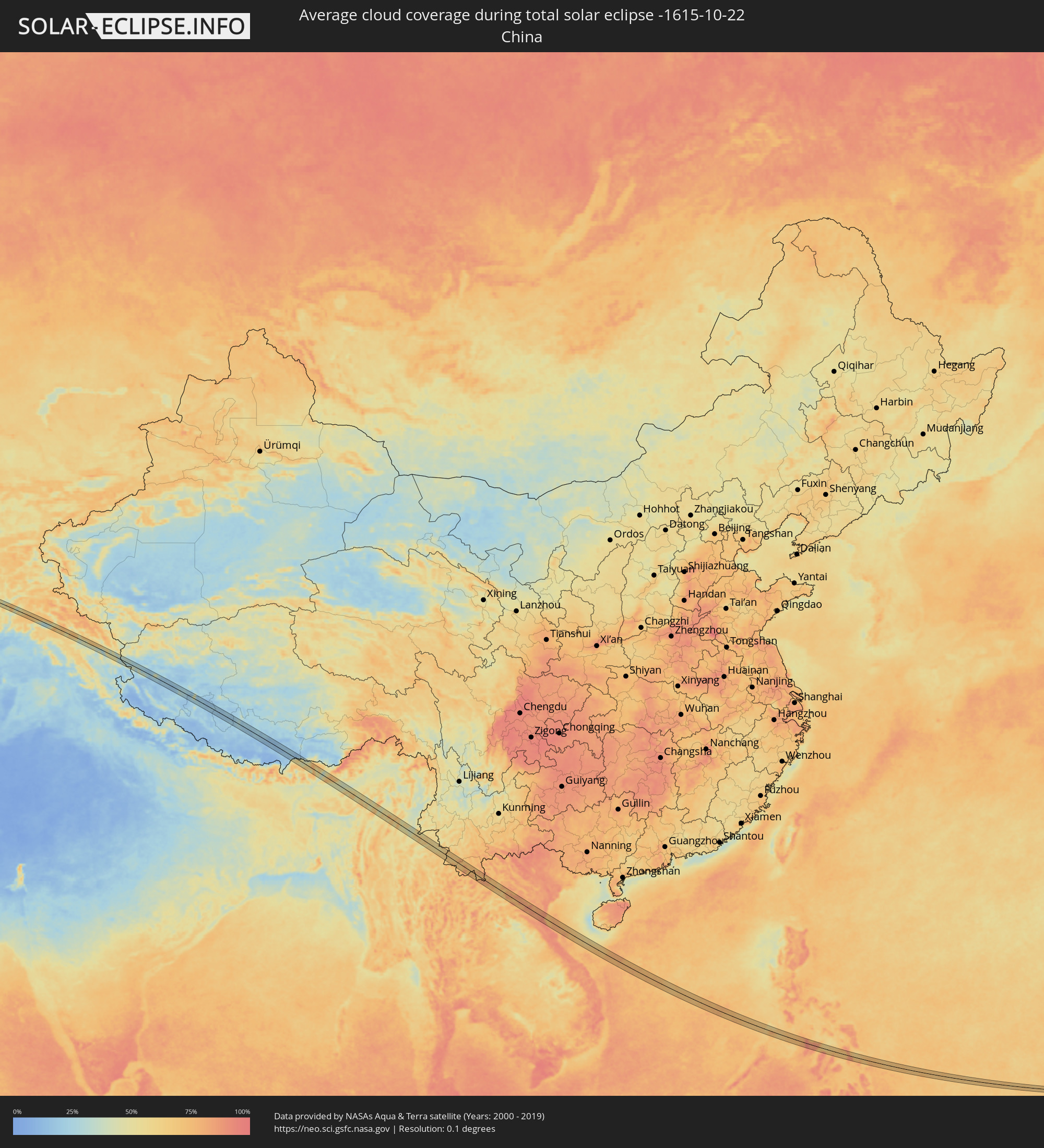
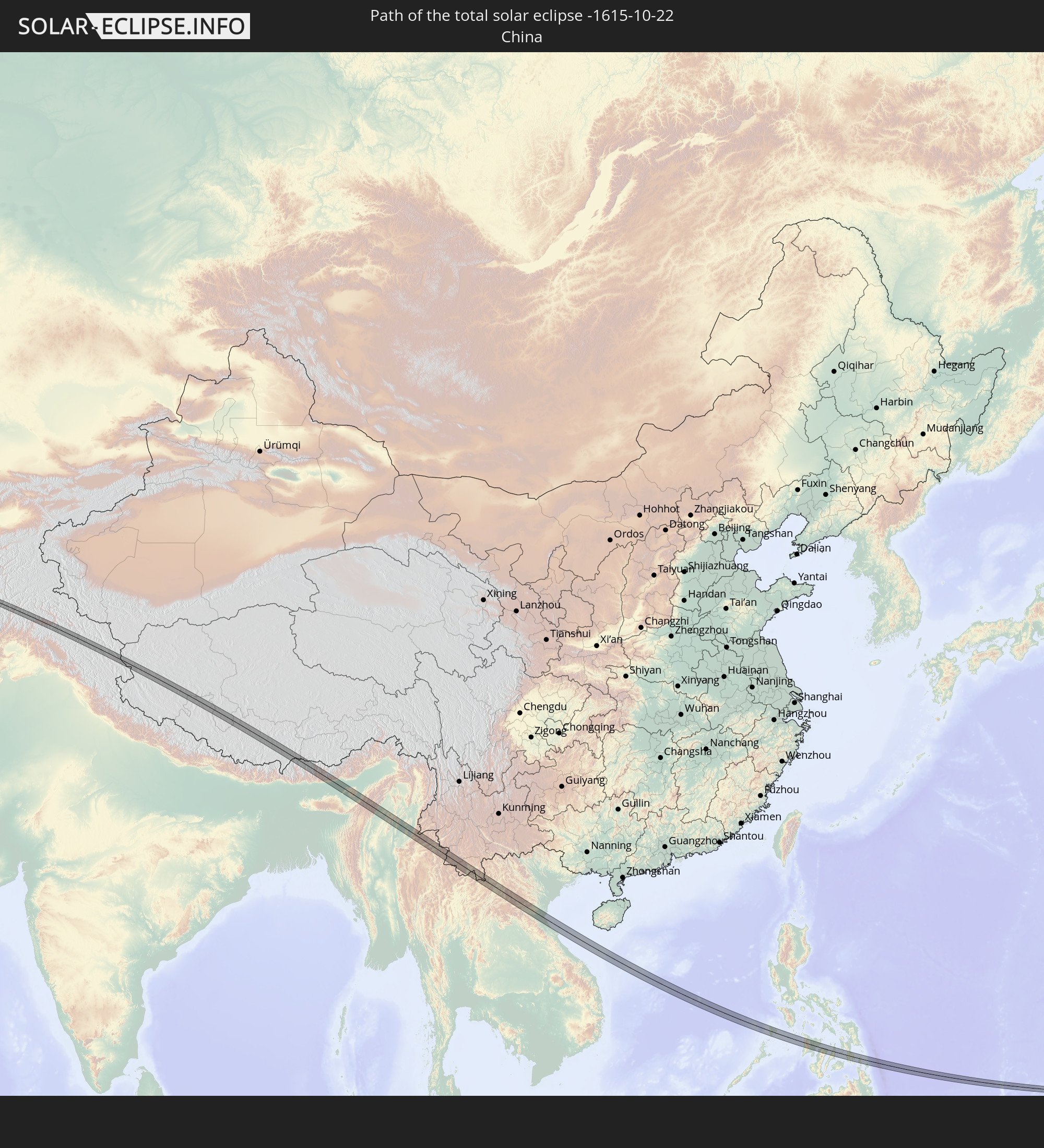 Volksrepublik China
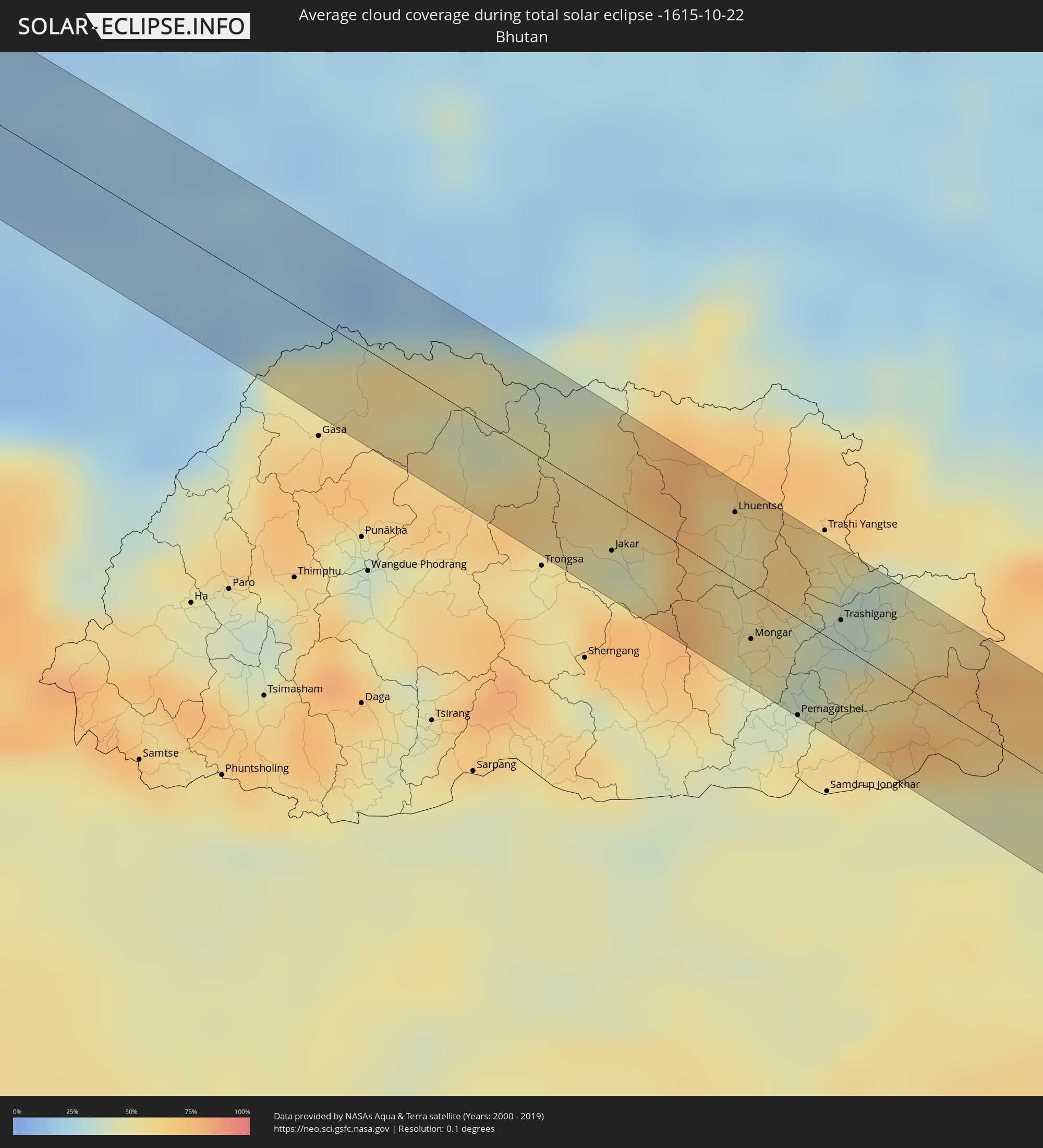
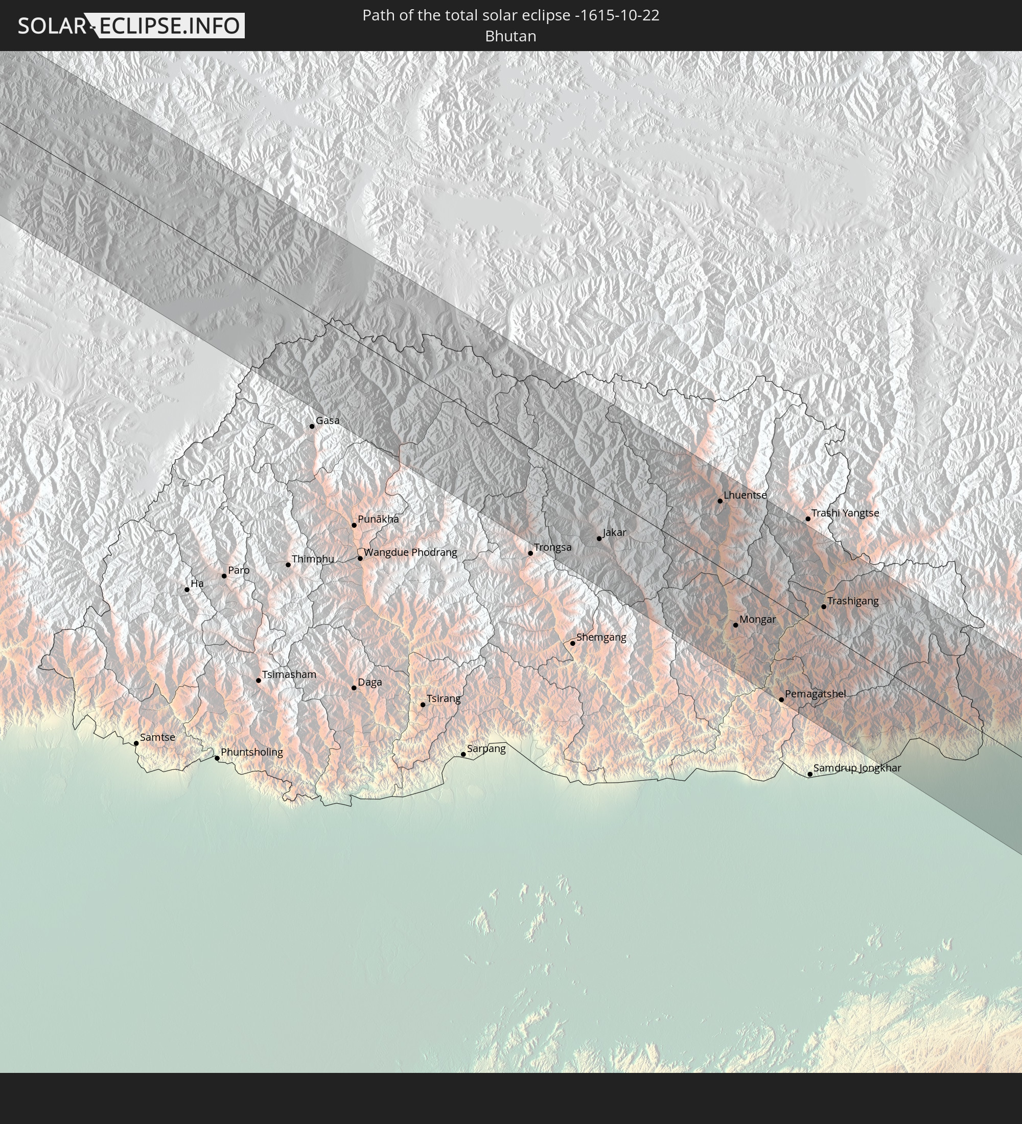 Bhutan
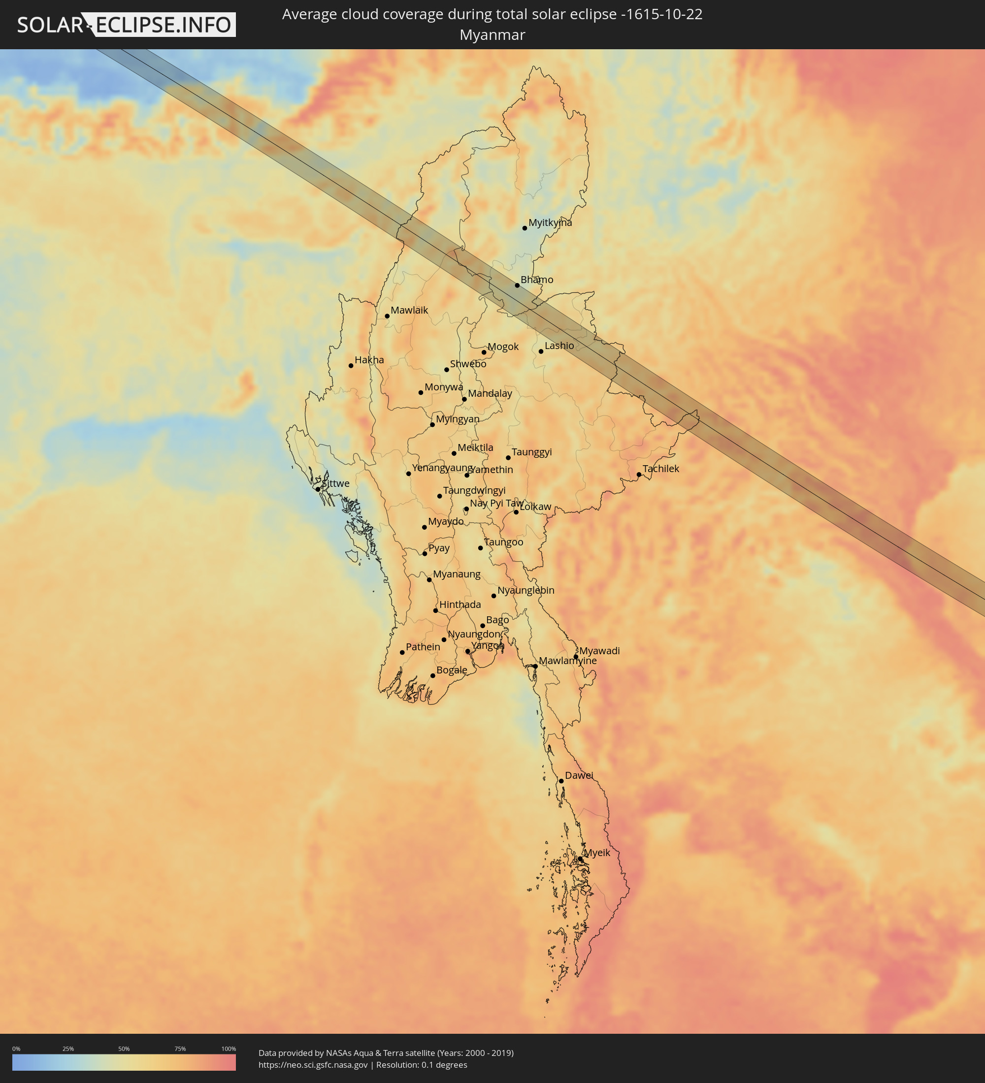
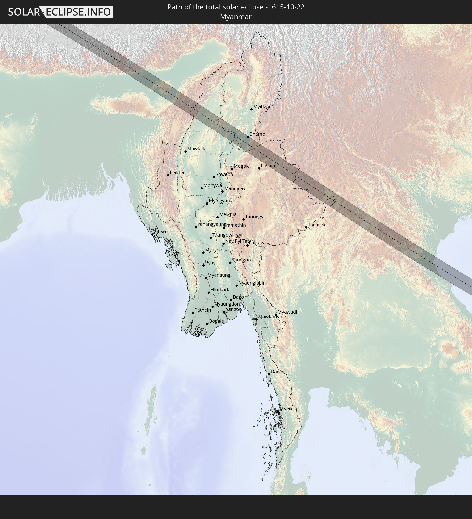 Myanmar
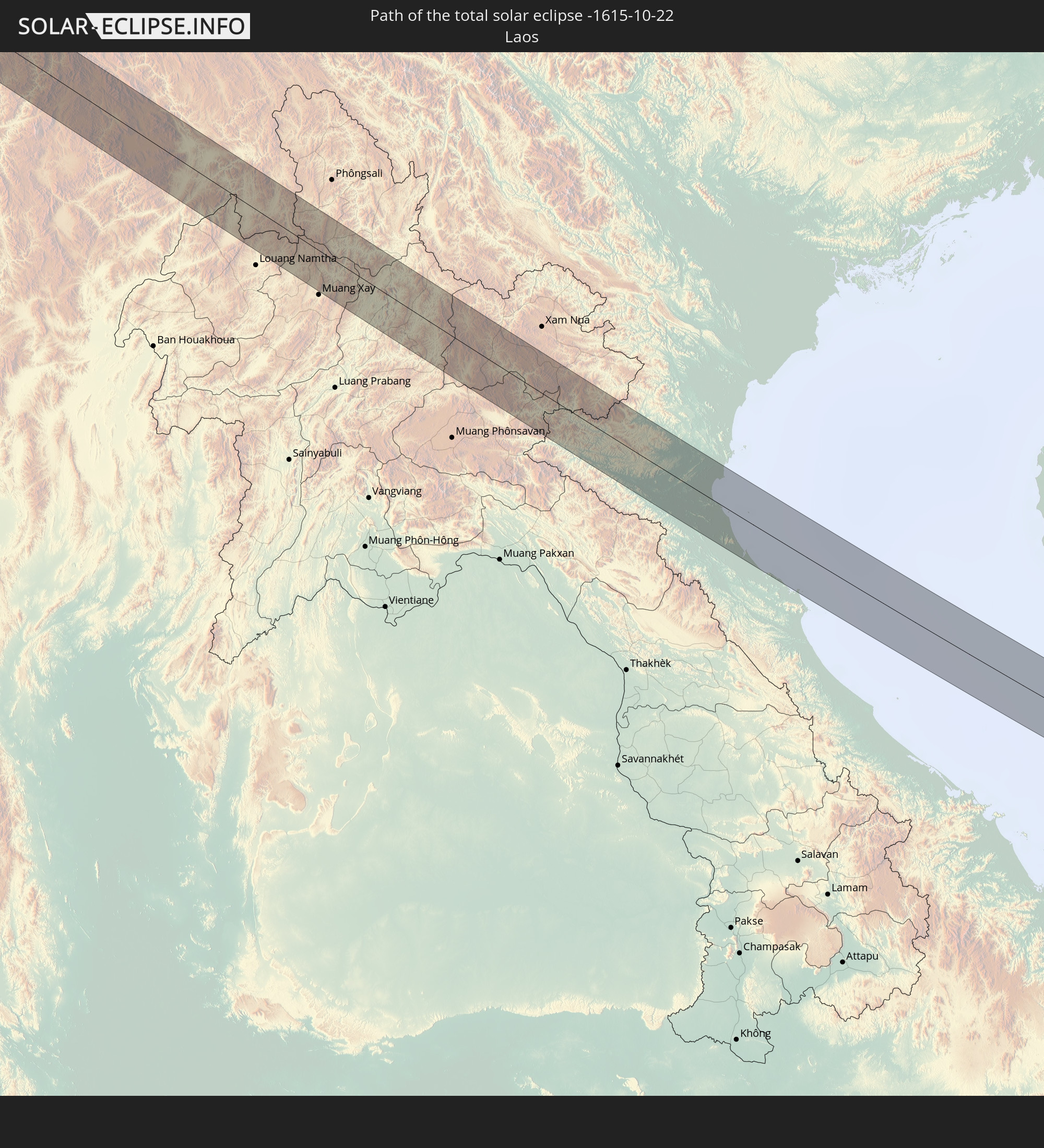 Laos
Laos
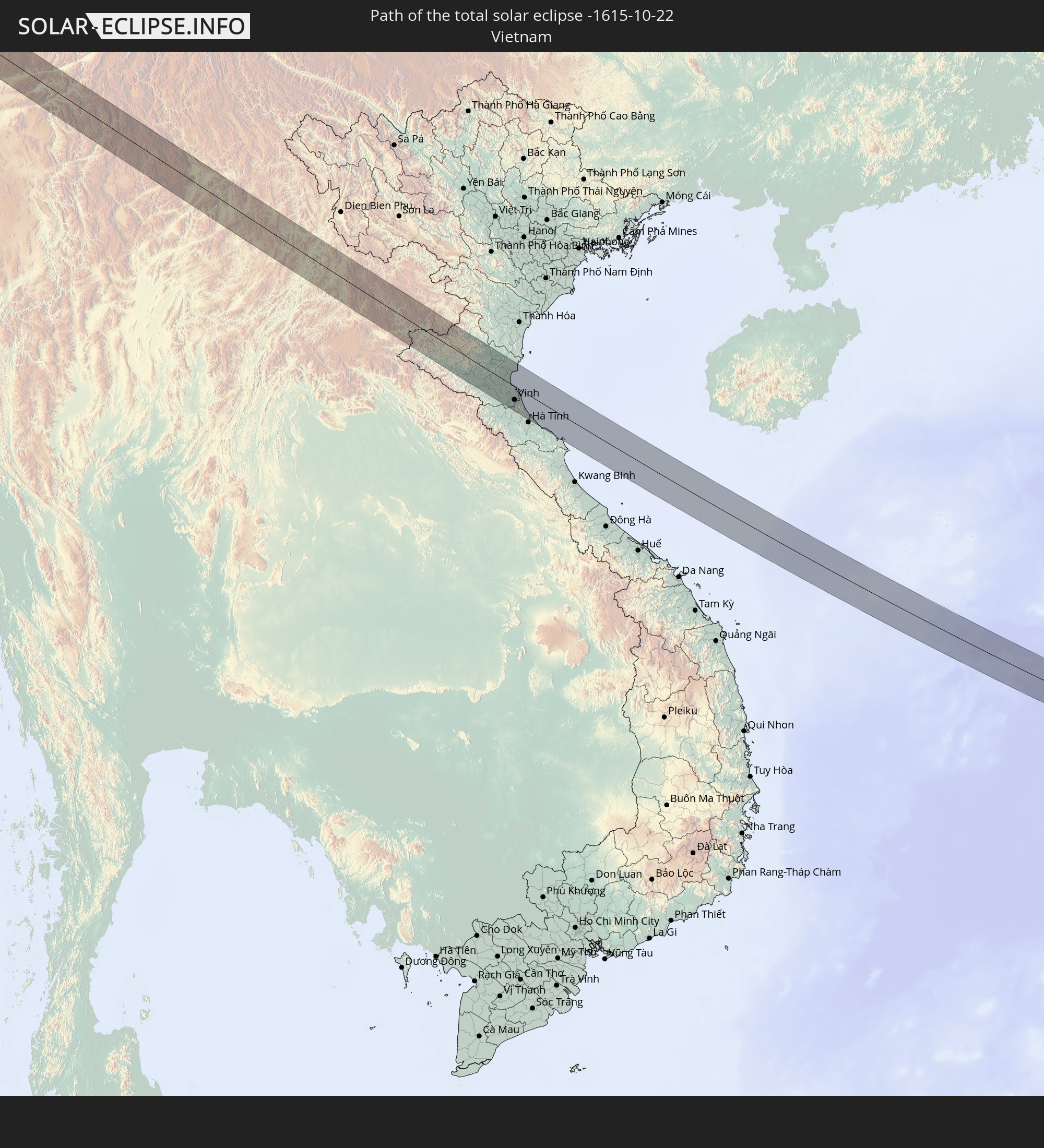 Vietnam
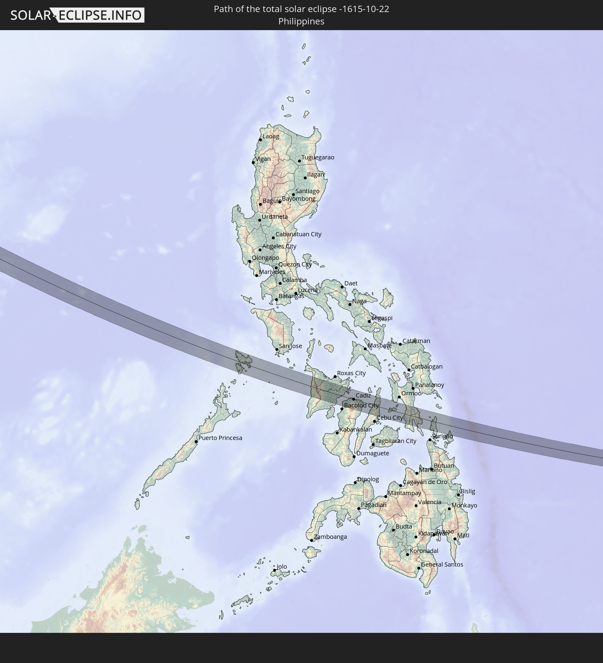 Philippinen
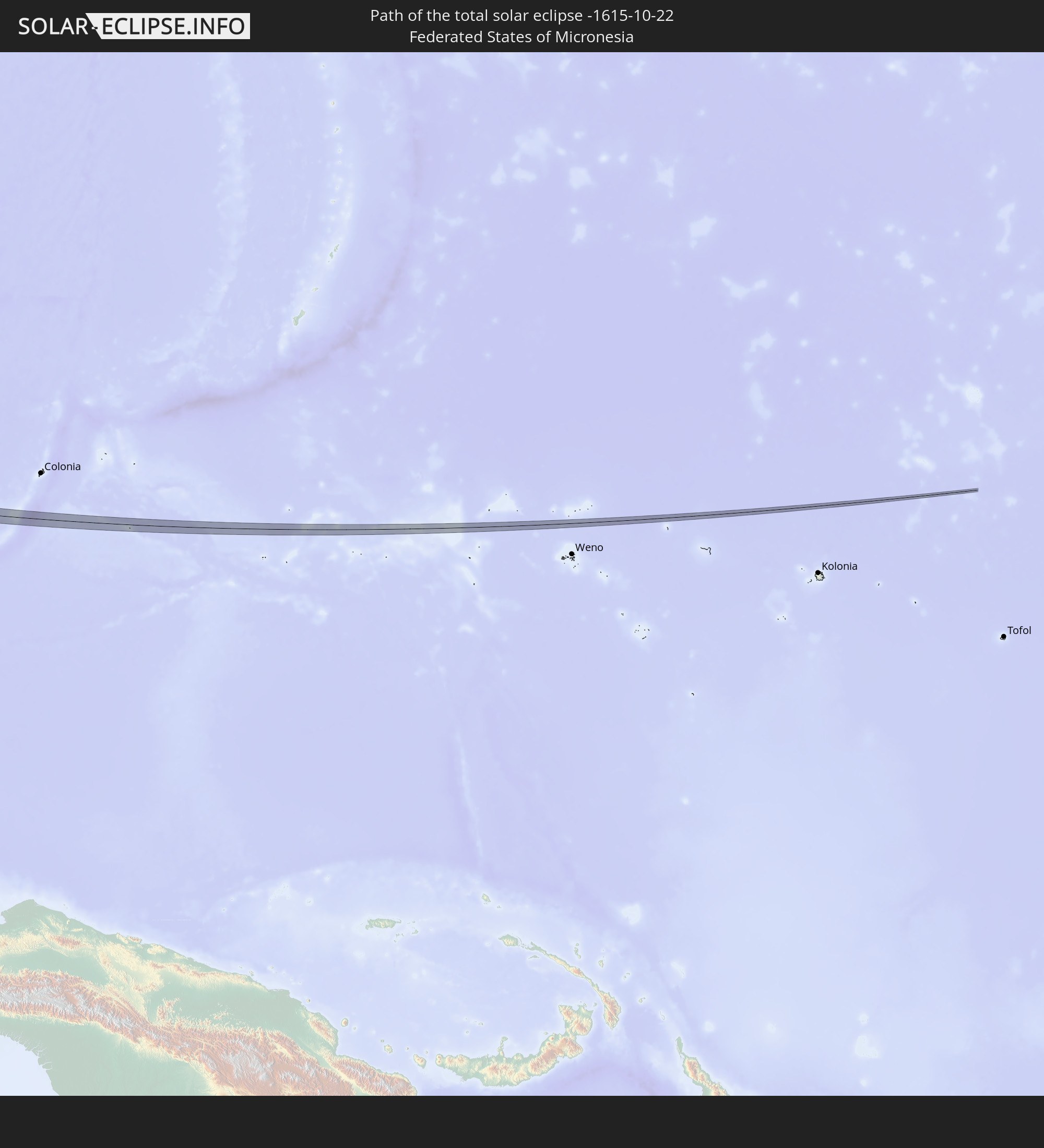 Föderierte Staaten von Mikronesien
In den folgenden Ländern ist die Sonnenfinsternis partiell zu sehen
 Russland
 Sudan
Sudan
 Ukraine
 Ägypten
 Türkei
 Äthiopien
 Saudi-Arabien
 Jordanien
 Libanon
 Syrien
 Eritrea
 Irak
Irak
 Georgien
 Somalia
 Dschibuti
 Jemen
Jemen
 Armenien
 Iran
Iran
 Aserbaidschan
 Kasachstan
 Kuwait
 Bahrain
 Katar
Katar
 Vereinigte Arabische Emirate
 Oman
Oman
 Turkmenistan
 Usbekistan
 Afghanistan
 Pakistan
 Tadschikistan
 Indien
 Kirgisistan
 Malediven
 Volksrepublik China
 Sri Lanka
 Nepal
Nepal
 Mongolei
 Bangladesch
 Bhutan
 Myanmar
 Indonesien
 Kokosinseln
 Thailand
 Malaysia
 Laos
Laos
 Vietnam
 Kambodscha
 Singapur
 Weihnachtsinsel
 Australien
 Macau
Macau
 Hongkong
 Brunei
 Taiwan
 Philippinen
 Japan
Japan
 Osttimor
 Nordkorea
 Südkorea
 Palau
Palau
 Föderierte Staaten von Mikronesien
 Papua-Neuguinea
 Guam
Guam
 Nördliche Marianen
 Salomonen
 Neukaledonien
 Marshallinseln
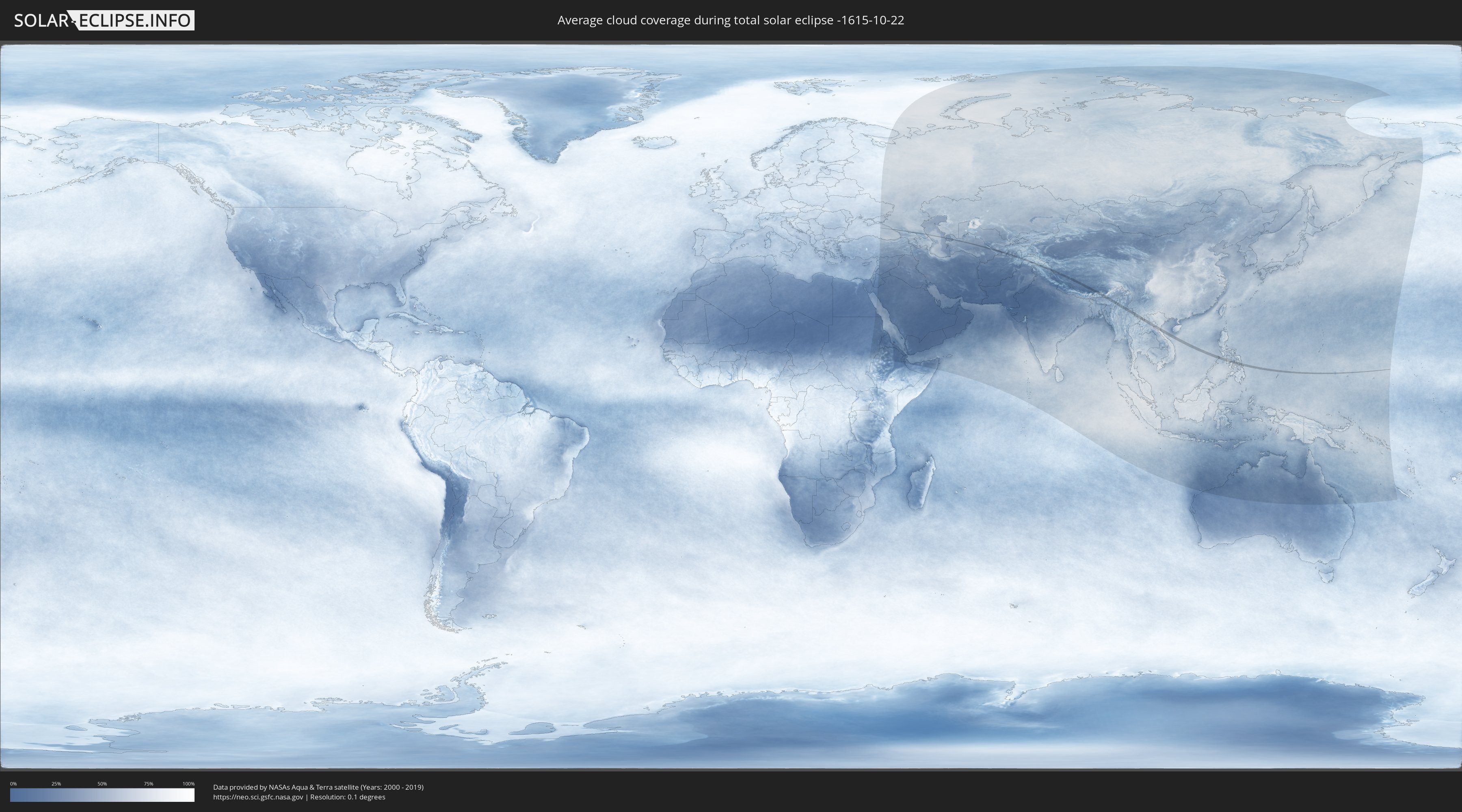
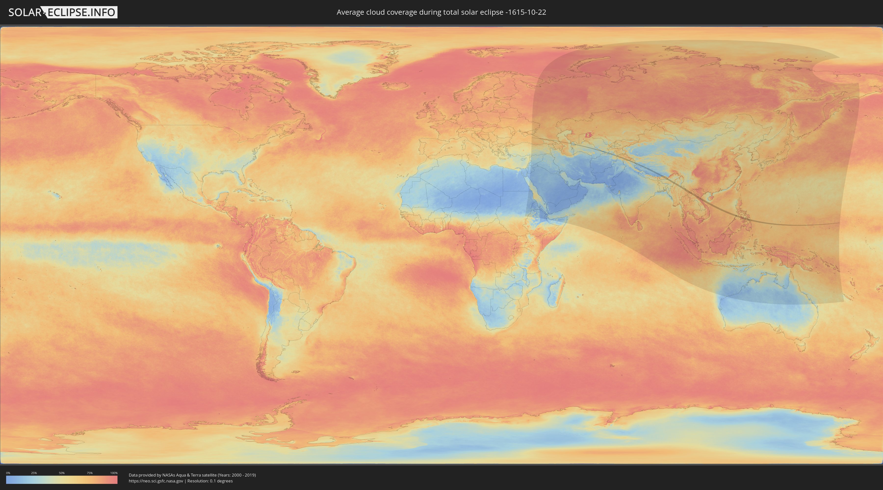
Wie wird das Wetter während der totalen Sonnenfinsternis am 22.10.-1615?
Wo ist der beste Ort, um die totale Sonnenfinsternis vom 22.10.-1615 zu beobachten?
Die folgenden Karten zeigen die durchschnittliche Bewölkung für den Tag, an dem die totale Sonnenfinsternis
stattfindet. Mit Hilfe der Karten lässt sich der Ort entlang des Finsternispfades eingrenzen,
der die besten Aussichen auf einen klaren wolkenfreien Himmel bietet.
Trotzdem muss man immer lokale Gegenenheiten beachten und sollte sich genau über das Wetter an seinem
gewählten Beobachtungsort informieren.
Die Daten stammen von den beiden NASA-Satelliten
AQUA und TERRA
und wurden über einen Zeitraum von 19 Jahren (2000 - 2019) gemittelt.
Detaillierte Länderkarten
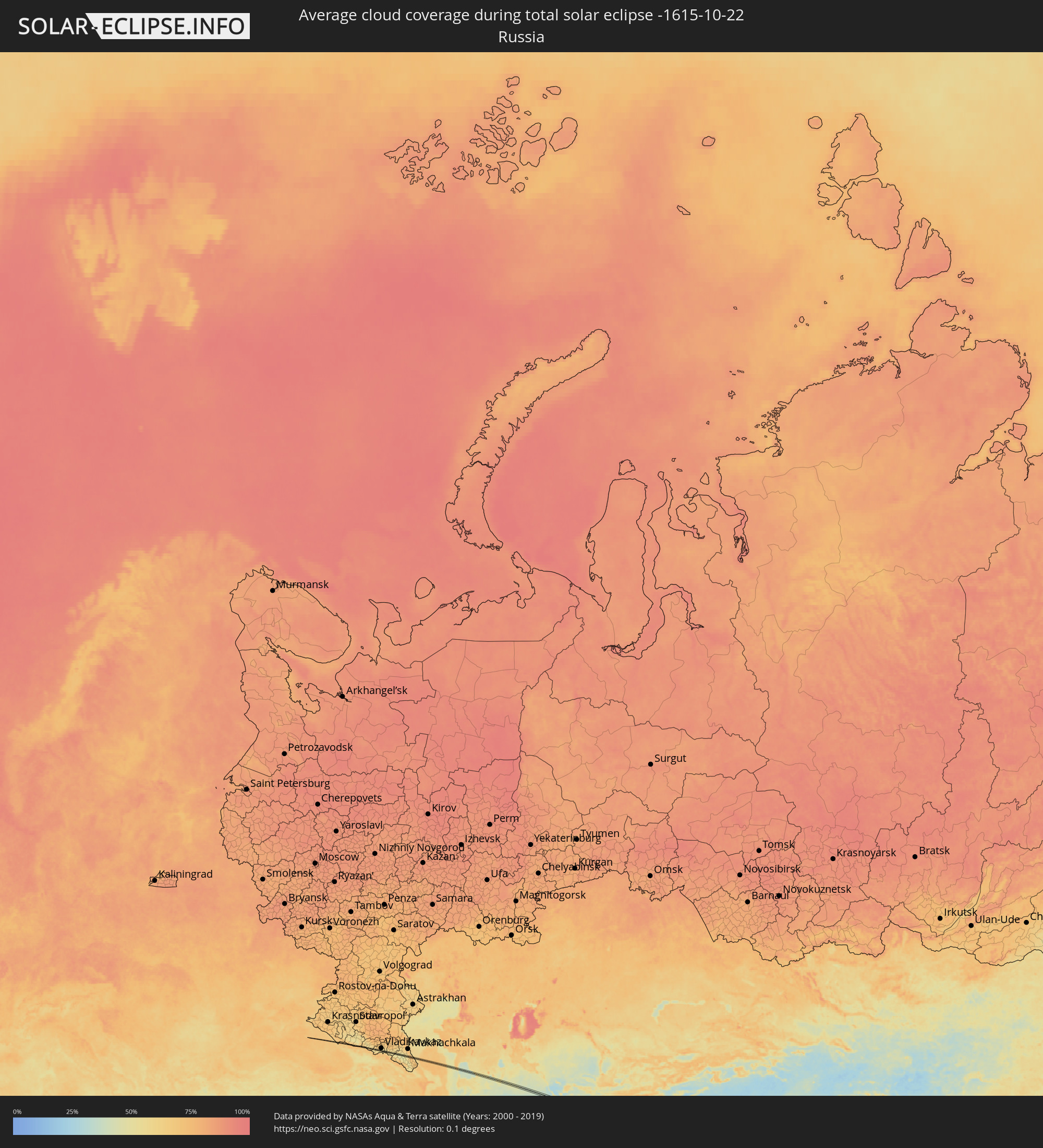 Russland
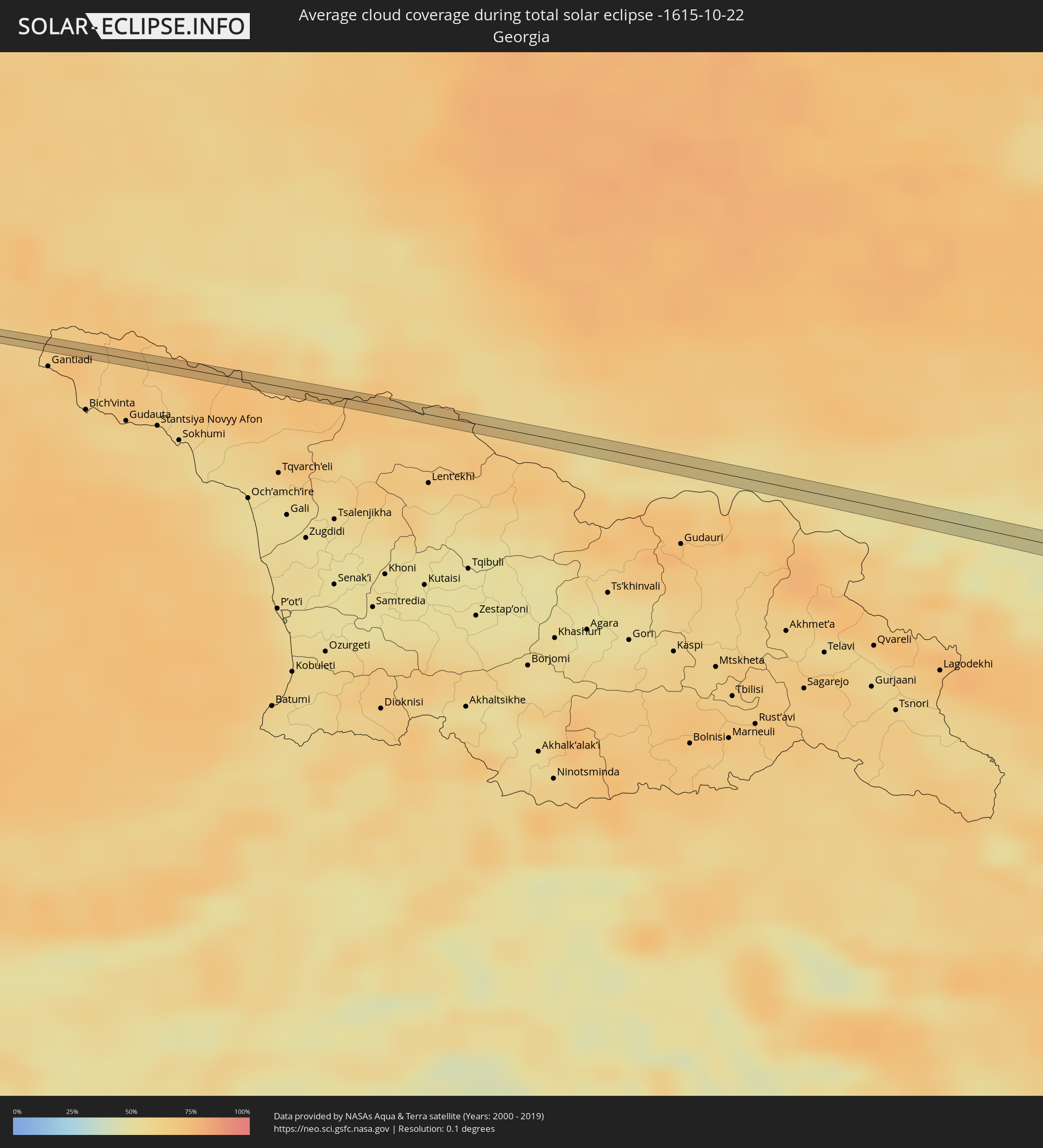 Georgien
 Turkmenistan
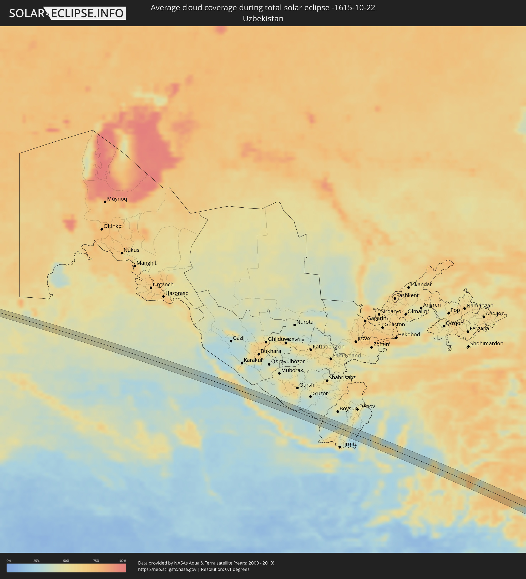 Usbekistan
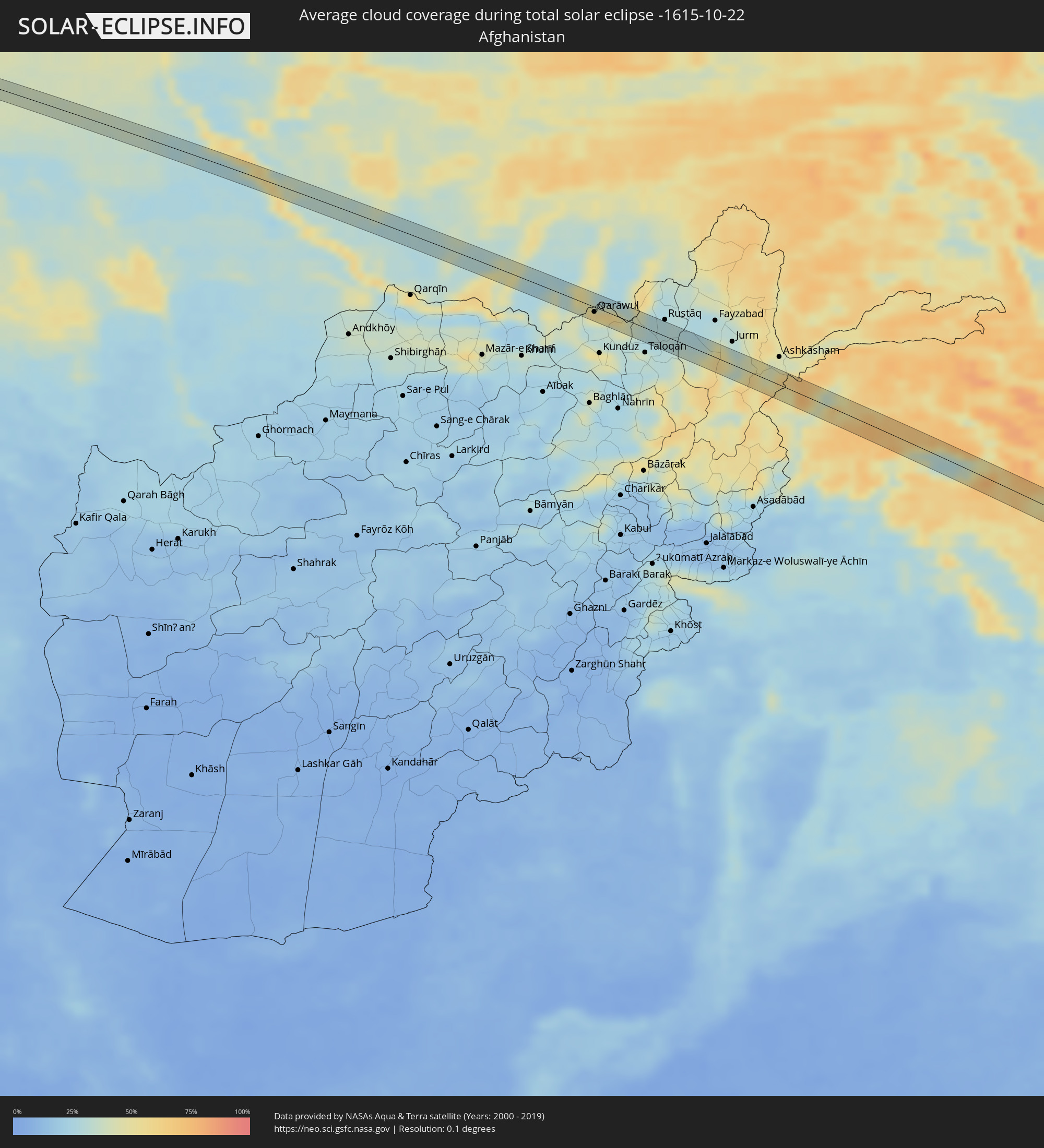 Afghanistan
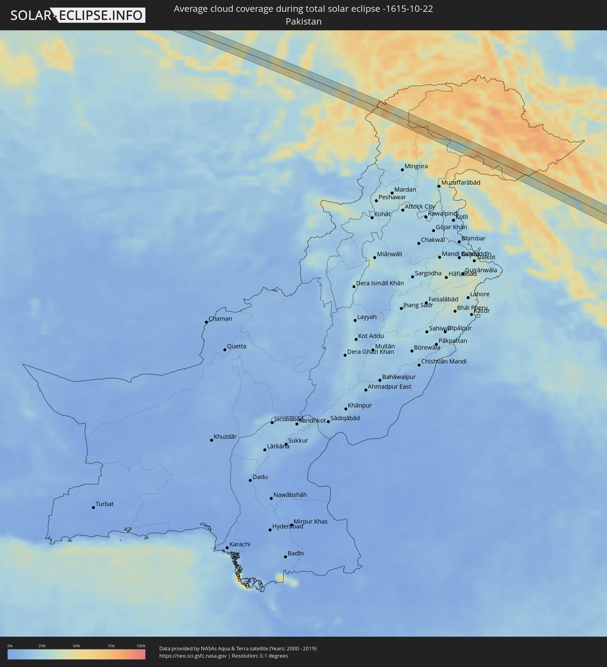 Pakistan
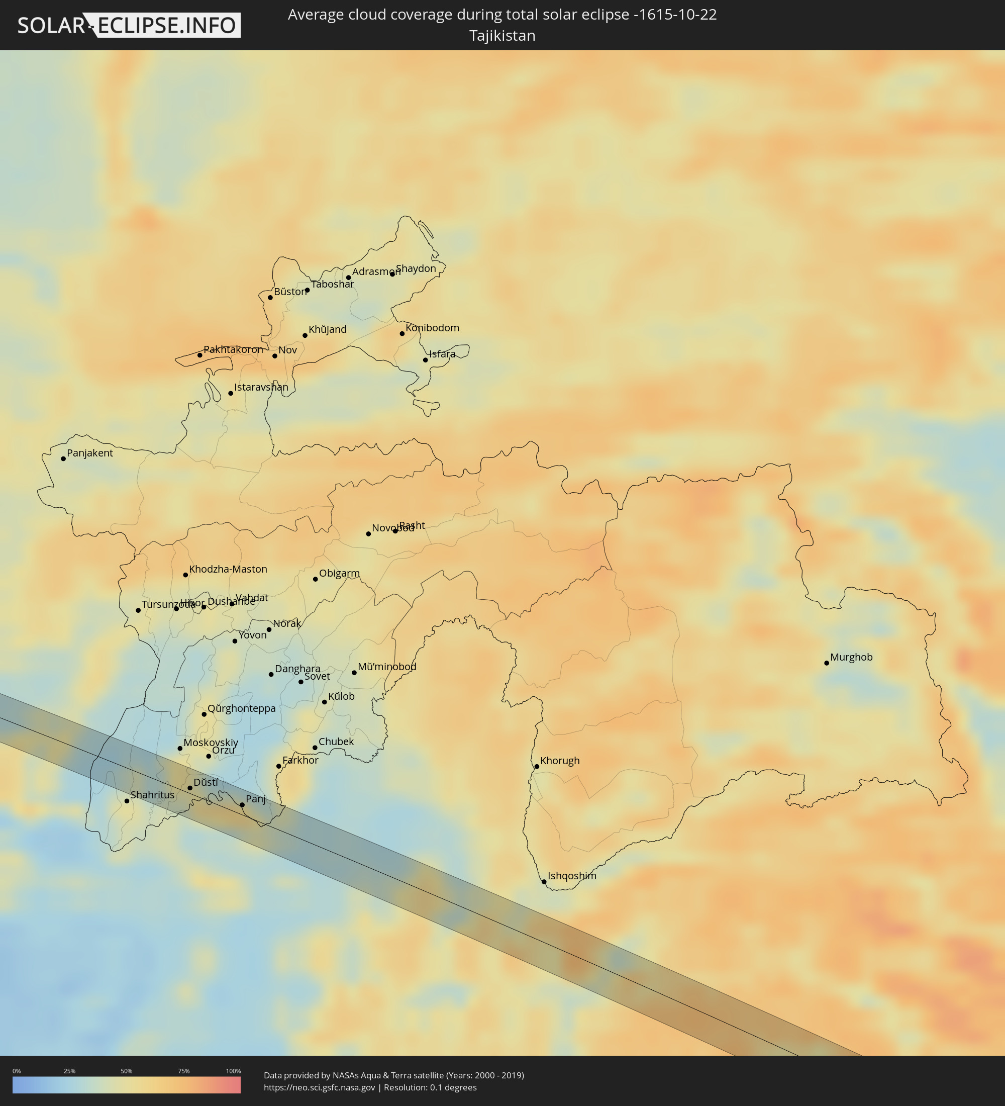 Tadschikistan
 Indien
 Volksrepublik China
 Bhutan
 Myanmar
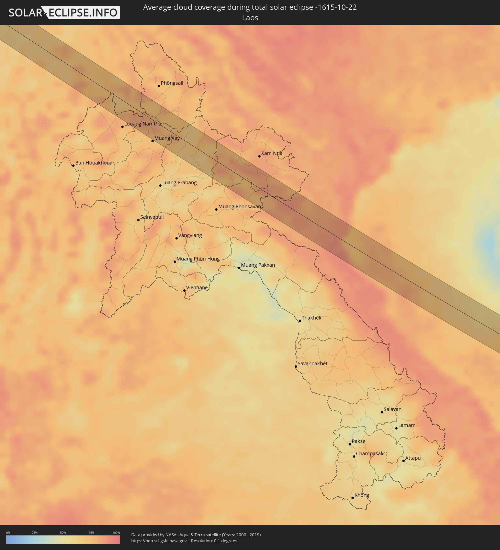 Laos
Laos
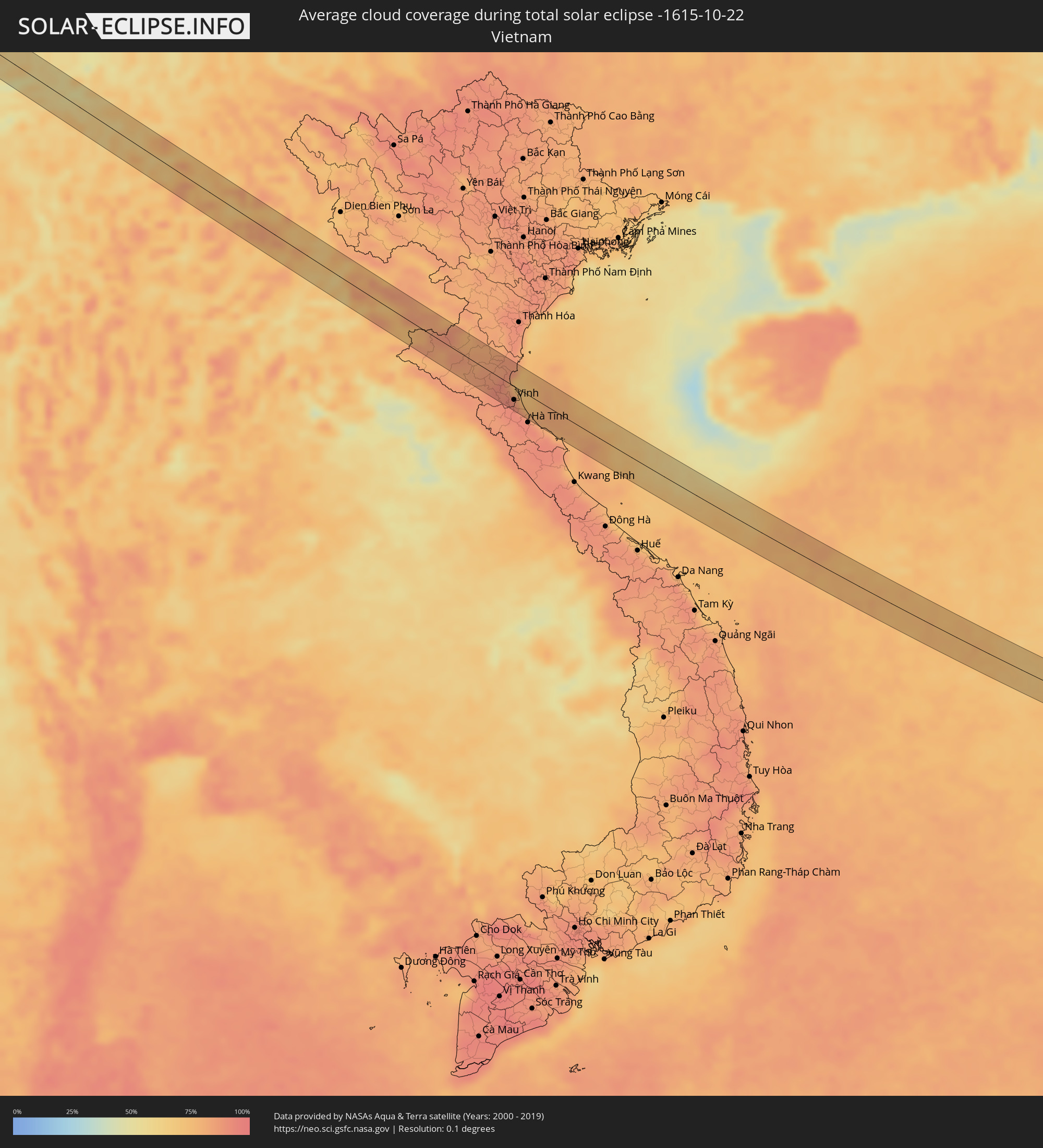 Vietnam
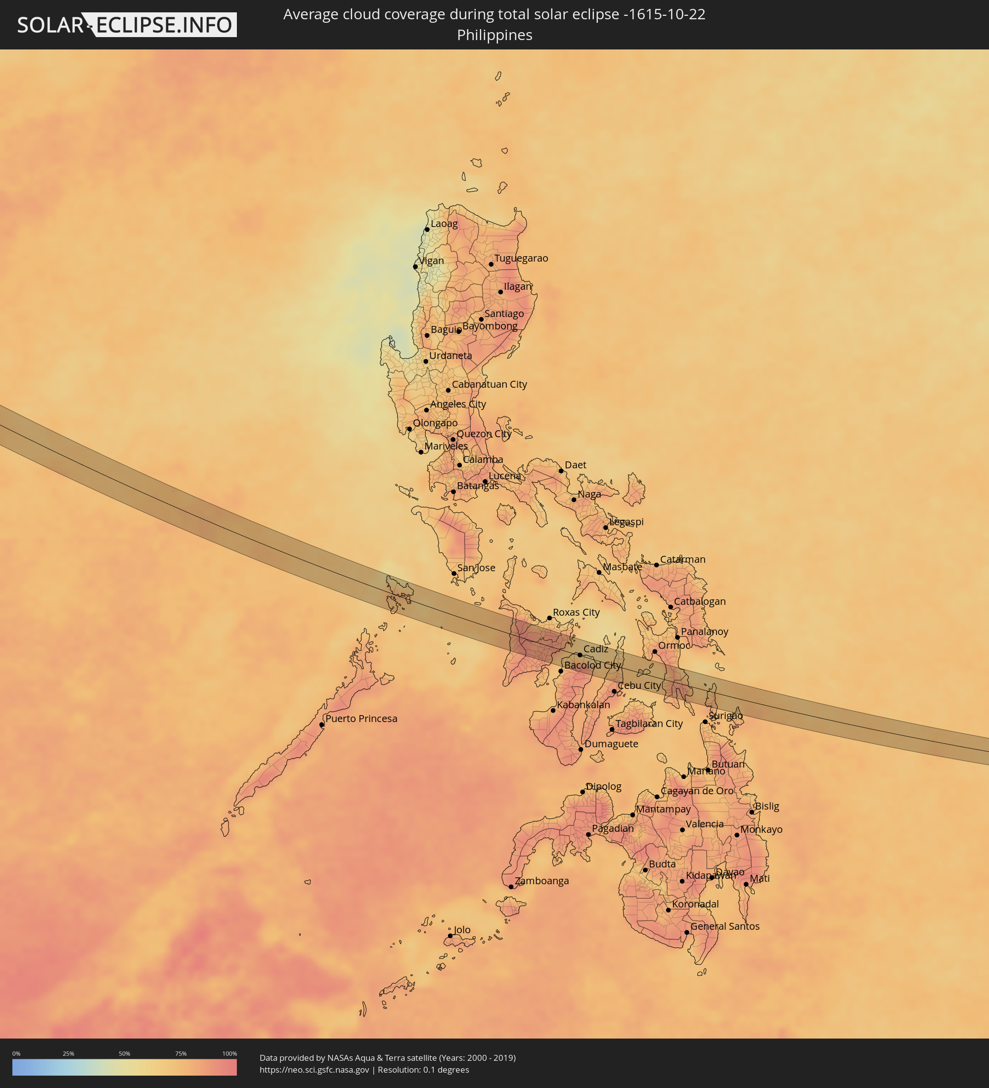 Philippinen
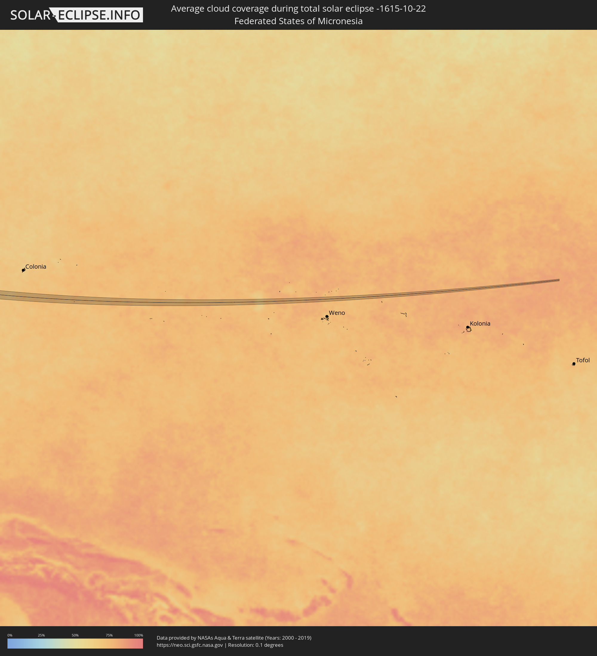 Föderierte Staaten von Mikronesien
Orte im Finsternispfad
Die nachfolgene Tabelle zeigt Städte und Orte mit mehr als 5.000 Einwohnern, die sich im Finsternispfad befinden. Städte mit mehr als 100.000 Einwohnern sind dick gekennzeichnet. Mit einem Klick auf den Ort öffnet sich eine Detailkarte die die Lage des jeweiligen Ortes zusammen mit dem Verlauf der zentralen Finsternis präsentiert.
| Ort | Typ | Dauer der Verfinsterung | Ortszeit bei maximaler Verfinsterung | Entfernung zur Zentrallinie | Ø Bewölkung |
|
Khosta, Krasnodarskiy
|
total | - | 06:20:06 UTC+02:30 | 0 km | 64% |
|
Kudepsta, Krasnodarskiy
|
total | - | 06:20:06 UTC+02:30 | 2 km | 64% |
|
Gergebil’, Dagestan
|
total | - | 06:21:09 UTC+02:30 | 4 km | 48% |
|
Khadzhalmakhi, Dagestan
|
total | - | 06:21:08 UTC+02:30 | 4 km | 52% |
|
Levashi, Dagestan
|
total | - | 06:21:11 UTC+02:30 | 0 km | 53% |
|
Ulluaya, Dagestan
|
total | - | 06:21:10 UTC+02:30 | 5 km | 57% |
|
Kayakent, Dagestan
|
total | - | 06:21:22 UTC+02:30 | 6 km | 75% |
|
Saýat, Lebap
|
total | - | 07:52:21 UTC+03:53 | 2 km | 48% |
|
Jilikŭl, Khatlon
|
total | - | 08:38:06 UTC+04:35 | 14 km | 49% |
|
Dŭstí, Khatlon
|
total | - | 08:38:12 UTC+04:35 | 3 km | 54% |
|
Qarāwul, Kunduz
|
total | - | 08:03:06 UTC+04:00 | 6 km | 47% |
|
Imām Şāḩib, Kunduz
|
total | - | 08:03:15 UTC+04:00 | 4 km | 51% |
|
Panj, Khatlon
|
total | - | 08:38:38 UTC+04:35 | 6 km | 56% |
|
Dasht-e Archī, Kunduz
|
total | - | 08:03:29 UTC+04:00 | 2 km | 45% |
|
Ārt Khwājah, Takhar
|
total | - | 08:03:49 UTC+04:00 | 4 km | 33% |
|
Kargil, Kashmir
|
total | - | 09:33:00 UTC+05:21 | 8 km | 38% |
|
Leh, Kashmir
|
total | - | 09:35:06 UTC+05:21 | 11 km | 31% |
|
Jakar, Bumthang
|
total | - | 10:38:51 UTC+05:58 | 14 km | 49% |
|
Lhuentse, Lhuntse District
|
total | - | 10:39:40 UTC+05:58 | 20 km | 49% |
|
Mongar, Mongar District
|
total | - | 10:40:06 UTC+05:58 | 15 km | 45% |
|
Pemagatshel, Pemagatshel District
|
total | - | 10:40:39 UTC+05:58 | 28 km | 57% |
|
Trashigang, Tashigang
|
total | - | 10:40:43 UTC+05:58 | 7 km | 54% |
|
Udalguri, Assam
|
total | - | 10:04:58 UTC+05:21 | 18 km | 44% |
|
Dhing, Assam
|
total | - | 10:06:02 UTC+05:21 | 25 km | 47% |
|
Dhekiajuli, Assam
|
total | - | 10:05:49 UTC+05:21 | 3 km | 45% |
|
Rangāpāra, Assam
|
total | - | 10:06:07 UTC+05:21 | 20 km | 43% |
|
Tezpur, Assam
|
total | - | 10:06:35 UTC+05:21 | 8 km | 44% |
|
Dimāpur, Nagaland
|
total | - | 10:09:18 UTC+05:21 | 10 km | 53% |
|
Bokajān, Assam
|
total | - | 10:09:19 UTC+05:21 | 3 km | 54% |
|
Sarupathar, Assam
|
total | - | 10:09:13 UTC+05:21 | 21 km | 45% |
|
Silapathar, Assam
|
total | - | 10:09:12 UTC+05:21 | 22 km | 45% |
|
Kohima, Nagaland
|
total | - | 10:10:24 UTC+05:21 | 11 km | 68% |
|
Phek, Manipur
|
total | - | 10:11:17 UTC+05:21 | 9 km | 51% |
|
Bhamo, Kachin
|
total | - | 11:22:43 UTC+06:24 | 28 km | 44% |
|
Jinghong, Yunnan
|
total | - | 13:09:12 UTC+08:00 | 15 km | 71% |
|
Yên Vinh, Nghệ An
|
total | - | 12:33:00 UTC+07:06 | 21 km | 90% |
|
Vinh, Nghệ An
|
total | - | 12:33:03 UTC+07:06 | 19 km | 90% |
|
Coron, Mimaropa
|
total | - | 14:11:52 UTC+08:00 | 7 km | 72% |
|
Janiuay, Western Visayas
|
total | - | 14:18:12 UTC+08:00 | 24 km | 87% |
|
Passi, Western Visayas
|
total | - | 14:18:15 UTC+08:00 | 3 km | 87% |
|
Dao, Western Visayas
|
total | - | 14:17:56 UTC+08:00 | 29 km | 89% |
|
Barotac Nuevo, Western Visayas
|
total | - | 14:18:40 UTC+08:00 | 24 km | 81% |
|
Barotac Viejo, Western Visayas
|
total | - | 14:18:46 UTC+08:00 | 3 km | 70% |
|
Binonga, Western Visayas
|
total | - | 14:19:24 UTC+08:00 | 28 km | 79% |
|
Ajuy, Western Visayas
|
total | - | 14:18:55 UTC+08:00 | 16 km | 78% |
|
Victorias, Western Visayas
|
total | - | 14:19:24 UTC+08:00 | 11 km | 79% |
|
Cadiz, Western Visayas
|
total | - | 14:19:46 UTC+08:00 | 0 km | 88% |
|
Minapasoc, Western Visayas
|
total | - | 14:20:14 UTC+08:00 | 24 km | 91% |
|
Tiglauigan, Western Visayas
|
total | - | 14:19:54 UTC+08:00 | 3 km | 66% |
|
Escalante, Western Visayas
|
total | - | 14:20:20 UTC+08:00 | 5 km | 77% |
|
Asturias, Central Visayas
|
total | - | 14:21:09 UTC+08:00 | 27 km | 78% |
|
Catmon, Central Visayas
|
total | - | 14:21:30 UTC+08:00 | 3 km | 73% |
|
Danao, Central Visayas
|
total | - | 14:21:49 UTC+08:00 | 23 km | 76% |
|
San Francisco, Central Visayas
|
total | - | 14:22:20 UTC+08:00 | 1 km | 73% |
|
Bato, Eastern Visayas
|
total | - | 14:23:33 UTC+08:00 | 21 km | 79% |
|
Baybay, Eastern Visayas
|
total | - | 14:23:06 UTC+08:00 | 17 km | 74% |
|
Sogod, Eastern Visayas
|
total | - | 14:23:50 UTC+08:00 | 10 km | 82% |